A collection of walks, discoveries, insights and pictures of exploring Dartmoor National Park
February 14, 2023
Tavistock ‘T’ Stones
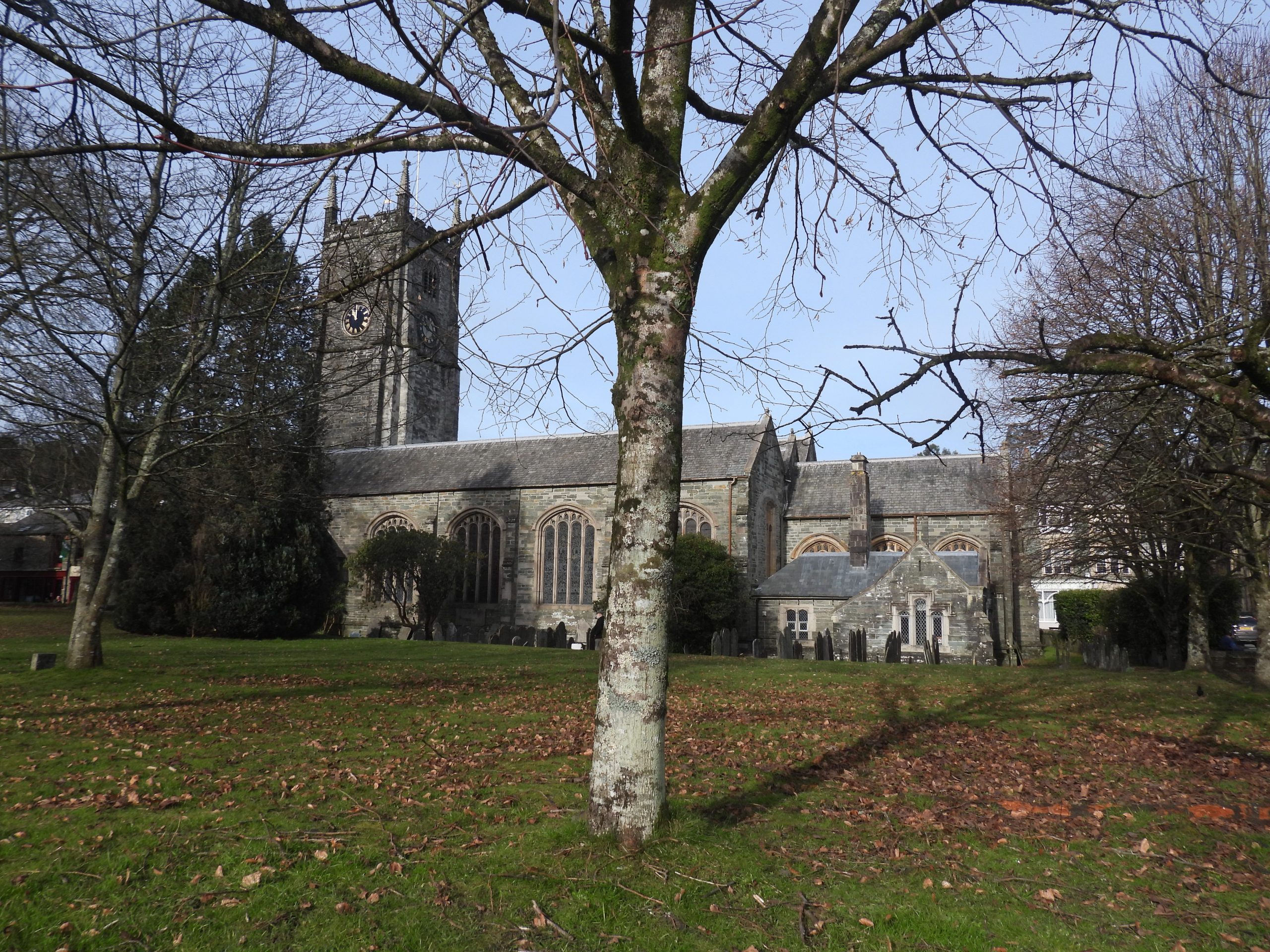
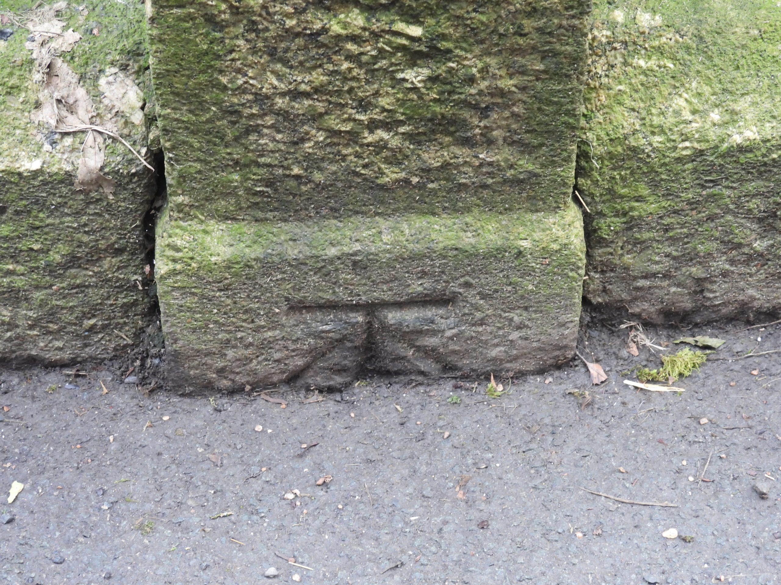
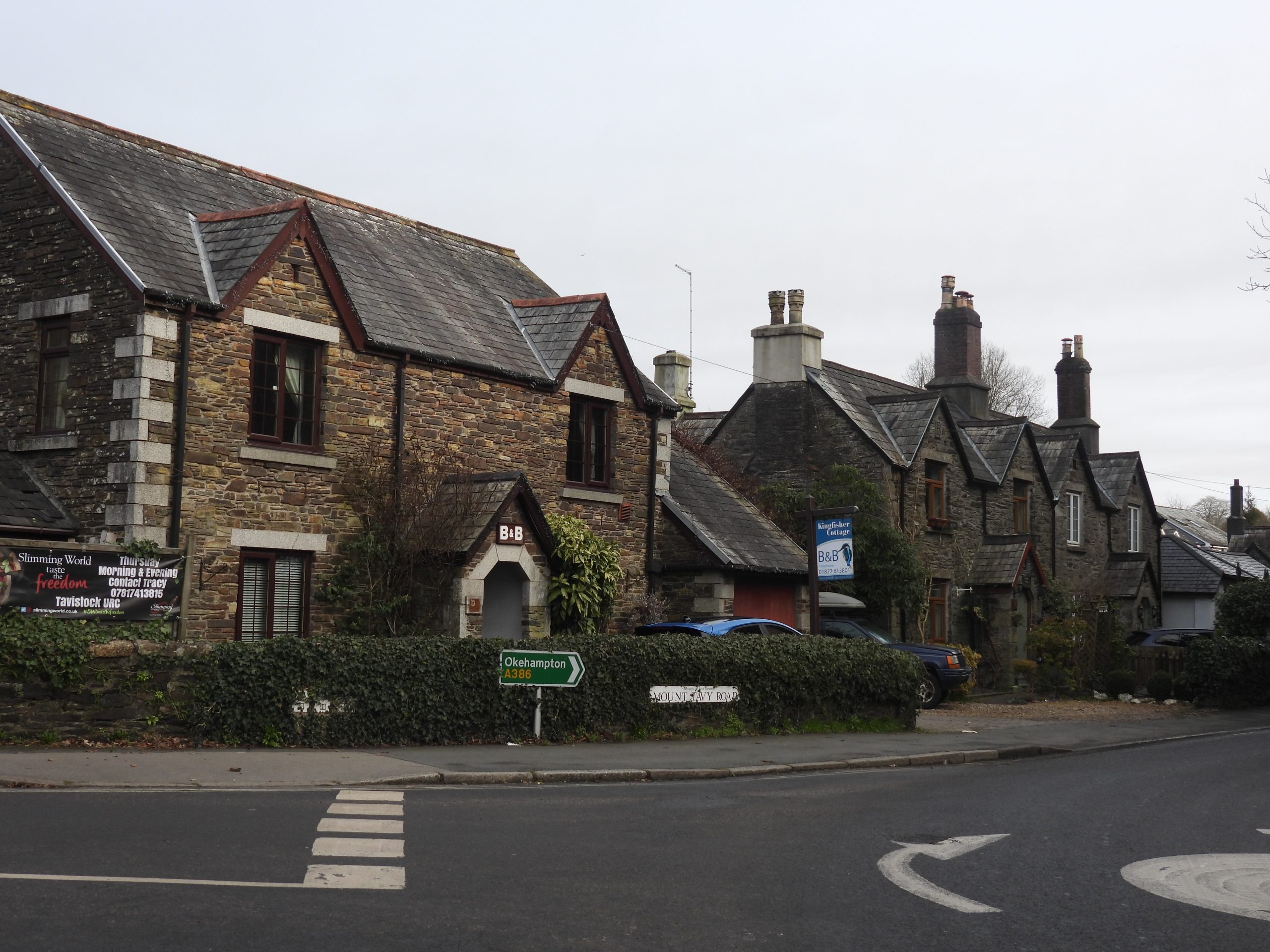
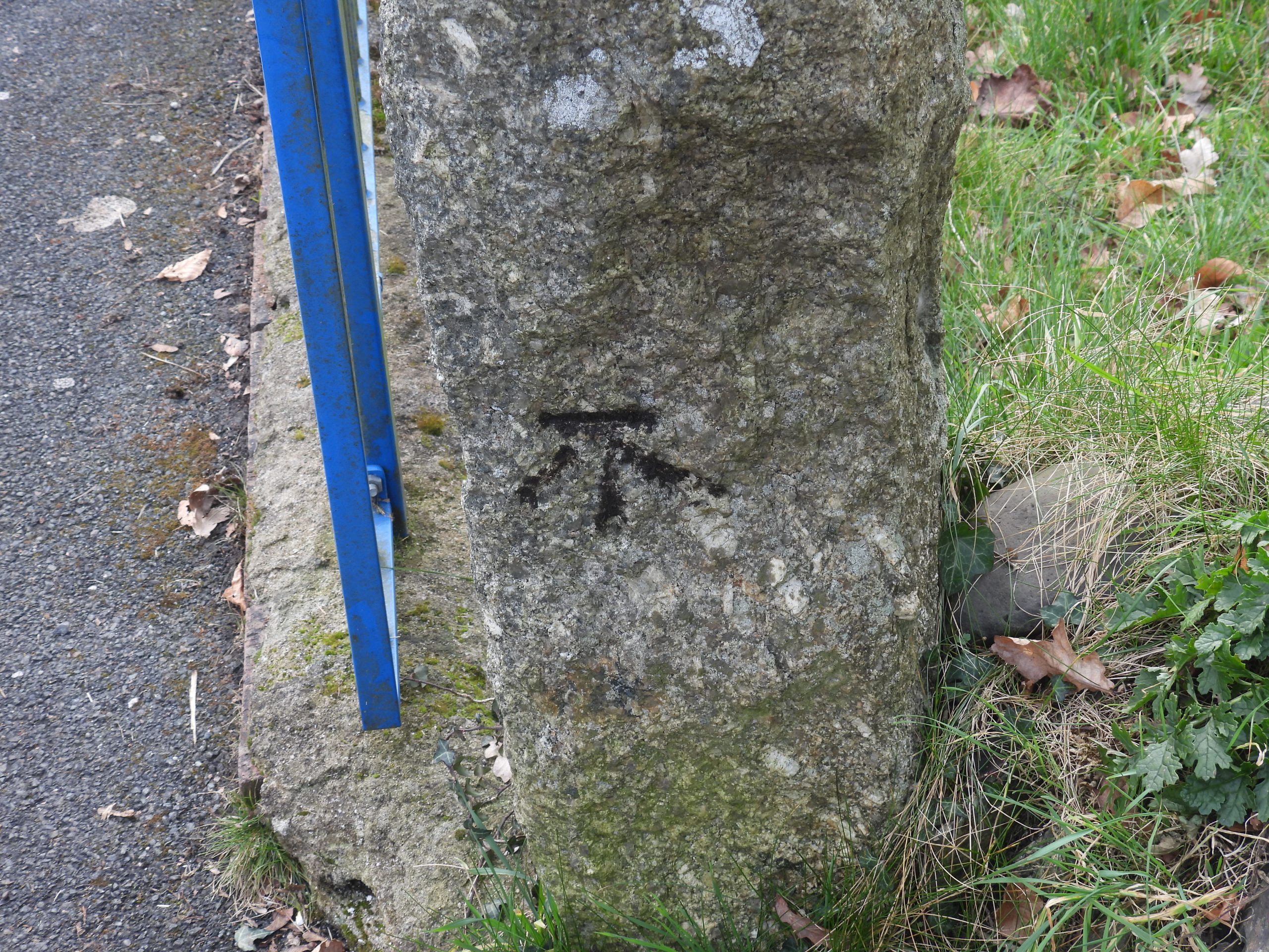
Tavistock, which lies just outside the Dartmoor National Park boundary, is a charming ancient stannary and market town, which can trace its history back to 961 when Tavistock Abbey was founded. As with many towns and villages across the country, Tavistock was ‘festooned’ with Ordnance Survey (broad arrow) benchmarks, which were cut in the 19th and 20th centuries (from as early as 1840). There were over 1 million benchmarks cut over the country, of which, it is believed 500,000 still survive today. Of interest in the town are a number of inscribed “T” marks on buildings and bridges which were the forerunner to these more ‘modern’ (broad arrow) benchmarks.
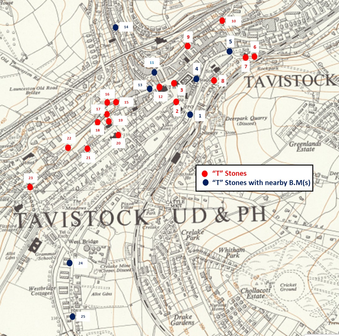
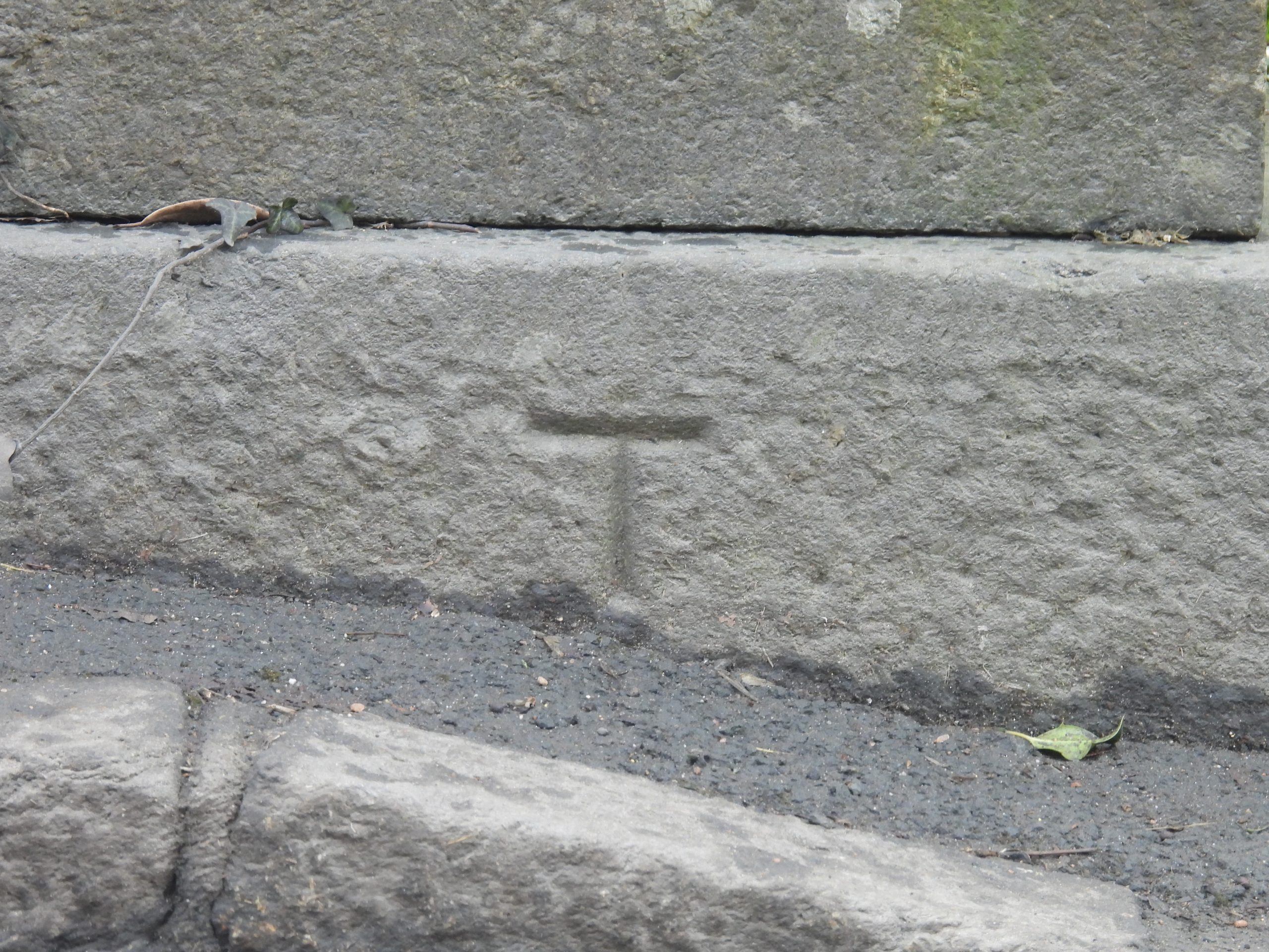
Armed with the information published by John Stickland and later collated by Mark Fenlon, this post records all the known “T” inscribed benchmarks / surveyors marks plus a number (10) more traditional ‘modern’ (broad arrow) benchmarks which lie close to them. There are 22 “T” stones with a further 3, which look like a “T” with “wings” thus looking like a traditional broad arrow benchmark. Some of the “T” inscribed stones appear to have benchmark annotations on late 19th century maps. The “T” marks have been inscribed into granite, hurdwick stone and on render throughout the town. The order by which the recorded inscribed stones and benchmarks can be found in this post has been considered to enable the reader to follow a route around the town to see them all in a logical way.
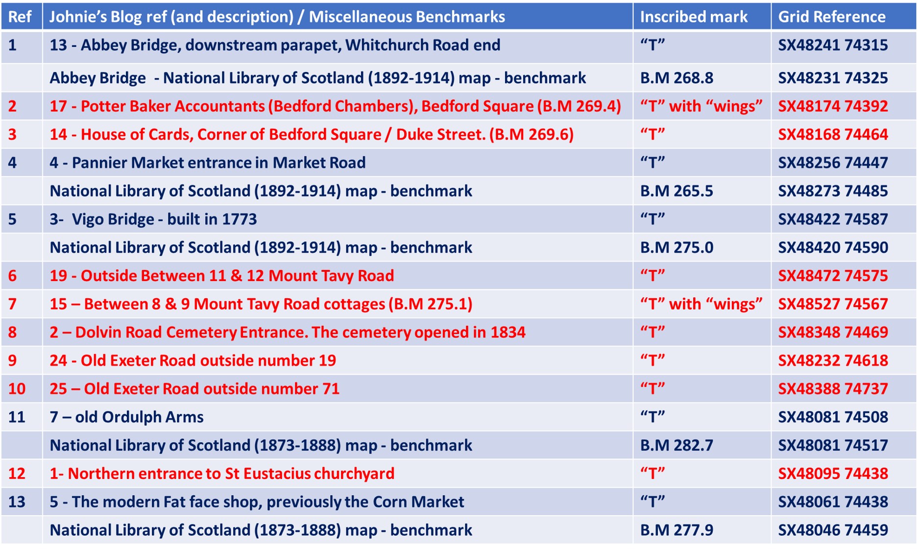
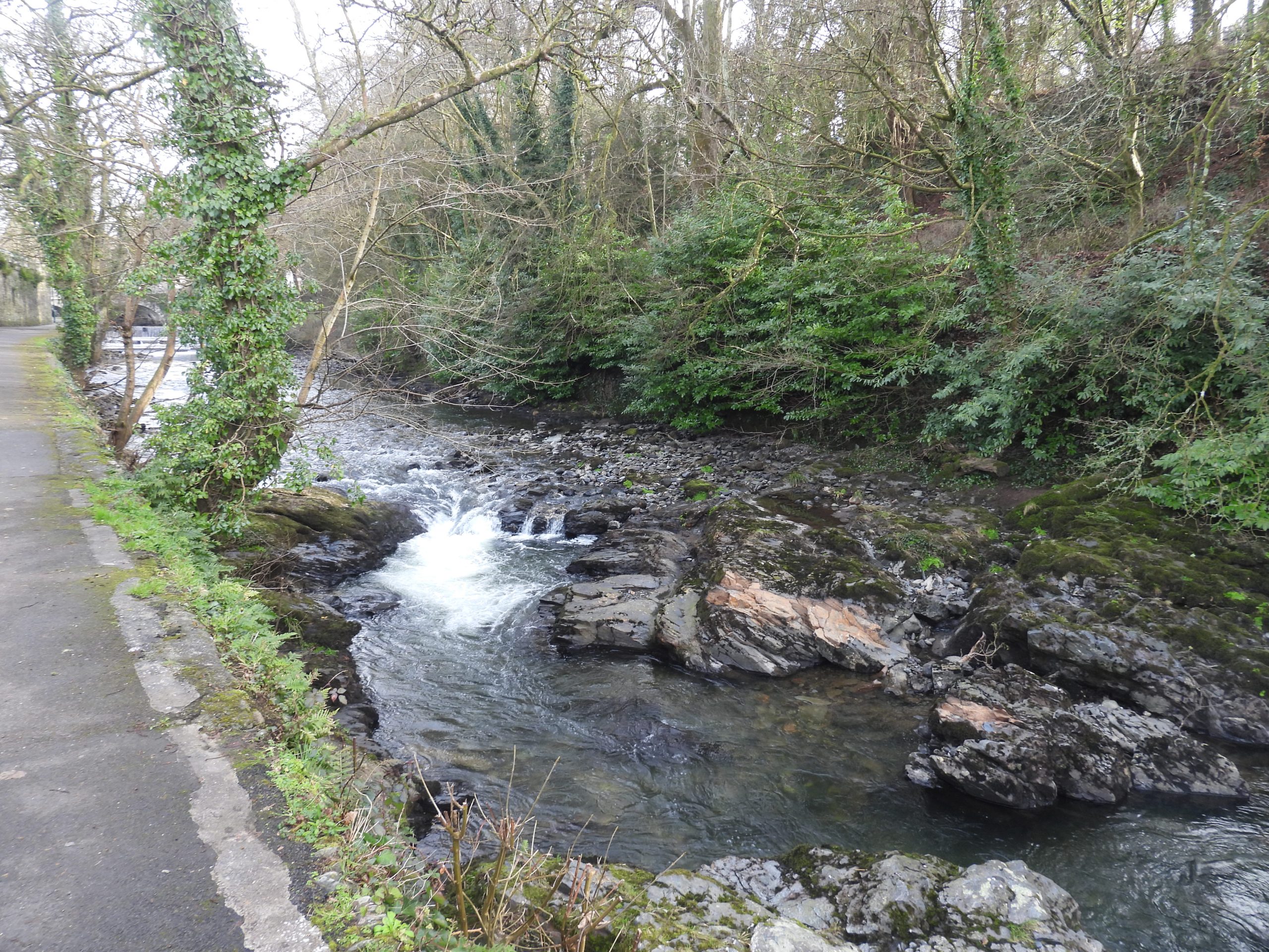
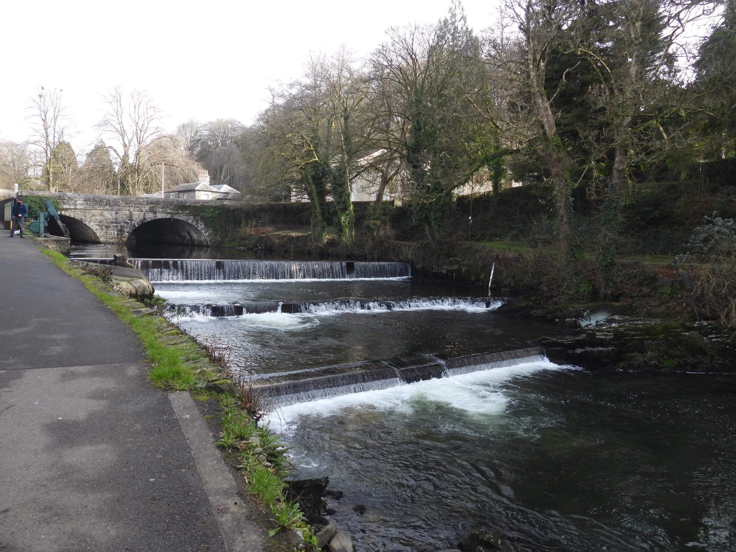
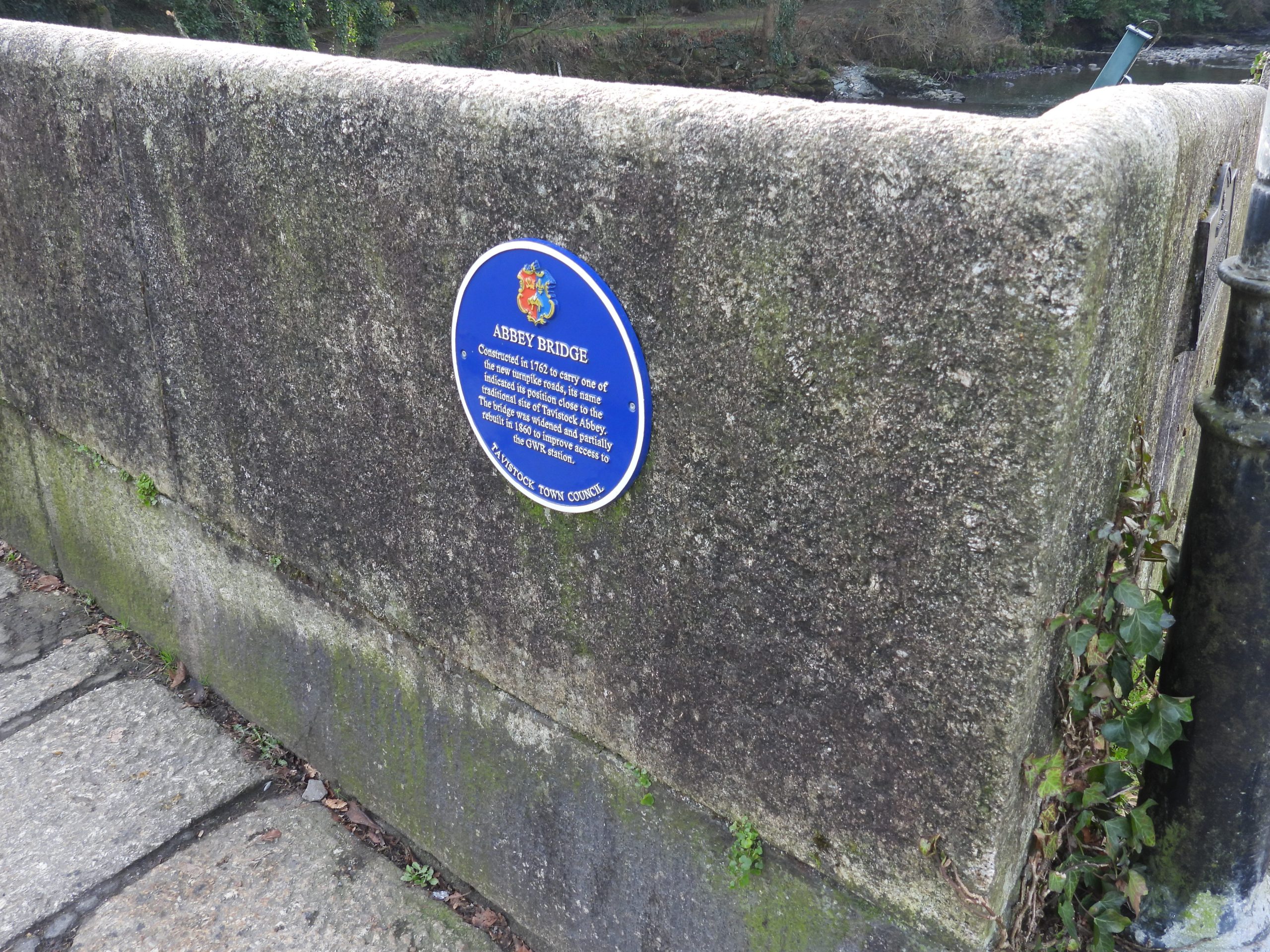
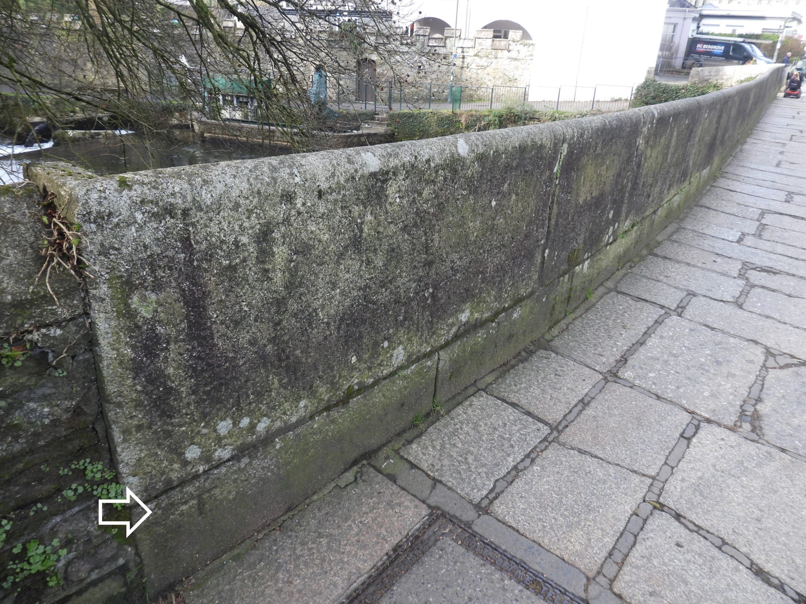
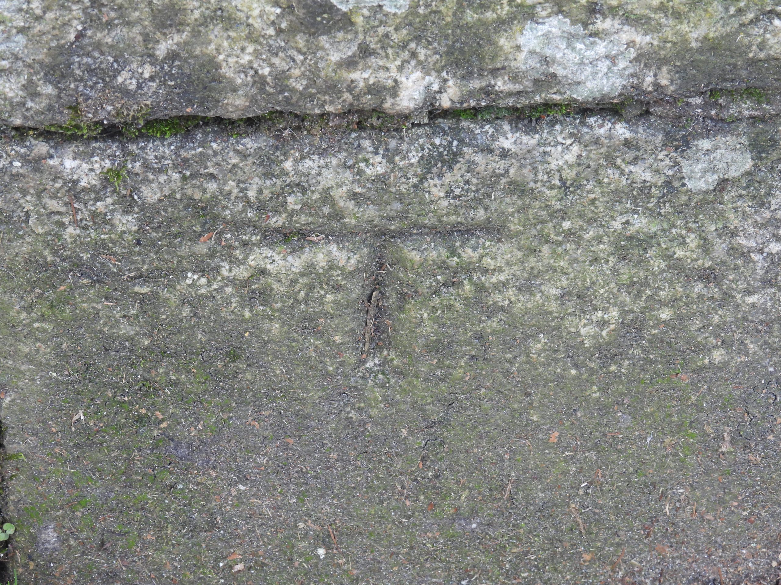
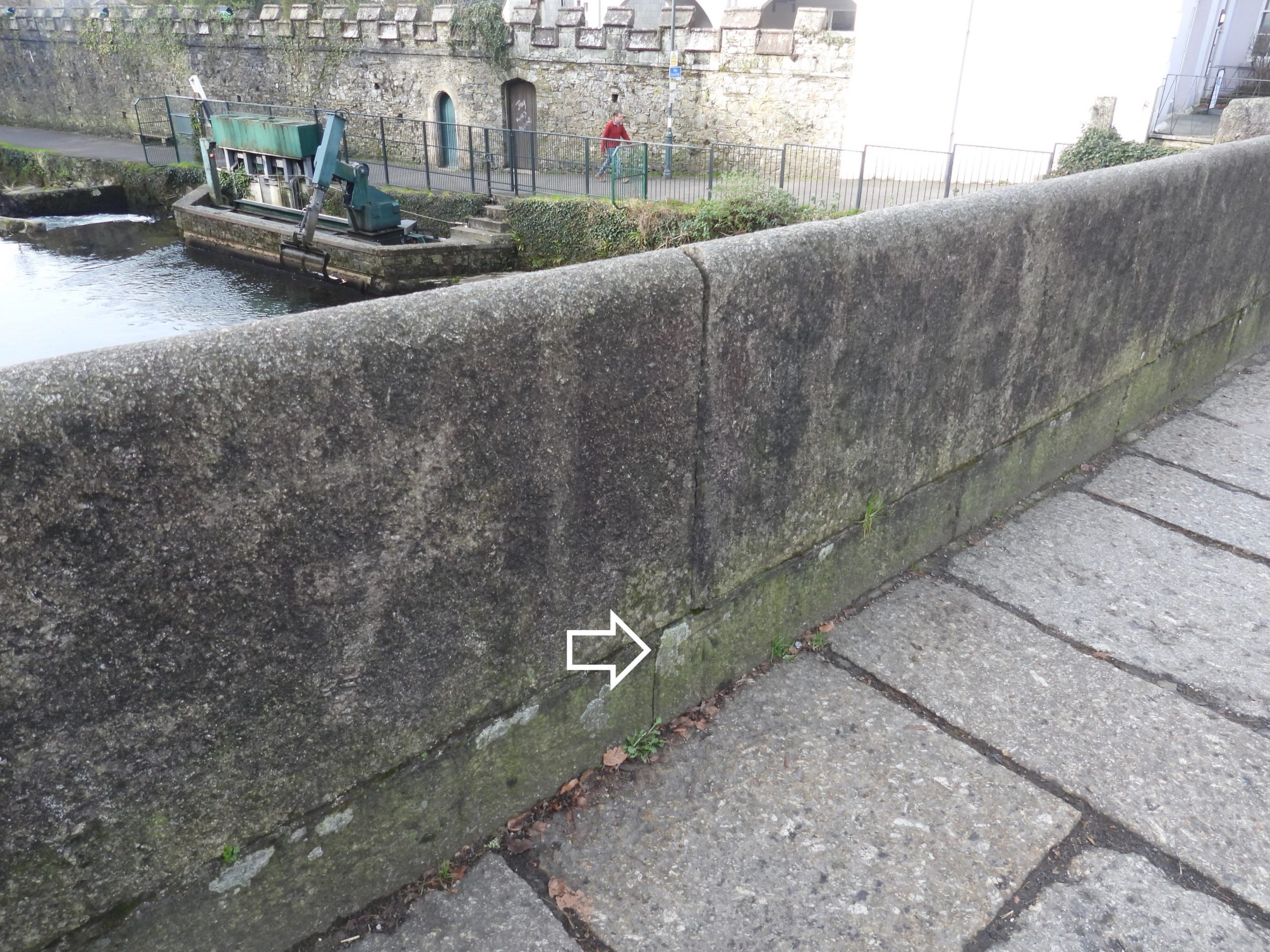
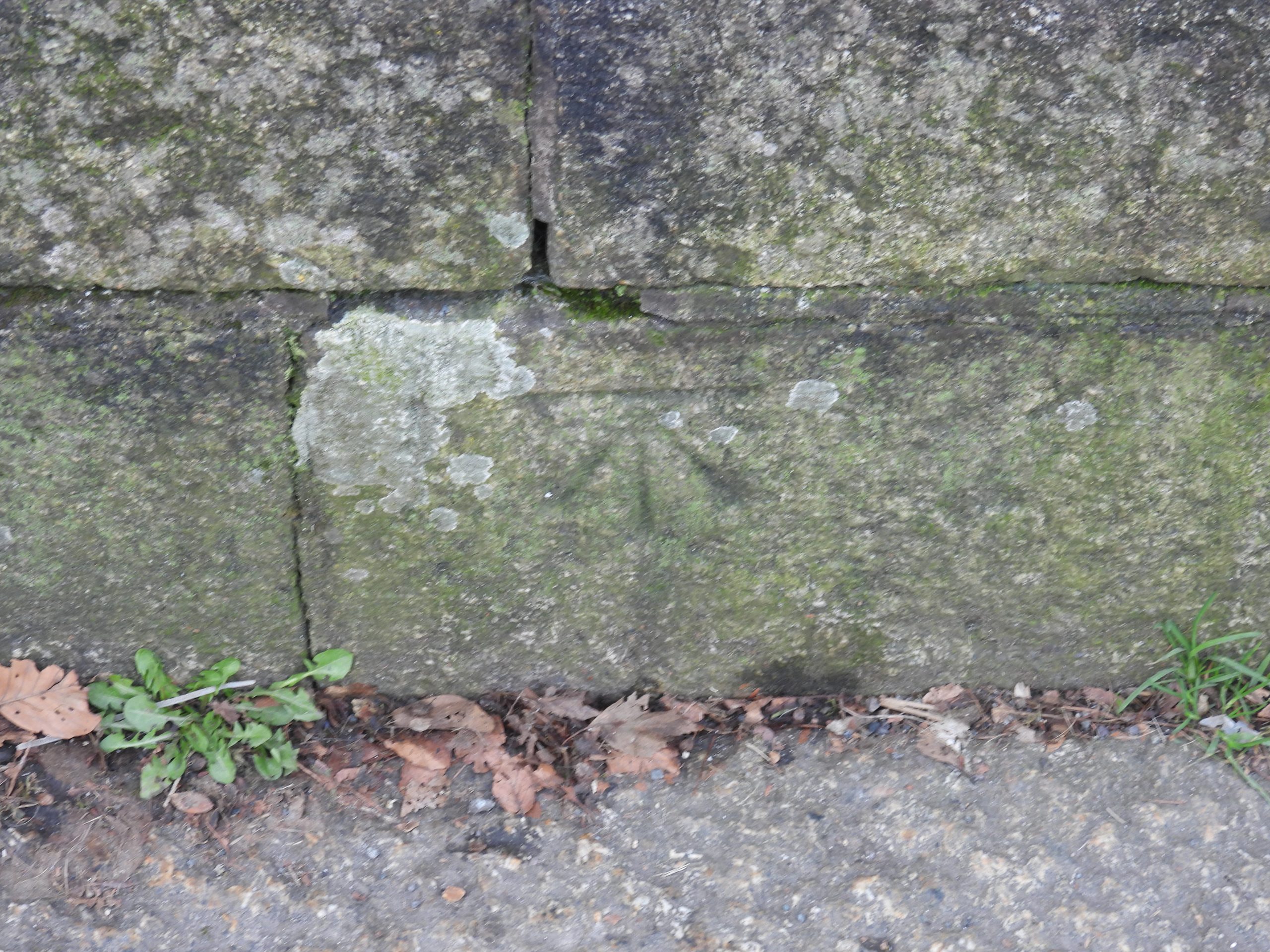
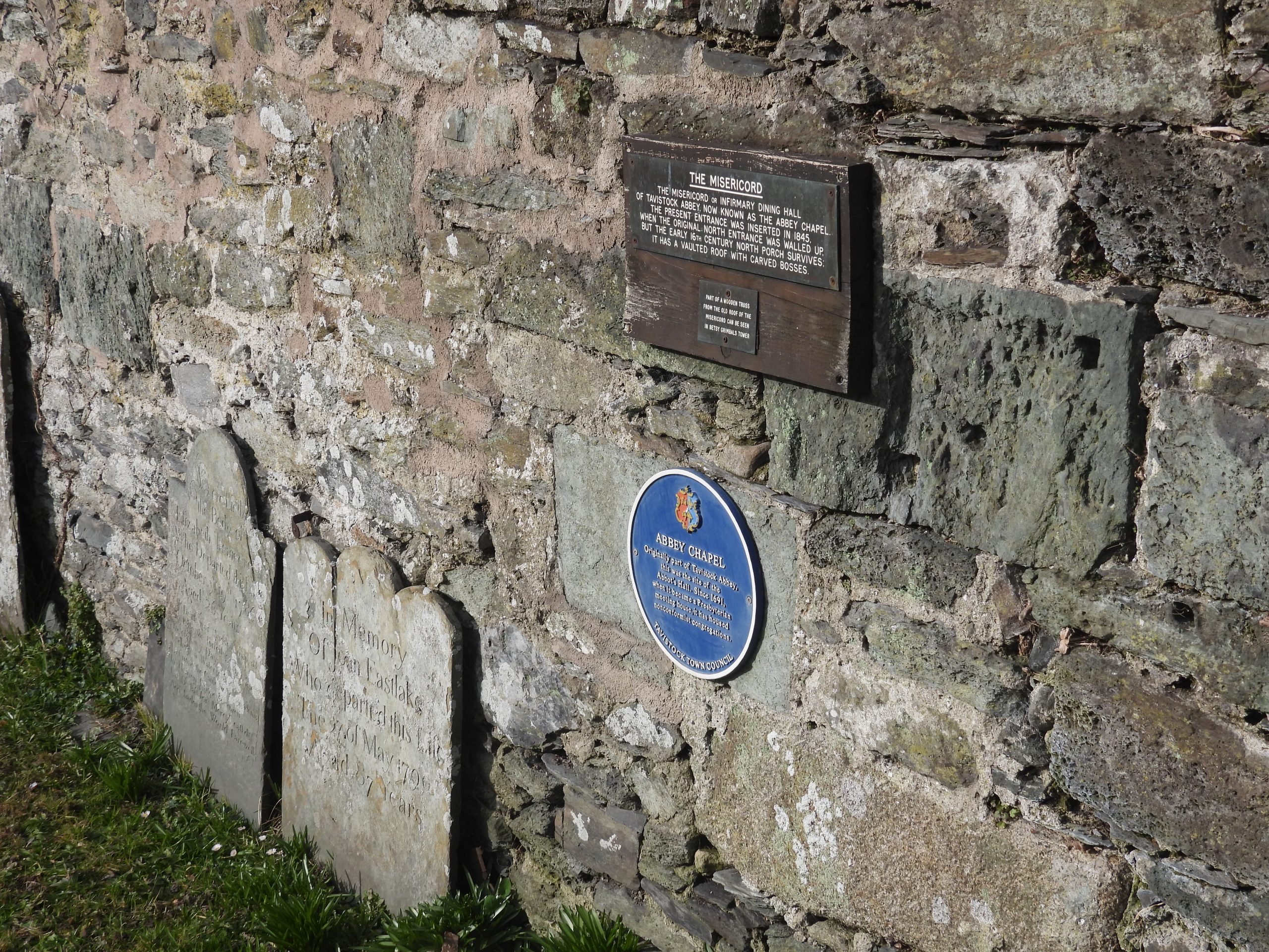
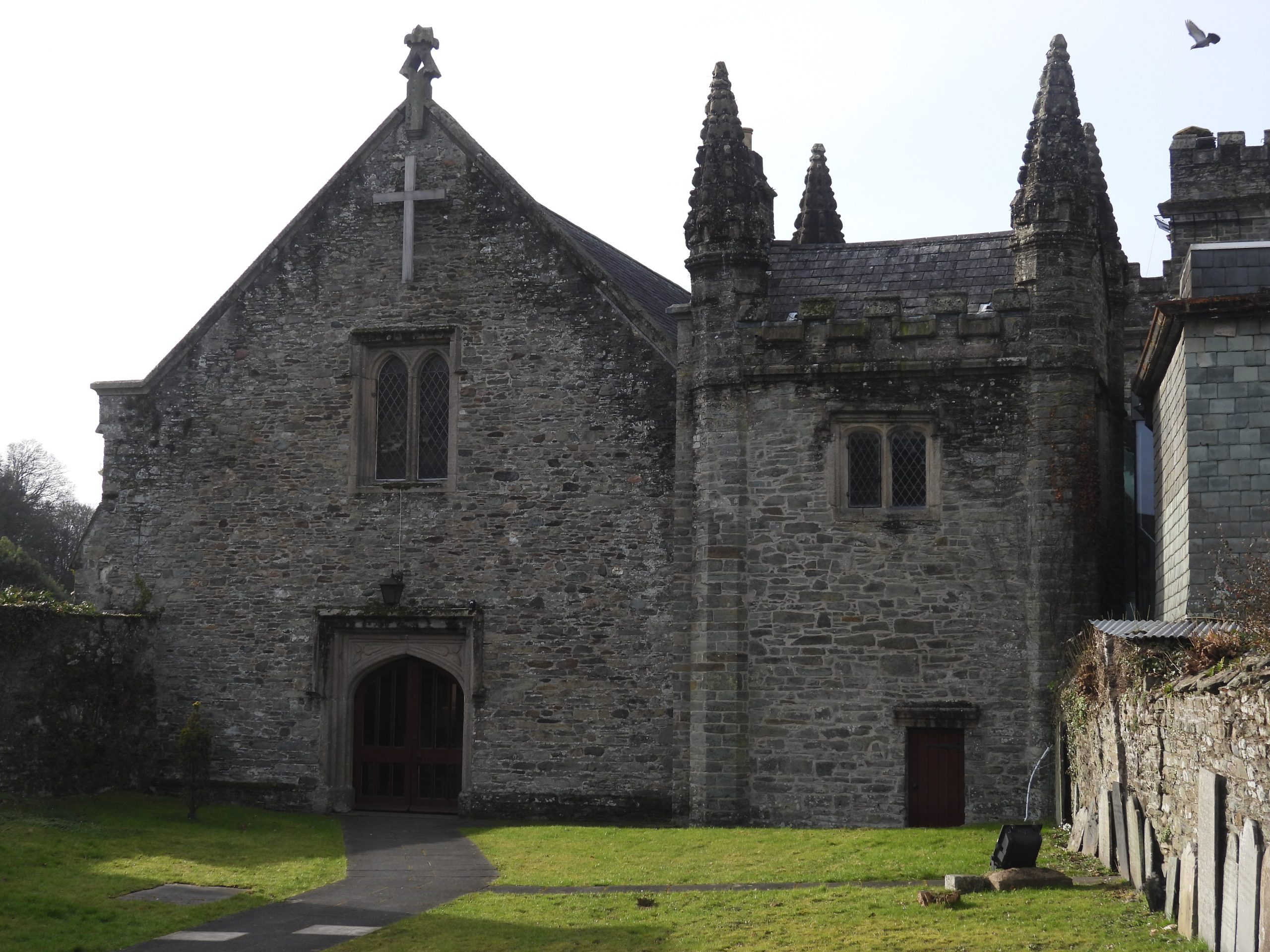
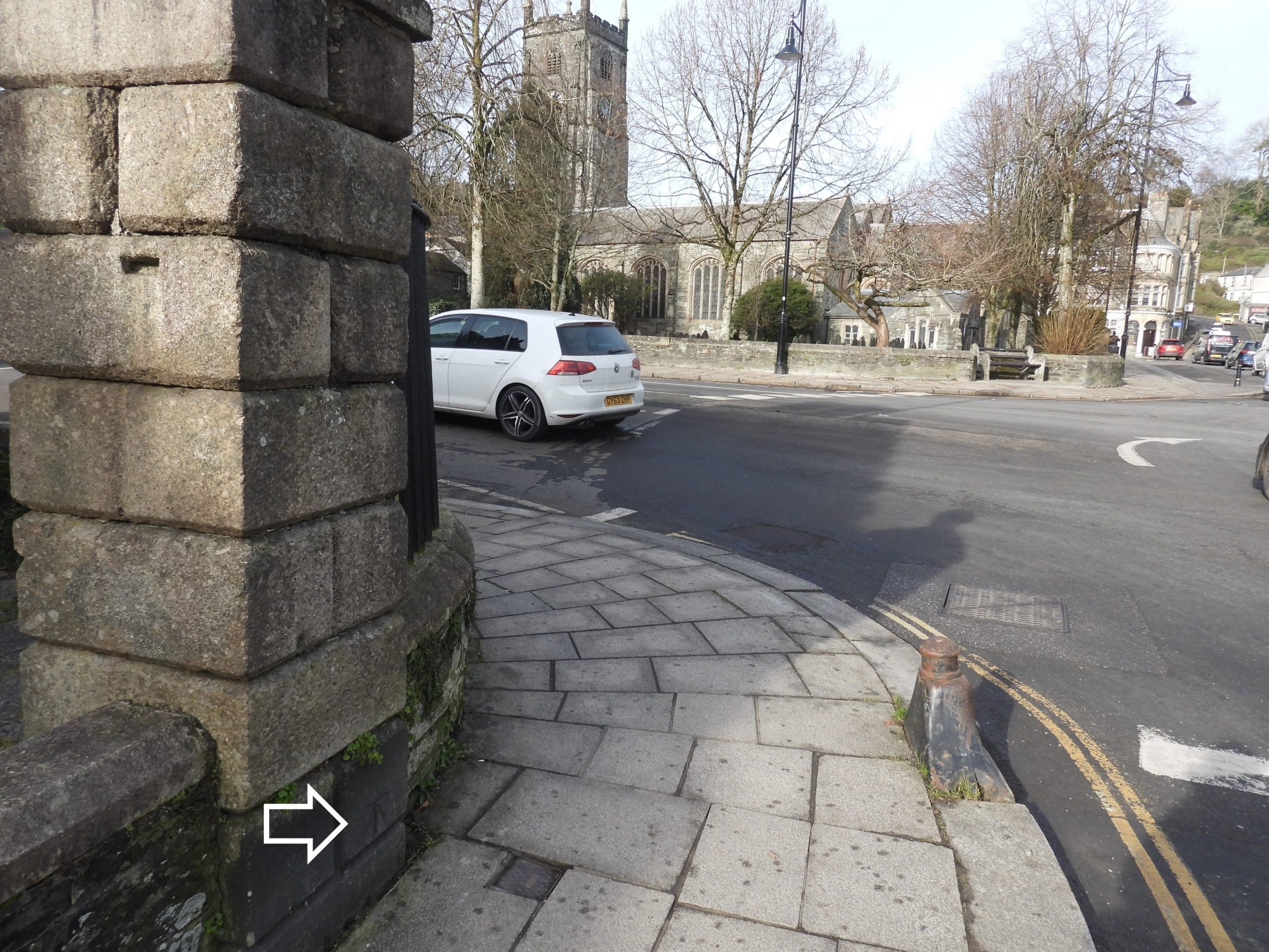
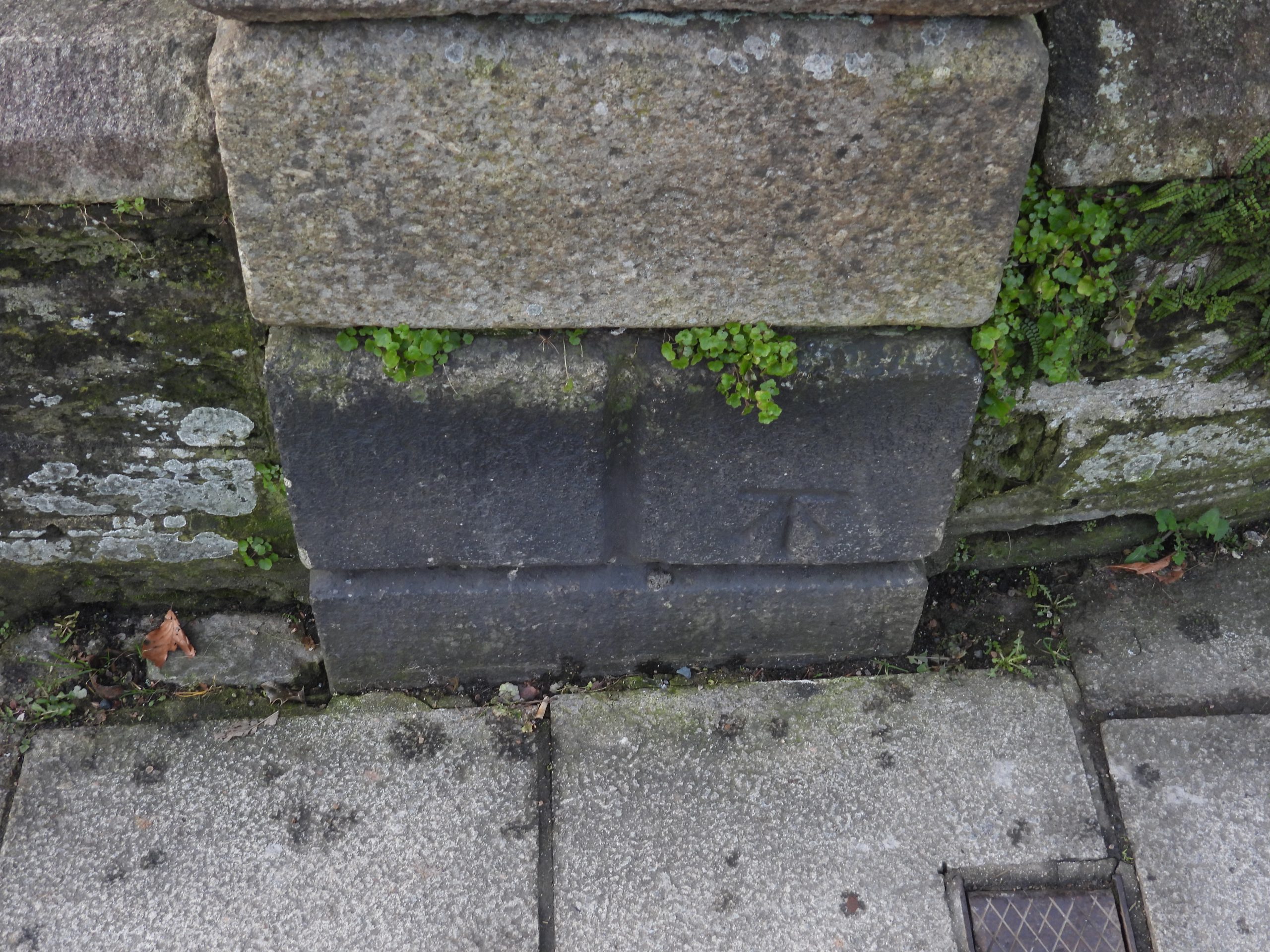
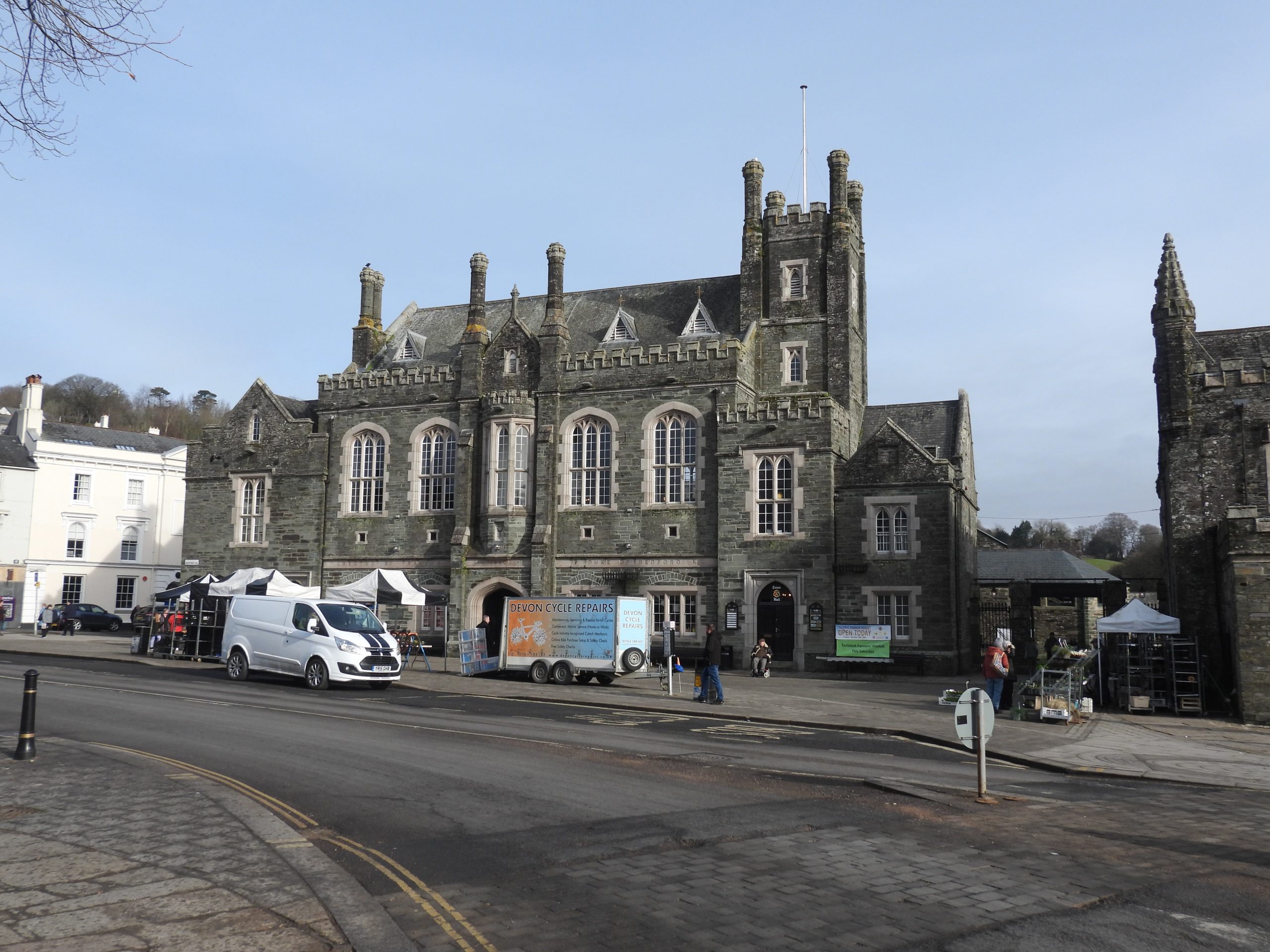
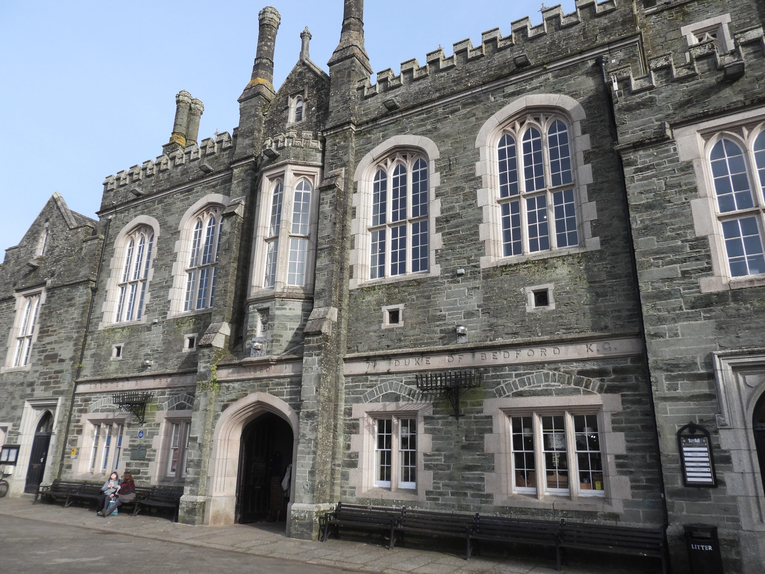
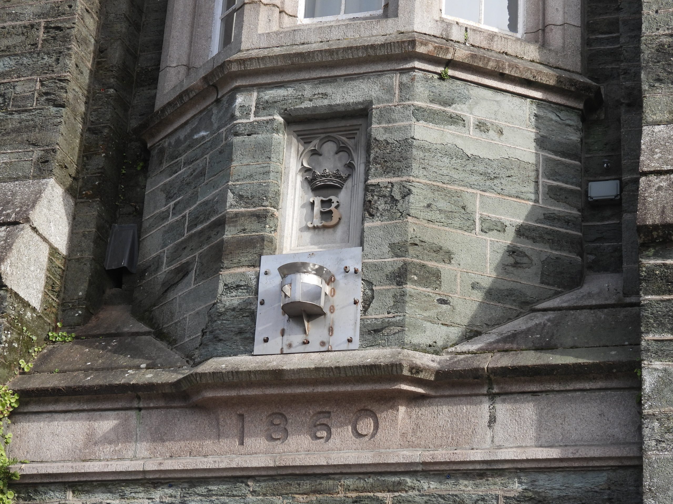
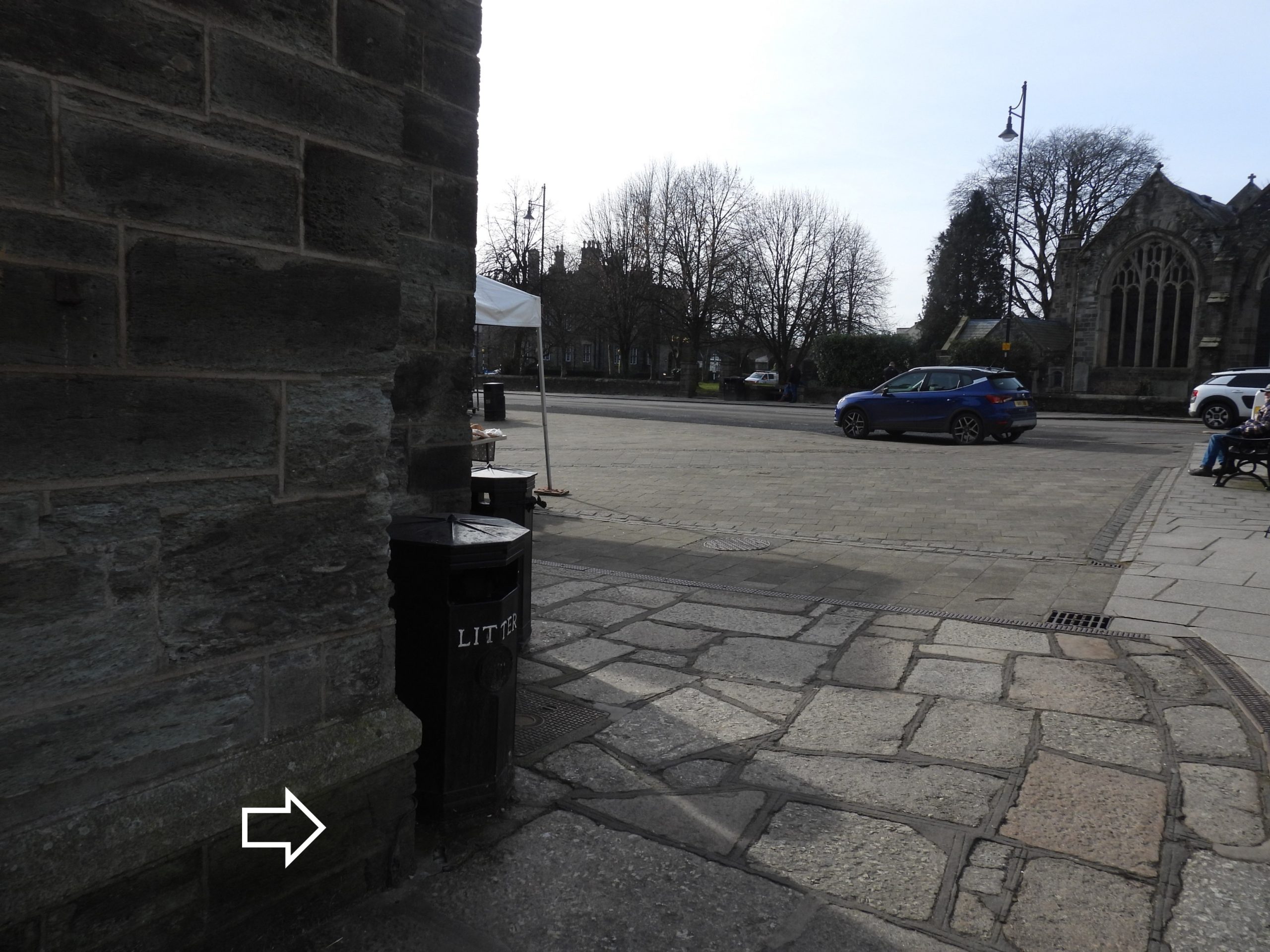
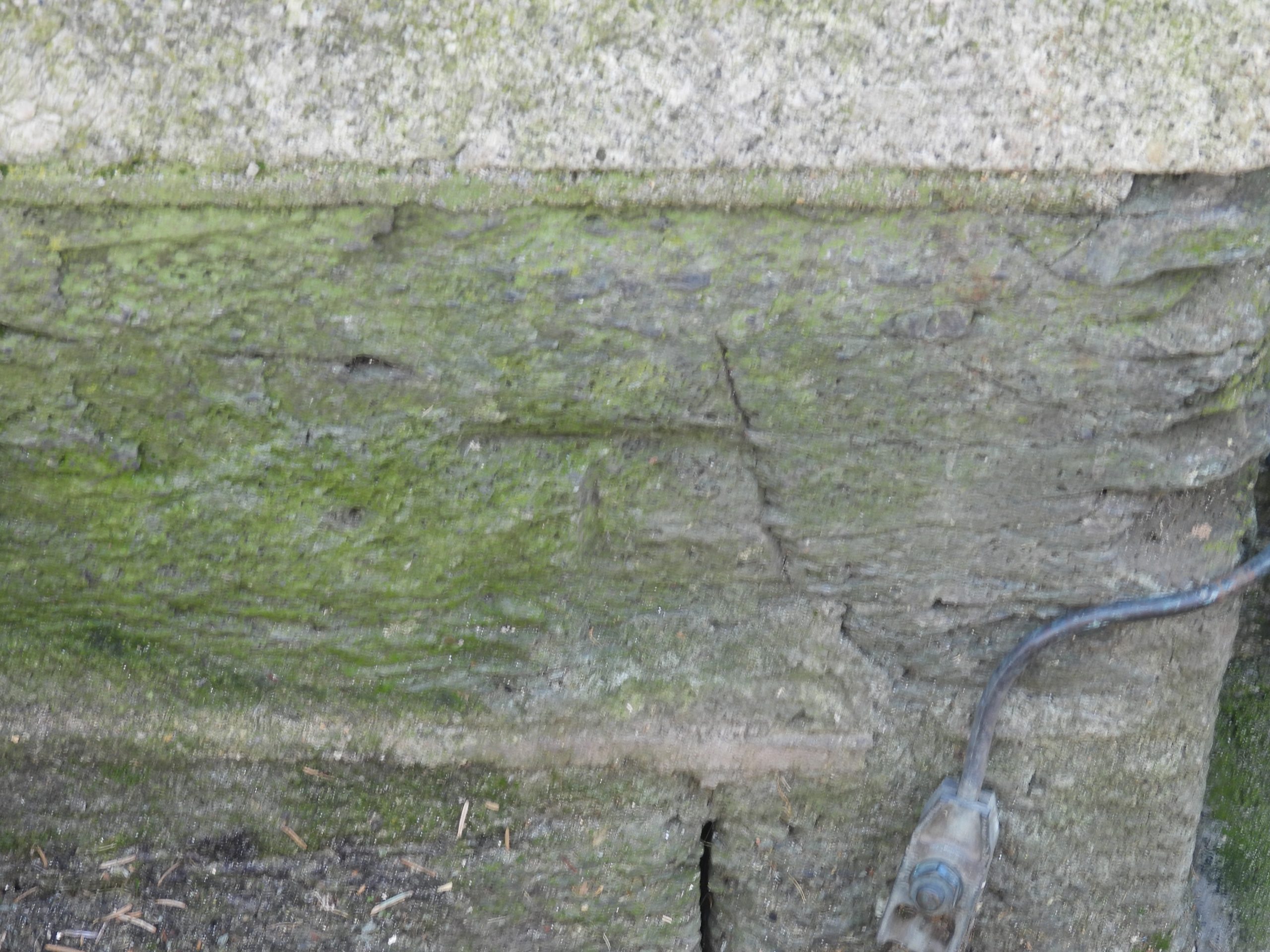
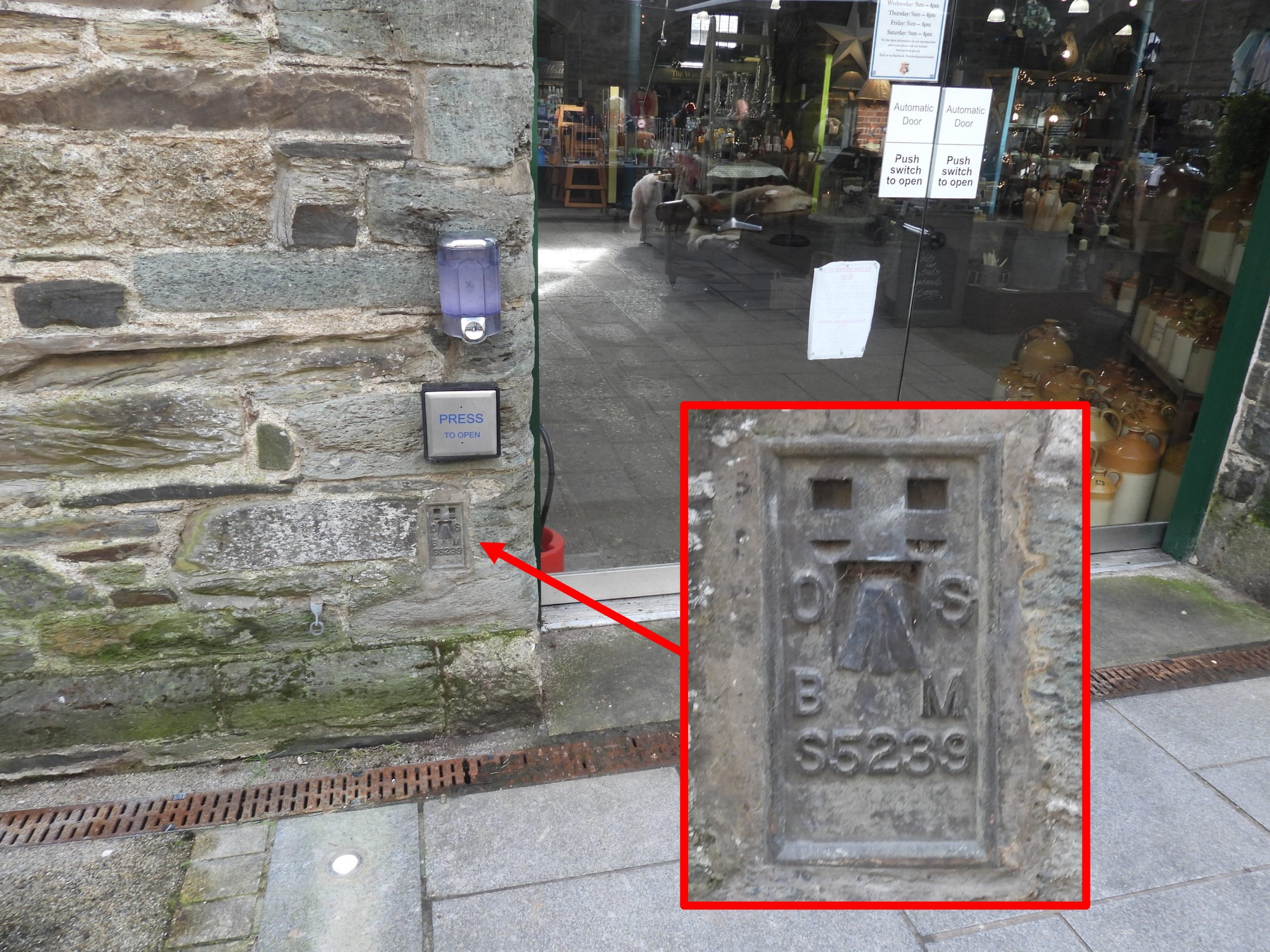
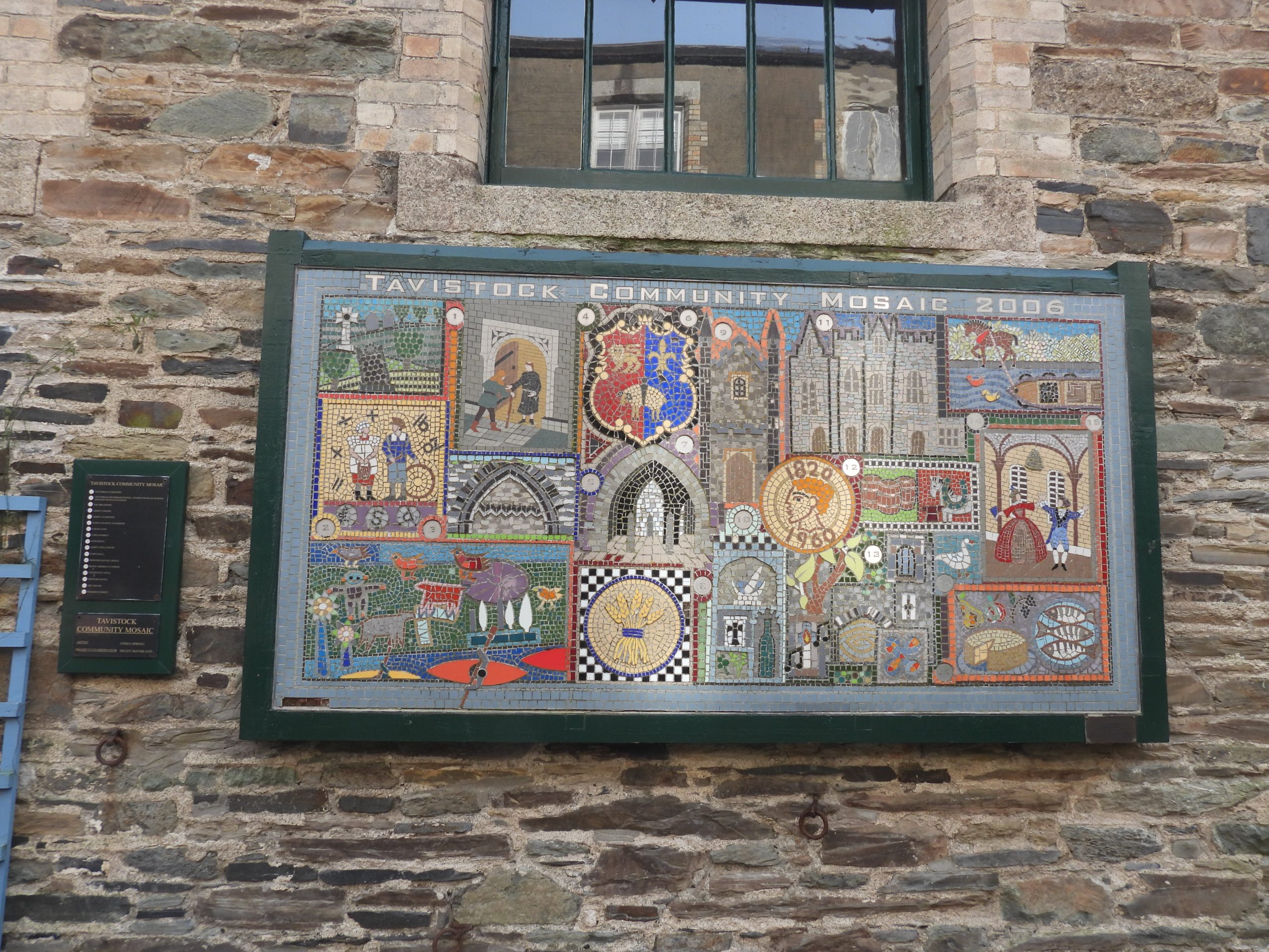
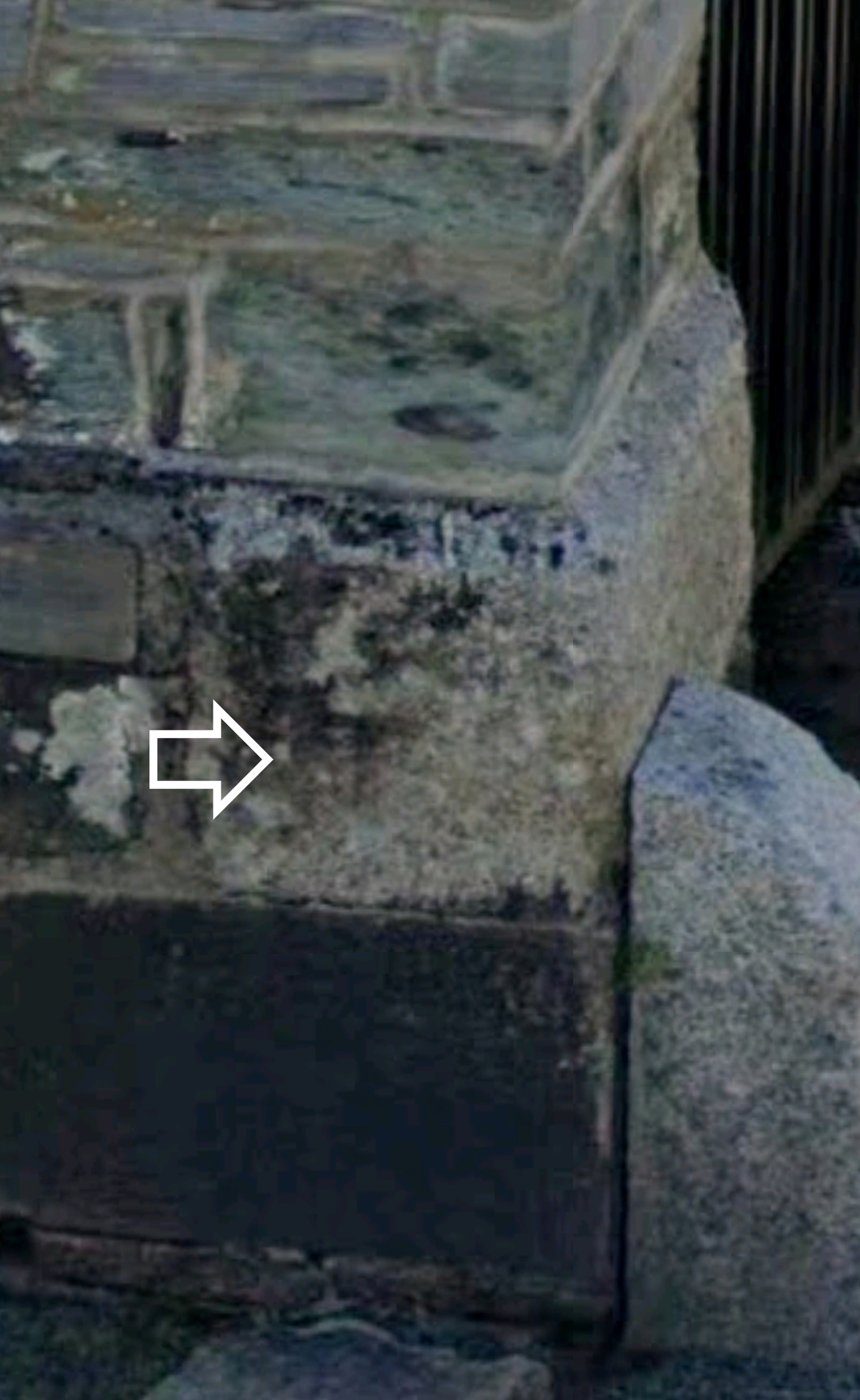
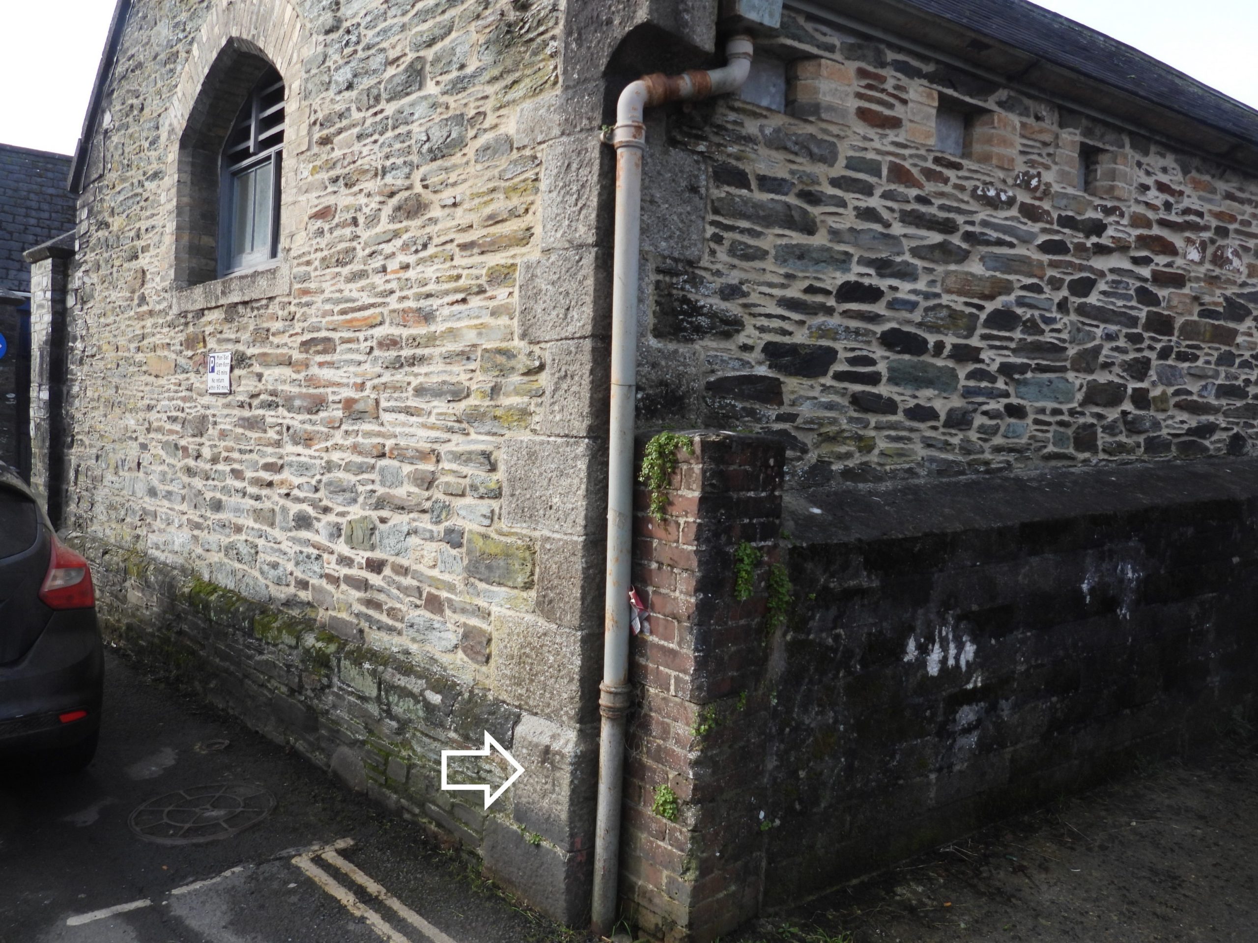
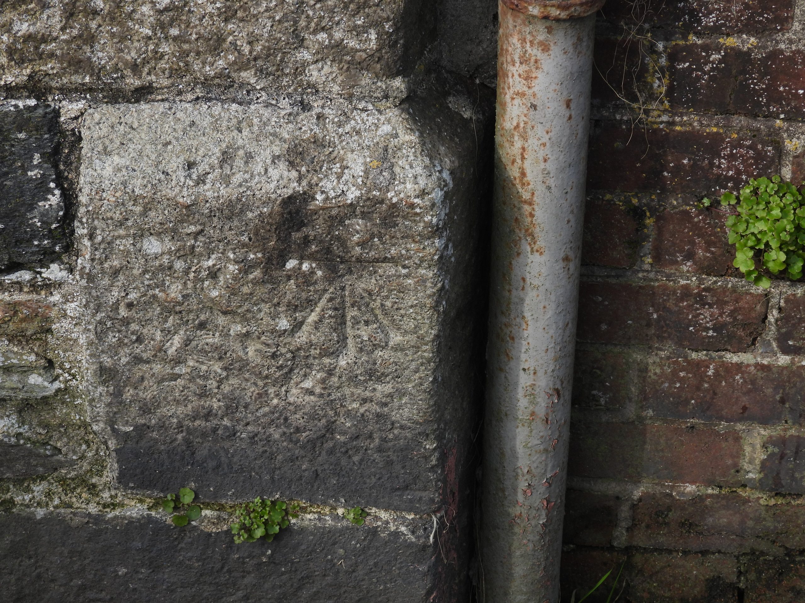
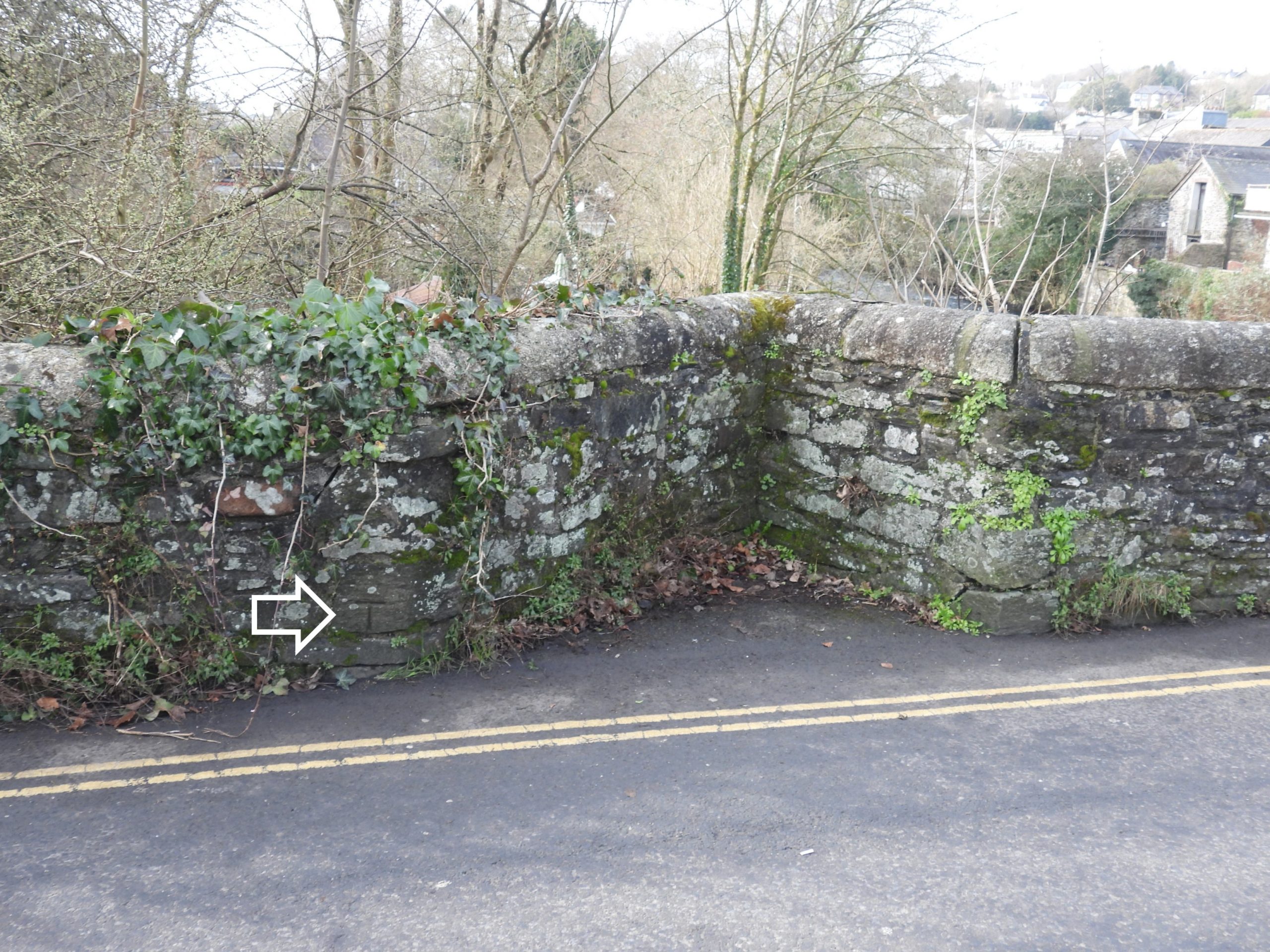
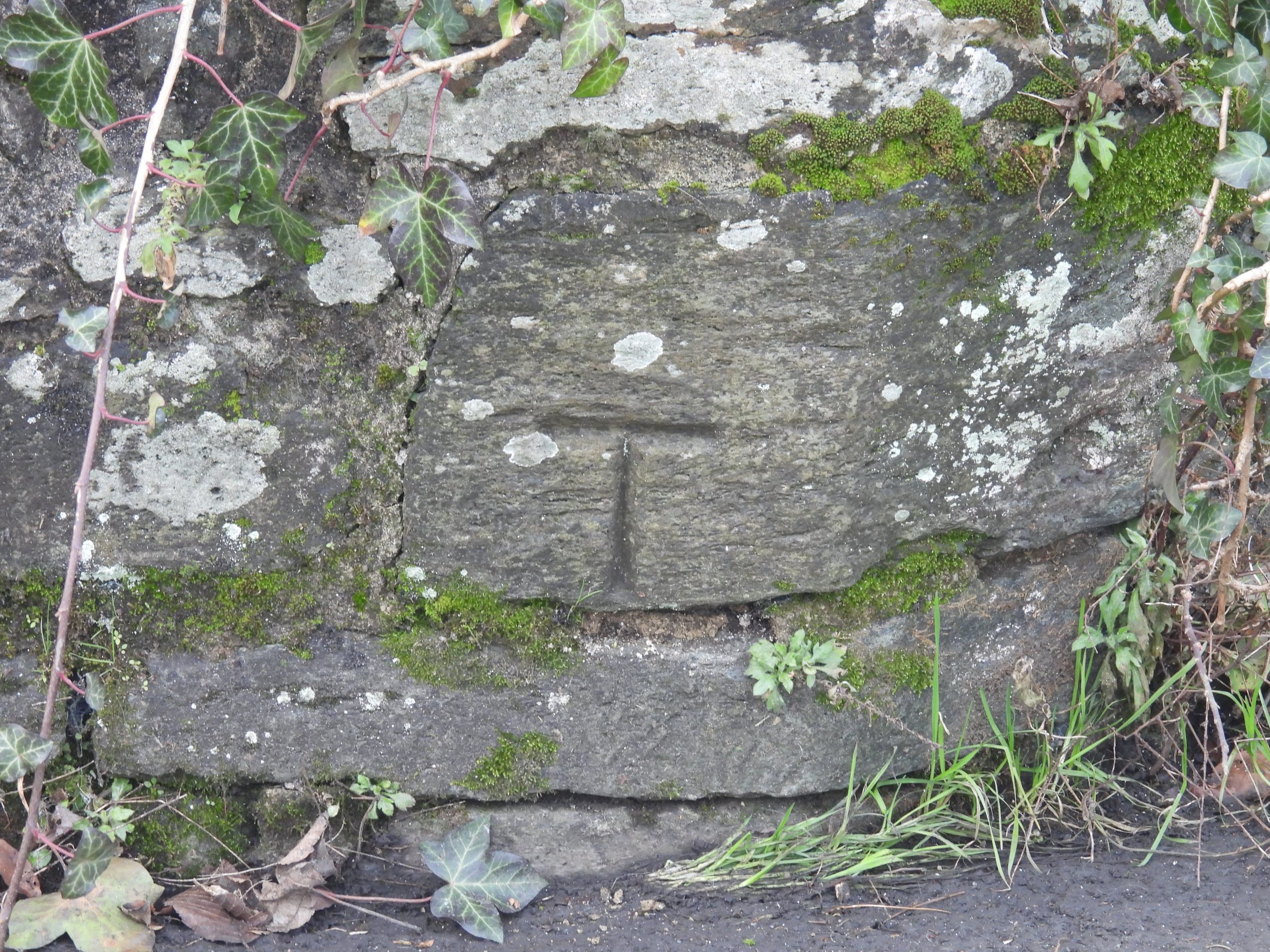
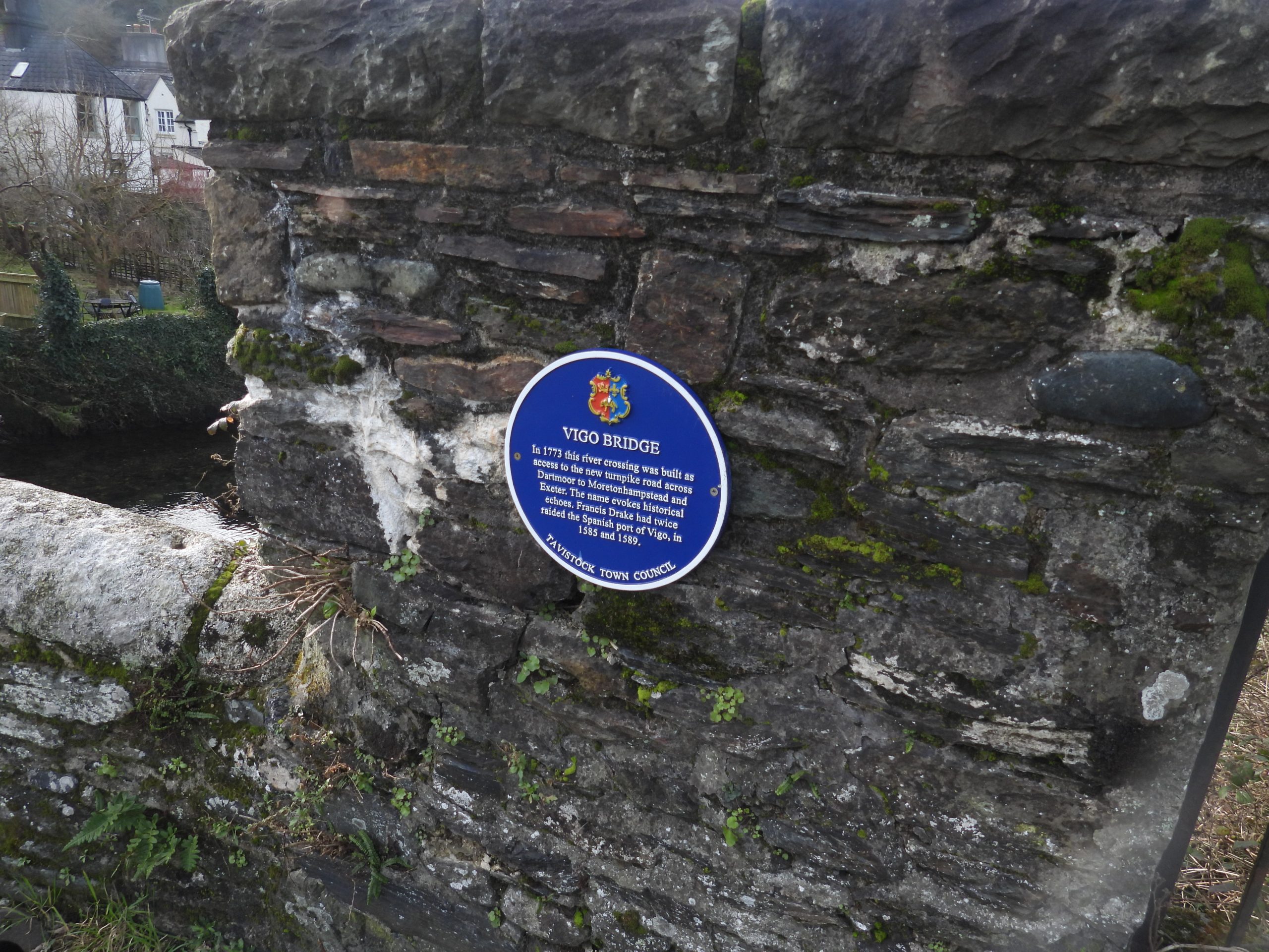
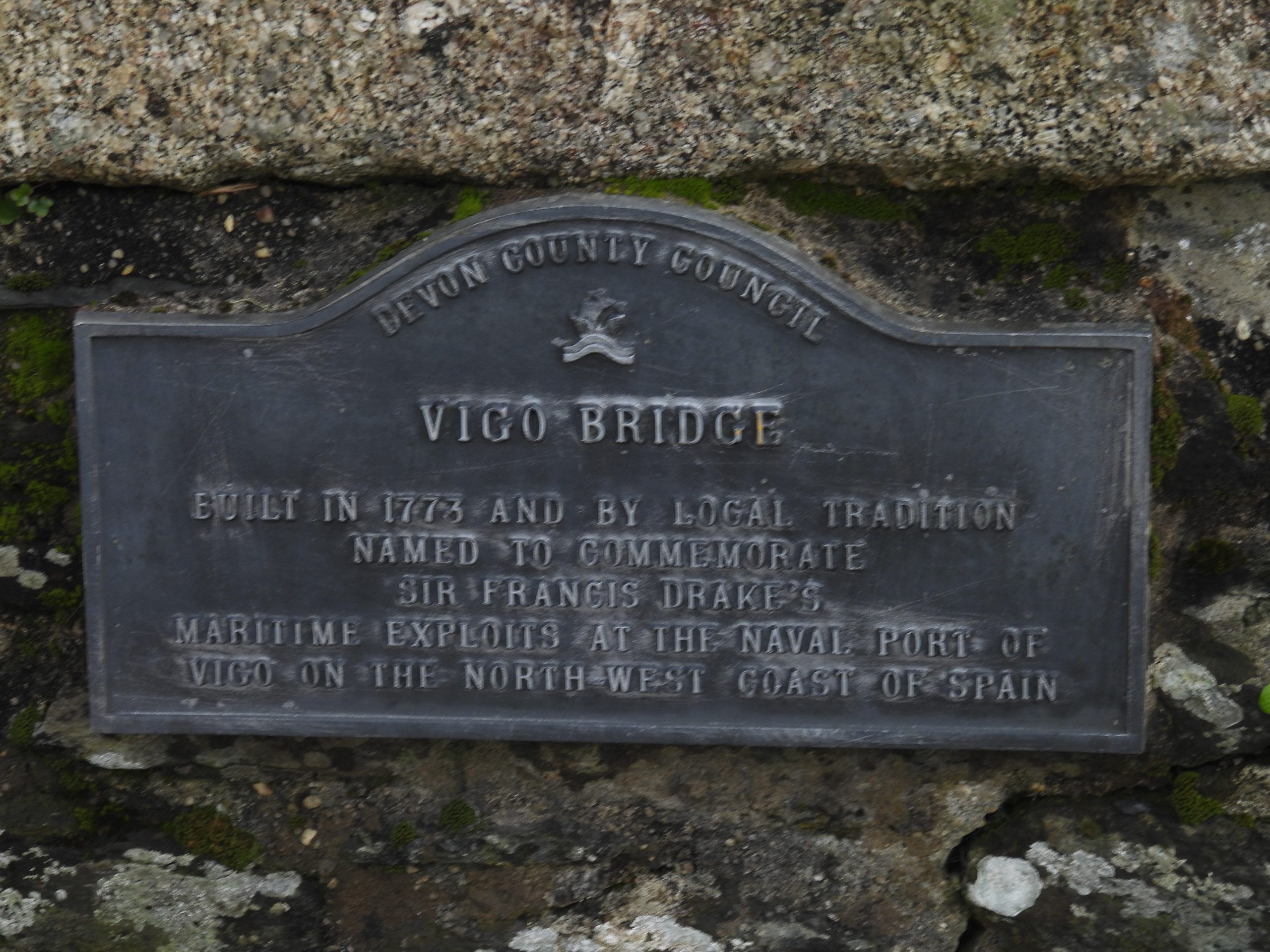
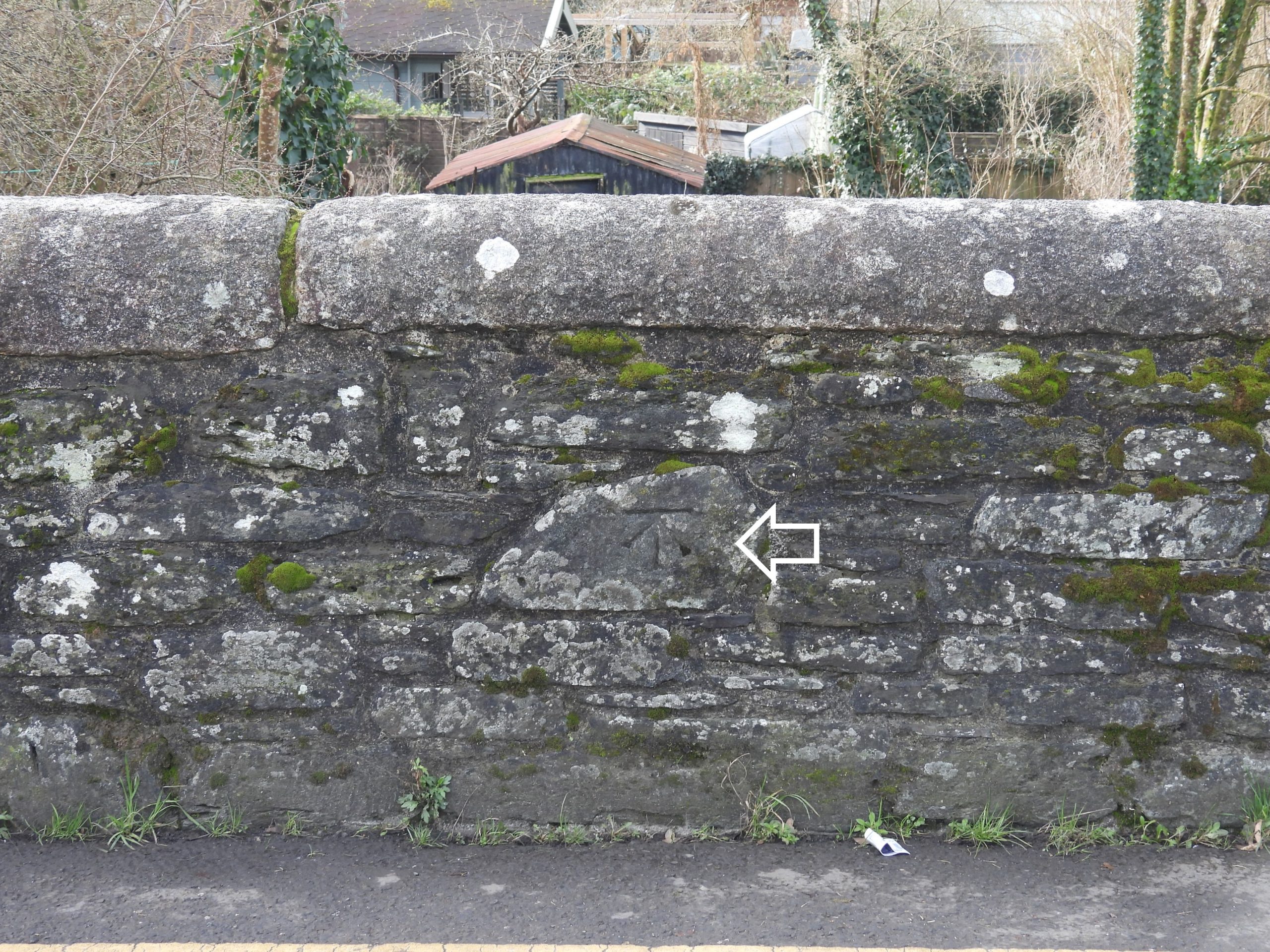
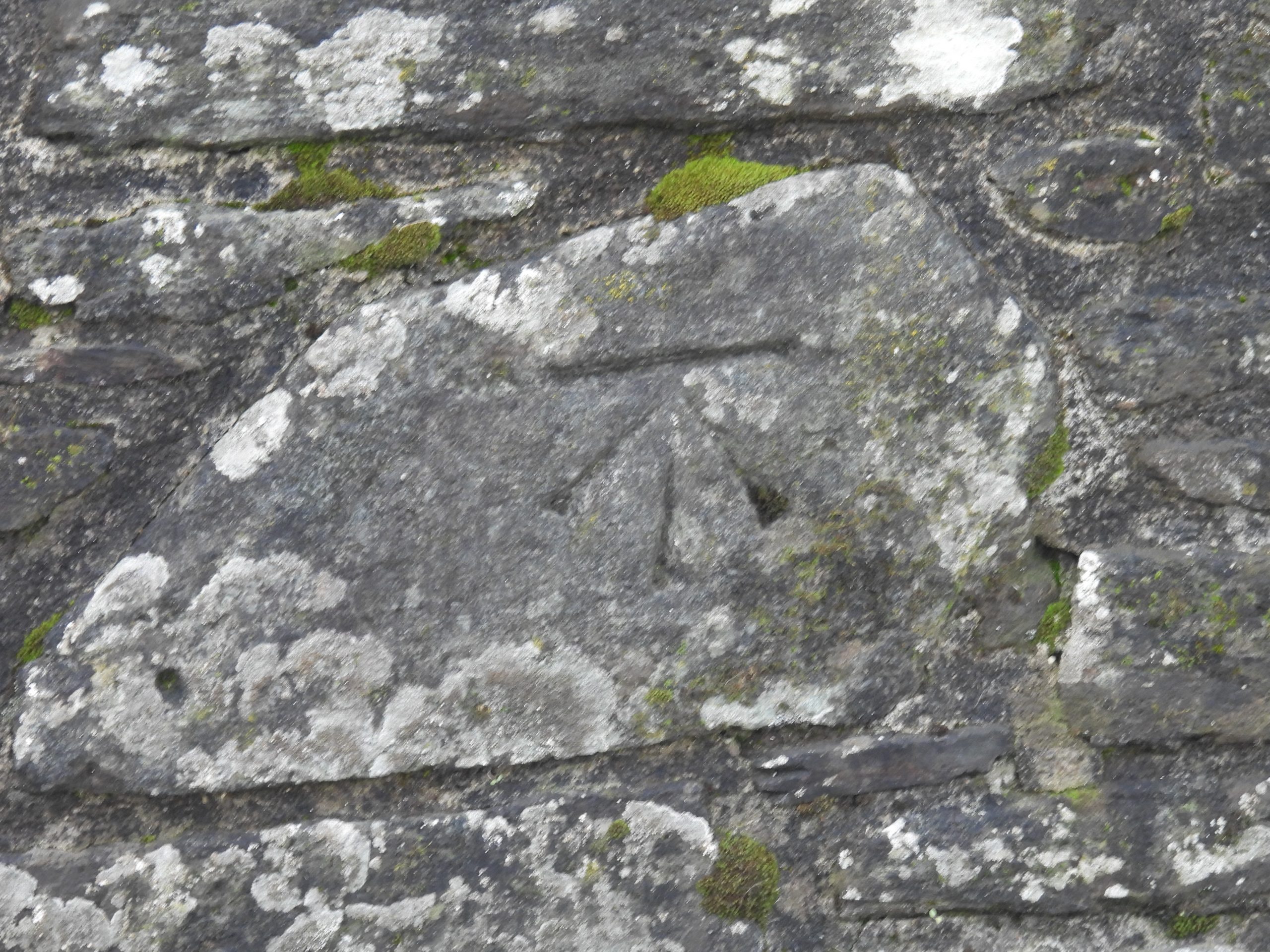
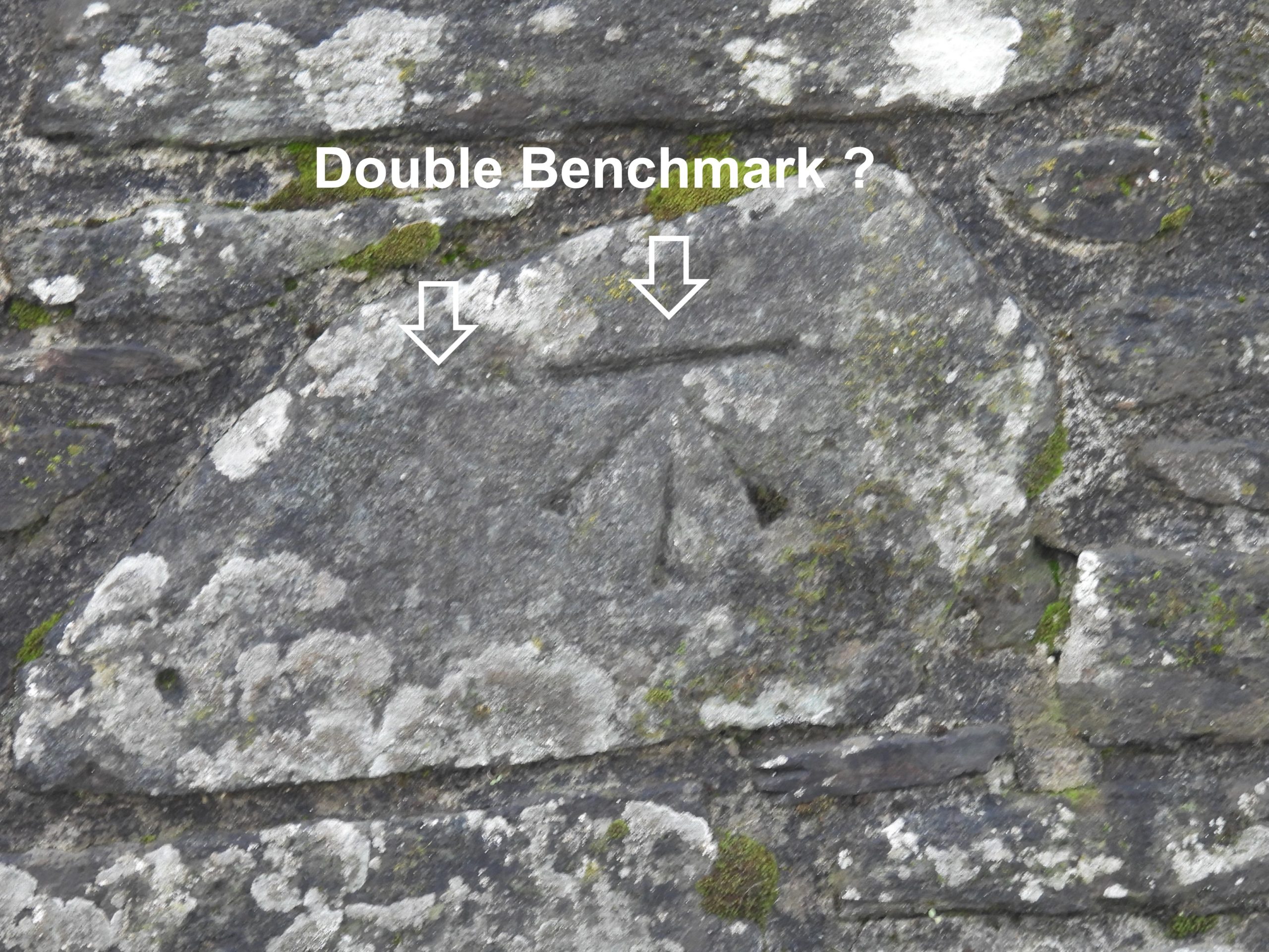
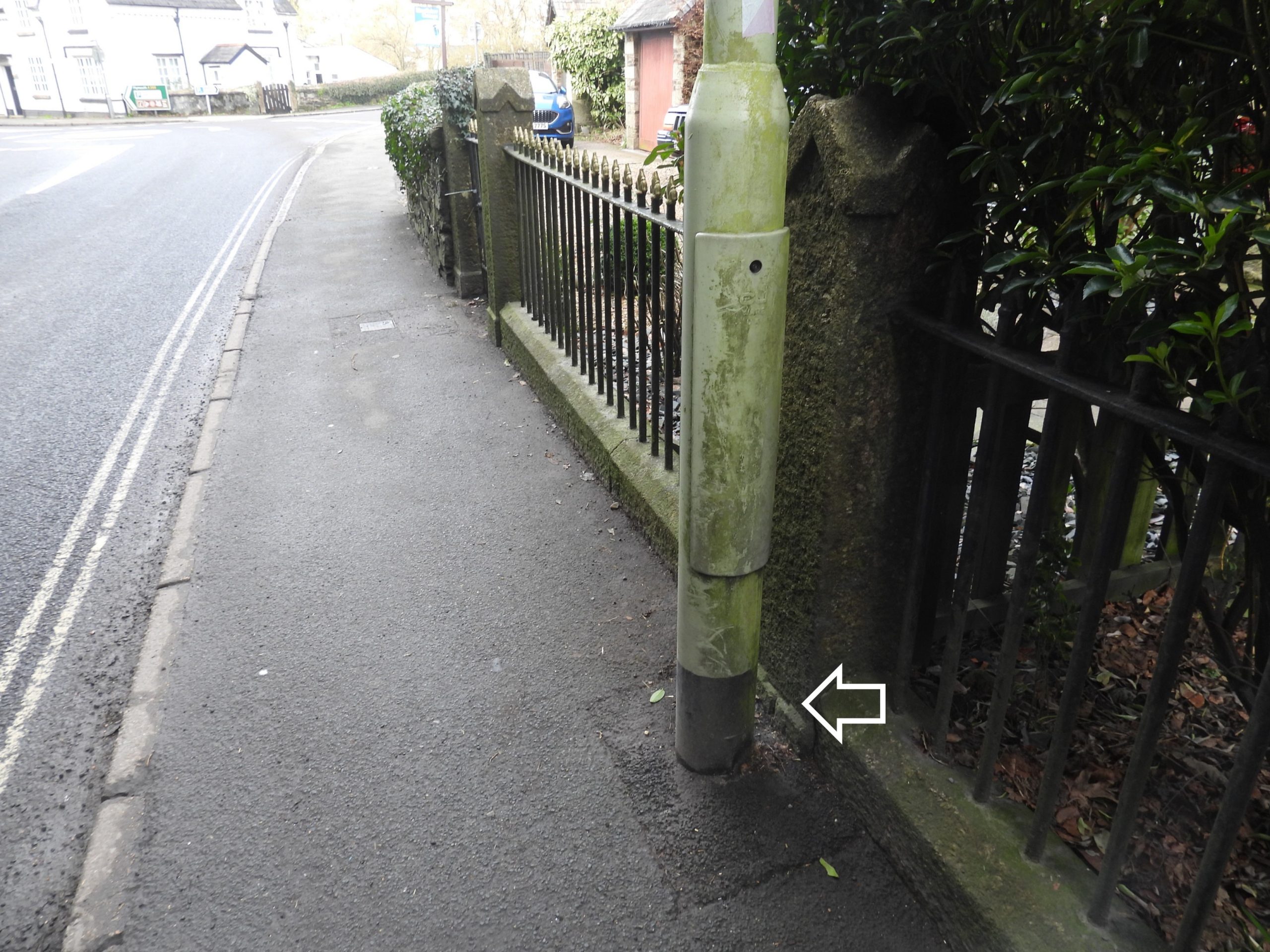
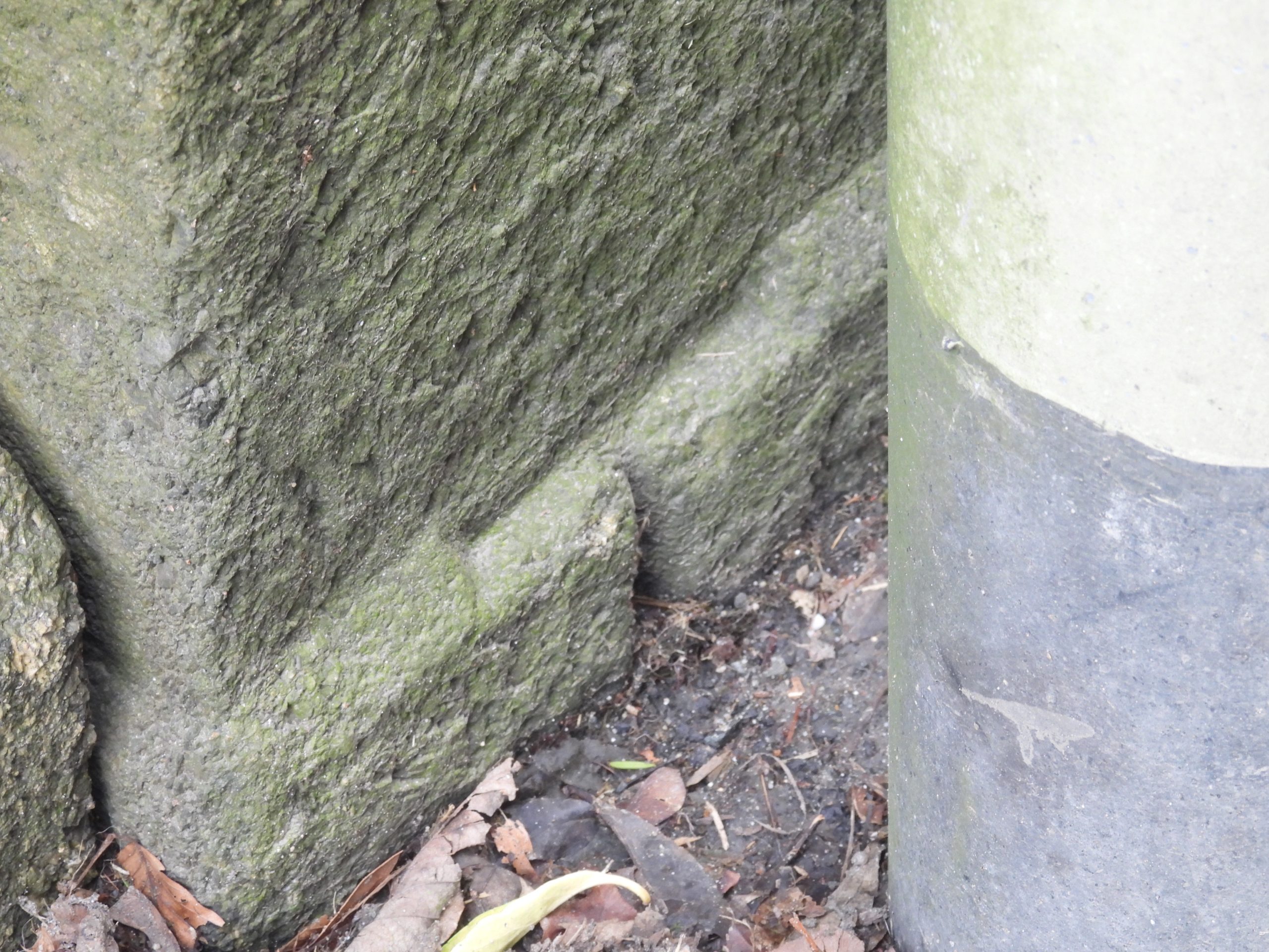
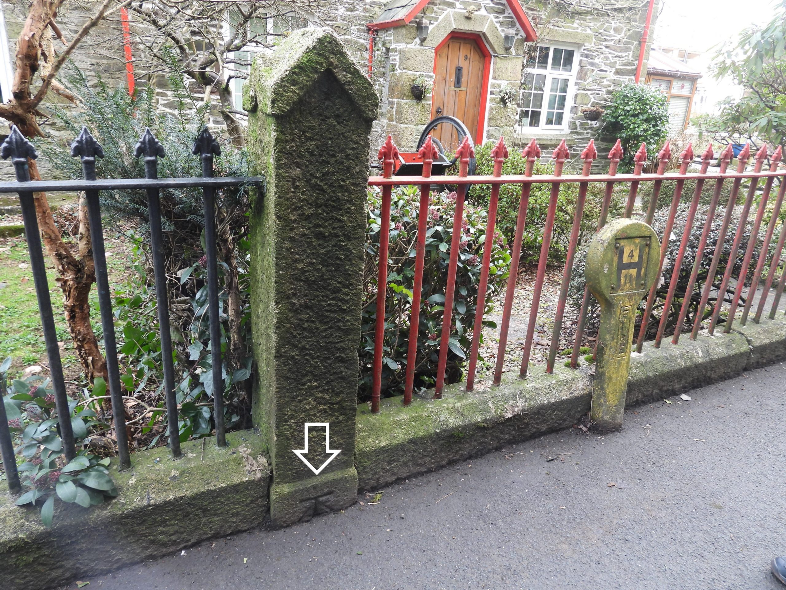
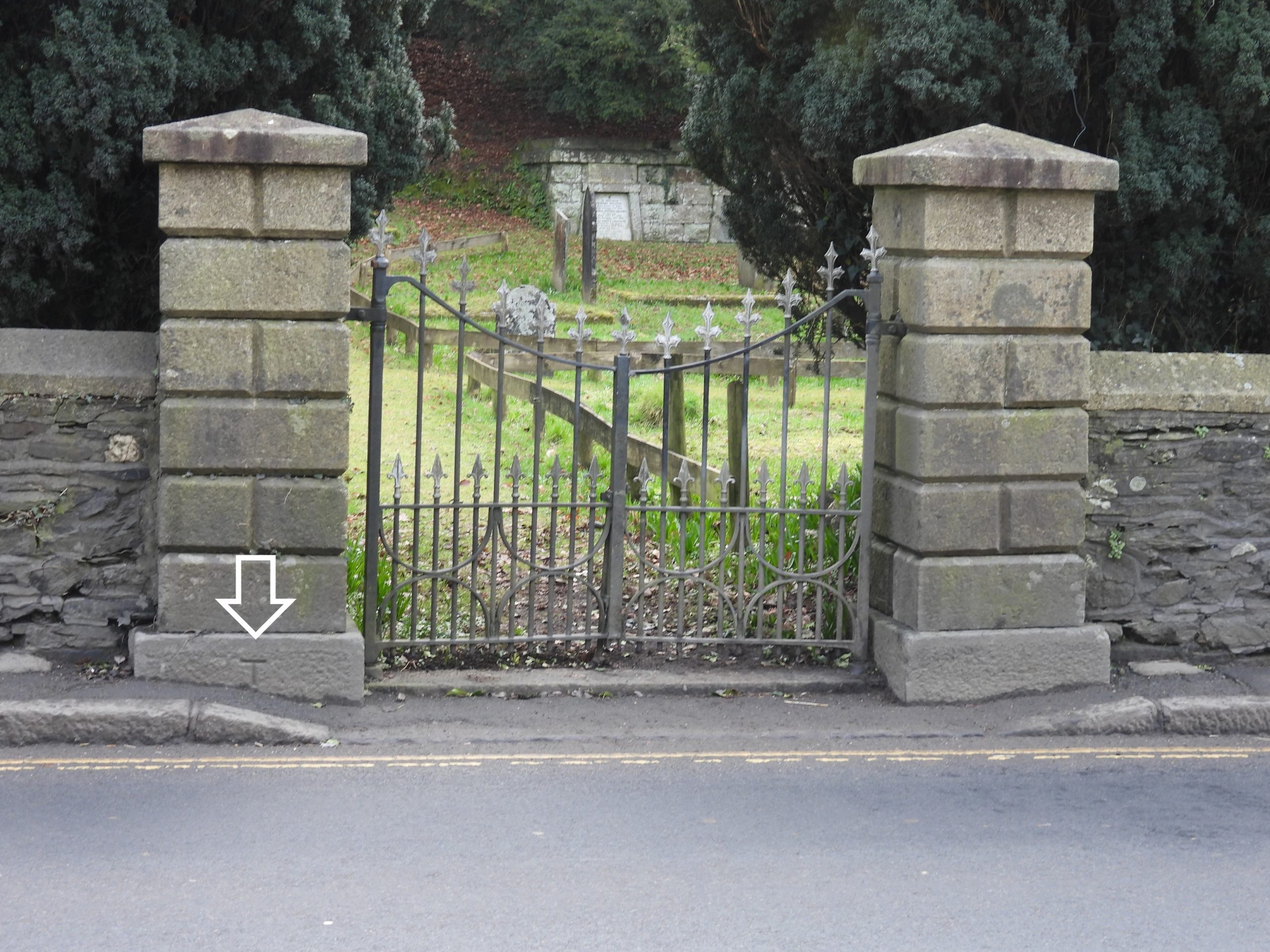
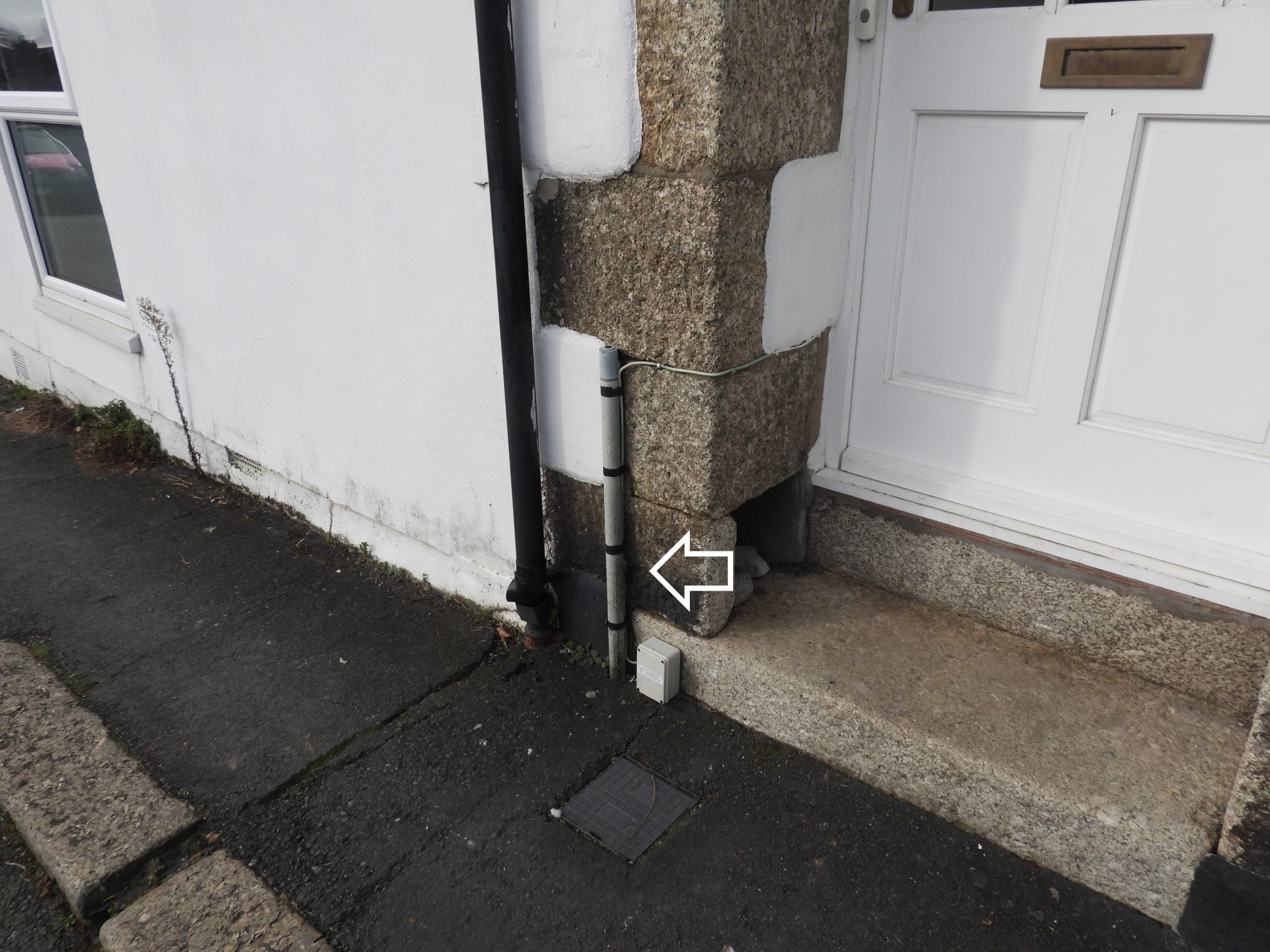
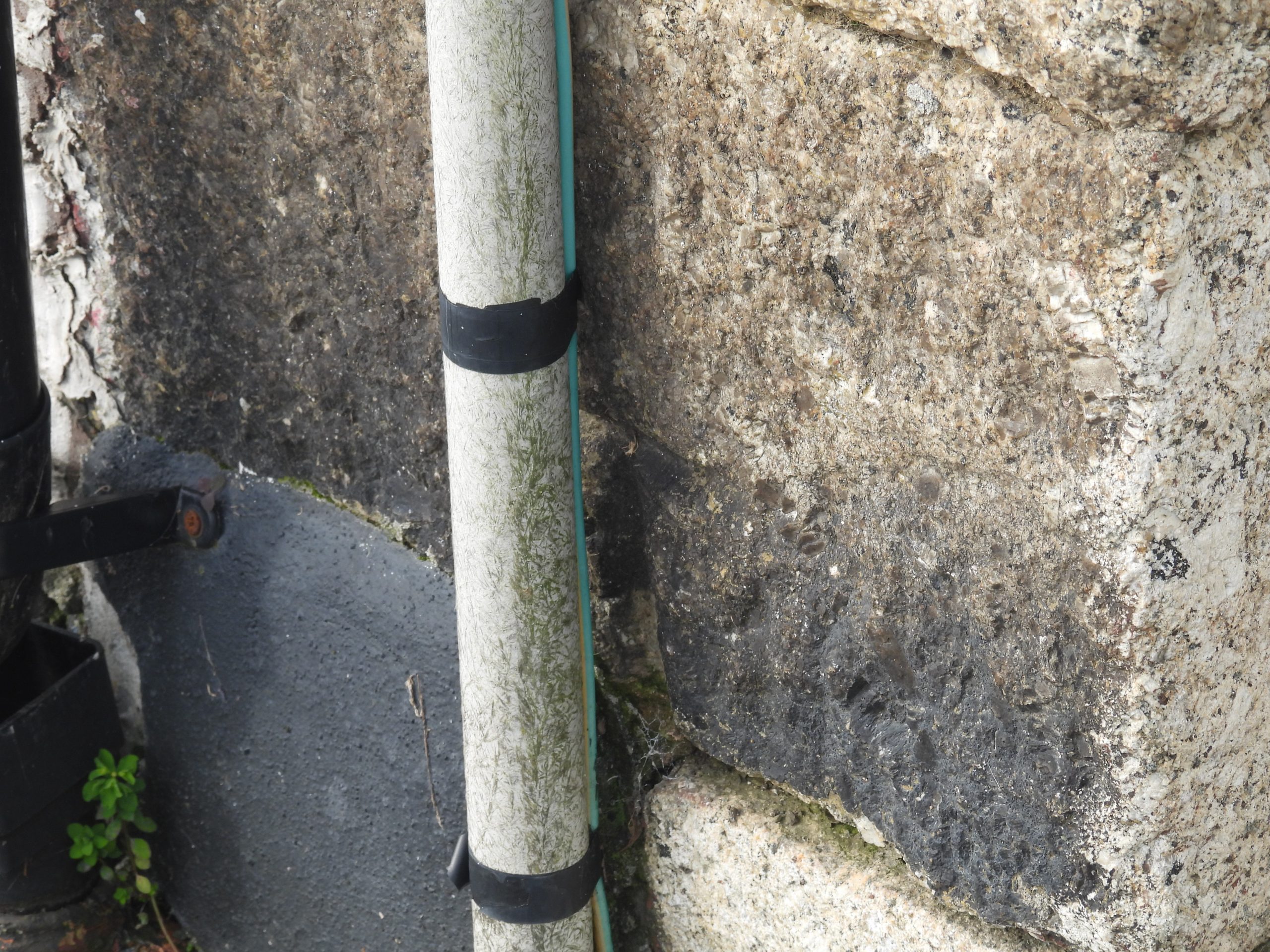
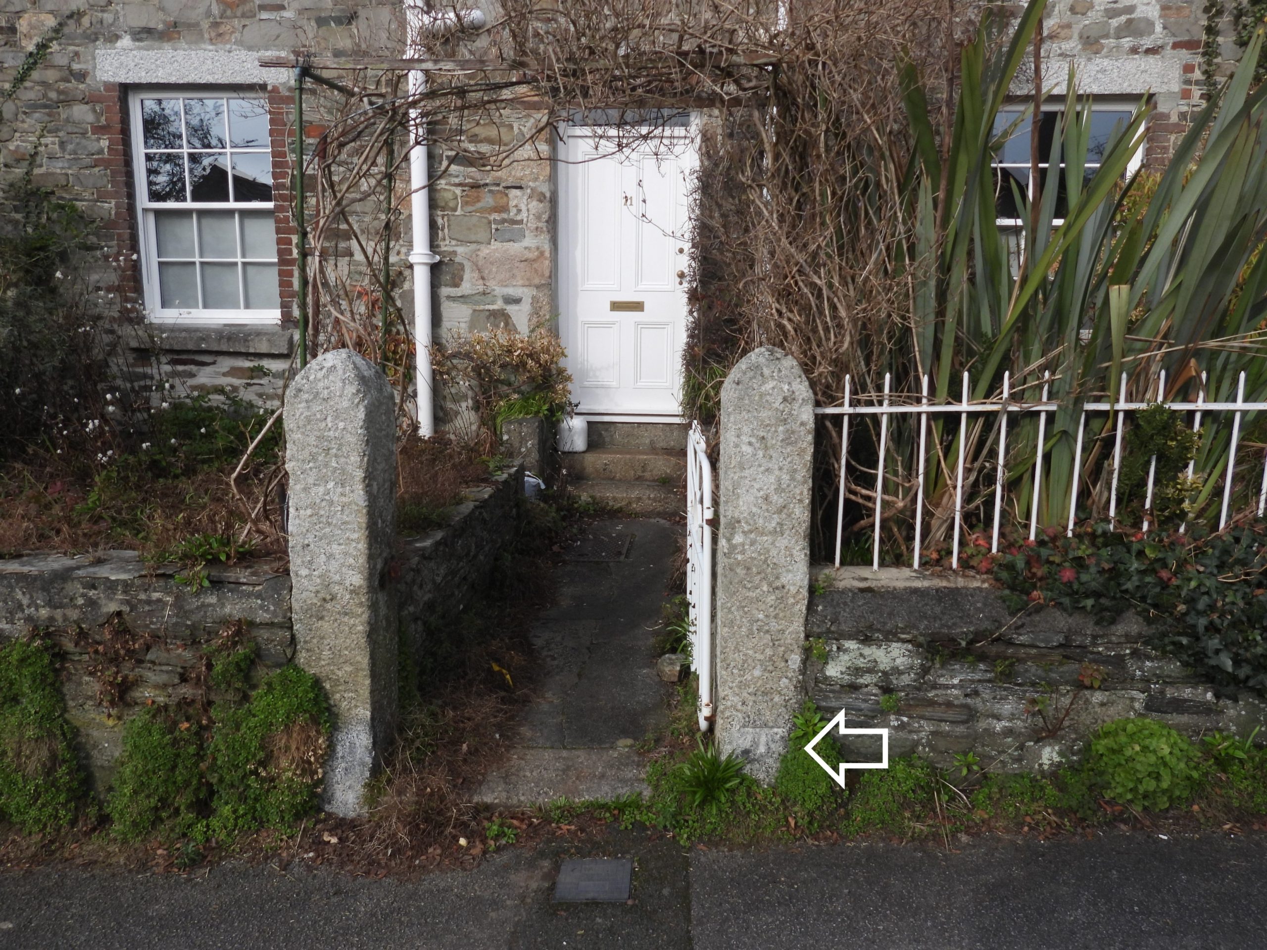
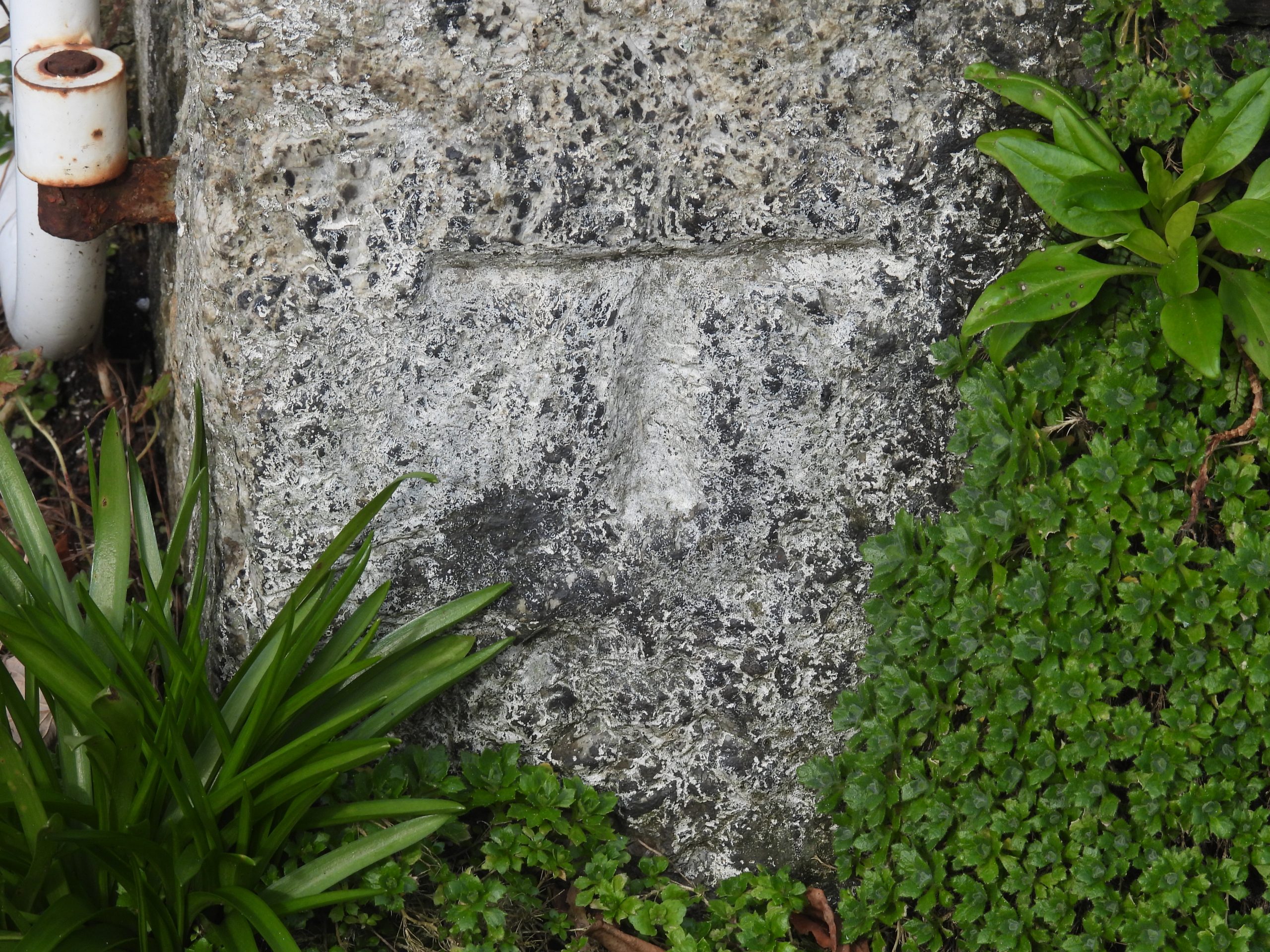
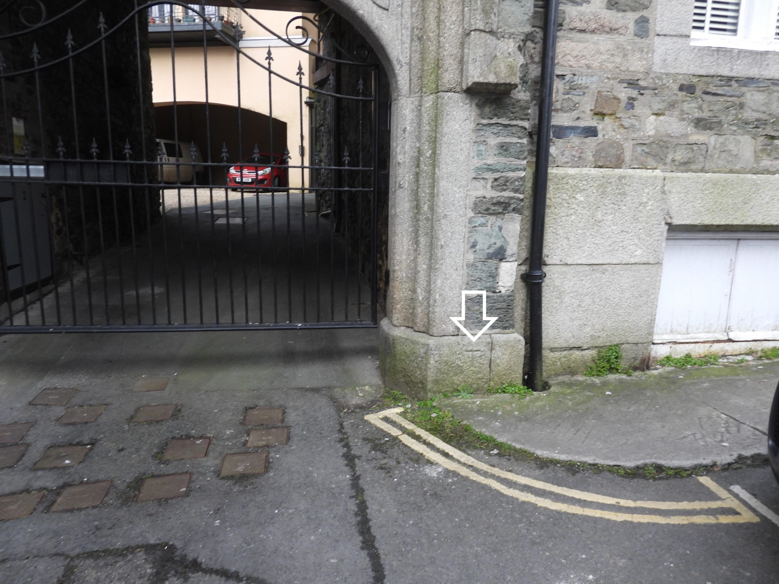
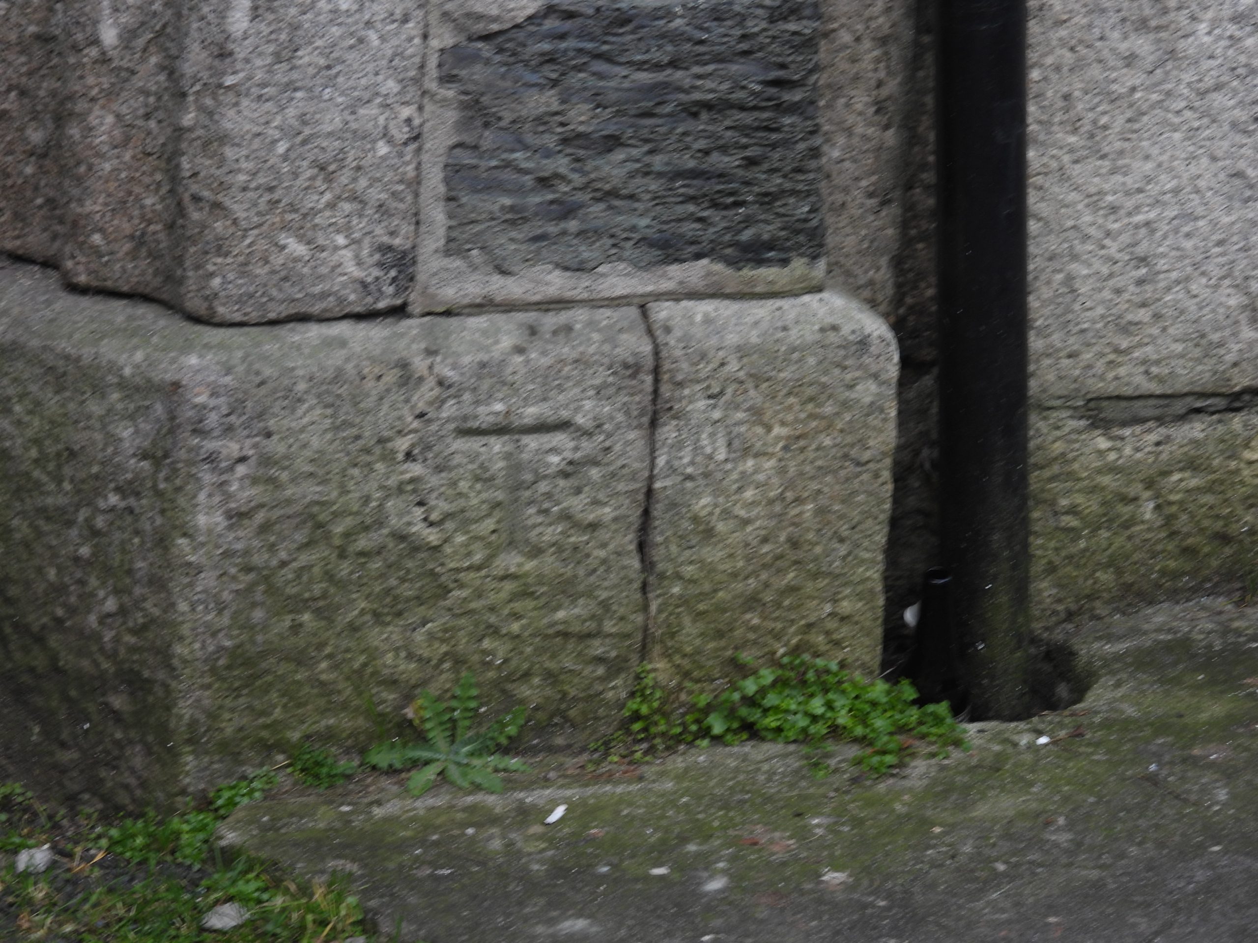
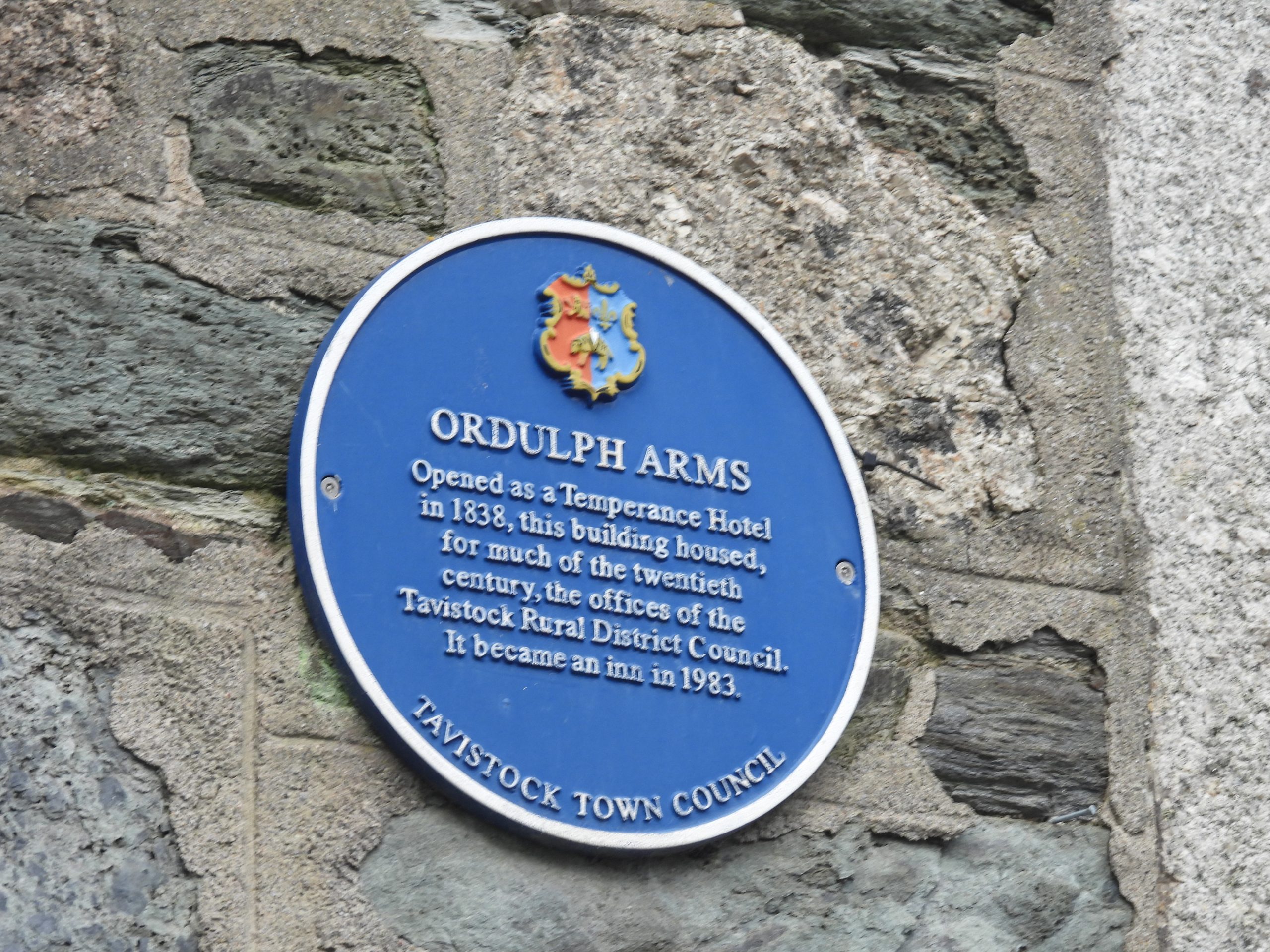
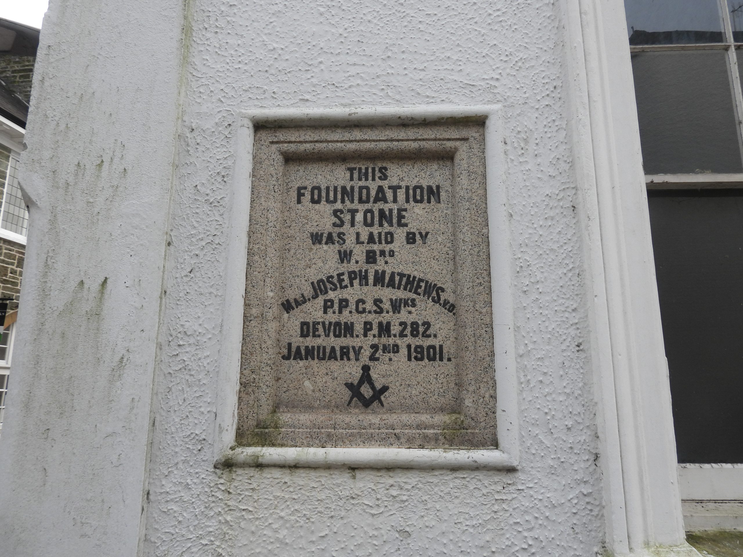
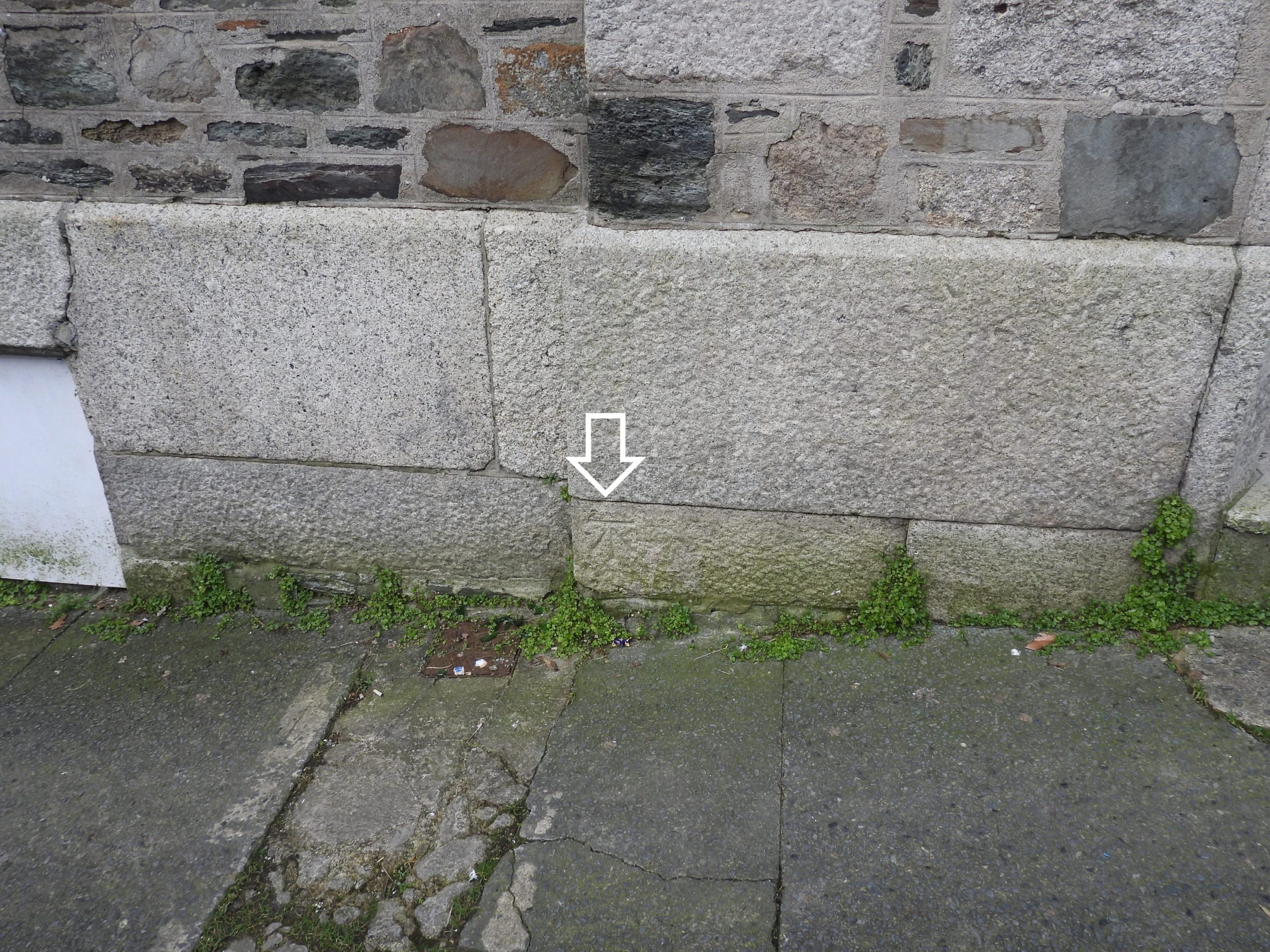
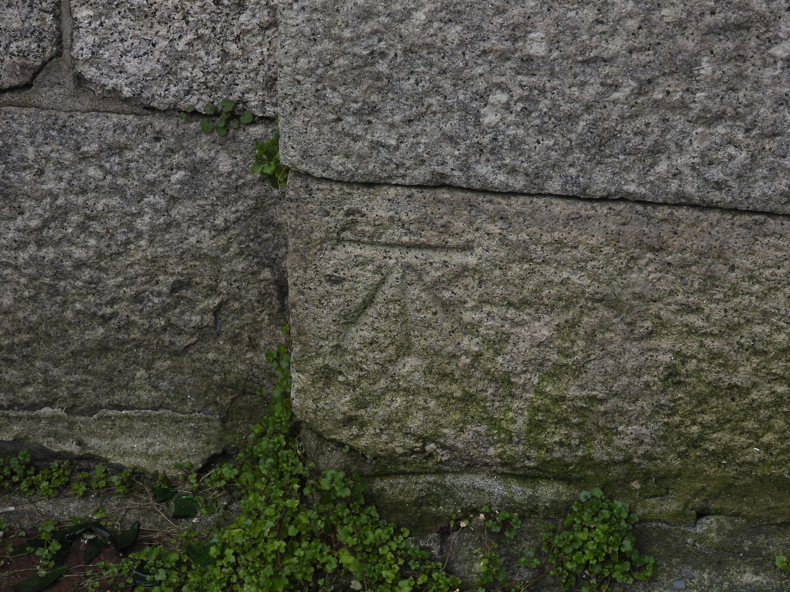
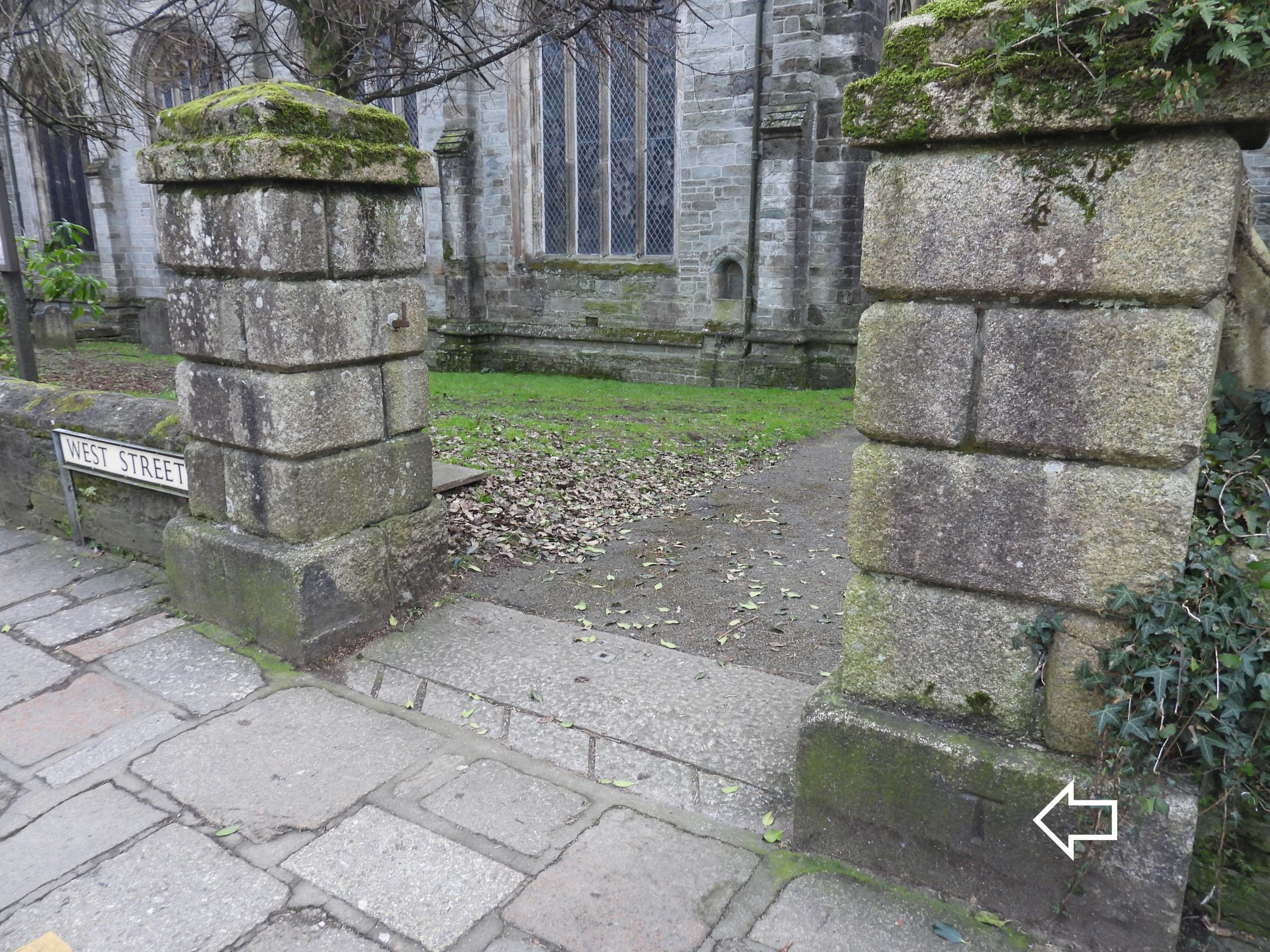
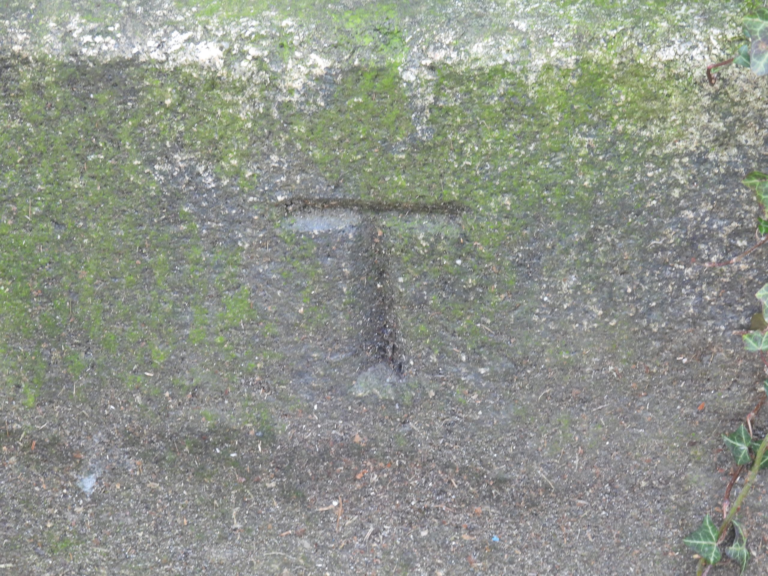
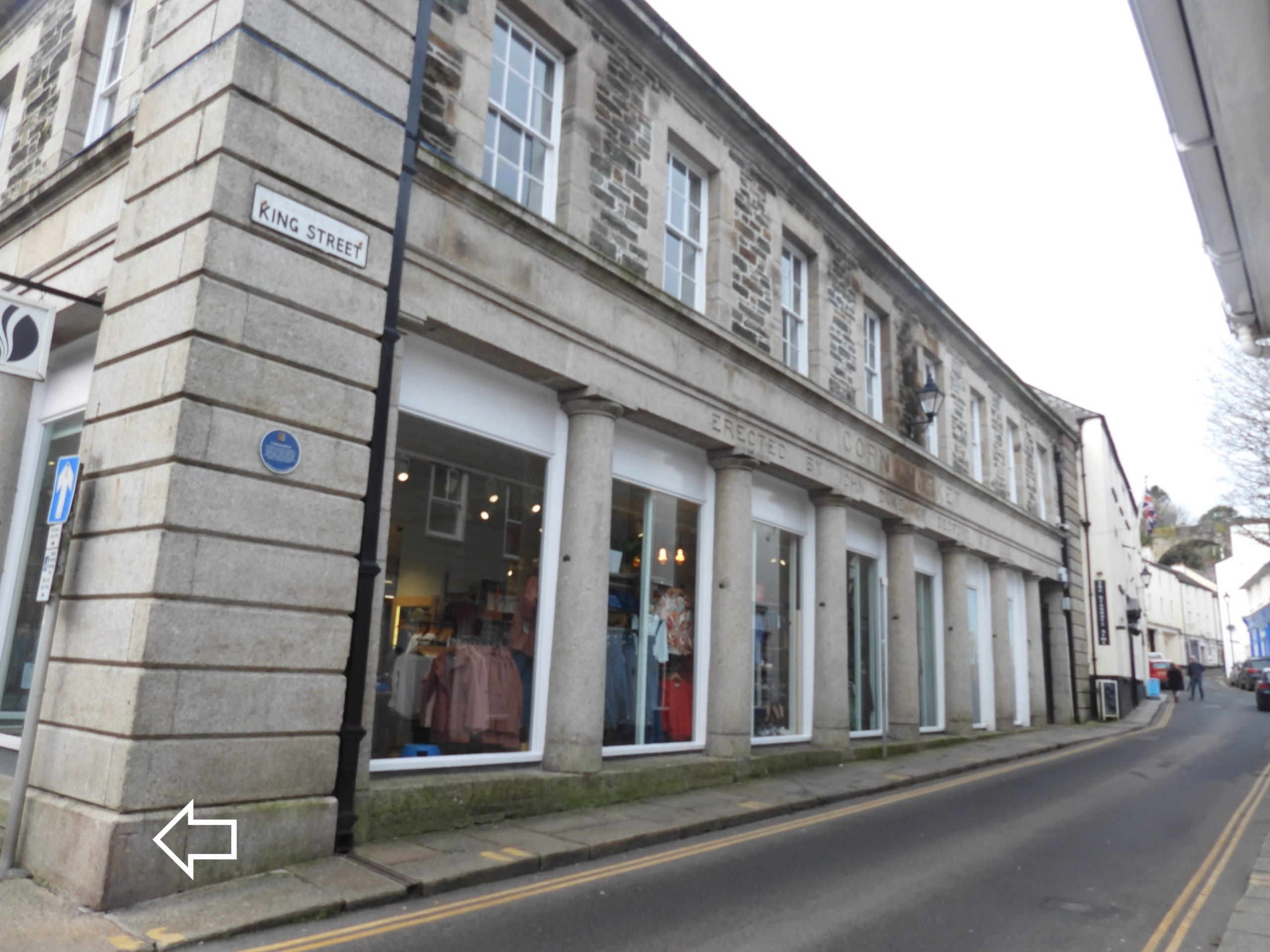
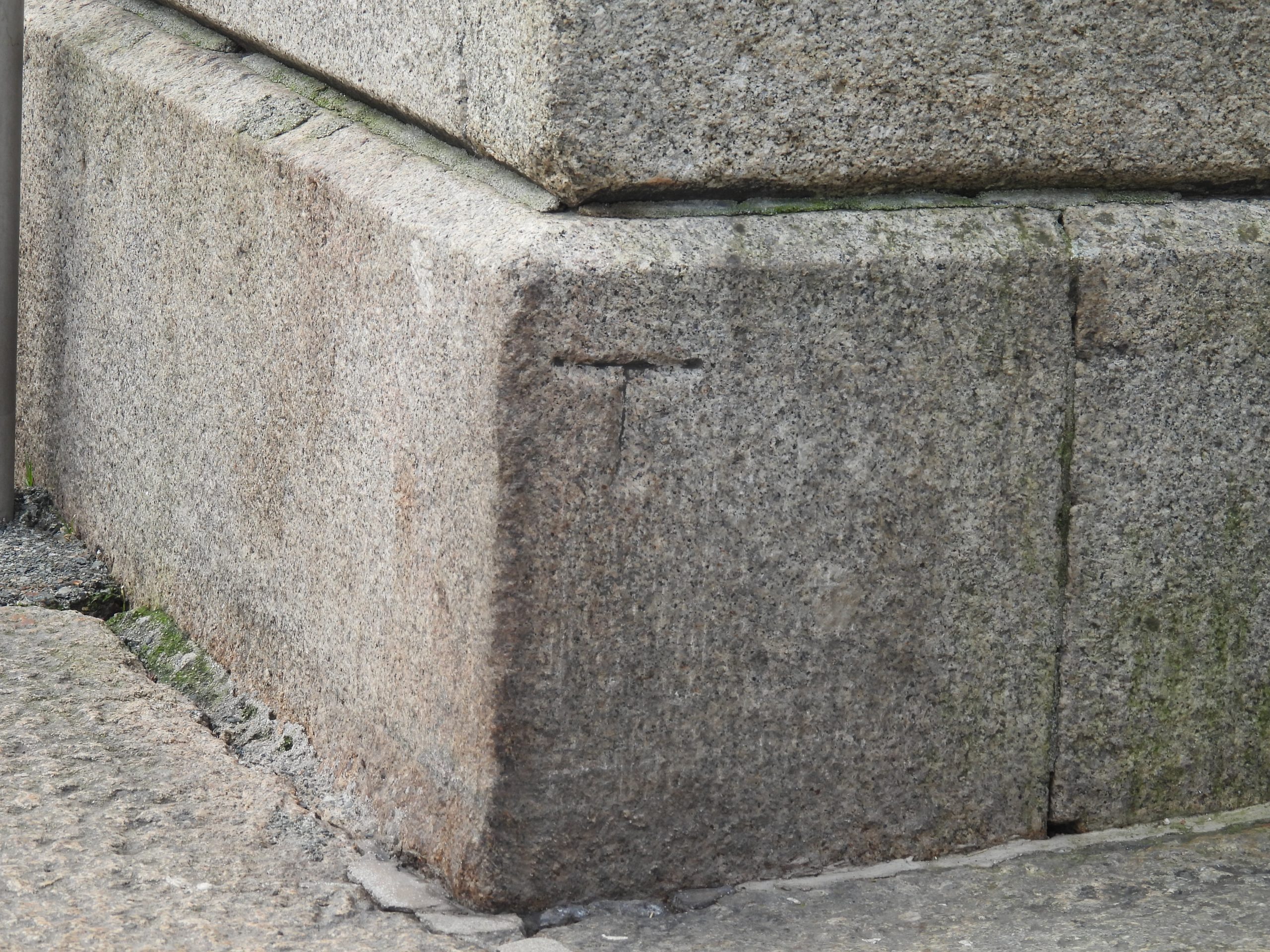
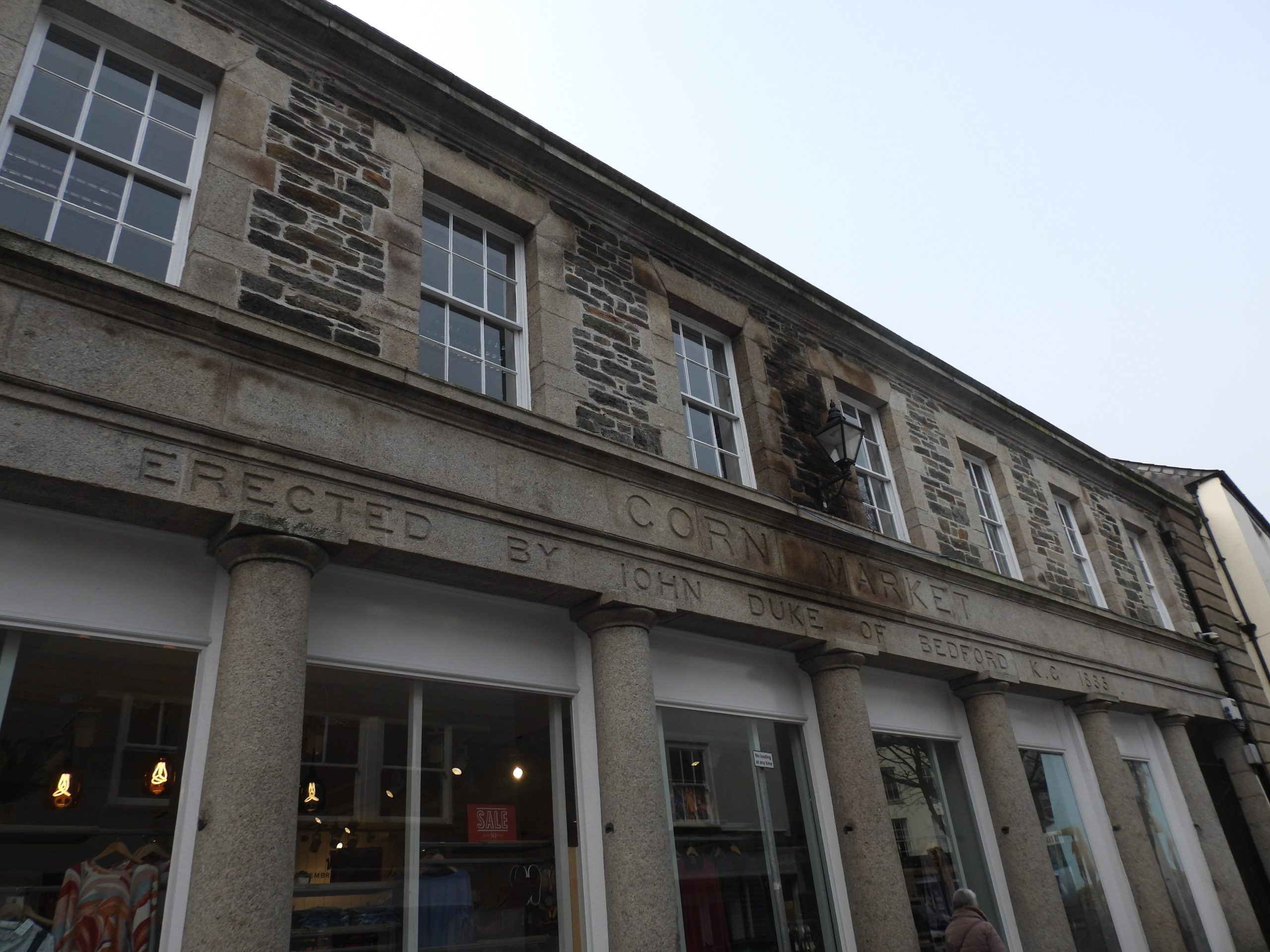
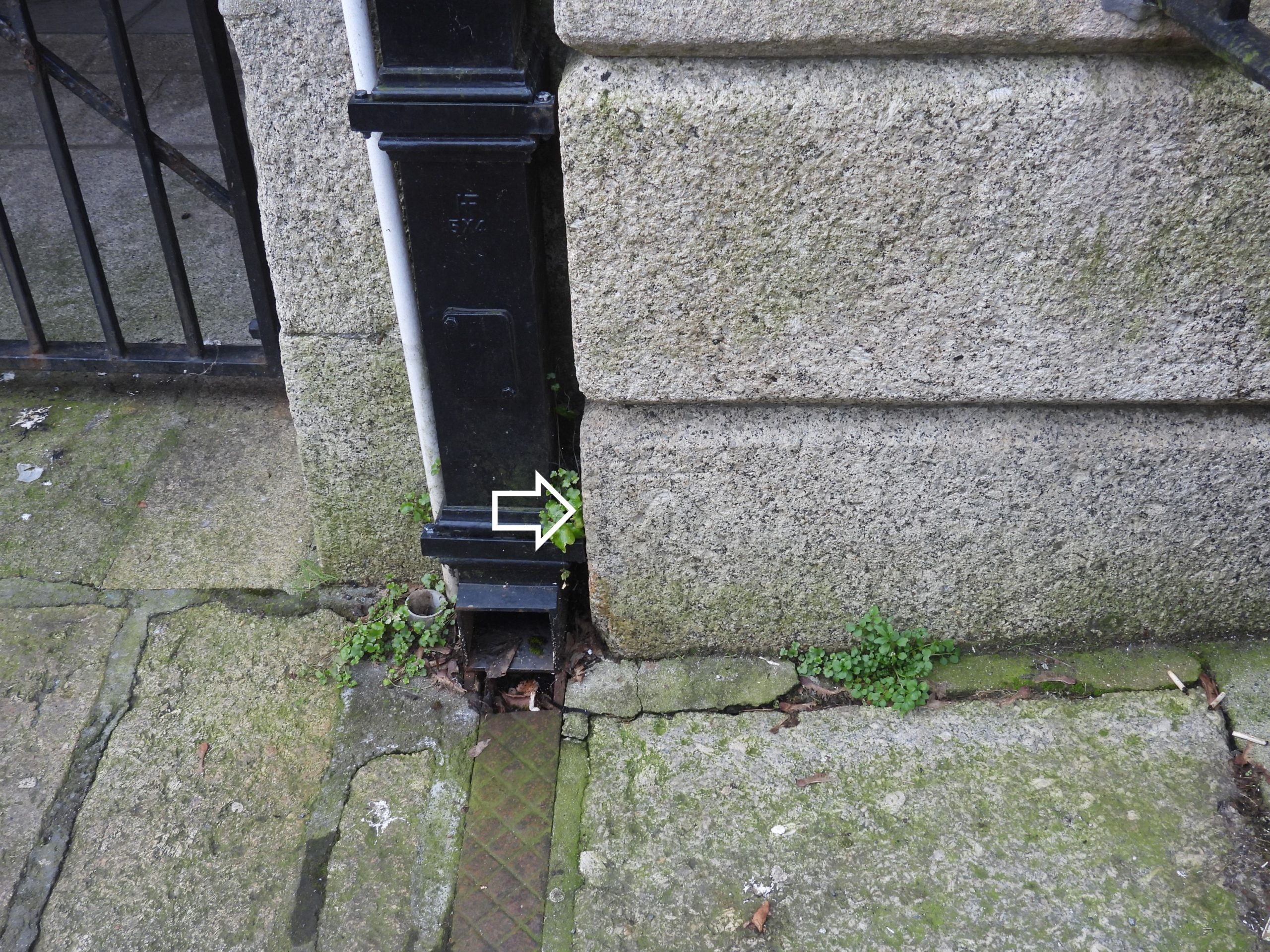
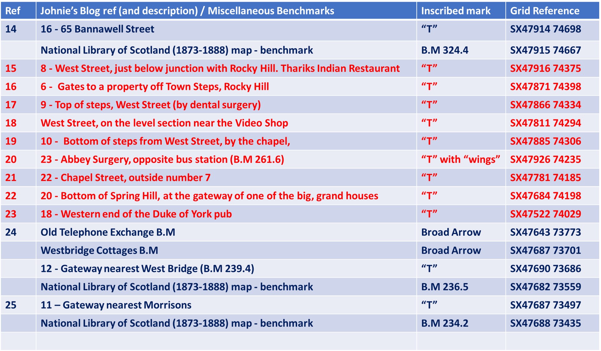
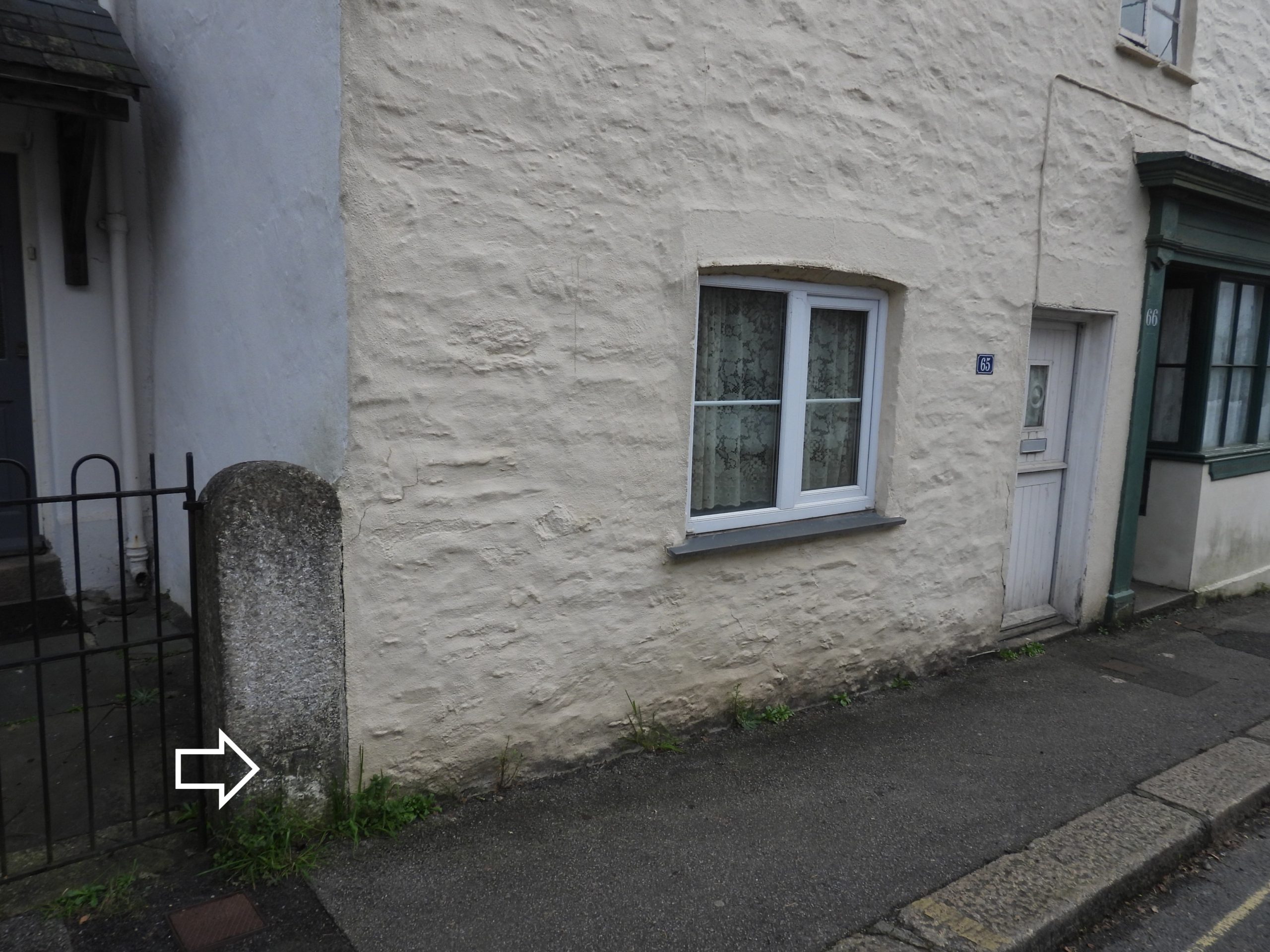
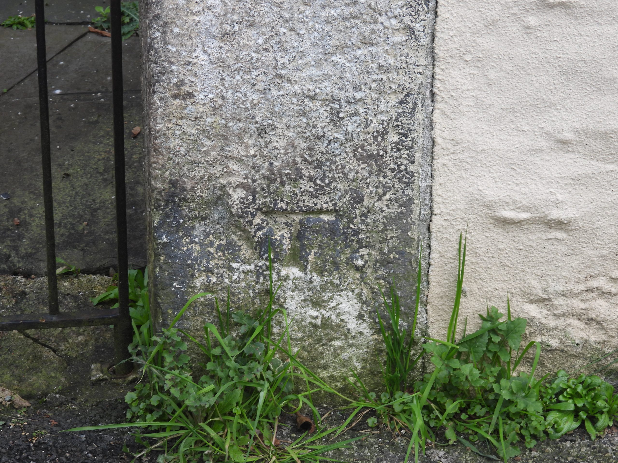
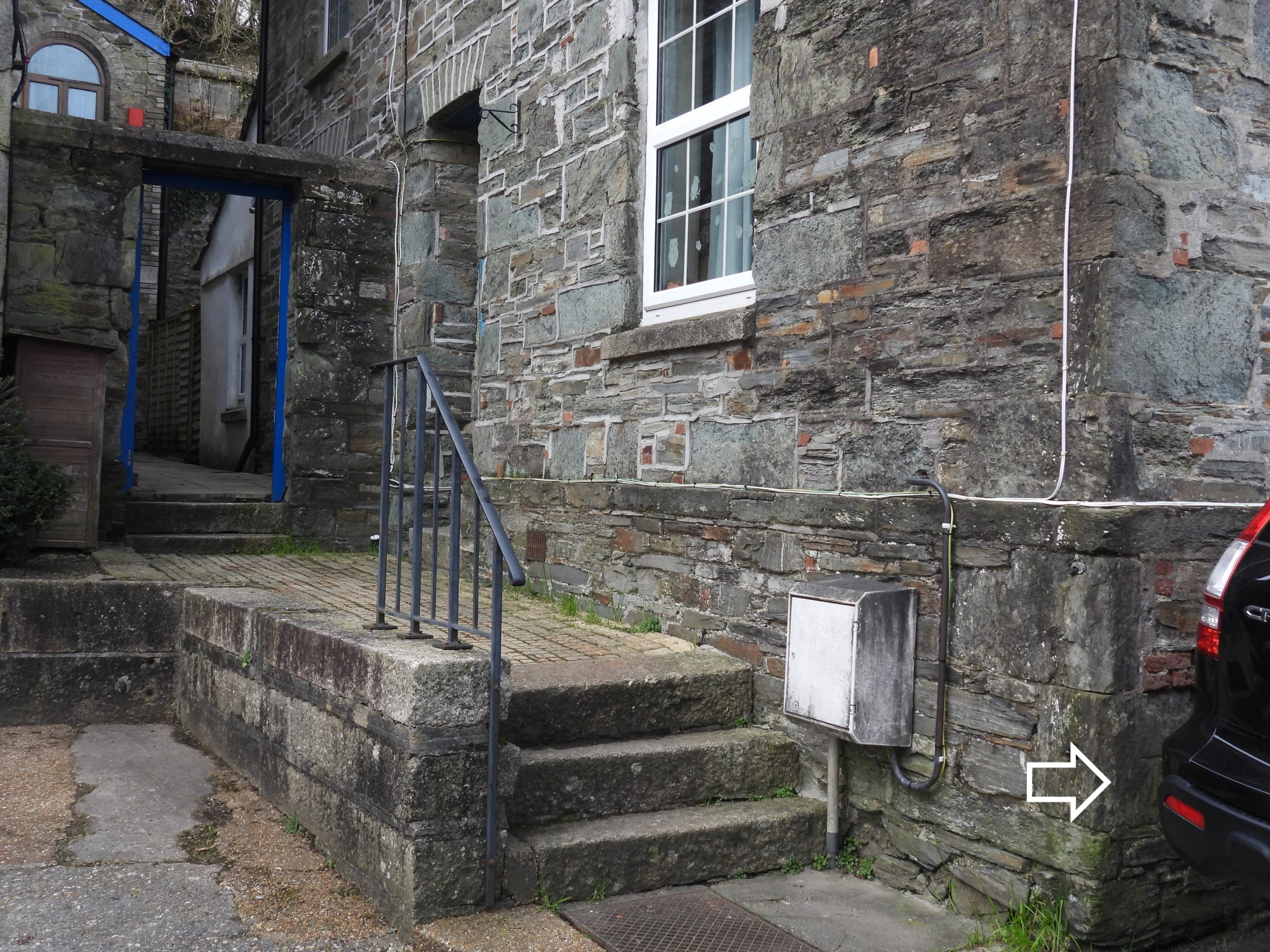
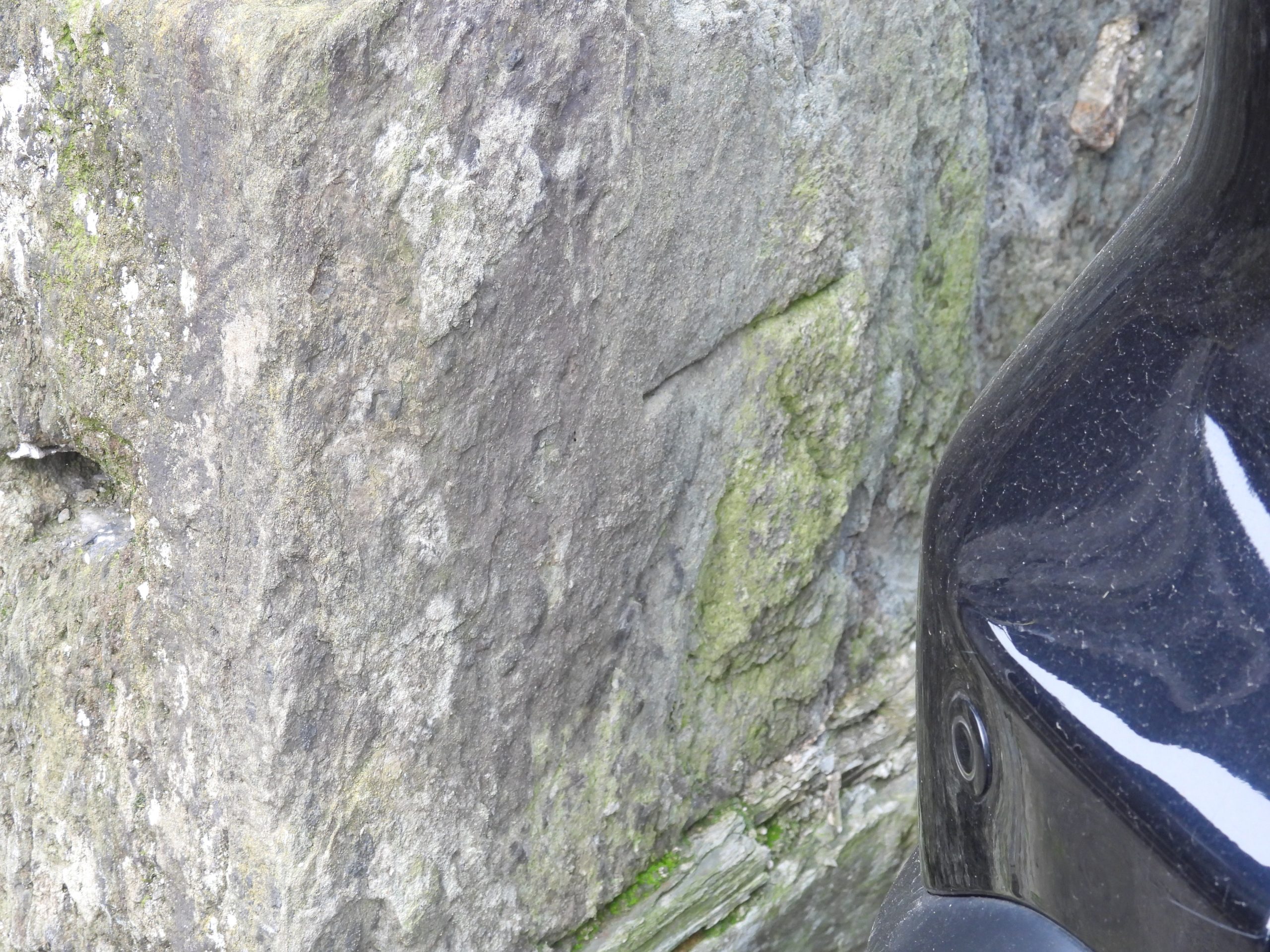
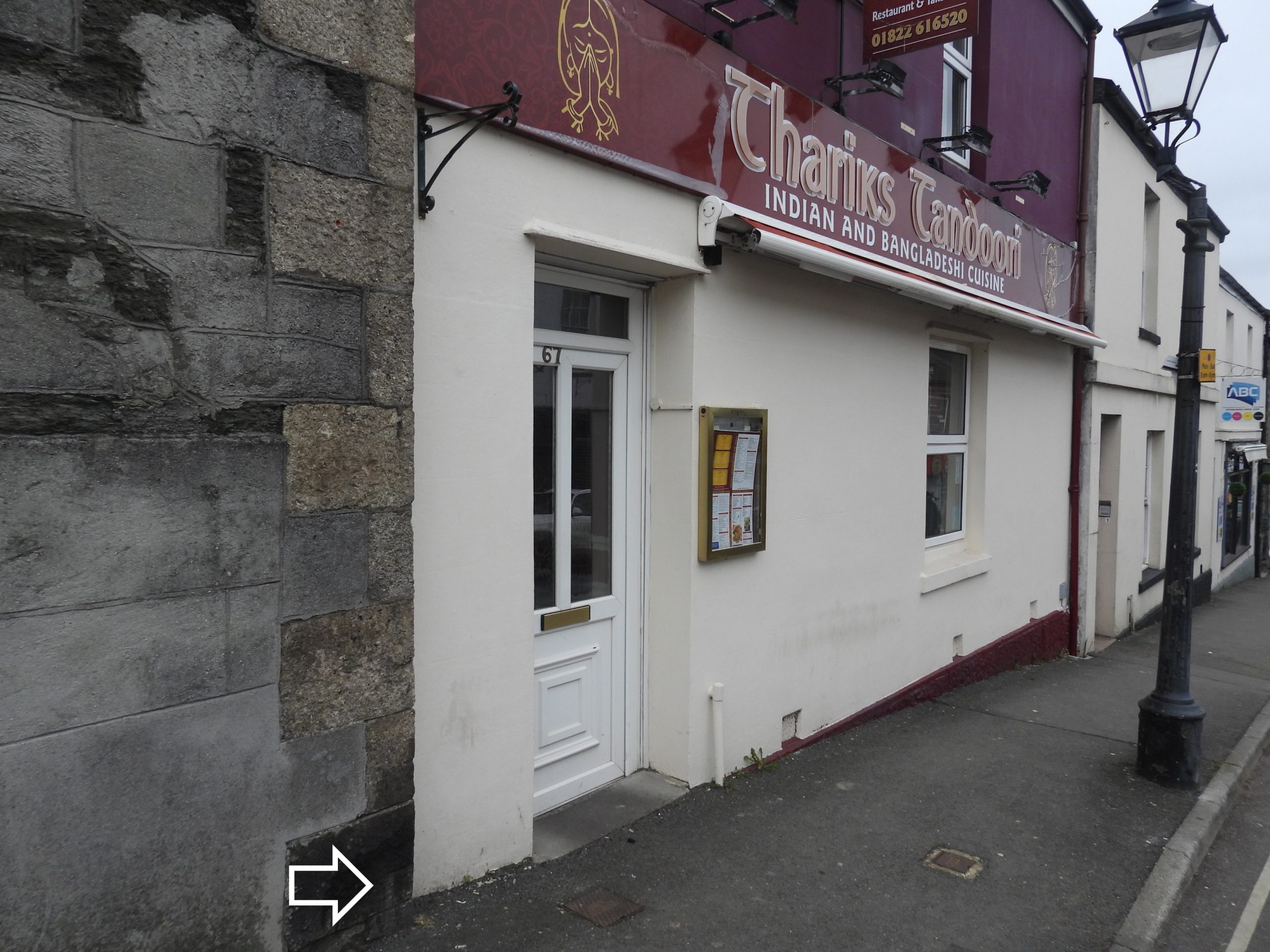
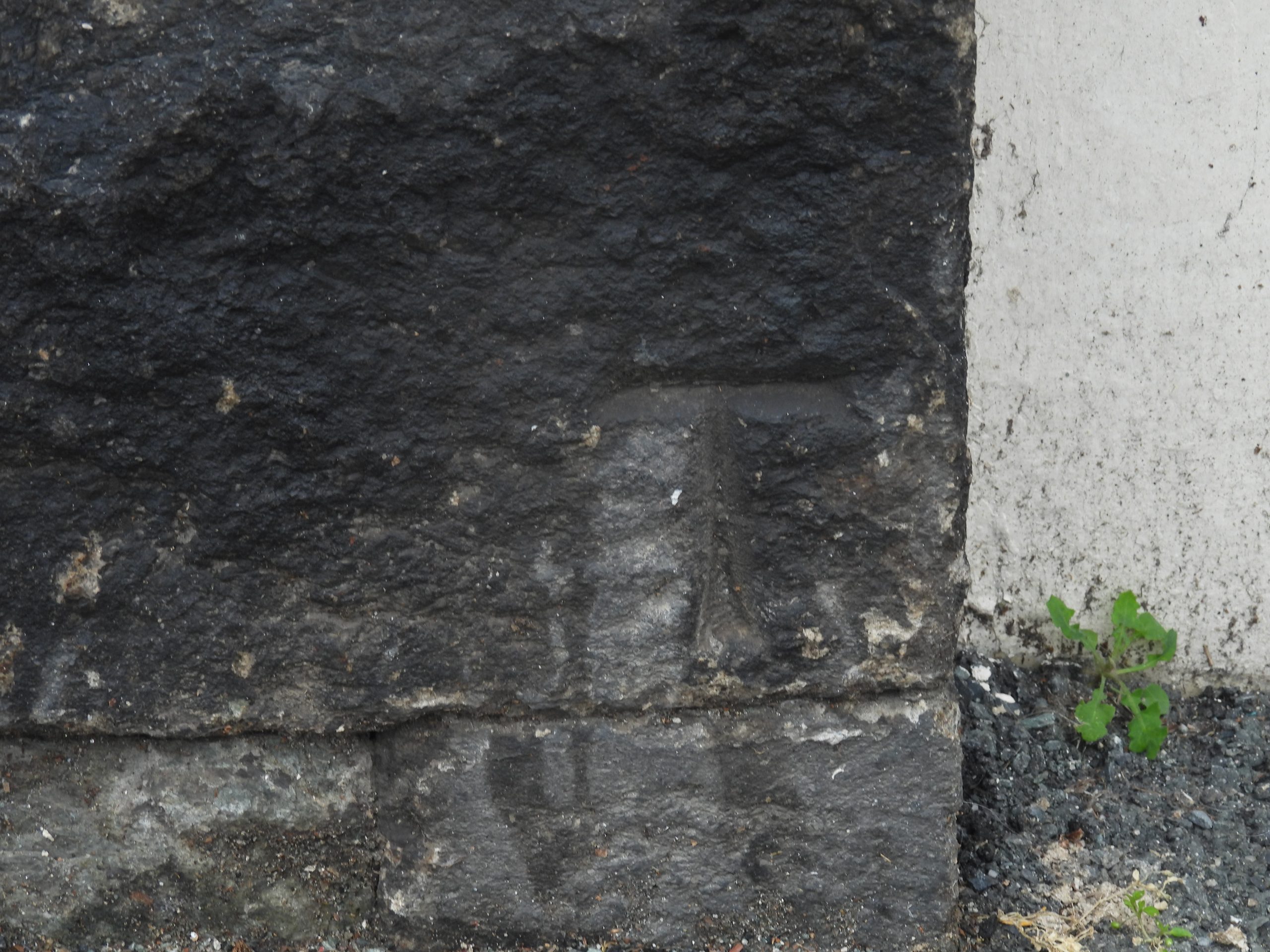
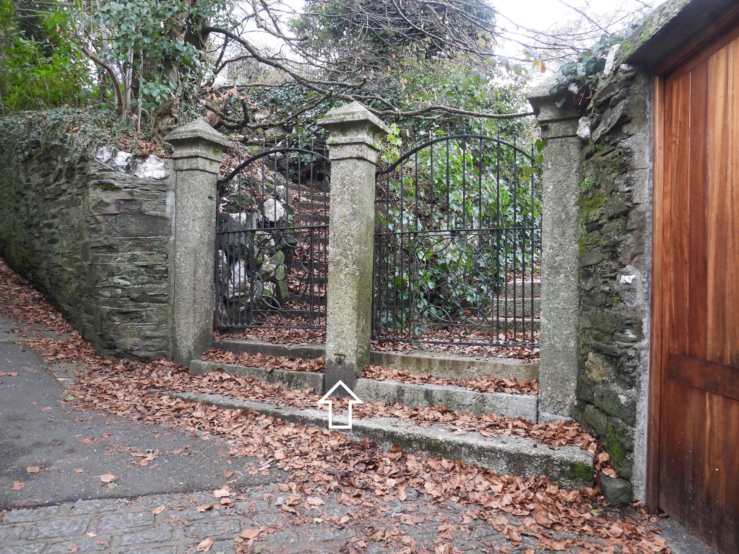
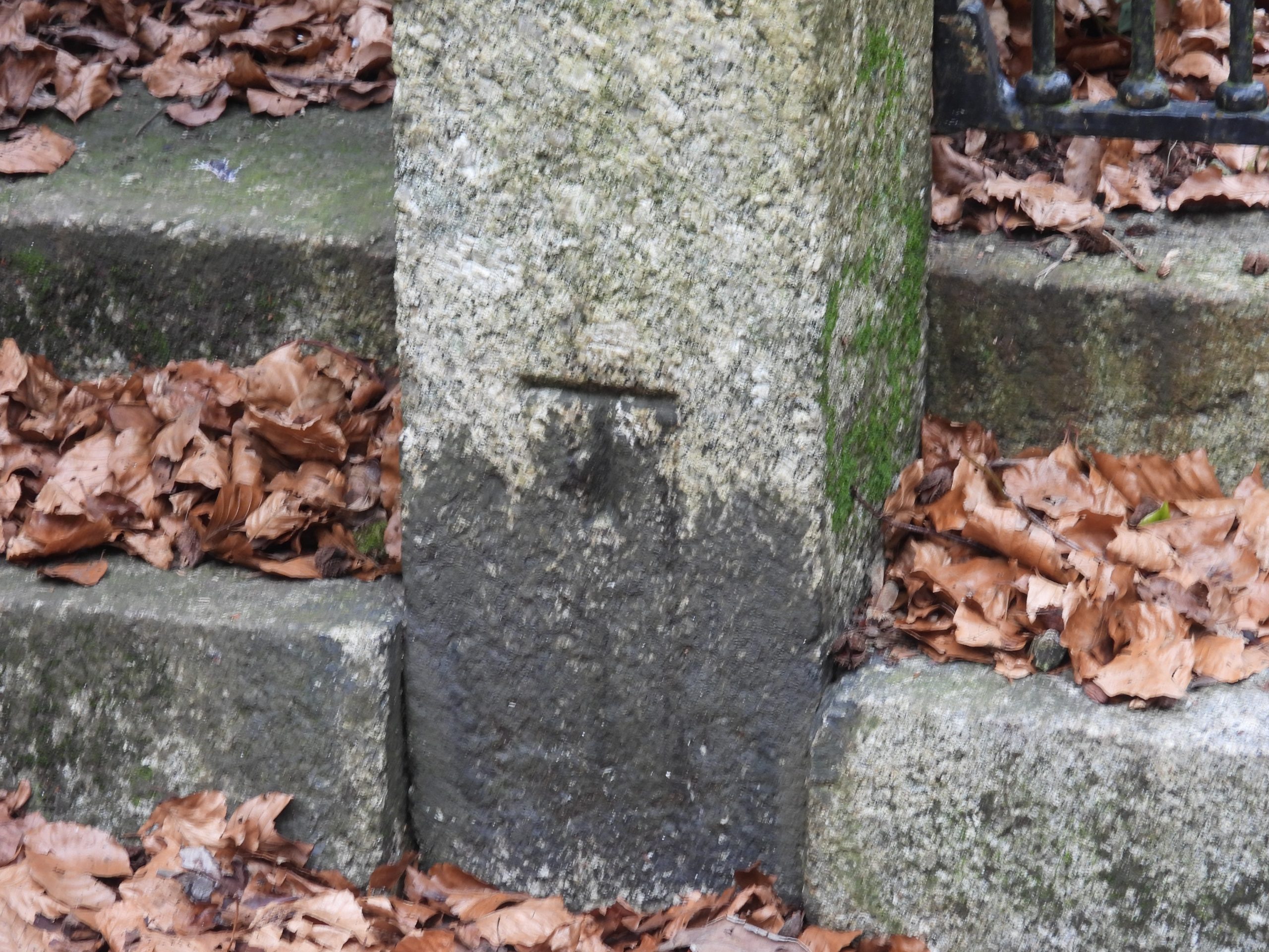
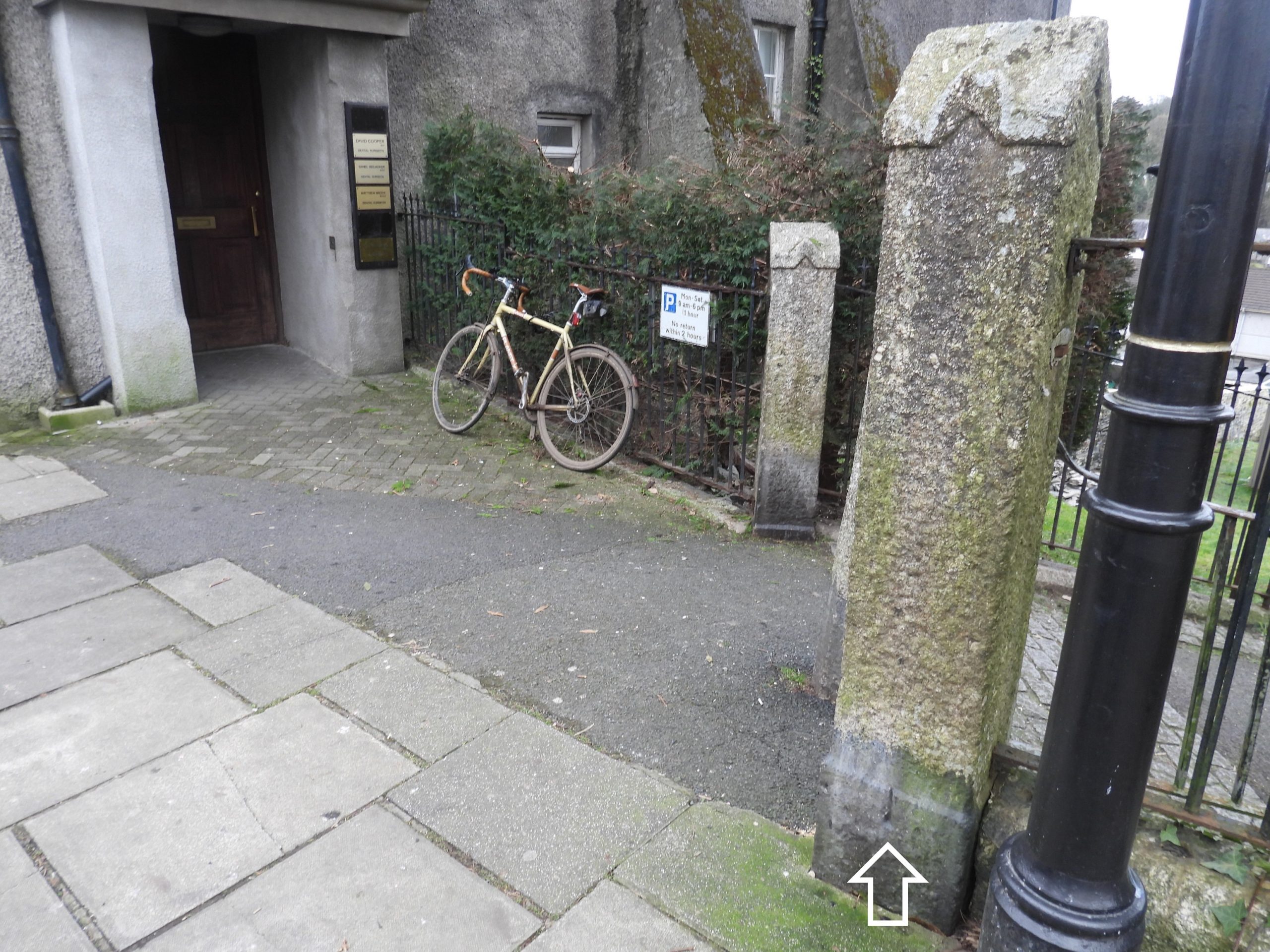
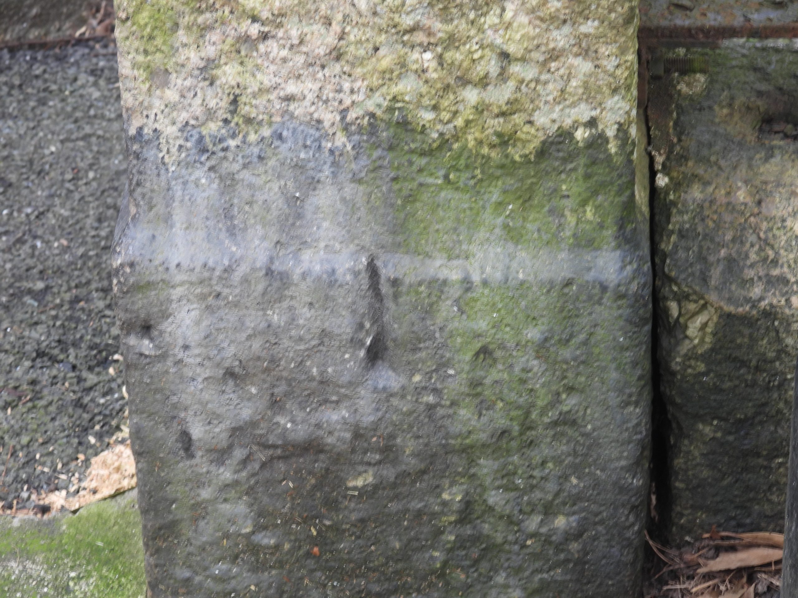
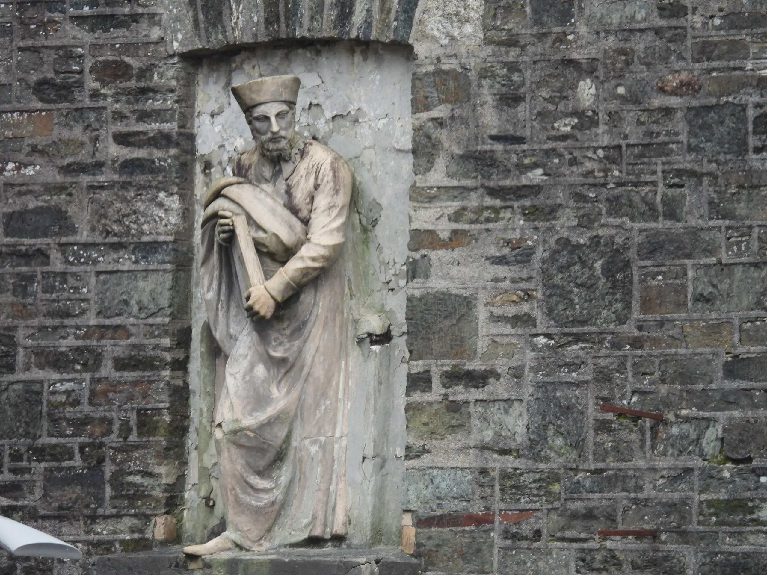
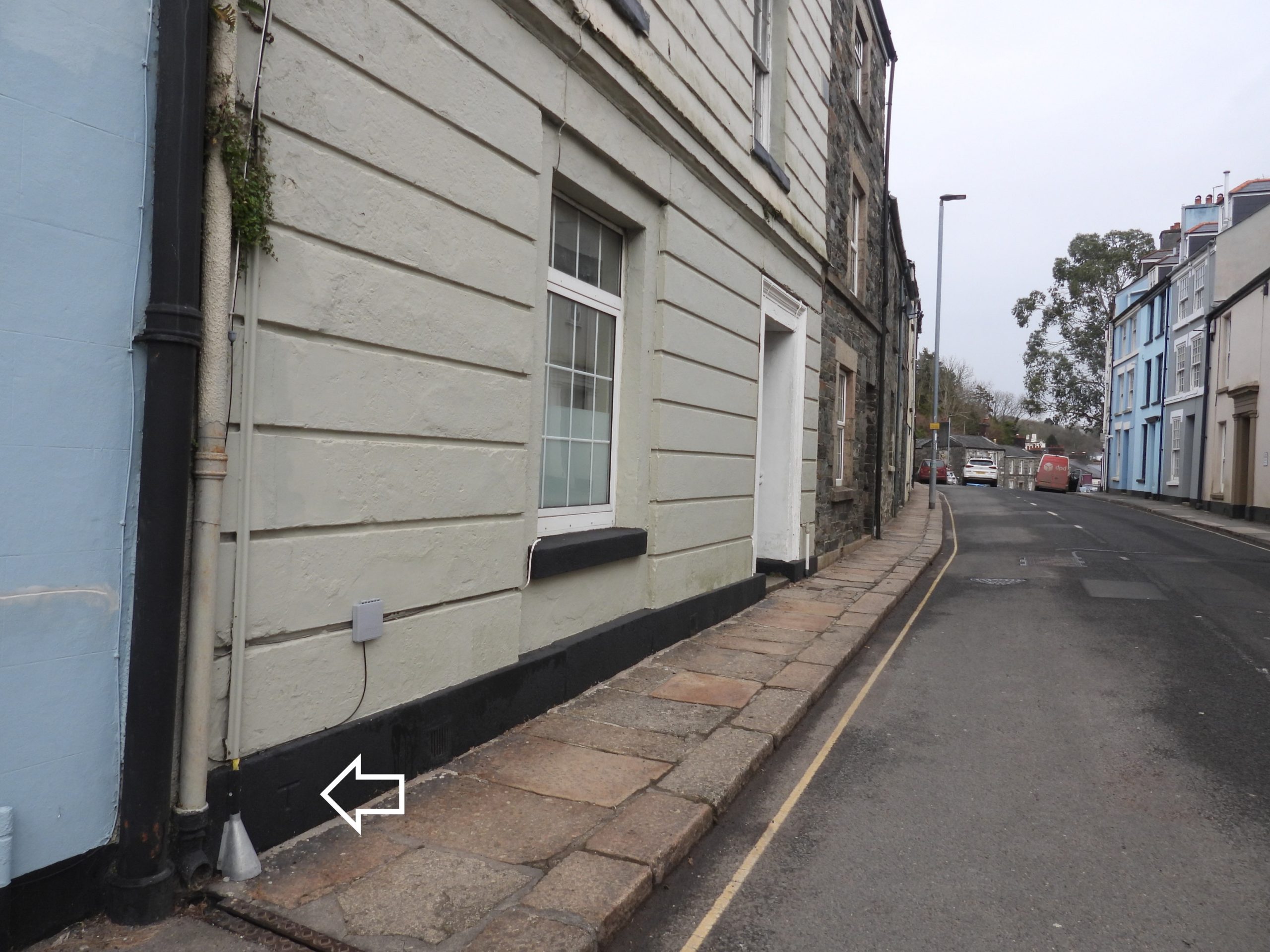
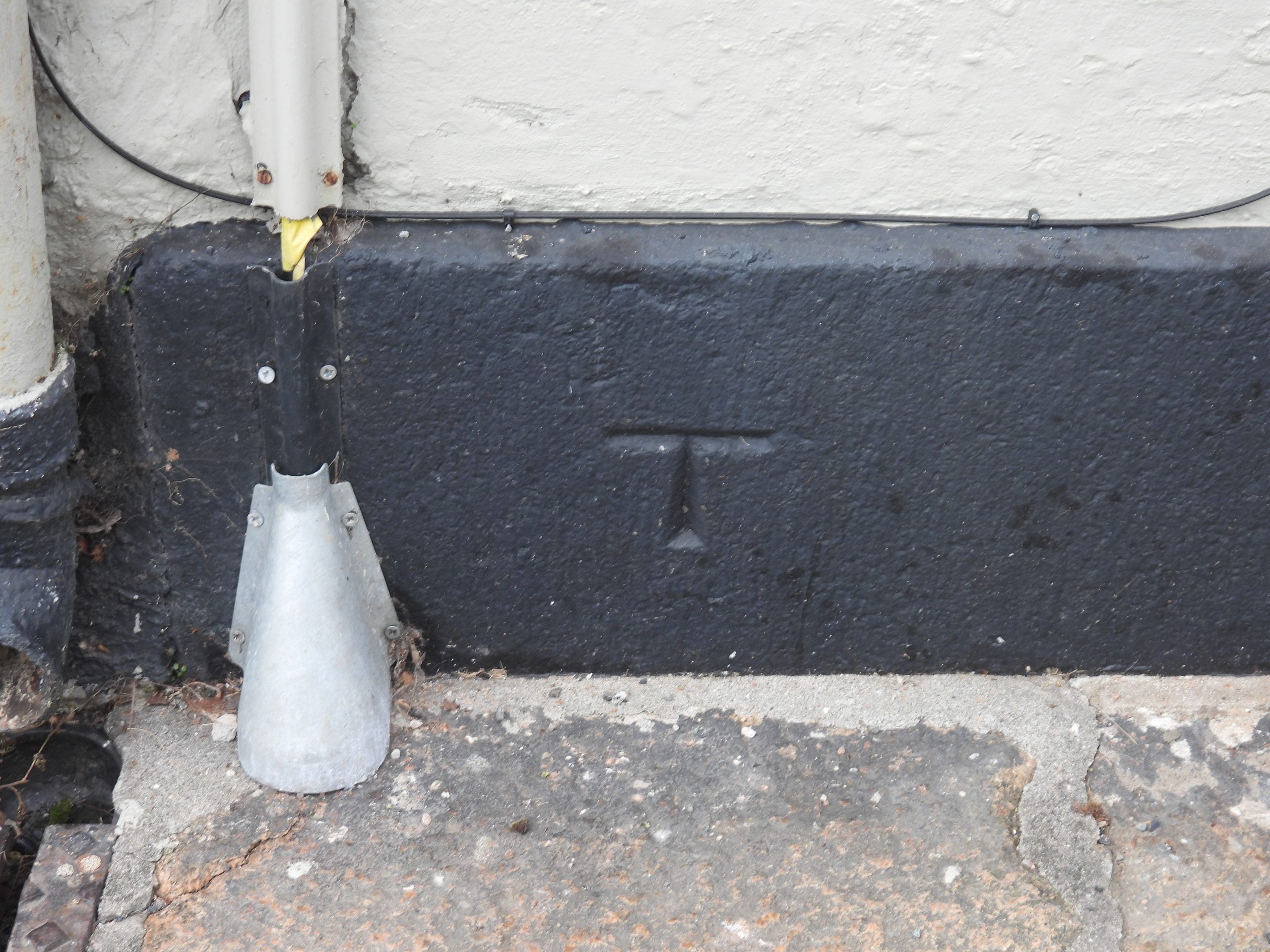
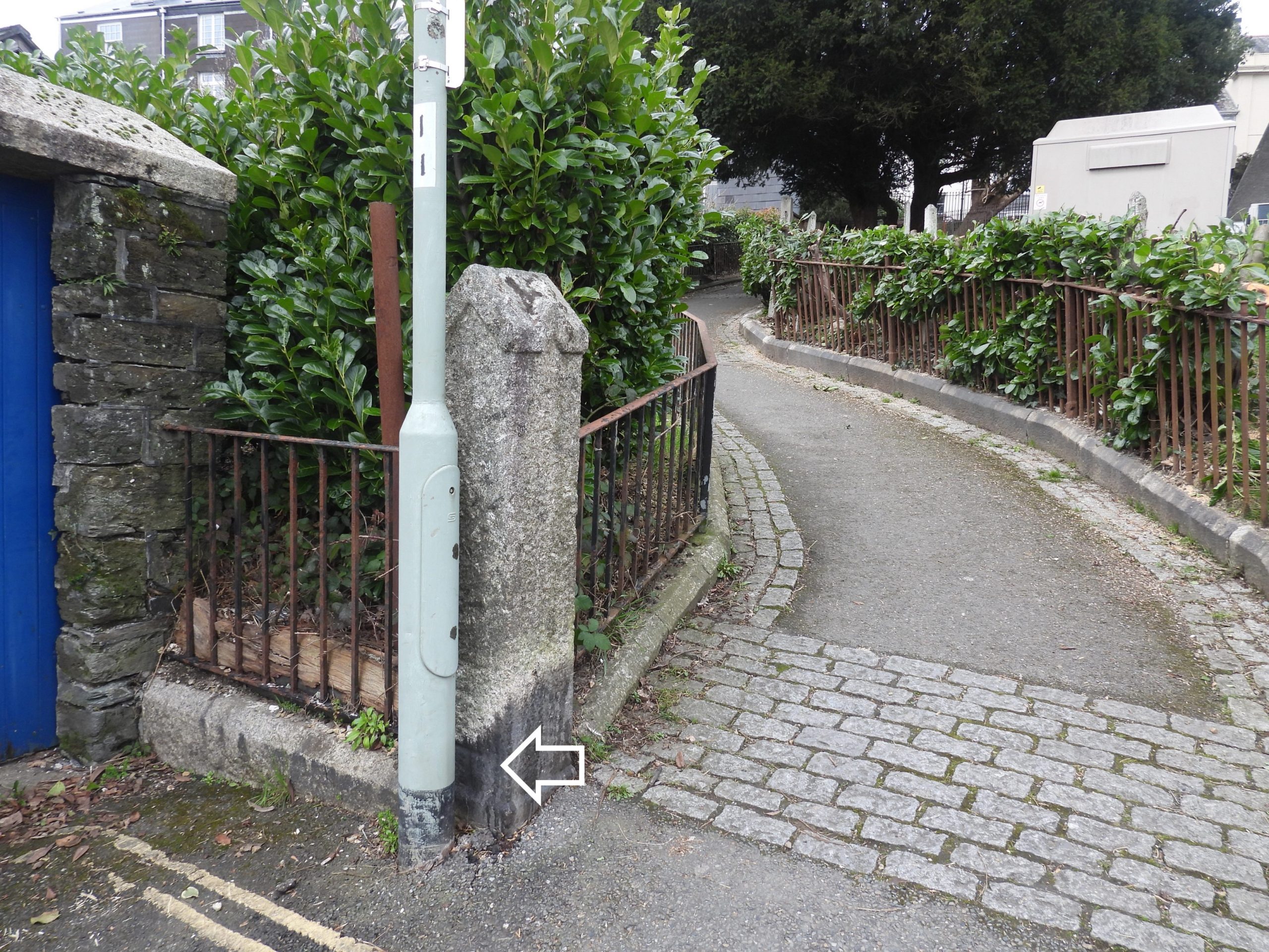
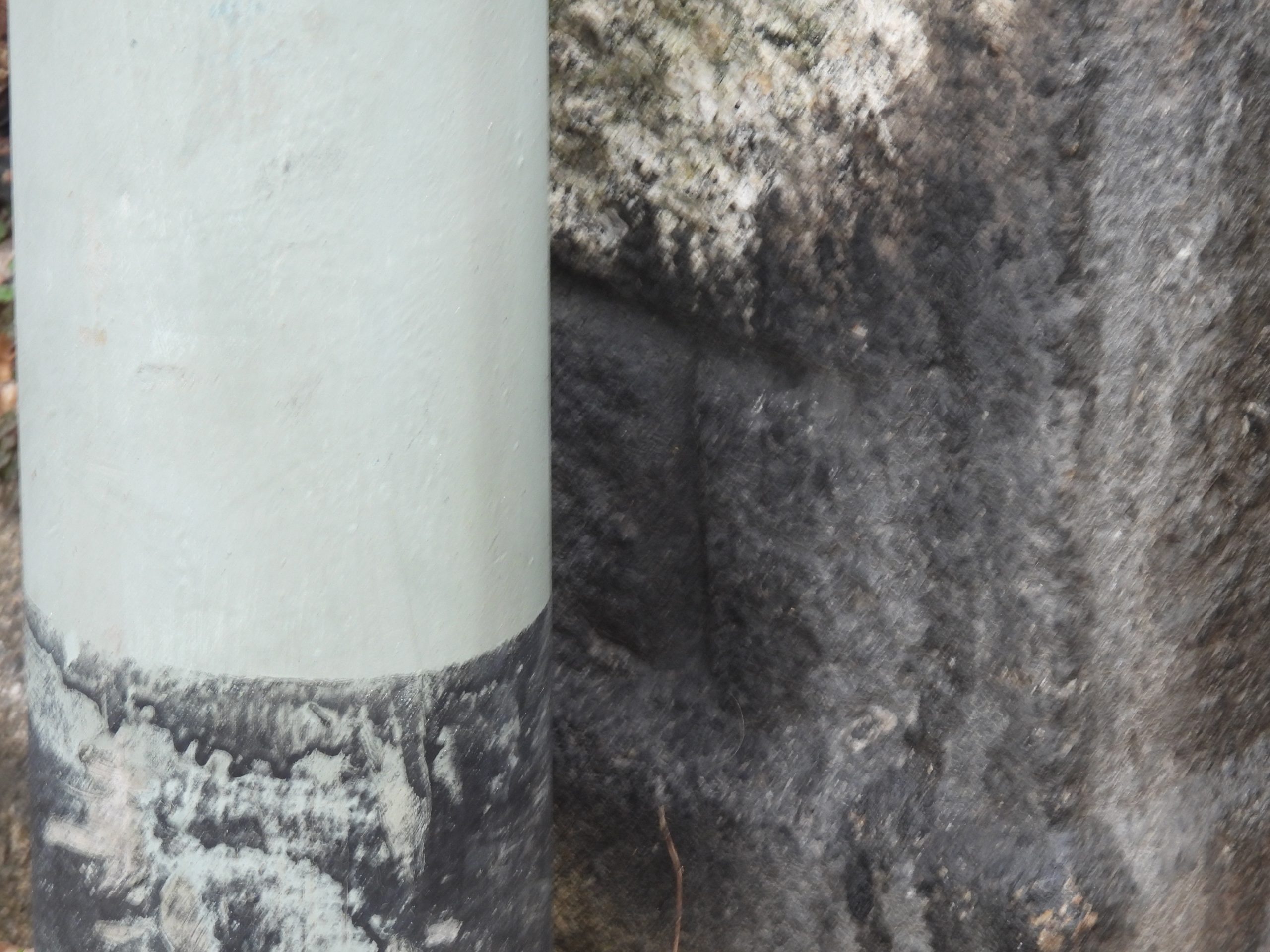
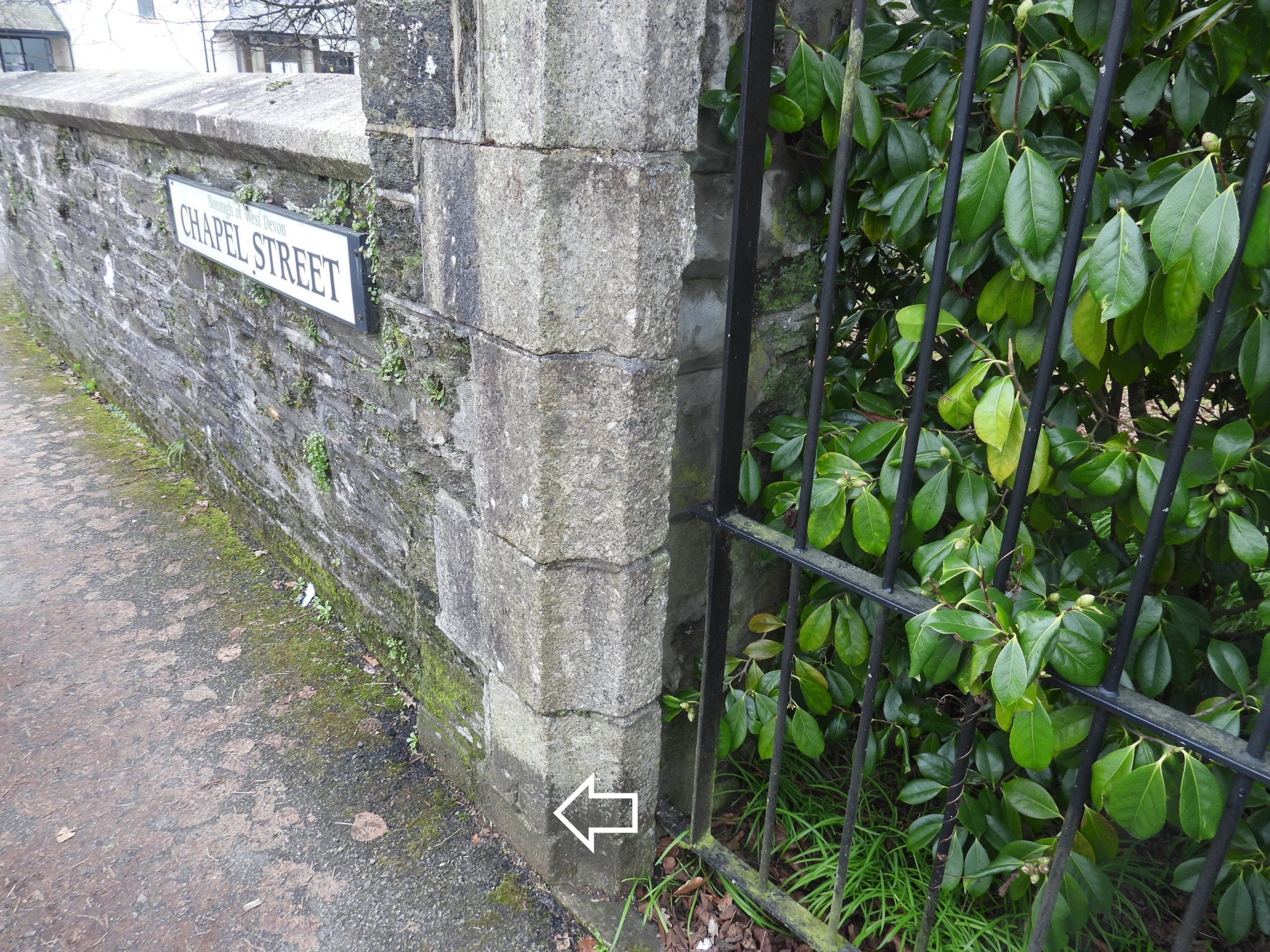
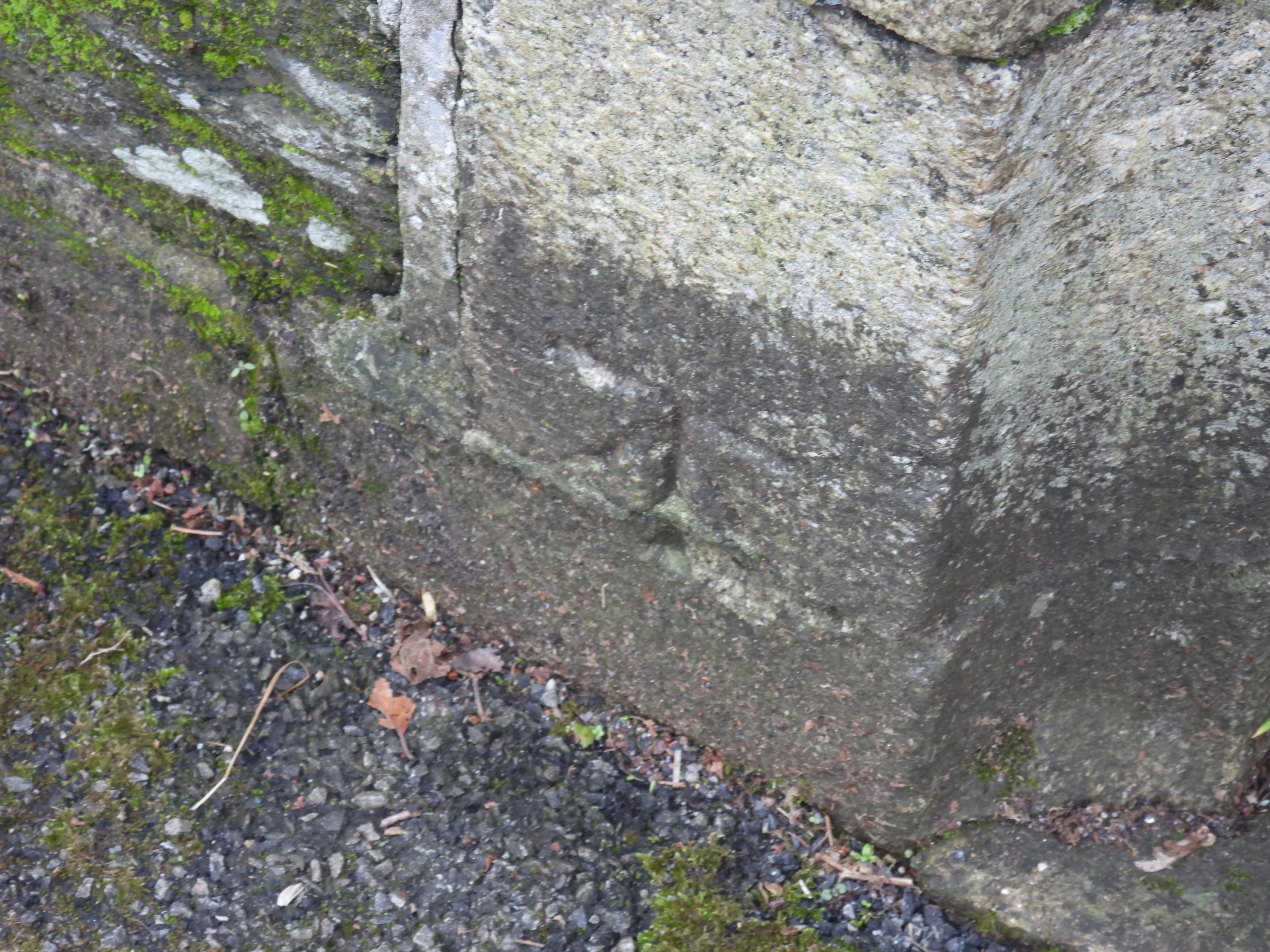
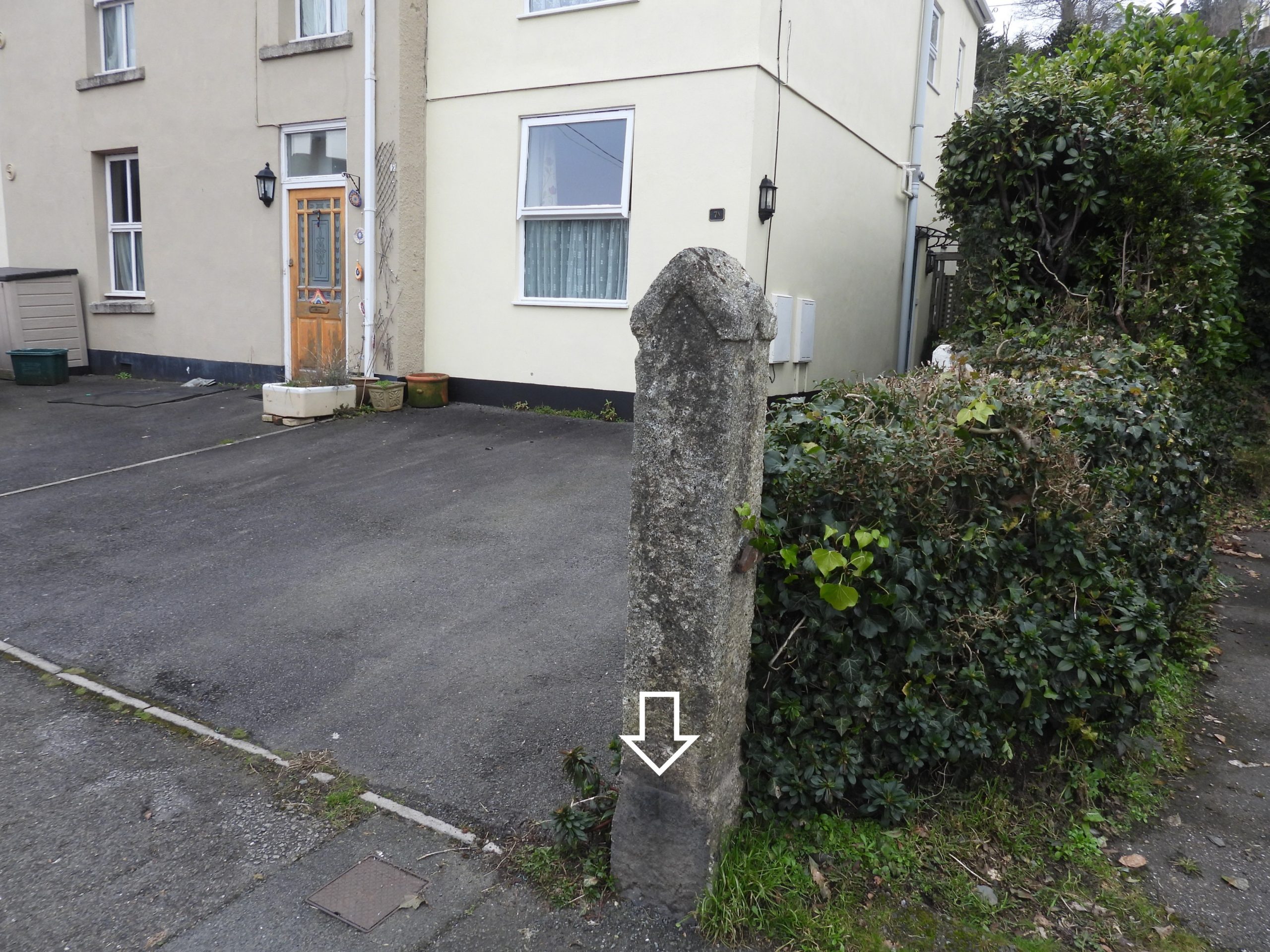
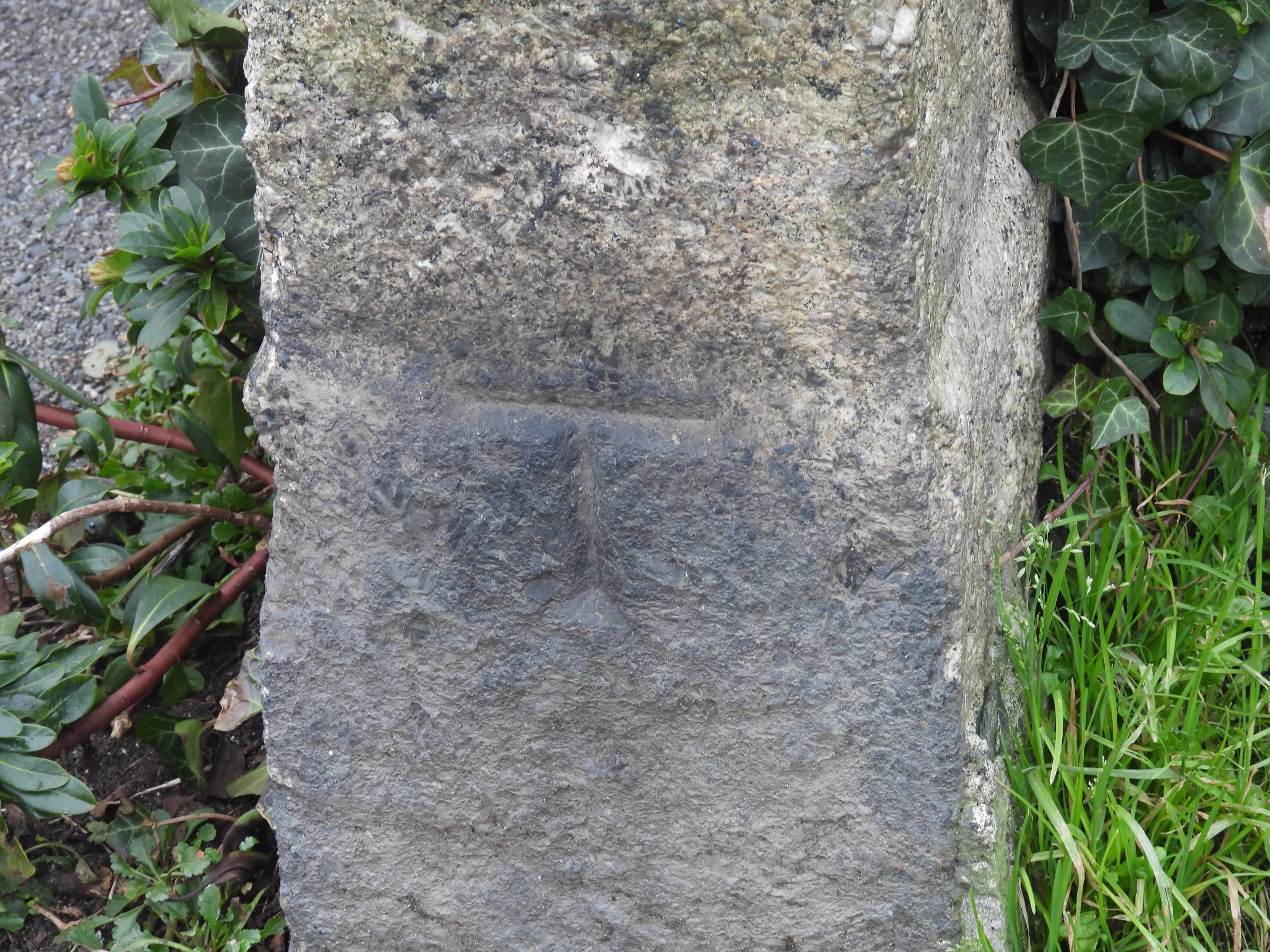
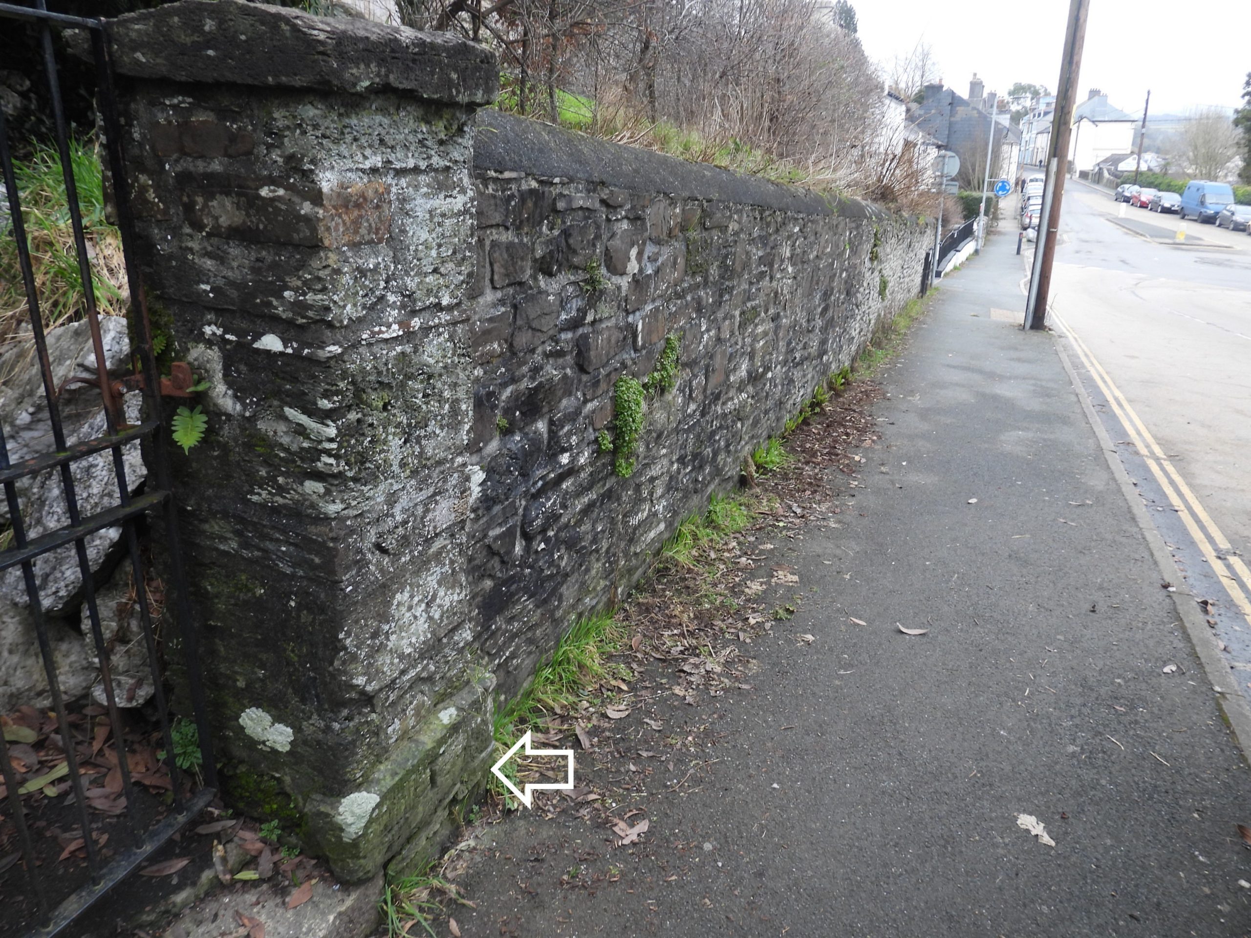
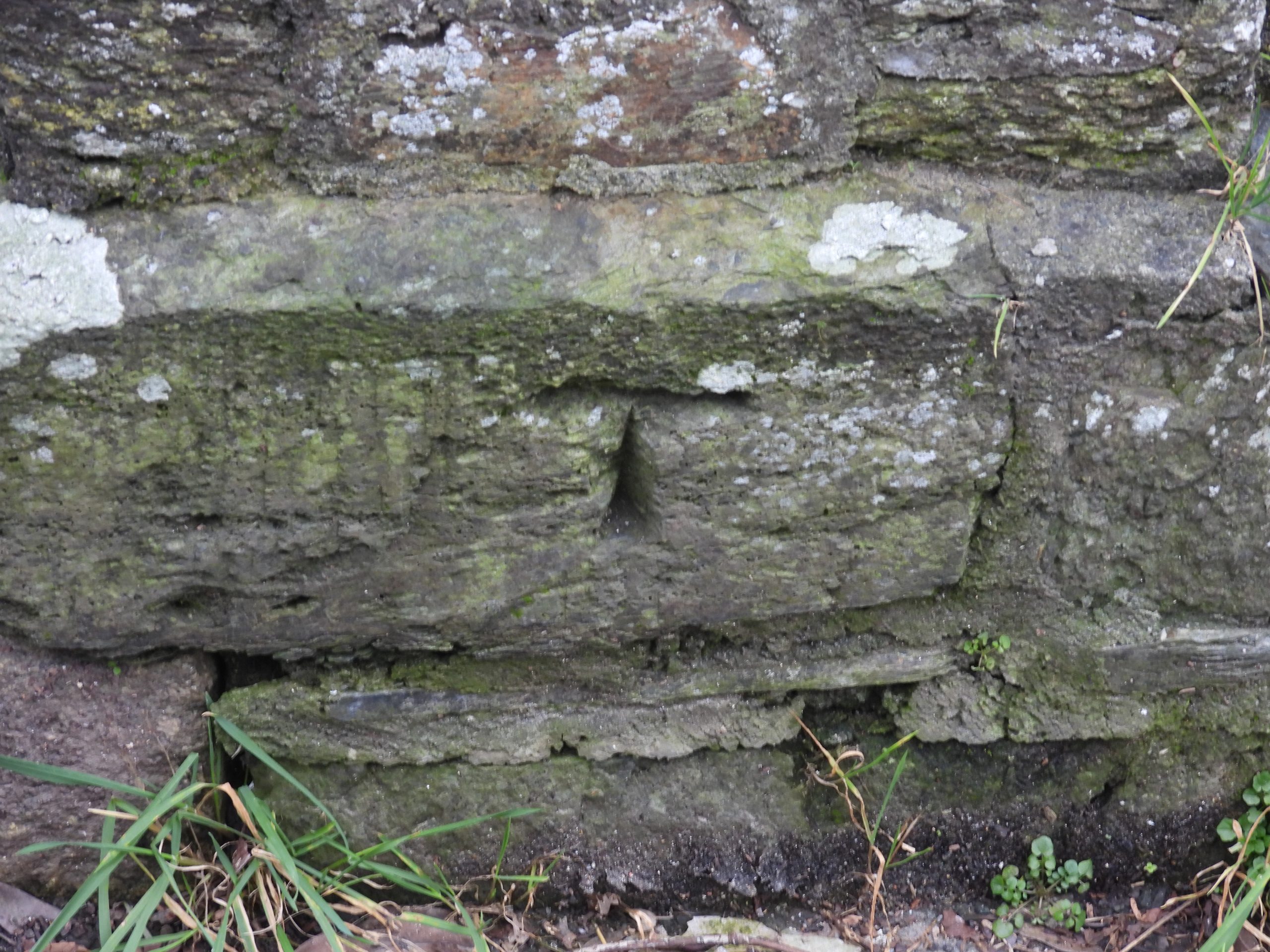
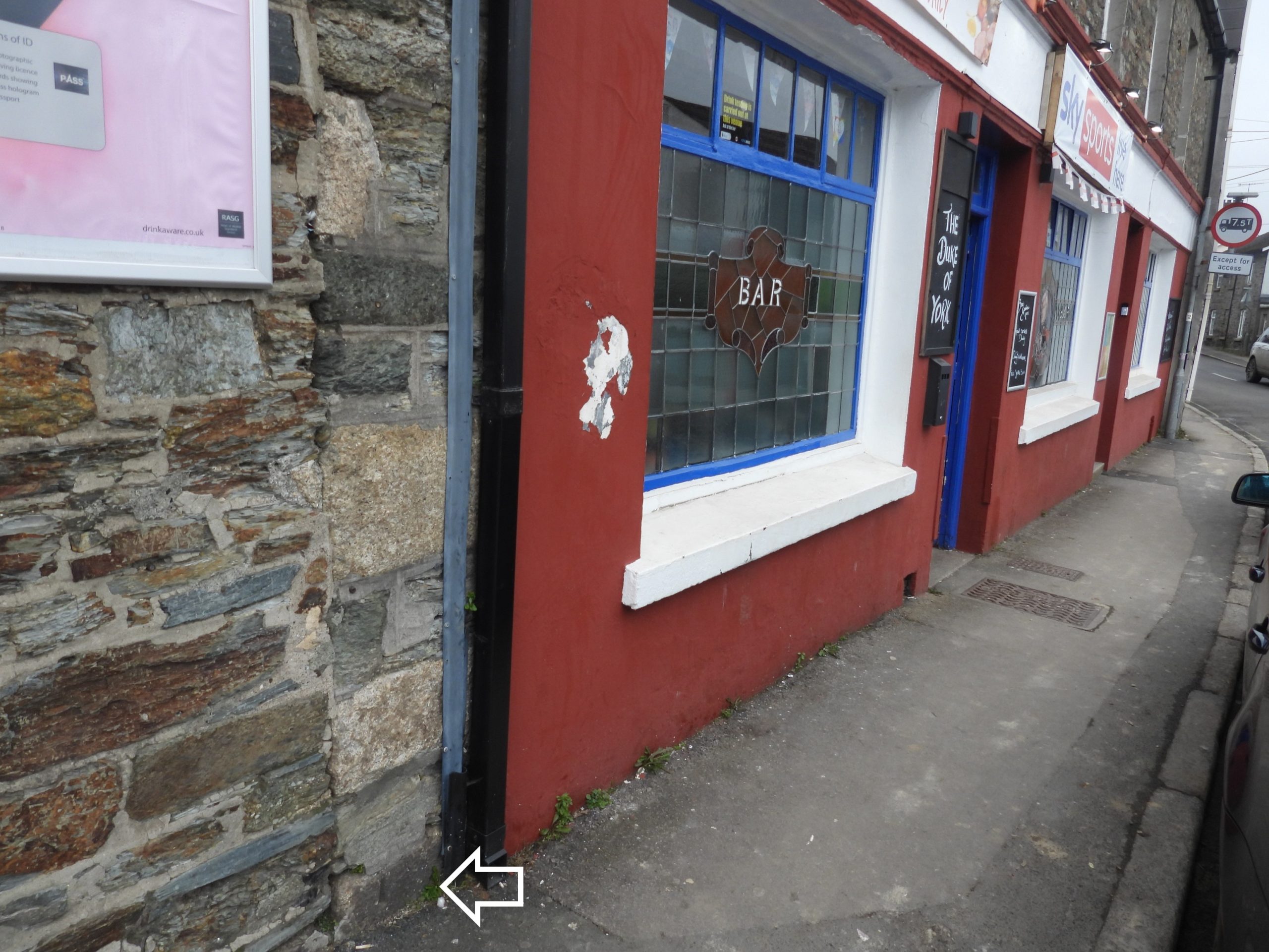
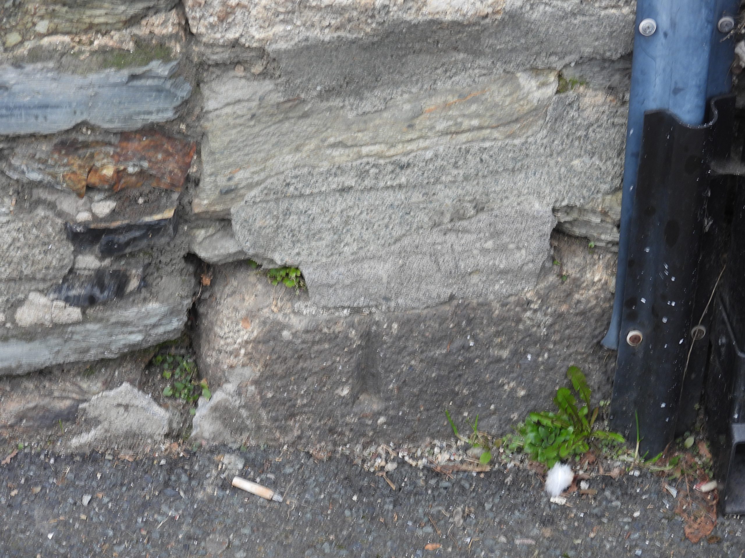
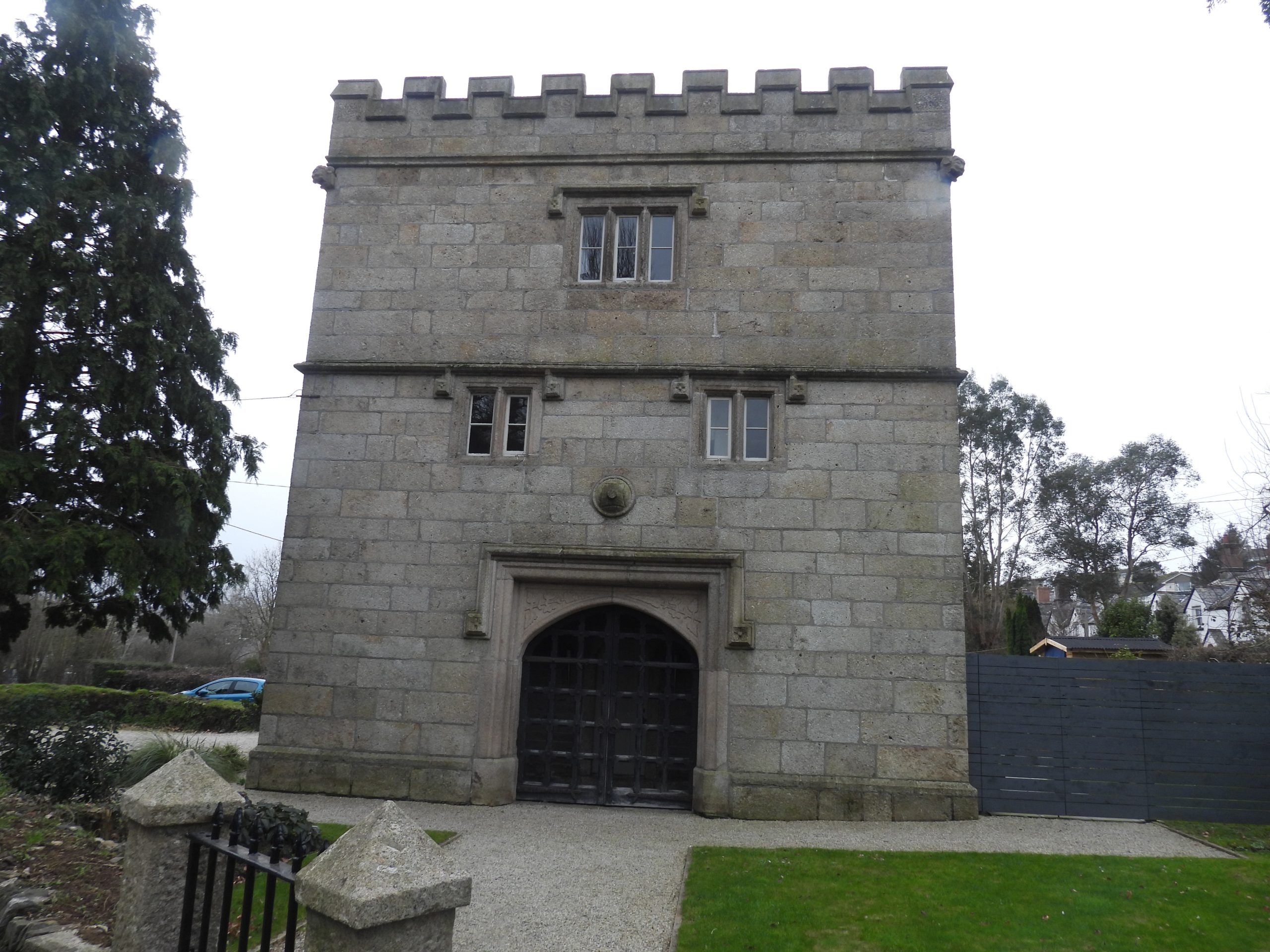
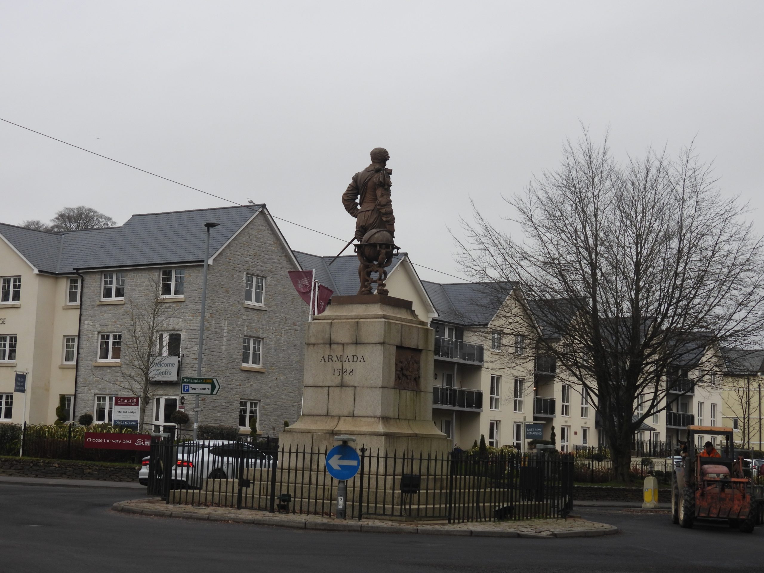
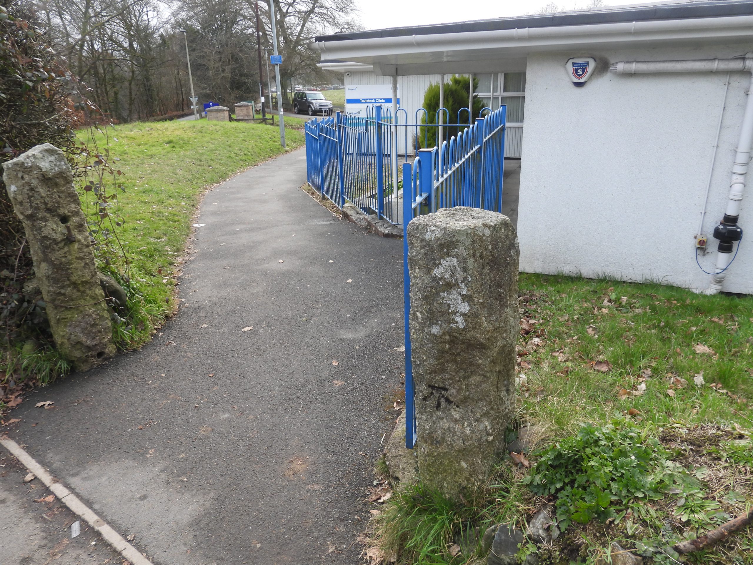
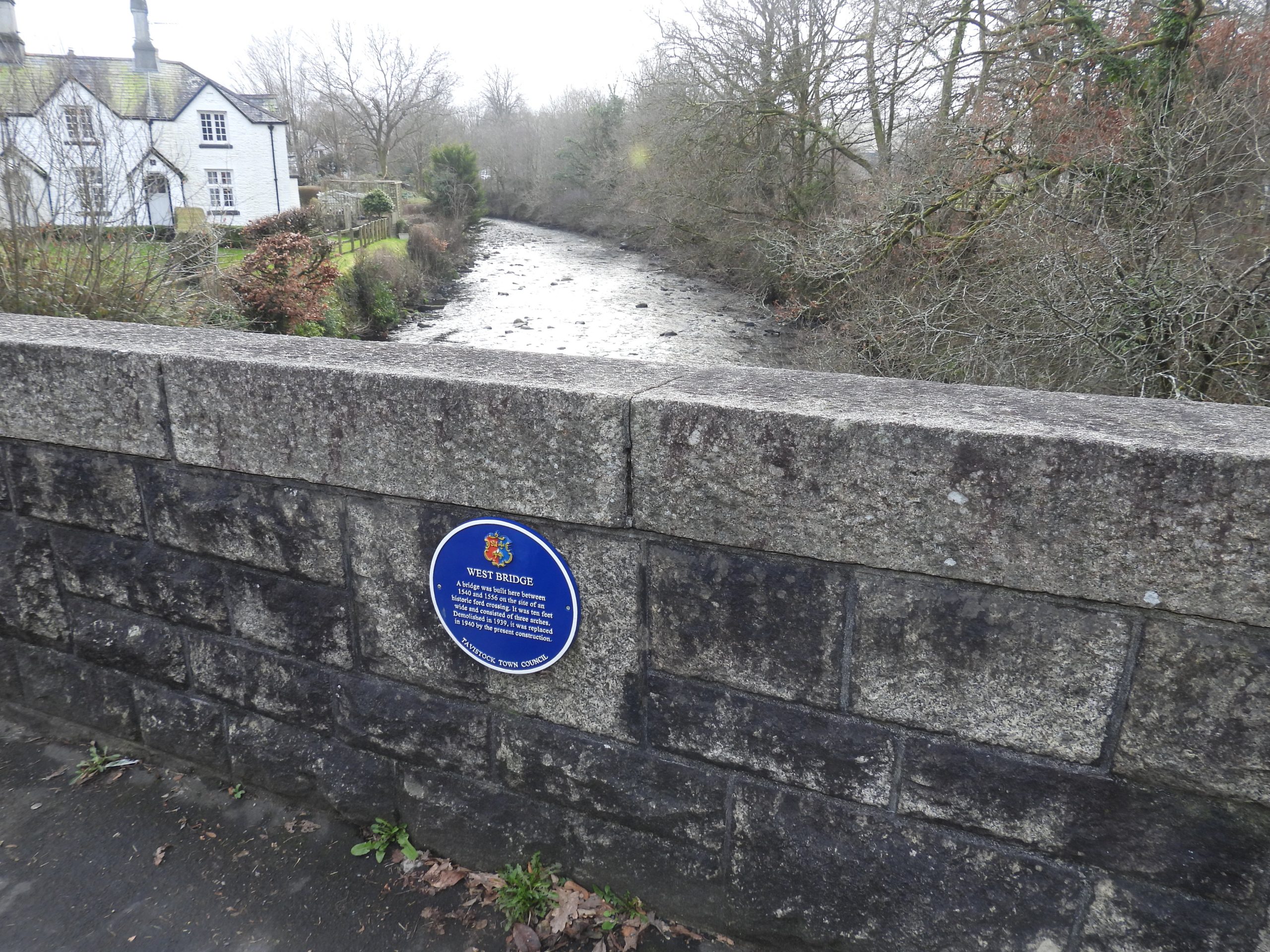
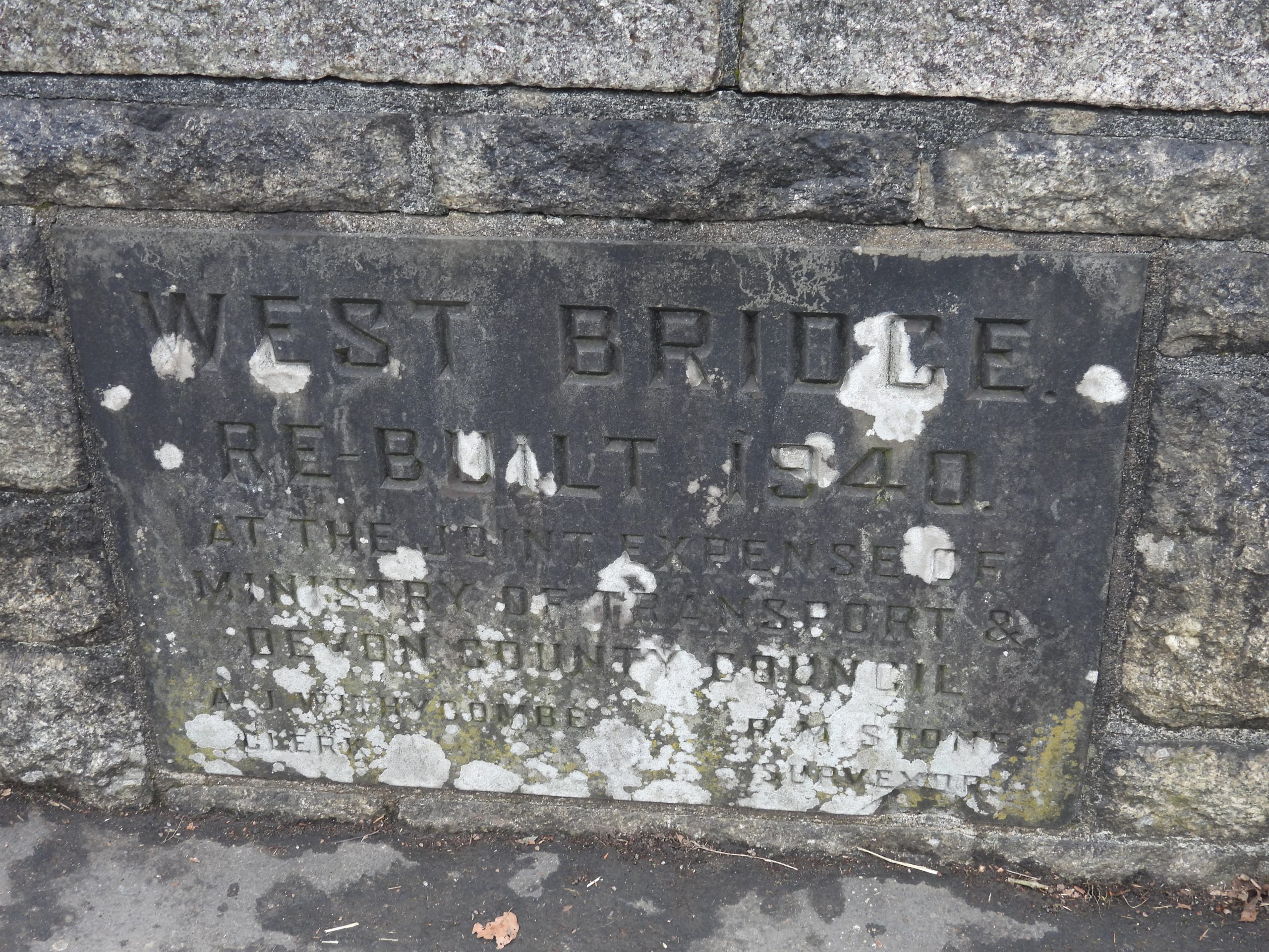
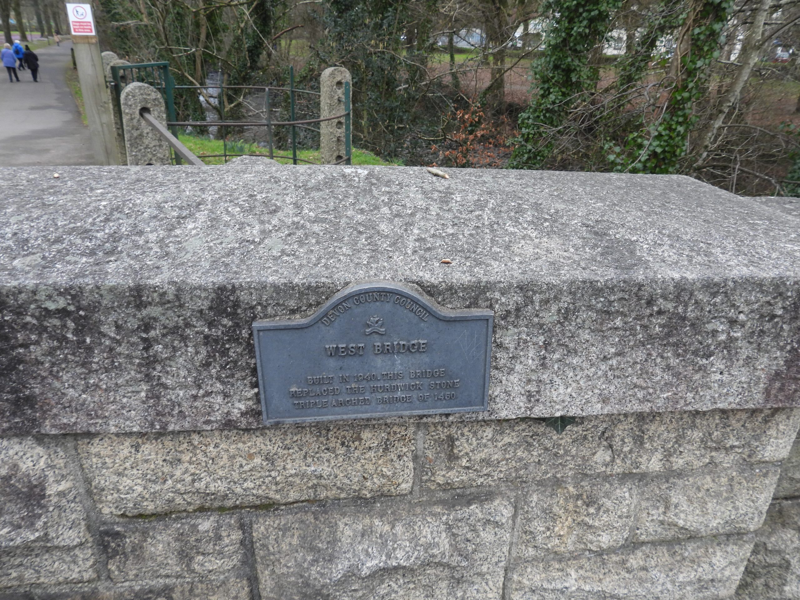
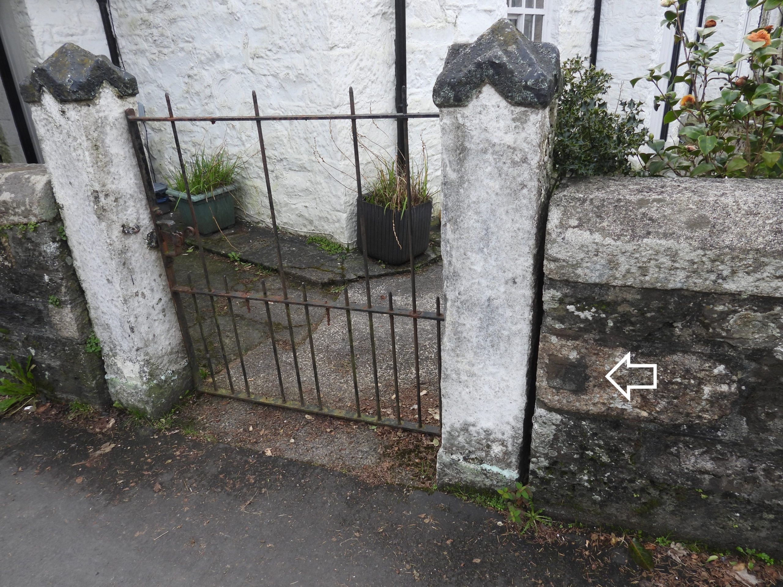
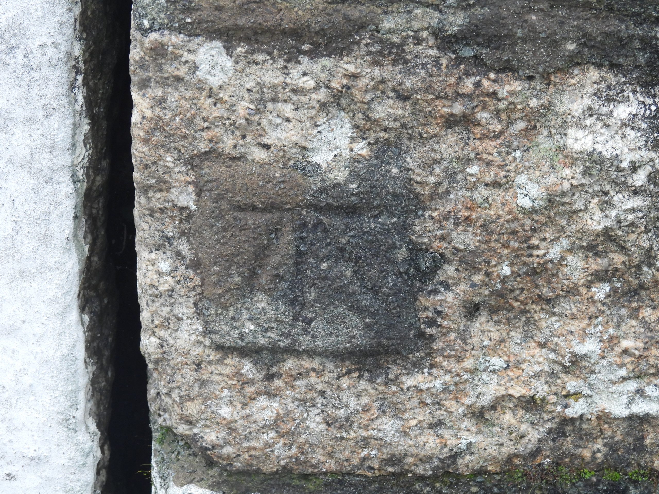
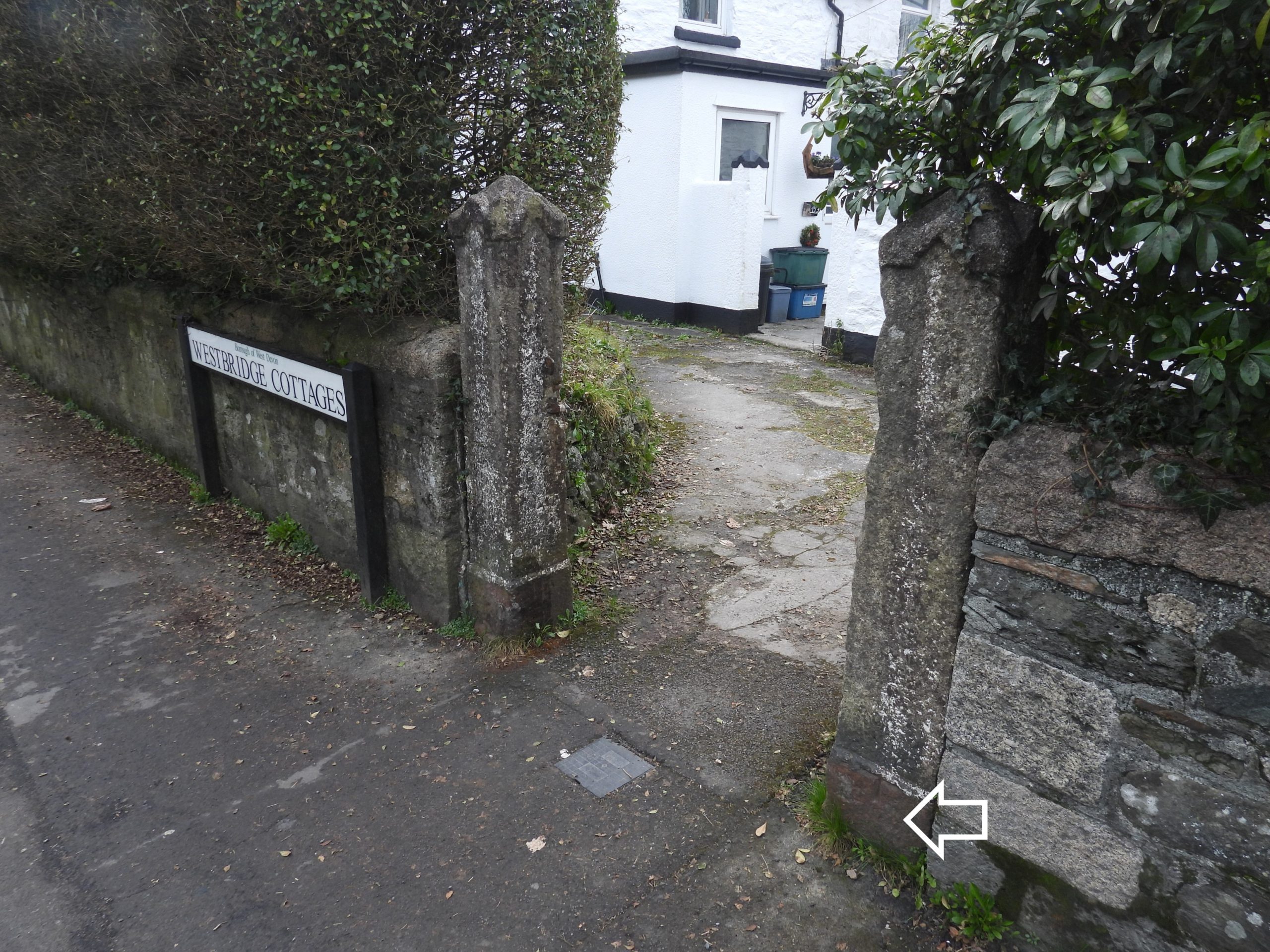
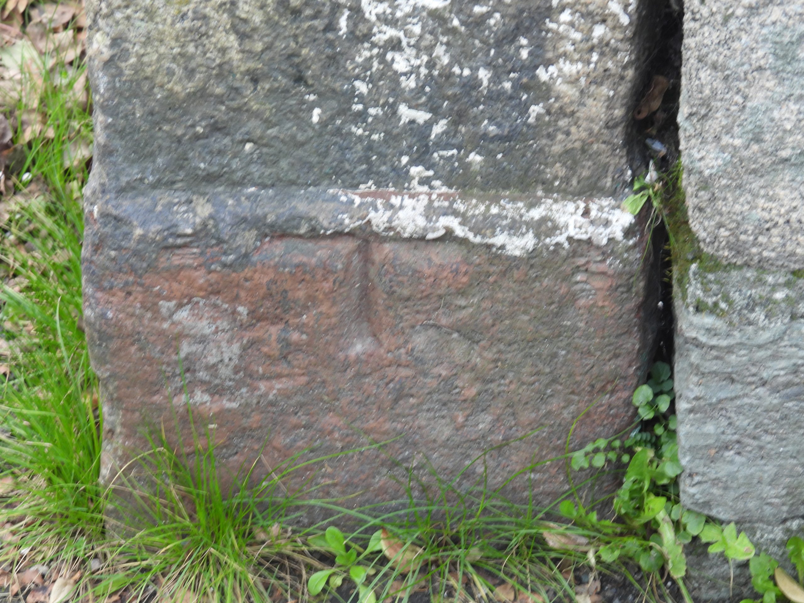
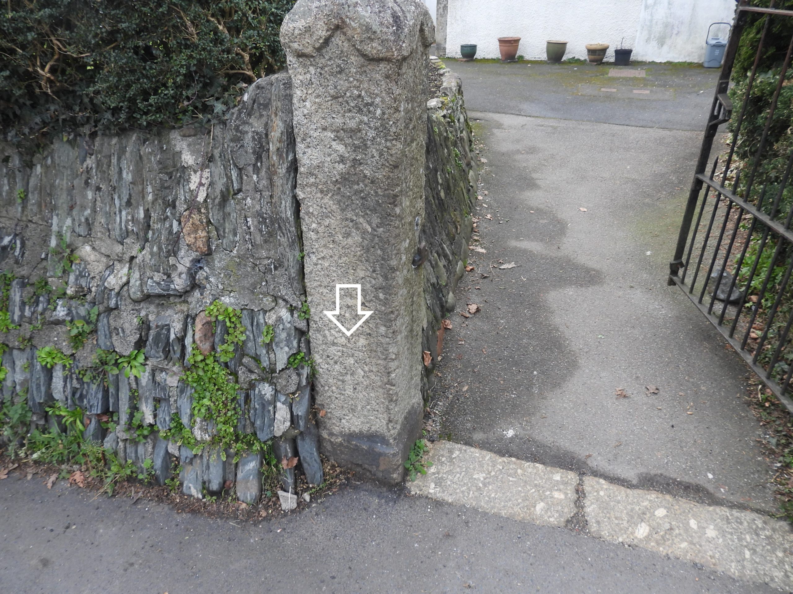
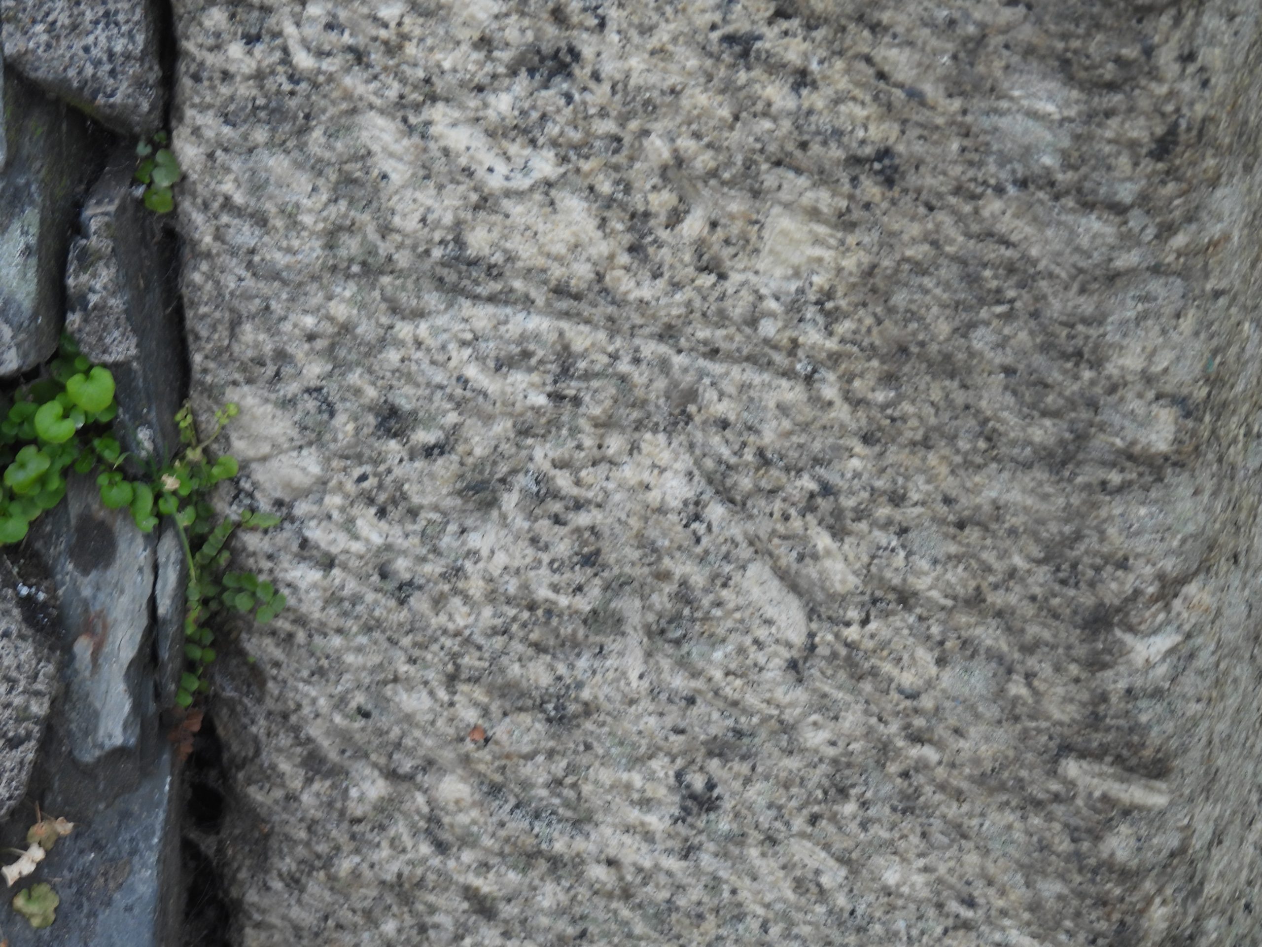
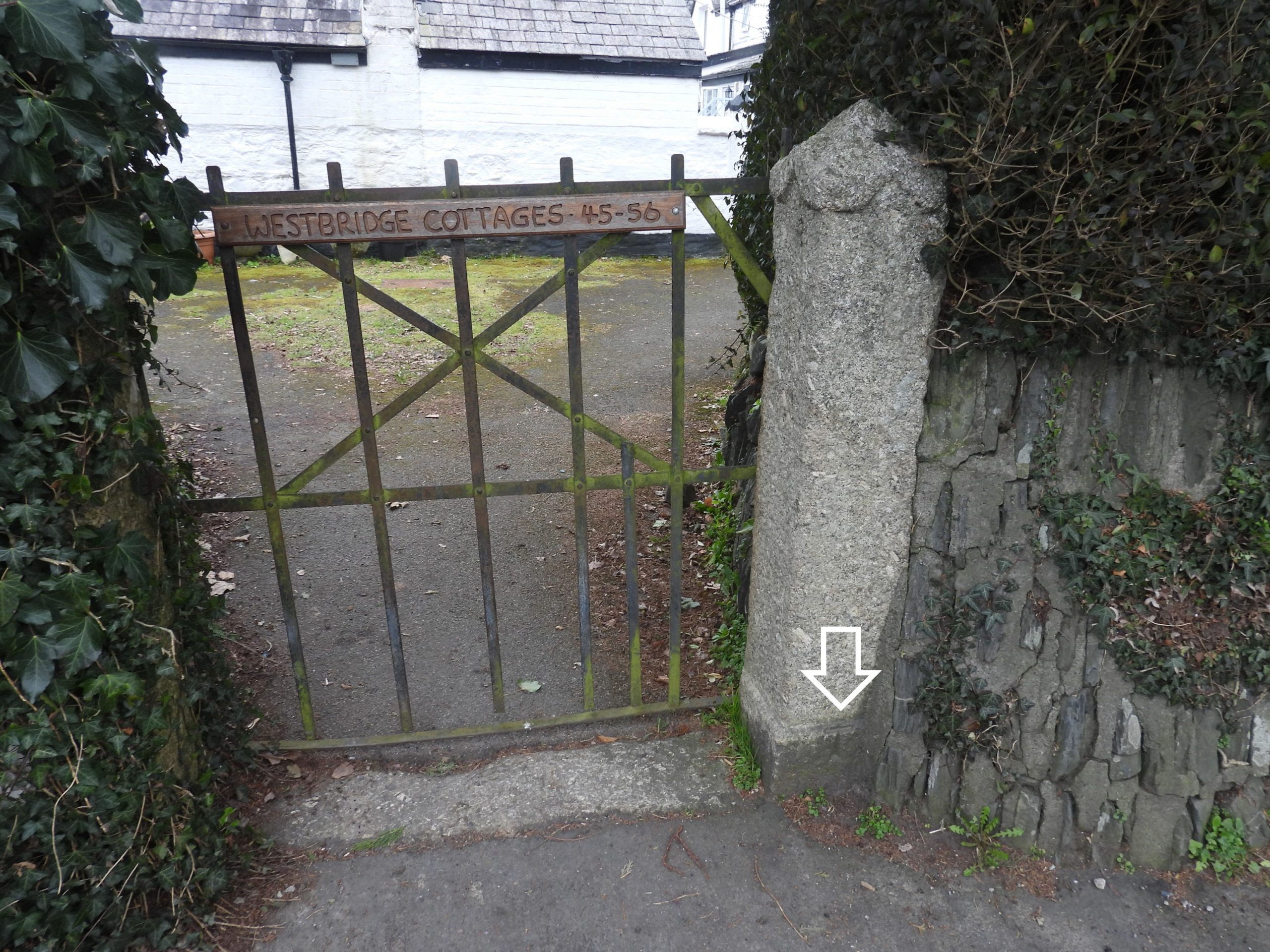
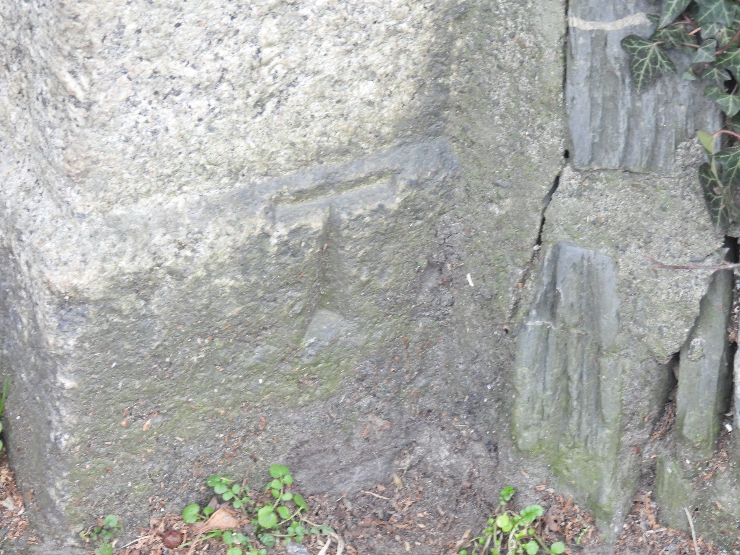
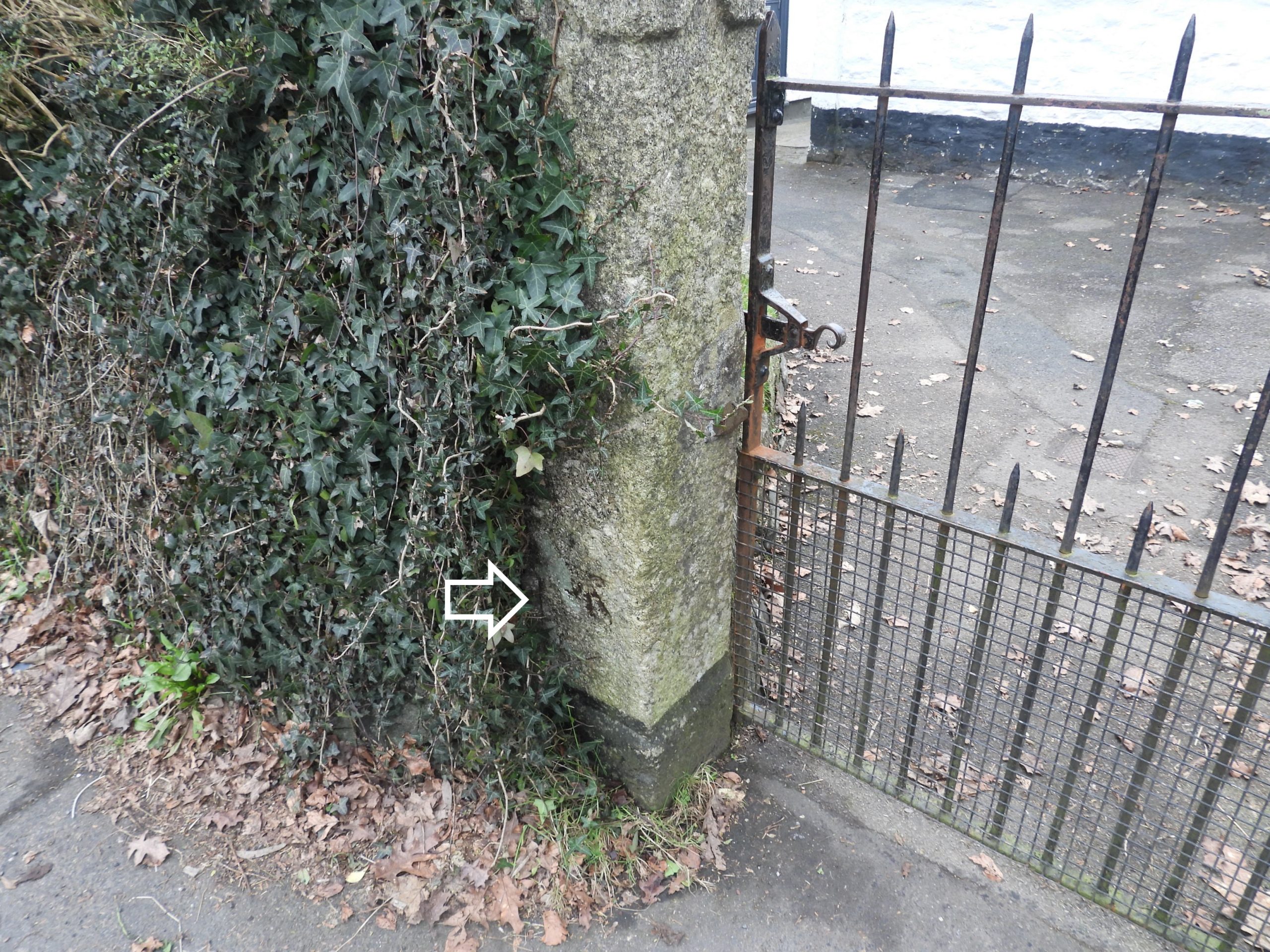
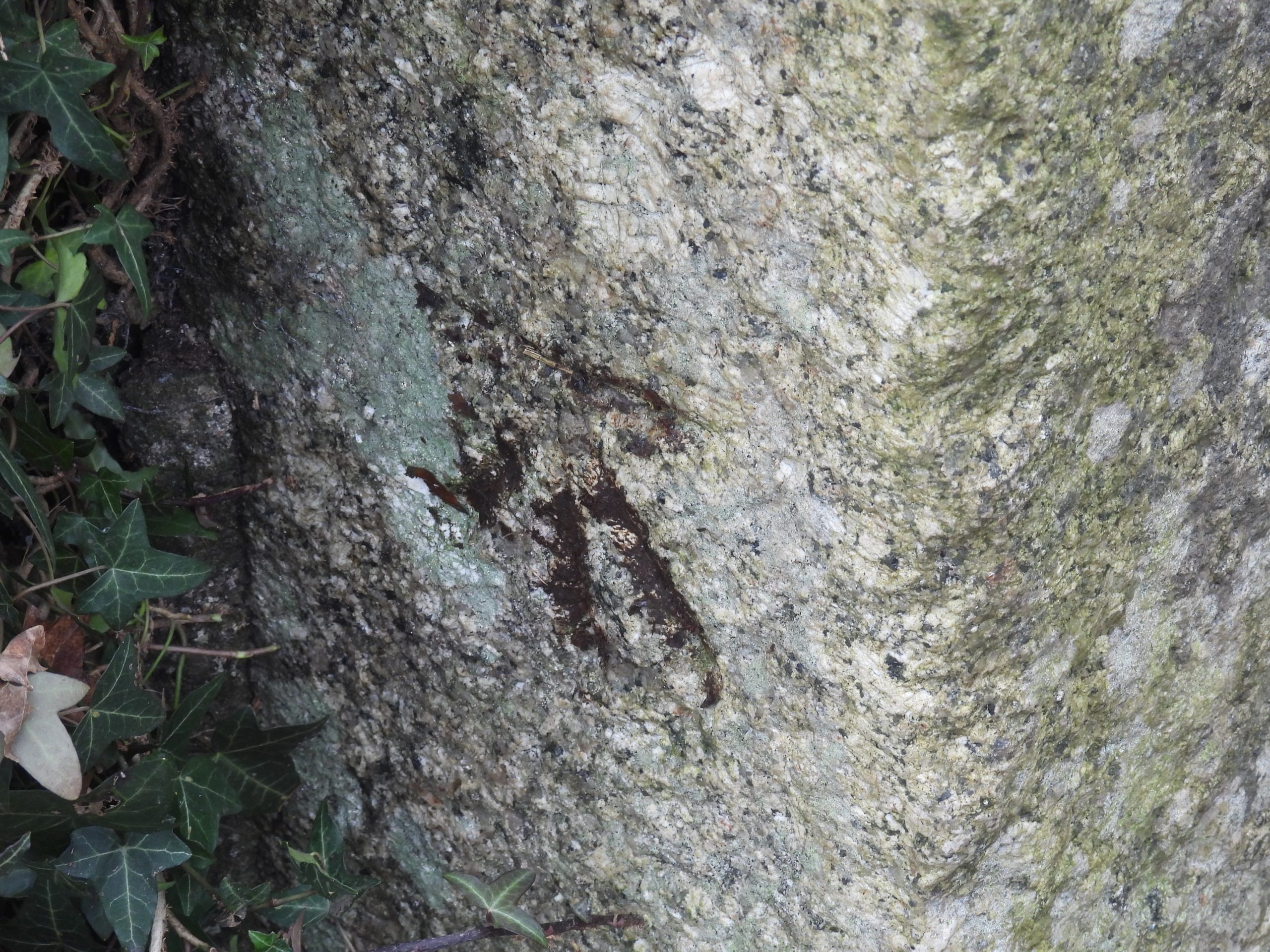
Annotated 19th century map showing the locations of all 25 “T” stones. The ‘red’ locations are where the author noted just the “T” inscribed stones and the ‘blue’ locations are where the author noted “T” inscribed stones with the more traditional (broad arrow) benchmarks nearby (usually within a few 10’s of metres)This table records 13 of the 25 “T” inscribed stones with benchmarks which are located close by. As with the map, the ‘red’ denotes where the author noted just the “T” inscribed stones and the ‘blue’ denotes where the author noted “T” inscribed stones with the more traditional (broad arrow) benchmarks nearby (usually within a few 10’s of metres). As a reference to the original John Stickland blog, the ‘order’ in which the stones were recorded there are noted in the table.A good starting point for viewing all the inscribed stones and benchmarks in this post is the main (Bedford) car park off Plymouth Road and next to the River (Tavy). There are a couple of ‘gaps’ in the wall from the car park taking the visitor to the riverside path.Just a short distance upstream are the Tavy weirs next to the Abbey BridgeThe Town Council Abbey Bridge blue plaque states: “Constructed in 1762 to carry one of the new turnpike roads, its name indicated its position close to the traditional site of Tavistock Abbey. The bridge was widened and partially rebuilt in 1860 to improve access to the GWR station”.On the east end of Abbey bridge (downstream parapet) is the first “T” inscribed stone in this post.The “T” inscription is located at SX48241 74315In the middle of the downstream parapet of Abbey Bridge there is a benchmark (B.M 268.8) ref : National Library of Scotland (1892-1914) map – benchmarkClose up of the benchmark at SX48231 74325The route follows passes the site of the former Abbey Chapel. The Town Council blue plaque states: “Originally part of Tavistock Abbey, this was the site of the Abbot’s Hall. Since 1691, when it became a Presbyterian meeting house, it has housed nonconformist congregations”.“The Abbey Chapel” was built adjacent to the monastic infirmary and was the dining-hall for the use of the sick. The earliest mention of the building is in 1348. The 2nd “T” has “wings” and is located outside Bedford Chambers on the corners of Plymouth Road and Abbey Place. The “T” part of the inscription looks like the same style as the other “T”s around Tavistock. This inscription, however, has the extra “wings”, which makes it look like a (broad arrow) benchmark. Is it possible that this was originally a “T” and the “wings” added later or was the inscription all done on at the same time ? It is marked as a benchmark B.M 269.4 on 19th century maps. It is located at SX48174 74392St. Eustachius Church dates from 1265 http://www.tavistockparishchurch.org.uk/church/history/Bedford Square. Buildings were commissioned by Francis Russell, 7th Duke of Bedford as part of a broader initiative to remodel the town centreTavistock Town Hall with inscription ‘Erected by Francis / 1860 / 7th Duke of Bedford K.G’Inscribed date and “B” (Bedford) with crown motif on Town hallThe 3rd “T” is located at the ‘House of Cards’ on the junction of Duke Street and Bedford Square.This “T” is located at SX48168 74464 and is labelled B.M 269.6 on 19th century maps.Flush Bracket (for OS levelling bracket fixture) on Pannier Market at SX48204 74475Tavistock Community Mosaic 2006 on the Pannier Market. The community mosaic project was spearheaded by the Tavistock Integrated Arts Group at the Molly Owen Centre and attracted funding from the Heritage Lottery Fund. The mosaic depicts prominent sites of archaeological and historical points of interest in the town. It tied in with the celebration of the 900th anniversary (2005) of the granting of the town’s market charter. (ref: https://www.tavistock-today.co.uk/news/all-set-for-official-launch-of-community-mosaic-366186)The 4th “T” inscribed stone can be found at the Market Road entrance to the Pannier Market at SX48256 74447Near the 4th “T” stone is another benchmark B.M 265.5B.M 265.5 can be found at SX48273 74485Moving onto Vigo Bridge a 5th “T” inscribed stone can be located.This “T” inscription is located at SX48422 74587Blue Plaque on Vigo Bridge which states: “In 1773 this river crossing was built as access to the new turnpike road across Dartmoor to Moretonhampstead and Exeter. The name evokes historical echoes. Francis Drake had twice raided the Spanish port of Vigo, in 1585 and 1589”.Another Vigo Bridge sign states: “Built in 1773 and by local tradition named to commemorate Sir Francis Drake’s maritime exploits at the naval port of Vigo on the north west coast of Spain”In the centre of the downstream parapet of Vigo bridge is a benchmark, which is referenced B.M 275.0 on historical maps.B.M 275.0 is located at SX48420 74590B.M 275.0 looks like it was inscribed twice. The one on the left, barely discernible could have been replaced by the one on the right.Moving from Vigo Bridge to Mount Tavy Road a 6th “T” inscribed stone can be located, behind a lamp post. It is located between numbers 11 and 12.Inscribed “T” number 6 is located at SX48472 74575A 7th “T” inscribed stone (with “wings”) can be located, on a post between 8 & 9 Mount Tavy Road cottages. The “T” is in keeping with others around the town. It is labelled as B.M 275.1 on historic maps.B.M 275.1 can be found at SX48527 74567At a gate to the cemetery on Dolvin Road Cemetery, the 8th “T” is locatedThe 8th “T” is located at SX48348 74468Mount Tavy Road cottages.The 9th “T” inscribed stone is located on the Old Exeter Road (outside number 19). There is straight forward access to this road via the steps at the ‘back’ of Paddons Row off Brook Street.The 9th “T” is located behind a gas pipe at SX48232 74618The 10th “T” stone is located outside no 71 Old Exeter RoadClose up of the 10th “T” at SX48388 74737The 11th “T” is located outside the former Ordulph Arms in Pym StreetClose up of the 11th “T” at SX48081 74508Ordulph Arms sign: “Opened as a Temperance Hotel in 1838, this building housed, for much of the twentieth century, the offices of Tavistock Rural District Council. It became an inn in 1983”.Opposite the old Ordulph Arms is this plaque on the Freemason’s HallA few metres from the “T” on the old Ordulph Arms is this benchmark. Referenced as B.M 282.7 on 19th century mapsThe benchmark is located at SX48081 74517At the entrance in West Street to St. Eustachius Church is the 12th “T”This “T” is located at SX48095 74438On the corner of West Street and King Street (old Corn Market) is the 13th “T”The 13th “T” is located at SX48061 74438Old Corn Market with its inscription stating it was erected by John (Russell) Duke of Bedford K.G 1835. It was erected on the site of the Green Dragon Inn. Between 1913 and 1937, the building was a cinema. It was renovated in 1992.A few metres up King Street from the old Corn Market is this benchmark, which is referenced B.M 277.9 on old 19th century maps. It is located at SX48046 74459This table records the final 12 of the 25 “T” inscribed stones with benchmarks which are located close by. As with the map, the ‘red’ denotes where the author noted just the “T” inscribed stones and the ‘blue’ denotes where the author noted “T” inscribed stones with the more traditional (broad arrow) benchmarks nearby (usually within a few 10’s of metres). As a reference to the original John Stickland blog, the ‘order’ in which the stones were recorded there are noted in the table.The 14th “T” is outside number 65 Bannawell StreetThe 14th “T” is located at SX47914 74698Also in Bannawell Street is this benchmark. It is referenced as B.M 324.4 on 19th century mapsB.M 324.4 is located at SX47915 74667Returning to West Street, the 15th “T” is located outside an Indian TakeawayThe 15th “T” is located at SX47916 74375On the centre gate post off Town Steps, Rocky Hill is the 16th “T”The 16th “T” is located at SX47871 74398The 17th “T” is located at the top of the steps in West Street (by the dental surgery)The 17th “T” is located at SX47866 74334This statue at Rocky Hill / West Street is a figure of a lawyer in Medieval costume and is believed to have been brought from the 1851 Great Exhibition of London by Francis Russell, the 7th Duke of Bedford (1839-1861).The 18th “T” can be found in West Street on the opposite side of the road to the video shop.The 18th “T” can be found at SX47811 74294The 19th “T” is located at the bottom of the path leading down from West Street (in West Avenue close to the Tavistock Methodist Church). It is slightly obscured behind a lamp post.The 19th “T” is located at SX47885 74306The 20th “T” is outside Abbey Surgery, opposite bus station and has “wings”. It is referenced as B.M 261.6 on 19th century maps.The 20th “T” is located at SX47926 74235The 21st “T” is located in Chapel Street outside No 7 on a gatepost.The 21st “T” is located at SX47781 74185From “T” number 21 to number 22, walk to the end of Chapel Street, turn right into Ford Street and left into Spring Hill. The 22nd “T” is located outside a side gate of one of the large houses.The 22nd “T” is located at SX47684 74198Returning back down Ford Street, the 23rd “T” is located next to the Duke of York pub.The 23rd “T” is located at SX47522 74029Fitzford Gate House is now a holiday cottage. It dates back to the 16th century and is the only remaining part of Fitzford House. Fitzford House was the seat of the Fitz family from the 15th Century.Drake StatueCrossing the canal bridge towards West Bridge (across the Tavy), on a gatepost outside the former telephone exchange a benchmark can be found. The author has been unable to find a reference number on mapsThis benchmark is located at SX47643 73773West Bridge blue plaque states: “West Bridge. A bridge was built between 1540 and 1566 on the site of an historic ford crossing. It was ten feet wide and consisted of three arches. Demolished in 1939, it was rebuilt in 1940 by the present construction”.A West Bridge tablet states: “West Bridge. Re-built 1940 at the joint expense of Ministry of Transport & Devon County Council”.Another West Bridge plaque states: “West Bridge. Built in 1940, this bridge replaced the hurdwick stone triple arched bridge of 1450”.Outside the gates of the Westbridge Cottages closest to the bridge is a benchmark, which does not appear on any old mapsThe benchmark is located at SX47687 73701The 24th “T” is located outside the gates to Westbridge Cottages near to the bridge. It is marked as a benchmark on old maps (B.M 239.4)The 24th “T” is located at SX47690 73686Another benchmark outside Westbridge Cottages can be found (near the petrol station). It referenced as B.M 236.5This benchmark is located at SX47682 73559The 25th (and final) “T” can be found outside Westbridge Cottages 45-56.This final “T” is located at SX47687 73497On the last gatepost (heading towards morrisons) there is another benchmark. It is referenced as B.M 234.2B.M 234.2 is located at SX47688 73435
The “sculpture” of a figure described as “a lawyer in medieval dress” attached like a plaque to the end wall of the house at the foot of the Rocky Road looks rather like two sculptures in Hungary (seen on Google) of St John of Nepomuk. The hat and other clothing is especially similar, as is the face and beard.
St Nepomuk was apparently the patron saint of sailors.
Is there a connection with Tavistock or the Duke of Bedford?
I’m personally delighted to see my initial curiosity and legwork recorded so professionally.
the T stone at the north side of St Eustacius Church was my first one – noticed whilst attending an emergency call.
I’m sure there are a few more, yet to be discovered …
Hello both John & Steve
As a retired Land Surveyor, I have presented a talk on The ‘Tavistock Theodolite’ to a couple of local organisations and wondered if you would mind if I made reference to your site and some of the images contained within, in particular your map at the beginning.
I always assumed the ‘T’ marks were just Stone-mason marks and have found your research to be both informative and also fascinating.
Brian Galbraith January 14, 2024
The “sculpture” of a figure described as “a lawyer in medieval dress” attached like a plaque to the end wall of the house at the foot of the Rocky Road looks rather like two sculptures in Hungary (seen on Google) of St John of Nepomuk. The hat and other clothing is especially similar, as is the face and beard.
St Nepomuk was apparently the patron saint of sailors.
Is there a connection with Tavistock or the Duke of Bedford?
SteveGriggDartmoor January 14, 2024 — Post author
Hi Brian,
Thank you for your question. I have tried to find an answer for you but have been unsuccessful so far.
Regards,
Dartmoor Explorations (Steve)
John Stickland October 22, 2024
I’m personally delighted to see my initial curiosity and legwork recorded so professionally.
the T stone at the north side of St Eustacius Church was my first one – noticed whilst attending an emergency call.
I’m sure there are a few more, yet to be discovered …
SteveGriggDartmoor October 23, 2024 — Post author
Hi John,
Thank you for your leg work which inspired my post. I hope I did the topic justice.
Kind Regards,
Steve (Dartmoor Explorations)
Paul Blowey May 13, 2025
Hello both John & Steve
As a retired Land Surveyor, I have presented a talk on The ‘Tavistock Theodolite’ to a couple of local organisations and wondered if you would mind if I made reference to your site and some of the images contained within, in particular your map at the beginning.
I always assumed the ‘T’ marks were just Stone-mason marks and have found your research to be both informative and also fascinating.
Thank you for such a fantastic site.
Kind Regards
Paul Blowey
SteveGriggDartmoor May 15, 2025 — Post author
Hi Paul,
Please feel free to make reference to the website and use any images (duly acknowledged please)
Kind Regards,
Steve (Dartmoor Explorations)