A collection of walks, discoveries, insights and pictures of exploring Dartmoor National Park
February 28, 2023
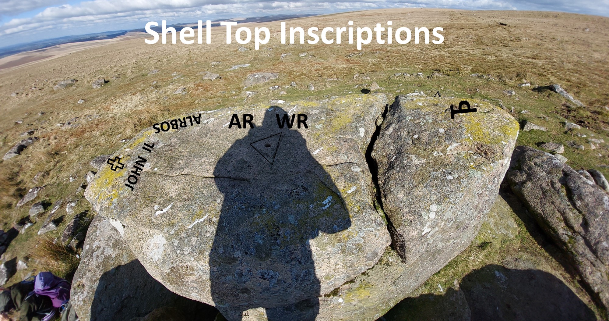
Shell Top Inscriptions
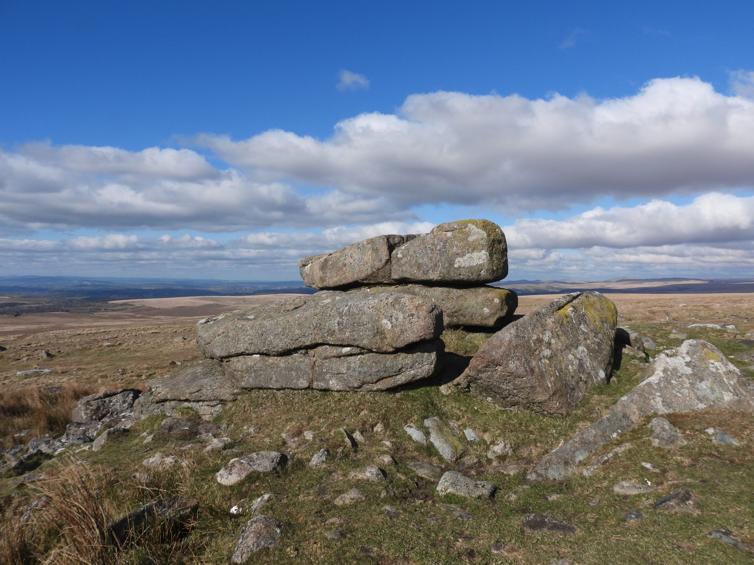
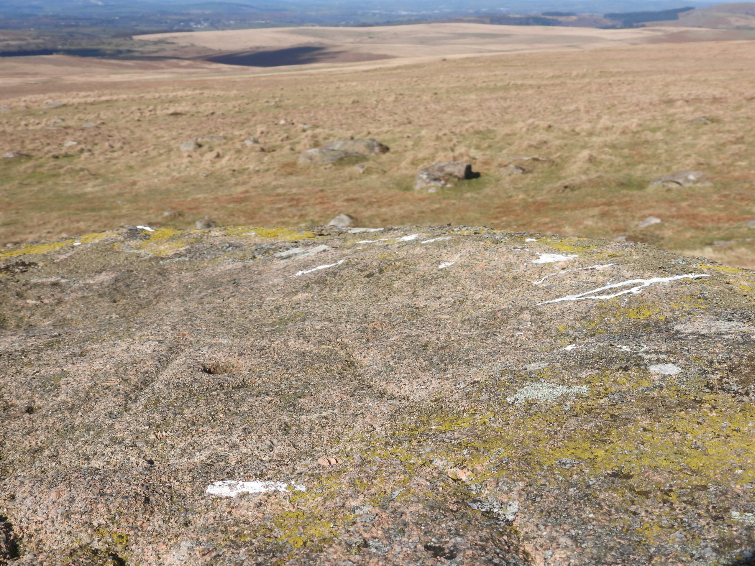
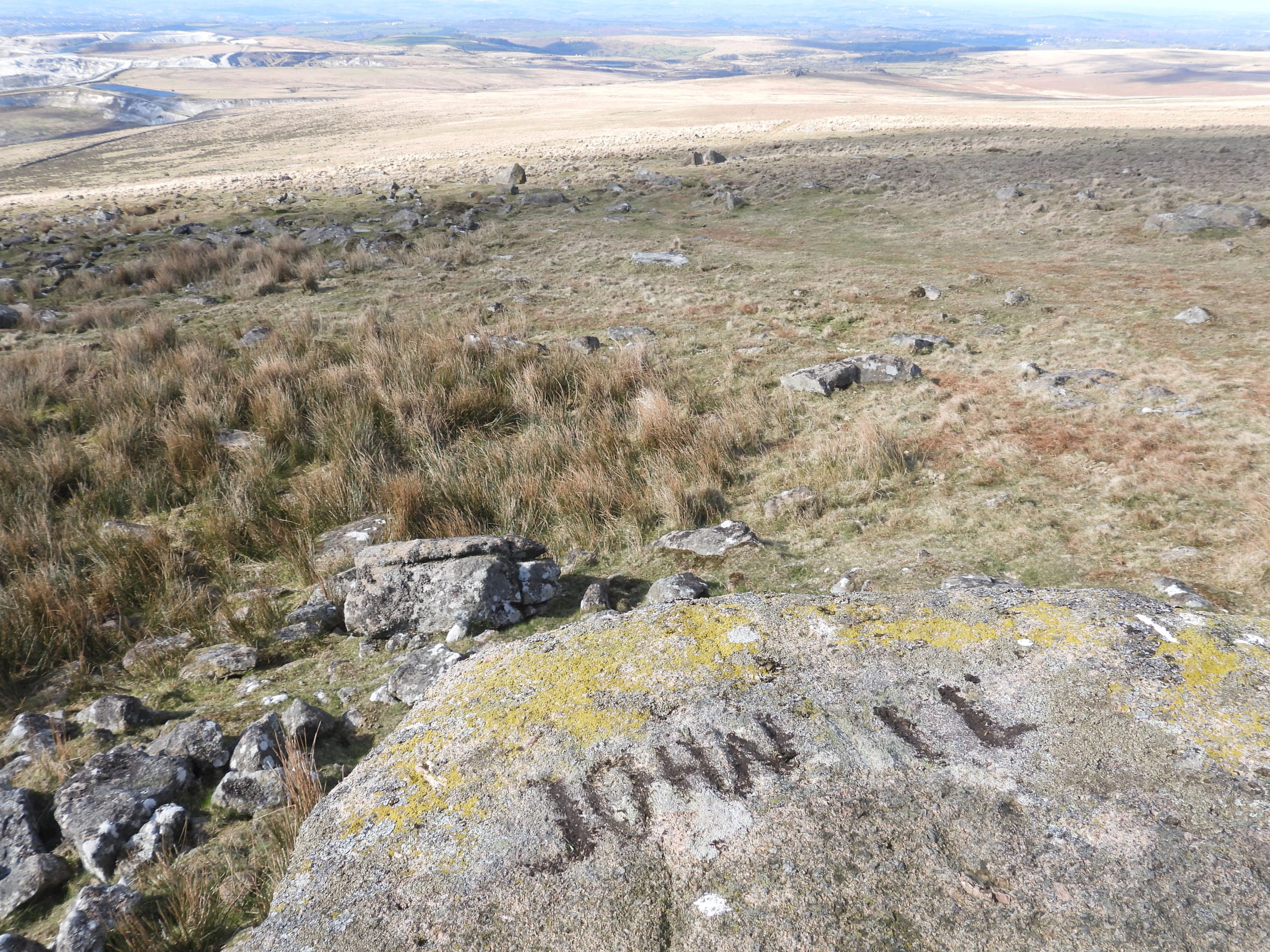
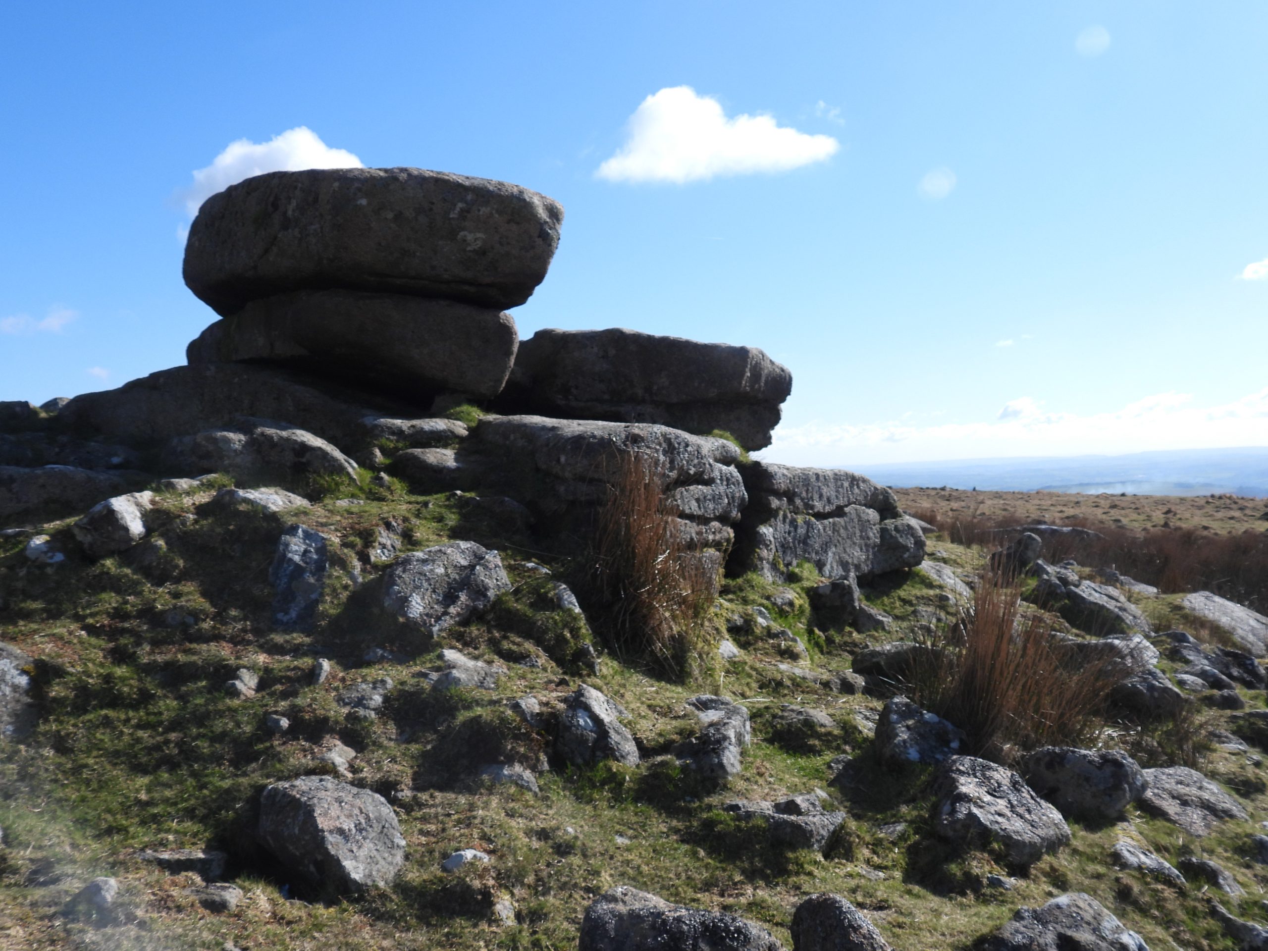
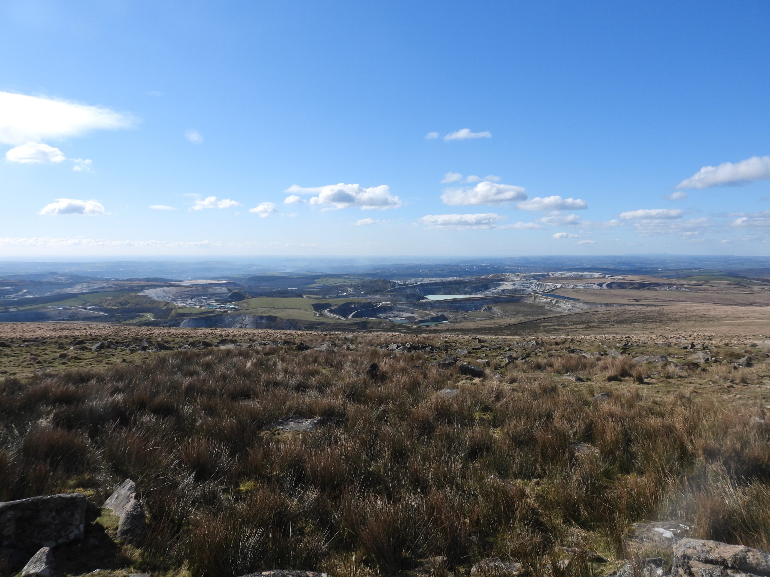
Shell Top (previously known as Shiel Top, Shell Tor, Shill or Pen Shiel) is a small outcrop which comprises three main layers of blocks, which although small are very distinctive when approached from the the south, west and east. The modern name ‘Shell’ is another example of a misleading modern corruption. The outcrop is located at 475m (1558ft) above sea level at the western end of Broadall Gulf, approx 1km to the NNE from Penn Beacon and has magnificent vistas all the way to the English Channel.
The author was first aware of there being several inscriptions on top of the outcrop in the 1980’s but it wasn’t until reading a letter in the Dartmoor Magazine (Winter 1993 edition) penned by Tom Greeves that the extent and number became evident. Tom Greeves, in his letter described at least 5 inscriptions asking readers of the magazine if they knew what the inscriptions meant and who was responsible. Further to this, Dave Brewer (Dartmoor Boundary Markers) also noted an incised cross on the outcrop. On a recent visit to the outcrop on a bright late winters morning, the author recorded all the aforementioned inscriptions plus found a further inscription on a rock a few metres away from the main outcrop to the south east, which are covered in this post.
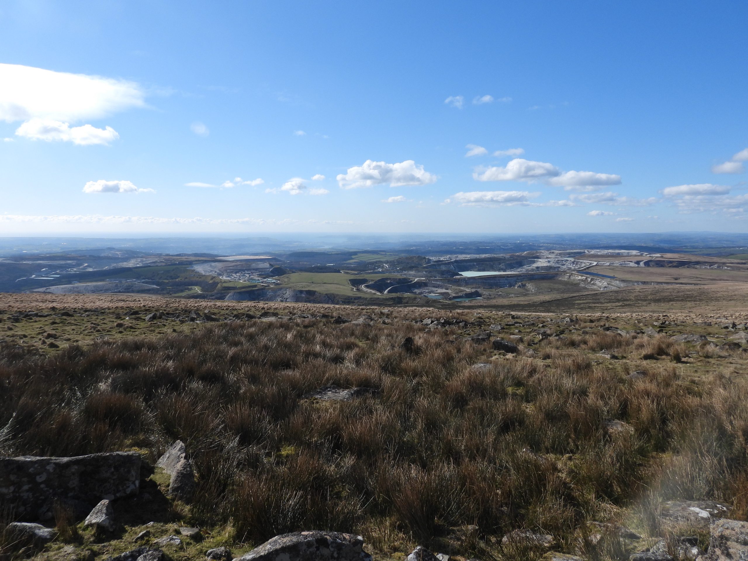
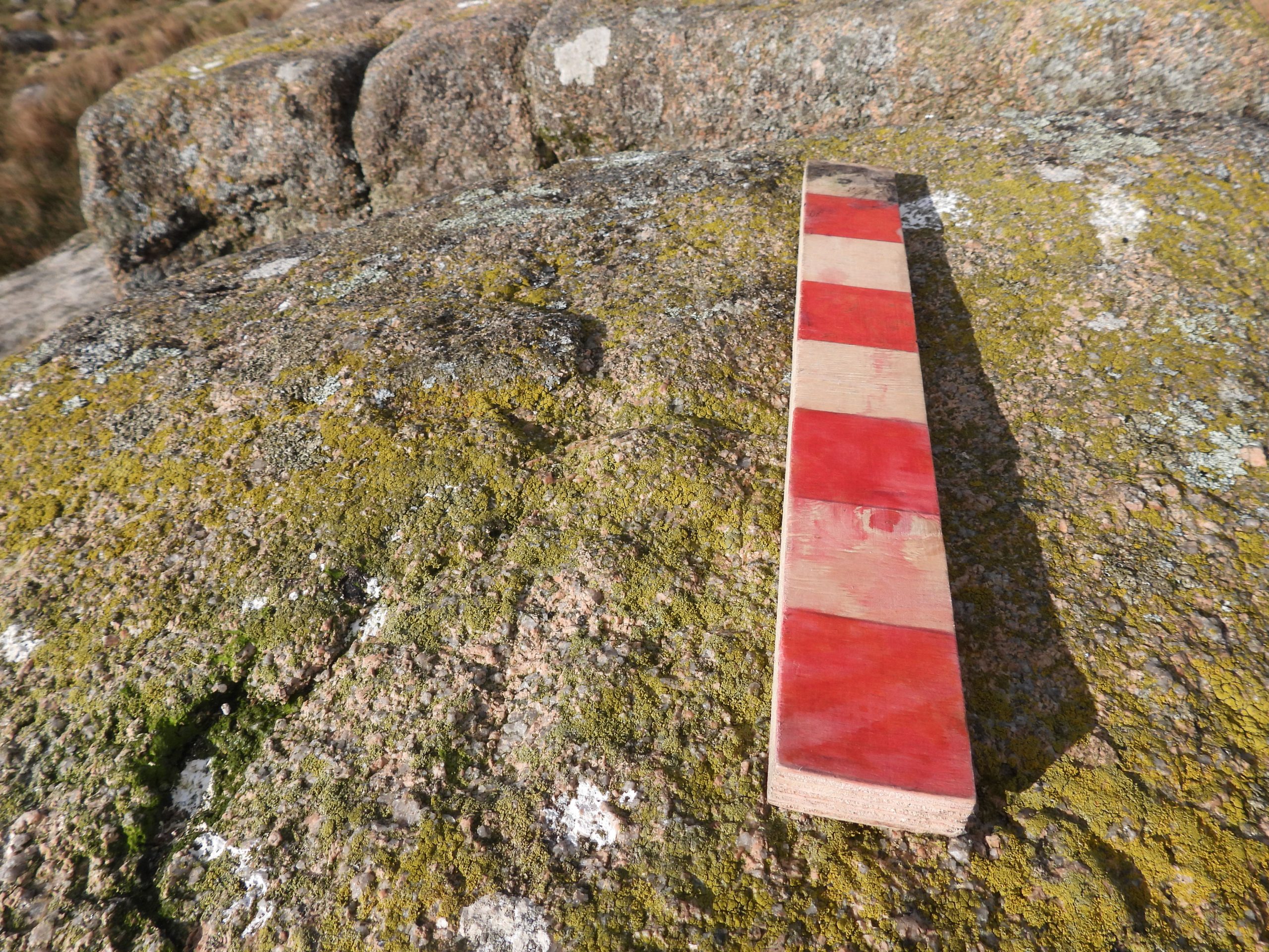
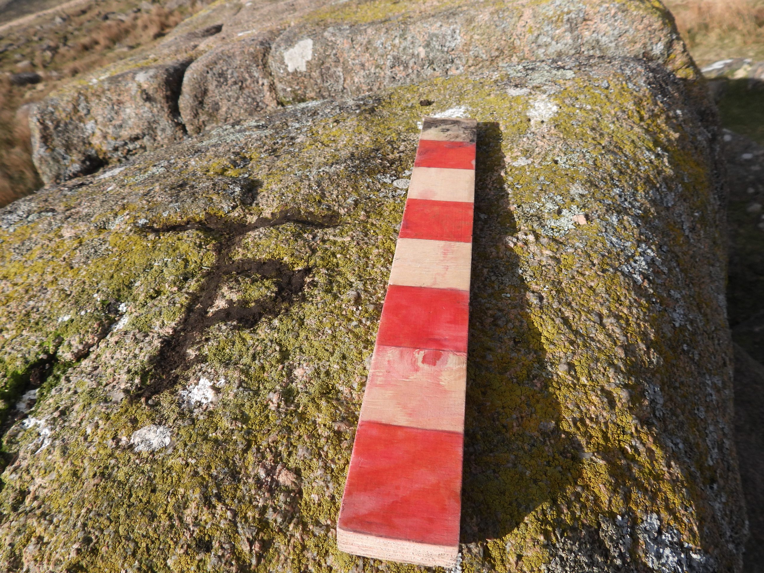
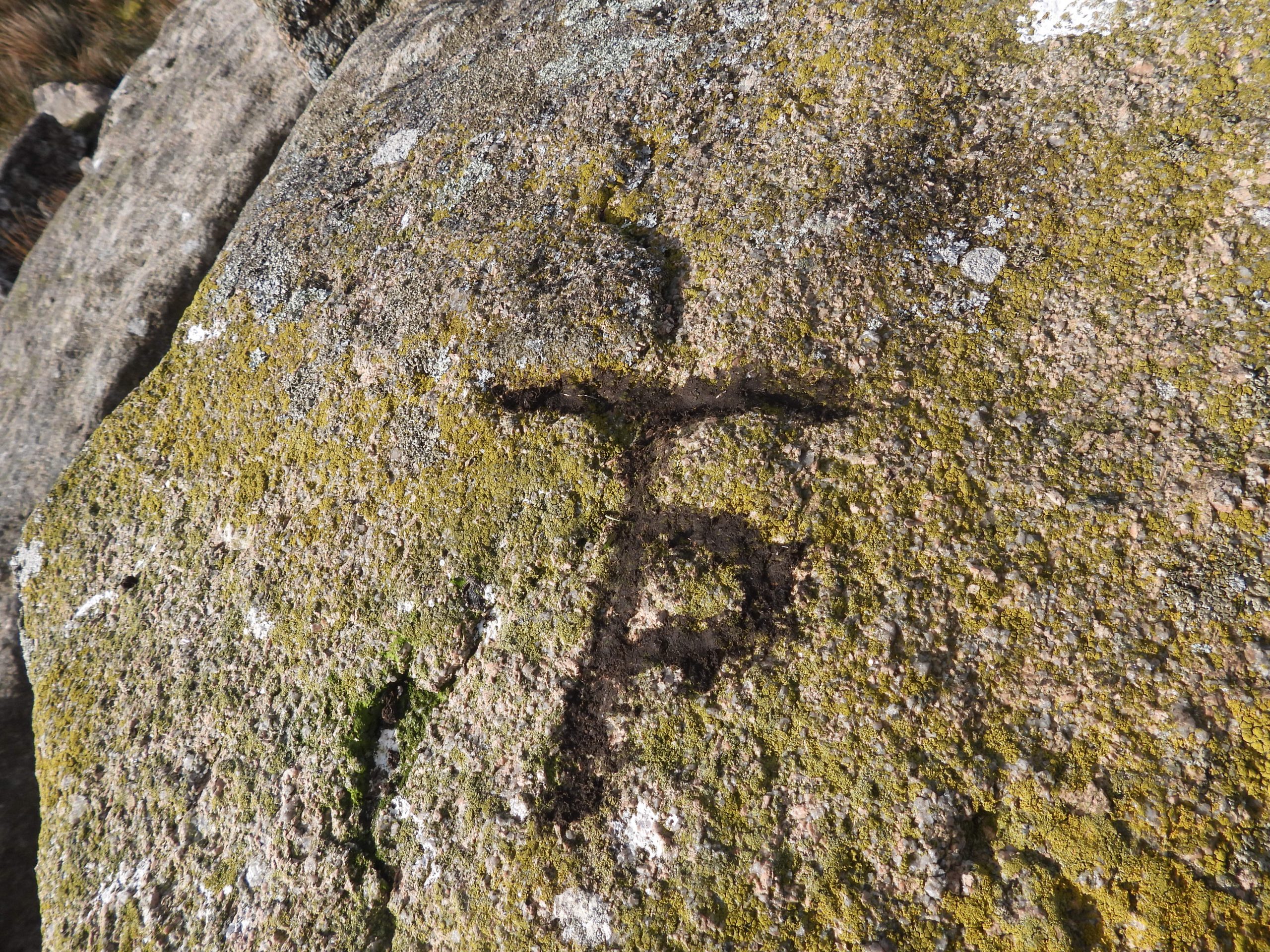
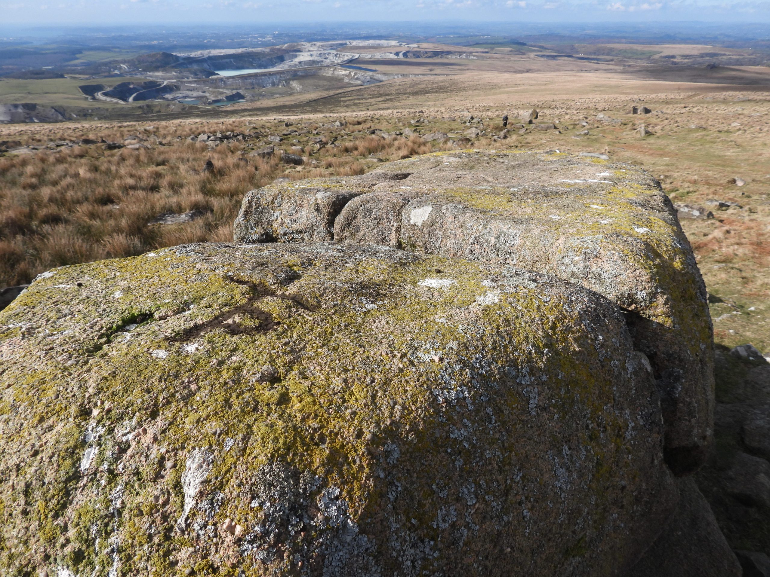
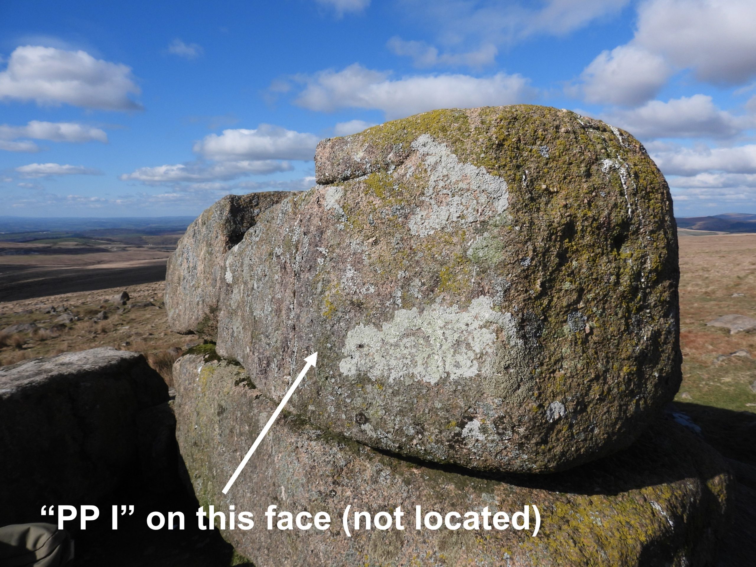
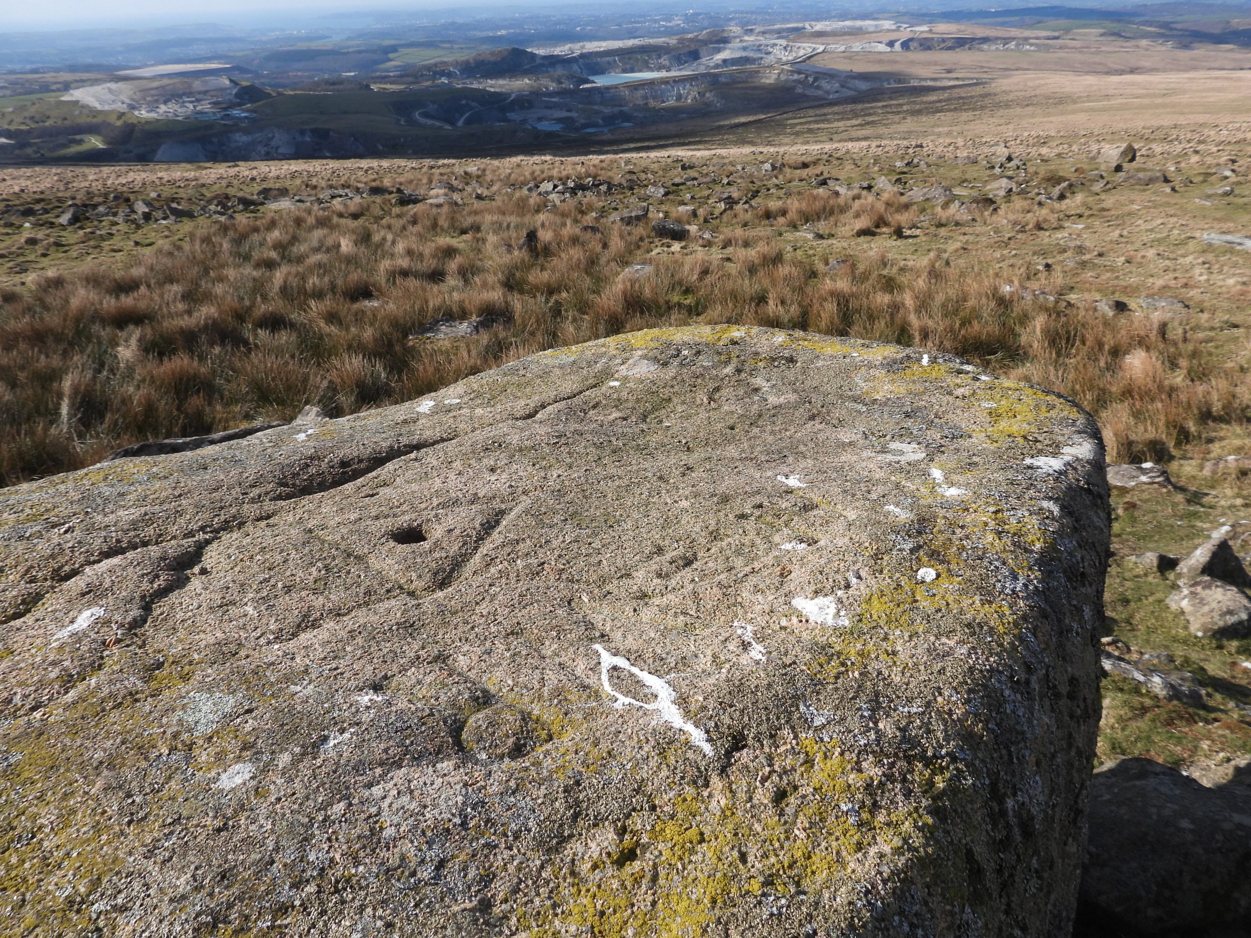
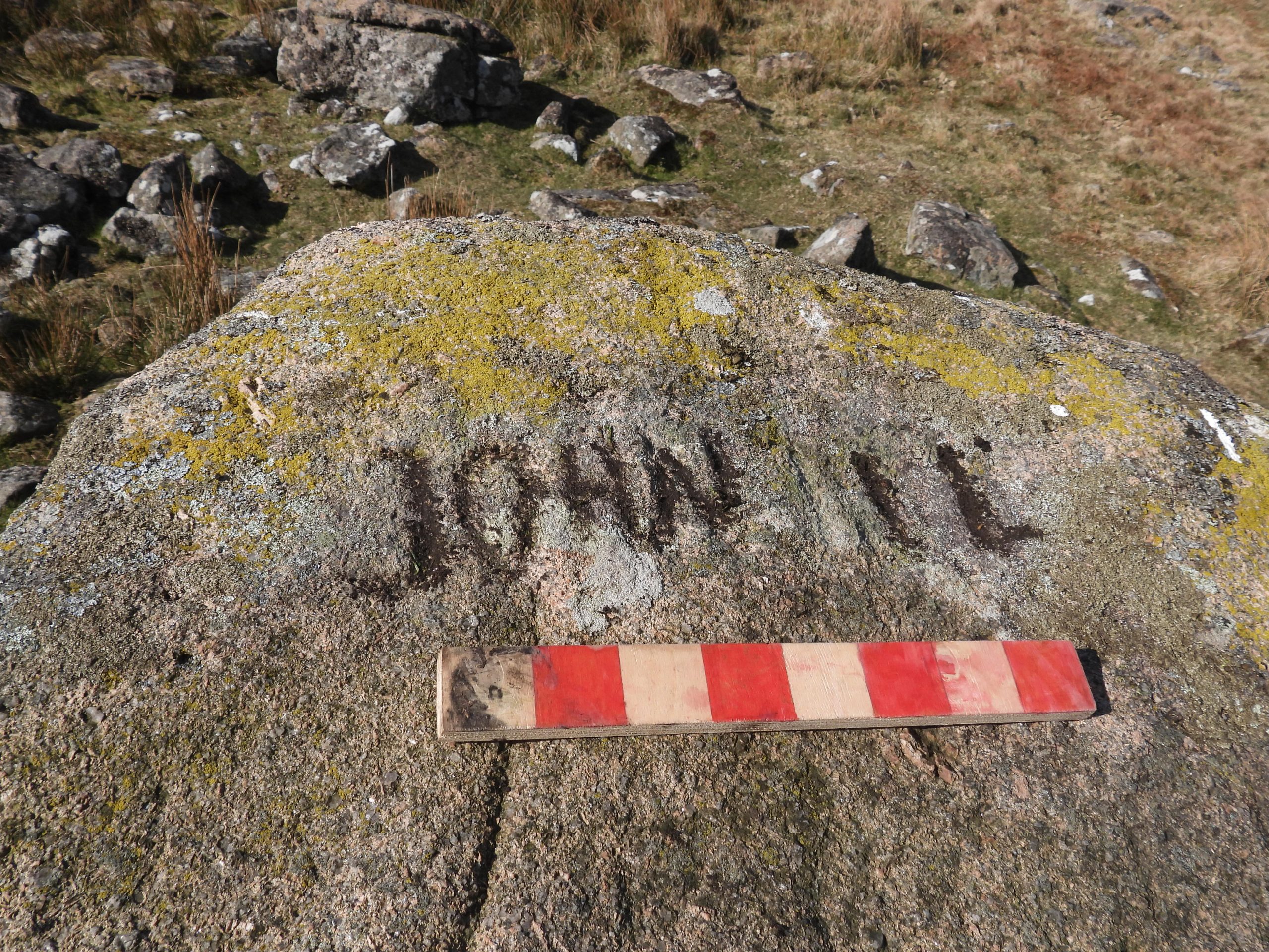
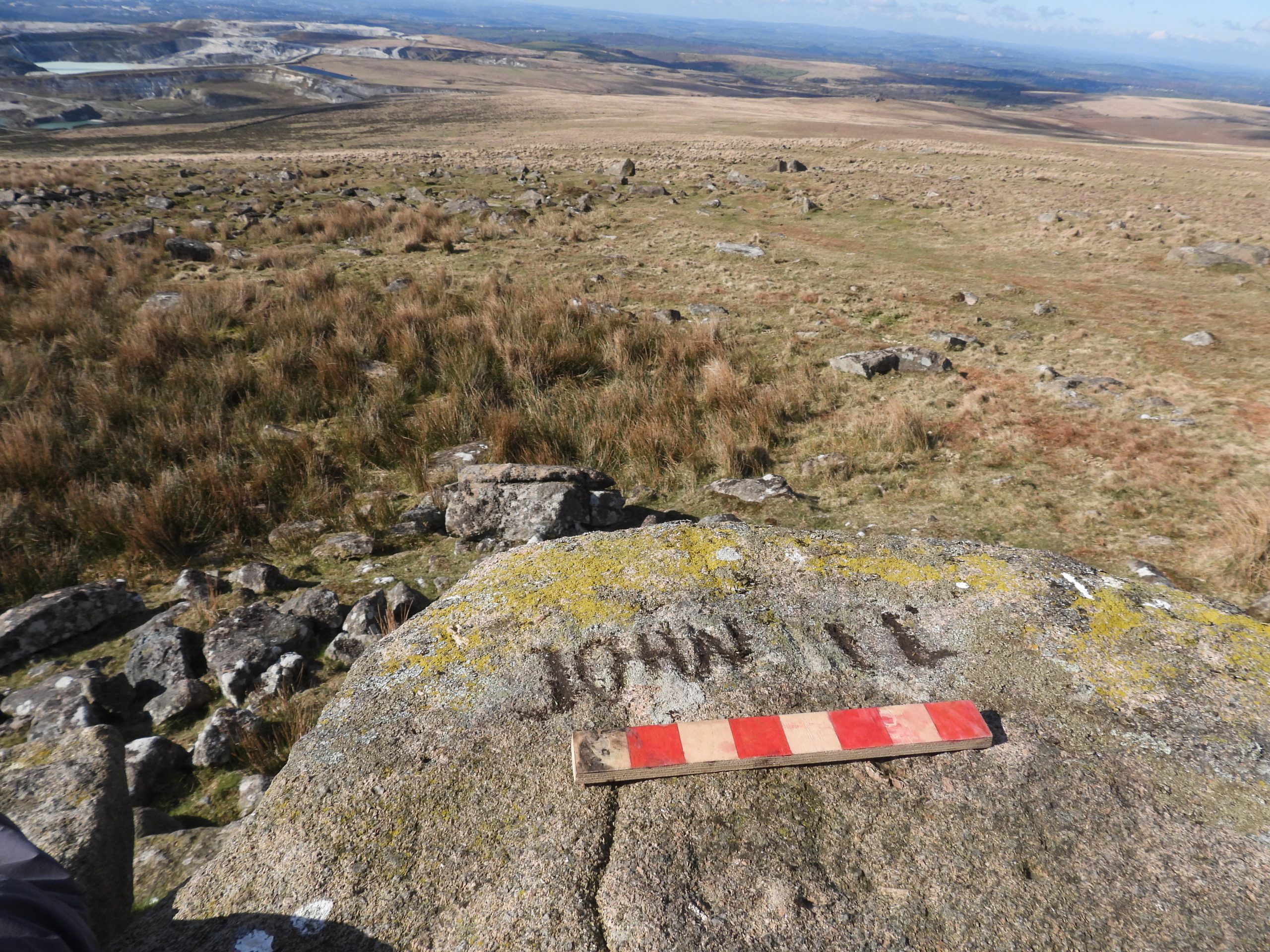
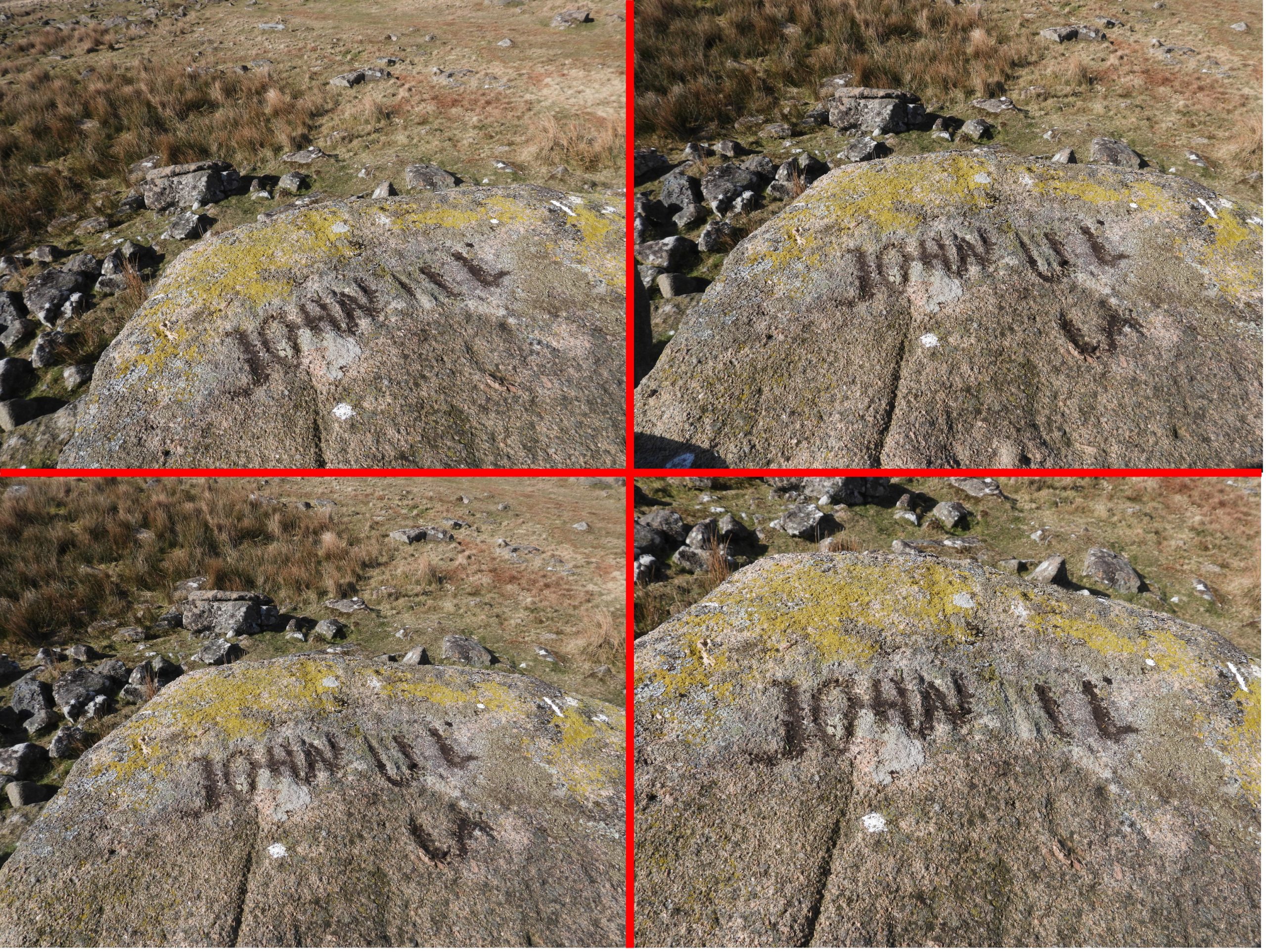
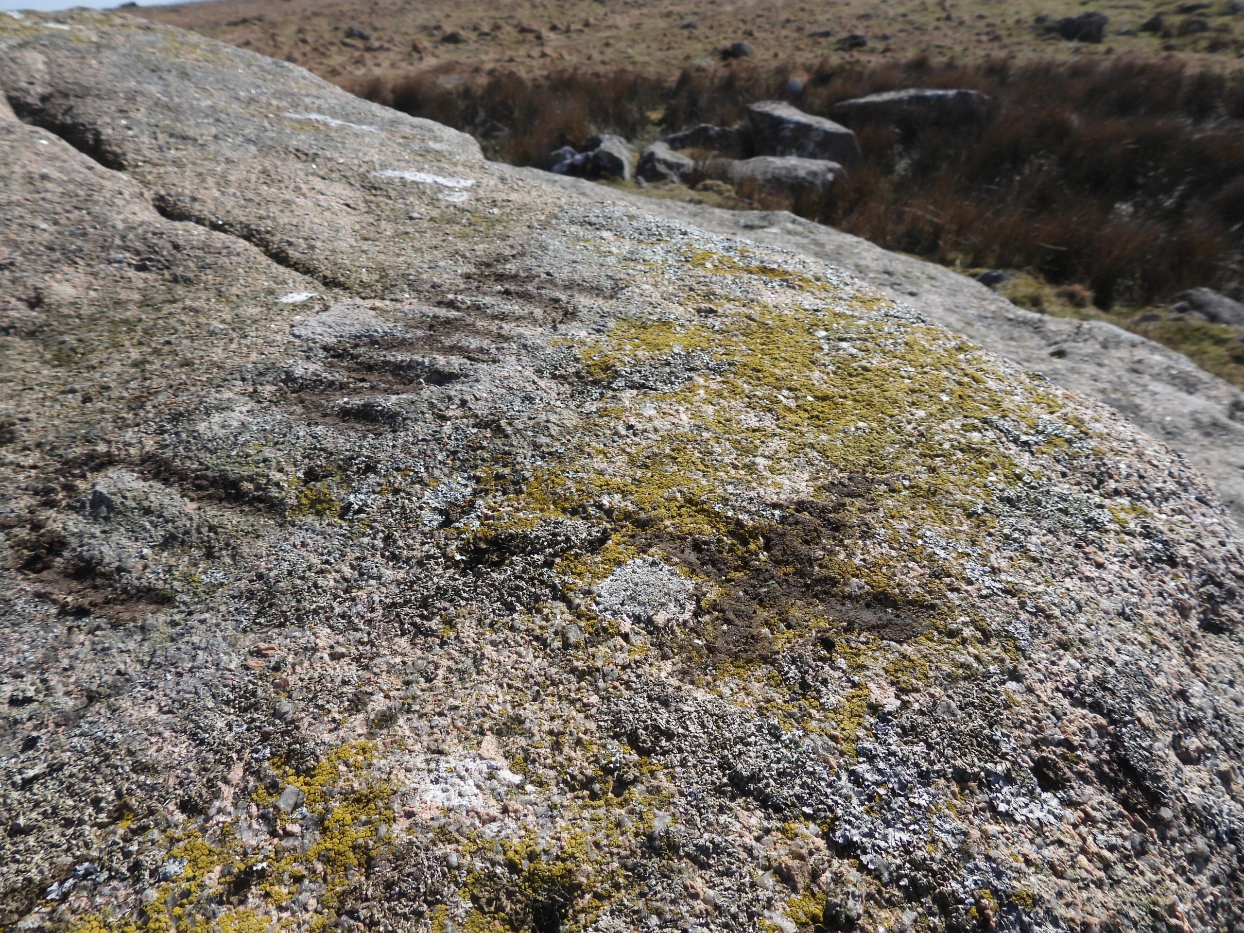
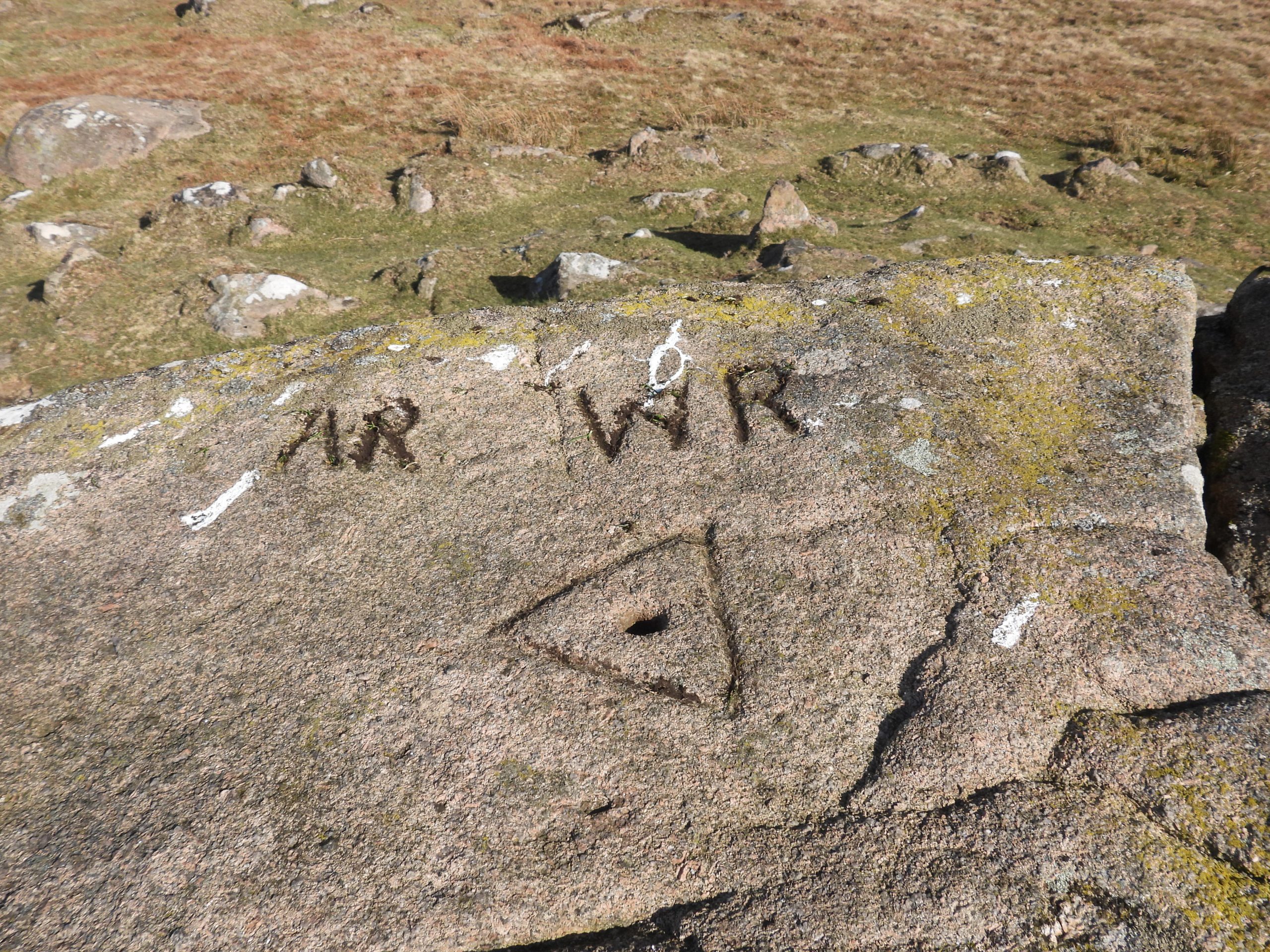
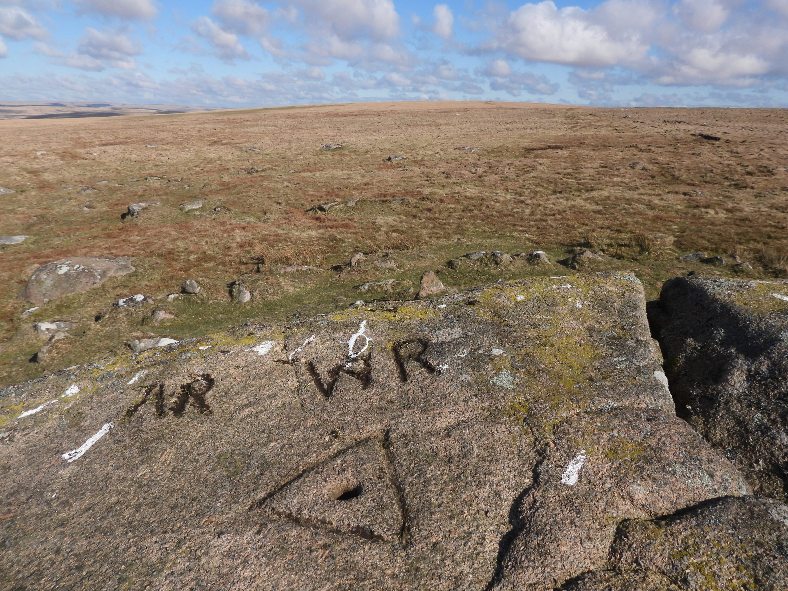
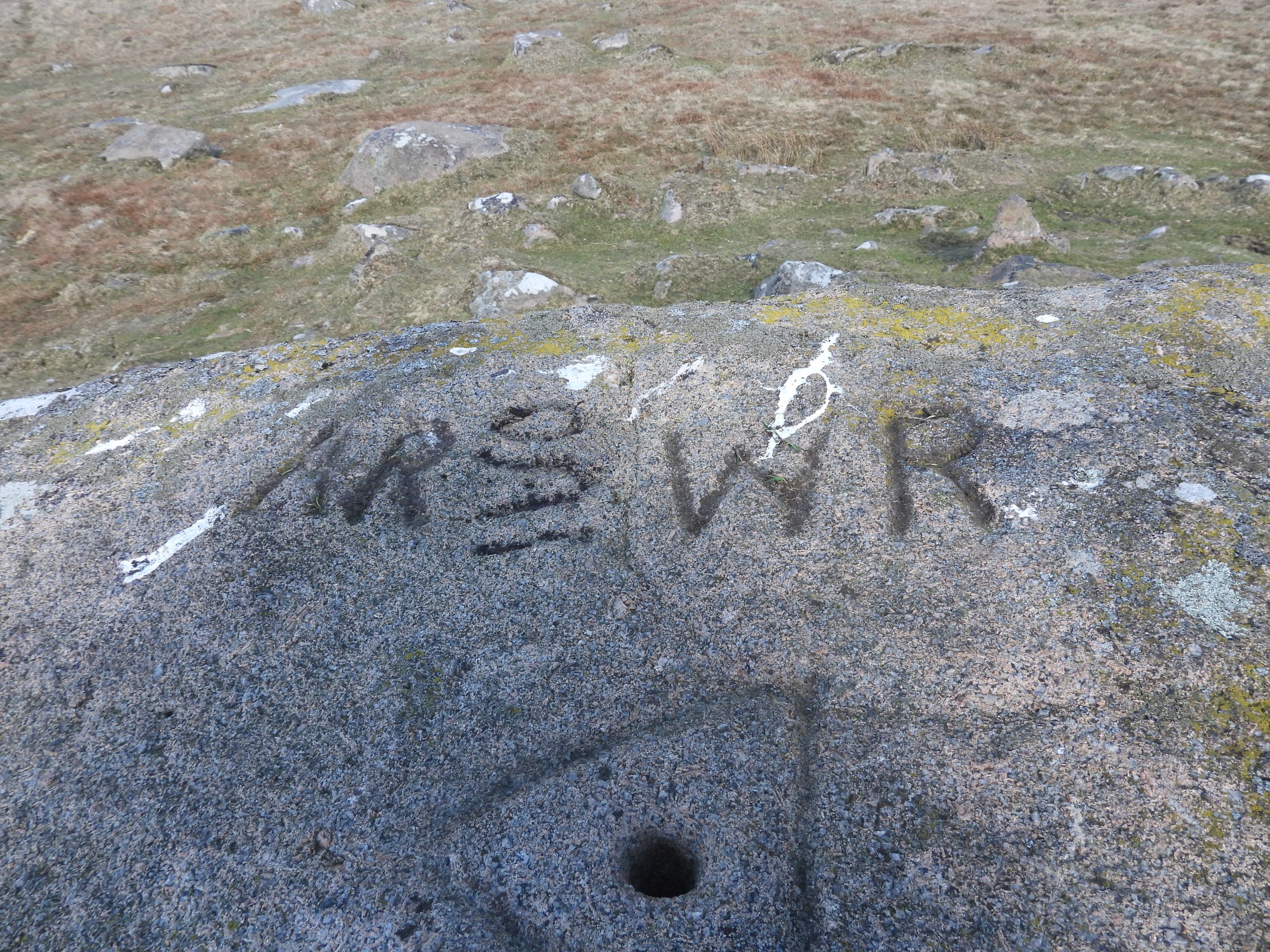
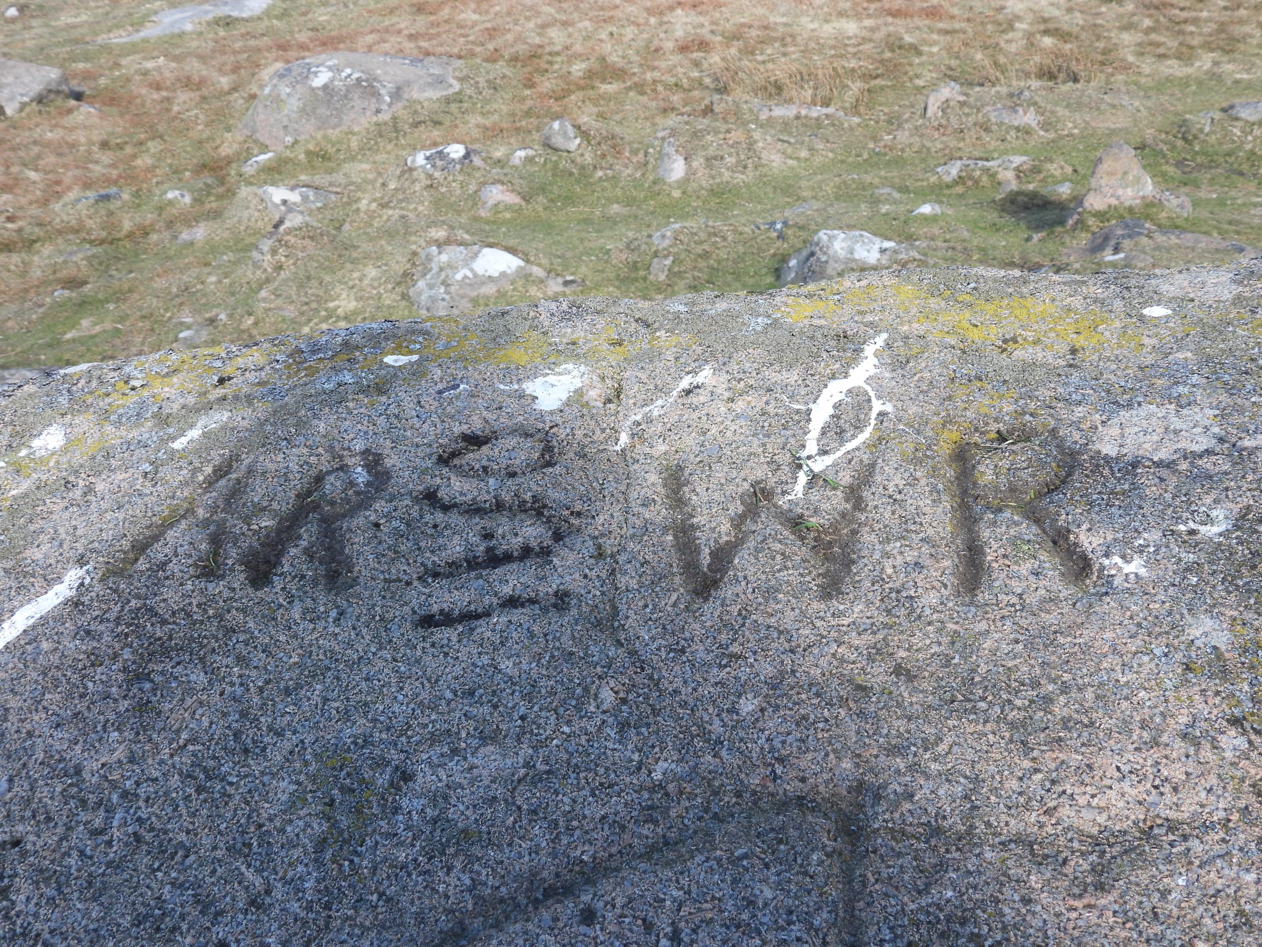
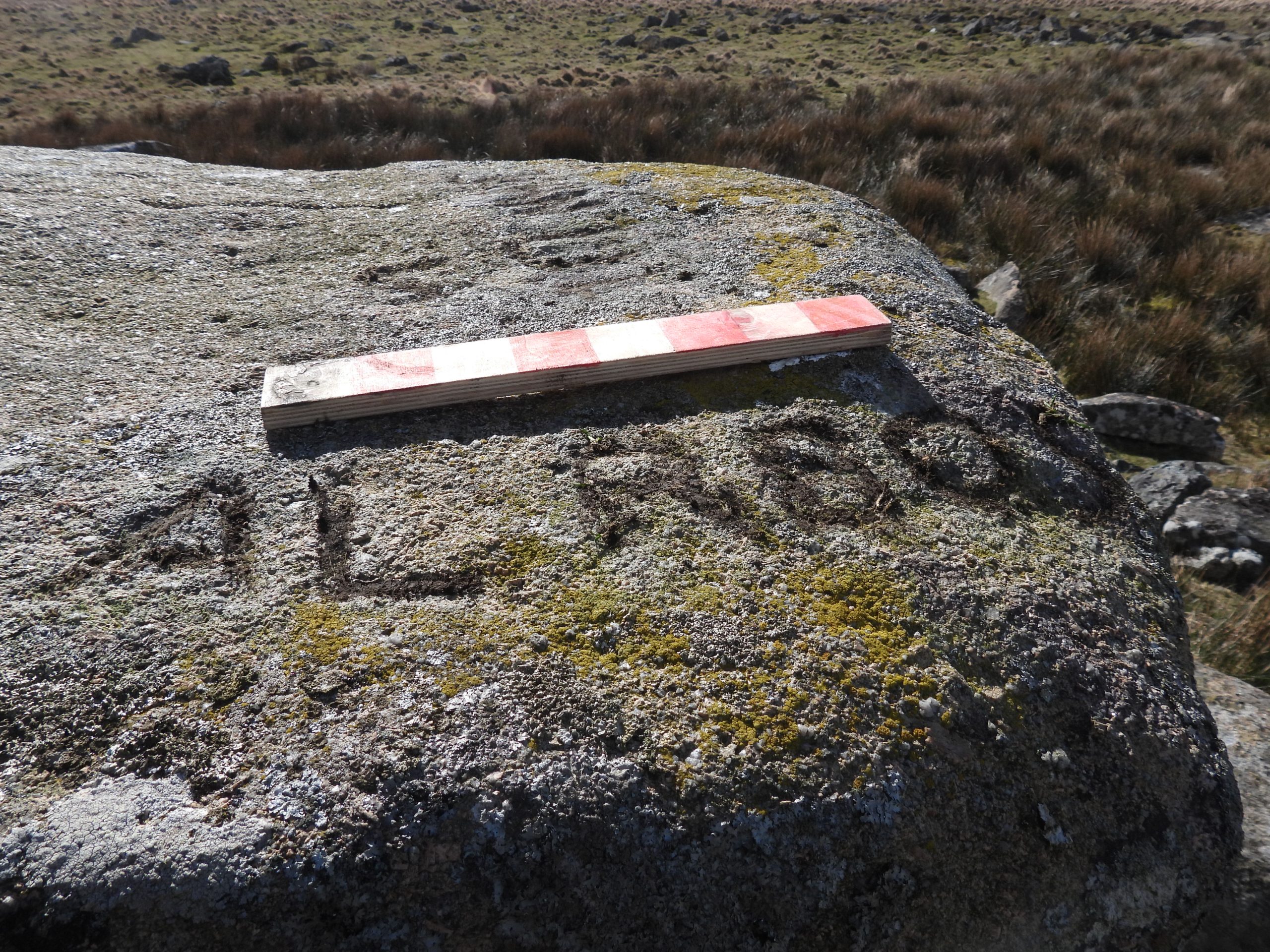
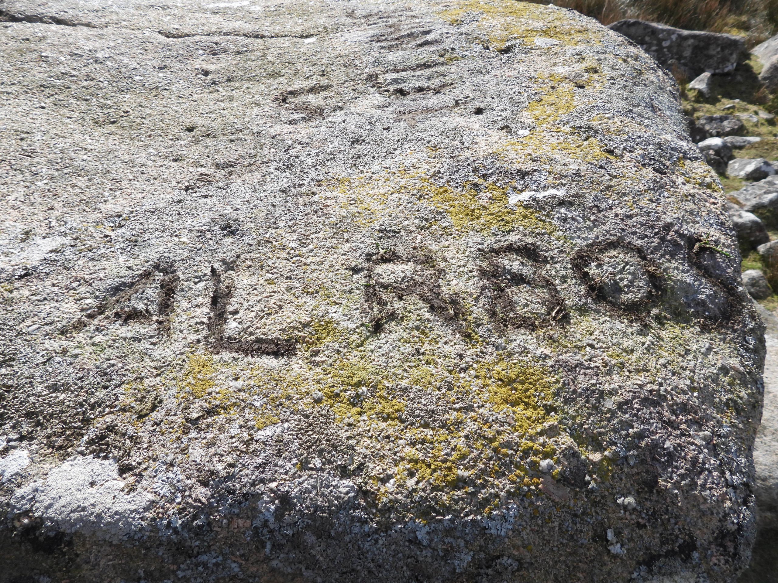
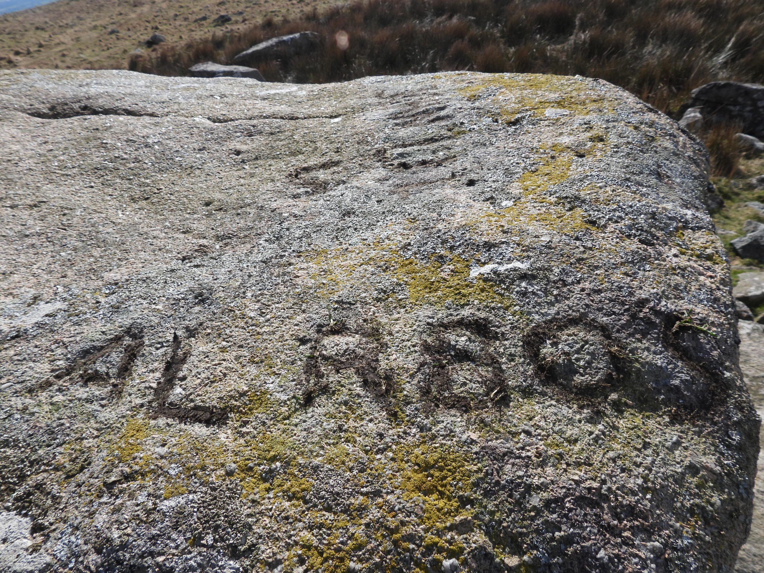
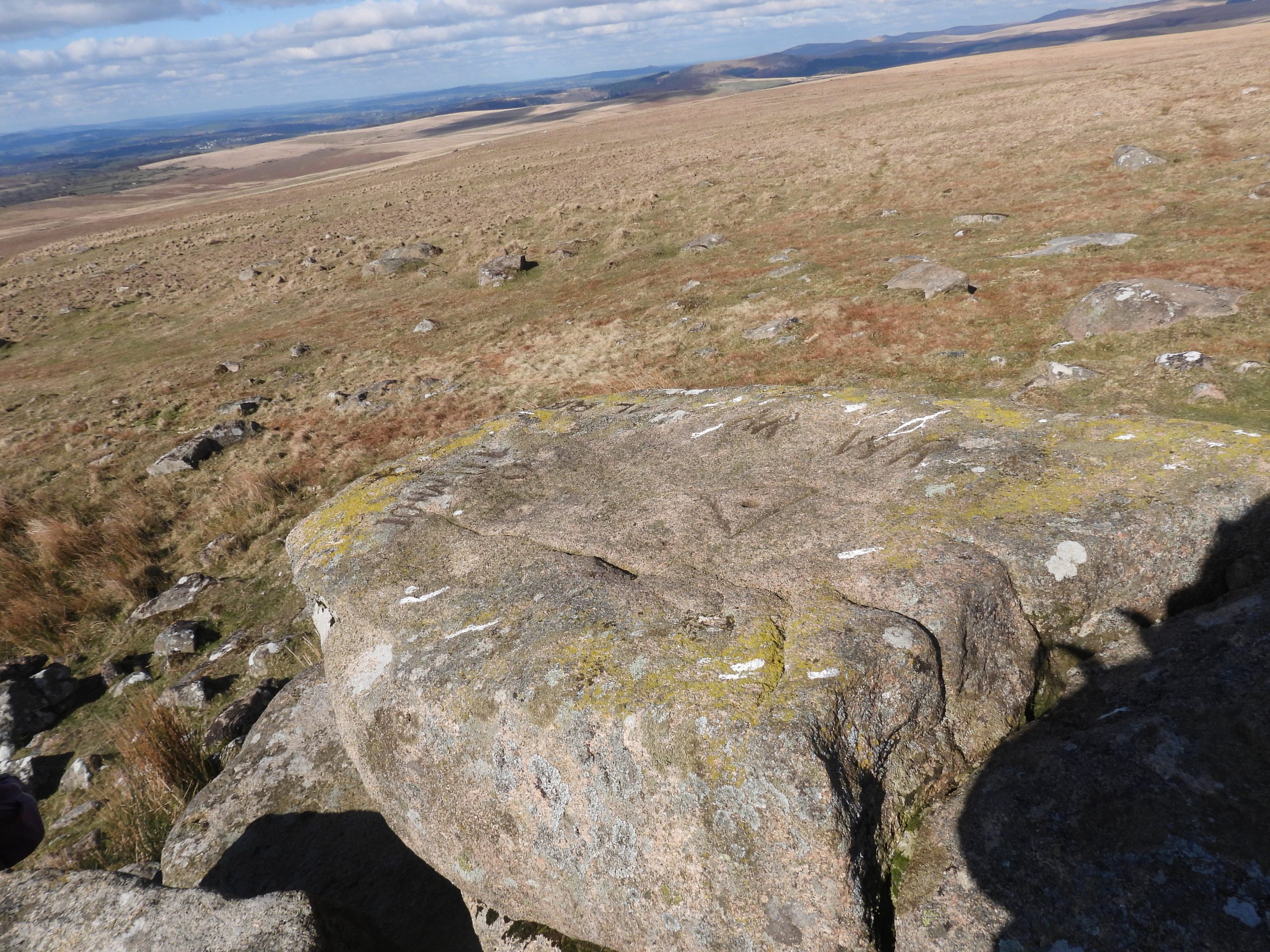
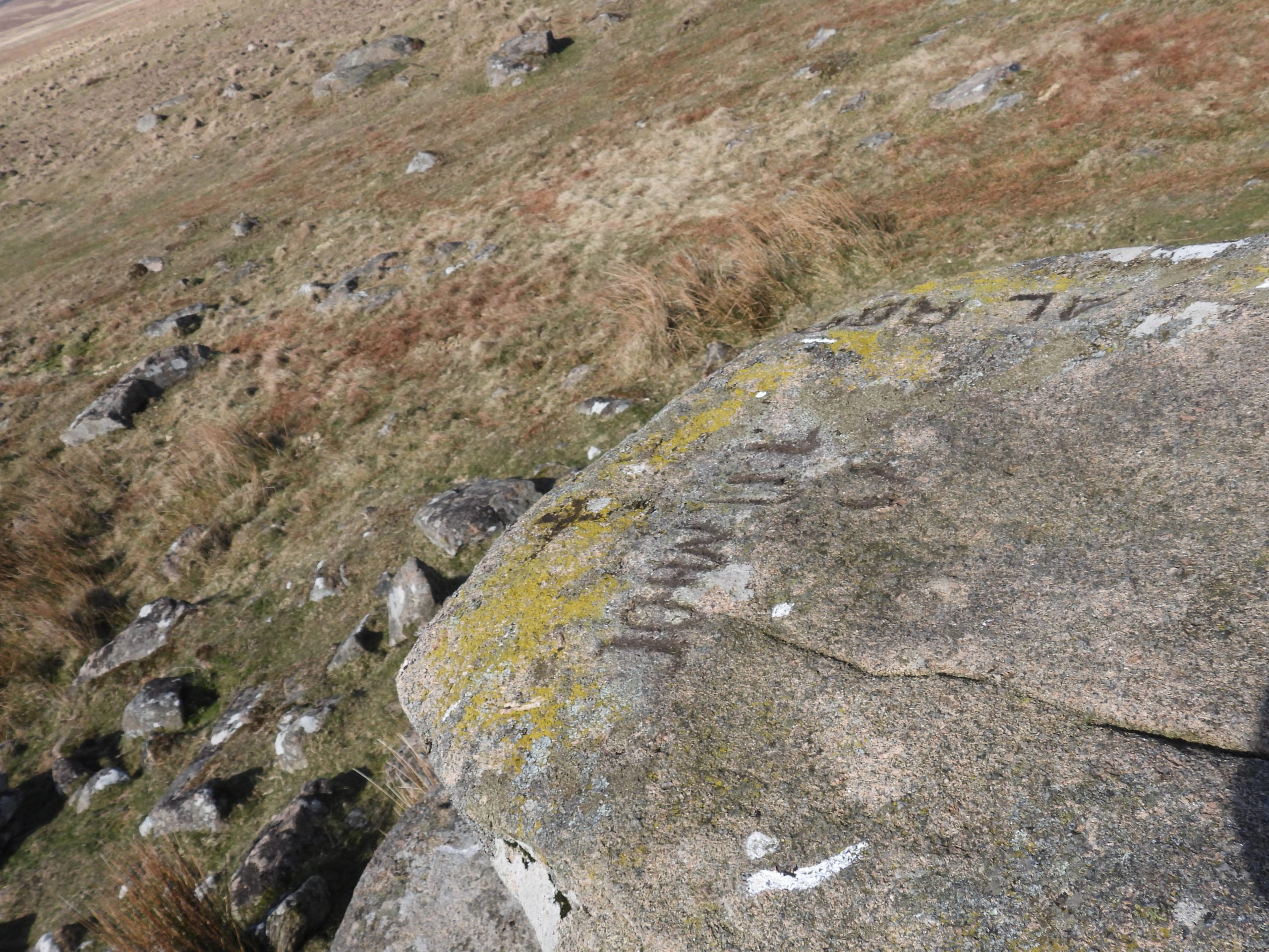
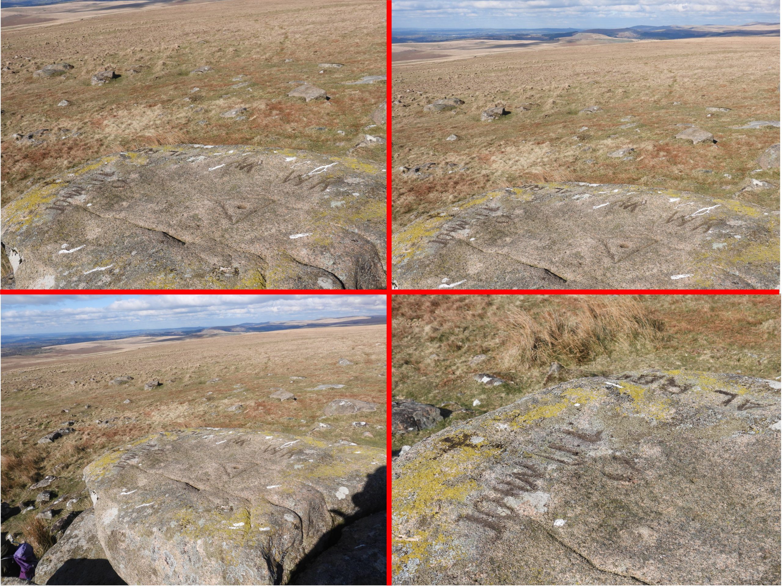
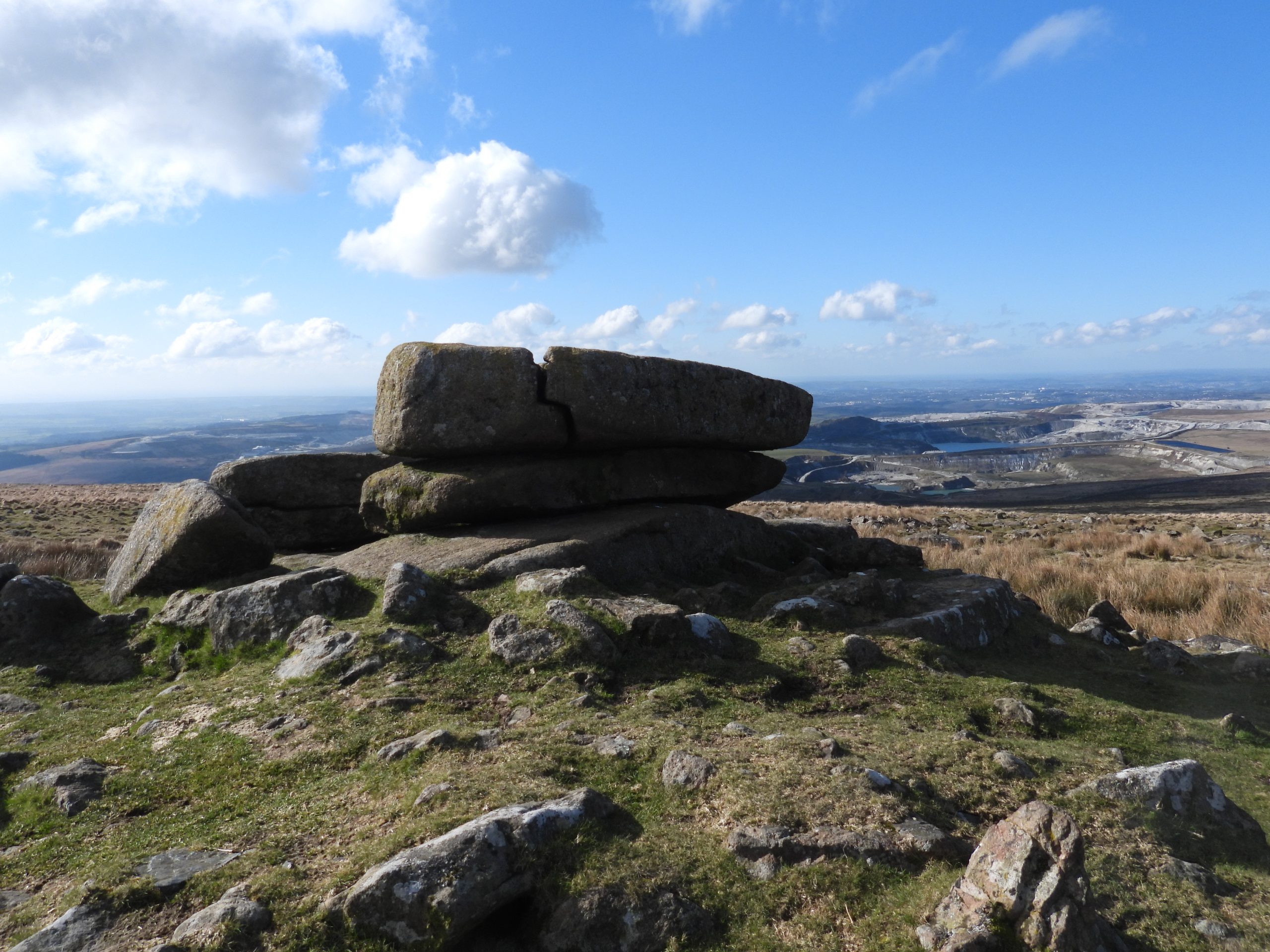
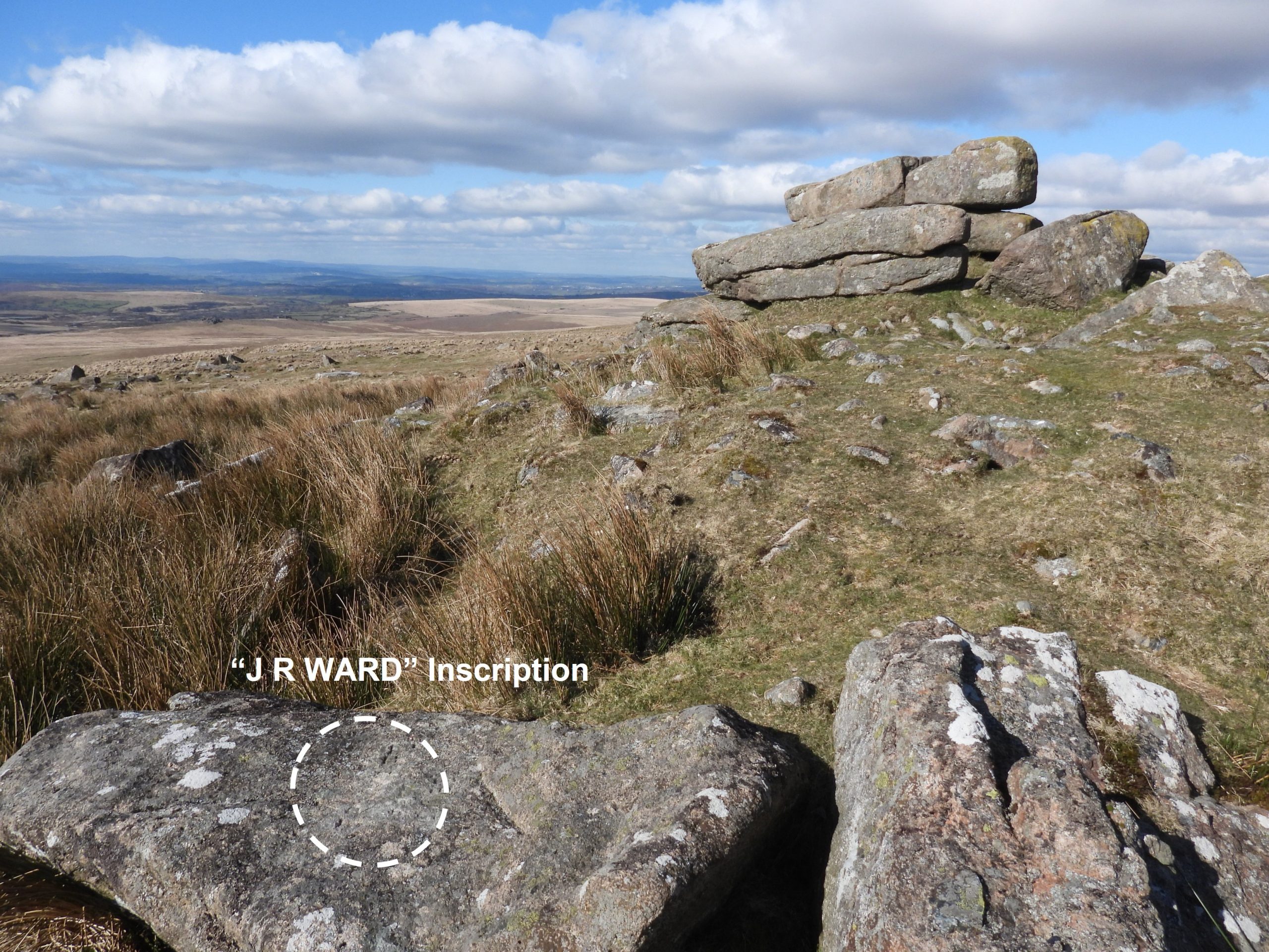
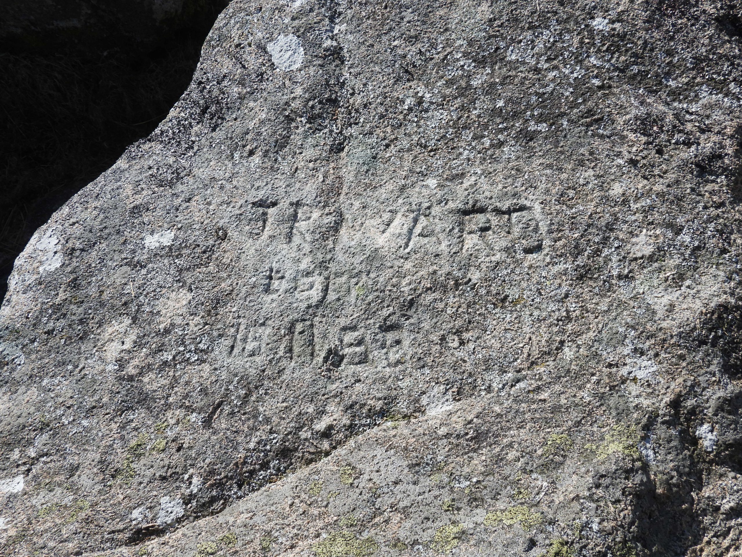
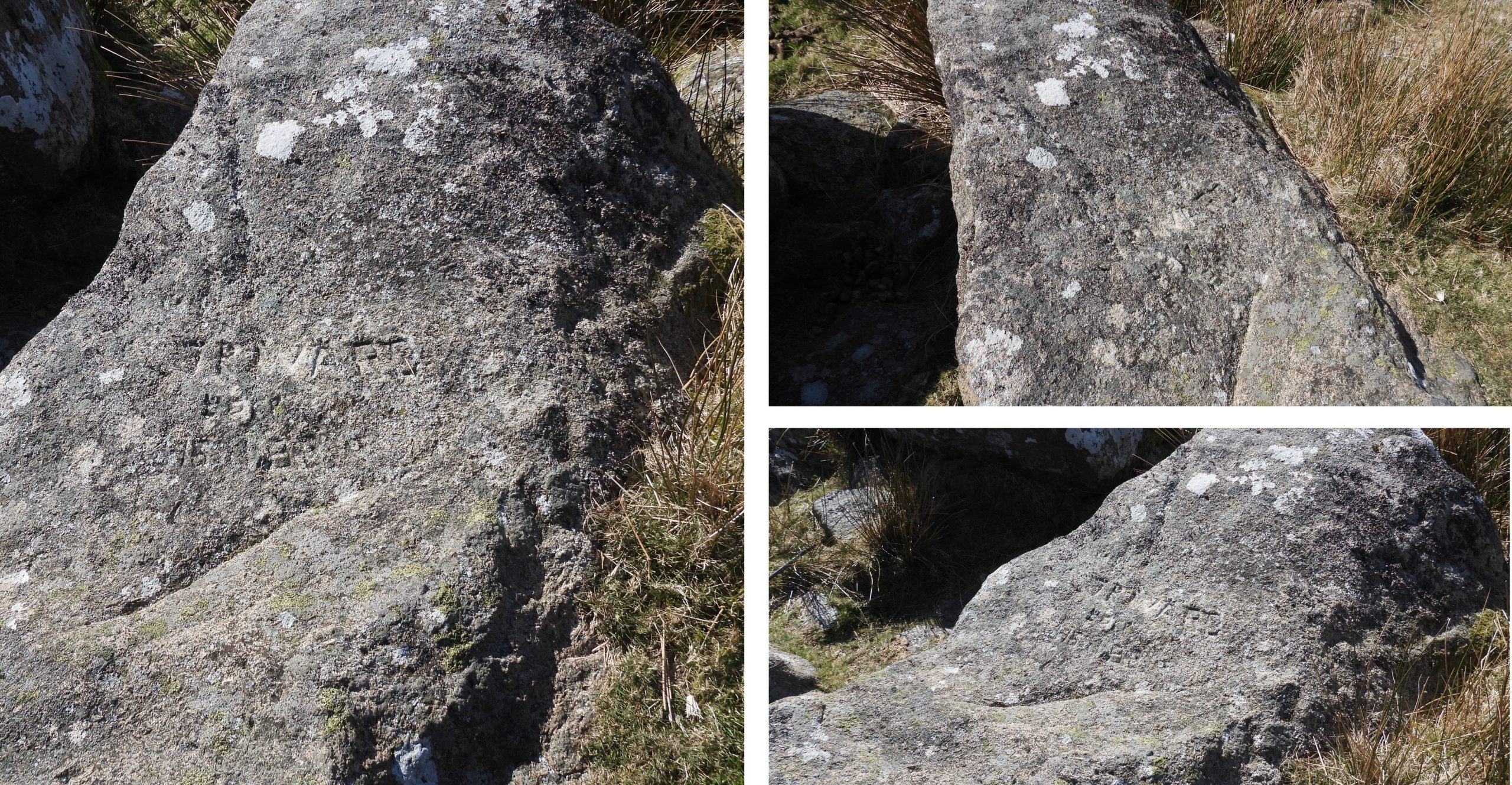
The top block on Shell Top contains most of the inscriptions, which have been annotated on the above photograph. The block is split (naturally) in two. The western half is the larger of the two and contains the majority of inscriptions. Tom Greeves speculates that the inscriptions most likely date from 18th or early 19th centuries.Shell Top lies on the boundary between the parishes of Cornwood and Shaugh Prior. That said, there doesn’t appear to be any (known) evidence to link this fact with any of the inscriptions.View from Shell Top to the south. Eric Hemery in High Dartmoor (Page 211) eulogizes thus: “Views to the north-west are tremendous. At one glance the entire china-clay industry of south-west England can be seen: Shaugh Moor, Lee Moor, Cholwich Town Waste, Heddon Down and Cornwall’s St Austell Moor. In the north, the vista of valley-folds and ranges of hills and tors is itself worth the long but steady climb to the summit.“On the eastern half of the top block, at the eastern edge of its upper surface, Tom Greeves describes an incised ‘mark’ which looks like a monogram combining a “T” and a “P”. Even with the low winter sunlight. this incised mark is barely discernible as can be seen from the above photograph.To assist in finding this incised mark, it is described as being about 17cm high. In the picture, each graduation on the above rule is 5cm, thus the mud painted mark looks to confirm Tom Greeves’ measurement.The “T” / “P” monogram does take a little time to find as it has only very shallow incised marks. Reading the rock (like braille) does help with identifying these marks.Contextual picture of the “T” / “P” incised markTom Greeves from his letter, 3 decades ago, references another set of inscriptions on the eastern top block. He describes two letters “PP”, only 6cm high, finely incised on its vertical southern face, with a possible “I”, 5cm high, set below and to the east of it. After extensive searching the author could not conclusively find these inscriptions, albeit there were one or two possible candidates.Now to look at the western half of the top block. On the upper surface there are some very obvious and some less obvious inscriptions. Without any mud painting to accentuate the inscriptions, with a casual glance many could be missed.The most obvious feature on the upper surface of the western half of the block is small socket hole, which is surrounded by an incised triangle. It is speculated that a danger (red) flag once flew from the spot in war time to warn of firing.At the west end of the western block, Tom Greeves recorded that there is an inscribed name “JOHN”. With the low winter sunlight, this inscription can just about be discerned without need for ‘mud painting’.The name “JOHN” is said to the followed by a gap then a “D” or an “O” then the letters “IL”. Initially the author mud painted the “JOHN” and the “IL”.The overall length of the inscription is said to be 48cm. The author recorded it as being of similar length but did struggle to confirm the “D” or “O”. The letters are around 10cm tall.Contextual view of the inscription.With a bit more mud, the author thought there may well be a “S” (side on to the main inscription) and there is the outline of a “U” (is this the Tom Greeves “O” or “D”). Although the author was unable to 100% correlate the findings with those of Tom Greeves, 30 years earlier, he was satisfied the location of the inscription had been confirmed.Just to the west to the “JOHN” inscription is an incised cross (“+”), which the author assumes is the one found by Dave BrewerThe most obvious inscriptions on the western half of the top block, near its northern edge are the initials “AR” and “WR” (when read from the south). They are close to then inscribed triangle and the socket hole. The initials “AR” are 11.5cm tall and the “WR” initials are 16cm tall. These letters have ‘serifed’ feet.The author noted that the surface between the “AR” and “WR” appeared to (potentially) have more inscriptions, which if read from the west read “OAI”. This area could, of course, just be a natural part of the boulder and not be an inscription at all.Close up of the “AR”, “OAI” and “WR” inscriptions.The next set of inscriptions are located on the upper surface of the north west corner of the western half of the top block. The shadows in the above picture indicate that there does appear to be an inscription here but it is difficult to read. Using the Tom Greeves reference, the author was able to ‘mud paint’ and confirm the inscription reads “ALRBO” then a “S” or reversed “2”. Interestingly the original Greeves reference didn’t include any gap between the “L” and the “R”, which the author is inclined to believe there is. The inscription is 58cm long and the letters are 10cm high.The author suggests this inscription is “AL” then “RBOS”. The “B” might be an “8”The “AL” then “RBOS” is best viewed from the north.Contextual view of the western half of the top block on Shell TopThe “+”, “JOHN O IL” and “AL RBOS”General views of the western half of the top block on Shell Top.Shell Top as viewed from the westShell Top as viewed from the north.Views from on top of the outcrop towards the English ChannelWhilst in the area, the author (to be honest the authors walking companion) stumbled across another inscription on a rock to the south east of the main outcrop. The rock is at SX59757 63795The inscription on the rock is split into three lines, thus: “JR WARD”; “born”; “18 11 88”. The author is confident the top line reads “JR WARD”. The second line is less discernible and the inscription “born” is guessed at. The third line does look like a date “18 11 88”. The inscriptions do look ‘modern’ and likely to be late 20th century (1988 ?) or early 21st century. If anyone reading this post can add any more information to this or any of the other inscriptions the author would be most grateful in receiving this.