A collection of walks, discoveries, insights and pictures of exploring Dartmoor National Park
April 1, 2024
Croftshead Farmstead
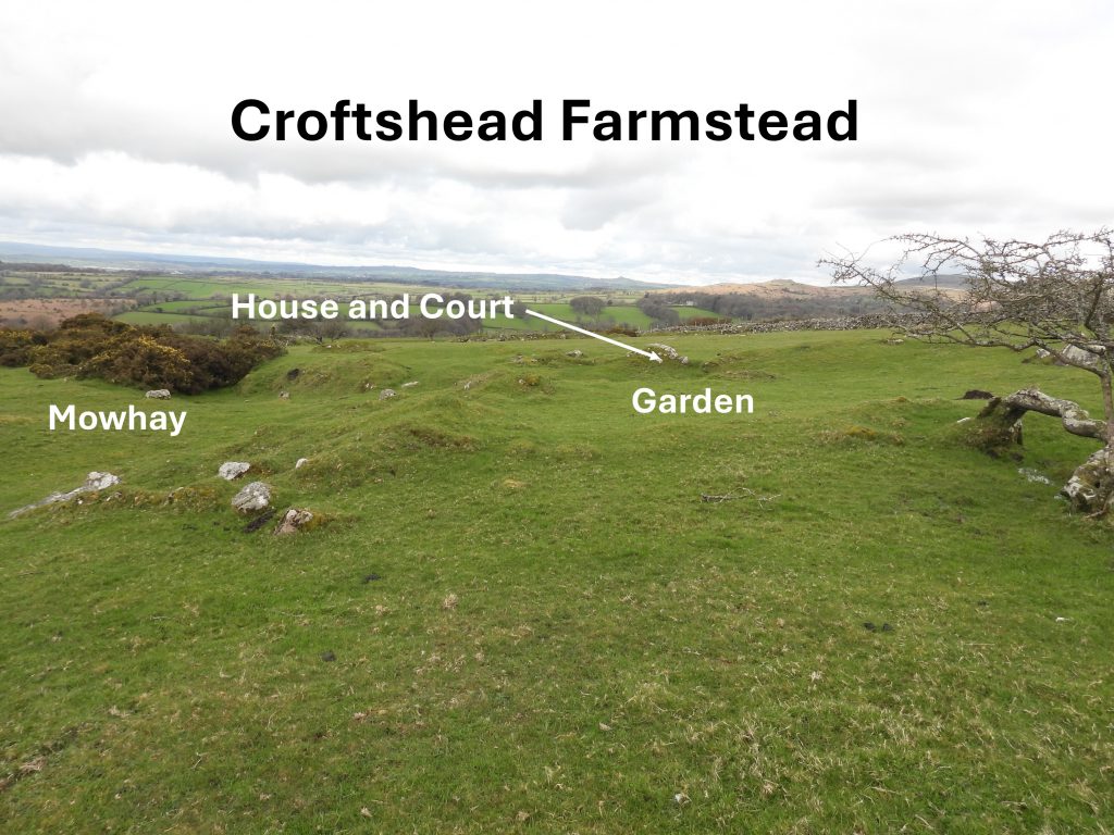
Croftshead Farmstead is depicted on the Tithe Map; 237 and 271 through 277 on the Walkhampton Apportionment. That said, there appears to be very little known or recorded about it.
Some information was provided by R.G.Haynes, who surveyed the farmstead in March 1966 and recorded that the farm site has been “almost ploughed out of existence”. Additionally to this, the Royal Commission on the Historical Monuments of England, have recorded that the farmstead was ‘not visible on 1947 Royal Air Force vertical aerial photographs’.
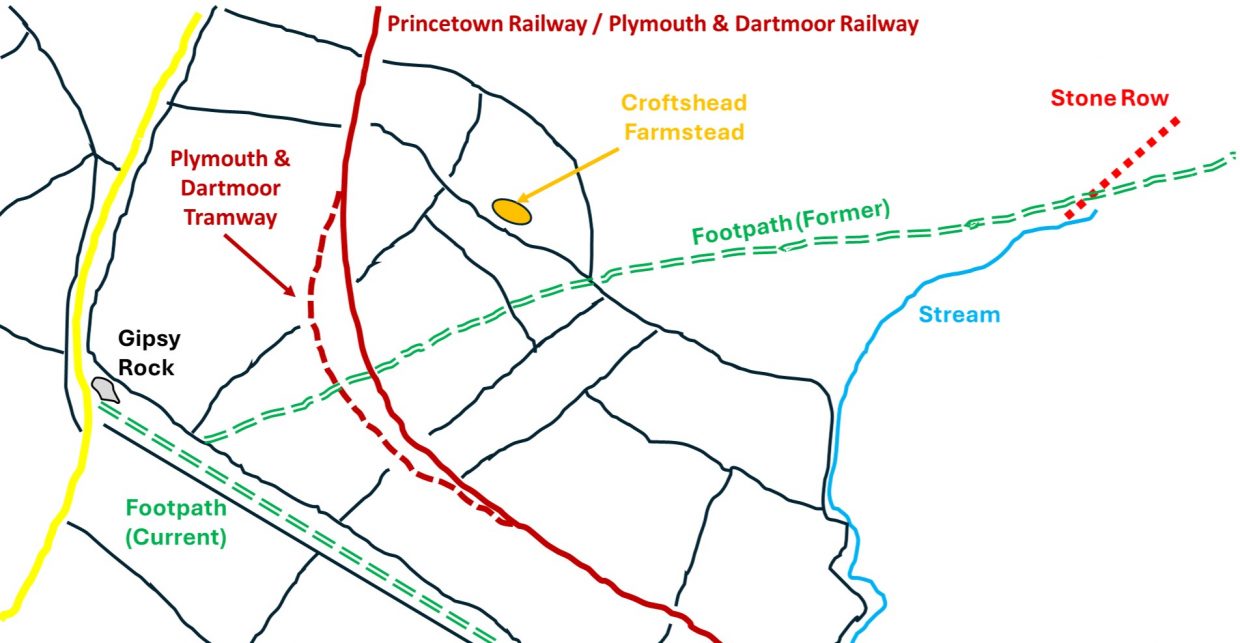
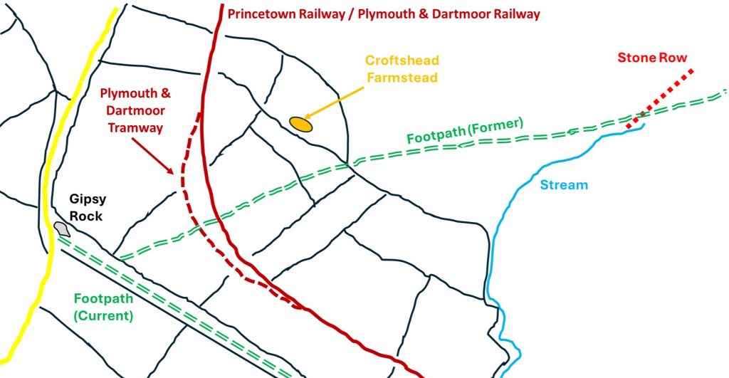
Intrigued by this vague information, the author set about investigating this apparent little known farmstead further. This post is a photographic record of what remains of this farmstead and what information the author has managed to find. The post also looks at some of the artefacts in the immediate area. The farmstead lies between the open moor and the former Plymouth and Dartmoor Tramway / Princetown Railway track and not far from a (former) footpath, which leads to an unlocked gate close by.
Bibliography
Haynes, R. G., 1966-1969, Ruined Sites on Dartmoor, 27 (Un-published).
Butler, J., 1994, Dartmoor Atlas of Antiquities: Volume Three – The South-West, 43; Map 45, Figure 45.6
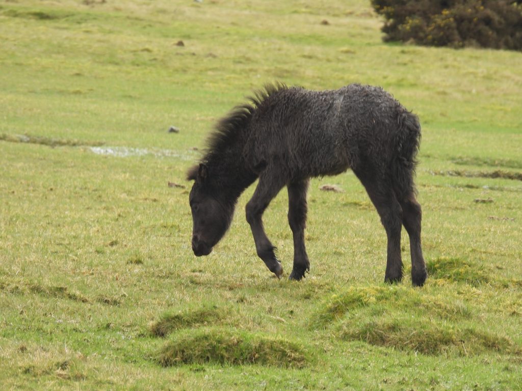
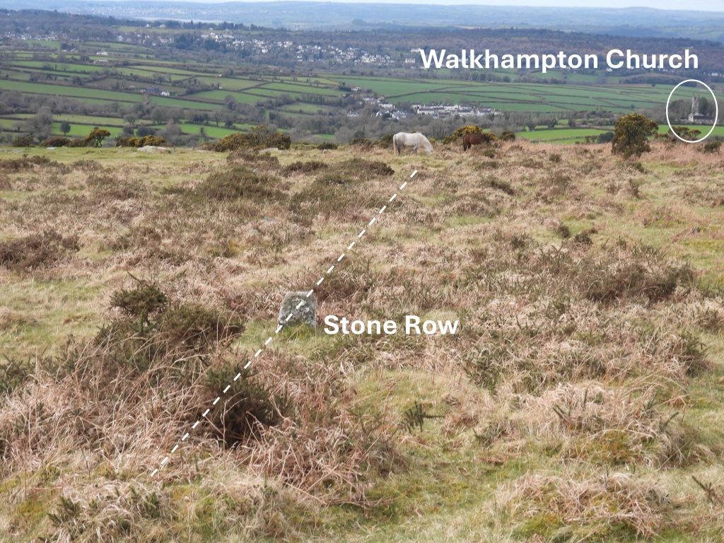
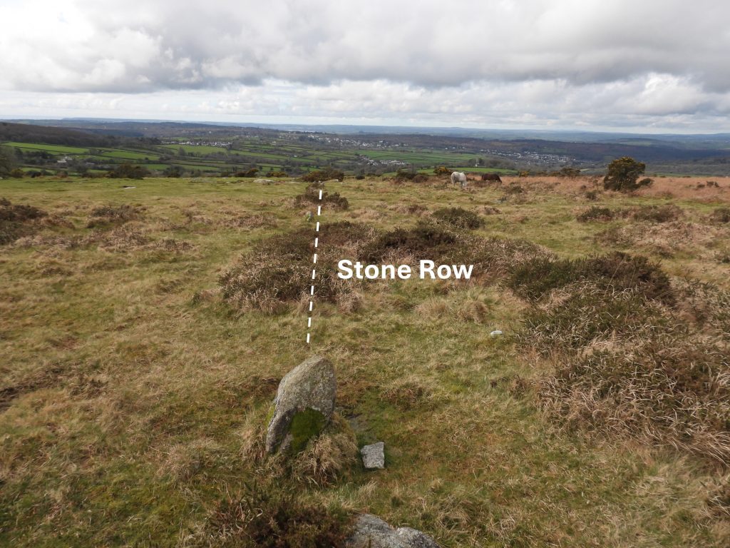
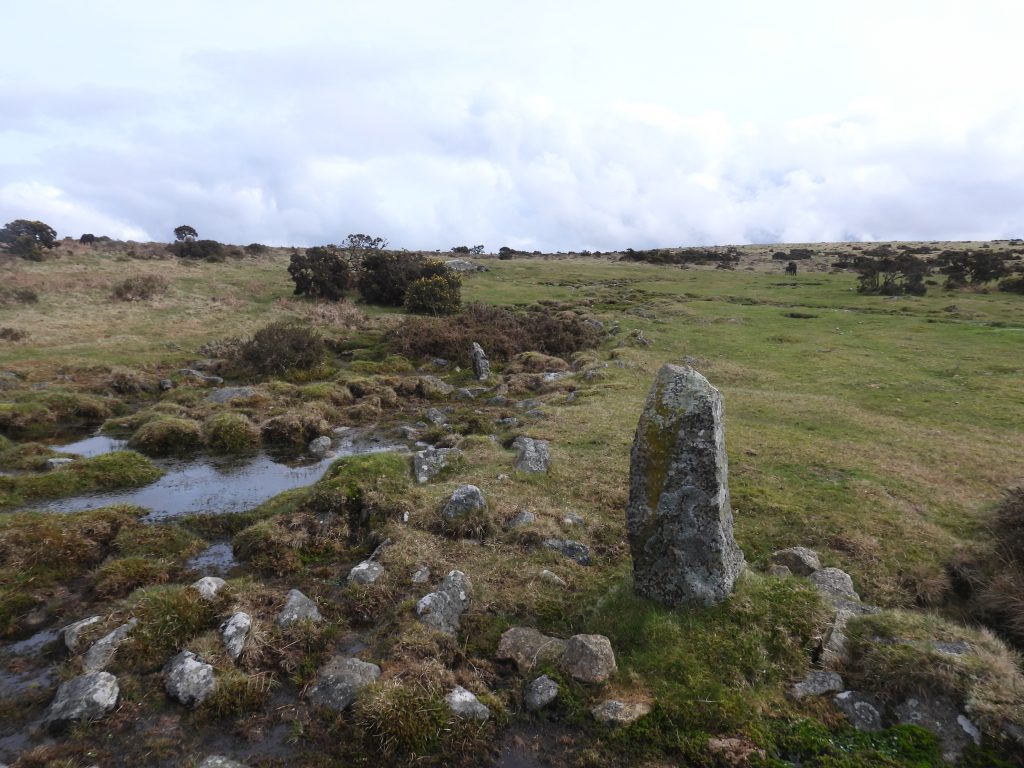
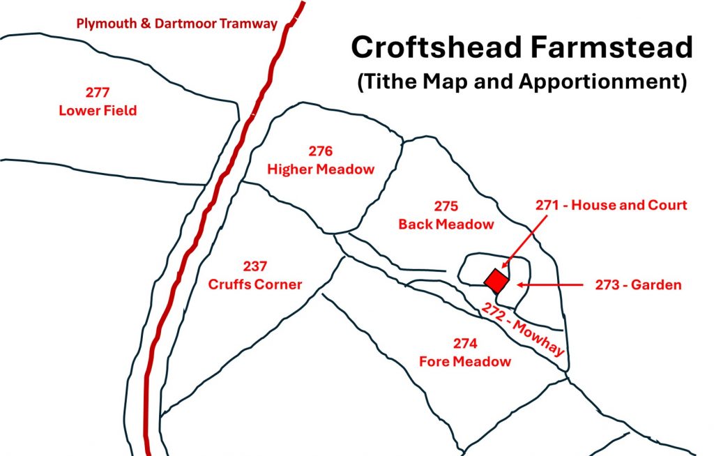
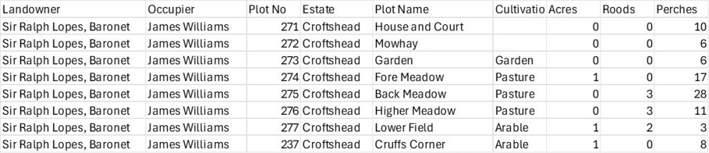
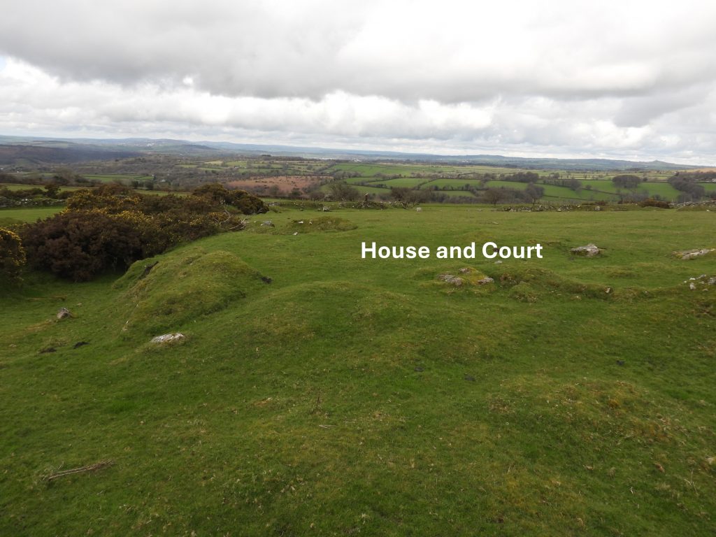
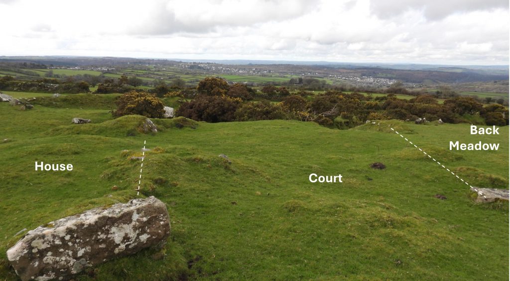
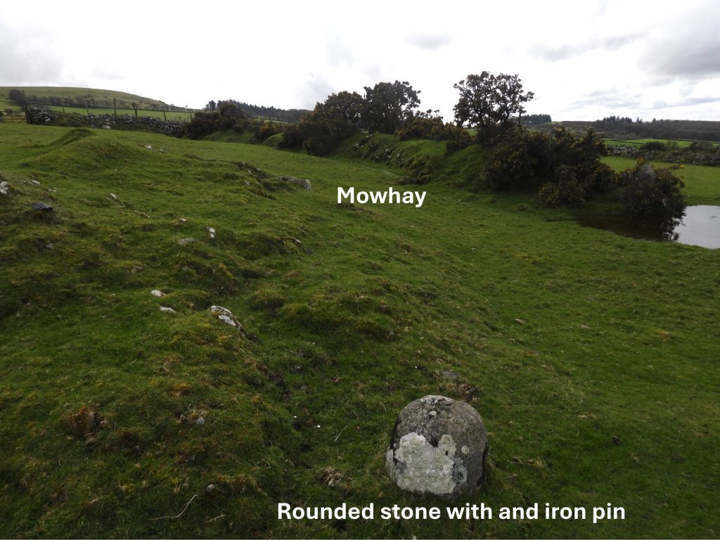
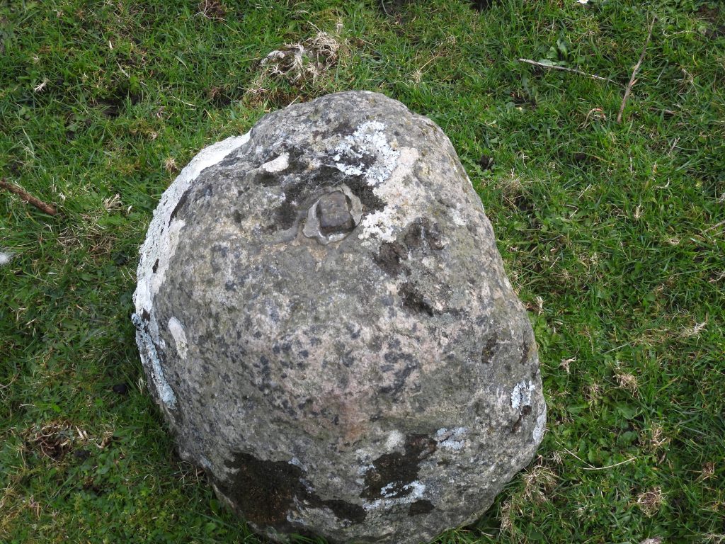
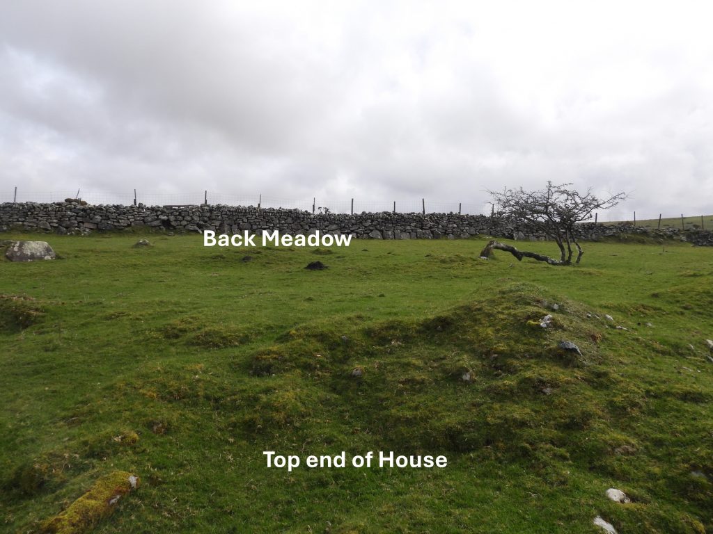
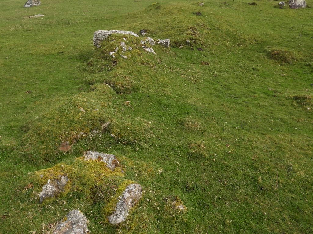
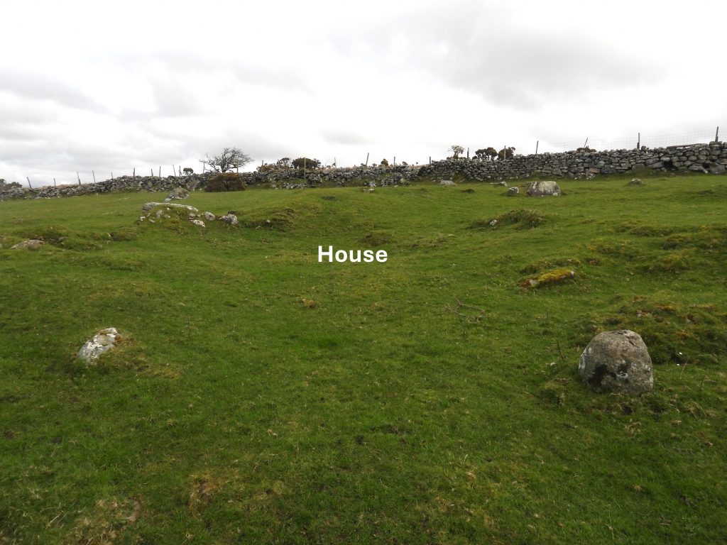
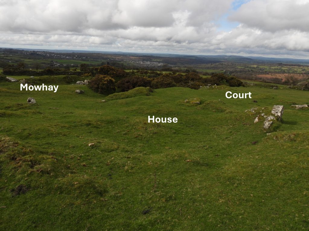
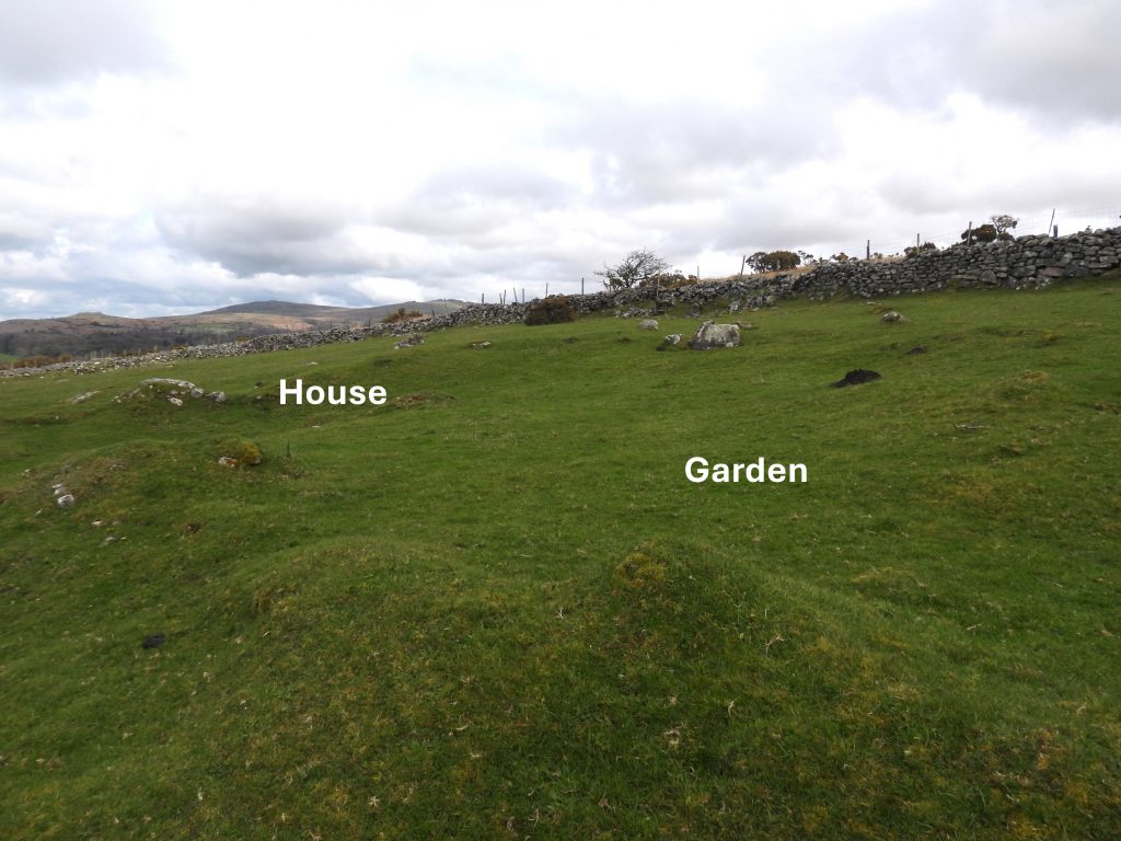
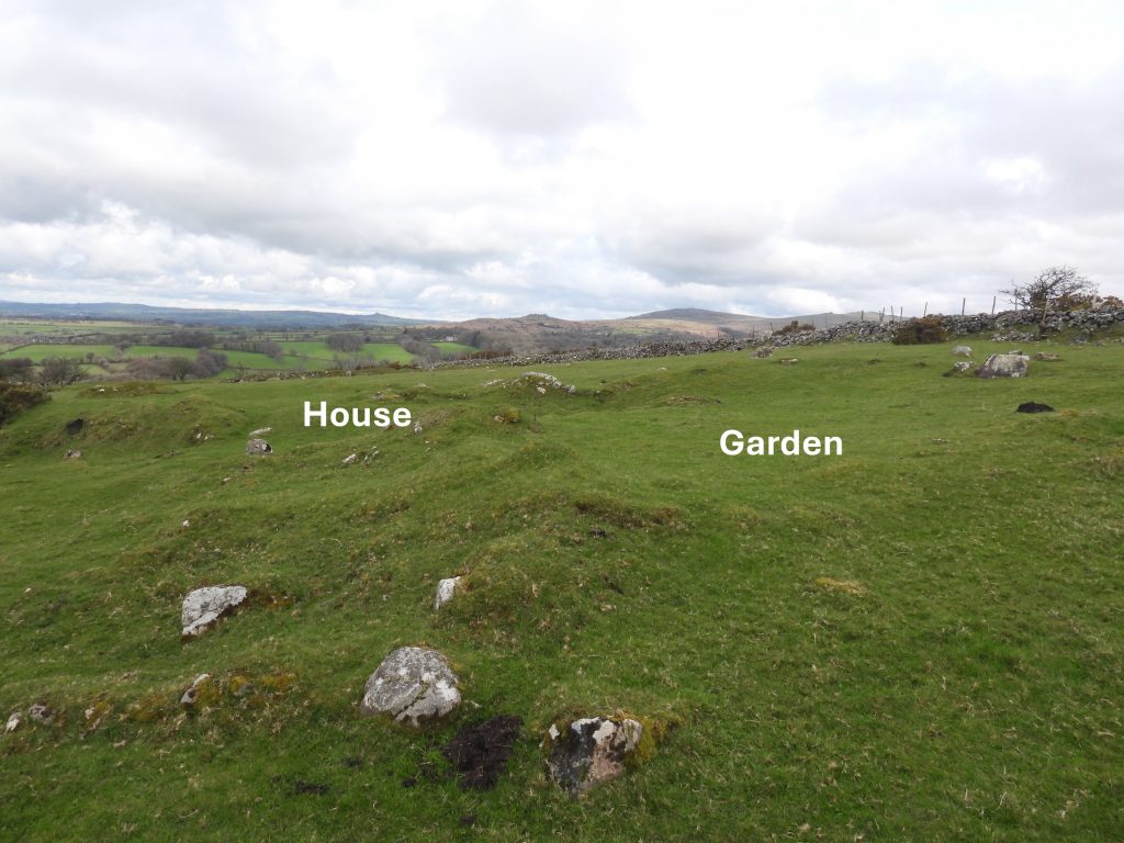
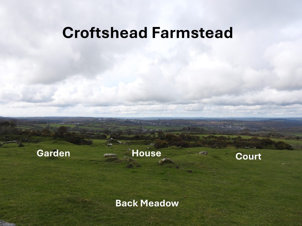
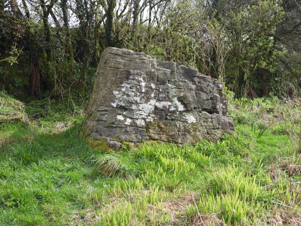
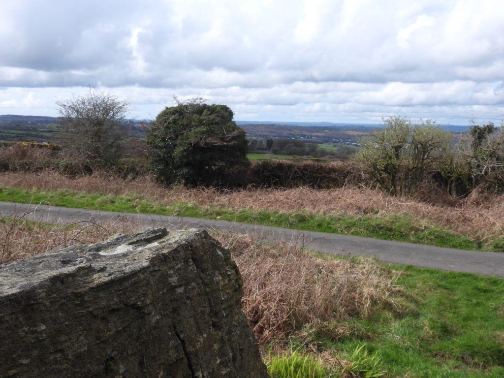
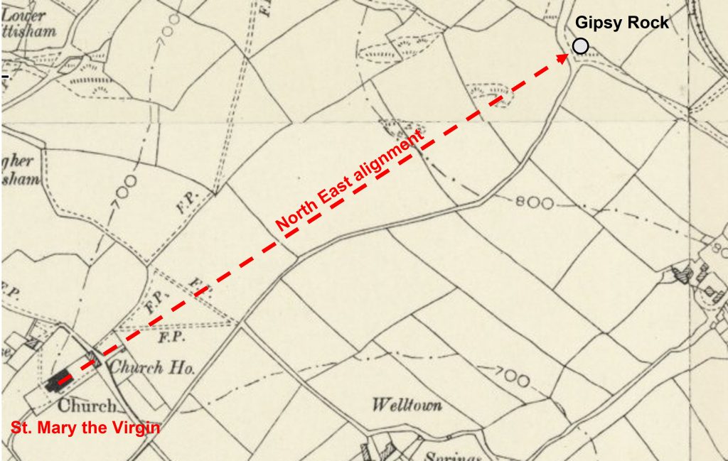
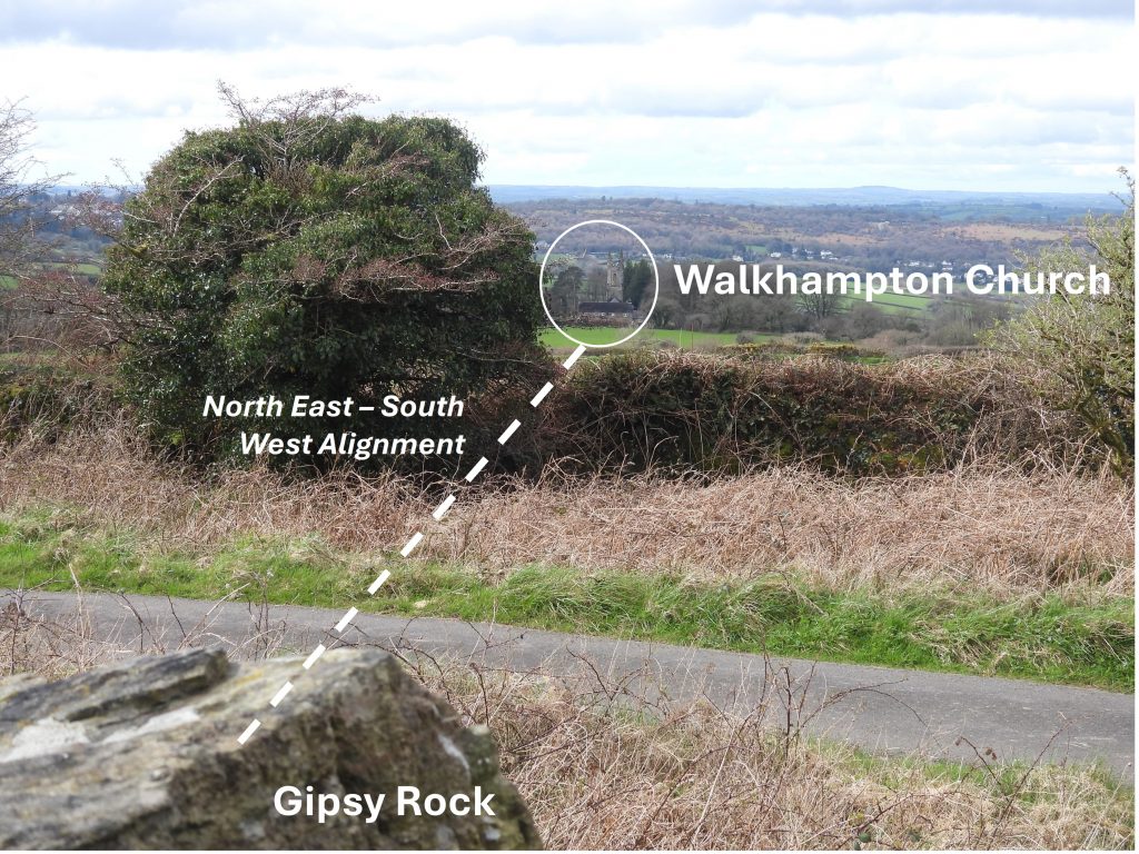
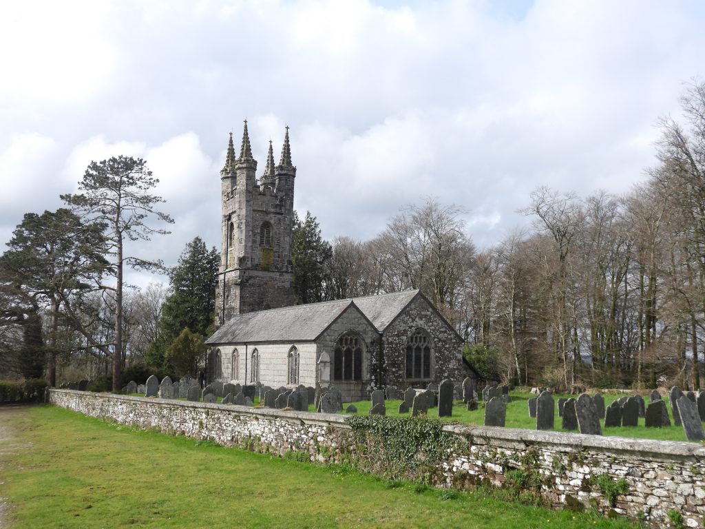
Sketch map of the location of Croftshead Farmstead and the features in the locale. The farmstead was probably entered from the north-west by a sunken lane which leads up to the site from the old Princetown railway line, which in 1840 was the Plymouth and Dartmoor TramwayYoung foal near to the stone row which lies 600 metres north-east of HorseyeattThe stone row north-east of Horseyeatt is located near to five cairns, two stone hut circles and a length of reave. Jeremy Butler in Dartmoor Atlas of Antiquities: Volume Three – The South-West, records: “Starting at a cairn uphill it (the row) descends for 132 metres to a tall pillar 1.2 metres high marking the lower end and by far the largest stone in the row”.The stone row, in spite of having between over 40 stones (mostly single, some double), is difficult to discern as much of the row is covered by vegetation.The lower (south west) end of the alignment there is a large upright stone standing 1.3m high. The author can recall being on a guided (night) walk with Ted Burkett-Dixon* in the 1990’s who told a story of this stone being reset. He said that when it was returned upright there was a definitive ‘click’ as it as returned to its vertical position. This most likely took place in the 1940s or 1950s. * Ted was the recorder for Devonshire Association (Barrow Reports) the following the death of Richard Hansford WorthSketch of Croftshead Farmstead and field systems as depicted on the tithe map and apportionment (Walkhampton Parish). The (former) footpath passes across 274 – Fore Meadow, entering the enclosure at the south east ‘point’ of 272 – MowhayOn the tithe apportionment the farmstead was occupied by a James Williams with (unsurprisingly) the land owner being Sir Ralph Lopes (2nd Baronet of the Maristow Estate). The field sizing uses acres, roods and perches. There are four roods in an acre and 40 perches in a rood.Haynes description of the farmstead is very apt insofar as the site has been “almost ploughed out of existence”. In spite of this, all the tithe apportionment boundaries can still be seen. The picture is taken slightly to the west of where the (former) footpath enters the enclosure through an unlocked gate.The house and court are quite distinctive with former walls evidentHouse, court and edge of Back Meadow looking southHaynes recorded in 1966: “Near the entrance leading to the main room is an upright rounded stone with and iron pin leaded into its top, flush with the granite. Probably used for holding a gate open”. This stone is still in situ 58 years on.The upright rounded stone with and iron pin leaded into its top is located at SX54638 70680Top end of the house, back meadow and enclosure wall (beyond which is the open moor)Croftshead House wallingHaynes record states : “The remains are very sparse; signs of one large room (6.7 by 3.7 metres)”.House, court and mowhay looking southGarden and House remains looking west across the Walkham Valley, towards Pew Tor, Cox Tor and the Staple TorsGarden and House remains looking west across the Walkham Valley, towards Bodmin Moor, Brent Tor, Pew Tor, Cox Tor and the Staple TorsView of Croftshead Farm house, garden the court from the open moorland looking over the enclosure wall looking south.Gipsy Rock. The rock is said to have possibly been the meeting place of the ‘Walkhampton Hundred’ (administrative division) in Saxon times. Walkhampton Church (which can be seen from Gipsy Rock) has an unusual feature in that it faces north-east, not the normal due east and points towards Gipsy Rock. North of east, of course, is the point of sunrise at the Summer Solstice.Walkhampton Church has a north east alignment, which is evident on 19th century maps. A crude measurement of the church orientation using 19th century maps indicates it is 50 deg east of north, which is the same as the direction of the sun at sunrise at the Summer solstice. Of course the actual ‘physical’ orientation of the church may be slightly different. Is this alignment just pure coincidence? Source: A brief guide to St. Mary the Virgin, Walkhampton by Peter Hamilton-Leggett.Walkhampton Church (St. Mary the Virgin) was struck by lightning in April 1889 and the north east pinnacle was sent crashing through the roof of the nave. The church was built long before the village of Walkhampton hence the unusual distance (half-a-mile) between the two. It occupies a very ancient site.