A collection of walks, discoveries, insights and pictures of exploring Dartmoor National Park
October 15, 2022
Target Railway and other military artefacts on and to the north of East Mill Tor
There are some ‘linear’ features on the northern and north eastern flanks of East Mill Tor, which were once recorded and described as leats, based on 1969 aerial photography alone. In 1993, this description was changed by the Royal Commission Historic Monuments of England following a ground based study and they are now recorded as products of military activity. It is suggested that these features are the remains of a target railway. The (probable) target railway has been partially destroyed by a military track which runs from the west side to the east side of the old ring road.
Following some further research in readiness for an detailed exploration of the area, the author discovered the area also has a couple of old redoubts / artillery target butts, some late 19th / early 20th century target supports and a short length of a turf and stone bank, all of which are of military origin. This post records the exploration of all these aforementioned military artefacts, plus the current and former Observation Posts (OPs) in the area. Additionally, the post covers a couple of features along the Black-a-ven brook, namely: a former weir and a tinners’ hut.
Sources of information for this post were obtained from the Historic Environment Record (Royal Commission for the Historical Monuments of England and Nigel Machin) and from the fabulous publication “Dartmoor Observation Posts” by John Deakins.
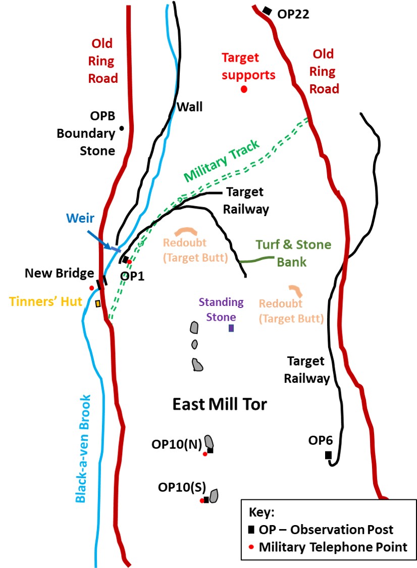
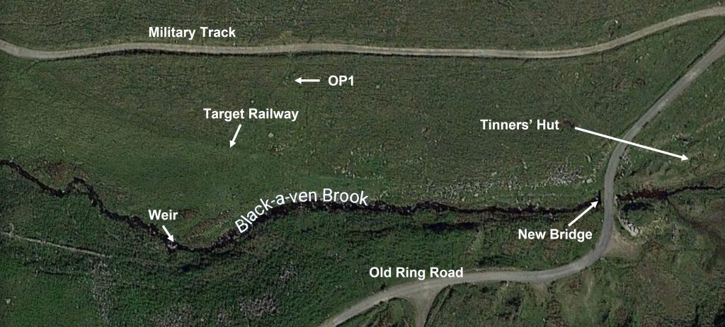
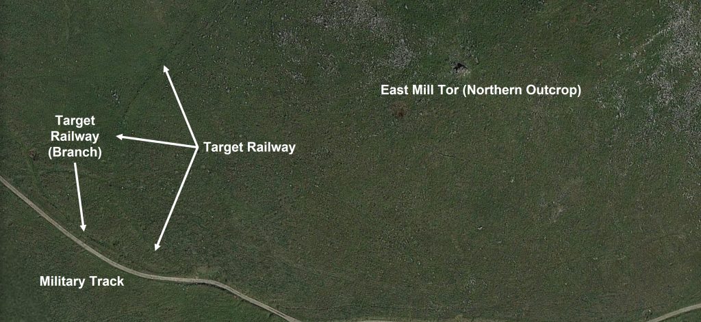
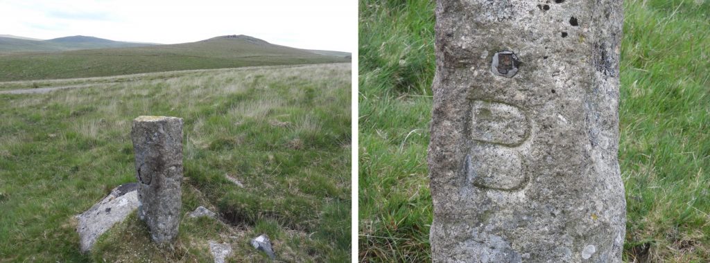
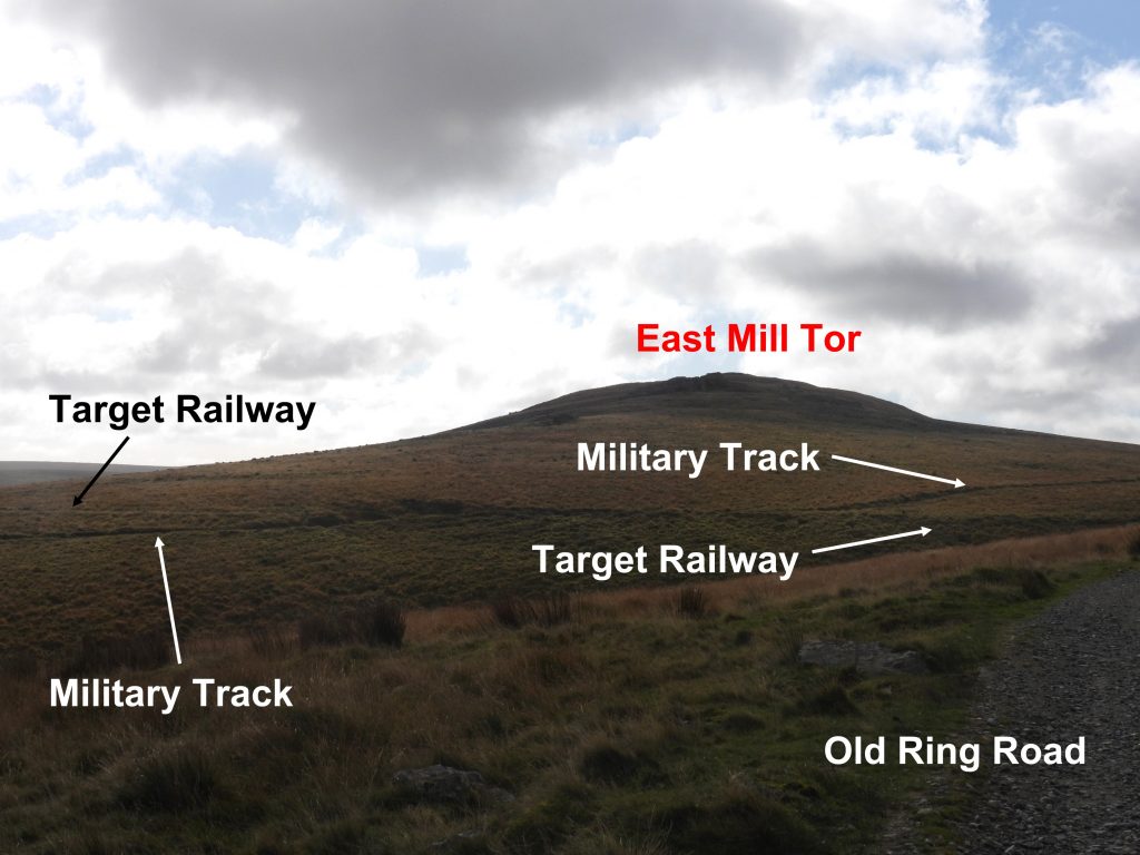
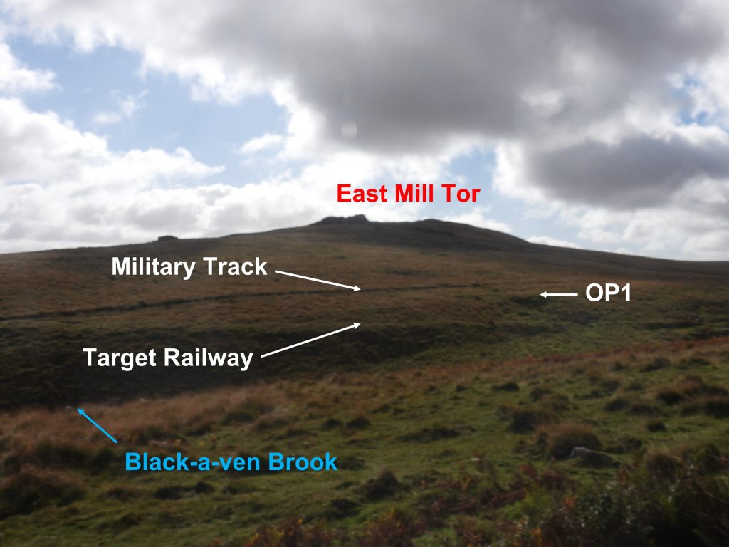
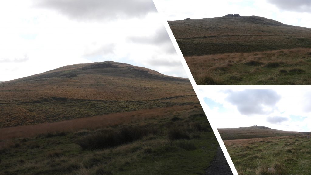
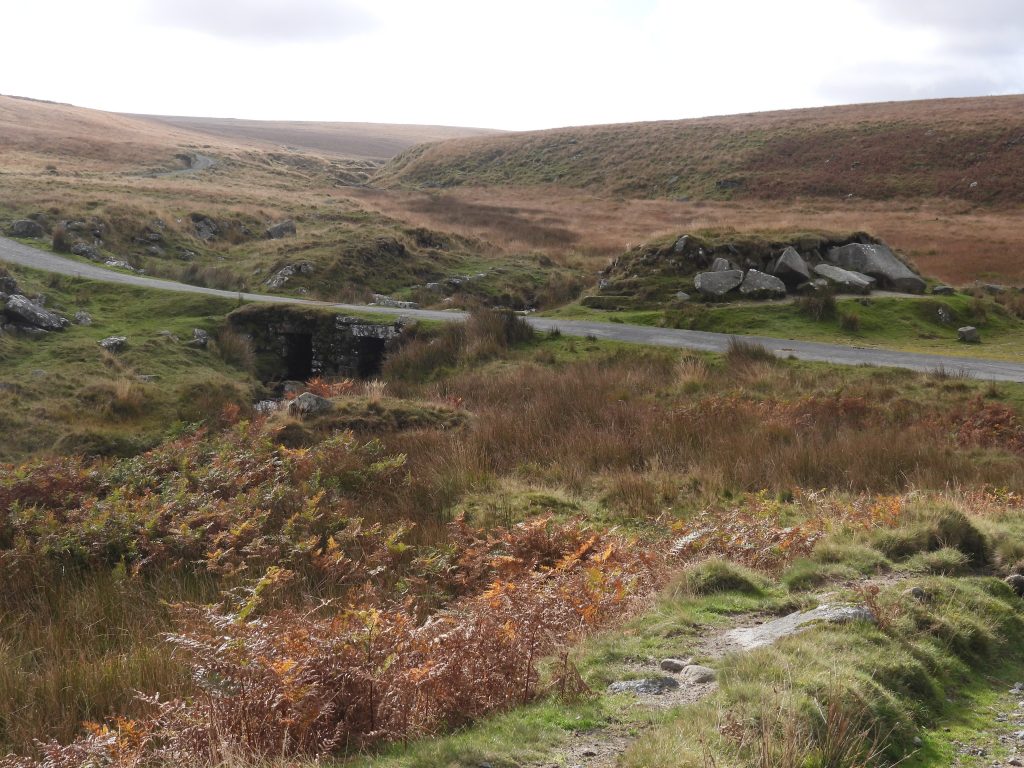
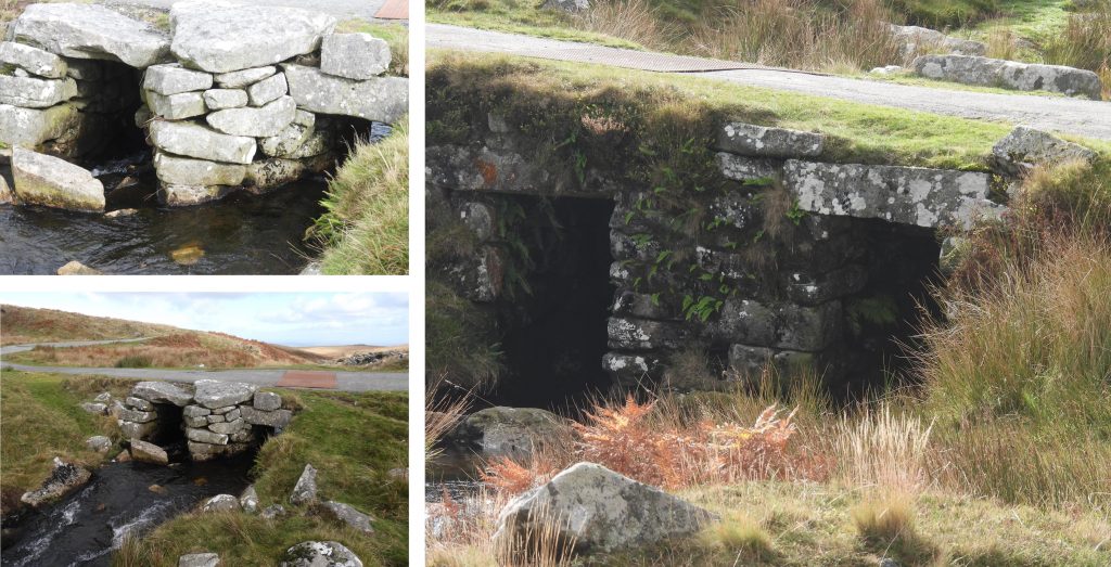
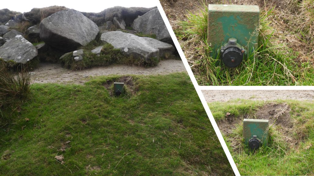
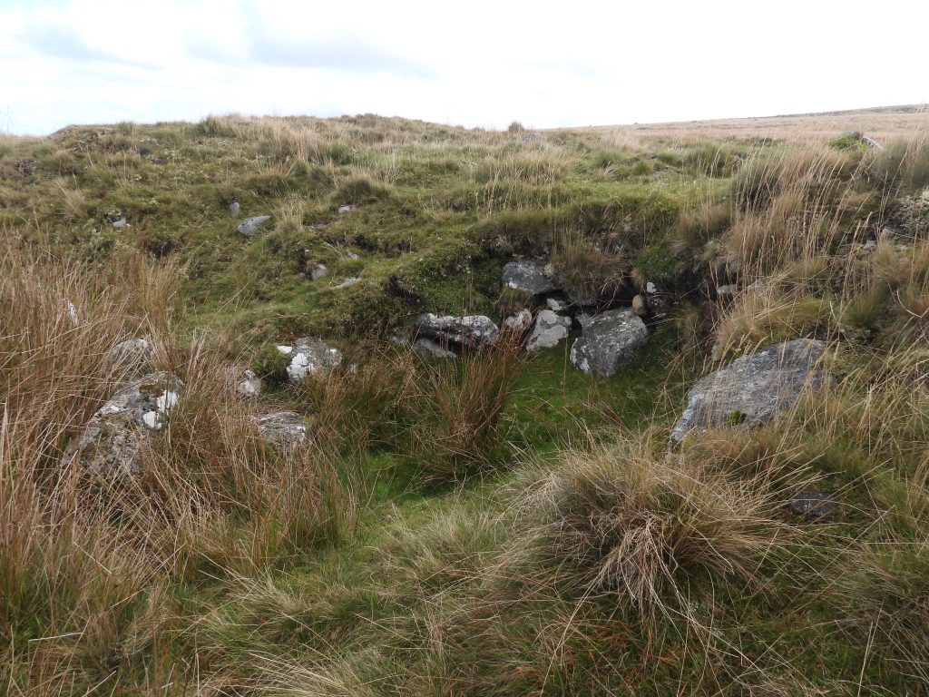
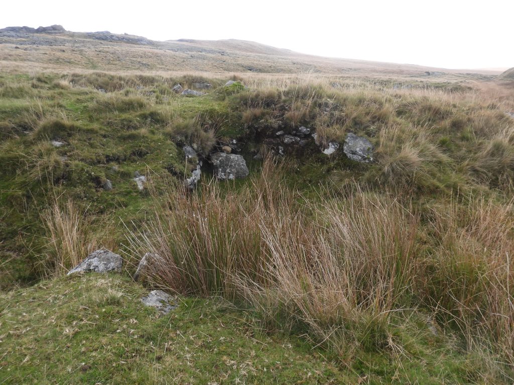
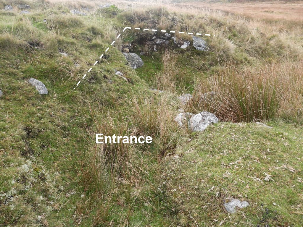
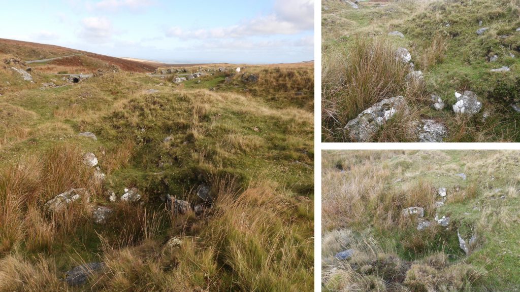
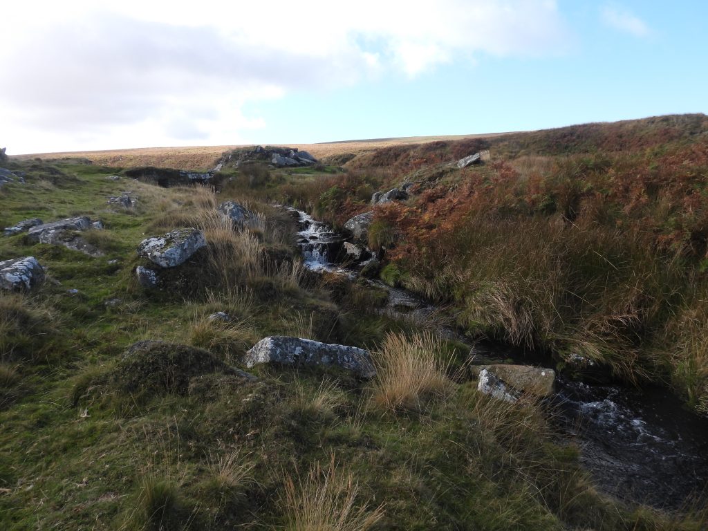
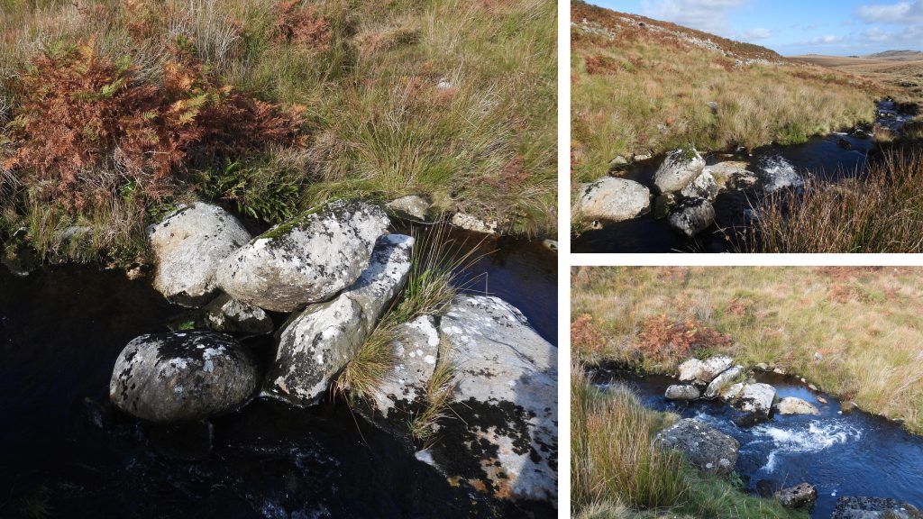
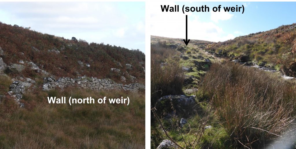
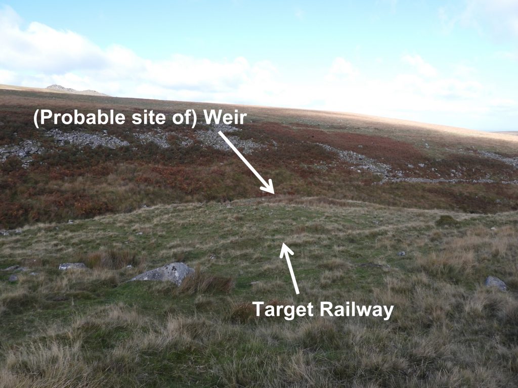
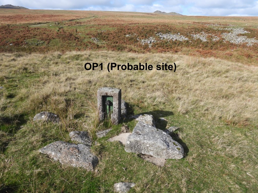
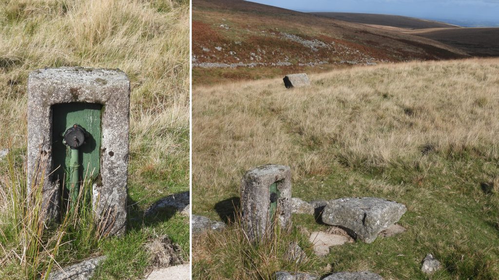
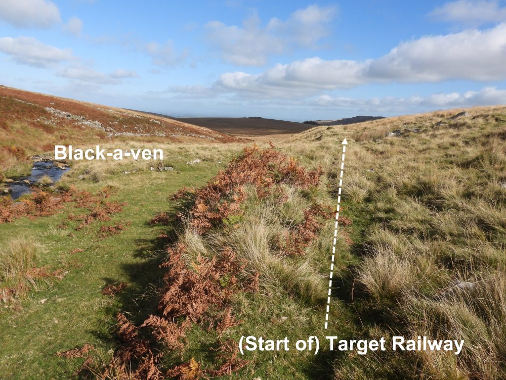
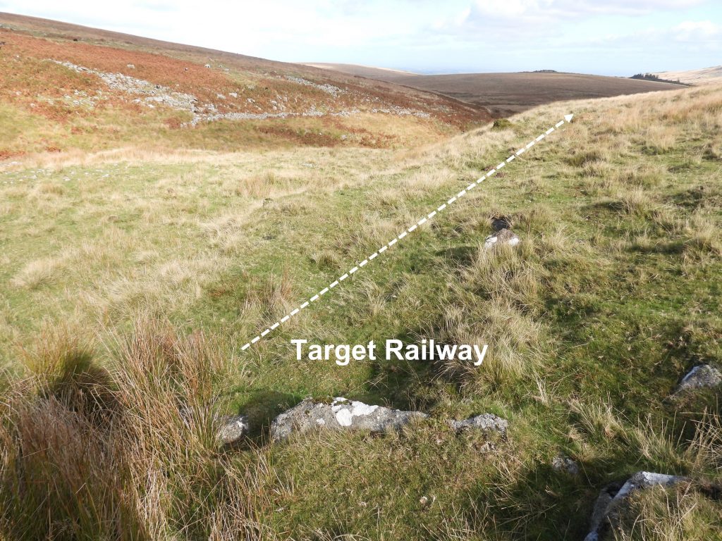
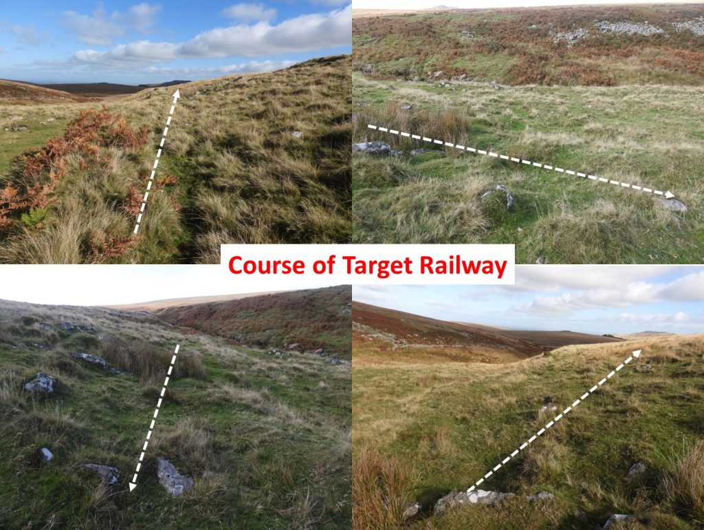
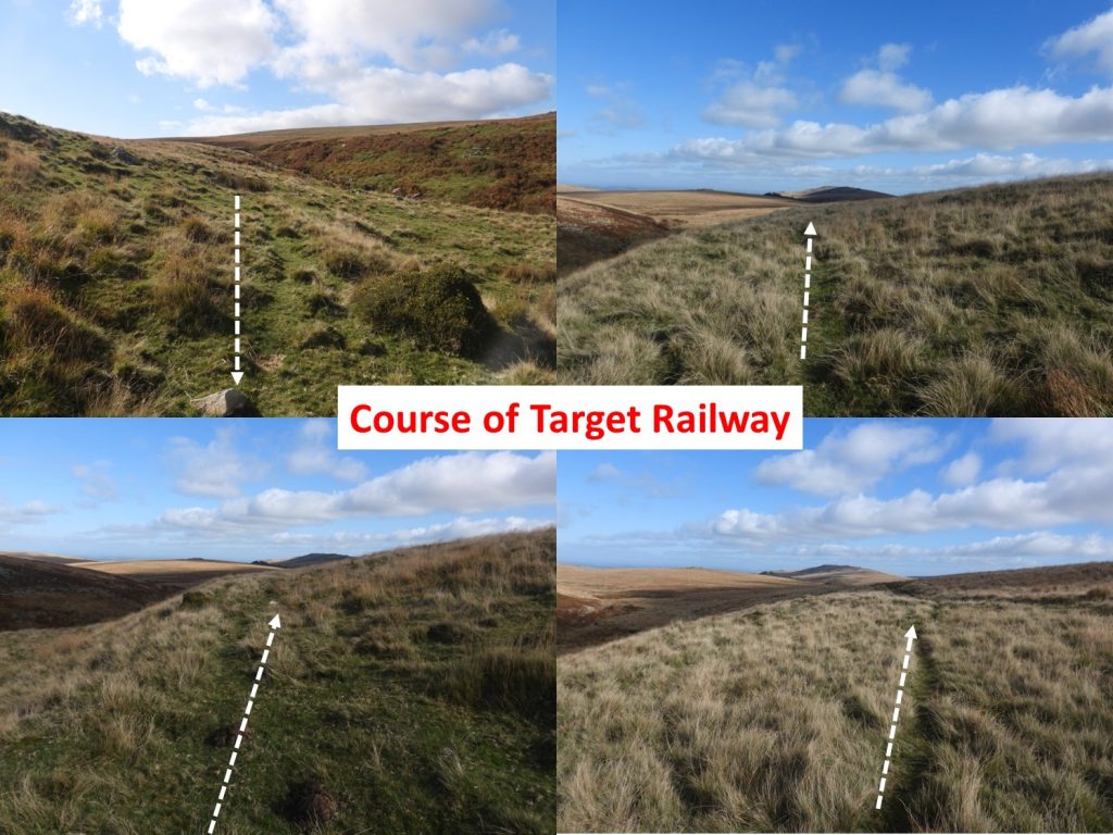
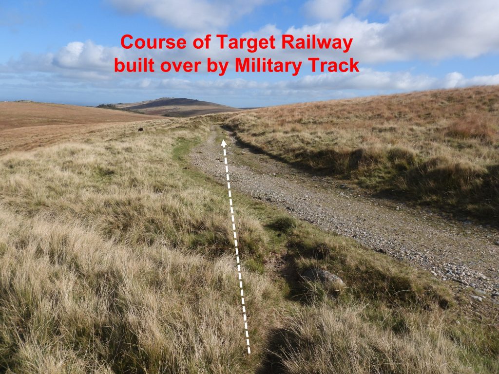
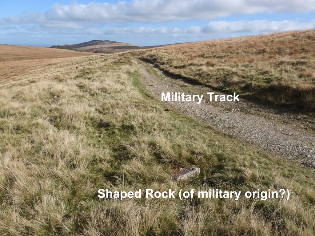
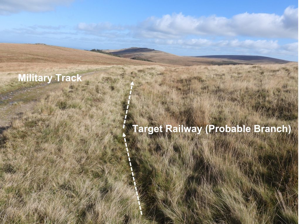
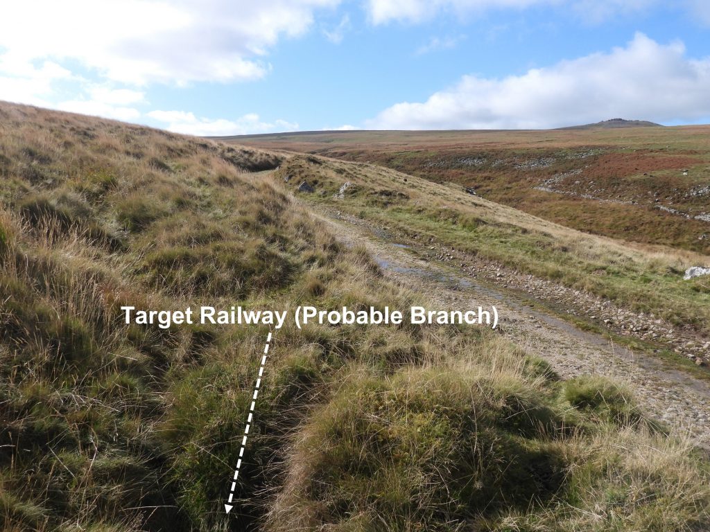
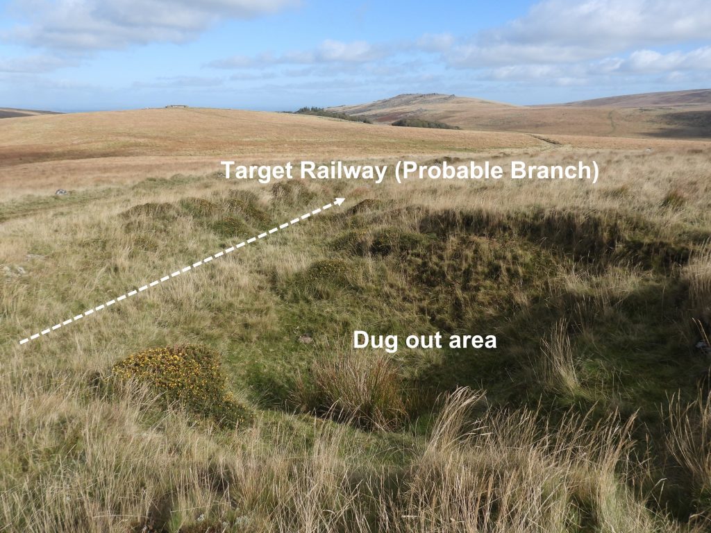
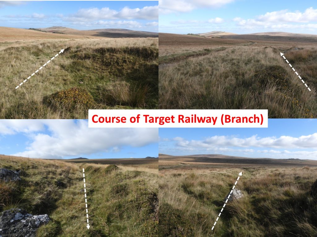
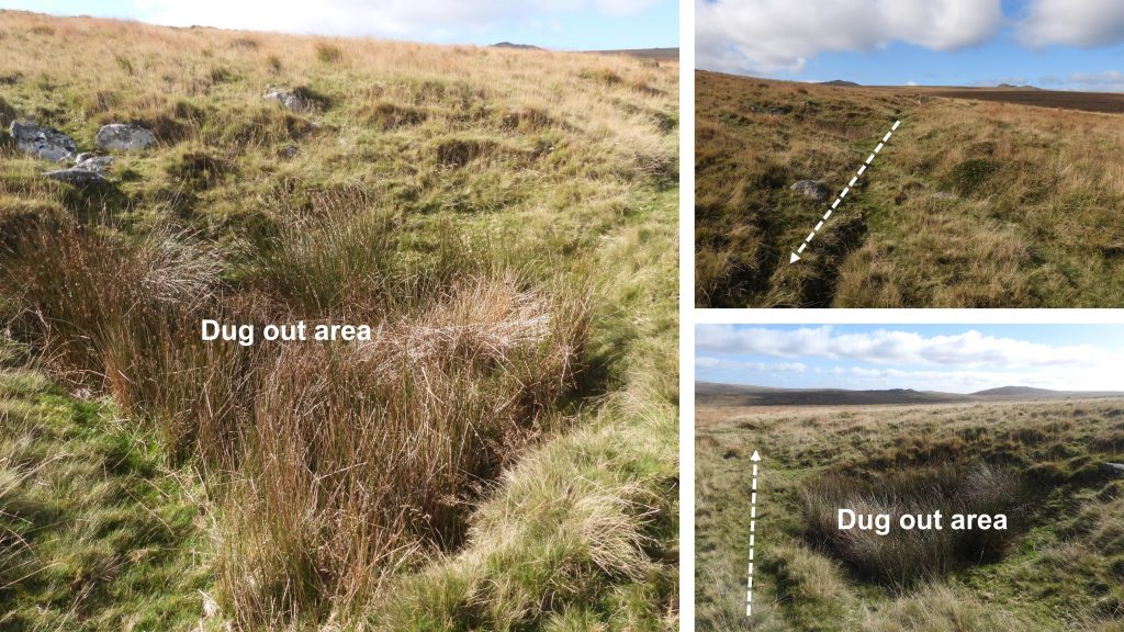
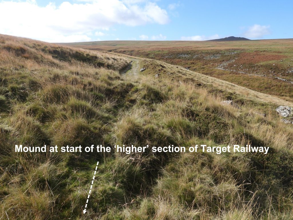
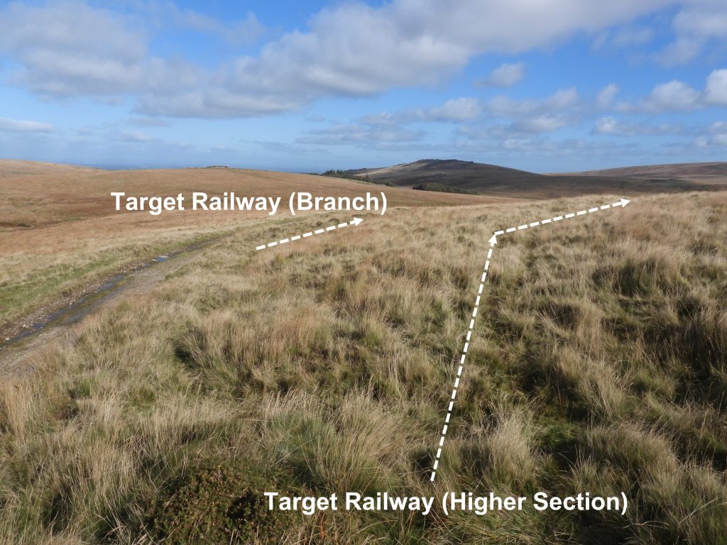
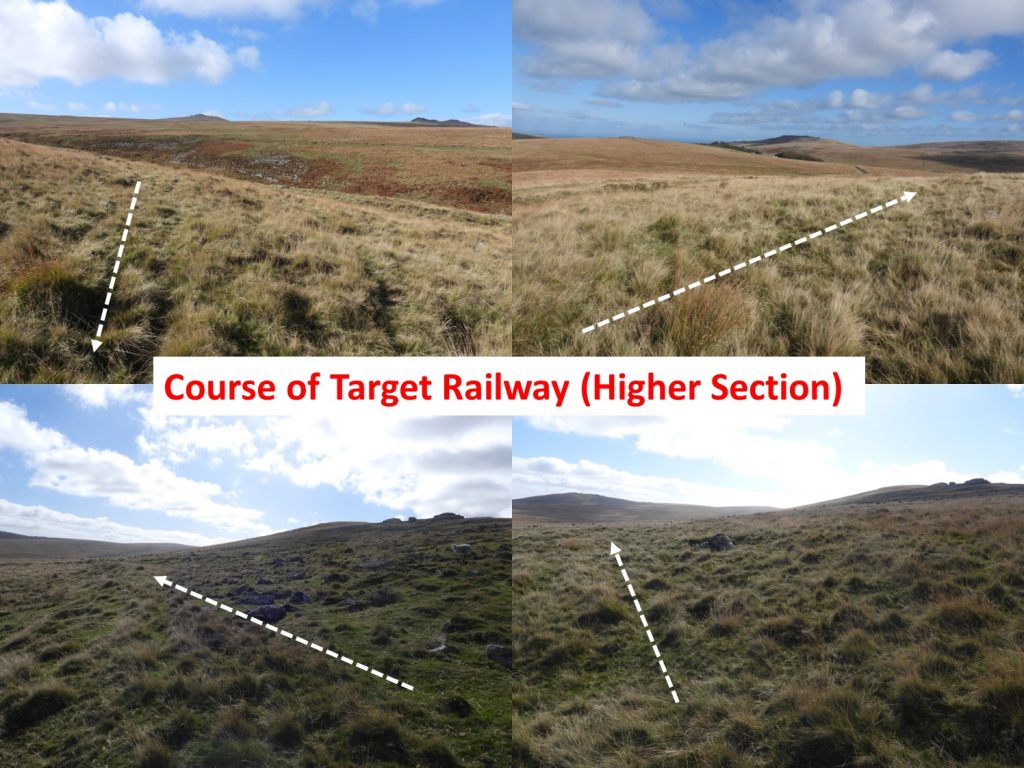
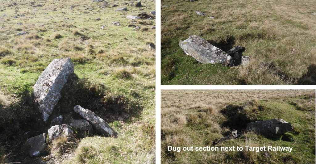
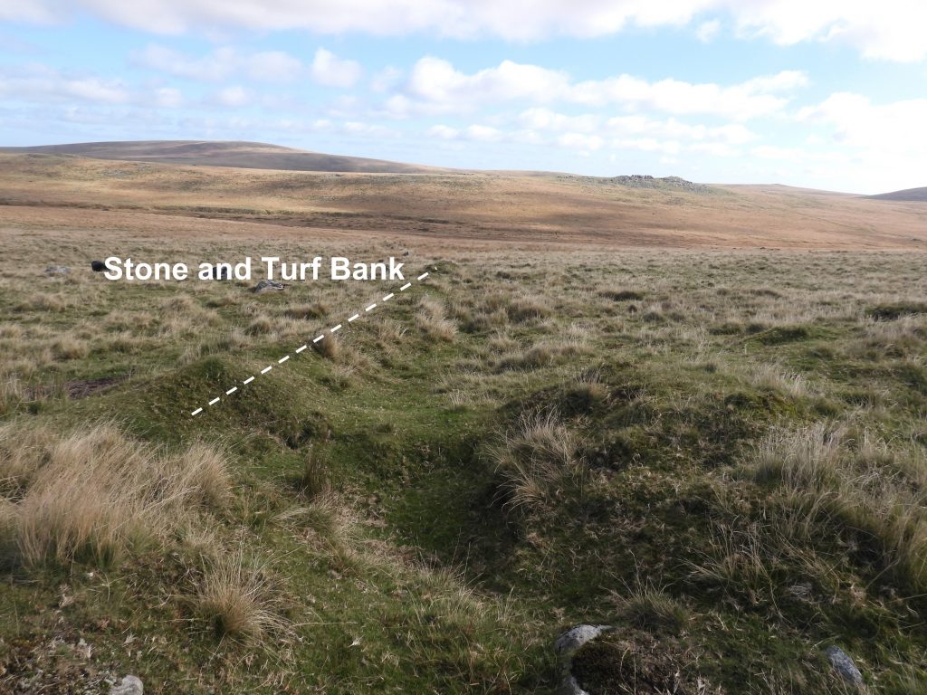
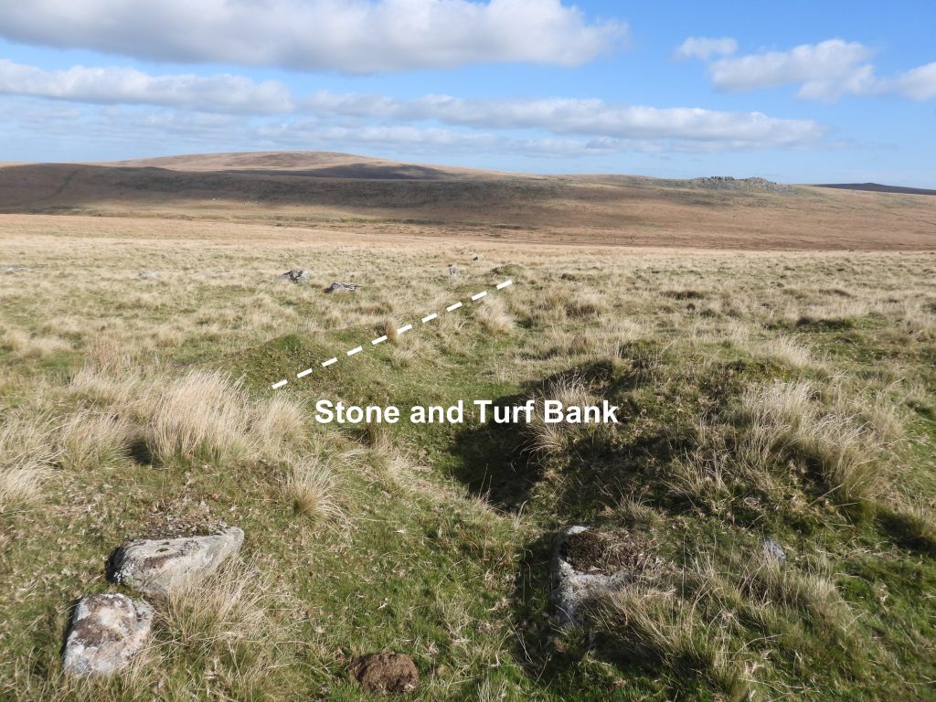
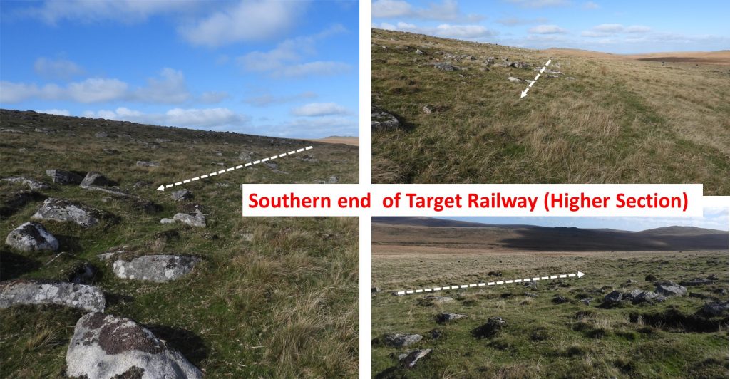
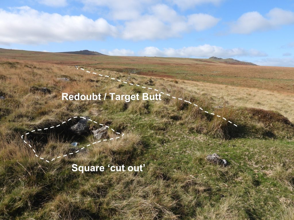
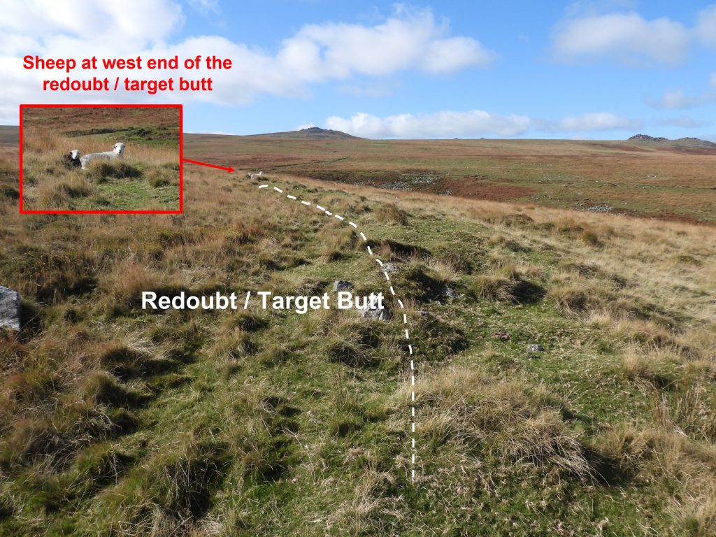
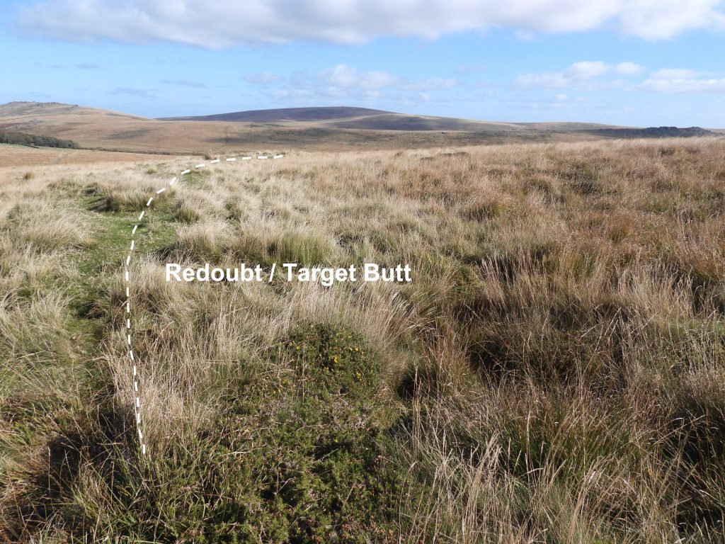
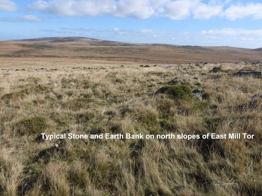
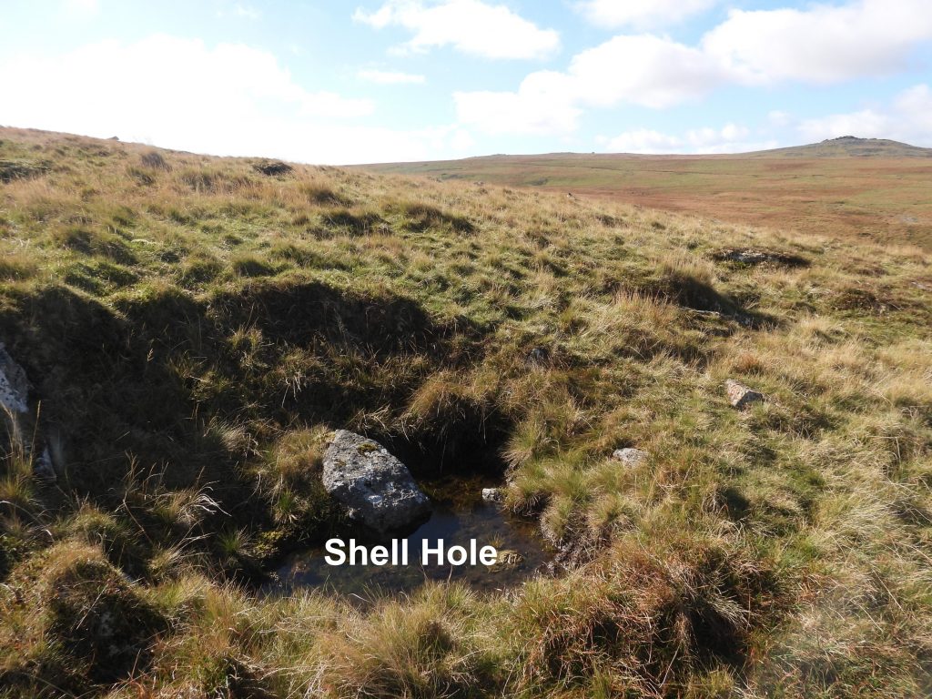
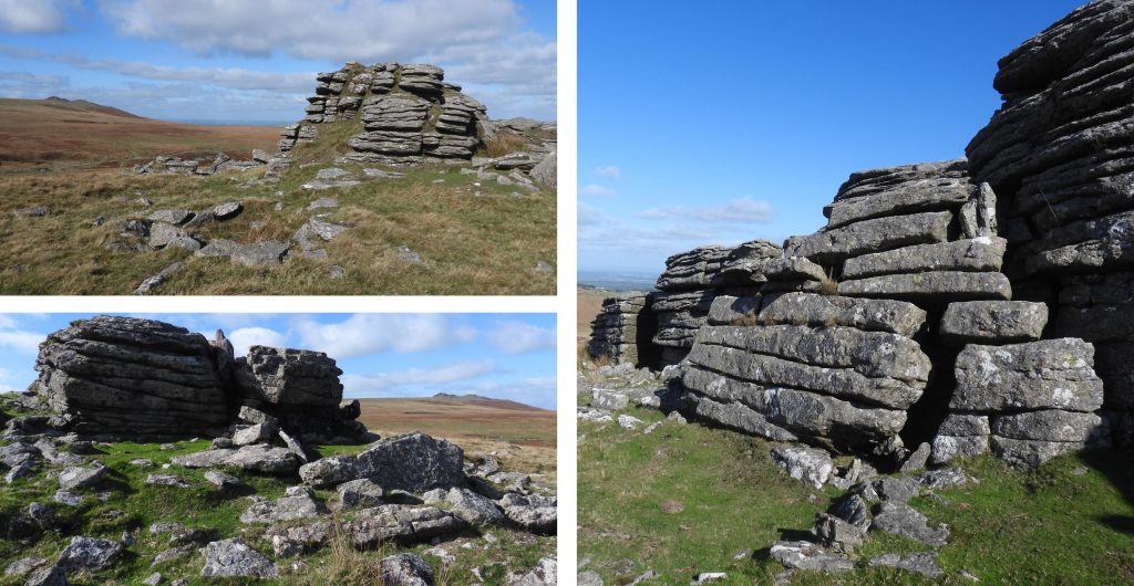
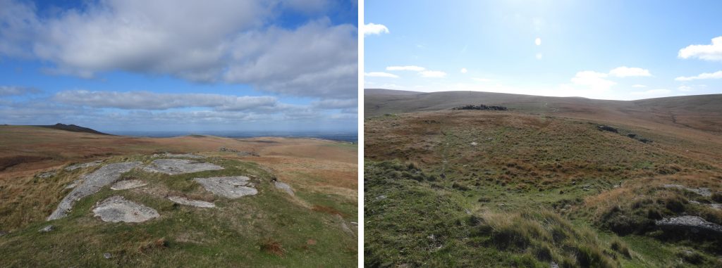
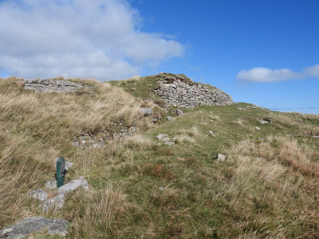
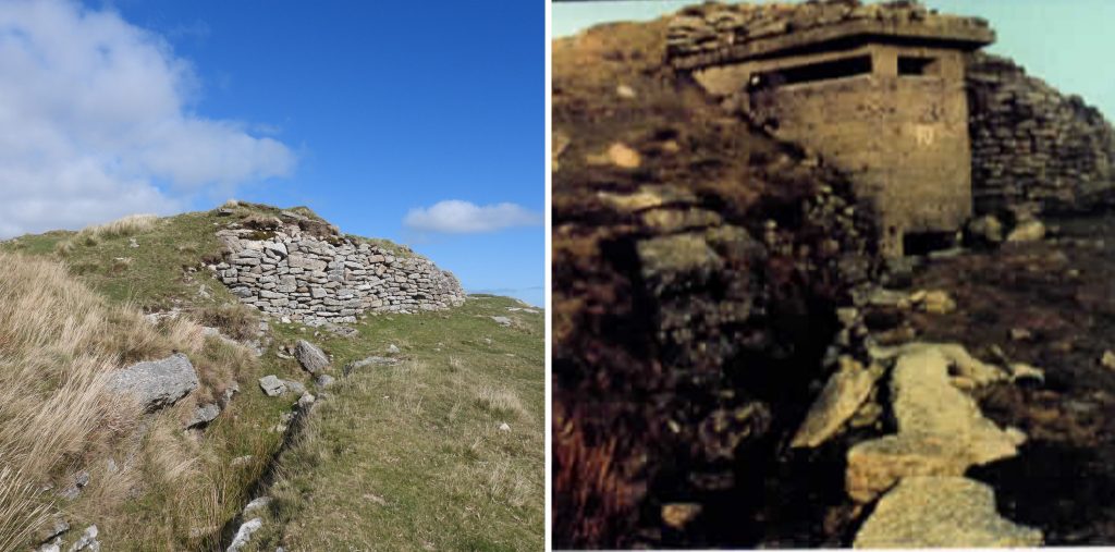
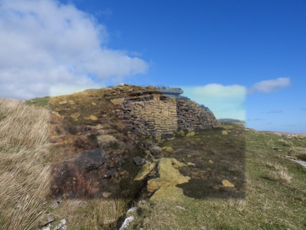
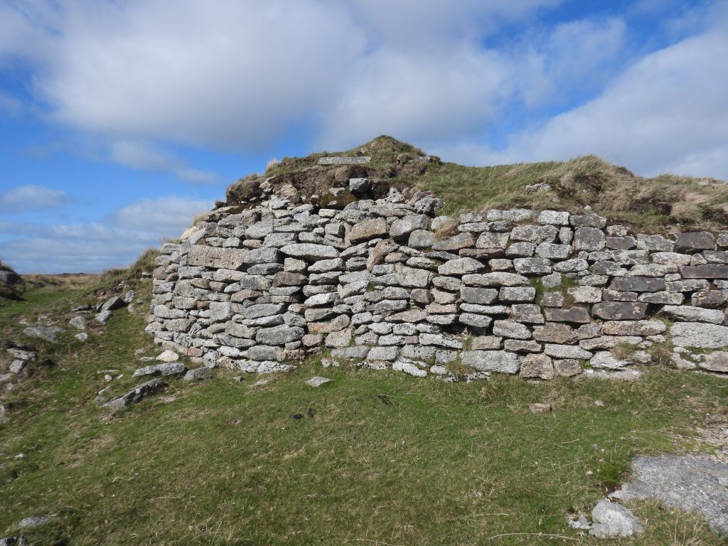
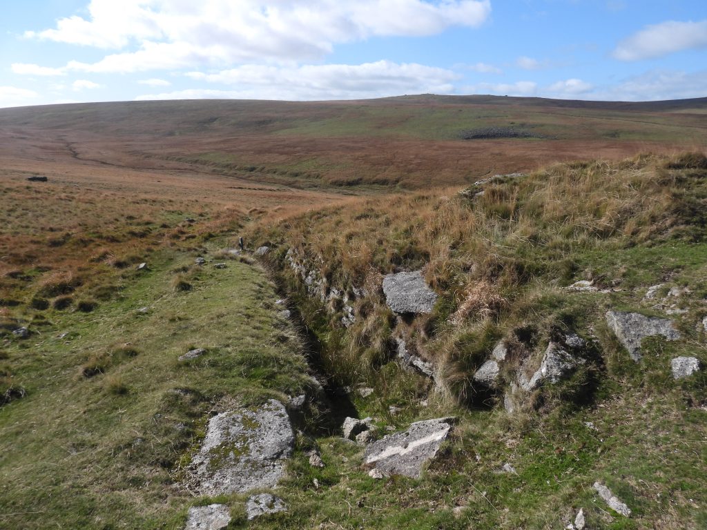
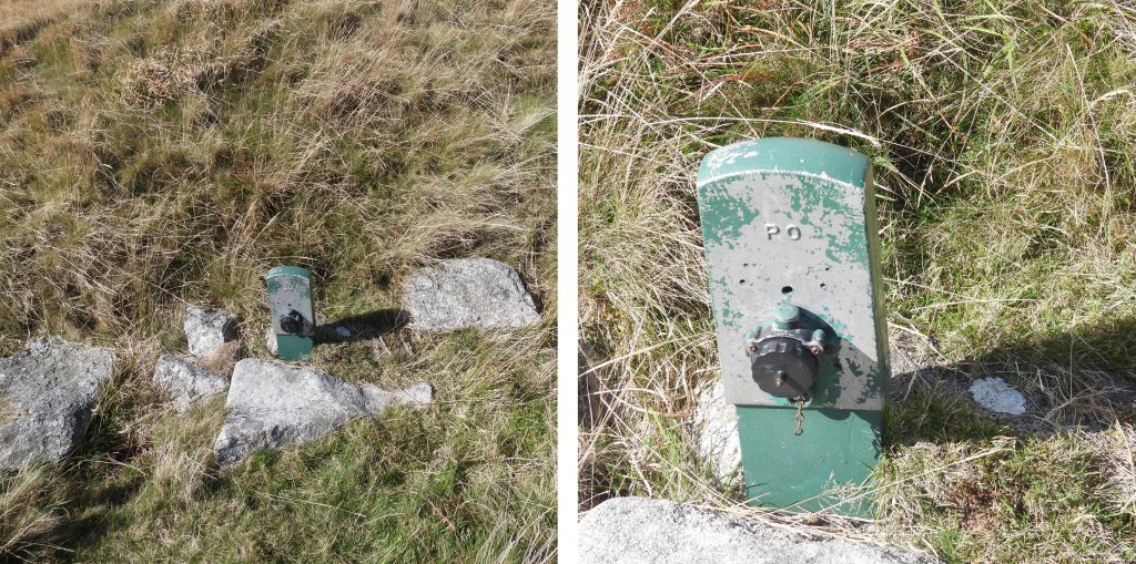
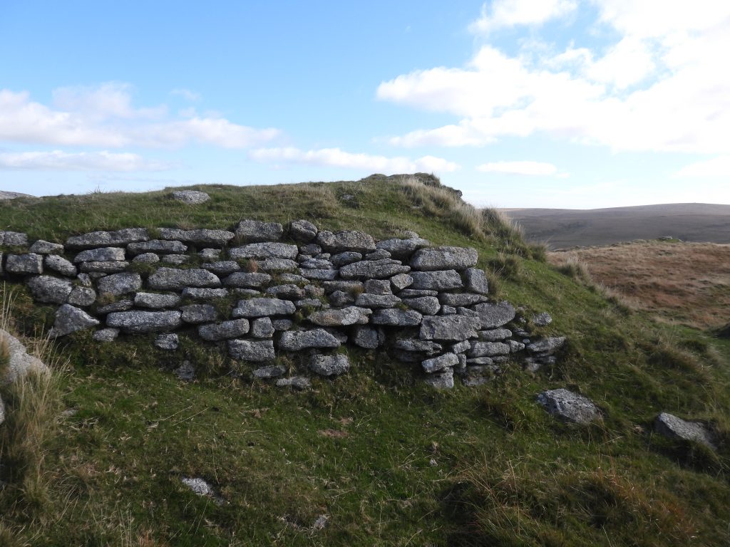
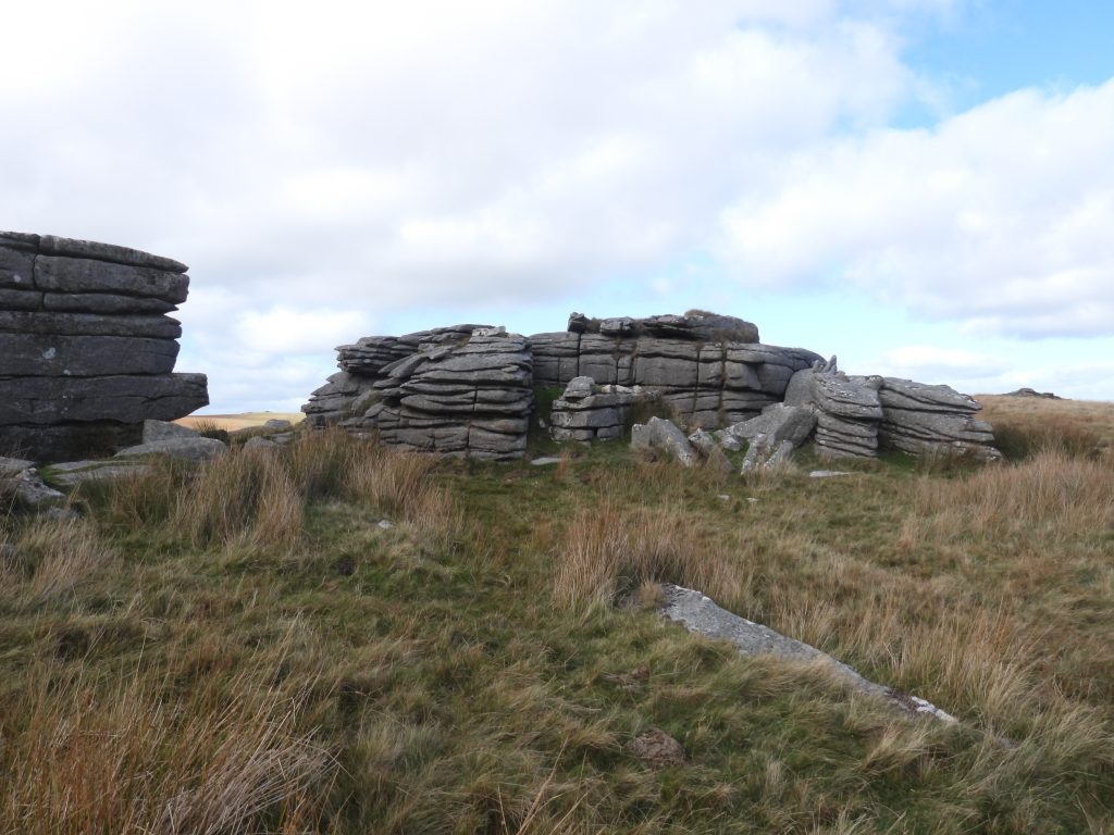
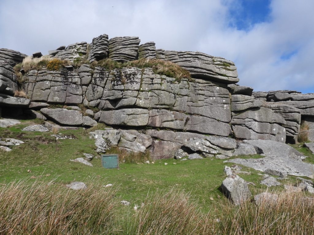
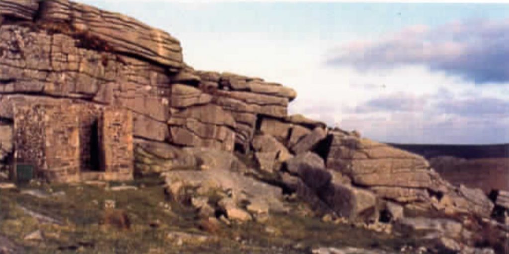
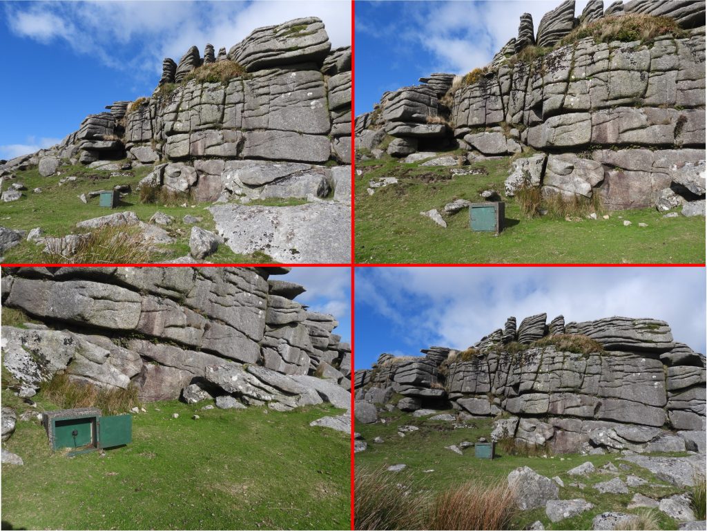
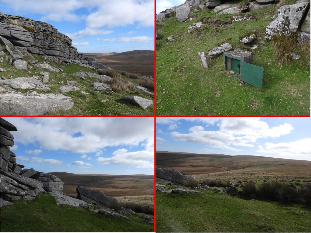
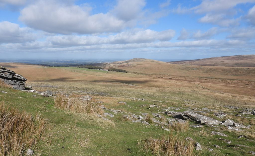
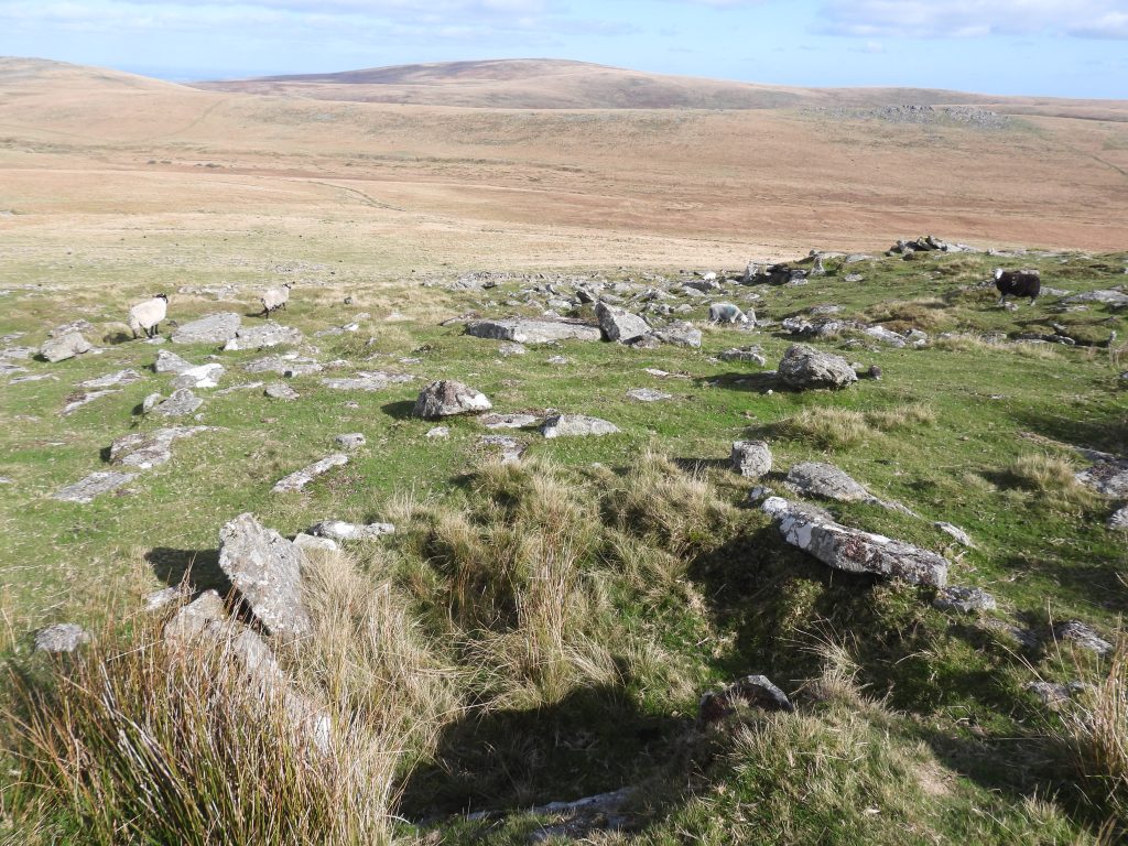
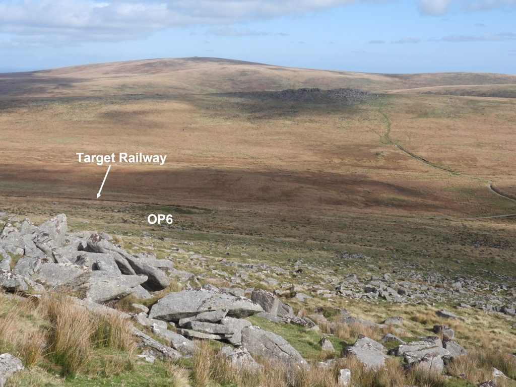
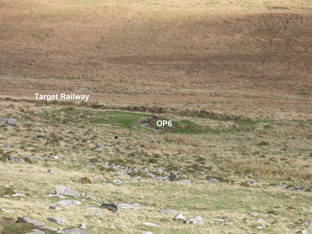
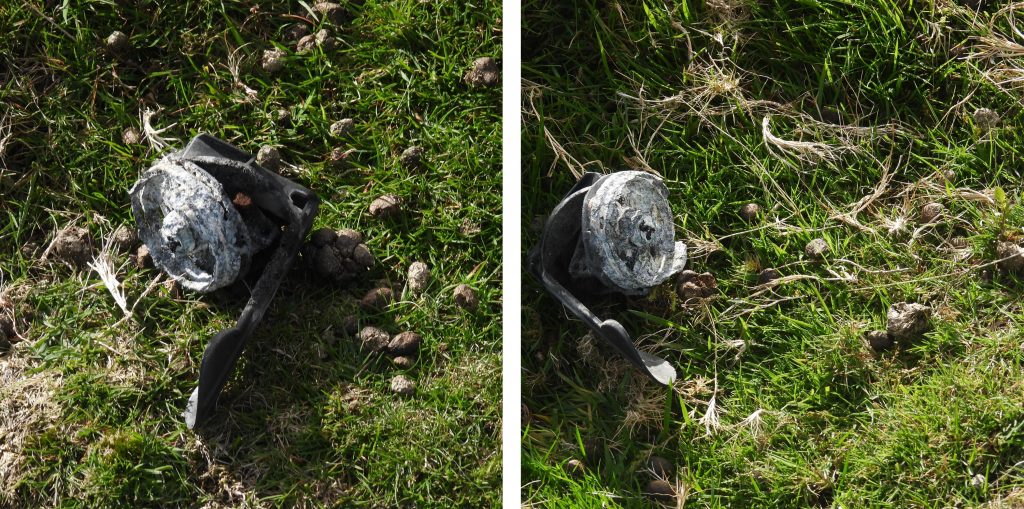
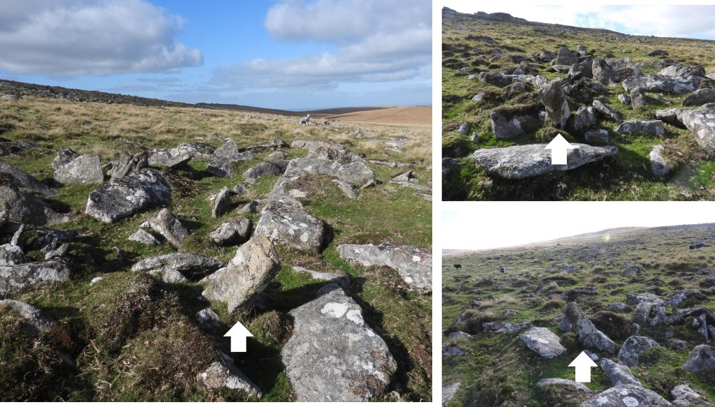
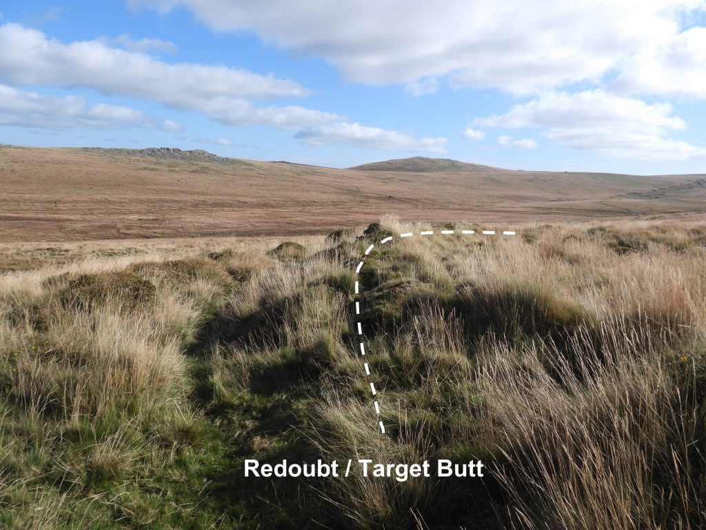
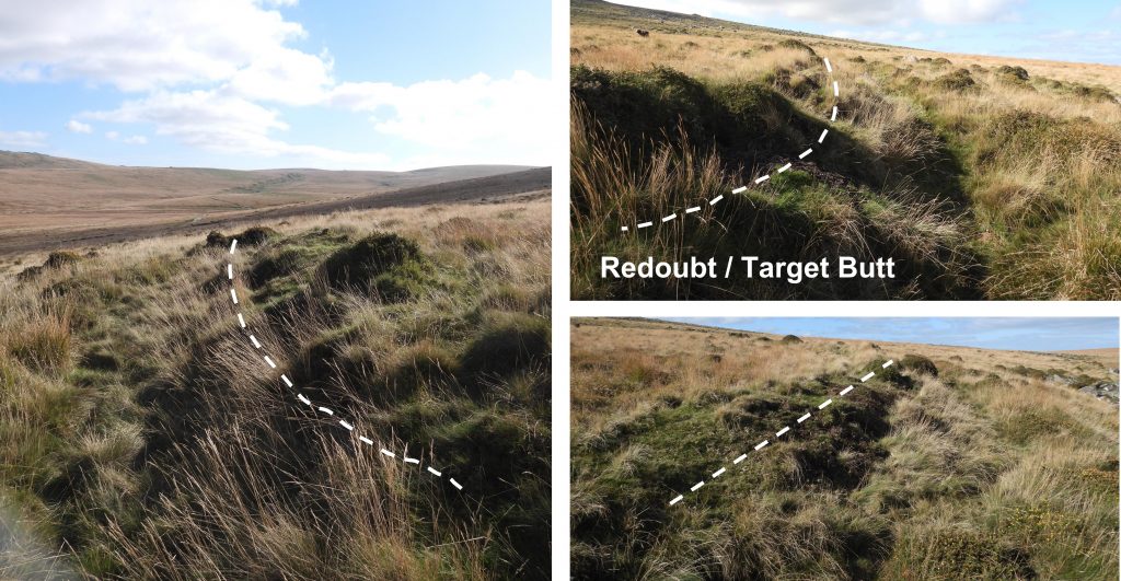
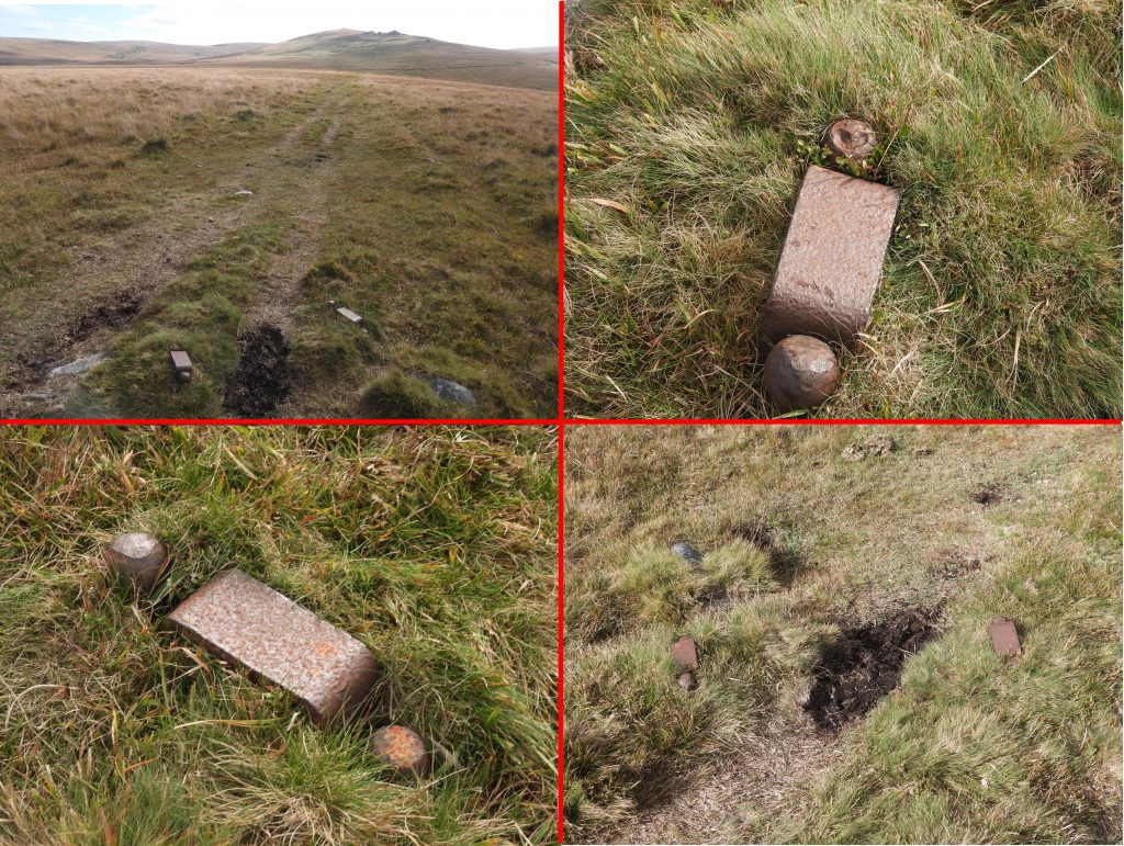
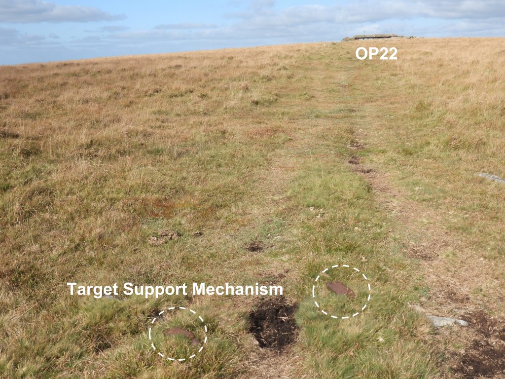
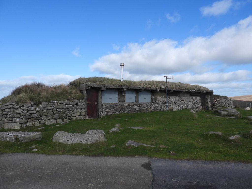
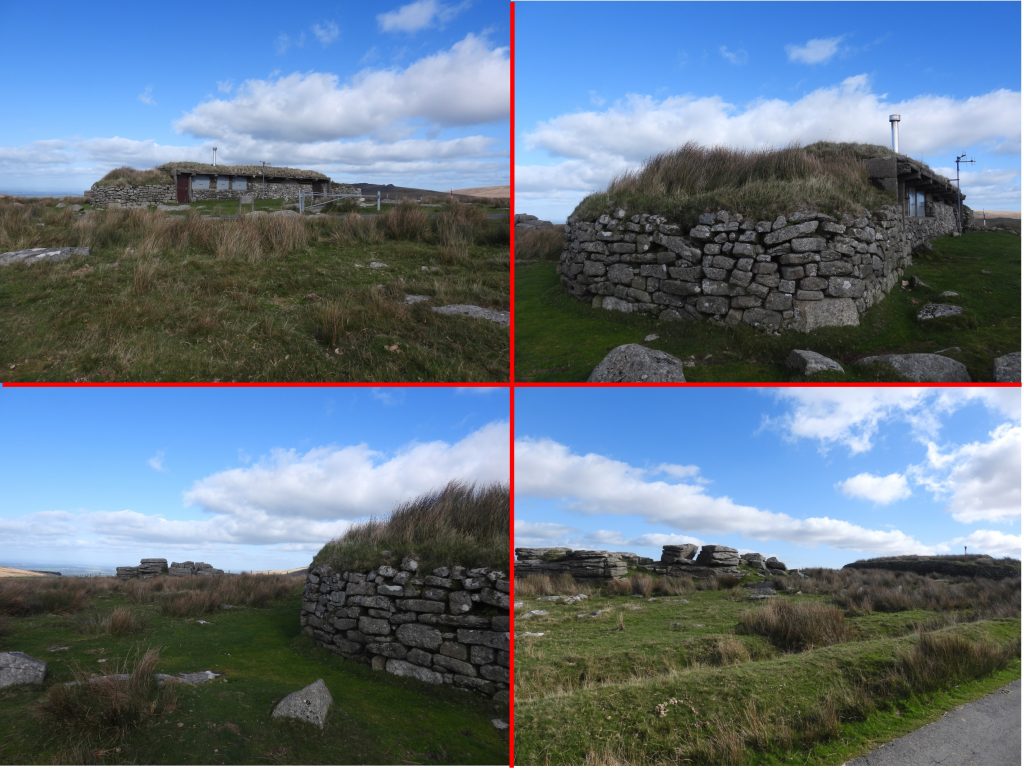
Sketch map showing all the features covered in this post with the exception of the OP6 target railway which is covered by another post on the Dartmoor Explorations website.This google earth image shows the target railway starting close to the Black-a-ven Brook, New Bridge and the former OP1. It is easy to see why using aerial photography alone, this feature could be initially recorded as a leat.Crossing the military track the two sections of the target railway can be discerned from a google earth image.En-route to the exploration area from Row Tor car park, just above the old ring road is an Okehampton Parish Boundary (OPB) boundary stone. This boundary stone is unusual insofar as the O, P and B are on three different sides. East Mill Tor and Oke Tor beyond. This boundstone can be found at SX58682 90770.Approaching New Bridge on the old ring road, the lines of the military track and target railway can be seen viewing across Black-a-ven BrookAnother view across Black-a-ven Brook from the old ring road.Dark and moody views of East Mill TorNew Bridge on the Black-a-ven. There is a large area of tin streamworks here defined by a series of spoil mounds and water channel diversions. The bridge is possibly Medieval, though of unusually large sizeFirst named “New Bridge” on the 1907 OS map, this bridge is a double clapper. The bridge is described in the Historic Environment Record as having: “…. a central and two side piers each 1.4 m wide and 1.2 m high, with slabs and parallel post-type stones laid between them. The bridge is 7.2 m long and 5.2 m wide”.Military telephone point at New Bridge at SX59601 90316A short distance (40m) to the south of New Bridge on the eastern bank of the Black-a-ven Brook is a ruinous tinners’ hutThe tinners’ hut is recorded by the Royal Commission for the Historical Monuments of England as being “revetted into the eastern edge of an area of streamworking debris and measuring 4.0m by 2.3m”. It was recorded at SX59614 90280The western wall of the tinners’ hut is absent. An irregular gap in the north eastern corner is said to mark the site of a former entrance.An additional description of the tinners’ hut states: “The walls are of randomly coursed boulders which form revetments up to 0.9m high”. The left hand picture shows New Bridge and the old ring road.The Black-a-ven downstream from New BridgeThere is a weir shown on mid-20th century maps on the Black-a-ven Brook. The author believes the probable site of the weir was where there are some large granite boulders which are on the line of an old wall which crosses the brook.More views of the probable weir. Its location was recorded at SX59678 90472The wall (and foundations) either side of the weir.View of the probable site of the weir in relation to the start of the target railway.OP1 (Observation Post1) was one of 22 numbered OPs which were (and still are) located on northern Dartmoor. Successful military manoeuvres rely on observation and communication and originally basic huts were constructed to assist with this aim. The OPs were built in the 1920s replacing these earlier, more flimsy structures after one was hit by a shell, which was occupied by four military personnel. OP1 sat on a stony platform 11m x 7m but was abandoned by 1970s. The phone point is the only real evidence that remains today at the site. (Source: Dartmoor Observation Posts by John Deakins).The telephone point is located at SX59712 90407The start of the target railway can be traced to SX59671 90404. From this point the feature runs gently uphill between the right bank of the Black-a-ven Brook and OP1. It is clear that this could never have been a leat (as per 1969 aerial photographs) as the water would have had to flow uphill.The remains of the target railway consist here of a flat, stone-free terrace on average 5.0m wide and 0.8m high with a slight turf and stone lip on its downslope side.In places the rear of the terrace is cut up to 0.5m into the slope. Such railways were devised to assist with anti tank training. A target trolley would have carried a fabric representation of a tank.There is no evidence of any rails, sleepers or track chairs which are apparent on other target railways (e.g Row Tor and OP6). That said, there are other target railways on the moor which do not contain these features either.The course of the target railway is punctuated by the military track which connects the east and west sides of the old loop road.Close to the junction of the military track and the first part of the target railway, there is a rock which appears to have been “squared off” which probably indicates military origin. Location is SX59765 90489A probable branch of the target railway runs from SX59844 90558 adjacent to the military trackStart of the probable branch of the target railway. Next to the probable branch of the Target Railway is a square “dug out area”. The area looks too square to have been a shell hole and the author speculates it is related to the railway and certainly of military origin. This area is located at SX59877 90579The course of the branch of the target railway is easily followed as the ditch is quite pronounced. It exists as a flat bottomed linear hollow up to 1.4m deep and 1.8m wide. Its course runs almost parallel with the military track.Approaching the end of the target railway branch is another “dug out area”, similarly as square as the first one. This one is located at SX59956 90600Returning back to the junction of the military track and the target railway branch and then climbing the slope by a few metres a small mound can be found which marks the start of a third section of the target railway, which the author has dubbed as the ‘higher’ section. The start of the ‘higher’ section is located at SX59835 90539A short distance from the small mound, a view of both the ‘higher’ section and ‘branch’ section of the target railway can be seen in one view.The ‘higher’ section is not as discernible as the other two sections. That said, it can be followed with care and some features can be seen along the way. Next to the ‘higher’ section of the target railway another “dug out” area can be located. Could this have been a small building / construction ? It is located at SX59996 90437A turf and stone bank running east to west. The bank is 1.2m wide and 0.6m high doesn’t appear to have an obvious function but most likely military in origin. It runs approx perpendicular to the ‘higher’ section of the target railway.The stone and turf back at SX60014 90406 cuts the terraced platform of the ‘higher’ section of the target railway.The southern end of the ‘higher’ section of the target railway peters out on stony ground at approx. SX60033 90373An earthwork component of a former infantry redoubt which has been reused as an artillery target butt can be found up the gentle slope from the ‘higher’ branch of the target railway en-route to the northern outcrops of East Mill Tor. Near the east end of the earthwork is a square ‘cut out’ at SX59890 90495The west end of the redoubt / target butt is located at SX59846 90483The Royal Commission for the Historical Monuments of England entry in the Historic Environment Record describe the redoubt / target butt as “….comprising a crescentic turf and stone bank 7.5m wide and a maximum of 1.1m high with a length between the ‘horns’ of 35m”.Climbing the slope towards East Mill Tor northern outcrop more stone and earth banks can be found. The one in the picture was recorded at SX59894 90440The northern hillside of East Mill Tor is stony and littered with small shell holes.East Mill Tor northern outcropsHighest point of East Mill Tor.Under the southern lip of the highest point of East Mill Tor was the location of the only two levelled Observation Post. It was numbered OP10N with the N meaning north. A drystone granite revetment 5.5m long and a up to 1.5m high on the south side of an enhanced natural mound provided the access point to the former OP. This can be seen behind the telephone point in the photograph.The OP was made entirely out of reinforced concrete. The top story had slits in it to afford views to the east, west and south. The OP was demolished around 1992. A remaining wall collapsed and had to be rebuilt in 1994, which is what is seen today. (Source: Dartmoor Observation Posts by John Deakins)Overlay combination of the original OP10N with the view from 2022.The rebuilt wall covering the original OP at SX59933 89863View from OP10N looking west down the line of the original access trench.The telephone point at the start of the access trench is located at SX59924 89858Retaining wall ‘behind’ the mound where OP10N was located.East Mill Tor southern outcropThe original East Mill Tor OP was located next to the southern outcrop of the tor. It was a freestanding building but had limited views. Thus OP10S, as it was known (S for south) was replaced with OP10N (the two level OP). OP10S resembled a range clearers hut. It was originally known as Splinterproof Hut 5. (Source: Dartmoor Observation Posts by John Deakins)Overlay combination of the original OP10S with the view from 2022.Demolition of OP10S took place in 1992 with final clearance in 1995.The demolition and clearance of OP10S has left little evidence with the exception of the telephone cupboard which is at SX59962 89638Returning to the northern outcrops of East Mill Tor there are commanding views towards East Okement Farm and Belstone TorsViews towards Oke Tor and Cosdon. The valley below is known as Skit Bottom. A scooped out area in the foreground is one of many to be found in the area. This one was at SX59907 90149Looking east, Observation Post 6 can be seen with its associated target railway running in a northerly direction. This target railway is not covered in this post as it was covered in a previous post at: https://dartmoorexplorations.co.uk/east-mill-op6-incline-target-railway/Zoomed in on OP6. The structure was originally built as a target carrier shed and housed about ten target trolleys. once the need for a target railway passed, a half height concrete blast wall was added and thus OP6 was born.Military detritus on east side of the tor.This standing stone is located at SX60042 90245. It appears to be a worked stone and could easily have been a reference point for military training / operations. It doesn’t appear to have been located on any known boundary.To the east of the ‘higher’ section of the target railway a second redoubt / target butt can be found. The northern end is at SX60176 90324The redoubt / target butt comprises a crescentic turf and stone bank on which has been recorded as averaging 3.5m wide and a maximum of 1.3m high. It is 31min length and possesses a ditch 1.4m wide and 0.4m deep. The southern end is at SX60202 90308Described by Nigel Machin in the Historic Environment Record thus : “A pair of metal supports spiked into the ground that held a beam on which was mounted a pulley or the mechanism for targets that would be pulled up from a safe location, such as splinter proofs, on the instructions of the officer conducting the live firing exercise in the late 1800s to early 1900s”.The target support mechanism is located approx 275m south-south-west of OP22 at SX60047 90899OP22 was constructed 1923/4 for the officers to view all the operations. It is twice the size of other OPsOP22 lies next to Hart Tor on the old ring road and is the furthest point on the east section of the road which is still accessible by the public. The OP internally has a dividing wall, sectioning off a stable to the range clearers horse. This is now the only OP which is still in regular use today. (Source: Dartmoor Observation Posts by John Deakins)