A collection of walks, discoveries, insights and pictures of exploring Dartmoor National Park
October 18, 2022
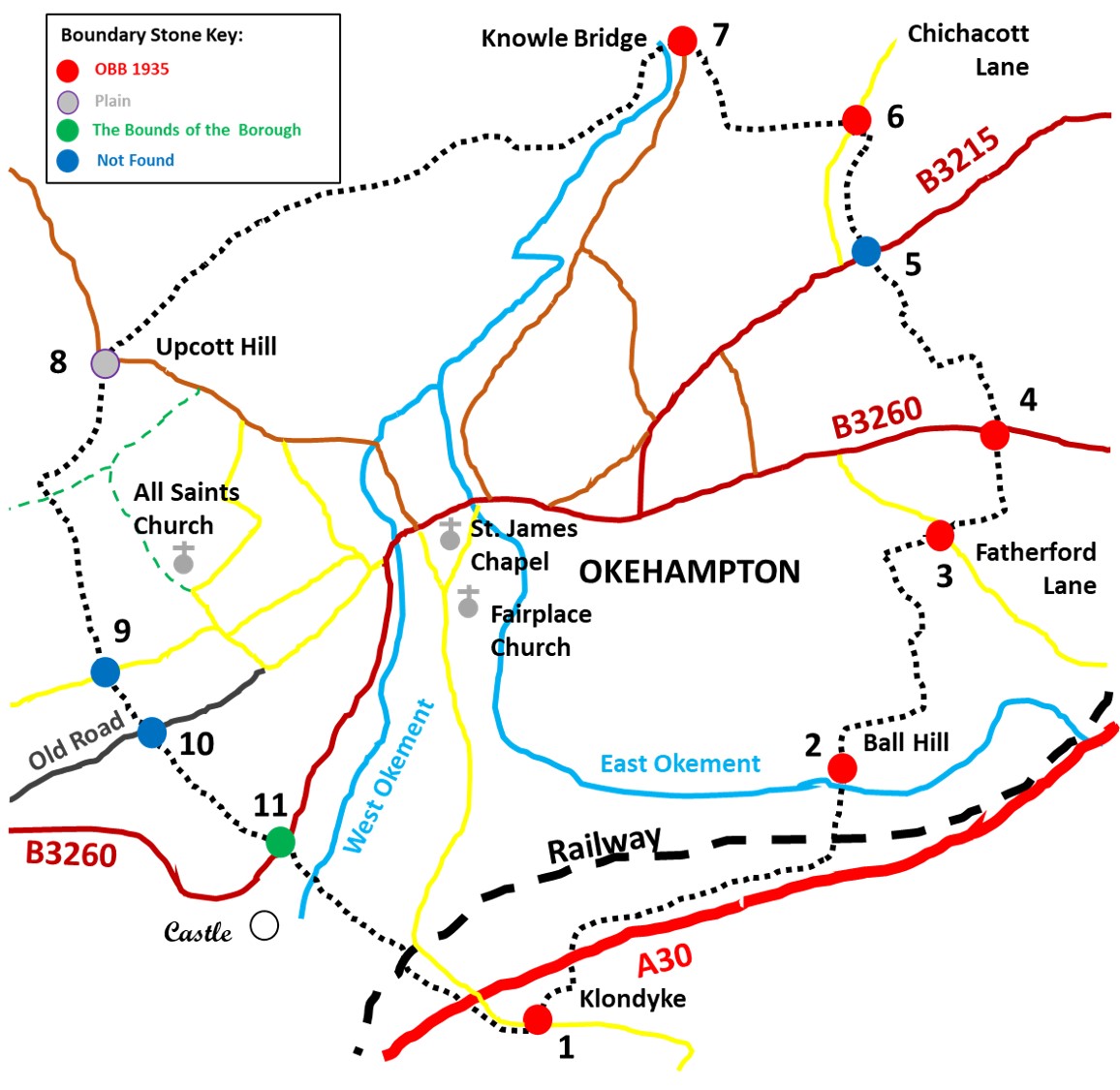
Okehampton Borough Bounds
Okehampton was founded by the Saxons with the earliest written record of the settlement dating from 980 AD as Ocmundtune, meaning settlement by the Ockment. Okehampton was a borough by the time of Domesday, when it had a market and a population comprising 21 villagers, 11 smallholders, 18 slaves, 6 other population and 4 burgesses (an inhabitant of a town or borough with full rights of citizenship). The tenant-in-chief in 1086 was Baldwin de Brionys, Sherrif of Devon. The Lordship of the borough was held by the Courtneys and their heiresses until the borough of Okehampton was incorporated by Royal Charter in 1623, and from 1640 Okehampton returned two members to parliament. The corporation became extinct in 1882 but by 1886 a new charter was granted and the governing body (consisting a mayor, 4 alderman and 12 councillors) created a Municipal Borough whose bounds remained the same as they were in 1623. The boundary is still marked by OS maps and on it are a number of inscribed stones. This post explores the borough boundary with much of the information contained herein being obtained from Dartmoor Boundary Markers (2nd Edition) by Dave Brewer.
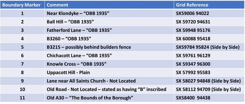
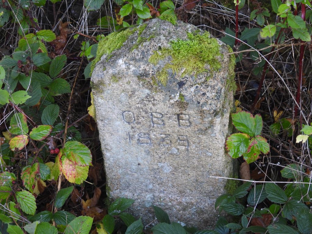
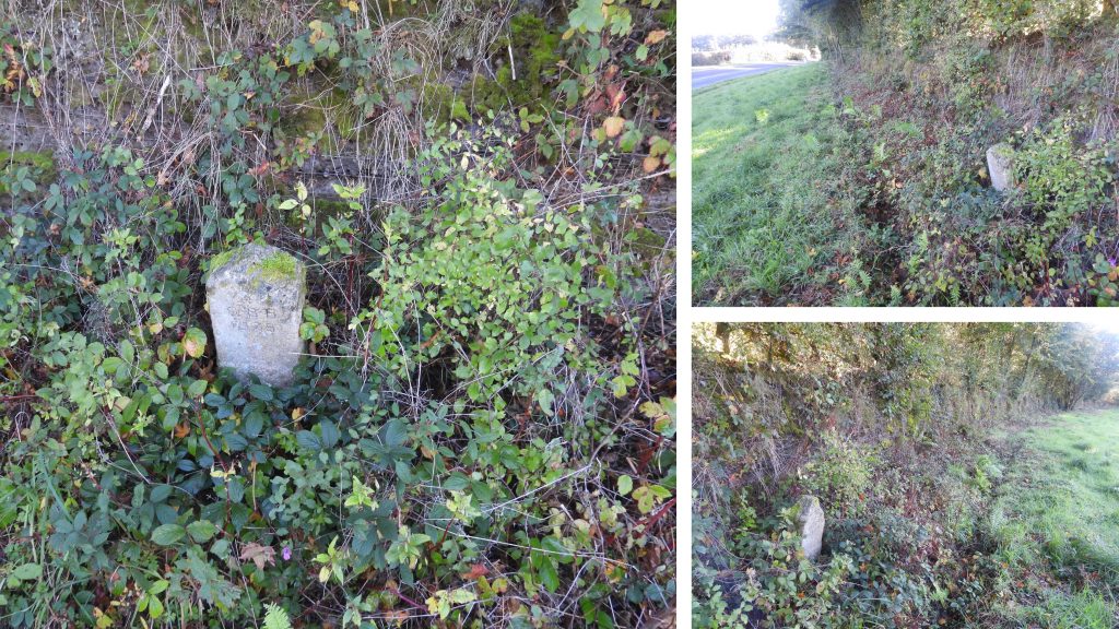
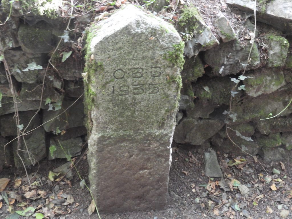
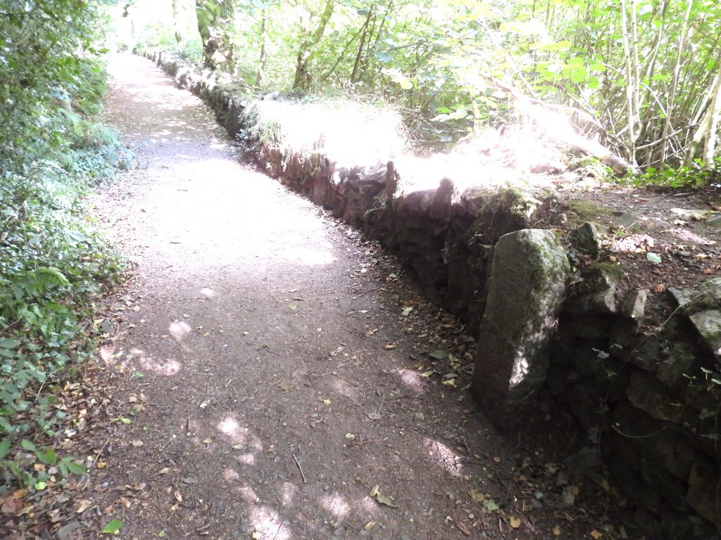
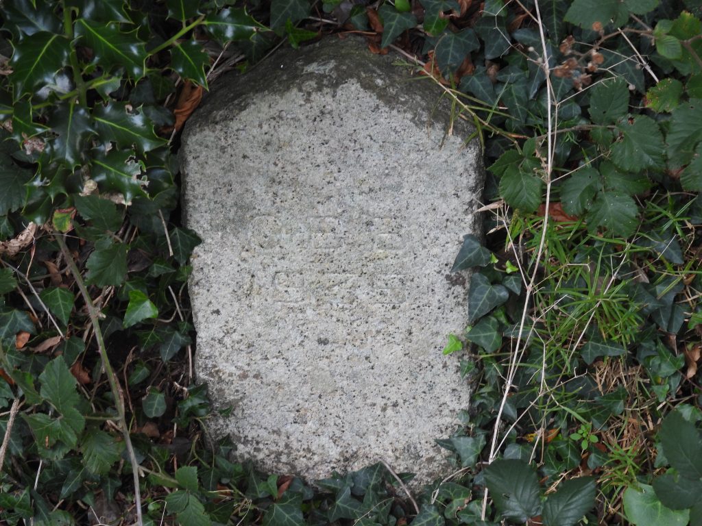
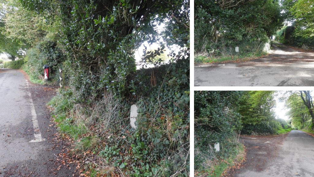
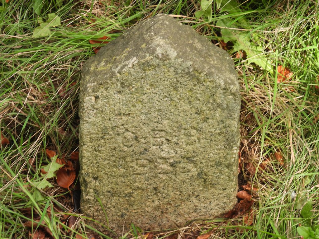
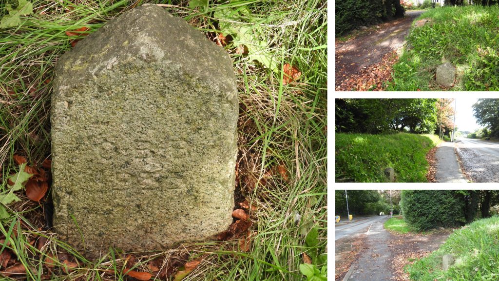
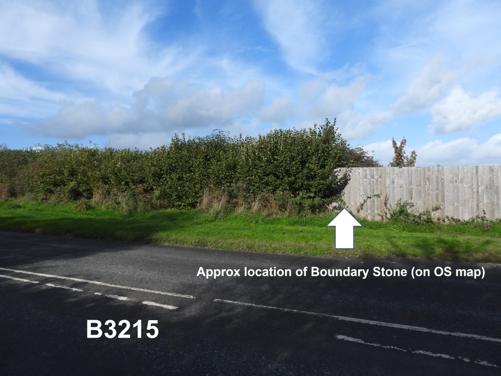
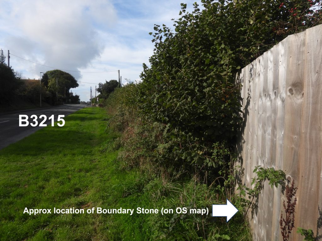
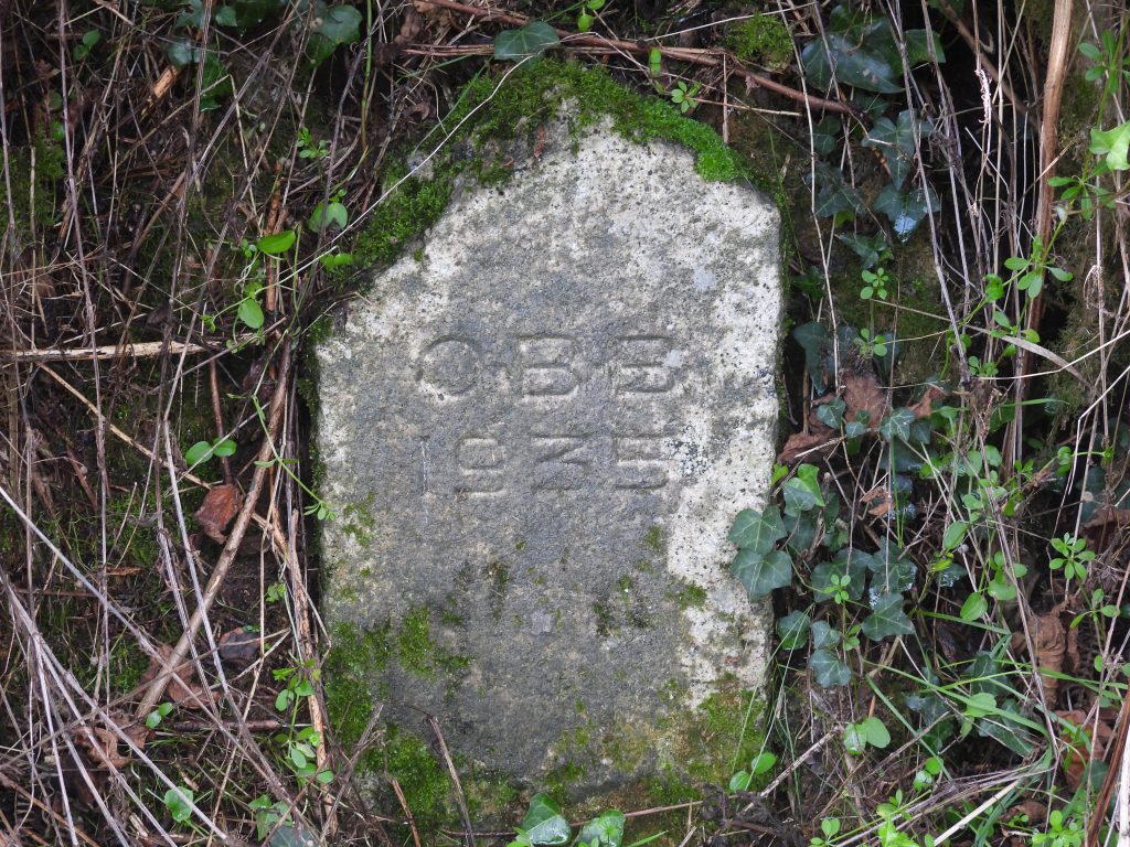
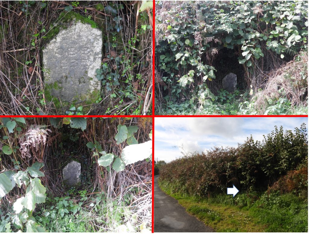
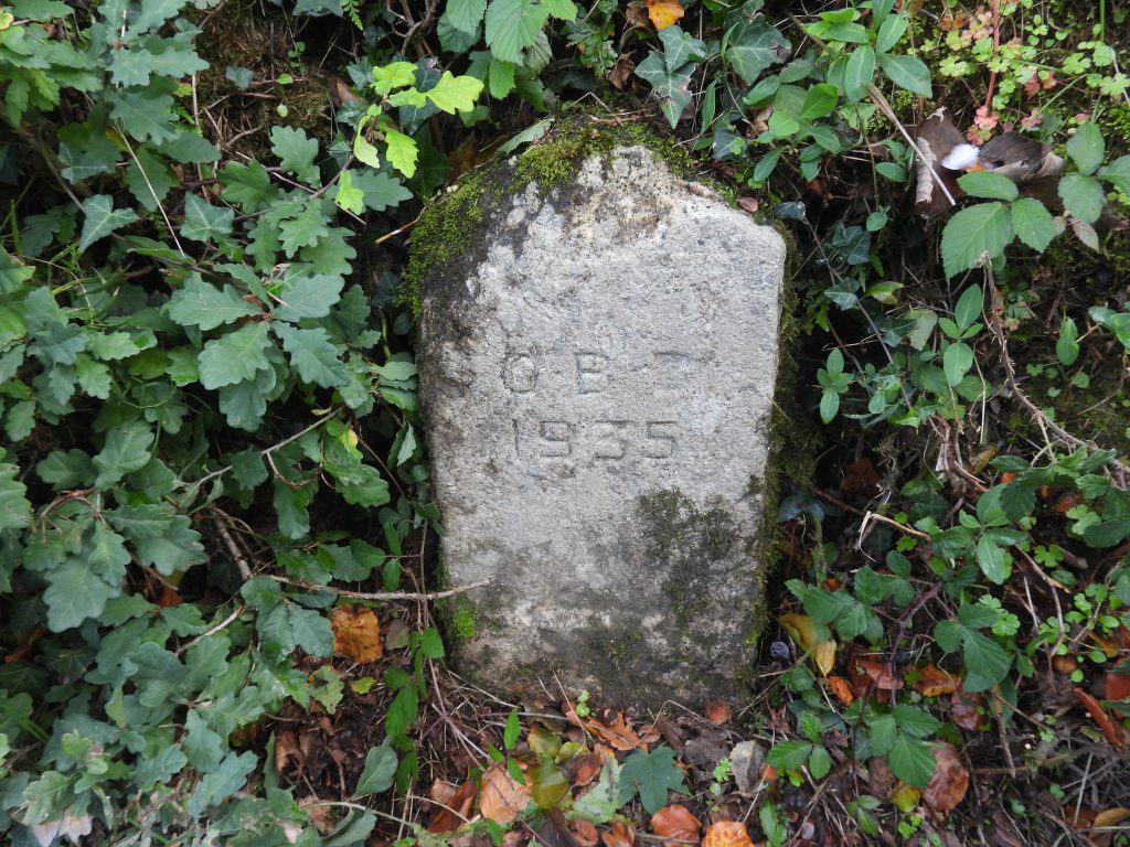
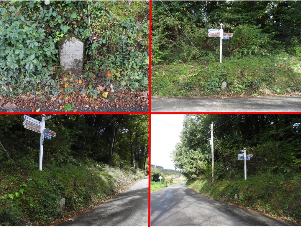
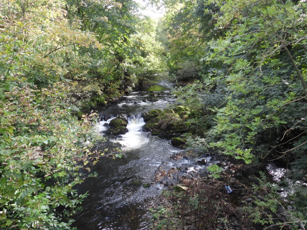
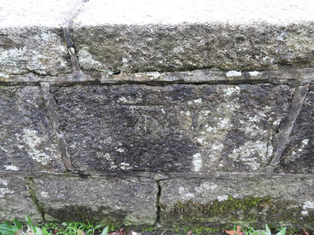
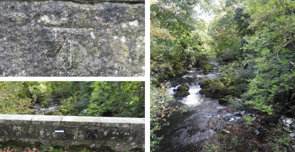
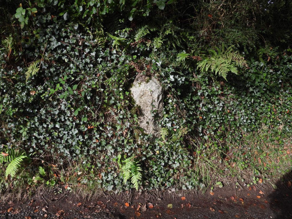
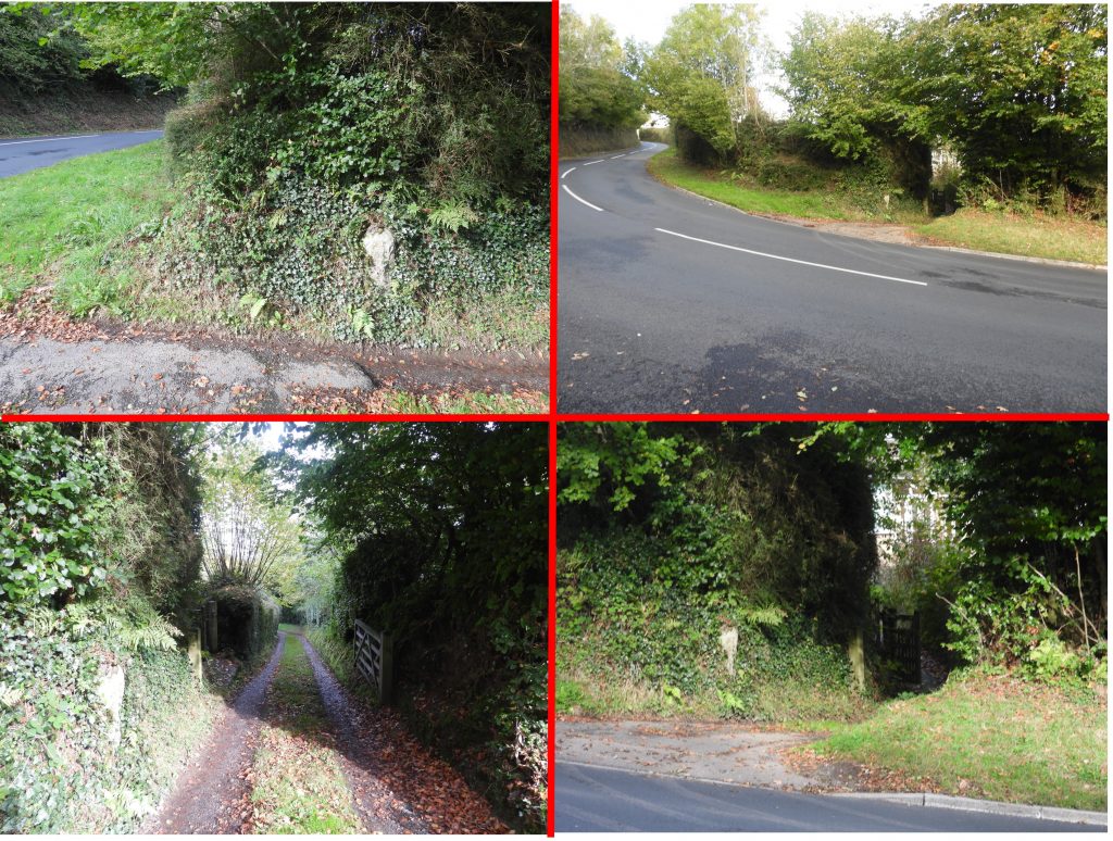
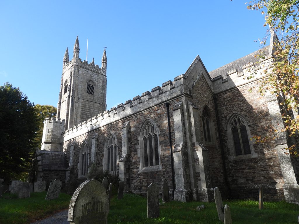
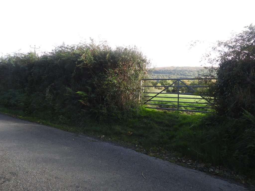
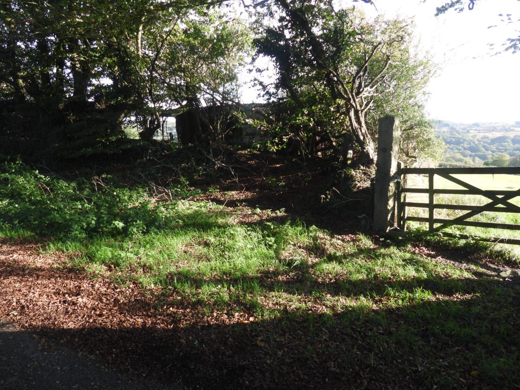
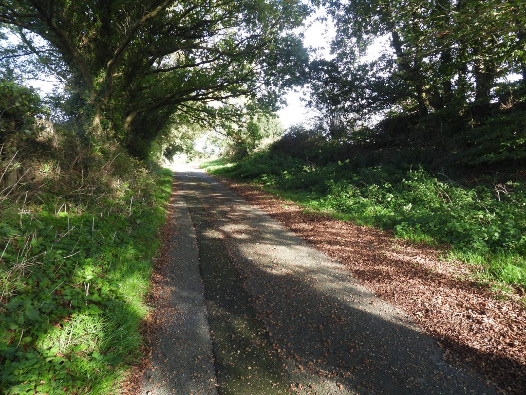
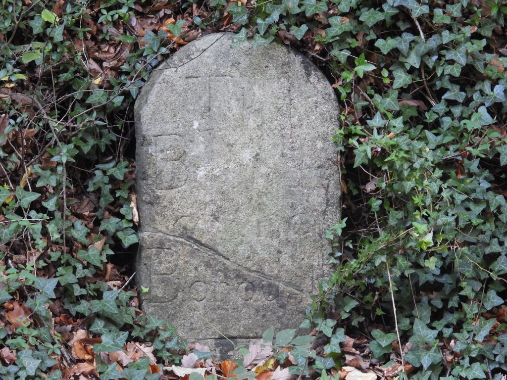
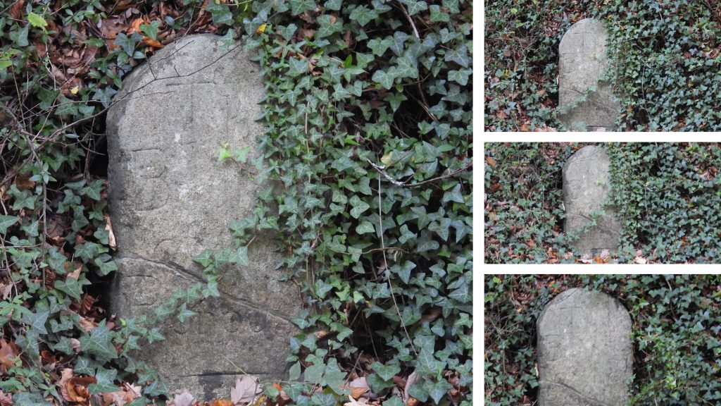
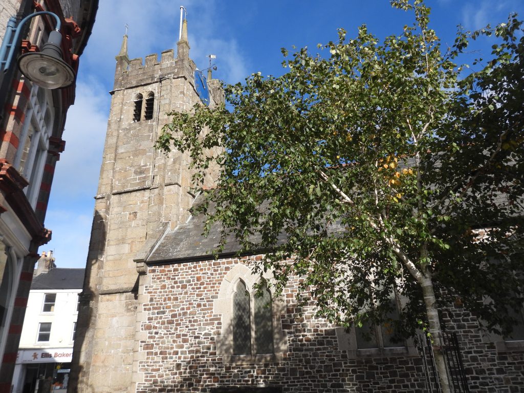
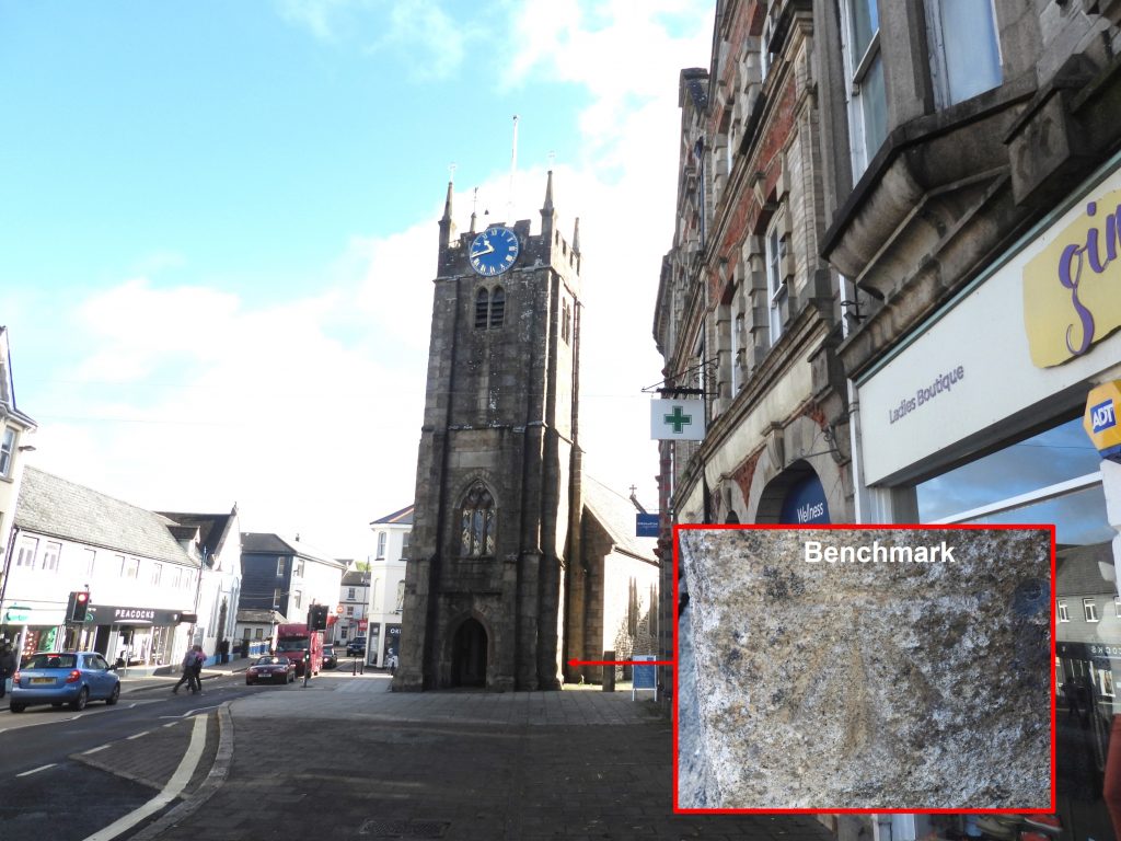
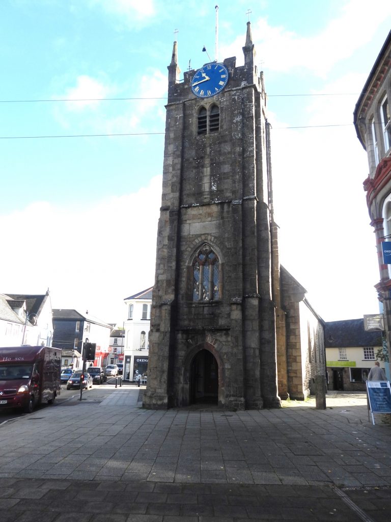
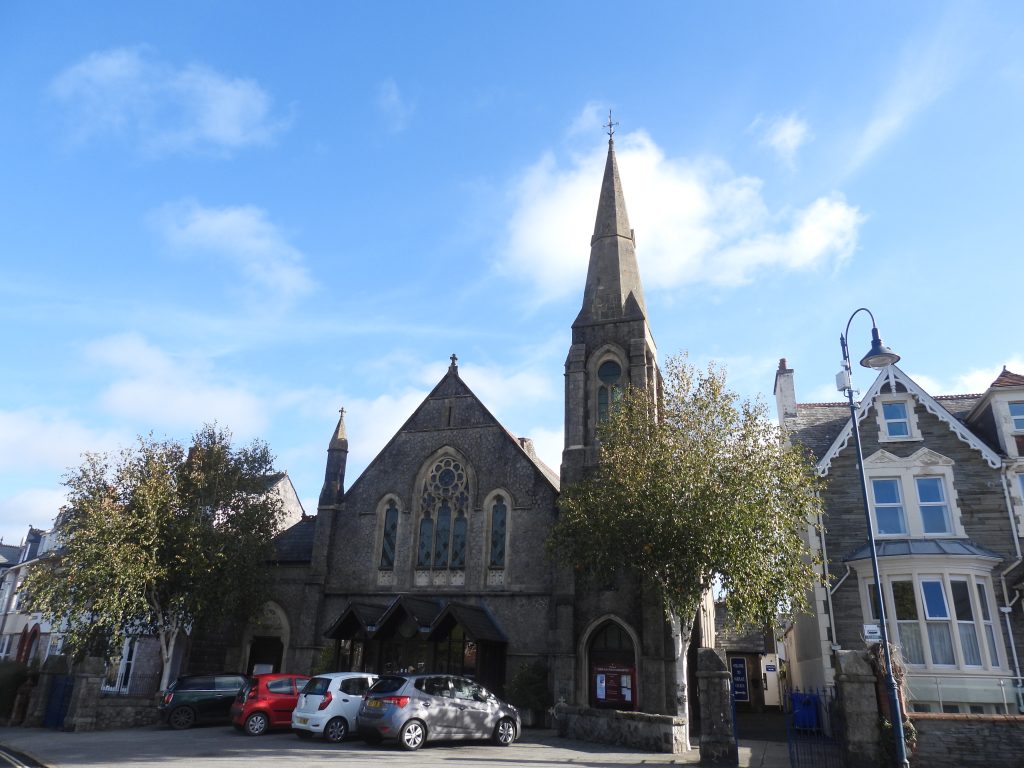
Sketch map of the Okehampton Borough Bounds. The author identified 11 boundary markers using the National Library of Scotland (side-by-side) map dated 1949-1971, the locations of which were explored in this post.Of the 11 locations explored, the author found 6 boundstones, which were set up in 1935 and are inscribed ‘OBB / 1935’. The Dave Brewer publication suggests there are eight of these boundstones. If any reader of this post is aware of the ‘missed’ two boundstones, the author would be grateful to learn of their location. On the borough boundary also found was a plain boundary marker and one inscribed ‘The / Bounds / of the / Borough’ – both of which pre-date 1935.Boundary marker 1 is inscribed ‘OBB / 1935’ and is located on Tors Road a few hundred metres downhill from a property called ‘Klondyke’.The first boundary marker is located next to a hedge line at the back of a wide grassy area. Boundary marker 2 is inscribed ‘OBB / 1935’ and is located on the footpath below Ball Hill. The boundary crosses north – south at this point (ie perpendicular to the path).The author can remember passing this boundary marker on many occasions whilst participating in the “O.A.T.S’ (Okehampton Adventure Training Scheme) walk.Boundary marker 3 is inscribed ‘OBB / 1935’ and is located on Fatherford LaneThe Okehampton Borough Boundary crosses Fatherford Lane and follows the line of the side lane shown in the top right picture (east of the boundary marker)Boundary marker 4 is inscribed ‘OBB / 1935’ and is located on the north side of the Exeter Road (B3260)The boundary crosses north – south at this point (ie perpendicular to the road).The location of a fifth boundary marker is still marked on modern OS maps on the B3215. The author believes it is either very deep into the hedge line shown or has been hidden behind a (relatively new) fence which is associated with the new housing estate. Disappointing if the fence has been built around it and therefore hidden it. The author would be grateful to see any pictures anyone has of the boundary marker which is / was here. Hopefully it is / was an ‘OBB / 1935’ boundary marker.The author also went to find a milestone a few hundred metres along the road, but that marker seems to have been removed as it was (probably) located where there is now a newly built hedgerow associated with the new housing estate. Boundary marker 6 is inscribed ‘OBB / 1935’ and is located on the lane leading to Barton Farm and Higher Chicacott Farm. Boundary marker 6 is buried deep into the hedgerow. The boundary at this point changes direction from south / north to east / west.Boundary marker 7 is inscribed ‘OBB / 1935’ and is located at Knowle Cross junction, close to Knowle BridgeThe boundary at Knowle Cross junction crosses the road at this point and follows (for a short distance) the lane which crosses Knowle bridgeOkement river looking upstream (south) from Knowle bridge.As with many bridges of similar age to Knowle Bridge, the OS surveyors inscribed a benchmark upon it. It is labelled B.M. 455.9 on 19th century maps.Knowle Road bridge over the Okement River is recorded as dating from circa mid 19th century and is constructed from granite ashlar. It has a wide single span segmental arch. Boundary marker 8 is located at a bend on Uppcott Hill. The author spoke to a resident of the property down the lane from this marker, who stated that she believes this marker once had a cross head set upon it. The author has been unable to confirm the history of this. Location of boundary marker 8. The boundary crosses this point from north east to south west.From boundary marker 8, the author would recommend taking Broadmoor Lane then turning south to visit All saints church. The church has a lovely 15th century west tower. The remainder of the church was rebuilt between 1842 and 1844 following a fire.The next (potential) boundary marker (no. 9) is / was located on Stoney Park Lane, where the borough boundary crosses from north to south. The author couldn’t find any evidence of a boundary marker at this location, but did manage to enjoy fabulous views to the high moor over the gate shown in the photograph.The next (potential) boundary marker (no. 10) is / was located on ‘Old Road’ where the boundary crosses north – south. Dave Brewer mentions in the Dartmoor Boundary Markers (2nd Edition) book that the boundary marker here is simply inscribed ‘B. The author failed to locate the boundary marker.The eleventh boundary marker in this post is on the very busy ‘Castle Hill’ road (the old A30). It is just over 1 metre high and is shallowly inscribed ‘The / Bounds / of the / Borough’. It has been repaired at some point and dates from around the 1880sThe author had to wait for a ‘ very large’ gap in the traffic, to cross the road and remove some ivy and record the grid reference. The photographs taken therefore showed the full inscription without the vegetation.To complete the visit to Okehampton the author visited St. James Chapel, which was first mentioned in the reign of Edward I. The tower on the west side is of late 14th century date. as with most churches / chapels of this date, St. James has an Ordnance Survey benchmark. (Ref: B.M. 0501.2)The chapel was ruinous in 1794 but was restored in 1861. The oldest part of the building is the tower.En-route back to the car park (at Simmons Park) Fairplace Church can be found. The church was completed in 1904, firstly for the Wesleyan Methodists, joined in 1962 by those from the Bible Christian tradition and amalgamating with the United Reform Church in 1974. Of interest is is that a J. Bird German donated windows to Fairplace Chapel in 1903 – presumably related to the town Mayor of 1905-7. (Source: https://www.westdevonmethodists.org.uk/churches/okehampton-fairplace/).