A collection of walks, discoveries, insights and pictures of exploring Dartmoor National Park
July 25, 2021
Boundstones on Southern (Moorland Section) of Belstone Parish Boundary
The parish of Belstone is roughly triangular in shape and and is recorded as covering 2.7 square miles. It rises from a low point of 190 metres on the East Okement river at Fatherford to around 440 metres at Lower Tor. The parish (except for a tiny portion at Fatherford), lies within the Dartmoor National Park. This post covers the southern part of the parish boundary between the Rivers Taw and East Okement on the open moorland section. The information for this post comes from “Book of Belstone (2002)” by Chis and Marion Walpole and “Dartmoor Boundary Markers (2nd Edition)” by Dave Brewer.
From the Book of Belstone there is an interesting account of the beating the bounds from 16th July 1958, viz: “……..of the 200 who set out only about 50 finished the gruelling course, soaked to the skin, tired, but still happy. Piloting them round was 66 year-old Mr Frank Kelly, a retired gardener and one of the oldest members of the party. “I have done the trip seven or eight times before, but this was the worst ever from the point of view of weather” he said afterwards. Youngest of the beaters to complete the journey was seven year old Peter Bullen. At Taw Marsh, where the Duchy keeper, Mr J Endacott, was waiting to welcome them, the stream was fished by Mr C Robinson symbolising the commoners’ claims to fishing rights in the Forest. Mr Robinson caught a trout and this was later cooked and eaten by Master Kevin Woodward”.
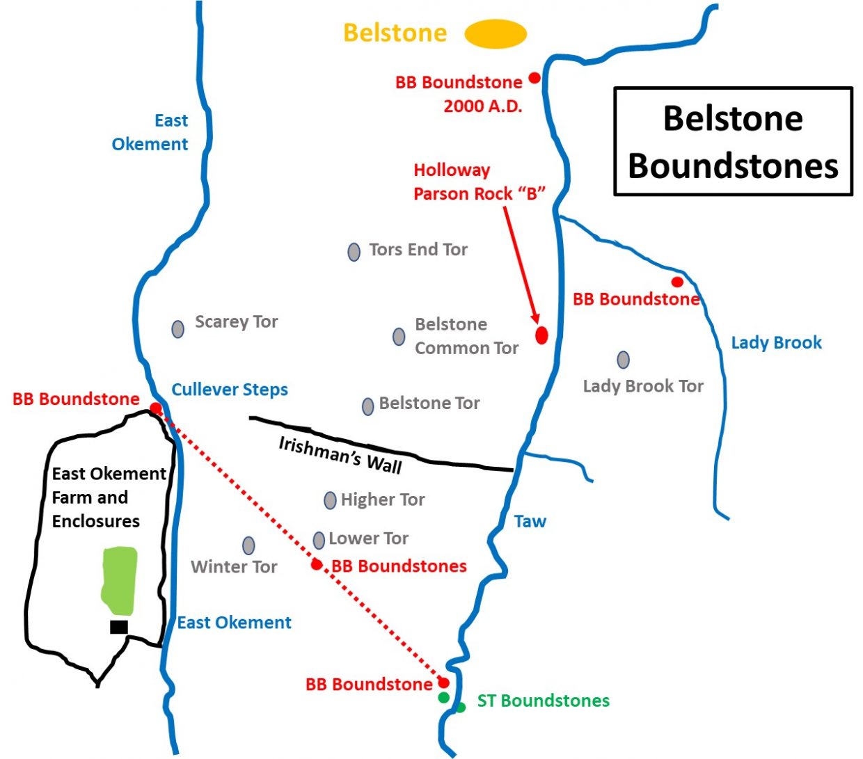
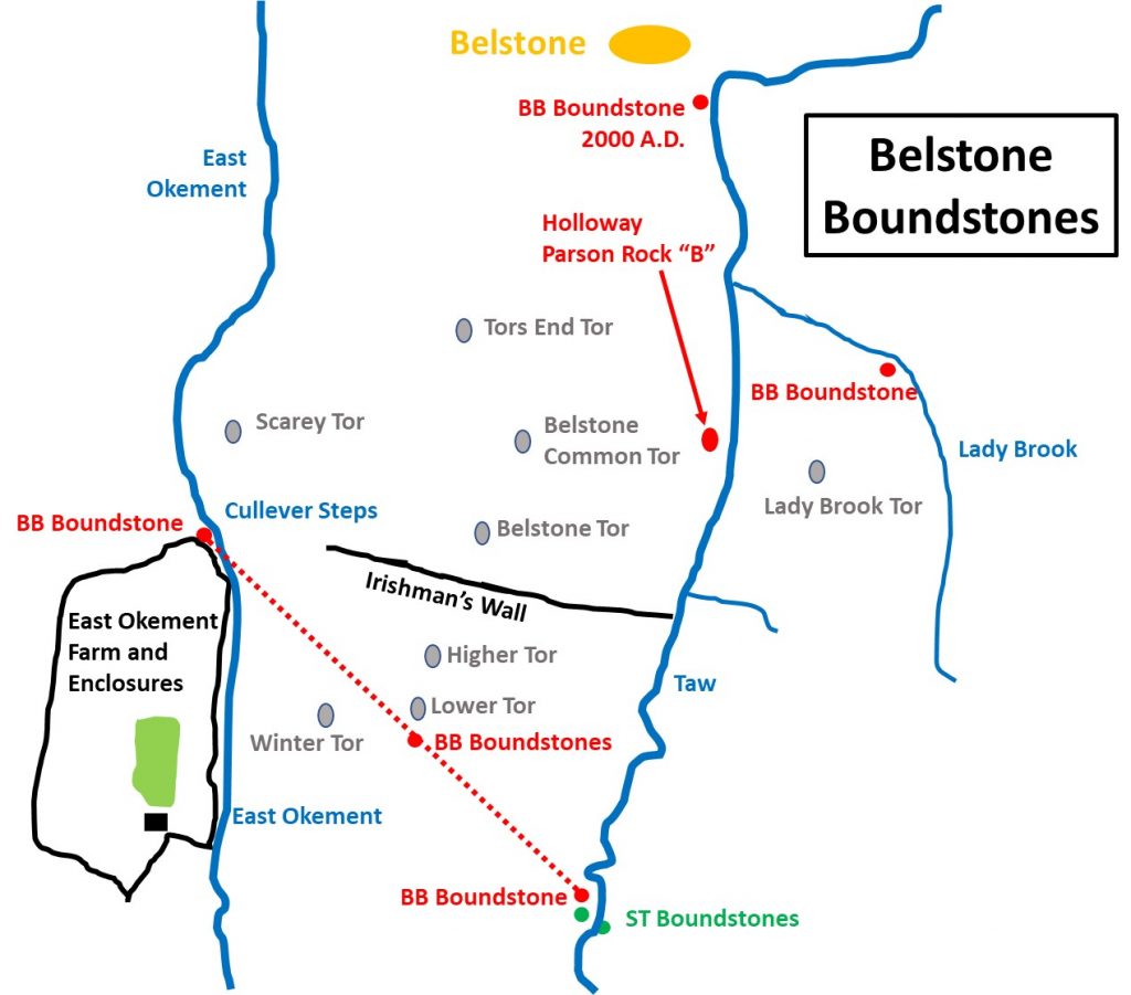
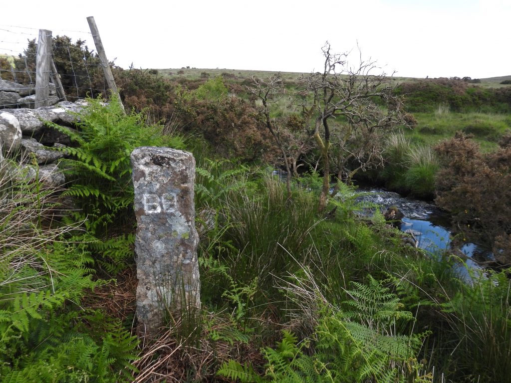
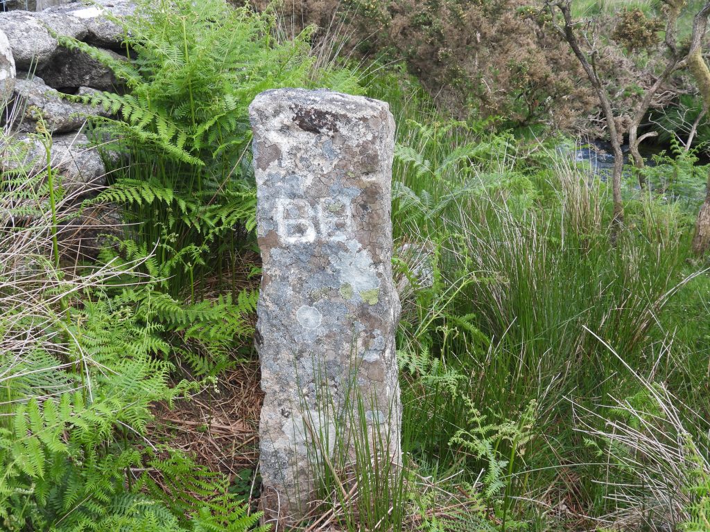
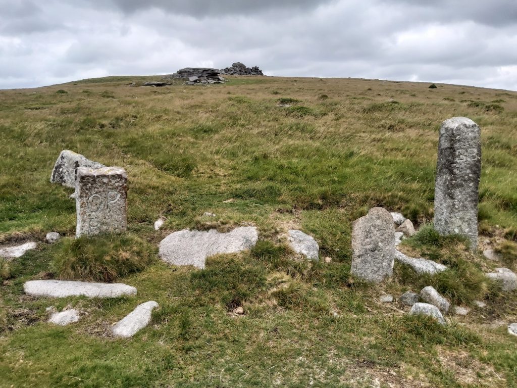
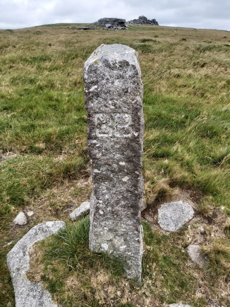
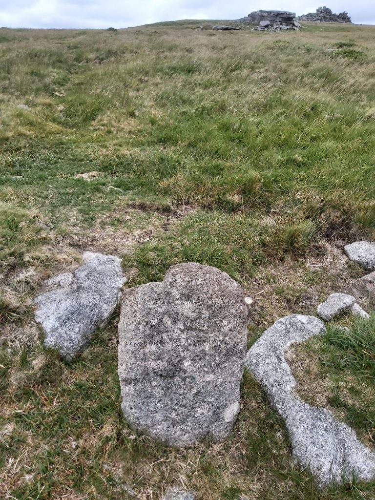
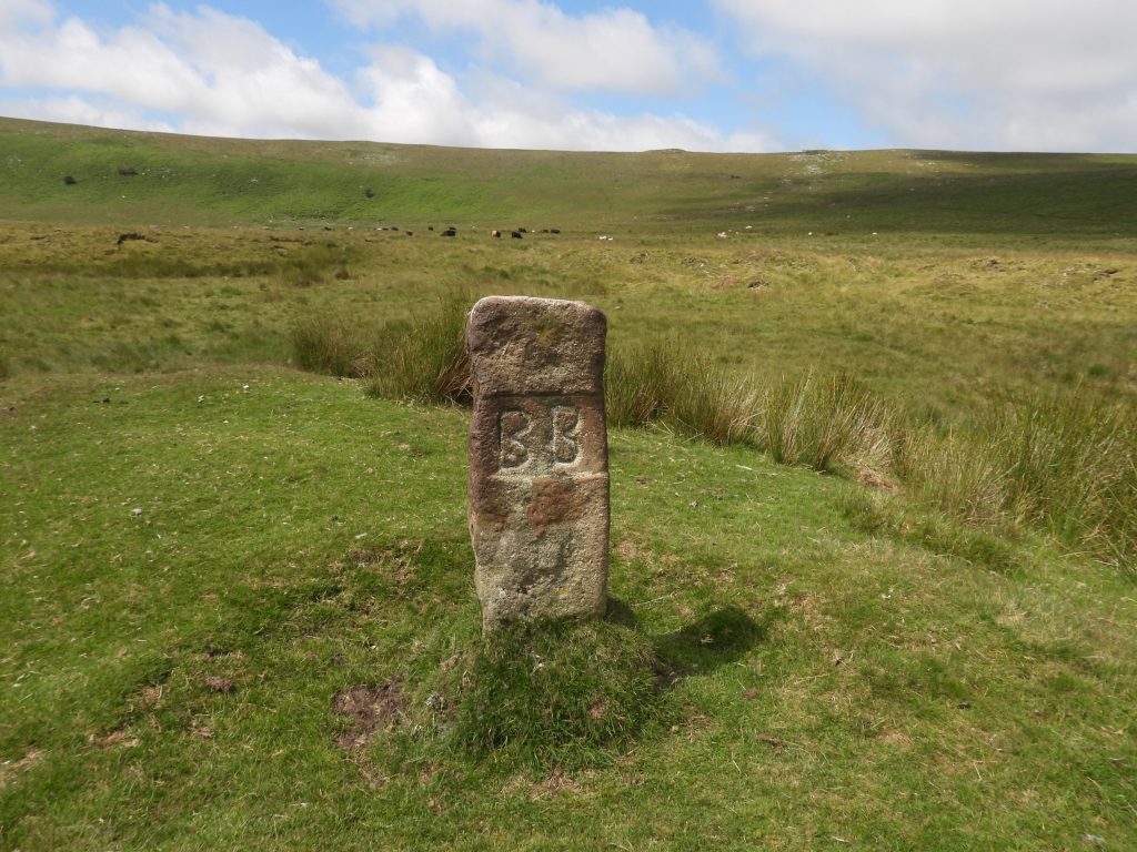
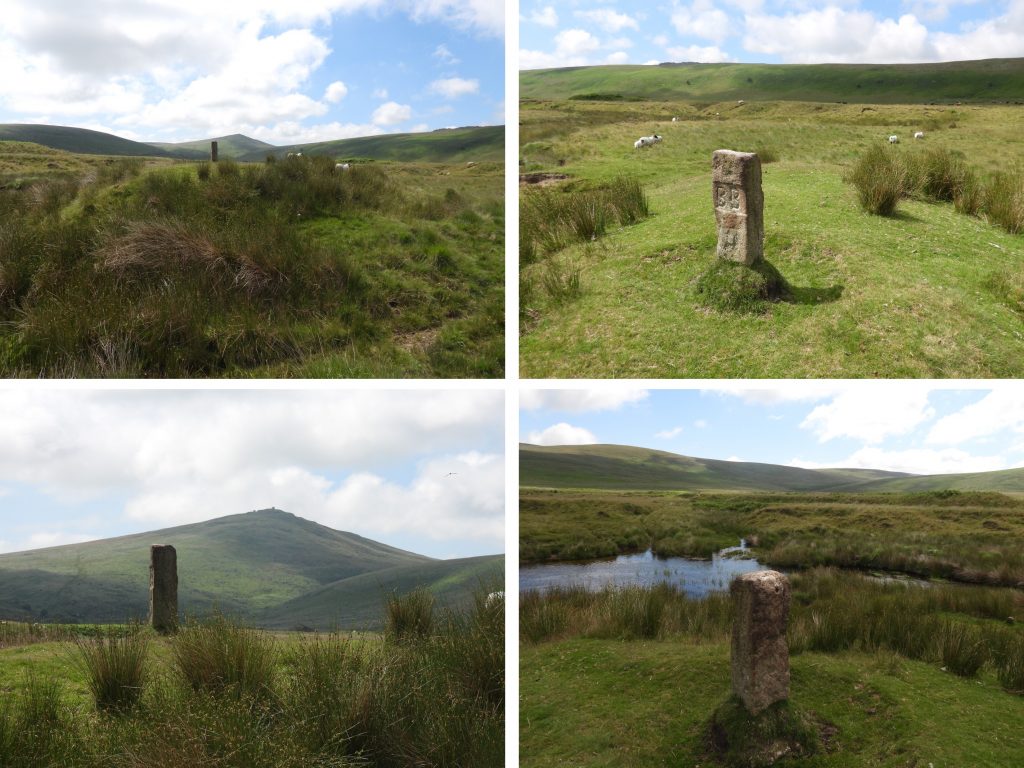
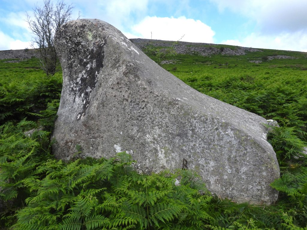
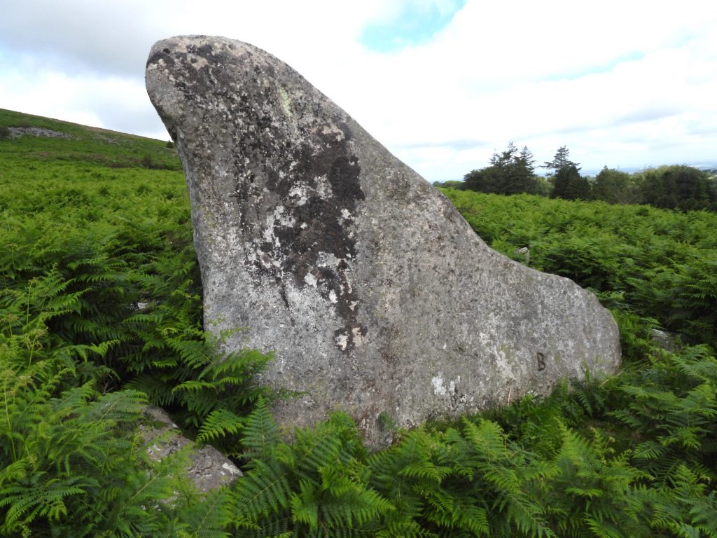
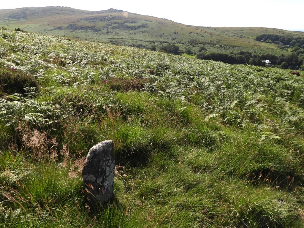
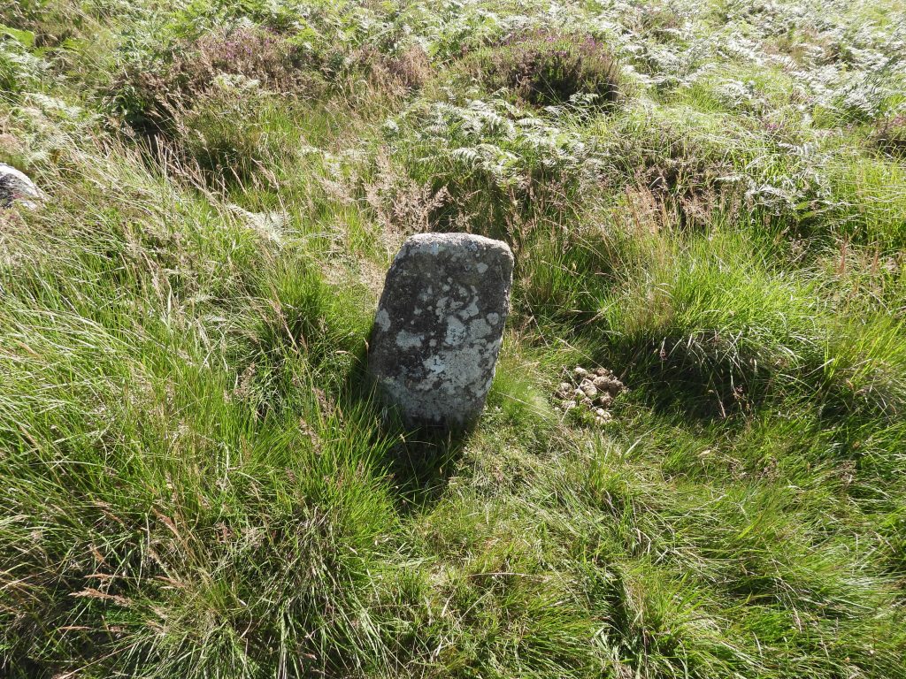
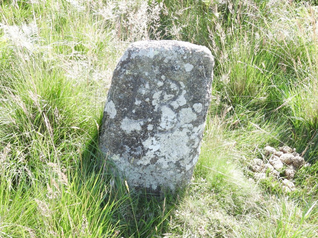
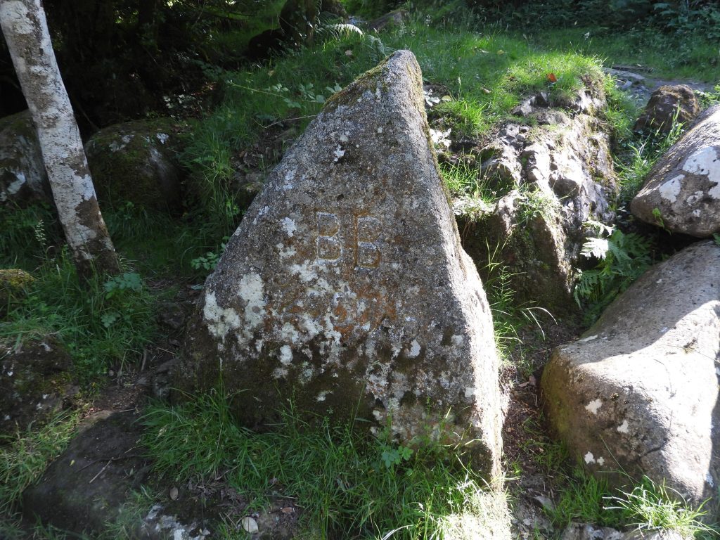
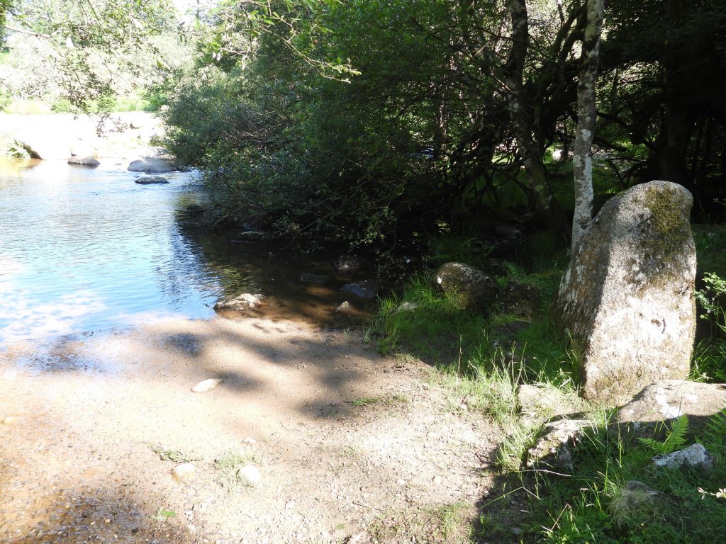
Sketch map showing the location and extent of the boundstones covered in this post.The pre-1987 Lydford / Belstone boundary line went first to the NE corner of the East Okement Farm Enclosures (also known as Hartor Farm enclosures). At this point there is a boundstone inscribed “BB”. It is 19th century and has tare and feather markers.Close up of the “BB” boundstone at NE corner of East Okement Farm enclosures at SX60628 92076.There are two Belstone boundstones and an “OPB” boundstone near Lower Tor. The larger (and newer) of the Belstone Boundstones near Lower Tor is inscribed “BB”. The smaller of the Belstone Boundstones near Lower Tor is inscribed “BB/P”. It can be located at SX61244 91484This “BB” (Belstone Boundstone) dates from 1968. It is located on a small “tump” as described by Dave Brewer in the Dartmoor Boundary Markers book (second edition). Close by are two South Tawton (“ST”) boundstones. The boundary between the two parishes was in dispute for many years and it is recorded that Belstone lays no claim to the river. The stone is located at SX61755 90949.General views of the “BB” boundstone. The historic dispute with South Tawton is recorded to be related to who had the right to remove gravel from the river. On 3rd June 1993, the Belstone Commoners beat their bounds in a clockwise direction. On reaching this spot after up-ending a youngster and bumping them in the traditional manner, they fired a gun to claim “game rights”. According to the “Book of Belstone Book (2002)” : Strict tradition dictates that the youngest child of the parish is upended by the oldest man, rapped on the backside with the Union flag, has his or her head banged on the boundary stone – thus impressing upon them, quite literally, its position – and receives a monetary reward for the trouble. The Holloway Parson Rock is also known by the names as The Walrus Stone or the Belstone Clanger. It is inscribed with a “B”, which one assumes stands for Belstone.The Holloway Parson Rock “B” inscription can be found at SX 62124 92389. The author has heard of another inscribed granite stone on Belstone Common, marked with a ‘B’ (believed to have been cut by local stone mason William Brock) which has a bench mark symbol and lies between this rock and the river. A further exploration is needed !The Belstone bounds are defined today by the River Taw flowing down to Sticklepath. However, this was not always the case. Near Lady Brook (corruption of Lud-a-Brook, recorded in Court Rolls of 1383) is a set boundstone inscribed with “BB”.The Lady Brook boundstone inscription has elongated letters and is considered to be some age. Some believe that the style of lettering can be dated to the late 16th or early 17th century. The stone is approx 2ft 6in tall and is positioned which is more or less on a straight line between Chapel Ford (on East Ockment) and Cosdon or Cawsand Beacon.Close up of the Lady Brook boundstone is located at SX62645 92585.On 1st June 2000, the bounds of Belstone once more were beaten. Their first stop was to see the new boundary stone near the footbridge below the village. It is inscribed “BB” with “2000 AD” below. It was carved by Peter Cooper.Location of the latest “BB” / “2000 AD” boundstone next to the Taw at SX62111 93360.