A collection of walks, discoveries, insights and pictures of exploring Dartmoor National Park
July 29, 2021
Cator Bounds
Cator Manor / Cator bounds lie within the Spitchwick Manoral bounds, which in turn lies within the parish of Widecombe. This post covers boundstones found on Cator Common relating to these bounds, namely: Spitchwick boundstone / gatepost (which is also known as Arthurs Stone) and six Cator Bound (CB) stones. Also in this post are two related “spiked” stones found at Cator Green and the road junction leading to Lower Cator farm.
Spitchwick Manor was mentioned in Domesday as Spice wite. In the 13th century a Thomas de Spicwyk is recorded as granting a gift of some of his lands as a marriage settlement, which is where the origins of Cator was born. Fast forward to late 19th century Spitchwick manor listed 16 farms within its bounds including those of Great, Middle and Lower Cator.
The source of information for this post has been obtained from Dartmoor Boundary Markers (2nd Edition) by Dave Brewer plus two letters published in the Dartmoor Magazine in the Spring 2001 and Summer 2001 editions.
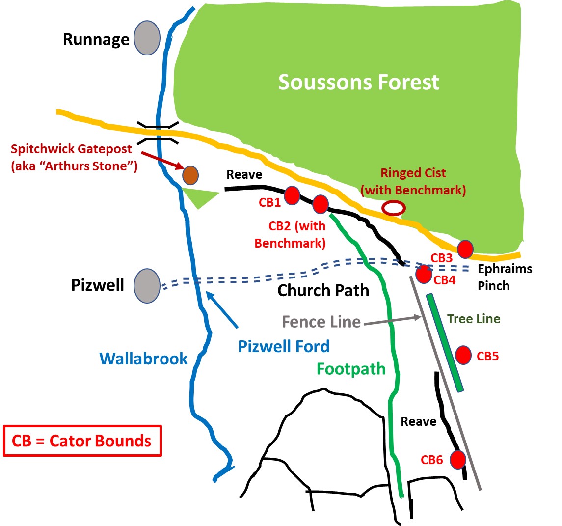
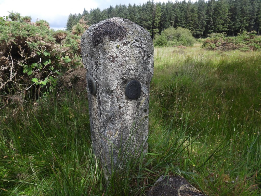
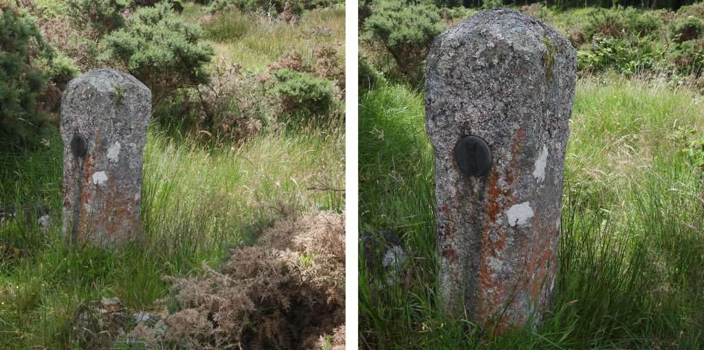
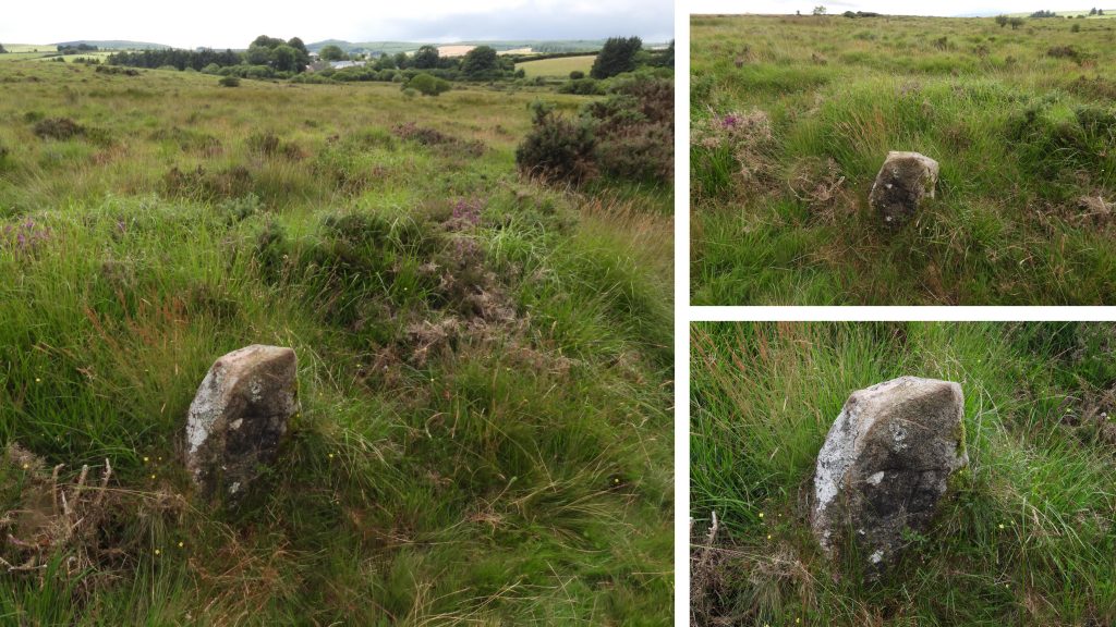
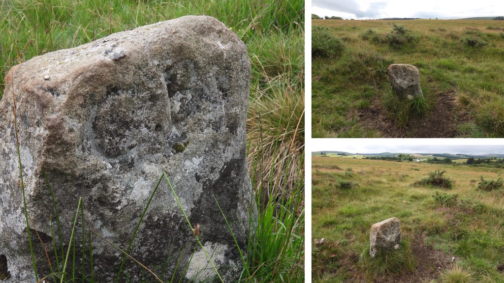
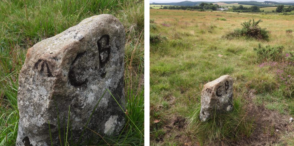
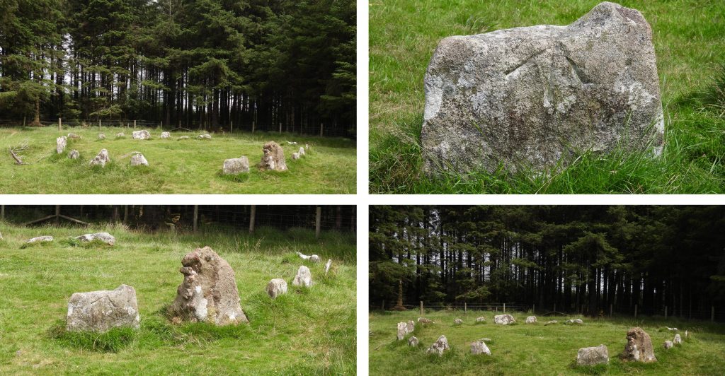
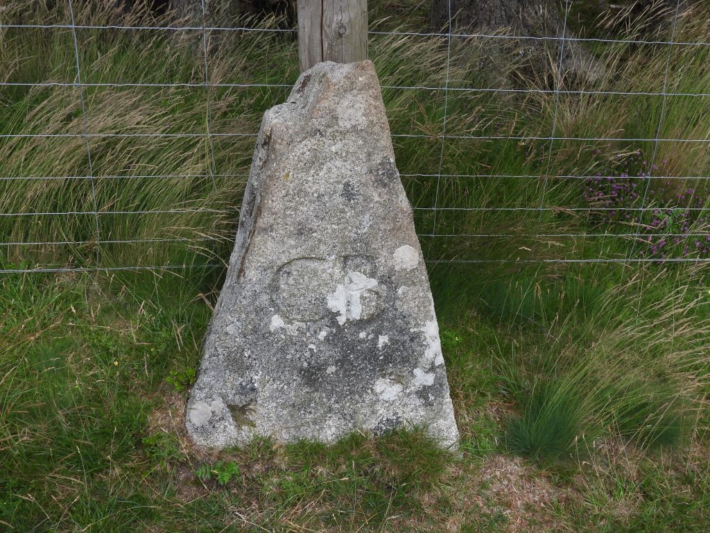
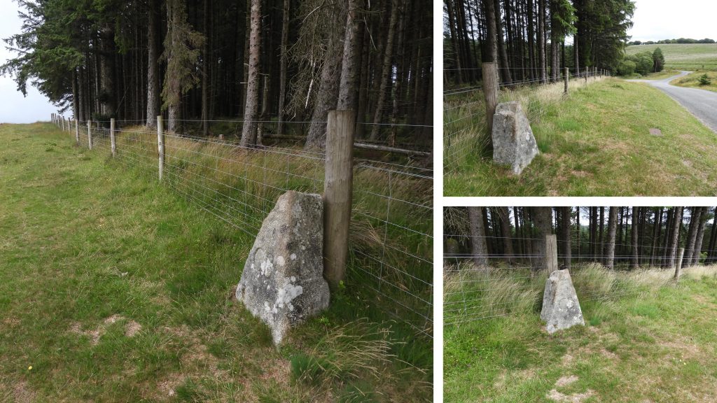
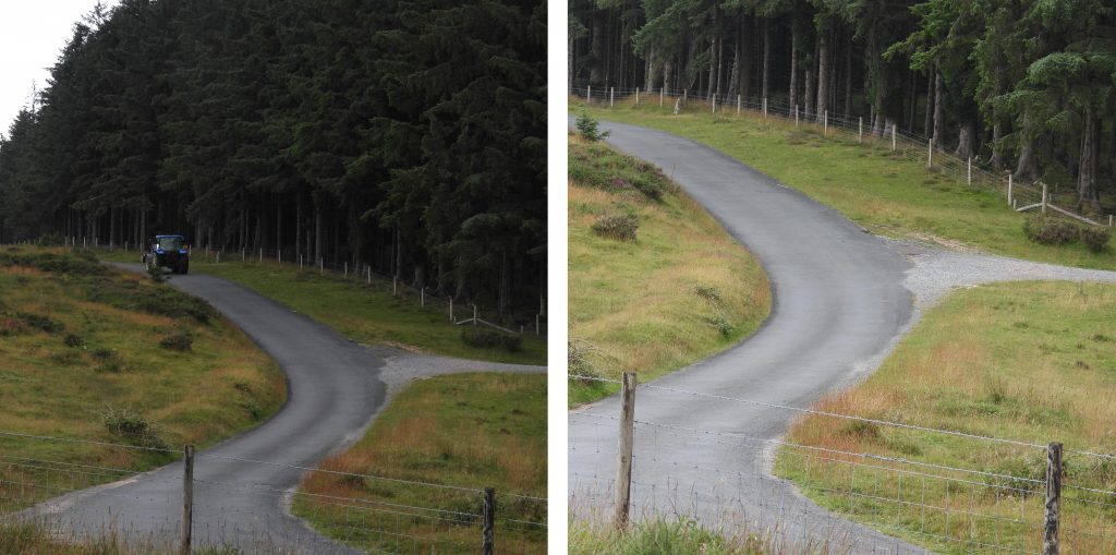
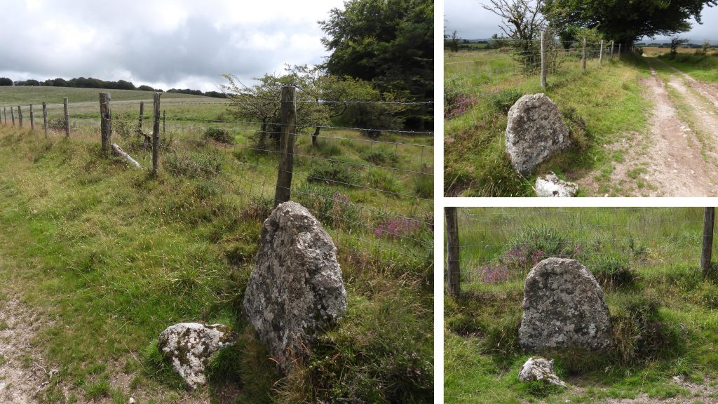
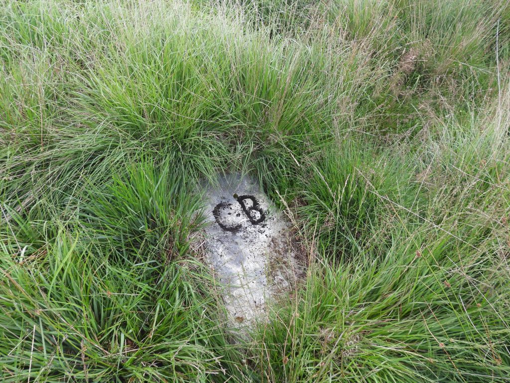
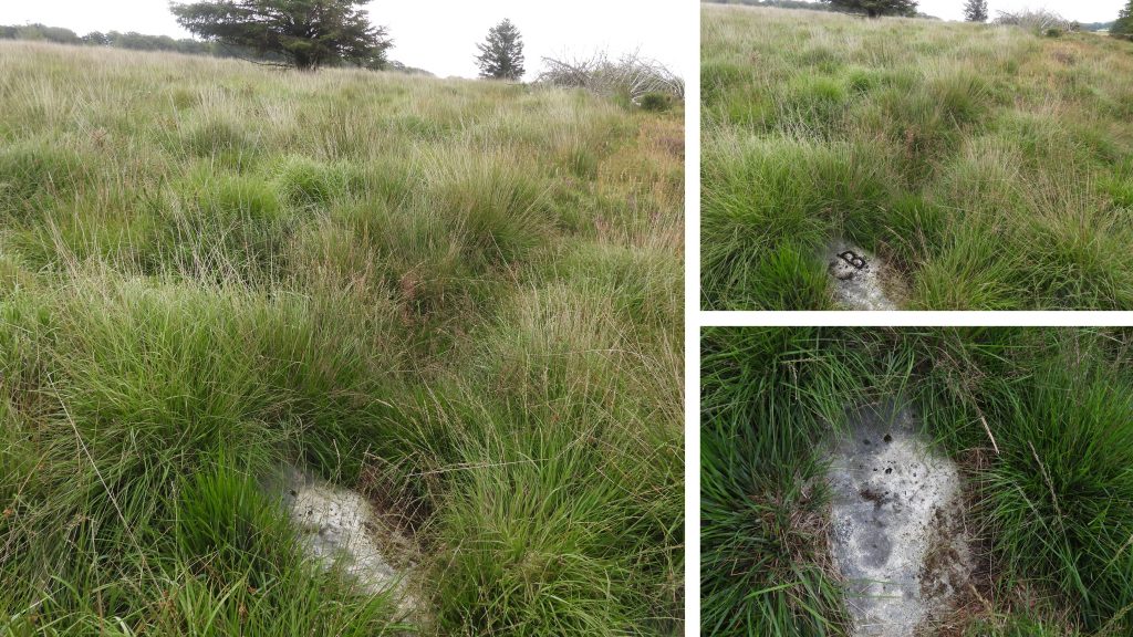
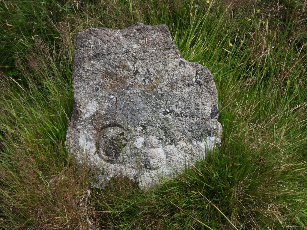
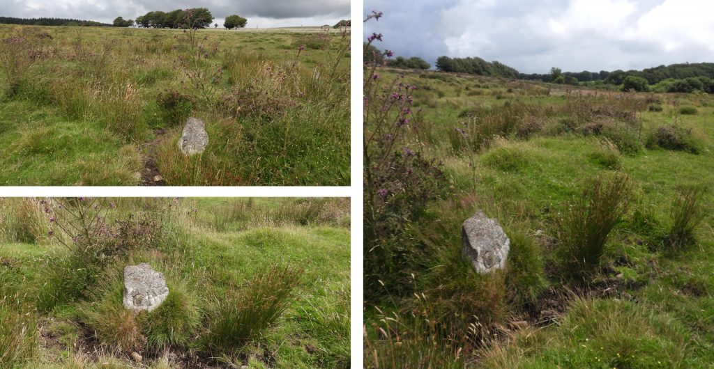
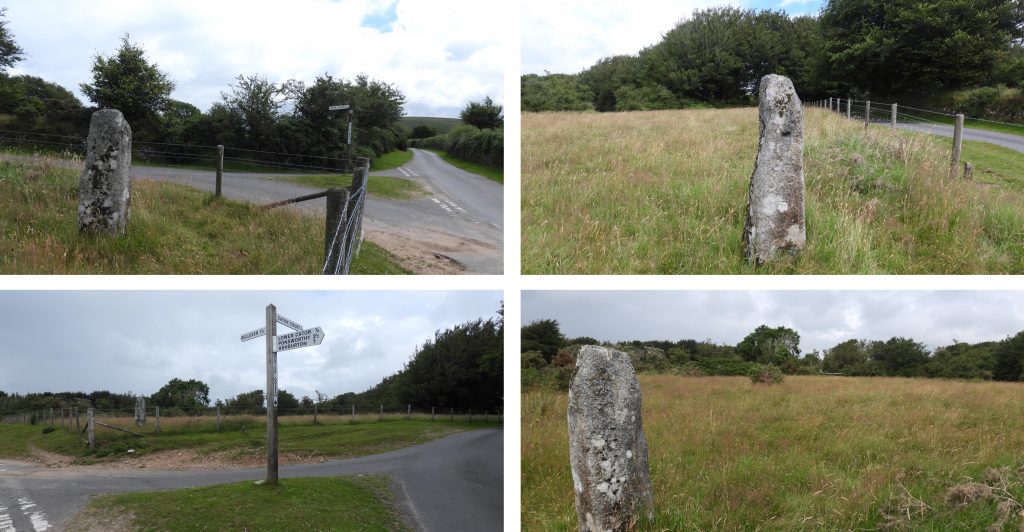
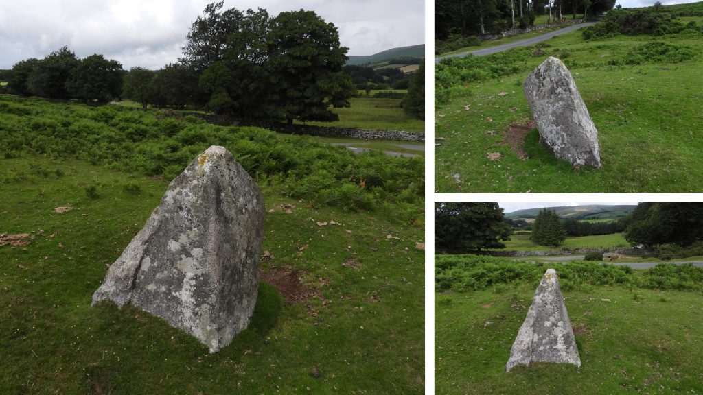
This sketch map shows where the key features in this post from Cator Common are located. The two “spiked” stones are not included on this mapThis boundstone is known as Spitchwick gatepost or Arthurs Stone. It lies near the Wallabrook on the most North West point of the Spitchwick Manor bounds. It was erected in 1973 at the time of the beating of the bounds. It can be found at SX66908 78741.The boundstone marks the boundary of Widecombe (Spitchwick Manor), Lydford and Manaton and the name Arthurs stone relates to Arthur Routley who erected it.On three sides of the Spitchwick gatepost / Arthurs Stone are three bronze plaques, which were added in 1995 during the beating the bounds. The inscriptions are “WID” (Widecombe) facing East, “LYD” (Lydford) facing West and “Spitchwick Manor” encircling the initials “SJVS” facing South. The initials “SJVS” relate to Stephen John Valentine Simpson, the Lord of the Manor of Spitchwick.Moving East from the Arthurs Stone an old reave can be found, which represents the Cator Bounds, where several “CB” inscribed stones can be found. The first “CB” stone, marked CB1 on the sketch map can be found at SX67166 78737. As can be seen from the photographs, the boundstone is a rough piece of moorstone.Moving East along the reave a second “CB” rough moorstone boundstone (CB2) can be found. This boundstone can be found at SX67312 78698.The 2nd “CB” inscribed stone also has a OS benchmark and a brass rivet. The “mud makeover” of the inscriptions and benchmark were added to emphasise the markings for the above photographs.Just off the Cator bounds and next to the road is a ringed cist and is worth a visit. Intriguingly, even these ancient monuments appeared not to escape the OS attentions of the 19th Century, with a large benchmark inscribed on one of the stones. A third “CB” stone (CB3) is not located on the boundary but adjacent to the road. In a letter by Peter Hirst (Widecombe History Group), in Dartmoor Magazine (Summer 2001 edition), he refers to the largest “CB” stone having been buried and coming to light when telephone cables were buried at this location. The stone was re-erected in a convenient location. The author has assumed that it is this stone that is being referred to. It is likely to have been initially buried when the road was established.The third “CB” stone (CB3) can be located at SX67635 78596. This is at the top of a small rise known as Ephraim’s Pinch (which relates to the exploits of a young man attempting to win the hand of the farmers daughter at Runnage, who was tasked to carry 20 stooks of wheat and a sack of flour from Widecombe to Runnage and back – he failed in his task at this “pinch” and he sadly died).Ephraims Pinch.At the junction of the previously mentioned reave and the Church Path leading from Pizwell Ford is a fourth “CB” stone (CB4), once again an inscribed moorstone. It can be found at SX67584 78506.On the modern OS map this “CB” boundstone is marked simply as “stone”. It is the east side of the fenceline and treeline which borders Cator Common. To access the area, the explorer must go to the cattle grid below Ephrain’s Pinch, where there is a gap in the fenceThe boundstone, labelled “CB5” on the map can be found at SX67691 78251.A sixth “CB” stone, marked as CB6 on the sketch map, was recorded by Maureen and Robin Vane from Lincoln in a letter to Dartmoor Magazine (Spring 2001 edition). The information was conveyed to Kath Brewer for the Dartmoor Boundary Markers book. However, the location was never confirmed in the book and only an approximate Grid Reference provided. The stone is yet another rough moorstone and can be found at SX67632 77974.CB6 can be found on a reave approx 75 metres from the public footpath which crosses Cator CommonIn the marriage settlement granted by Thomas de Spicwyk in the 13th Century a Pikestann (Piked Stone) is mentioned. One such stone was quite recently (20th century) re-erected at Cator Green at what is believed to have been its original site, having previously been used as a gatepost at Middle Cator for several centuries. It can be found at SX67969 76672.Another very prominent “Piked Stone” can be found near the Bellever Road opposite the Lower Cator junction. This stone is on the Cator Boundary, which continues uphill to the Northern end of Corndon Down. It can be found at SX68475 76003.