A collection of walks, discoveries, insights and pictures of exploring Dartmoor National Park
February 4, 2022
Soussons Down Antiquities
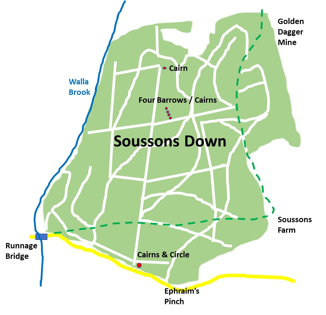
Due to its afforestation in the late 1940’s (started 1947), Soussons Down appears to the casual observer as a place which holds little or no interest. However, the down does contain the remnants of a cairn, a ring cairn, several barrows and a cist, which can all still be easily located as they were spared by the foresters. These Bronze Age monuments lie in three areas; Firstly on the southern boundary of the current plantation, probably the most visited is the Ringastan or Soussons Stone Circle, secondly there are four Bronze Age round barrows known as Red Barrows close to the centre of the plantation and thirdly a little known cairn near to the northern boundary where the path exits the plantation onto open moorland between two deep tinners’ gullies associated with Golden Dagger Mine.
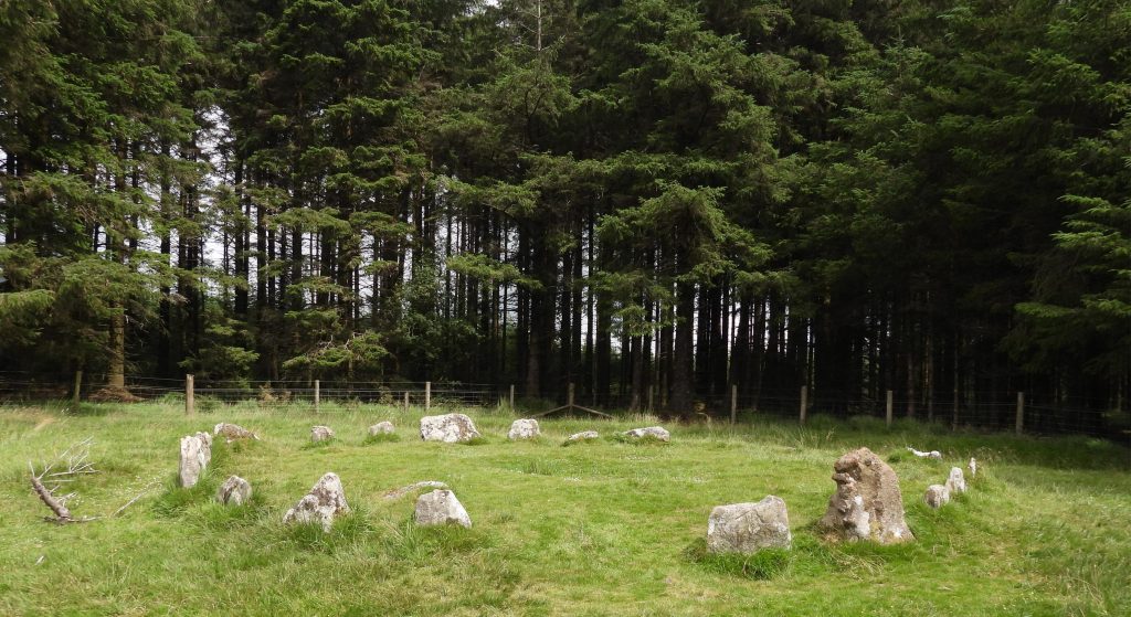
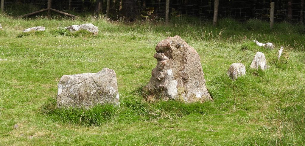
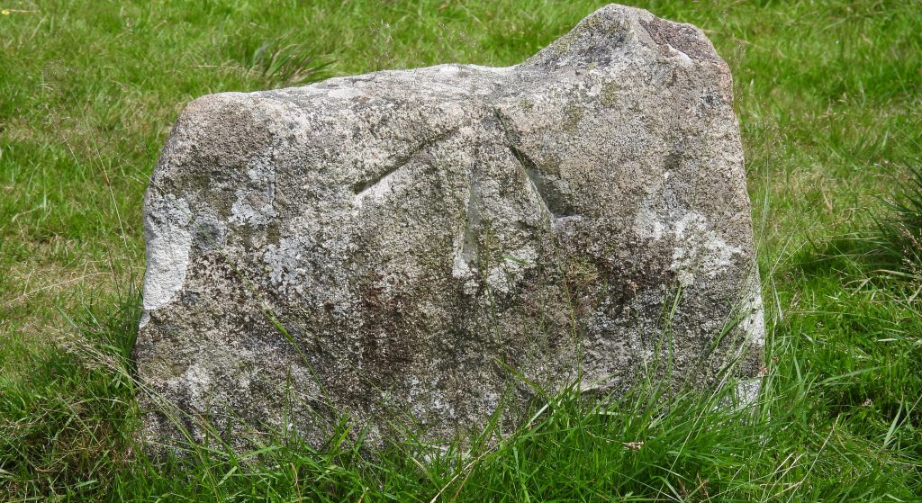
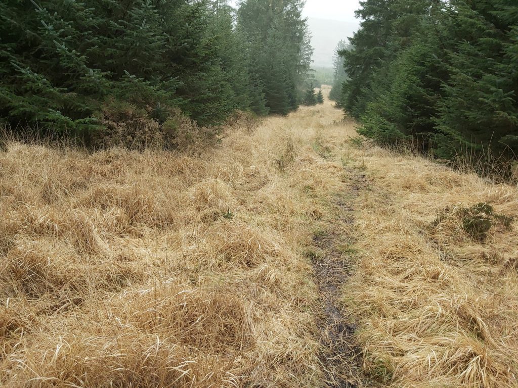
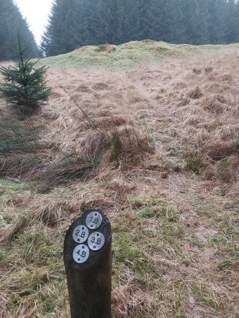
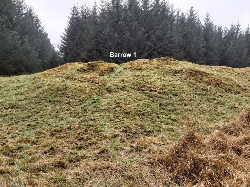
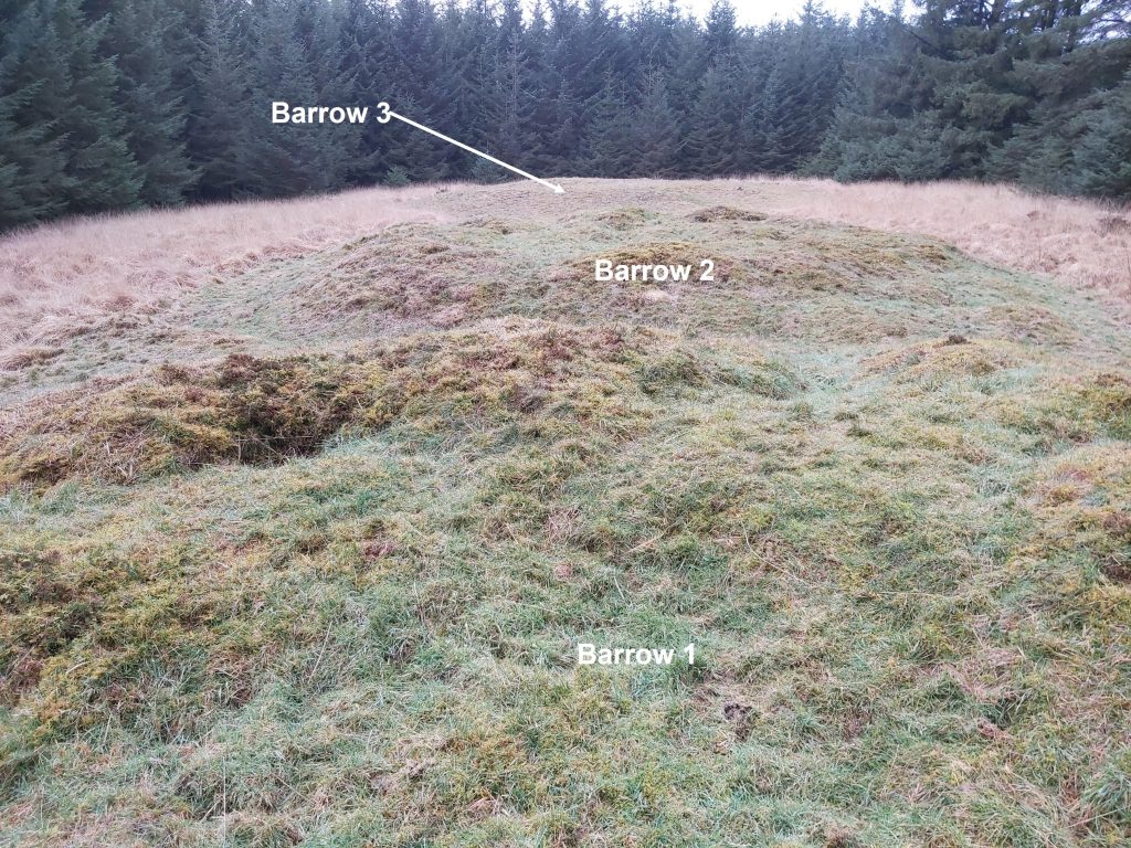
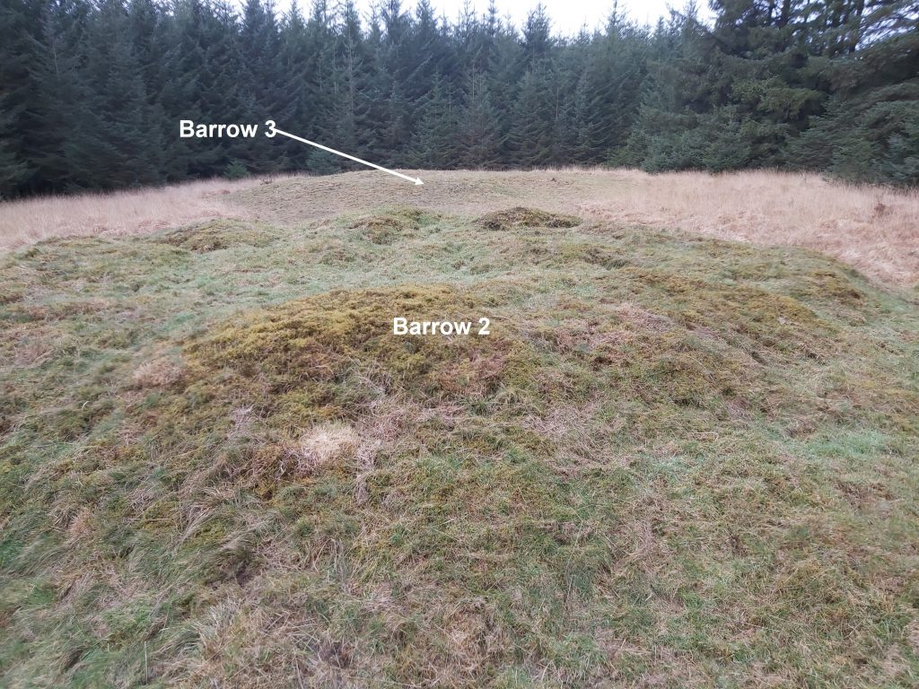
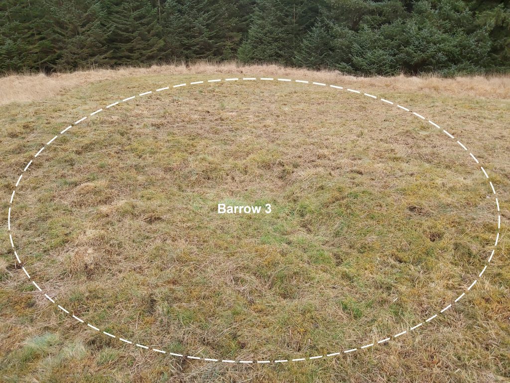
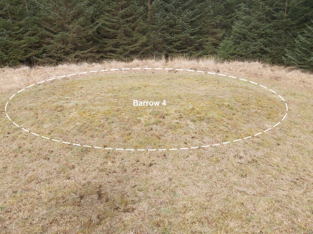
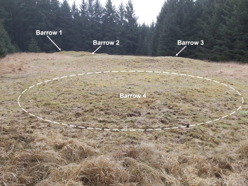
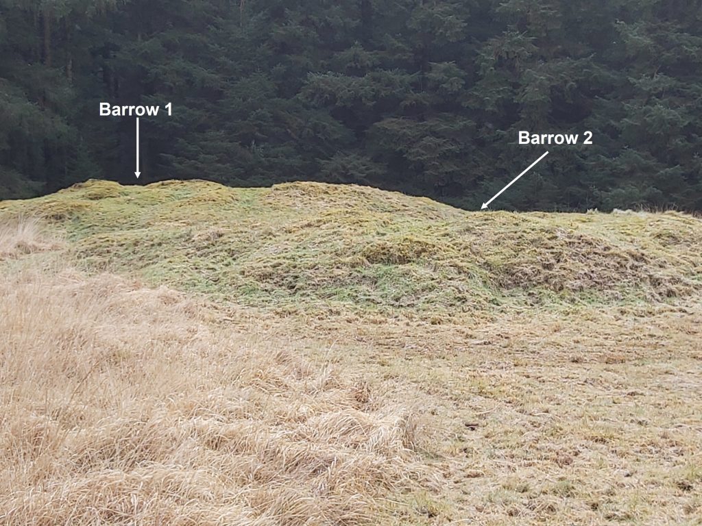
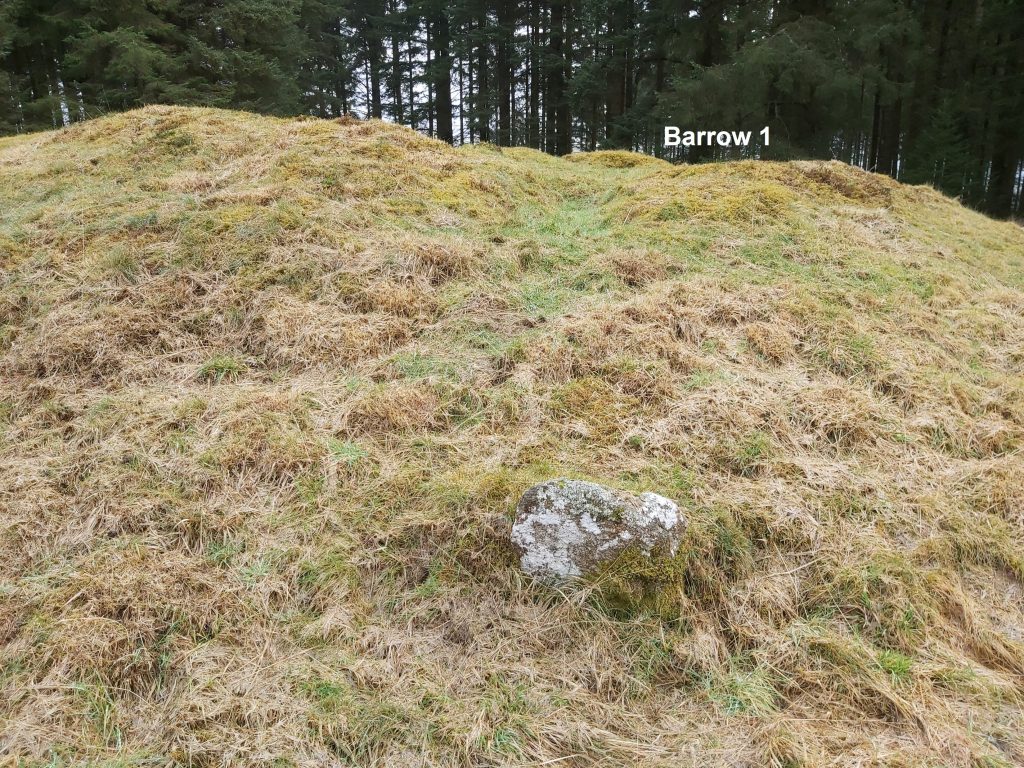
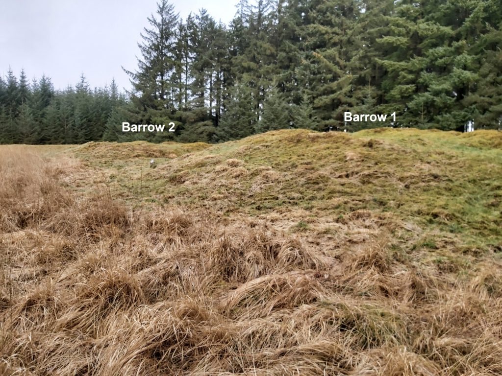
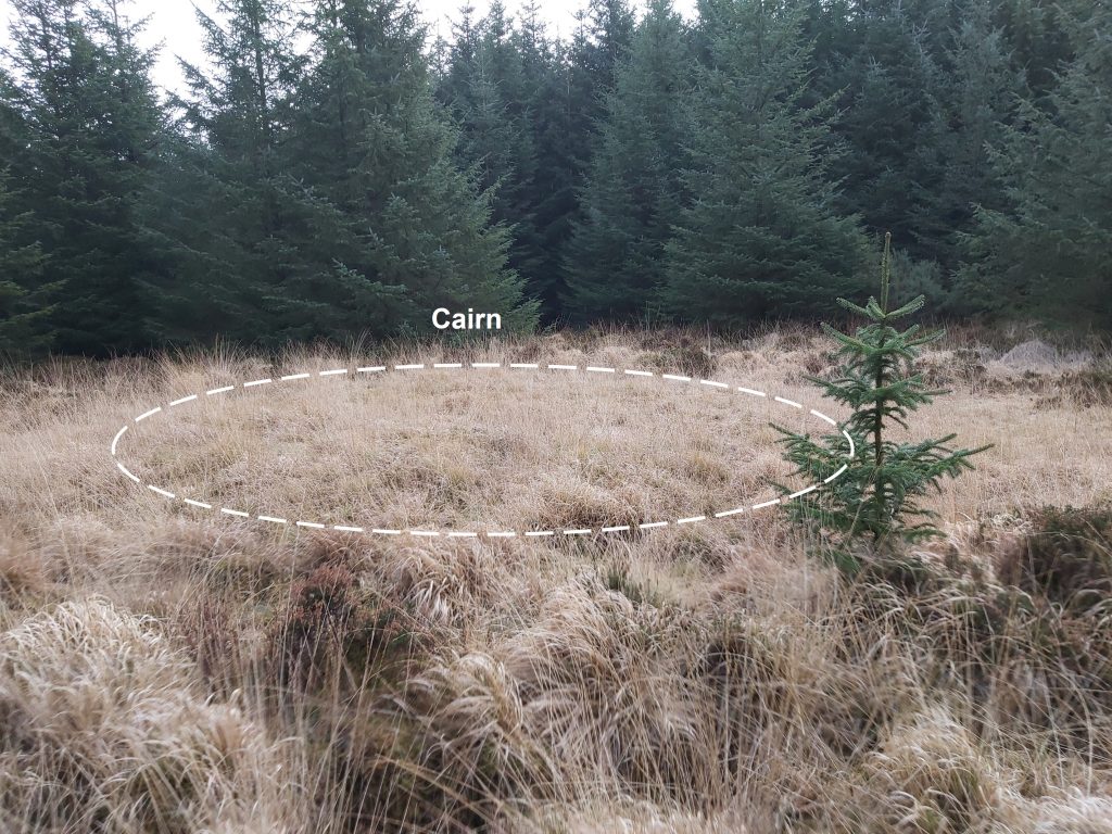
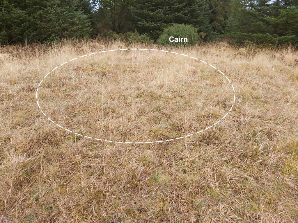
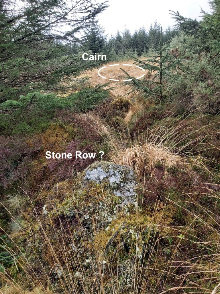
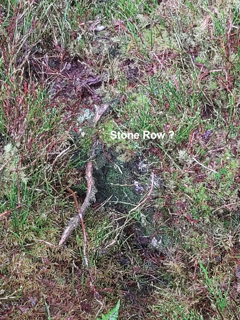
Sketch map of the locations of the Bronze Age antiquities on Soussons Down. The area has also been known (Crossing) as South Sands, South Stone Common, South Shute Common. It is suggested (English place name society) that “Soussons” could originally have meant “at the seven stones”. (Source: Legendary Dartmoor)The Ringastan is a ring cairn on the southern side of Soussons Down. It is recorded (Dartmoor HER) as being diameter 8.6m, with the maximum height of the stones as 0.85m. There is a cist in the centre 1.3m by 0.5m.Next to the tallest stone (0.85m), the adjacent stone has been defaced with a very large benchmark.The size of the benchmark seems out of keeping of the normal 19th century OS benchmarks which can be found all over the moor. A typical “fire break” in Soussons Plantation. The one in the picture connects the eastern boundary (near Golden Dagger) and the Red Barrows.The Red Barrows comprise four Bronze Age round barrows. To the east of the southern most barrow is a wooden post with 4 labels (1B, 2B, 3B and 4B) which represents the designation for each of the barrows. The southern most barrow is number 1 and the northern most is number 4. Behind the wooden post is barrow 1.All the Red Barrows are scheduled monuments. In 1902 the Dartmoor Exploration Committee of the Devonshire Association ‘explored’ the two barrows and published their findings in 1903.The Dartmoor HER states that “the southern mound (barrow 1) measures 19.5m in diameter and stands up to 2.2m high and was partially excavated revealing charcoal, a flint flake and a circular cist containing burnt human bones and another flint flake. A single sherd of pottery and traces of a stone kerb were also recorded”.Picture is standing atop barrow 1 at SX67695 79655 looking north. Rev. Sabine Baring-Gould in1898, recorded these barrows in the Fifth Report of the Dartmoor Exploration Committee. He described them as ‘four fine tumuli’, which showed some signs of having been dug into; although he further stated that this may be in part due to animal burrowing. He concluded that these features should be investigated.Barrow 2 is recorded a being 14m in diameter and 1.4m high. It was partially excavated in 1902 by the Dartmoor Explorations Committee, who found a flint arrowhead, two pieces of bronze and a central pit containing wood charcoal and burnt bone. A paved area beside the pit was also covered in bone and charcoal. It is located at SX67699 79655.The Dartmoor HER describes barrow 3 as measuring 20m in diameter and 1m high with two edge set stones on the south eastern side of the mound which may represent the remains of a kerb which survives elsewhere as a buried feature. It is at SX67682 79687Barrow 4 (the most northerly) is 10m diameter mound standing up to 0.5m high. It is at SX67689 79704.View from barrow 4 looking south. Barrows 1-3 appear to be aligned with barrow 4 slightly “offset” from that alignment.Rev. Sabine Baring-Gould recorded the findings of barrows 1 and 2 in 1903 as part of the Ninth Report of the Dartmoor Exploration Committee.On barrow 1, this rock can be found. Does it represent the remains of a kerb ?Both the excavated barrows (1 and 2) were composed largely of soil and it is concluded all four may have been constructed in this way. Towards the north end of the plantation (in a small clearing) lies a round cairn which is recorded as having diameter 9.7m and height 0.6m. The centre of the cairn is located at SX67662 79963.Within the cairn is a central pit 2.2m by 1.5m by 0.6m deep. Bilberry and grass covers mound, thus making it not that easy to discern. The Dartmoor HER described there being four stones in the immediate vicinity which may have once belonged to the now destroyed row. The author found this stone to the east of the cairn, which may form part of the described feature.A little further east from the first stone (and in alignment with the cairn) a second stone was found amongst the vegetation. A 3rd and 4th stone couldn’t be found. Is this stone also part of the described “stone row” feature.