A collection of walks, discoveries, insights and pictures of exploring Dartmoor National Park
December 8, 2023
Foale’s Arrishes (Torr Town Bronze Age Settlement)
Rev Sabine Baring-Gould (who was a member of the Dartmoor Explorations Committee) provides a great description of Foale’s Arrishes in his book ‘A Book of Dartmoor’ (Page 176-177), which was originally published in 1900. Baring-Gould penned: “By Pill Tor, are the remains of an extensive prehistoric settlement. Many huts and inclosures (sic) remain. The place bears the name of Foale’s Arrishes, from a man of that appellation who spent his energies in converting the prehistoric inclosures into fields for his own use, to the destruction of much that was interesting to his own dubitable advantage. The huts have yielded fine specimens of ornamented pottery”.
Baring-Gould certainly didn’t hold back on his condemnation of Foale, who was at one time the innkeeper of the nearby (now ruined) Newhouse Inn, which was located on the west side of the Ashburton road. Having rebuilt walls of the original prehistoric enclosures, as recorded by Hemery in High Dartmoor (page 662), Foale was thought to have grazed some of his livestock here. Hemery further notes that the name Foale (or a derivation Foall) has been extant in the Widecombe area since the 16th century. Although the word ‘Arrishes’ is a Devonshire term for a field (particularly a corn field) with the word deriving from the Old English word ersc (Legendary Dartmoor), there must have been some arable connotations for the map makers to name it as ‘Foale’s Arrishes’. The Dartmoor Explorations Committee wrote in the 4th Transactions of Devonshire Association (TDA) in 1897 (page 151) suggested about Foale’s Arrishes that: “It probably received its modern name from some squatter who seems to have hazarded its cultivation, for attempts appear to have been made to gather the surface stones in heaps, so that a scanty tillage might be pursued between”. Whether, this cultivation was carried out by Foale is unknown but it is likely. The Dartmoor Explorations Committee also supposed much of the prehistoric site had been dismantled by road makers.
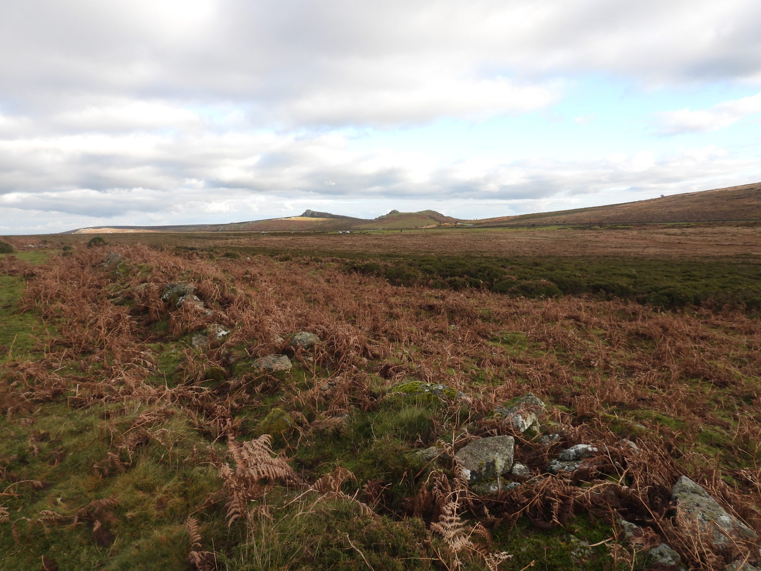
The old name for the area as recorded by Rev’d Croker in 1851 in his guide to the Eastern escarpment of Dartmoor, appears to have been either Torr Hill or Torr Town. Therefore, had Foale not interfered with the prehistoric settlement, which is believed to have been in use from the Bronze Age to the early Iron Age, the area might well have been known today as “Torr Hill or Torr Town Bronze Age Settlement”. It is unfortunate that the name Foale’s Arrishes appears to relate to the whole settlement where in fact only two of the eight hut circles here are located within the ‘Arrishes’. The author rather likes a possible name of “Torr Town Bronze Age Settlement”, which is why this has been added to the title of this post. This post records the huts and some of the pounds / paddocks of this Bronze Age settlement using the Dartmoor Explorations Committee notes from their excavations in 1896, recorded one year later in the 4th TDA.
Bibiography
Baring Gould, S 1900 A Book of Dartmoor – Methuen
Hemery, E. 1983 High Dartmoor – Devon Books
Butler, J. 1991 Dartmoor Atlas of Antiquities – Vol. 1. Exeter: Devon Books.
Transactions of the Devonshire Association. 1897. Fourth Report of the Dartmoor Exploration Committee – Vol. 29.
Newman, P., 2015, Rippon Tor Premier Archaeological Landscape, Dartmoor National Park
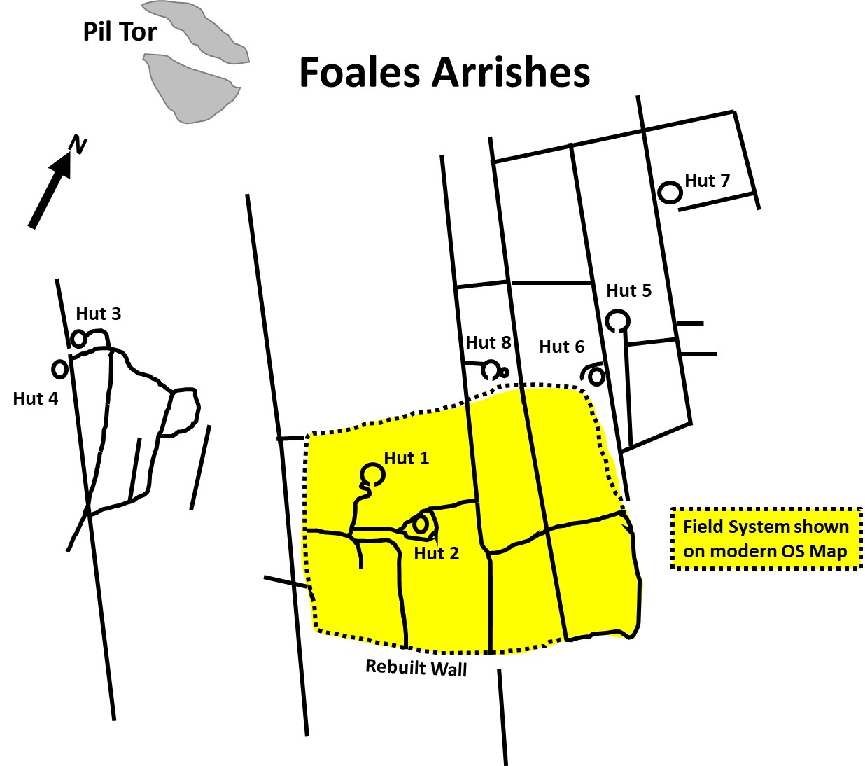
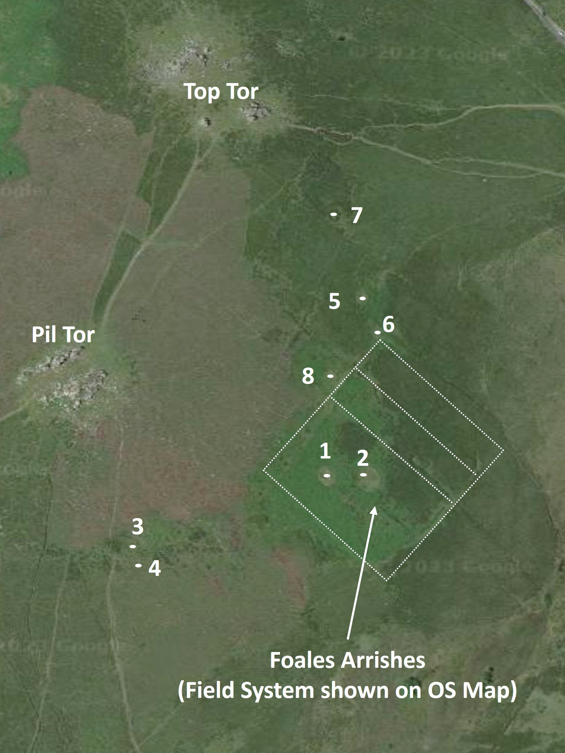
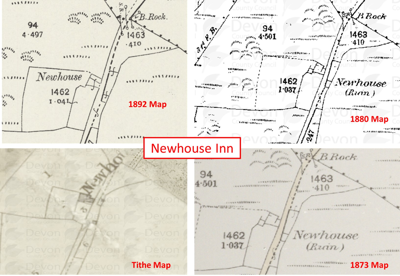
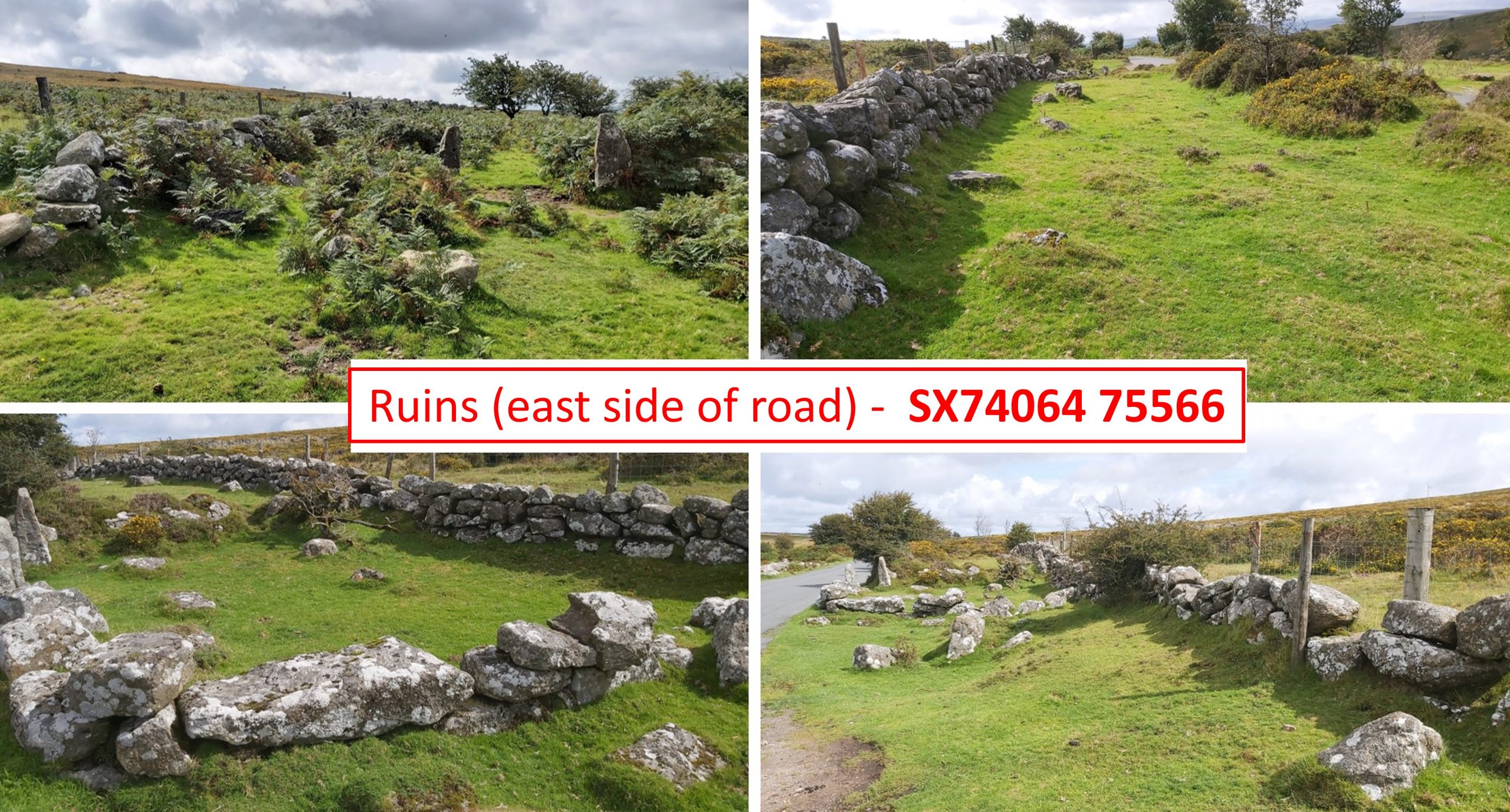
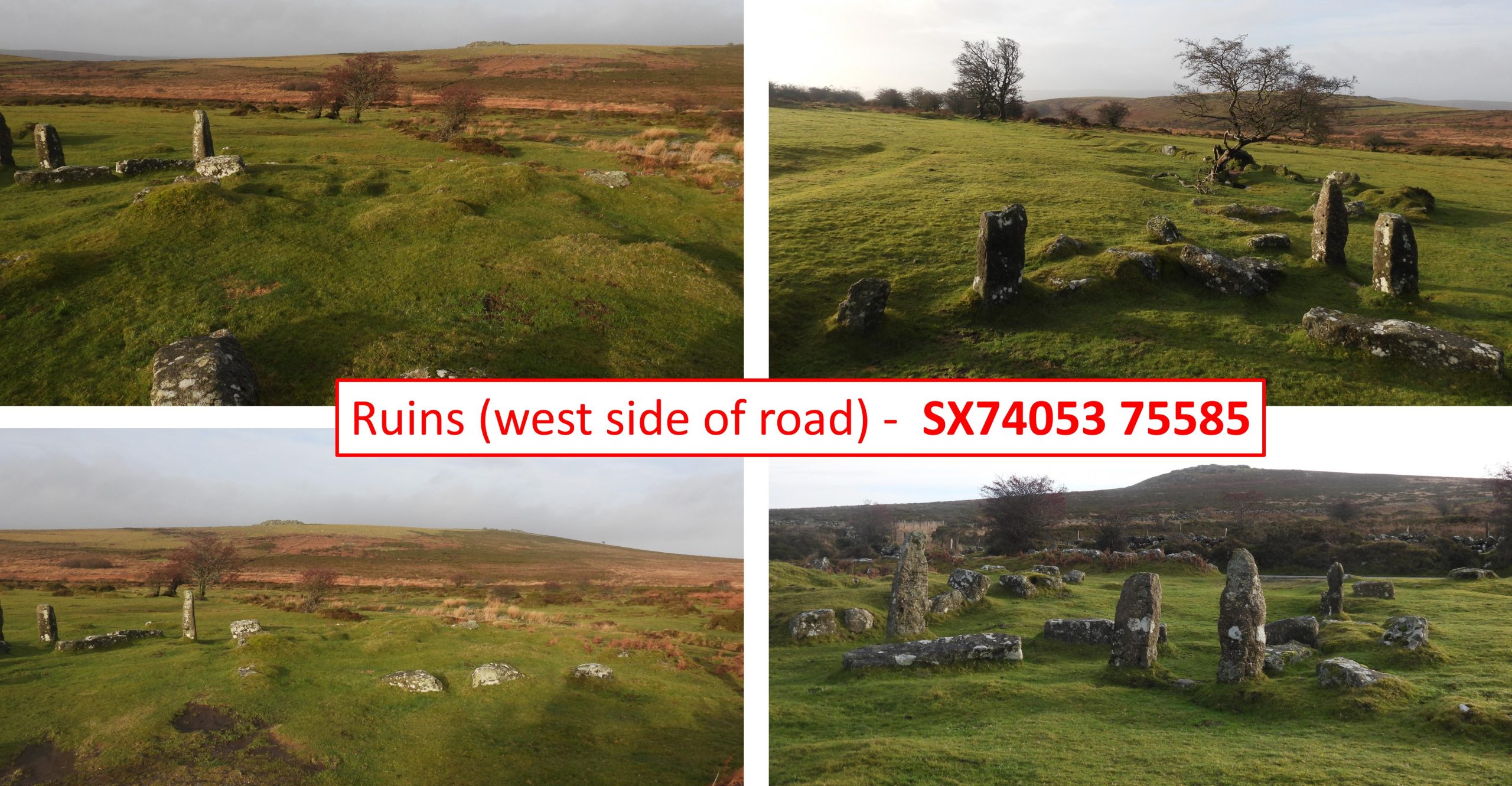
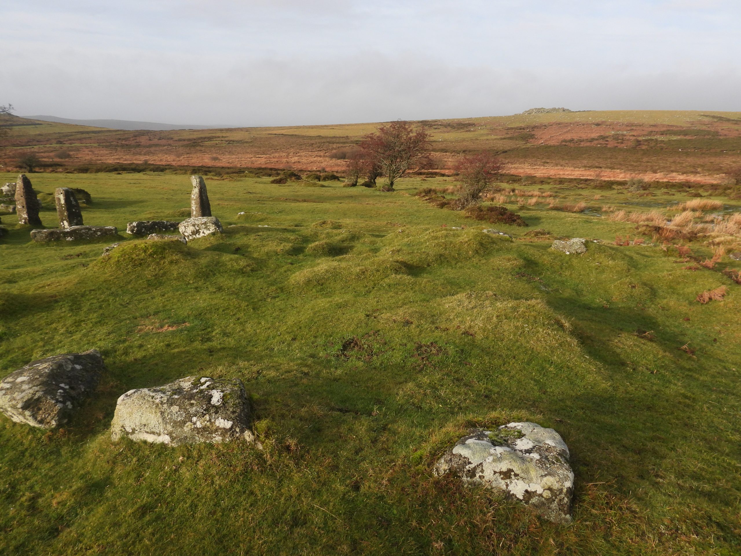
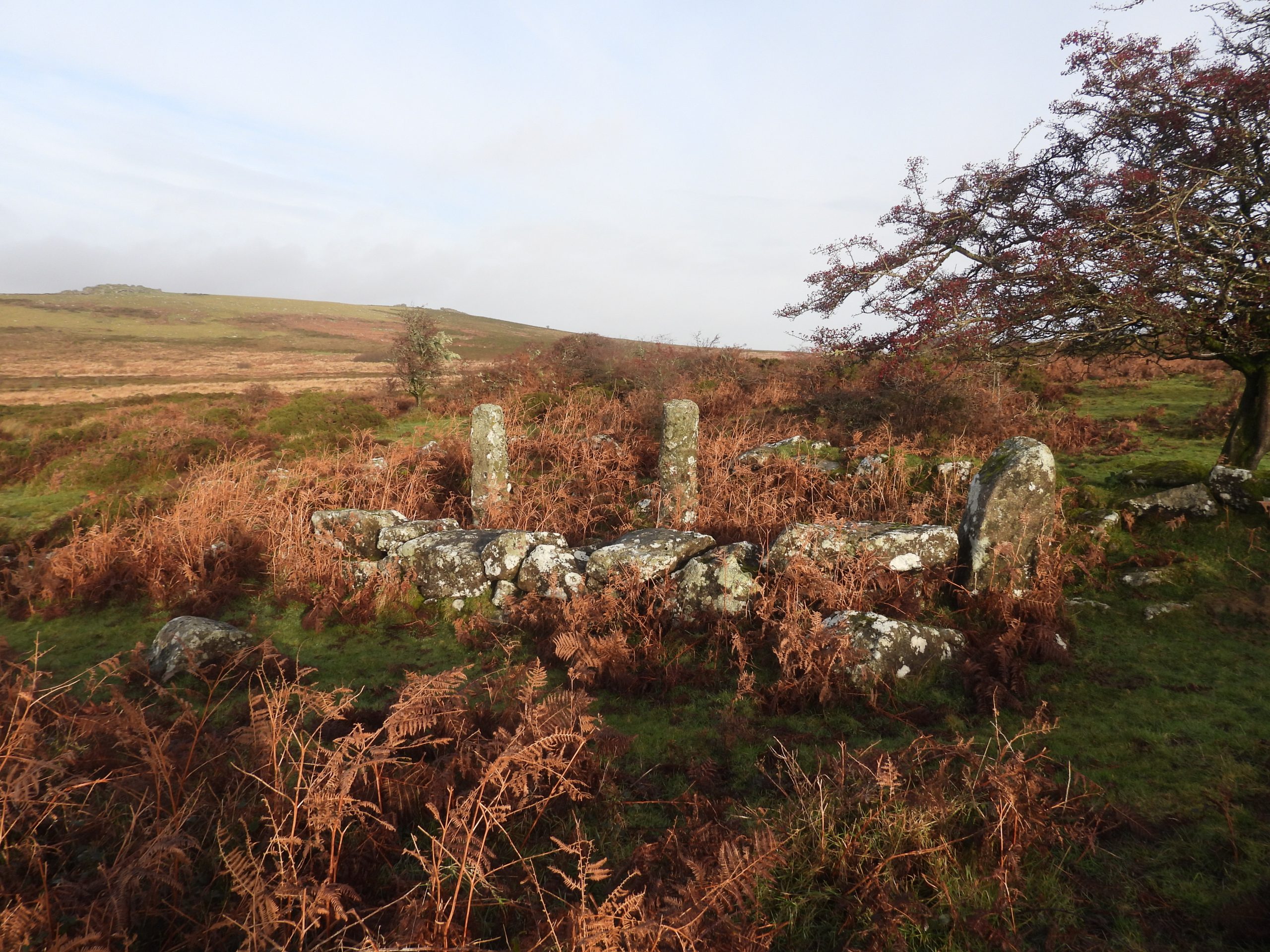
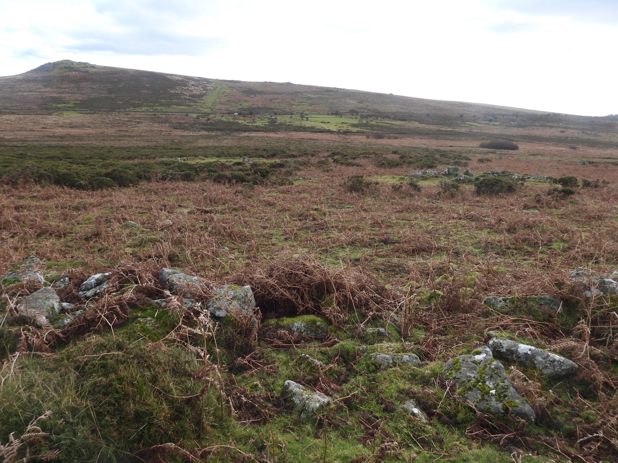
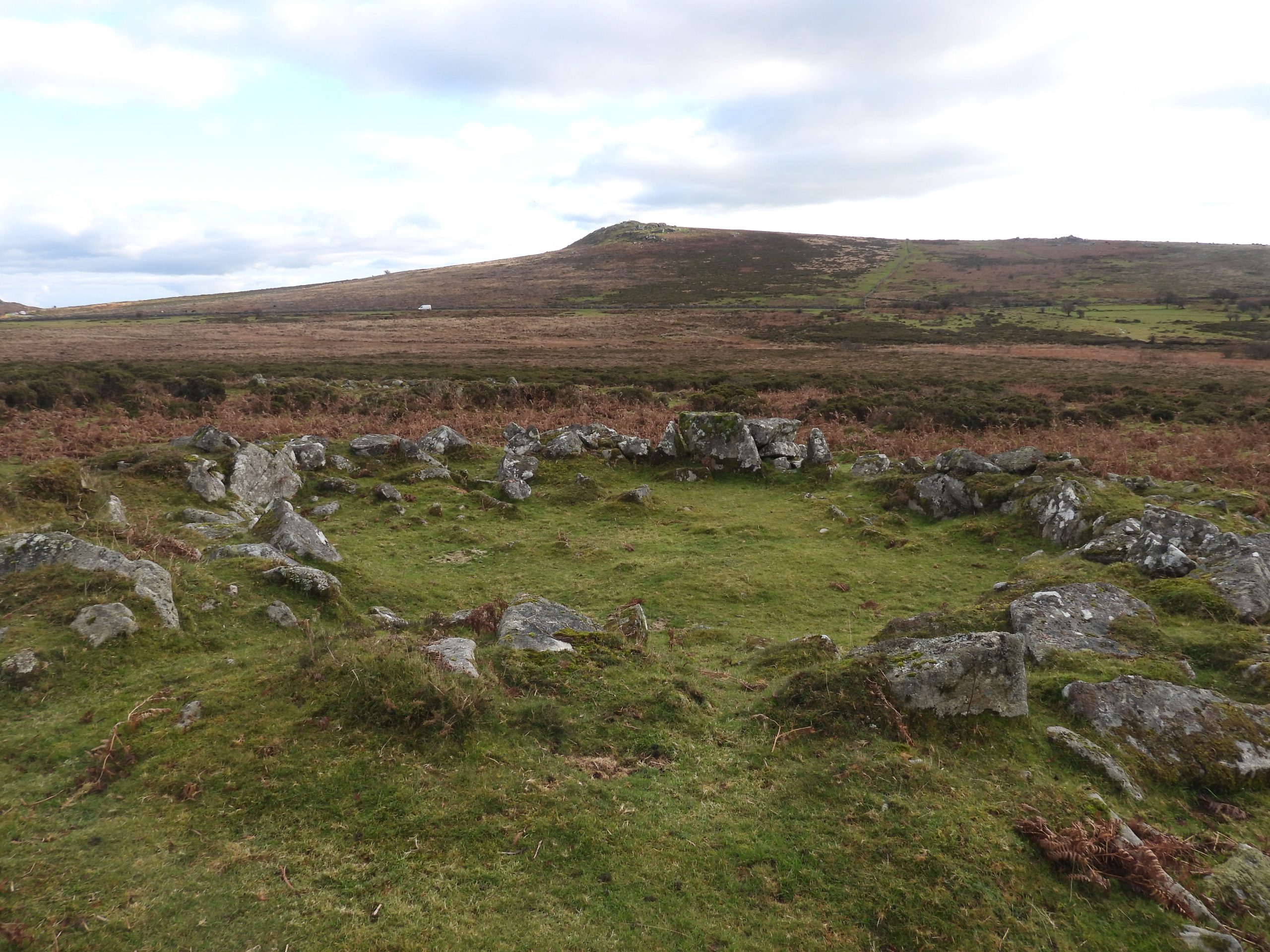
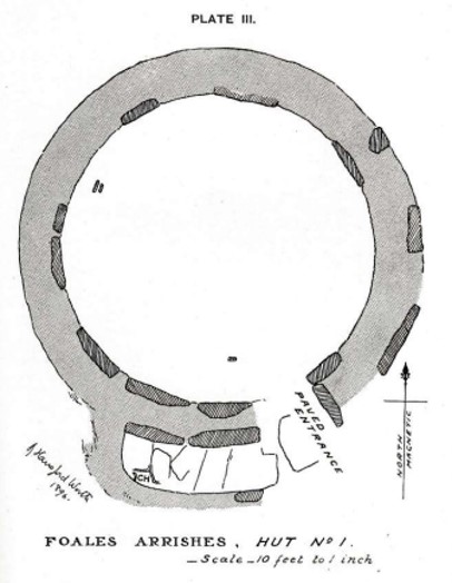
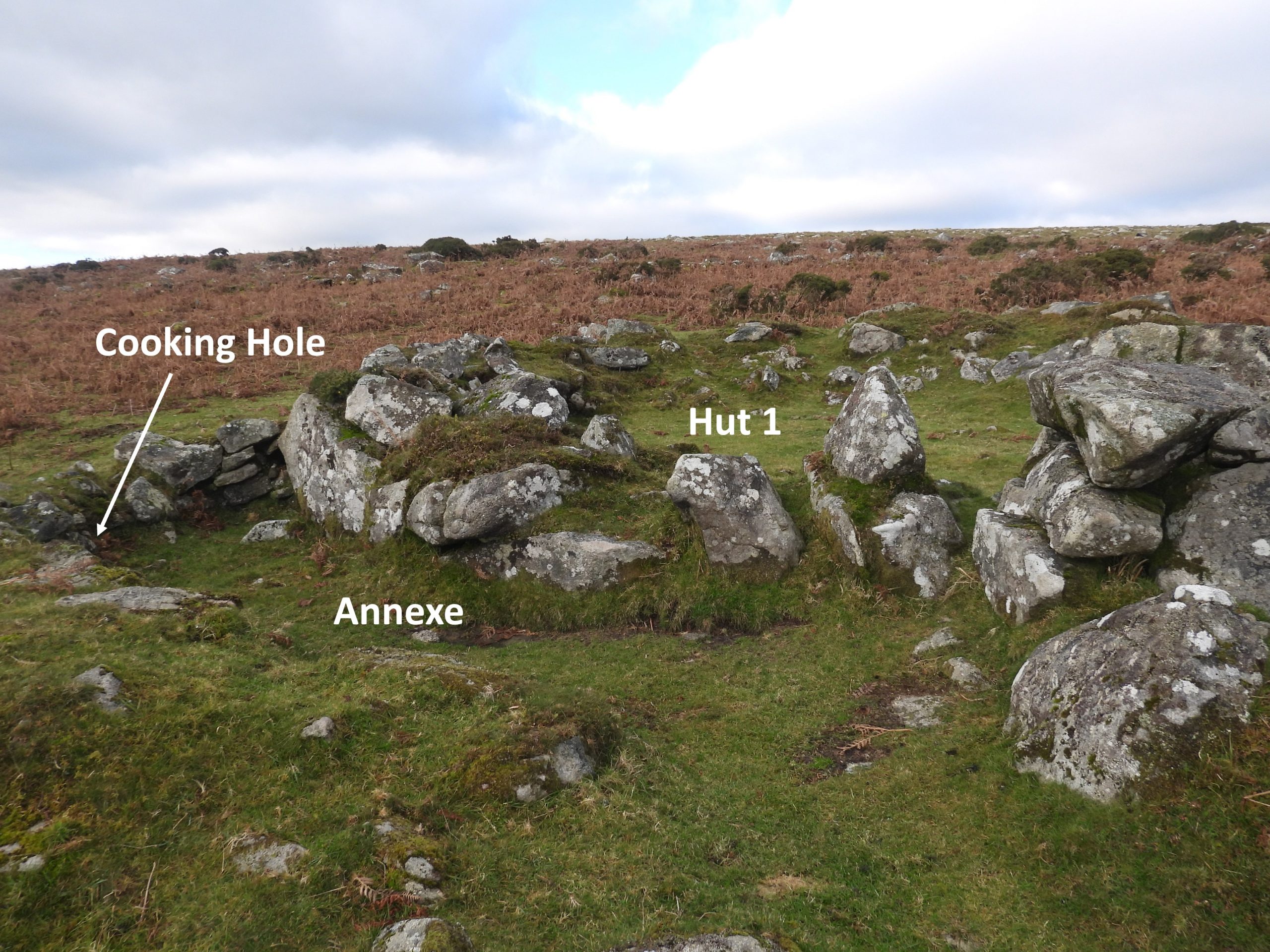
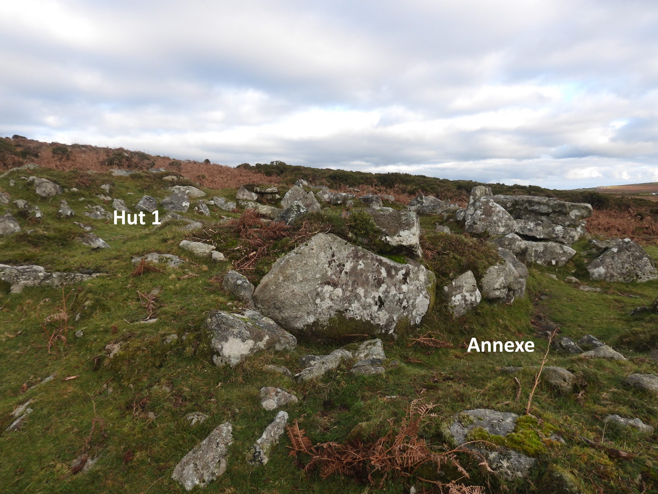
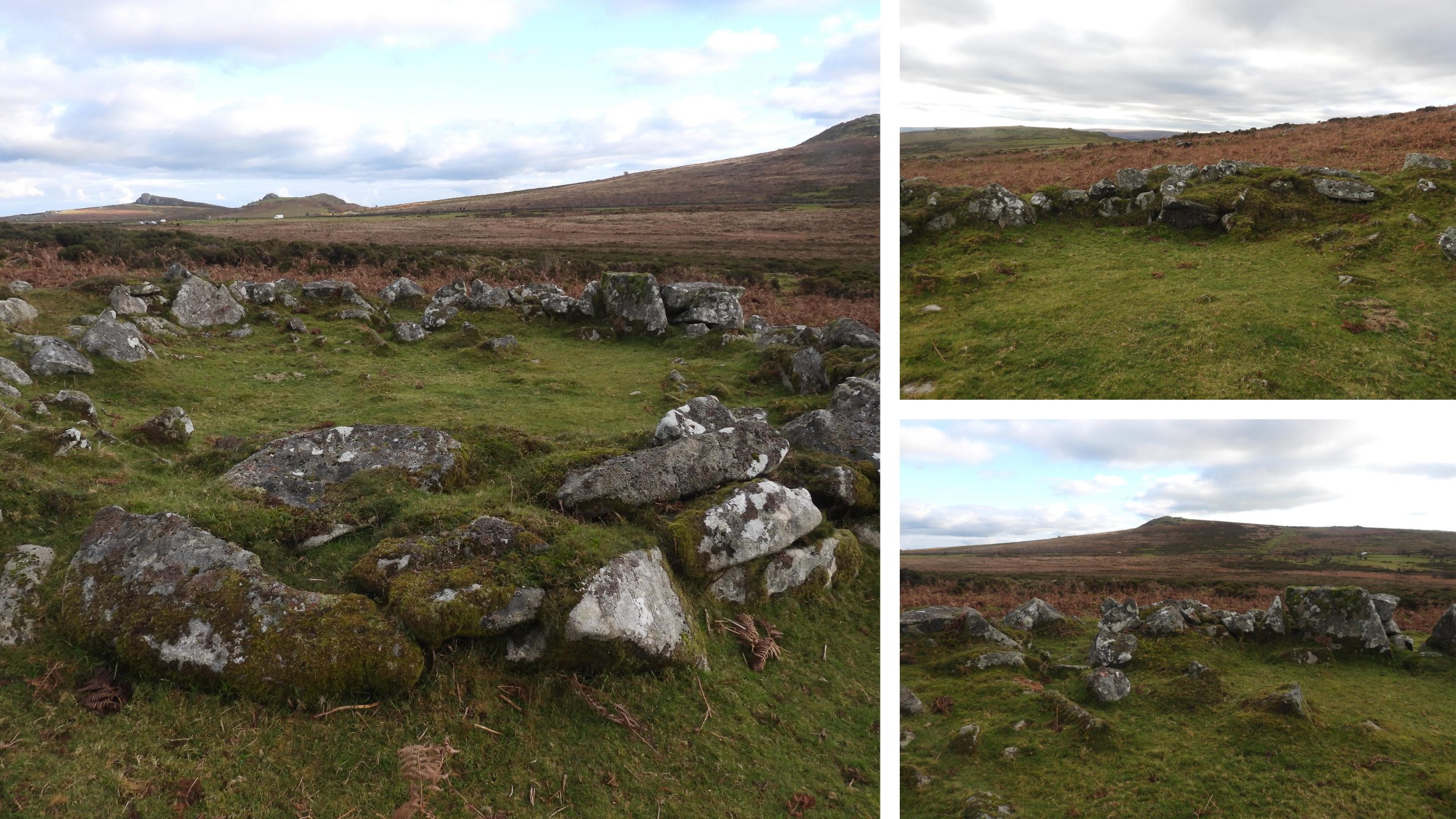
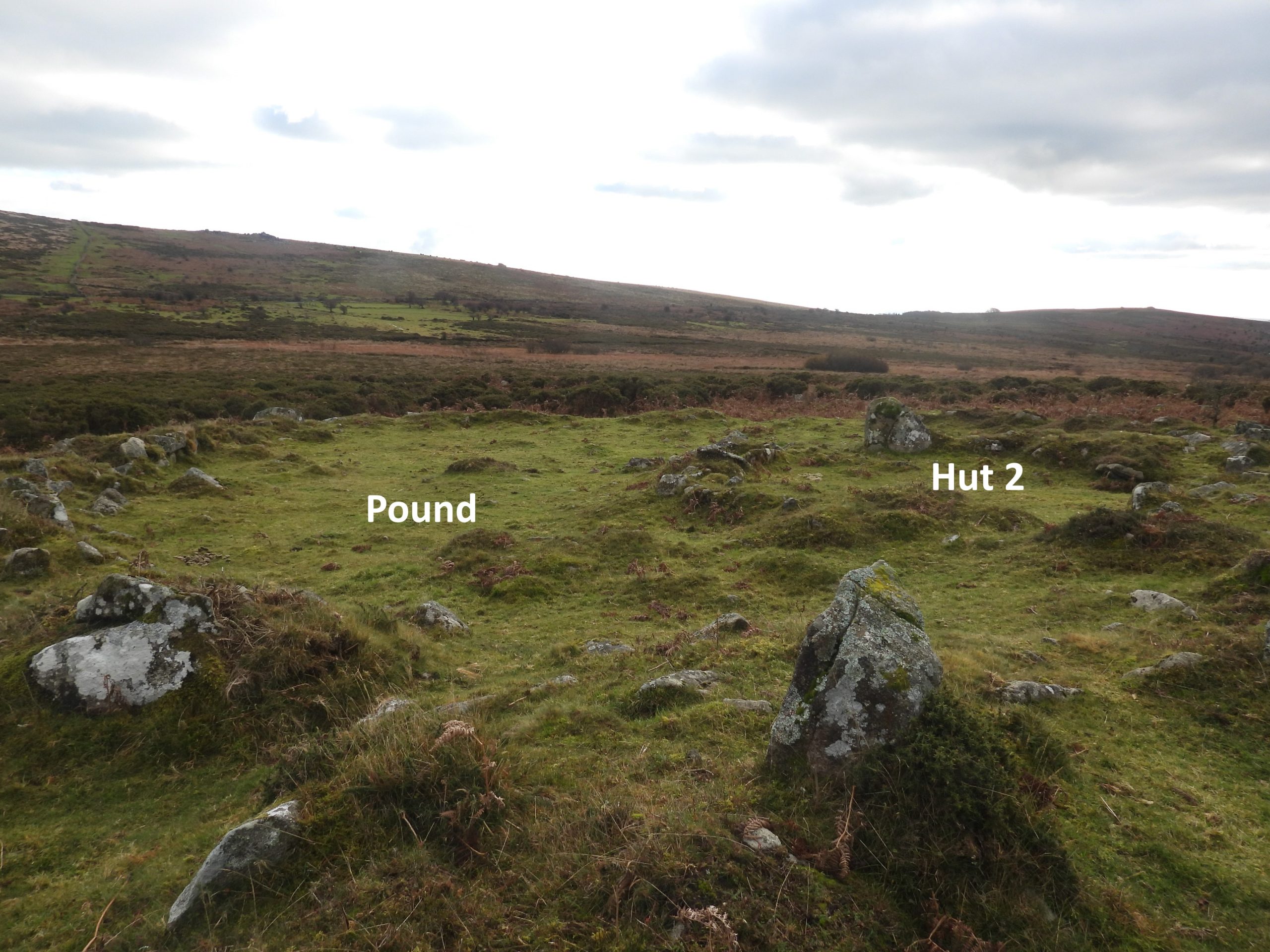
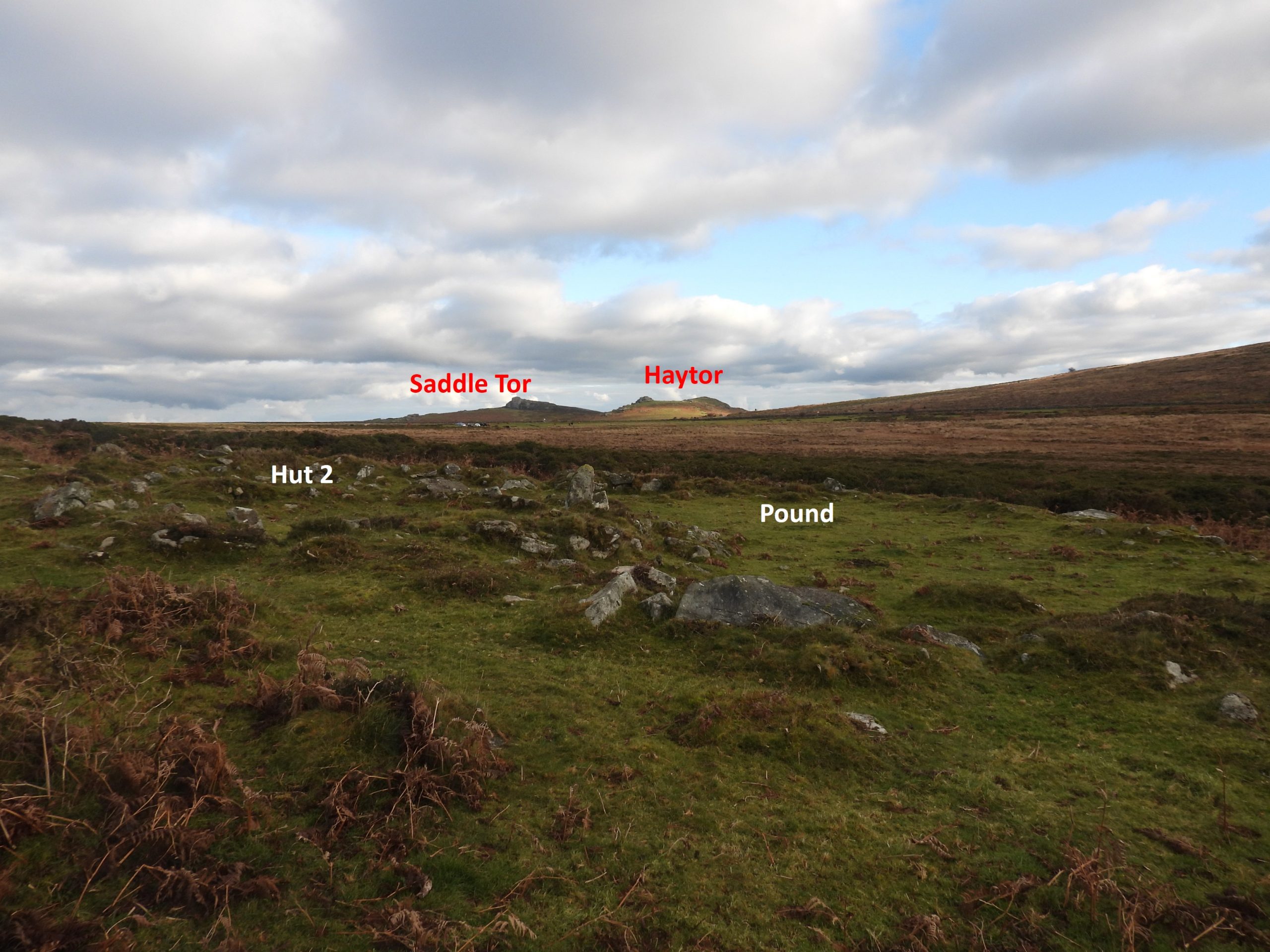
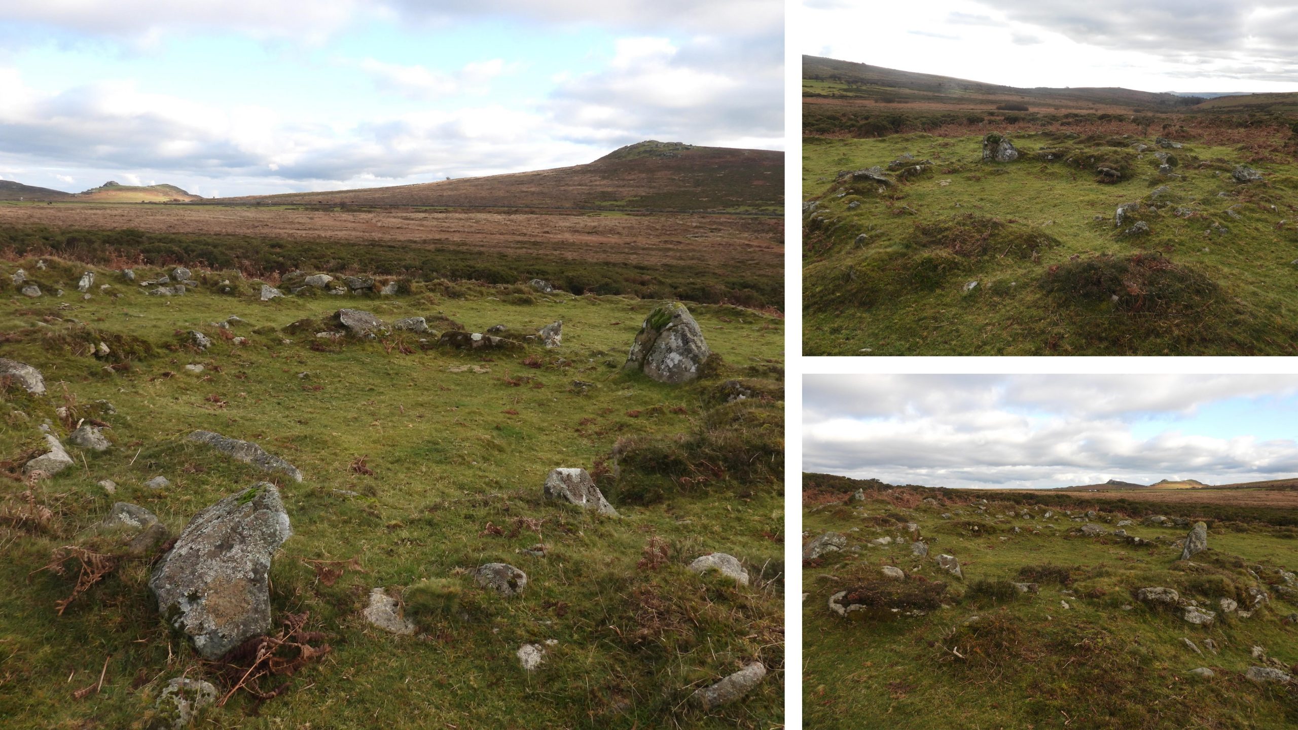
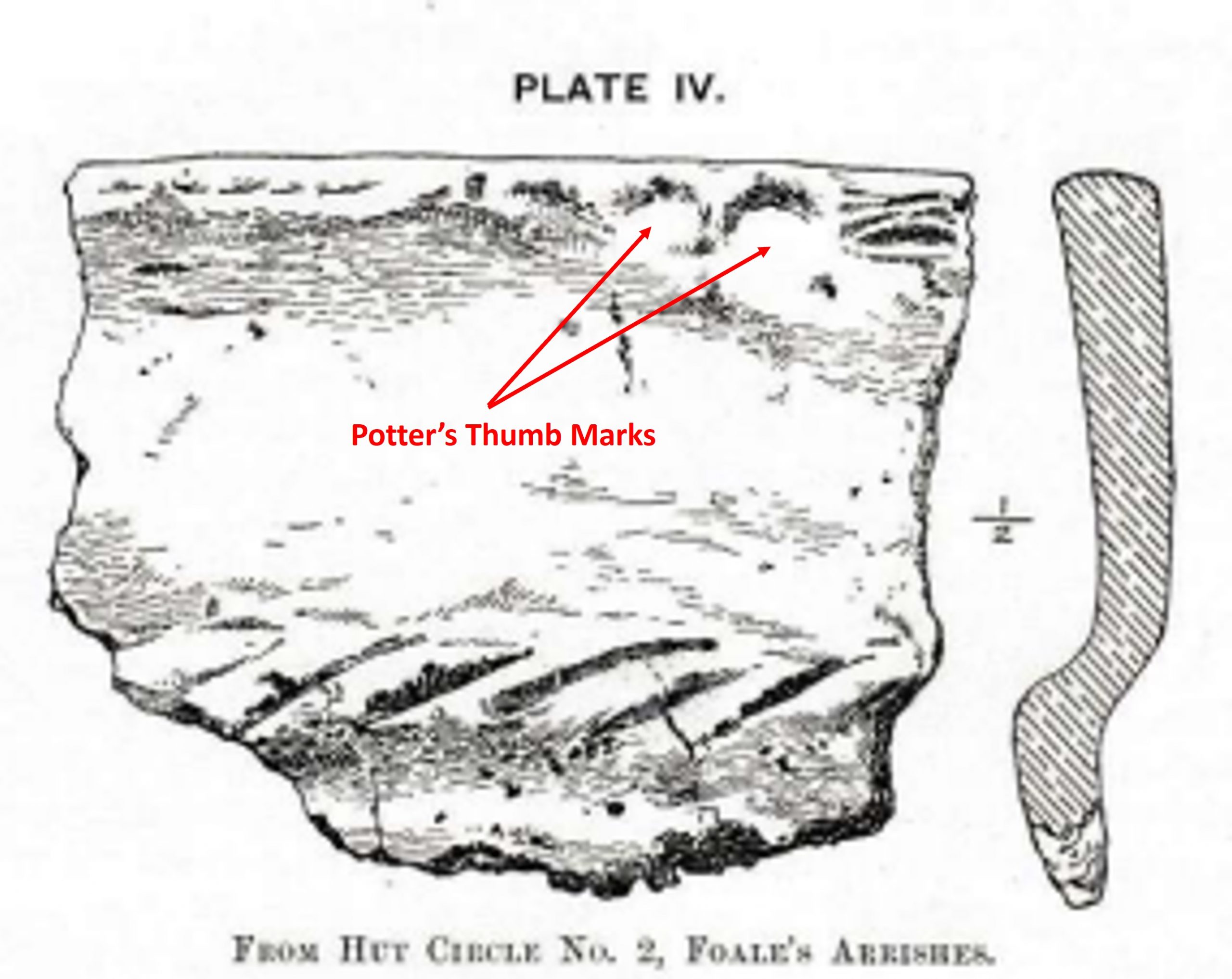
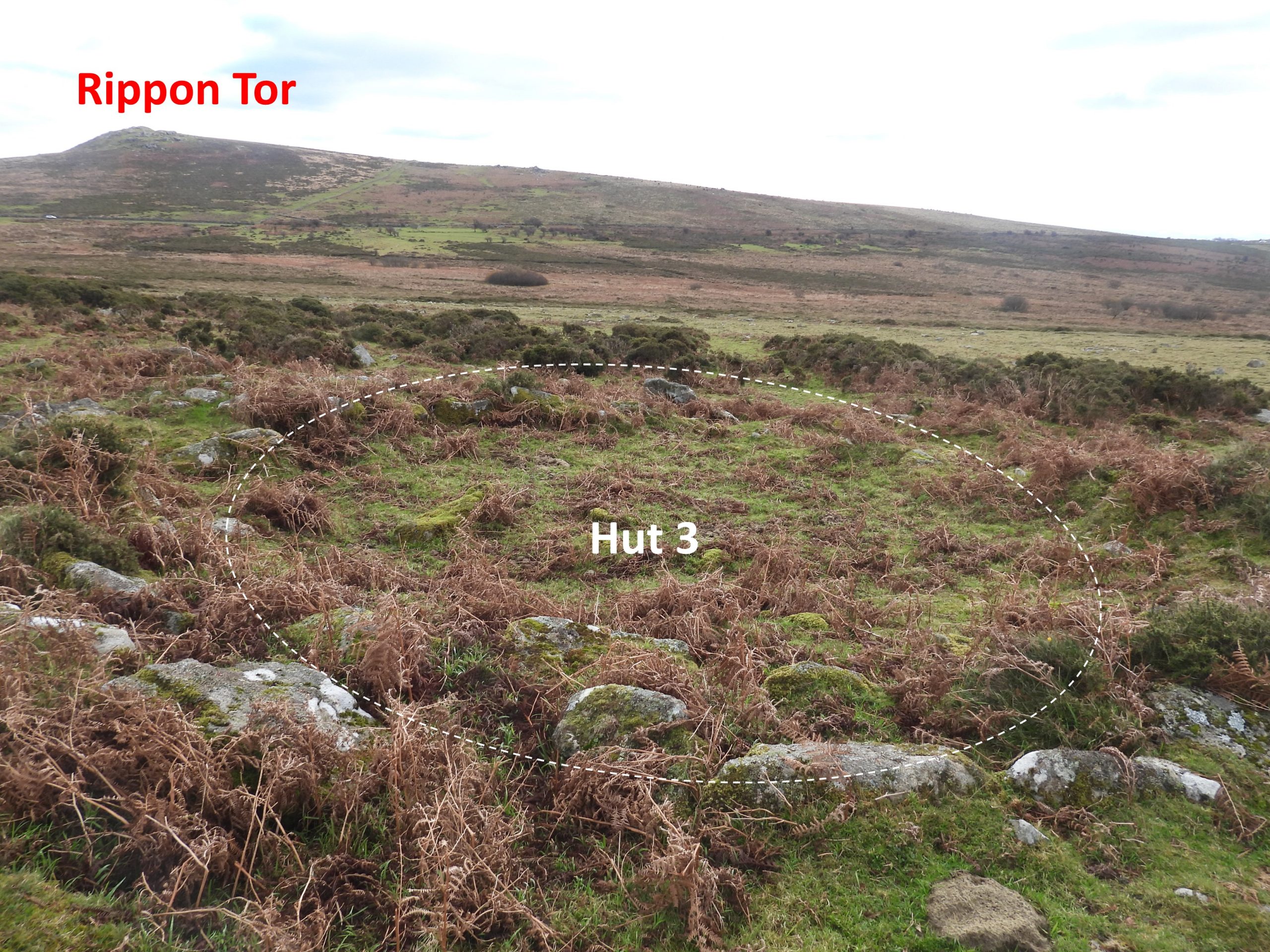
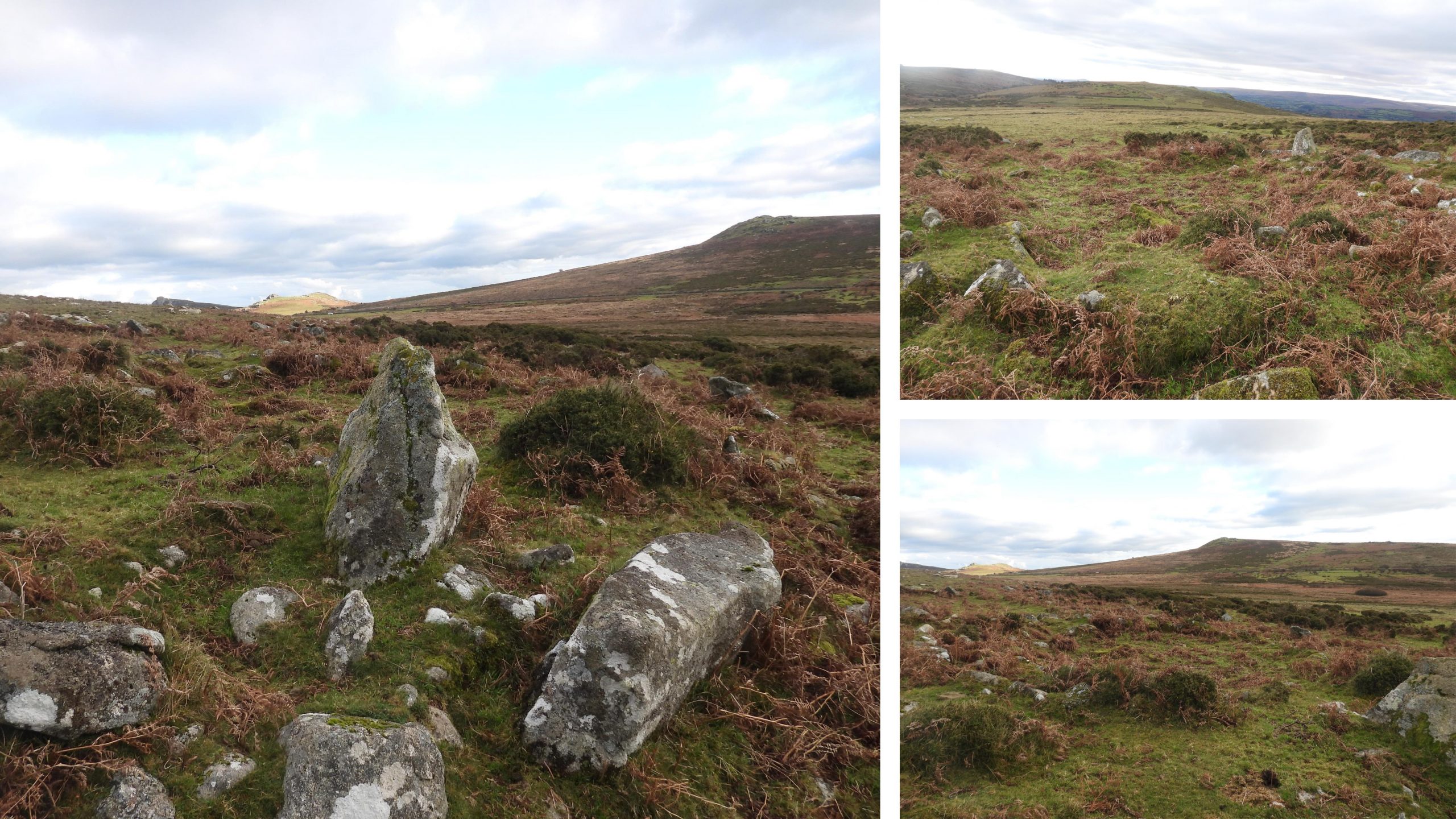
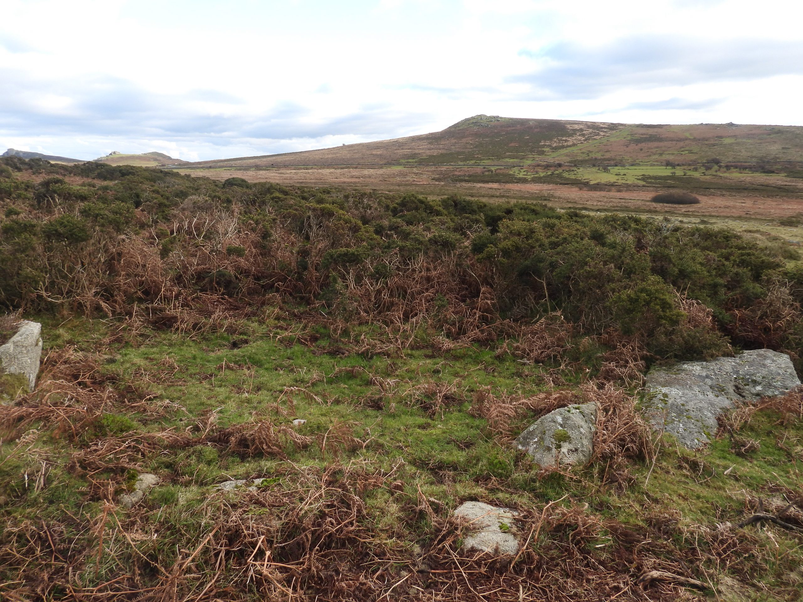
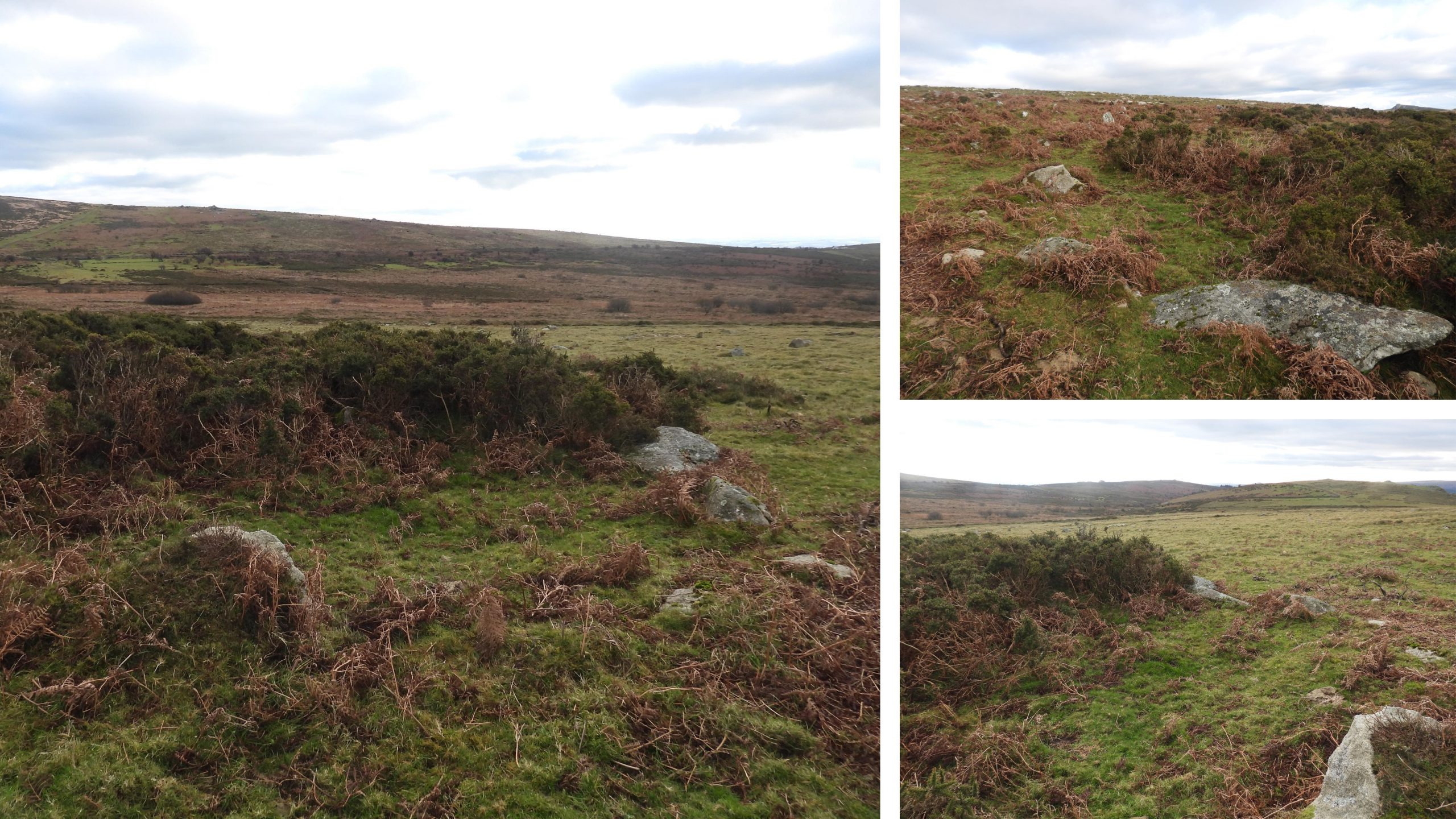
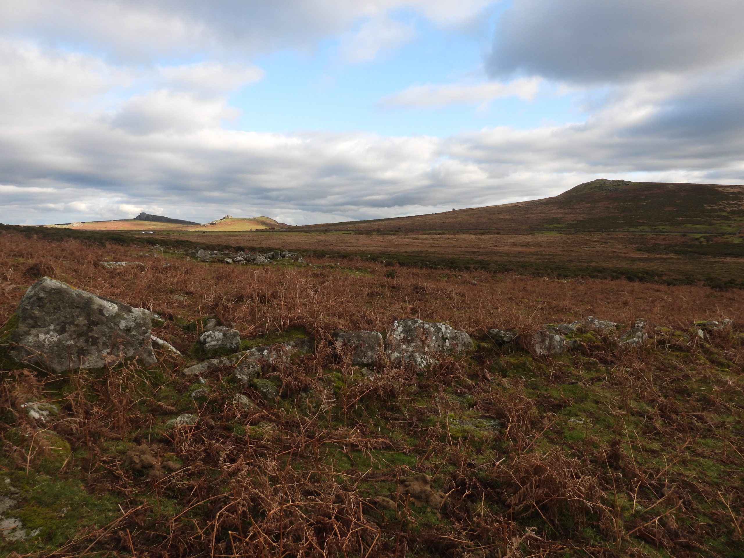
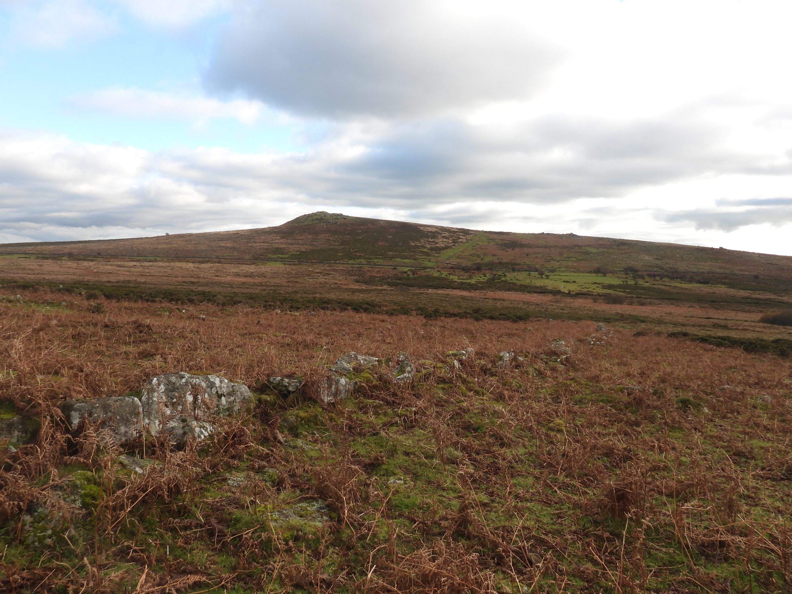
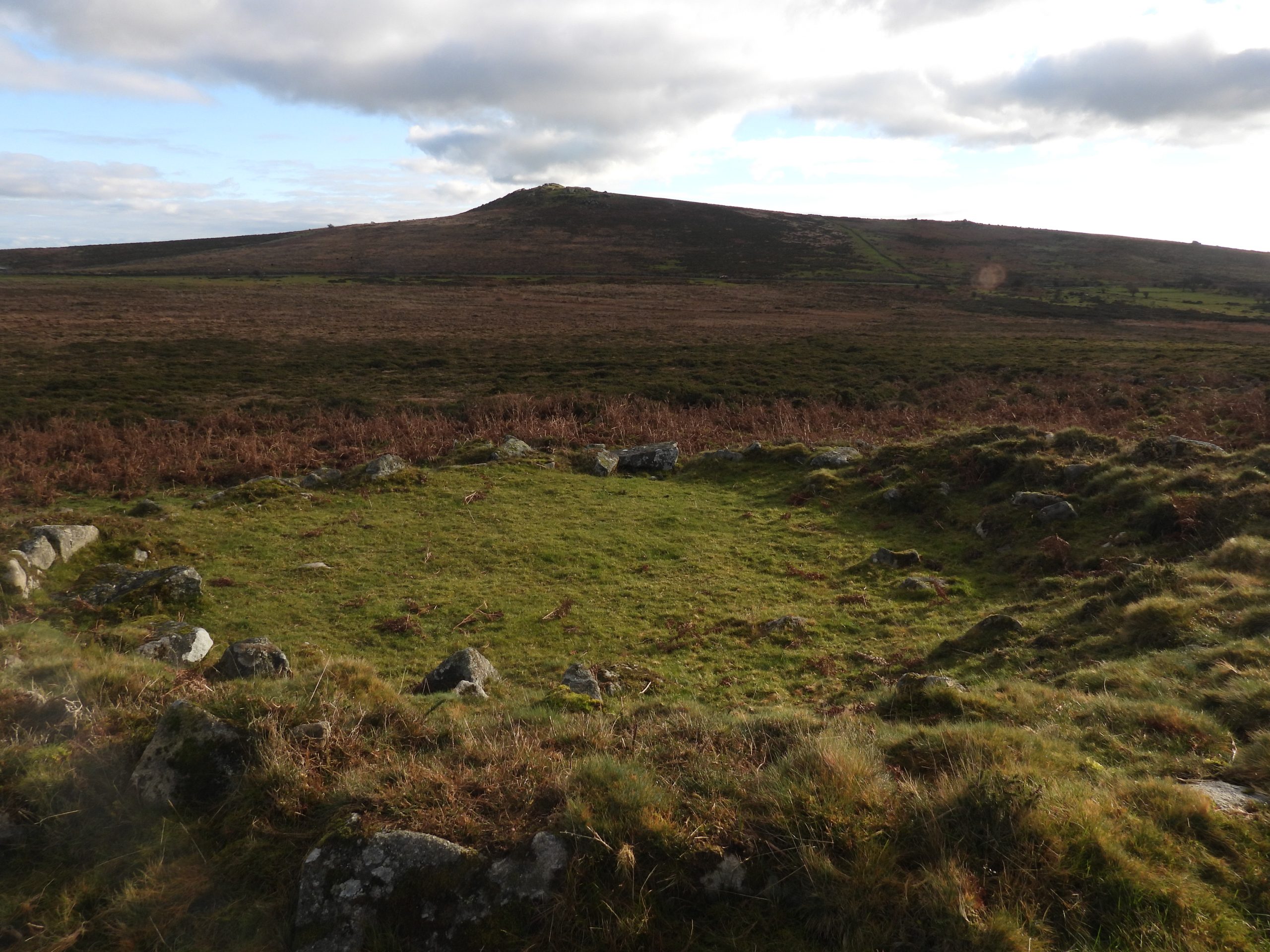
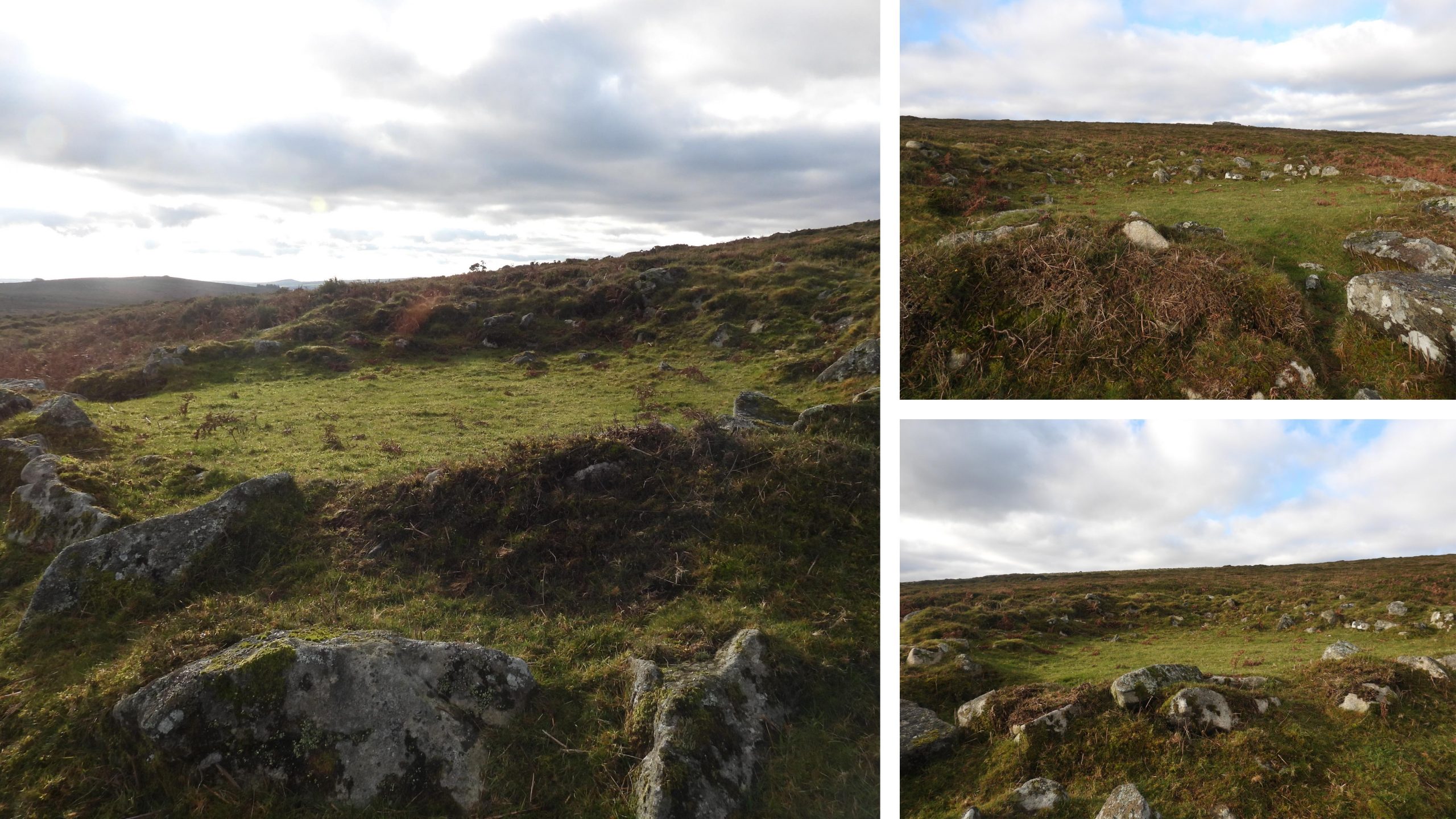
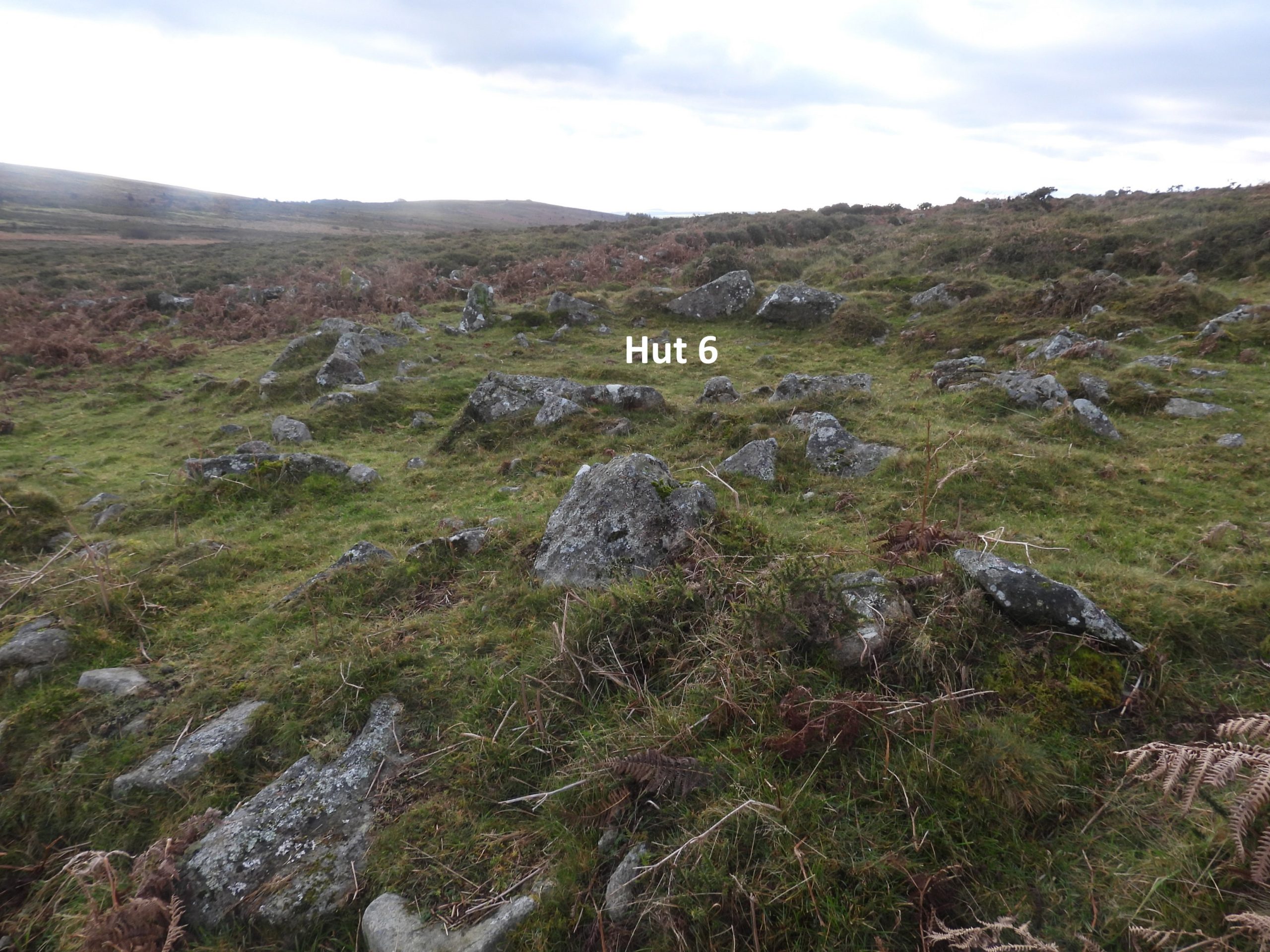
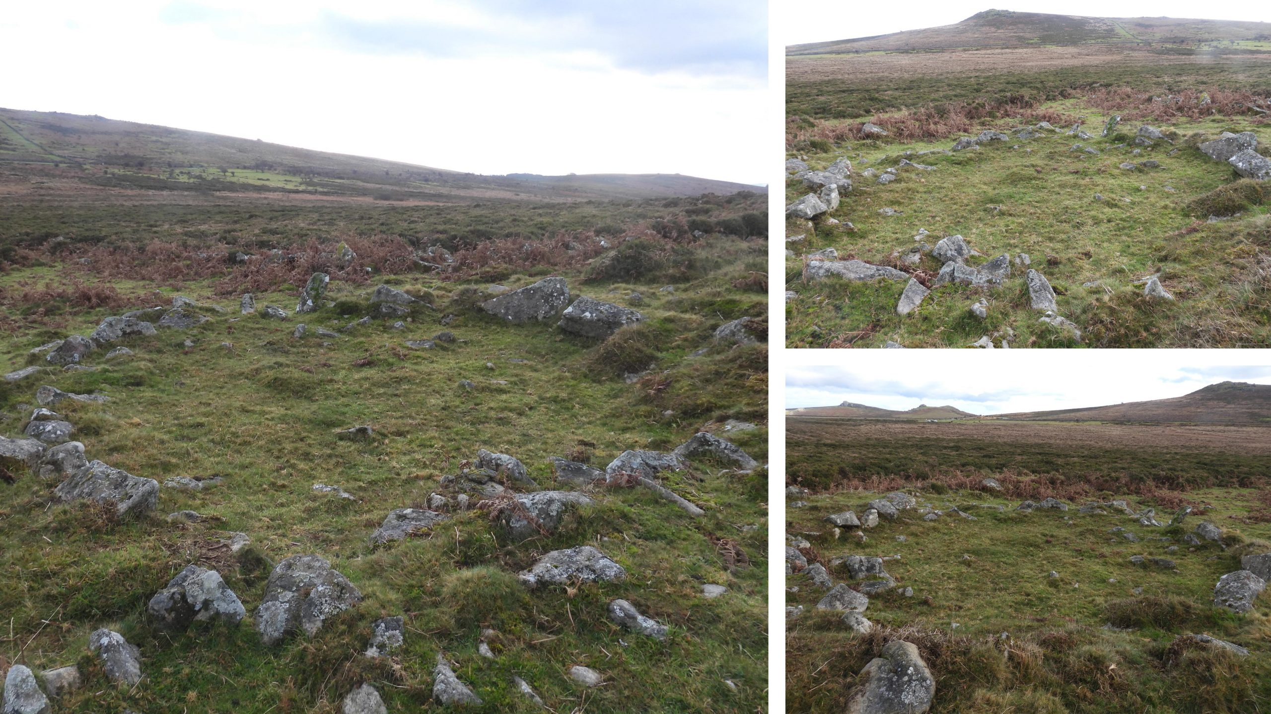
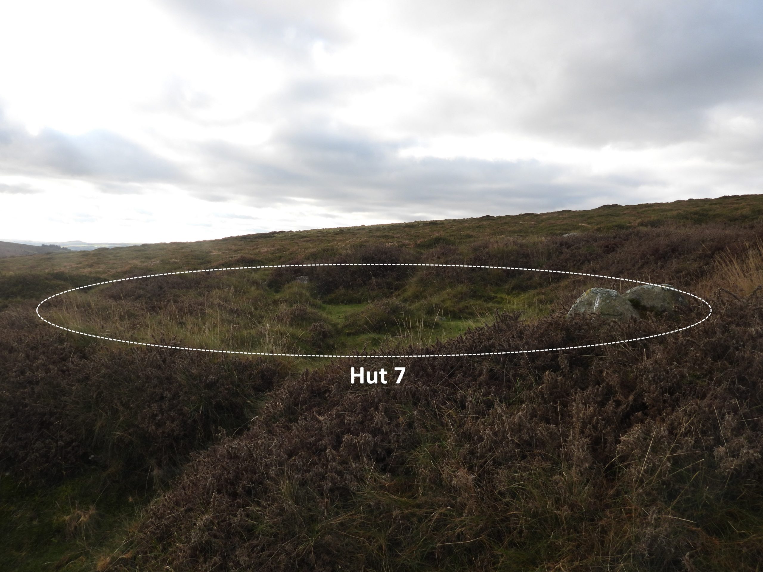
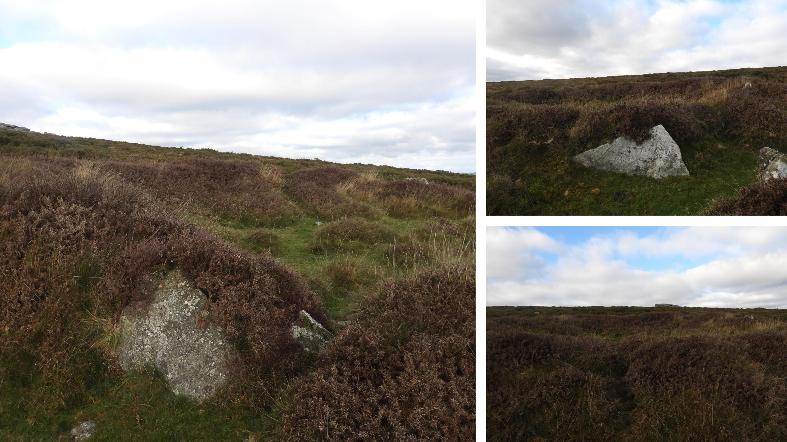
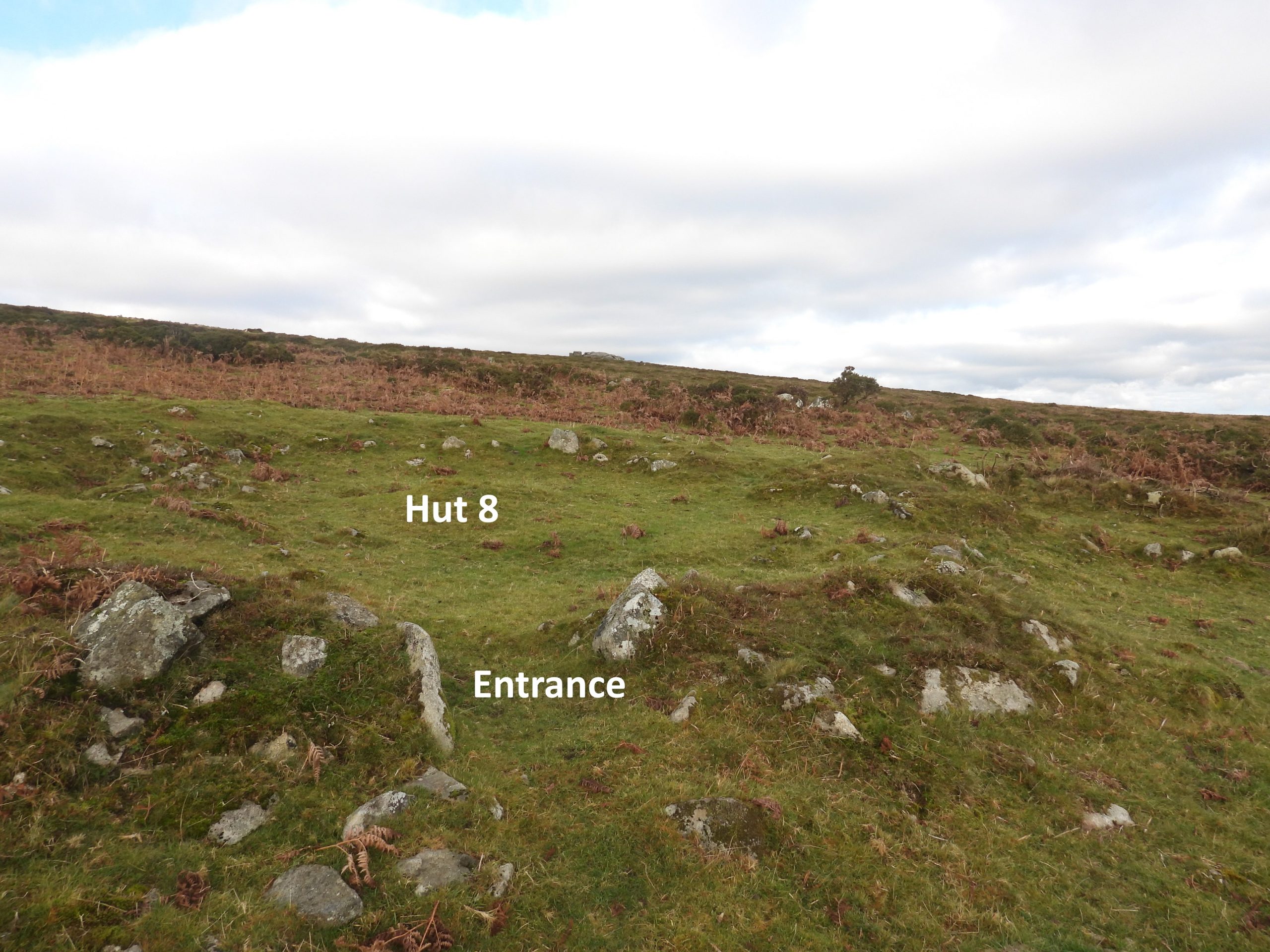
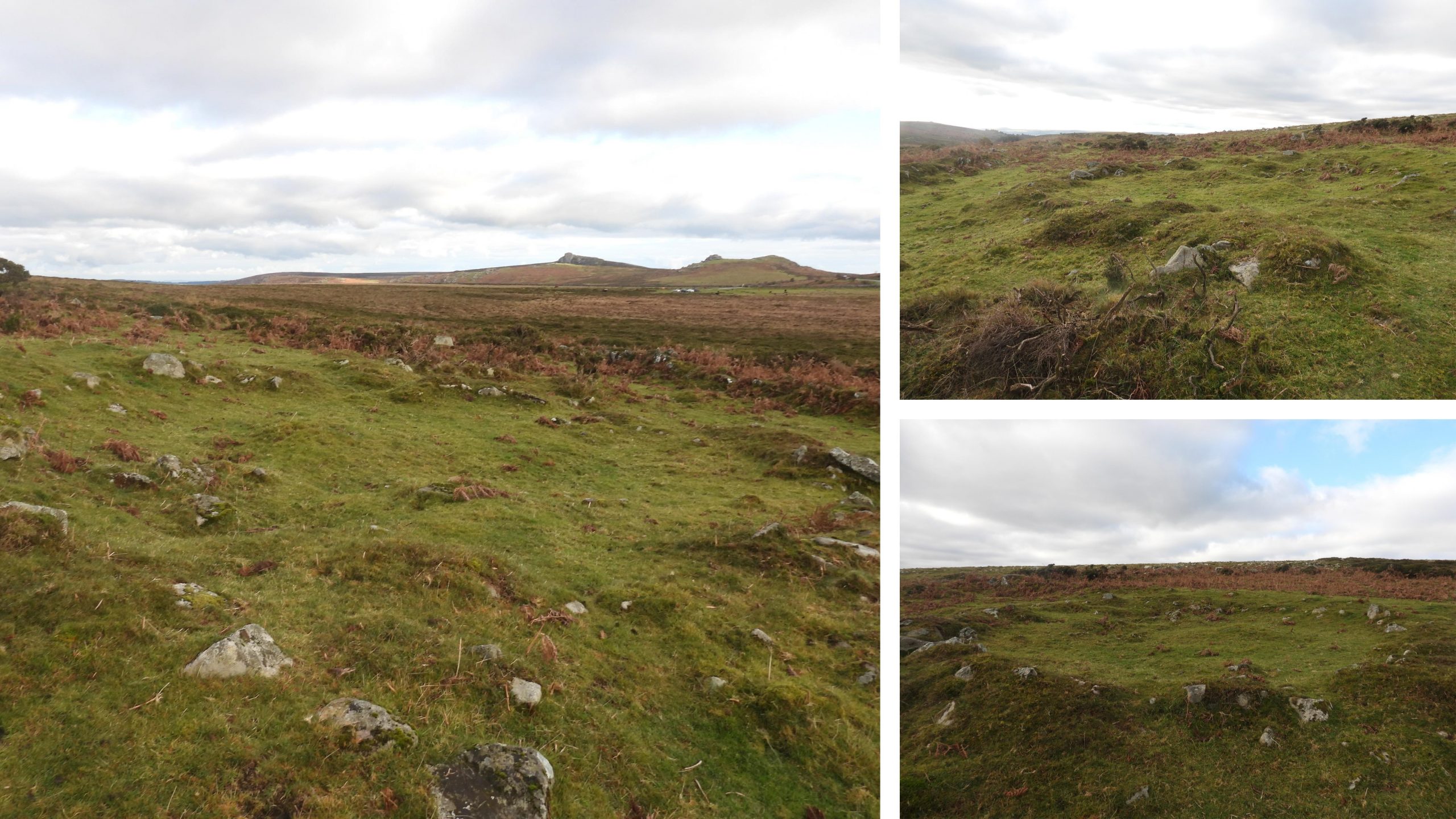
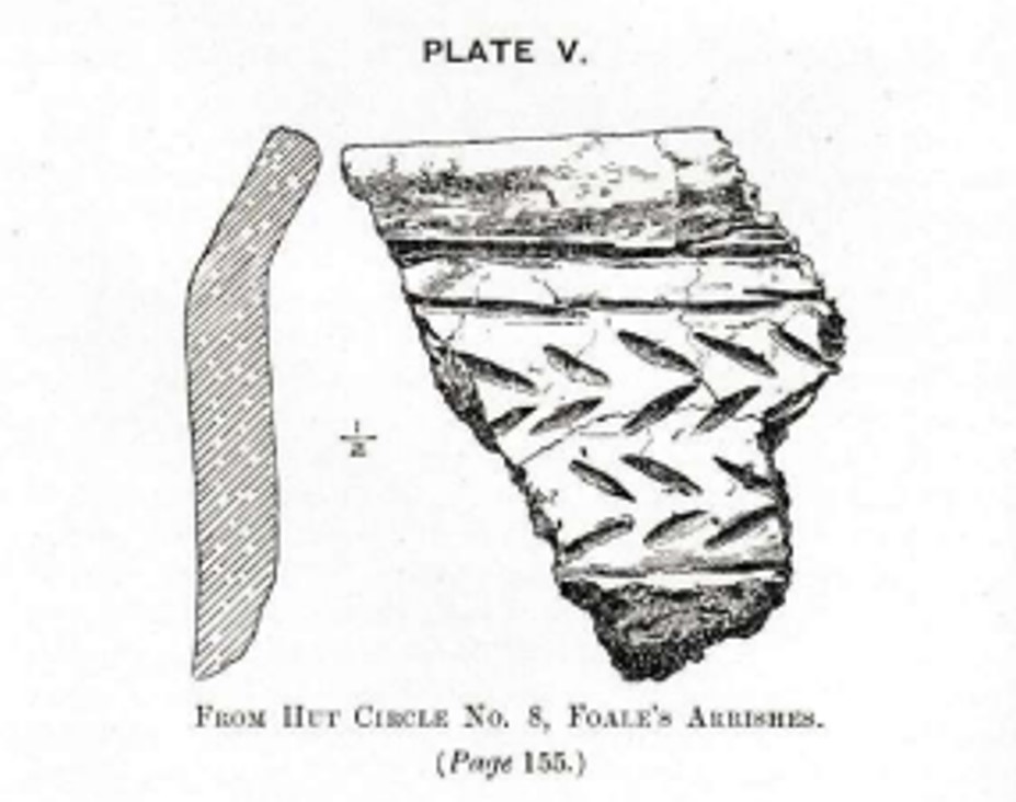
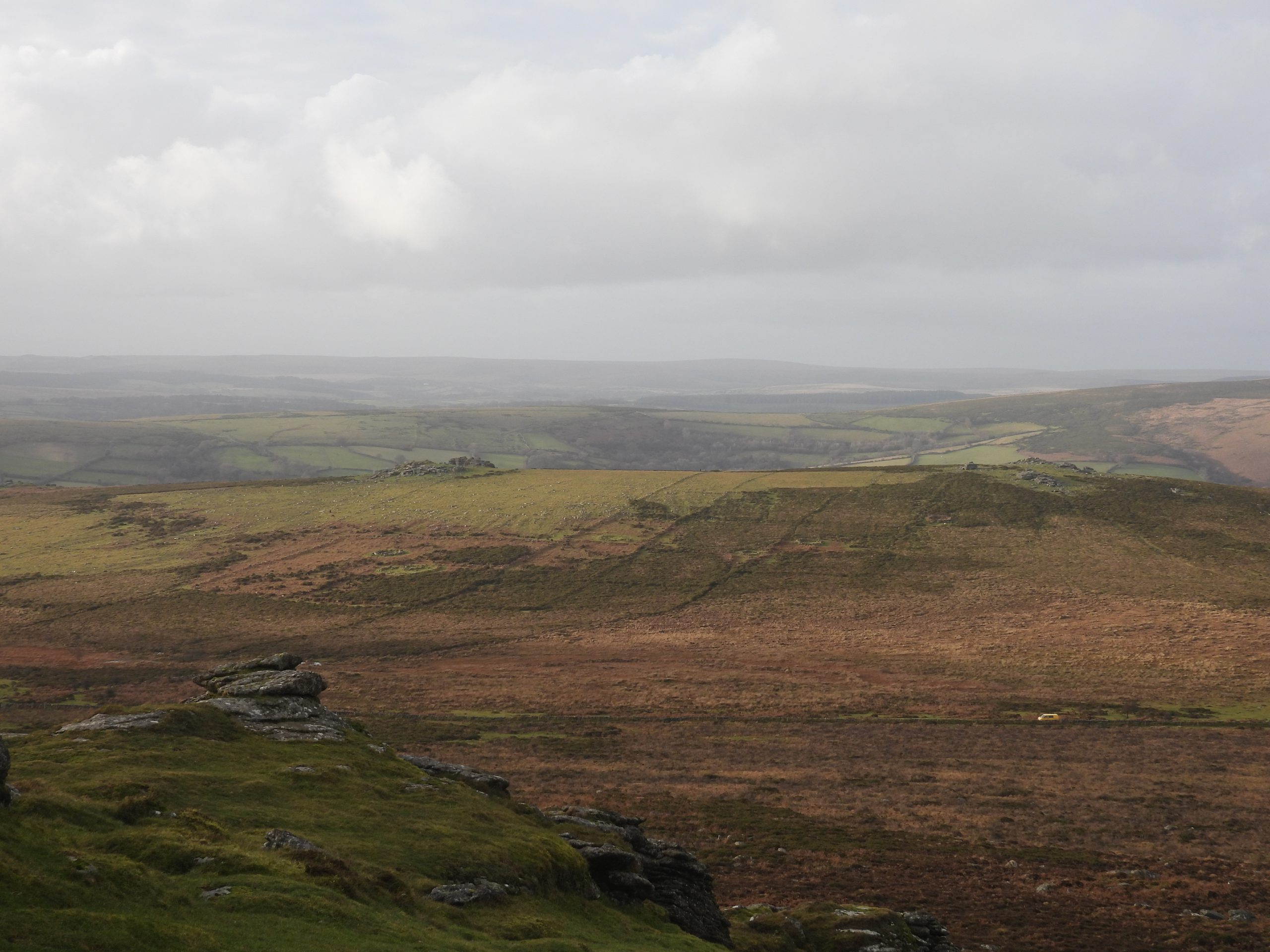
This sketch map is based on Map 9 (Fig 9.1) – page 57 found in Jeremy Butler’s Dartmoor Atlas of Antiquities – Vol. 1 published in 1991. The annotated numbers (1-8) for the huts are consistent with the record in the 4th Transactions Devonshire Association by Dartmoor Explorations Committee. The settlement was laid out between the ends of a series of reaves near the head of Blackslade Water. Cross-banks were built between the reaves forming rectangular fields surrounding the huts with short curved banks providing a pound, paddock or yard for each. Unfortunately, much of the site is under bracken in the Summer. Butler speculates that the number of huts found uphill and the extra fields constructed between the reaves indicate a population increase of the settlement sometime.Annotated Google Earth picture showing the relative locations of the 8 hut of the Bronze Age Settlement (Torr Town) with respect to Foale’s Arrishes, Top Tor (Taptor in the Dartmoor vernacular) and Pil Tor. Huts 3 and 4 are to the west of Foale’s Arrishes with Huts 5-8 being to the north.The location of the Newhouse Inn where Foale was the landlord isn’t very obvious when looking at late 19th century maps, where the labelling suggests it might have been located either on the east side of the road (1873 and 1880) or west side side of the road (1892). That said the Tithe Map (circa 1840) places the Inn on the west side of the Ashburton to Manaton / Widecombe road. The Tithe map location is at SX74053 75585. The ruins on the east side of the Ashburton – Widecombe / Manaton road where the 1873 and 1880 maps indicated Newhouse Inn may have once stood.The ruins on the west side of the Ashburton – Widecombe / Manaton road where the 1892 and Tithe maps indicated Newhouse Inn may have once stood. There are faint earthwork foundations here together with a few upright granite posts which mark the locations of the buildings of Newhouse. They are set within a series of stone walled enclosures totalling 4.2 hectares. These ruins are almost certainly those of Newhouse Inn as the Tithe map indicates this side of the road as being the correct locationNewhouse Inn replaced an earlier inn known as Culver House having been built by the Woodley family. Landlords on the Inn include a Leaman who was host in the late 1700’s, as well as the Hannafords. The Foale family also ran the Inn, when the ‘Arrishes’ were being created. Foale’s Arrishes can be seen in the distance below Pil Tor. There is story which suggest the womenfolk of Widecombe had this burned down because the men spent too much time and money on their on their way back from market. It appears to have been abandoned and demolished in the 1840s.A short distance away from Newhouse are the ruins of a stone outbuilding. The foundations of a ruined granite outbuilding suggest a probable barn. It is built against the south-west side of an enclosure wall around 300 metres south-west of Newhouse. The granite posts used to support the roof.Foale’s Arrishes ‘re-built’ north wall. Hut 2 can just be seen near the top right of this photograph, stones being laid on top of the originals.Re-built north wall of Foale’s Arrishes looking towards Hemsworthy Gate. This photograph was taken near Hut 8 of the Bronze Age Settlement. There is also evidence of a small ditch having been cut alongside, most probably a modern (Foale) addition.In the Fourth Report of the Dartmoor Exploration Committee (DEC) in 1897, Hut 1 is described as “lying west of a track line which starts from the high ground between Pil Tor and Top Tor, and proceeds in a S.E direction until it is lost in the upper portion of Blackslade Mire”. It is one of two huts which lie within ‘Foale’s Arrishes’ (fields) albeit it is one of eight huts as part of the greater ‘Torre Hill Bronze Age Settlement’. The centre of this hut is at SX73743 75854The Dartmoor Exploration Committee report included this fine sketch (drawn by Hansford Worth in 1896). Their excavation of this hut in 1896 had been preceded by a Mr Robert Dymond, which they stated did not yield any findings. What is interesting about this hut is that it has an ‘annexe’ next to the entrance as can be seen in the sketch.The entrance to Hut 1 lies to the south-east next to the annexe which measures 5.5 m by 1.2m internally. In 1896, the Dartmoor Explorations Committee found the annexe to be covered by a ‘heap of stones’. Having cleared the stones they found the annexe and within one corner they found a cooking hole and hearth with much charcoal and fragments of pottery.They (Dartmoor Explorations Committee) remarked that the annexe ‘cooking area’ was paved and unusually was positioned outside the hut.Hut circle 1 is recorded as measuring 9.5 m diameter internally and has ‘Double walls’ of moorstone at 1.4m thick and between 1m -1.5m high. The DEC remarked at the overall size of the hut suggesting that it would have been difficult to keep weather tight in Winter (whether thatched of made of skins) thus concluding that, including the position of the cooking area, this hut was probably a Summer residence only. It is the largest hut in the settlementHut 2 lies within the same square enclosure as Hut 1 and is within ‘Foales Arrishes’ (see the yellow shading on the sketch map). It has its own circular pound or paddock. The centre of Hut 2 is at SX73784 75849The pound or paddock (as described by the Dartmoor Exploration Committee in the 4th TDA) measures 16m north to south and 20m east to west. The photograph shows Hut 2 and its pound with Hemsworthy Gate and the iconic Saddle Tor and Haytor beyondHut 2 measures (internally) 6.3 m by 5.8m. The width of the walls are just over 1 metre with height between 0.3m and 0.6 m. The hut has two entrances, north and south-east and during the excavations by the Dartmoor Explorations Committee in 1896 a cooking hole (46cm x 31cm x 25cm) was found just inside the south-east entrance. Within the cooking hole and vessel of pottery was found and was believed to have been a cooking pot. The hut excavations also revealed three rubbing stones and three fragments of flint.The largest shard of pottery found in the cooking hole in Hut 2 was sketched and recorded in the 4th TDA. The piece is the rim down to the shoulder of the vessel. Of interest in this piece are two fingerprints (probably a thumb) made by the potter, who the DEC believed was from a female hand. The vessel would have been around 28cm deep and 20cm in diameter.Hut 3 is less discernible than Huts 1 and 2. It measures 7m in diameter. Hut 3 is located at SX73572 75796H.Quinnell, in 1993, recorded in Hut circle associated with Foale’s Arrishes (Heritage Gateway) that this Hut had ‘one or two uprights surviving’. A flint flake (part of a knife) was found here by the DEC in 1896Hut 4, when excavated in 1896 there were no signs of human habitation. It has an internal diameter of 5.5 m, walls 0.6 metres high. It is sited south of most south-westerly field boundary and some say it is dubiously a hut, since there is only one ring of stones. Hut 4 is located at SX73574 75778Foale’s Arrishes ‘re-built’ west wallPart of the re-built wall with Rippon Tor in the background. The dead bracken is testament to how overgrown the area becomes in the Summer monthsHut 5 of Torr Town Bronze Age Settlement lies outside Foale’s Arrishes. It measures 8.2 m diameter, with walls 2.1 m thick and between 0.4 m and 1.2 m high. There is an entrance on the south-east sideThe Dartmoor Explorations Committee didn’t find any signs of human habitation in Hut 5, which is located at SX73785 76022Hut 6 lies beside a reave and near a northern corner of Foale’s Arrishes. It has a internal diameter of approx 6.4 mWhen Hut 6 was excavated in 1896, no charcoal or floor was found but one rubber of grit, which the author believes was for sharpening tools. The Hut is located at SX73798 75990Hut 7 is the most northerly of the 8 Huts in Torr Town Bronze Age Settlement and as can be seen from the photograph is overgrown with heather. It has an internal diameter of 8.4 m with double walls 1.5 m high. A probable doorway is located to south-east. The centre is at SX73758 76100The Dartmoor Explorations Committee recorded that in the centre of Hut 7, there was a triangular flat stone (46cm long), which was probably the footstone of the central support of the roof. They also found a few potsherds, charcoal, a flint spall and a ‘double’ notched scraper. The double notched scraper was the first the Dartmoor Explorations Committee had found (they had previously only found single notched scrapers) and were used for scraping arrow sticks or pieces of round wood or bone.Hut 8 is located close to the north (west) wall of Foale’s Arrishes. It has a well-defined entrance (facing south) where the first of two cooking holes was found, just inside the doorway on the west side. The first cooking hole was 46cm x 36cm x 20cm and contained some charcoal. The hut has a diameter of around 8m with the entrance being around 0.75m across. The hut is located at SX73756 75947A second cooking hole was found in Hut 8 which had dimensions 30cm x 23cm x 30cm, being much smaller than the first one found and also contained some charcoal. This cooking hole was located on the SE side of the Hut. The cooking hole was covered by a large stone (by accident or by design is unknown) and contained potsherds. During excavations of the hut floor; two flints, a thumb scraper and quartz crystal were found. There was a flat stone (40cm x 30cm) in the centre of the hut, which was sunk into the floor. A burnt area (firepit) was also found near the west wall of hut.Between the entrance to Hut 8 and the first cooking hole, the Dartmoor Explorations Committee found this shard of pottery in 1896. It was under a large stone, which had fallen off the wall. The shard formed part of a pot and was considered to have been used for cooking purposes. As can be seen from the sketch, the shard was quite ornate. It was around 1/2 inch (12.5 mm) thick.For an overall overview of the unmistakable lines of the reaves and walls of Torr Town Bronze Age Settlement and Foale’s Arrishes on the eastern slopes below Top Tor and Pil Tor they are best viewed from Rippon Tor