A collection of walks, discoveries, insights and pictures of exploring Dartmoor National Park
February 2, 2022
Dewerstone Quarries
Below Dewerstone Hill within the woodland lies some extensive nineteenth century granite quarries. It is believed that the quarrying began from around 1840 and most had probably finished by 1882 (definitely by 1904). Many of the quarries have (or appear to have) circular crane bases within them and one quarry appears to have the foundations of an old building. The area is especially noted for its tramway (with incline plane) which still has many stone setts in situ, which links the quarries. Part of the infrastructure remains includes a ruined drum house at the top of the incline plane. To the west lies Dewerstone Cottage ( a former site manager’s house which included a smithy) and a stone embankment near the River Meavy which was built with the intention to link the granite tramway with the South Devon and Tavistock Railway. The stone bridge intended to cross the river to connect the tramway (embankment) and the railway was never completed and an abutment (of the bridge) on west side of River Meavy is still extant.
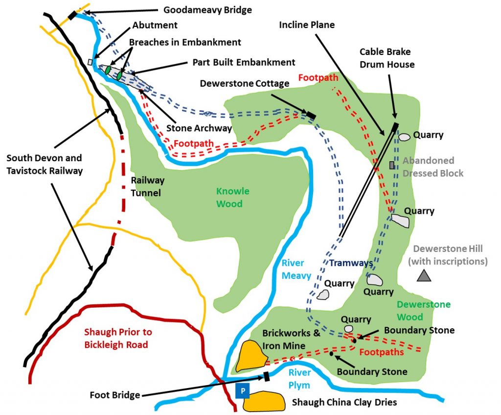
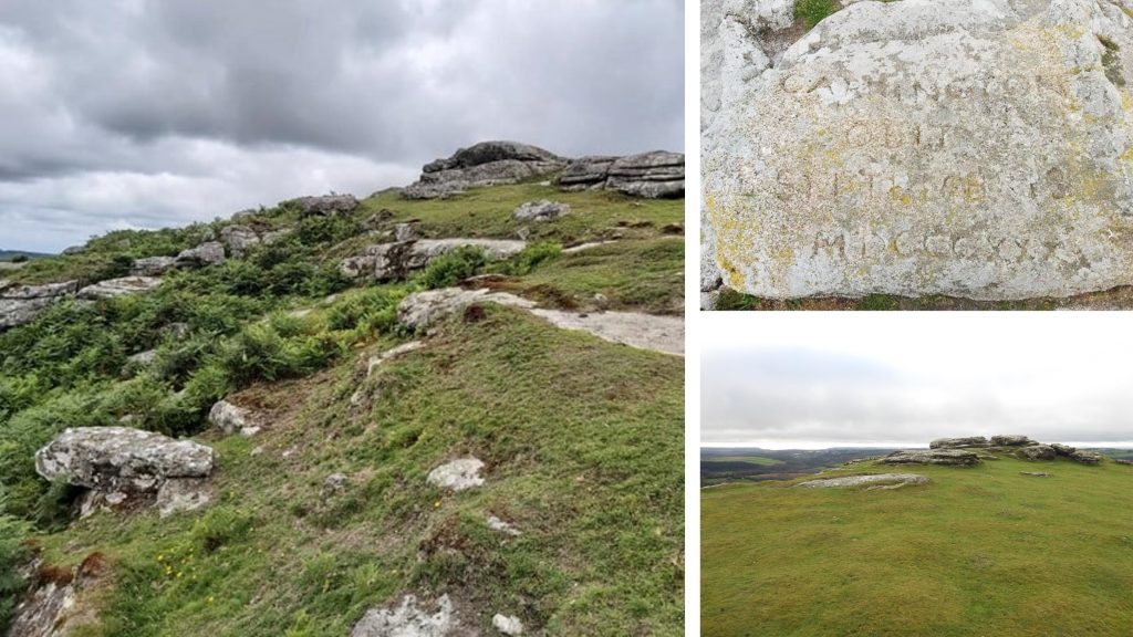
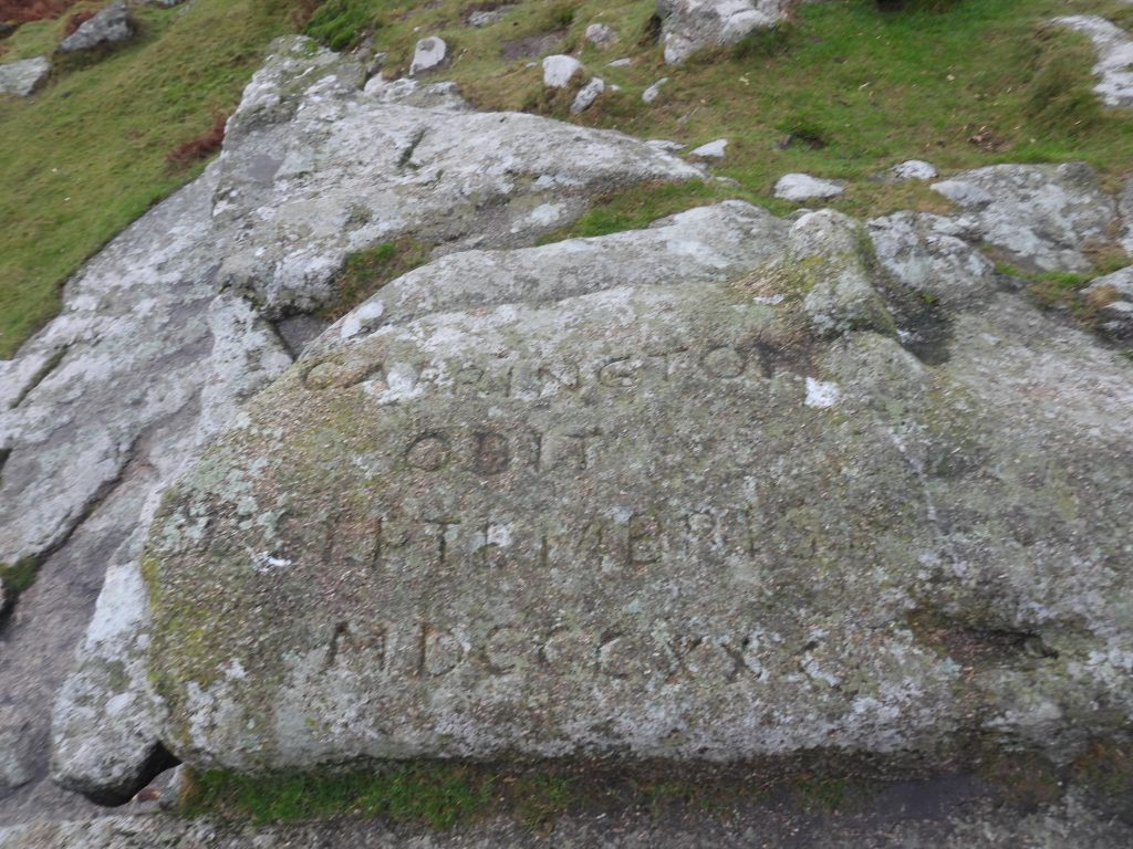
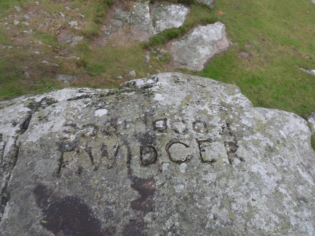
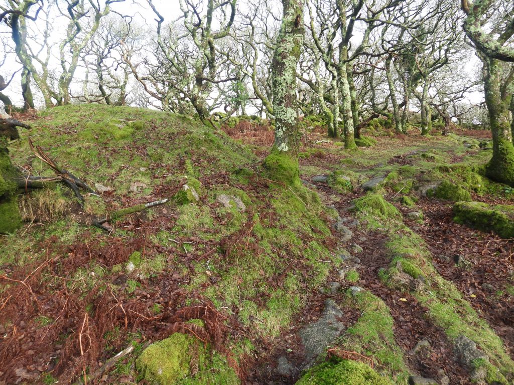
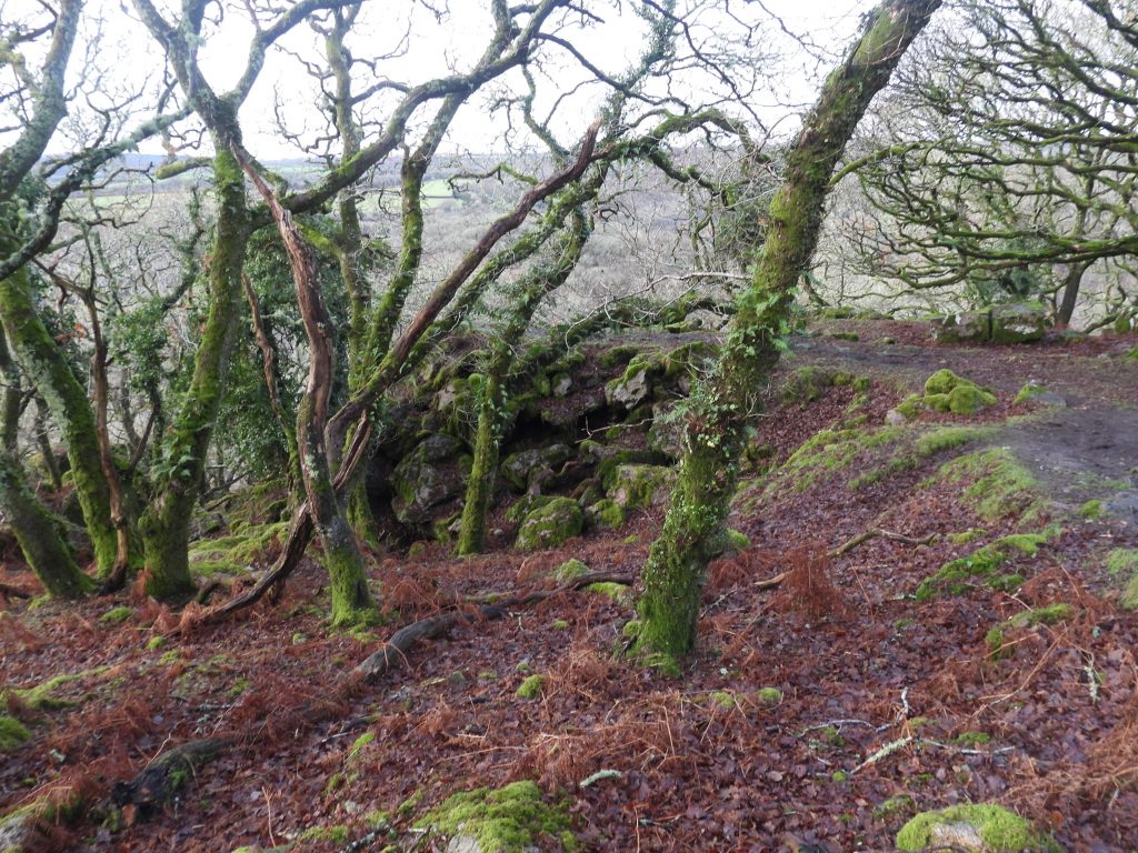
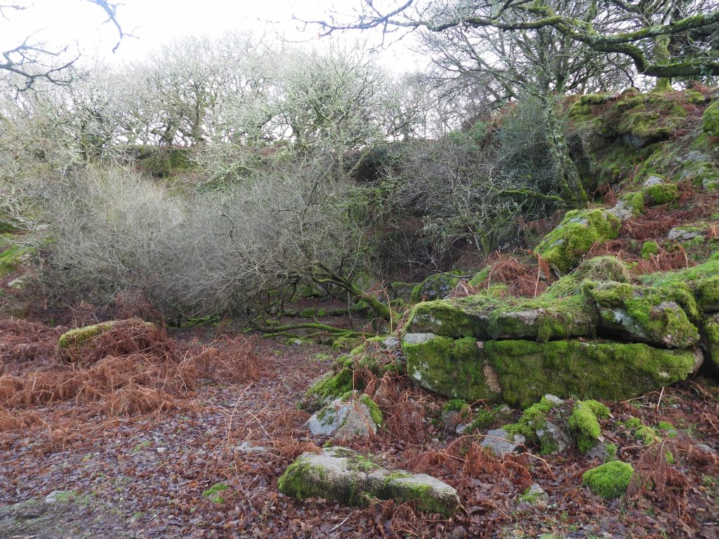
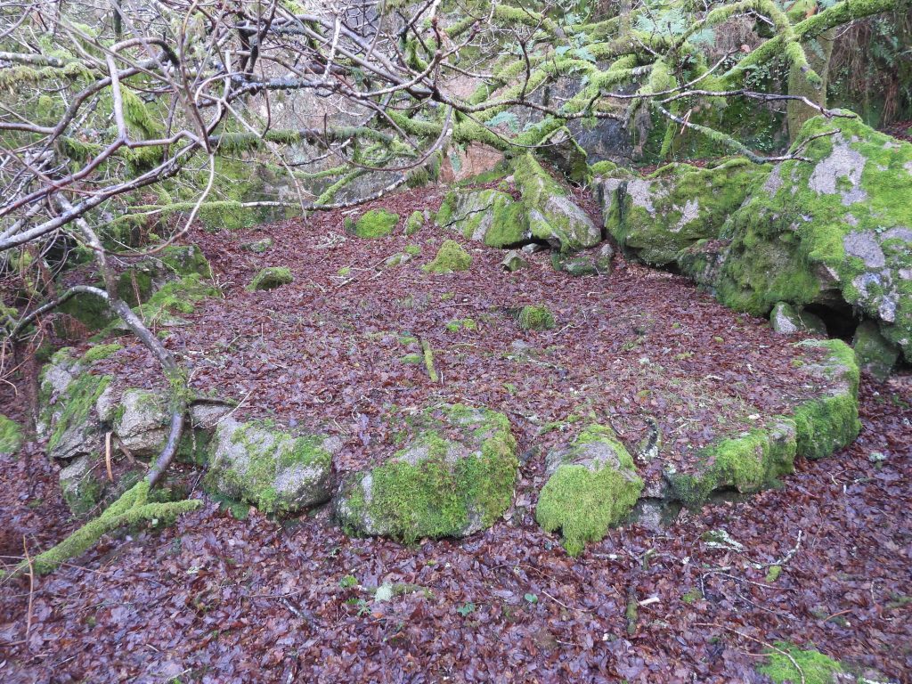
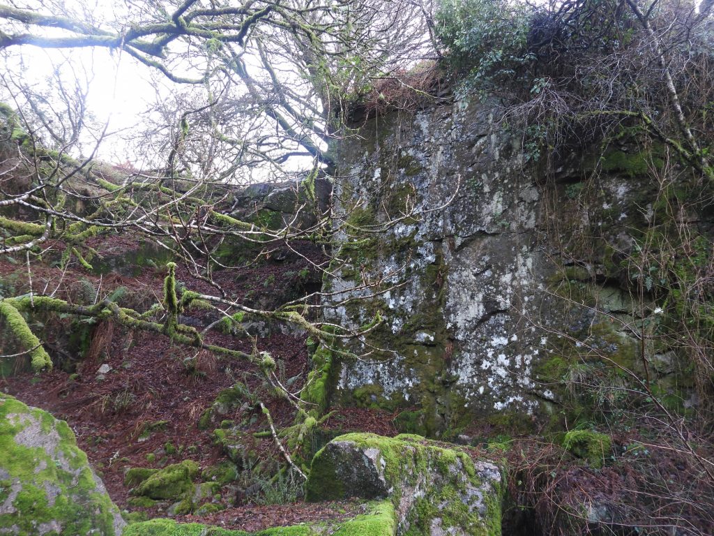
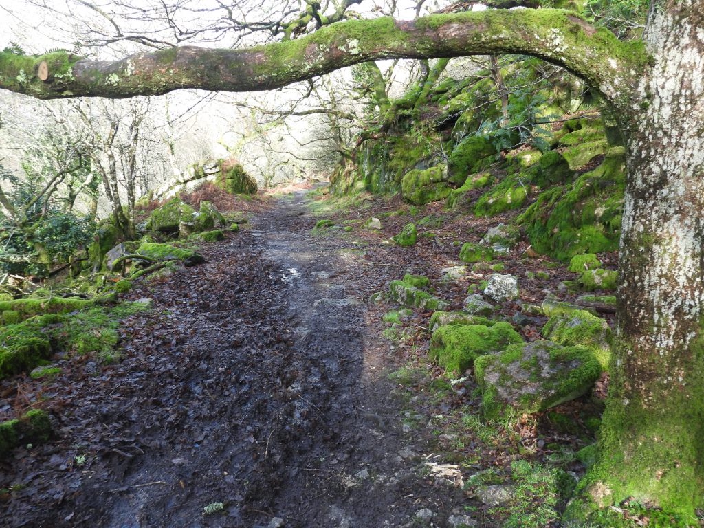
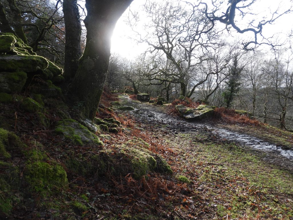
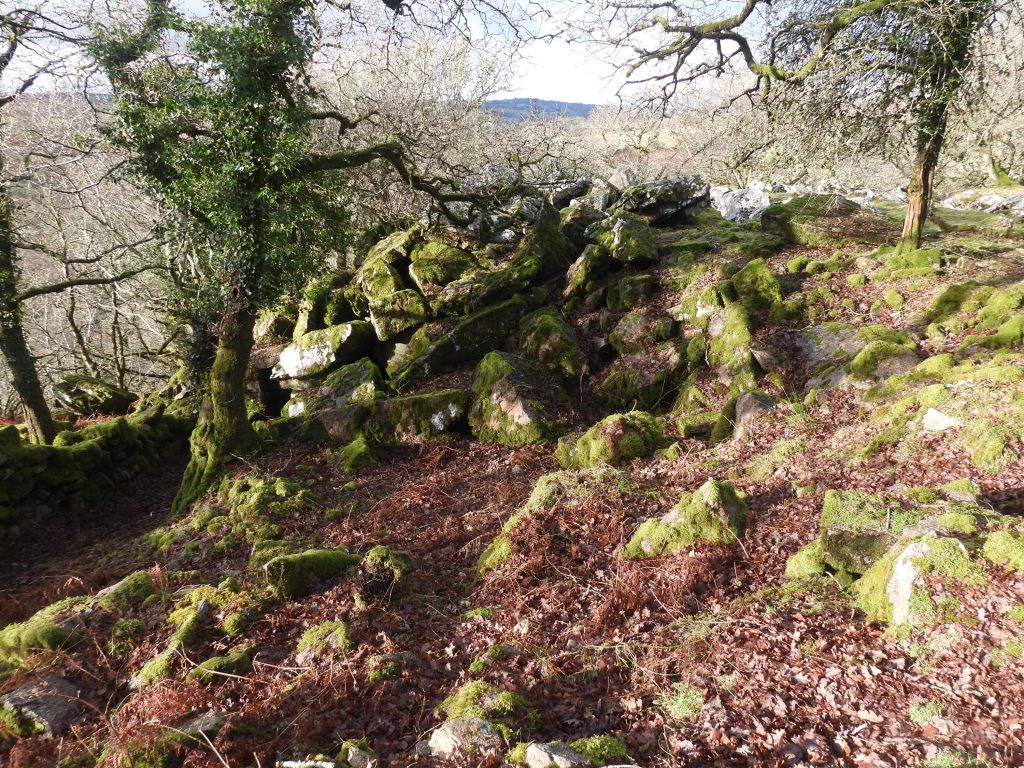
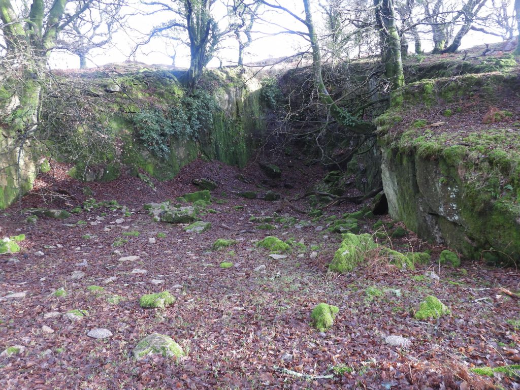
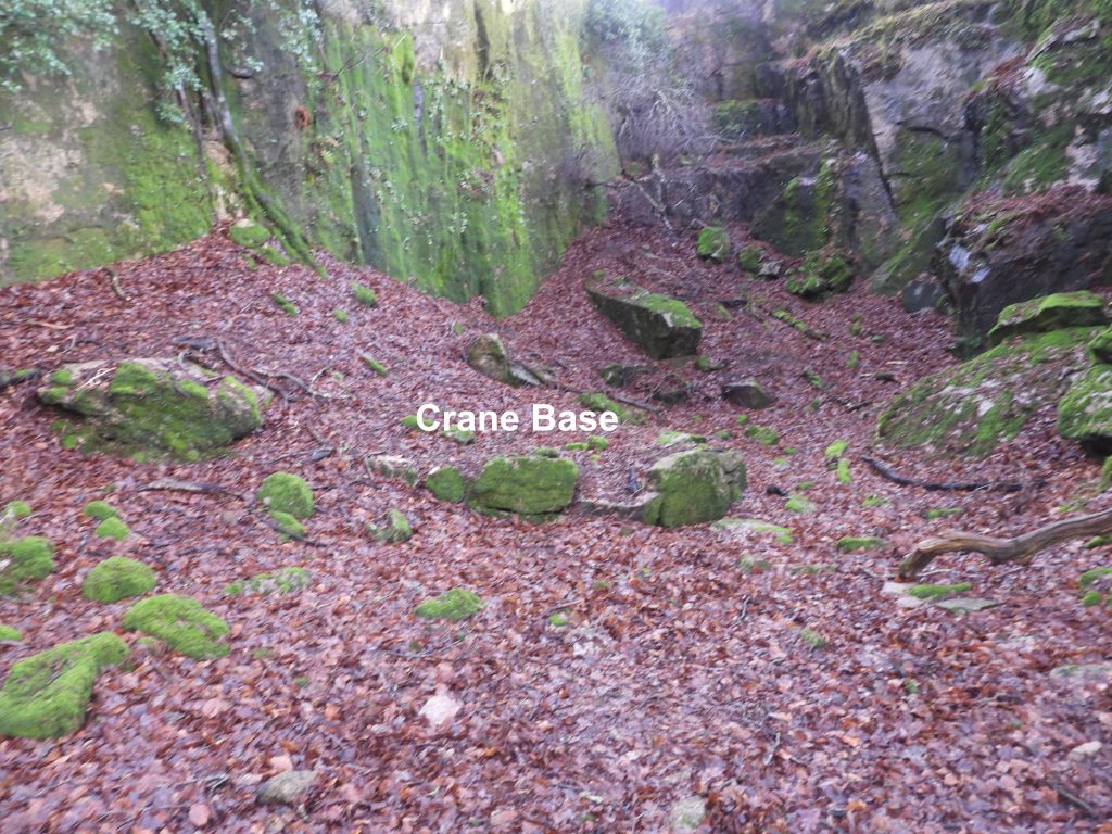
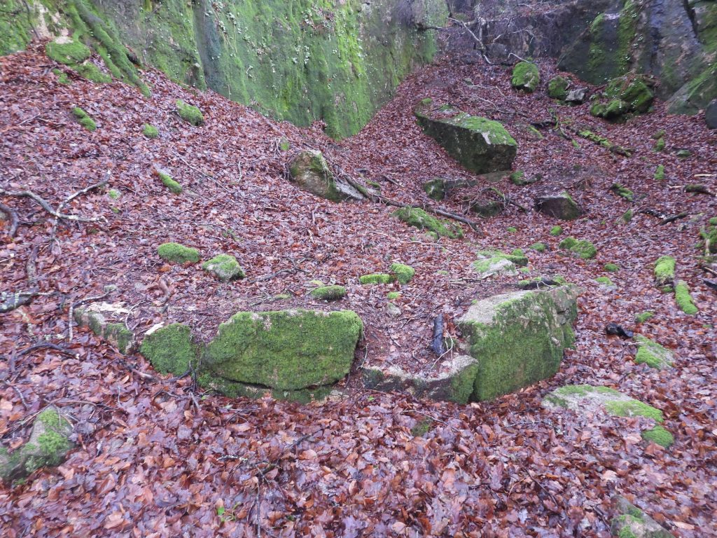
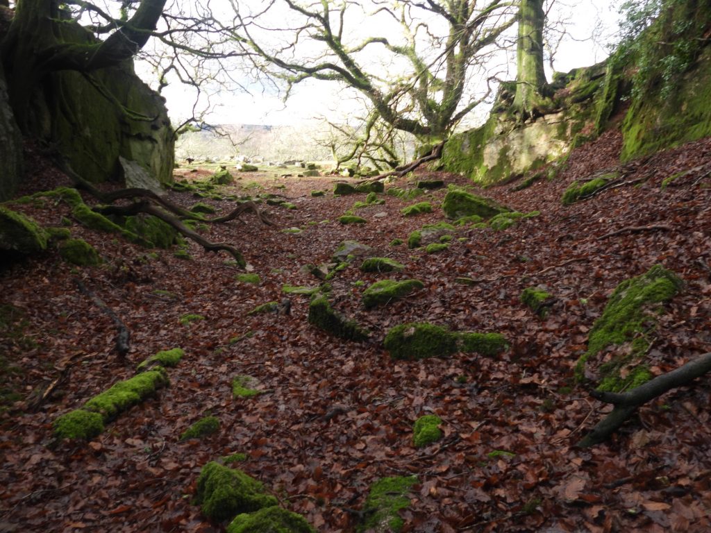
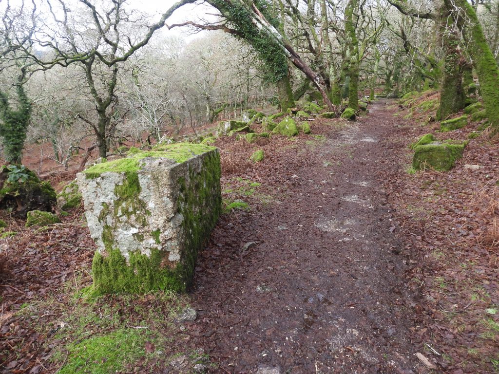
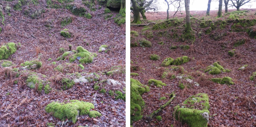
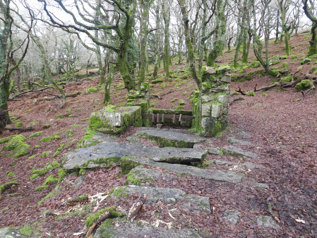
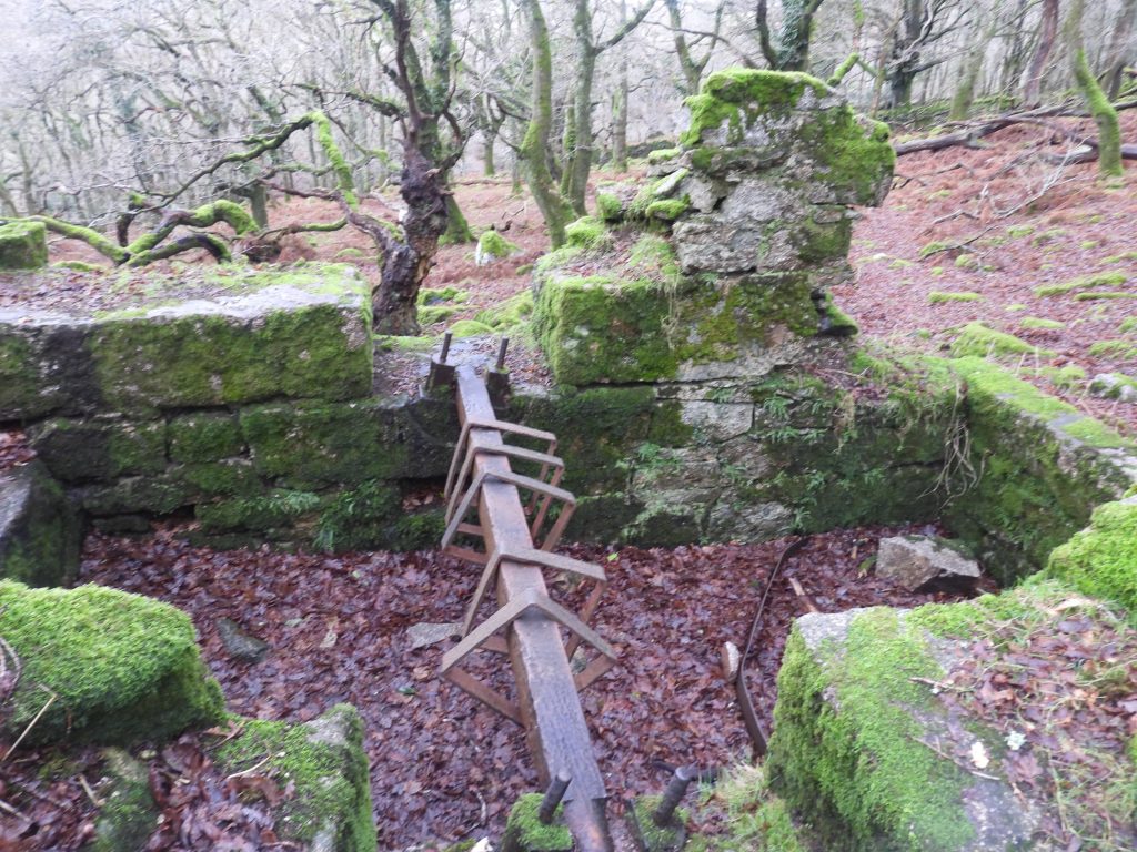
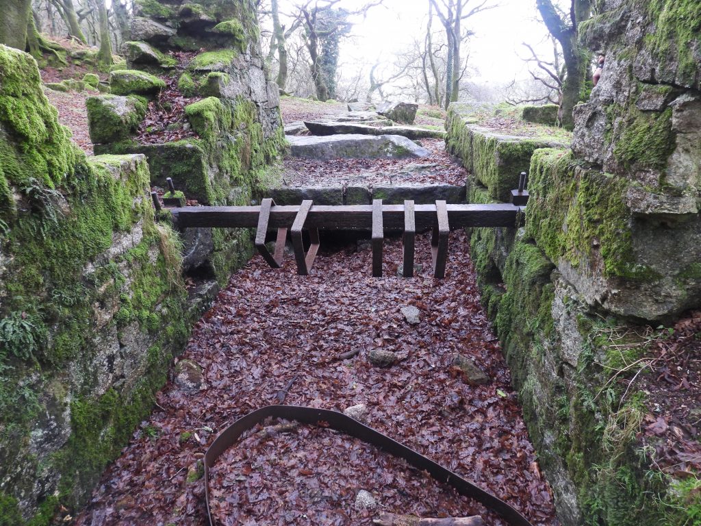
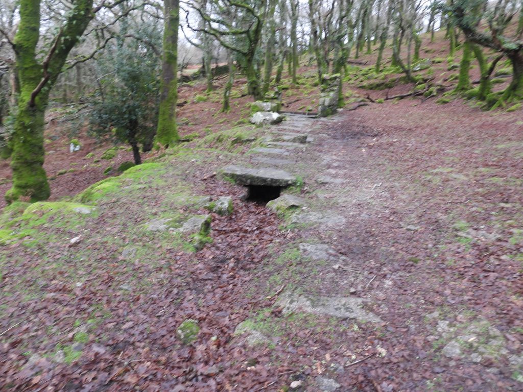
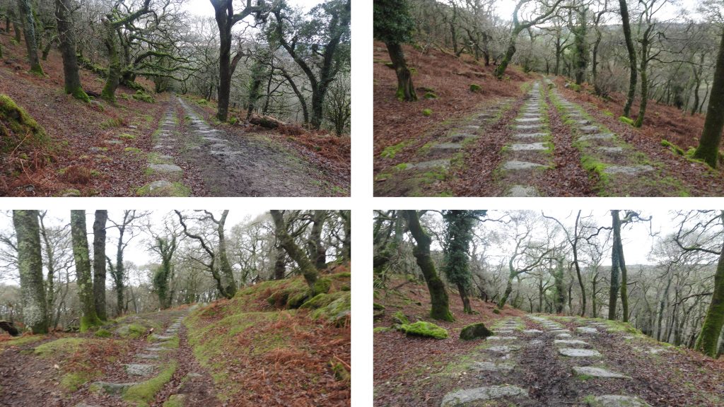
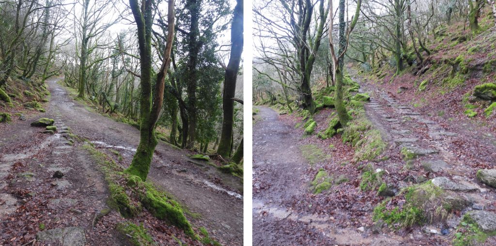
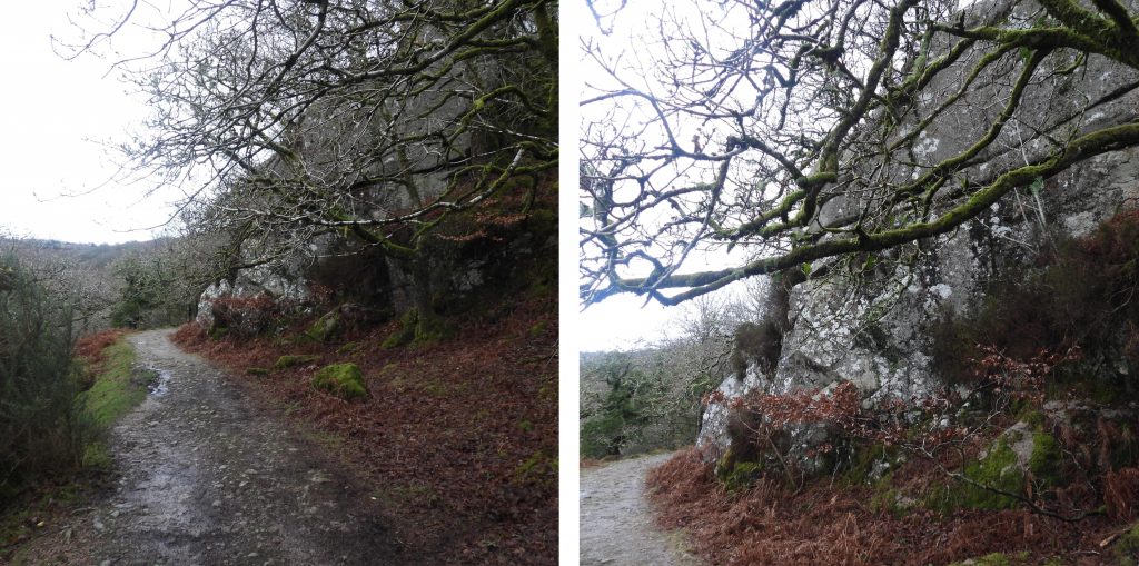
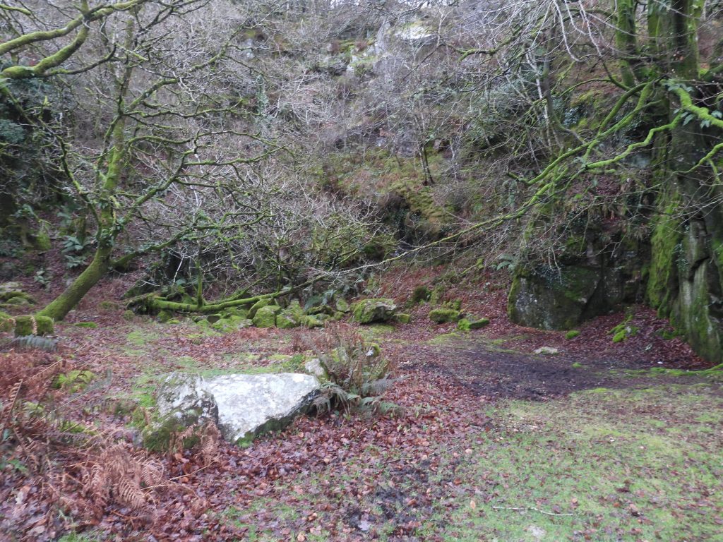
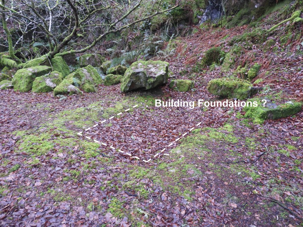
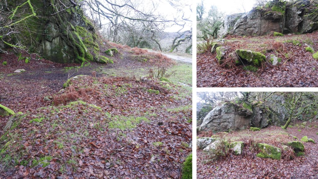
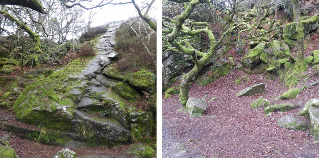
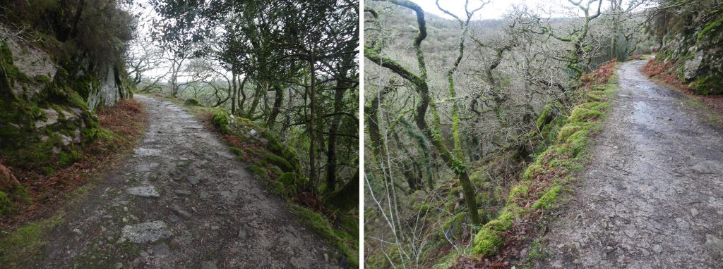
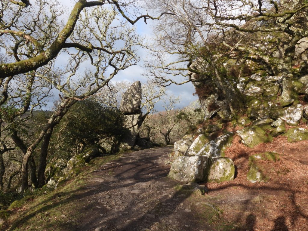
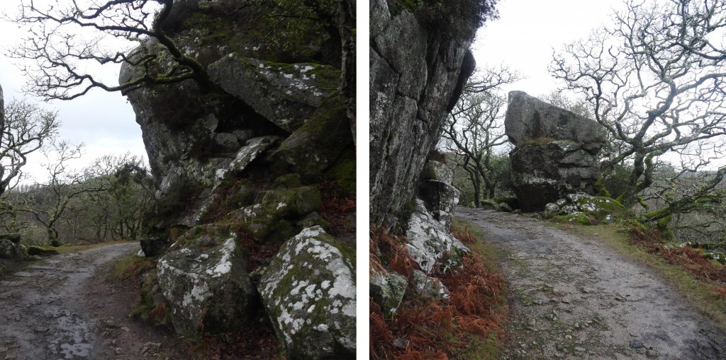
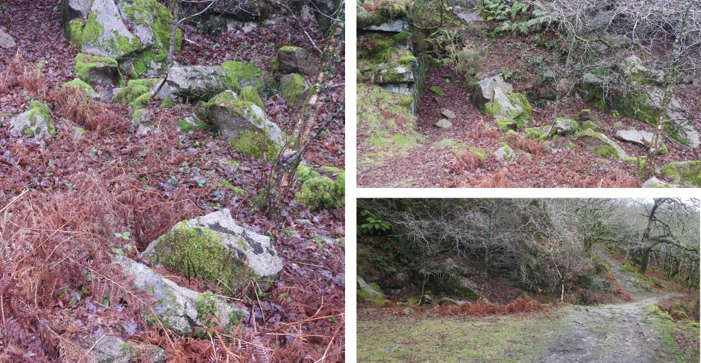
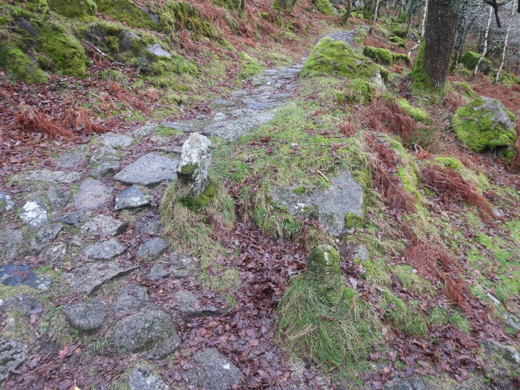
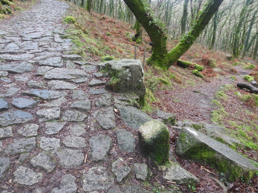
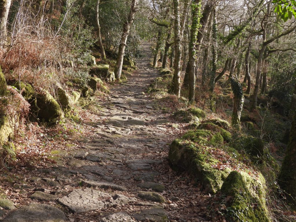
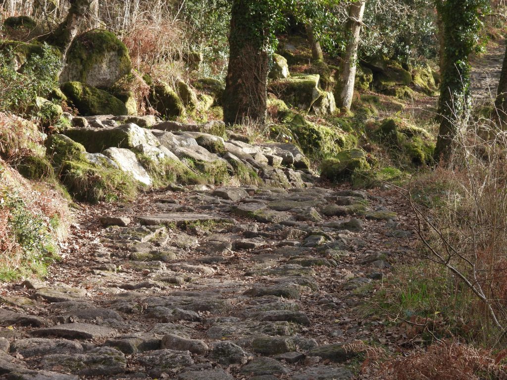
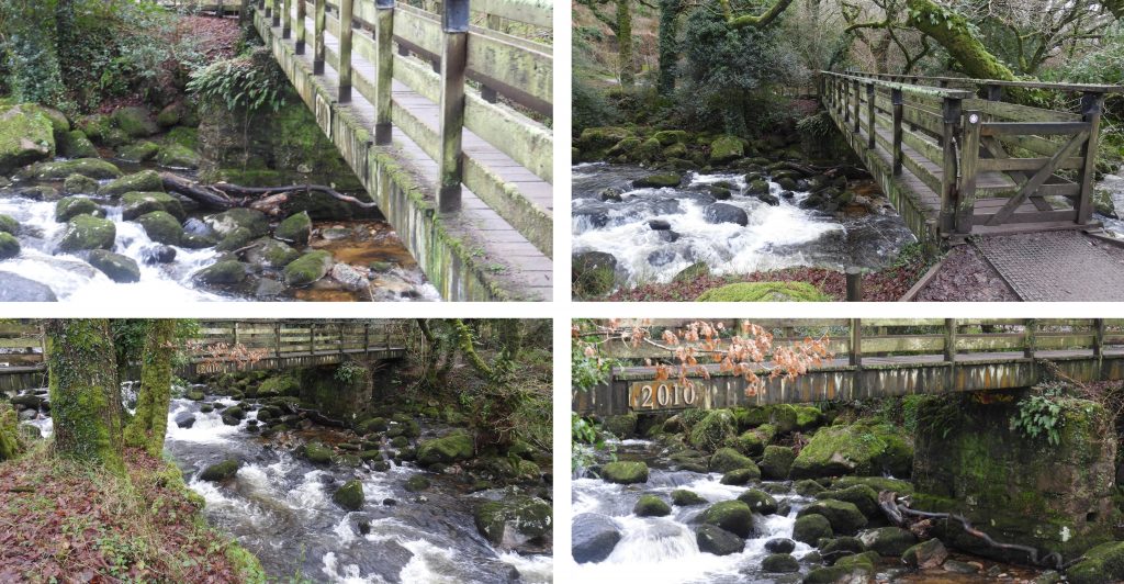
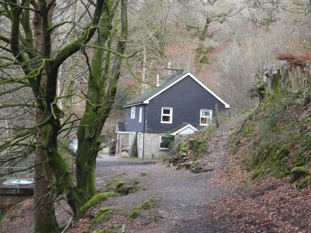
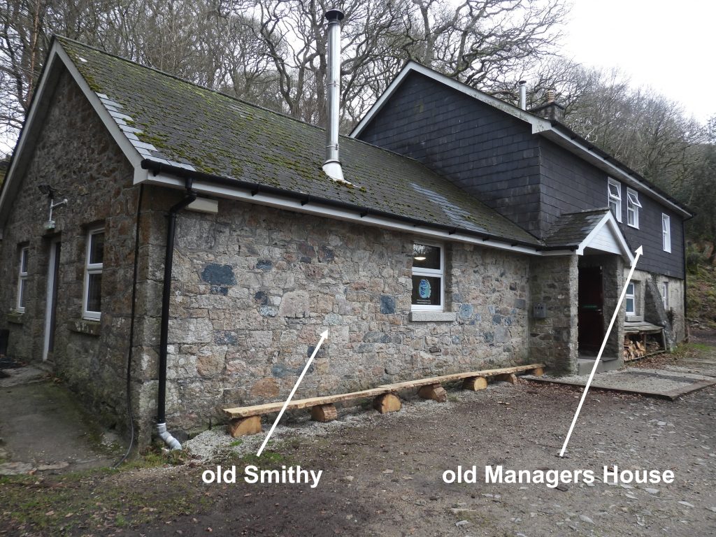
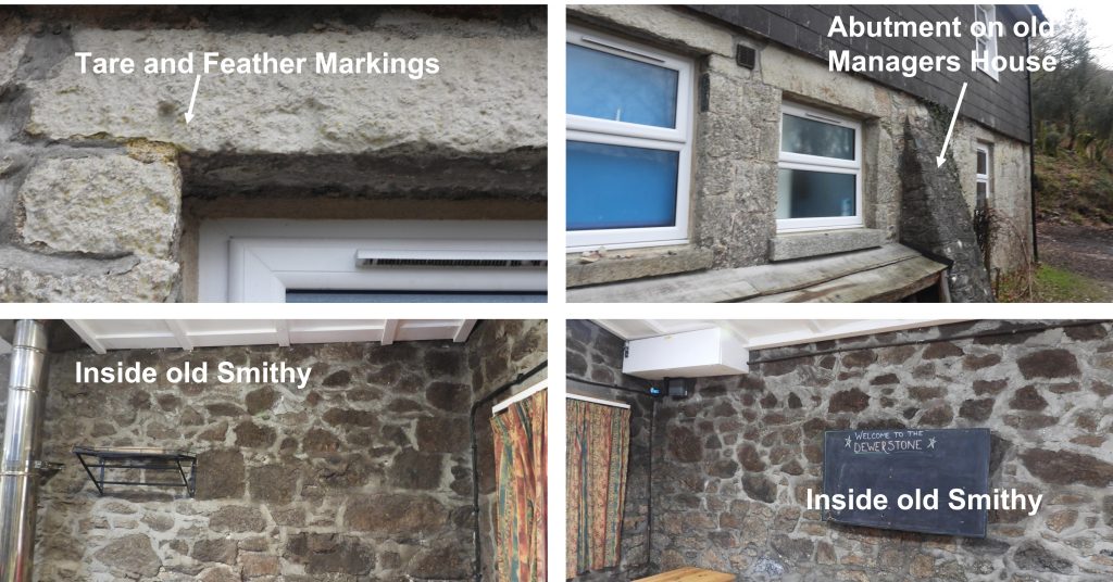
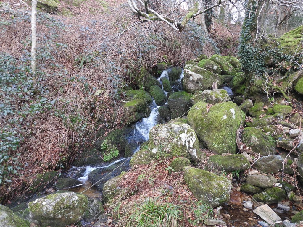
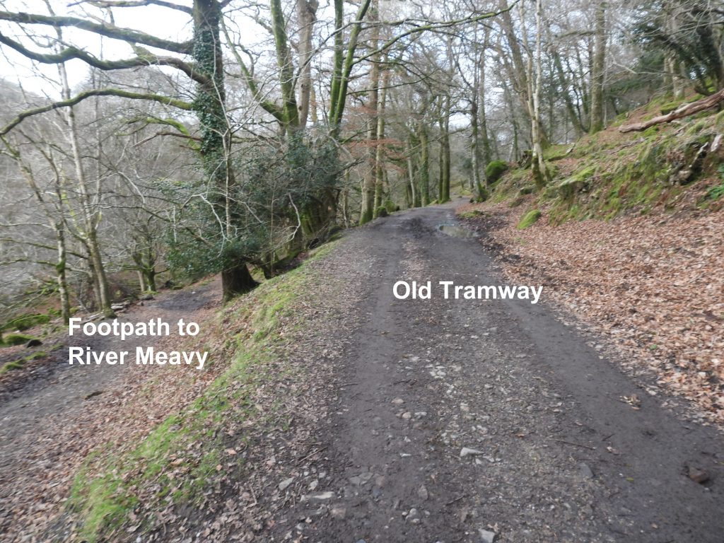
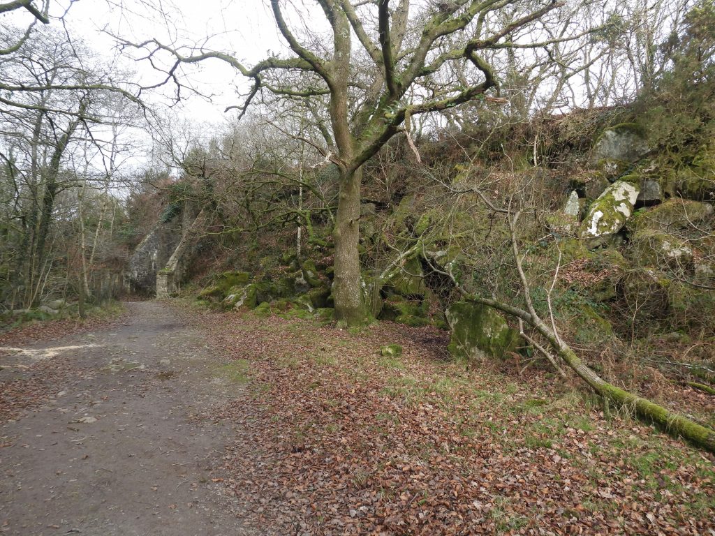
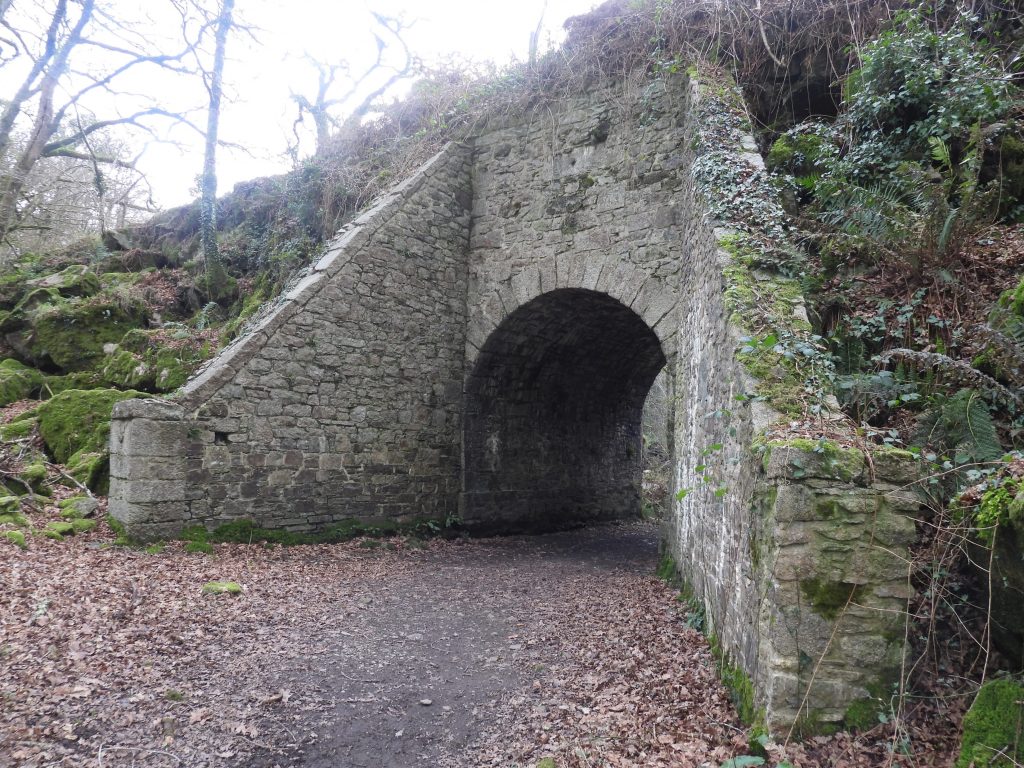
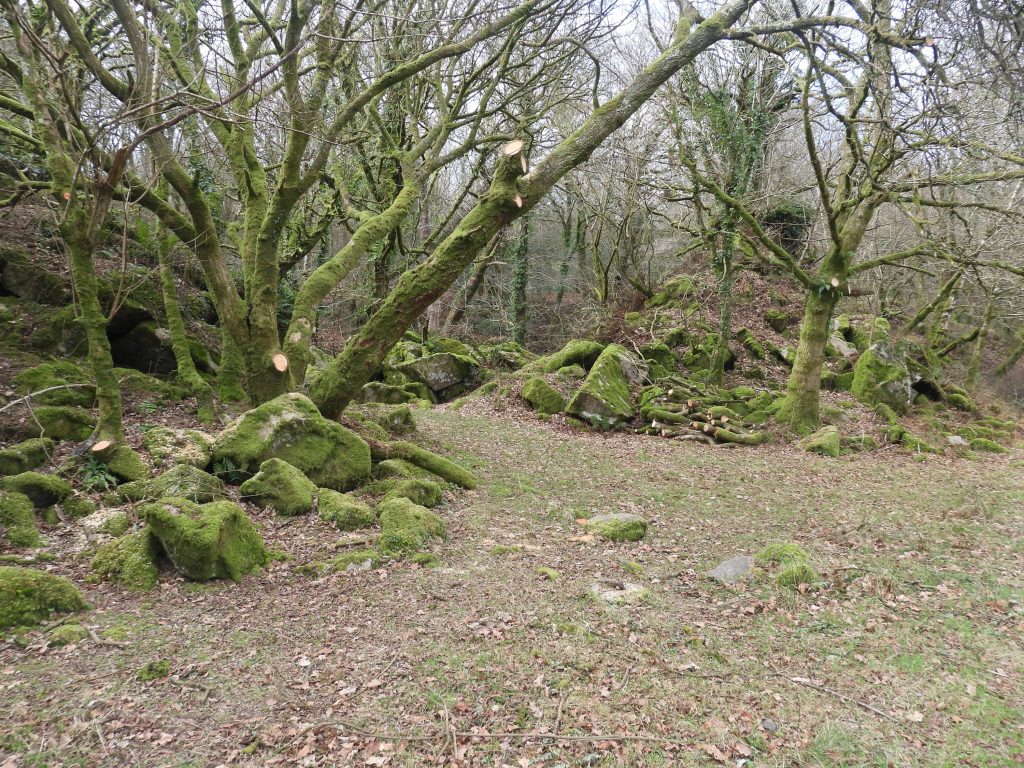
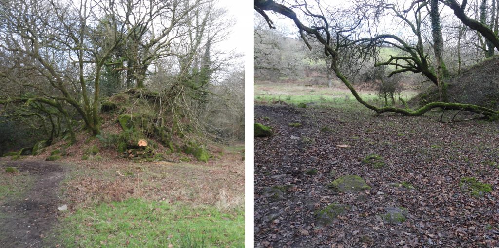
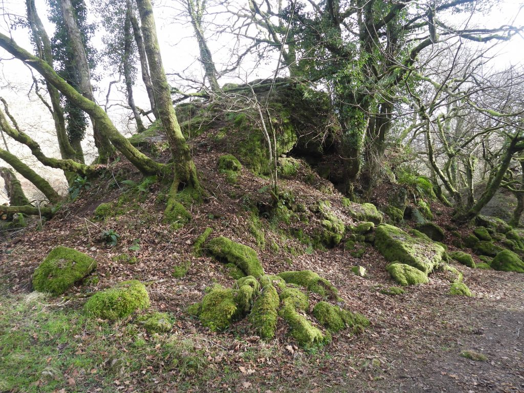
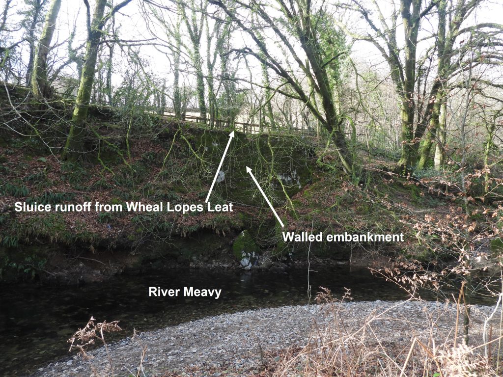
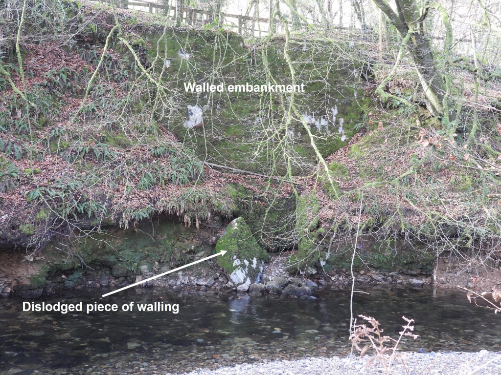
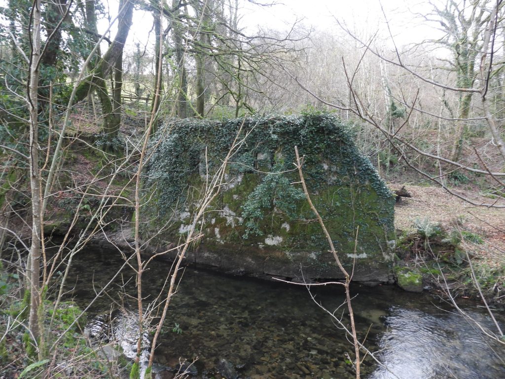
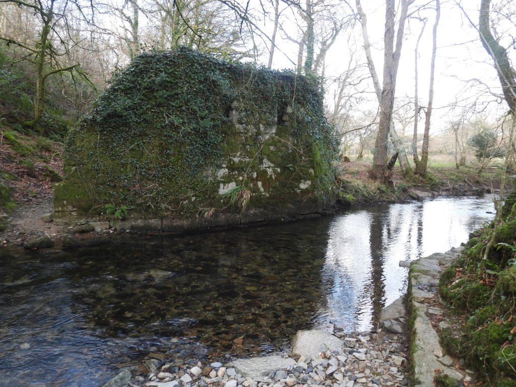
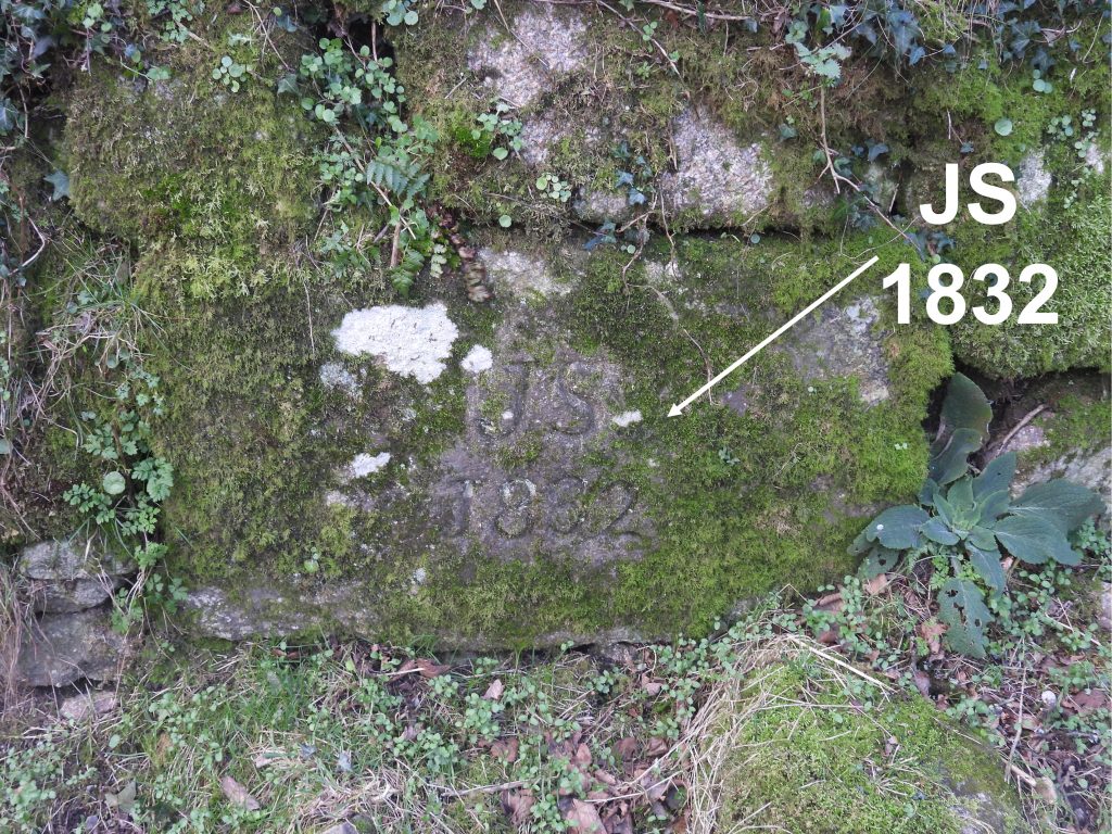
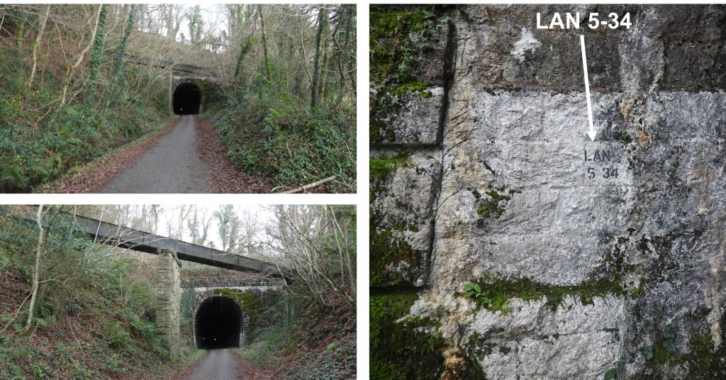
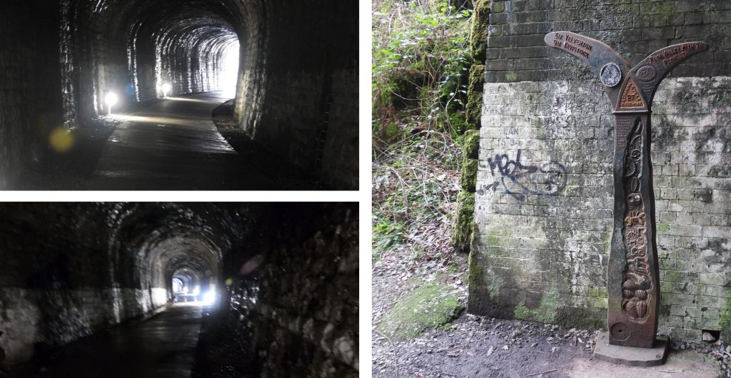
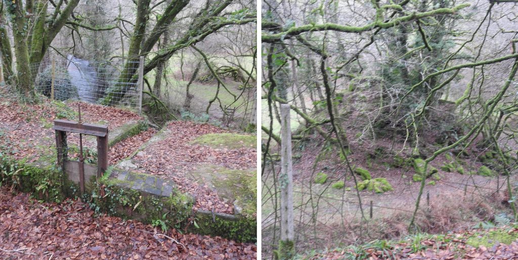
Map of the area covered in this post. The first part of the post covers Dewerstone Hill down to the River Plym via the incline plane, tramways and the footpath. The second part of the post covers the tramway branch from the bottom end of the incline plane following the tramway to a part built embankment and abutment where a bridge was proposed to cross the River Meavy to connect the tramways to the South Devon and Tavistock railway. The third part of the post shows part of the South Devon and Tavistock railway around the Leighbeer Tunnel and where the tramways would have joined had the bridge been built.Tithe Map for the Parish of Meavy marks the summit of the Dewerstone Hill as “Dewerstone Tor”. Fabulous views to the English Channel can be viewed from this lofty vantage point.On top of the Dewerstone Hill as stated by William Crossing, there is a rock that has the following inscription carved on it: “Carrington – Obit Septembris MDCCCXXX“. This carving relates to 2nd September 1830, when Dartmoor poet Noel Thomas Carrington died. Obit comes from the Latin obitus, “death,” the past participle of obire, “to go toward” or “to die.”More inscriptions on the summit. F WIDGER and F DODRIDGE are obvious and below the “D” in “WIDGER” is a “W” which is the start of an inscription W.FORD.Descending Dewerstone Hill to pick up the upper end of the tramway, the explorer passes a man made “mound” not mentioned in the Dartmoor HER. It is located at SX53676 63866 and the author’s first impression is that it might be a charcoal burning platform.The end of the upper tramway is truncated by an embankment of granite spoil, which is located at SX53636 63900.At the end of the upper tramway is the highest quarry.Within the upper quarry is a circular structure which the author believes was a crane base. It is located at SX53669 63909.Inside the upper quarry.Moving north from the last quarry along the old tramwayAnother view of the upper tramway.Another granite spoil embankment next to another quarry on the upper level.The second quarry on the upper tramway level.Within the second quarry is another circular structure which the author also believes was a crane base. It is located at SX53732 64065.Close up of the crane base.Inside the second upper quarryThe woodland next to the upper tramway contains lots of old granite walls, which most likely would have pre-dated the quarries.An abandoned large granite block, whose dimensions are recorded as 1.8m by 1.2m by 0.9m. It has bevelled borders and rusticated faces, thus indicating it was likely to be intended for a specific major public building. Why was it never delivered? This block is located at SX53727 64223.Small quarried area at the end of the upper tramway near the ruined cable drum house at the top of the incline plane. The small quarry is located at SX53733 64280. Ruined cable drum house at the northern end of the upper granite tramway.The cable drum house is quite well preserved and the remnants of the wooden drum remain inside the pit. The cable drum house can be found at SXSX53732 64304.Inside the cable drum house. The cable would have run underneath the granite blocks shown at the far end of the pit. Exit point for the cable. The incline plane. The cable-operated incline enabled granite blocks to be lowered to the lower level before being reversed to head north past Dewerstone Cottage towards Goodameavy Bridge. The full wagons descending were counterbalanced by empty wagons ascending with the cable drum being part of a braking and control system.Bottom of the incline plane. The lower tramway heads north to Dewerstone Cottage and Goodameavy Bridge and south the tramway was used to connects additional quarries. This post will continue on the south branch down towards the River Plym. Later in the post the north branch from this point will be followed.The lower tramway has some remarkable engineering with large outcrops having to be negotiated around.First quarry next to the lower tramway.Within the first quarry appear to contain the foundations of a building. These are not mentioned on the Dartmoor HER. The foundations are located at SX53526 63889.A few metres from the building foundations lies what the author believes to be yet another crane base. It is located at SX53526 63882.Some features next to the lower tramway. The rock formation in the left picture appears to be a point which is regularly climbed. The area in the right hand photograph looks as if stone has been removed (small quarry ?) and is located at SX53501 63834.This curve in the lower tramway is where it changes direction from north/south to (more or less) east/westAnother example of the engineering required to built the tramway, this time through a granite outcrop.Another view of the outcrop “split” by the tramway.At the end of the lower tramway (where it continues as a footpath) a small quarried area can be found. It is located at SX53561 63775.To the east of the final small quarry the path splits. At this point there are two un-marked upright boundstones. The author is not aware of their significance. They are located at SX53579 63762.Descending the pathway to the River Plym another upright boundstone can be found. Once again the author is unaware of its purpose. It is located at SX53549 63728.The pathway to the river (looking back uphill).The “step” in the pathway is where a former aqueduct crossed to feed a waterwheel associated with the nearby Ferro-Ceramic mine. More information can be found here: https://dartmoorexplorations.co.uk/the-ferro-ceramic-company-ltd-including-shaugh-brick-and-tile-works/A former tramway from the old brickworks would have crossed where the current day footbridge is located. The footbridge has a date on it (2010), which is assumed to be the last time it was repaired. The abutment underneath the bridge would have been part of the foundations of the former tramway.Heading back up to the northern branch of the lower tramway and heading north, the explorer can find Dewerstone Cottage. “Spirit of Adventure” acquired the lease of the property in mid 2014 and completely refurbished it. More information can be found at: https://www.spirit-of-adventure.com/accommodation/The Dartmoor HER and the National Trust have recorded Dewerstone Cottage as an old Smithy and the old Managers House (both associated with the quarries). The author was fortunate to meet the director on “spirit of adventure” and during the conversation, it was speculated that northern end was most likely the smithy and the southern end the managers house.To support the assumption of the smithy being the northern end, inside can be found old lime mortared walls indicating its age. As the building has a low(ish) ceiling compared to the managers house would most probably supported the fact the smithy was this end. The Managers house end has a chimney, an external abutment and “tare and feather” marks can be found on a window lintel. The author is grateful for being allowed to view the inside of the building.A few metres to the north of Dewerstone Cottage is a stream which descends the hill down to the River Meavy. The author speculates that the presence of this stream probably influenced the location when deciding to build Dewerstone Cottage.Heading north from the Dewerstone Cottage a footpath which leads down to the River Meavy can be located. The author recommends taking this route as a picturesque route to the unfinished tramway embankment.The rather imposing stone embankment to the east of River Meavy was intended to link the granite tramway with the railway (South Devon and Tavistock) on the west of the river, The embankment is believed to have been constructed from old granite spoil.As the embankment reaches the river, this rather delightful stone bridge / archway can be located. It is very well preserved and is located at SX53088 64419.Towards the end to the embankment, there are two clear “breaches” in its construction, giving an appearance of being incomplete. The stone was removed for the construction of Lopwell Dam (on the River Tavy). This breach is located at SX53048 64443.The second breach in the embankment is located at SX53014 64458.The final piece of the embankment, in isolation, could be mistaken for a “mini tor”At the end of the granite embankment and looking across the River Meavy lies a walled embankment. This lies below a sluice leading from Wheal Lopes Leat.On closer inspection there is two pieces of stone walling (one is dislodged) at the base of the walled embankment.Originally the Dewerstone Quarries granite tramway was planned to connect with the South Devon and Tavistock railway. A bridge would have needed to have been constructed across the river. However, permission to build across the River Meavy could not be obtained from the landowner (Maristow Estates). Talking with a resident of Goodameavy, he stated the Maristow Estates effectively owned the river. The bridge was unfinished and an abutment on west side of river meavy is extant and seems complete.The abutment is located at SX52972 64479. On the east side of the river some footings can be seen at water level.Granite from the quarries would have had to be transported via Goodameavy Bridge as the river crossing to the railway wasn’t possible. A point of interest on the bridge is an inscribed stone (JS 1832). The stone is mentioned in ‘A Field Guide to the Boundary Markers on and around Dartmoor’ by Dave Brewer. It is known that the initials refer to one J. Scoble, a former landowner, but its purpose is unknown. It is located at SX52913 64624.This post now takes the explorer onto the South Devon and Tavistock Railway to view where the Dewerstone Granite Tramway would have connected. The pictures show the south end of the Leighbeer Tunnel. The line opened to Tavistock on 22nd June 1859, which was some 20 years after the quarries started. The attraction to connect to it would have been very appealing. The line finally closed on 31st December 1962. Of interest on this part of the line is an aqueduct which carries the Wheal Lopes Leat. The leat fed a “short-lived” mine located at Hele Bottom, which is known to have been worked as early as 1825. A further attempt was made to work the mine around 1860 (just after the railway opened) but it seems that attempts to sell it in 1862 were unsuccessful. It is assumed that the aqueduct was built by the railway engineers. On the entrance to the tunnel is painted a distance marker (LAN 5 34), which stands for 5 miles and 34 chains (from Tavistock Junction). LAN stands for Launceston.The Leighbeer Tunnel is approx 300m long but well lit for both walkers and cyclists, albeit a little damp in places.Just a few metres from the north entrance to / exit from the Leighbeer Tunnel, a glimpse can be seen of the abutment (west side of River Meavy) and the end of the granite embankment (east side of River Meavy). In the foreground a sluice gate leading from the Wheal Lopes Leat is still extant. This would have allowed water to re-enter the river (at the location shown in previous photographs in this post). The Dartmoor HER states that the leat dates from 1819 and originated from a head weir on the River Meavy at Hoo Meavy Bridge. The leat runs for 9 kilometres and as well as traveling over the previously seen aqueduct would have gone through a tunnel under Knowle Wood.
I have lived all my life in Plymouth and discovered the Dewerstone quarries whilst on a walk. I like to read about industrial archeology, particularly close to home. Thanks for the information
Thanks so much for the fascinating insight into the quarry & tramways. I hadn’t appreciated that the river bridge had never been constructed.
Many thanks,


Adrian February 2, 2023
I have lived all my life in Plymouth and discovered the Dewerstone quarries whilst on a walk. I like to read about industrial archeology, particularly close to home. Thanks for the information
SteveGriggDartmoor February 2, 2023 — Post author
Hi Adrian,
Thank you for your comments. Like yourself, I love industrial archaeology.
Regards,
Dartmoor Explorations (Steve)
Martin Perry February 19, 2023
I used to live in the area and had no idea this existed! Many thanks for a fascinating web page.
SteveGriggDartmoor February 22, 2023 — Post author
Hi Martin,
Many thanks for your comment.
Kind Regards,
Dartmoor Explorations (Steve)
David simkins December 15, 2024
Hi Adrian
I have added a link from this website to my Walkingwestdevon.co.uk website. The Dewerstone walk.
Hope that’s ok.
david
SteveGriggDartmoor December 16, 2024 — Post author
No problem
David simkins December 15, 2024
Hi Adrian
I have added a link from my website to yours. You can find it under The Dewerstone in Dartmoor Walks
Hope that’s ok.
david
SteveGriggDartmoor December 16, 2024 — Post author
No problem
Ian July 5, 2025
Thanks so much for the fascinating insight into the quarry & tramways. I hadn’t appreciated that the river bridge had never been constructed.
Many thanks,
SteveGriggDartmoor July 18, 2025 — Post author
Thanks Ian for your comment and reading the website
Kind Regards