A collection of walks, discoveries, insights and pictures of exploring Dartmoor National Park
February 26, 2024
Smallacombe Farm
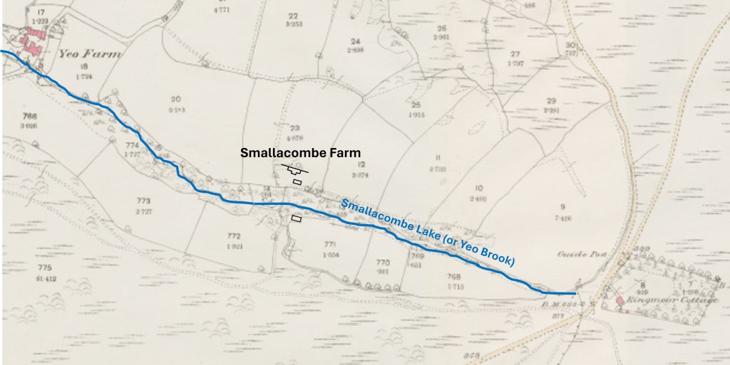
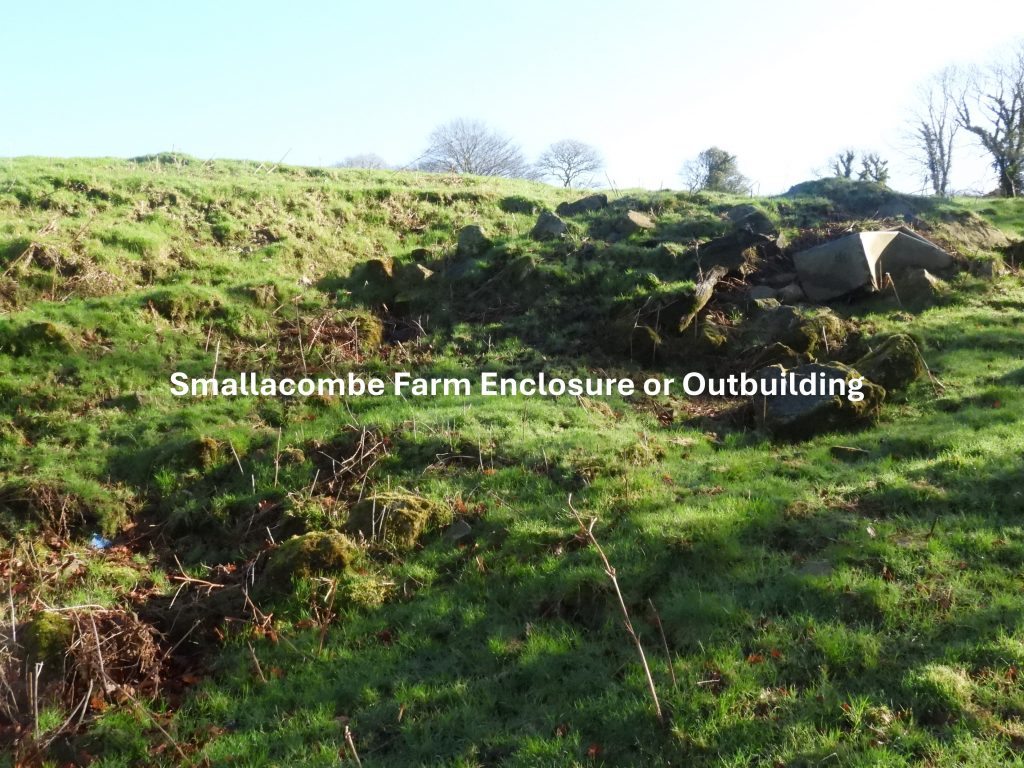
Half way up Smallacombe valley between Yeo Farm and Ringmoor Cottage lies the enclosures, fields and ruined dwelling house of the former Smallacombe Farm. The land is now farmed by Yeo Farm but Smallacombe still appears on modern OS maps.
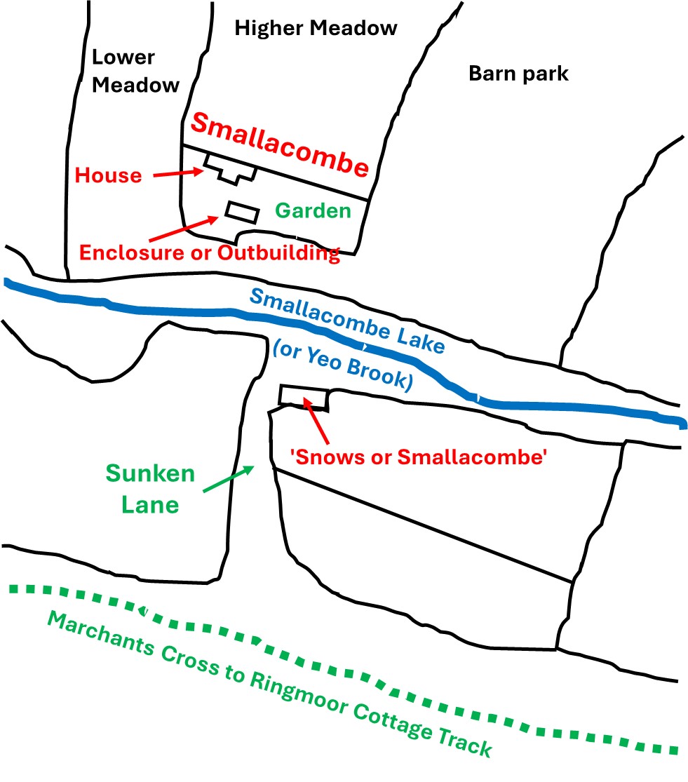
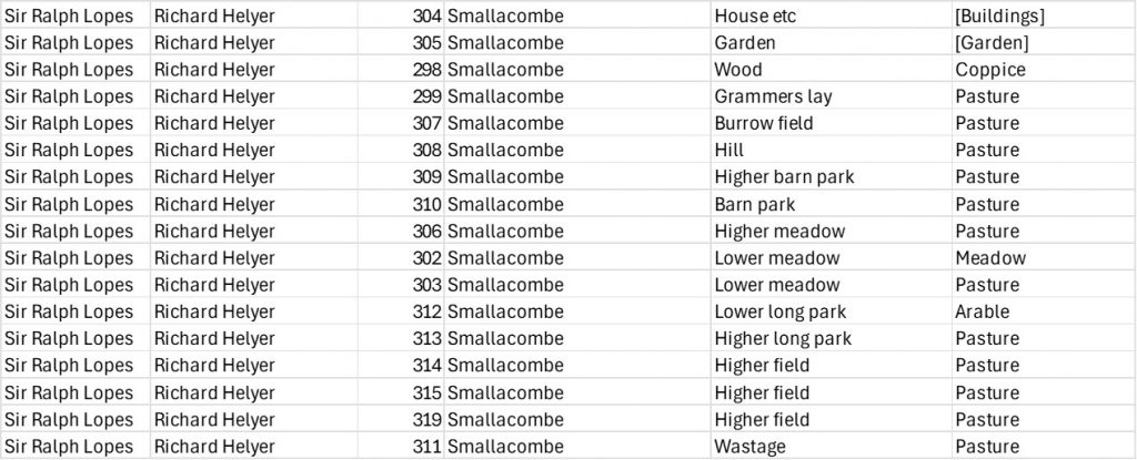
‘Smallacombe’ is shown on the Tithe Map as a T-shaped building in a rectilinear enclosure. Close by is a rectangular enclosure or possible outbuilding to the east. To the south (over the Smallacombe Valley) is the location of another building. The Tithe Apportionment for Smallacombe lists Field Number 304 as ‘House etc.’ and Field Number 305 as ‘Garden’, which appears to have been the centre of the farmstead.
Today, little remains of building(s) / enclosures / hedges north of the stream where quarrying and dumping has taken place and field banks removed. There are a few scattered stones and an old cart track. To the south of the stream a better preserved ruin is located. Using the public path around Yeo Farm, by following a course up Smallacombe Lake the farm can be located
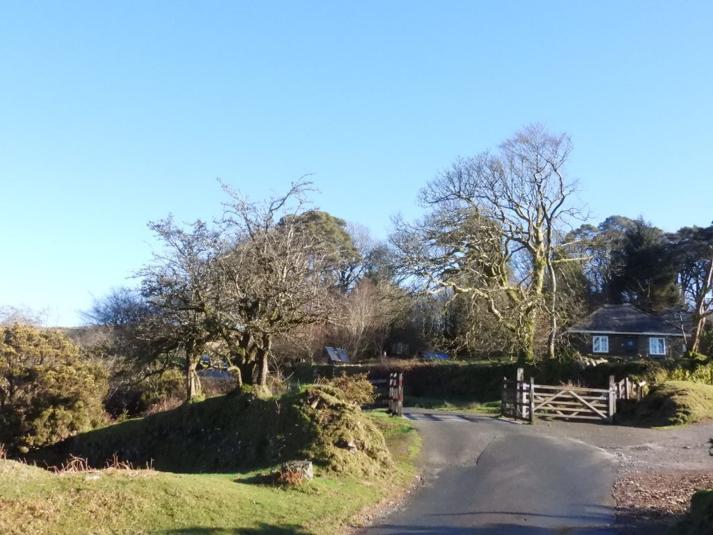
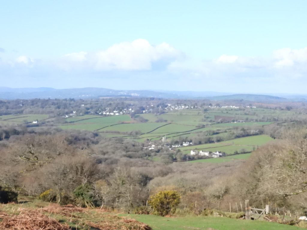
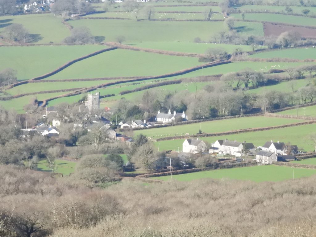
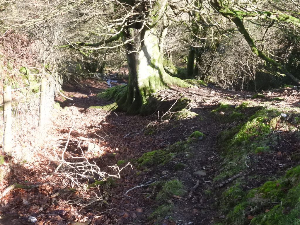
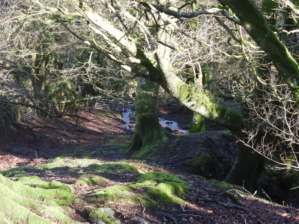
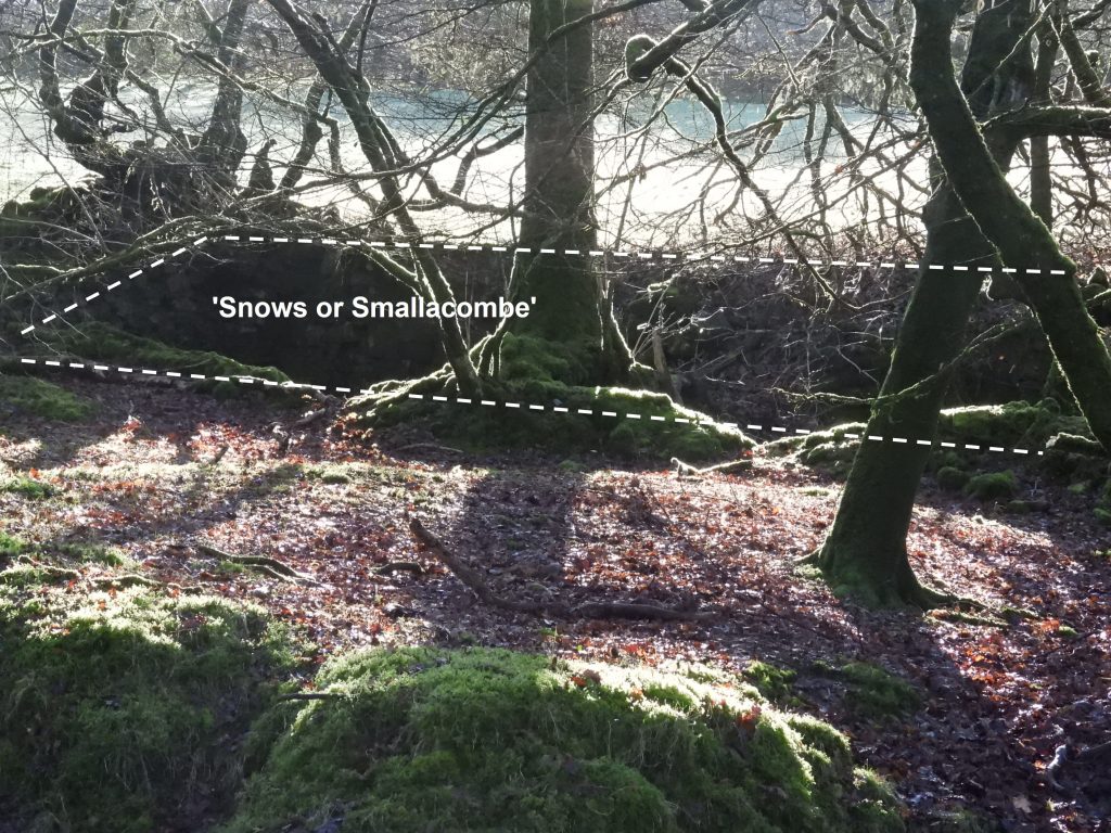
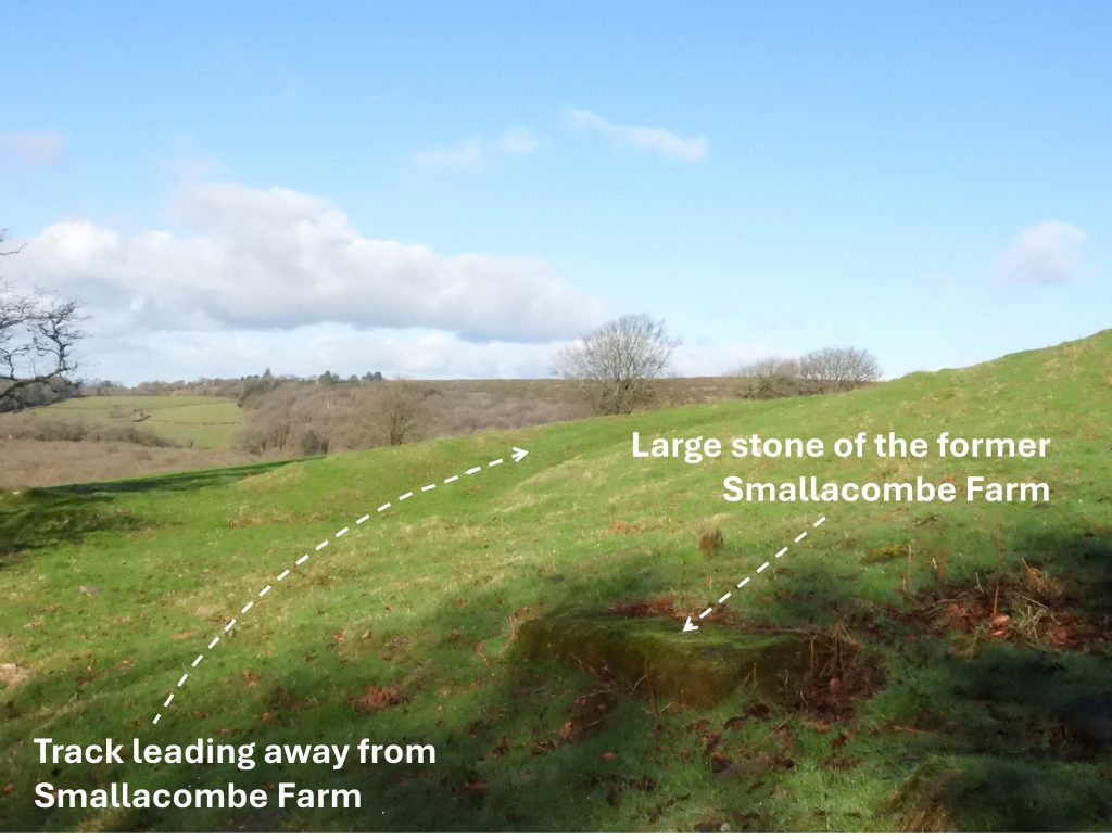
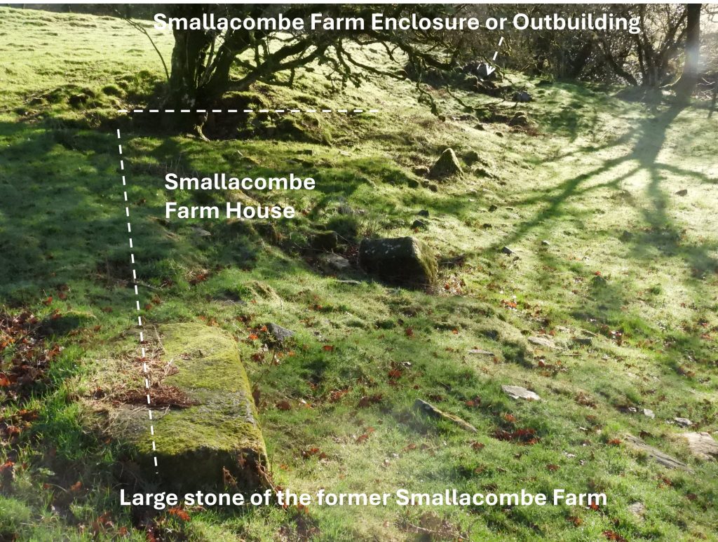
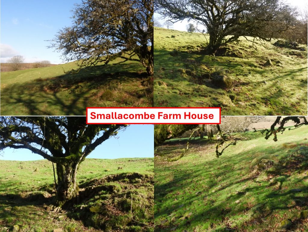
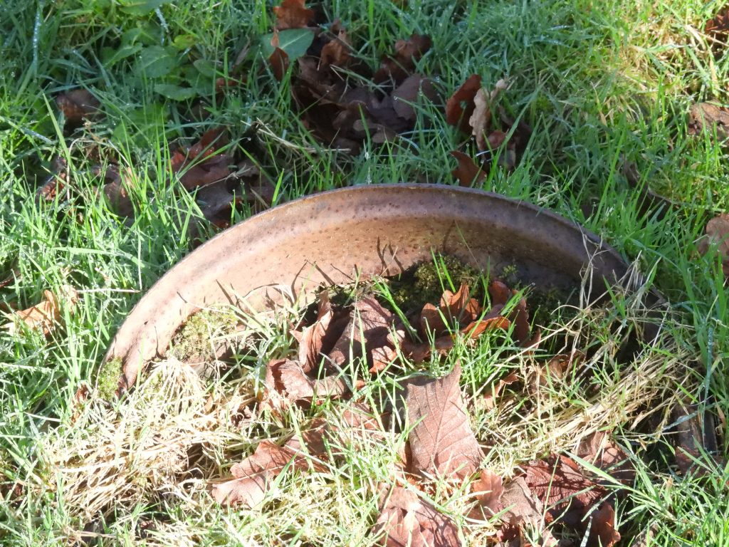
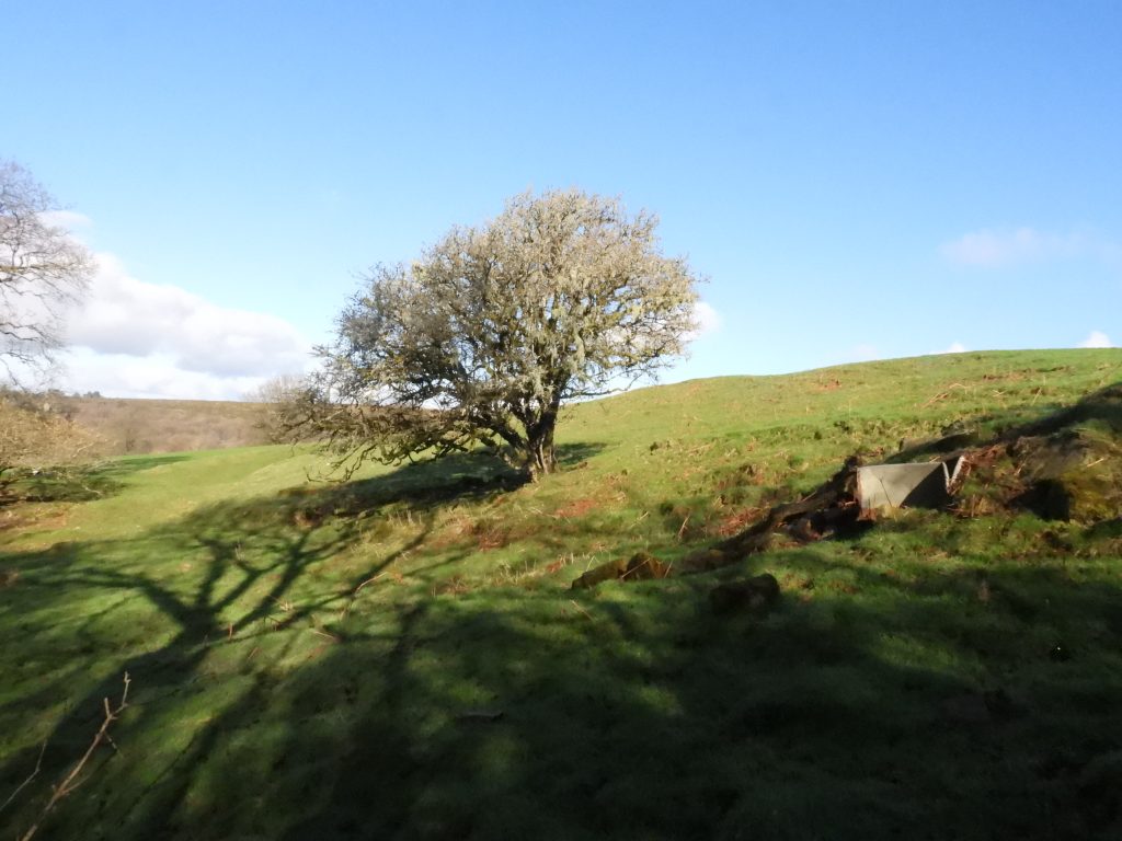
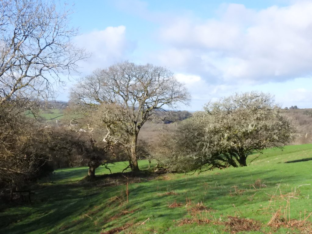
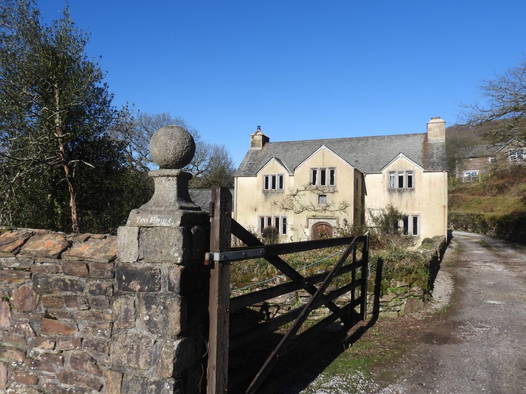
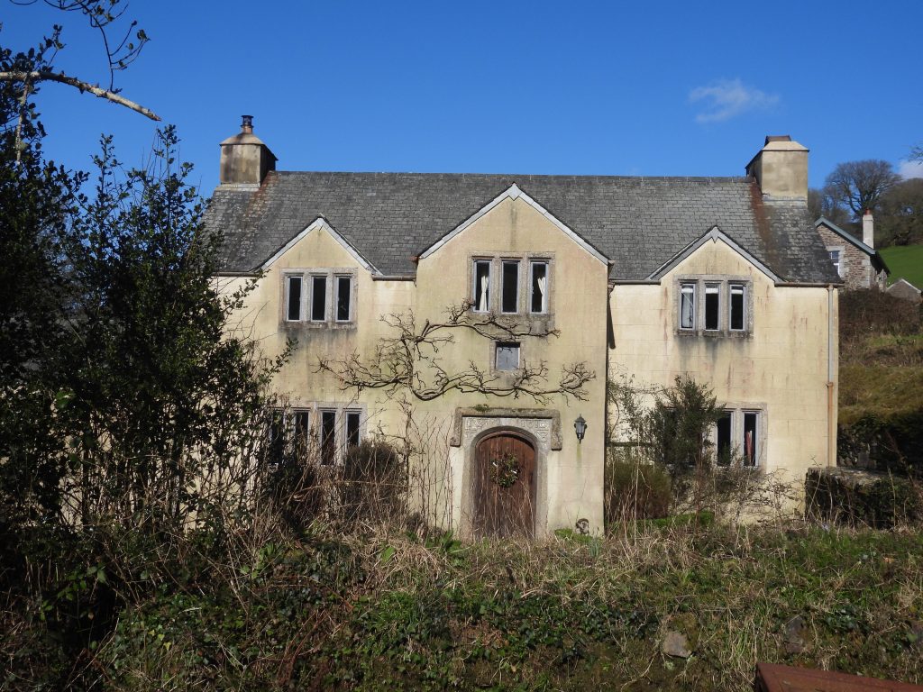
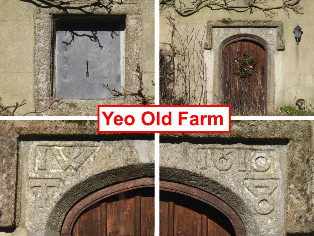
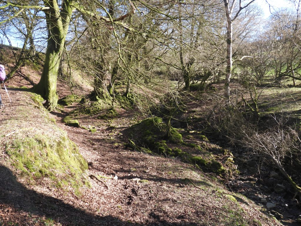
Location of former Smallacombe Farm in relation to Yeo Farm and Ringmoor Cottage to the north of Smallacombe Lake / Yeo BrookThis sketch map is based on the tithe map of Smallacombe FarmThe tithe apportionment shows that Smallacombe was quite a large farm, with the land owned by Sir Ralph Lopes and leased to Richard Helyer. The name ‘Smallacombe’ still appears on modern OS maps.The location of Ringmoor Cottage was formerly known as Gees CrossView from the track leading down from Ringmoor Cottage. The views include Meavy, Yelverton and Cornish HillsZoomed in view of MeavyA description in the Heritage Gateway describes that Smallacombe Farm is approached (from the south) by a sunken lane which descends from the Marchants Cross to Ringmoor Cottage track into the deep watercourse (Yeo Brook). This is where the author found the reference to Yeo Brook (which is also known as Smallacombe Lake). The lane bounds fields of Yeo Farm on the south side of the water course. Access to the farm would have been down the lane, then would have crossed the brook, rising on the opposite side of the gully, before entering what was formerly the farmyard.Access to Smallacombe Farm is no longer possible from this sunken lane as the path is blocked by fencing, barbed wire and gating. Just to the right of the metal gates shown in the picture is the ruin called ‘Snows or Smallacombe’.The Apportionment for a small building to the south lists it as ‘Snows or Smallacombe’ where Field Number 365 is listed as ‘Waste’. The picture above is a zoomed in view of the building (access is not possible due to fencing). To get the picture the author used an unlocked gate near the location of the old Smallacombe Farm which leads down to Smallacombe Lake (or Yeo Brook). The Heritage Gateway describes the building as a probable dwelling house and it was two roomed. It is recorded as “Measuring 12.5m. by 4.3m internally, and is 0.6m. high, with roughly dressed slate slab walls 0.8m. thick, cut back into the slope to a depth of 2.7m. The farmstead and fields appear to be quite late and are certainly of post Medieval date”. Using the National Library of Scotland (side by side) maps the grid reference is SX55450 66716One of the most discerning remains at Smallacombe is a rectangular stone (recorded as being 0.91 metres by 0.61 metres) and which may have been part of a wall or a boundary stone. Nearby, there is a clearly visible cart track, now entirely grassed over. The grass track passes through the former farmyard and heads up the hill. It is located approx. at the junction of the former ‘Lower Meadow’ and ‘Higher Meadow’ (as per the tithe map).The Smallacombe Farm House appears to be cut into the slope to the north where a probable inner edge of the wall can be discernedThe former Smallacombe Farm House (according to the Tithe Map) was located at SX55426 66791The former Smallacombe Farm Enclosure or Outbuilding (according to the Tithe Map) was located at SX55429 66777Possible piece of old farm machinery found in the ruins. It looked like a drum part of an old wheelGeneral view of the former Smallacombe Farm House and enclosure or outbuilding viewed from the east. The metal animal feeder seen in the photograph is clearly a relatively modern additionGeneral view of the former Smallacombe Farm House and enclosure or outbuilding viewed from the east from near the garden and the former field called Barn Park (tithe apportionment)Yeo Old Farm enroute to Smallacombe Lake consists of what looks like an unoccupied farmhouse, whihc is recorded on the Heritage Gateway and being now in use as shippon. It is dated from 1610.The Heritage Gateway records that “the house is likely to have been abandoned in the later 19th or early 20th century and the rooms of the front range were knocked into one room for use as a shippon with store above”.Of interest at Old Yeo Farm, the porch has an arched doorway with broad chamfer and square hoodmould. As can be seen in the pictures, carved in its spandrels is the date 1610 (on the right) and the initials ‘I. W. T’ (on the left). There is also a sundial above the porch.Looking up (south east-ish) the Smallacombe Lake valley from the public path. Following the water course upstream, the remains of Smallacombe Farm can be located.