A collection of walks, discoveries, insights and pictures of exploring Dartmoor National Park
February 27, 2024
Ringmoor Down Standing Stones
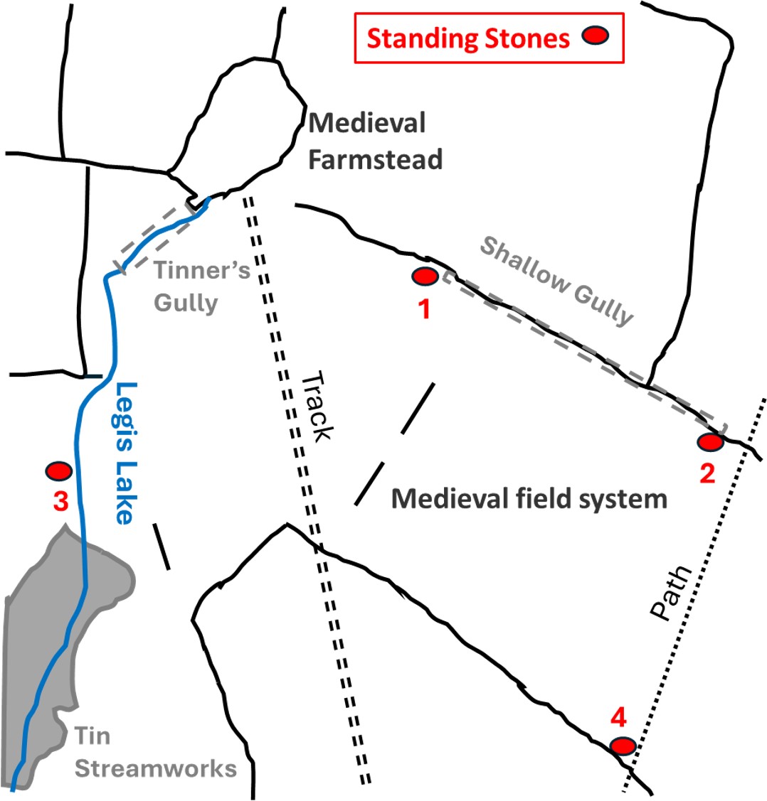
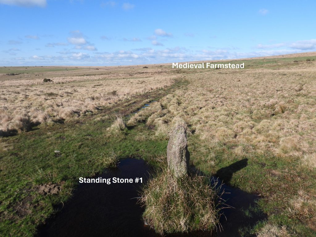
There are four standing stones on Ringmoor Down which do not possess any inscription and whose origin and function are unclear. The stones lie to the south and east of an Medieval Farmstead, to the east of Legis Lake and to the north of Legis Tor.
There are plenty of Medieval field systems in the area (some barely discernible in the turf) and there is evidence of Tinner’s Workings, especially around the Legis Lake area. The only theory the author can think of is that these stones mark a tinner’s sett, albeit it is only a small area.
Bibliography:
S.Probert, (2005), Ringmoor Training Area: Monument Baseline Condition Survey
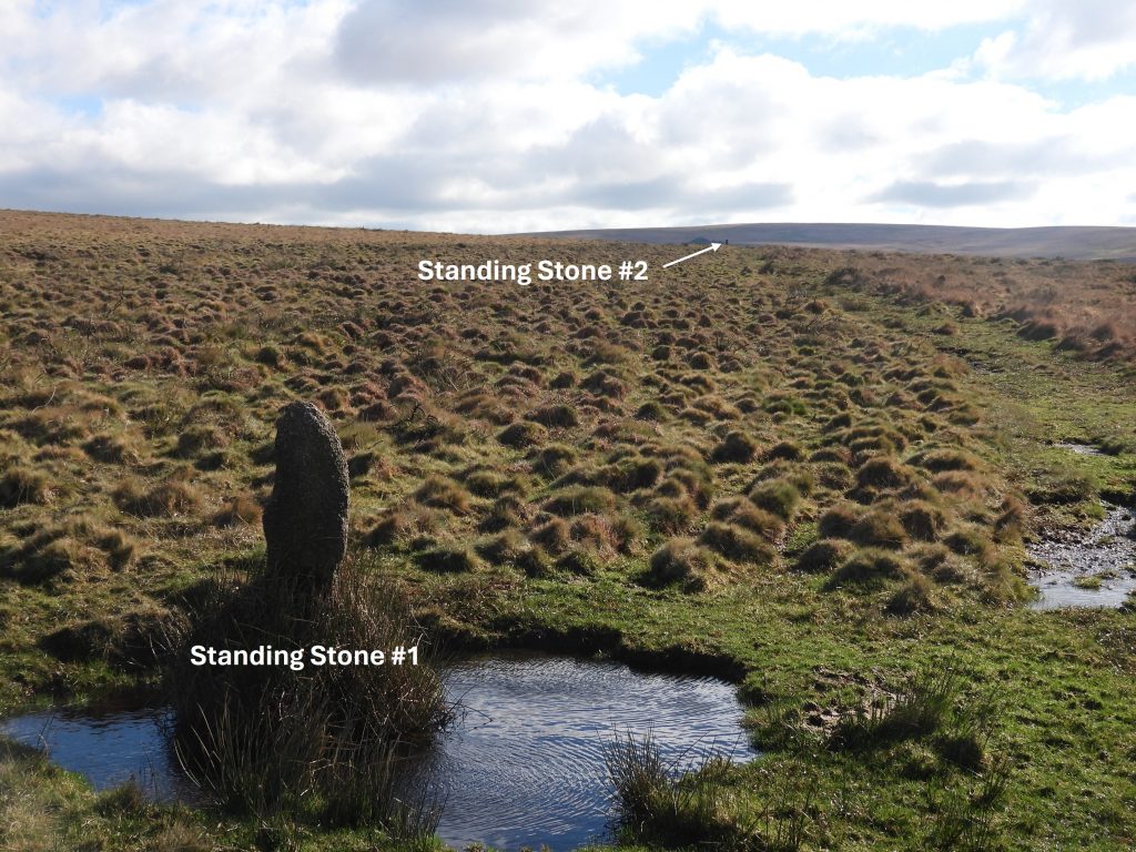
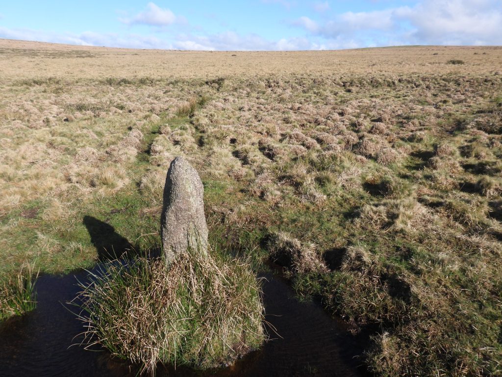
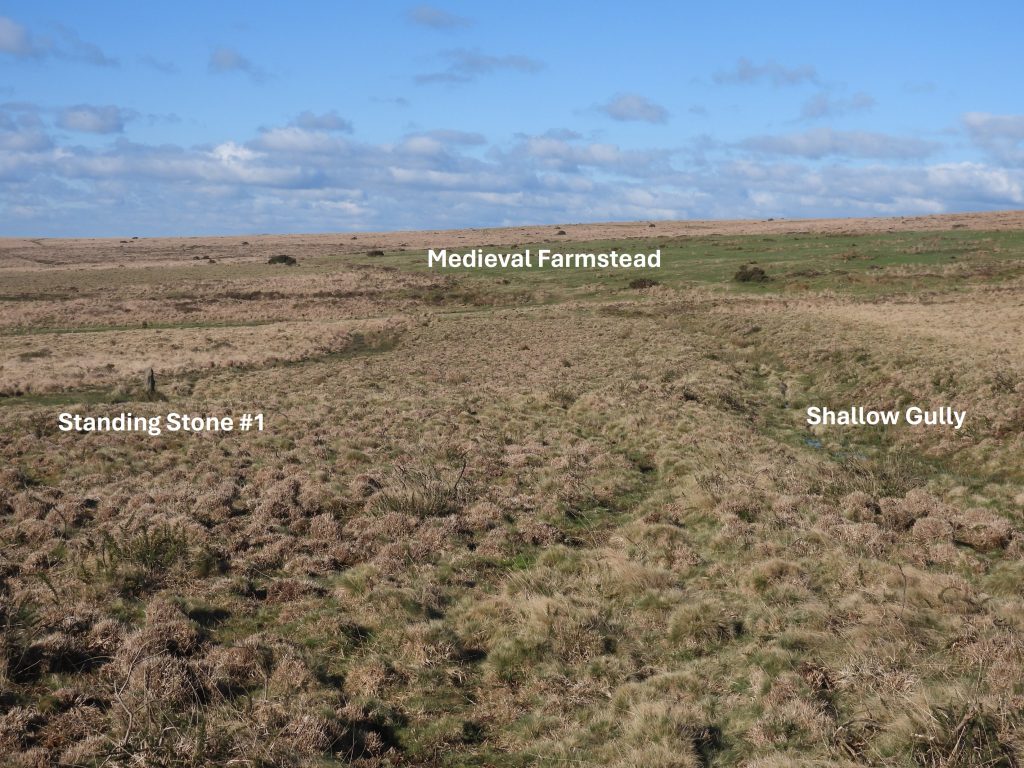
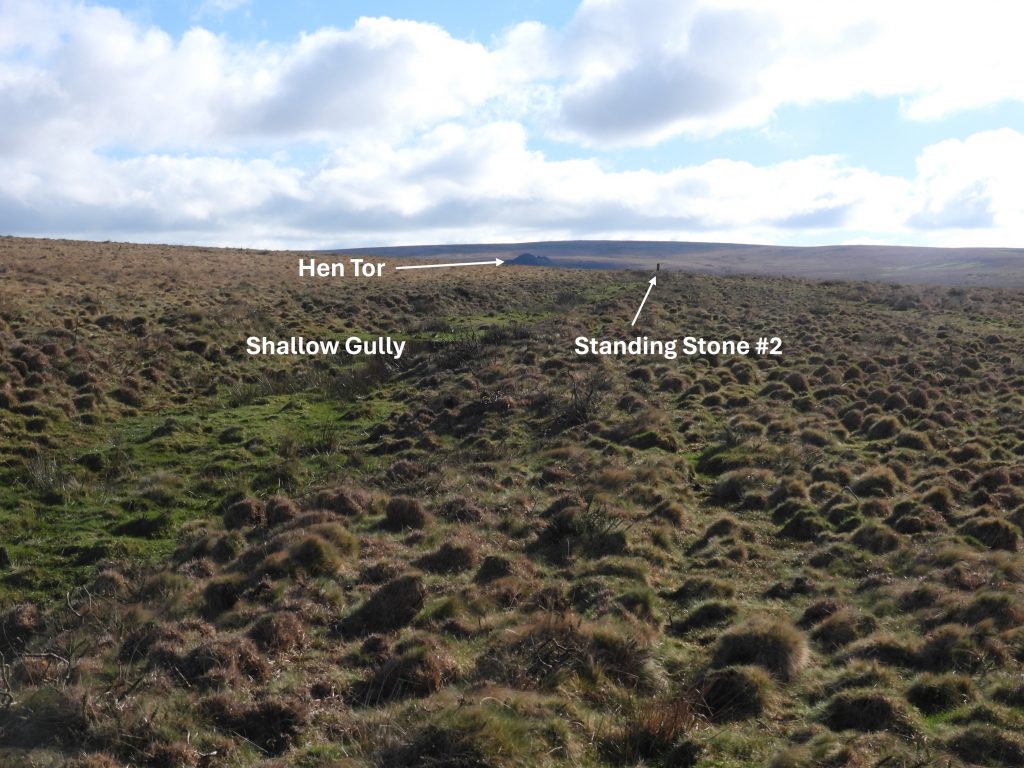
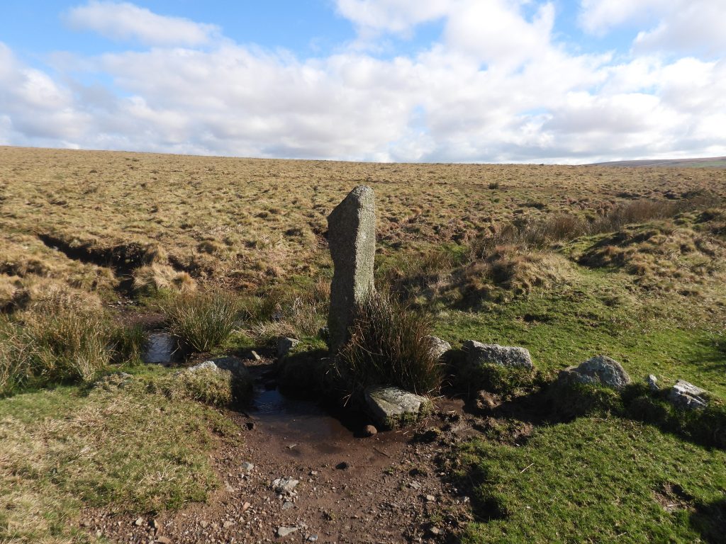
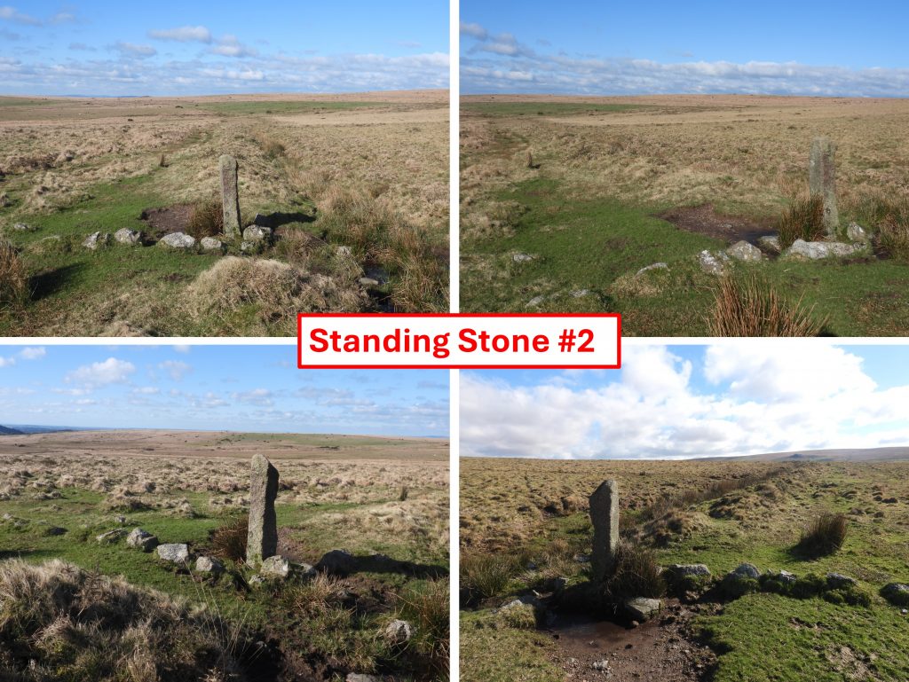
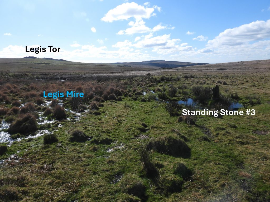
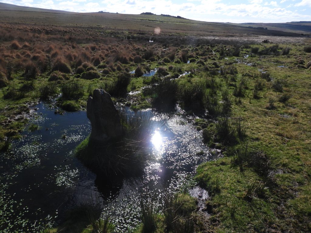
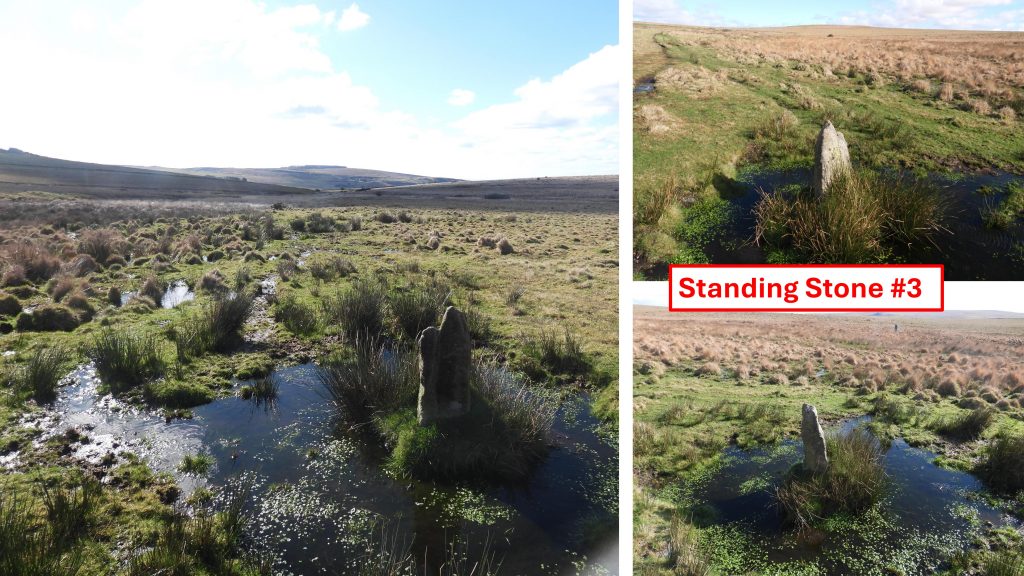
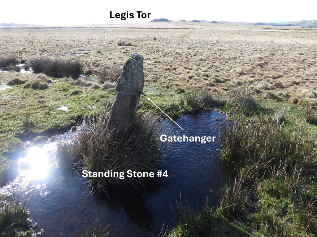
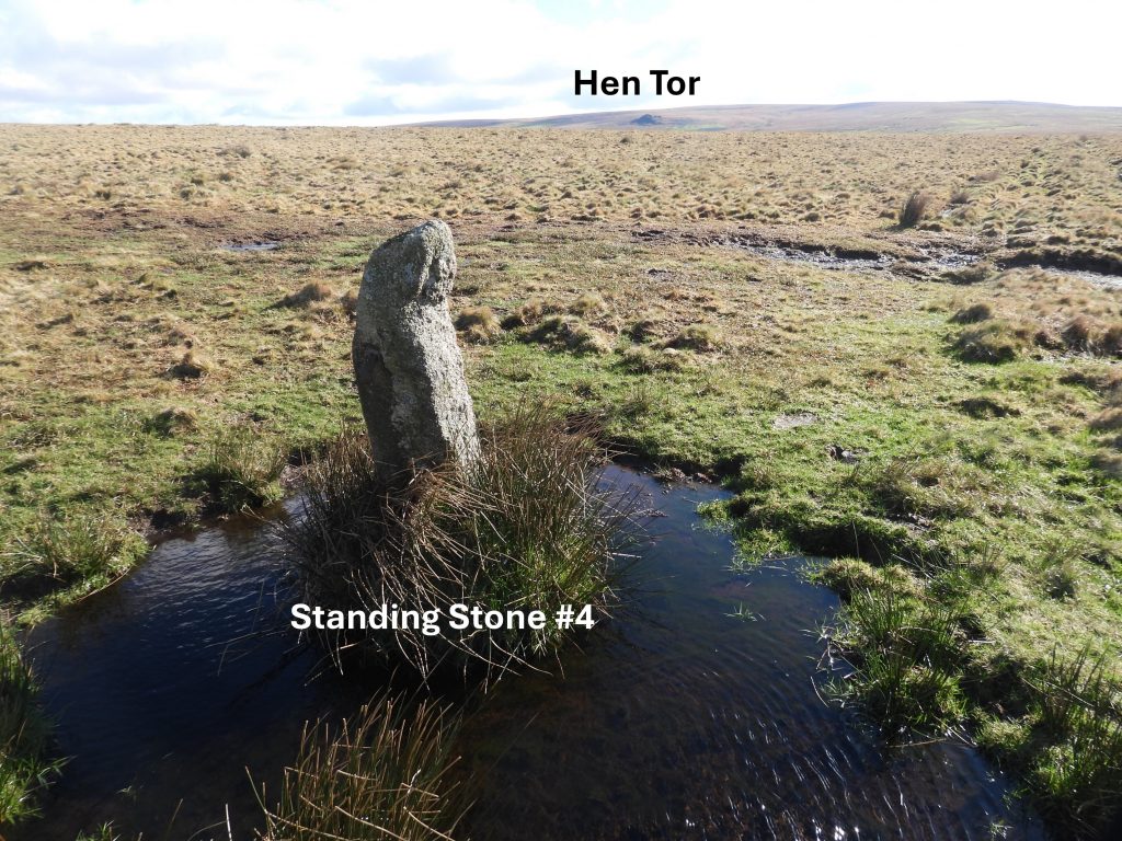
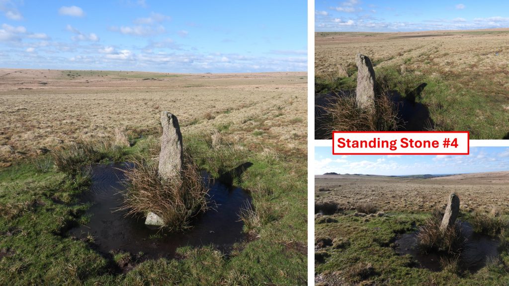
Sketch map of the locations of the four standing stones in relation to Legis Lake and the Medieval farmstead.Standing stone #1 is the closest one to the Medieval farmstead. Looking in the direction of Hen Tor, standing stone #2 can be seenStanding stone #1 is described by Probert (2005) thus: “The pointed -topped granite post measures 1.1m high, 0.25m wide and 0.25m thick”.Standing stone #1 is located at SX57097 66317Just to the north of Standing stone #1 is a shallow gully which runs towards the Medieval farmstead and the head of Legis Lake where there are tinner’s workings. Could the shallow gully relate to walling of old Medieval fields or possibly an exploratory gully dug by tinners ?The shallow gully leads to Standing stone #2Standing stone #2 is described by Probert (2005) thus: “Chisel-topped granite post measures 1.25m high, 0.2m wide and 0.2m thick”. There is a line of stones leading away from the stone in a southerly direction. The shallow gully running approx west-east can be seen behind the stone.Standing stone #2 is located at SX57274 66230Standing stone #3 is located a few metres to the west of Legis Mire. There is a ford across Legis Lake a short distance downstream by impassable in winterStanding stone #3 is described by Probert (2005) thus: “Pointed -topped granite post measures 1.0m high, 0.35m wide and 0.25m thick”.Standing stone #3 is located at SX56878 66210Standing stone #4 is located close to a path which runs north-south. Its origin as a gatepost is apparent from there being a gatehanger on the western side. This feature narrows down possible dateline for the standing stones.Standing stone #4 is described by Probert (2005) thus: “Pointed -topped granite post measures 1.0m high, 0.35m wide and 0.25m thick. Standing stone #4 is located at SX57216 66040