A collection of walks, discoveries, insights and pictures of exploring Dartmoor National Park
January 15, 2022
Shaugh China Clay Works
The Shaugh Bridge clay works (processing complex) was built between 1870 and 1895 in three different phases and closed down in 1952. Extraction of china clay had began around 1860. The site was originally leased from the Maristow Estate but was later purchased by Watts, Blake and Bearne Ltd. The clay came from near Cadover Bridge having flowed in ‘water suspension’ (similar to the Red Lake operation) via clay pipes to settling tanks and thickening tanks before being kiln dried, cut and loaded onto carts for onward transportation. Clay would have originally flowed in open leats to the site. The clay works processing can be followed clearly from the remains (the process runs from east to west). The processing required impurities (mostly mica) falling to the bottom of the pits before the clay and water was pumped into the refining pits, where the clay was allowed to settle and the water drawn off from the top.
The clay processing works although abandoned some 70 years ago is remarkably intact with white clay still being found. The author first visited the area as a youngster in the 1970’s and and can recall being allowed to explore on his own! That said, please note: Extreme care must be taken by any would-be explorer as there are lots of vertical drops (up to 5m) and some ankle tugging vegetation. The information in this post (descriptions and measurements) has been obtained from Dartmoor HER; Shaugh Prior China Clay Works, Shaugh Prior MDV2218 (and associated links), which have been interpreted by the creation of a sketch map by the author.
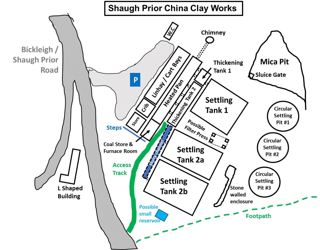
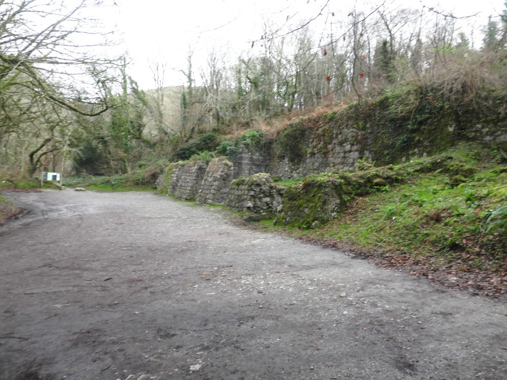
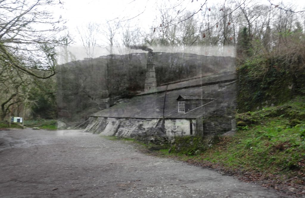
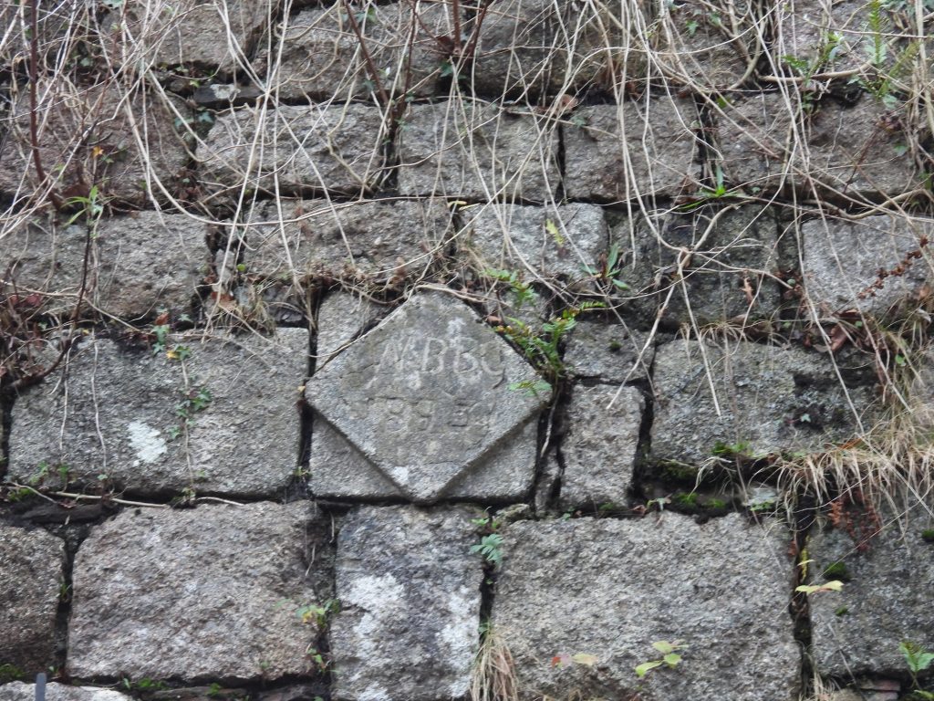
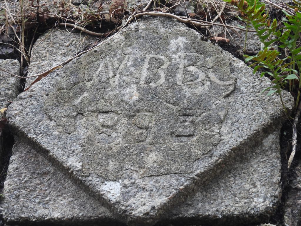
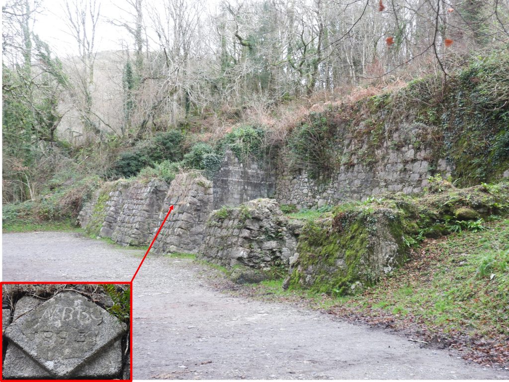
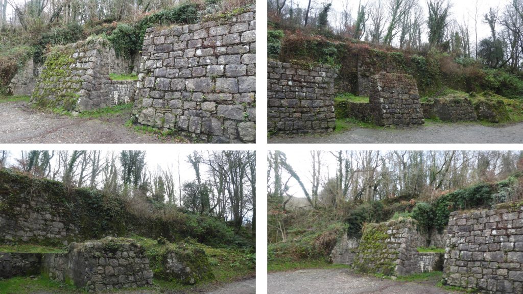
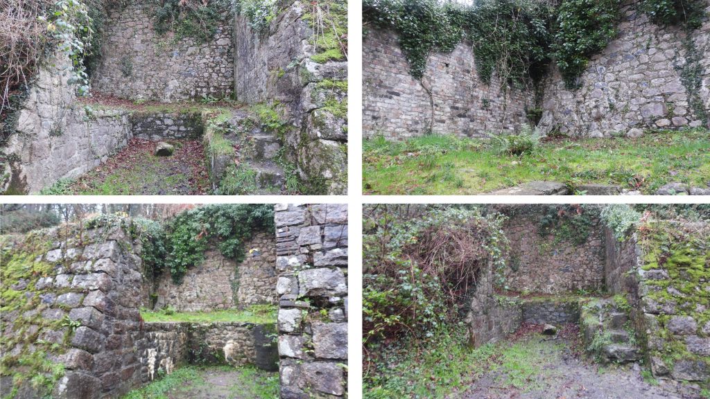
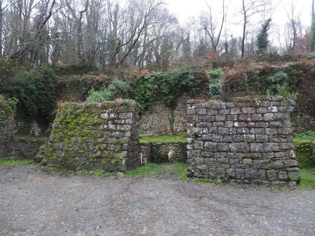
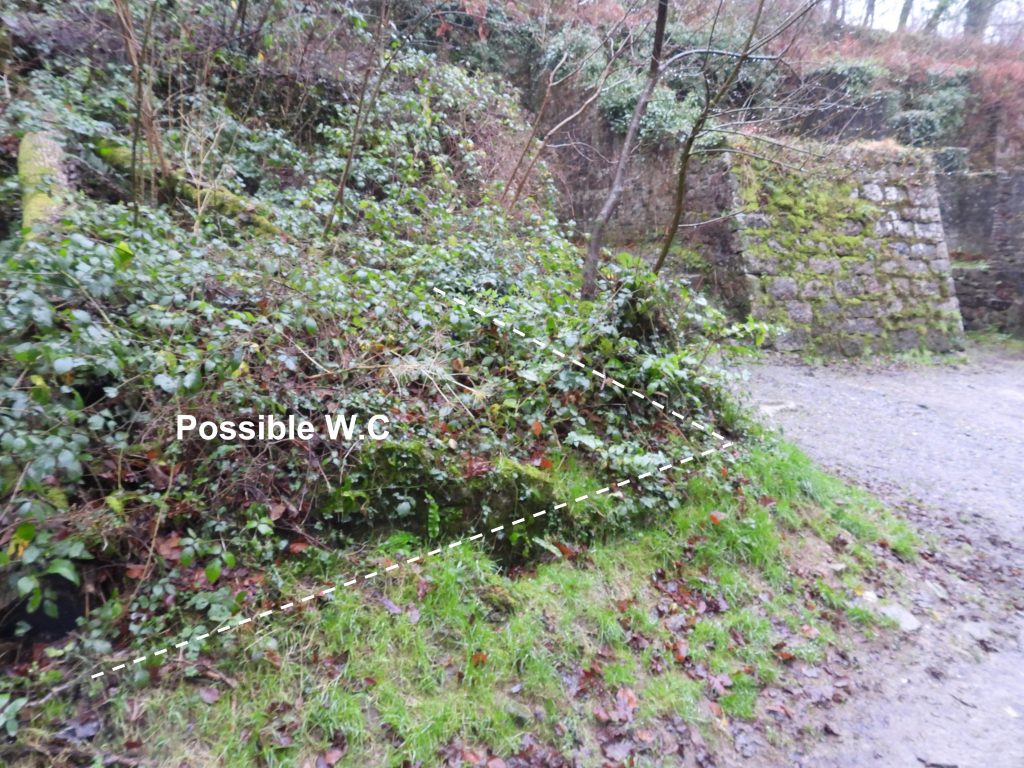
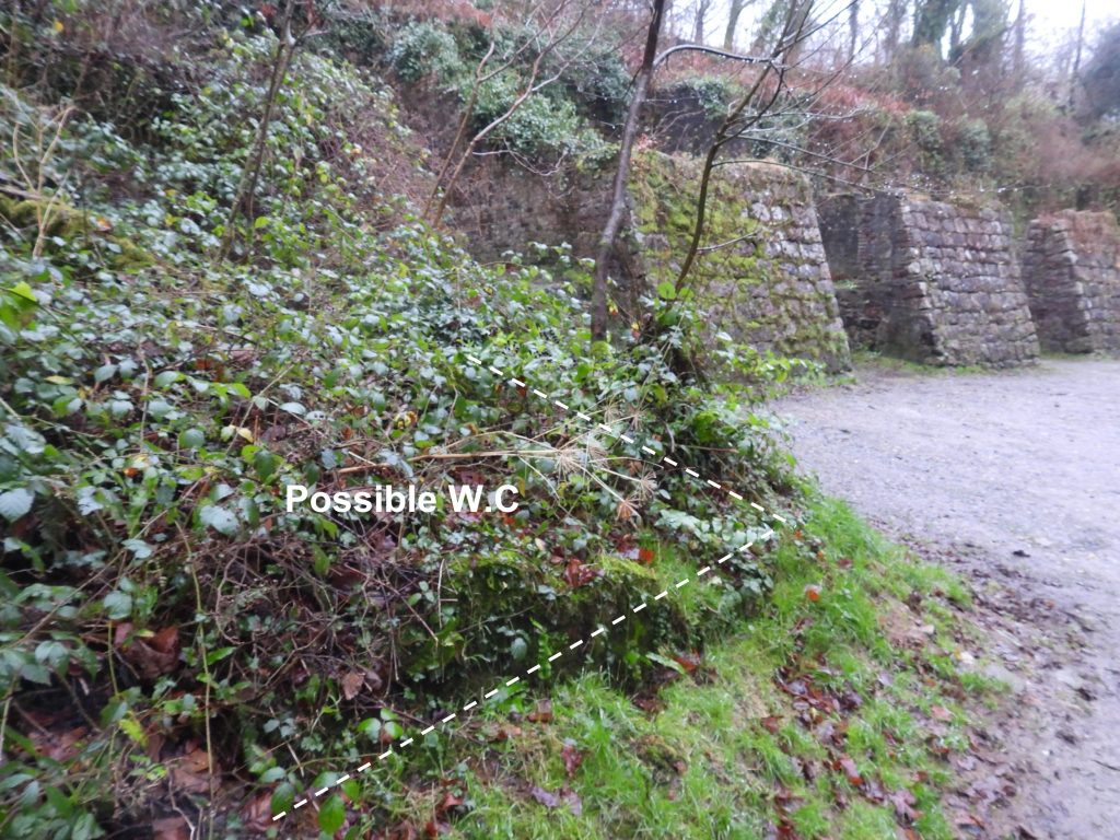
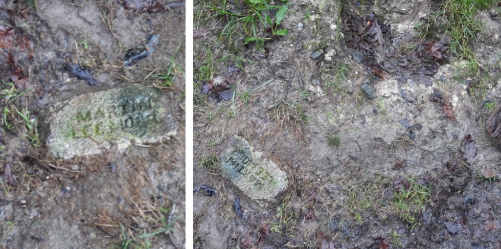
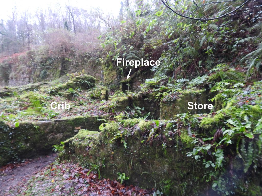
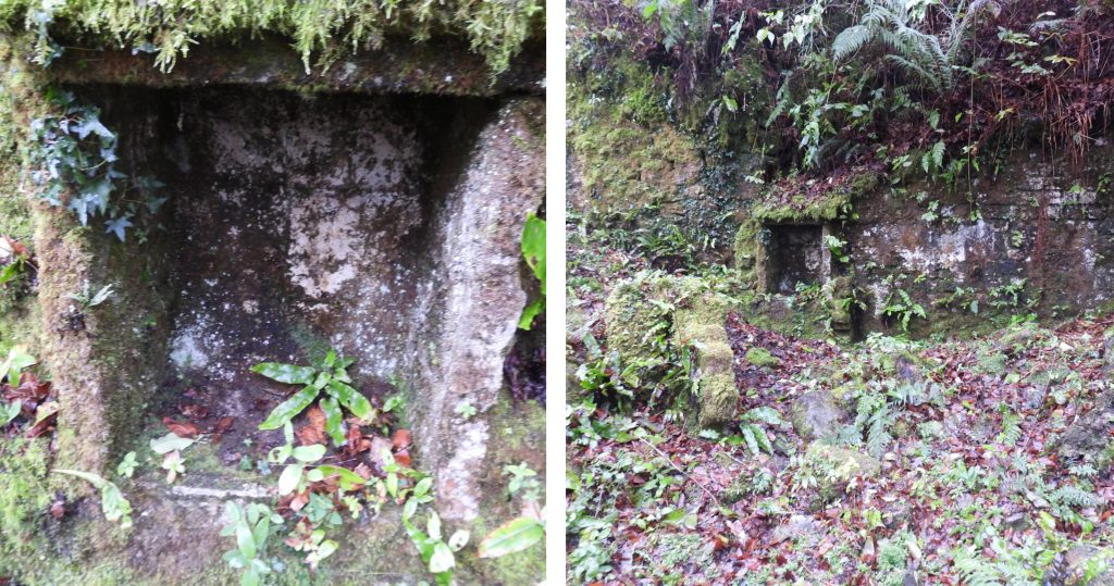
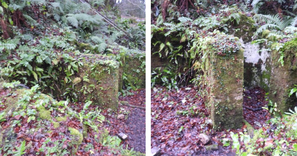
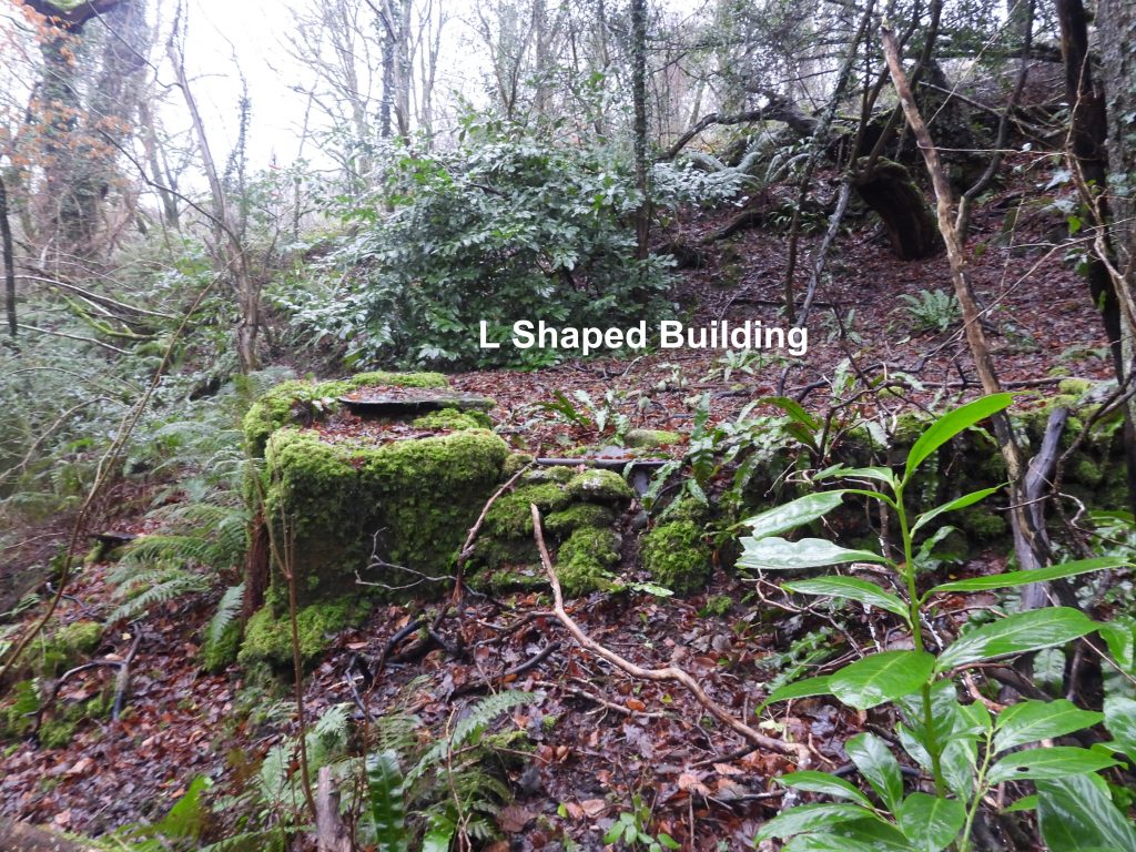
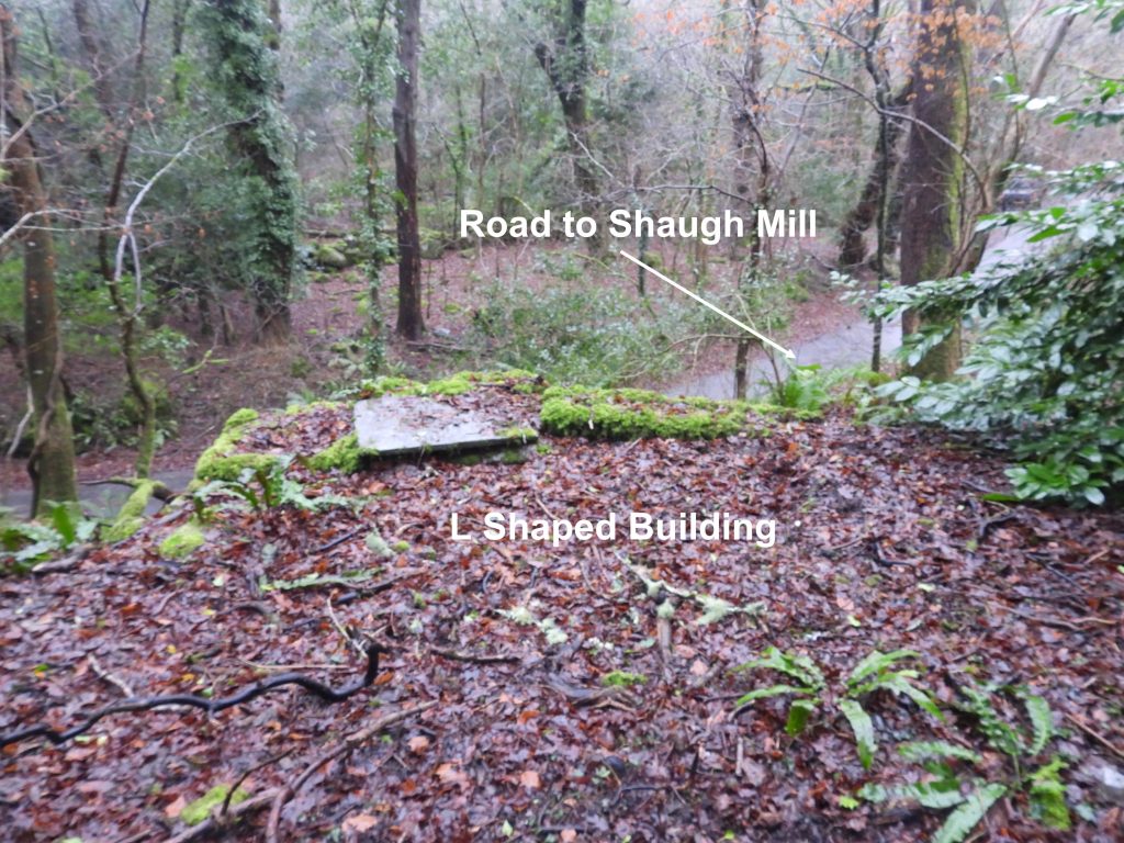
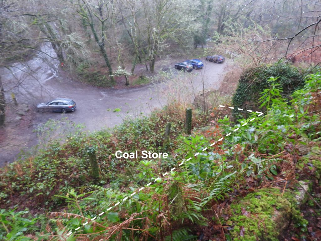
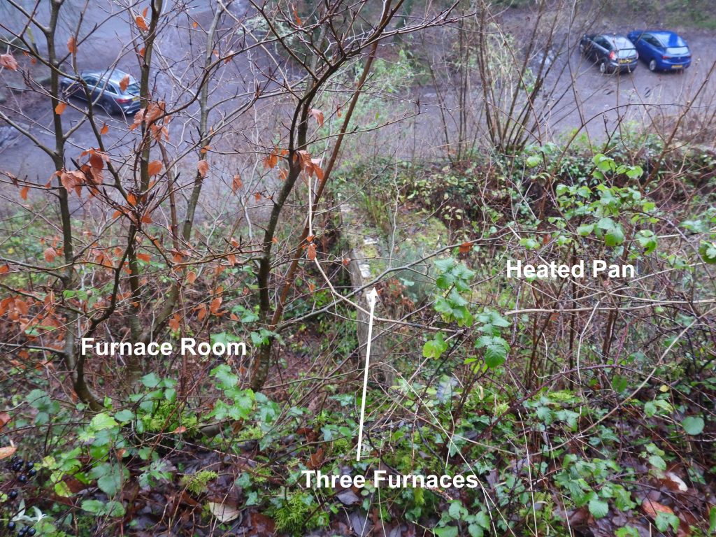
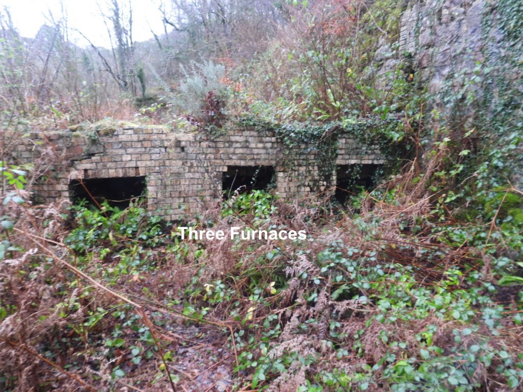
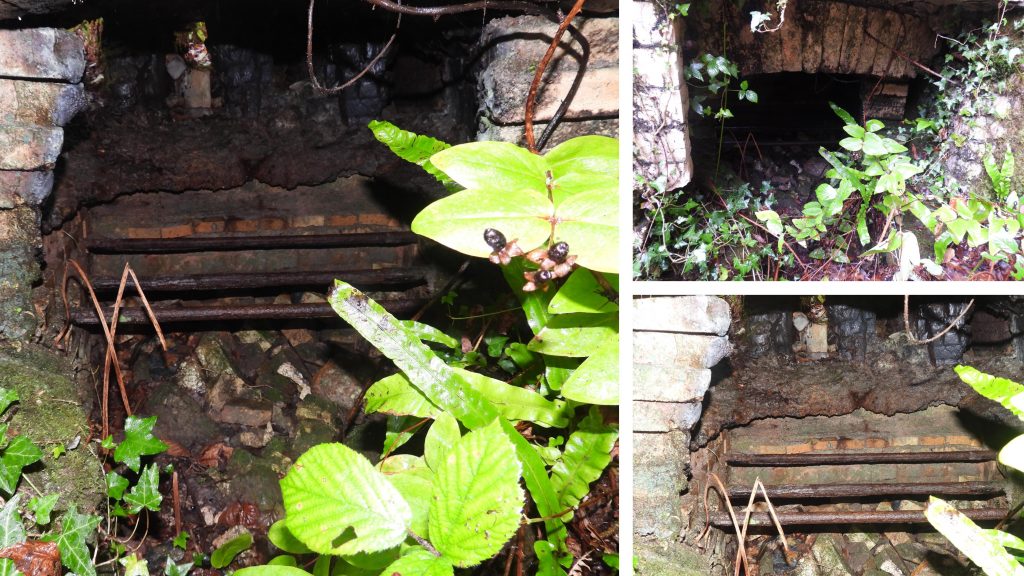
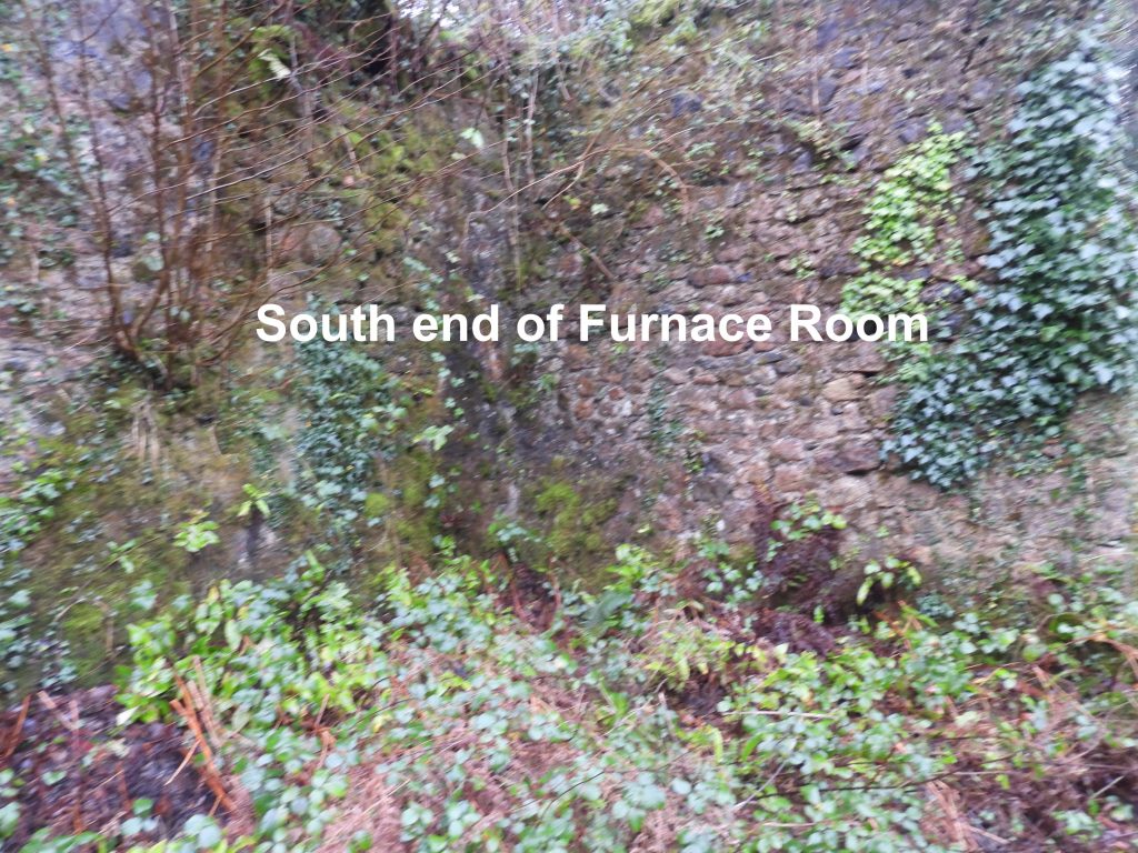
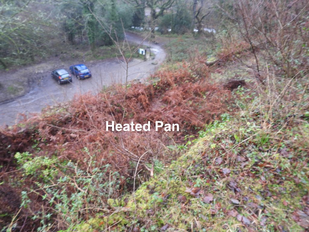
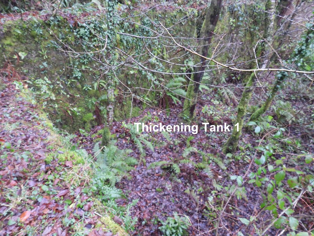
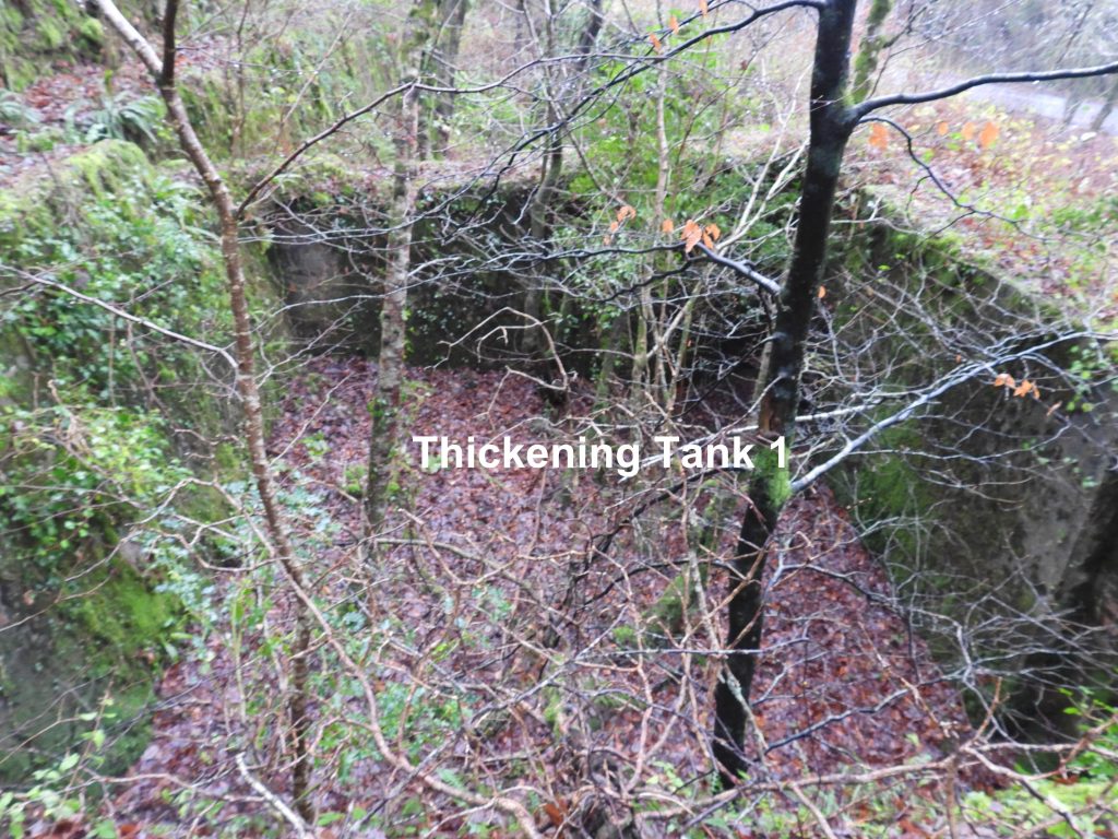
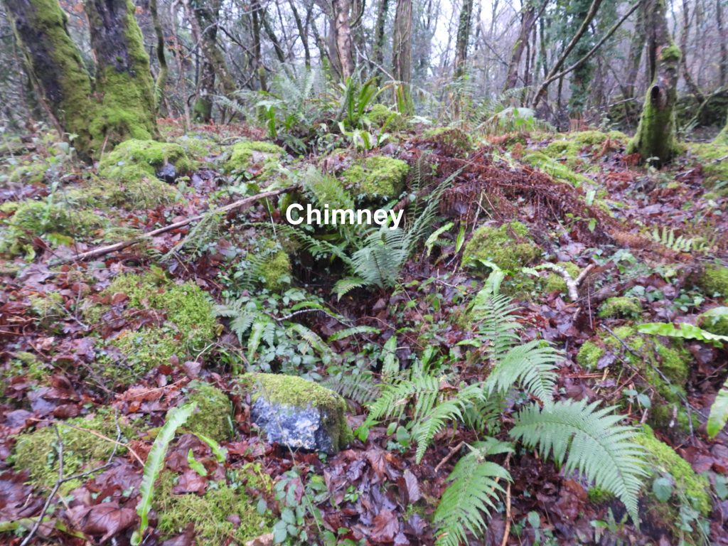
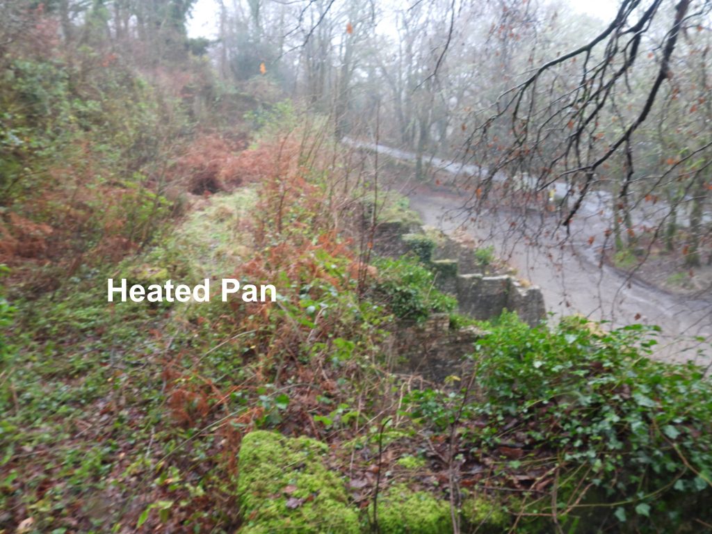
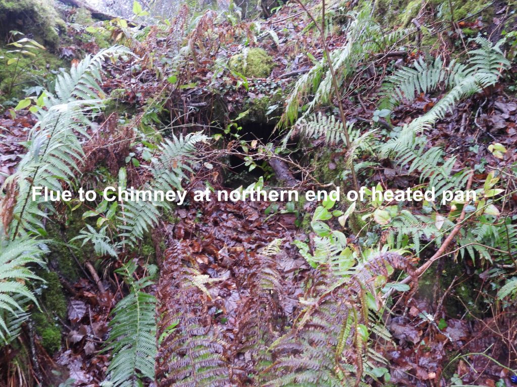
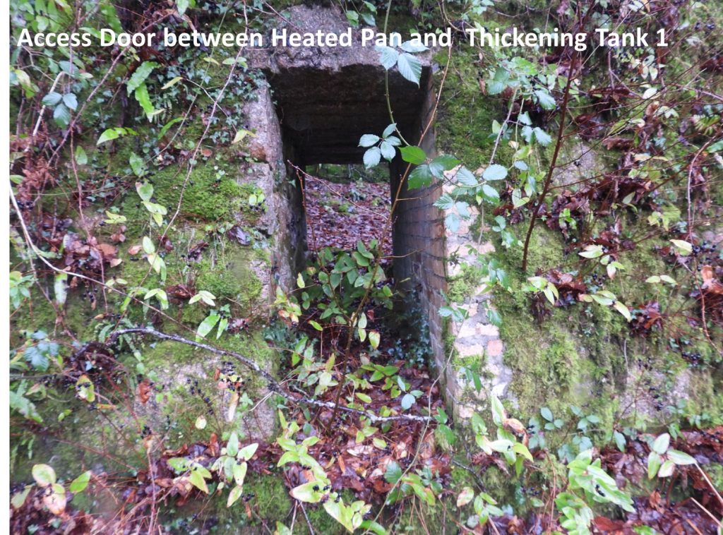
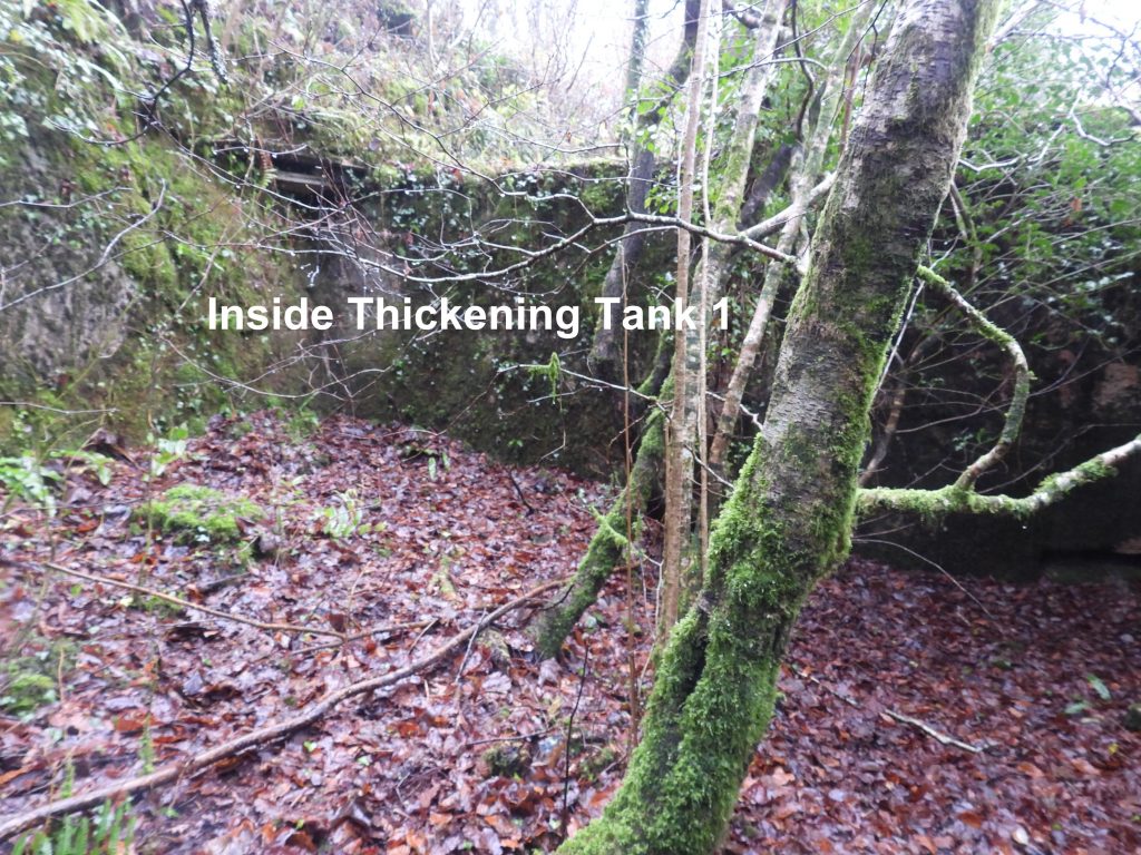
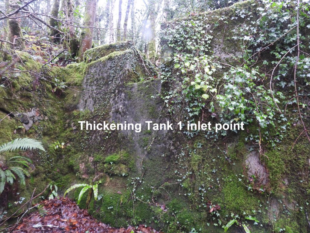
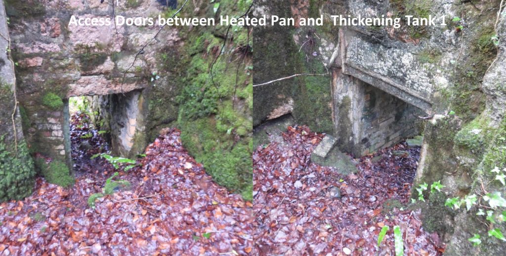
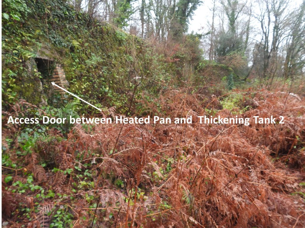
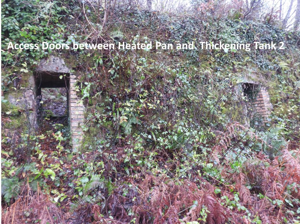
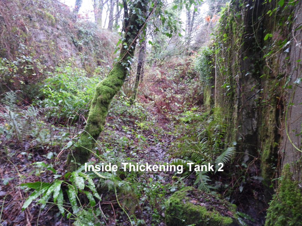
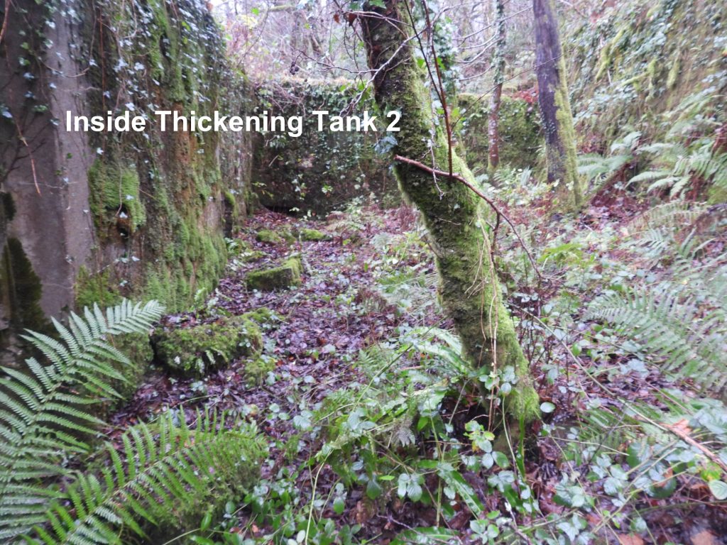
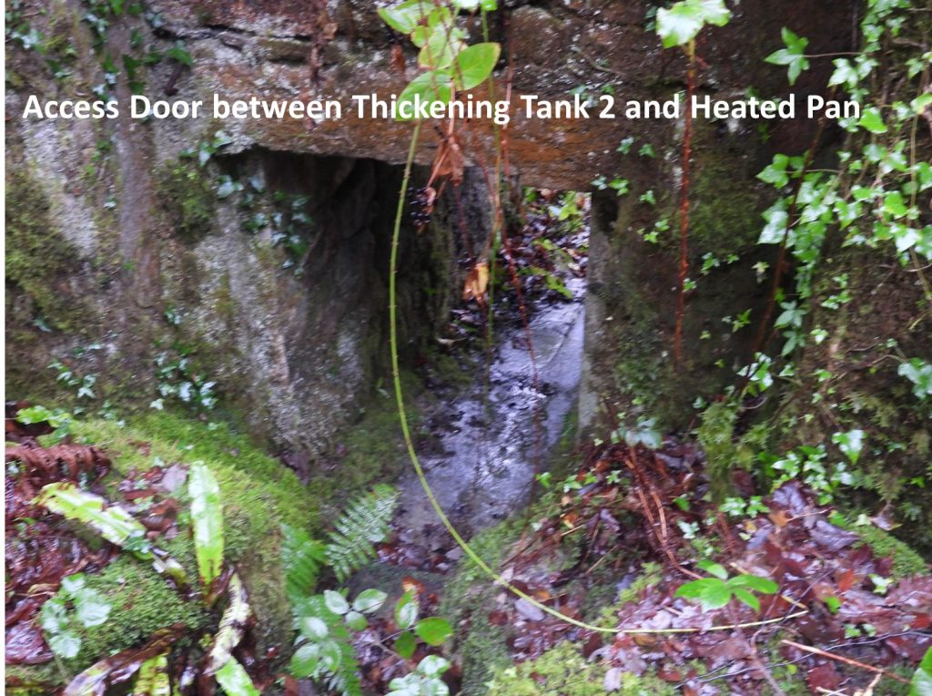
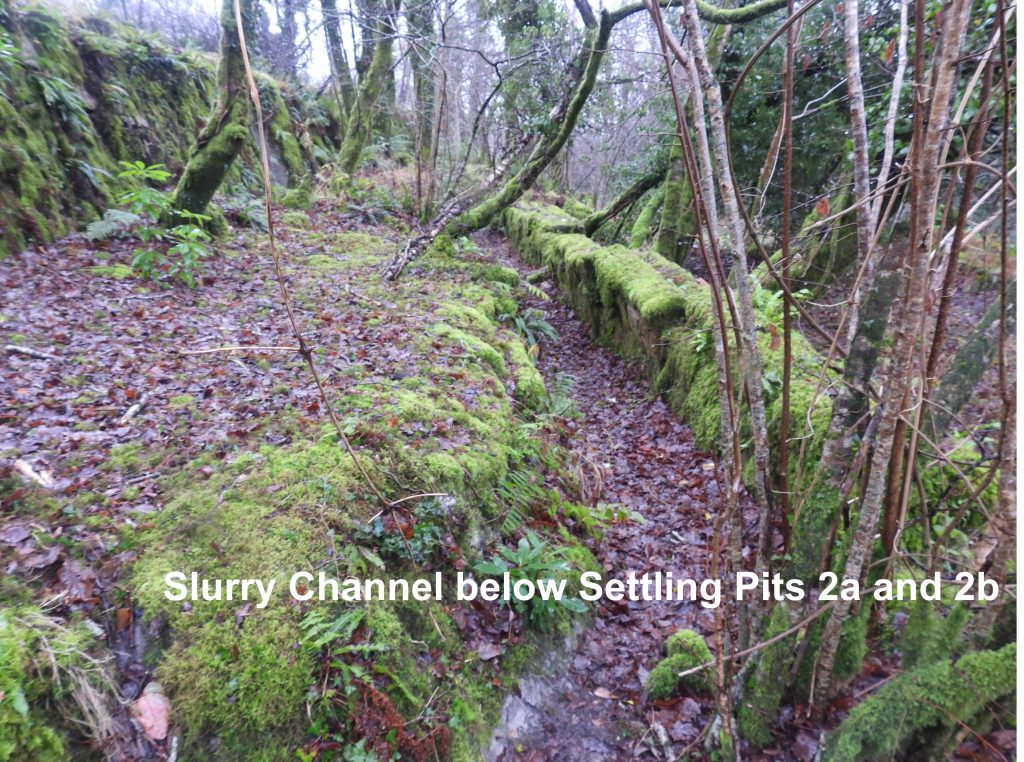
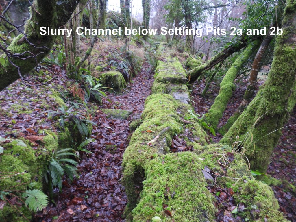
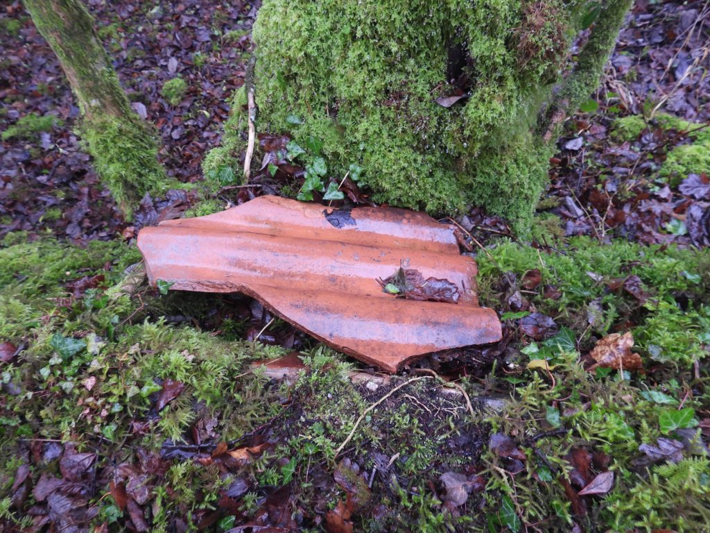
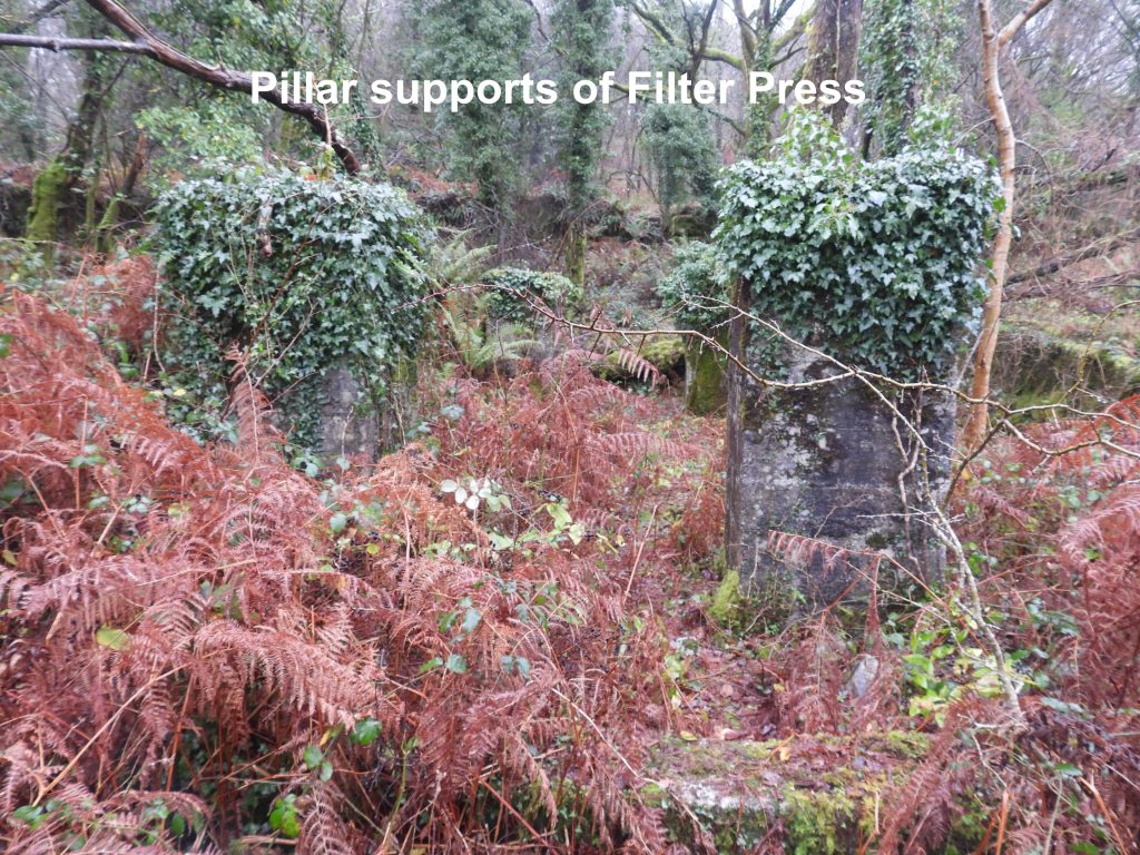
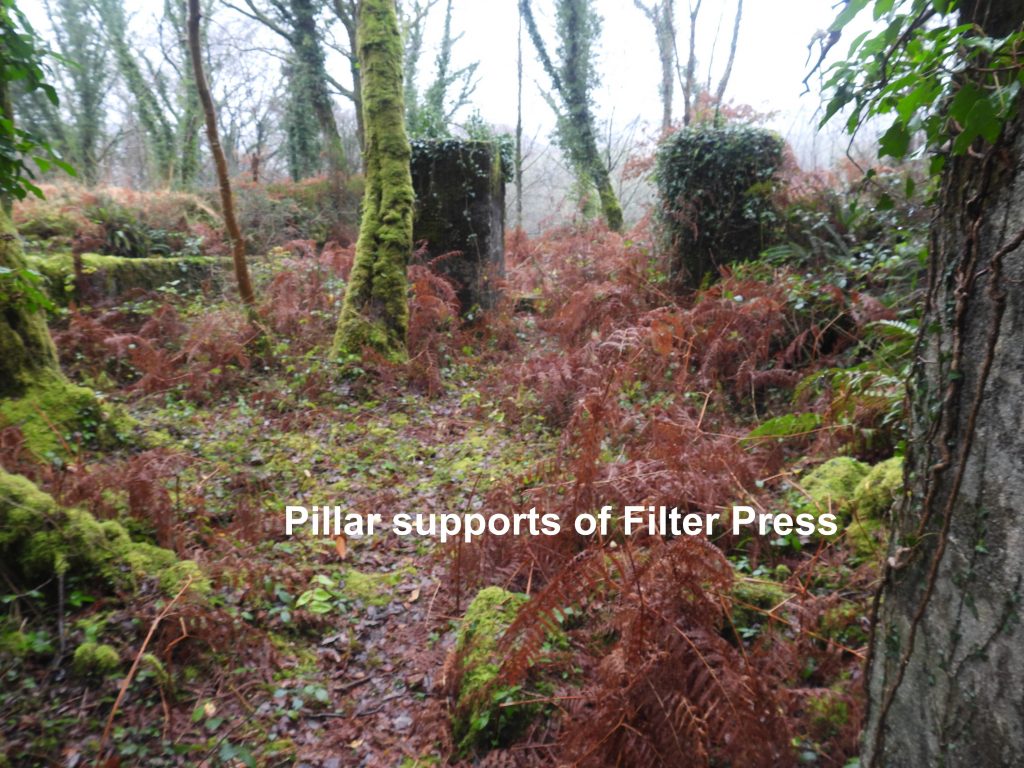
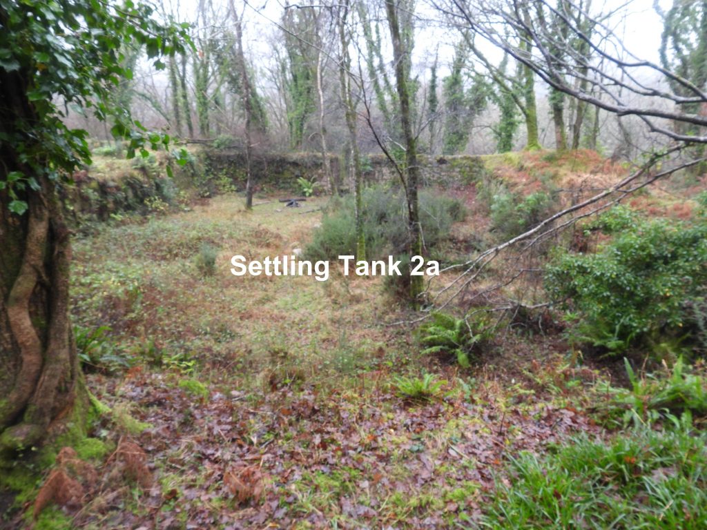
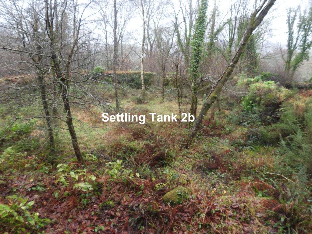
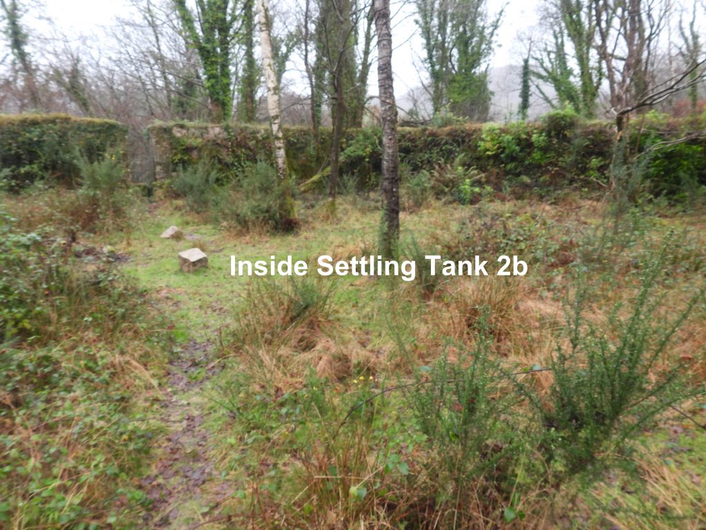
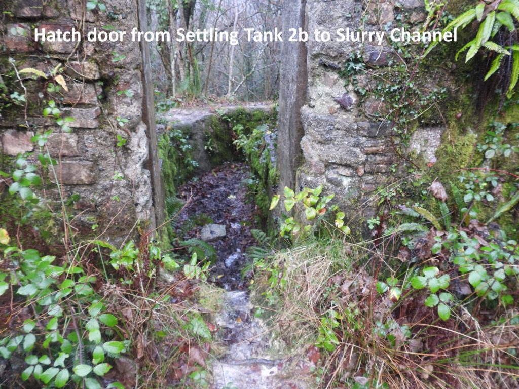
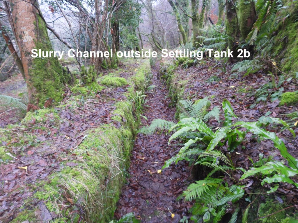
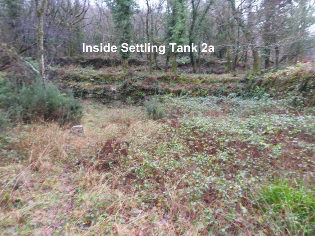
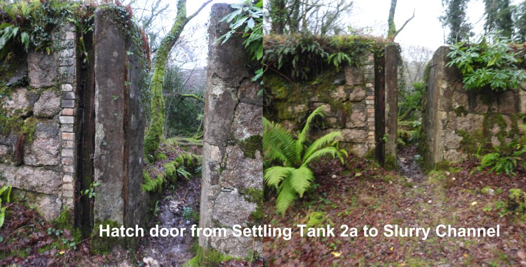
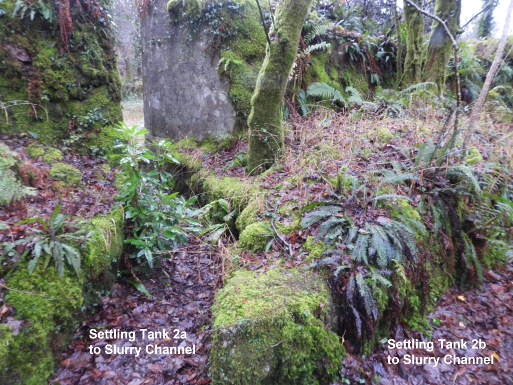
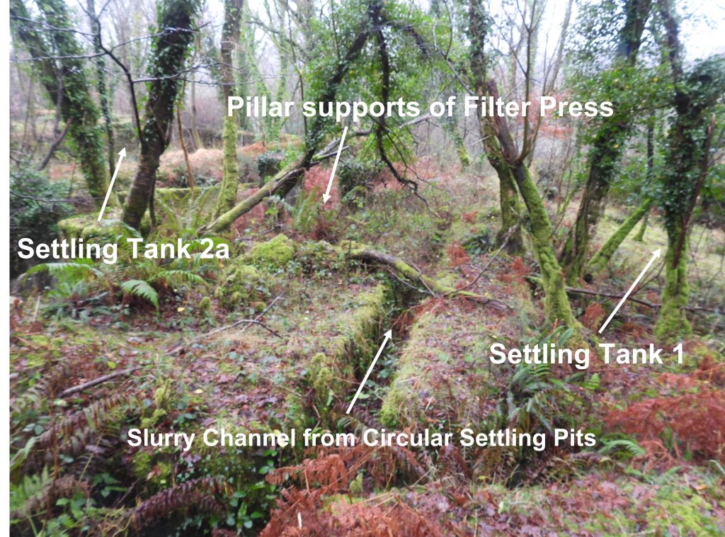
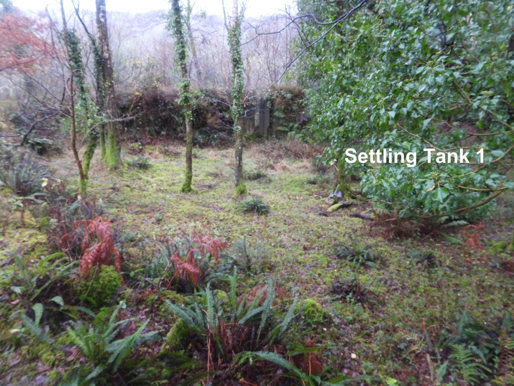
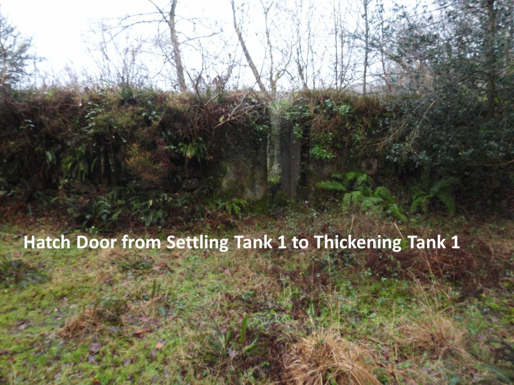
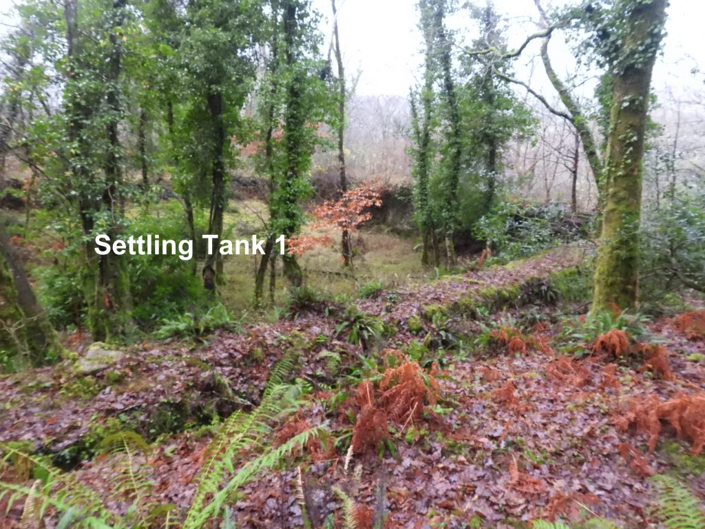
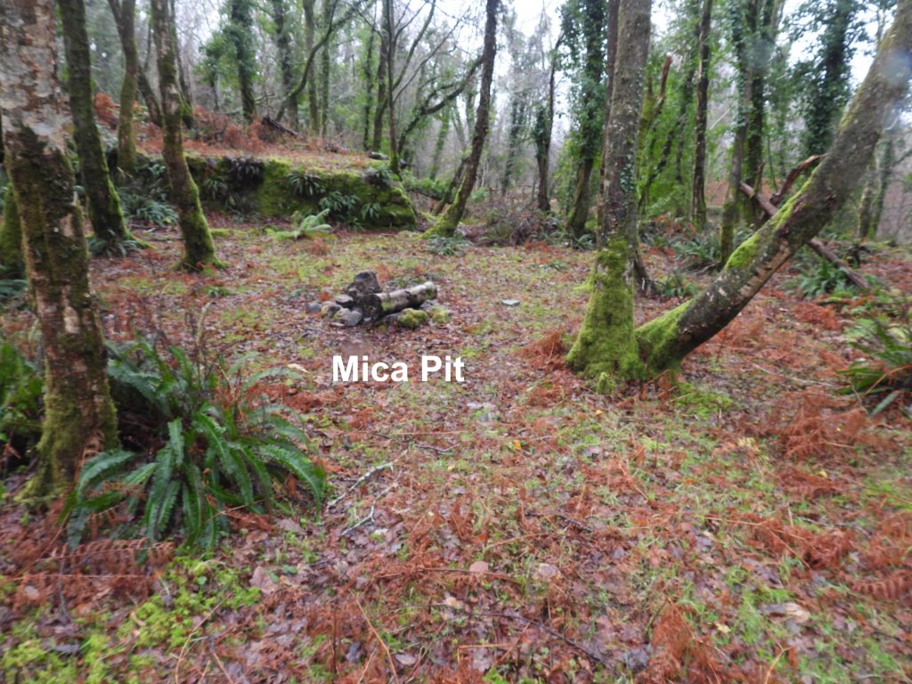
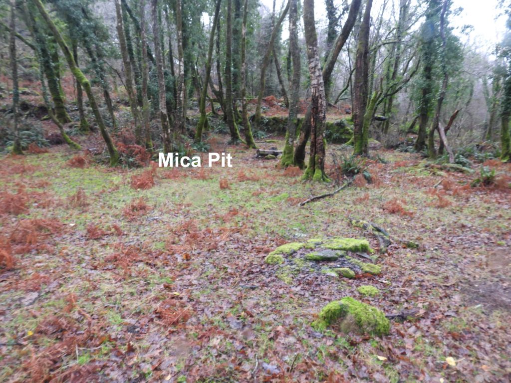
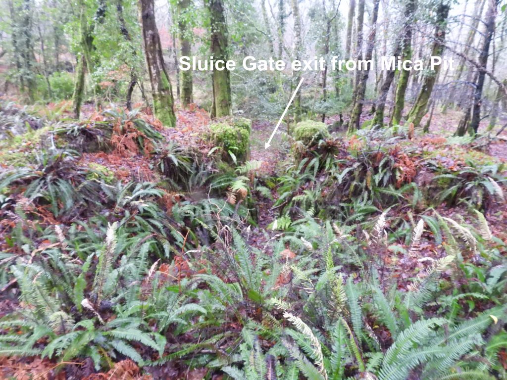
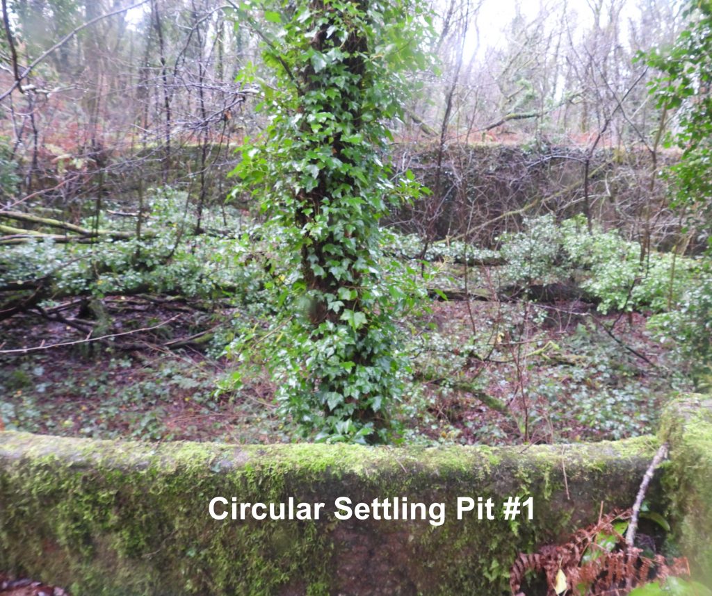
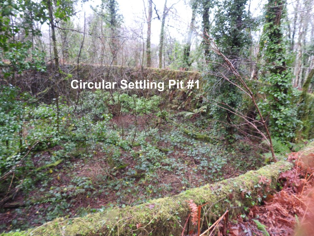
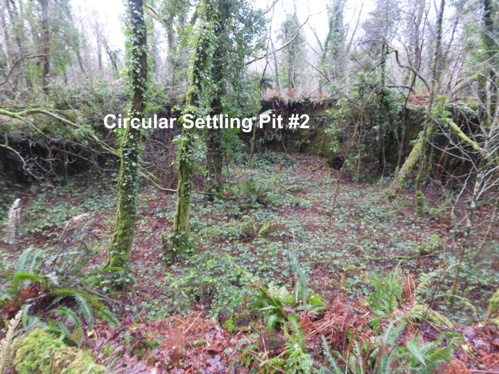
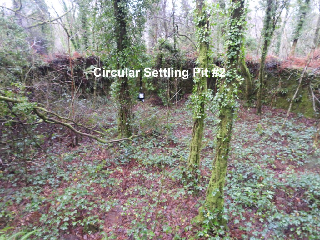
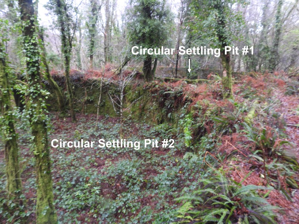
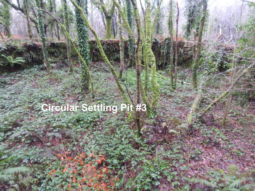
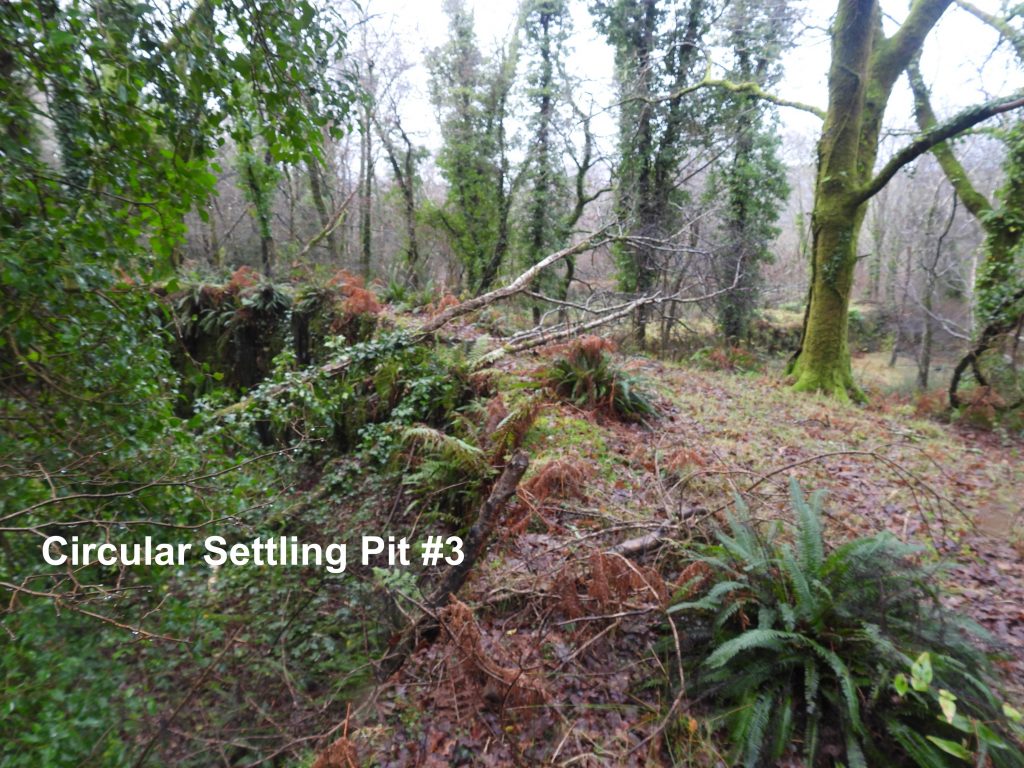
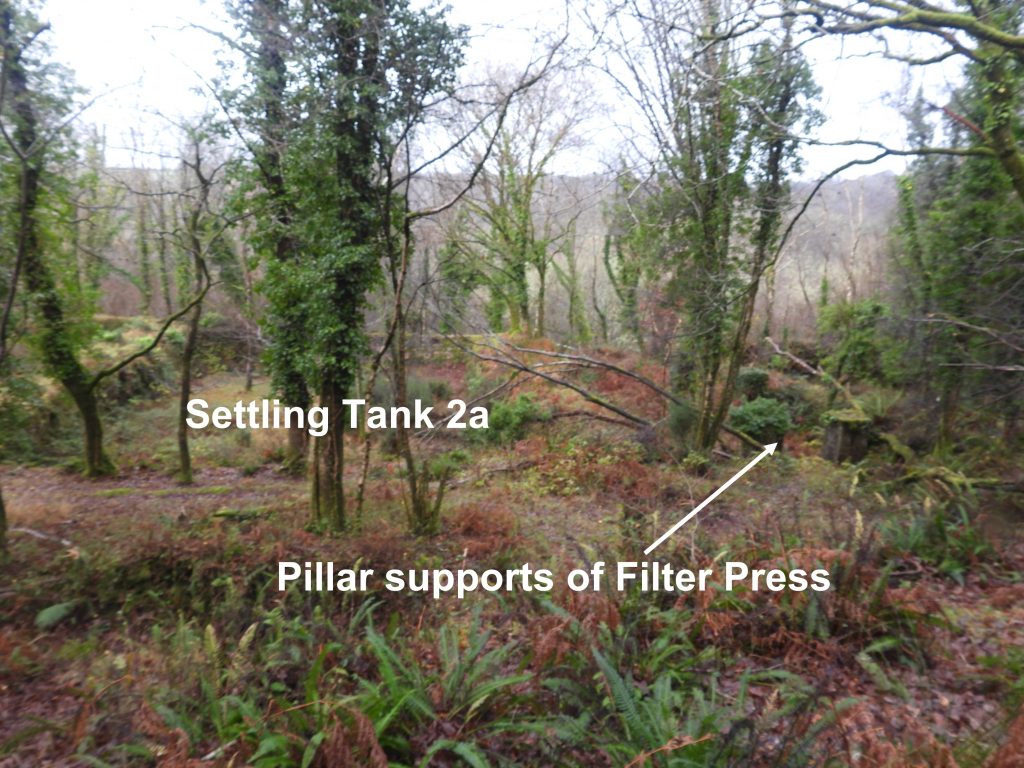
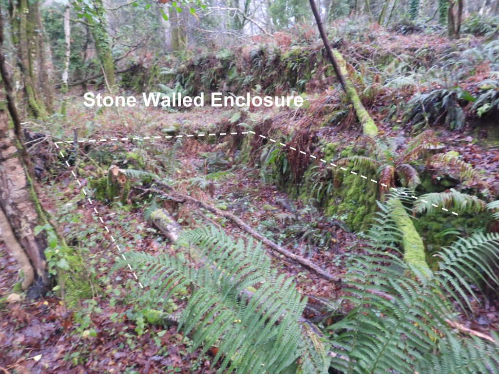
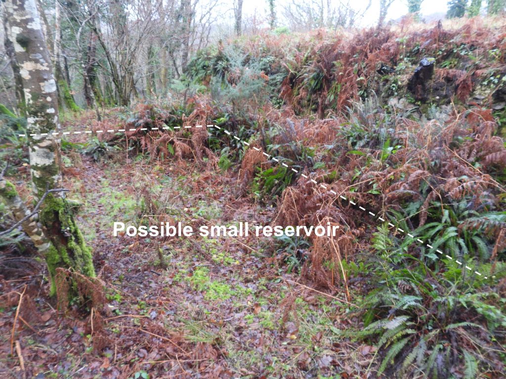
Sketch map of the Shaugh China Clay Works covering all the features contained in this post.The clay drying sheds today are the location of a National Trust car park. Superimposed on a January 2022 photograph is a picture taken circa 1939On one of the granite piers has a date stone inscribed “WBBC 1895” . The date stone is located at SX53345 63628.WBBC stands for Watts, Blake, Bearne and Company and the date is believed to represent the time of an expansion of the works.Location of the date stone. There are six granite masonry piers which supported the front edge of the kiln roof and formed the front wall of the linhay. The four north-eastern piers are circa 3.1 metres but the south-western two have been reduced to circa 1.7 metres. The spaces between the piers formed the entrances to cart bays. There are five cart bays which provided access for horse-drawn vehicles to load the finished clay.Close up of the granite pillars and the cart bays. The rear wall (covered in vegetation) is recorded as measuring 5 metres high which also forms the ‘front’ edge of the heated pan at the higher level. Clay was stored in block from which enabled it to be stacked neatly. The foundations of a small buildingat the north end of the site is approx. 2 metres by 2 metres. The function of the small building is uncertain but it may have possibly been a lavatory. It is located at SX53341 63628A brick can be found in the car park which is manufactured by Martin of Lee Moor. Similar bricks can found of the Rattlebrook Peat Works. The Martin’s china clay works at Lee Moor produced these white frogless (no indentation) bricks with a granular body, always marking them “MARTIN LEE MOOR” in plain letters. Production of these bricks began in 1840 and continued until the early 20th century. These bricks were used extensively in the construction of brick kilns, due to their excellent fireproof qualities. This brick was found at SX53349 63616At the south-west end of the Linhay/ Cart Bay section is a ‘crib’ hut and shelterfor the workers. There are a number of walls still in situ. The centre of the building is at SX53337 63593 ‘Crib’ hut and shelter, there appears to be a hearth. That said, the hearth does not appear to have a flue !The Dartmoor HER describes a small coal store outside the “crib”. The author has interpreted the walls shown in the photographs at SX53332 63599 as the coal store. There is an L-shaped building shown on 19th century maps. Its function is unknown. It lies between the road to Shaugh Prior and the road to Shaugh Mill. The L-shaped building is located at SX53298 63554There is a wide access track, which leads from the road to the area above the main coal store, which lies next to the furnace room.The main coal store can be approached by a flight of steps from the linhay level or via the wide access track. The store is recorded as being 10 metres by 5 metres with a 4 metre high retaining wall behind, where coal was tipped from carts using the access track. Looking down on the three furnaces, which separate the furnace room (to the south) and the heated pan (to the north).The three furnaces were constructed in a light coloured refractory brick. The furnaces are located at SX53345 63608Although the fire doors from the three furnaces have been removed internally some ironwork remains inside them. The furnace room is divided from the coal store by a granite wall which has been recorded as measuring 3.4 metres high. At the northern end of the room there are the remains of three furnaces.Looking down on the heated pan which is recorded as measuring area 30 metres by 5 metres. Access to the pan can be gained at the north end near the chimney. Looking down on thickening tank 1. Access to the inside of the tank can be gained through a door hatch from the heated pan. Another view looking down on thickening tank 1. which is recorded as being 5 metres wide and circa 3 metres deep. The thickening tank is masonry cement rendered on three sides.The former chimney stack has long since collapsed or was demolished. It is now just a mound of rubble. The chimney base is clearly visible at the centre of the mound. The former chimney stack is located at SX53373 63640 Access to the heated pan can be gained from the north (just down from the chimney). There would have been pan tiles covering the floor of the heated pan.The flues from the heated pan exit to the chimney stack (underground) at the northern end.There are six hatch doors which connect the two thickening tanks to the east side of the ‘Heated Pan’. Climbing through one of the hatch doors the inside of thickening tank 1 can be accessed. The centre of thickening tank 1 was measured at SX53378 63616The inlet point into thickening tank 1 is located on the north east corner. A slurry channel feeds into this tank directly from a settling tank 1 to the south-east. There are two hatch doors which connect the thickening tank 1 to the east side of the ‘Heated Pan’. These pictures show the thickening tank side of the doors.The six hatch doorways would have been closed by wooden panels. This photograph (and others in this post) shows that the hatch doors appear to have been narrowed by the addition of a brick in fill on one face. There are four hatch doors which connect the thickening tank 2 to the east side of the ‘Heated Pan’. Climbing through one of the hatch doors the inside of thickening tank 2 can be accessed. The depth of the tank is circa 3 metres. The centre of thickening tank 2 was measured at SX53359 63609 There are four hatch doors which connect the thickening tank 2 to the east side of the ‘Heated Pan’. These pictures show one of the doors on the thickening tank side. Thickening tank 2 can be exited at its southern end where the wall has partially collapsed. At this point a slurry channel leading from Settling Pits 2a and 2b can be discovered.This slurry channelis recorded as measuring 1 metre wide by 0.7 metres deep and directly links settling tanks 2a and 2b to the south to the thickening tank 2. The middle point of the slurry channel was measured at SX53352 63591Roof slate found next to the slurry channel. Between settling tank 1 and settling tank 2a there are four concrete pillars each 1.9 metres high. They are enclosed by a low concrete wall. It is suggested that this was a late addition to the site and the pillars are the base supports for a filter press.To have a a press-house, the Dartmoor HER records that there would have needed to be considerable modification to the tanks as well having additional pipework and a pump-house. That said, there is no evidence that these extra features were ever installed and therefore it is assumed that the construction of a press-house was never completed. It can be found at SX53377 63585There are two large settling tanks, side by side, 2a and 2b. Settling tank 2a is the northern of two settling tanks and is recorded as measuring 25 metres long by 16.5 metres wide. The southern of two settling tanksis labelled 2b on the sketch map. It is recorded as having been constructed around 1880 with internal dimensions being 25 metres by 19 metres.The walls of settling tank 2b are of earth-mortared granite masonry construction and are around 2 metres high by 2 metres wide. The centre of the settling tank 2b can be located at SX53351 63559A hatch doorway in settling tank 2b leads to the slurry channel previously visitedAnother view of the slurry channel, this time looking north. The upper part of the channel is constructed of granite and the lower portion of concrete.Another hatch door leads from the slurry channel into settling tank 2a. The centre of settling tank 2a was measured at SX53349 63577Exit hatch door on the west side of settling tank 2b leading to the slurry channel.Point where the slurry channels lead from settling tank 2a and settling tank 2b. The joint channel leads to thickening tank 2To the east of the site between the rectangular settling tanks and the circular settling tanks another slurry channel can be found. This channel is 0.7 metres deep and connects to channels to the north-west by the thickening tanks.The northern most of the rectangular settling tanks is labelled settling tank 1 on the map. This settling tank is recorded as being constructed between 1886 and 1905 as was an addition to the original works. The tank measures 20 by 22 metres and is up to 2.5 metres deep. The centre of the tank was measured at SX53367 63602The hatch doorway from settling tank 1 lies to the north west and leads directly into thickening tank 1. There is no slurry channel beyond the doorway, just a drop directly into the thickening tank. The ‘notch’ of the connection between the two locations is shown earlier in this post in a photograph from inside the thickening tank (labelled as ‘inlet point’).The settling tank 1 as viewed from the north leading towards the mica pit.At the north east of the site a mica pitcan be found and it is surrounded by an earth-mortared granite wall. The mica pit measures 28 metres by 22 metres.The (approx) centre of the mica pit was recorded at SX53408 63627. It is believed that waste was piped down from the mica drags from the east (not recorded in this post) as a series of these pits run upslope. A sluice gate, at the west corner of the mica pit controlled the run-off of clear water into the channel to the south-westOn the east side of the site are a set of three circular settling pitswhich all have a granite masonry fronted plinth up to 1.5 metres high. The three granite circular settling pits are 16 metres in diameter by 2.5 metres deep. They cannot be entered. The centre of circular settling pit #1 is measured as SX53412 63597 (using side-by -side maps to measure).The middle of the three circular settling tanks is measured at SX53407 63580Each of the three circular settling pits had a sluice which allowed each pit to be emptied or ‘landed’ to the tanks / pits below to the west. The Dartmoor HER records that around the tops of the three circular settling pits were a series of shallow channels 0.1 metres deep which were probably intended to collect and divert rainwater. The site is very overgrown, so these features are difficult to discern.The southern most of the three circular settling pits. It is recorded in the Dartmoor HER that a wooden launder to the east of the pits would have been the means for the distribution of the clay into the pits. The centre of the three circular settling tanks is measured at SX53401 63561 (using side-by-side maps).View looking west from edge of the circular settling pit #3 towards the filter press and settling tank 2aBetween the circular settling pit#3 and settlings pits 2a and 2b is a stone-walled enclosure, which is0.7 metres deep and which is recorded as having no obvious function. It has a 6 metres single masonry wall. It can be located at SX53380 63564At the south end of the china clay works, near to the road, lies some low earth banks set out as a sub-rectangular enclosure 6 metre by 5 metres. It is thought it may pre-date the clayworks and possibly was a small reservoir or pond. It is located at SX53350 63544
Very interesting. Have walked along the footpath today from Shaugh Prior to the carpark at Cadover bridge following the remains of the pot & cast iron pipe line all the way along. Not sure what this was originally used for but there must have been pumping stations at certain points along the route as it is very undulating! Any information on that? I was born in 1952, the year that the works closed!!
The pipe (or traces of it) can be followed all the way to Cadover Bridge. It conveyed china clay slurry (china clay suspended in water) from the Wigford Down to the Shaugh Lake Clay Pits and the china clay processing works at Shaugh Bridge. The clay was carried in either a single ceramic pipe, a cast iron pipe or twin ceramic pipes. Four inspection chambers occur at various intervals.
A clay worker reported how they had to regularly pull scrapers through the pipe to clear intruding tree roots, etc.(reference: Owens M 1994 ‘Industries beneath Dewer’ Dartmoor Magazine 35, 16-18). There is an interesting section near the Cadover Bridge end where the pipeline traverses a small stream valley through a cast iron pipe of 0.3m internal diameter. This pipe has a short T-connection at the lowest point of its run, which presumably was used to occasionally flush out the pipe.

Martin Leather February 21, 2024
Absolutely fascinating, how ingenious were our ancestors.
SteveGriggDartmoor February 22, 2024 — Post author
Hi Martin,
I agree the 19th century industries were very ingenious
Regards,
Dartmoor Explorations (Steve)
Nick Buckingham October 4, 2025
Very interesting. Have walked along the footpath today from Shaugh Prior to the carpark at Cadover bridge following the remains of the pot & cast iron pipe line all the way along. Not sure what this was originally used for but there must have been pumping stations at certain points along the route as it is very undulating! Any information on that? I was born in 1952, the year that the works closed!!
SteveGriggDartmoor October 4, 2025 — Post author
Hi Nick,
The pipe (or traces of it) can be followed all the way to Cadover Bridge. It conveyed china clay slurry (china clay suspended in water) from the Wigford Down to the Shaugh Lake Clay Pits and the china clay processing works at Shaugh Bridge. The clay was carried in either a single ceramic pipe, a cast iron pipe or twin ceramic pipes. Four inspection chambers occur at various intervals.
A clay worker reported how they had to regularly pull scrapers through the pipe to clear intruding tree roots, etc.(reference: Owens M 1994 ‘Industries beneath Dewer’ Dartmoor Magazine 35, 16-18). There is an interesting section near the Cadover Bridge end where the pipeline traverses a small stream valley through a cast iron pipe of 0.3m internal diameter. This pipe has a short T-connection at the lowest point of its run, which presumably was used to occasionally flush out the pipe.
https://dartmoorexplorations.co.uk/cadover-to-shaugh-china-clay-pipeline/
With regards,
Steve (Dartmoor Explorations)