A collection of walks, discoveries, insights and pictures of exploring Dartmoor National Park
October 30, 2022
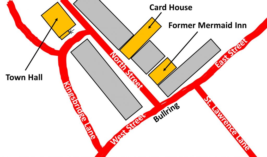
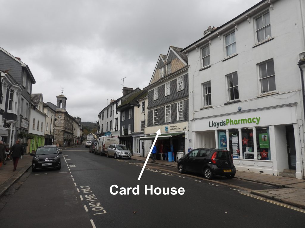
The Card House, Ashburton
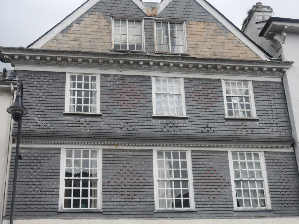
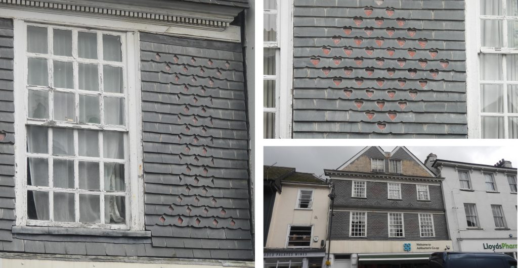
The Card House (also known as House o’ Cards or the Pack of Cards House) is described in Philip Knowling book, ‘Dartmoor Follies’ as: “….a folly in which you can go shopping”. The folly is at No 10 North Street, Ashburton and is located between the Bullring junction and the Town Hall. The building is now the Co-op (October 2022) but was once a gaming house, hence the numerous playing card punched patterns (ie Hearts, Diamonds, Clubs and Spades) that can be found on the upper floor slate hung facade. The centre of Ashburton dates back to medieval times but the building is recorded as being late 17th century (with a late 20th / early 21st century shop front – obviously!). Also of interest in the vicinity of the Card House is the former Mermaid Inn, which has links back to the English Civil War and the Town Hall which was built in the mid-19th century.
This post primarily has been written to cover the Card House folly as part of the ‘Dartmoor Explorations’ series on follies but also includes information on the former Mermaid Inn and the Town Hall. Information for the post has been obtained from the Philip Knowling book, ‘Dartmoor Follies’ as well as from the Dartmoor Historic Environment Record (HER).
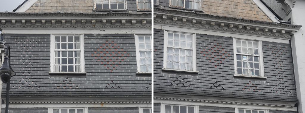
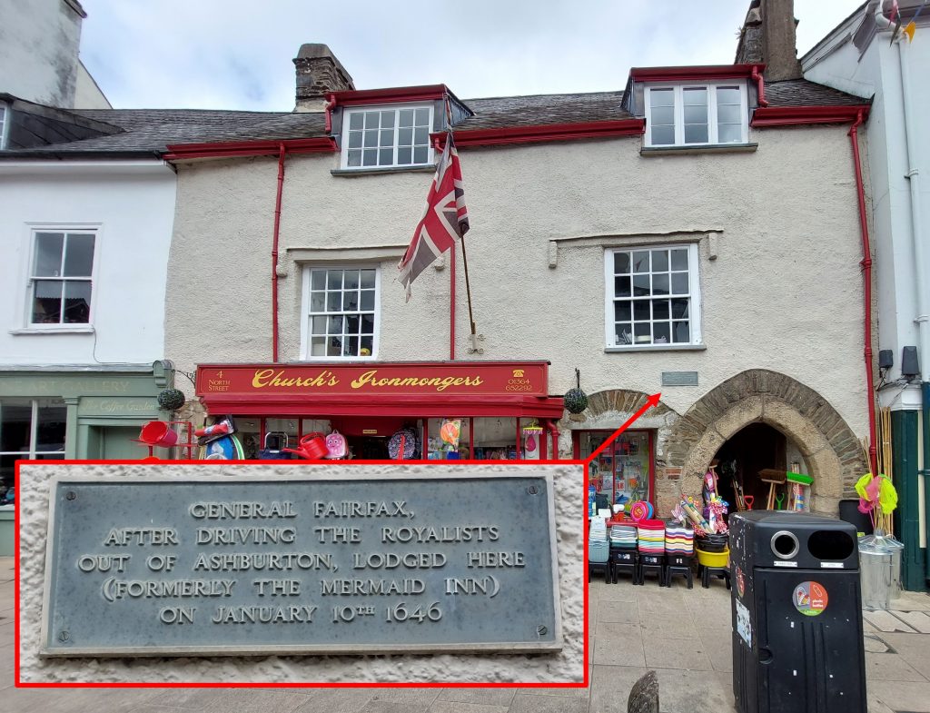
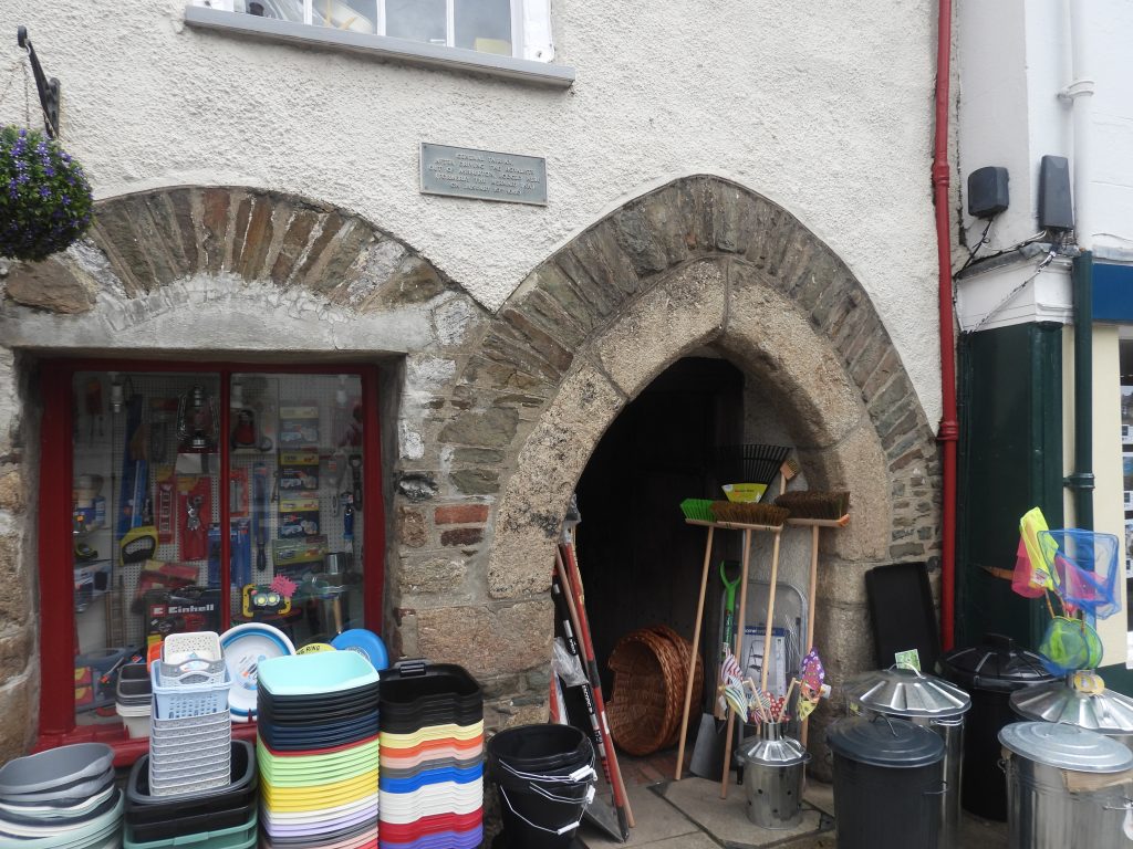
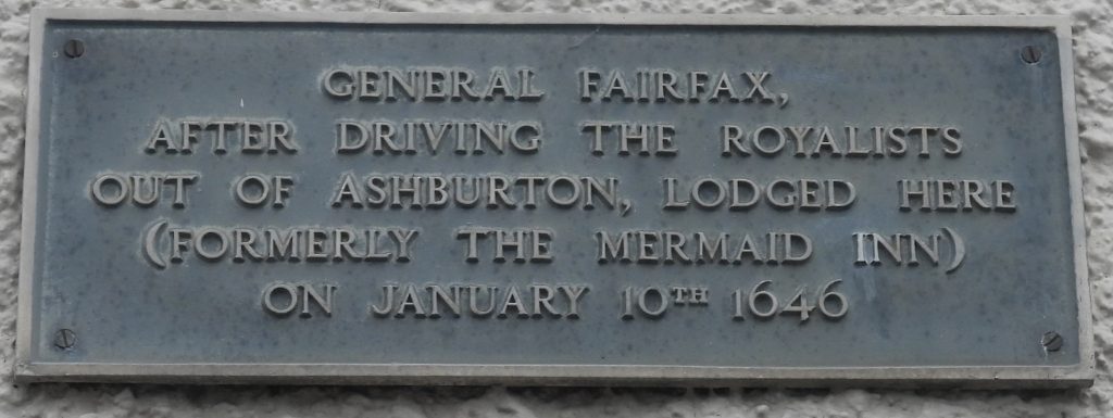
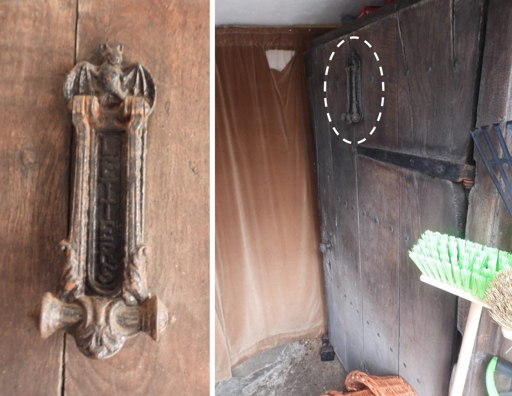
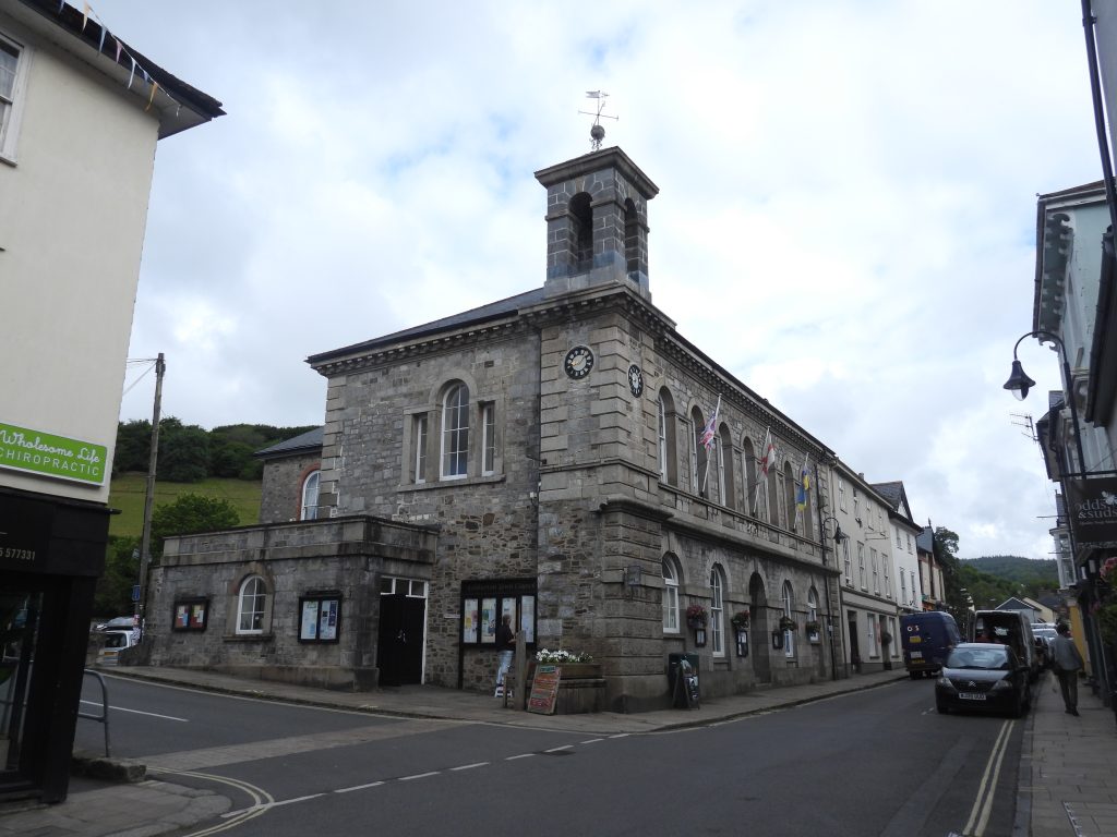
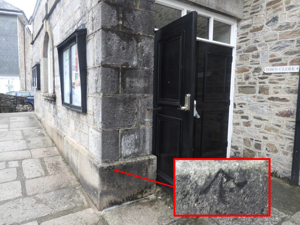
Sketch map showing the relative locations of the Card House, the old Mermaid Inn (now Church’s Ironmongers) and the Town HallThe Card House. in its time has been a gaming house, a cafe (the Card House Cafe), a butchers (Halse’s) and a grocery / supermarket. There was almost certainly an early building here that the late 17th century one we see today.Upper floors of the Card House. It was described by the Department of Environment in 1973, (Source : Dartmoor HER) as “a fine late 17th century, 4 storey, slate-hung front with 2 overhanging gables, cornice with shaped brackets. Slates cut in designs of hearts, spades, diamonds and clubs, picked out in red and black”. Each of the four suits are easily discernible.In 1989, after a storm brought down part of the frontage, specialist conservation builder Oliver Bosence (supported by Dartmoor National Park and English Heritage) was called in to renovate the property. He suggested the current building dated from 1690s. Close up of Diamonds (left) and Hearts (top right). During the 1989 renovation work Cornish slate was used, although the original facade would have used local Devon slate. Oliver Bosence stated at the time of renovation that different size slates were (and still are) used and slates are placed with an accuracy of only an inch or so (not that you’d notice from street level)At No 4 North Street is Church’s Ironmongers. Of note, is a plaque to the right hand side of the building between upper part of the arch and an upstairs window. The building was formerly the Mermaid Inn which served as General Fairfax’s headquarters in 1646 during the English Civil War, with his officers billeted around the corner in the Royal Oak. Church’s Ironmongers was established over 100 years ago (established by A.R.Church). It is described as being a traditional hardware store offering a wide range of ironmongery, tools, kitchen and home wares, plumbing and electrical fittings, seeds and gardening equipment, camping supplies and much more.Close up of the plaque which reads : “GENERAL FAIRFAX / AFTER DRIVING THE ROYALISTS / OUT OF ASHBURTON, LODGED HERE / (FORMERLY THE MERMAID INN) / ON JANUARY 10TH 1646”A curiosity can be found on the side door (under the medieval archway) of Church’s Ironmongers – a ‘bat’ on a letterbox. This curiosity might have been placed here by A.R.Church.Further along North Street is a more (relative) modern building, the Market hall, which now Town Hall. It was built between 1849-50 by Lord Clinton; the architect was A. Norman of Devonport. In its time, between 1933 and 1945, the Town Hall was also used as the Fire Station Headquarters.On the side entrance to the doorway of the Town Hall is a benchmark (B.M 239.9) which the author found as labelled on a 1873 map, so one would have thought the date it was inscribed by the Ordnance Surveyors can be narrowed to between 1850-1873? On closer inspection of the map, the benchmark was located on the corner of the building adjacent to North Street. This ‘side entrance’ is set back from the main street, so is this entrance a more recent addition and is the benchmark the original B.M 239.9 reference?