A collection of walks, discoveries, insights and pictures of exploring Dartmoor National Park
March 3, 2024
Ringmoor Down Medieval Farmsteads
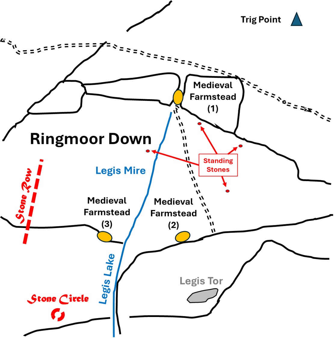
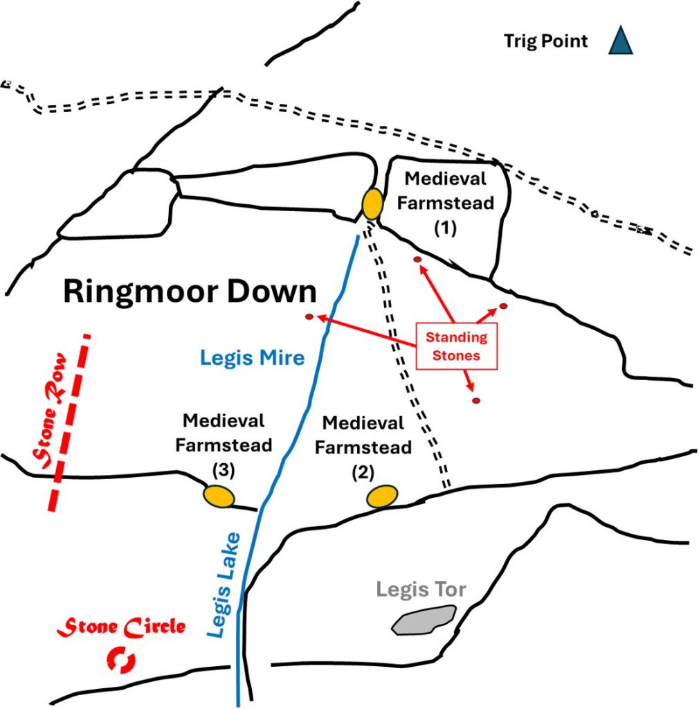
When walking across Ringmoor Down, you could be forgiven for observing there might be little of interest. However, in this area there are three settlements, four granite uprights, a warren with distinct walling, several stone circles, a stone row and to the south a lovely tor (Legis) with a well preserved vermin trap.
As well as these features there is also a large medieval field system (96 ha) which surrounds the upper reaches of Legis Lake. Associated with the field system are the three ‘contemporary’ settlements (labelled as Medieval farmsteads in this post). The field system links these farmsteads together and contains areas of ridge and furrow.
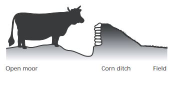
To the south of Ringmoor Down is Legis Tor Warren, which was established by early 18th century and which helps to date the farmsteads. A warreners wall (or possible corn ditch) defines the northern boundary and is located adjacent to the Medieval farmstead (2). The wall is ‘contemporary’ with the commencement of warrening, and appears to butt up to the farmstead, suggesting it (the farmstead) had already been long since abandoned by then. It is possible that the farmsteads date from the 15th or 16th centuries.
Some excellent research work by S.Probert (2005) and Dr P.Newman (2022) has been used for the generation of this post.
Bibliography
P. Newman, (2022), Ringmoor Down Premier Archaeological Landscape Dartmoor National Park, Devon.
S. Probert, (2005), Ringmoor Training Area: Monument Baseline Condition Survey
R.H. Worth, (1941), Retaining Circles Associated with Stone Rows
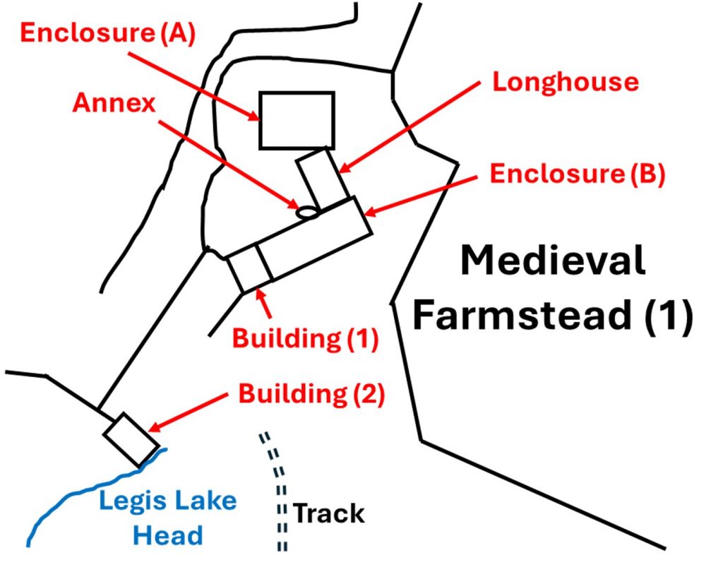
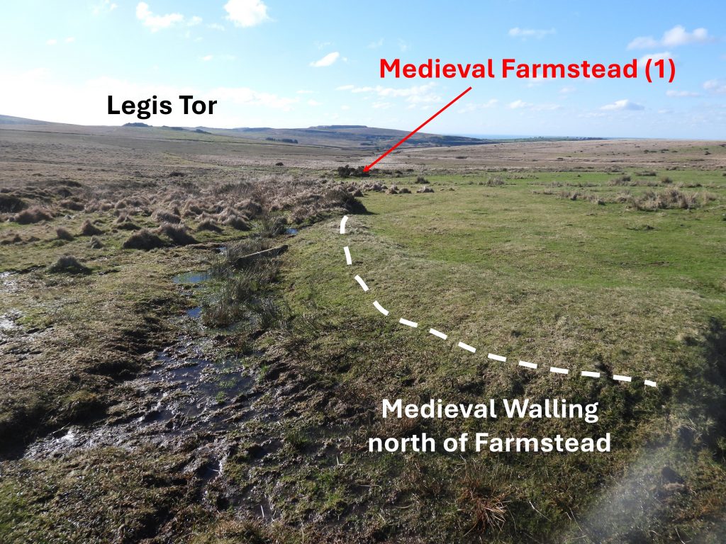
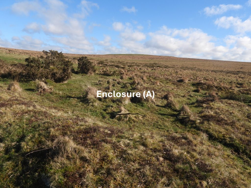
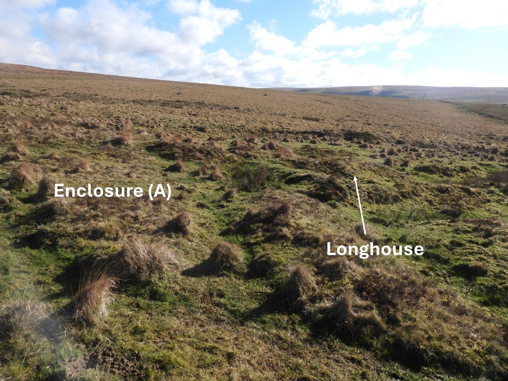
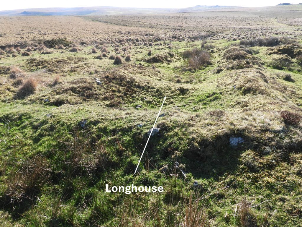
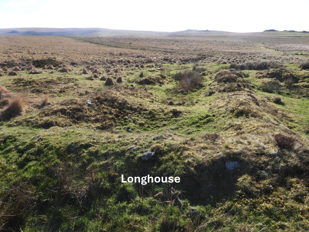
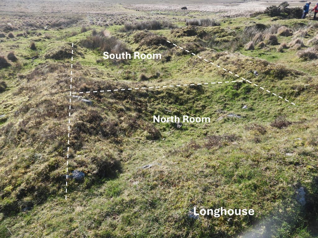
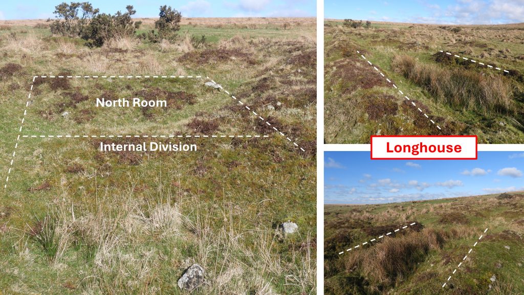
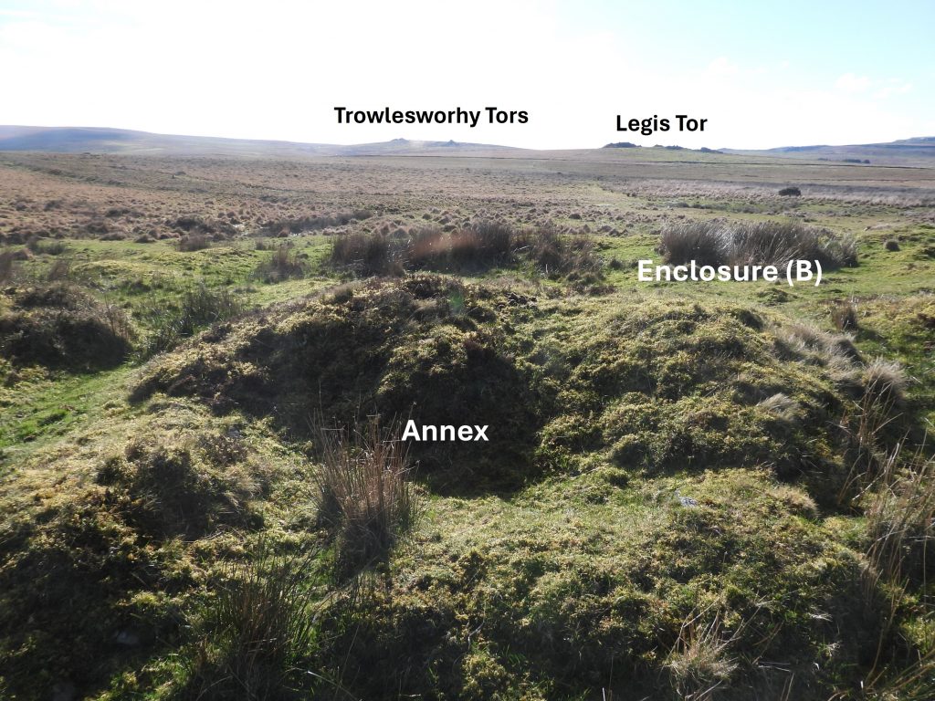
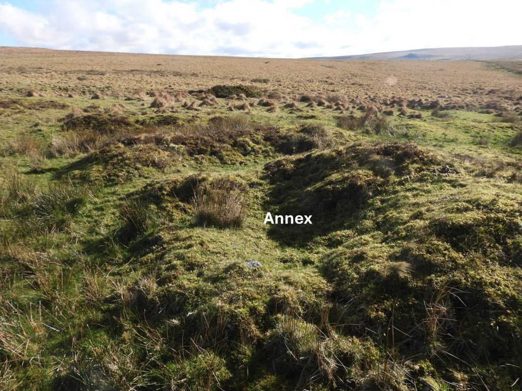
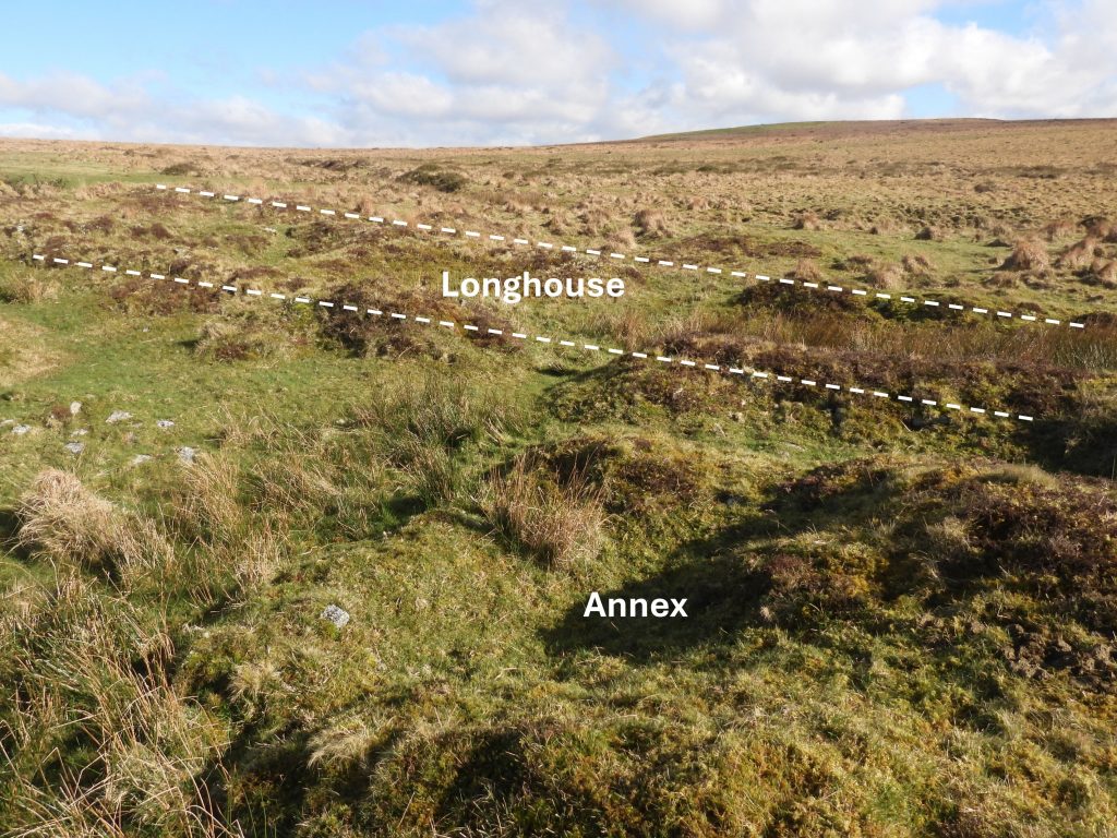
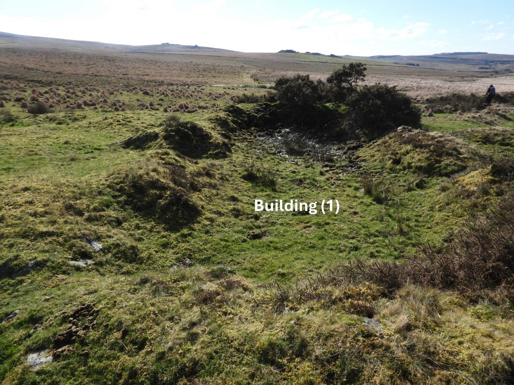
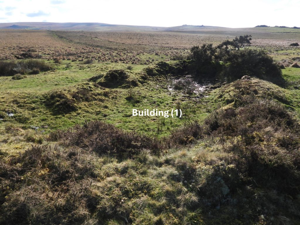
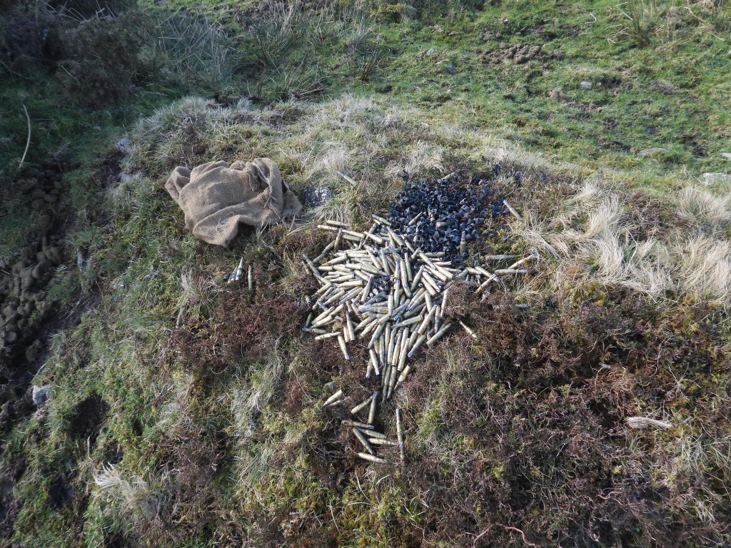
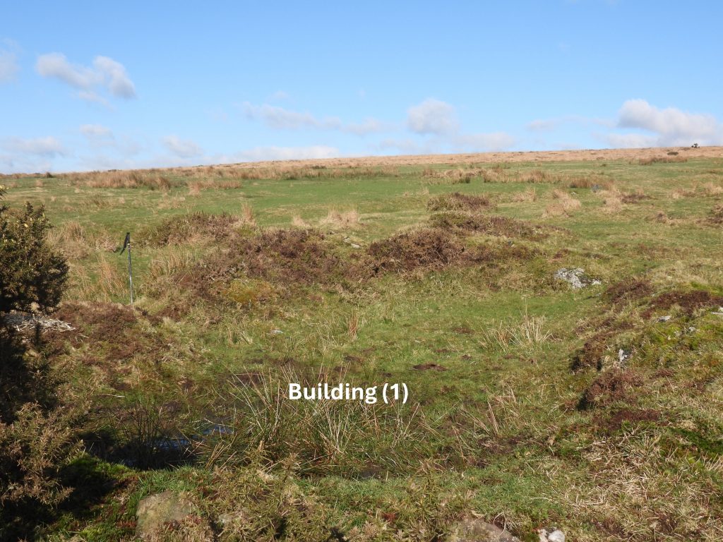
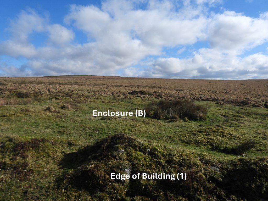
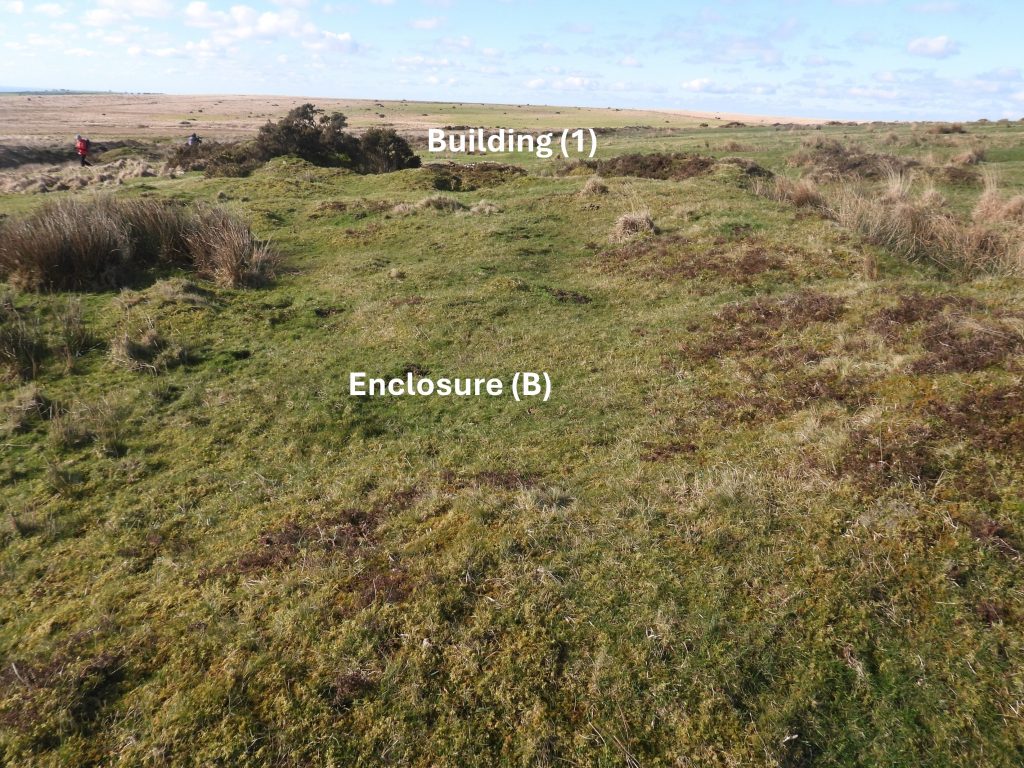
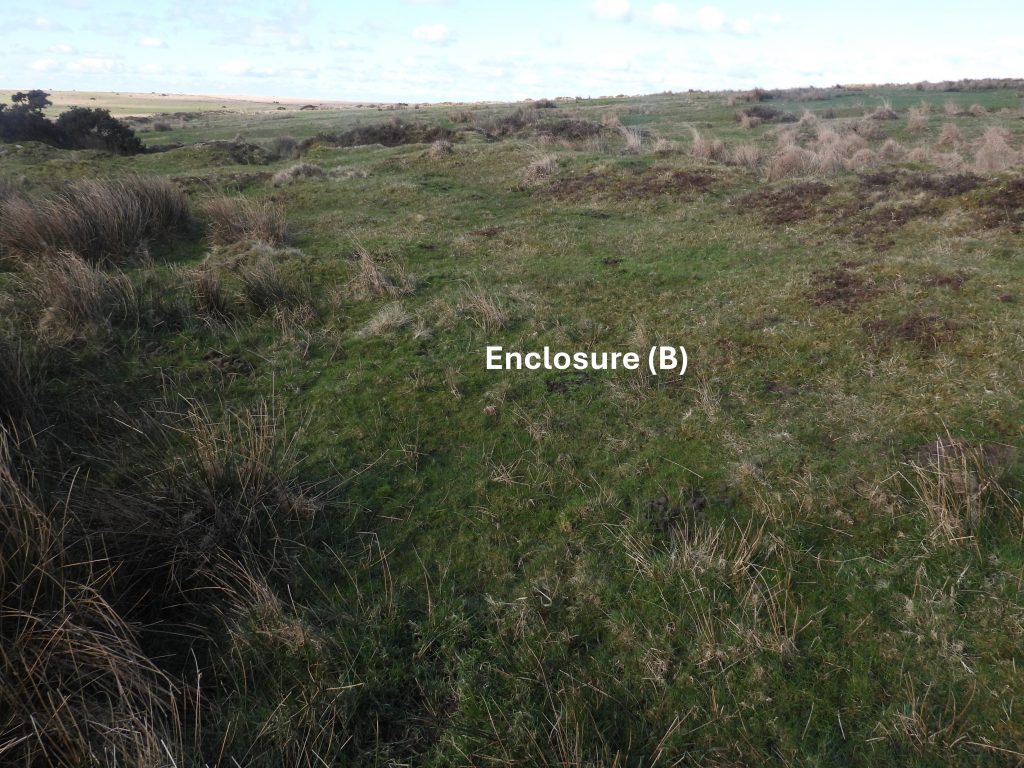
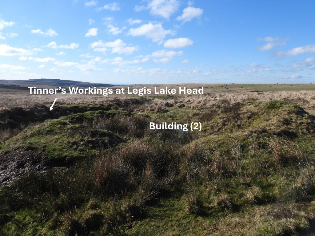
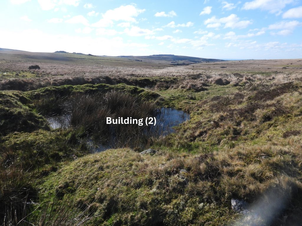
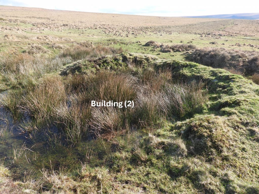
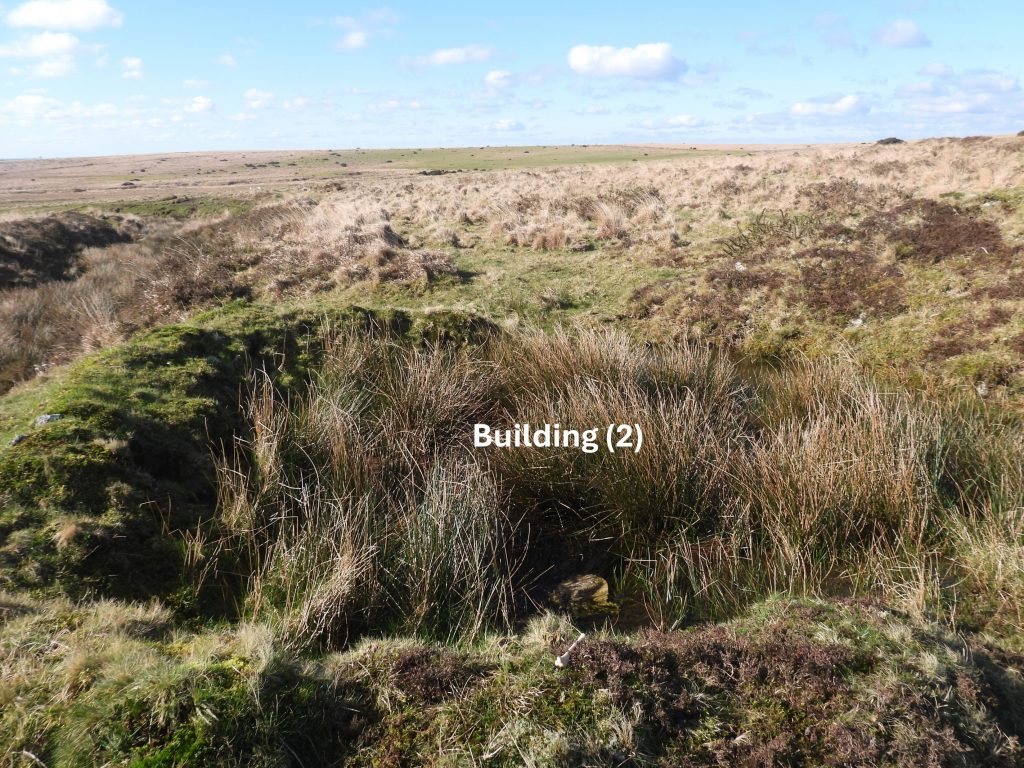
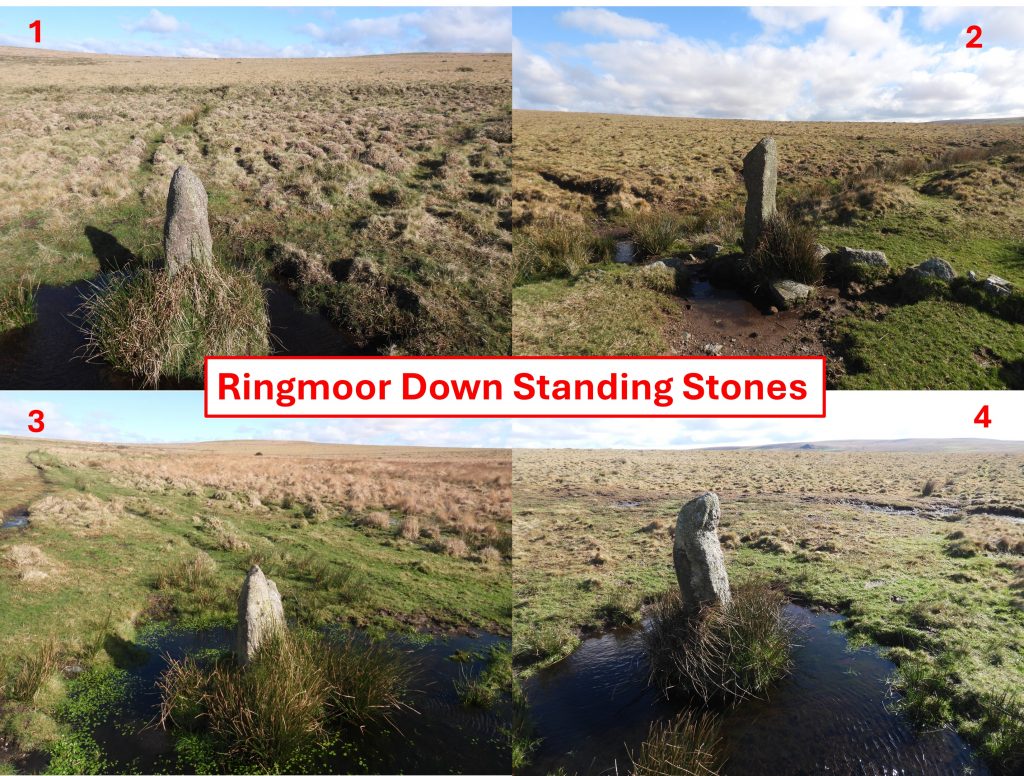
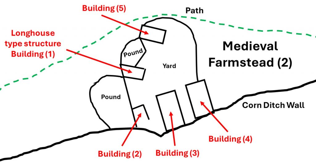
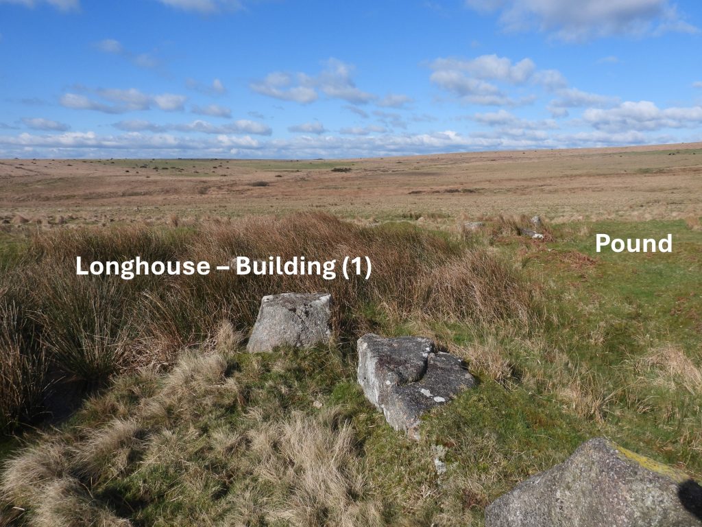
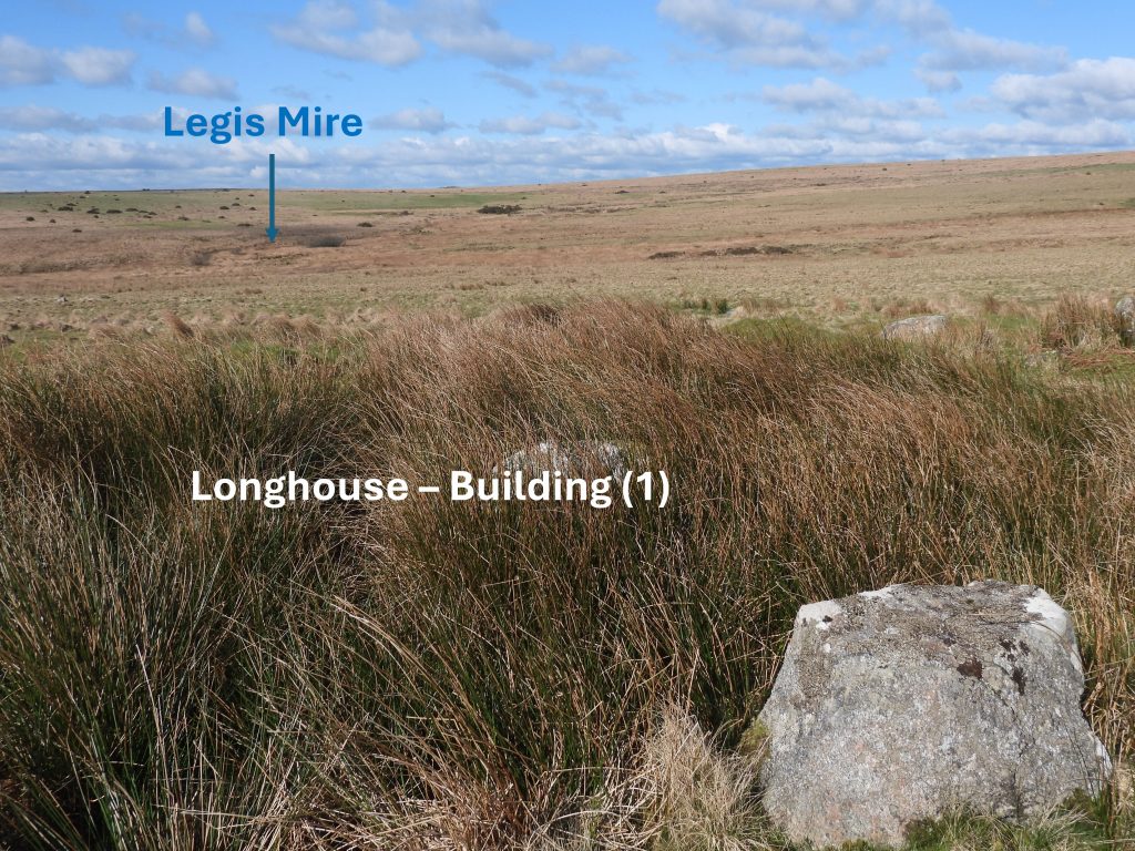
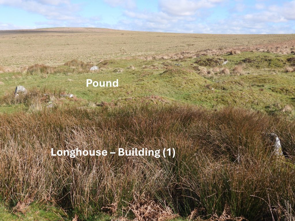
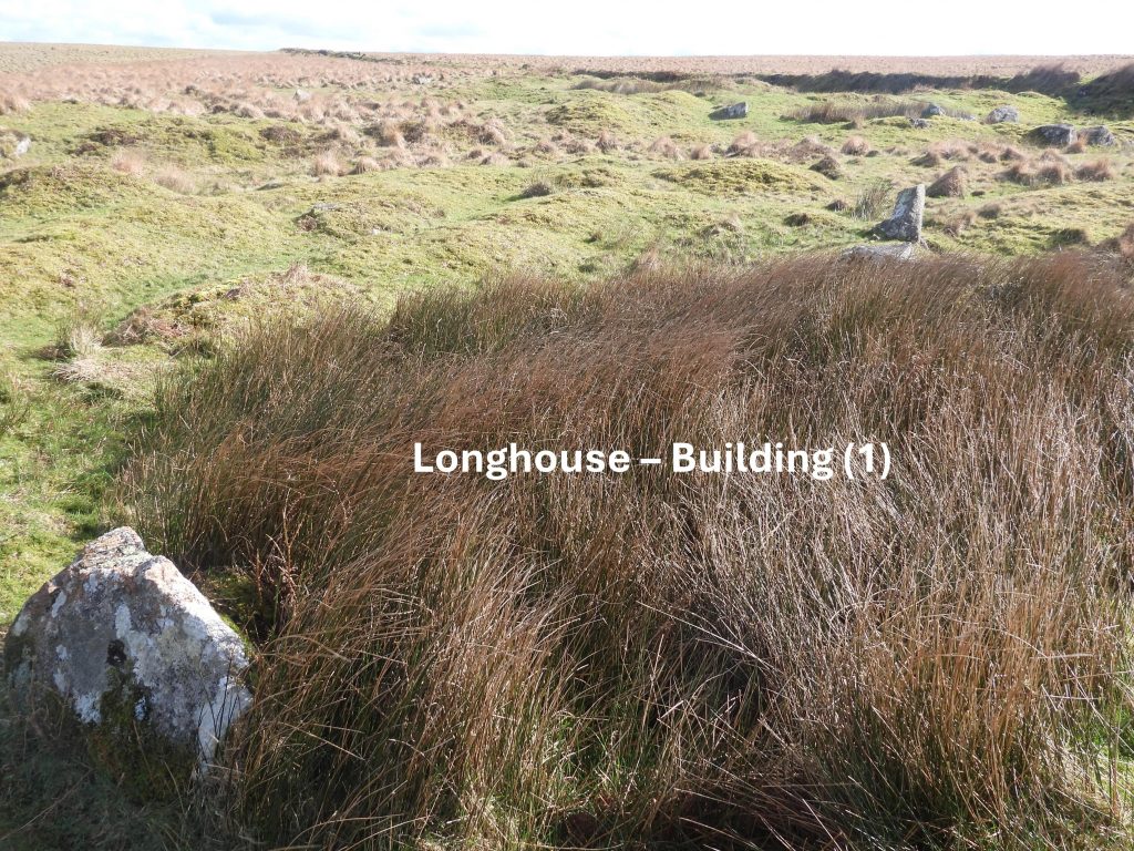
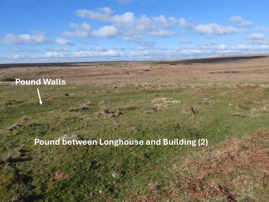
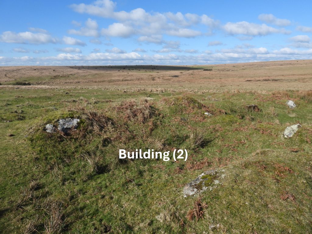
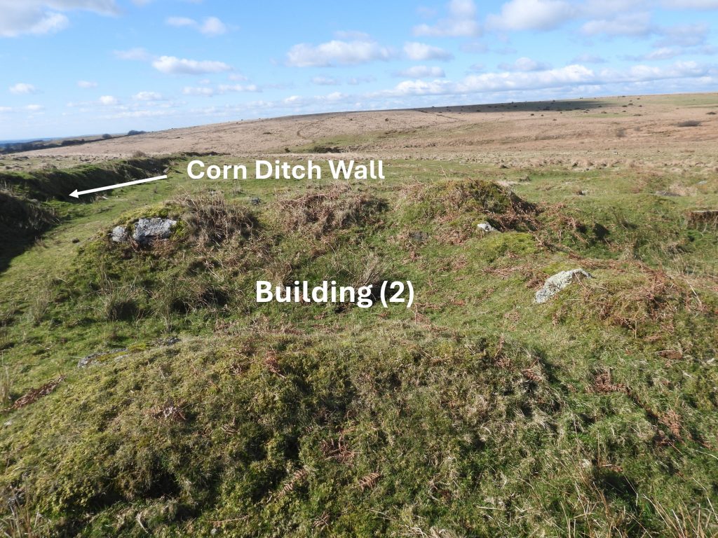
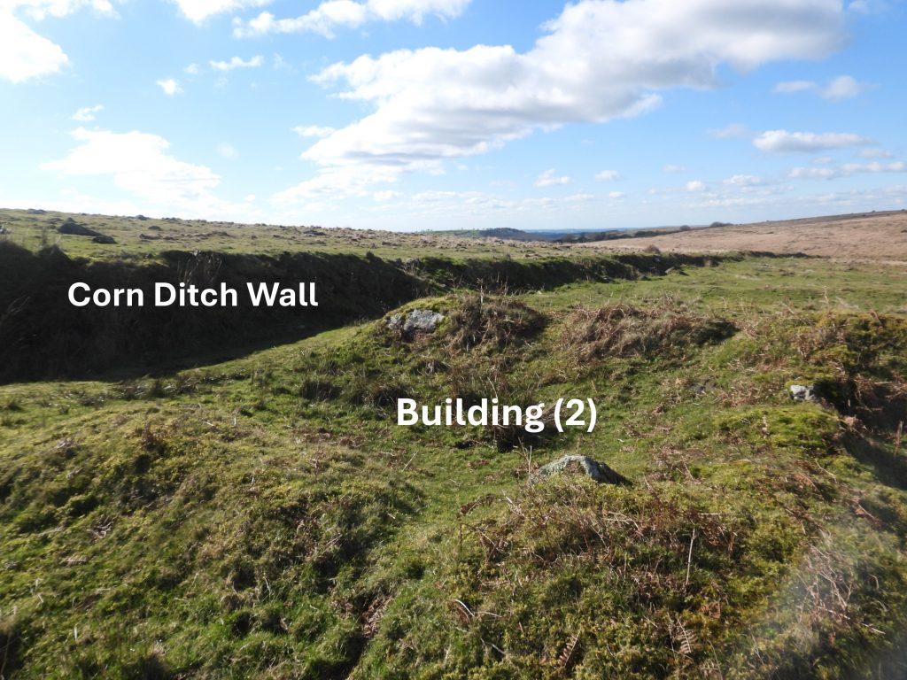
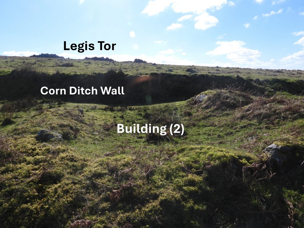
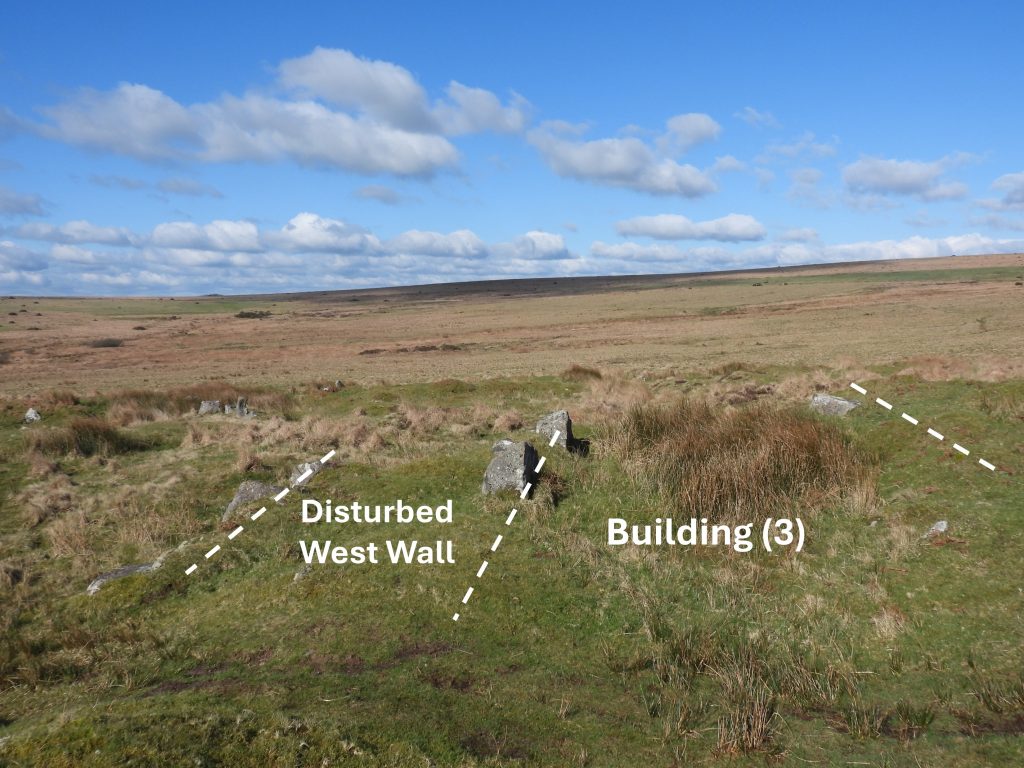
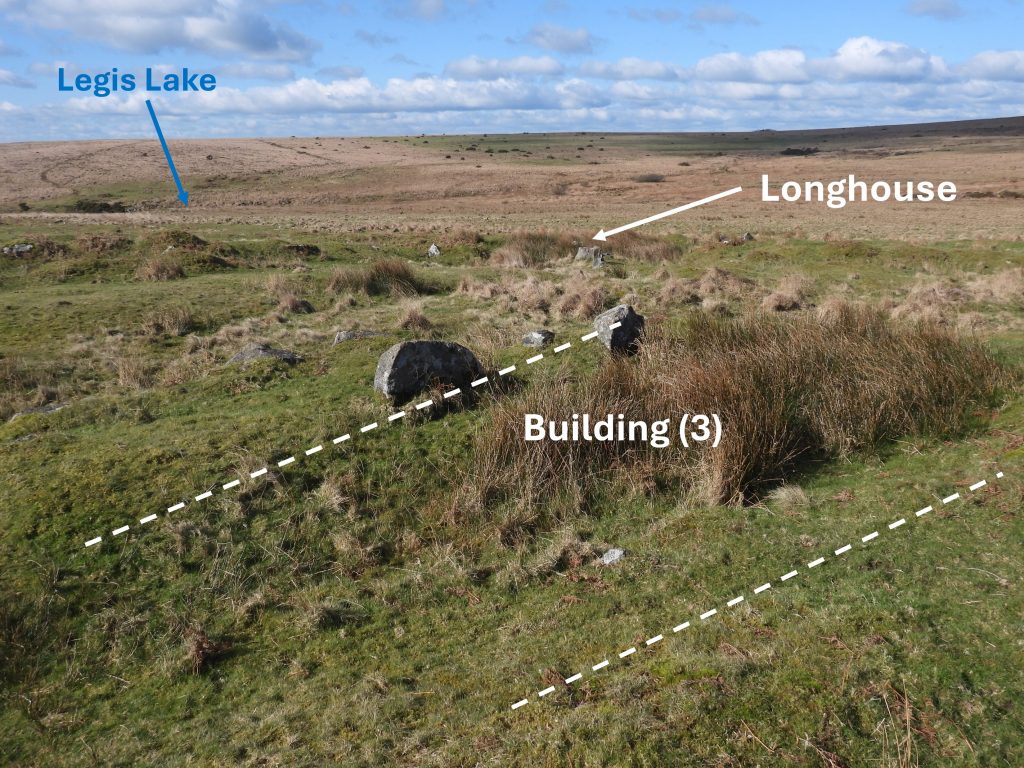
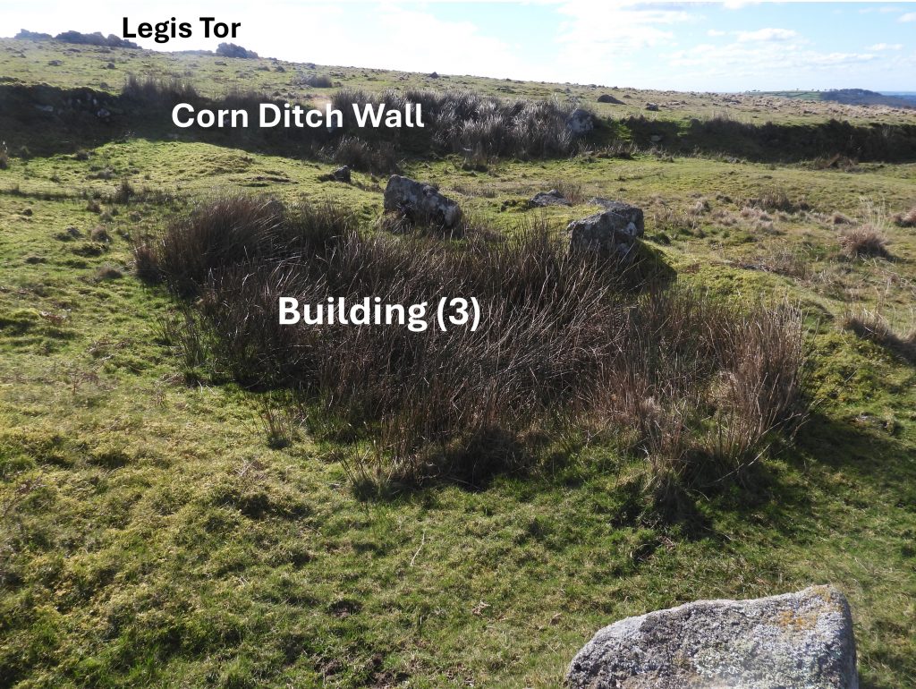
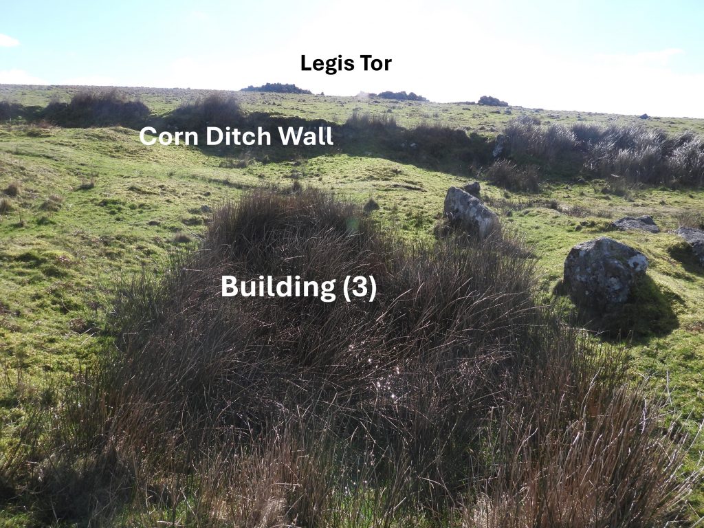
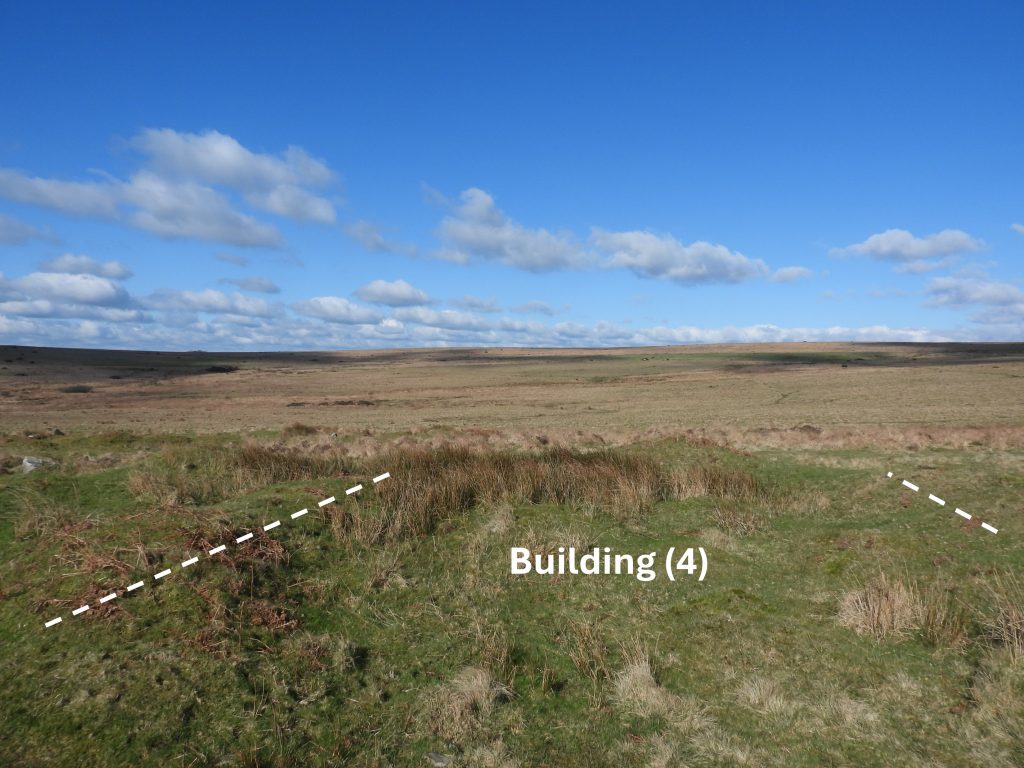
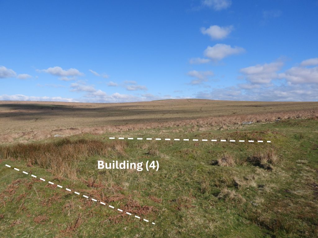
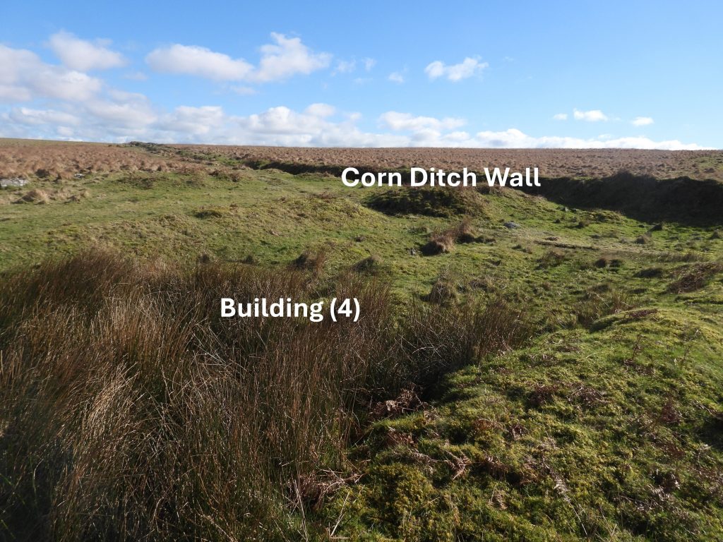
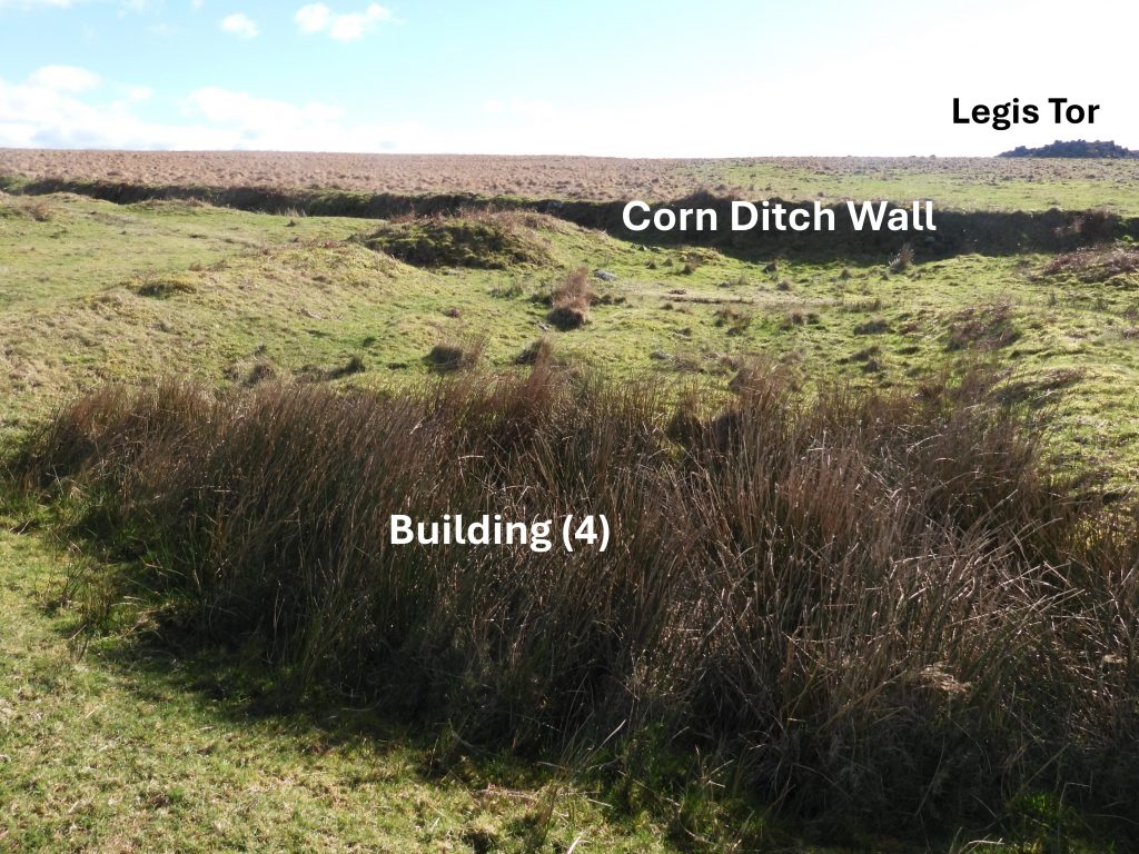
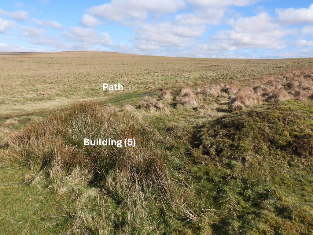
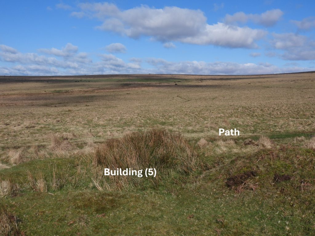
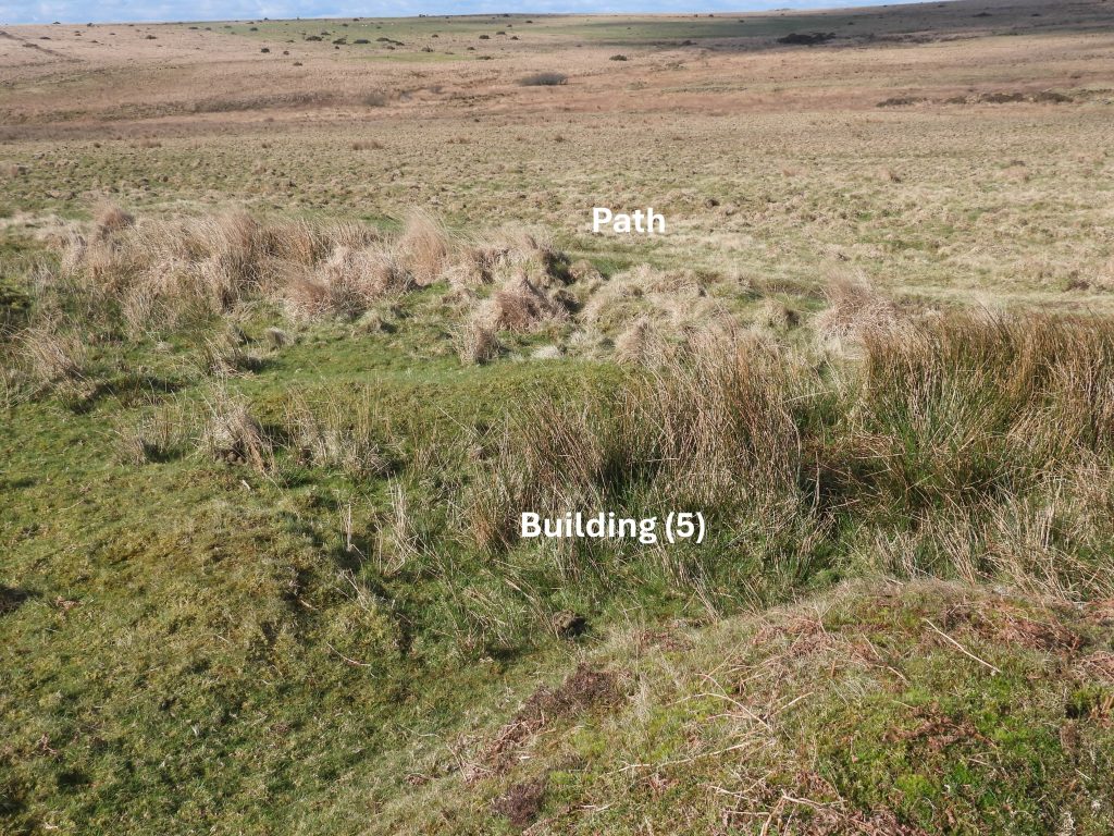
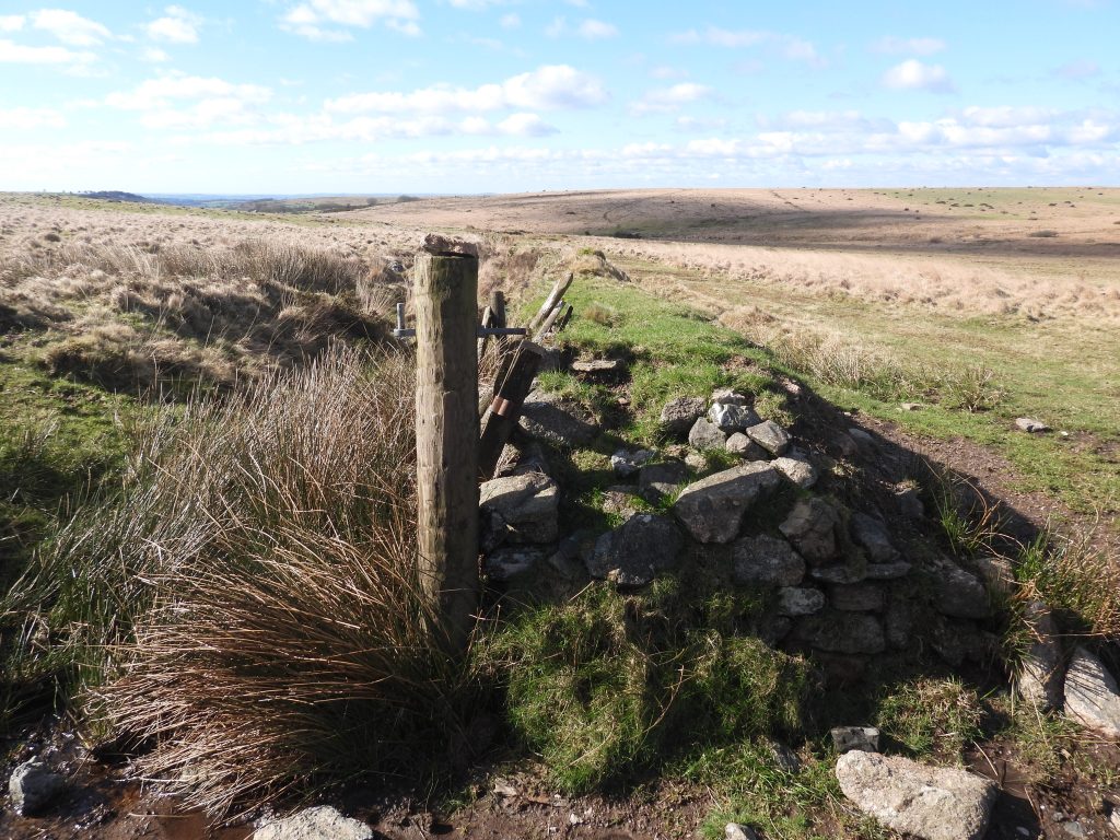
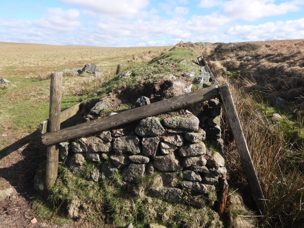
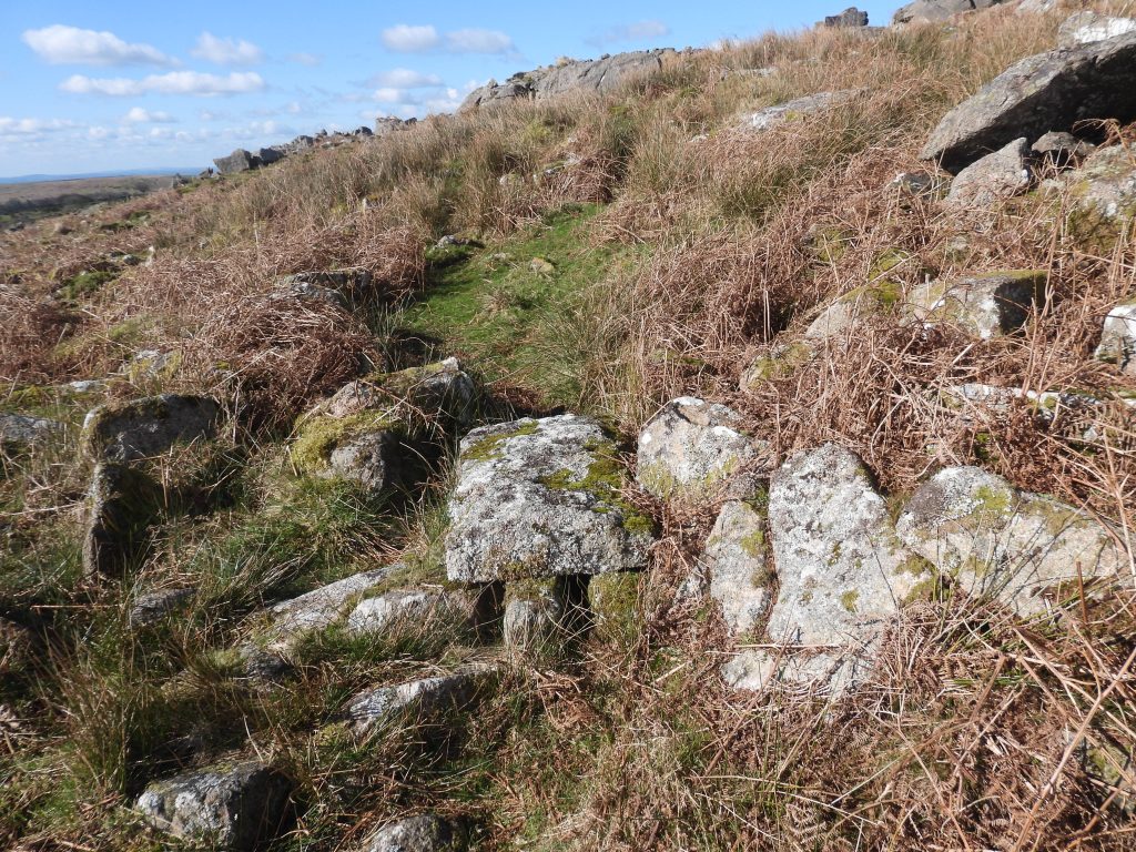
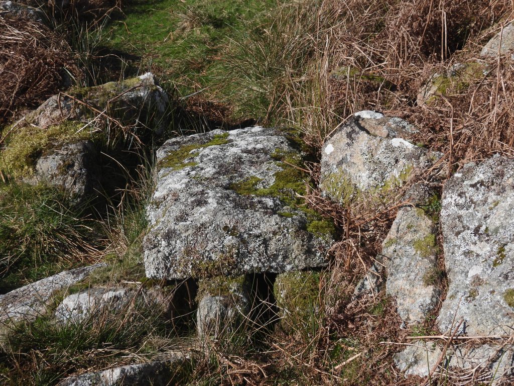
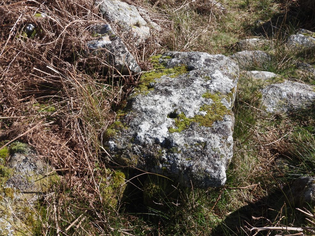
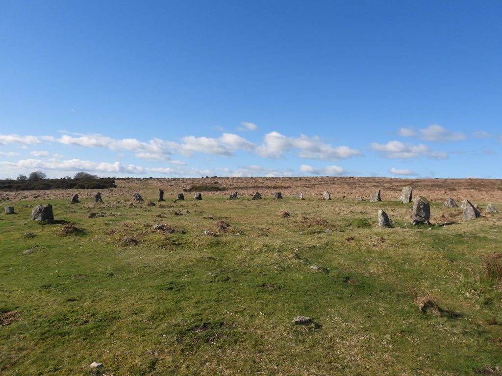
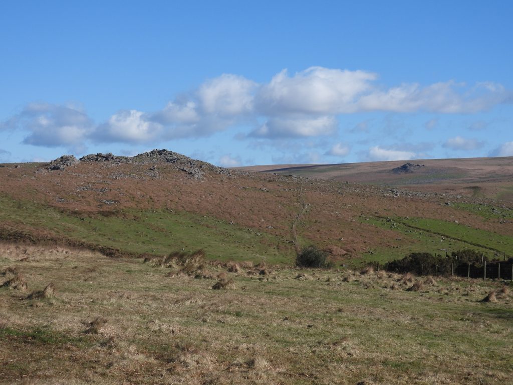
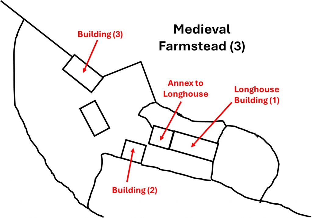
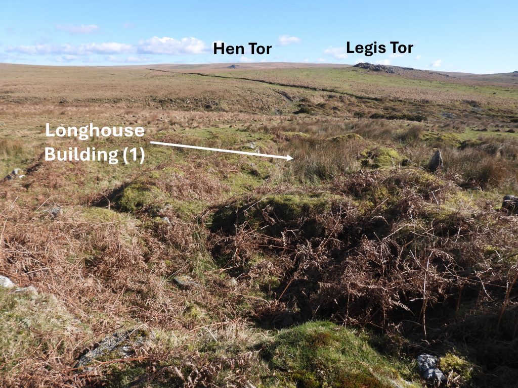
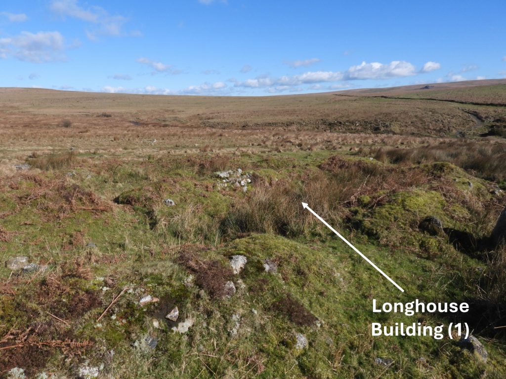
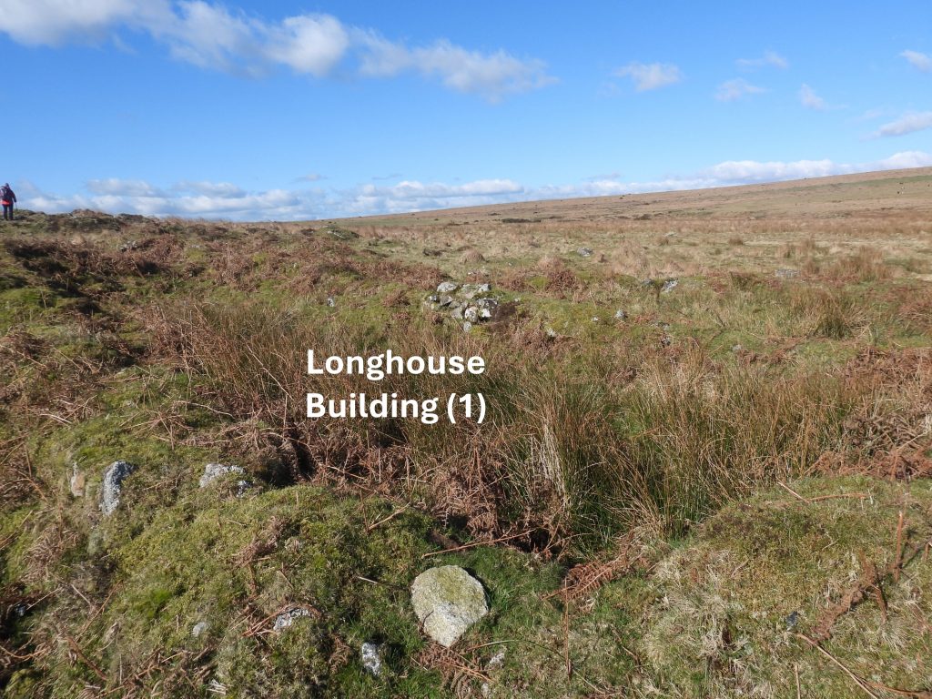
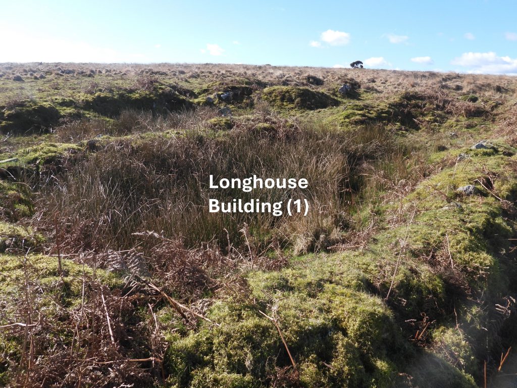
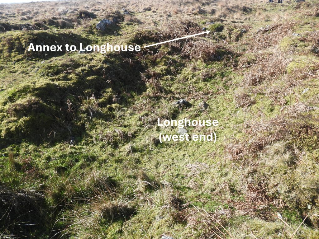
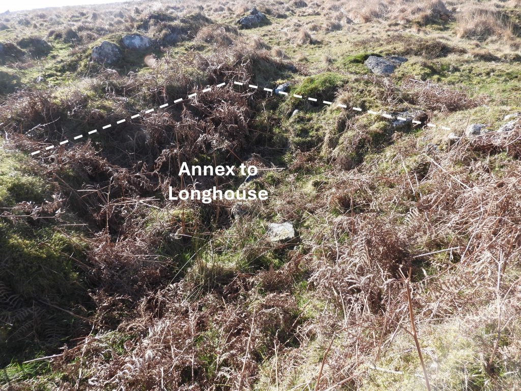
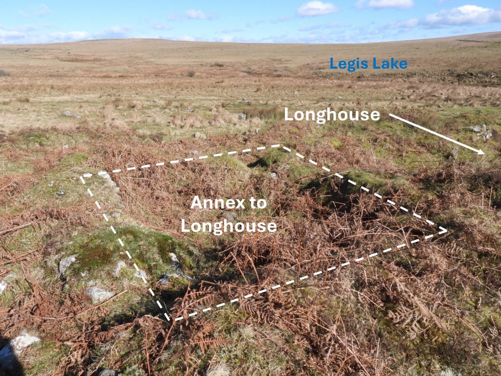
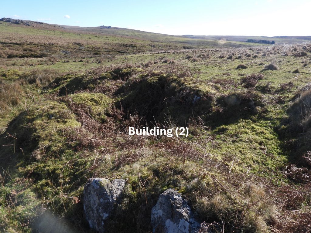
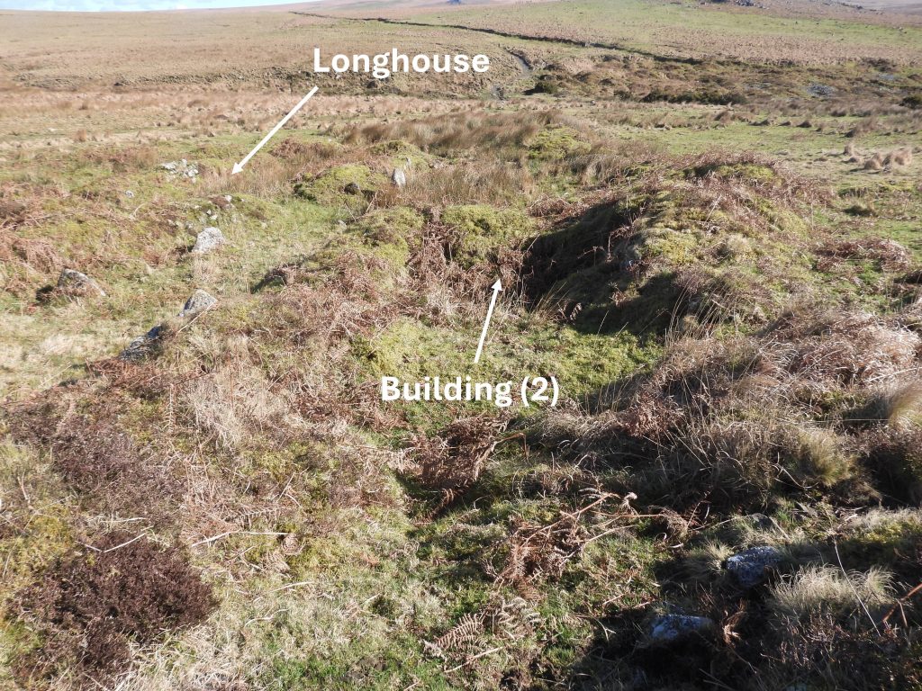
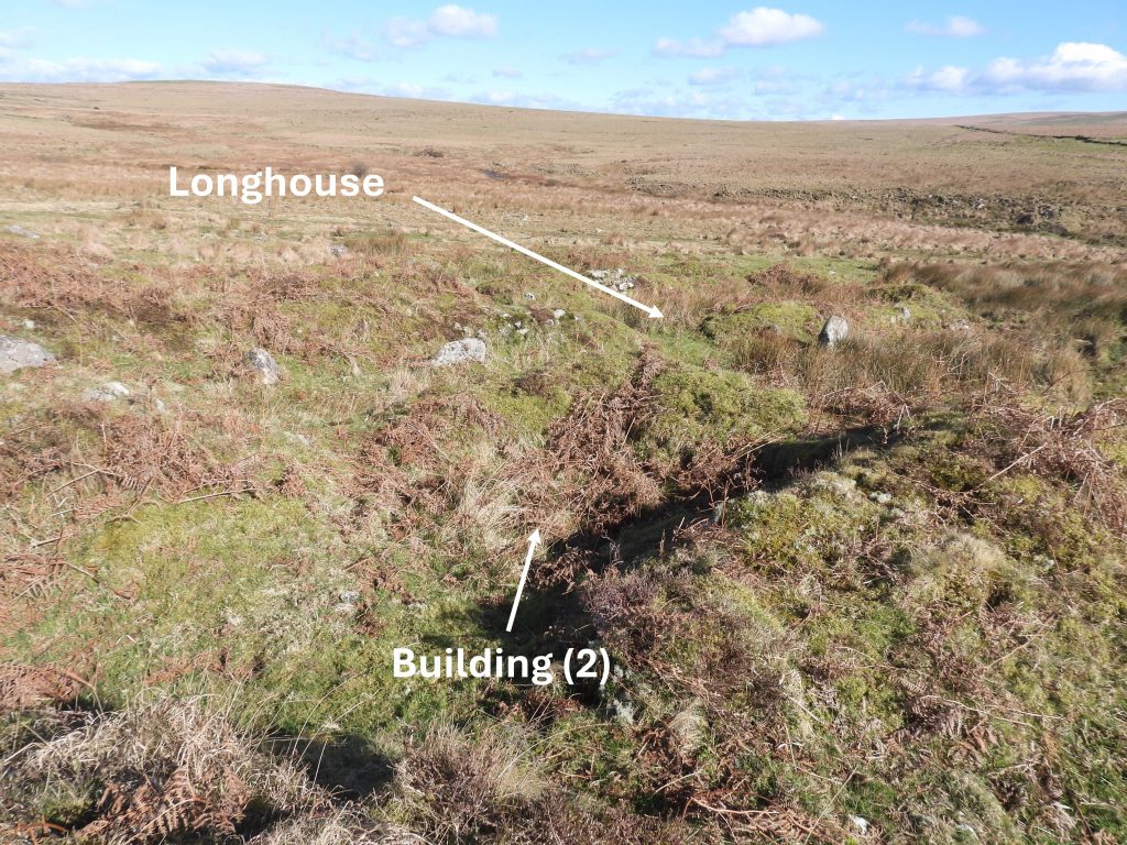
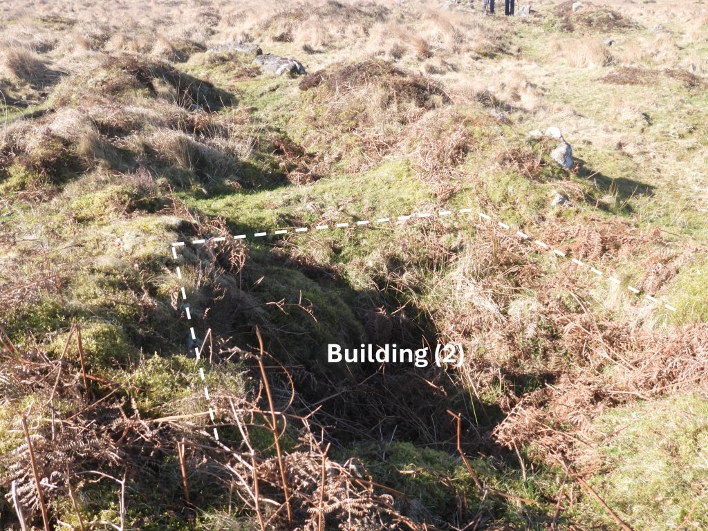
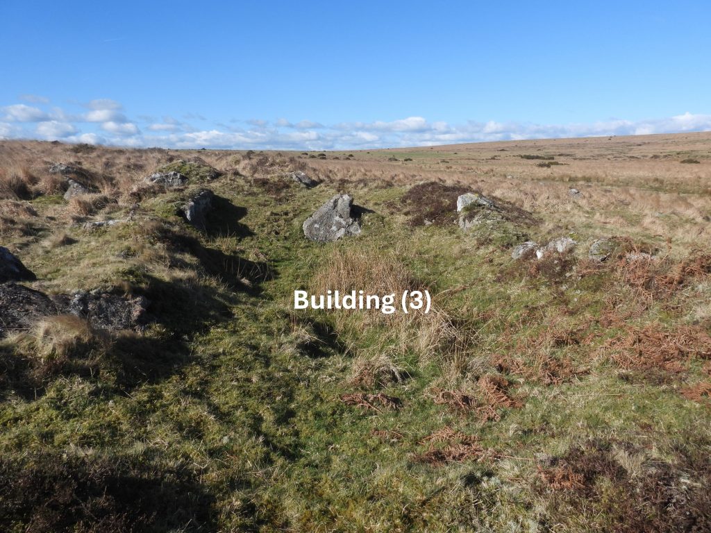
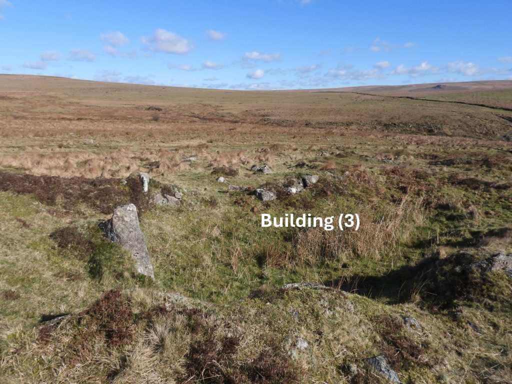
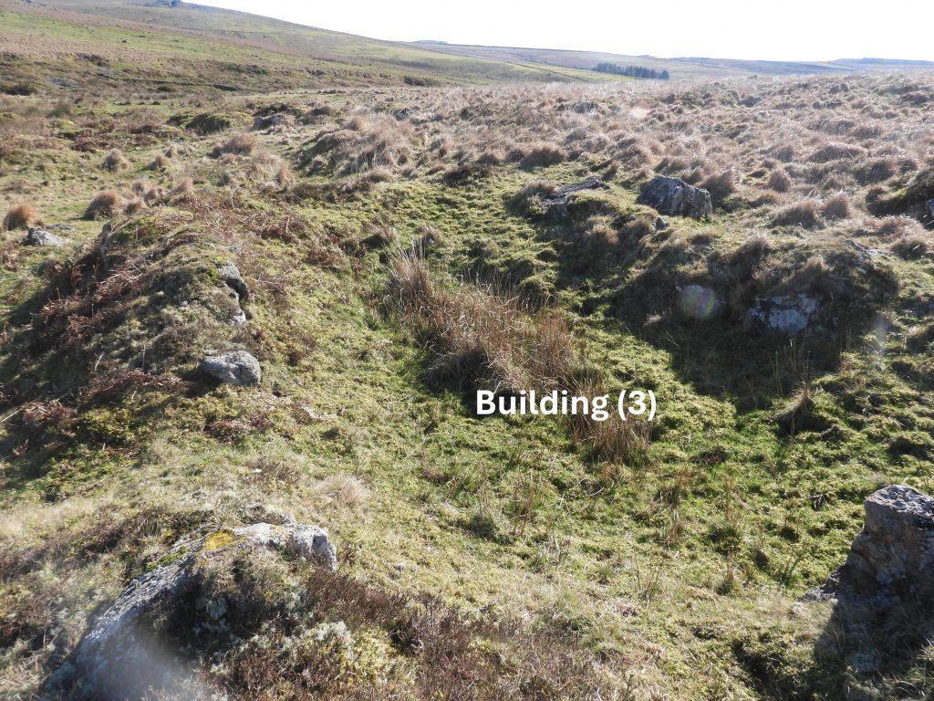
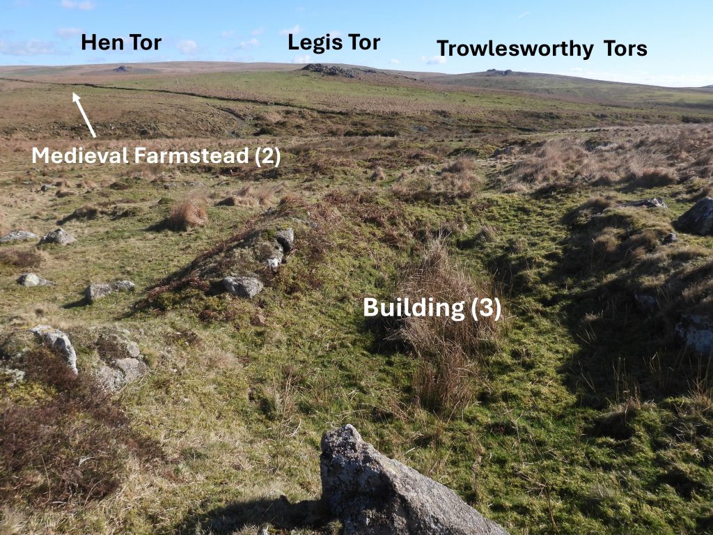
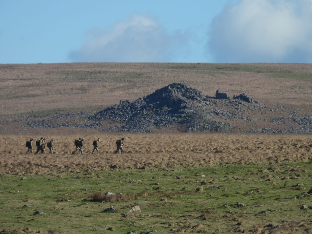
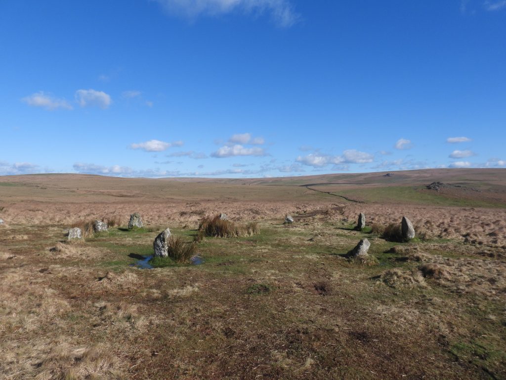
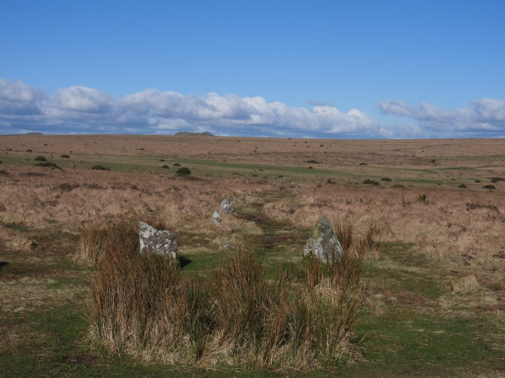
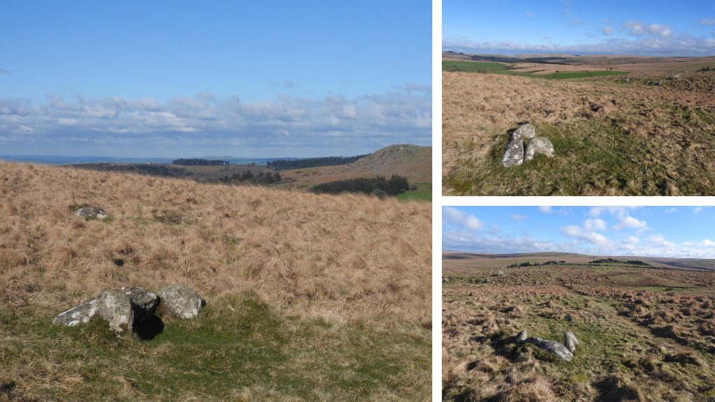
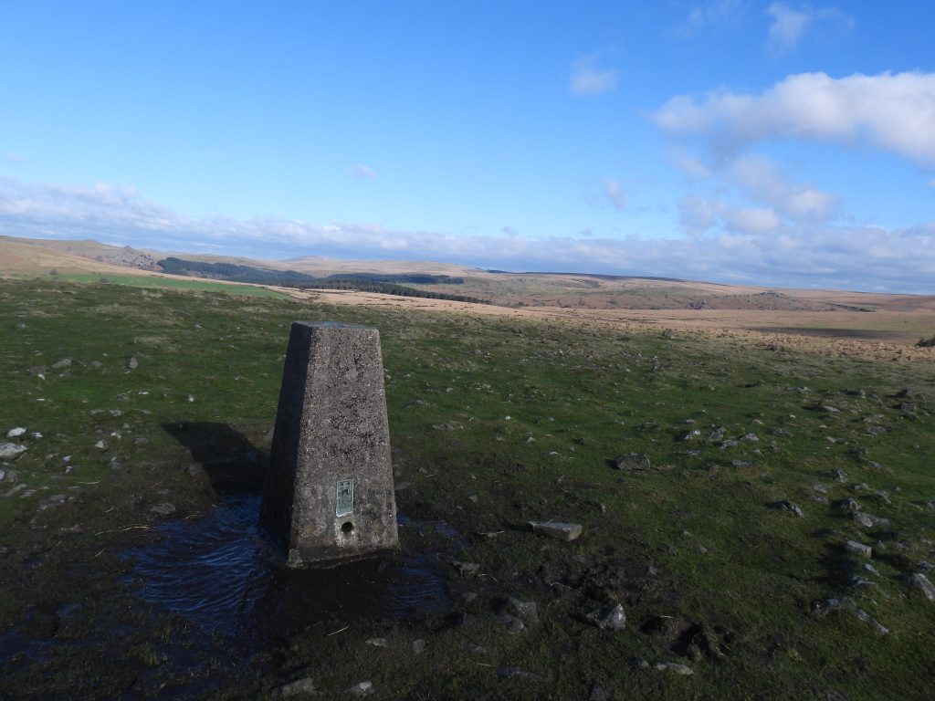
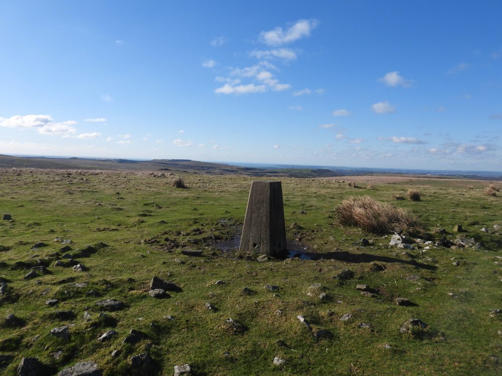
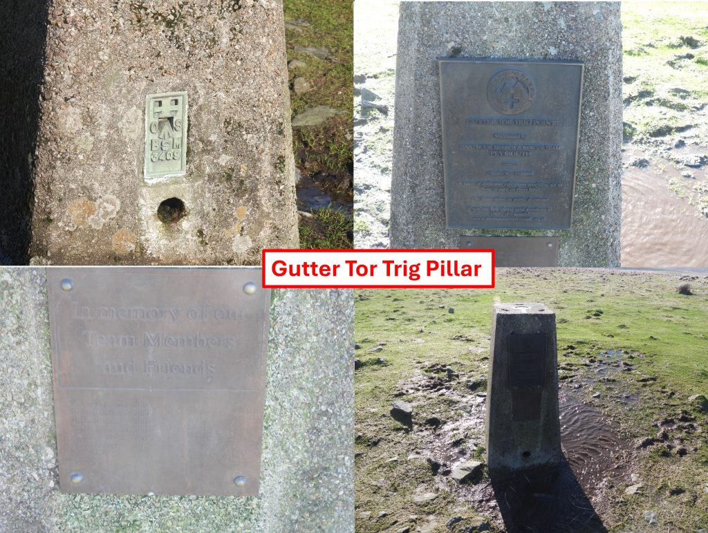
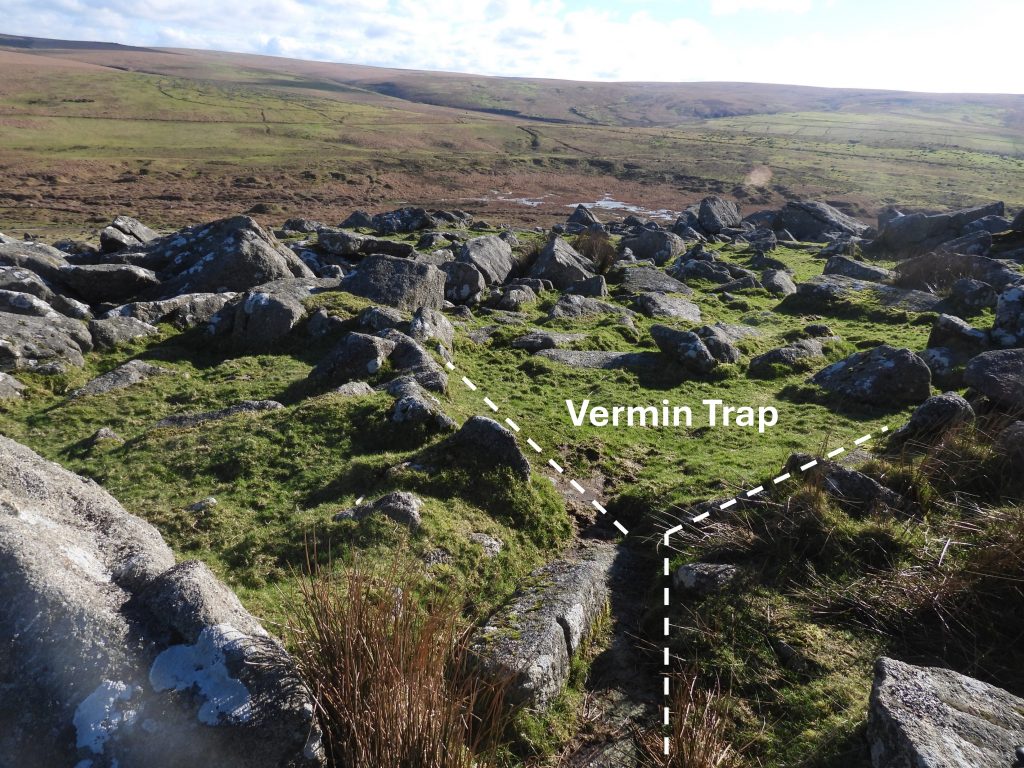
Sketch map of the main features covered in this post. The post also records a few other artefacts near Gutter Tor, which was the direction the author came from to visit the area.Sketch map of a deserted medieval farmstead on Ringmoor Down (labelled Medieval farmstead (1) for this post). The farmstead is located at the head of Legis Lake, comprises four ruined buildings and two enclosuresNorth end of the farmstead where there is a ‘funnel’ of medieval walls leading to the farmstead.Enclosure (A) can be found at the north end of the farmstead. The centre of the Enclosure was recorded at SX56999 66439Enclosure (A) lies next to the main building (Longhouse) at the farmstead. 13m by 10m with wall banks now spread up to 3mThe largest building at the Medieval farmstead (1) is a longhouse which is set obliquely into the slope, with a dividing wall approx 1/4 way down the slope from the north (highest) end. It has two opposing entrances on the long wallsThe Longhouse turf-covered foundation walls survive up to 2.6m wide. The overall interior measurements are approx. 14.6m by 4m.The walls which remain are around 1m high. There is an internal division at the northern end creating an inner room of around 2.8m by 4m.The centre of the Longhouse is located at SX57006 66426A few metres to the south west of the Longhouse and butted up against Enclosure (B) is a small structure (labelled Annex on the sketch map)The Annex walls are very turf-covered with some reeds by an obvious entrance. The structure is approximately 1.9m by 1.2m.The Annex is located at SX57000 66422The second largest building at the farmstead (labelled Building (1) on the sketch map) is constructed in a similar style to the Longhouse, thus it is assumed they were built during the same period. Building (1) has opposing entrances on the east and west sides and measures around 9.4m by 4.3m (interior dimensions)Sadly, this cache of blank bullets were left on the west wall of Building (1). The author isn’t anti-military but pro-Dartmoor and this litter ought to and could easily be avoided Building (1) is located at SX56989 66413Enclosure (B) is attached to the east side of Building (1)Enclosure (B) measures around 17m by 10mEnclosure (B) is located at SX57001 66414The final building of the farmstead (labelled Building (2) on the sketch map) is located near the head of Legis Lake, where there is evidence of tinner’s workingsBuilding (2) structure, like the other buildings (except the Annex) has two entrances in both long walls.The interior dimensions have been recorded as being approximately 5.5m by 4.3m.Building (2) is located at SX56966 66376There are four boundary stones of unknown origin and purpose on Ringmoor Down. More information can be found here: https://dartmoorexplorations.co.uk/ringmoor-down-standing-stones/Sketch map of a deserted medieval farmstead on Ringmoor Down (labelled Medieval farmstead (2) for this post). The farmstead is located adjacent to a corn ditch wall a short distance just to the north of Legis Tor. The farmstead comprises at least four (possibly five) ruined buildings, two pounds (enclosures) and a large yard. All the buildings have been demolished, which is suggested as most probably as a result of robbing the stone to build the warren enclosure wall (corn ditch). The wall transects buildings 2, 3 and 4 as shown on the sketch map.A longhouse-type structure, shown as Building (1) on the sketch map was measured by Probert (2005) as 9.0m north-west to south-east by 2.6m internally. Much of the structure is heavily overgrown with reeds. The Longhouse is located at SX56993 65813An alignment of stones form part of the south wall of the Longhouse.The walls of the Longhouse (also measure by Probert (2005)) are as wide as 1.8m with a maximum 0.4m in height.To the north of the Longhouse, separating it from another possible building (number 5) is a small pound / enclosure, defined by a flat area.To the south of the probable Longhouse is a second pound / enclosure beyond which is building (2).Building (2) is one of three ruins which are transected by a warreners wall. The level interior measures 4.5m long north-south by 3m wide. That said, the original length of the building extends to the wall making it 6.3m long internally. The original length of the building is unknown because of the more recent wall.The walls of building (2) are 1.5m wide and around 0.5m high. They show evidence of internal facing.The wall is later boundary (Legis Tor Warren) and occupies the site of the original southern edge of this farmstead (as no additional earthworks lie on the south side of the wall). Parts of the walls are likely to have been constructed from robbed stone from the farmstead.Building (2) is located at SX56999 65795The remains of Building (3) are very disturbed. Probert measured the building as being approximately 13.8m north-south by around 3.5m wide. Of special interest is the western wall, which is 3m thick by 0.8m high, with stone surviving on both sides of the wall.The east and north wall foundations of Building (3) both survive as earthworks. As Building (3) and Building (4) are much larger structures than Building (2) and the Longhouse (Building (1)), it is suggested (Newman) that they may have been constructed at a later period.Building (3) is located at SX57019 65802Building (4) is another rectangular earthwork, like Building (3) and is of similar proportions. The banks are around 3m wide.Interestingly, Probert (2005) suggests that this ‘Building’ appears to be a yard adjacent to the previous structure (Building (3)), and Newman (2022) “casts some doubt over the exact status of this feature but if it was a building, its proportions were similar to those of its neighbour”. Building (4) or Yard is located at SX57032 65804Building (4) or yard like Building (3) is terminated at its southern end by the warreners wall (corn ditch) beyond which a few hundred metres away is Legis Tor.Recorded by Probert is the site of a possible Building (5). It lies at the north end of the farmstead.Building (5) is a rectangular hollow 4.6m north-west to south-east by 2.5m and is located next to a pathBuilding (5) is located at SX57005 65835Building (5) like others on the site has reeds within its interior.Legis Tor Warren surrounds the tor and is bounded on the south and east by the River Plym and the west and north by a high stone wall, banked on the north side. The photograph shows the warreners wall (corn ditch) looking west. Warreners wall (corn ditch) looking east. The wall next to Medieval farmstead number 2 is a classic Corn ditch. There type of walls were synonymous from the medieval onwards where farmsteads separated areas of ‘common grazing’ from enclosed lands. They (corn ditches) comprised and a vertical stone-faced bank which discouraged stock from entering fields from the moor. That said, as recorded in this post some Dartmoor observers have recorded this as a warreners wall. Did the warreners deliberately built a this wall as a corn ditch?Any trip to the Legis Tor area would be incomplete without visiting one of the best preserved Vermin Traps on DartmoorThe Vermin Trap includes two v-shaped lengths of walling, which together forming an X-shaped trapThe Vermin Trap cover has 3 holes which is laid onto two flat-sided stone slabs laid parallel to each other.Brisworthy Stone Circle is located a short distance to the west of Legis Lake and can be visited en-route to Medieval farmstead 3. The circle was re-erected in 1909 and according to R H Worth is badly restored. It is estimated that, when complete, the circle would have had 42 stones, though only 24 stones were re-erected in 1909.View of Legis Tor and Hen Tor from a short distance north of Brisworthy CircleSketch map of a deserted medieval farmstead on Ringmoor Down (labelled Medieval farmstead (3) for this post). It lies on the western slope of Legis Lake and comprises three ruined buildings and an annex plus an enclosed yard.The largest building at this Medieval farmstead is a probable longhouse (labelled Building (1) on the sketch map), which is oriented North West to South EastThe Longhouse measured in 2022 (Newman) was recorded as having internal dimensions of 13.7m by 3.9m. An entrance opening is present on the SW side and another possible one on the opposing wall. Between all the buildings are small pens (only faint outlines). There is a walled yard attached to the North East side of the Longhouse.The Longhouse has walls which stand up to 0.7m high and are around 0.8m thick.The Longhouse is located at SX56666 65824Attached to the North West end of the Longhouse is a small annex.The Annex measures 2.9m by 3.8m. It is located at SX56659 65828The Annex has a probable entrance opening on its north sideA few metres South West of the Longhouse is a second Building (number 2 on the sketch map). Building (2) is built against an enclosure wallBuilding (2) is located at SX56656 65820Building (2) is recorded (Newman) as having internal dimensions of around 6.5m by 2.7m. Dr Phil Newman records it has a probable entrance opening on the north side.Building (3)is located 14m North West of the LonghouseBuilding (3) is located at SX56642 65840Building (3) is built against an enclosure wall. Part of the building uses small rock outcrop to form its western cornerBuilding (3) has (internal) dimensions of around 6.9m by 4.8m. Walls are 0.9m high and 0.8m thick. There is a entrance on the North East side.Zoomed in picture from near Medieval farmstead 3 – Military (dry training). The unusual angle suggesting they were close to Hen Tor. In actual fact the Plym stood between them and the aforementioned tor.Cairn with retaining circle at the southern end of Ringmoor Down stone row. The site was restored in 1909 (by Baring-Gould), somewhat inaccurately according to R.H. Worth, viz: “Plan of original circle was one standing stone, four fallen stones and six pits in the surface soil which may have had stones. There are ten standing stones now in circle”.Southern end of the (mostly) single line 300 metres long stone row (measurement by Jeremy Butler). The row is double at places and possibly may have once been double throughout (ref: R.H. Worth)A pleasant walk to Ringmoor Down can be made via Gutter Tor, where there are several artefacts worth checking out. Three are covered here to complete this post. The first artefact, close to Gutter Tor is this cist, which has only three sides left standing. It measures: length 0.83 metres, width 0.5 metres, depth 0.55 metres.The second artefact of interest on a trip to Ringmoor Down is this trig pillar.The Trig Pillar was built in June 1948 and re-levelled in May 1974The OS Trig Pillar number is BSM 3409. There are two plaques here commemorating members of the Dartmoor Search and Rescue Team.The third and final artefact visited during the trip to Ringmoor Down was this Vermin Trap which can be found near the summit of Gutter Tor. There are at least another three traps on the tor.