A collection of walks, discoveries, insights and pictures of exploring Dartmoor National Park
September 19, 2023
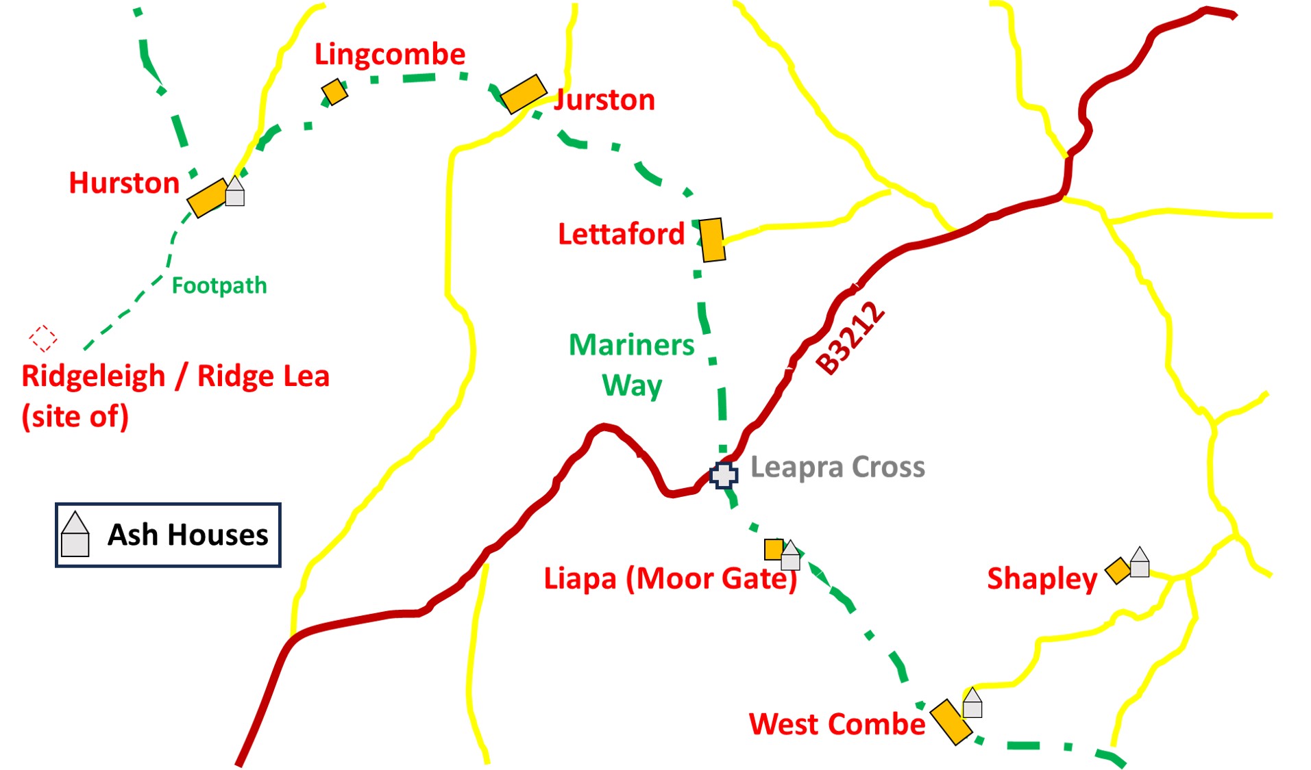
Farmsteads and Ash Houses on (or close to) ‘The Mariners Way’
There are some fabulous Dartmoor farmsteads located on the route of the central part of an old Dartmoor trackway known as the Mariner’s Way. This old trackway ran from Bideford to Dartmouth and it is said the route was used by sailors who would be changing ships between the two ports, a journey of some 70 miles. The track is believed to be centuries old, possibly from at least 17th or 18th century (based on Gidleigh and South Tawton Churchwardens accounts where sailors were given charitable donations as recorded in ‘Walking Dartmoor’s Ancient Tracks’ by Eric Hemery (page 22)).
That said, the Tudor shipbuilding industry which flourished at Bideford where crews were needed to be recruited may date the track as early as the 16th century. Further evidence of this is that William Crossing states that rest-houses occurred at intervals. To support Crossing’s statement is that it is speculated that the ancient house at West Coombe was one such rest-house / hostel.
Today, some sections of the Mariner’s Way at this central part shares its route with one of the ‘optional’ routes of the more modern “Two Moors Way”, which was officially opened in May 1976. The farmsteads in this area included Longhouses, Barns, Outbuildings and Ash Houses, many of which are either thatched or turfed. This post covers a route, largely following the Mariners Way and starts on the edge of Hurston Ridge (at Ridgeleigh / Ridge Lea, an old farmstead) and finishes at Shapley. This was part of a linear walk the author took from the Warren House Inn through to North Bovey, a delightful 9 miles.
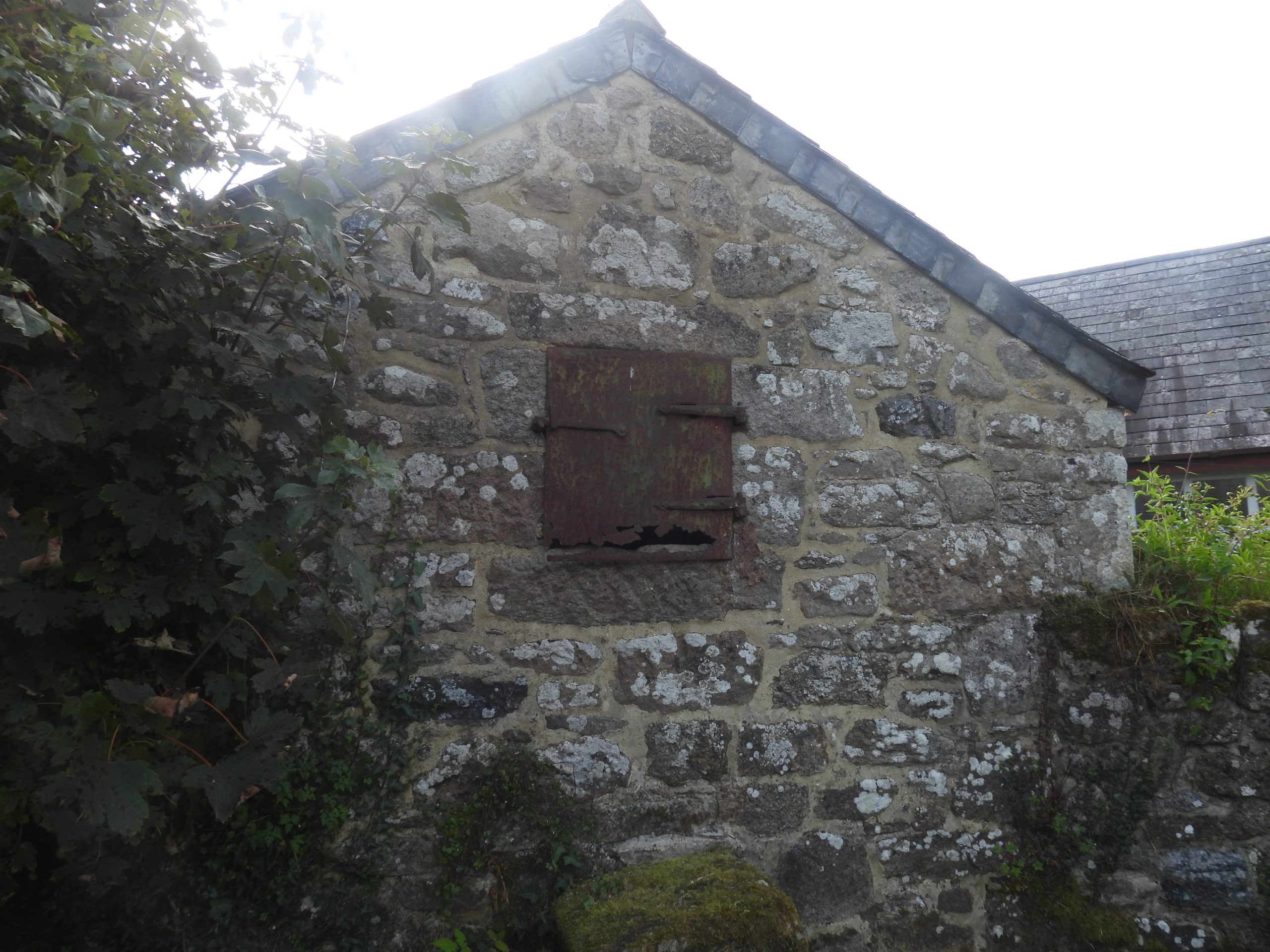
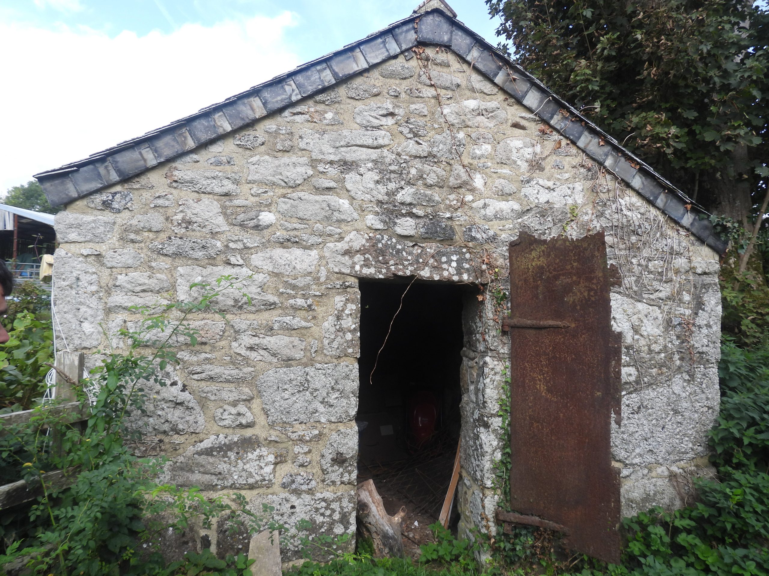
Of particular interest in the post are four Ash Houses which are likely to date from the 18th century. Ash Houses had two functions; firstly to provide a safe place for the old embers from the farm house fire to be placed and secondly for a storage place for accumulated ash together with vegetable waste so it could late be used as a fertiliser.
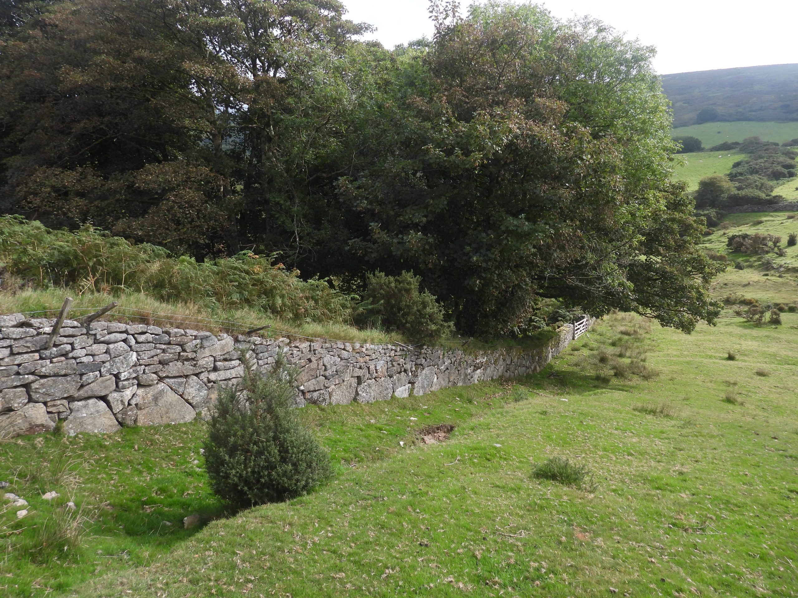
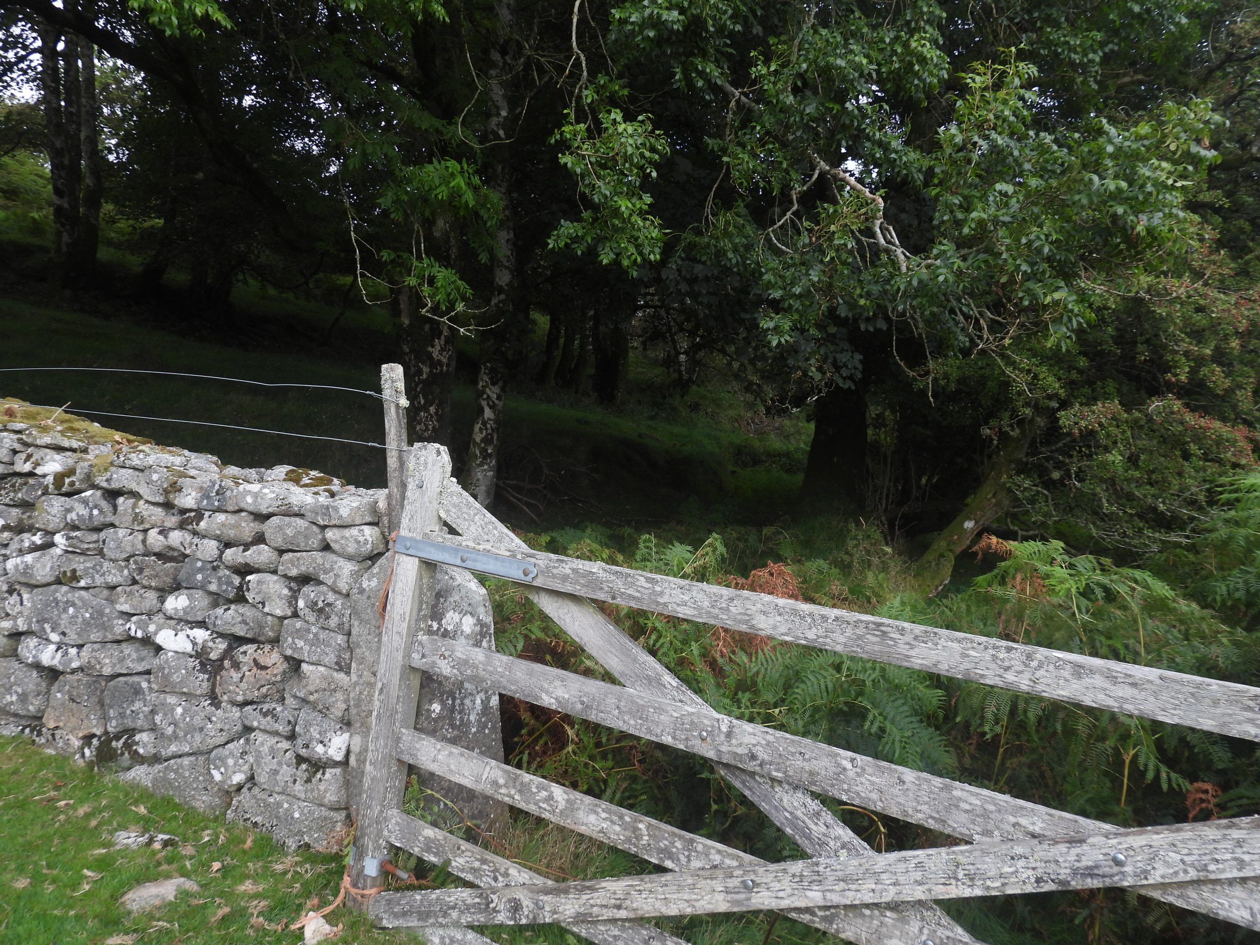
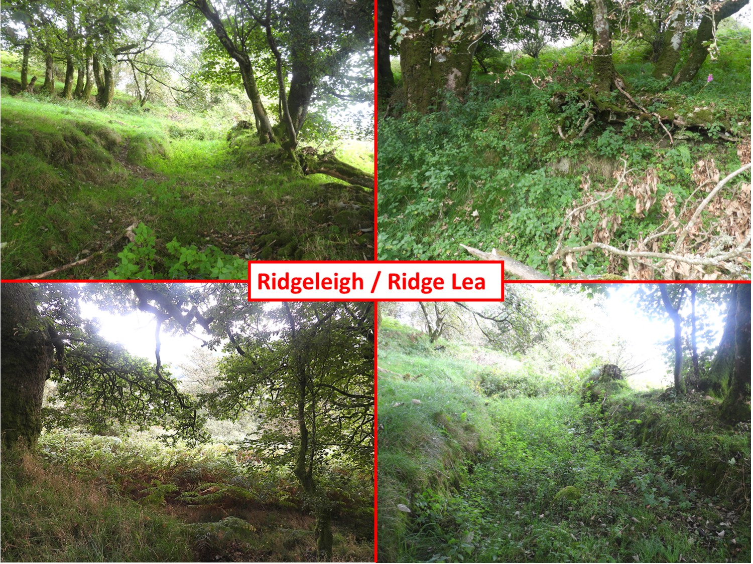
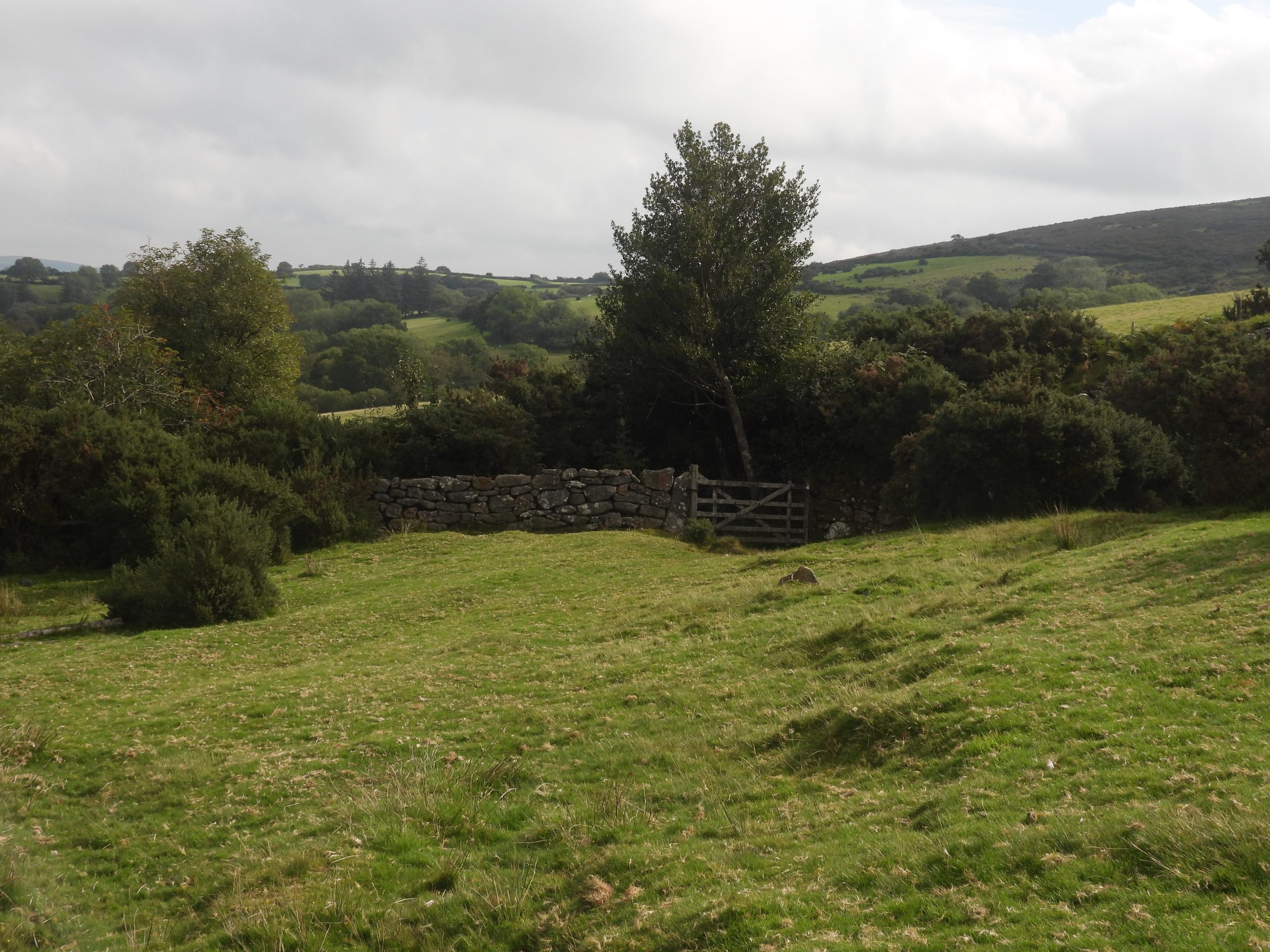
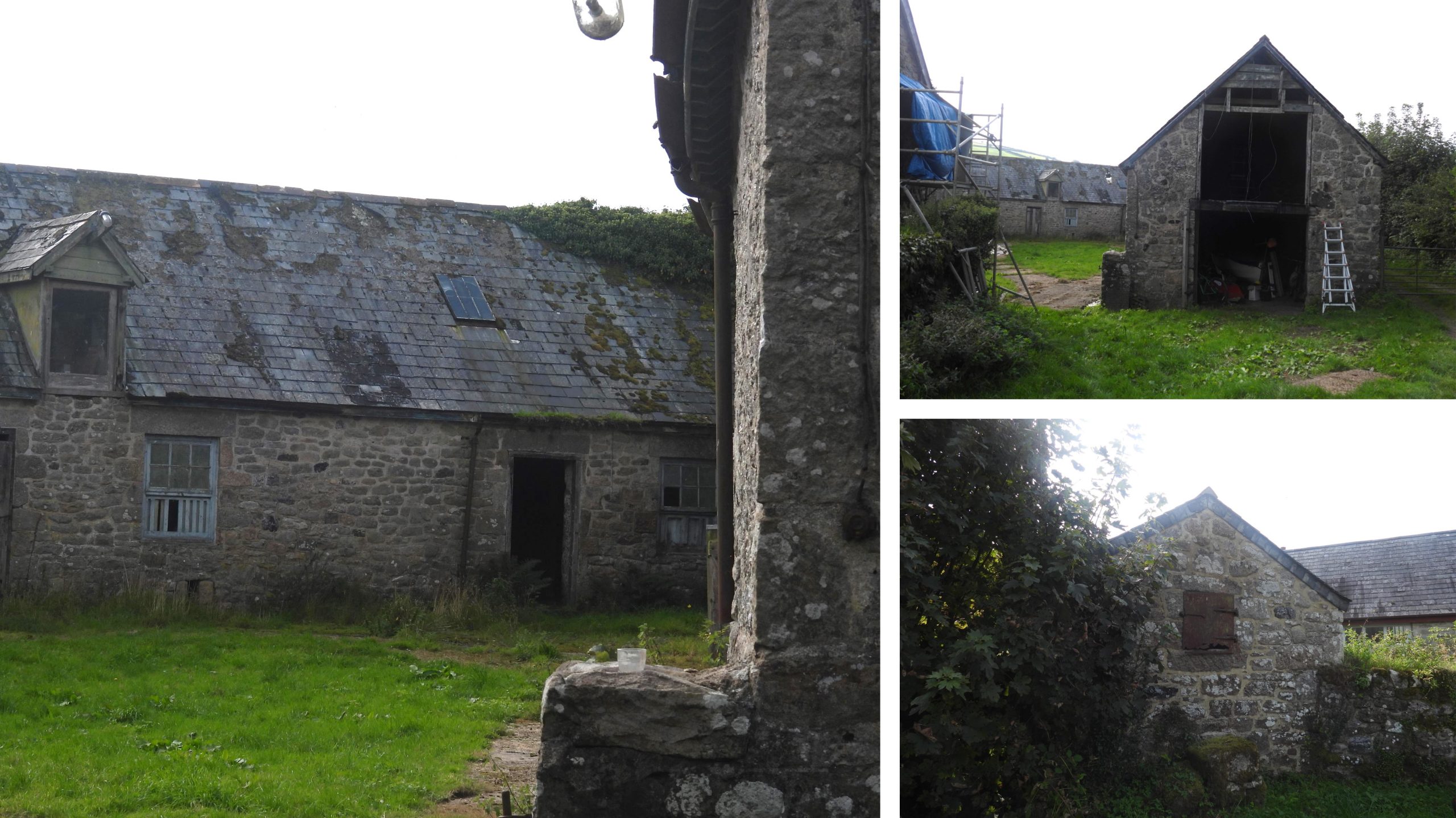
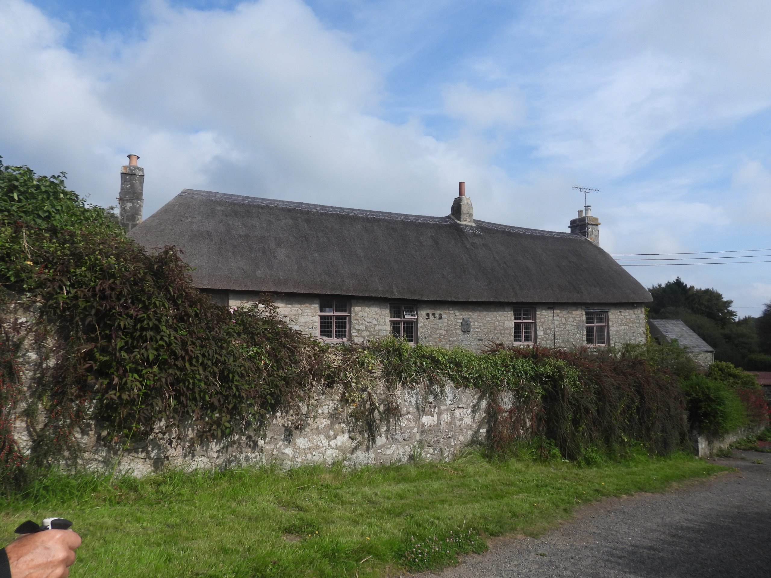
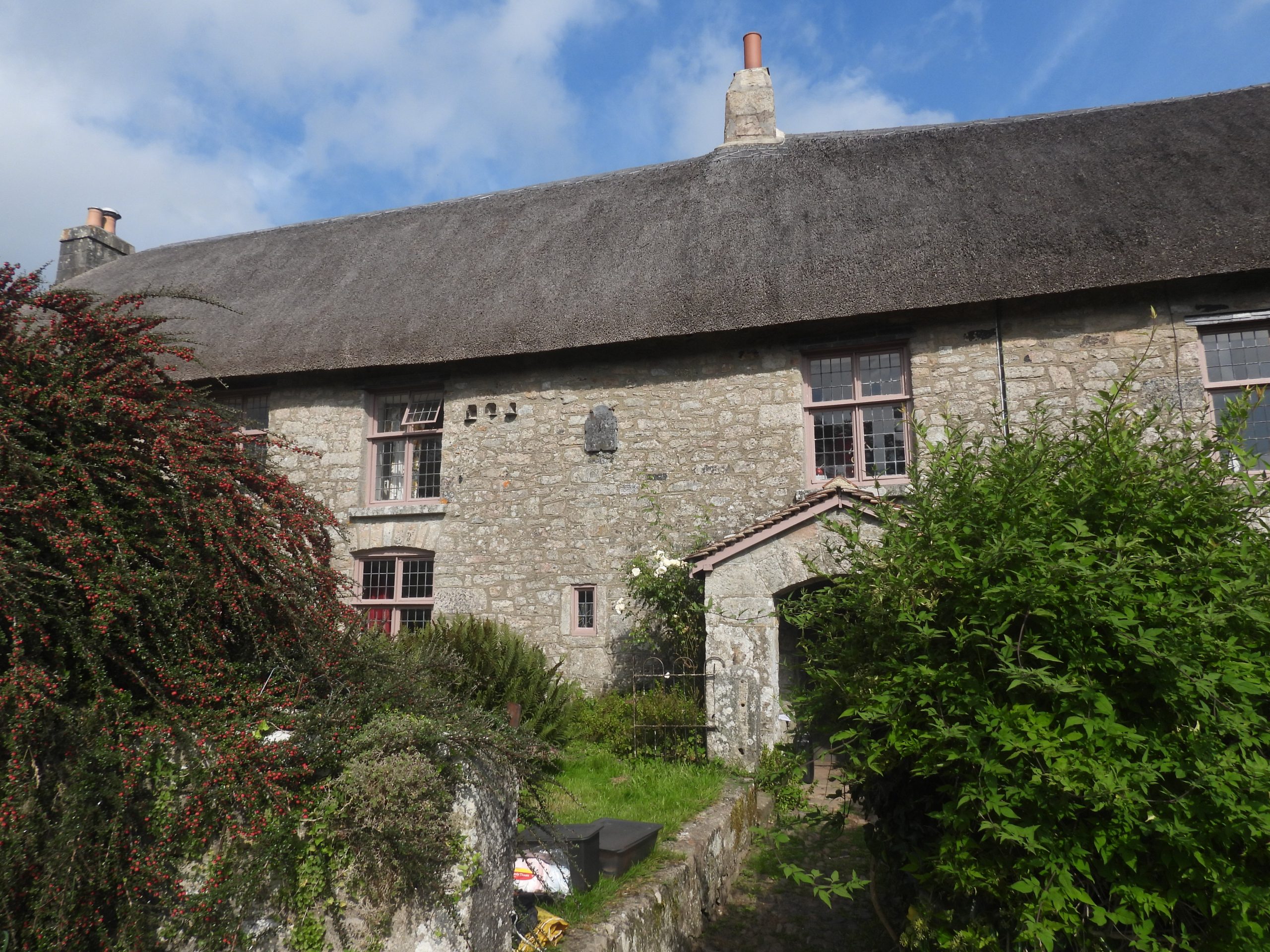
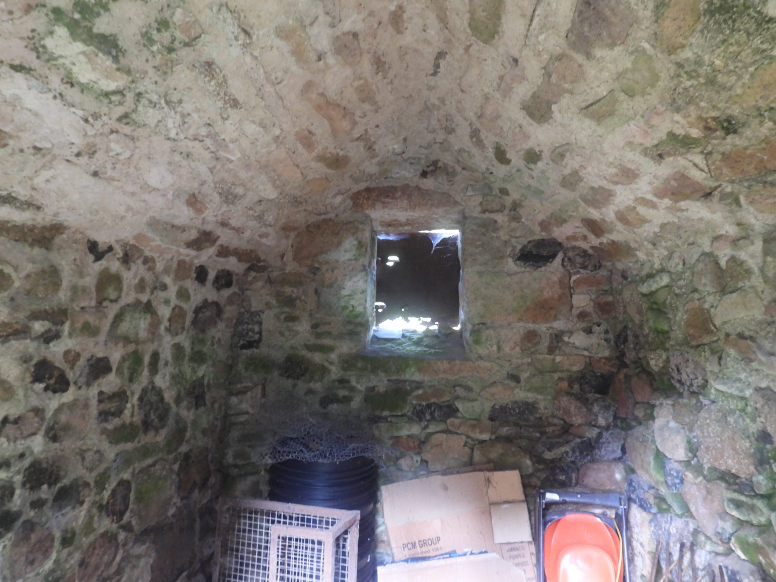
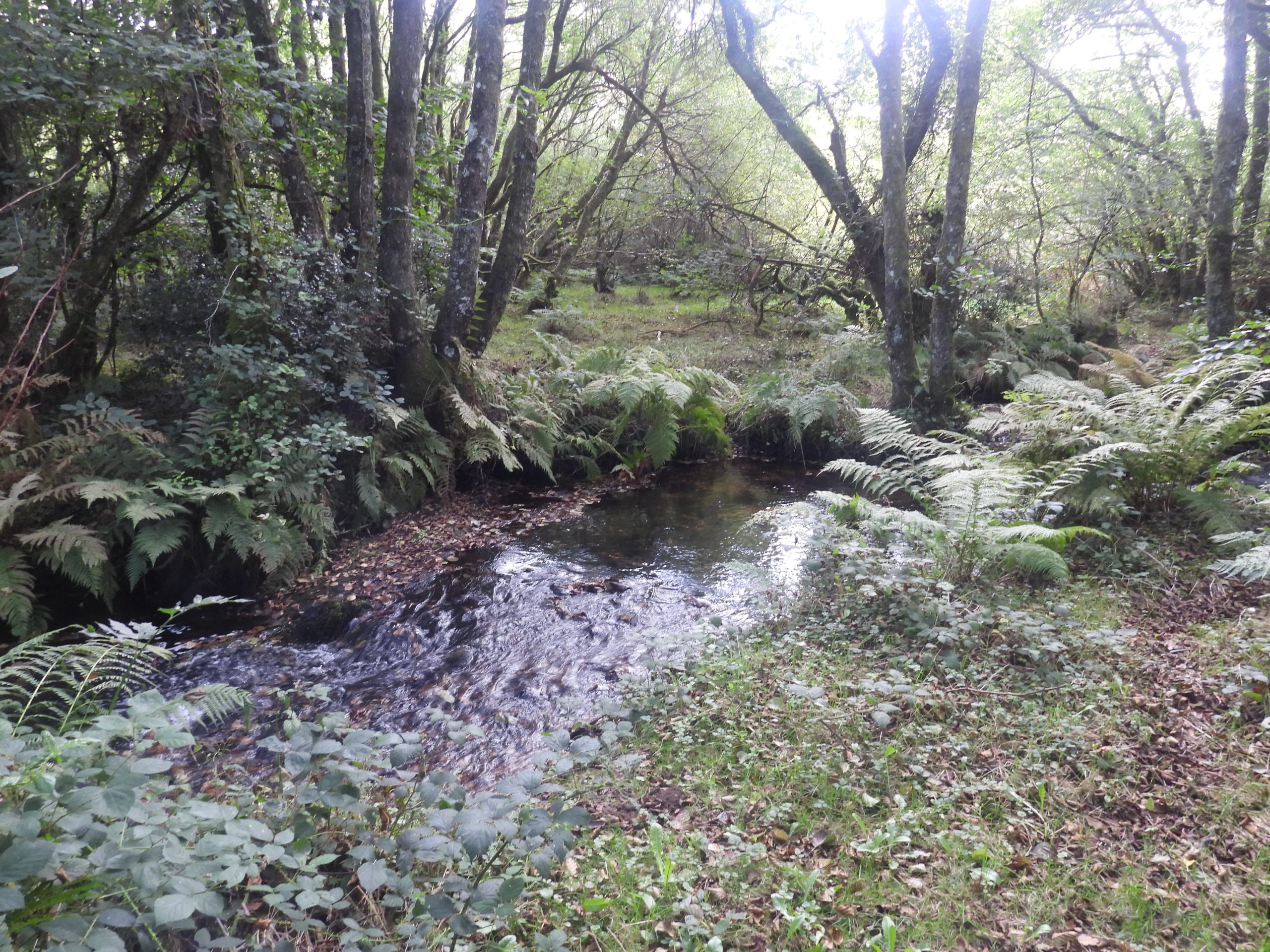
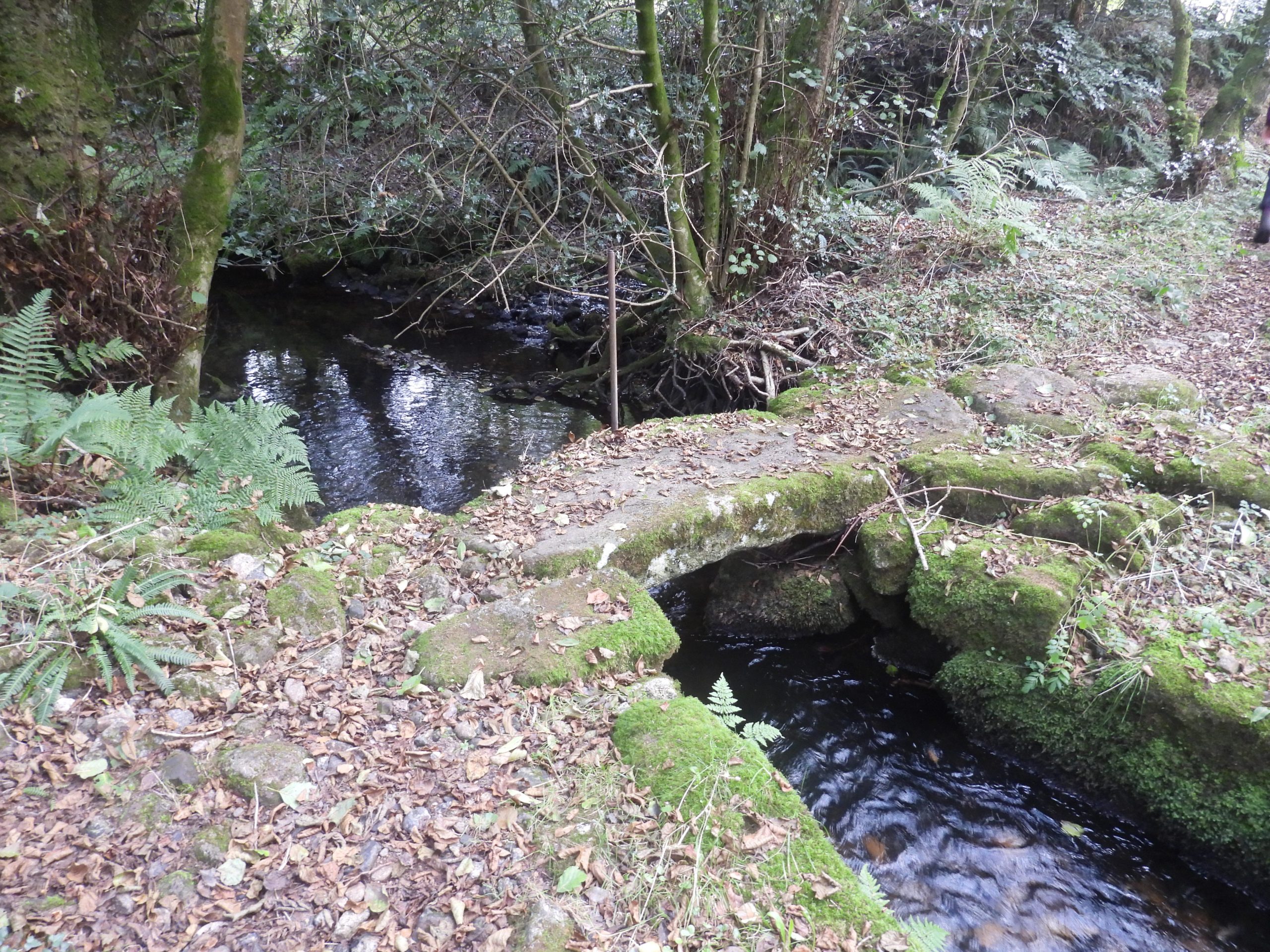
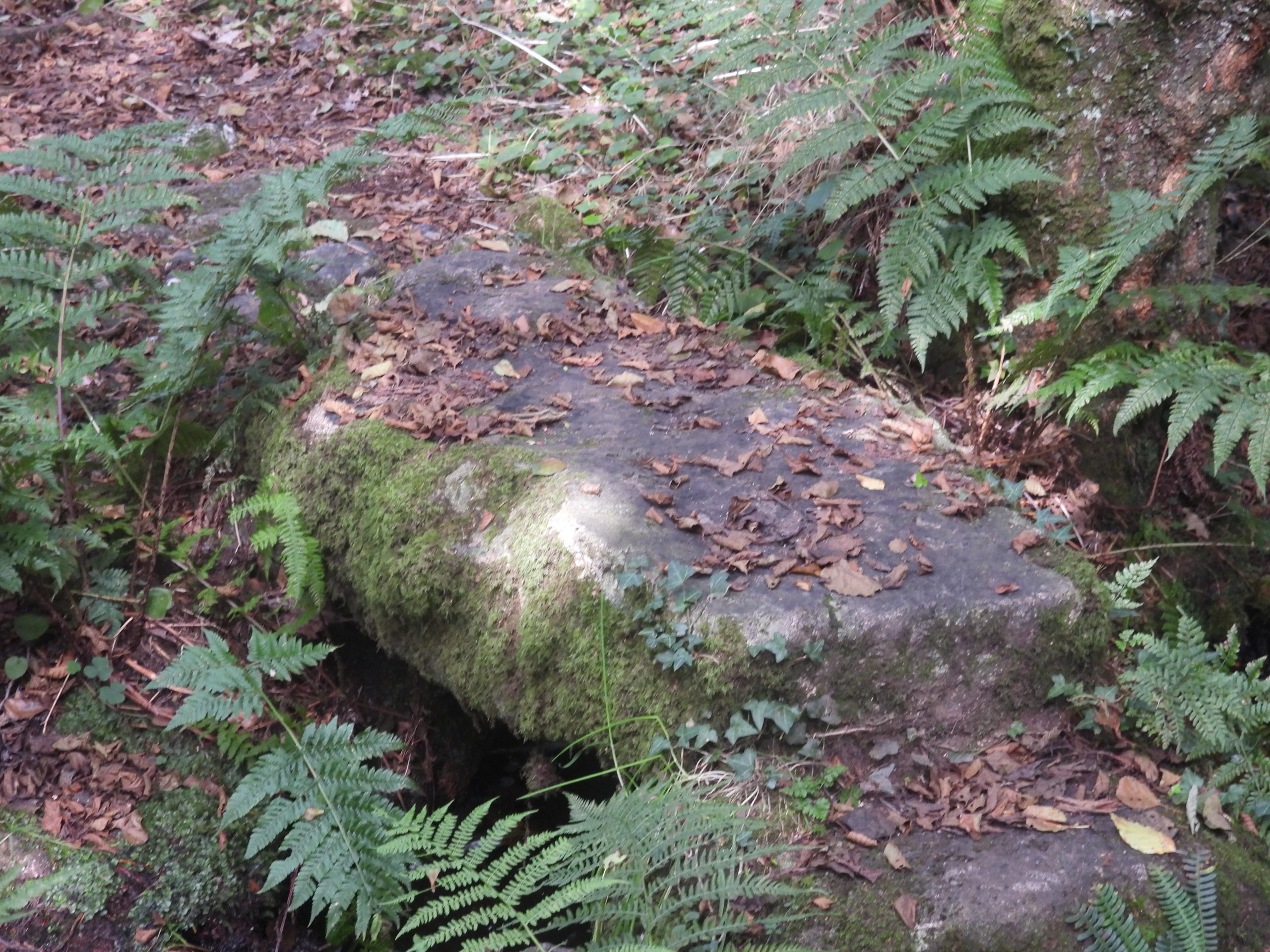
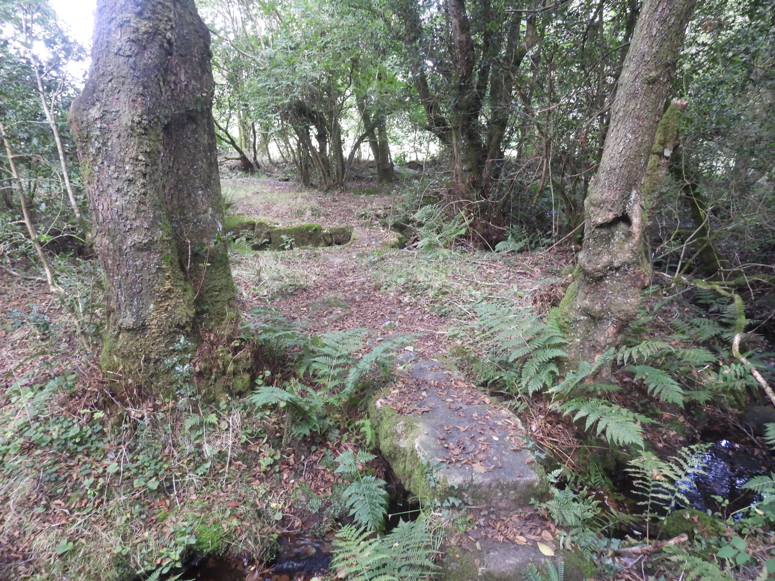
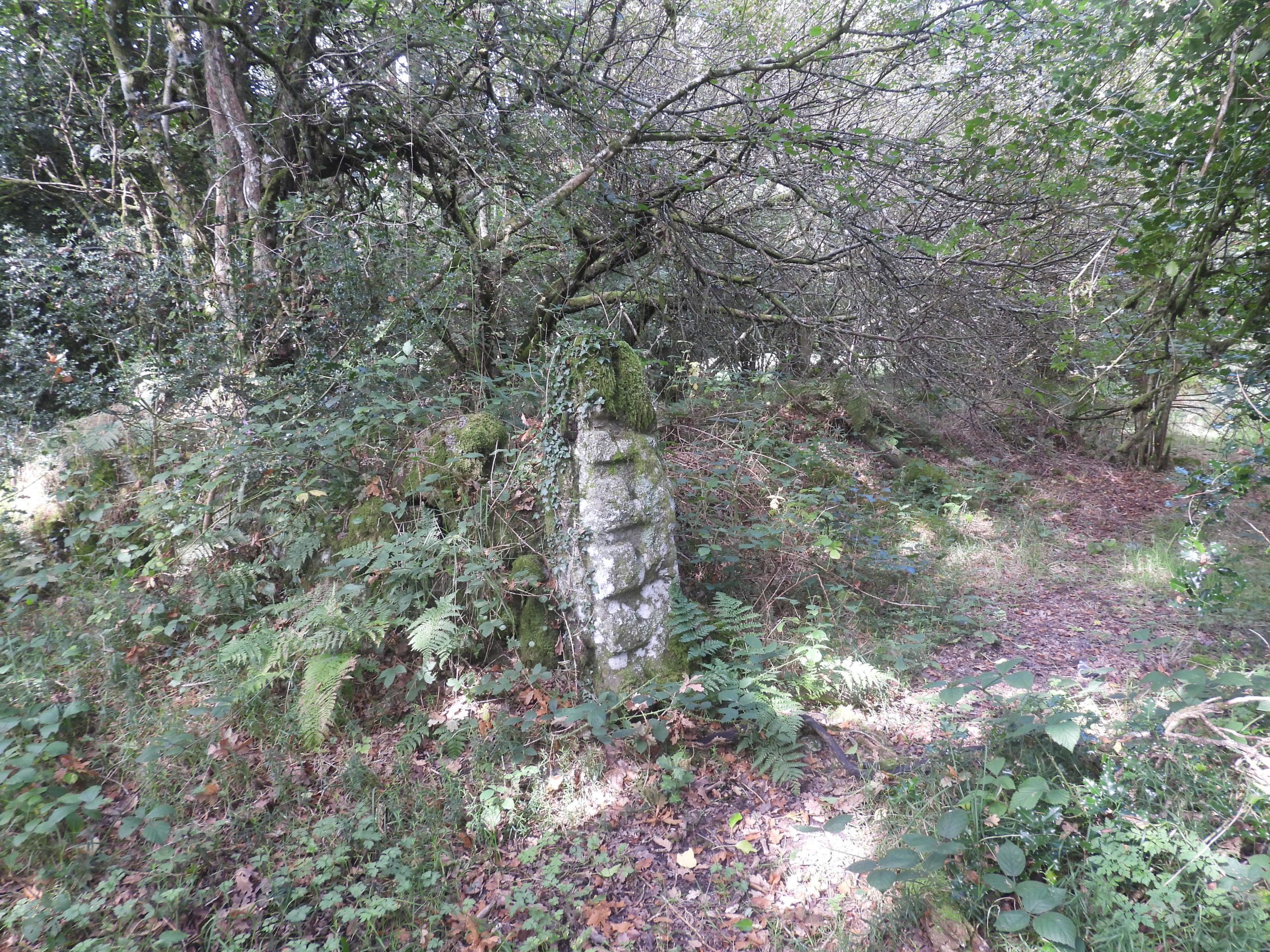
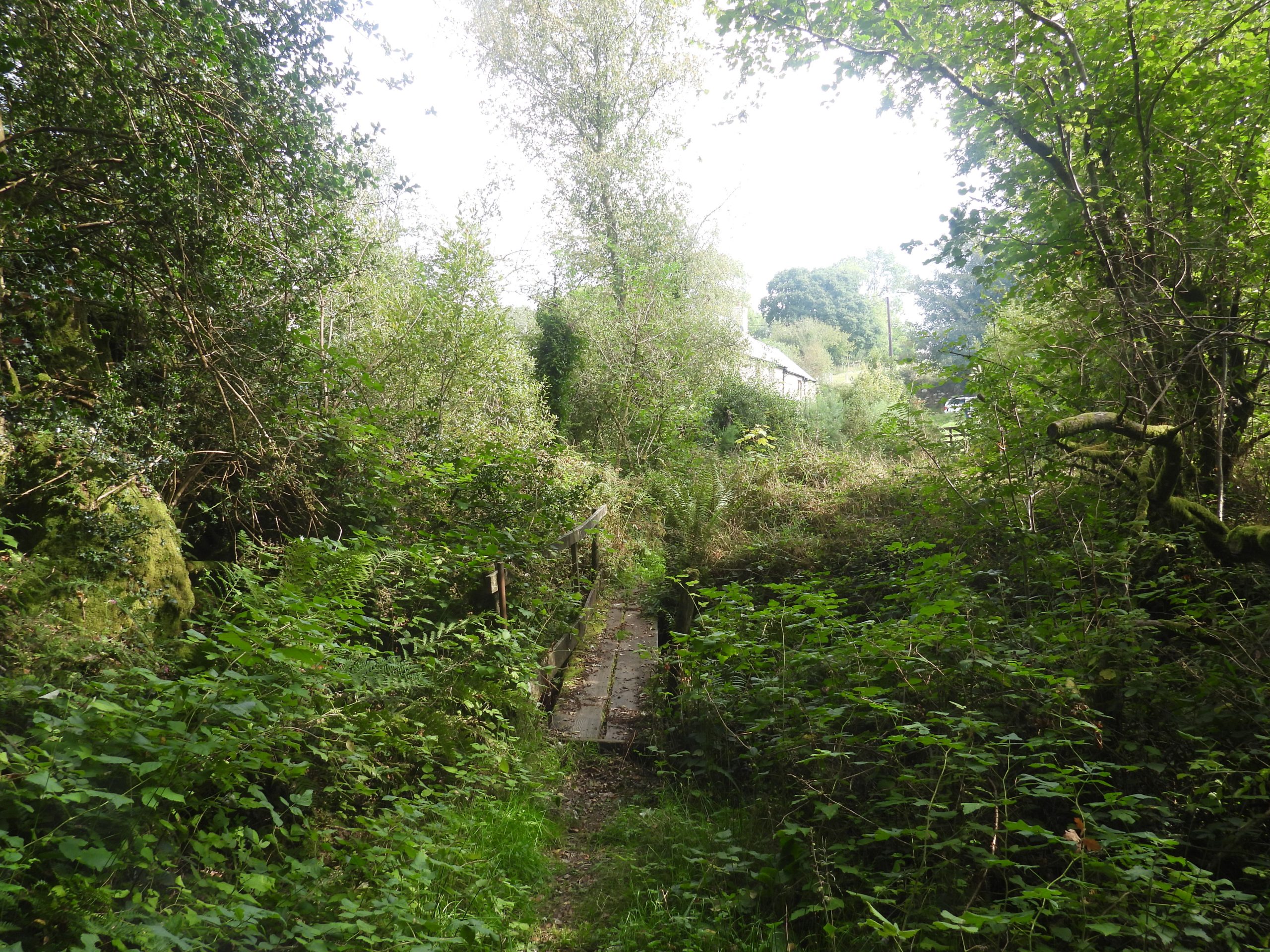
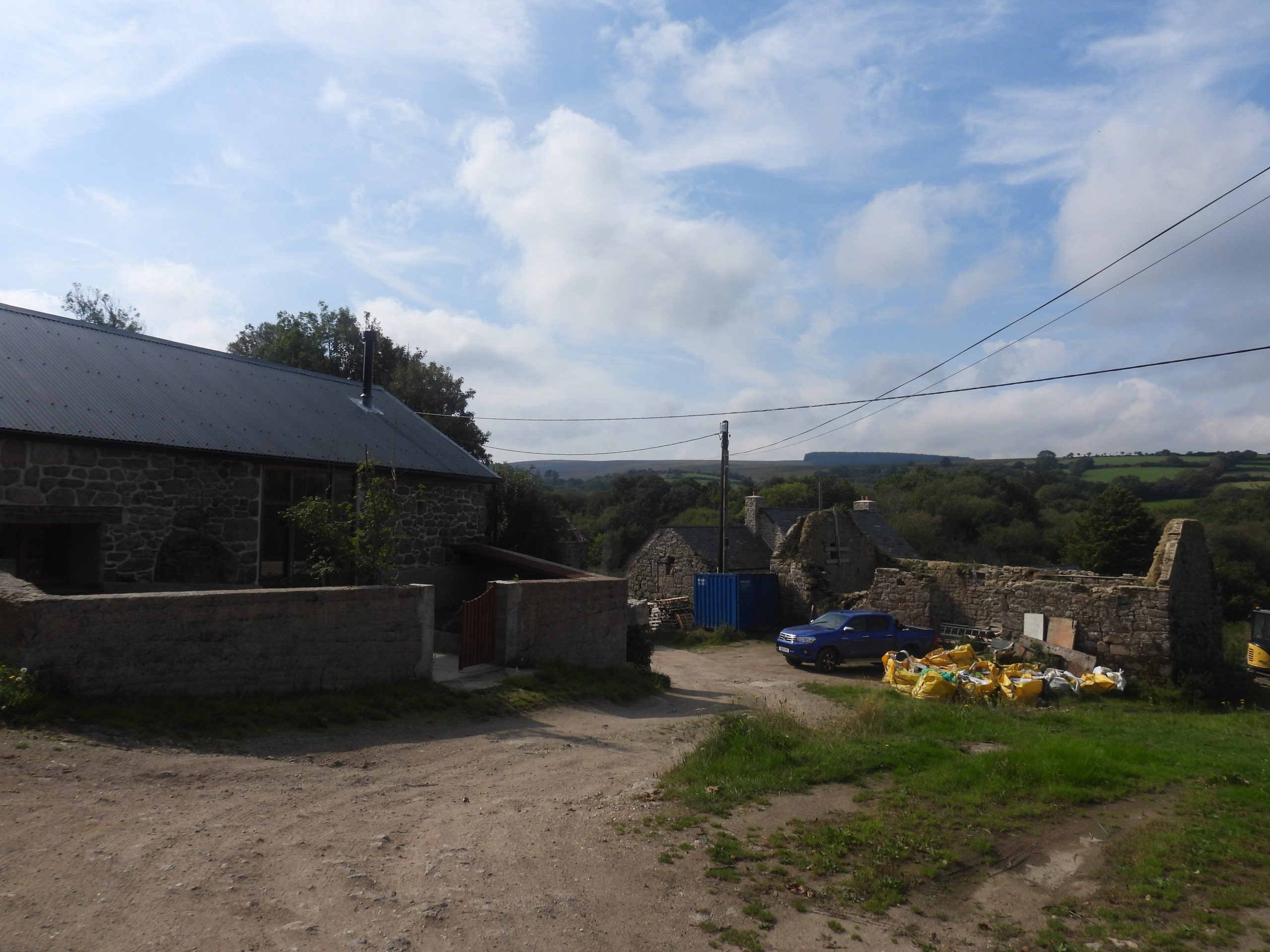
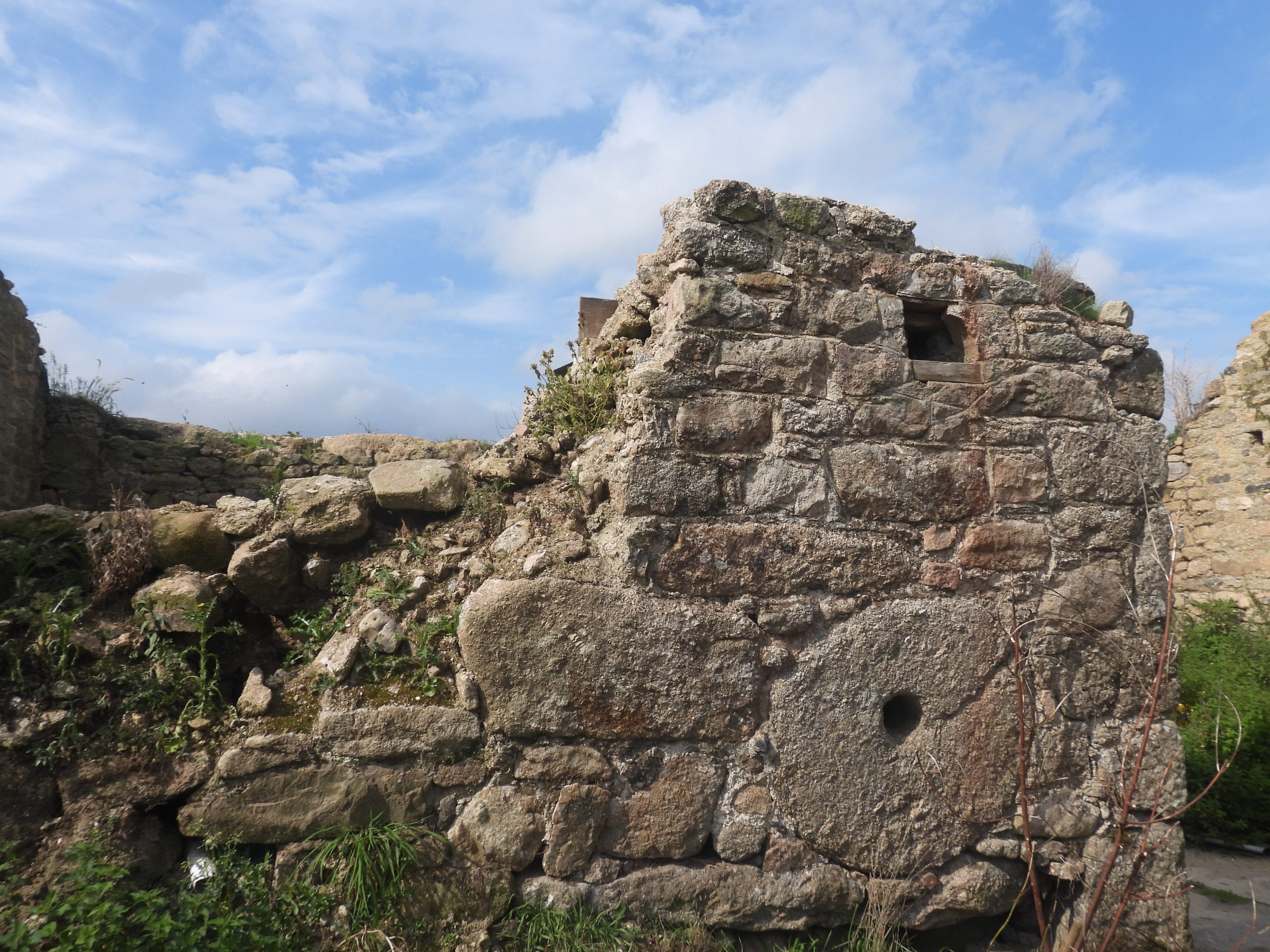
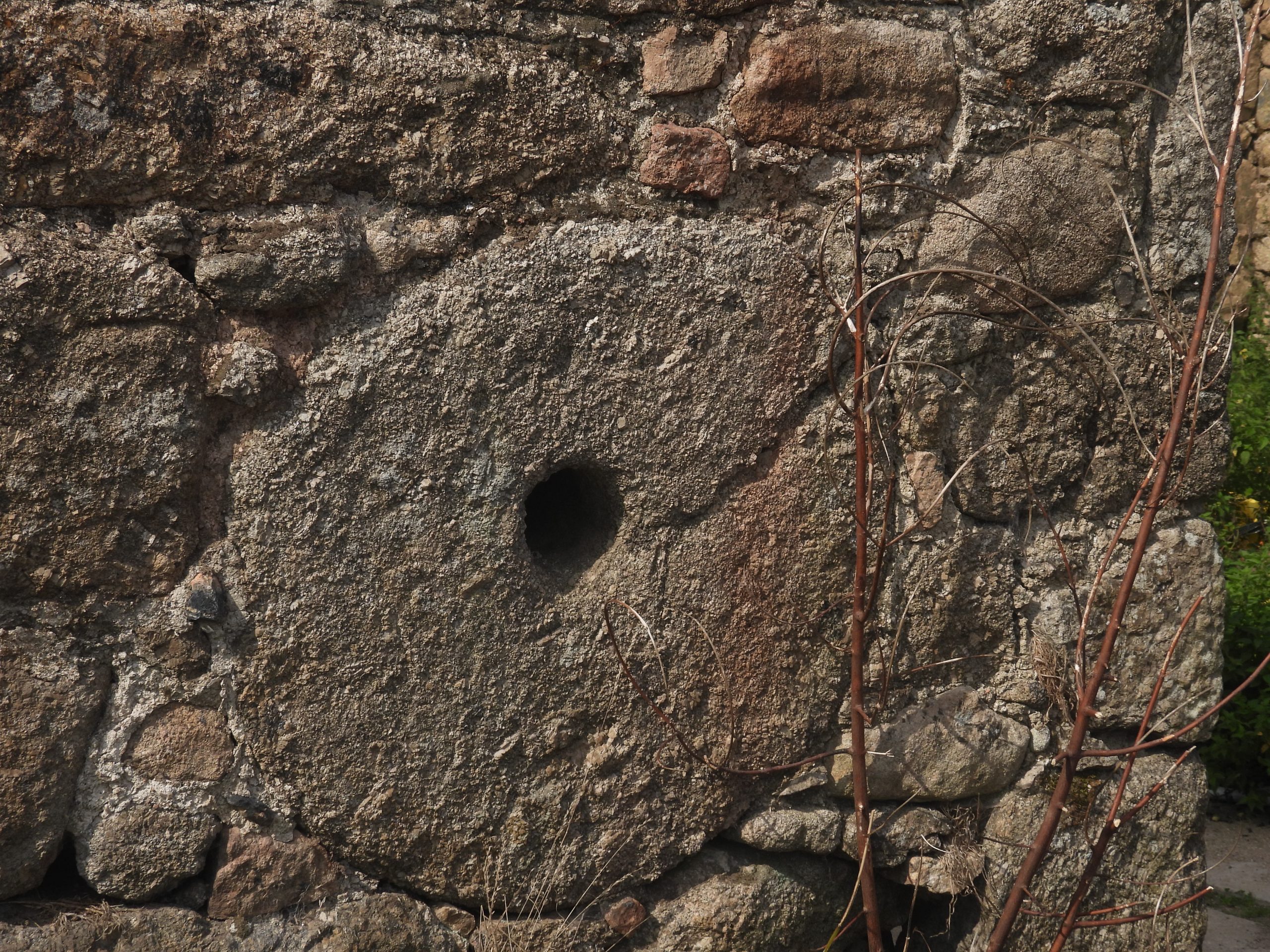
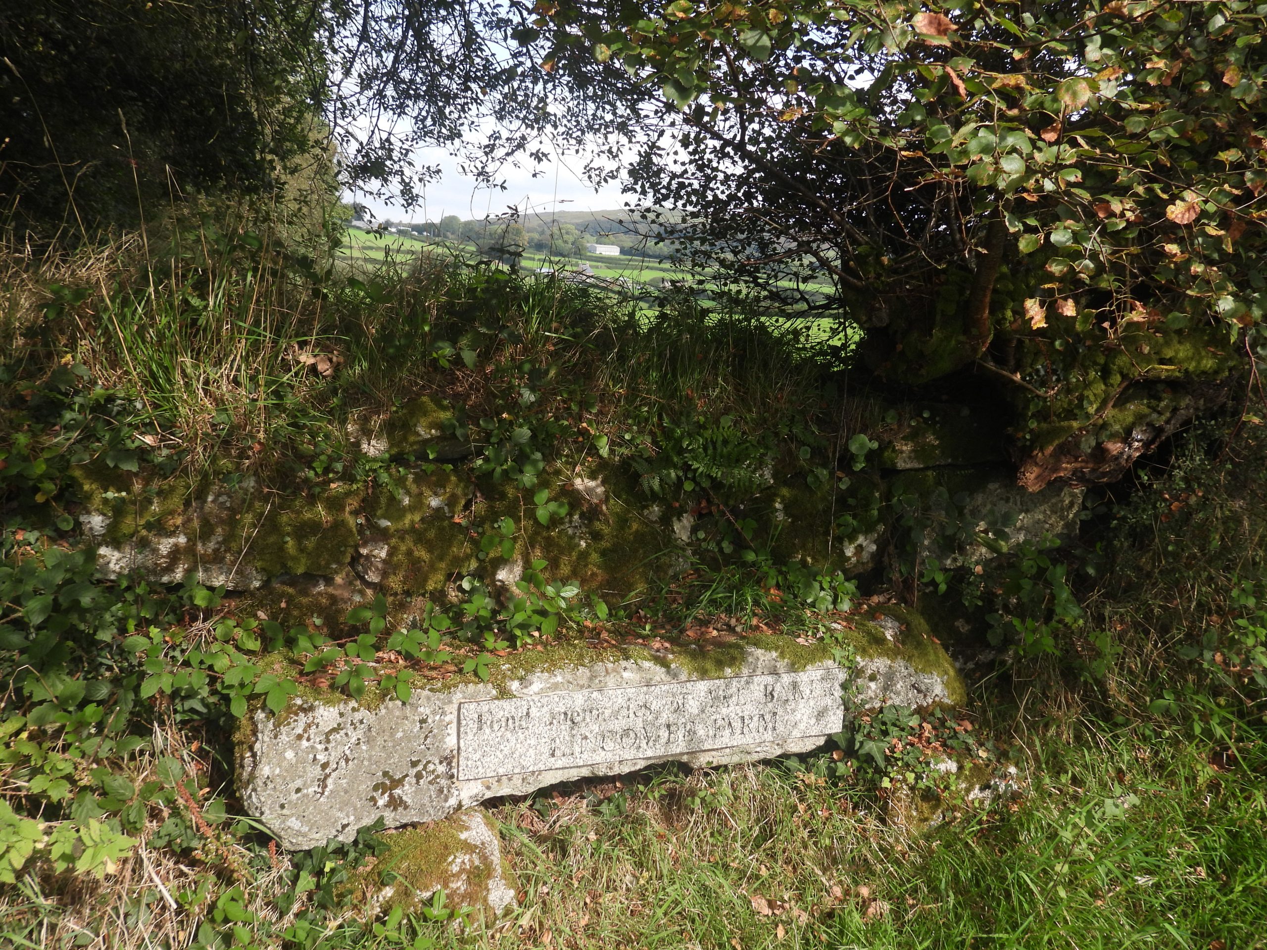
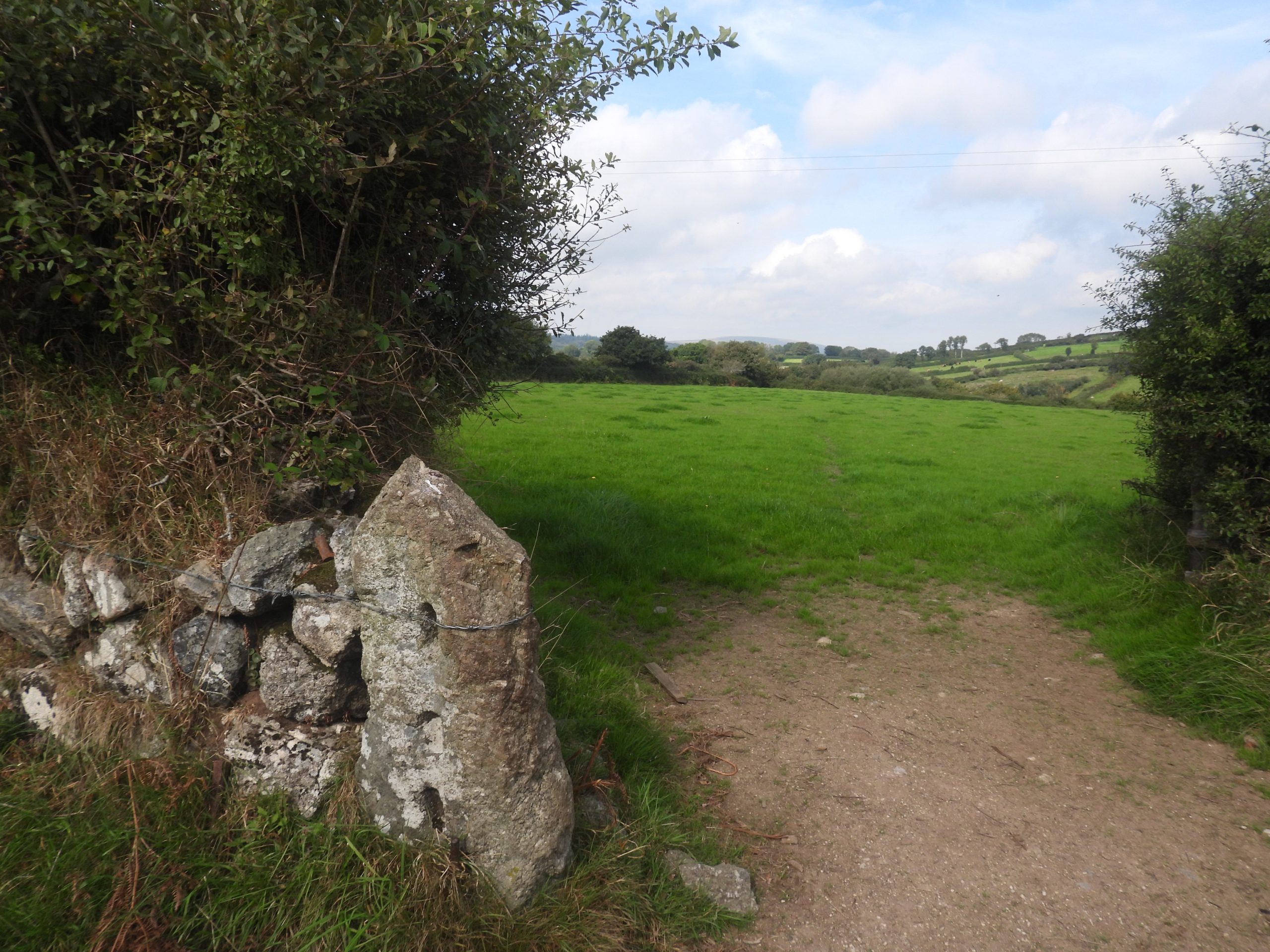
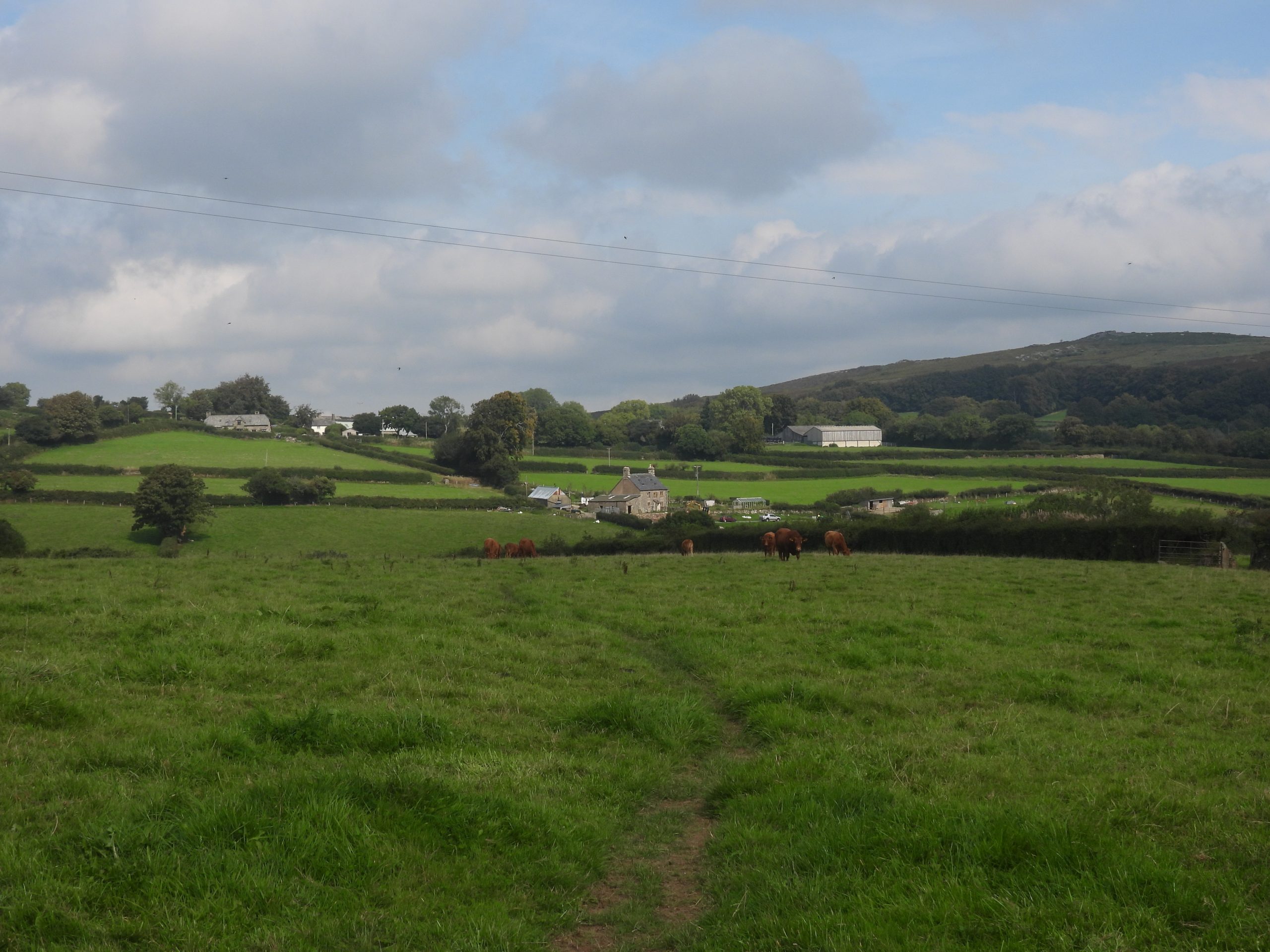
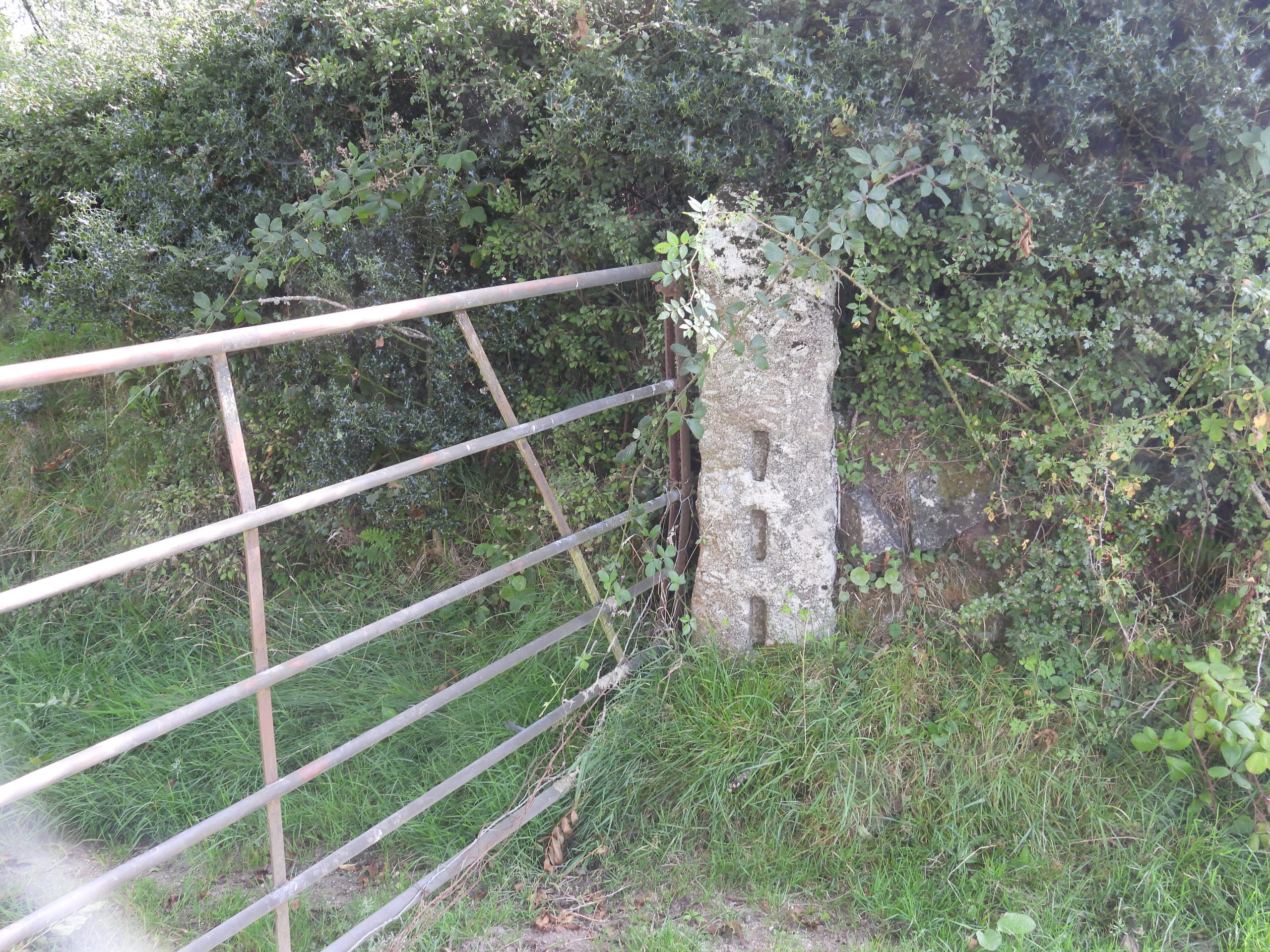
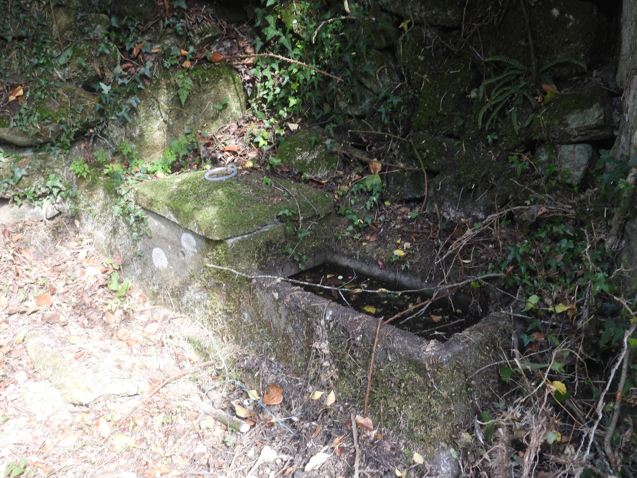
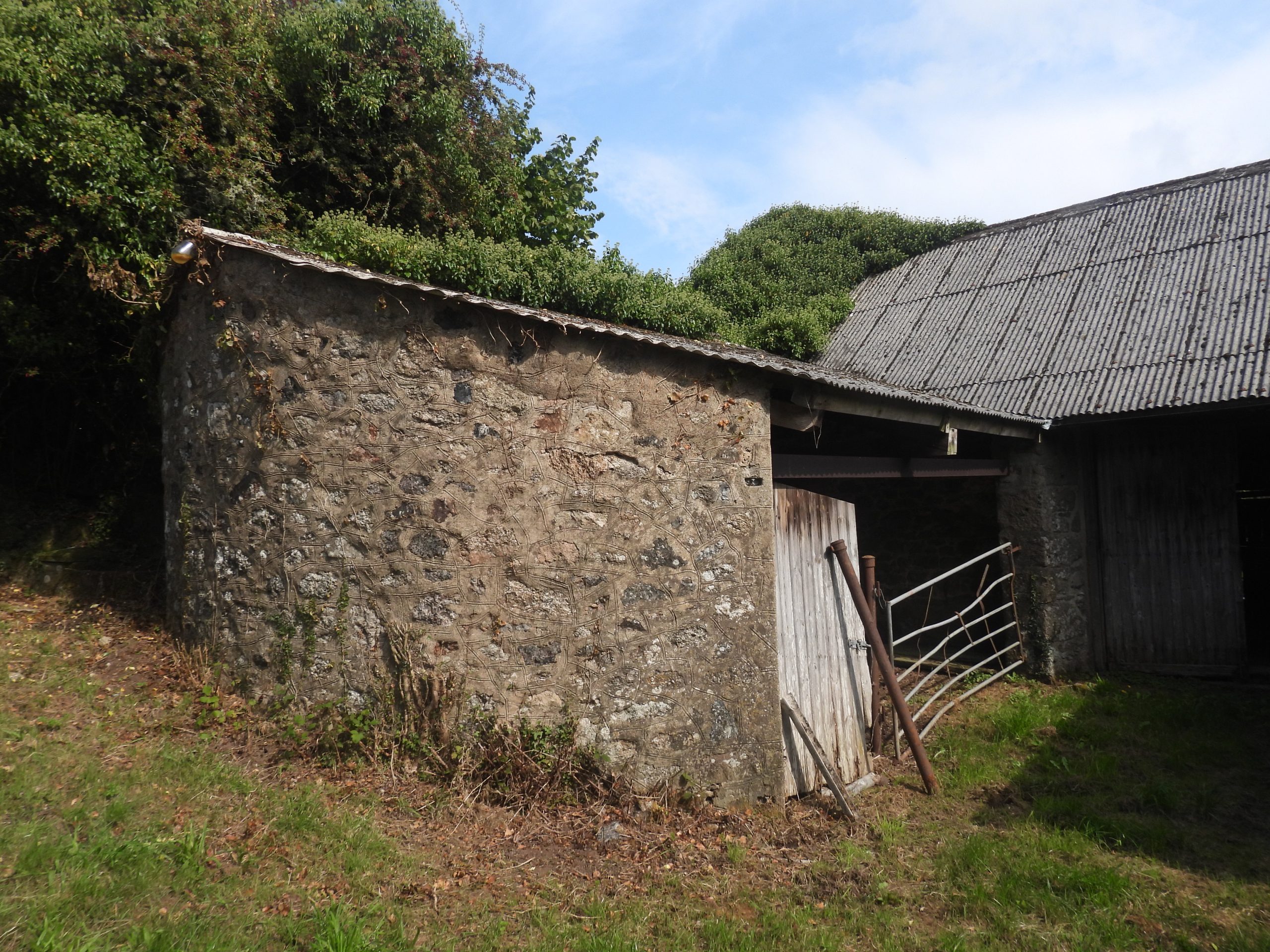
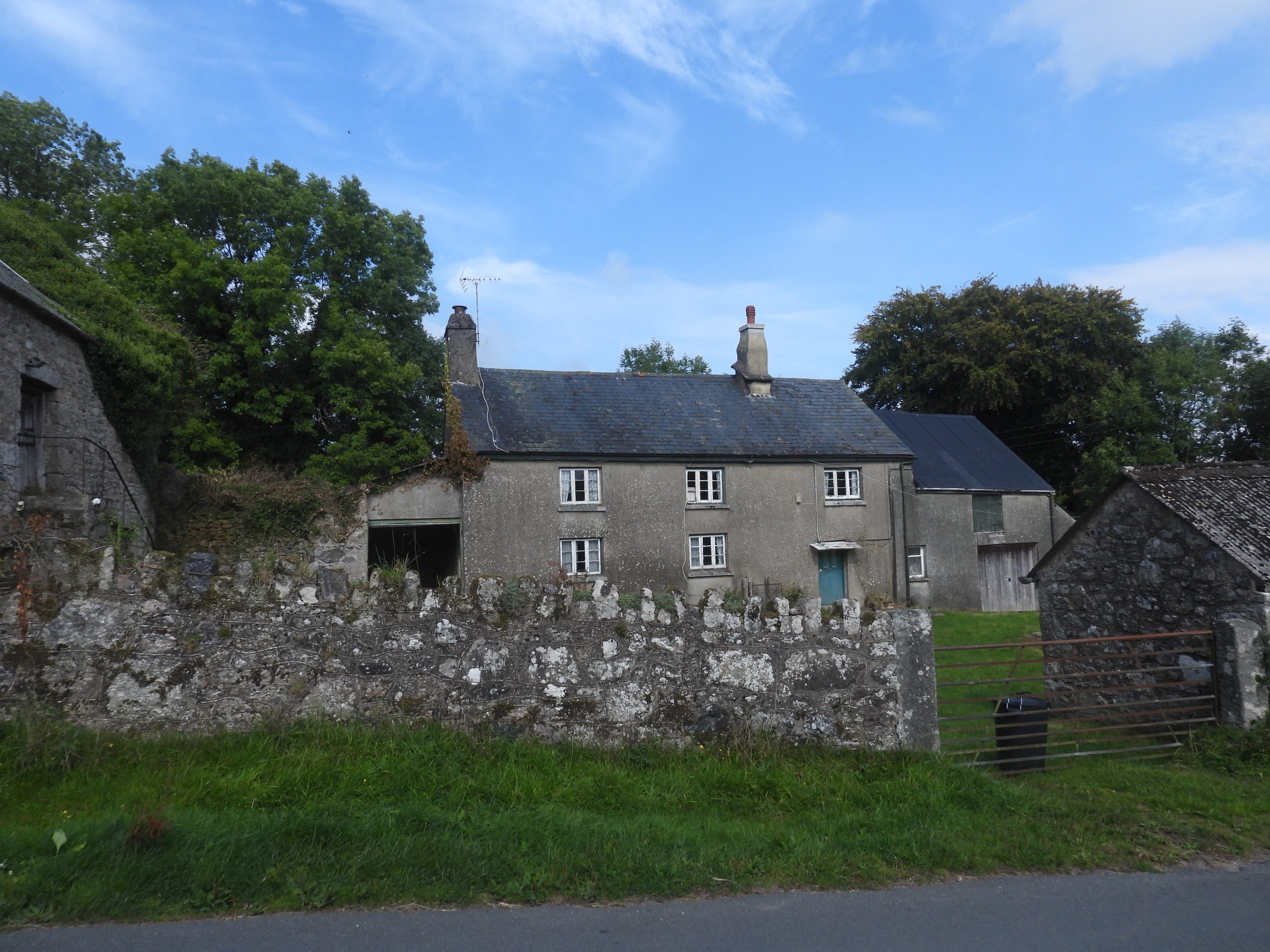
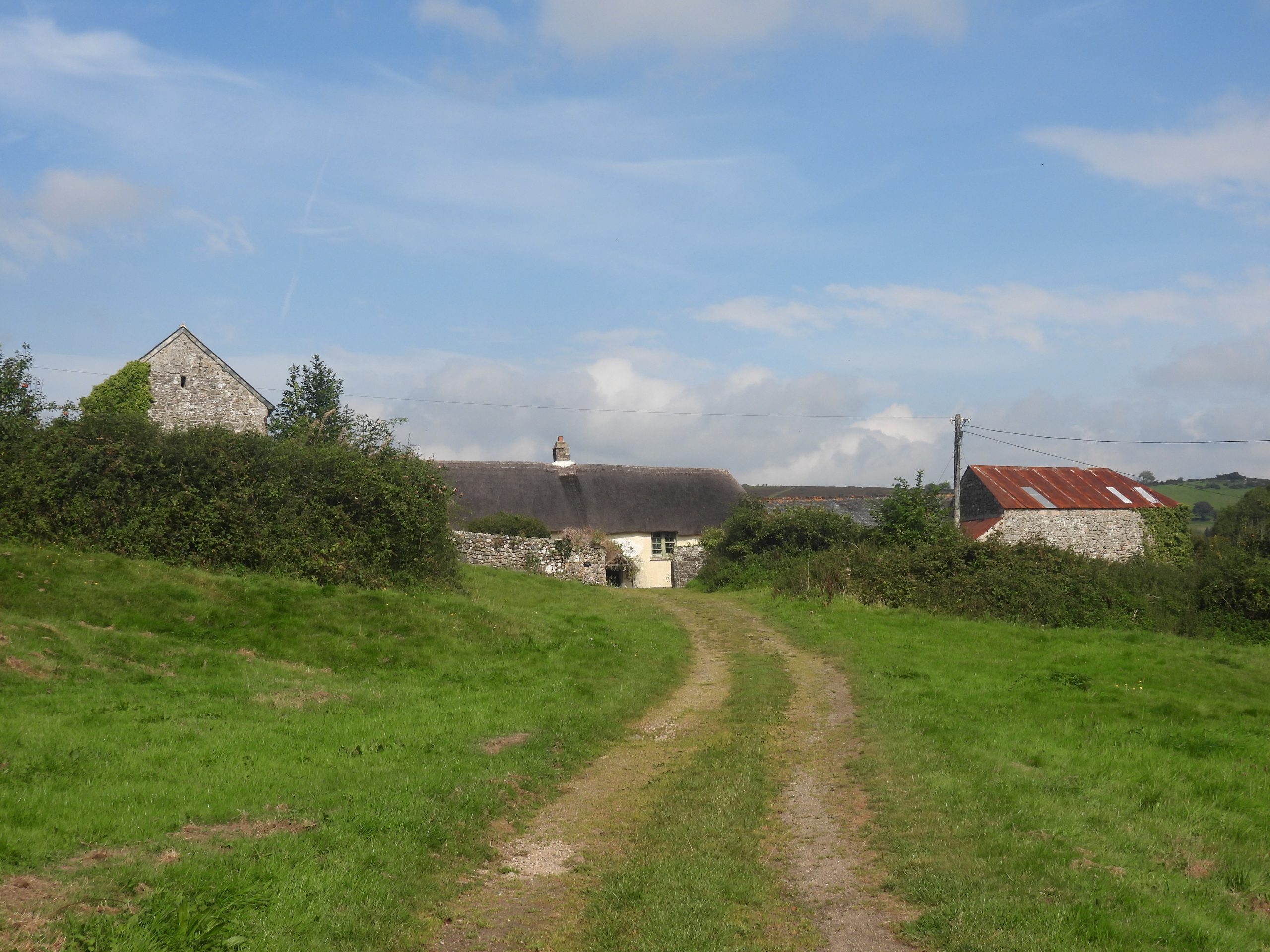
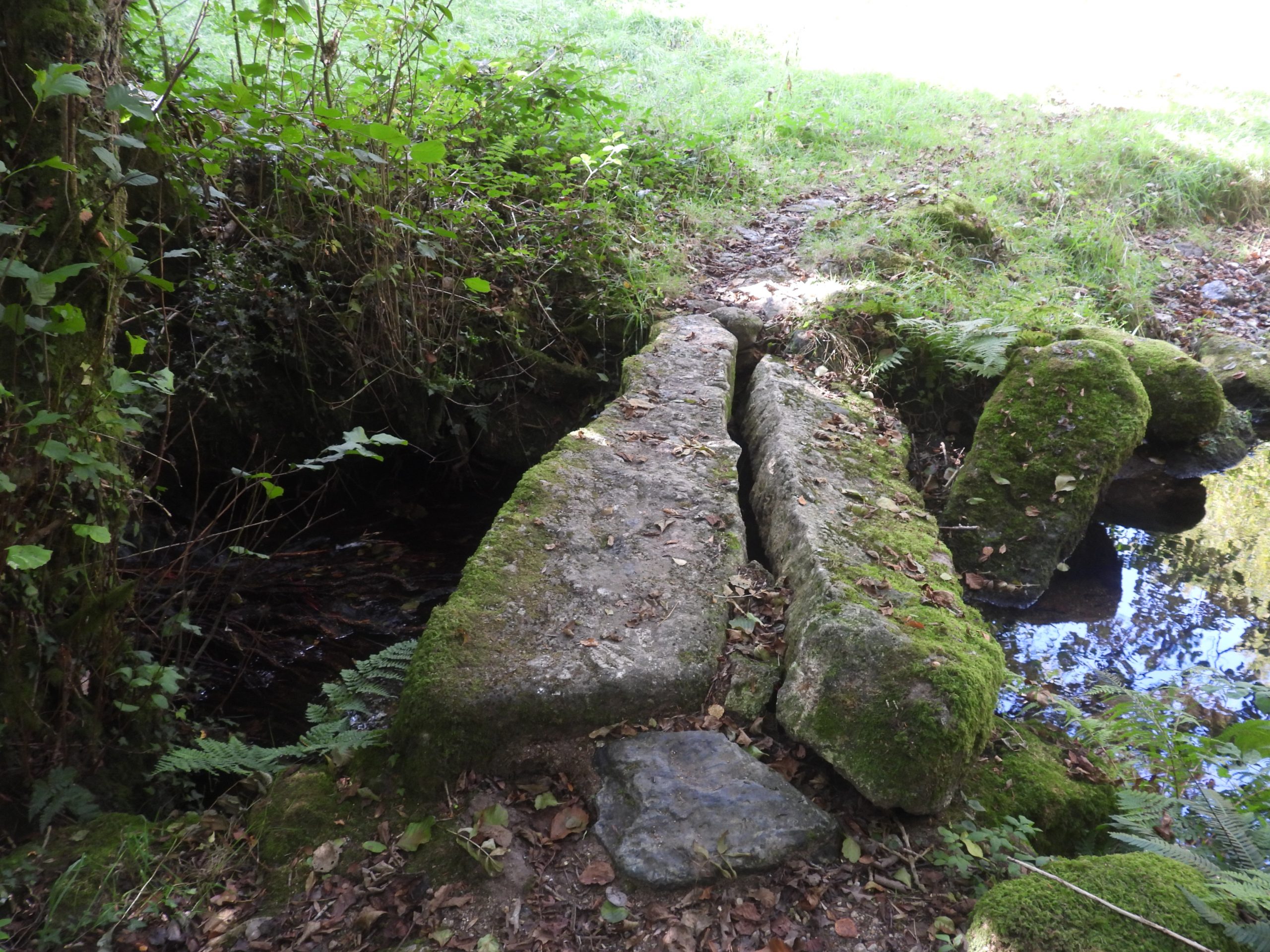
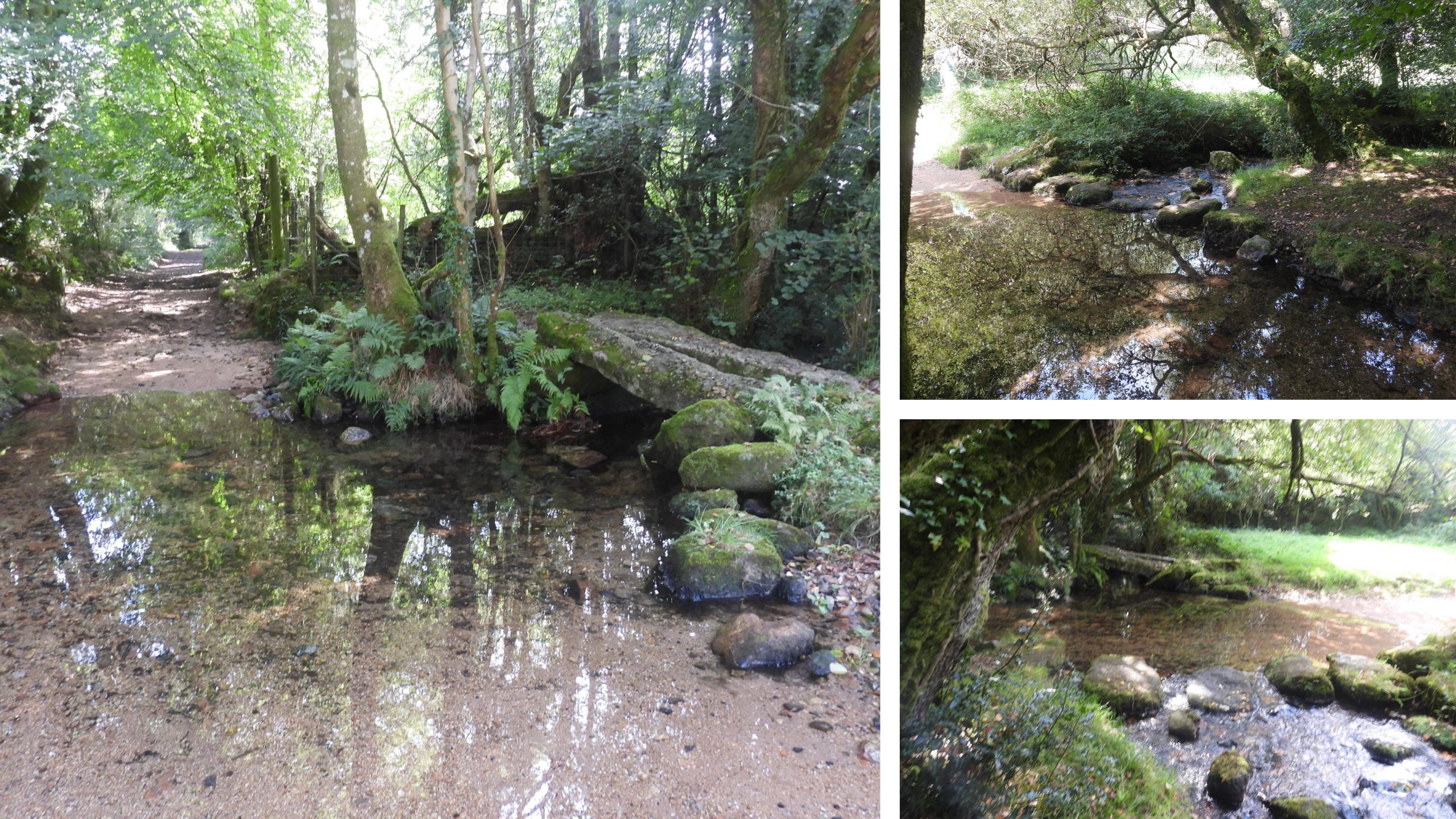
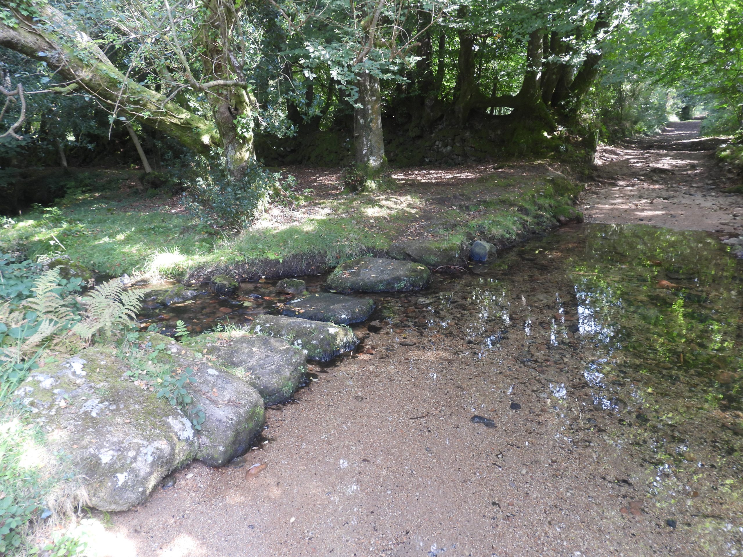
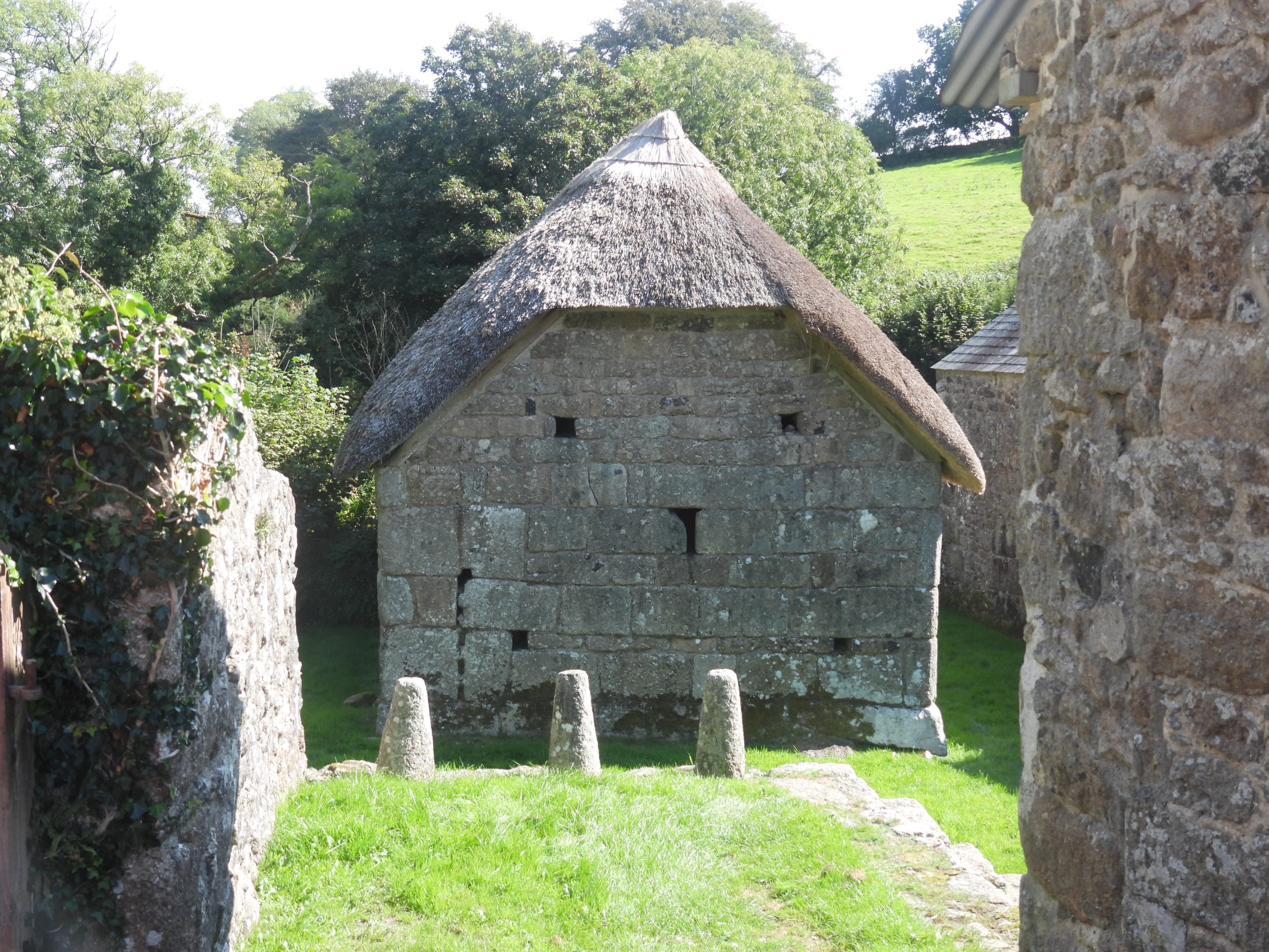
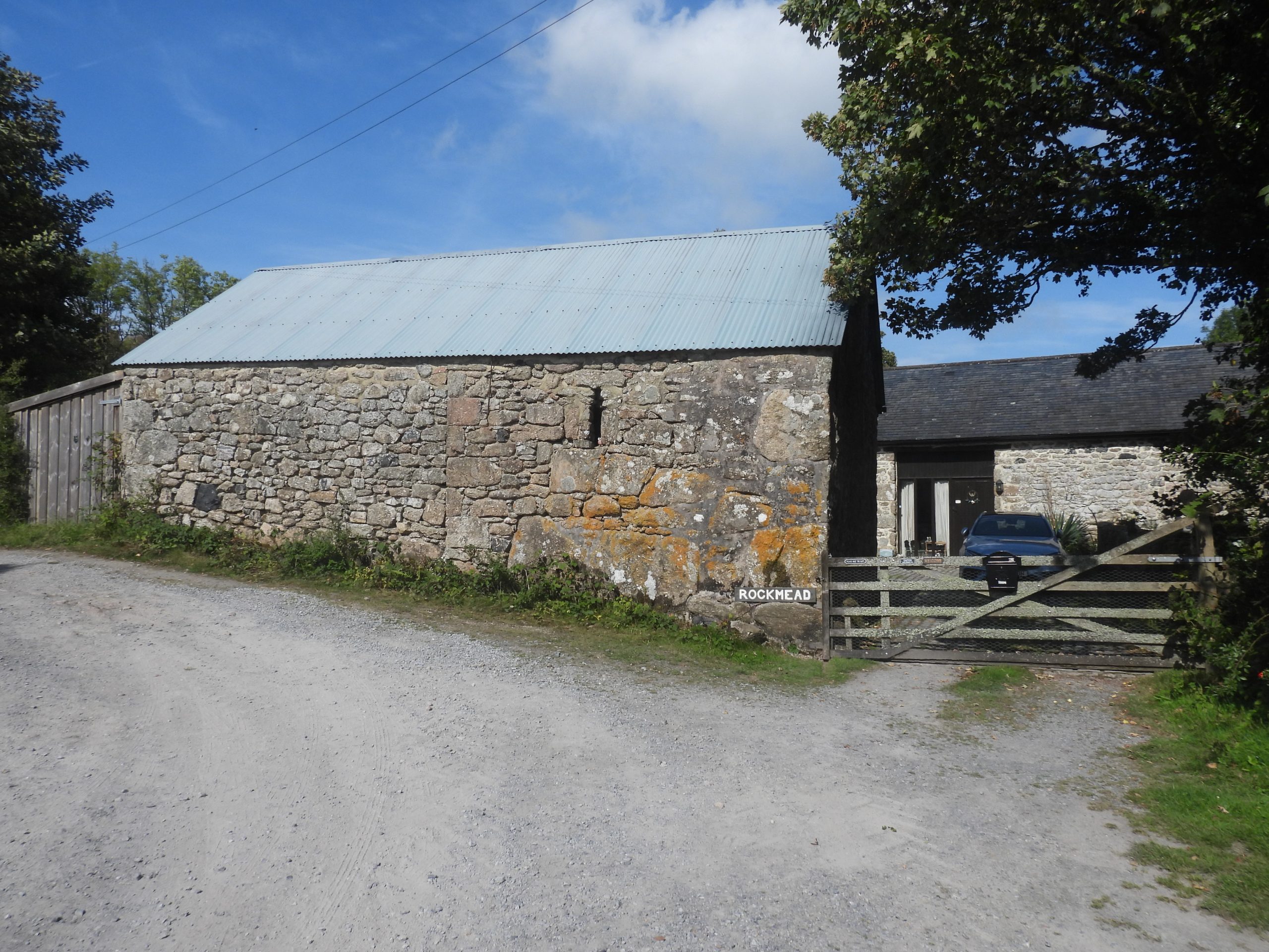
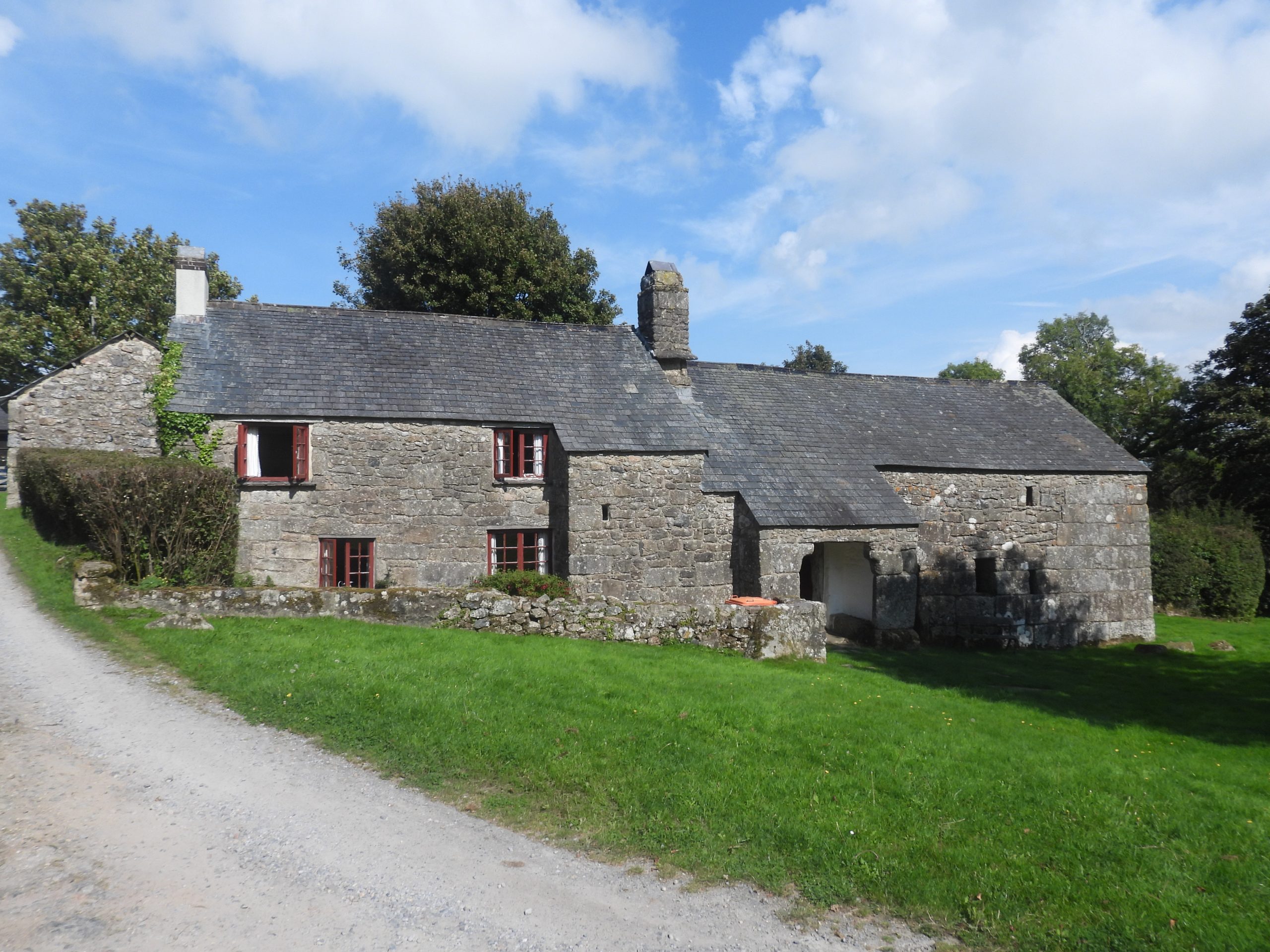
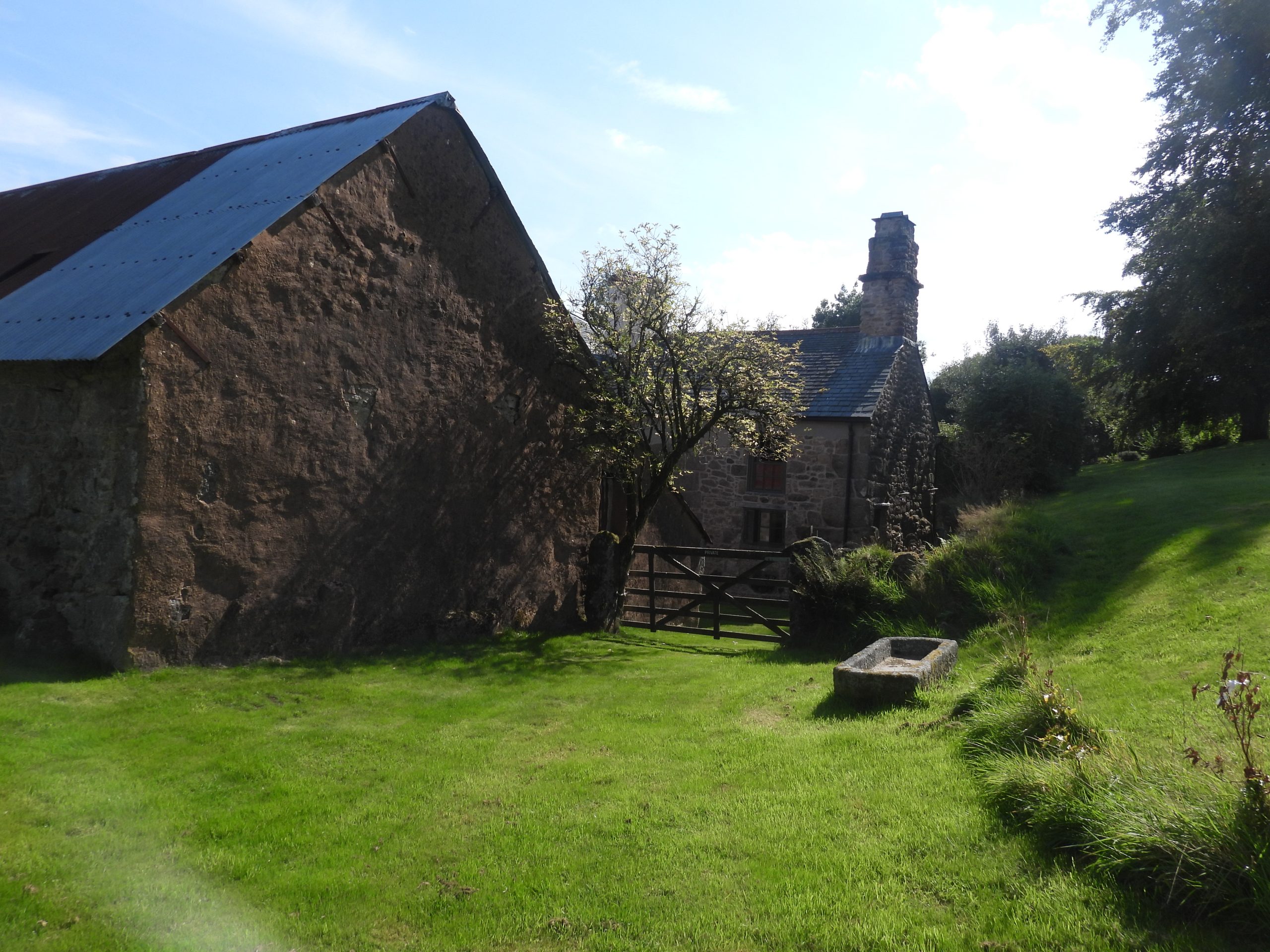
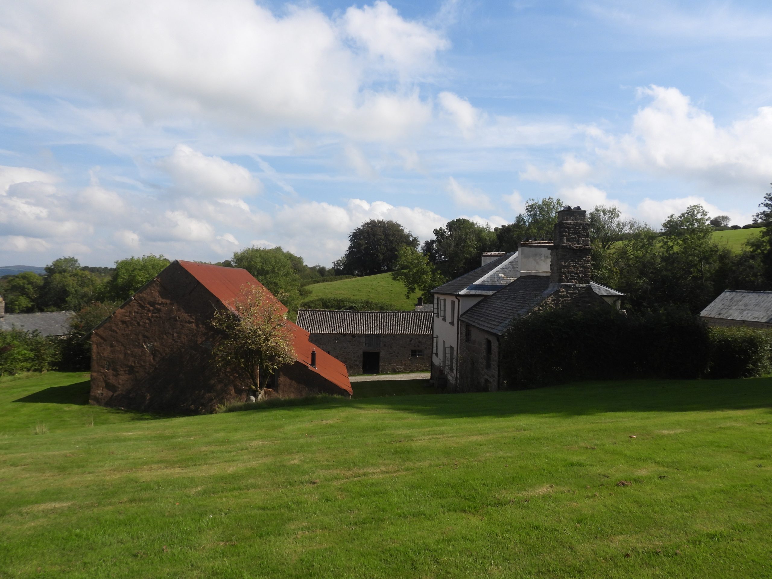
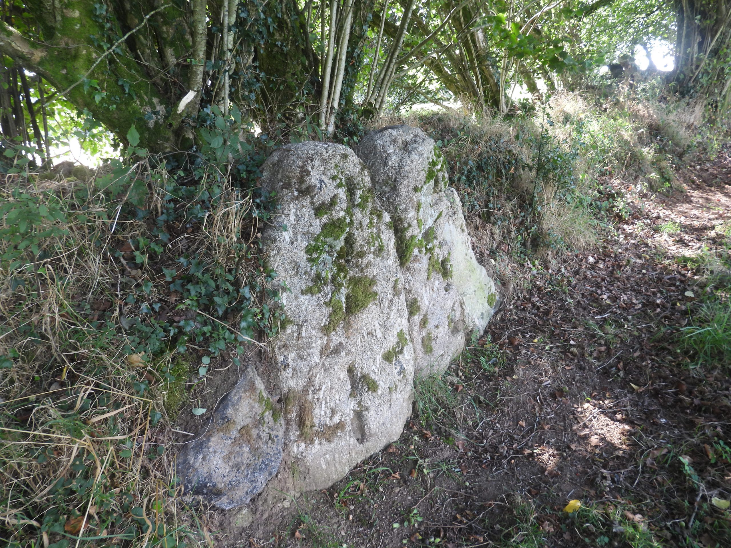
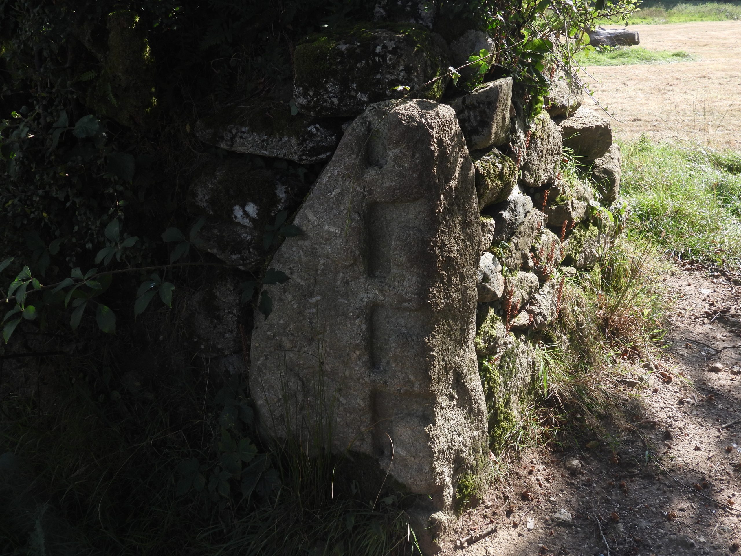
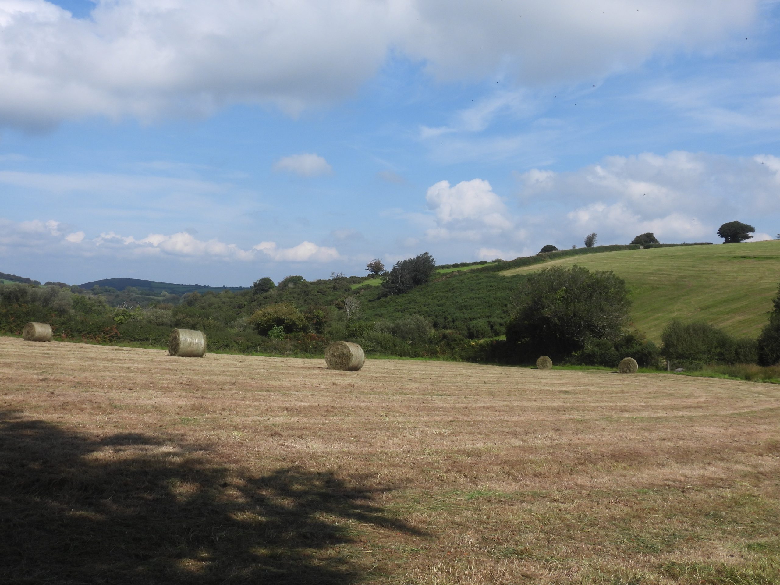
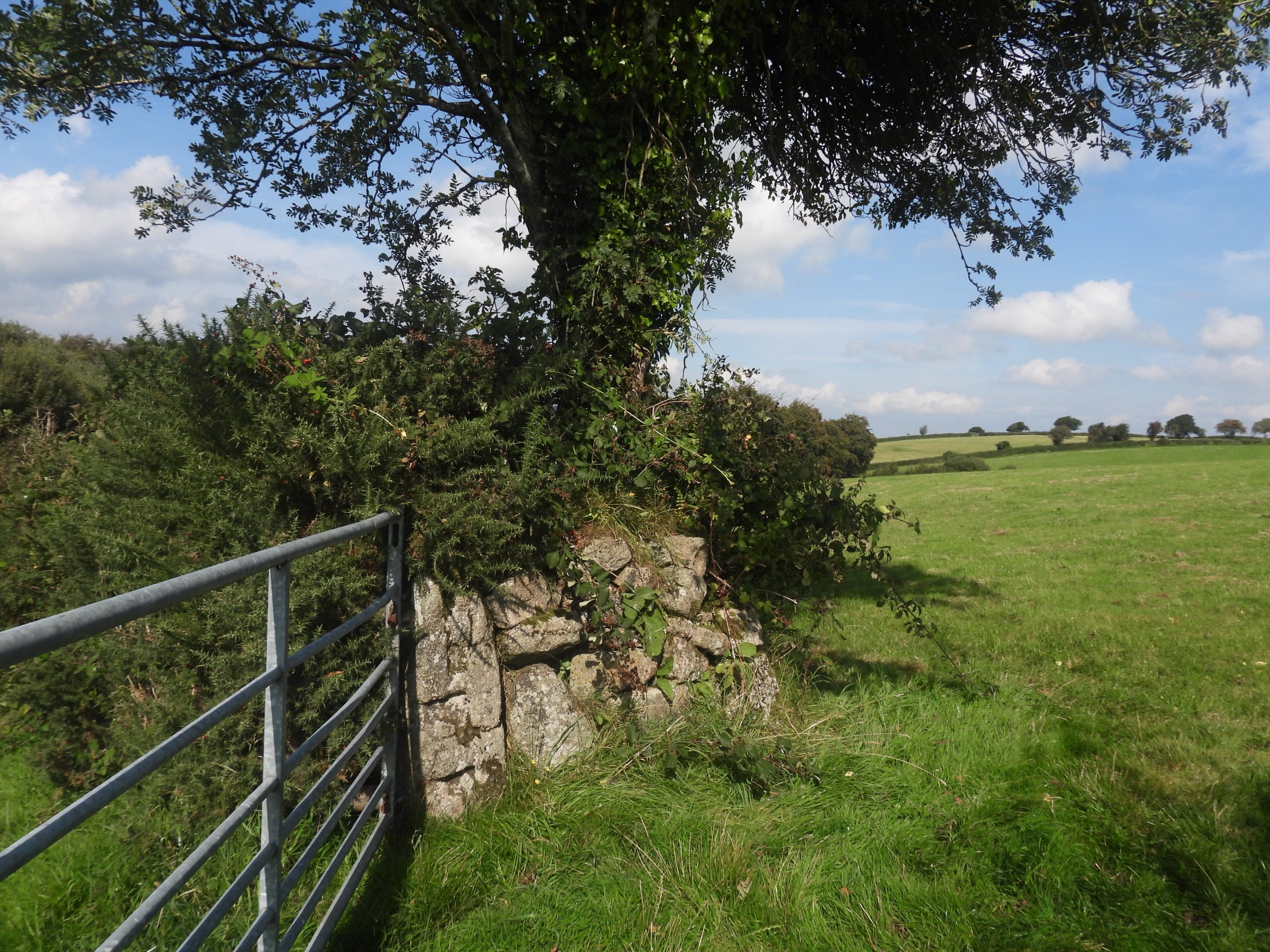
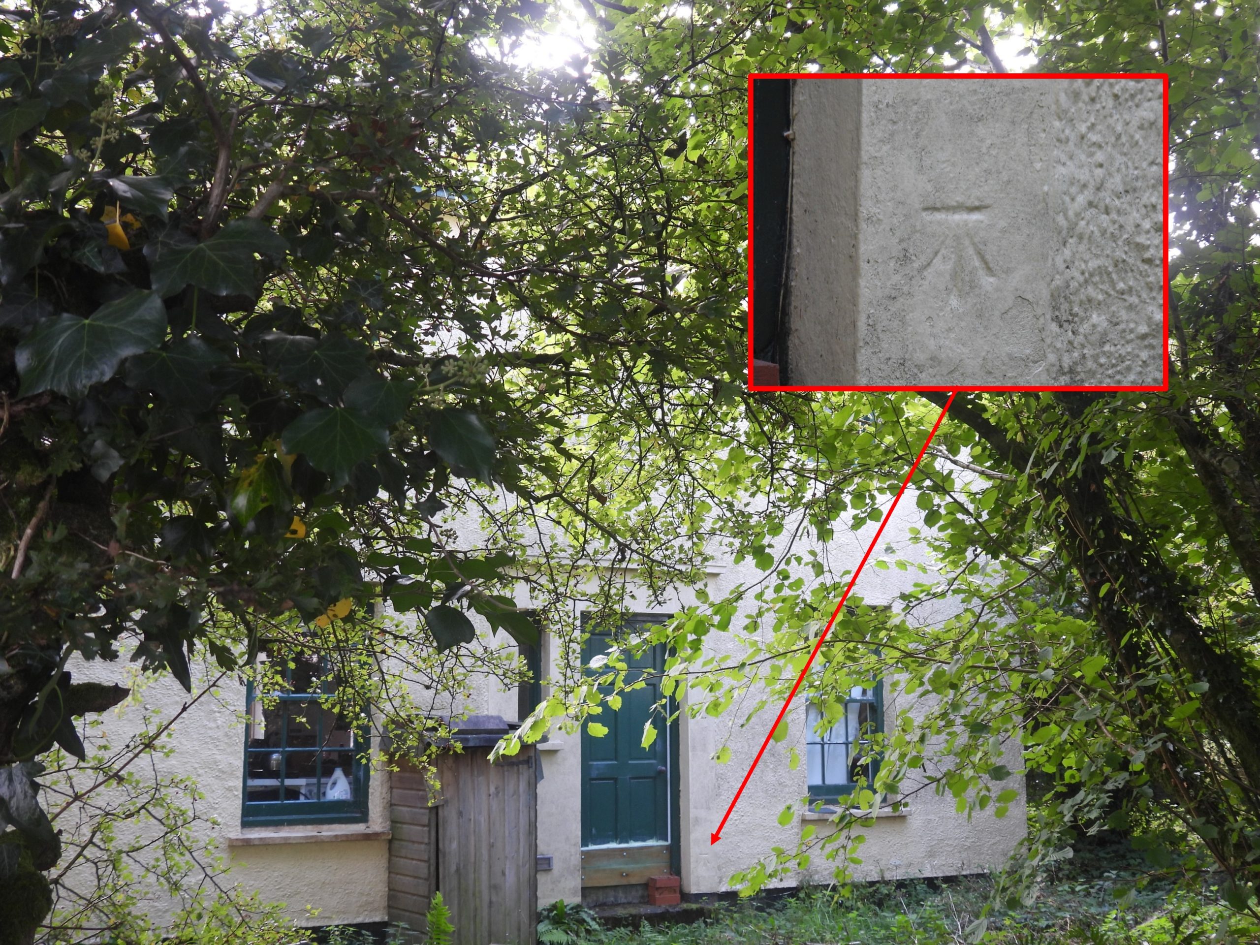
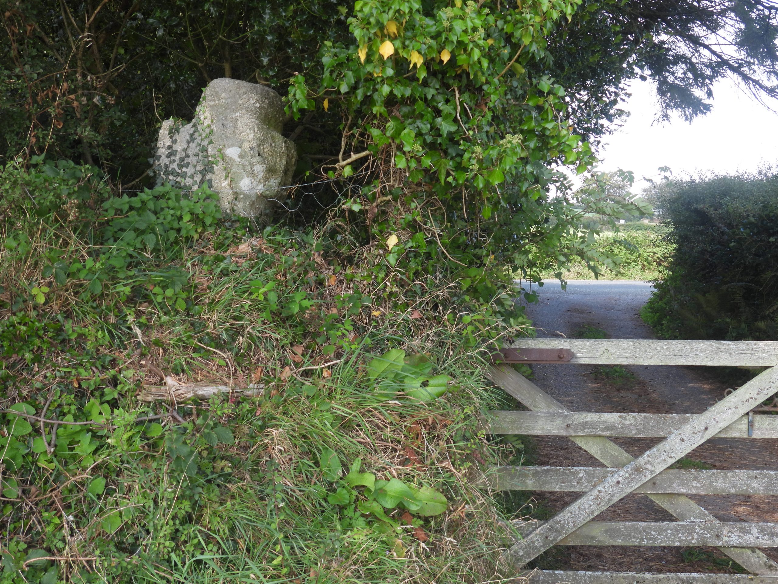
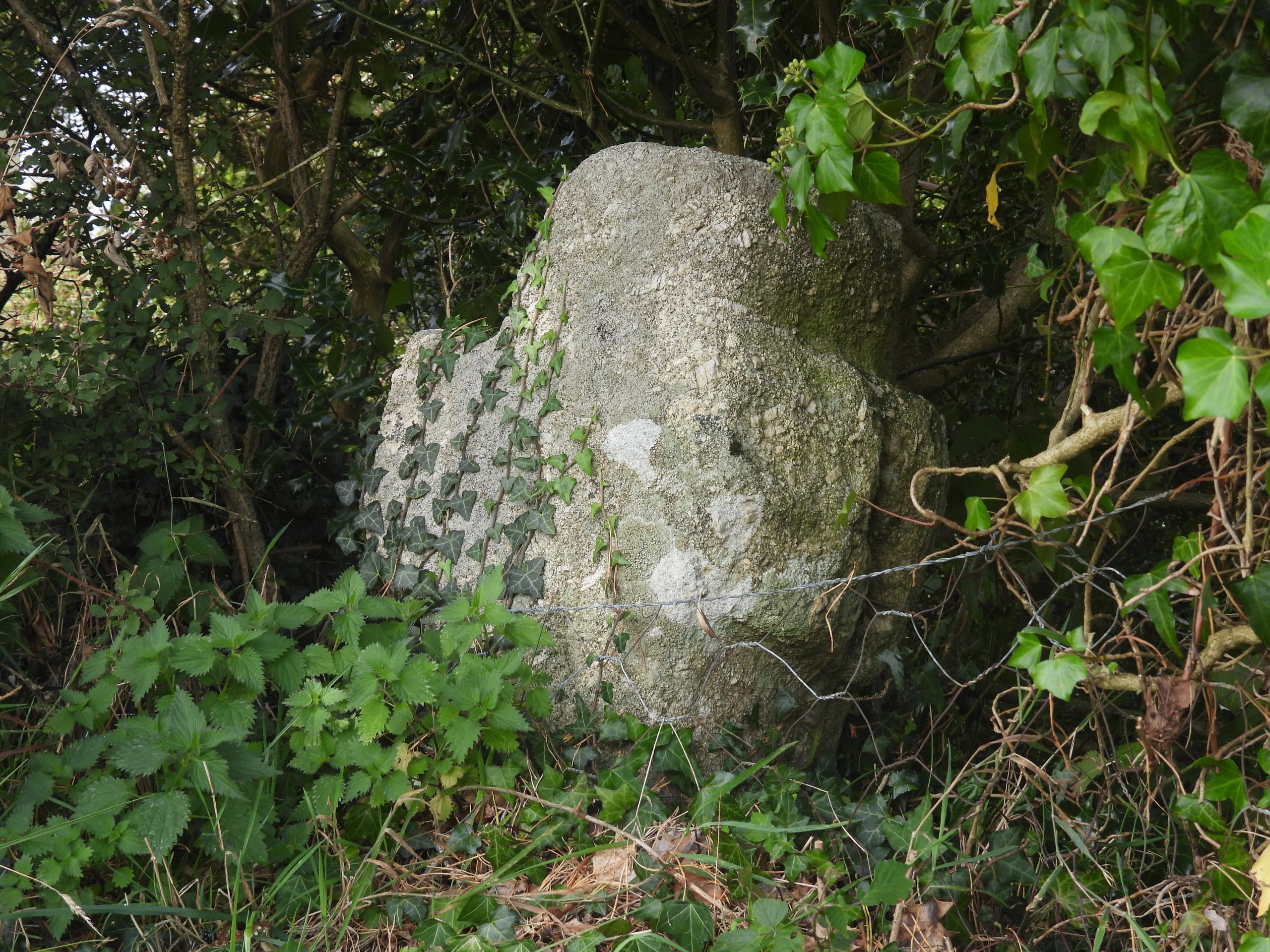
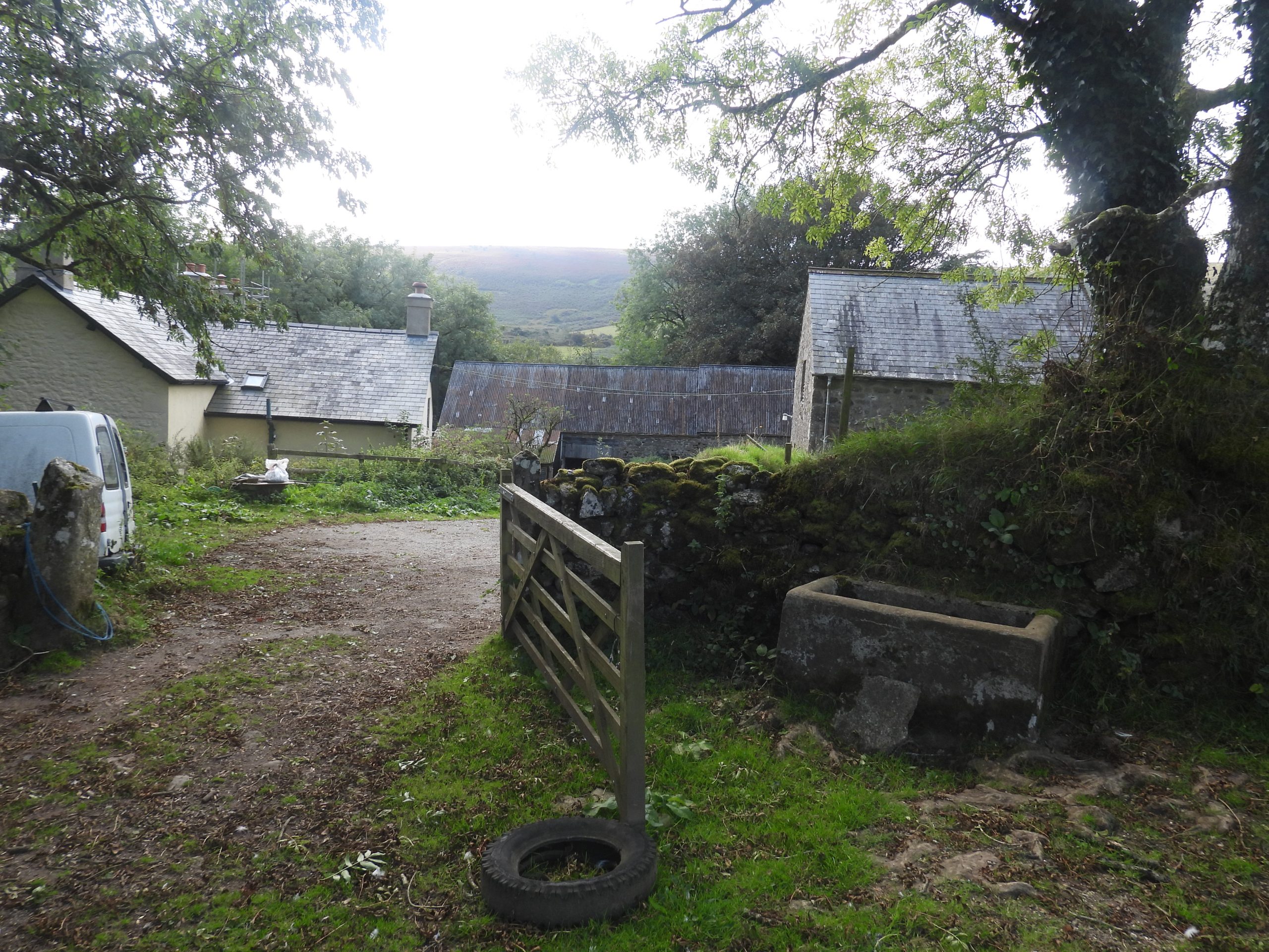
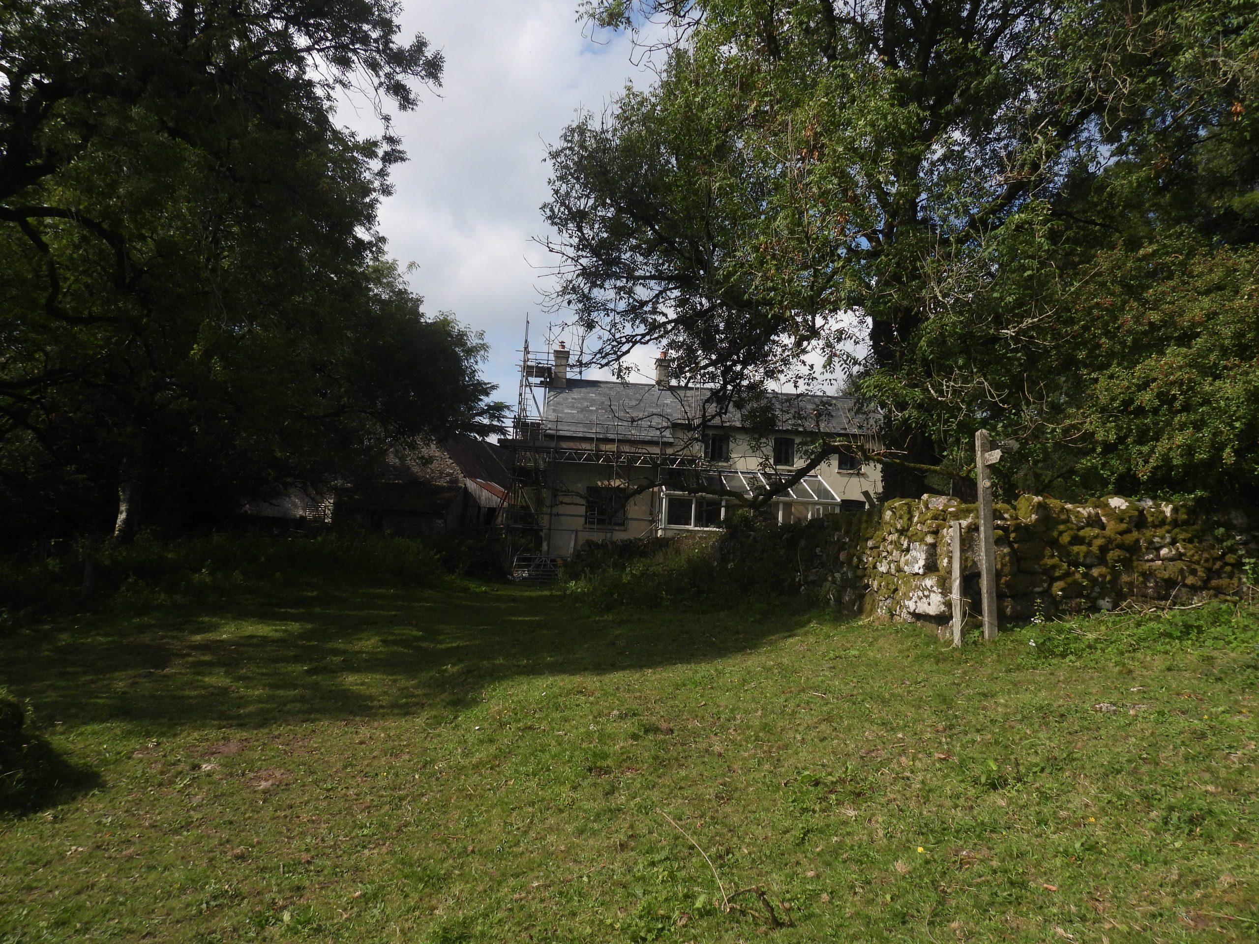
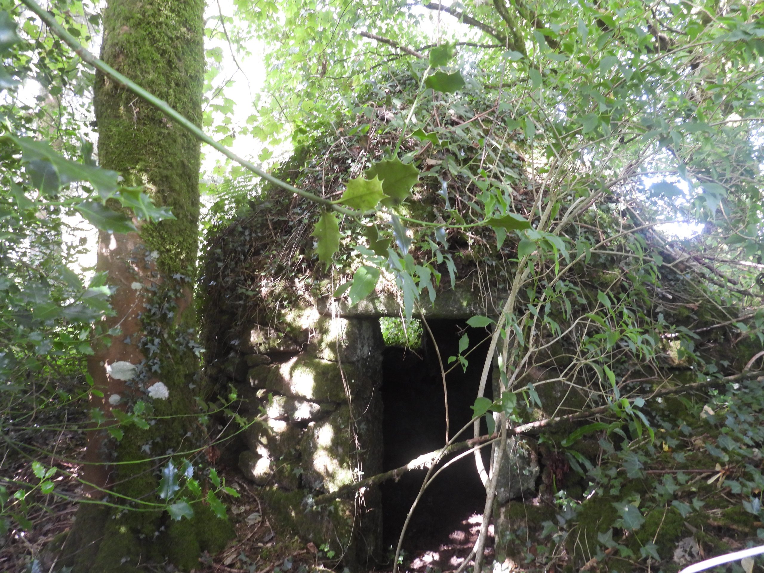
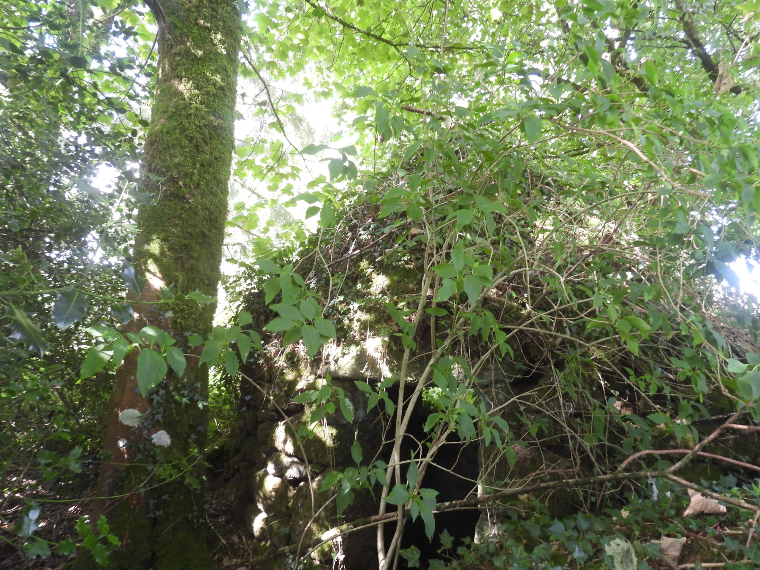
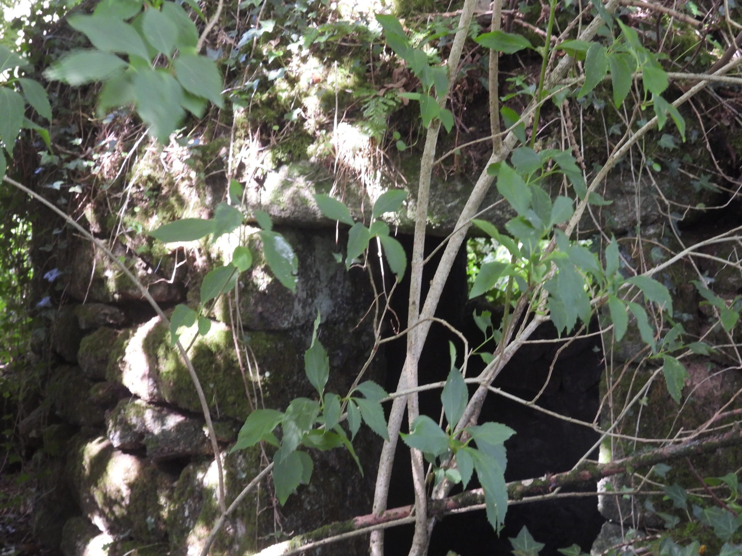
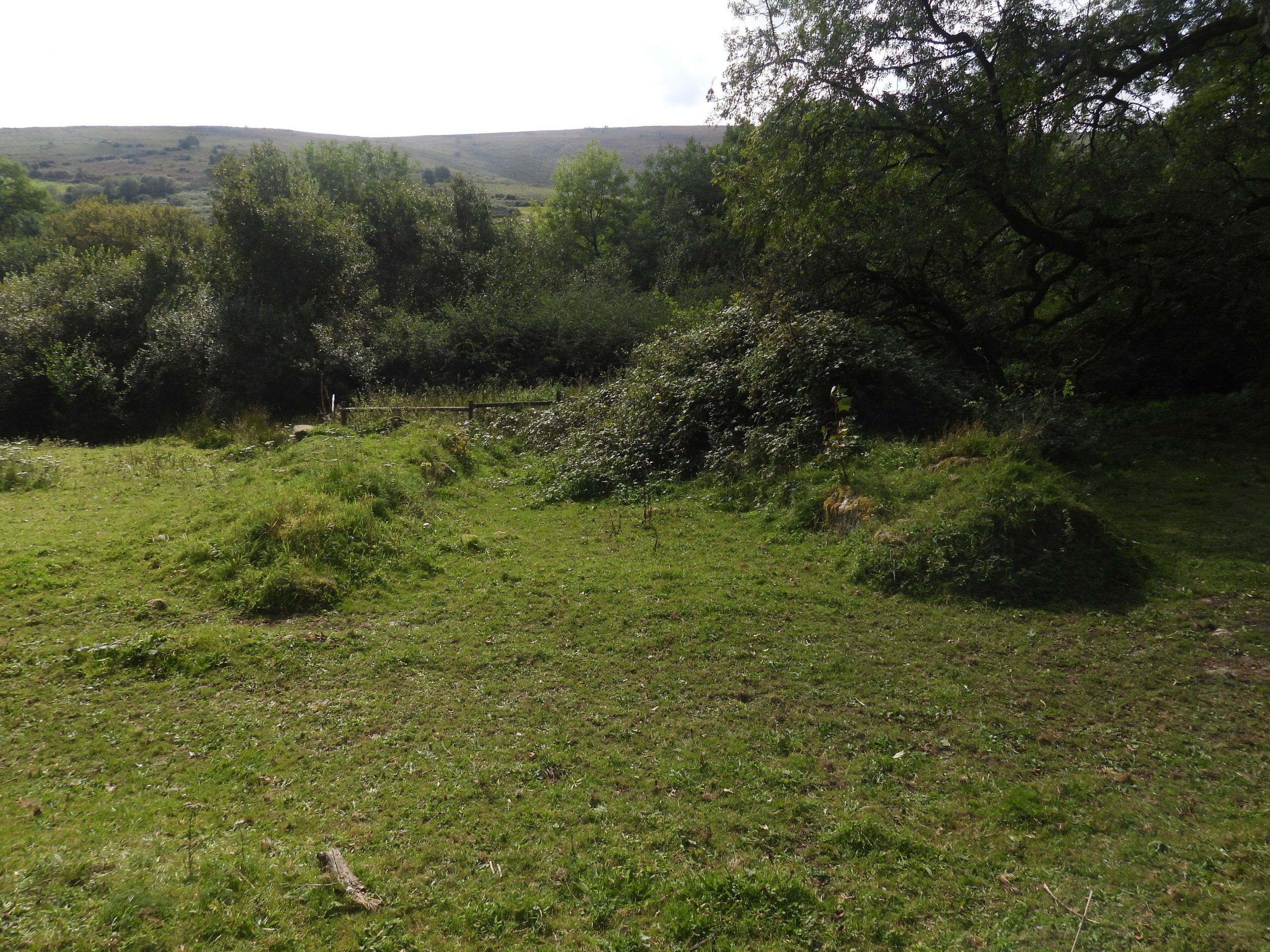
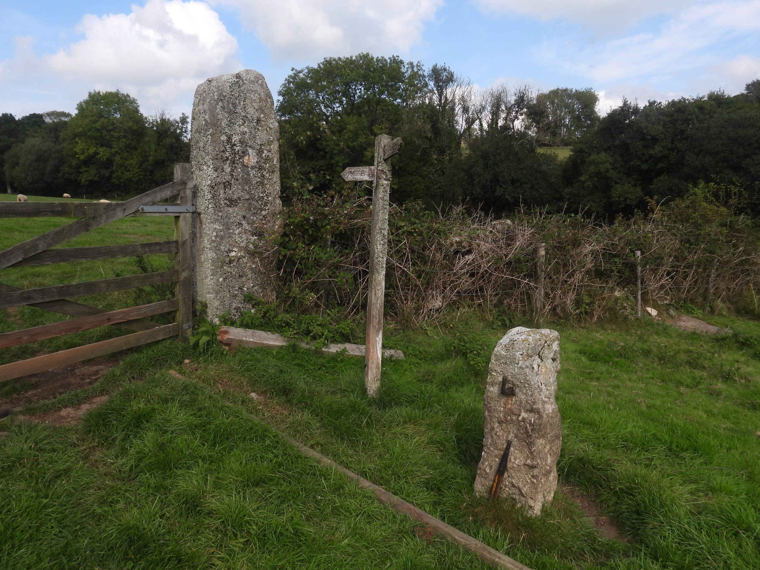
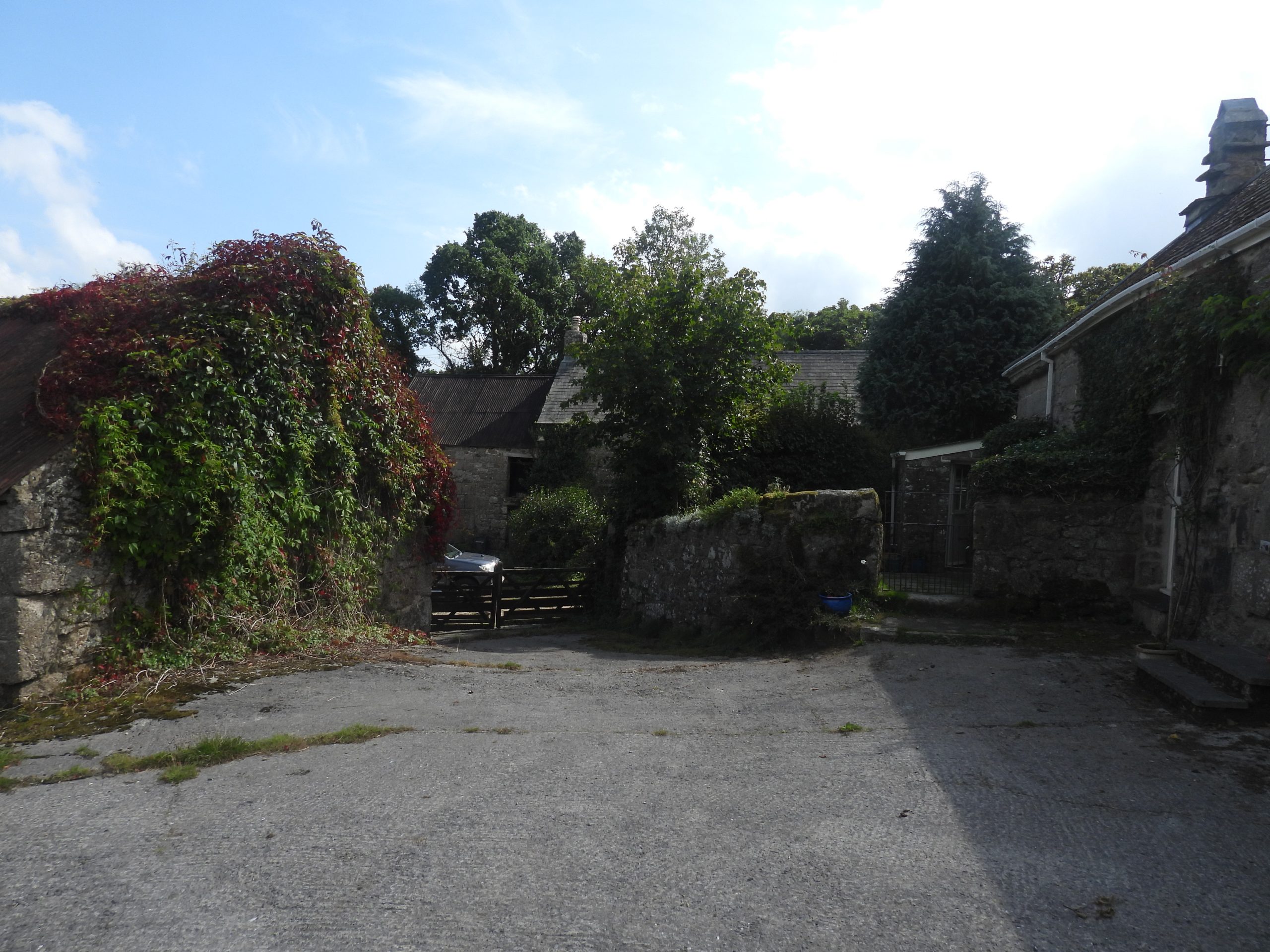
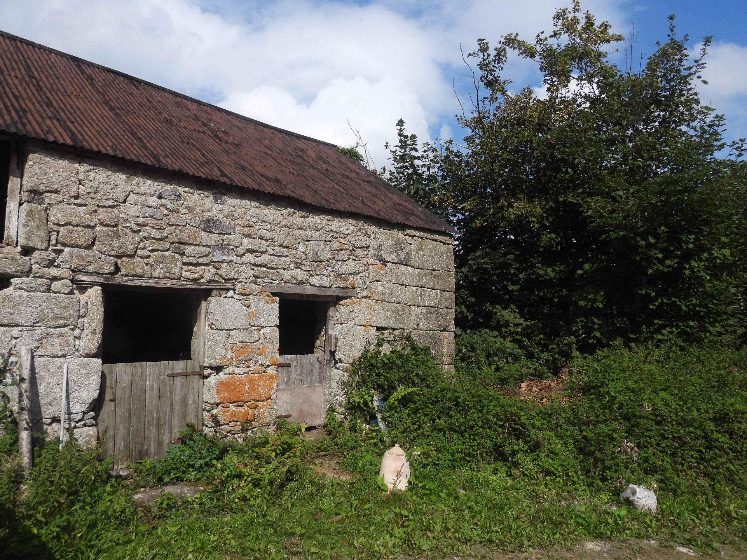
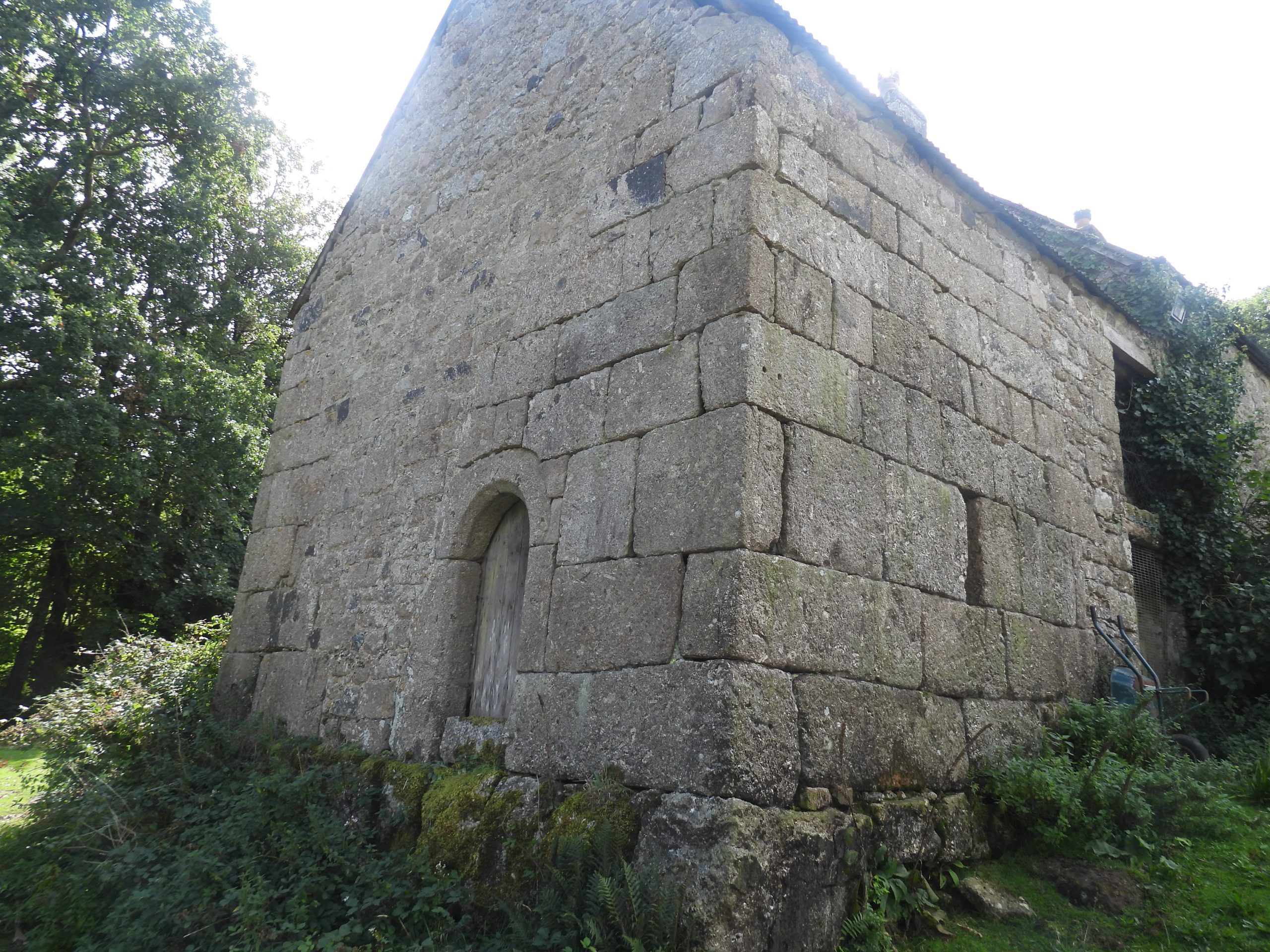
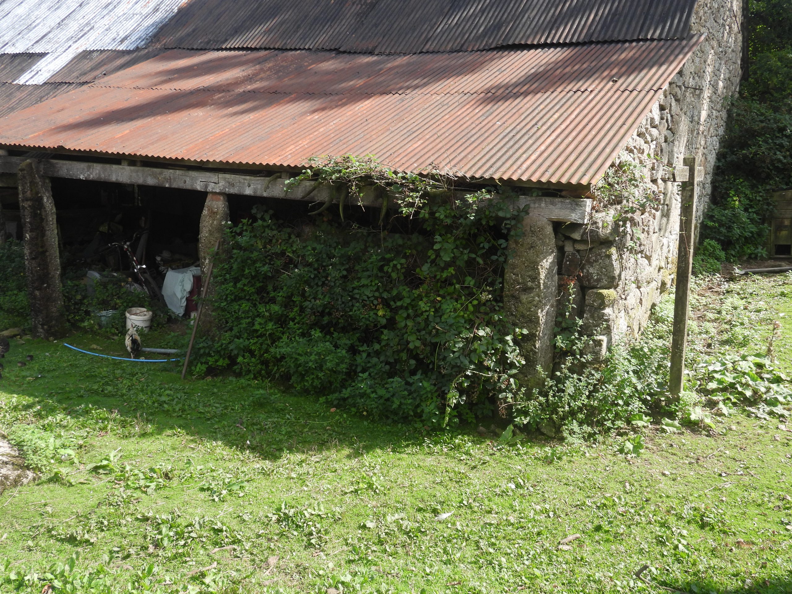
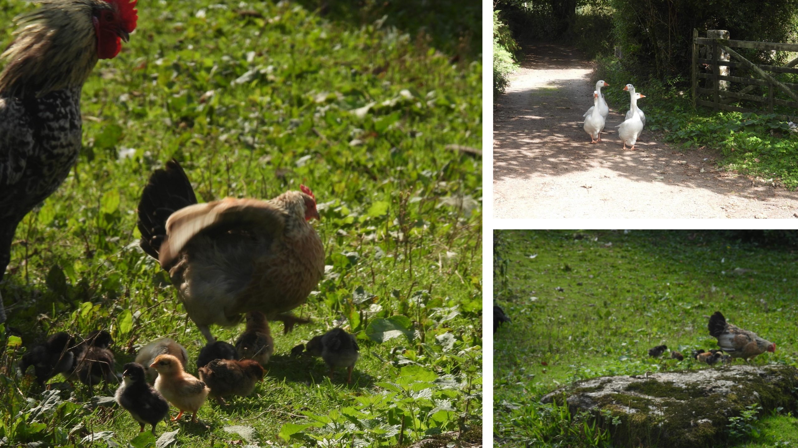
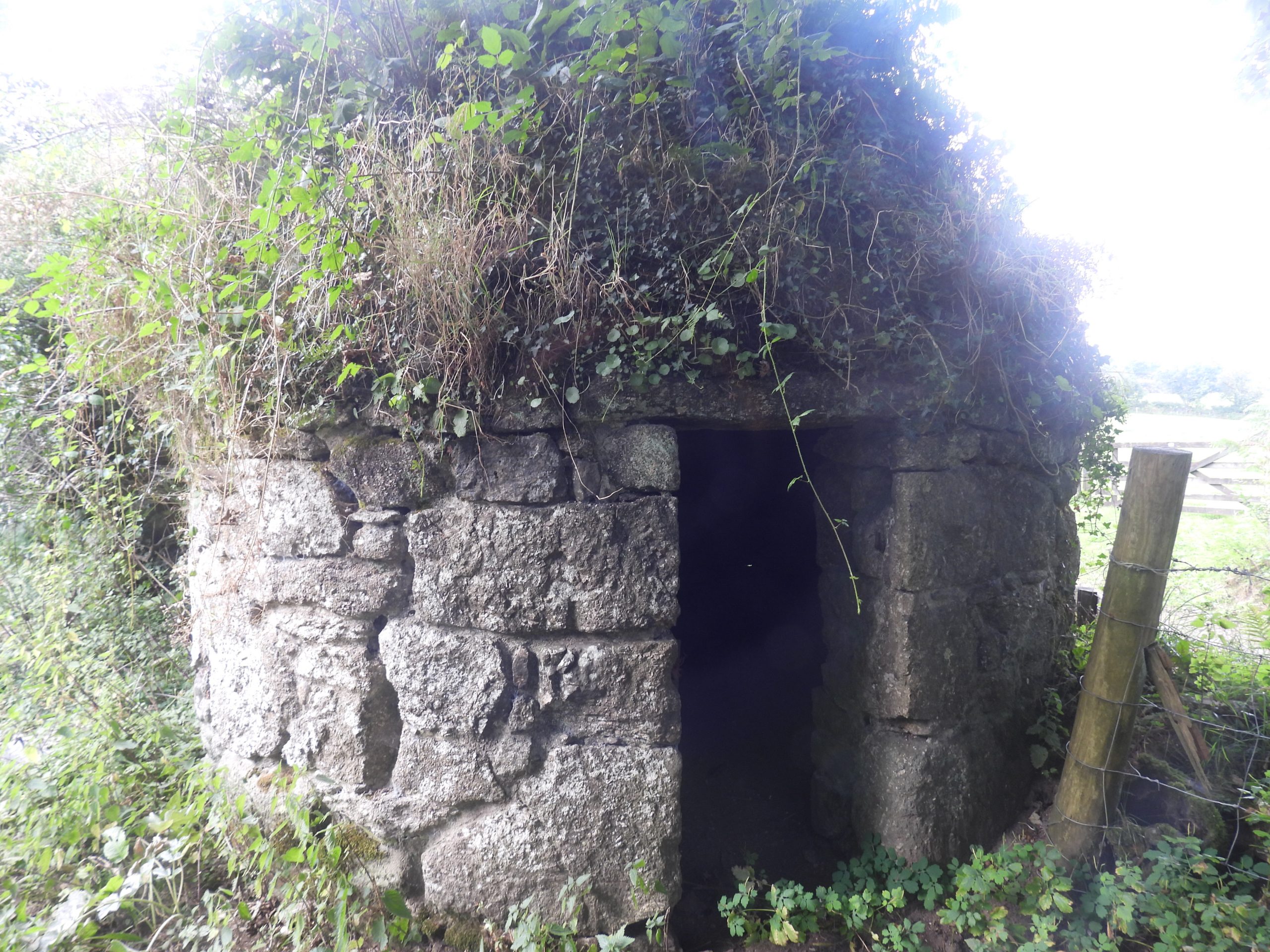
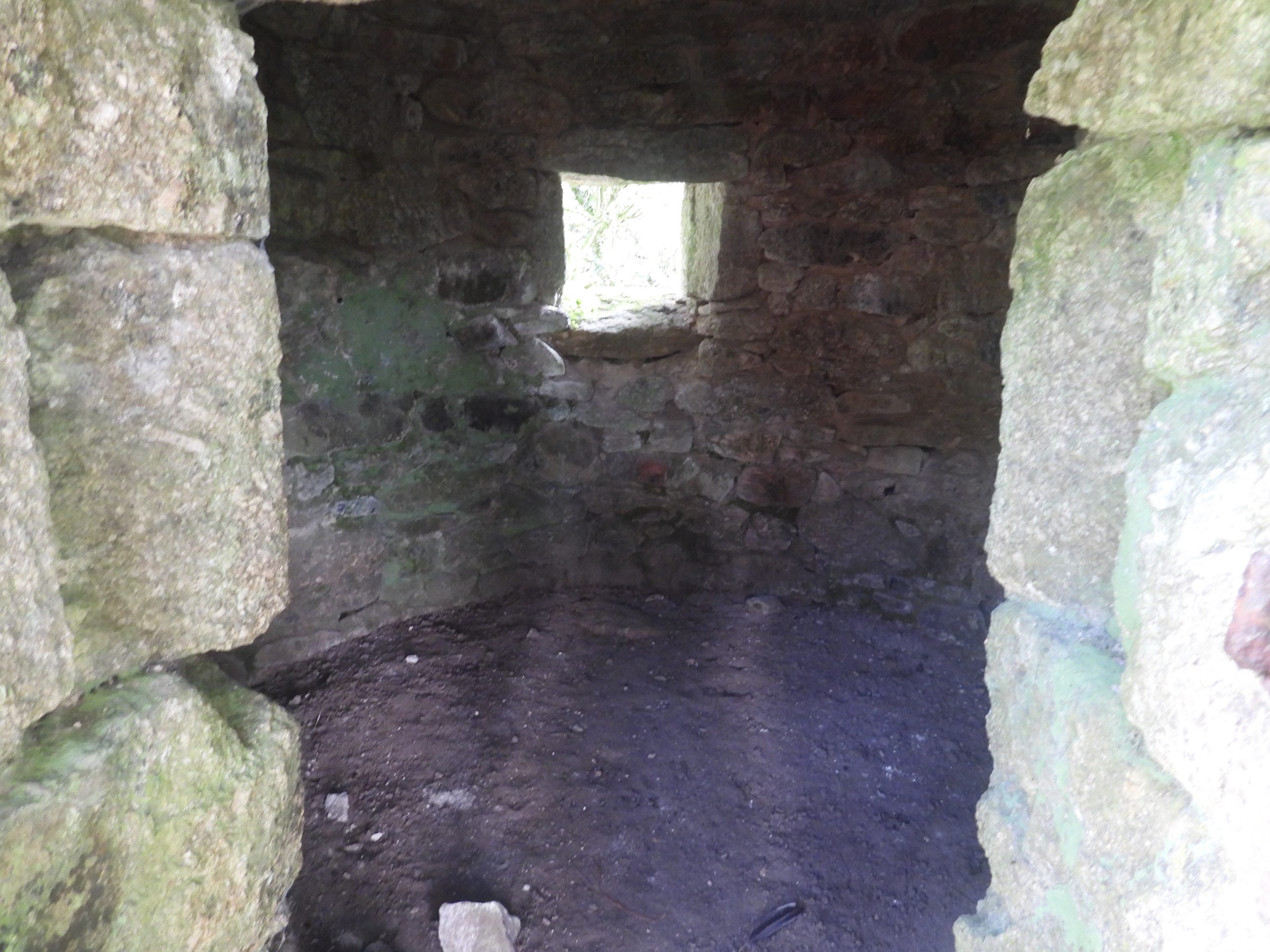
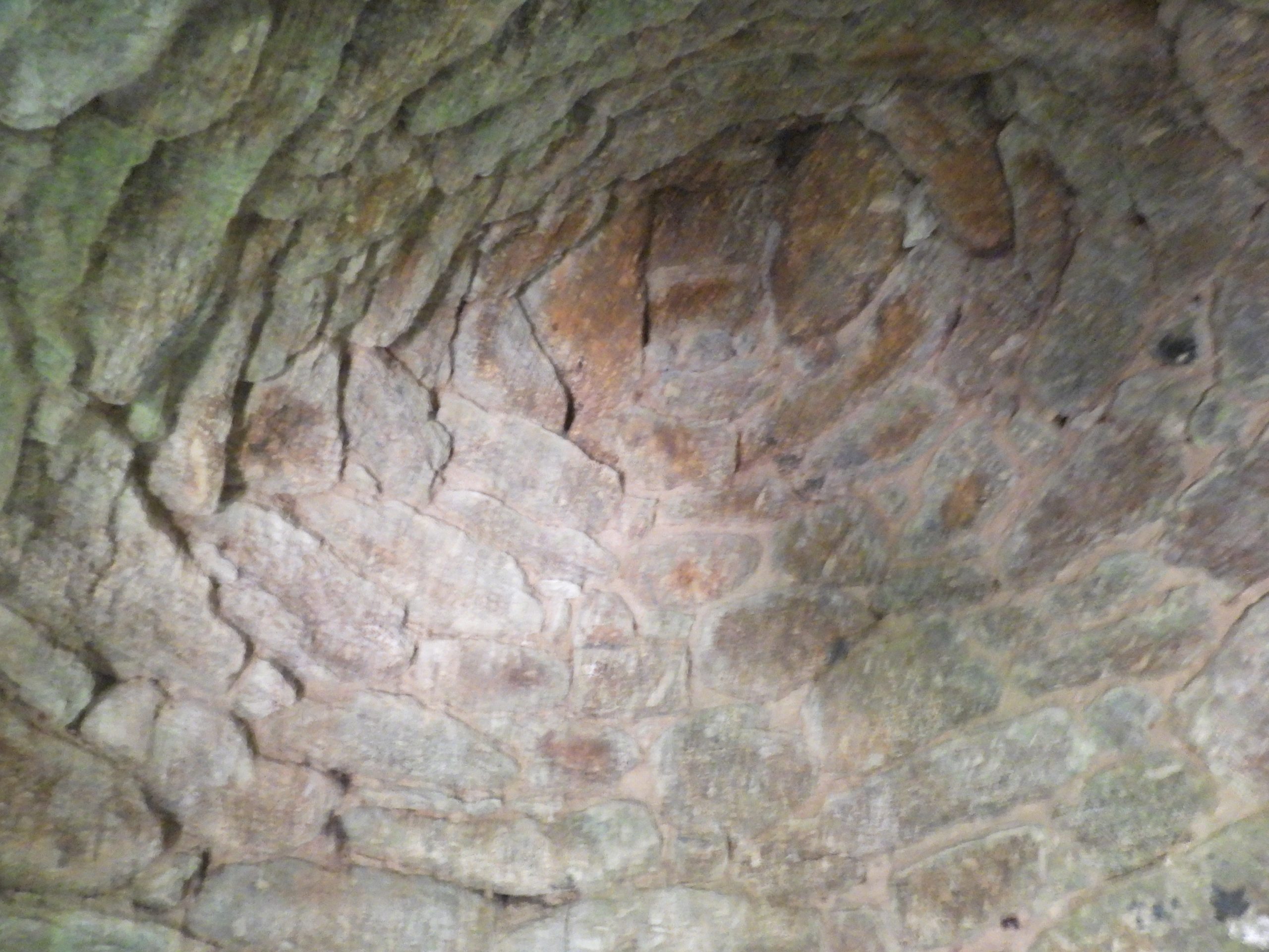
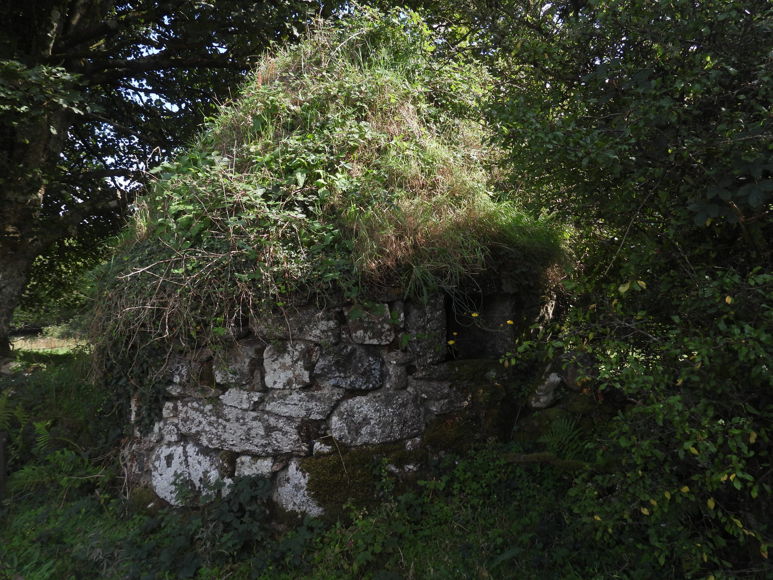
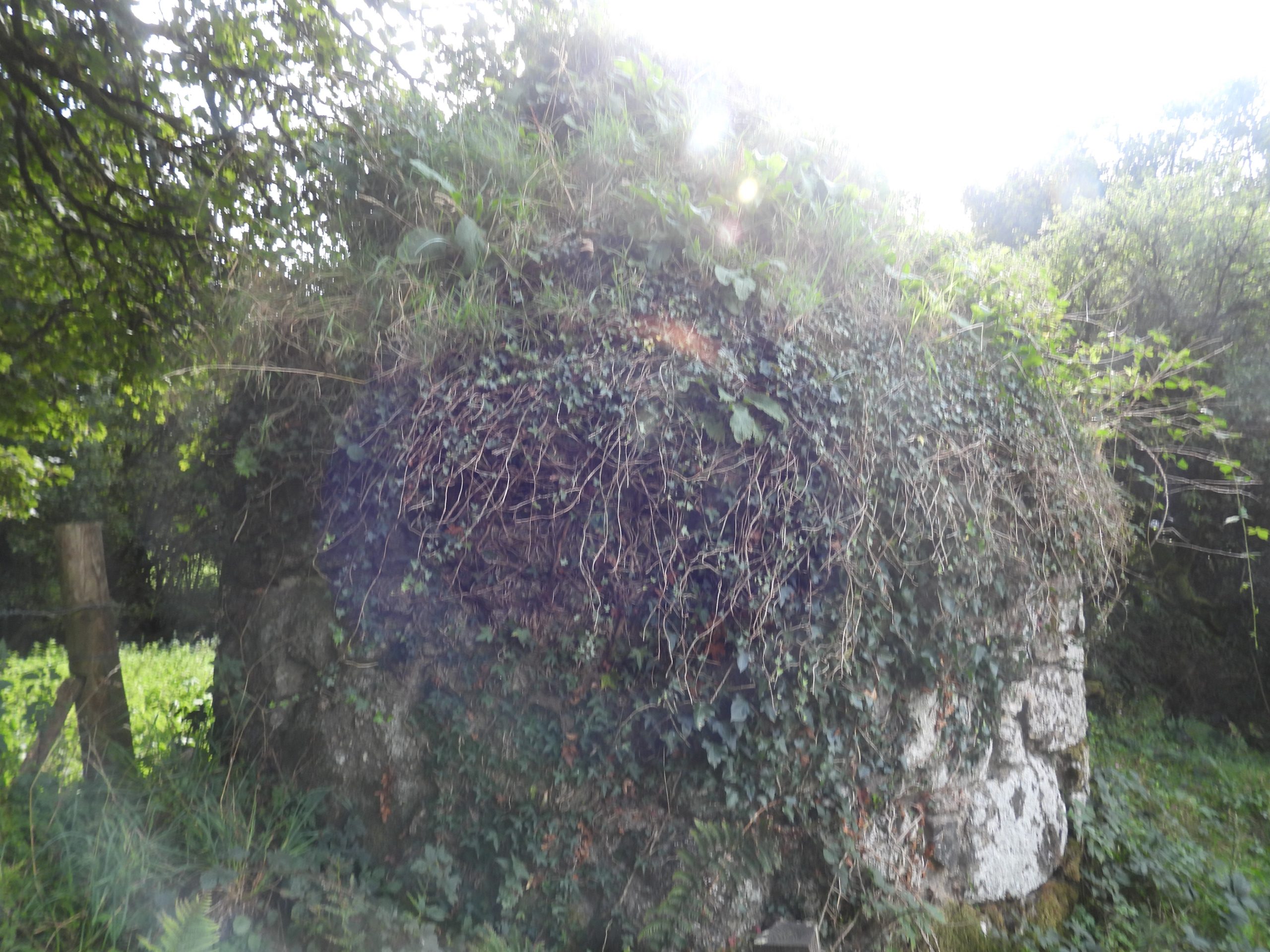
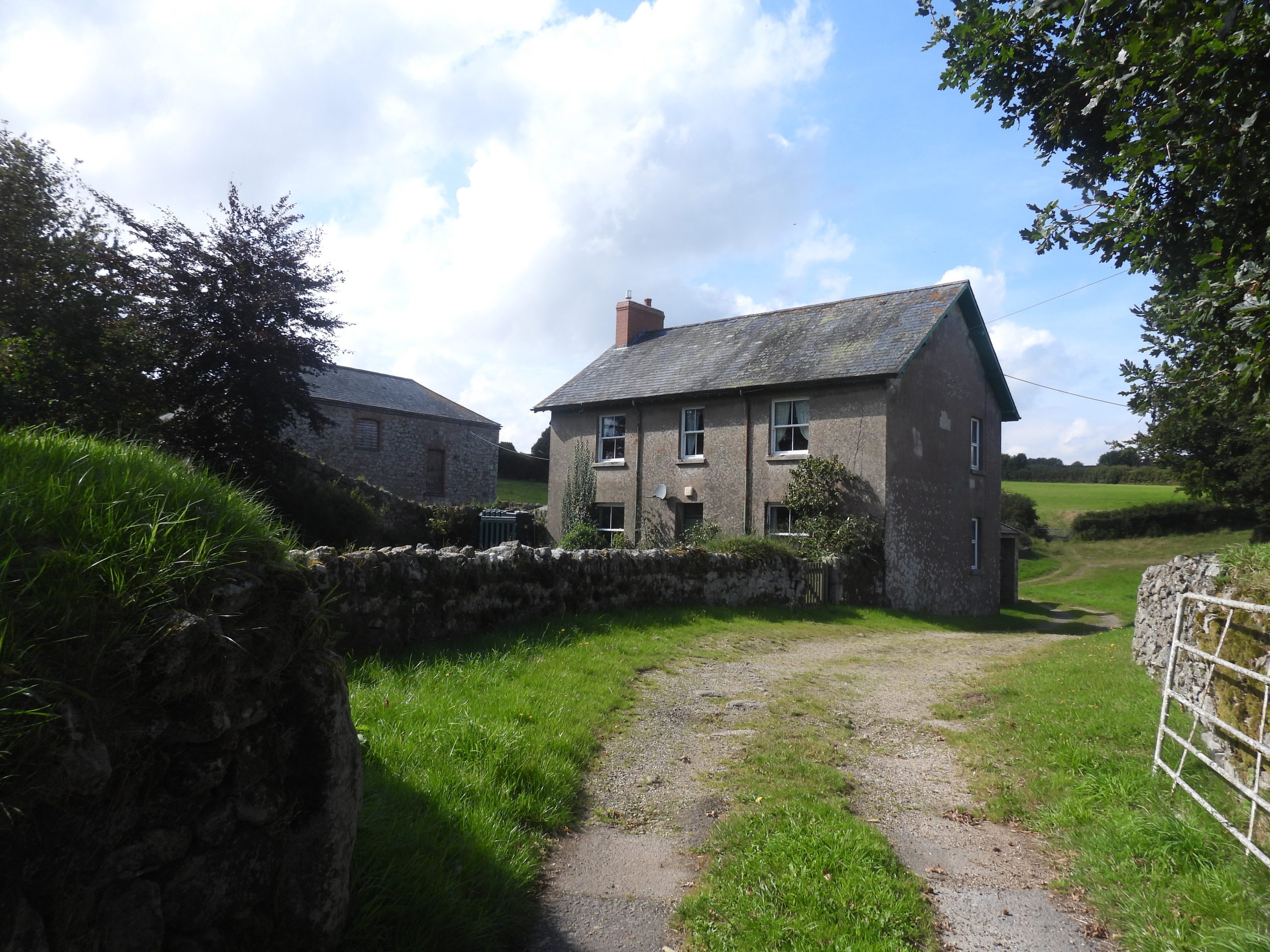
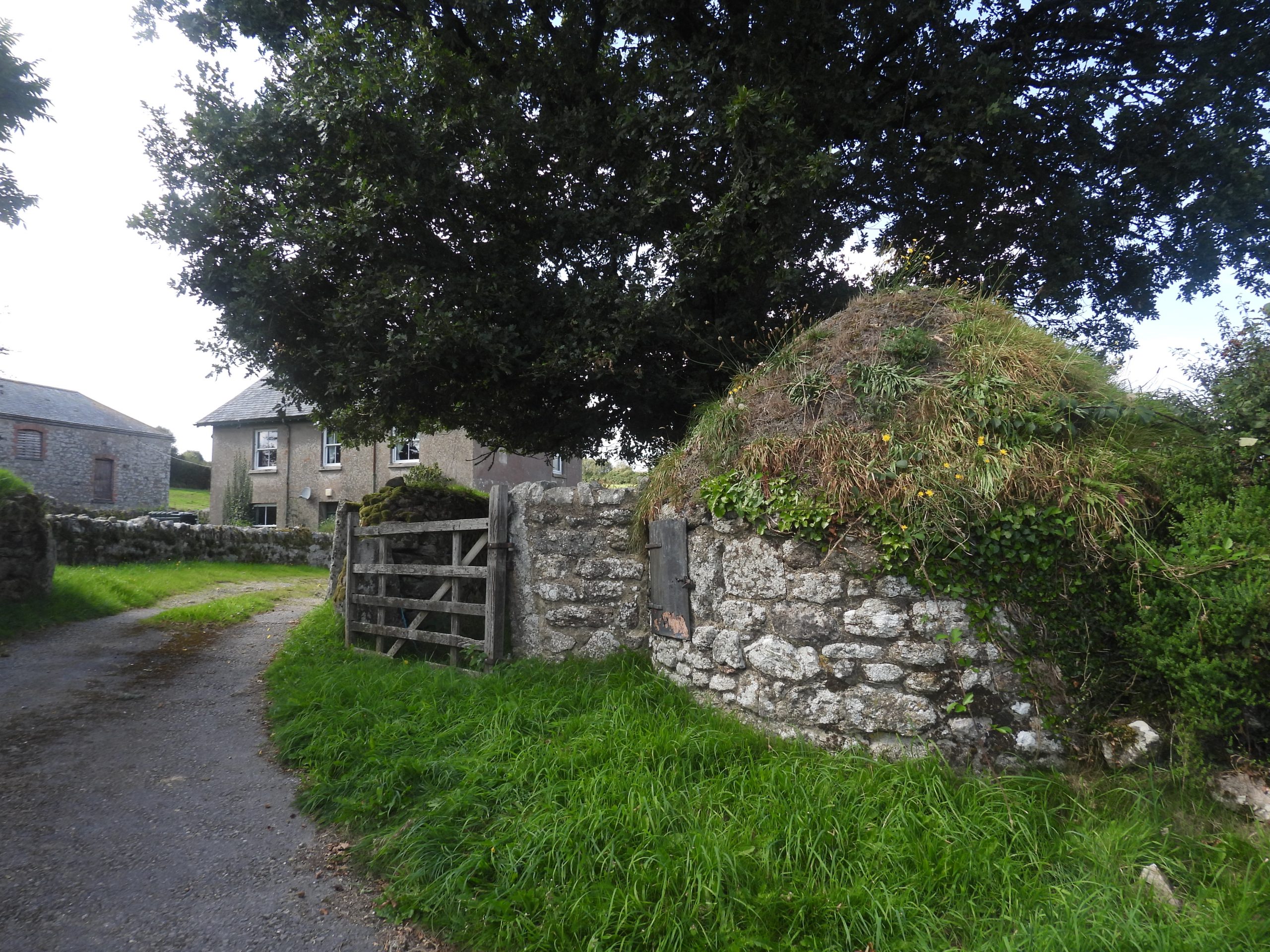
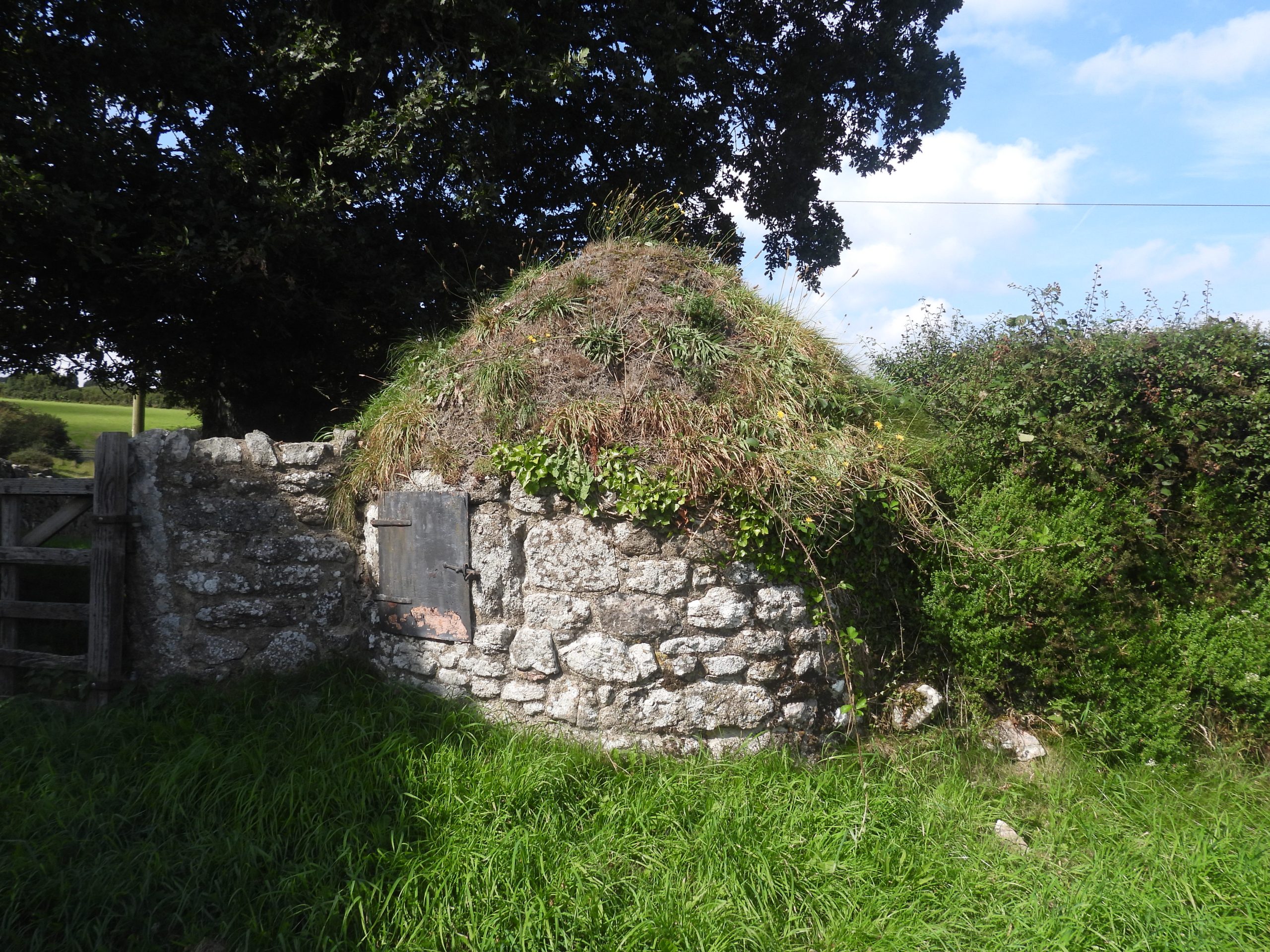
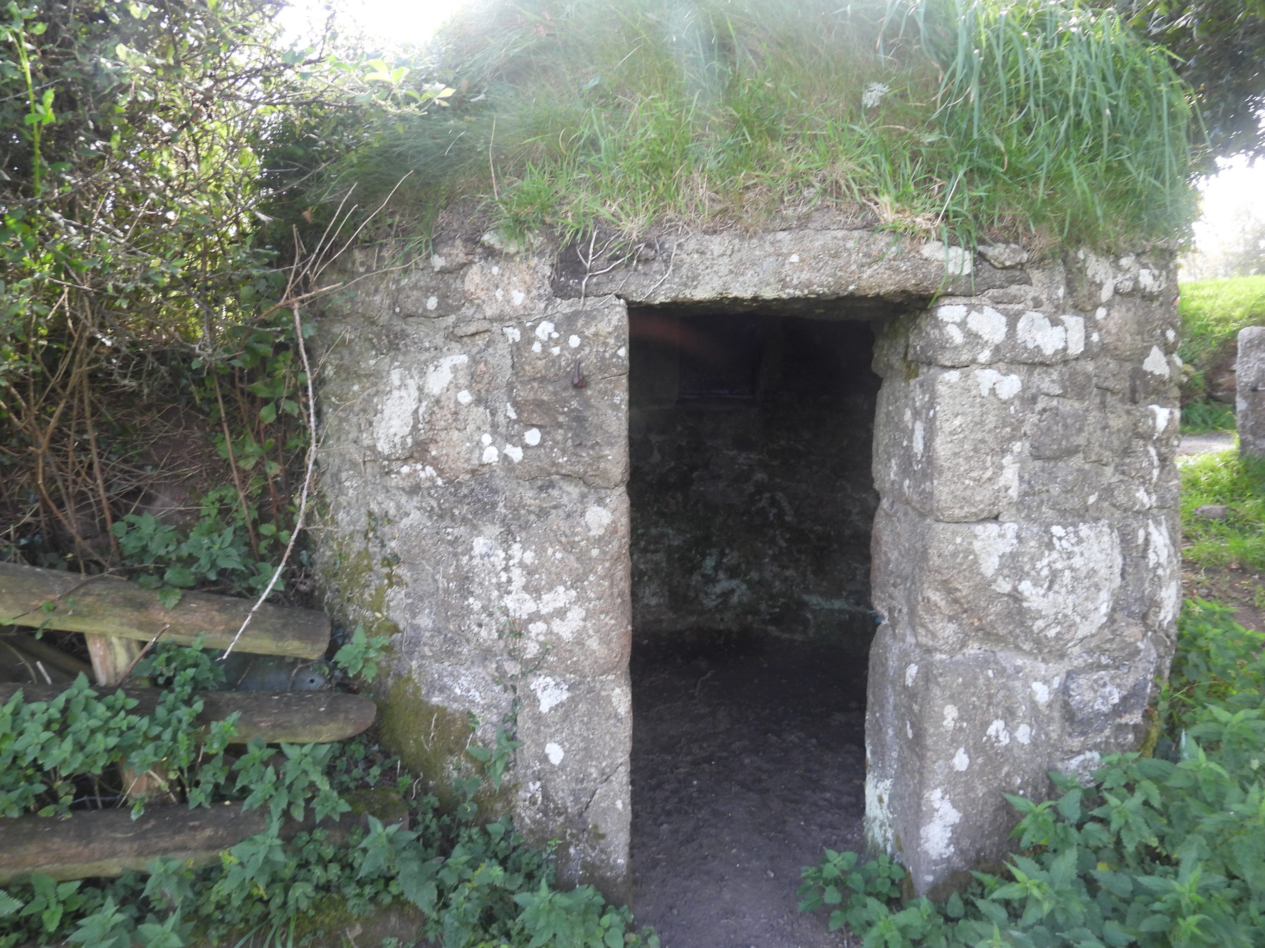
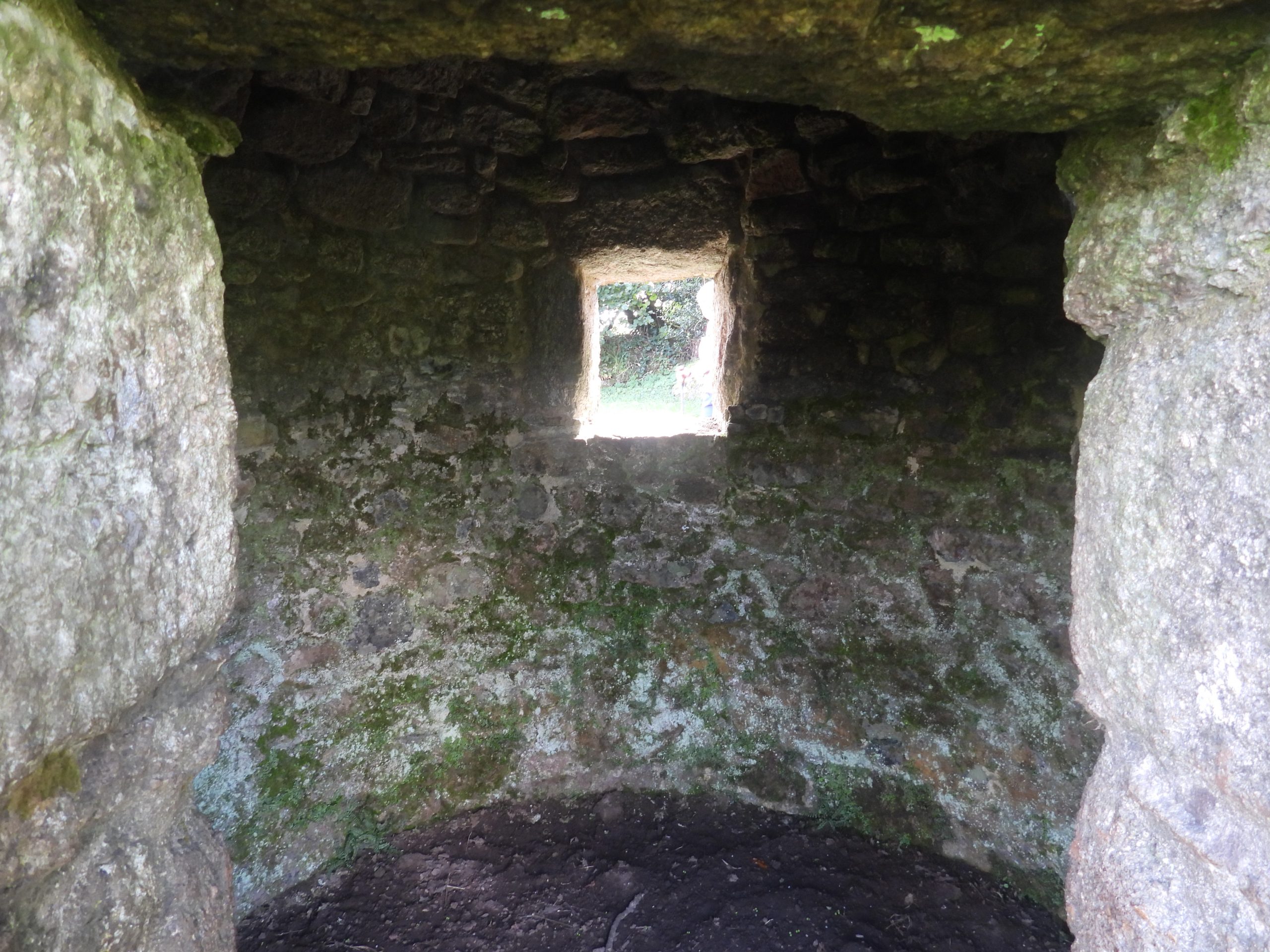
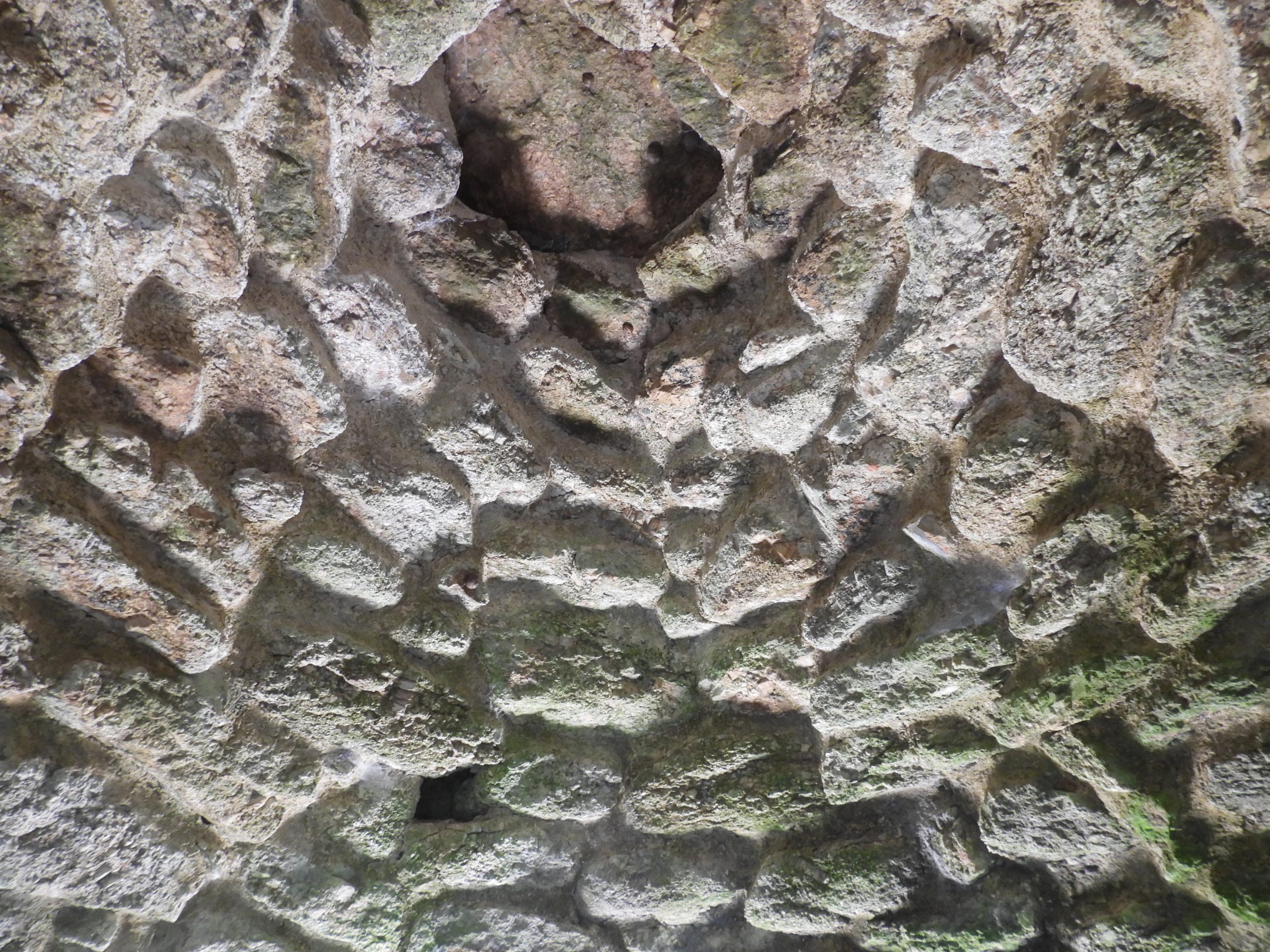
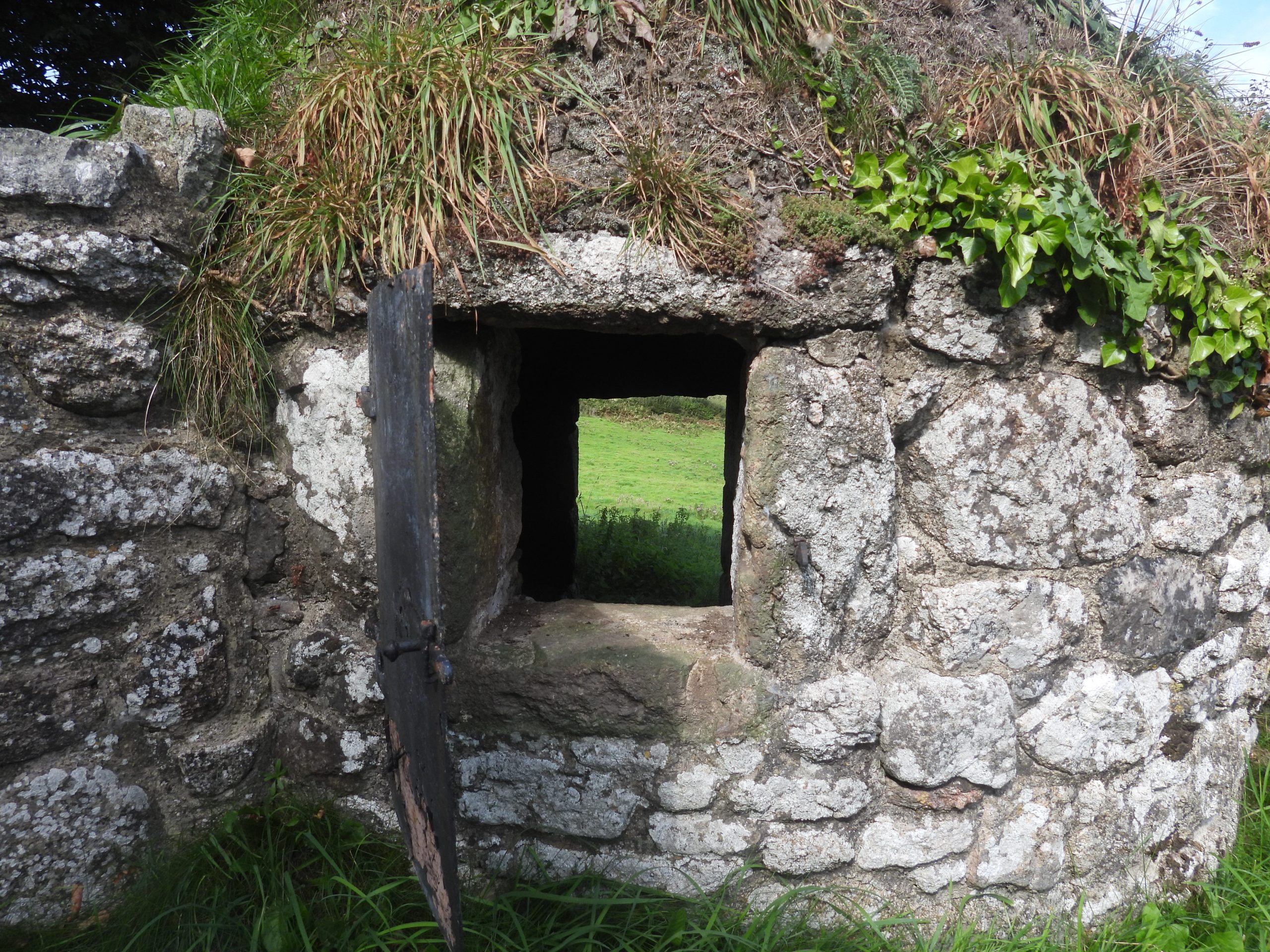
Sketch map of the farmsteads, hamlets and ash houses covered in this post. Leaving Hurston Ridge towards the Hurston hamlet the explorer will descend this hillside next to a magnificent drystone wallTowards the bottom of the hill the drystone wall is punctuated by this gate, through which the ruined farm of ‘Ridge Lea’ (or Ridge Ley or Ridgeleigh) is locatedThere are very few remains of Ridge Lea / Ridgeleigh. On the 19th century Tithe Map shows it is annotated as ‘Ridge Lea’ and the Apportionment as ‘Ridge Ley’. All sources suggest there were two houses / buildings at the site. There are very few remains today except a few overgrown walls. It is located at around SX68138 83726The gate leading to Hurston hamletFarmstead at Higher Hurston; This is depicted on the 19th century Tithe map as showing three buildings surrounding a central yard. It is believed to have dated from an earlier date.Higher Hurston farmhouse. It is believed to be from the 17th century with a probable 16th century core. The farmhouse was extensively refurbished and extended in late 19th century / early 20th century. The farmhouse is constructed from granite stone rubble with large dressed quoins with some ashlar. The roof is thatched (ref: Department of Environment record)Ash House at Hurston. It is a single storey gable ended building which is built completely of granite, with a stone roof clad with slate. The gable end facing the lane has an iron shuttered ‘window’ and is presumably where the ash would have been placed. The window has a granite lintel and cill.The doorway has at the other gabled end of the Ash House has very large squared granite dressings and large quoin blocks. The Ash House is located at SX68595 84154This building is unlike other Ash Houses on Dartmoor which are commonly circular with a conical roof. With grateful thanks to a resident of Hurston, the author was able to see the construction of the building on the inside.North Walla Brook between Hurston and LingcombeOne of two small clapper bridges across the North Walla Brook. This clapper, unusually has a metal post fixed into the downstream edge. The clapper is located at SX68820 84402The second of two small clapper bridges across the North Walla Brook. The clapper is located at SX68820 84391The two clapper bridges in one photograph. There was a possible smithy / mill here close to Lingcombe. There is a Tithe map field name of ‘Smithy Meadow’ which suggests this. Approaching Lingcombe on the Mariner’s Way track is a lovely slotted gatepost, one of many on this route.A little wooden bridge as the explorer exits the woods to LingcombeLingcombe. The farmstead was also known as Venn until the early-mid 20th century and may have 13th century origins, based on documentary evidence. There was lots of building work being undertaken (September 2023)Venn was probably the house of Stephen de la Fenne (1249 Assize Rolls). One of the walls has a millstone built into it, which the author speculates relates to the Tithe map field name of ‘Smithy Meadow’The mill stone is located at SX68976 84488Leaving Lingcombe (Venn), some old ridge tiles were seen carefully stored on a bank, presumably being kept as part of the apparent restorationA memorial a short distance from Lingcombe en-route to Jurston. The inscription reads ‘Fond memories of VAL BAKER / LINCOMBE FARM’. The Hertiage Gateway records the name as ‘Lingcombe’, whereas this memorial records it as ‘Lincombe’. Location is SX69141 84530Another slotted gate. Between Lingcombe and JurstonViews from ‘The Mariner’s Way’. The farms / buildings are at Higher Corndon, Lower Corndon and Western Corndon. Meldon Hill is on the horizonSlotted gatepost at JurstonTrough at Jurston with cover and metal ringBarn at Higher Jurston. There is a prominent semi-circular horse engine house facing the track. Farmhouse at Higher Jurston. The farmhouse was originally a longhouse and is likely to date from 17th century. It is recorded in the Heritage Gateway that the farmhouse was modified in the late 18th or early 19th century. The farmhouse was listed in 2022.Lower Jurston FarmTo the south east of Jurston, the Mariners Way crosses the East Bovey. Here there is a clapper, a ford and stepping stones. The clapper is located at SX69719 84352Views of the Mariners Way track crossing the East BoveyThe 6 stepping stones are located at SX69719 84352Further to the south east from Jurston lies the beautiful hamlet of Lettaford. The hamlet is originated circa 1450-1550 and has three longhouses, each with its own yard and ranges of farm buildings. The photograph is of the barn, one of a number of farm buildings north of Sanders Farmhouse. Note the central ventilation slit and the four square openings. It is recorded (ref: Dave Brewer) that in 1994, members of the Devon Archaeological Society Buildings section observed a ‘chi-rho’ inscribed on a corner stone of the barn at SandersRockmead which is part of the original Southmeads farmstead, the most northerly of the three farmsteads at LettafordSanders Farmstead at Lettaford. The longhouse and shippon here are early 16th century with mid 17th century modifications. The buildings were restored by the Landmark Trust in 1977.Higher Lettaford. This is the southern of the three steadings at Lettaford (with Southmeads to the north and Sanders to the north-east). The building in the foreground is a threshing barn from the late 18th or early 19th century with the farmhouse beyondHigher Lettaford. Of interest (ref: Heritage Gateway) is that at the time of the 1839 tithe this farmstead was owned by a Pinsent Burton and occupied by William Rogers, who was farming 95 acres. At that time it was listed as ‘Higher Littaford’ and ‘Blacksticks’, therefore Lettaford appears to be a more modern name for the farmstead and indeed the hamletPassing across fields to the south of Lettaford and through gateways in hedgerows, the author noted these rather large granite blocks which made up a part of the walling of the hedgerow. They appear to be slotted gateposts albeit rather larger and wider than others in the area. Clearly some recycling here with them being now built into a wallAnother slotted gatepost – between Lettaford and Leapra (Leeper) CrossFabulous view of hay bales and the rolling hills of eastern Dartmoor. Meldon Hill in the background.Yet another slotted gate, this one quite close to B3212, where the Mariners Way crosses the roadNext to the B3212 and near Leapra Cross, surrounded by tree is this building, which is not that historical (compared with others on the Mariners Way). However, it does have a benchmark, which in all likelihood was a 20th century one (as opposed to an original 19th century one), given the apparent age of the building.Liapa or Leapra Cross is approx 500m from Liapa (Moor Gate) farm, where is once was located. It is also called Leeper Cross and is medieval in origin. It was set up in its present location in 1937 on the insistence of the Dartmoor Preservation Association. However, prior to that at the turn of the 20th century William Crossing had noted the cross at Liapa Farm and wrote about it (Crossings Guide page 263). In his guide he describes “a fine granite cross may be seen built into the garden wall” . Shortly after Crossing’s comments, a Viscount Hambledon had the cross removed and taken to his house at North Bovey.The cross is located at SX70200 83300‘Liapa’ farm is shown on 19th century OS map as a large L-shaped building in an irregular shaped yard with an irregular shaped building to the north-east. By the 20th Century the farm had become known as ‘Moor Gate’ and is shown on modern OS mapping with additional buildings to the north and west.21st century view of Liapa (Moor Gate) farm from the east. The Ash House can be found in the small copseThe Ash House at Liapa (Moor Gate) farm can be seen just inside a hedge / fence at SX70417 83065. The National Monument Record describes this Ash House as being “a massively built ash house with corbelled stone roof, the walls of which are disintegrating due to neglect. The walls stand to 3.5 metres high, are 0.5 metres thick and 3.5 metres internal diameter”. There are two access points for the Ash House. At Liapa (Moor Gate) farm, there are some Chapel foundations which can be found at SX70407 83042. In the Dartmoor HER (MDV 8748) the chapel footings are not dated but are described as consisting “of two parallel banks running north to south with a foundation of loose stones and packed earth between them. The footings consist of definite walling of roughly rectangular stones plus others of cruder working”.Between Liapa farm and West Coombe farm on the Mariners Way, the explorer will pass through a few fields and gates. As one approaches West Coombe, you cannot fail to notice a rather large (out of keeping) gate post. Its ‘little brother’ stands a few metres awayWest Coombe was first documented in 1562 and comprises two farms (Higher and Lower West Coombe). The picture shows a farmhouse on the right (formerly listed as Higher Westcombe) and is circa early 16th century, altered probably in 18th century. It has granite walls, large ashlar blocks extending approximately half way along the front then changing to rubble.The Shippon at Higher Westcombe is believed to be 17th century constructed of granite ashlar and rubble.Lower West Coombe Shippon. At the gable end is a round-headed granite arched doorway. This is original, yet an unusual feature in a longhouse and whose purpose is unclear; possibly it served to muck out the Shippon.Part of the barn to the east of Lower West Coombe longhouse. It dates from circa late-18th century and has had a ‘Lean-to’ added along the length of the rear wall, which is open frontedBird life at West CoombeWest Coombe Ash House is probably 18th century and has granite rubble walls with conical corbelled granite rubble roof covered with turfsThe Ash House dimensionally is 4m high with an external diameter of 3mThe Ash House conical corbelled granite roofThe loading “hatch” of the Ash House faces Lower West Coombe farm.The Ash House can be found at SX70983 82533Shapley farmhouse is located at the end of a short lane. The farm looks modern, however, one would have thought it dates from at least the 18th century given the Ash House nearby is likely to date from that eraShapley Ash House is approx 12m east of the farmhouseThis Ash House is in remarkable condition and is probably 18th century. Like the Ash houses at Liapa and West Coombe it has granite rubble walls with conical corbelled granite rubble roof covered externally with turfs. The load doorway faces the laneThe Ash House is beautifully constructed with lovely quoins and lintel around the doorwayInternal view to the window / hatch from the doorwayThe Ash House conical corbelled granite roof, similar in construction to the West Coombe Ash HouseView of the loading chute / window through to the doorway. The Ash House is located at SX71516 83002