A collection of walks, discoveries, insights and pictures of exploring Dartmoor National Park
July 26, 2020
Ringleshutes (Ringleshutts) Mine
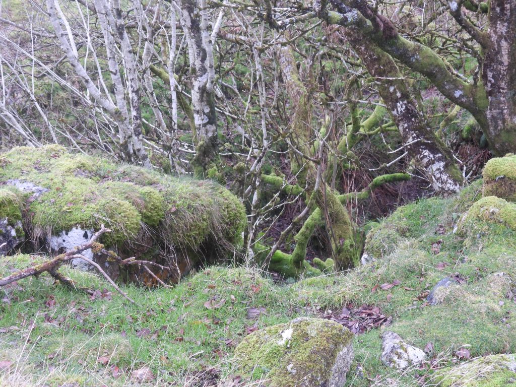
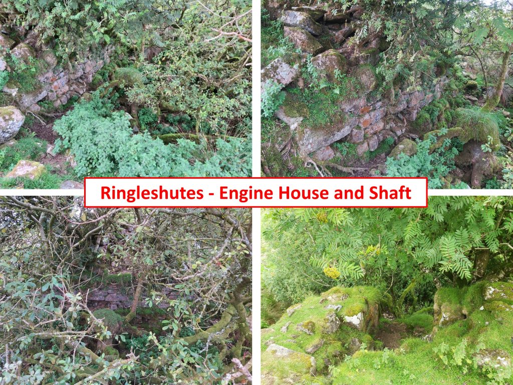
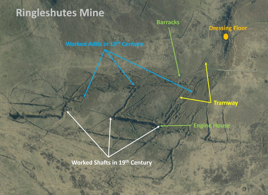
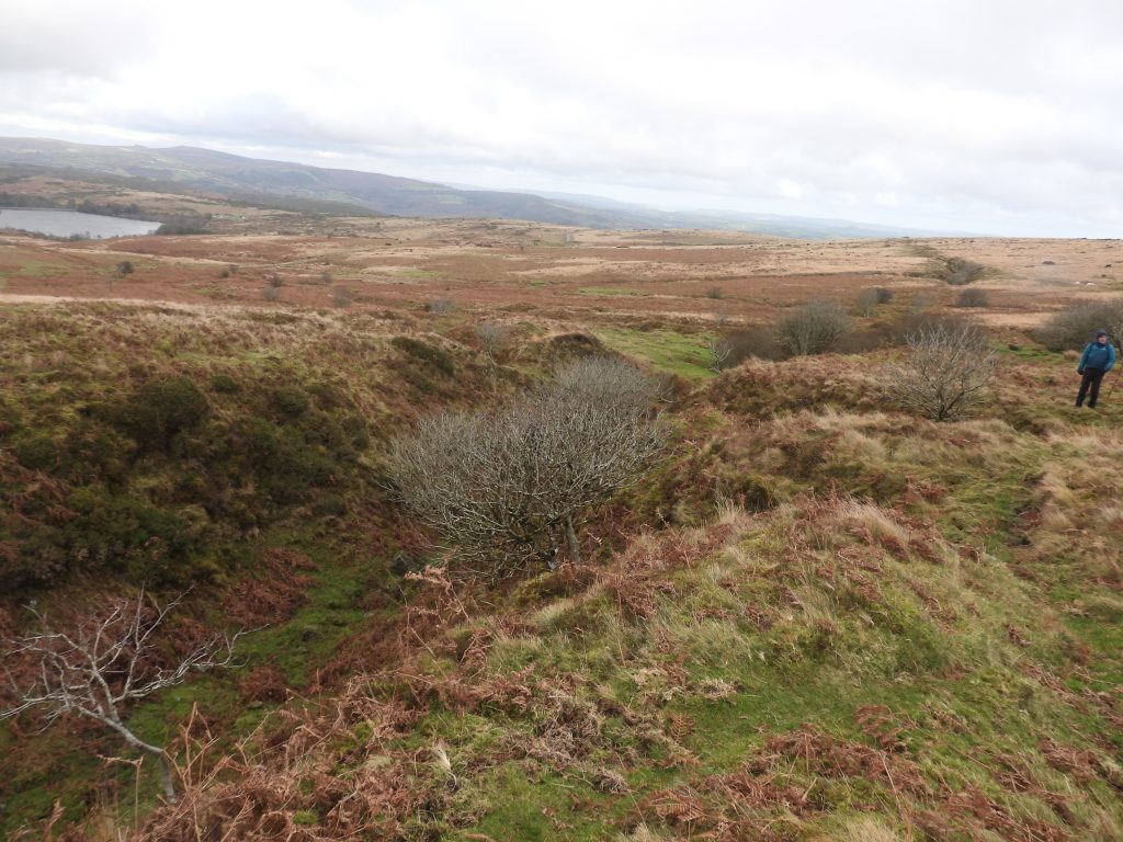
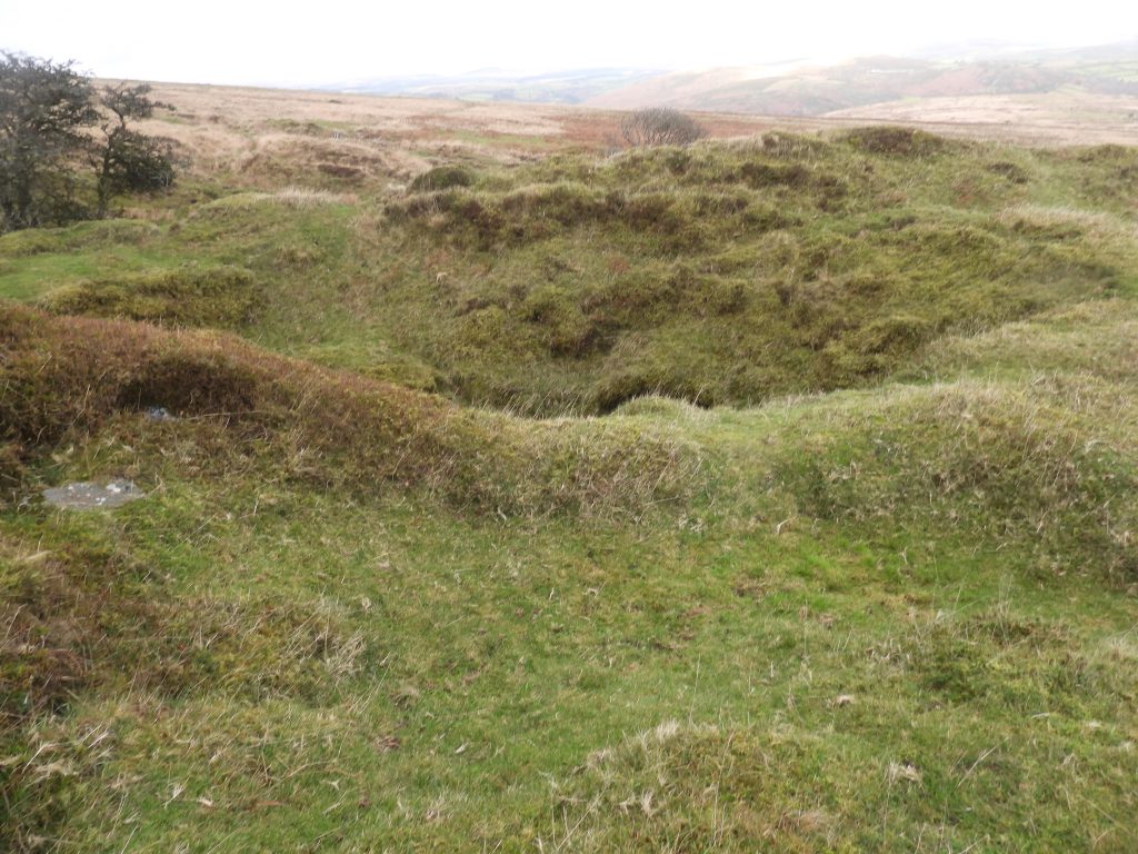
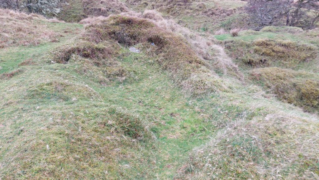
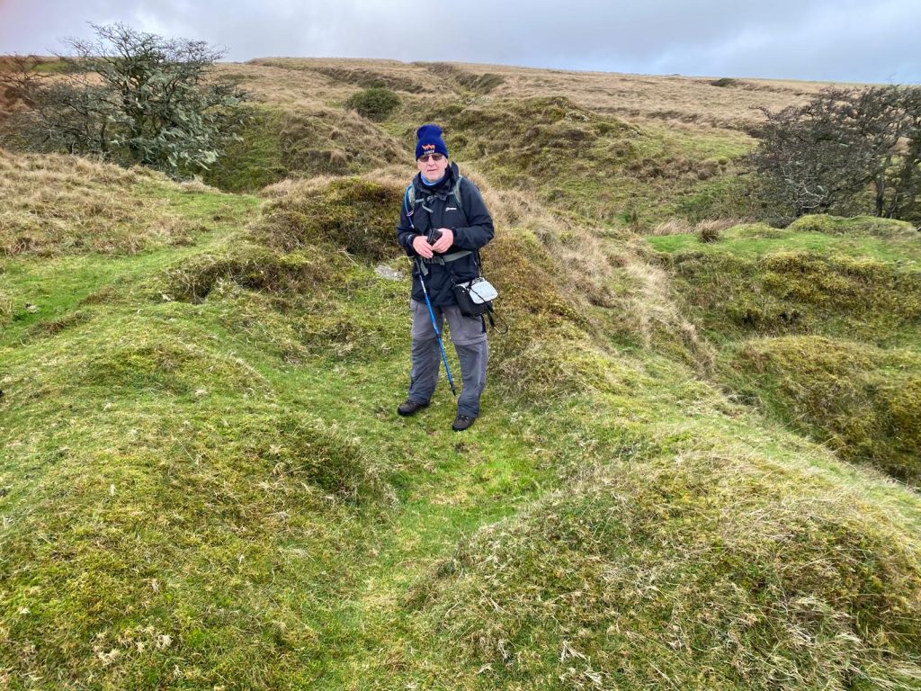
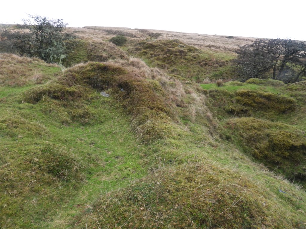
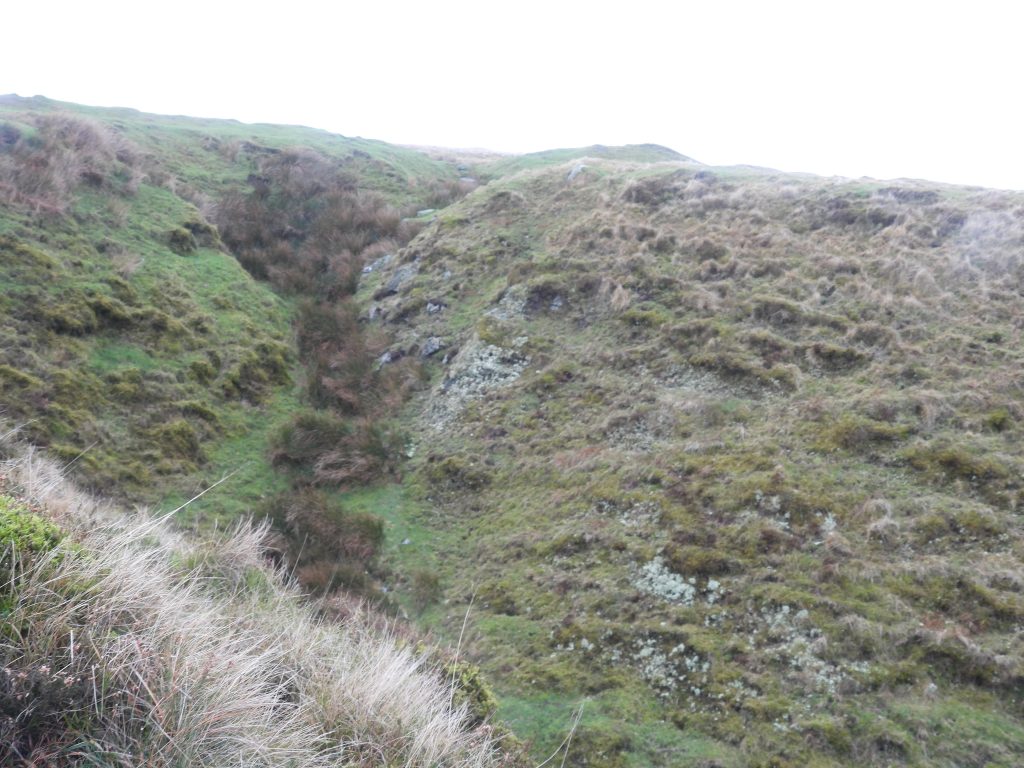
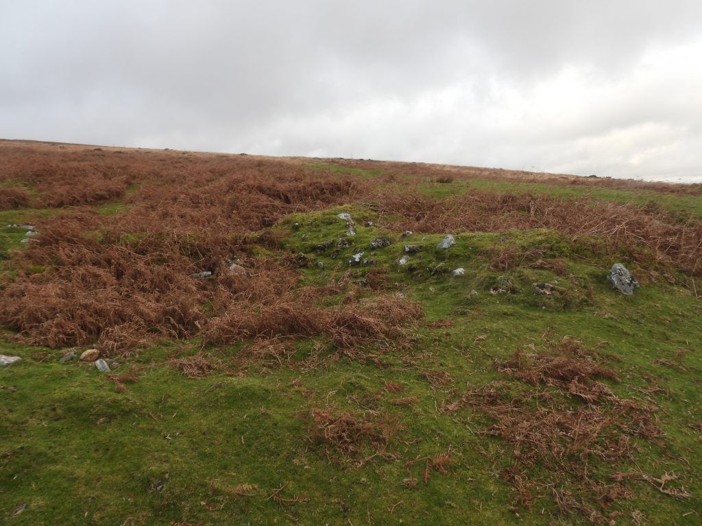
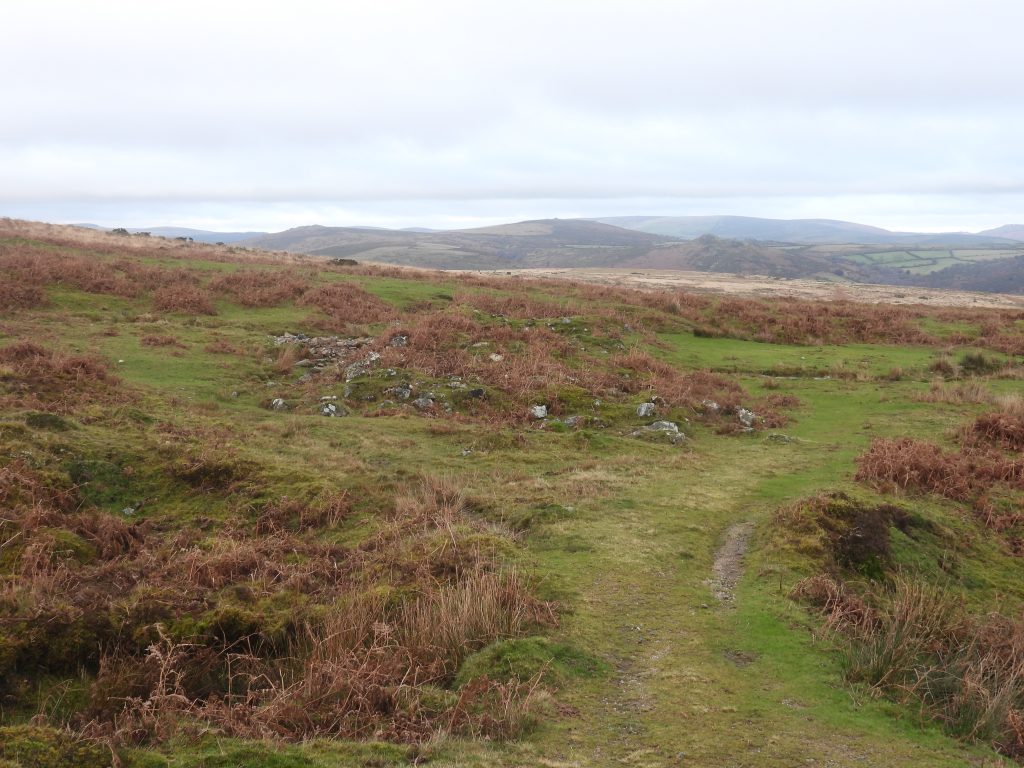
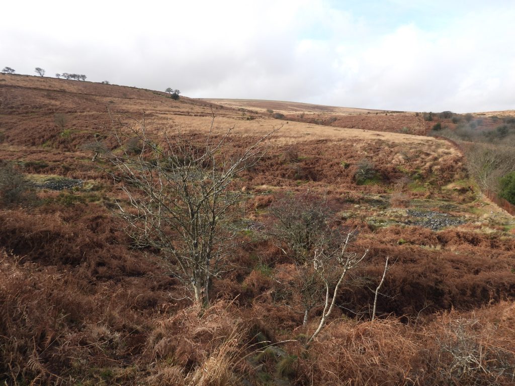
The mid 19th century Ringleshutes (sometimes called Ringleshutts) tin mine is situated within an area of extensive late Medieval openworks and streamworks at the head of Venford Brook. During an archaeological field survey in 1997, three mine shafts were identified between 7 metres and 9 metres in diameter, albeit there are also air shafts in the complex. One of these shafts was the main focal of the mid 19th century mining which has the remains of a 42-in Cornish Engine House adjacent to it. The mining operation seems to have followed three separate lodes where the shafts and associated adits are evident.
The original tin openworks are believed to be from 15th to 18th century (Newman) and there are at least 6 tinner’s reservoirs probably associated with this era. The workings originally only went underground to a very shallow extent before, in 1852, George Bennetts was granted a licence to work the mine in conjunction with Henroost under “Holne Moor & Hensroost United Mines”. Very little documentation for the mine survives but it is known that in 1852, £5k capital was raised and several shafts were sunk. It was a very short lived venture and is believed to have only lasted until 1855 – There were recorded sales of £22 12s 6d black tin in 1854. Crossing recorded in 1888, when he was 41 that the chimney from the Engine House was still standing but the mine was ‘old’ which is assumed to me abandoned
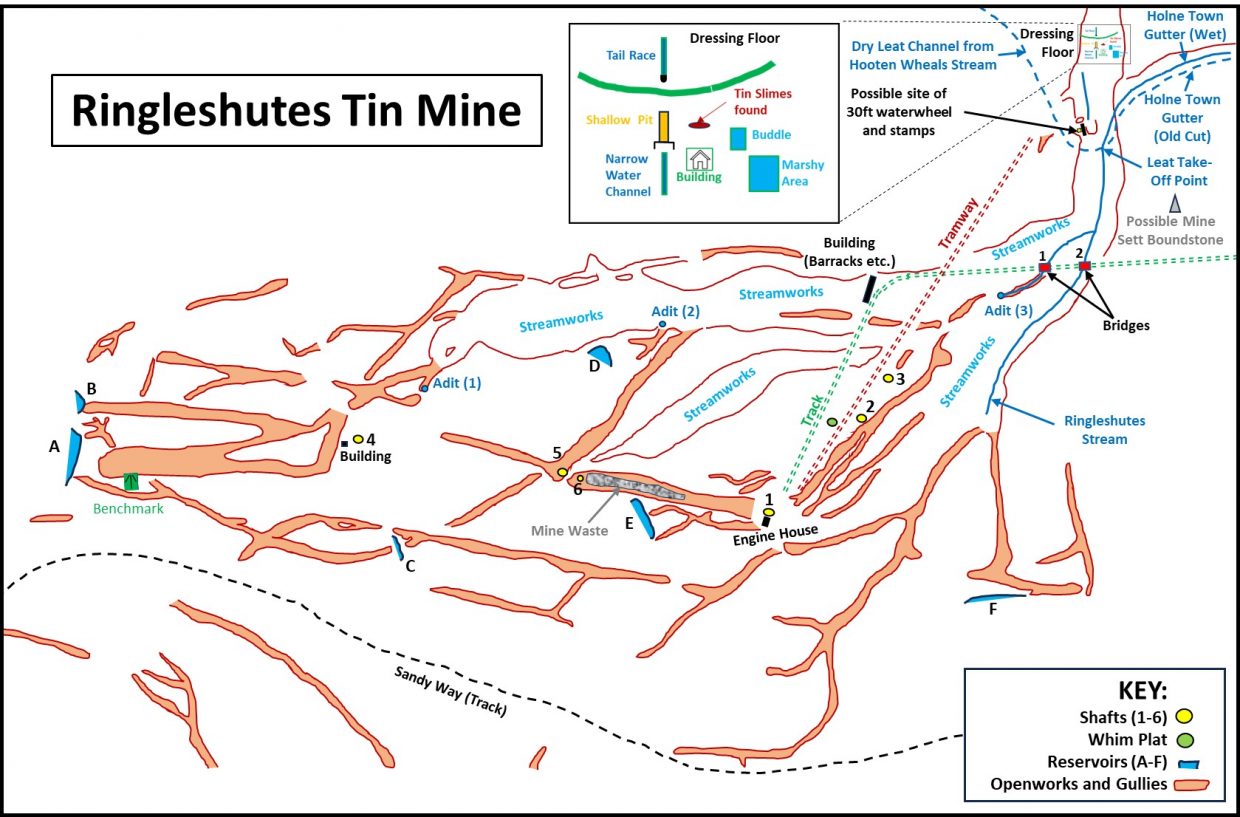
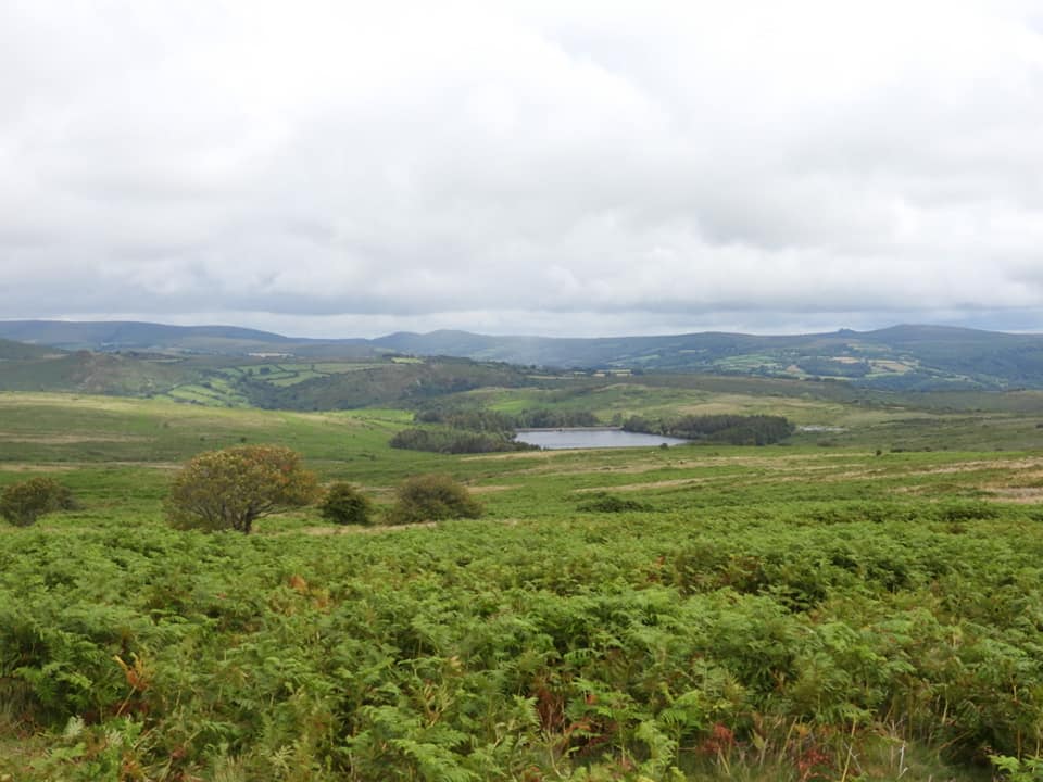
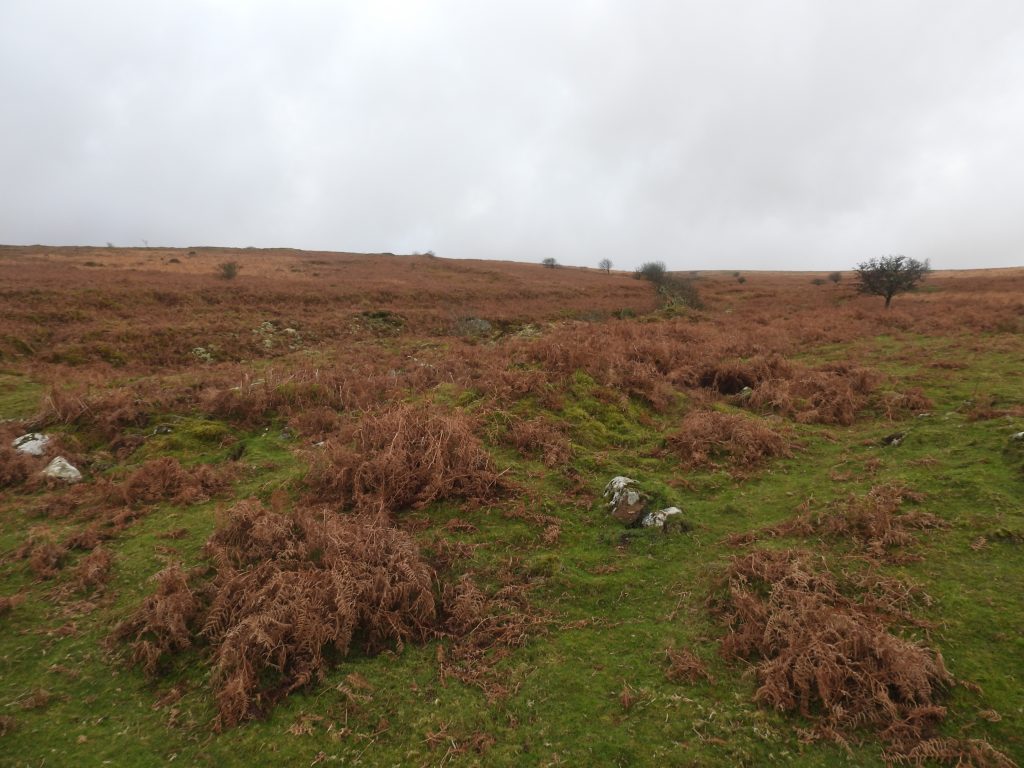
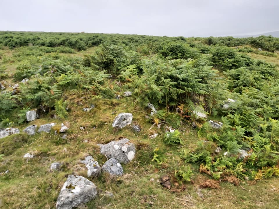
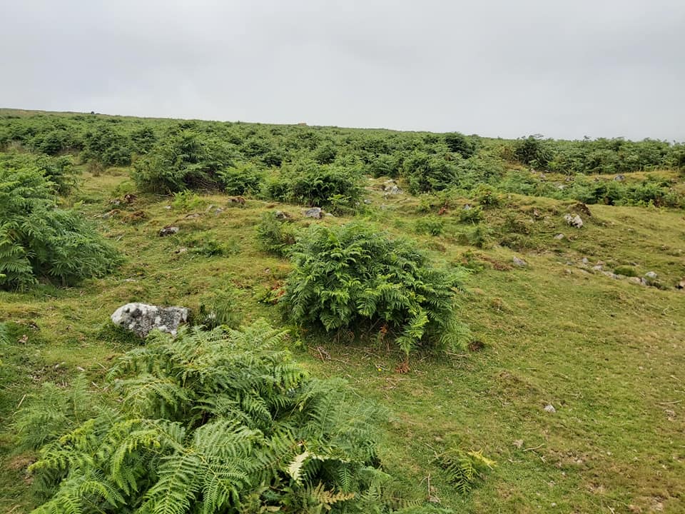
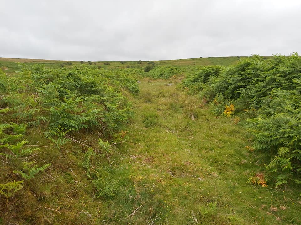
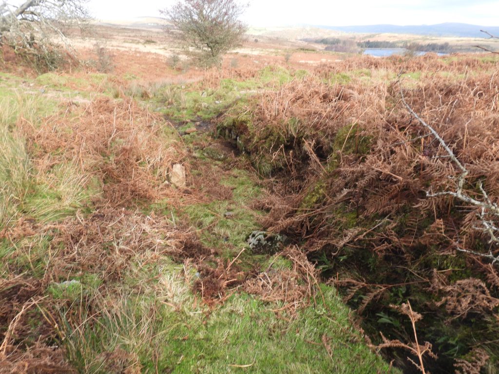
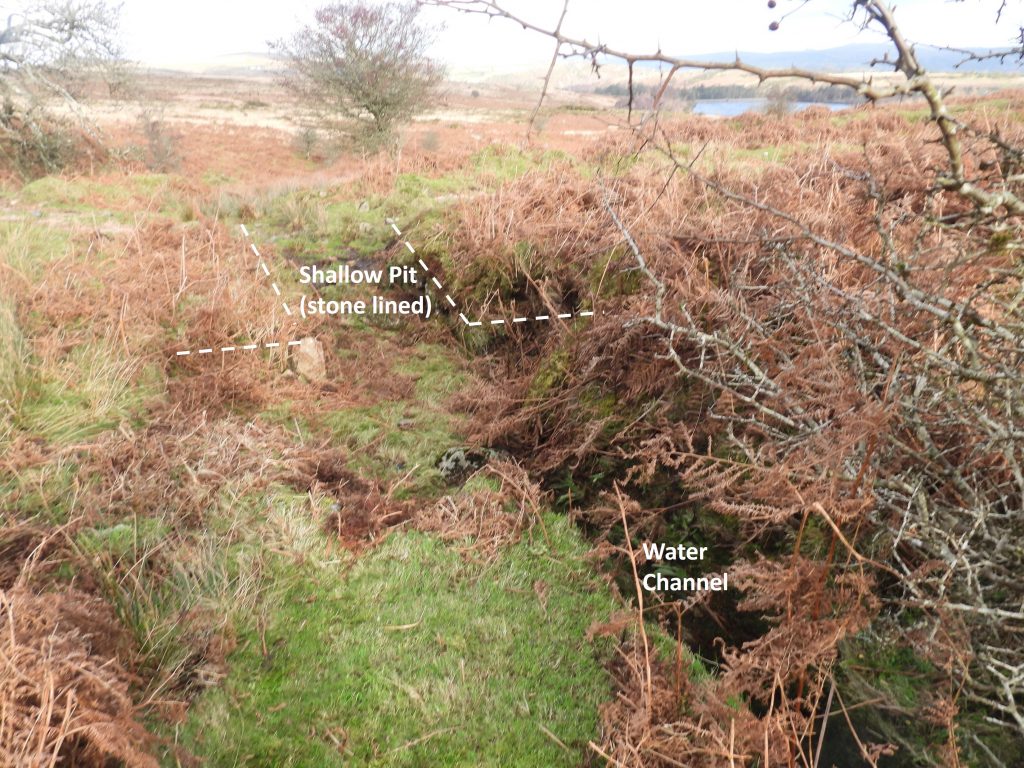
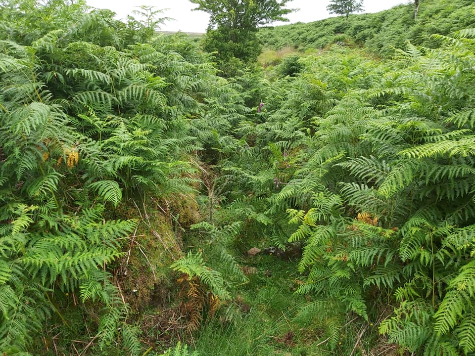
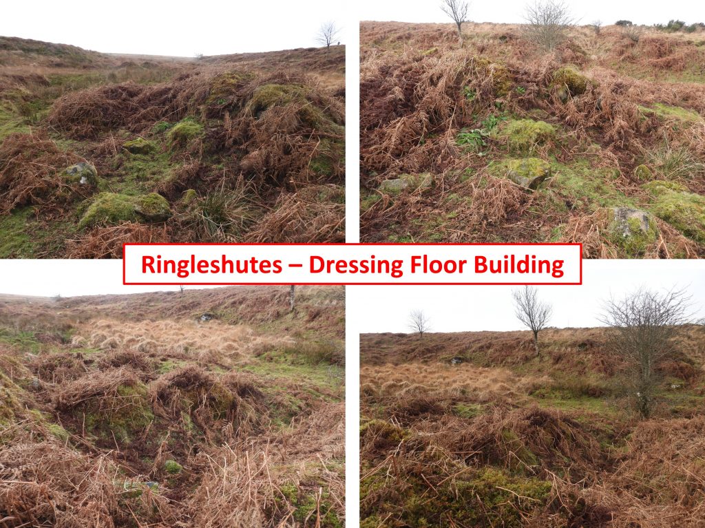
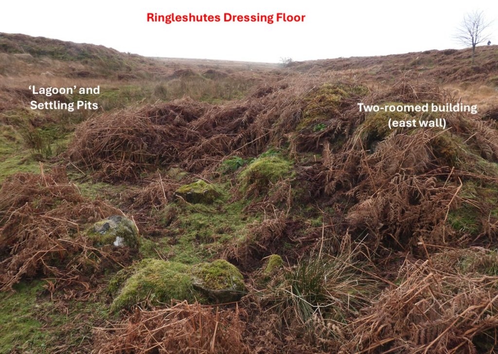
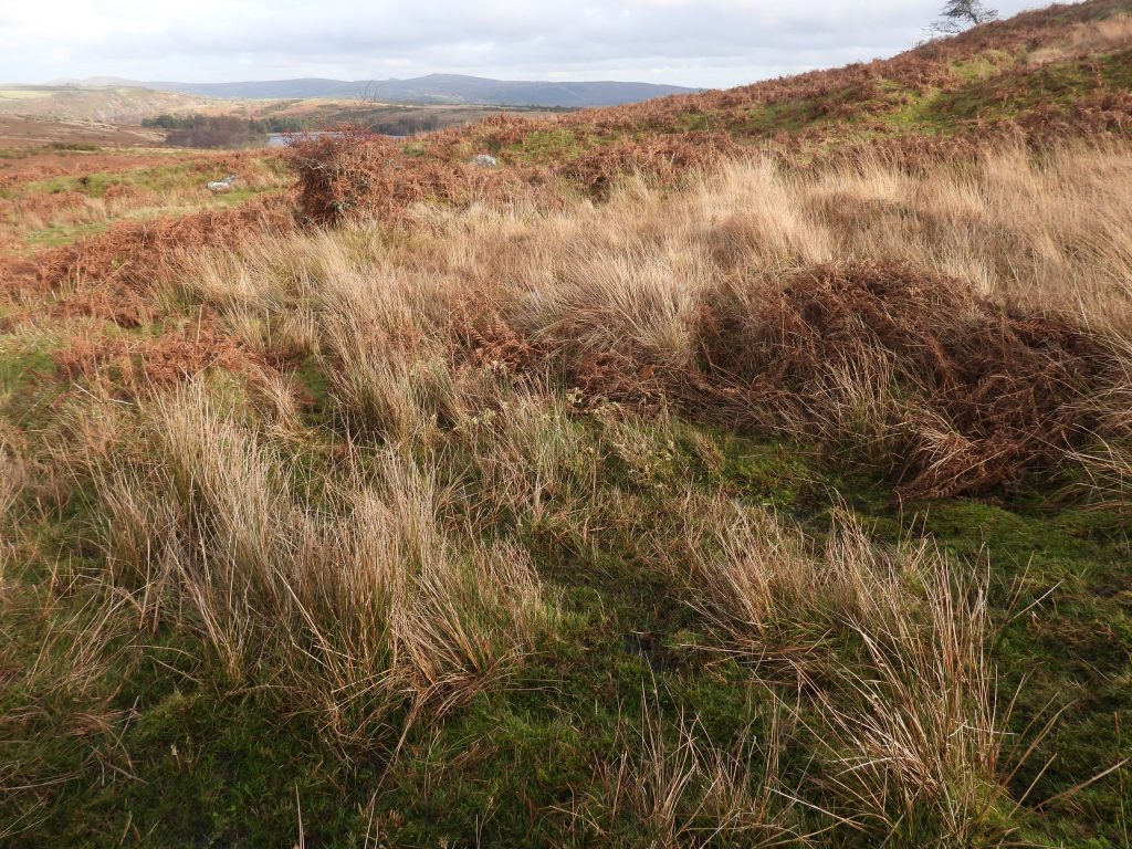
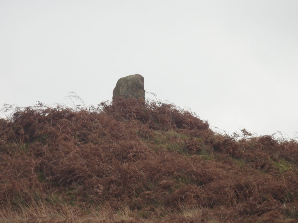
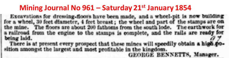
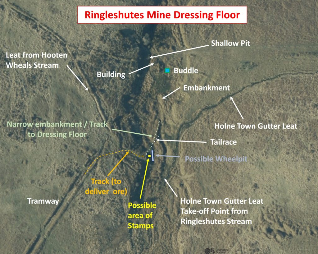
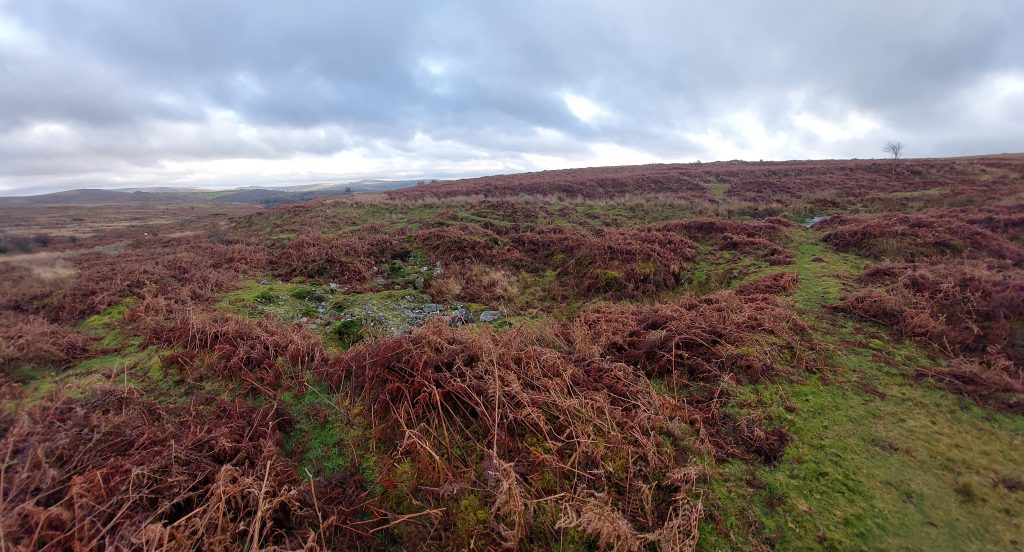
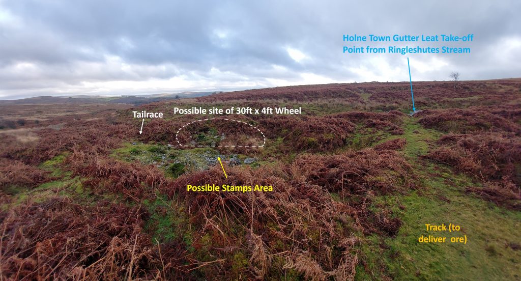
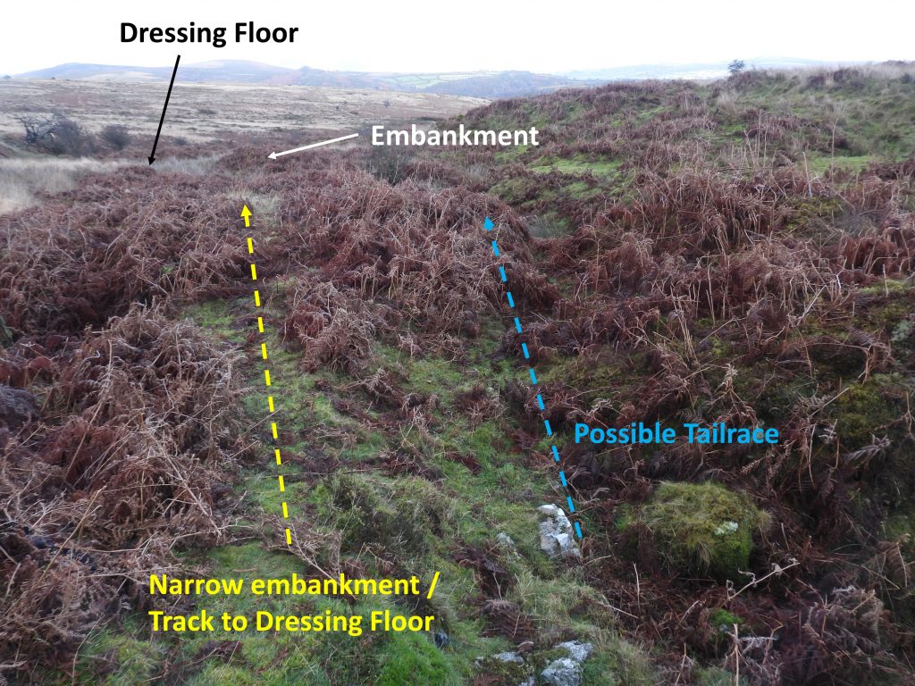
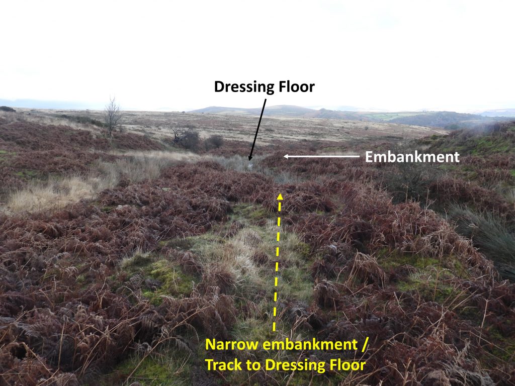
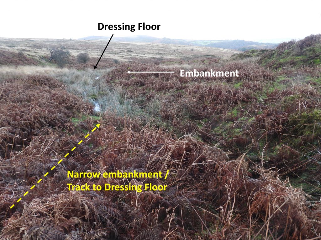
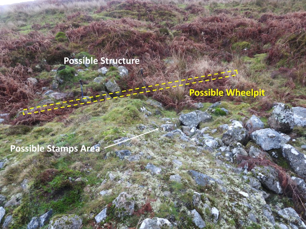
The Cornish Engine House and the main shaft are linked to a dressing floor by a 400m tramway, close to which are the remains of a large 5 roomed building assumed to the the barracks / admin etc. for the mine. A horse whim can be identified, next to the tramway, which due to the gradient would have been necessary to provide the motive power to haul skips up the hill. At the Dressing Floor, most of the features are covered by vegetation, especially in Summer, so any visit is recommended to be made during the Winter months. The Dressing Floor comprises a rectangular building, a level area containing at least one buddle, a narrow water channel leading to a stone lined shallow pit with a tail race. A 30ft x 4ft wheel was recorded by George Bennetts in 1854 (Mining Journal) and a possible location for this is detailed in this post. To the south of the Dressing Floor and on the east side of the mining complex there is a upright stone, which might possibly have been a boundstone defining the sett.
Bibliography
Dave Brewer – (1988) – Dartmoor Magazine issue 11, ‘Ringleshutes Tin Mine’, pages 22-24
John Robins – (1984) – Follow the Leat – Holne Town Gutter, pages 39-40
Simon Probert & Dr Phil Newman – (1997) – Holne Moor, Dartmoor, Devonshire. A Landscape Survey by the Royal Commission on the Historical Monuments of England
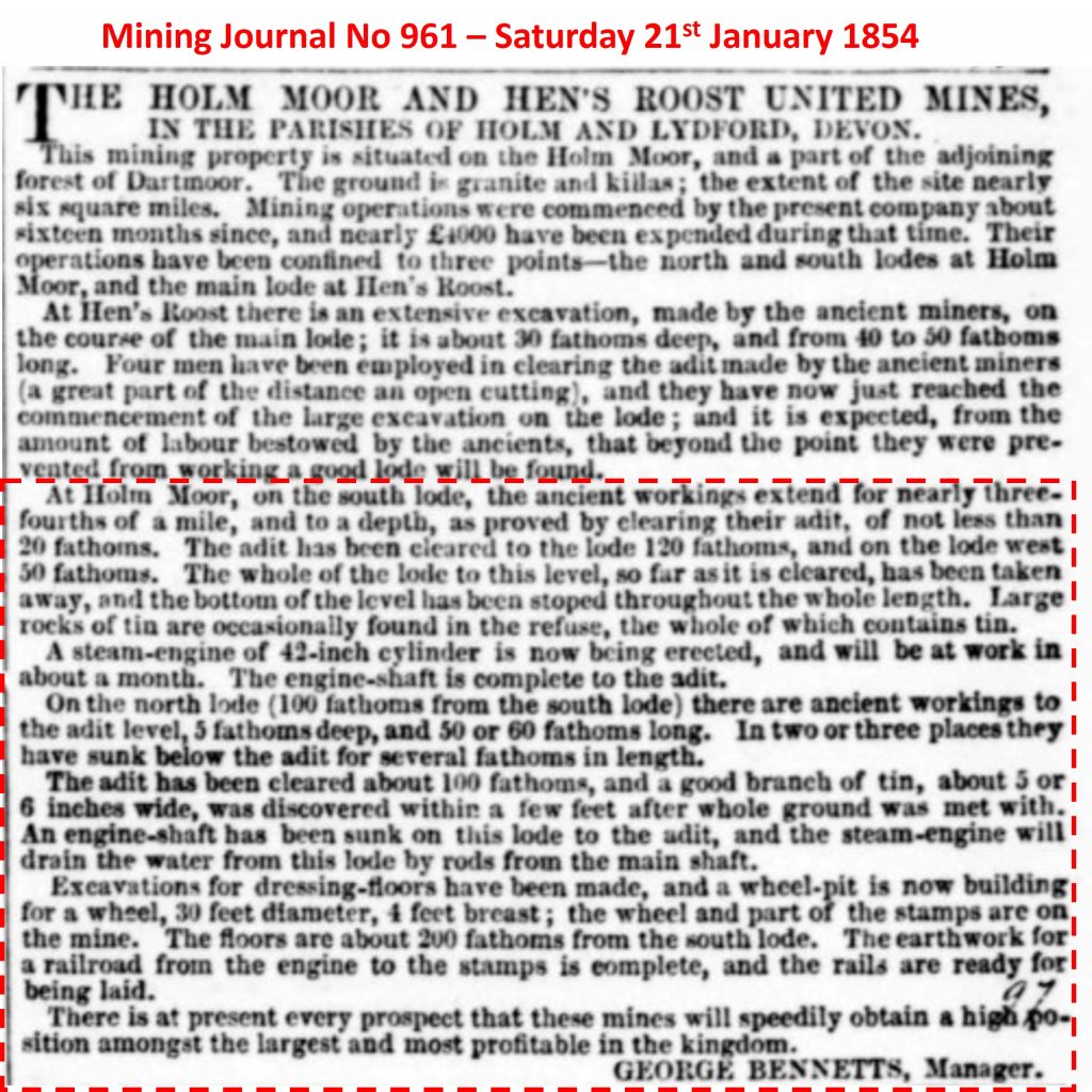
Mining Journal – (Saturday 21st January 1854) – No. 961 – George Bennetts, Manager
Mining Journal – (Saturday 8th April 1854) – No. 972 – George Bennetts, Manager
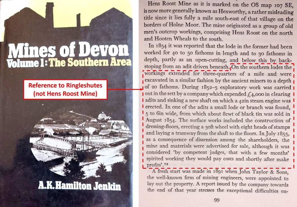
A.K. Hamilton Jenkin – (1974) – Mines of Devon, Volume 1: The Southern Area – page 99
R.J. Smerdon – (1995) – ‘Ringleshutes Tin Mine’, letter in Dartmoor Magazine, 39, Summer 1995, 28
Brian Le Messurier – (1974) – Crossing’s Amid Devonia’s Alps (from 1888), pages 108-9
Dr.Tom Greeves – (1986) – Tin mines and miners of Dartmoor, page 4
Dr. TomGreeves – (1990), An Assessment of Dartmoor Tinworking, 23 (Report – Assessment). SDV343684.
Bob Bruce – Dartmoor Tinworking Research Group – Newsletter 18 – (2000) – Ringleshutes Mine walk, pages 3-4
David Eeles – Dartmoor Tinworking Research Group – Newsletter 58 – (2020) – Ringleshutes Mine walk, pages 6-7
Eric Hemery – (1983) – High Dartmoor – pages 568 and 570
Eric Hemery – (1986) – Walking the Dartmoor Waterways – Holne Town Gutter, pages 66-68
Chris Kelland – (January 2009) – DTRG Newsletter 36, page 17 under the title ‘New name of a possible Dartmoor tin mine’
Dartmoor Chris – Pers. Conv.
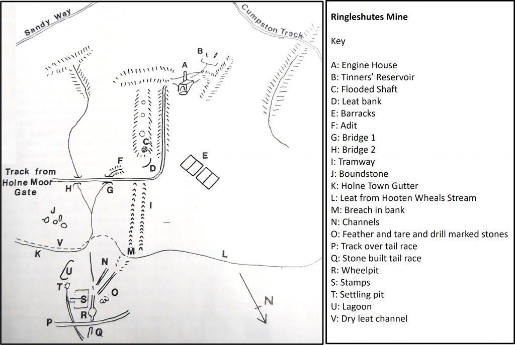
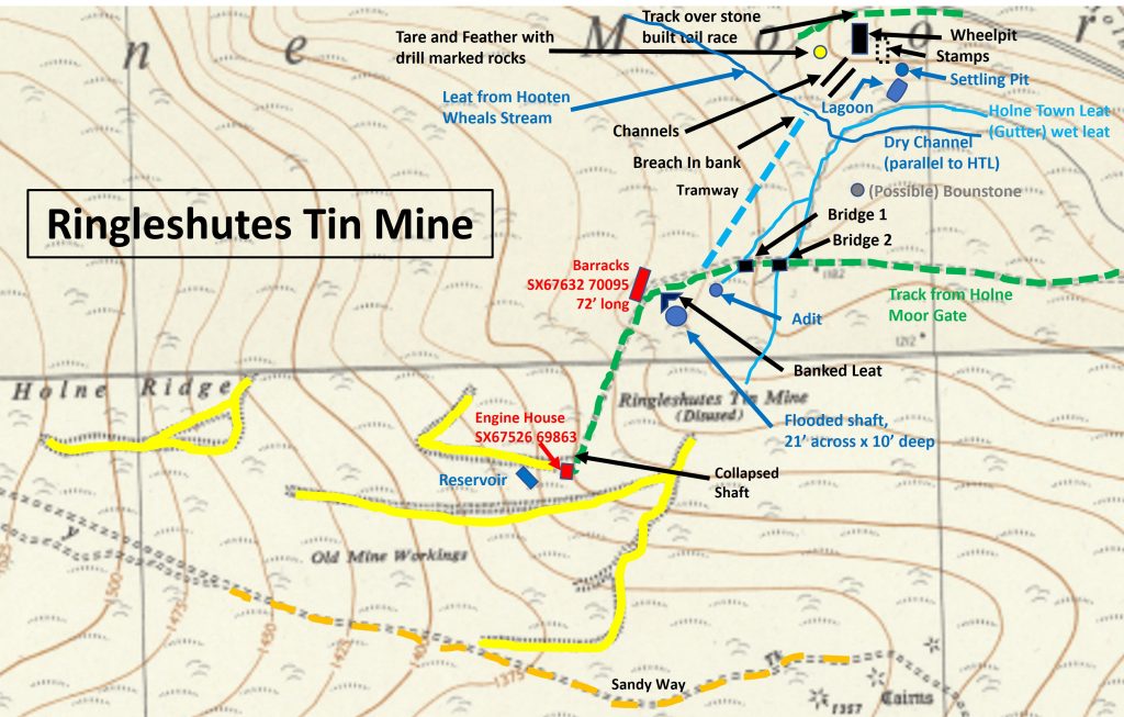
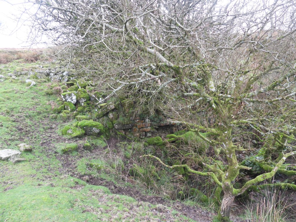
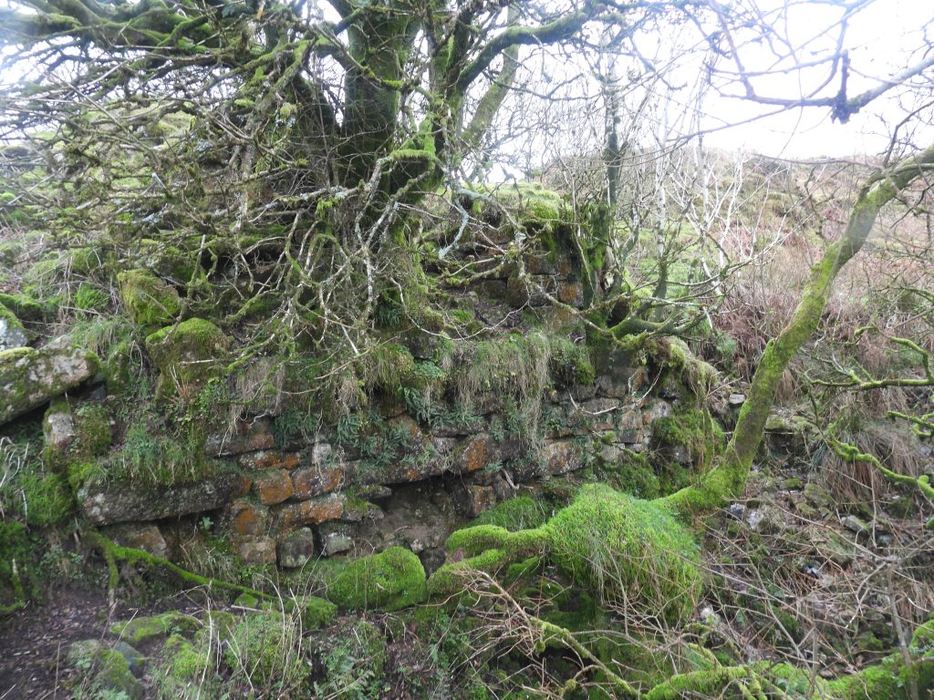
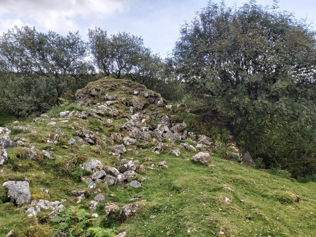
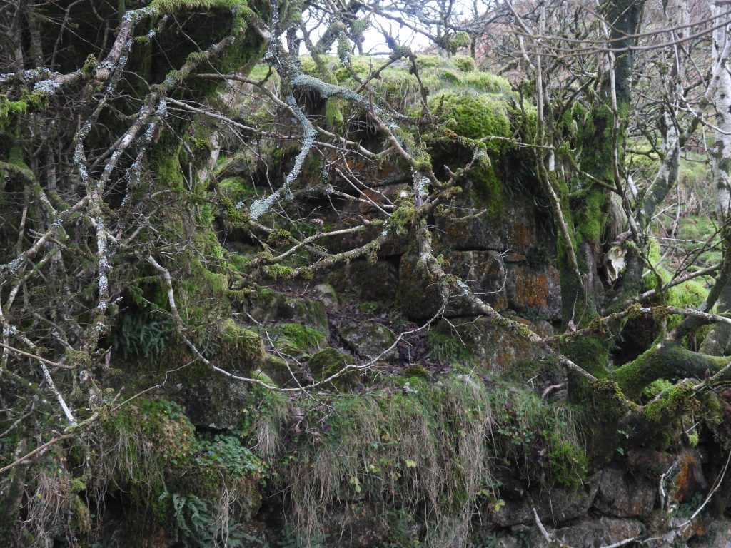
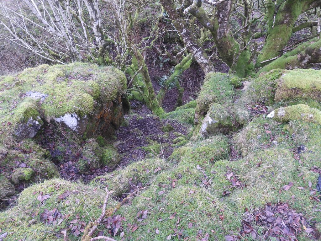
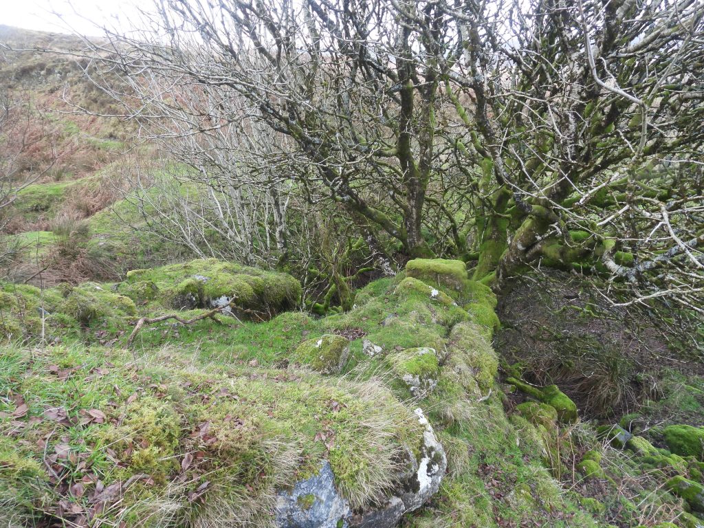
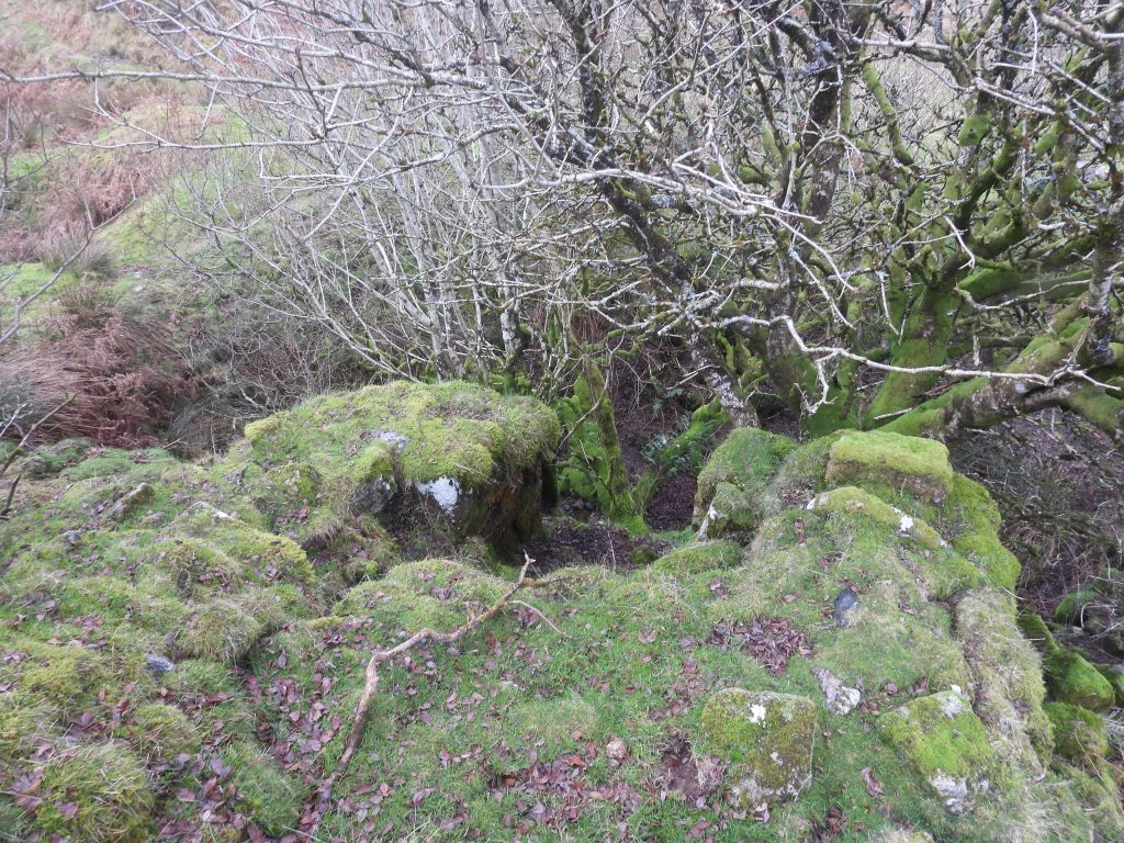
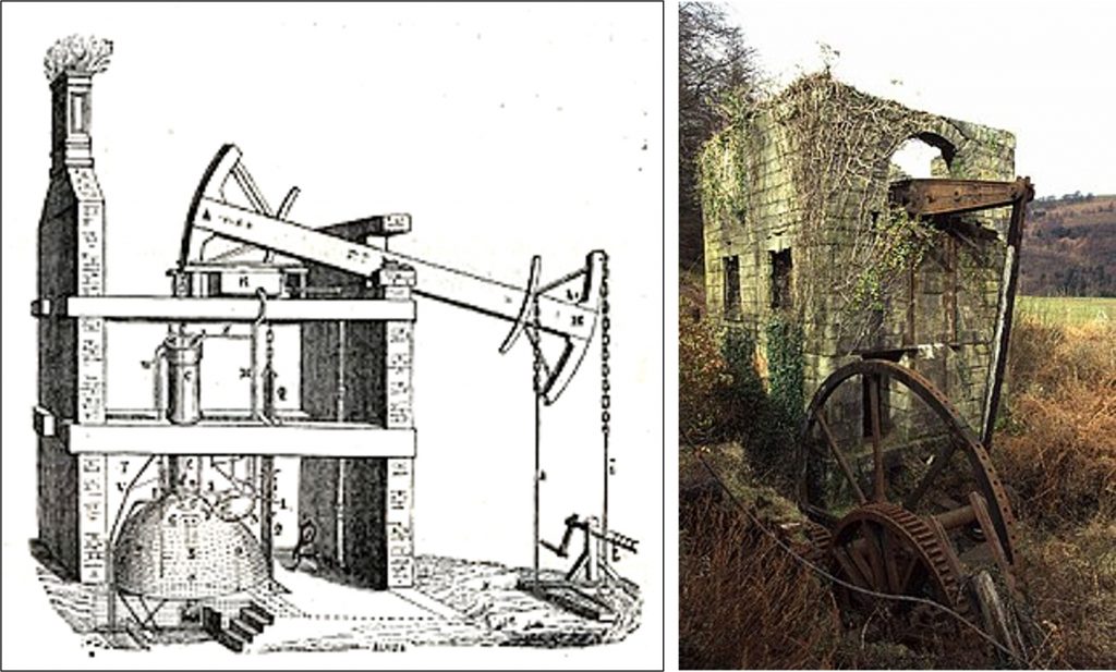
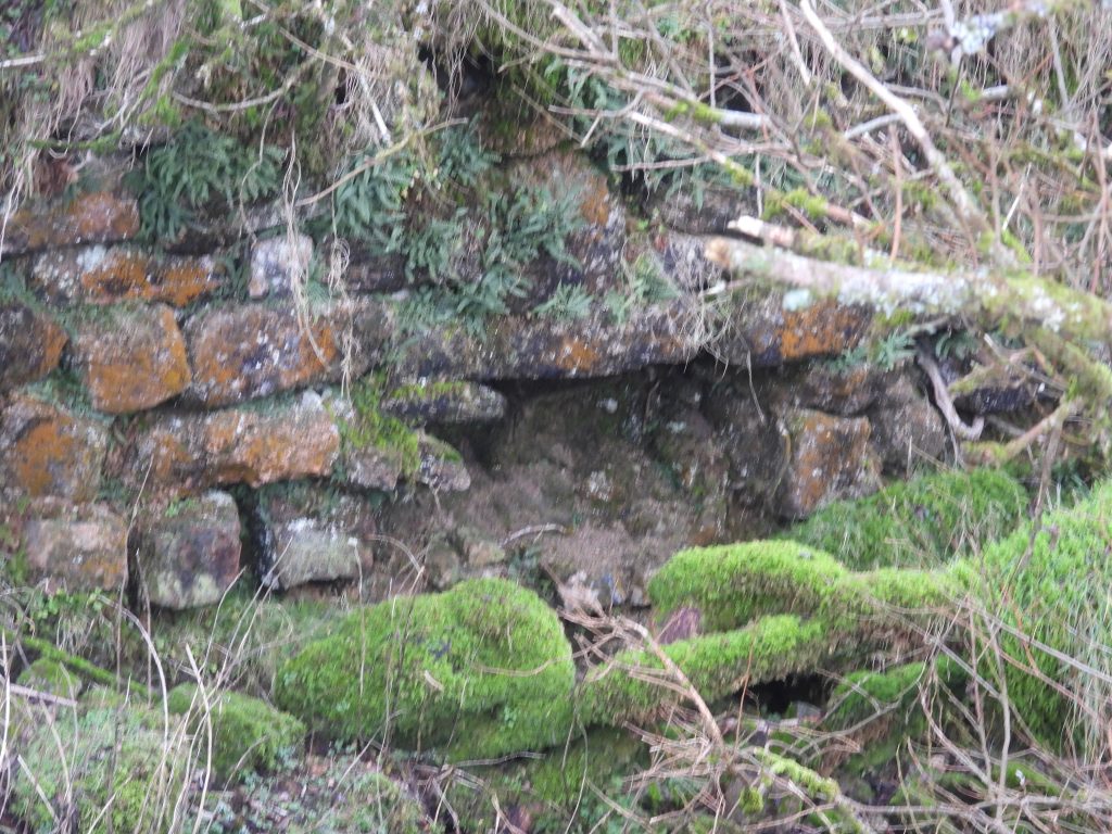
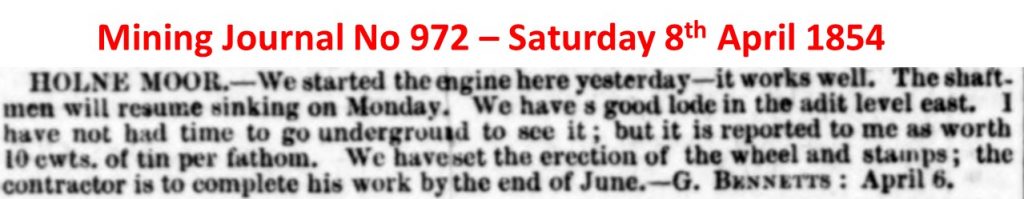
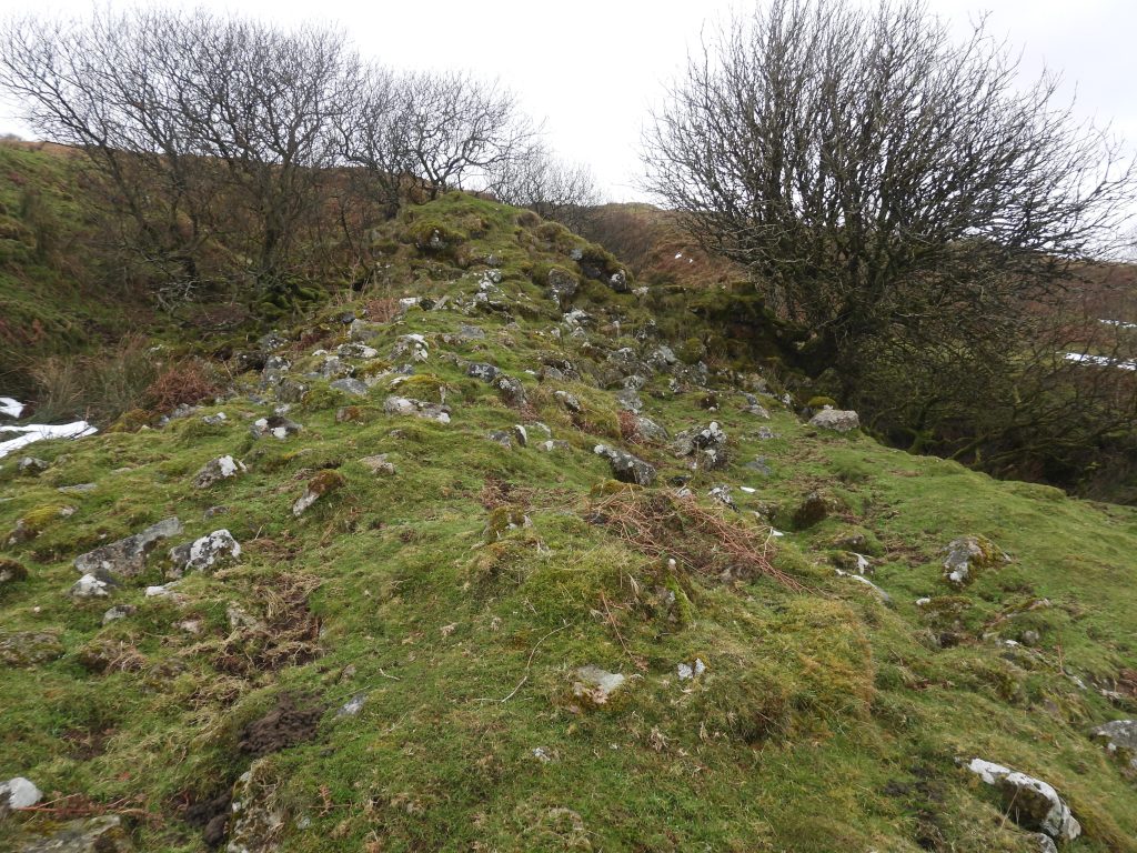
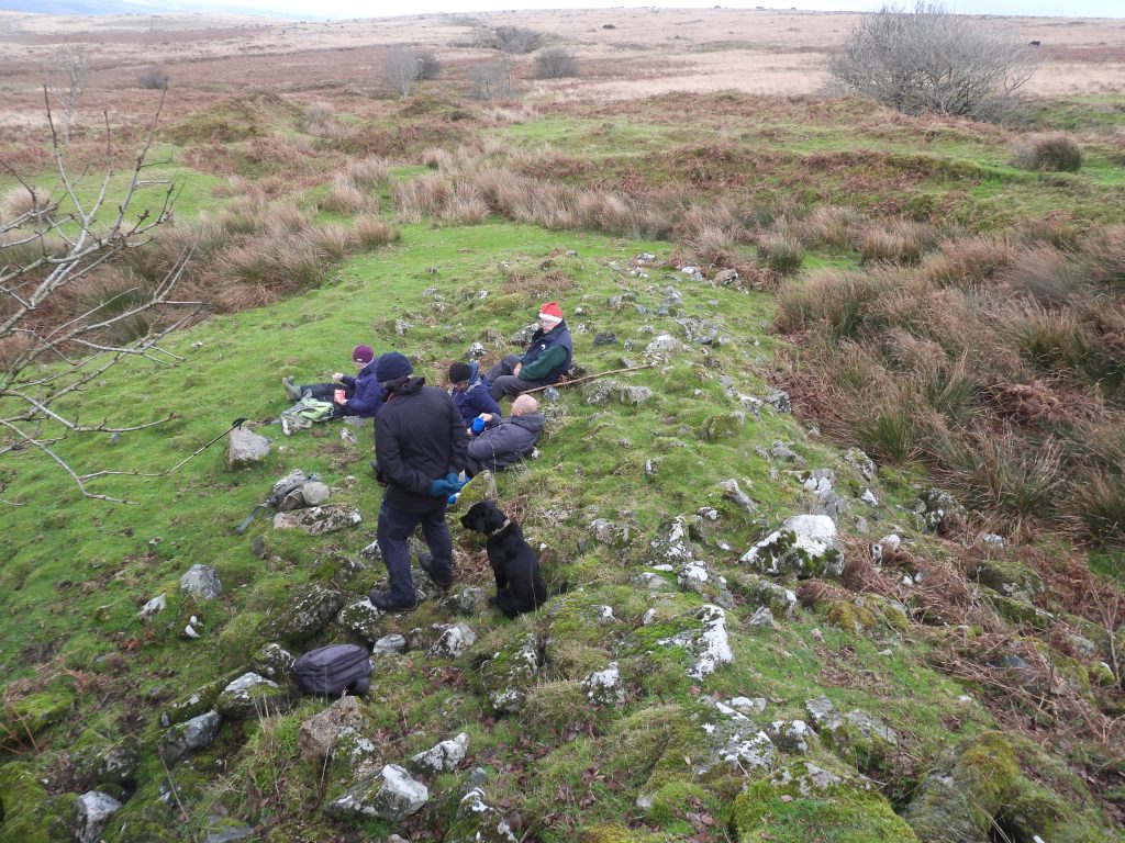
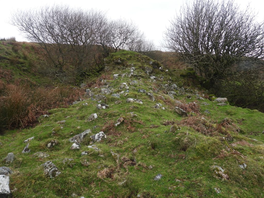
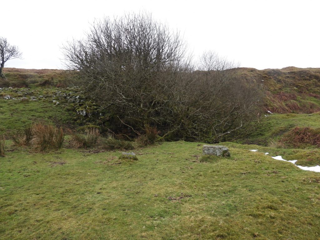
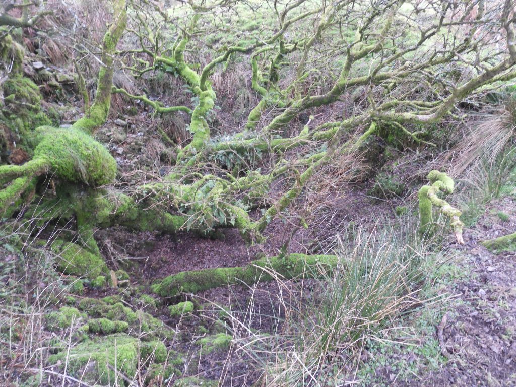
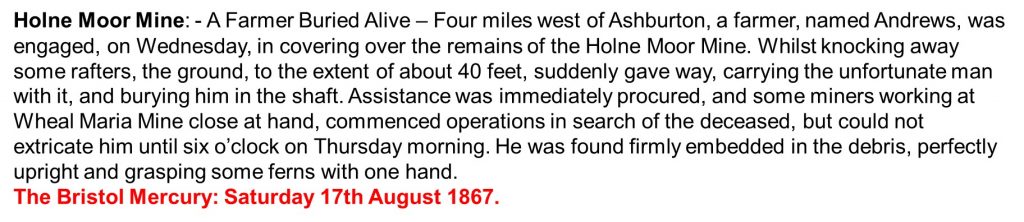
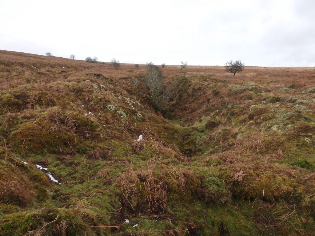
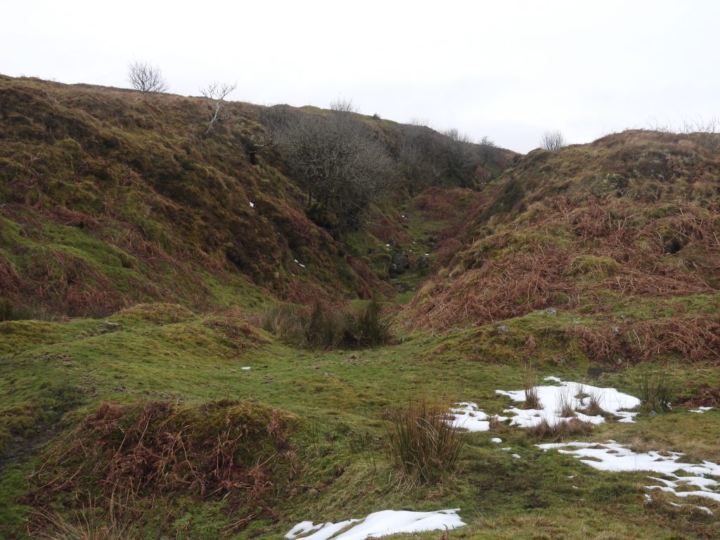
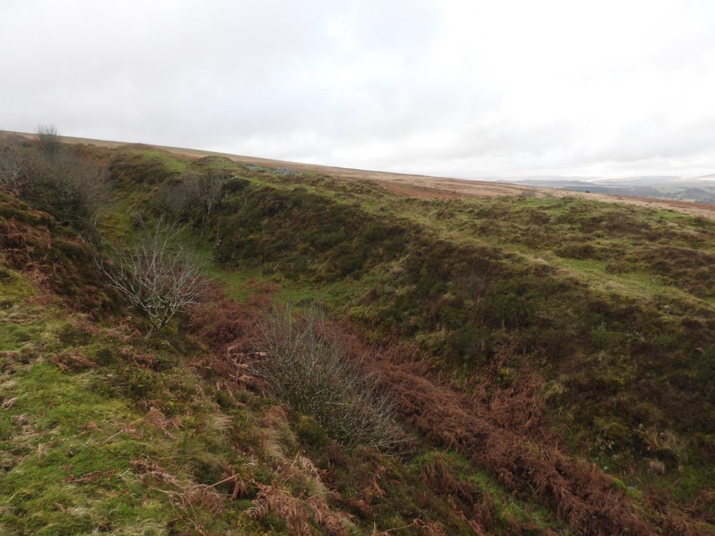
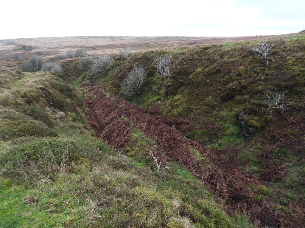
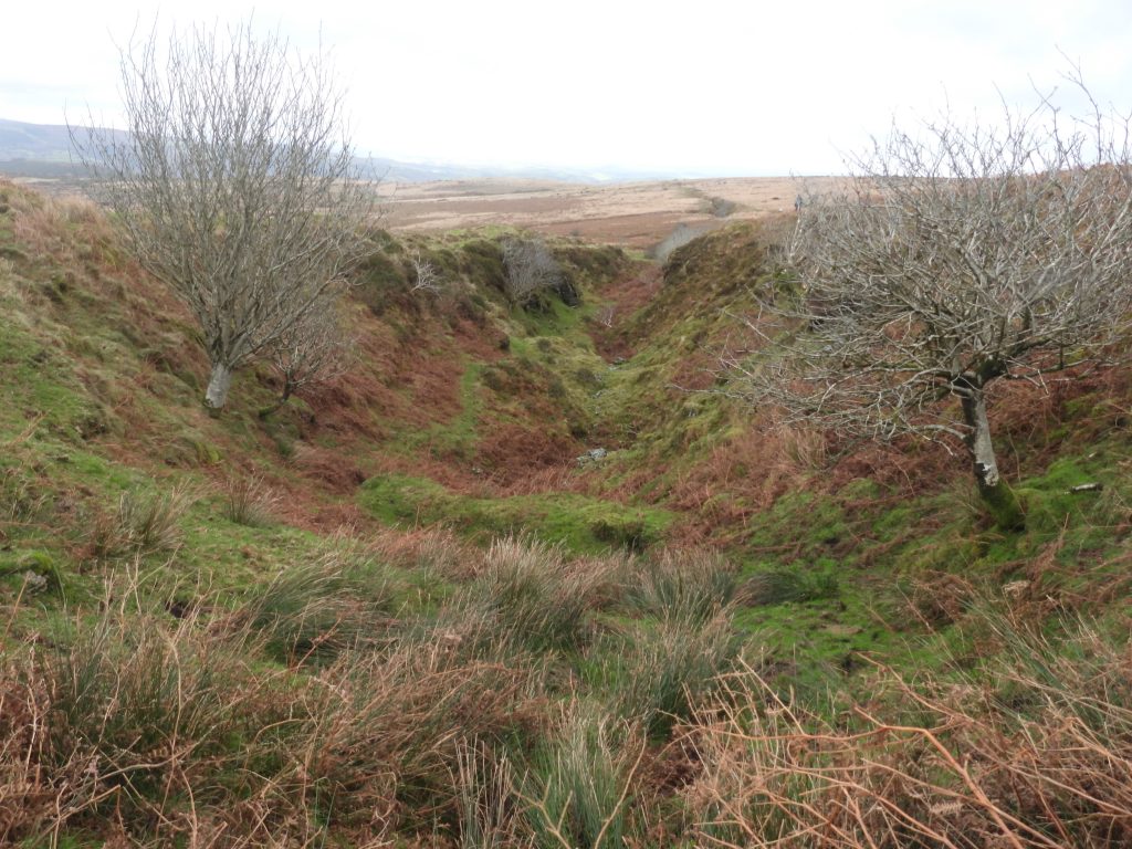
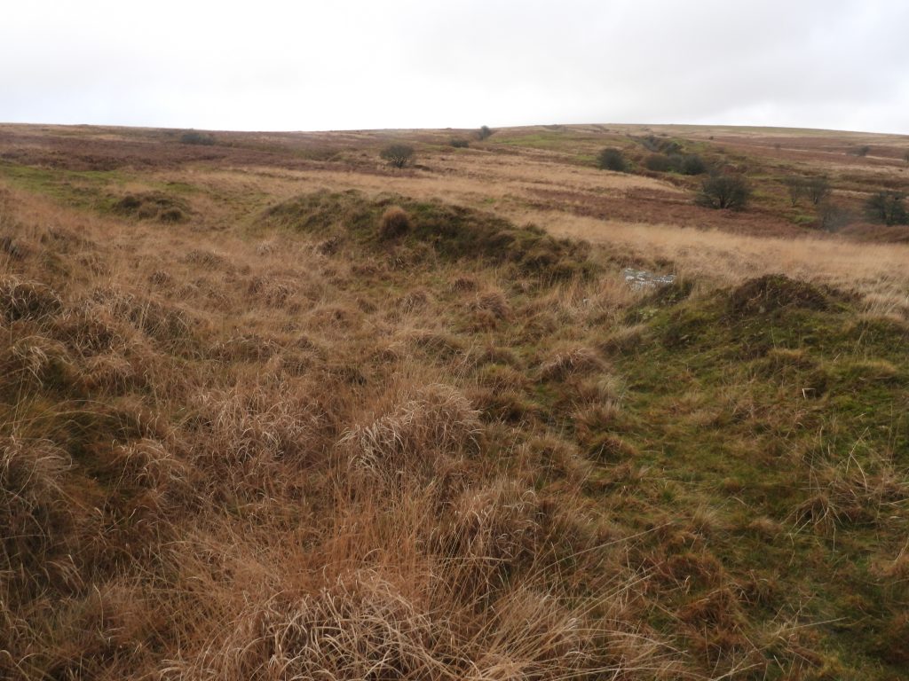
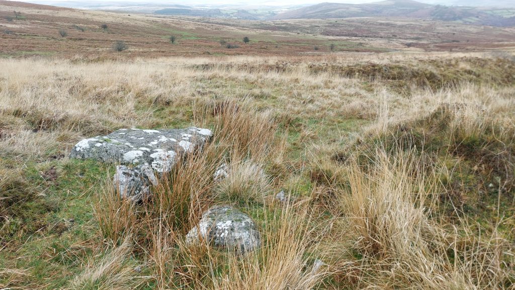
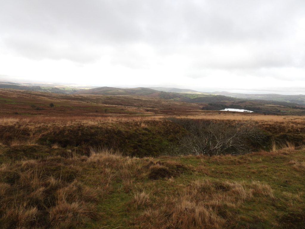
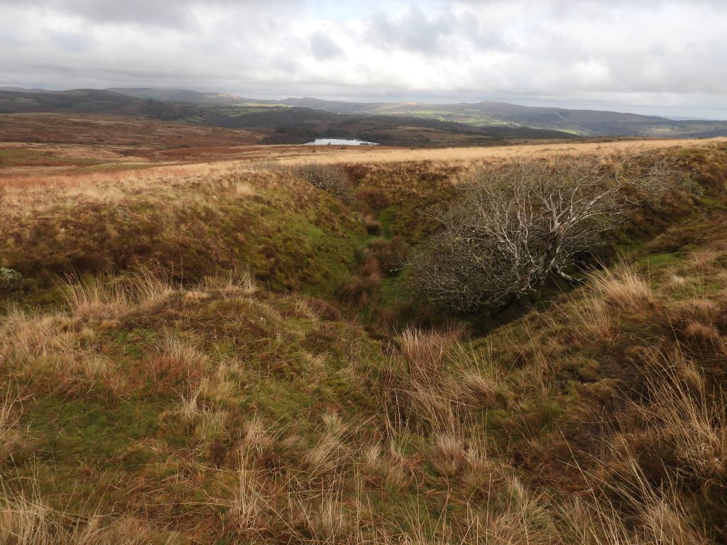
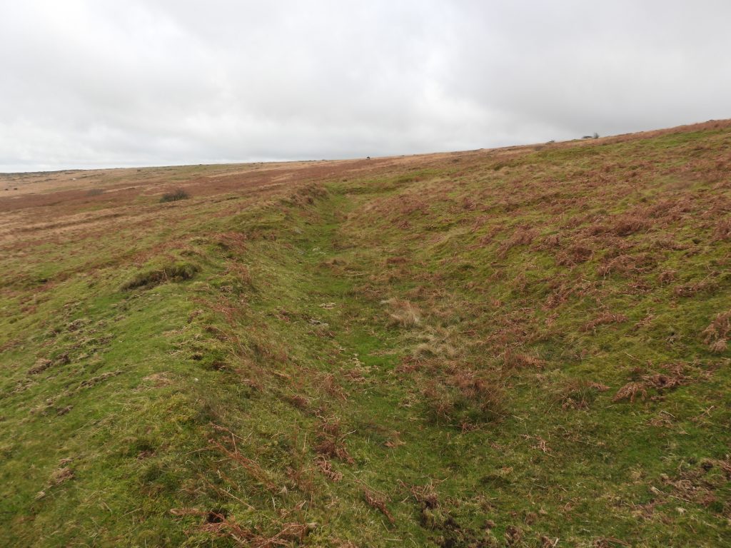
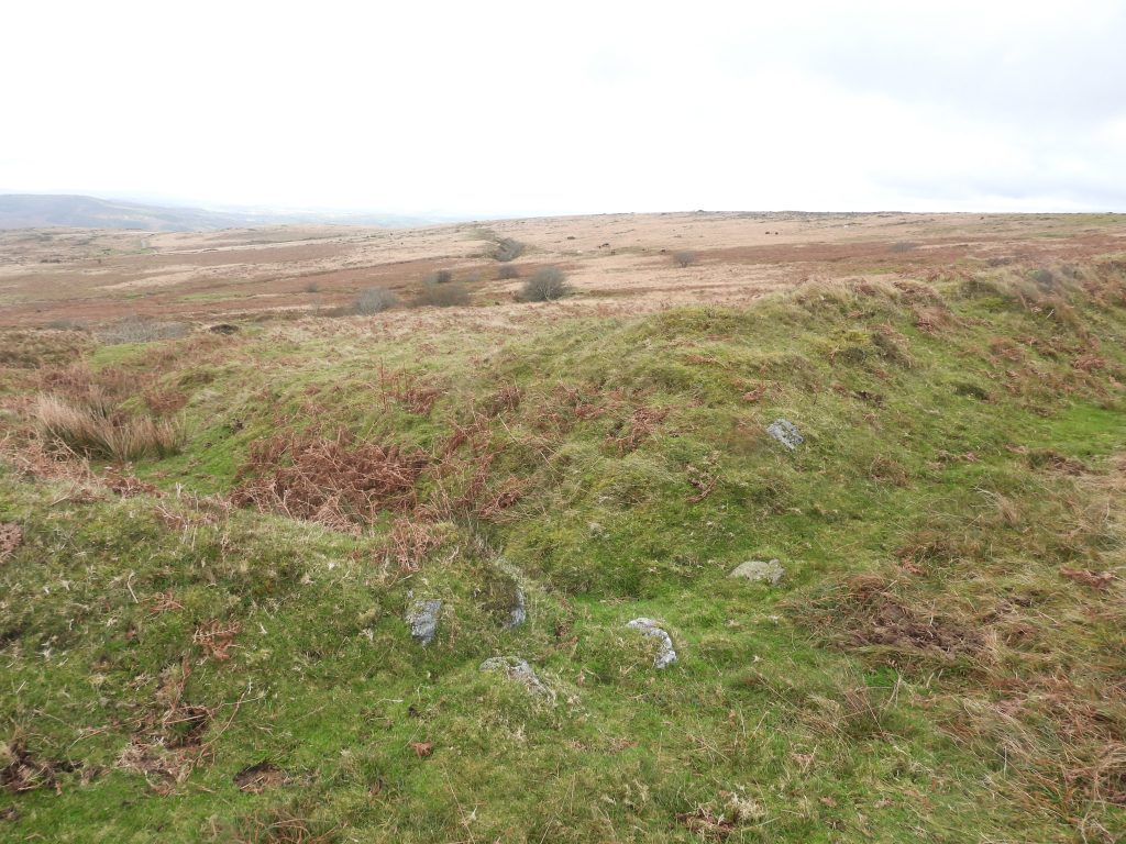
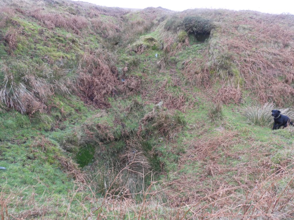
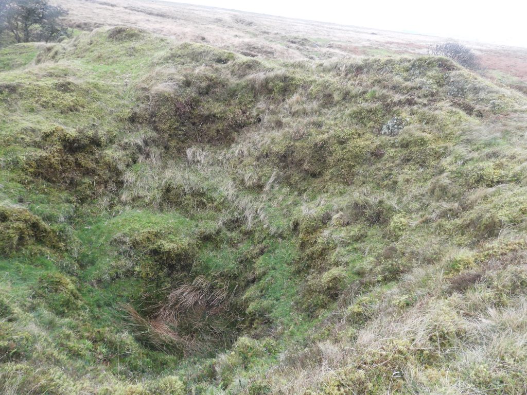
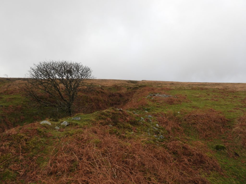
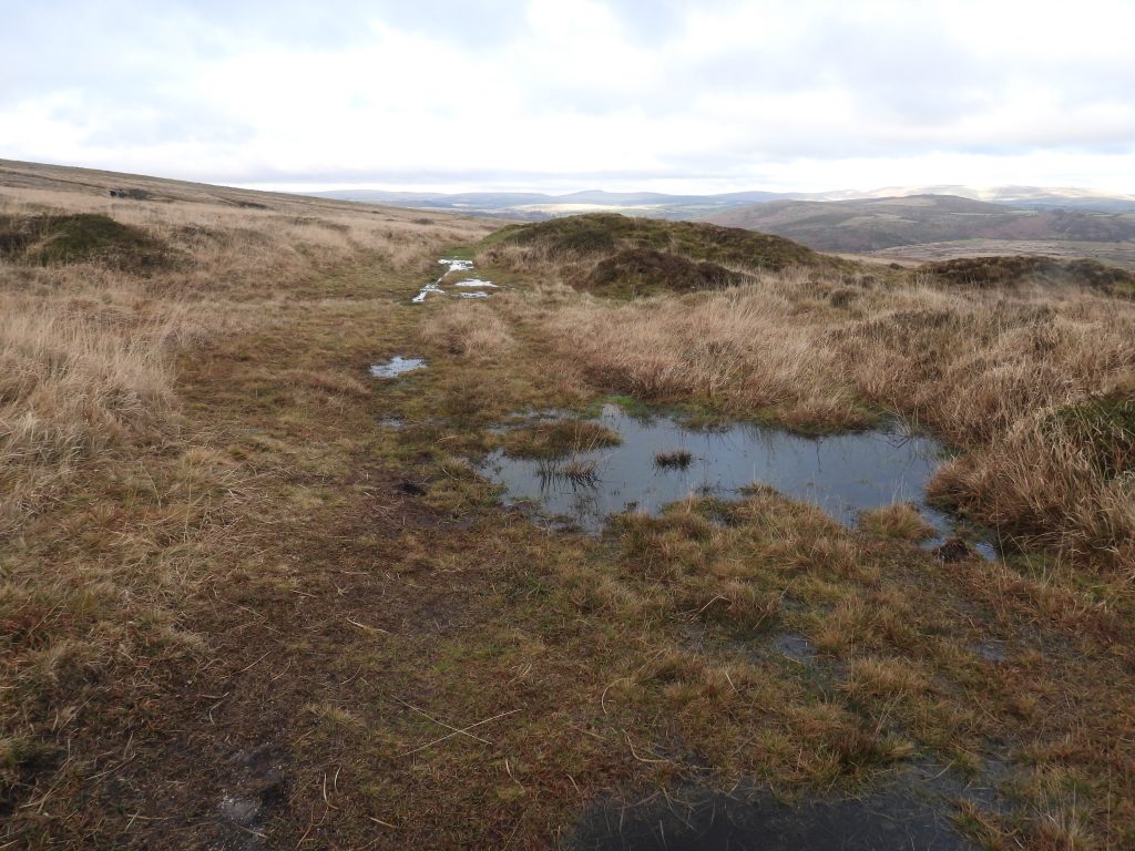
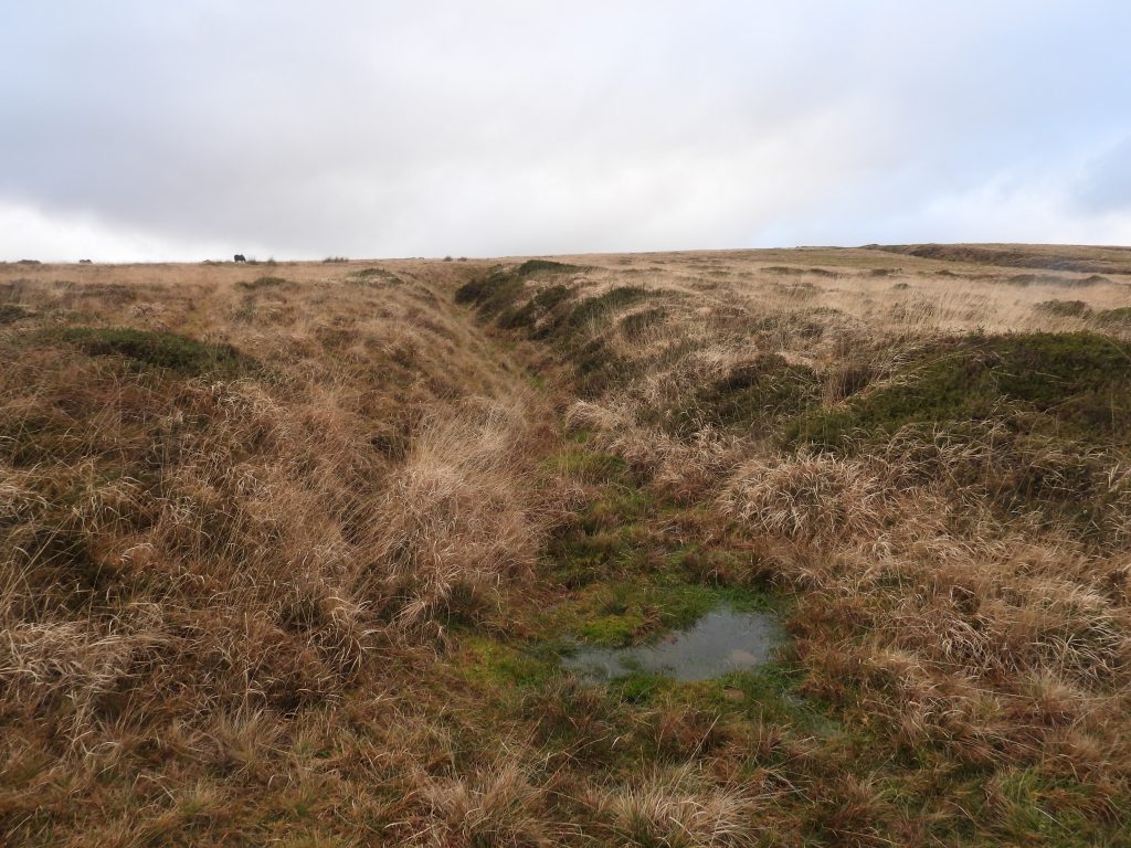
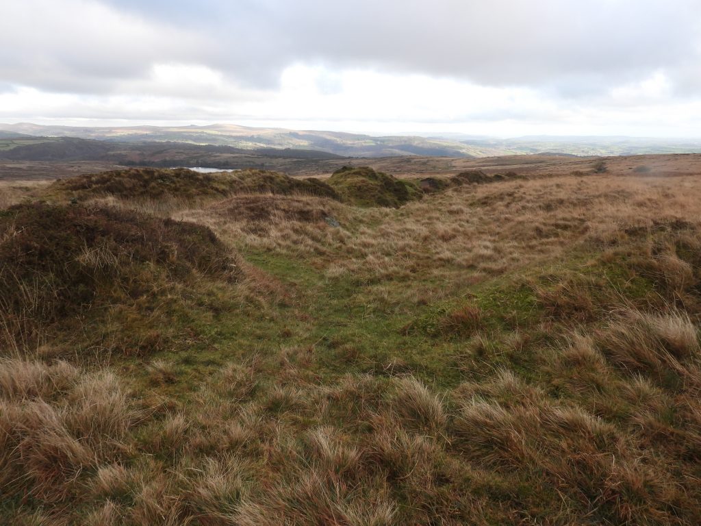
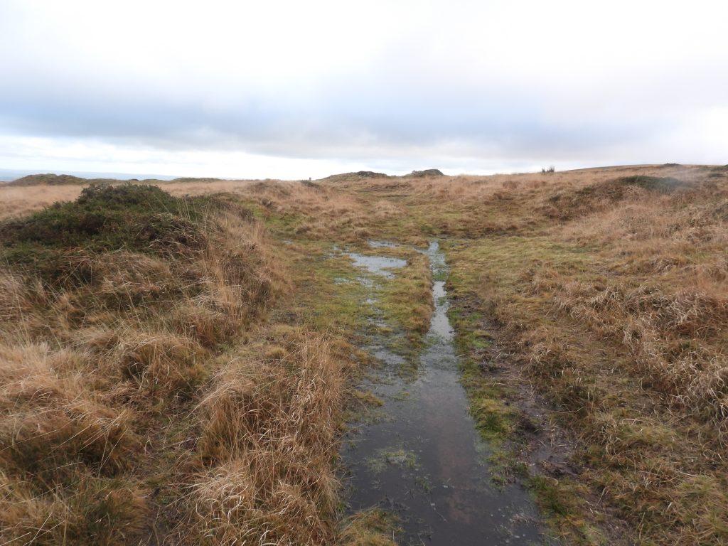
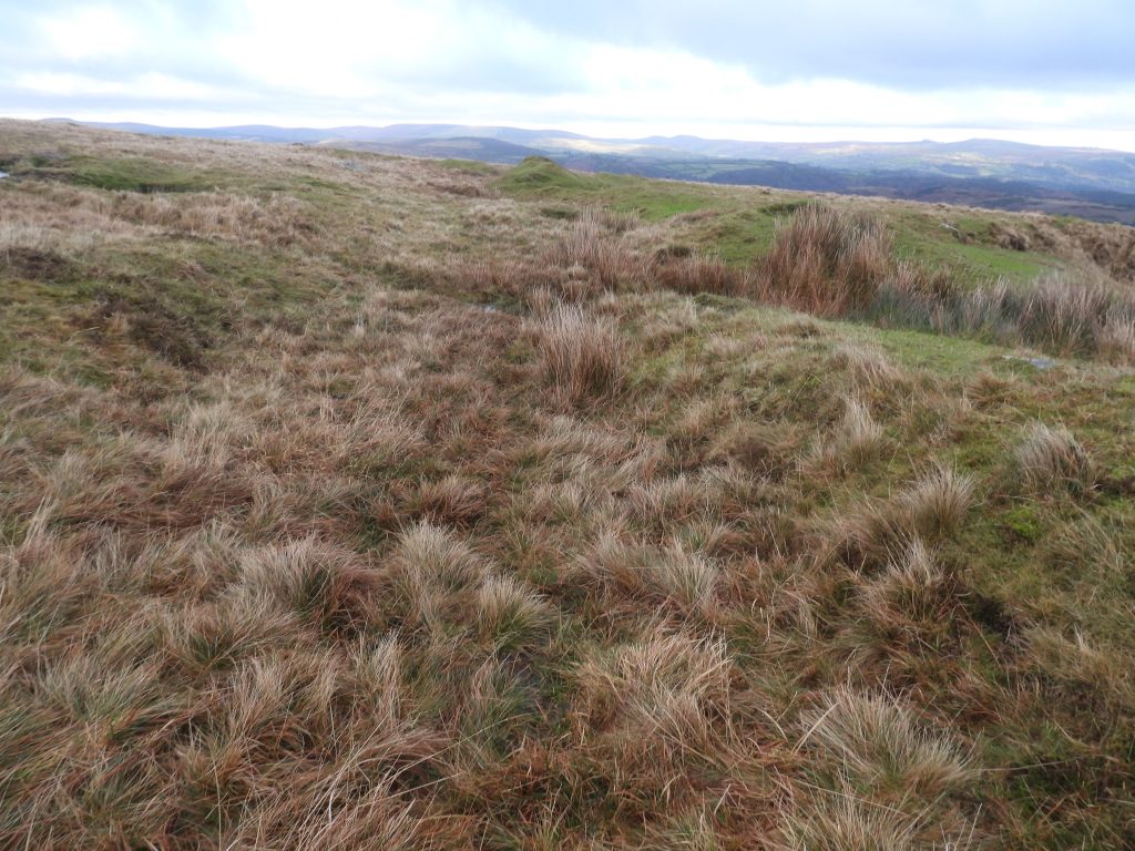
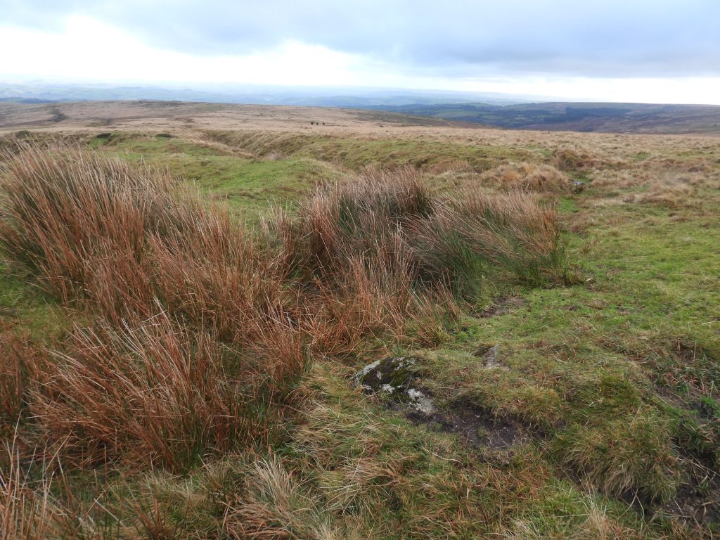
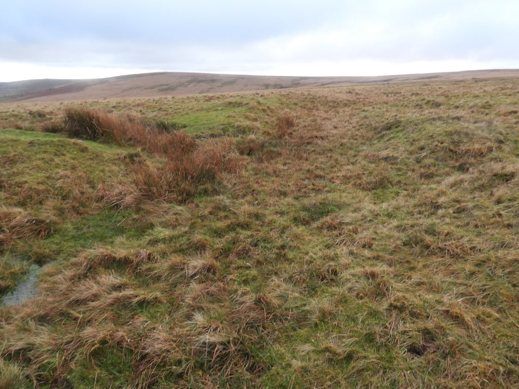
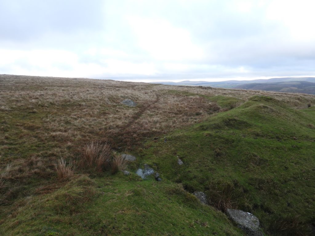
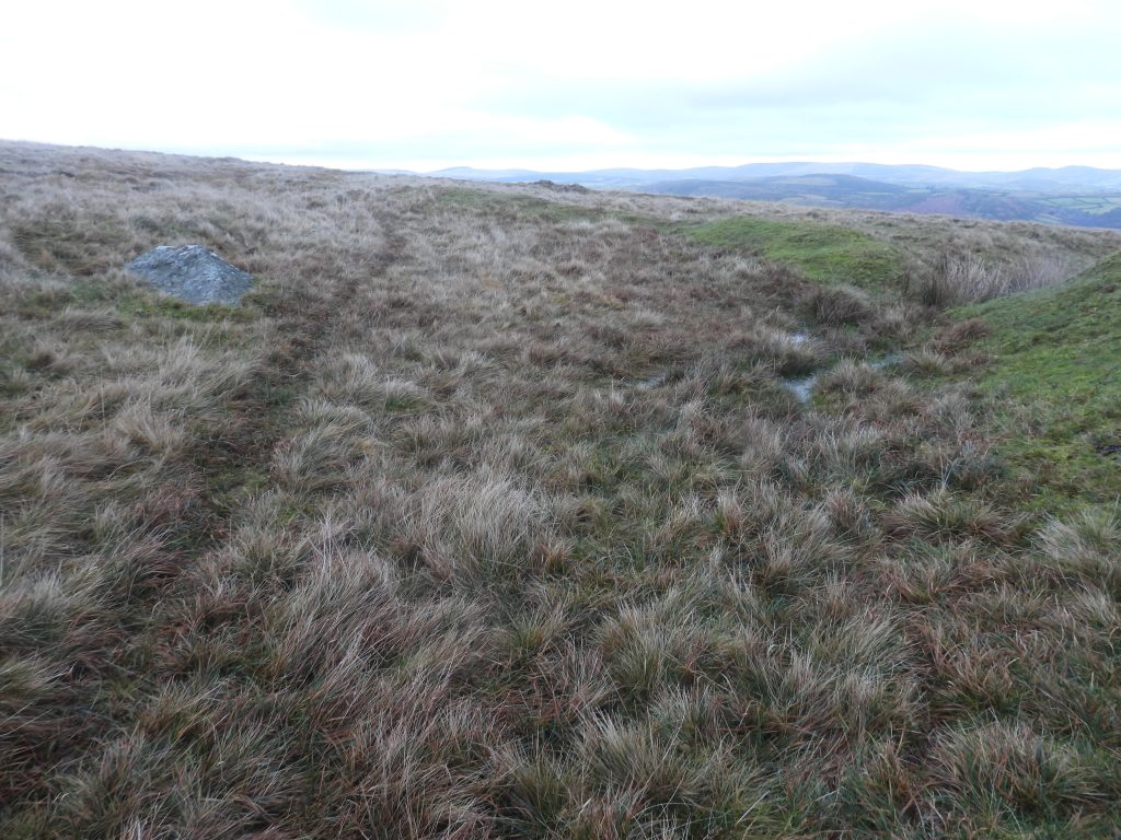
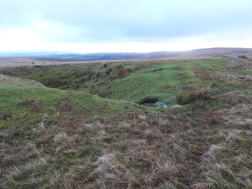
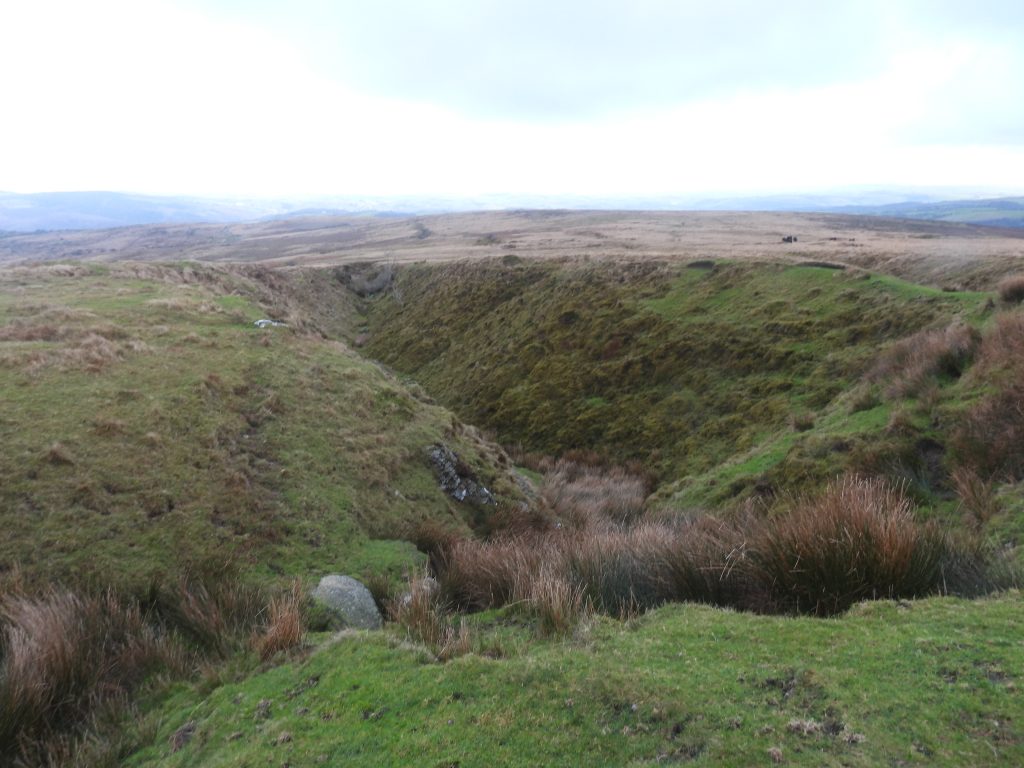
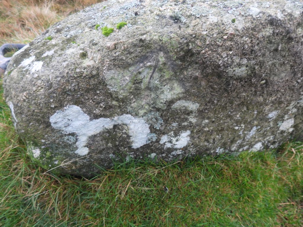
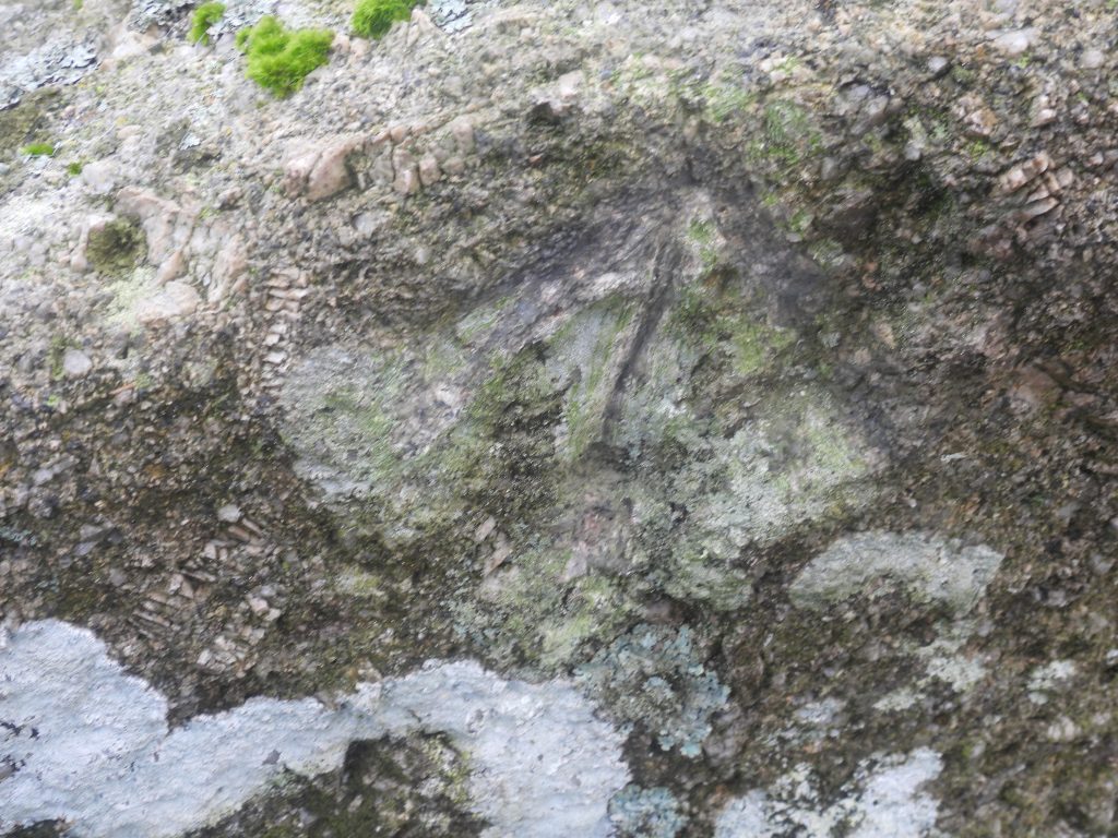
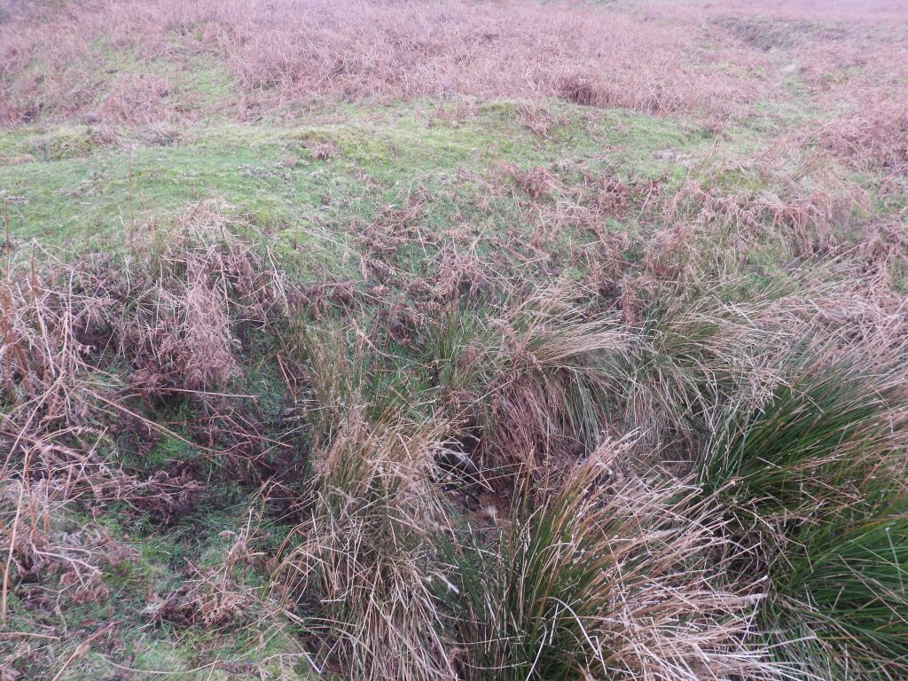
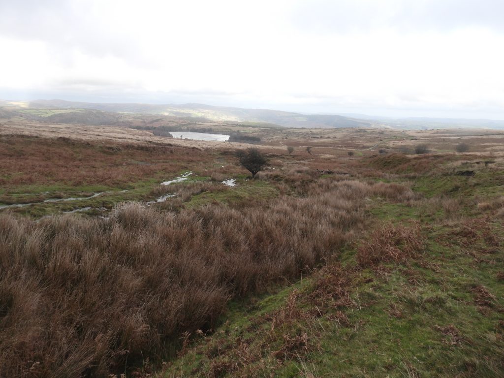
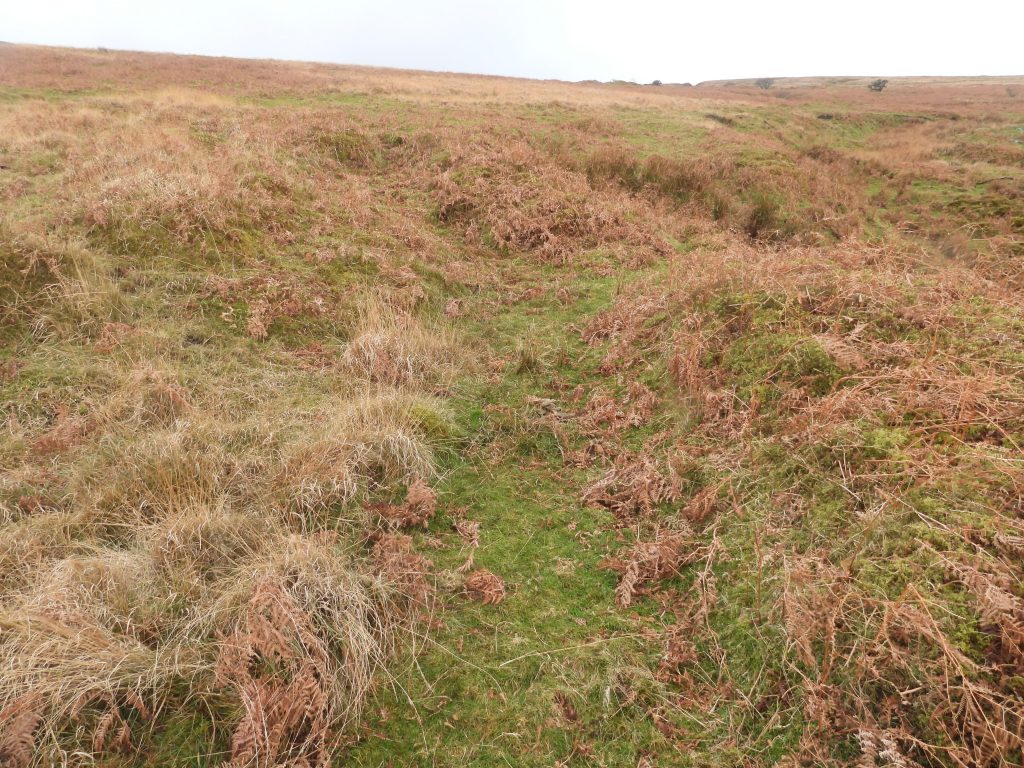
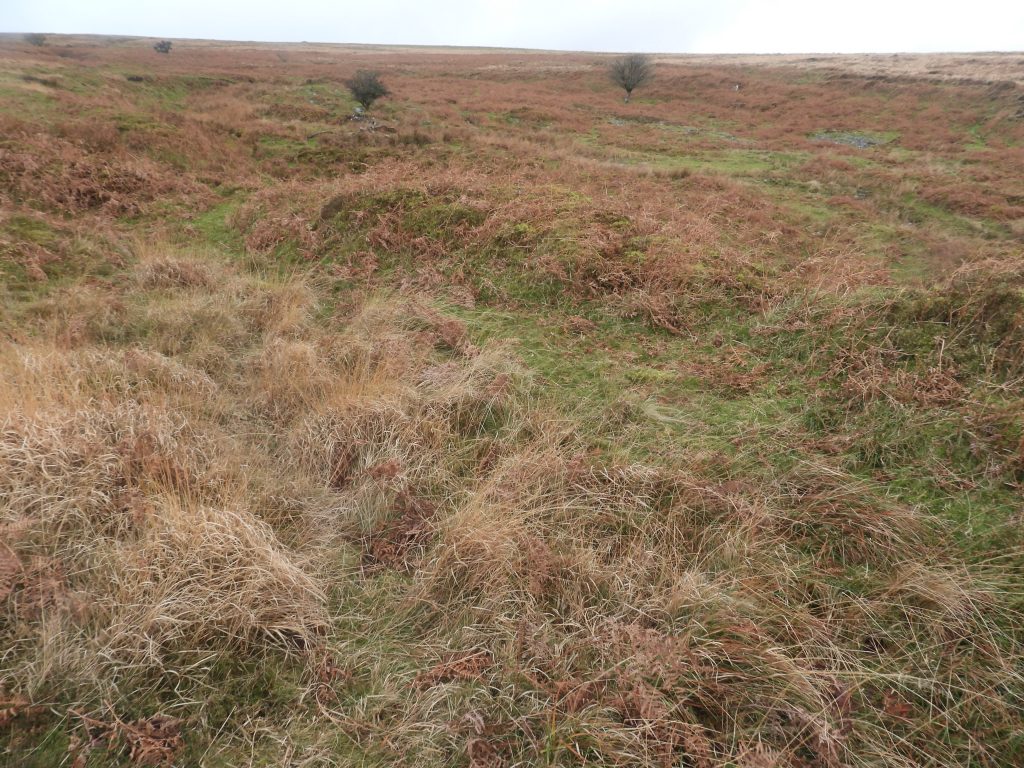
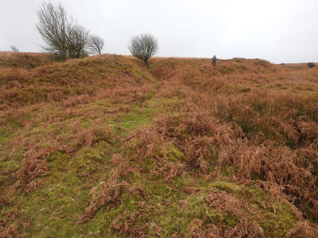
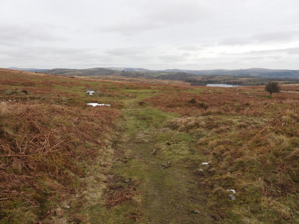
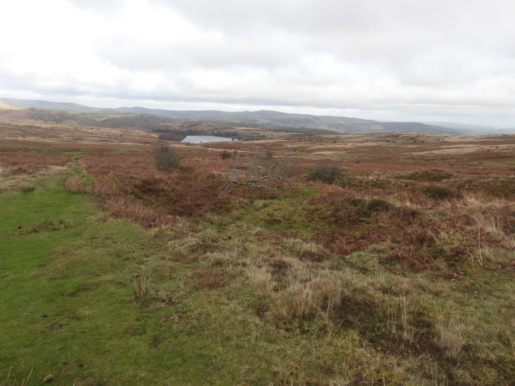
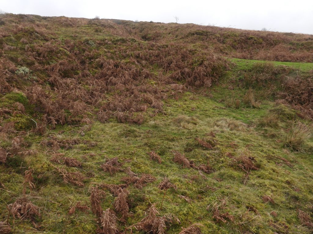
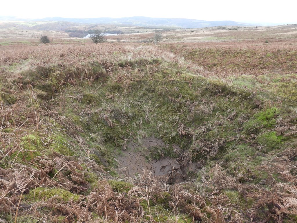
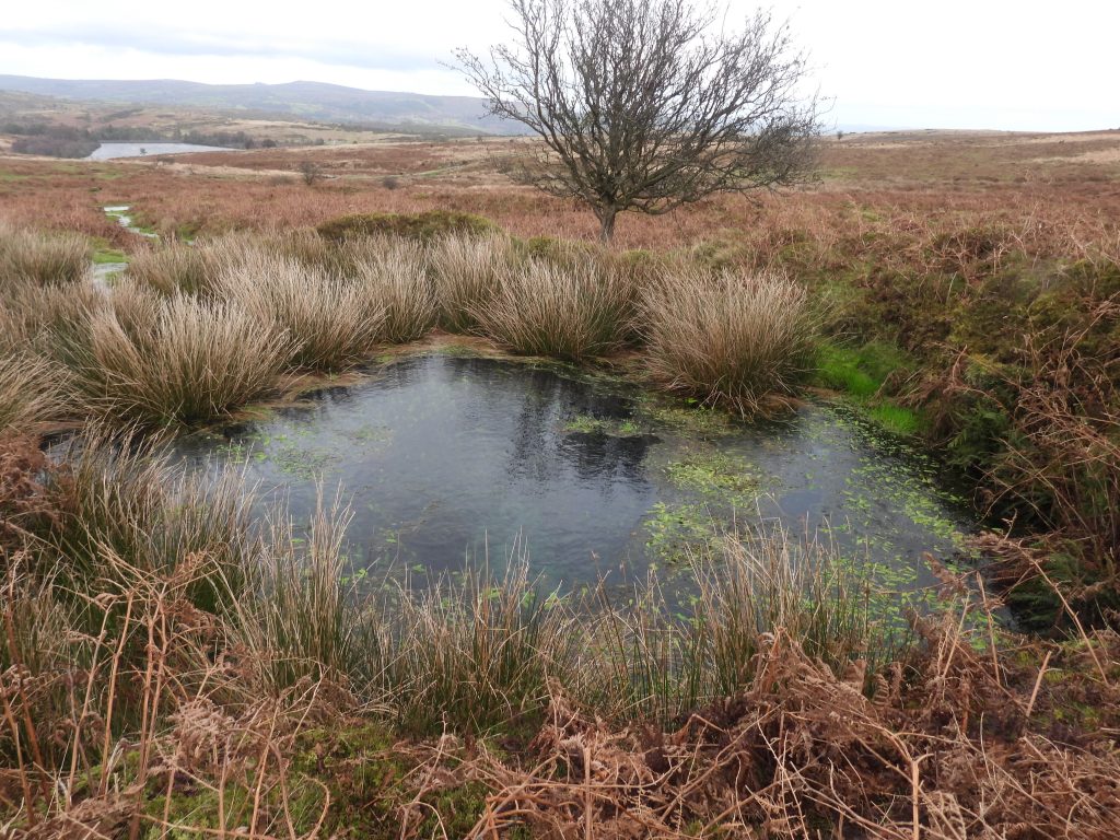
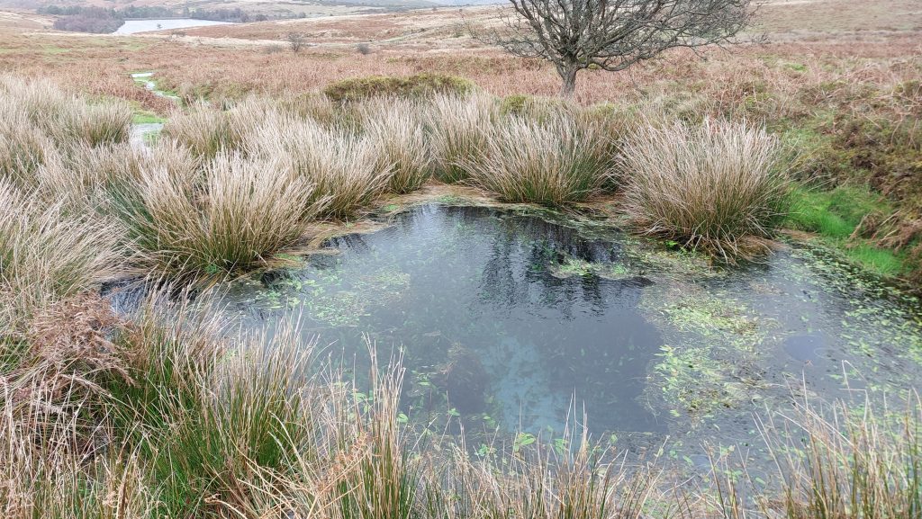
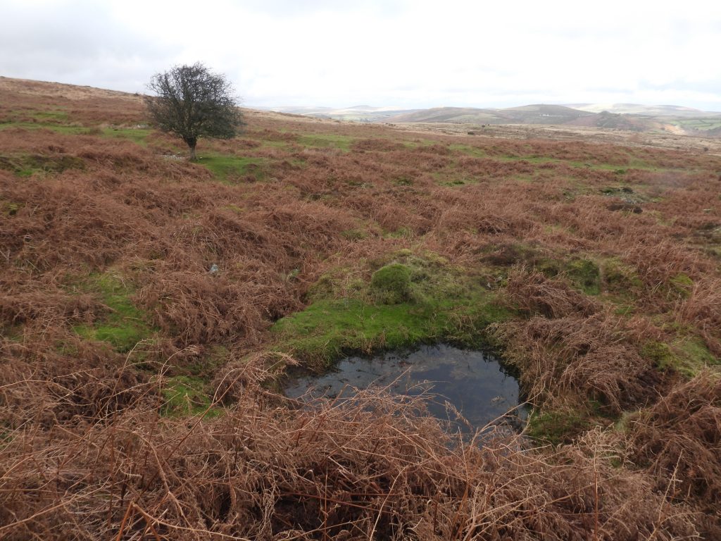
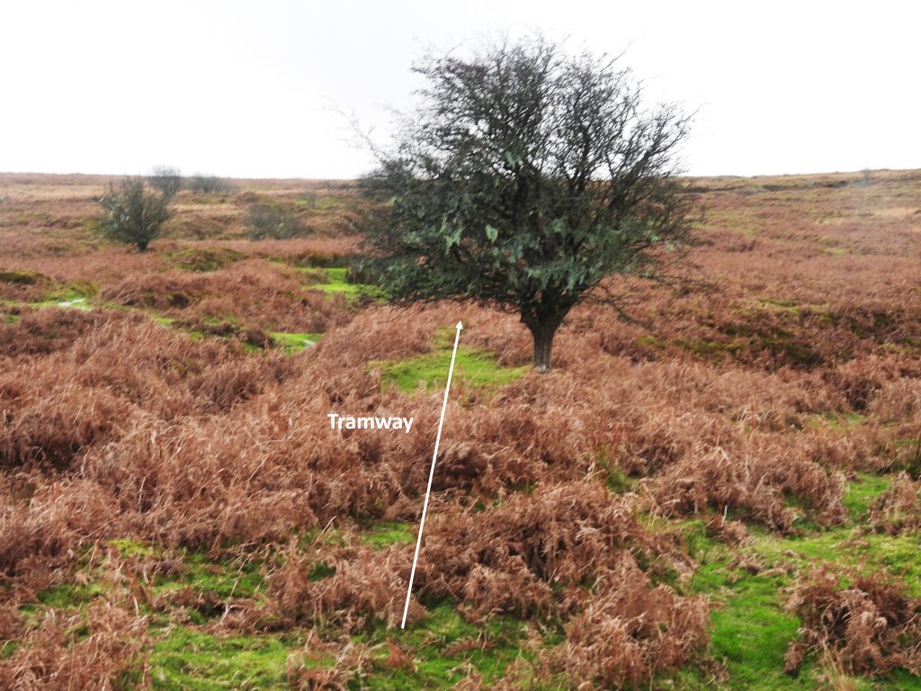
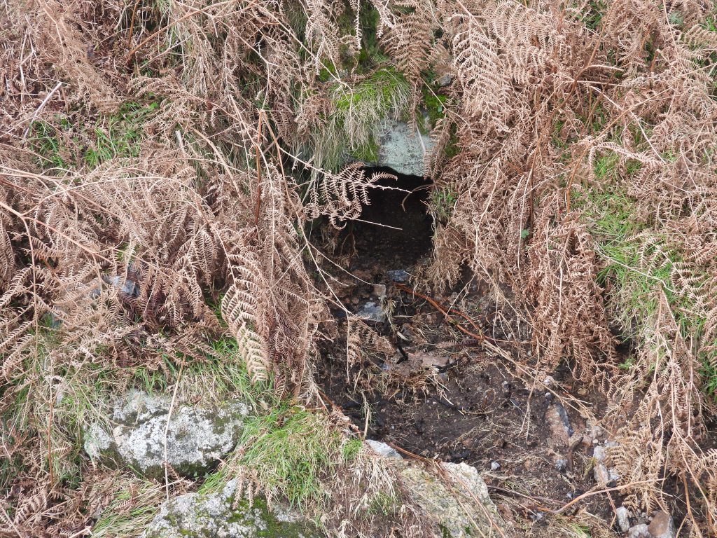
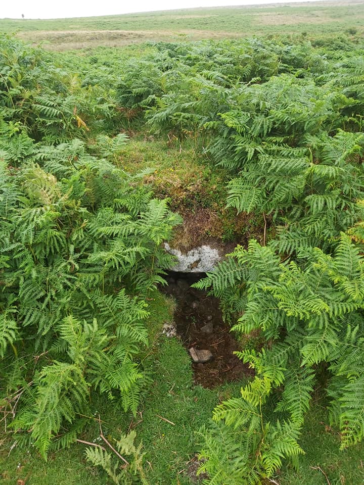
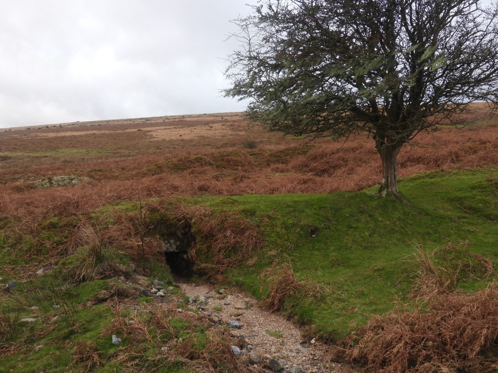
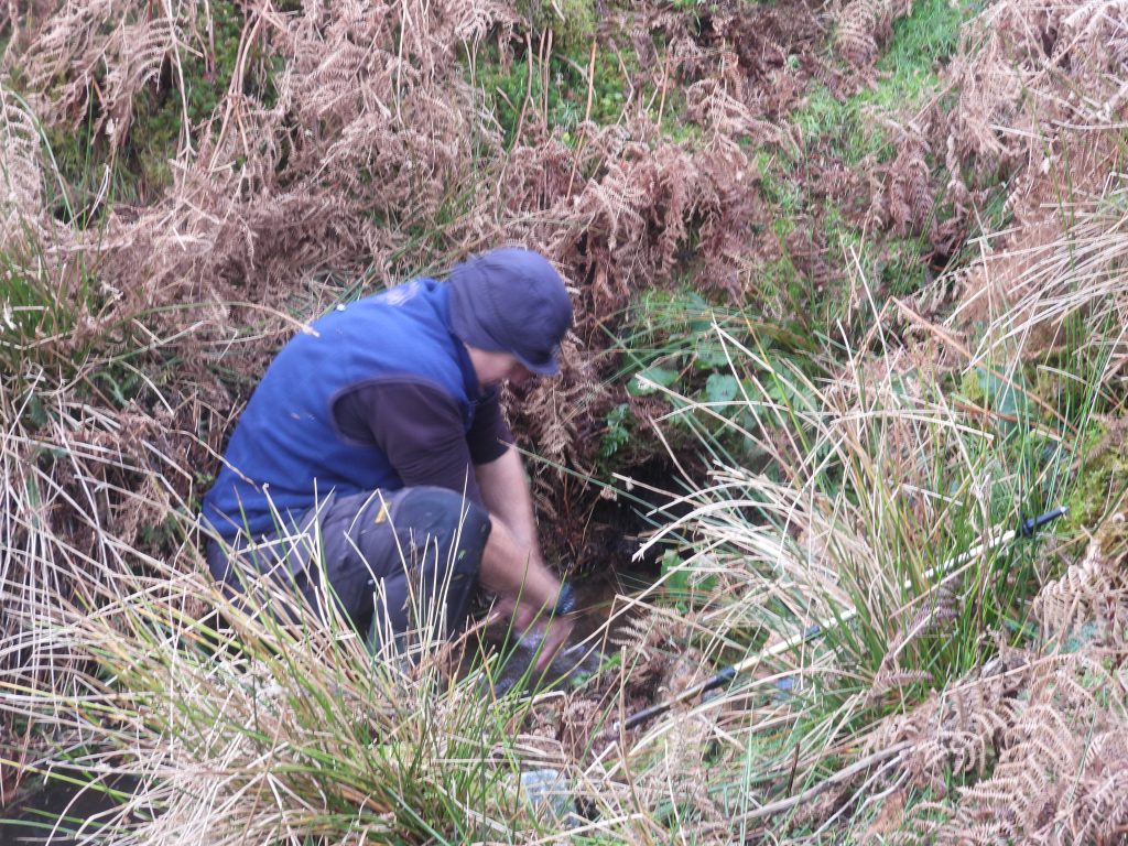
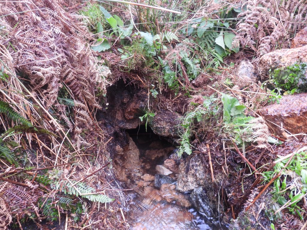
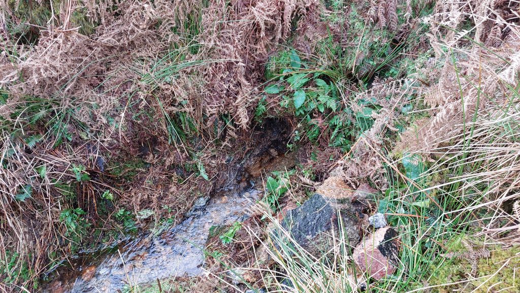
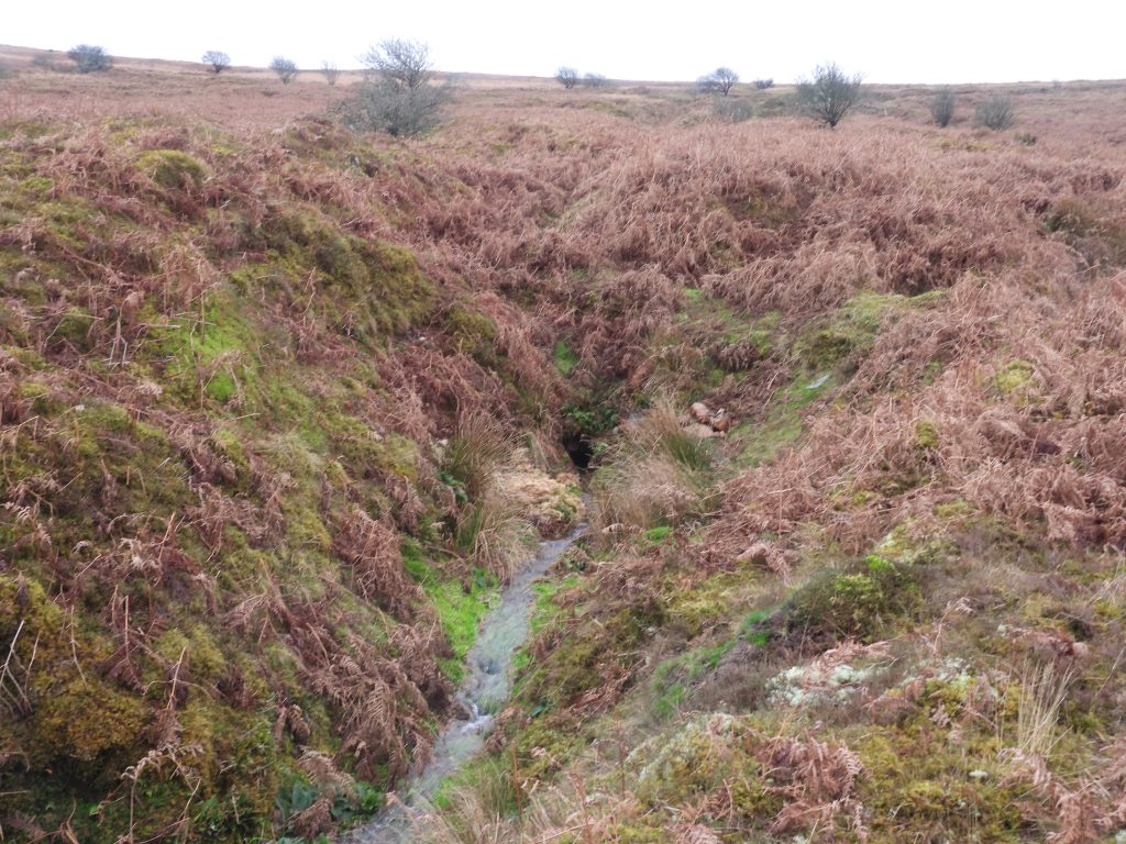
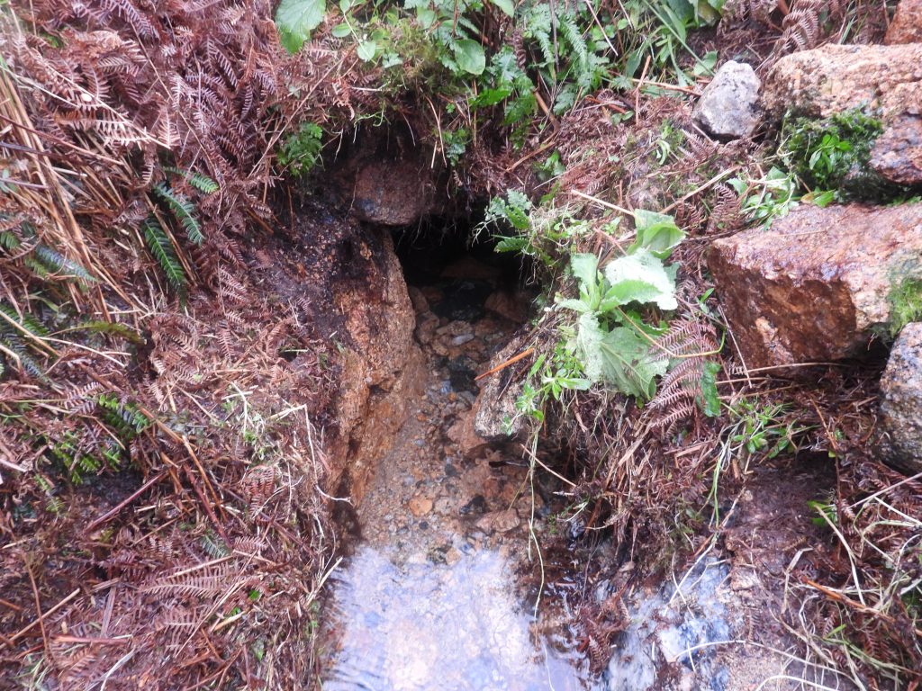
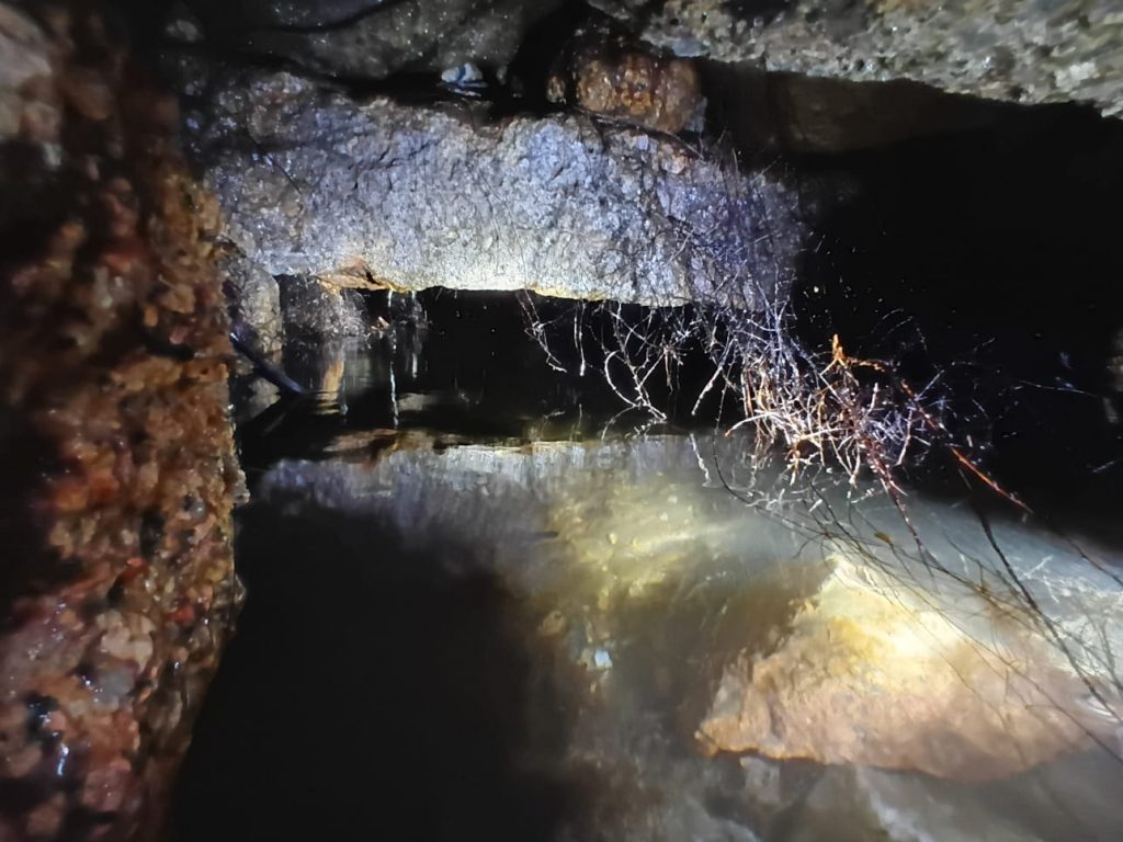
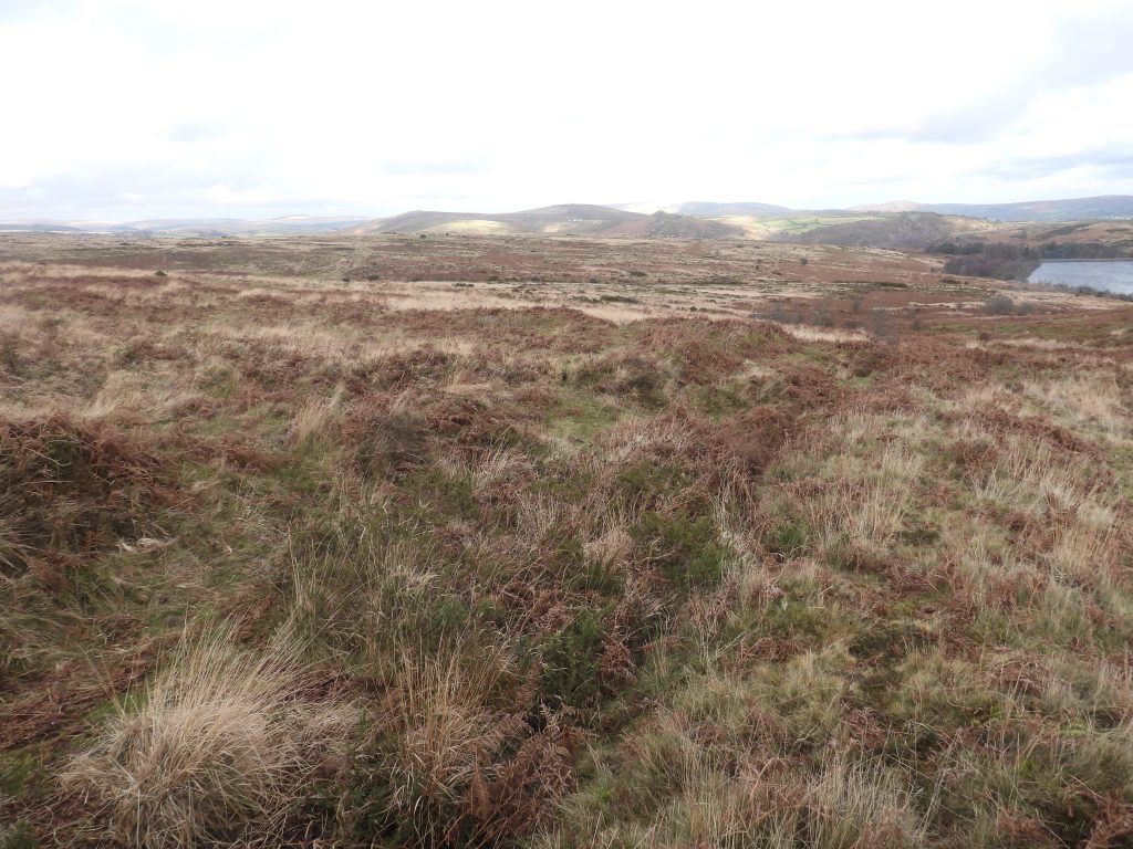
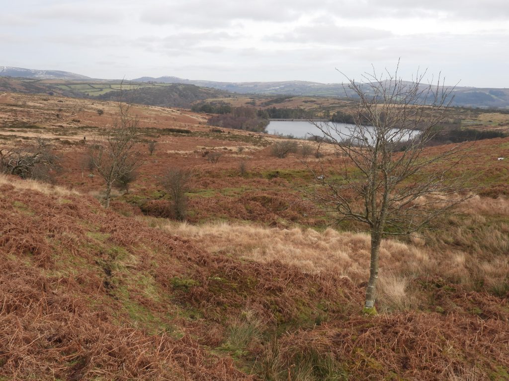
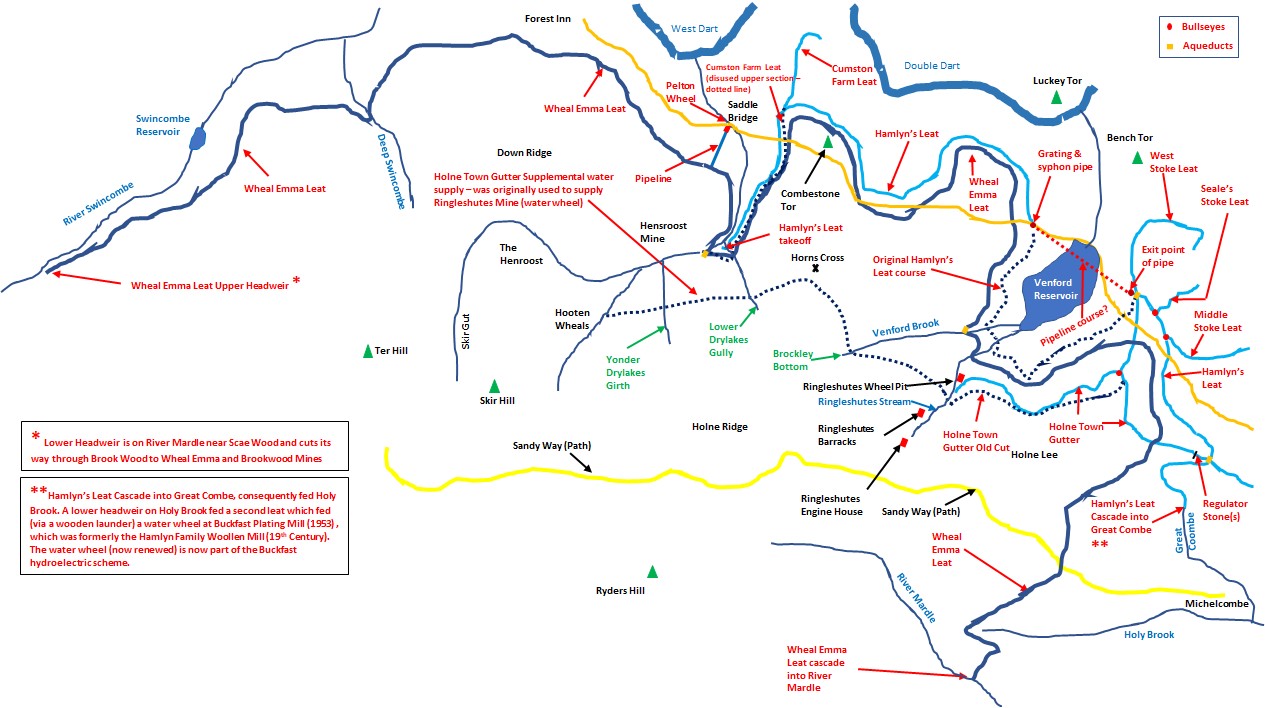
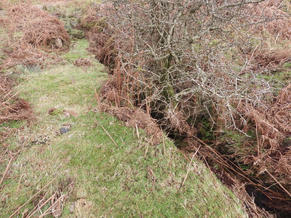
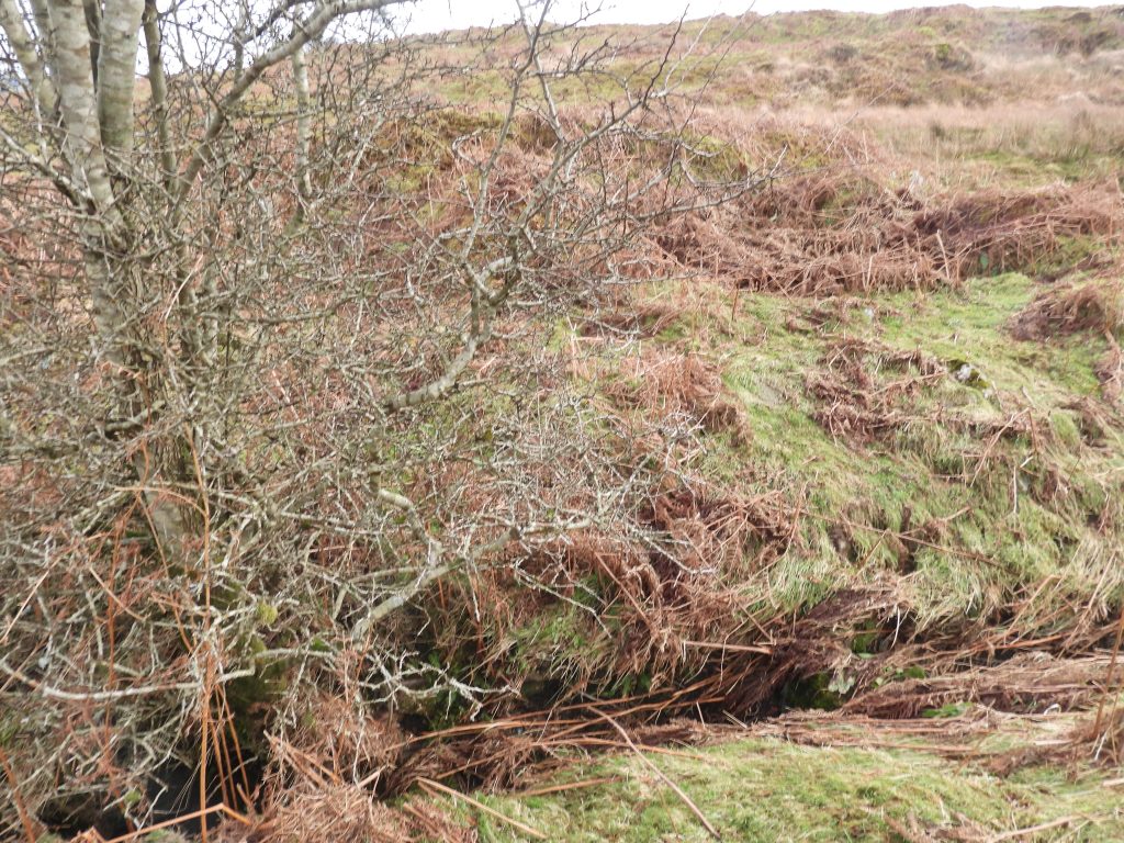
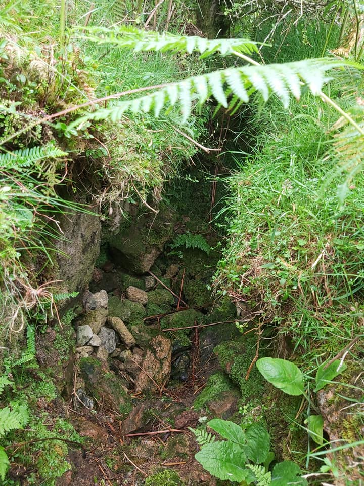
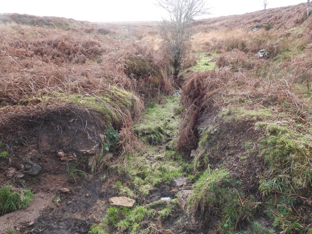
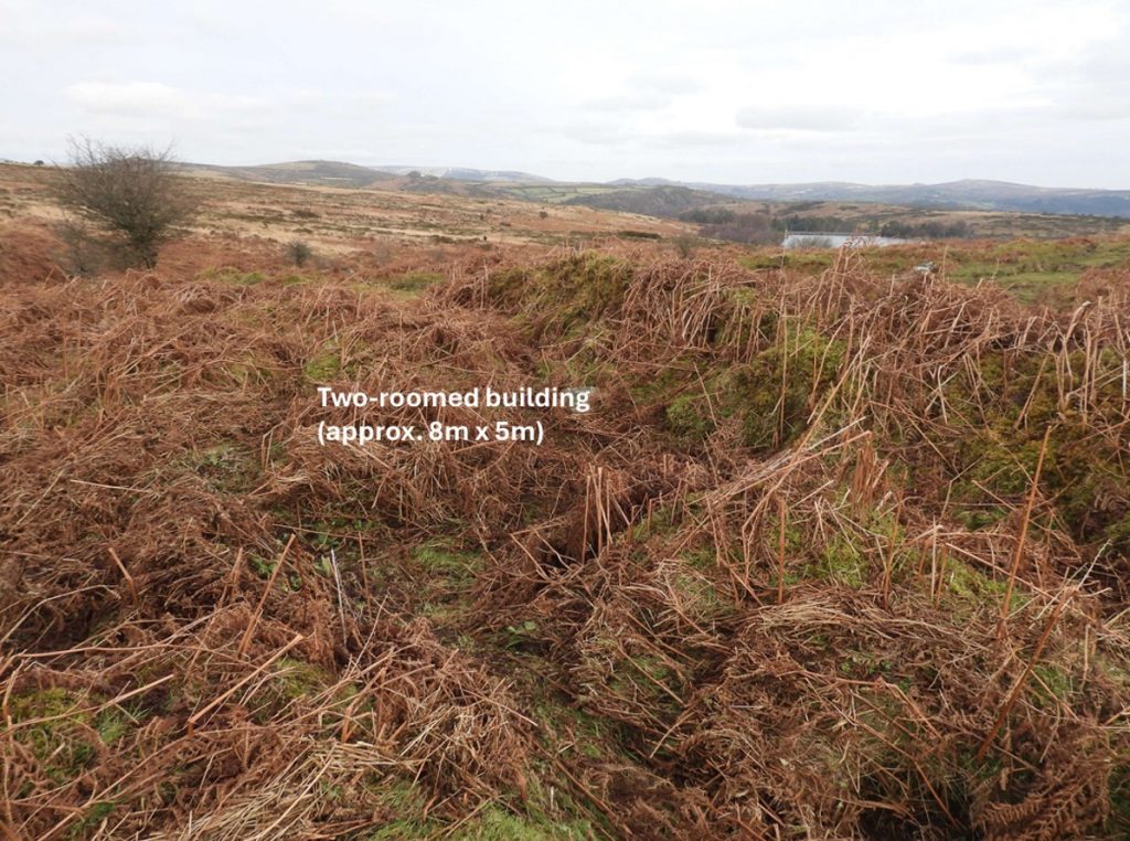
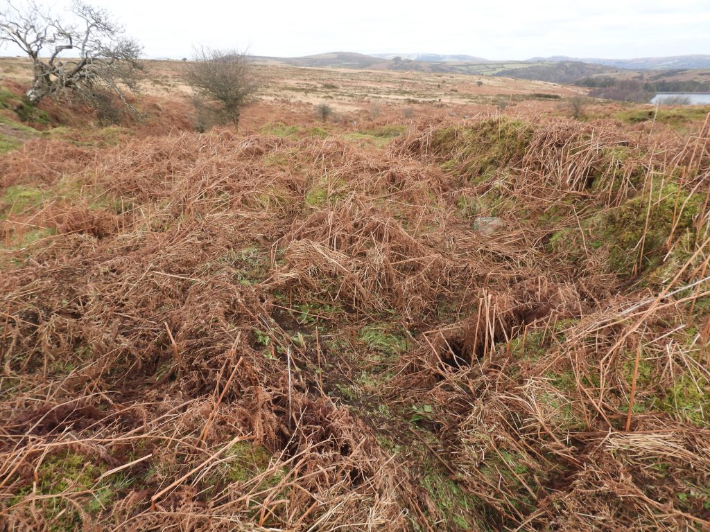
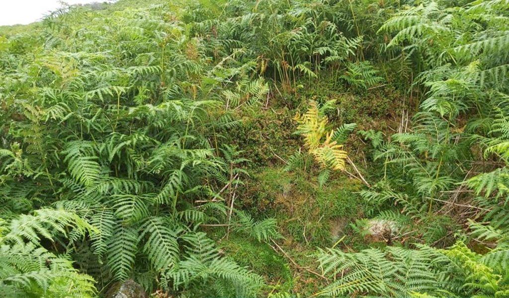
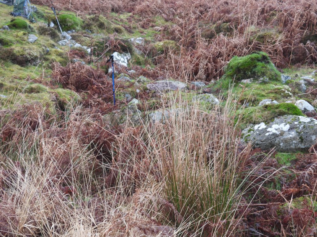
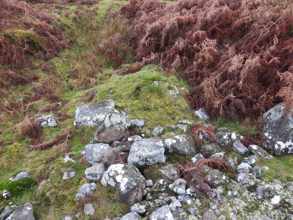
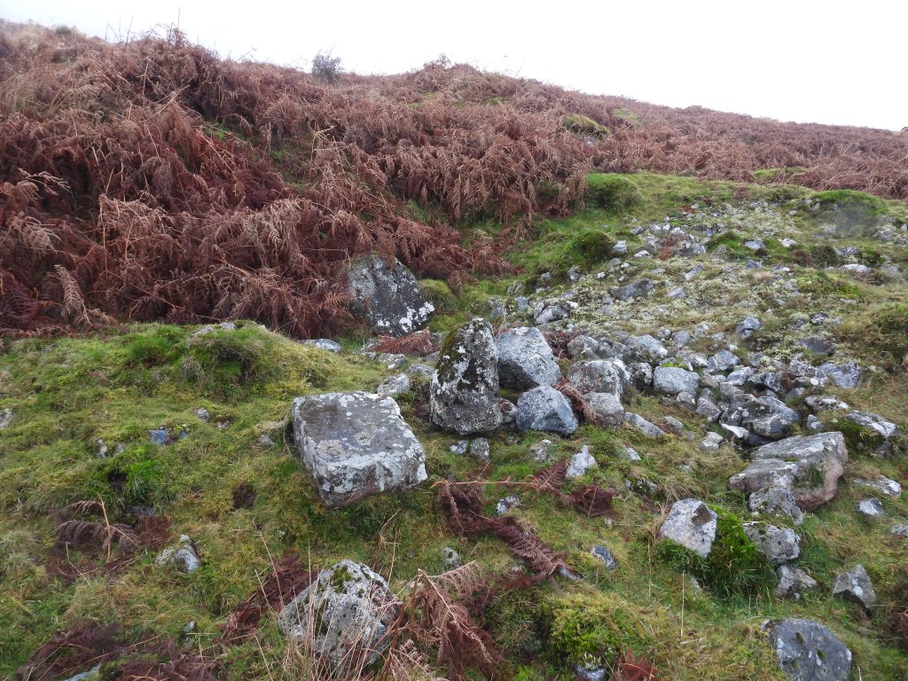
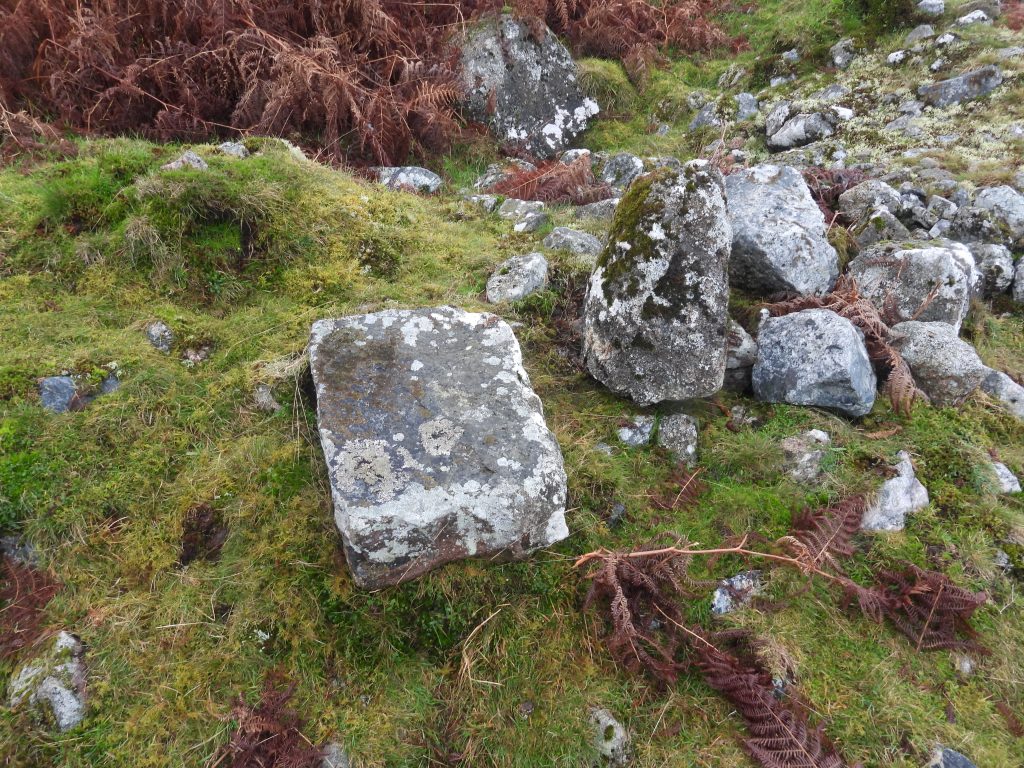
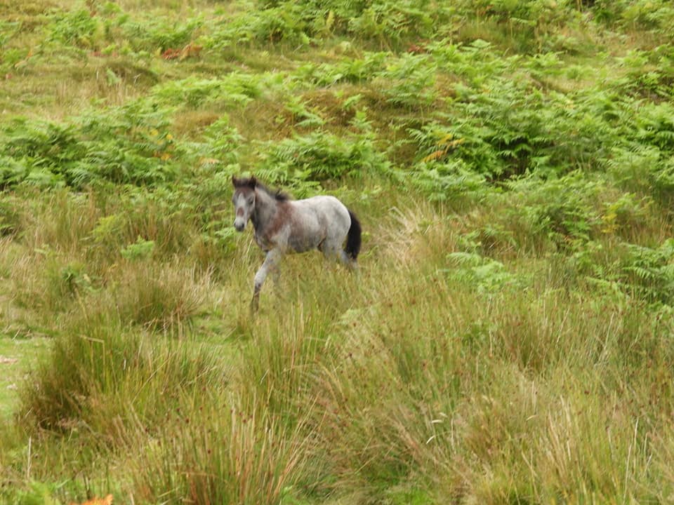
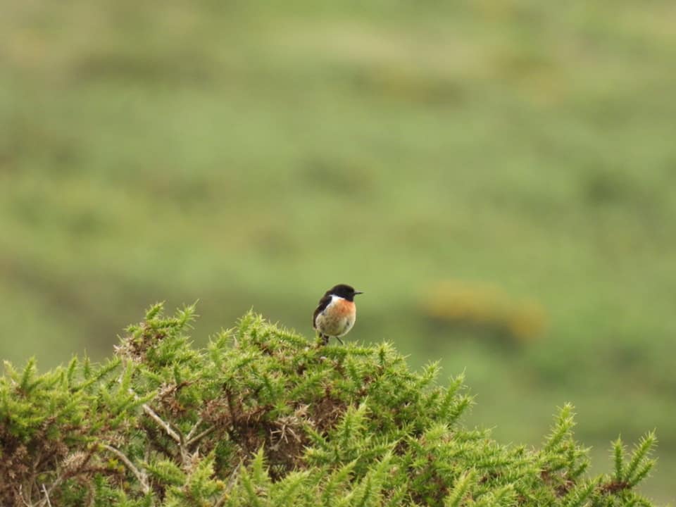
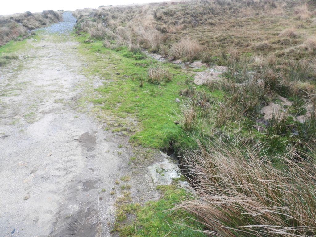
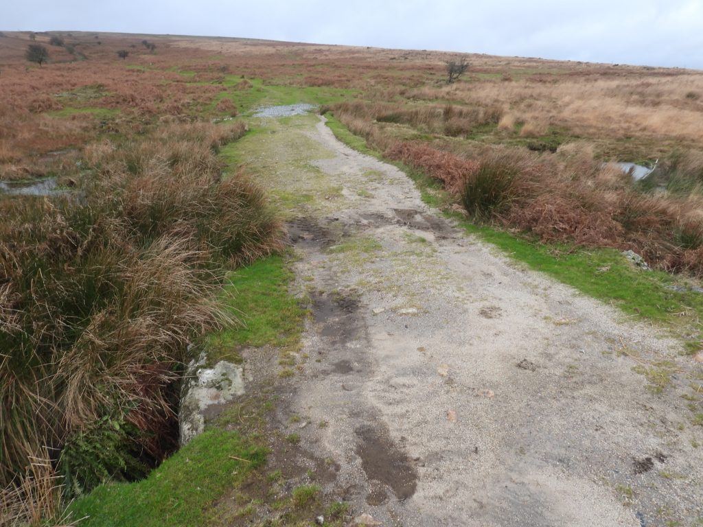
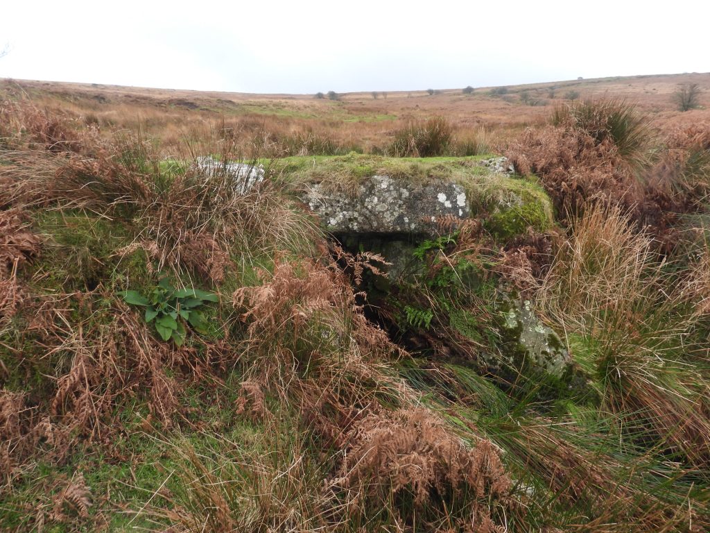
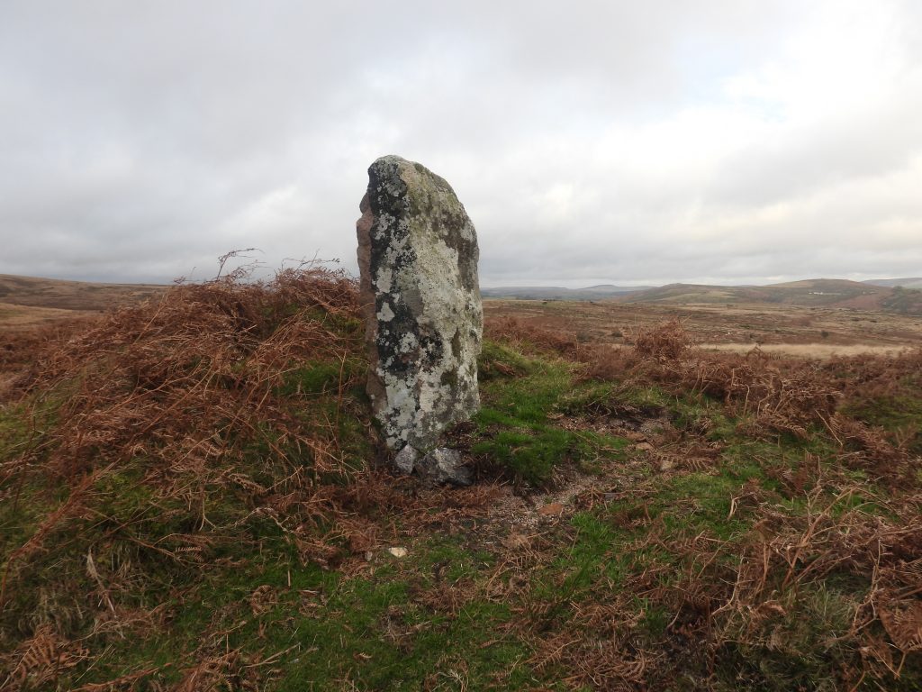
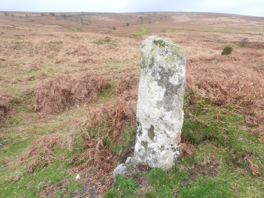
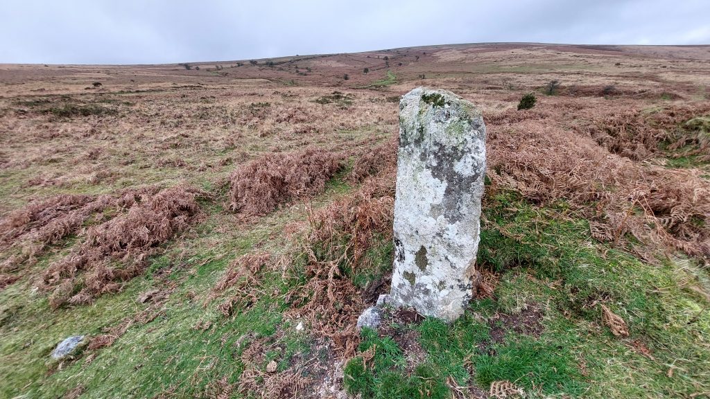
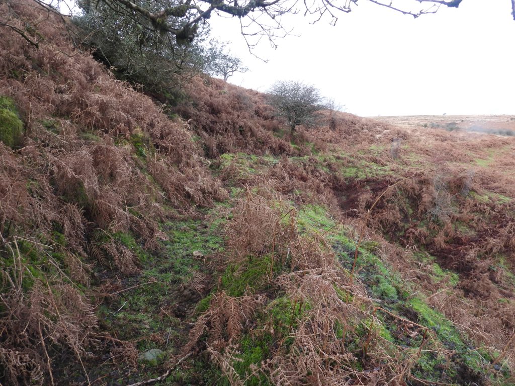
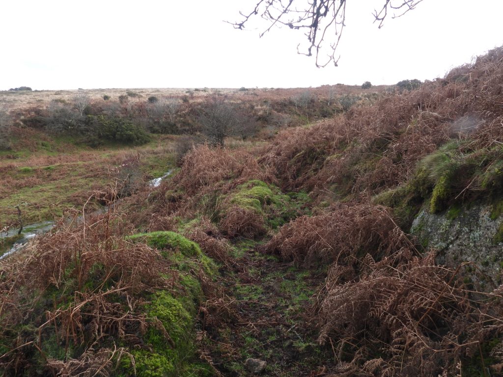
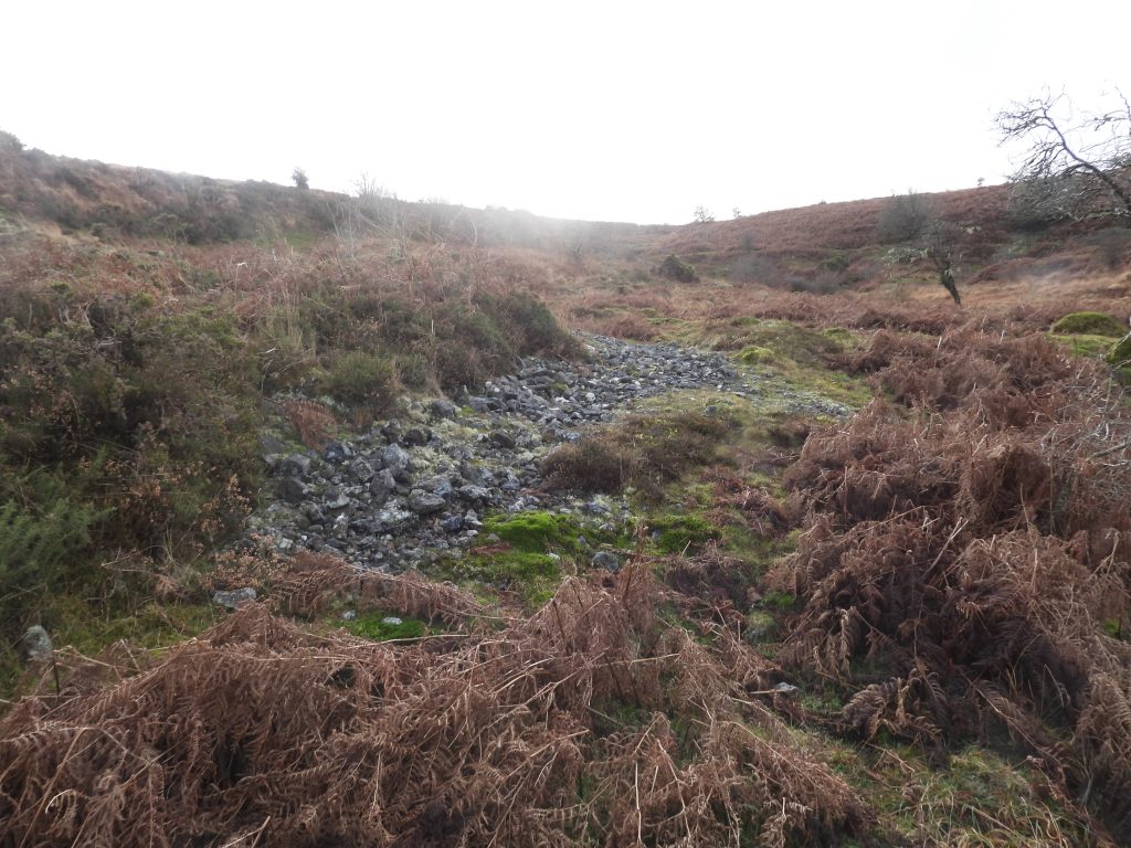
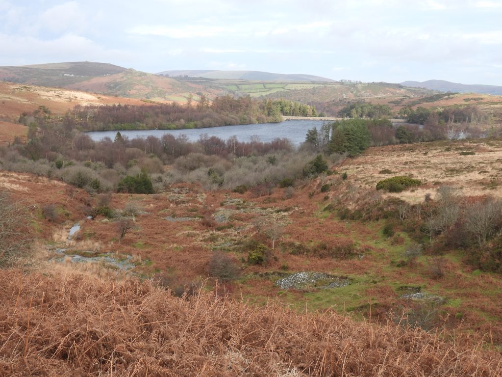
This sketch with key was created by Dave Brewer for Dartmoor Magazine in 1988 and was his interpretation of the main areas of the 19th century part of Ringleshutes Mine. By his own admission, Dave Brewer states in an associated article that “I am no expert, just an Dartmoor enthusiast, who tries to observe and interpret….the finer technicalities of mining are beyond me” – that said the sketch and description provided are both remarkably accurate. He (Brewer) wrote the article as he was surprised that very little had been recorded about the mine and mentions that even the eminent mine and industrial archaeology writers Helen Harris and A.K Hamilton Jenkin had recorded either very little or nothing respectively.Whilst exploring the area, there is more to Ringleshutes Mine than just the obvious Engine House and Barracks ruins. The above annotated map uses the information from the Dave Brewer (Dartmoor Magazine article), from Eric Hemery (Walking Dartmoor Waterways) and from John Robins (Follow the Leat). All this information pre-dates the extensive survey conducted by Royal Commission for Historic Monument England (RCHME), which was conducted in 1997.This sketch is based on the RCHME survey map from 1997, coupled with the Dave Brewer observations from 1988 and other features which are evident on modern OS maps. Most of the features shown are covered in this postThis report by George Bennetts, Manager of the mine was printed in the Mining Journal, Iss. 961 (21st January 1854). He appeared to be the manager of ‘The Holm (Holne) Moor & Hen’s Roost United Mines’. The final sentence of the report is very amusing where he states: “There is at present every prospect that these mines will speedily obtain a high position amongst the largest and most profitable in the kingdom”.This badly ruined Cornish Engine House lies adjacent to the main mine shaft at Ringleshutes Mine. It was built from granite and now consists only of the base of the building. It is located at SX67535 69873. George Bennetts mentioned in January 1854 that this steam-engine “….will be at work in about a month”.The ‘bob wall’ of the Engine House facing the shaft is around 4.5m high.The Engine House has overall external dimensions of around 6m by 5.4m, which is quite small. It is thought that the most likely purpose of the Engine was either for pumping the main shaft (most probable) or it could also have been used for winding or even for operating the tramway. Close up of the opening at the top of the wall where the balance-bob beam would have been locatedThe opening of the ‘bob wall’ from aboveAnother view of the Engine House and opening in the ‘bob wall’ from above towering above the main shaftJohn Robins in ‘Follow the Leat’ on pages 39 and 40, mentions the opening as a ‘vertical recess’ with it carrying a balance-bob beam for pumping – this interpretation preceded that of Brewer (1988) and RCHME (1997) and appears very accurate. That said, unknowingly he suggests there would have been a water wheel here, not a Cornish Engine. He also fails to mention the collapsed chimney.Top of the Engine House ruin where the balance-bob beam would have been located. The Engine House at Ringleshutes may have been a miniature version of the sketch and photograph shown above. The photograph is of a 1845 beam engine in the derelict Engine House at Glyn Pits, MonmouthshireThe rectangular opening at the base of the wall might be a plug door (1.5m wide) and used for cylinder openingThe Cornish Engine appears to have been set to work on 5th April 1854, according to the report by George Bennetts in Mining Journal No 972. The wheel and stamps would follow in JuneThe renowned author of mines in Devon (and beyond) was A.K. Hamilton Jenkin. In his book ‘Mines of Devon, Volume 1: The Southern Area’ he does not directly mention Ringleshutes but appears to have used the George Bennetts reports from Mining Journals and written about Hens Roost (near Hexworthy) and Ringleshutes as if they were the same mine. This was probably due to the fact that Bennetts was manager of both mines. That said, of interest, is that he mentions the closure of the mine around July 1855, stating: “….as a consequence of dissension among the shareholder, the mine and materials were advertised for sale….”Collage of the Engine House and the main (collapsed) shaft.The base of the former chimney stack has an internal diameter of 0.6m – the stack is now collapsed and comprises a 12m long spread of turf covered rubble on the eastern side of the Engine House. There does not appear to be any documentary records of the engine working or even the date of its destruction, however, Crossing’s ‘Amid Devonia’s Alps’ refers to the stack still standing in 1888 when he wrote: “…….I kept on the edge of the workings, and at last saw to my great joy the tall chimney shaft of old Ringleshutts rising up before me”. Note Crossing’s spelling ‘Ringleshutts’.Members of the Dartmoor Tinworking Research Group (DTRG) visiting Ringleshutes in December 2025, taking lunch at the collapsed chimneyThe rubble from the collapsed chimney lies spread to the east. Eric Hemery (High Dartmoor, page 570) states: “The rubble of the chimney-stack lies near the stamping floor”, which unfortunately isn’t true. He also suggests : “The mine relics include a large wheel-pit, to which water was leated from the upper reaches of the Mardle and Venford Brook, the stamping floor, mine-house or barracks and another building”. Did he assume the main shaft was a wheel-pit since the known wheel-pit 500m to the north isn’t obvious or large?The main shaft has a diameter of around 9m and is approximately 5m deep. The ore from the mine was a very reddy brown cassiterite (aka tinstone), Tin Dioxide. The reddy brown colour is due to iron impurities. The shaft lies on the intersection of the a NE-SW lode and the main E-W lodeThe probable main focus of the 19th century underground working is the shaft next to the Cornish Engine House at the site is at SX 6754 6986. It is annotated as shaft (1) on the sketch map at the start of this post. The shaft is located near the lower end of a major openwork. There is a corresponding adit at SX677051 70055 which was undoubtedly the drainage level. This is adit (3) covered later in the post. There is also one or two air shafts, now water filled, which is sited equidistant between the this shaft and the adit.This article was printed in the DTRG Newsletter 36 (January 2009) regarding an accident recorded at the mine in August 1867. The Bristol Mercury newspaper article had been found by Dartmoor Chris who added: “The following article I located is very interesting, due to the fact it states mine called Wheal Maria. I would place this mine about 1 km. north-west of the village of Michelcombe. There are a number of old workings and gullies in that area along with an adit level”.Venford reservoir from the Engine House.This annotated aerial picture coupled with the sketch maps in this post may assist the reader in piecing together the various constituent elements covered in this postThe openworks at Ringleshutes are as much as 30m wide and l8m deep (Bruce)The bottom of the openworks to the west of the Engine House and the main shafthead.The openworks leading away to the west from the Engine House.Looking west up the openworks. There appears to be possible evidence of a small tramway having operated here, albeit not shown on the original RCHME map but is referenced in their reportLooking east down the openworks. Looking east down the openworks. Shaft (6) is immediately below the position of the camera. The openworks is filled with mine waste suggesting the area was worked beyond the medieval period. The RCHME records “Within the openwork to the east of the shaft (this is reference to shaft 5), centred SX6742 6989, is a flat topped linear spoil heap which is likely to be the product of dumping spoil using skips running on a tramway. The source appears to be the shaft or possibly a further, smaller shaft 18m to the east”. The smaller shaft mentioned here is probably shaft 6. The George Bennetts report in the 1854 Mining Journal is rather confusing in parts. One sentence records: “An engine-shaft has been sunk on this lode and to the adit, and the steam engine will drain the water from this lode by rods from the main shaft” – an interpretation might be that the Bennetts ‘main shaft’ is No. 1 by the Steam Engine and there were planned flat-rods running up this openwork and close to or possibly shaft 6 where there was the ‘engine-shaft’. This would have been an unusual naming convention for an engine-shaft.Tinners reservoir at SX67739 69795. This reservoir is annotated as ‘F’ on the sketch map associated with this post.Sluice and outlet from reservoir FView from reservoir F, which could have emptied its water into the openworks in the foreground which are at the head of the Ringleshutes Strea,Head of the Ringleshutes Stream with Venford reservoir in the distanceTinners reservoir as depicted on the Dave Brewer sketch (annotated ‘B’). He records this as being 40 yards long, about 4 ft in height with short sides backing onto higher ground. The description fits very well. This reservoir is annotated as ‘E’ on the sketch map associated with this post. Approx half way along Reservoir E is a breach in the bank which appears to have been made to transfer water down in the direction of the Engine House. This is also accurately depicted by Brewer. The reservoir is located at SX67418 69874. Was this breach and subsequent channel for water made by the Medieval miners or the Victorian miners ? Dr Tom Greeves, writing in 1990, records of the area: “Openworks covering approximately 2 square kilometres, high on southern Dartmoor. Almost totally dependent on rainwater for filling leats and reservoirs. Offers great potential for understanding working techniques of late Medieval period, as has had relatively little disturbance in the 19th century”. This, perhaps confirming this reservoir (as with the other five in the area was created by the Medieval miners. Shaft 5 (and Angus the dog). It is sited in the top eastern end of a large openwork and next to the ‘land bridge’ to the openwork which contains shaft 6. It is located at SX6734 6991 and consists of a conical pit of 7m diameter. A probable adit connecting with this shaft can be found to the north near some streamworks. The westernmost shafthead (annotated at shaft 4 on the sketch map) is the largest in the mining complex and is located on previously undisturbed ground at SX6714 6994. RCHME described it as consisting : “…a conical pit of approximately 9m diameter with a crescentic ring of spoil on the downslope side”. There is a corresponding drainage adit (no 1 on the sketch map), which is associated with this shaft. NOTE: The author thinks there is a mistake on the NGR given on the Devon HER which states the shaft is at SX6714 6948 which would take it 460m to the south where there are no workings.Just a few metres to the west of shaft 4 is the outline of a very small building (foreground of the photograph)The building appears to have once had very wide (up to 1m spread) walls. The author did not record the dimensions, but estimates it is around 4m (e-w) by 2m (n-s).The author in the building checking for stone work in the banks to confirm where the walling is. The location is SX67134 69941. The picture is courtesy of David EelesBuilding ruins – given the location, perhaps this building was a store, it being unlikely to have had any other use.To the west of shaft 4 and the small building are even more openworks. These appear to have been left undisturbed by the 19th century adventurers and comprise only of medieval undertakings. The whole Ringleshutes complex is around 1km e-w by 0.5km n-s (estimate)Tinner’s reservoir which is now part of a track. It is annotated as ‘C’ on the sketch mapWater source for reservoir C, a small openwork running west-east down the slope of the hillOutflow from reservoir CReservoir C is located at SX67182 69839. One of the PUDC / RD H Venford reservoir upright stones near the Sandy Way can just about be made out in this composition towards the two moundsTinners reservoir annotated as ‘A’ on the sketch mapSluice / outflow from tinners reservoir ATinners reservoir A is located at SX66870 69909Tinners reservoir annotated ‘B’ on the sketch map. Note the small track through the reservoir and the outlet / sluice in the foregroundClose up of tinners reservoir B. It is located at SX66878 69934The sluice / outlet from tinners reservoir B which would have allowed water into the top of the most westerly openworks at RingleshutesLooking east into the openworks from the sluice / outlet from reservoir BOpenworks at the western end of the Ringleshutes complexBenchmark, high above the openworks at SX66931 69903B.M. 1511.6 is north facing (over the openworks)Adit 1 at SX67211 69993 has been cut into the southern outer scarp of an earlier streamwork (ref RCHME). It is completely blocked by boggy vegetation but water still issues from it. This adit would have drained the westernmost shaft (number 4) as previously described.Streamworks to the north between Adits 1 and 2 as indicated on the sketch map. To the higher ground above the streamworks is another medieval tinners’ reservoir. This is annotated as Reservoir ‘D’Reservoir D is located at SX67375 70031The approx location of Adit 2 (associated with shaft 5) which cuts into the southern scarp of the streamwork at SX6743 7004Returning to the 19th century centre of operations of the mine. The photograph is of the track between the Engine House and the Barracks BuildingTo the east of the track (between the camera position and the dead tree) is the remains of a horse whim. The gradient of a tramway here would have necessitated some motive power to haul skips up the hill. It is thought that this was provided by a horse whim. This whim plat is a flat topped, circular cutting and is located at SX67574 69918Possible air shaft or ground collapse adjacent to the tramway and between the main shaft at the Engine House and its associated aditThis flooded air shaft, approx. equidistant between the main shaft and its associated adit. It is labelled as shaft 2 on the sketch mapThe flooded air shaft is located at SX67646 70002. The water here is very clearAnother probable flooded air shaft. Annotated as shaft 3 on the sketch map. The tramway to the dressing floor from the main shaft is located by the tree in the photographAnother view of shaft 3. The tramway embankment by the tree is quite evidentThe tramwayCulvert under the tramway has a lintel stone. SX67684 70077
Culvert with a lintel stone in high summer
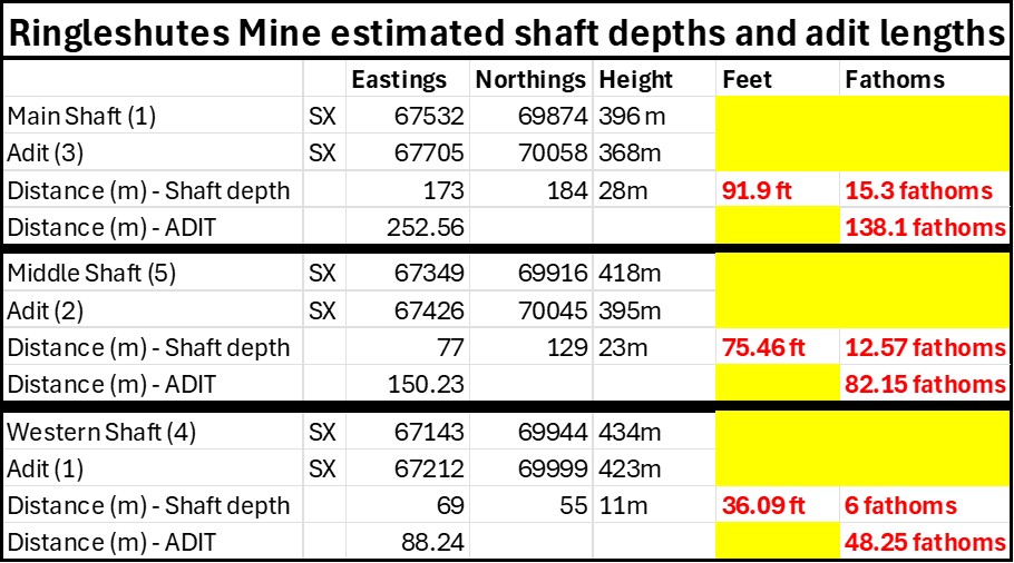
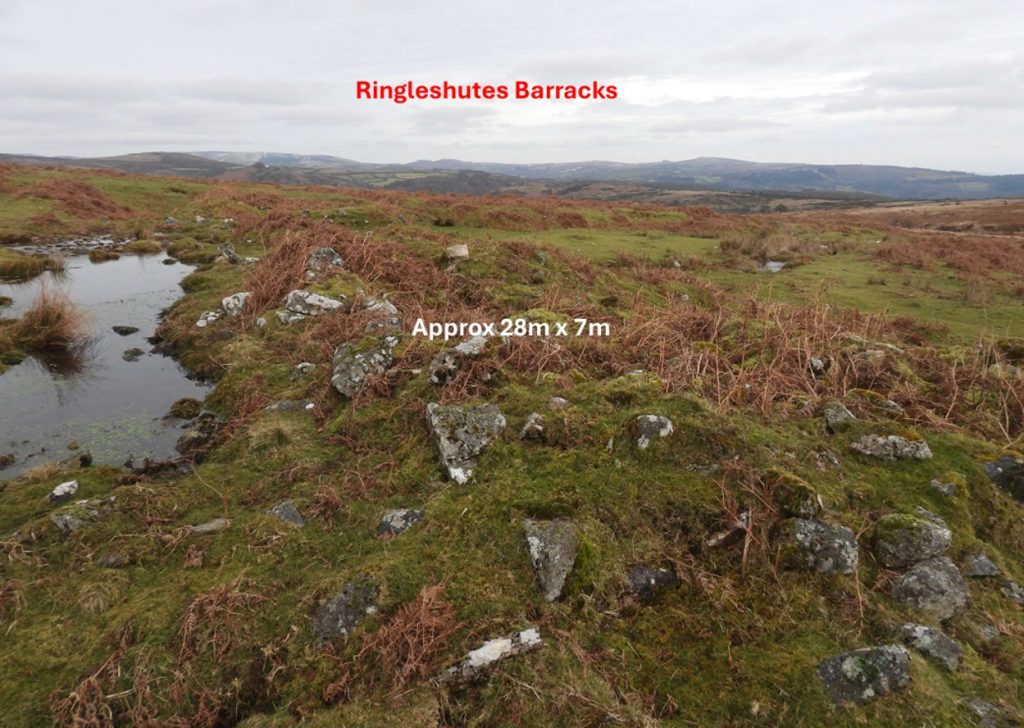
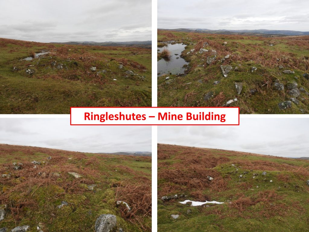
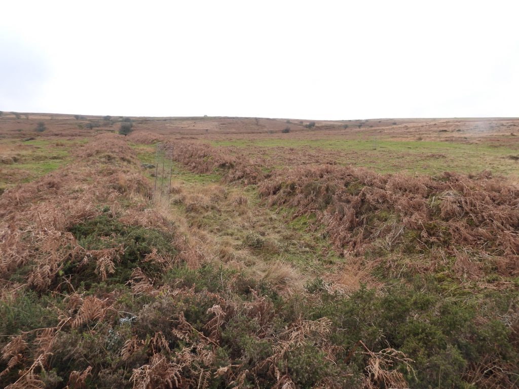
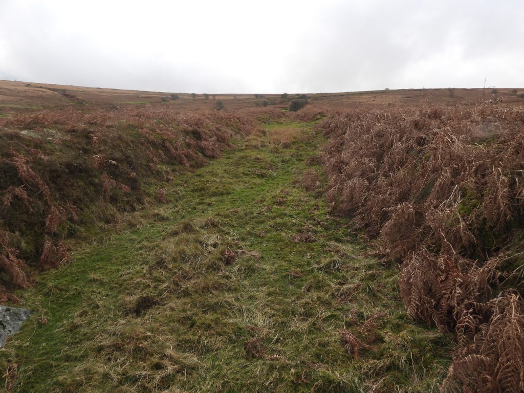
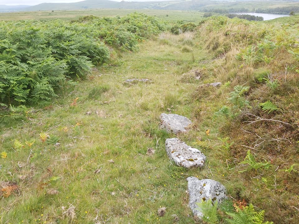
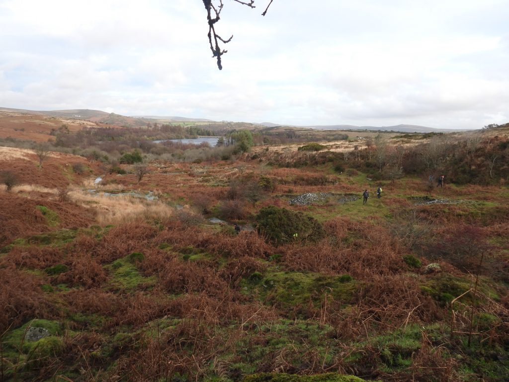
West side of the culvert. Where the tramway traverses disturbed ground of former streamworks between the engine house and the modern ‘mine’ track, it consists of a raised flat-topped embankment as is evidenced by this photographA member of DTRG examining Adit 3, which drains the main shaft. A walking pole was being used to check the extent of the ‘void’ beyond the adit entranceAdit 3 is located at SX67708 70055. This is undoubtedly the drainage level for the main shaft. Cleared out exit of Adit 3Adit 3 looking up the hillside. Note the rocks next to the entrance following some clearanceClose up of Adit 3 entranceInside Adit 3 entrance showing lintels in positionUsing the ‘dropped pin’ tool on ordnance survey using the relative heights above sea level of the shafts (1, 5 and 4) running east – west and their associated adits (3, 2 and 1) it is possible using simple mathematics to calculate the shaft depths (to adit level) and the approx. adit lengths. These figures are shown in red in the above table. It is interesting to compare these figures with those given by George Bennetts in issue 961 of the Mining Journal. When Bennetts refers to “The adit has been cleared to 120 fathoms”, it seems reasonable to assume he is referring to adit (3) to the main shaft at the Engine House. When describing “The adit has been cleared to about 100 fathoms, and a good branch of tin , about 5 or 6 inches wide, was discovered….” would seem to refer to shaft (5) and its associated adit (2). He then states that an “engine shaft has been sunk on this lode to the adit, and the steam-engine will drain the water from this lode by rods from the main shaft”. Perhaps this confirms shaft (5) or one close by was the engine shaft as previously mentioned in this post. Finally, when Bennetts describes “On the north lode……there are ancient workings to the adit level, 5 fathoms deep, and 50 or 60 fathoms long” – this presumably is referring to adit (1) to shaft (4). Track leading from the main shaft to the Barracks This building was divided into at least 5 rooms and is described on the Devon Historic Environment Record as probably providing shelter, storage and mine administration facilities for the tinwork. The author has always known it as ‘The Barracks’. The annotated measurements were made by the author.The long rectangular building at Ringleshutes alongside the track like the rest of the mine is best visited in WinterThe Devon Historic Environment Record (untitled reference) states: “This building is divided into at least 5 rooms and measures 26.5m by 4.5m internally, and the walls now stand up to 0.8m high”. The measurements are slightly different to those taken by the authorThe ‘Barracks’ looking southRuins of the Barracks in the Summer is covered in bracken.Another view of the Barracks in Summer.Barracks in December 2025This tramway was used for transporting mined ore from the main shaft to the probable site of small Dressing Floor at SX6785 7032. The tramway extends over a gentle gradient for 400m between SX6756 6987 and SX6779 7023. North of the mine track (as shown in the above photograph) the tramway as it cuts across open moorland the tramway runs between two narrow, linear earth banks of up to 2m highGeorge Bennetts in January 1854, stated: “The earthwork for a railroad from the engine to the stamps is complete, and the rails are ready to be laid”. In spite of this statement there is no evidence of rails or indeed wooden or granite sleepers every having been laid.Another view of the tramway with Venford Reservoir in view. This is the mid point of the tramway at SX67765 70195. The tramway appears to stop short of the dressing floor at the bottom and at the main shaft at the top. Does this suggest it was not fully finished ? Just down the track from the barracks is a continuation of a tramway leading to the Dressing Floor. It comprises a shallow cutting about 3m wide defined by earth banks on either side. Nearing the lower (north) end of the tramwayA channel leading from a now dry leat down to the Dressing Floor. Was this provide supplementary water as well as that provided by the stream in the small valleyOverlooking the Dressing Floor and Venford Reservoir (constructed 1906) beyond. The Dressing Floor remains are sited within an area of earlier tin streamworks along the valley of Venford Brook and are 500m from the main area of activity at the mine
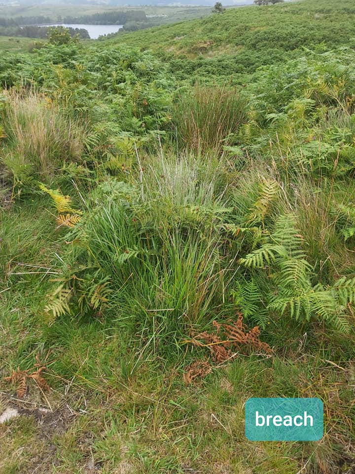
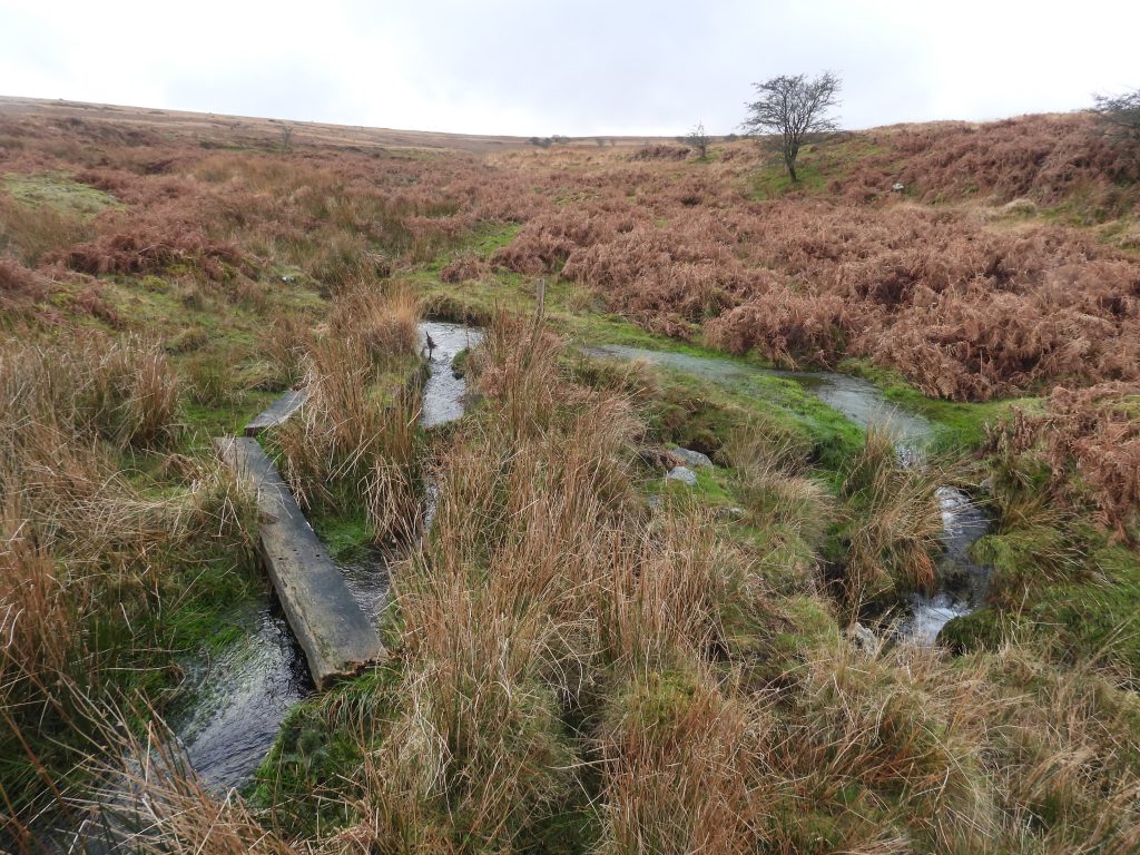
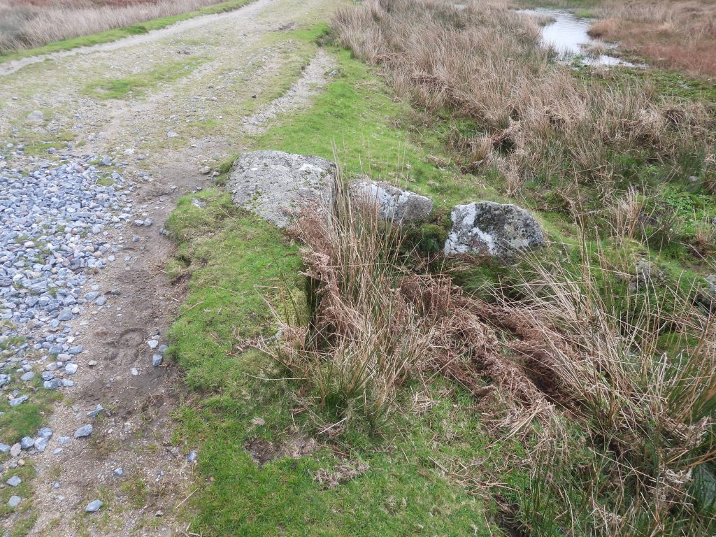
This is a breach in the (now dry) Old Holne Town Gutter, which supplemented water into Ringleshutes Stream to operate the water wheel below. This breach is at SX67808 70266
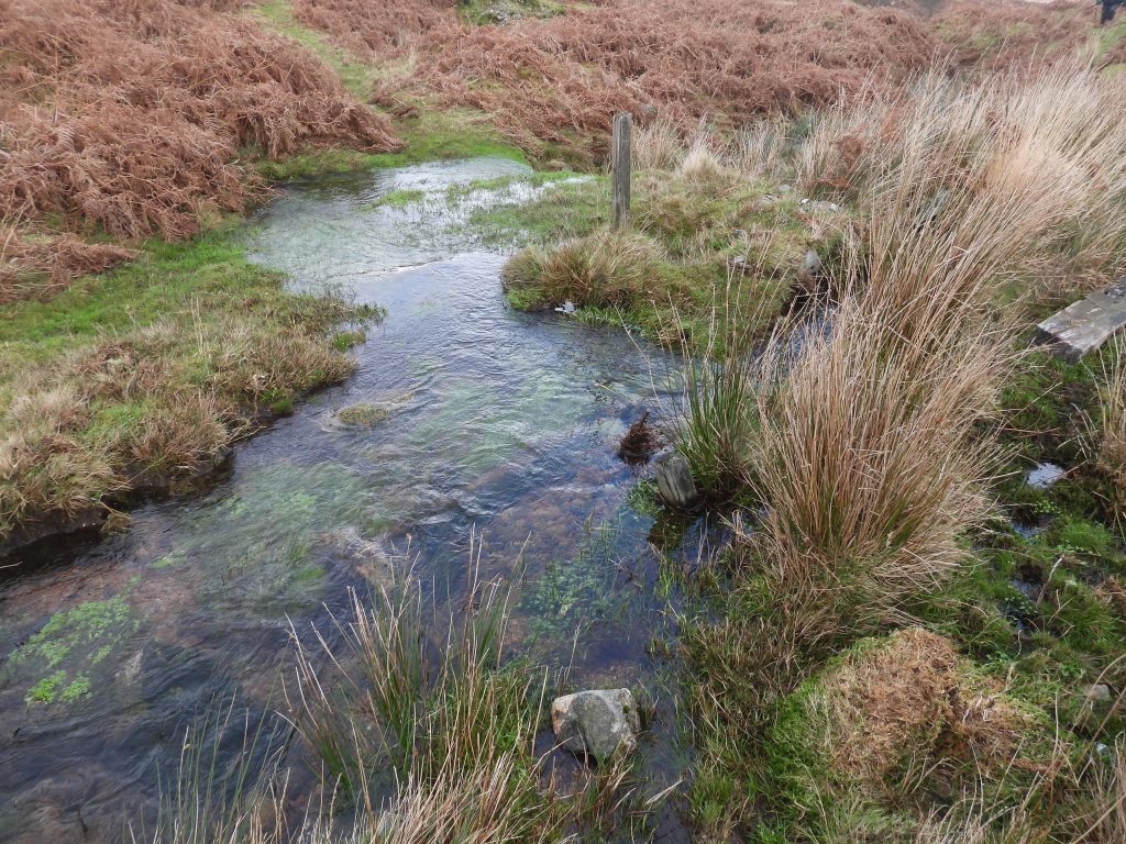
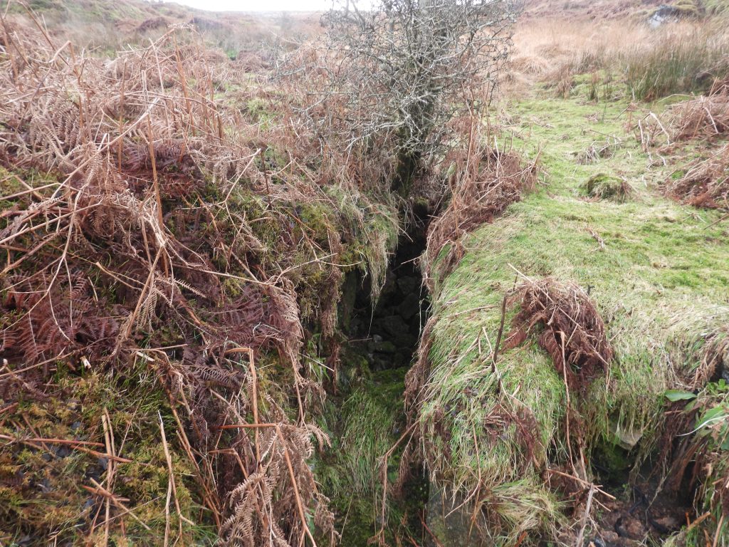
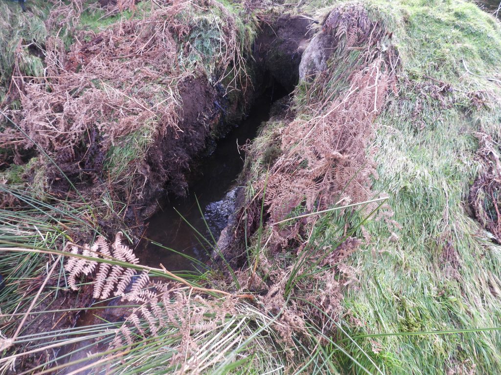
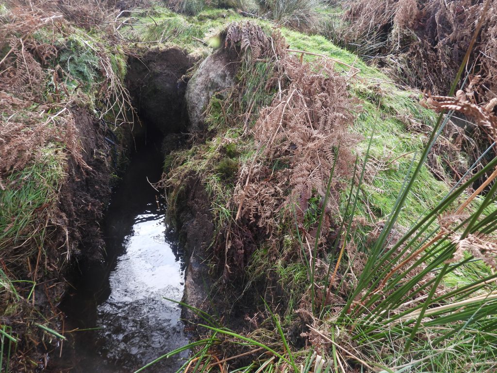
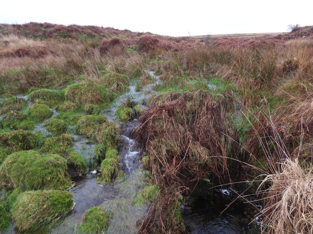
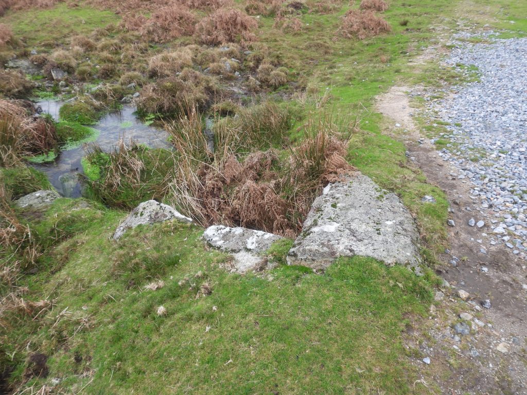
The leat system on Holne Moor showing the complexities of all the water courses ; There are three main leats here: Wheal Emma (dry), Hamlyn’s Leat (wet and dry sections), Holne Town Gutter (wet and dry sections). The waterwheel at Ringleshutes was (most likely) fed from Ringleshutes Stream and possibly an early cut of Holne Town Gutter from Hooten Wheals StreamHolne Town Gutter Leat ‘take-off’ point from the stream. The water comes from the Ringleshutes Mine streamThere is a small weir at the leat take-off point located at SX67862 70223Bob Bruce (in 2000) describes “a deep stone-lined channel presumed to be the wheelpit” (as shown in the photograph). That said, S.Probert and P.Newman (in 1997) recorded: “……a narrow leat which terminates in a rectangular depression …..This is a possible wheelpit though is rather shallow at 0.5m and would have been undershot judging by the position of the leat, which is unlikely at a Dartmoor tin mine”. Is this picture of a leat or water channel or is this the wheelpit ? The author believes this is the leat (or water channel)Side view of the narrow and deep water channel. This channel appears to have directed water away from the brook to the southAnother side view of the narrow and deep water channel
End of the water channel in Summer is covered in vegetation. Old stonework is very evident. SX67847 70325
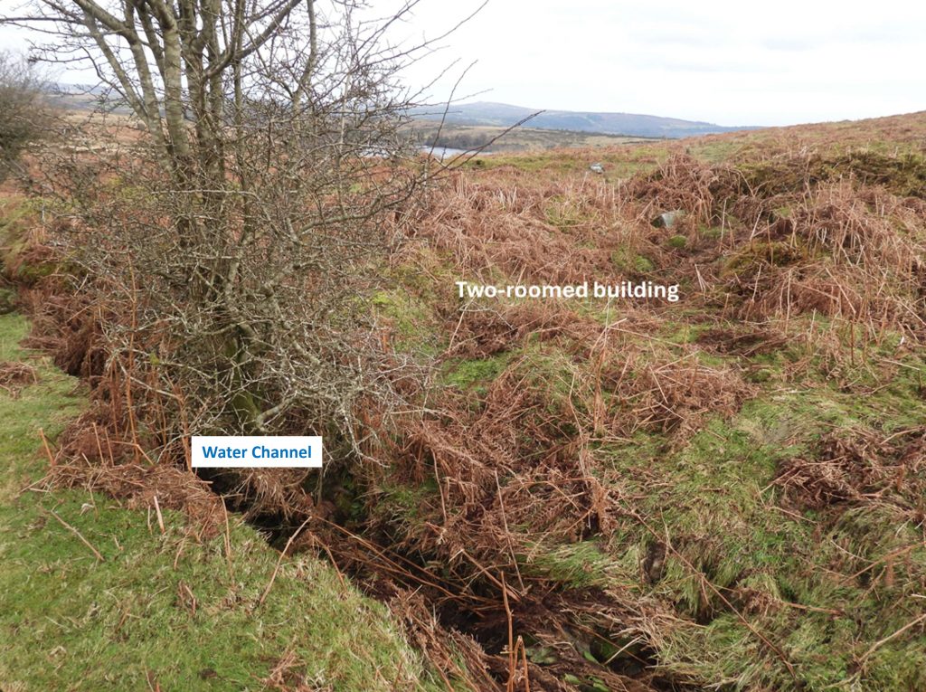
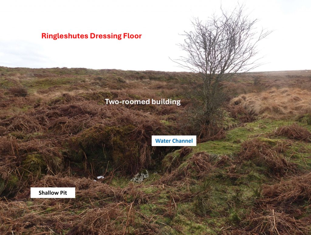
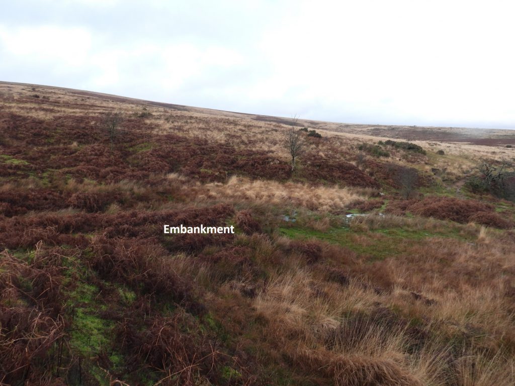
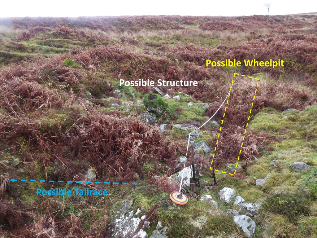
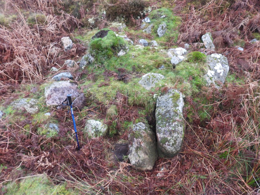
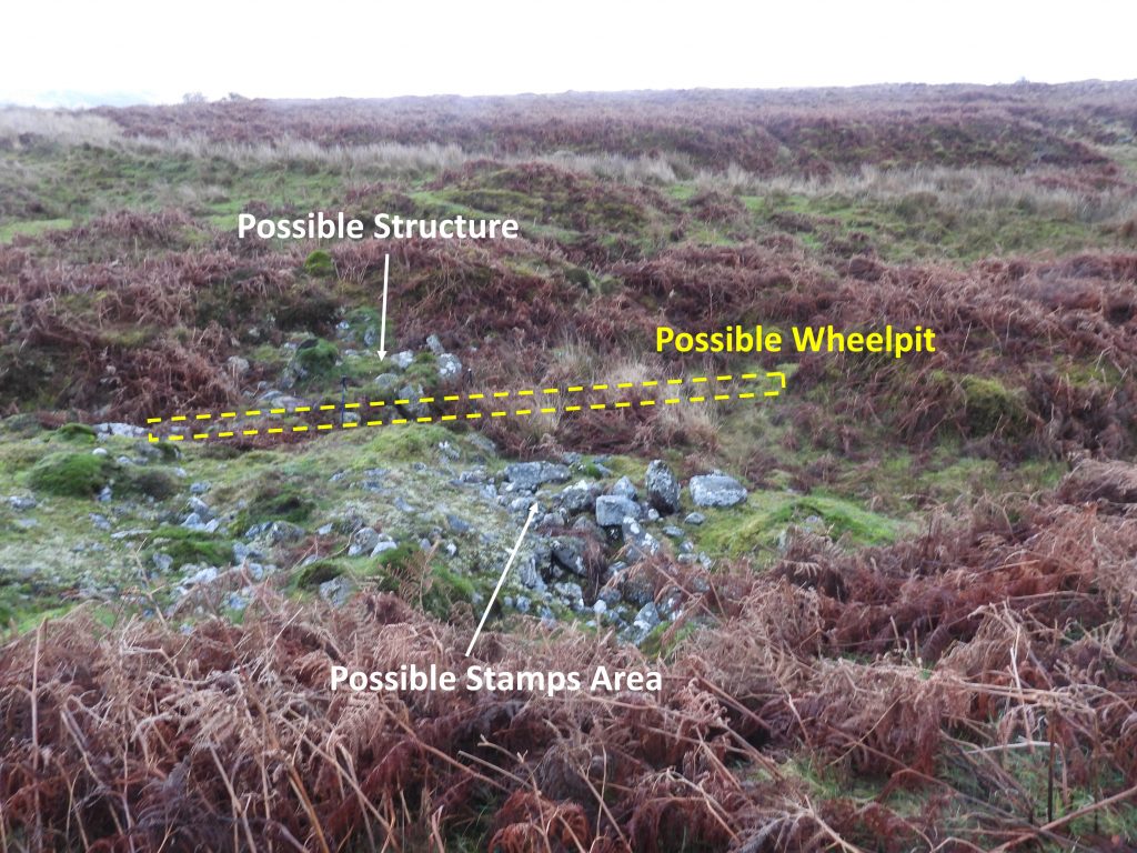
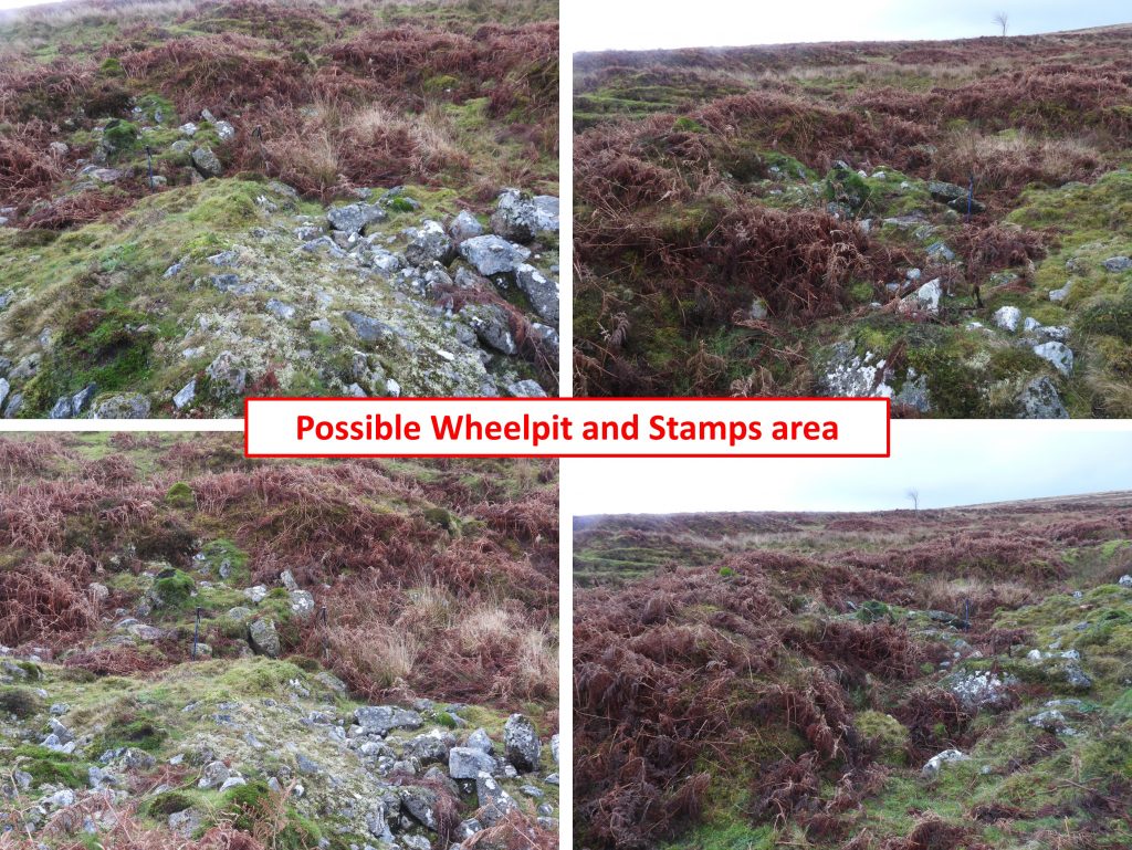
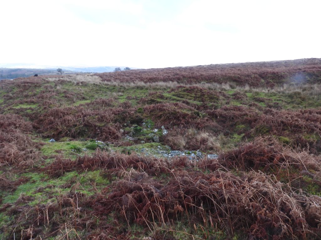
Below the ‘narrow’ water channel is an area which widens out into a shallow pit and has stone lined walling – Is this where a wheelpit would have been located ? George Bennetts, in 1854, spoke of a 30ft waterwheel, 4ft breast. The width of the gap here is 4ft 5ins. That said the walling is only about 12ft long. However, between the leat and the track (just behind where the camera is located), the length is 32ft which was just about long enough for a wheel to fit. On the balance of probabilities the author does not believe the water wheel was located here because; it would have been an undershot wheel and the size of the area is just too tight to have accepted a 30 ft x 4 ft wheel. So what was this pit for ?Looking north from the end of the ‘narrow’ water channel to the shallow stone lined pit and modern track. The stone lines shallow pit is located at SX67848 70329The dotted white lines show where stone lined walling can be found. These features line up exactly how Dave Brewer depicted this area in 1988. During a recent (December 2025) DTRG walk some tin slimes were found to the east (right of picture) of the shallow pit.
The ‘wheelpit’ / shallow pit in summer looking south. The water channel is where the tree is.
This is the end of the tail race, looking north, crossing a more modern track at SX67847 70331
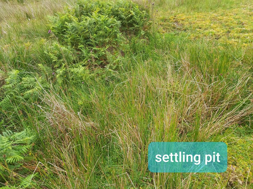
Tailrace below the modern track below the shallow stone lined pit. It is located at SX67849 70340The tailrace portal appears to be stone lined. It was cleared during a recent DTRG walk to the areaView of the narrow water channel and the two-roomed building at the dressing floorThe shallow stone line pit, water channel and two-roomed buildingTwo-roomed building as measured by the authorThe RCHME record of 1997 records: “The building, now badly ruined, has internal dimensions of approximately 6.3m by 3.8m and has one internal division, creating two compartments”. 4m northwest of the building is the stone lined shallow pitThe reason for the building is unknownDressing Floor Building – All that can be found in Summer are the remains of an overgrown side wall (where the light coloured fern is). SX67851 70320On the east side of the building is a level area (where Brewer describes a settling pit and a lagoon). The area has been cleared within the old streamwork dumps.Probable buddle. Dave Brewer described it as a settling pit. It is located at SX67864 70309This picture of some reeds is a rectangular settling pit as described by Dave Brewer. To the south is an area described as a lagoon. The ‘lagoon’ is silted up. Possible mining sett boundstone as viewed from the dressing floorContinuing the search for the waterwheel site and stamps to the south of the dressing floor where this small embankment can be found. Could this have been a leat embankment ?Below the embankment is a very wet and boggy area. If the embankment was a leat embankment there is no evidence of any wheelpit or stamps area. If there had been evidence one would have thought there would have been some granite in this areaReferring back to the George Bennetts report in the Mining Journal about Holne Moor (Ringleshutes) Mine, he recorded about the excavations for dressing-floors, an earthwork for a railroad from the ‘engine to the stamps’ and the building of a wheelpit for a wheel, 30 feet diameter and 4 feet breast. The wheelpit and stamps ought to be quite straight forward to find, one would have thought, even after over 170 years. The author and two Dartmoor Tinworking Research Group (DTRG) members who collectively describe themselves as ‘enthusiastic amateurs’ (and certainly not experts), decided to attempt to find (or at least propose) a location for the 30ft x 4ft wheel. The criteria used for any wheel location were that: it must have been close to the bottom end of the tramway; it must have space large enough; it must have space for adjacent stamps; it must have granite remains (for a wheelpit); it must be in a location where the wheel would be overshot; it must be a good water source(s) and it must have evidence of a tail race. With these criteria in mind, the search began…….Using the criteria previously stated, a (possible) location for the 30ft x 4ft wheel and stamps has been identified as shown on the annotated aerial photograph. All criteria appear to have been satisfiedThe possible site for the wheelpit and stamps has easy access via a track to deliver the ore from the tramway. It lies within a hollow just below the take-off point for the Holne Town Gutter from the Ringleshutes Stream. The hollow is large enough (35ft long x 31ft wide) for the wheel and the stamps. It is rather disturbed with lots of granite, some of which looks dressed.Annotated map of the hollow where the author (and others) believe the waterwheel was located. According to the Mining Journal No. 972 (8th April 1872), the stamps and wheel were set to be operational by June 1854Measuring the possible wheelpit, where there appears to be a tail race below and possibly a small structure to the east (as well as possible stamps to the west). The length of the area is 35ft so would just be large enough for the wheel reported by Bennetts in 1854 (at 30ft). The wheelpit ‘gap’ is 4ft 10in (accounting for rock tumble). There is evidence of two straight pieces of potential walling here. The centre of the wheel is SX67851 70245Possible structure to the east of the wheelpit is 7ft x 5ft. The structure to the east of the wheelpit has not been annotated as the stamps area, simply because it is on the far side of the wheelpit in relation to the track leading down from the tramway. The structure is located at SX67853 70245There are several dressed stones, where the author believes the stamps were once located. There is evidence here of various sized stones and boulders. This disturbed area is approx 20ft east-west and 15ft north-southDressed stone at the possible stamps area. Hamilton Jenkin suggests that the mine had eight heads of stamps. The location is SX67849 70242There is a narrow embankment / track leading down to the dressing-floor from the stamps area via the previously mentioned ’embankment’ which lies a short way across Ringleshutes Stream. This in turn is just above the dressing-floors.Is this narrow embankment / track was where crushed ore was barrowed down to the dressing floor?The narrow embankment / track as it meets the Ringleshutes streamView from the west of the possible stamps area, possible wheelpit and possible small structureWater could easily have been laundered to an (overshot) waterwheel here from Ringleshutes Stream (from near the Holne Town Gutter take-off point) and possibly also (albeit unlikely) from the leat which runs close to the bottom of the tramway and comes from Hooten Wheals Stream.Collage of the possible wheelpit and stamps areaThe disturbed area of where Bennett’s wheel once could have operated. With the mine closing in 1855, it would only have been operational for around a year at mostSome locals in the mine area.The foal had some nice colouring.Lots of Stonechats on Holne Moor, fabulous sight.One of two bridges at the mine trackBridge 1 (western most) The eastern bridgeView from the eastern most bridge looking westBridge 2This upright is mentioned by Dave Brewer (Dartmoor Magazine from 1988) and by Eric Hemery (Walking the Dartmoor Waterways). It is quite prominent and is easily seen from the Ringleshutes Mine Track to the east of the complex. Unusually, it does not appear to be recorded in the Devon Historic Environment.Hemery describes the upright thus: “On the spur of the hill between the mine road and the ancient leat (Holne Town Gutter) is an old mining pit in which stands a set stone; uninscribed, its firm setting shows that it once had particular significance, perhaps a mining boundary mark”. The only change the author would make to this description is that the stone is set ‘above’ and not ‘in’ old trial pits, Brewer describes the upright thus: “On the crest is a plain standing stone, possibly a boundstone of the sett”.With its prominent position on the east edge of tin workings, the supposition by Hemery and Brewer is probably correct with this upright being a mine sett boundstone. It is located at SX67962 70170To the east of the Ringleshutes complex (and worthy of a mention) are the extensive tin streamworks above Venford. Crossing the hillside and the streamworks are three leats, from highest to lowest on the hillside they are: Holne Town Gutter (wet), Wheal Emma Leat (dry) and Hamlyn’s Leat (dry) which is shown in the photograph. This view is looking westHamlyn’s Leat looking east just before it crosses the tin streamworks at VenfordVenford tin streamworks from the east side. The two ‘lines’ seen towards the top left of the photograph are Wheal Emma Leat and Hamlyn’s LeatVenford streamworksVenford tin streamworks overlooking the reservoir with views behind including Sharp Tor, Corndon Tor, Chinkwell Tor, Honeybag Tor and the broad ridge of Hamel Down. The ‘speckles’ of white near the top left corner of the photograph is part of the set for the film ‘Werewolf’ where filming took place around October-December 2025Members of the DTRG in Venford streamworks. William Crossing uses the spelling “Wennaford” which Hemery suggests was a corruption in use for a time when he was exploring the moor.