A collection of walks, discoveries, insights and pictures of exploring Dartmoor National Park
May 7, 2023
Owlacombe Beams, Wheal Beam, West Beam Mine and Brothers Mine
Owlacombe Beams, Wheal Beam, West Beam Mine and Brothers Mine are all located a few miles to the north east of Ashburton on private land adjacent to the road between Owlacombe Farm and Owlacombe Bridge. The Dartmoor Tinworking Research Group (DTRG) held an ‘Ashburton Parish’ event in late April 2023 which included a visit to these mines and tinner’s workings. The author was fortunate enough to attend these events and is grateful to Stephen Holley (DTRG Chairman), who led a walk to these sites and who provided a fabulous insight into their history and their operation. As well as DTRG information provided on the walk , further information on the tinners’ workings and mines used in this post has been gleaned from the Hamilton Jenkin, Mines of Devon publication and from the Heritage Gateway.
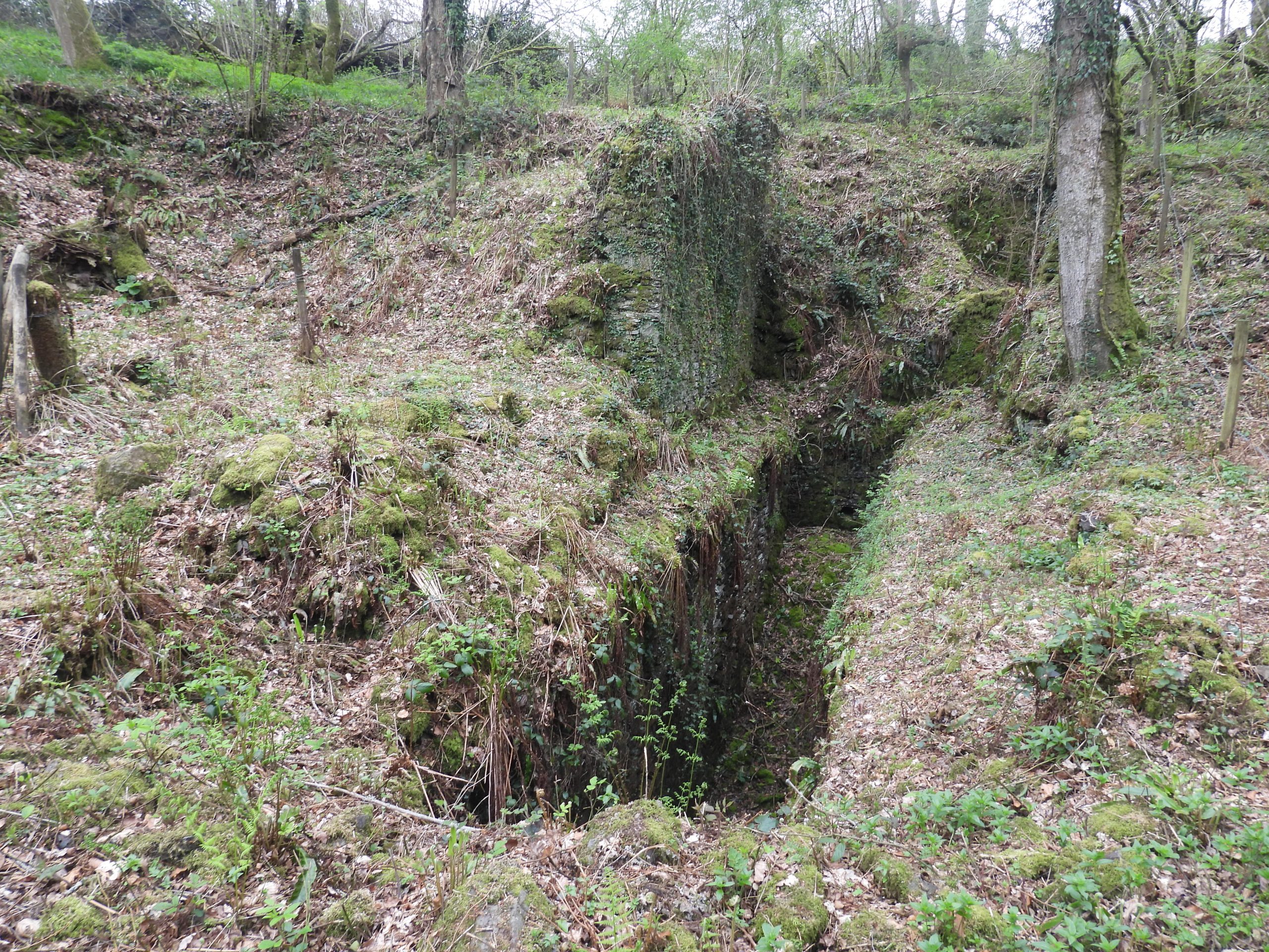
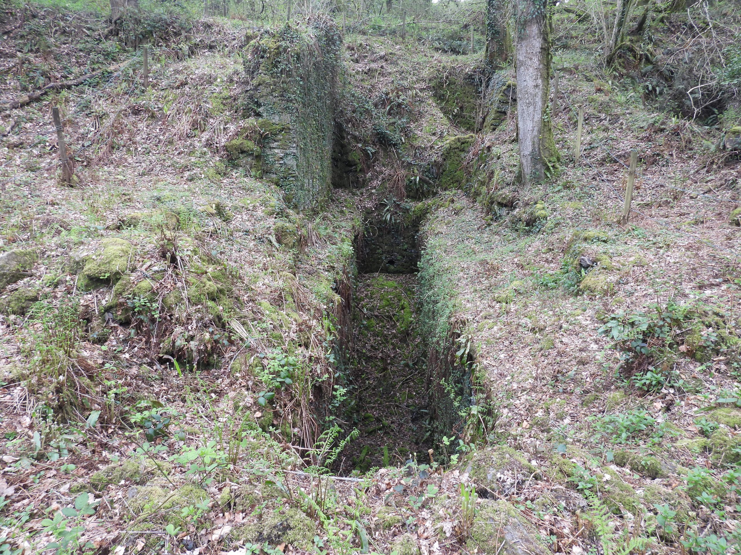
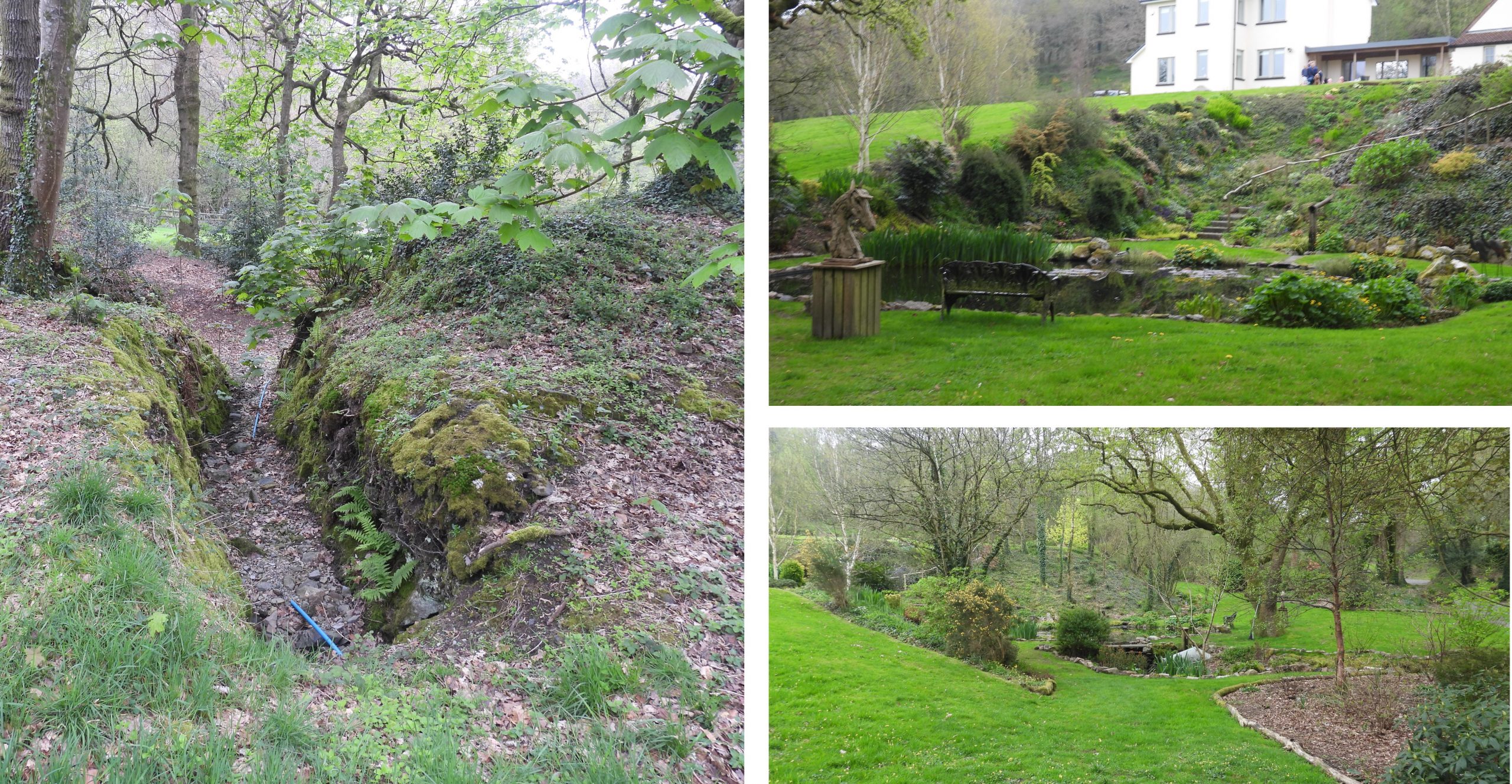
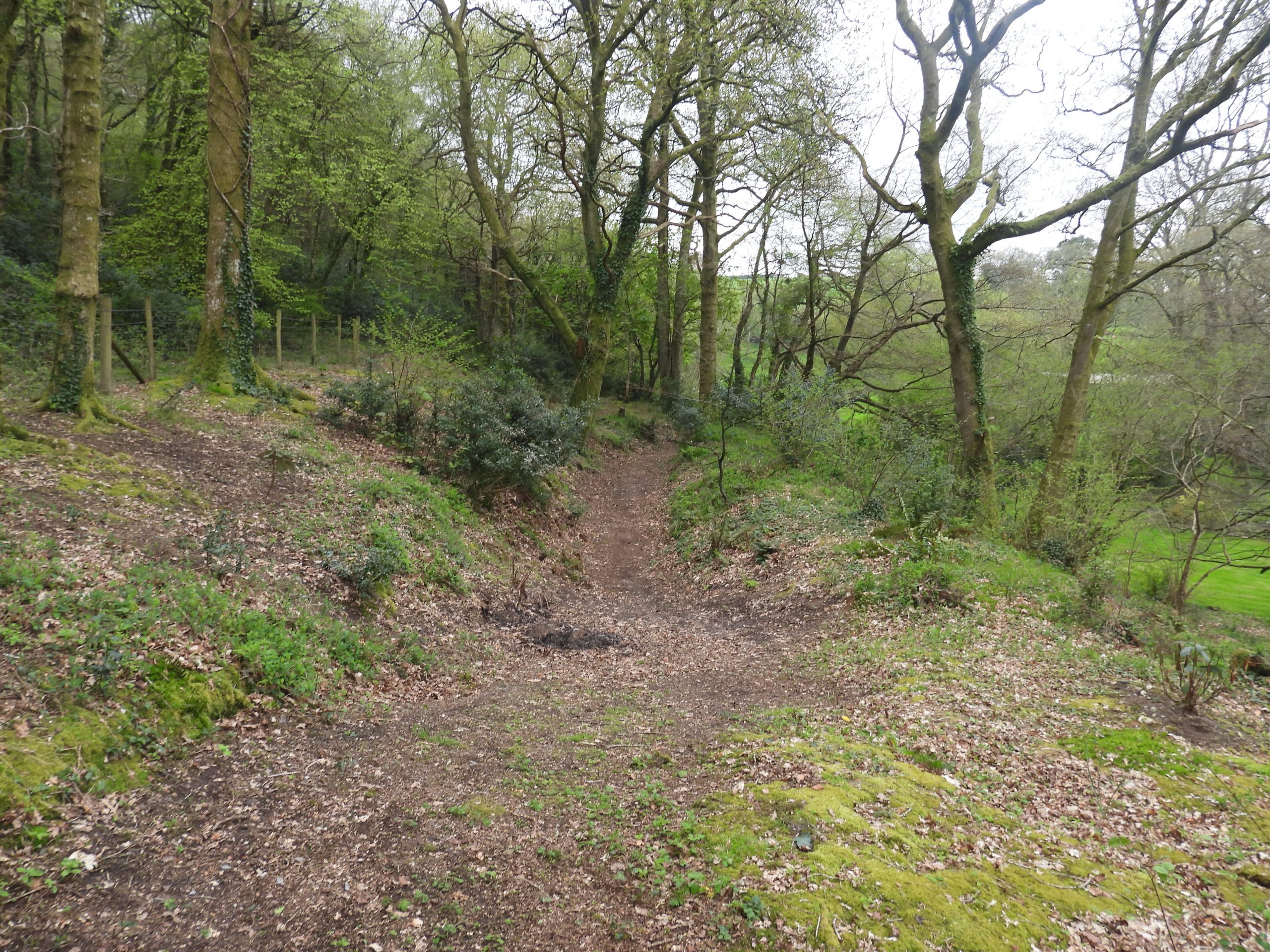
The first tinners’ activities in the area was at Owlacombe Beams, a large tinners’ cutting, which was dug by manual labour alone in the medieval period. They were first mentioned thus: “Major tin works, known as ‘Owlescomb worke’ in 1492″. Nearly 200 years later it is recorded that: “In a petition dated 1688 Richard Strode, of Newnham claimed ownership of tinworks called Owlacombe Beam within Ashburton Stannary”. Owlacombe Beams are now a tree lines impressive cutting, 1200 feet long, 30 to 40 feet deep and between 50 and 100 feet wide. In modern times there were attempts to fill in this rather impressive gorge, which fortunately ceased.
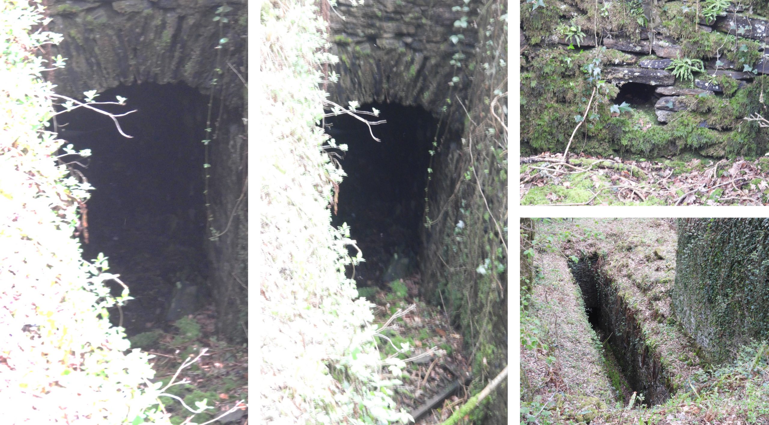
Hamilton Jenkin (HJ) records that during the 1840s, Owlacombe Beams were developed into shaft mining. There were two known lodes here, with the most northern one being exploited. The shaft mining here was known as Beam Mine or Wheal Beam and yielded £6,000 of Tin (£780k in todays terms) from depths of only 31 fathoms (186 feet) below the adit level. There are at least four shafts (Murray’s, Parry’s, Engine Shaft and James), in Owlacombe Beams. It is unclear from Hamilton Jenkin, which of these four shafts were part of Wheal Beam. That said, given that HJ records the depths of Wheal Beam (at 31 fathoms below adit) and then further mentions the depths of Murray’s and Parry’s shafts which are deeper, it is possible that Engine shaft and James shaft were the only shafts of Wheal Beam.
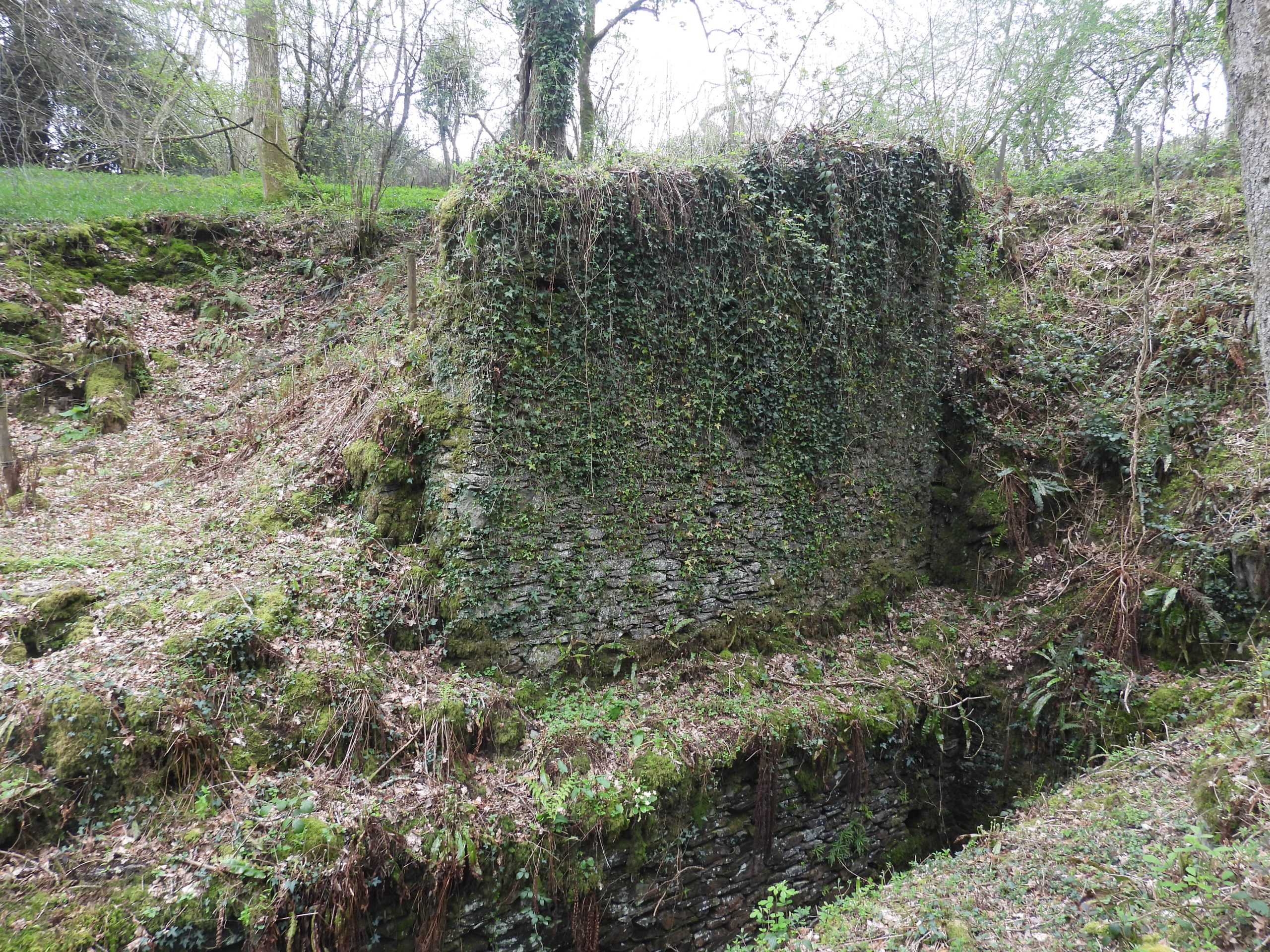
Adjoining the Beam Mine (Wheal Beam) was West Beam Mine, which had started a few years before Wheal Beam in 1836, when a shaft (West Beam Engine Shaft) to the west of Owlacombe Beams was sunk. The West Beam Engine shaft lay on the same northern lode as the shafts at Wheal Beam. West Beam Mine yielded £10,600 of Black Tin (£1.5 Million in todays terms). The shaft was limited to 40 fathoms (240 feet) due to having to use a water wheel based pumping system and water was rather lacking. The mine briefly ceased between 1848 and 1851 before the shaft was extended to 66 fathoms (396 feet) as a steam powered pump was installed at the shaft head to improve pumping. The last production figures recorded for this mine were around 1866 when the mine was abandoned with the production of 30 tons of black tin and 22 tons of copper ore being recorded.
To the south east of Owlacombe Beams is a further lode which is named Brother’s or Union lode, which was probably part of Brothers Mine / Wheal Union. Hamilton Jenkin records this as being a copper lode.
Although Hamilton Jenkin and the Heritage Gateway have recorded the mines, shafts and lodes in this area in some detail, the timeline and some of the information is a little confusing and doesn’t ‘knit together’ in some places. Thus, if anyone reading this post is able to add detail or correct assumptions made by the author, these would be most welcome.
Bibliography
Dr A. K. Hamilton Jenkin, 2005, Mines of Devon
J.S. Amery, 1924, (Presidential Address) The Ashburton of past days: its manners, customs and inhabitants).
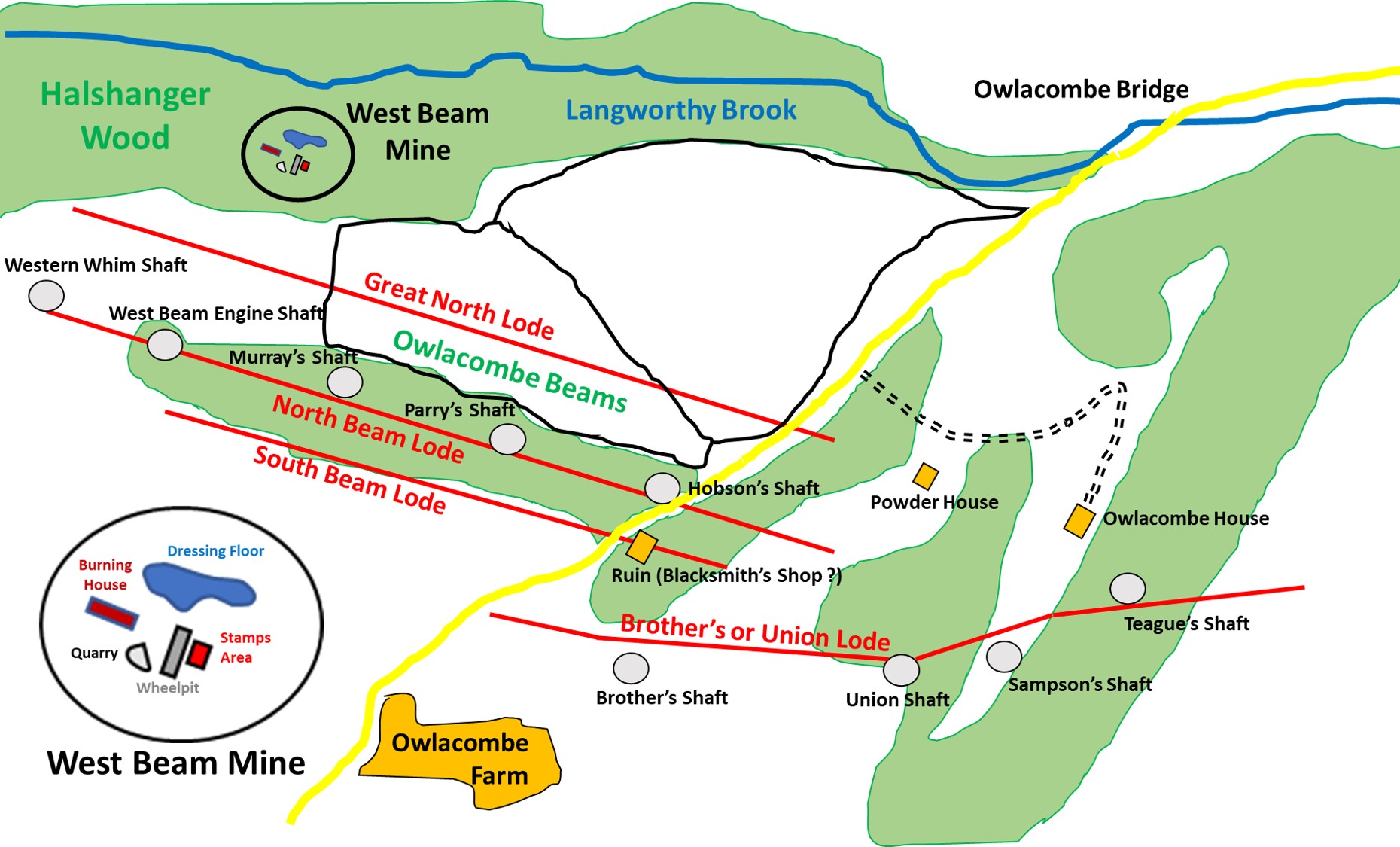
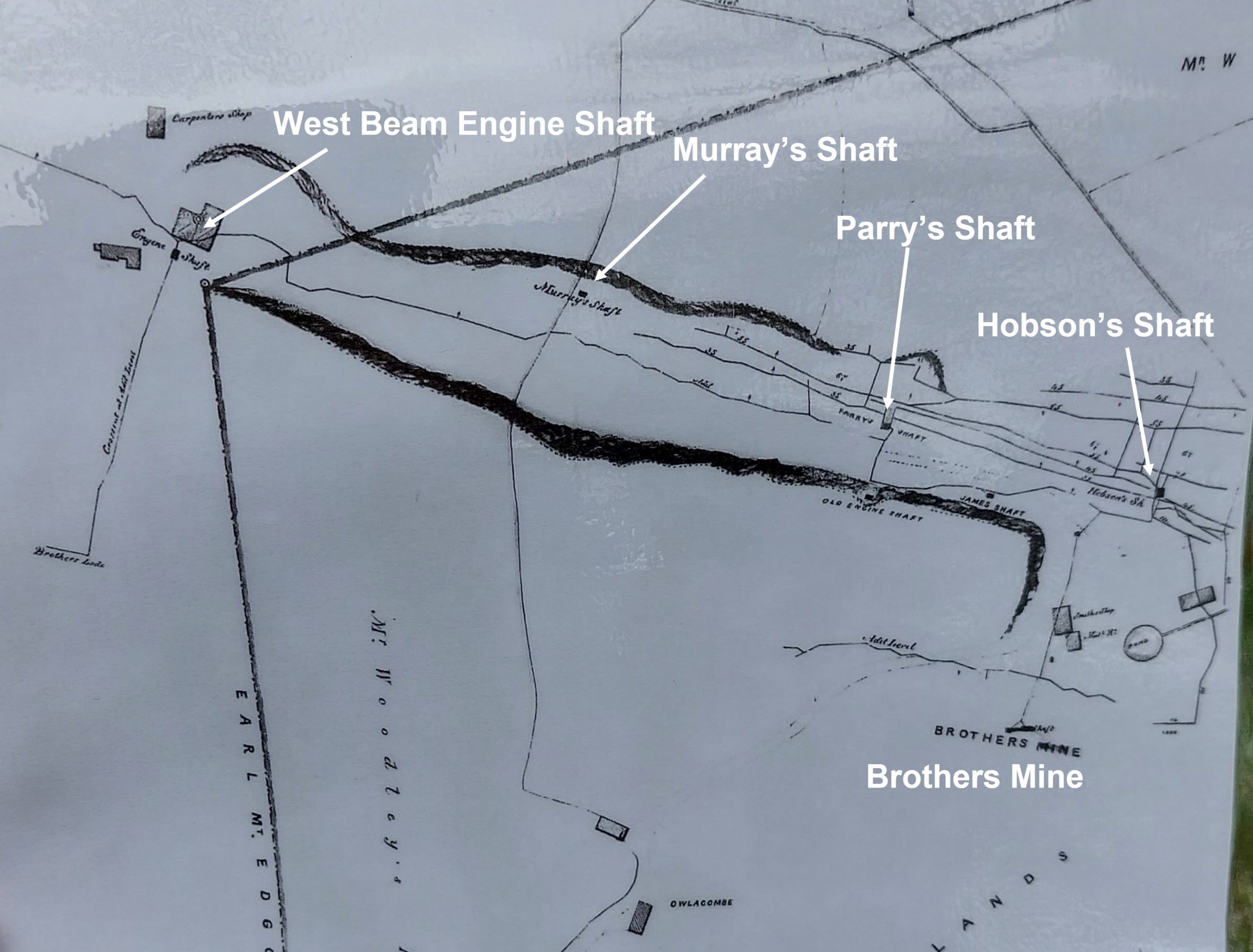
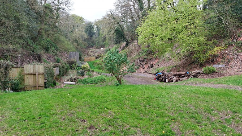
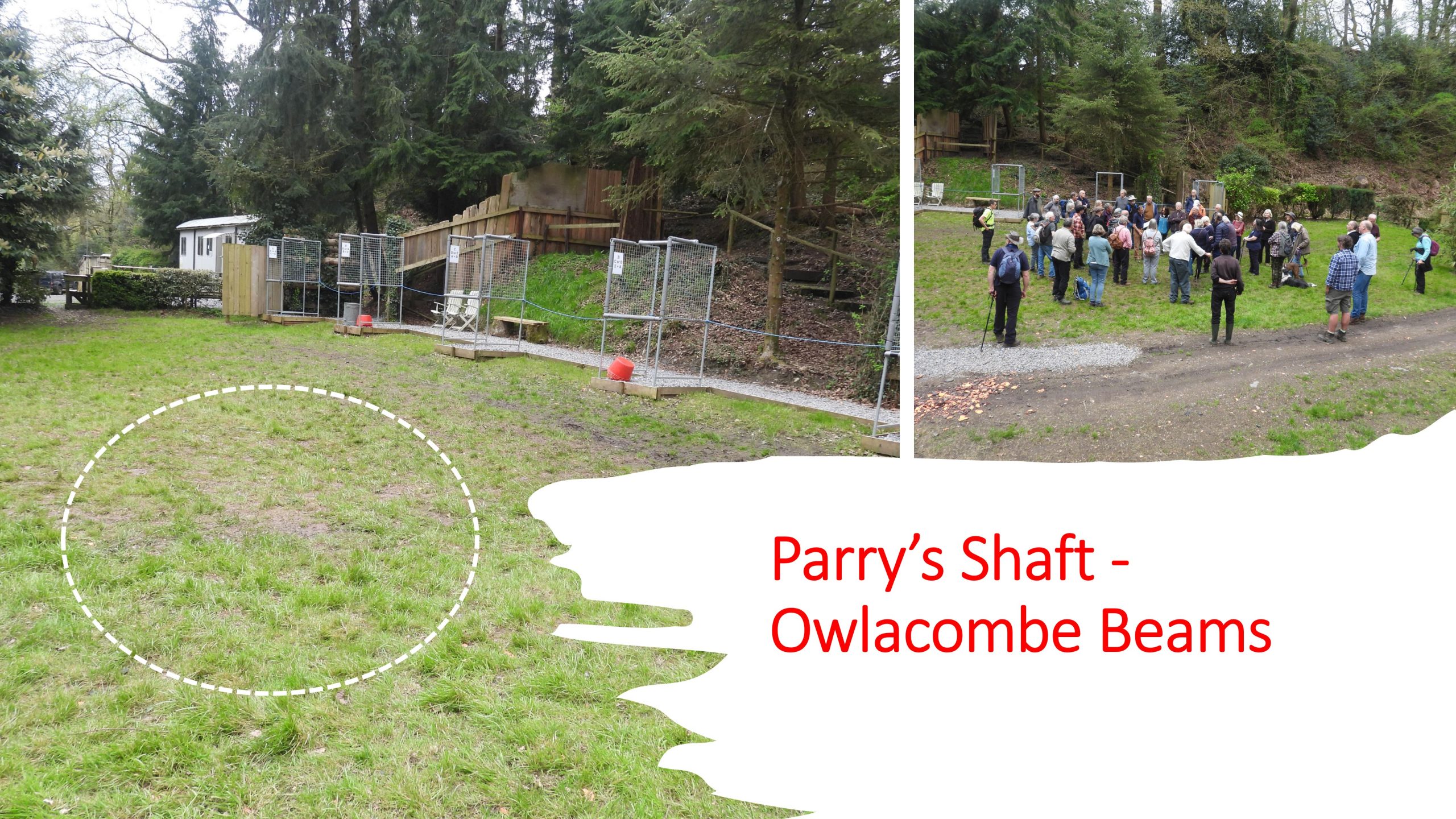
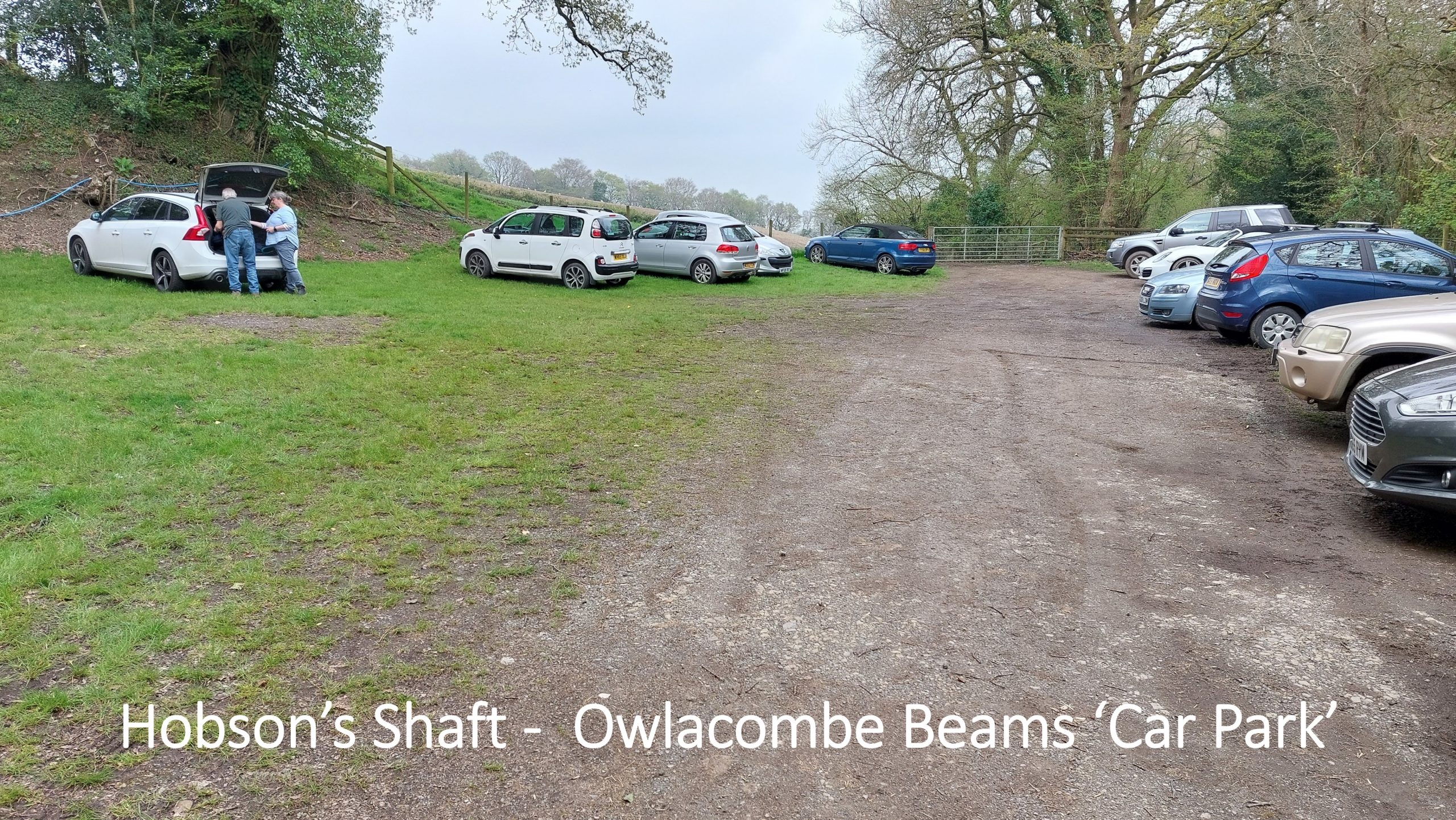
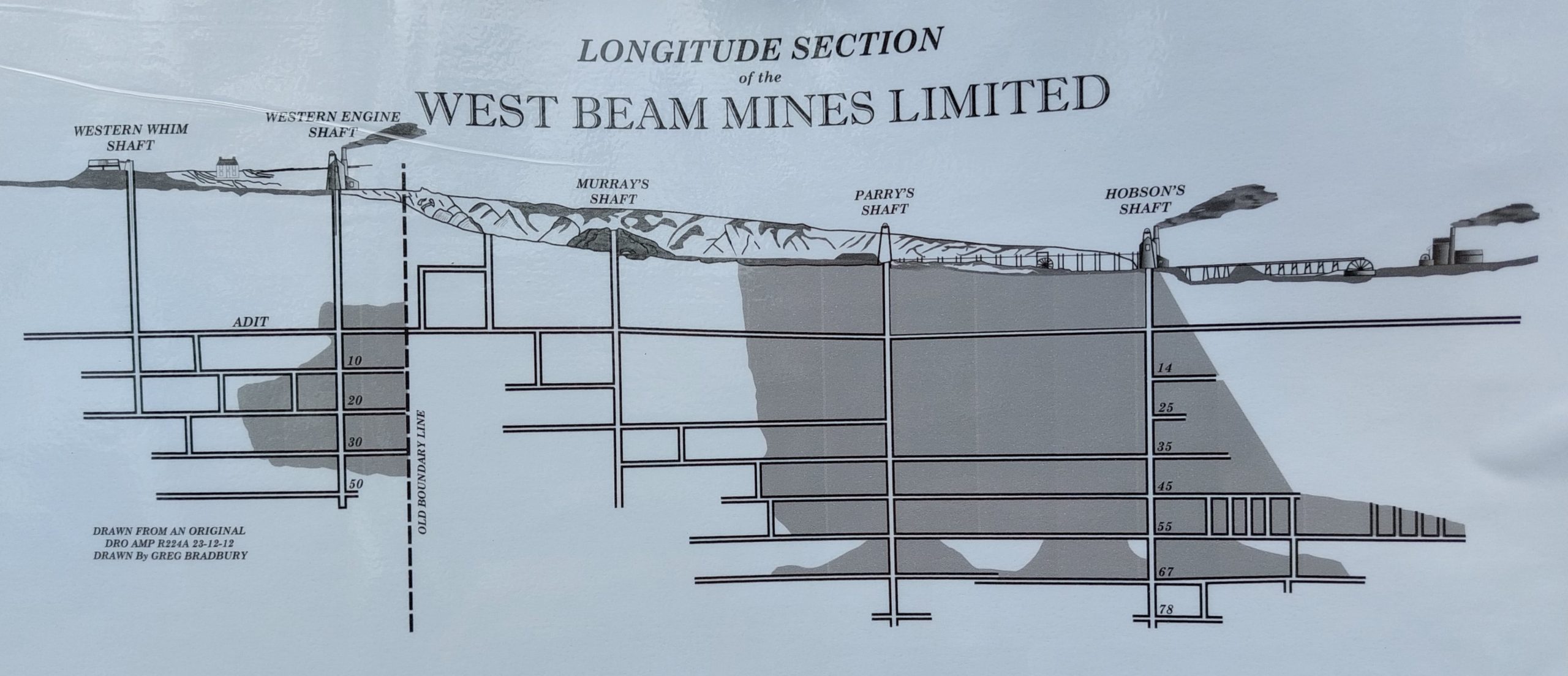
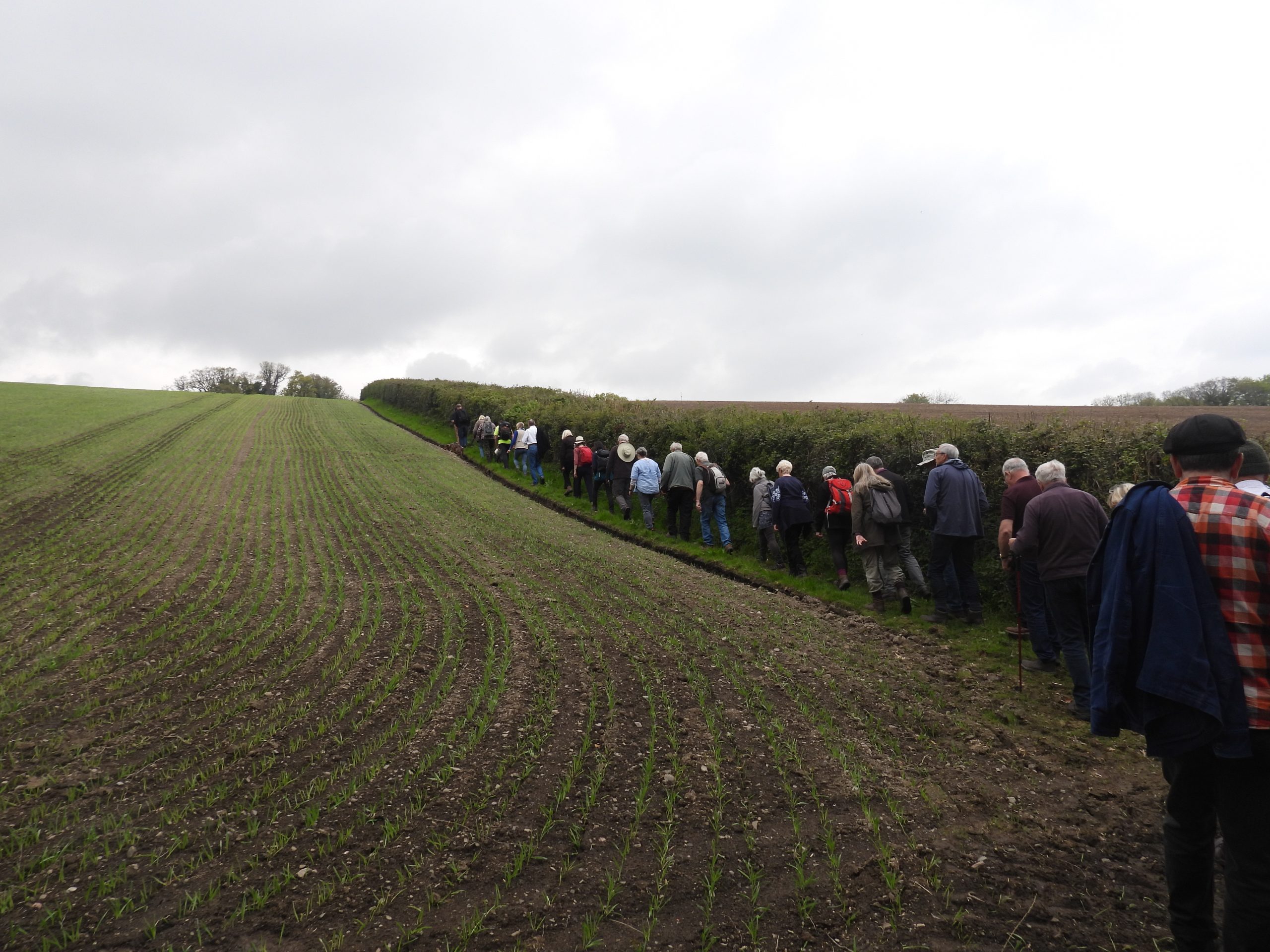
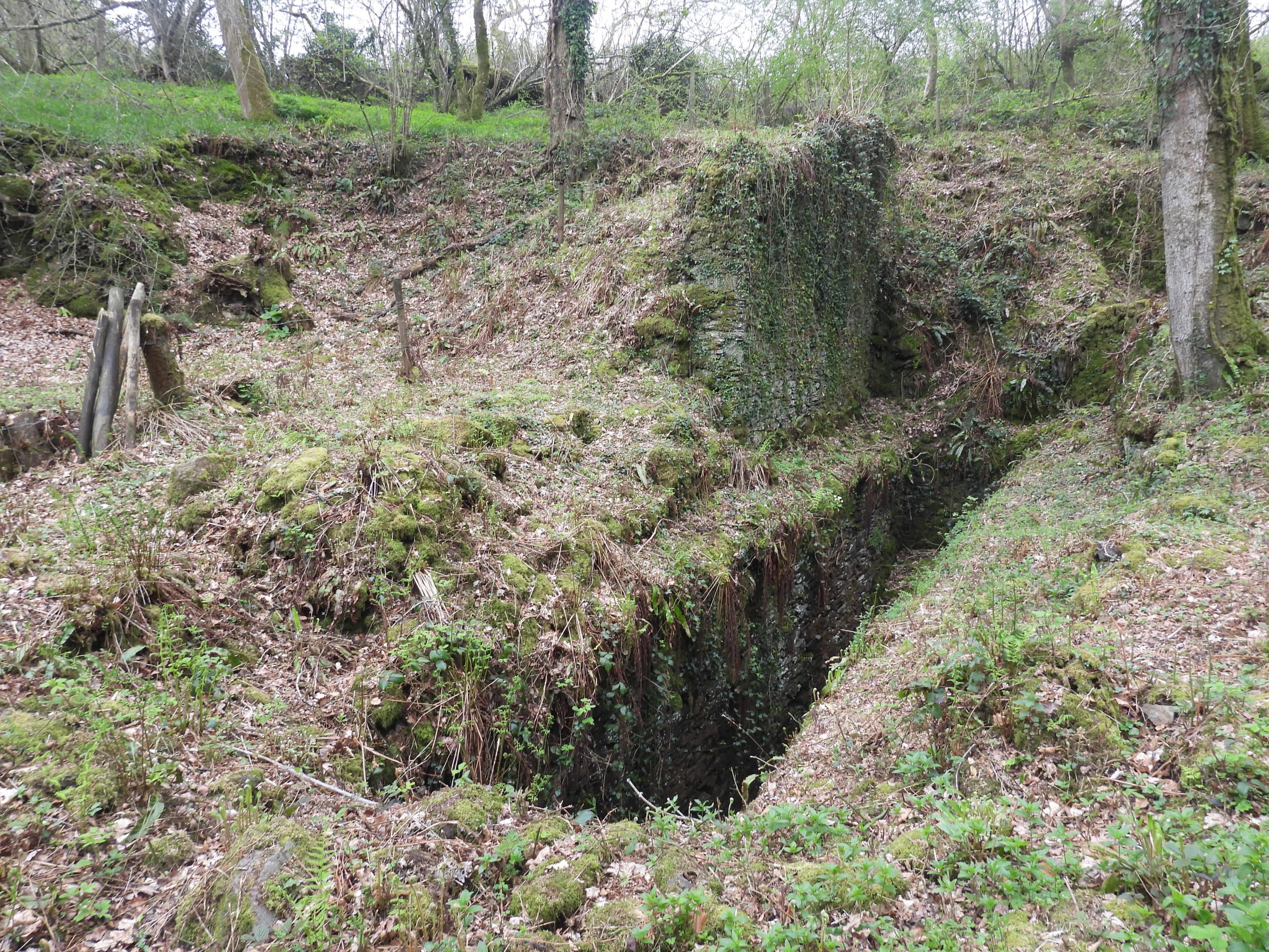
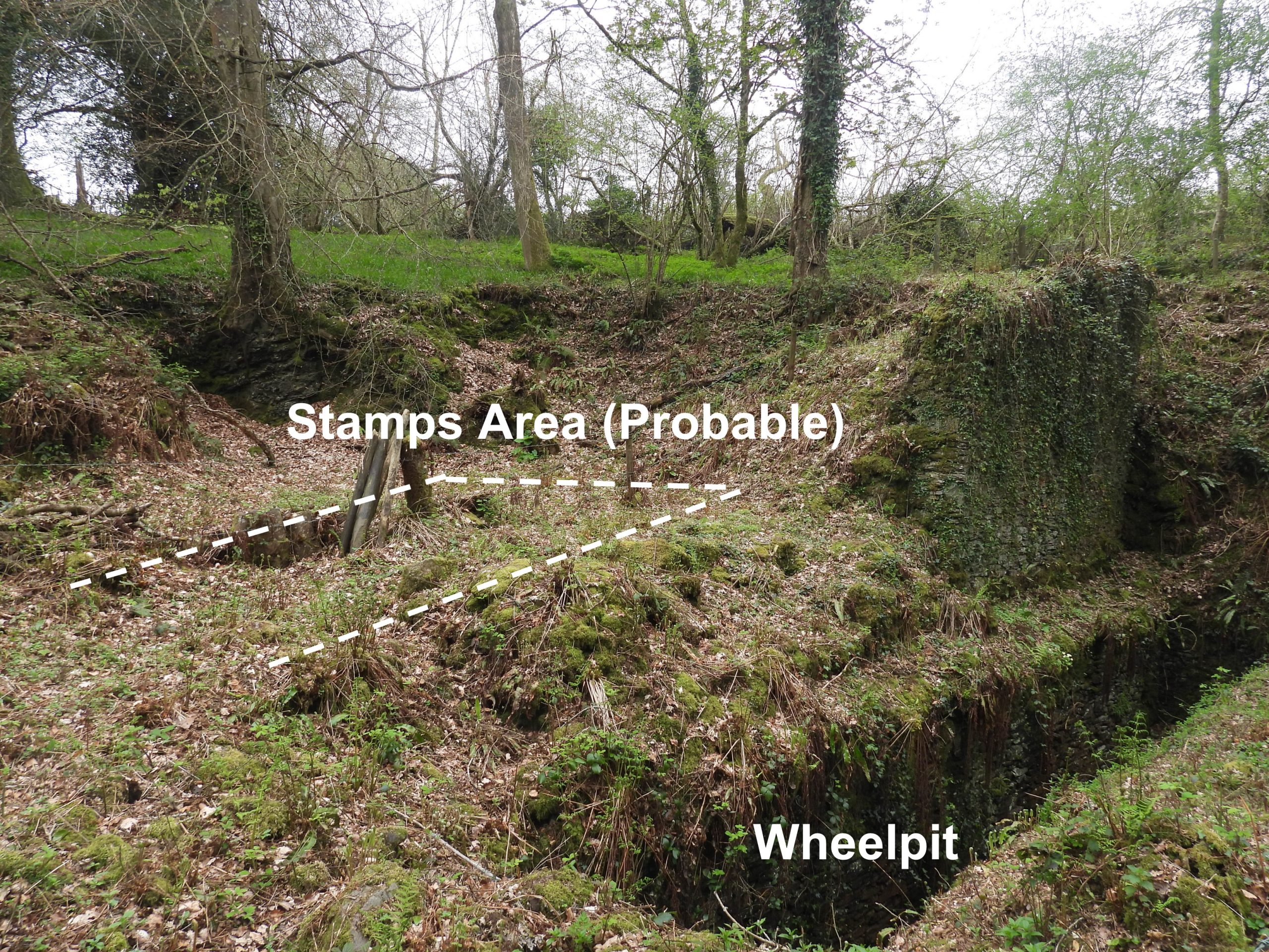
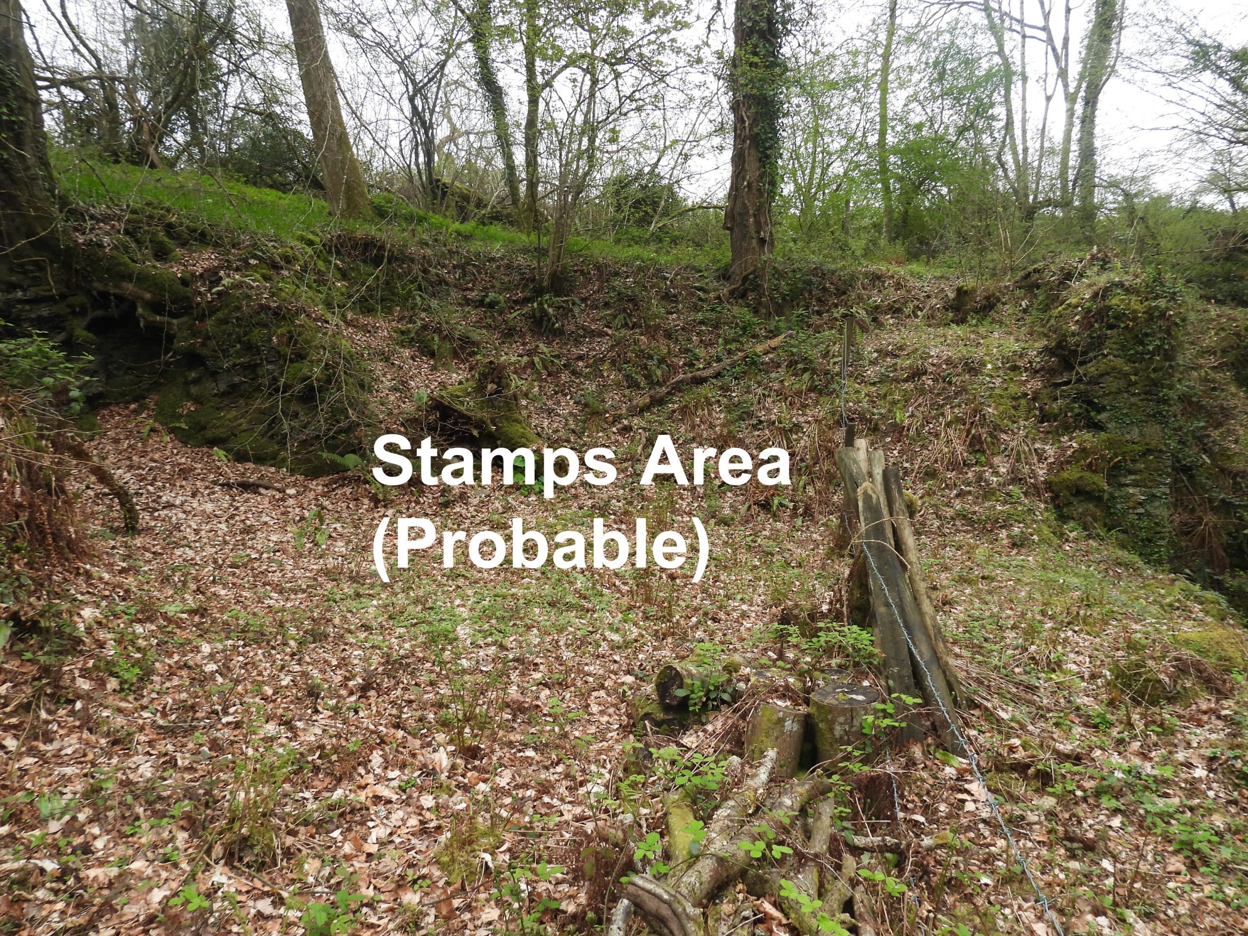
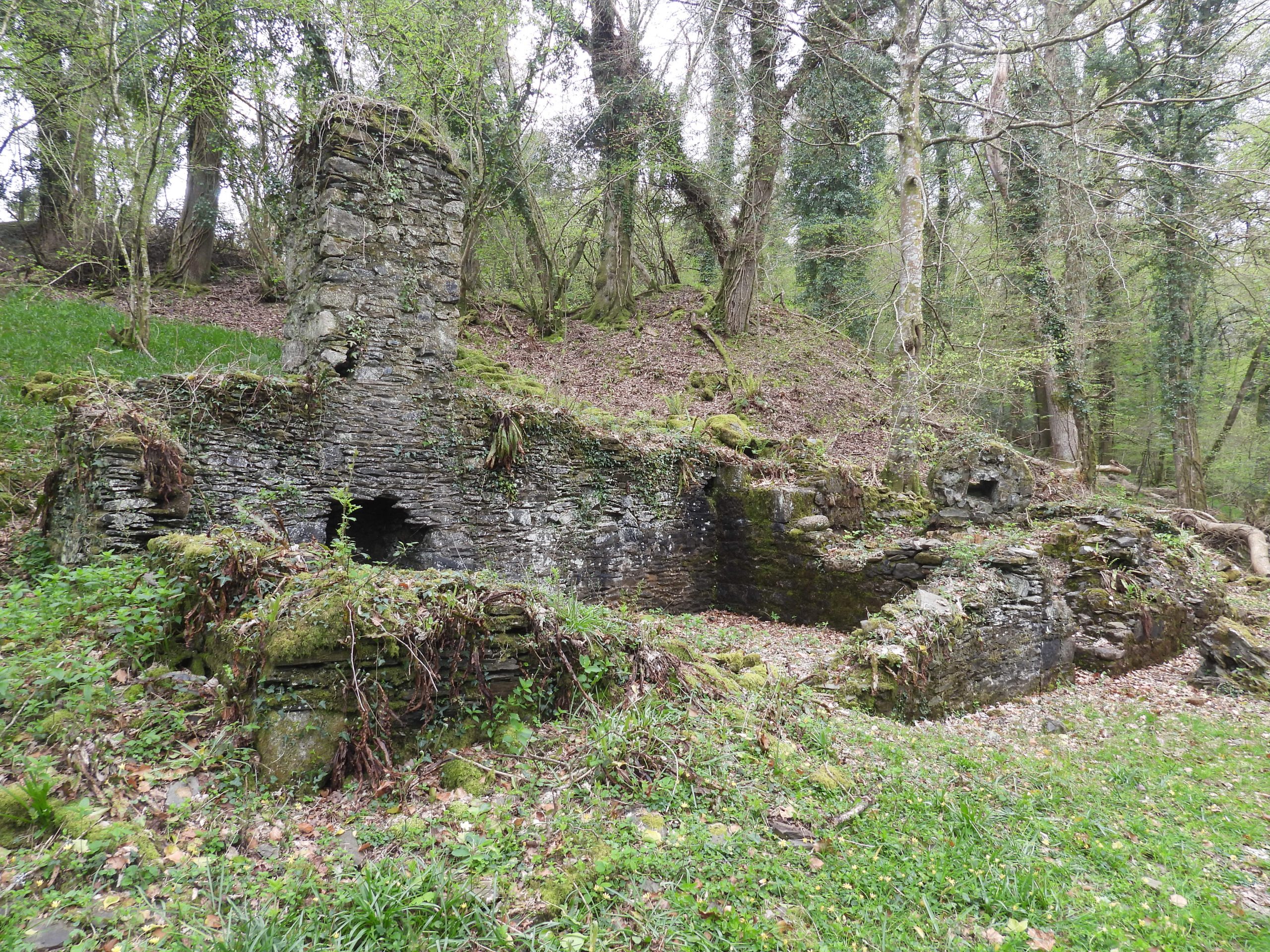
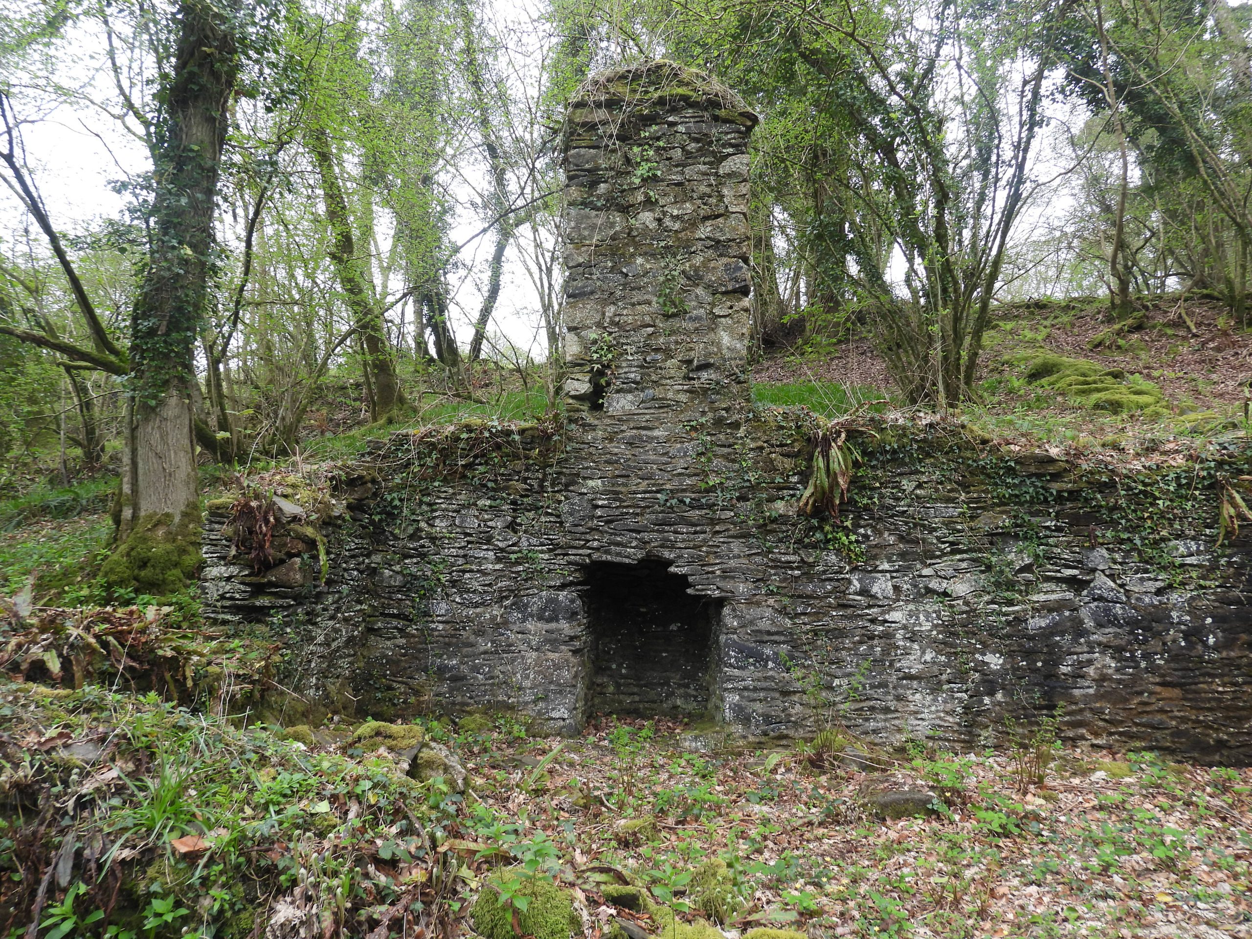
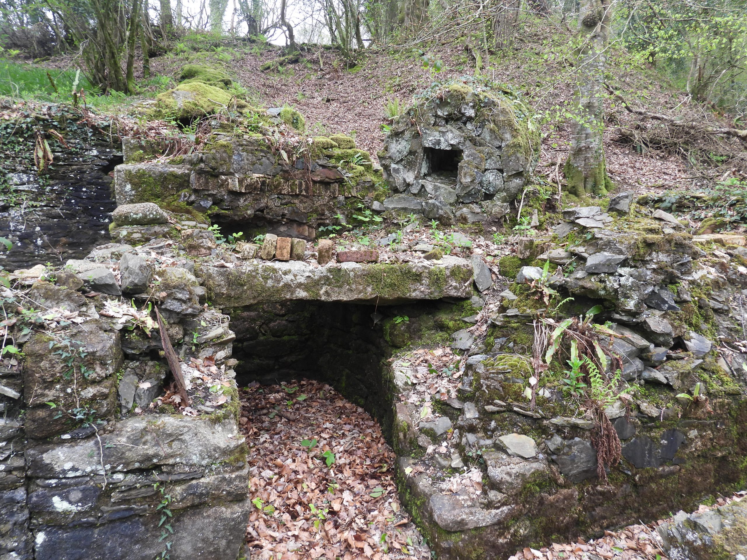
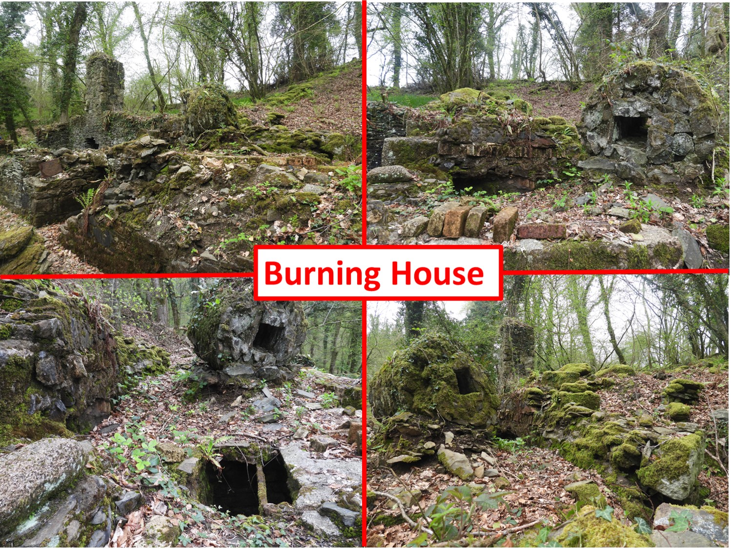
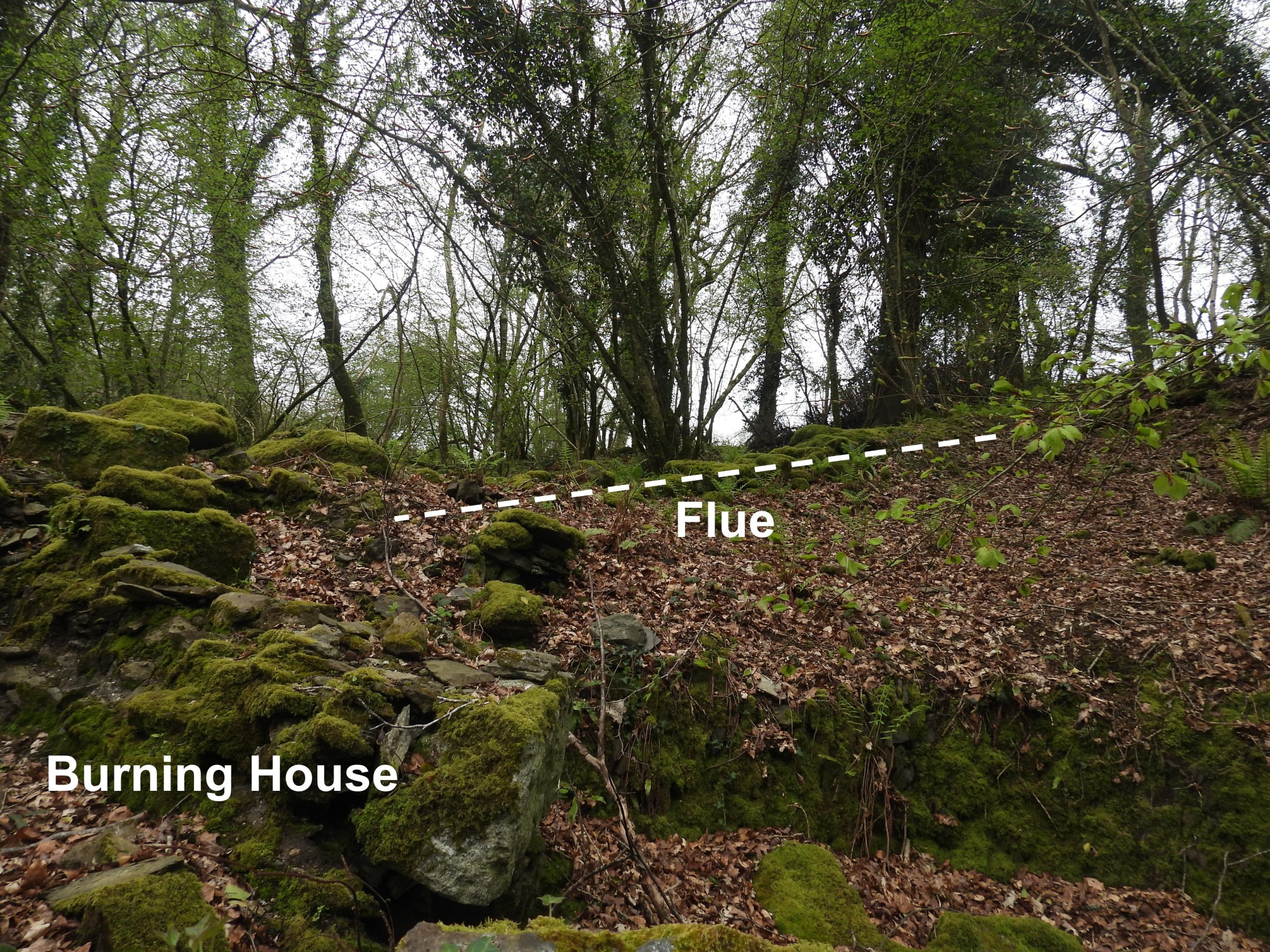
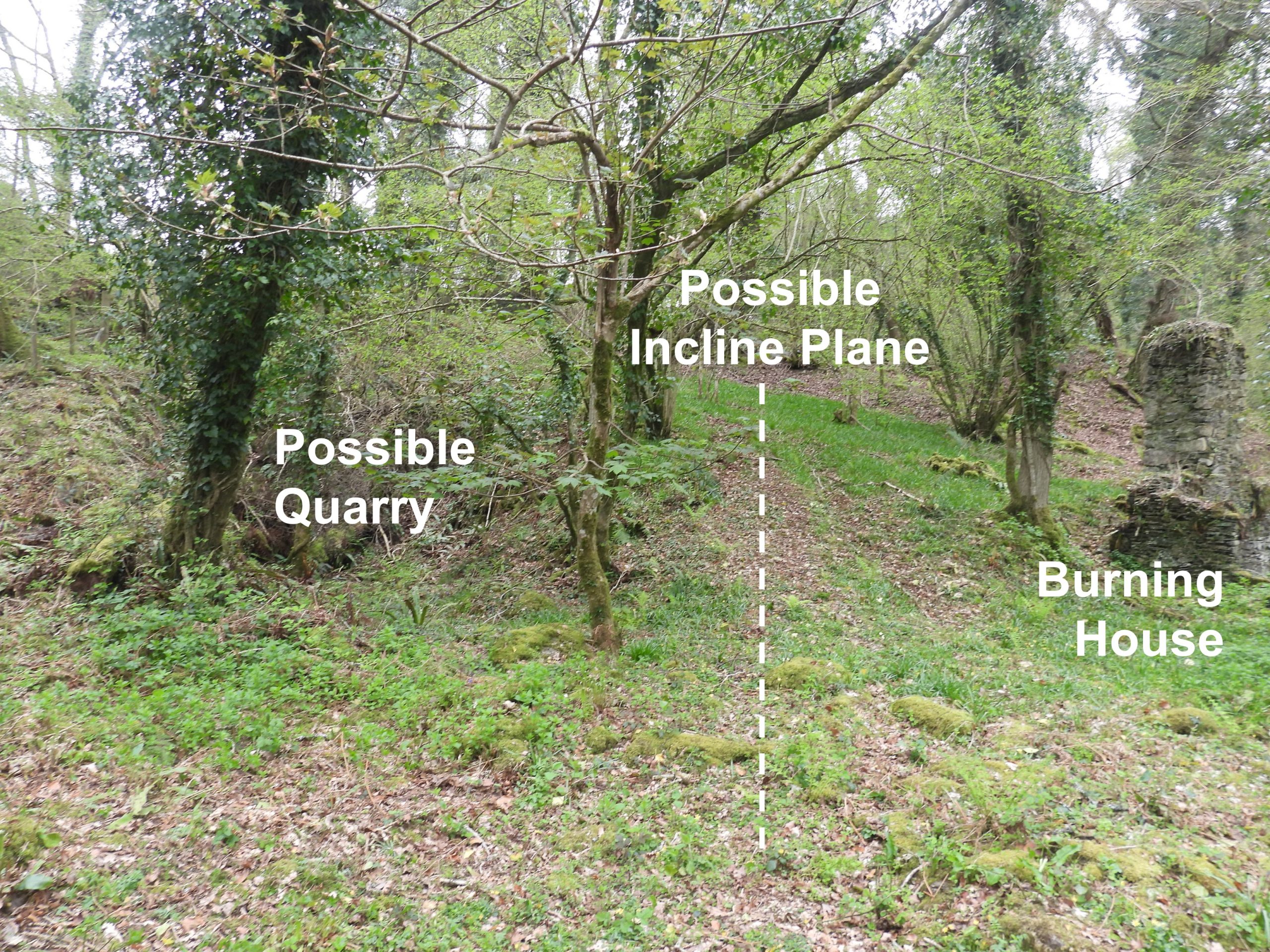
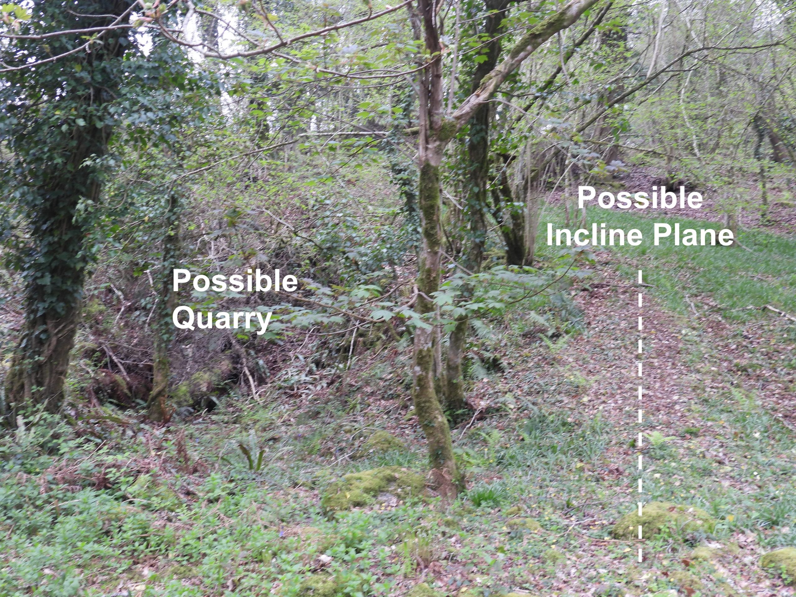
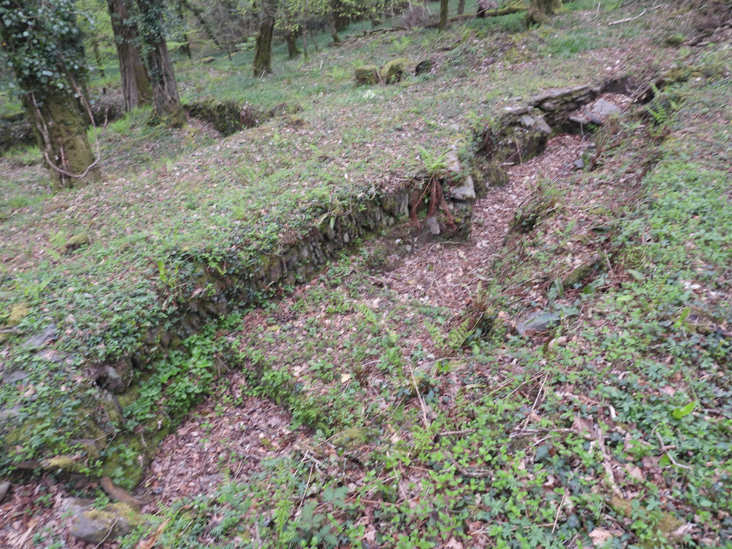
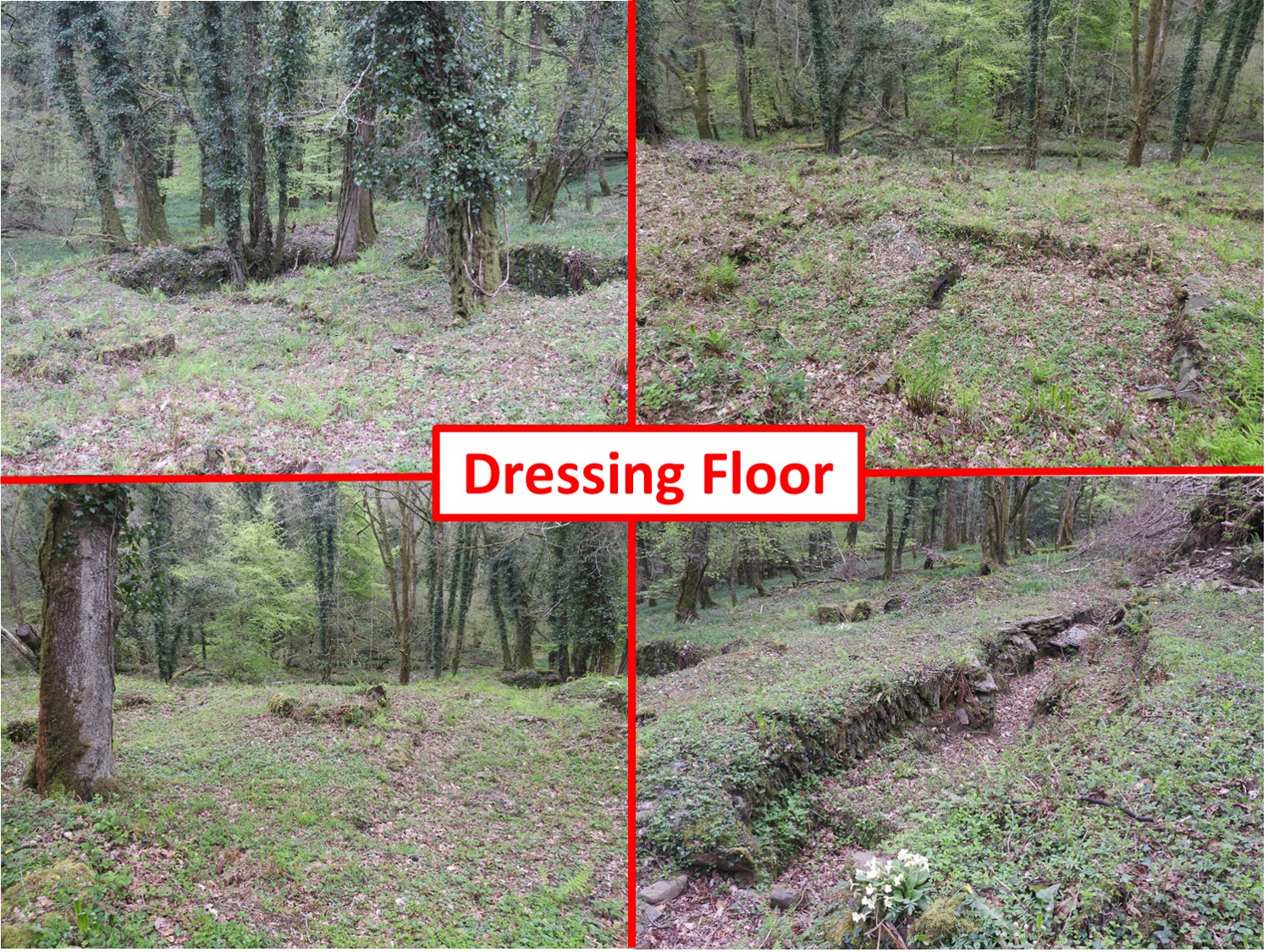
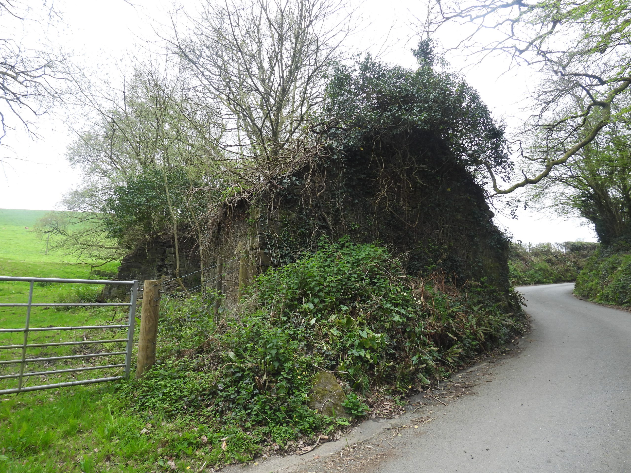
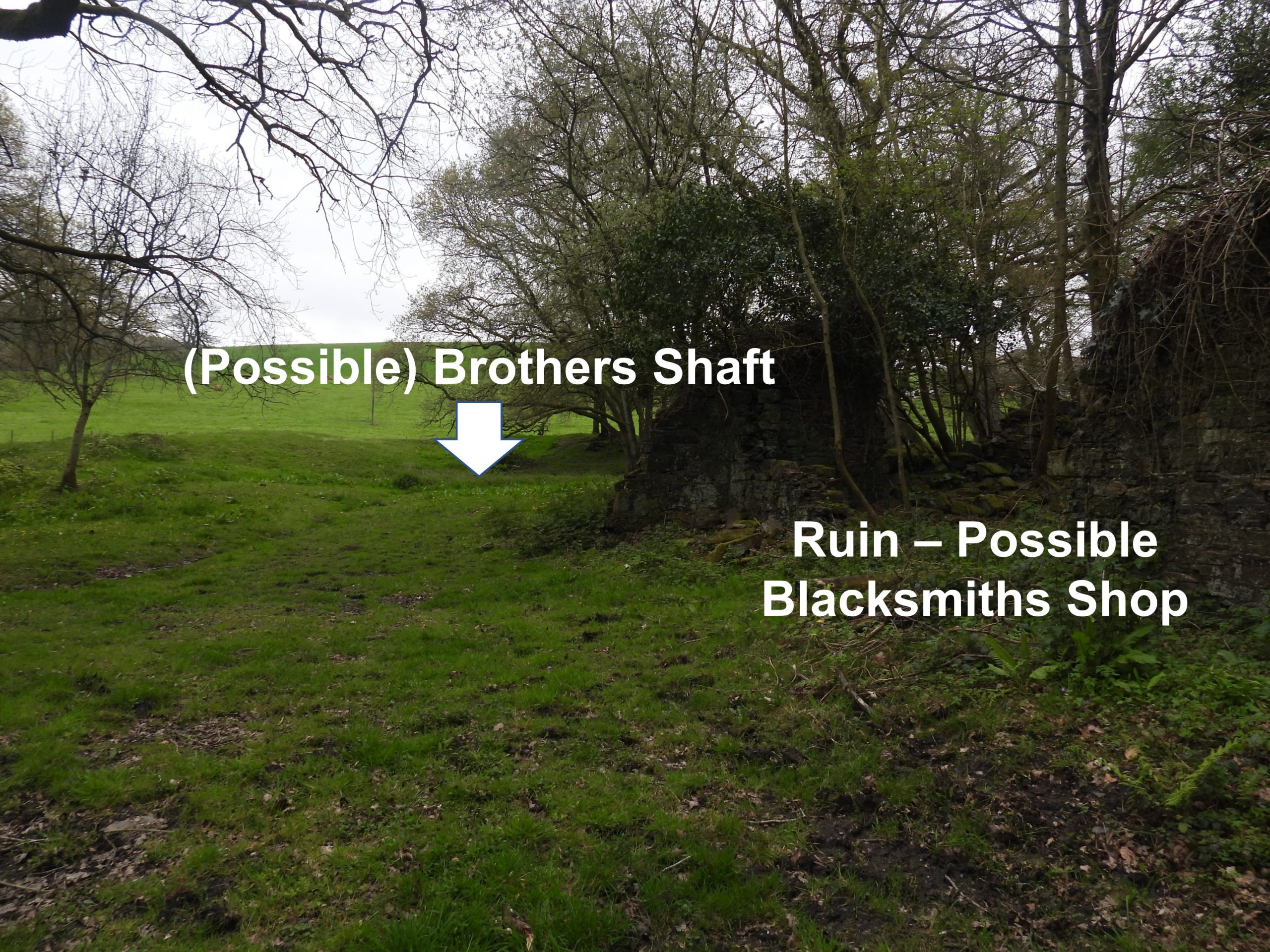
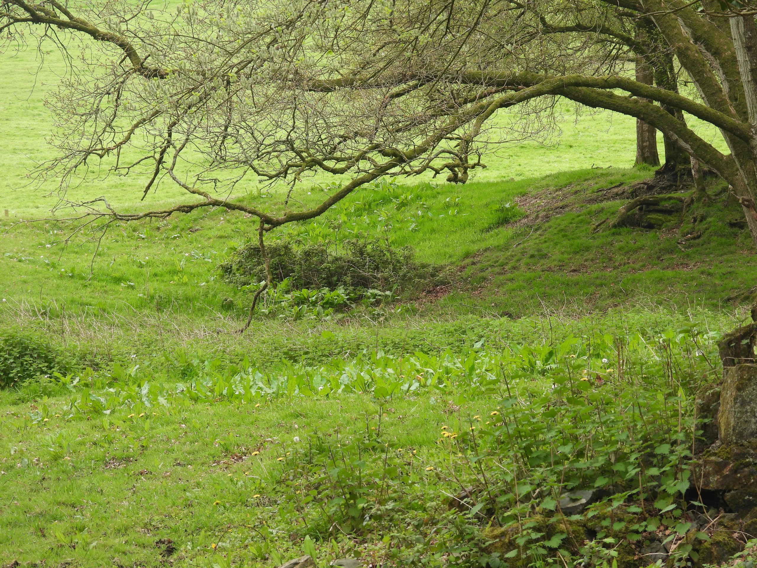
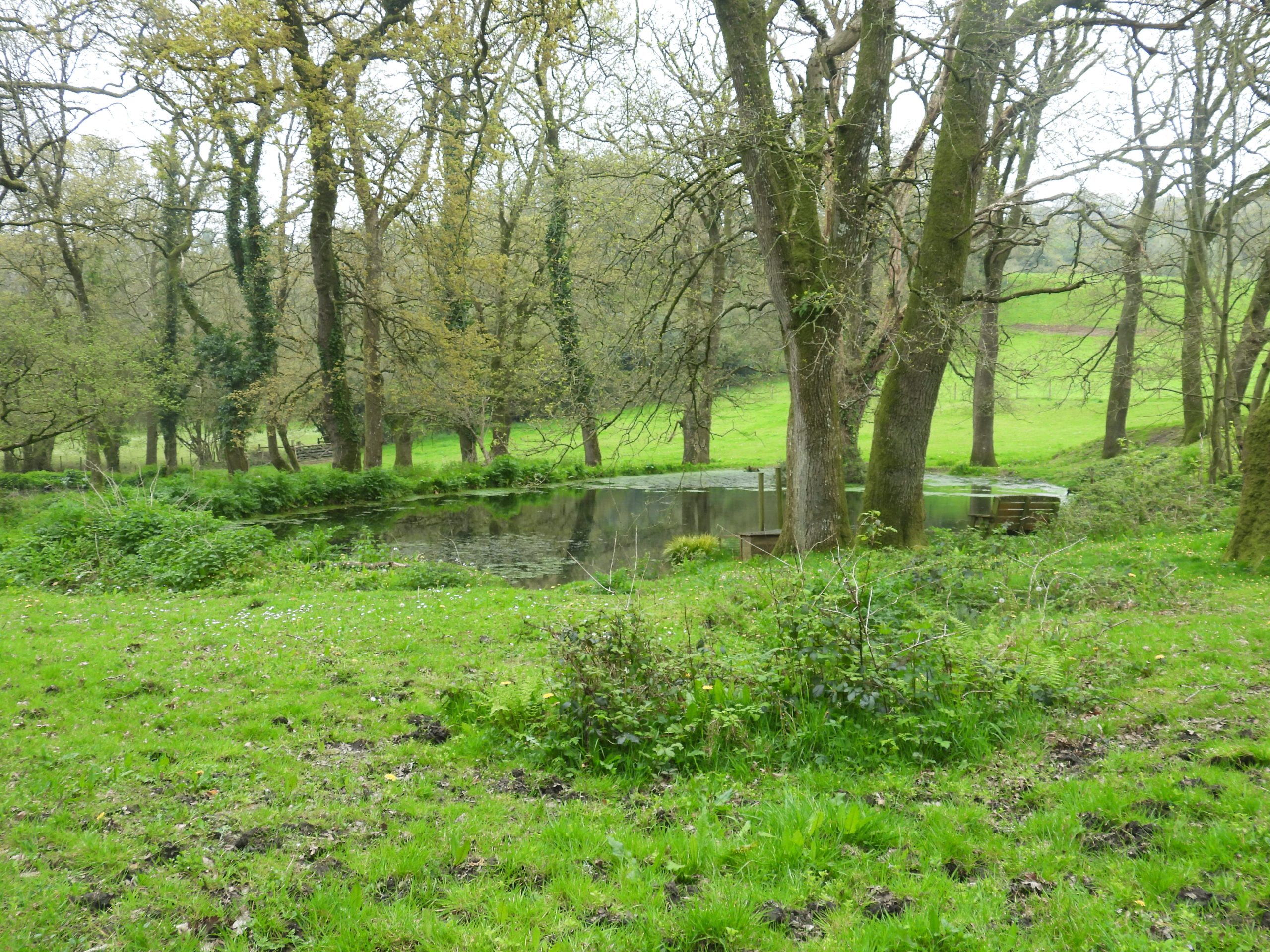
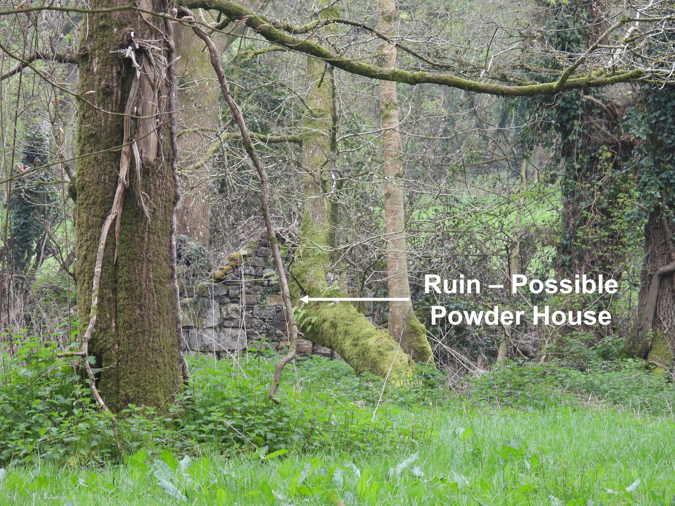
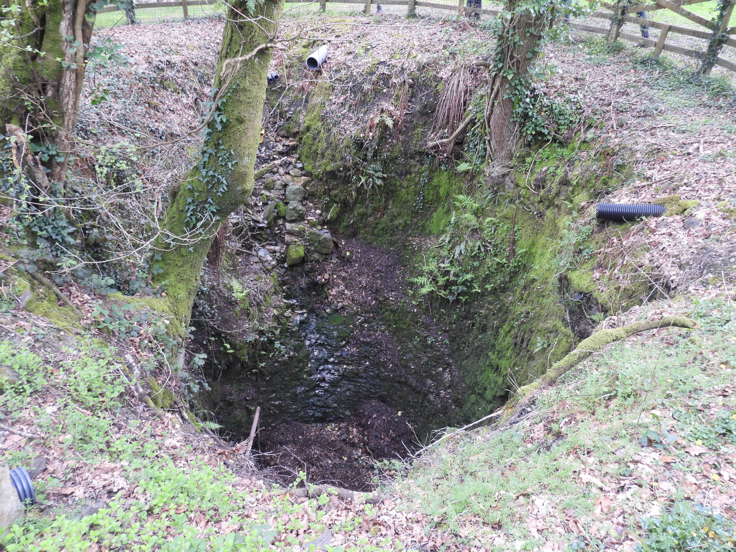
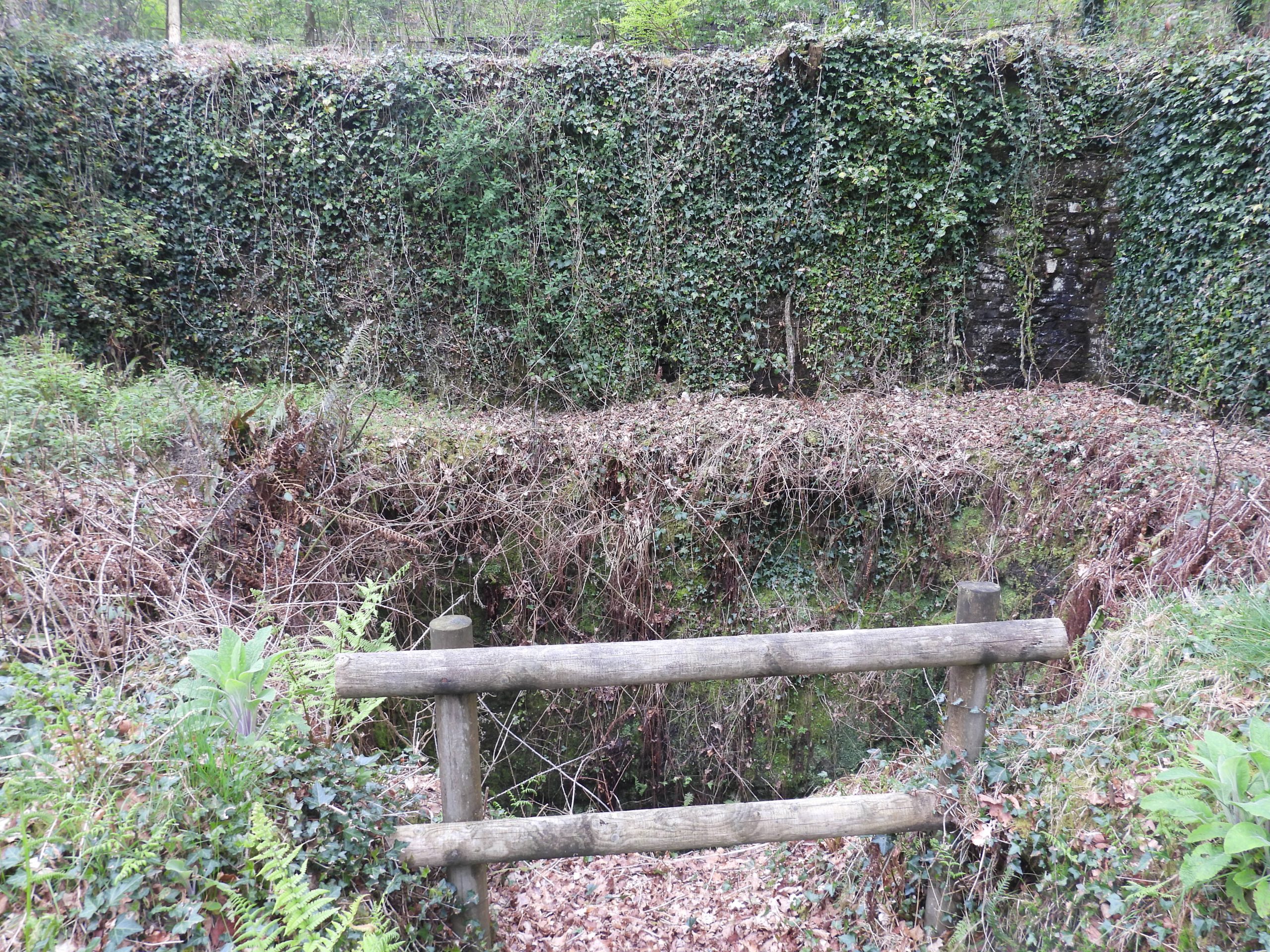
Sketch map of the mines, lodes, beams and other features covered in this post.This map was handed around by Stephen Tolley at the DTRG walk. The author has annotated it to show the shafts at Owlacombe Beams, West Beam (Engine Shaft) and at Brothers Mine. It would seem there were at least four shafts in Owlacombe Beams (Murray’s, Parry’s, Old Engine and James). Hobson’s shaft and West Beam Engine shaft, although lying on the northern of two lodes which ran through Owlacombe Beams, are located outside of the Owlacombe Beams ‘gorge’.The impressive cutting of Owlacombe Beams are now a tree lined, 1200 feet long, 30 to 40 feet deep and between 50 and 100 feet wide. The cutting is now used for clay pigeon shooting and ‘spent clays’ are strewn all over the sides of the cutting (seen as pink debris in the picture). Approx location of Murray’s Shaft in Owlacombe Beams, which Hamilton Jenkin records as being sunk to 45 fathoms (270 feet) below adit. Was the shaft a part of Wheal Beam ? Hamilton Jenkin mentions this shaft in the same paragraph of his publication as Union Mine, which is confusing as that mine was located on the opposite side of the road to Owlacombe Beams.Approx location of Parry’s Shaft in Owlacombe Beams, which Hamilton Jenkin records as being sunk to 76 fathoms (456 feet) below adit. As with Murray’s shaft was the shaft a part of Wheal Beam ? The pictures show the location in the modern day clay pigeon shoot. The group of people were part of the DTRG visit, late April 2023.Hobson’s shaft is believed to have been located in the Owlacombe Beams car park (used by clay pigeon users). Hamilton Jenkin (HJ) records that this shaft was sunk (eventually) to 78 fathoms (468 feet) below adit. HJ records this as being sunk in 1839, which seems to pre-date Wheal BeamThis longitudinal section of West Beams Mine Limited (passed around by Stephen Tolley at the DTRG event) suggested that the five shafts on the northern lode within Owacombe Beams at one time seemed to be worked under one mine name. This further adds to the confusion of mine names and their associated shafts mentioned in the introduction to this post. The picture clearly showing the interconnecting tunnels together with their relative depths (in fathoms). There were two water wheels as shown in the diagram. The buildings on the far right of the picture are believed to have been part of the processing works near to Owlacombe Bridge.The DTRG event in April 2023 with attendees en-route to West Beam mine (wheel pit, burning house and dressing floors).West Beam Mine wheelpit is rather impressiveThe wheelpit is said to have housed a 40 foot wheel. It is located at SX76540 73564In spite the size of the wheel here the pumping at the shaft (to the west) was limited to 40 fathoms (240 feet) and in 1848 working was suspended due to the lack of water. However, in June 1851, a small 21 inch steam engine was erected and the shaft eventually reached a depth of 66 fathoms (396 feet). One assumes the wheel was abandoned in 1848.The wheel pit has a tail race ‘tunnel’ which disappears under the nearby track towards the dressing floors.There is a large wall immediately adjacent to the wheelpit. Its function is unknown to the author, albeit Stephen Tolley may have mentioned something during the DTRG visit.Adjacent to the wheelpit is a (probable) stamps area, thus the wheel was used to power two features (ie the pumping at the shaft head and the stamps)Close up of the (probable) stamps area.A short distance along the track from the wheelpit are these ruins, which are known as the ‘Burning House’.One section of the ‘Burning House’ appears to have been an office with a fireplace. The chimney is well preserved.The ‘Burning House’ at West Beam Mine was effectively a ‘Calciner’ and was used to burn off unwanted arsenic from the tin ore. During the period of operation of the mine (1836-1866), arsenic wasn’t recovered.The ‘Burning House’ is located at SX76520 73581The ‘Burning House’ had a flue running from it to the south toward where there was a leat which fed the waterwheel. Between the ‘Burning House’ and the wheelpit, it is conjectured that there were two other features – a possible quarry and a possible incline plane.The quarry, might possibley have been the source of stone for the wheelpit and ‘Burining House’.Across the track from the wheelpit are the dressing floors of West Beam Mine. Many are stone lined with the one in the picture (I think) known as the coffin (I may have misheard this!). It is located at SX76556 73578General views of the dressing floor at West Beam Mine, which extended down towards the river (Langworthy Brook).Returning to the road between Owlacombe Farm and Owlacombe Bridge, there is a ruined building, which might have been a smithy for the mines hereabouts. It is located at SX76757 73301Behind the ruins of the (possible) Blacksmiths Shop are the earthworks relating to Brothers shaft, which was part of the Union or Brothers Lode, which the author believes was part of Brothers Mine or Union Mine. Hamilton Jenkin records that in 1857, after a period of idleness a company called Ashburton United, which took over the former setts of the Beam mines, Wheal Union and the copper lodes of Wheal Brothers.Close up of Brothers shaftBelow Brothers shaft is a pond, which possibly was used as a miners reservoirSeen from the road are more ruins, which were possible those of an old ‘Powder House’.The grounds of Owlacombe House, where there is evidence of previous mining from the area.Sampsons shaft at SX77038 73234 which is believed to have been part of Brothers Mine or Union Mine. which latterly became Ashburton UnitedTeague’s shaft at SX77061 73237 which is believed to have been part of Brothers Mine or Union Mine. which latterly became Ashburton UnitedJust above Teague’s Shaft en-route to Stormsdown Mine there is a remains of an old leat.