A collection of walks, discoveries, insights and pictures of exploring Dartmoor National Park
March 7, 2023
Norsworthy Farm
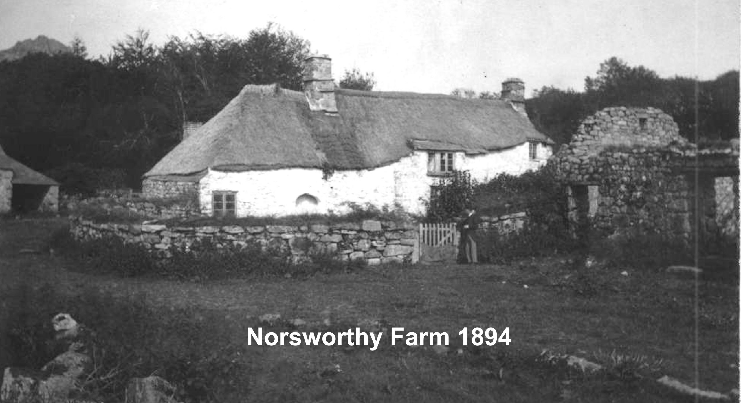
Norsworthy Farm was first recorded as Northisworthi in 1384. It is believed to have been abandoned between 1891 (when possible last known tenants were still living there) and 1894 (when Robert Burnard wrote that it had been abandoned). The farm once had an imposing medieval longhouse running down the slope, which was superseded by a structure (suggested to have been built in the 17th century) and which was photographed by Robert Burnard and which is featured in this post.
Persons living at the farm included; John Pyke (1494 until at least 1523), who was a jurate at the Stannary Court ; a Edward Atwill (1701), who was paid by Walkhampton overseers of the poor and ; a Peter Reed (1801 through 1810). By 1827 the Maristow Estate owned the property and in 1840 a Walter Andrew was the tenant. Until 1883, after major renovations (circa 1850) a tenant called Thomas Westlake stayed there. The last known tenants were Elizabeth and Thomas Creber who were known to still be living there in 1891*. The Maristow Estate decided it was uneconomical to run and offered the land to John Pearse of the nearby Kingsett Farm and he is known to have run both farms.
*The date and the names of the last tenants appear to be contradicted between the information from High Dartmoor (Eric Hemery) and Exploring around Burrator – a Dartmoor Reservoir (Paul Rendell). Eric Hemery states the Westlake family were occupants in 1900 and the last tenant was Tom Pearse until 1918. Is it possible Paul found out more information in 2007 that Eric wasn’t privy to in 1983 ? or is it possible the farm was abandoned around 1894 then re-tenanted in 1900 ?
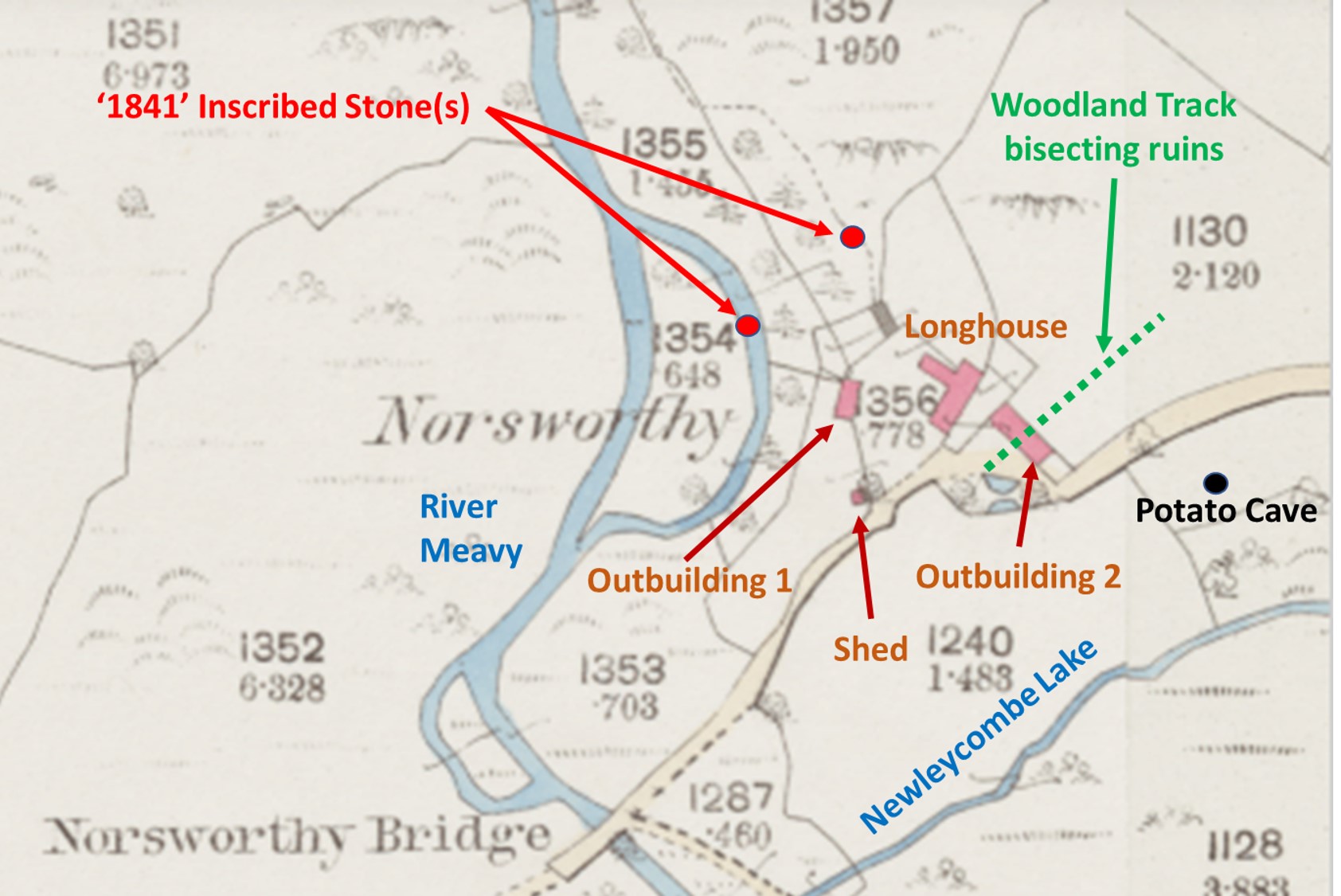
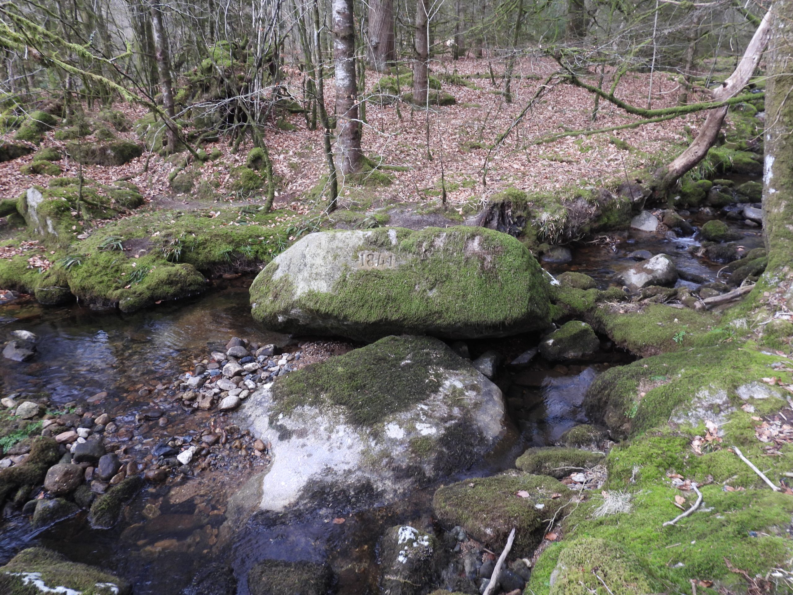
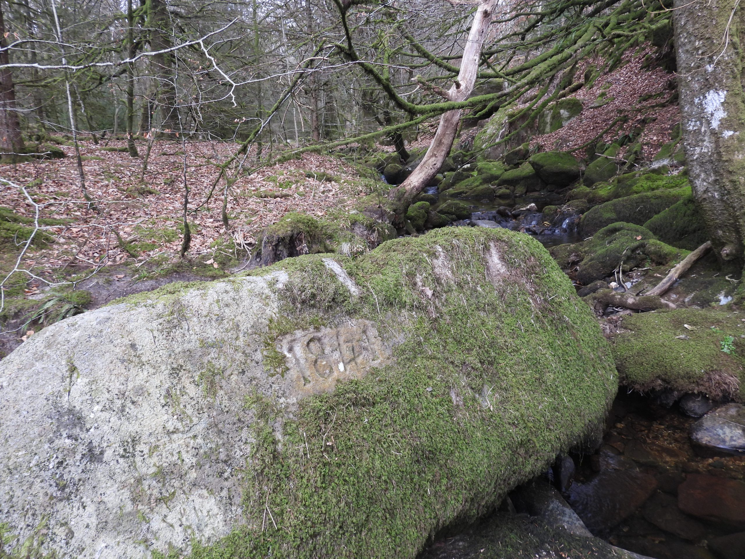
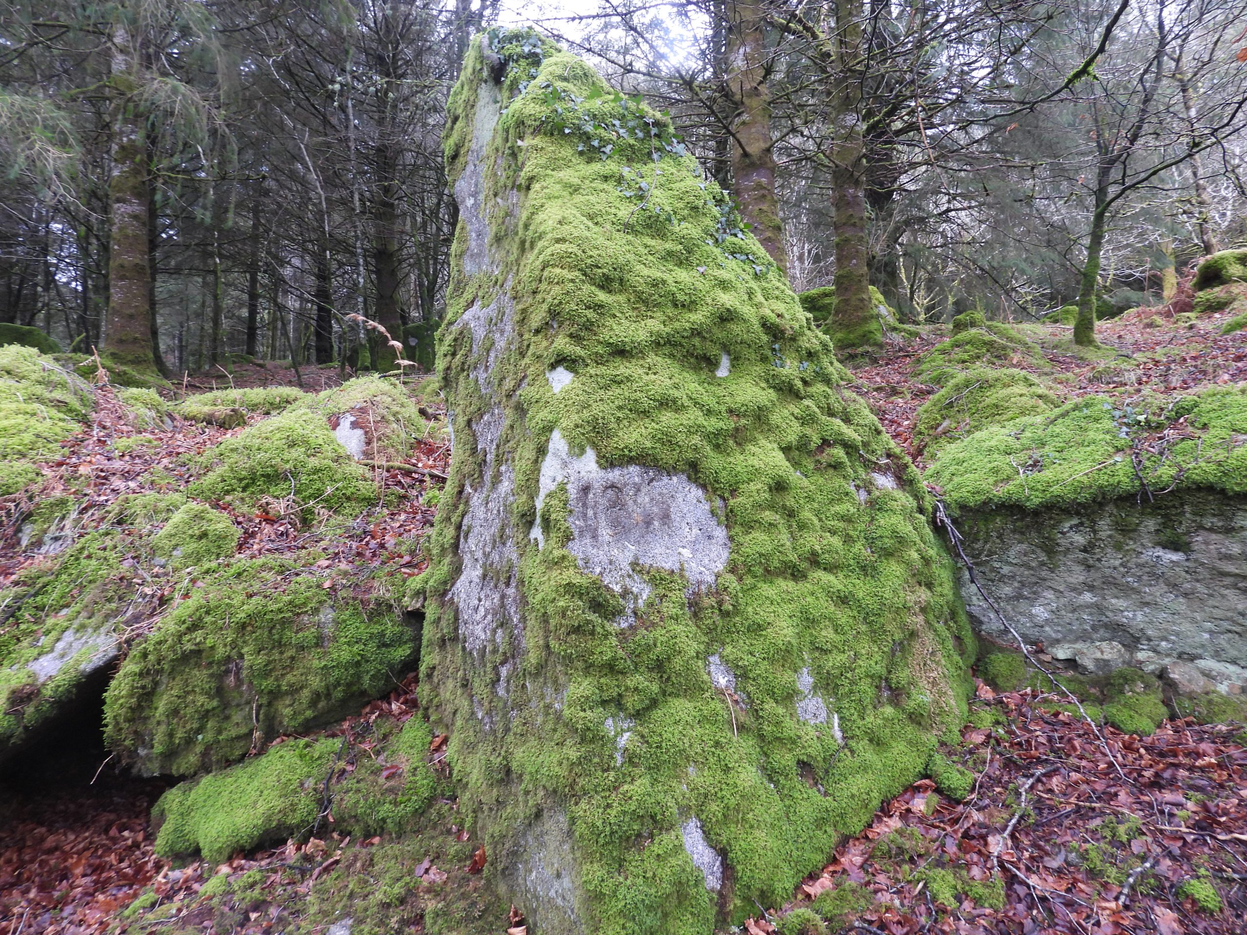
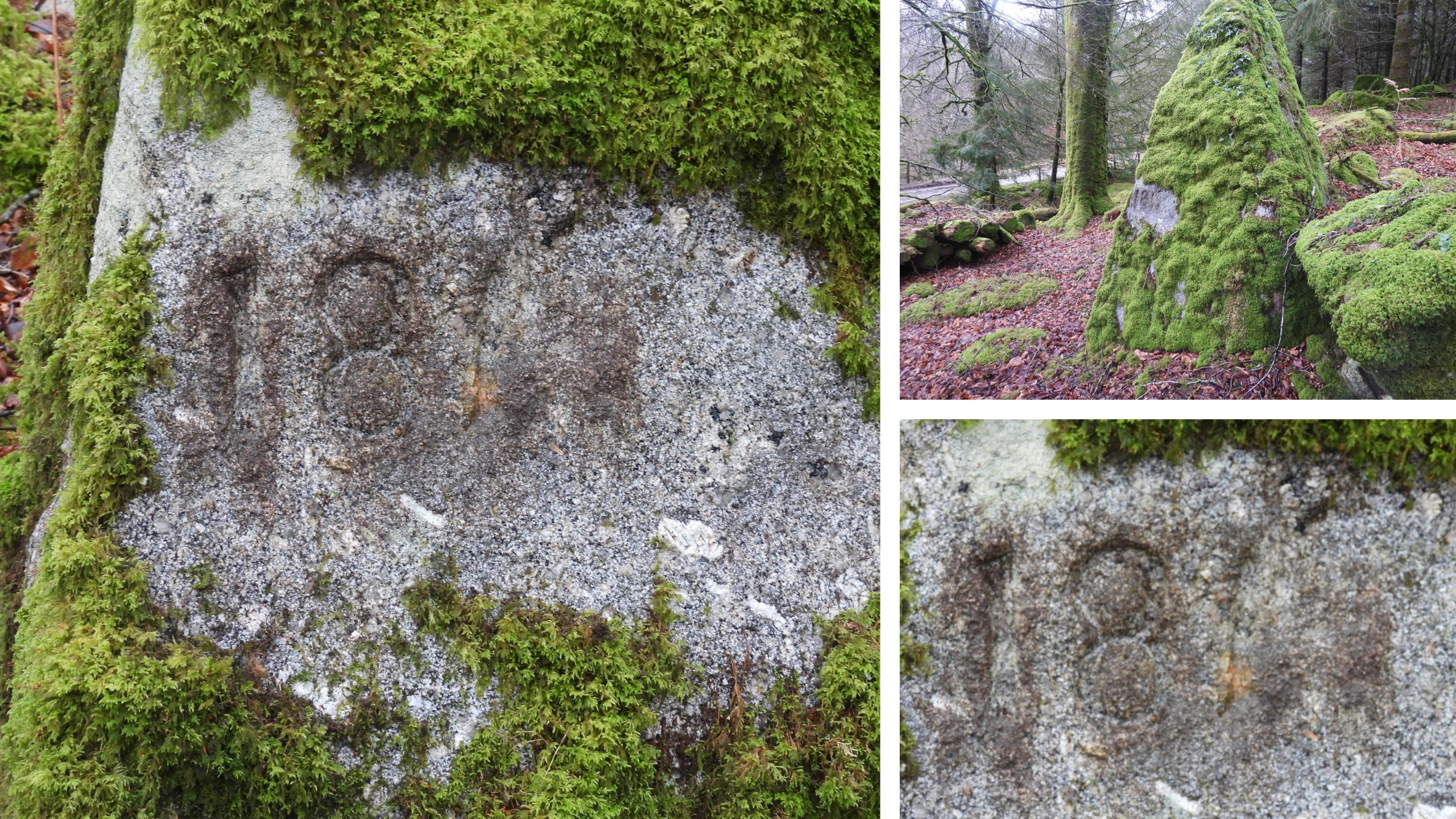
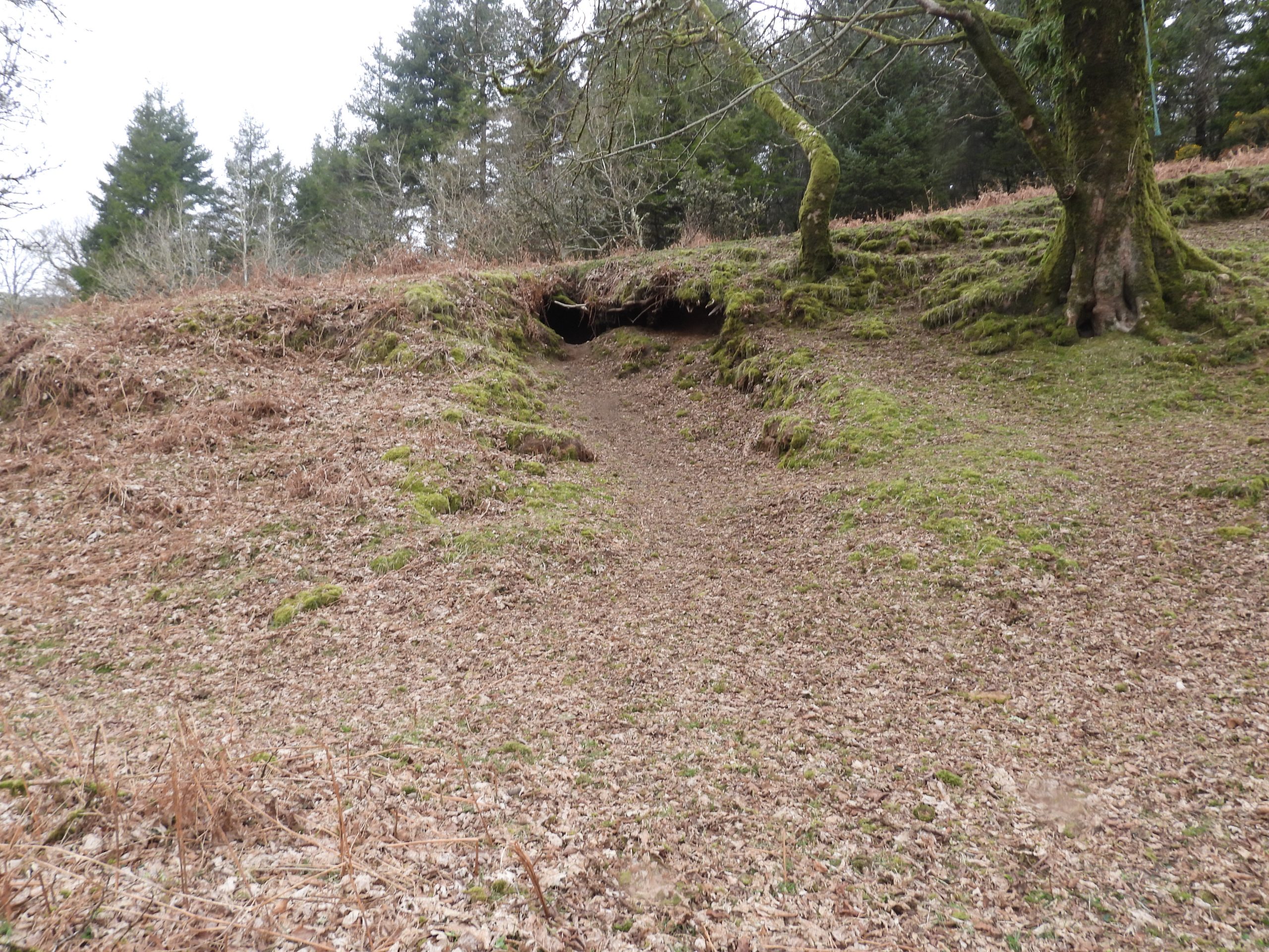
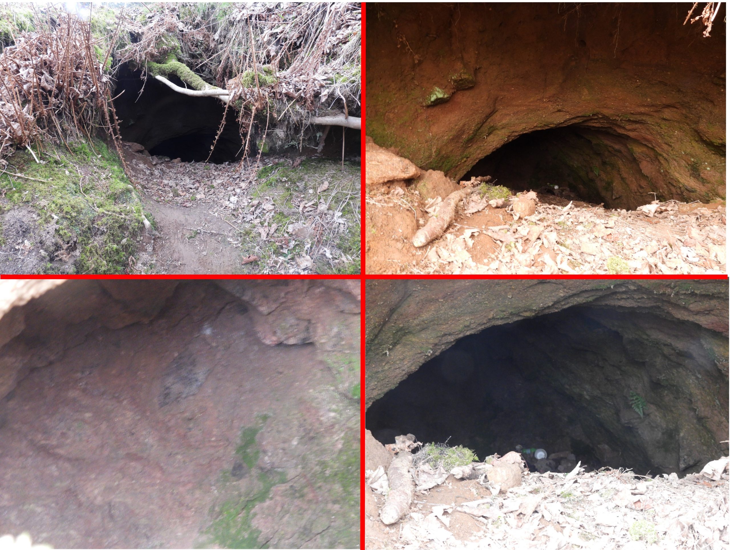
Of interest, other features in the vicinity of the farm include two inscribed boulders and a potato cave.
Bibliography
High Dartmoor (1983) – Eric Hemery (page 125)
Exploring around Burrator – a Dartmoor Reservoir (2007) – Paul Rendell (page29)
(CD) Guide to Dartmoor (2001) – Mike Brown
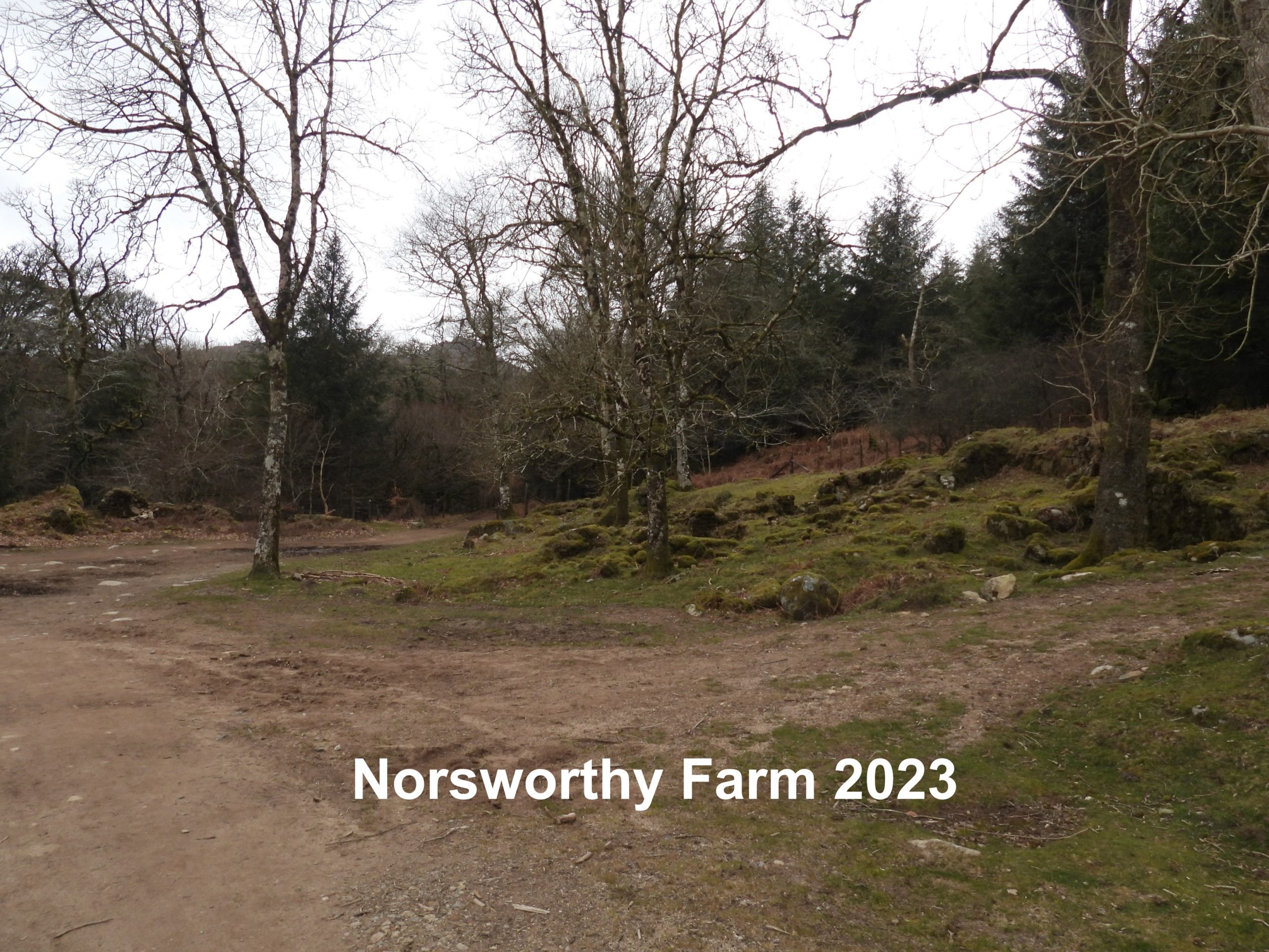
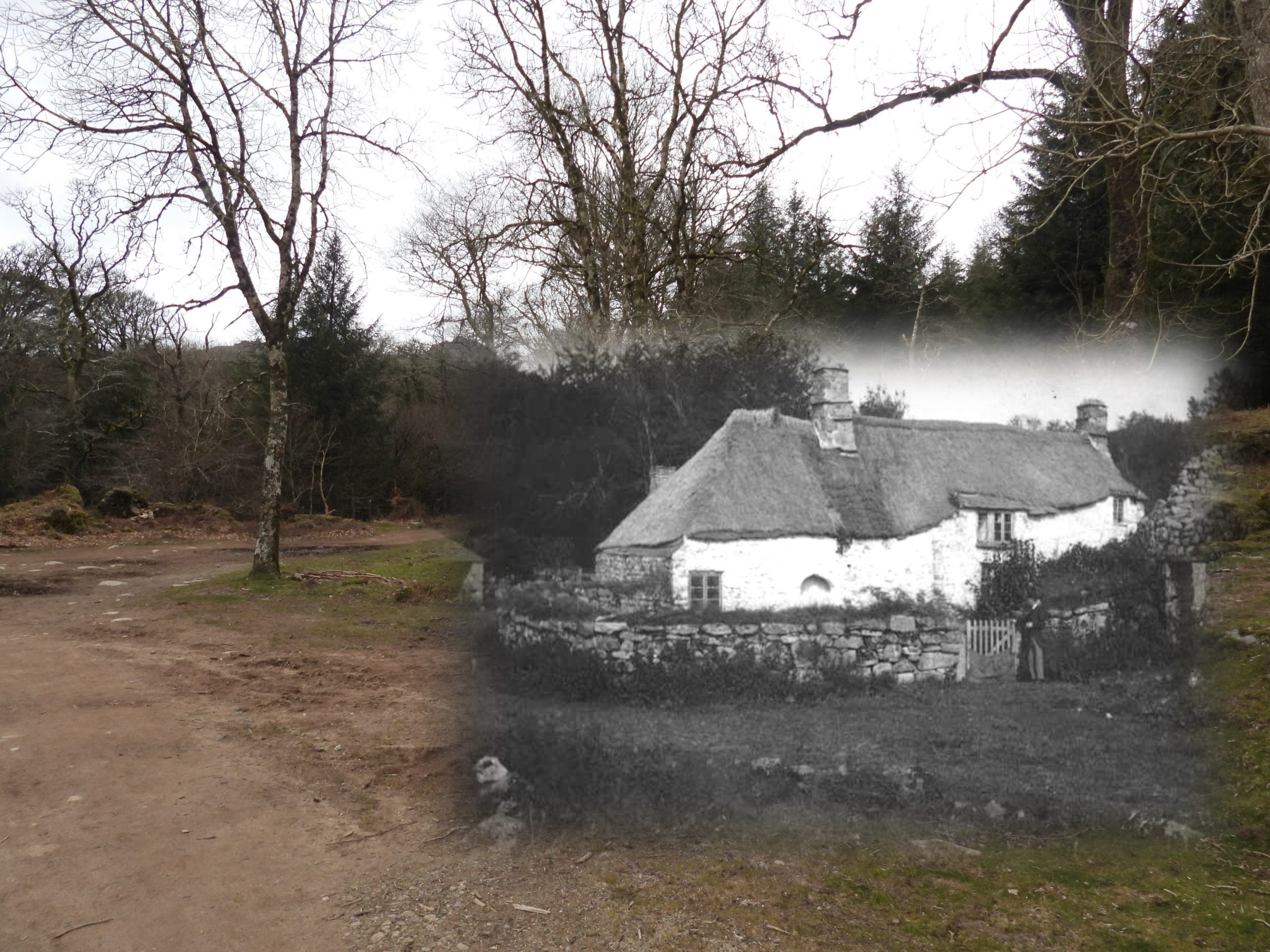
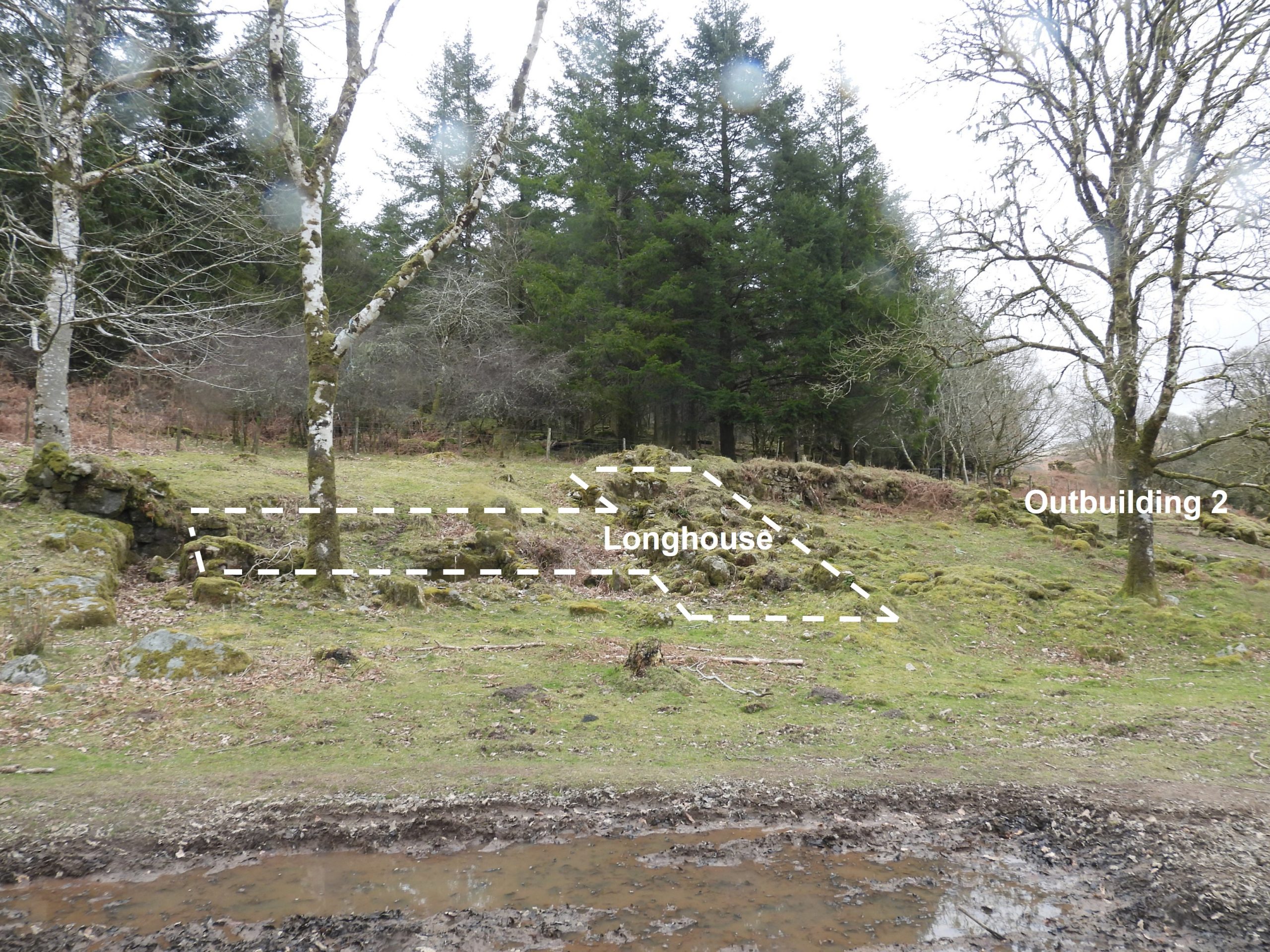
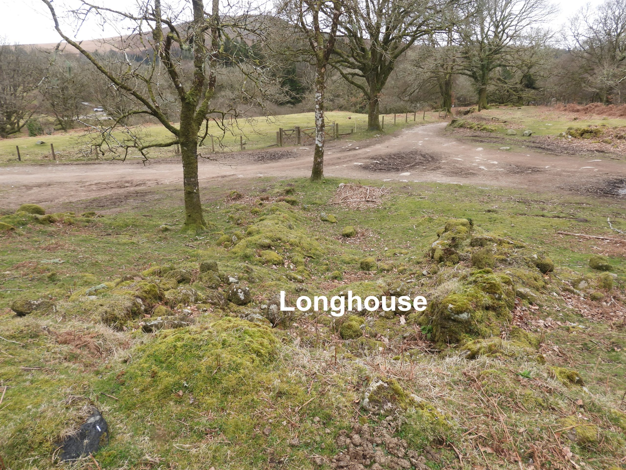
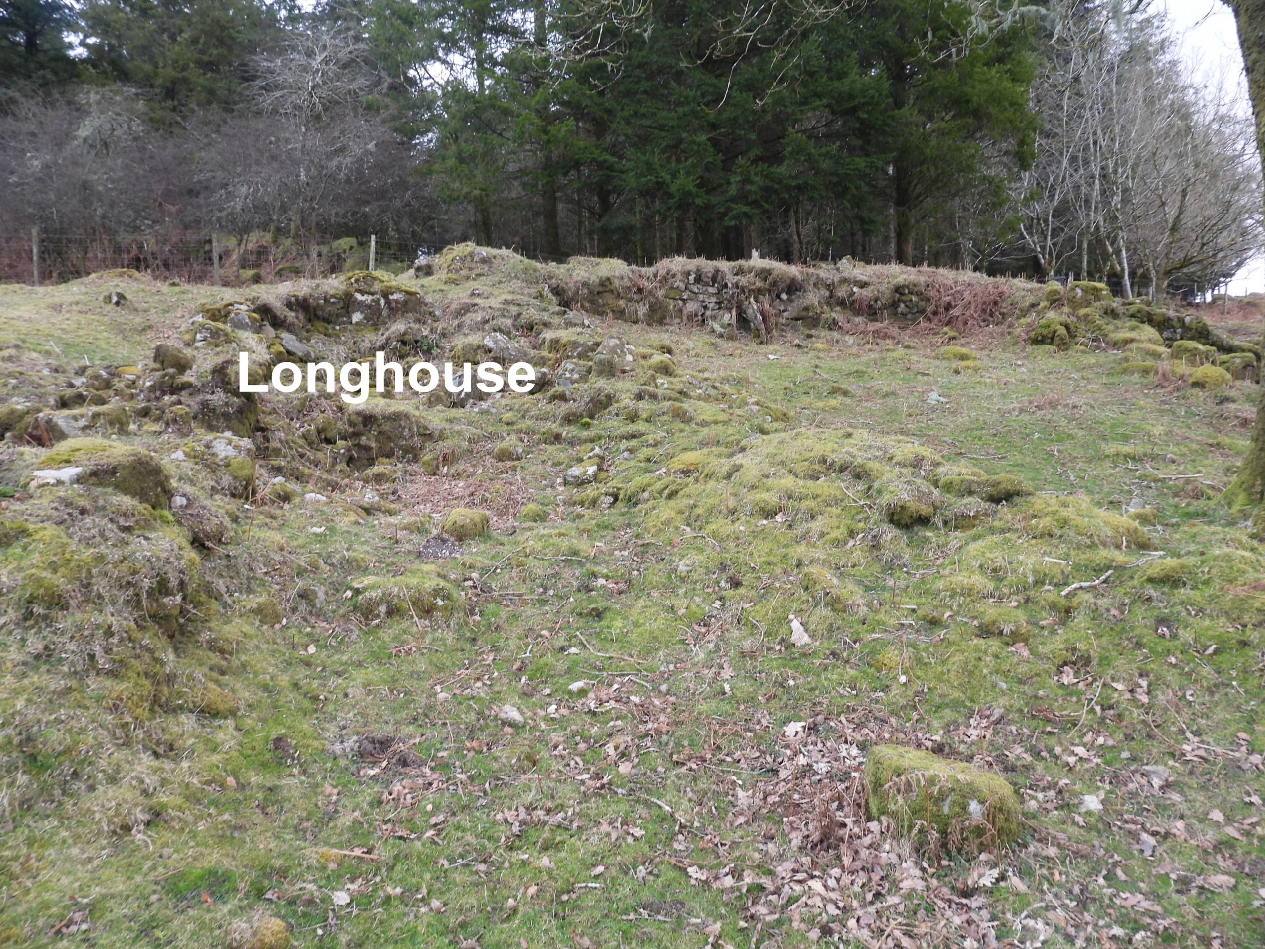
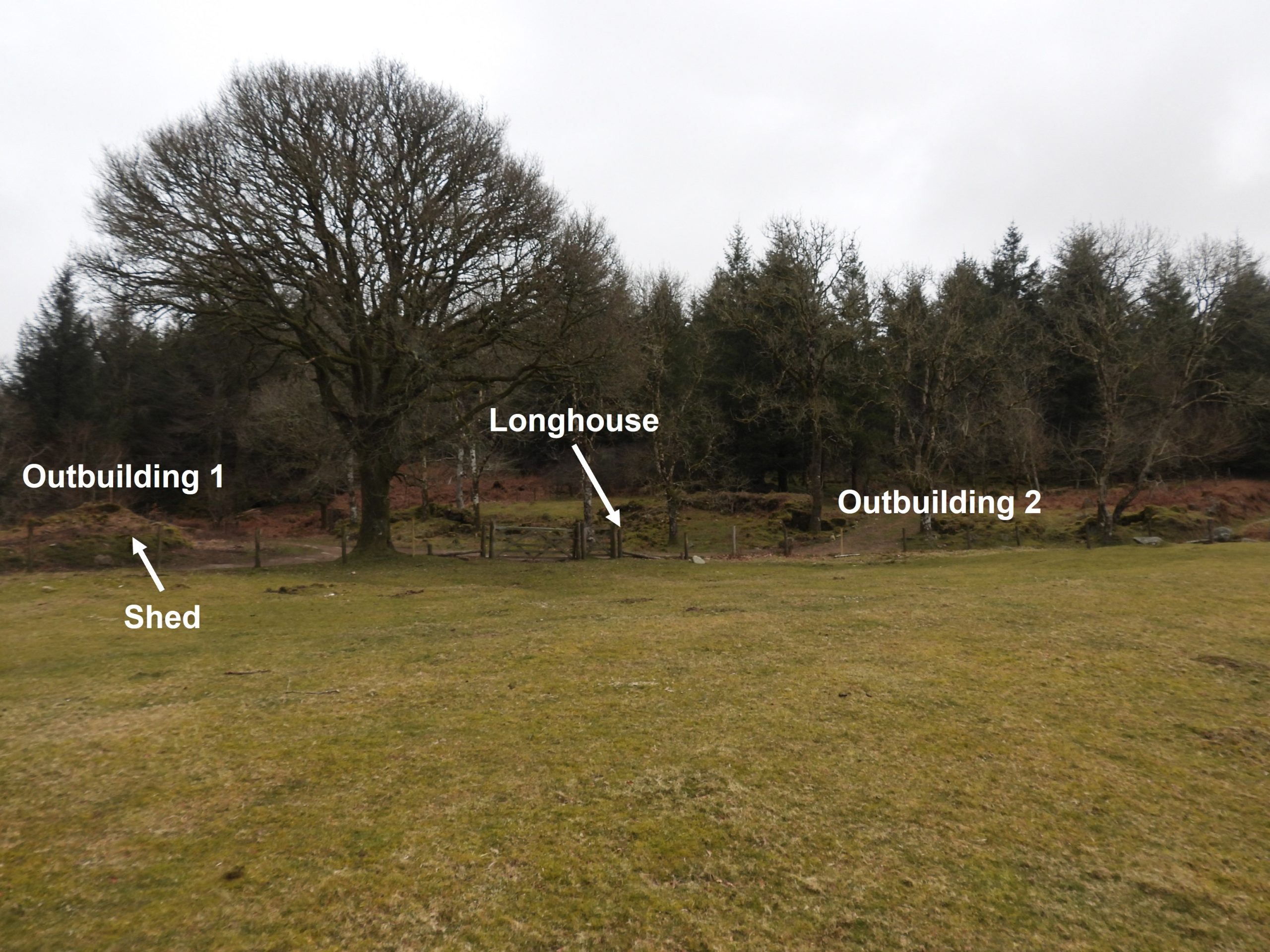
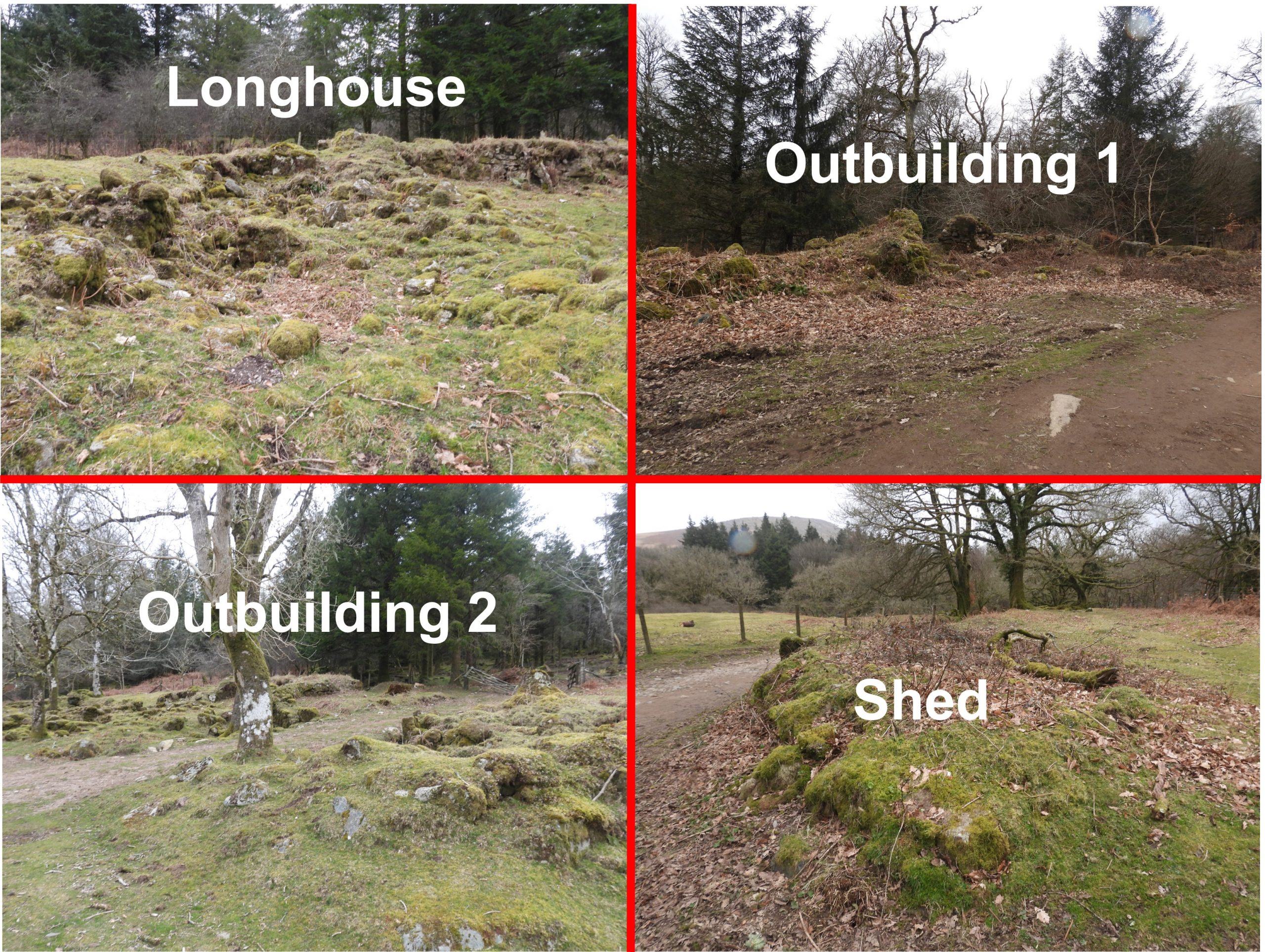
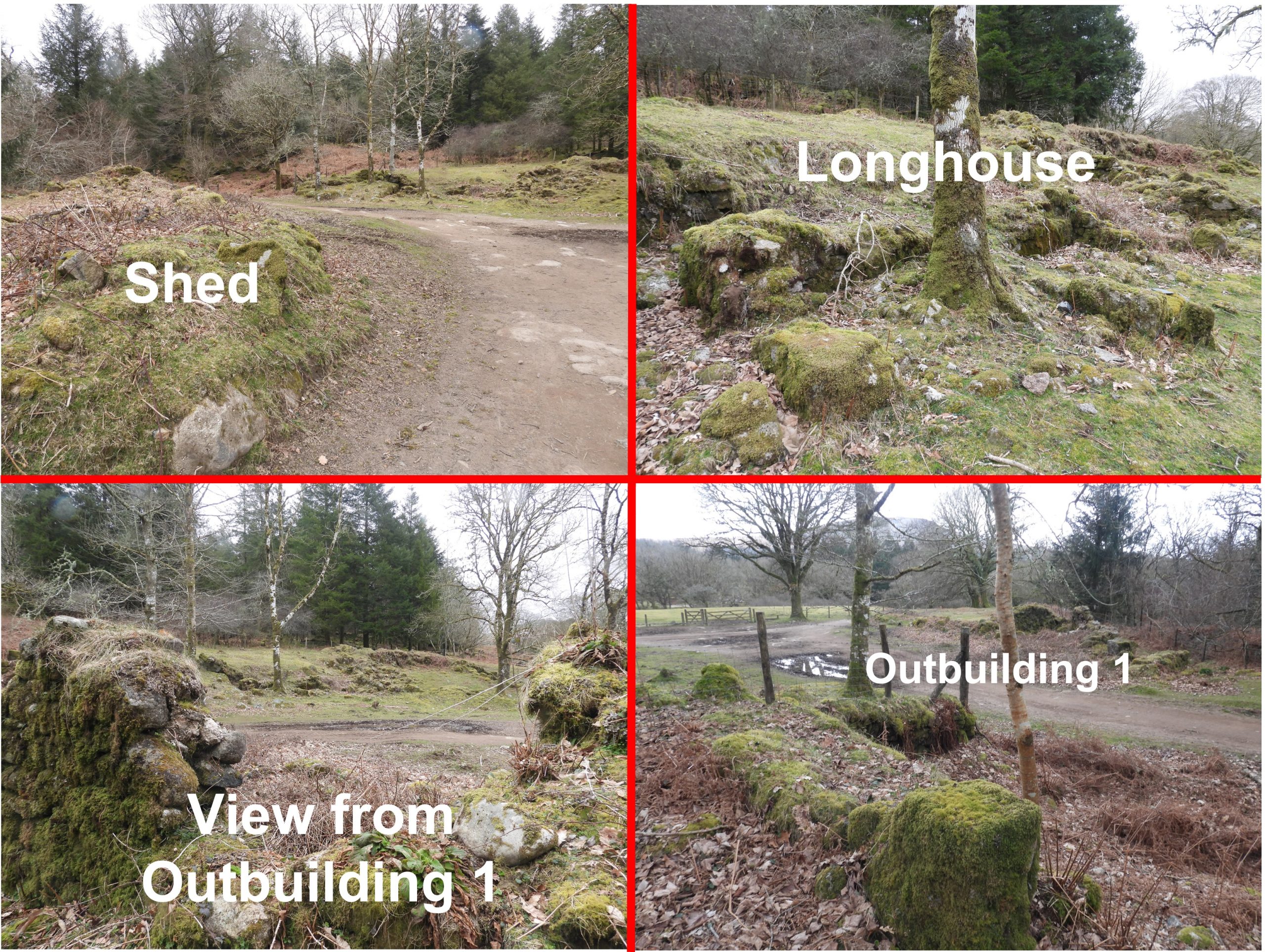
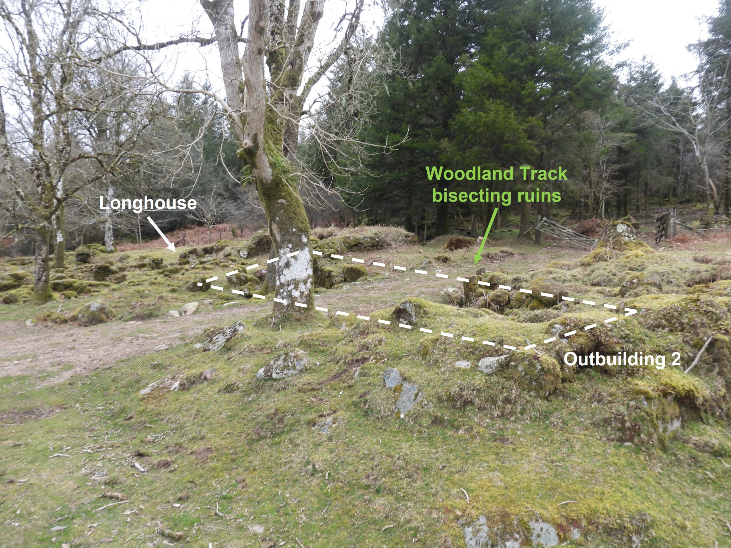
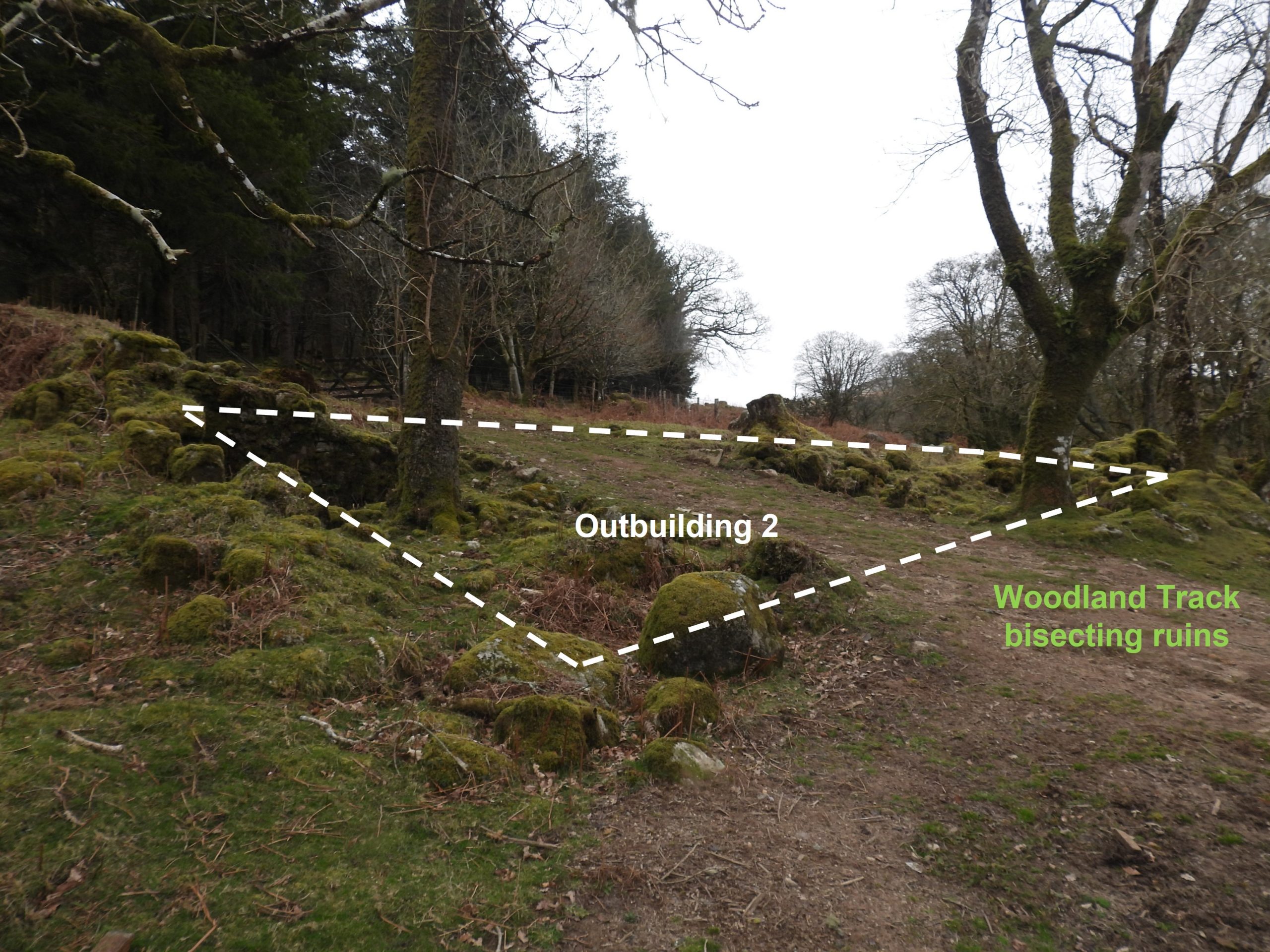
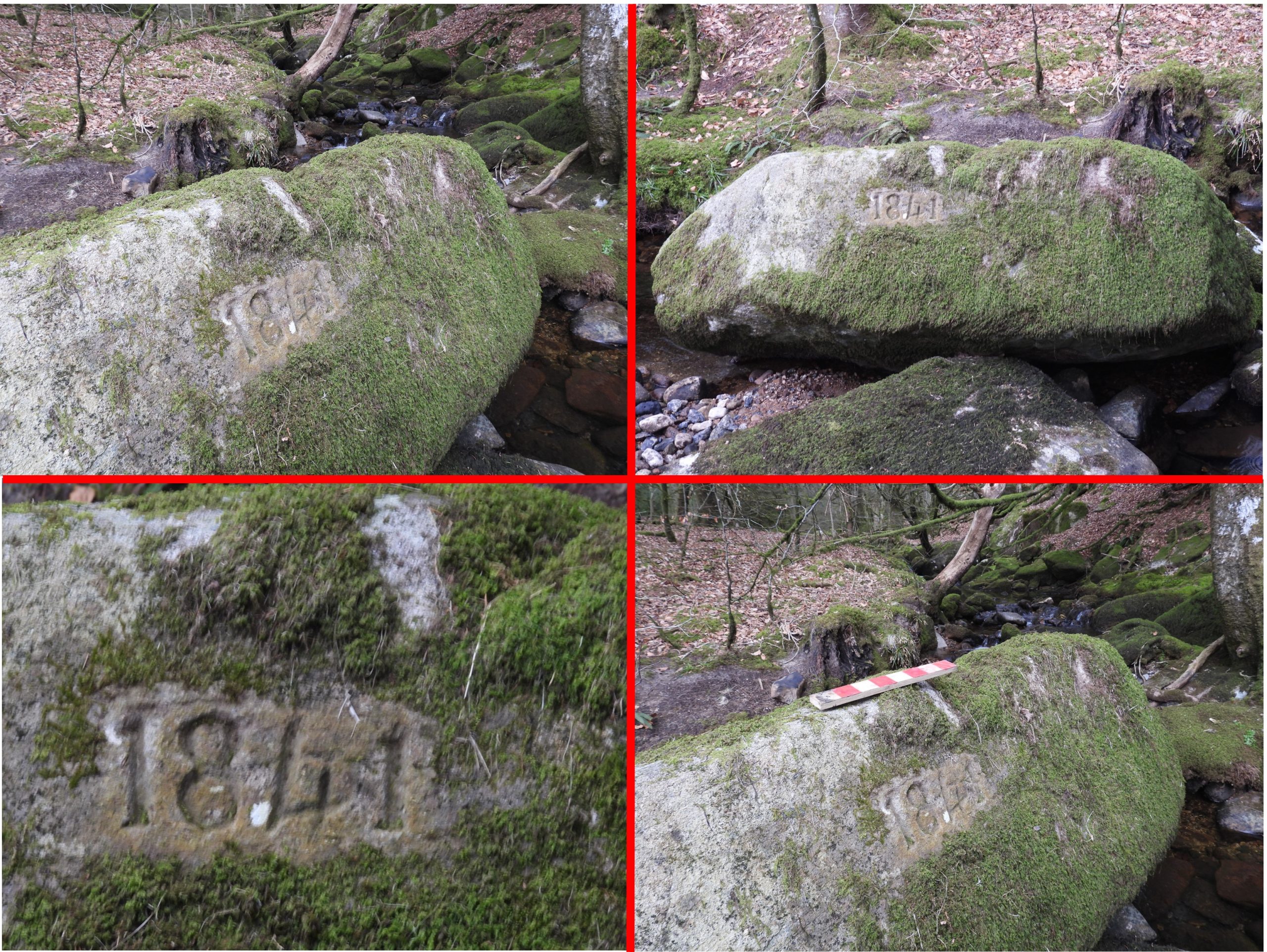
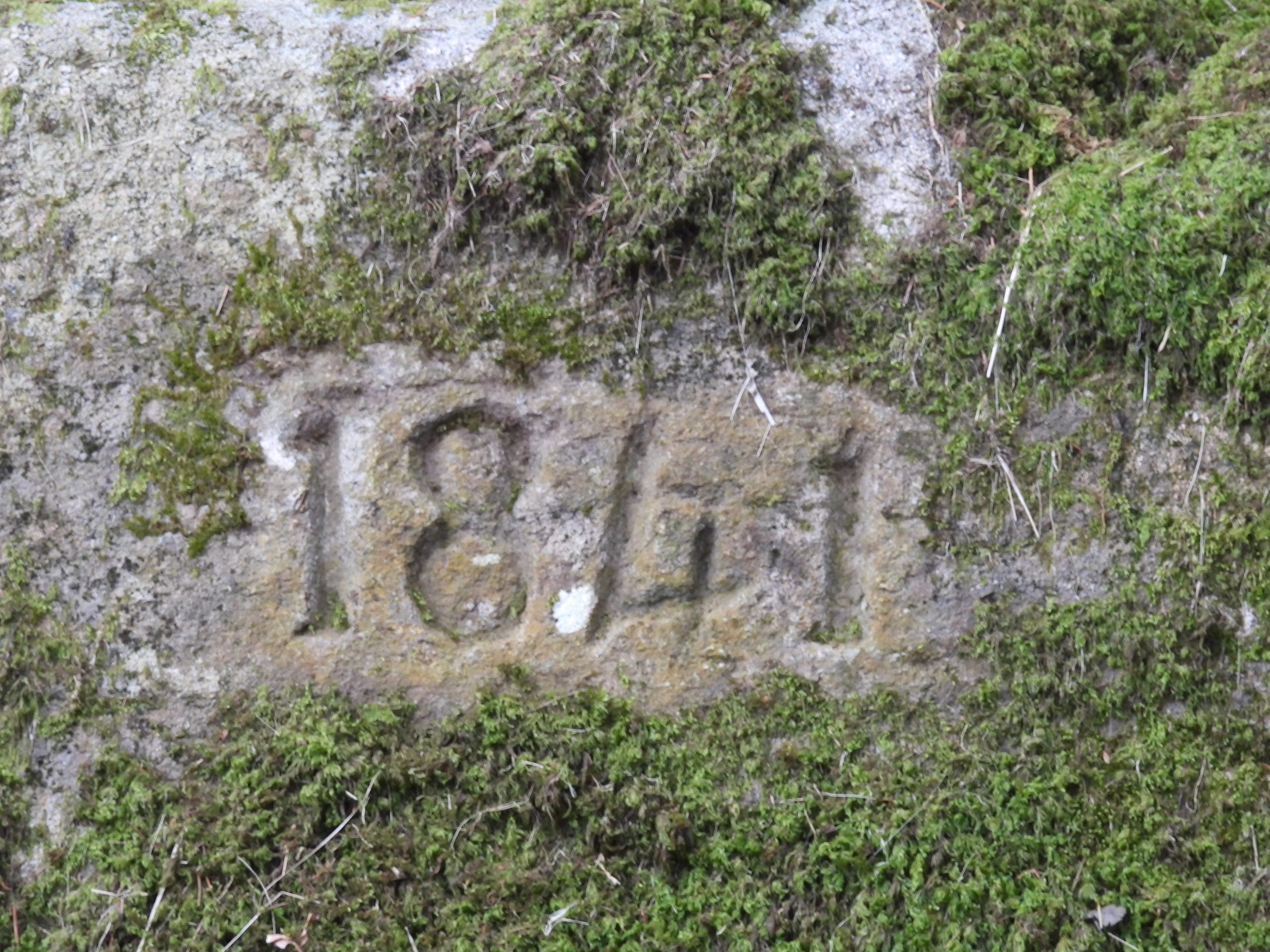
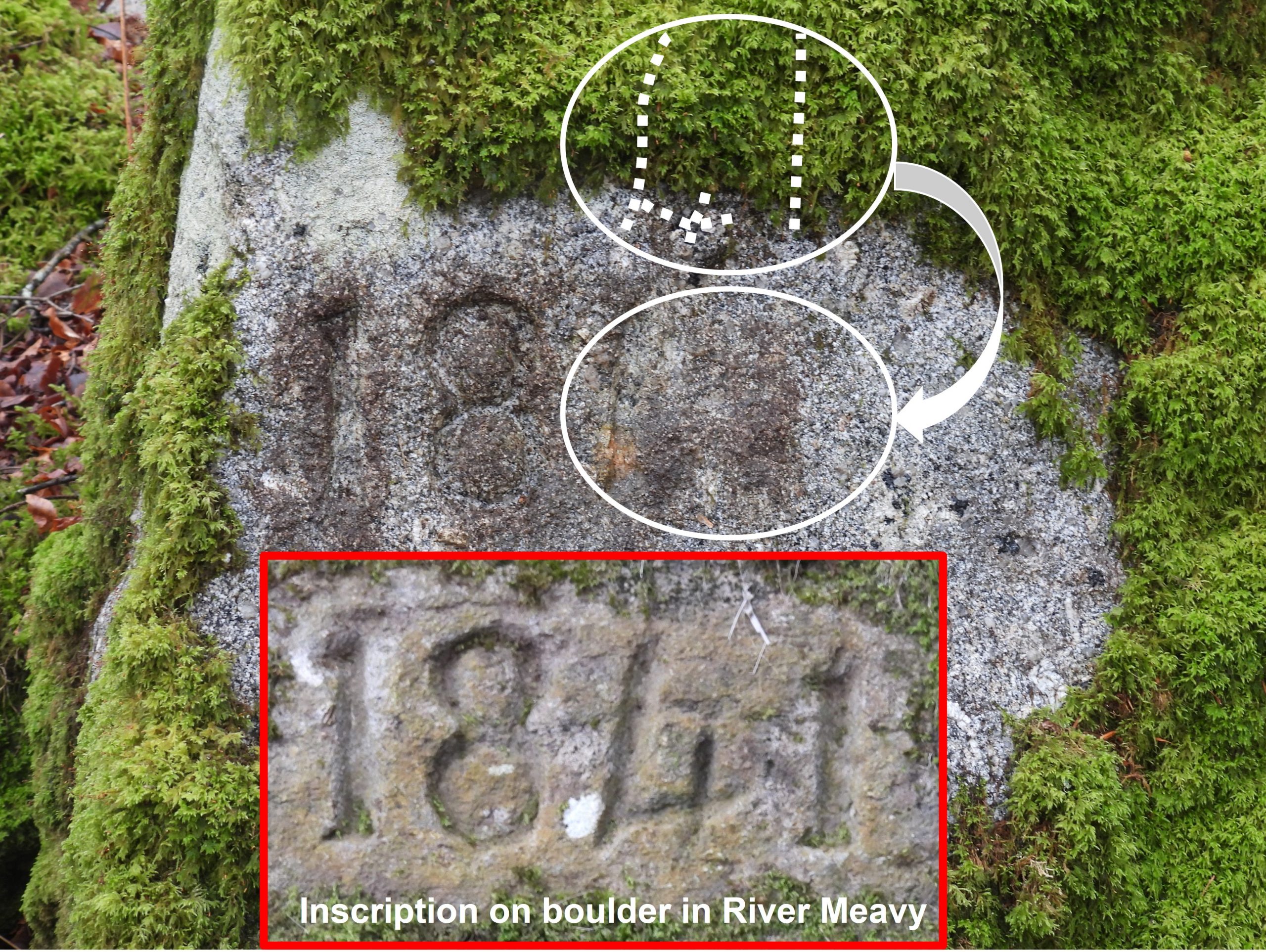
Annotated 19th century map showing all the key features at Norwworthy Farm and the immediate area. ‘Northworthy’ is depicted on the Tithe Map, plots: 951, 952. Pig styes were located to the north of the house.Norsworthy longhouse in 1894. Note the height of the trees and the looking rocky pinnacle of Leather Tor in the background. The well dressed figure by the gate could be Thomas Creber who was the tenant around that time.The same view as the 1894 picture, 129 years later. The rocky pinnacle of Leather Tor is harder to see, even though this picture was taken late Winter / early Spring with the trees still bare.Norsworthy 1894 overlaid onto Norsworthy 2023 (by ‘lining up’ the rocky pinnacle of Leather Tor).The longhouse appear to be “T” shaped on the 19th century maps. R.G. Haynes records that the longhouse was divided in three rooms and probably once having smaller divisions. There were stairs to an upper room (see 1894 photograph).View from the back of the Longhouse looking towards Sheepstor and the track coming up from Norsworthy Bridge. The track on the left leads to Crazywell Pool / Nun’s Cross and the track on the right leads to Leather Tor Bridge / Farm.View from the bottom of the slope of the longhouse. The longhouse looks like it once had a cross wall. To the right (east) is a field.View of Norsworthy Farm from the field to the south. All four buildings can be seen from this vantage point.Views of the four buildings in 2023. These are the ones shown in red on the 19th century map. The author has arbitarily labelled the buildings (except the longhouse). More general views of Norsworthy Farm. Outbuilding 2 (as labelled on the annotated map in this post) appears to now have a woodland track bisecting it.More views of the woodland track bisecting outbuilding 2 ruins.Mike Brown in his (CD) guide to Dartmoor records that this rock was probably incised by William Folland, a Mason, who was paid £18 3s 9d for repairs to buildings at Norsworthy, as recorded in the Walkhampton Manorial rolls.The incised boulder is in the bed of River Meavy next to an island at SX56810 69507. This boulder is mentioned in ‘Exploring around Burrator – A Dartmoor Reservoir’ by Paul Rendell on page 29. It is suggested that the inscription is ‘1840’ which the author suspects is an editorial error as the inscription is clearly ‘1841’.The ‘1841’ inscription is approx 30cm long. Each character is around 12cm tall.Close up of this very well inscribed rock.This boulder is mentioned in ‘Exploring around Burrator – A Dartmoor Reservoir’ by Paul Rendell on page 29. It is suggested that the inscription on stone is 184(1). The author believes the ‘1’ is in brackets as the inscription is so faint. It is known that work was being conducted at Norsworthy around February and March in 1841. It would make sense that the date on this stone matches that of the inscribed rock in the River Meavy, which is clearly inscribed as ‘1841’. The inscription on this boulder on first viewing looks like ‘181’ and not as suggested ‘1841’. The boulder is located at SX56832 69525By careful comparison of the inscription in the boulder in the Meavy and the inscribed boulder by the farm, the author believes the inscriptions were conducted by the same hand. Also, what looks on first viewing as being just ‘181’ does look like ‘1841’ with part of the ‘4’ and the second ‘1’ being very faint.Between Norsworthy Farm and Newleycombe Lake there is a potato cave build into the top part of a bank. In all likelihood, this potato cave (or hull) was used by the tenants of the farm to store their root vegetables. These was known as a ‘still’ in late 19th century. There are examples of a few others in the area.Views of the inside of the potato cave. It is located at SX56920 69465.
Regarding last tenants – 1891 census refers to Norsworthy House, not farm and records:- Thomas Pearse aged 32 – farm labourer, Elizabeth, wife 31, 4 children under 7 and a boarder – ? labourer
Possible relative of Pearse at Kingsett
1901 Census Thomas Pearse Farmer at Routrundle Walkhampton, no record of Norsworthy House
Stephen Barrow August 19, 2025
Regarding last tenants – 1891 census refers to Norsworthy House, not farm and records:- Thomas Pearse aged 32 – farm labourer, Elizabeth, wife 31, 4 children under 7 and a boarder – ? labourer
Possible relative of Pearse at Kingsett
1901 Census Thomas Pearse Farmer at Routrundle Walkhampton, no record of Norsworthy House
SteveGriggDartmoor August 19, 2025 — Post author
Hi Stephen,
Thank you for this information
Regards,
Steve