A collection of walks, discoveries, insights and pictures of exploring Dartmoor National Park
March 2, 2023
Blachford Manor Boundary Stones and Markers
Blachford Manor lies within the Cornwood parish to the east of the village. Dave Brewer in his second edition ‘Dartmoor Boundary Markers’ (2002) tells us that it is an ancient manor, which has variously been recorded as ‘Blacheorda’ (in Exon – the domesday survey of the South West of England) and ‘Blacheurde’ (in the Exchequer Domesday). Later, in 1302-3 (in a tax roll) it was recorded as ‘Nitherblachesworthy’ or just ‘Blachworthy’. It wasn’t until the seventeenth century it became Blachford as we know it today.
The manor house was rebuilt in the late 17th century (1694) and was in the Rogers family for nearly 300 years, up to 1985. The estate is recorded by Brewer as covering some 700 acres, but the author surmises that figure didn’t include moorland around the Yealm and the Erme which includes Stall Moor, since that is recorded as being 4,050 acres.
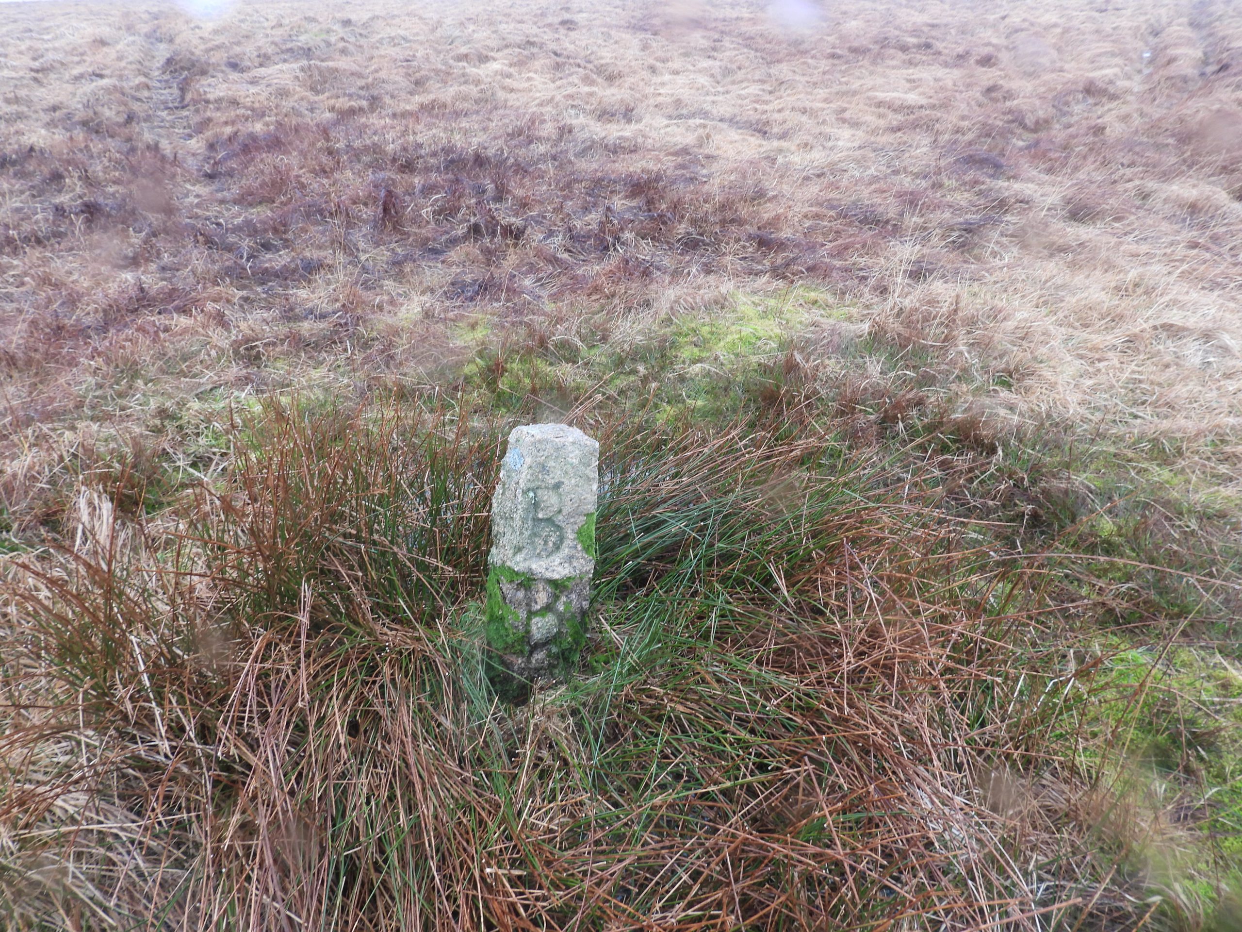
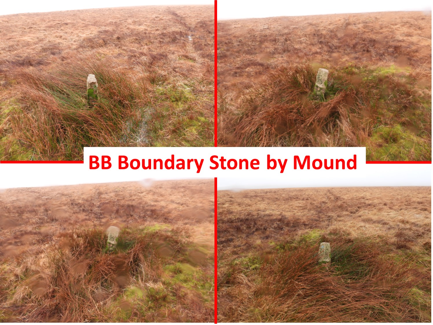
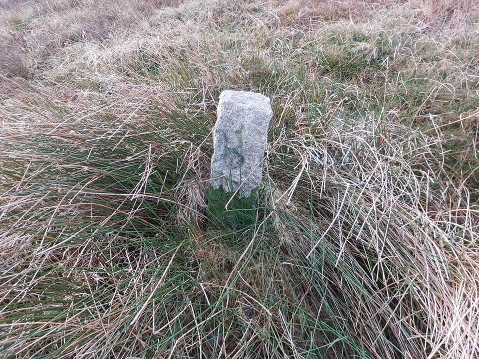
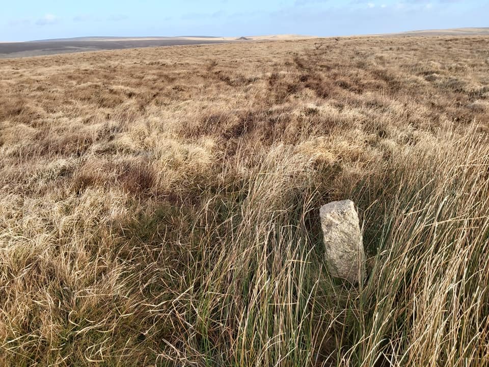
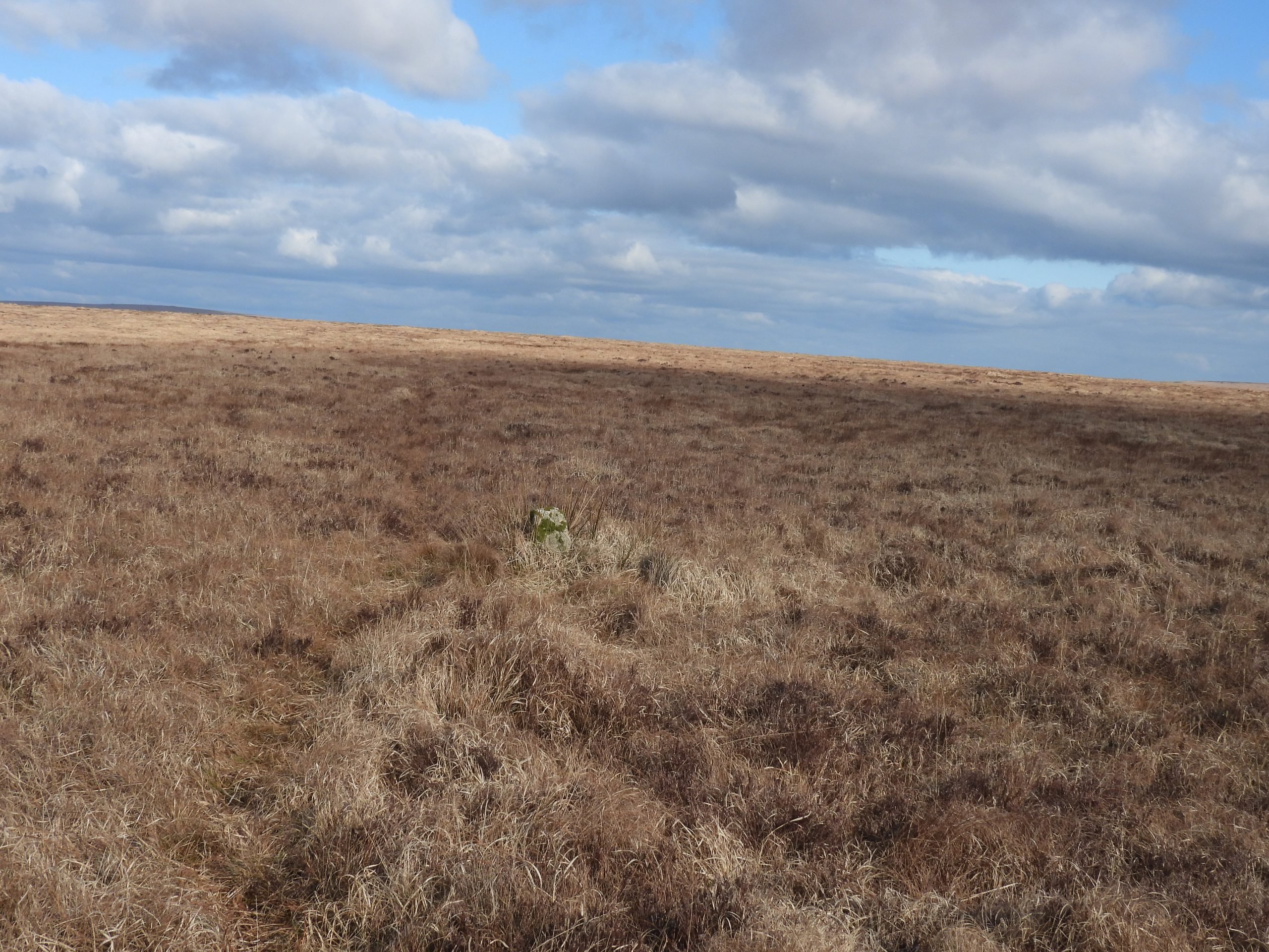
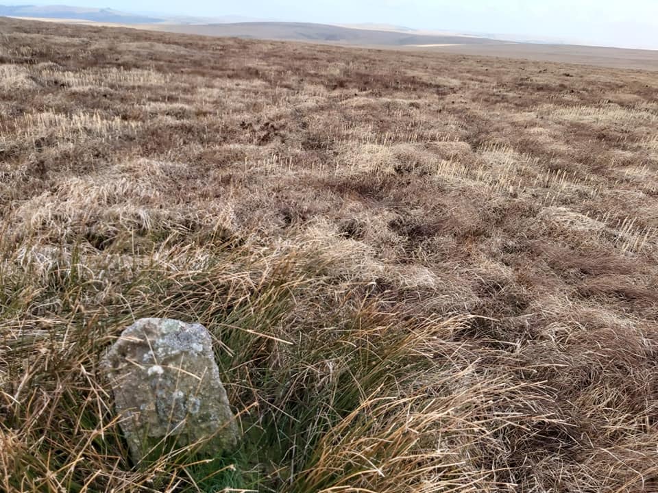
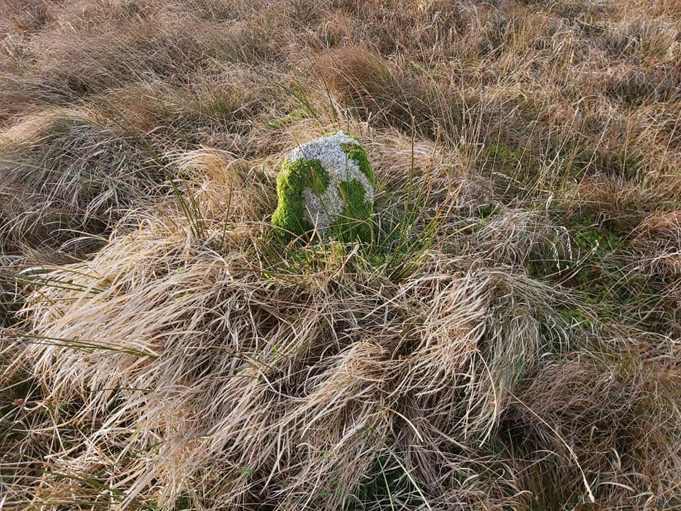
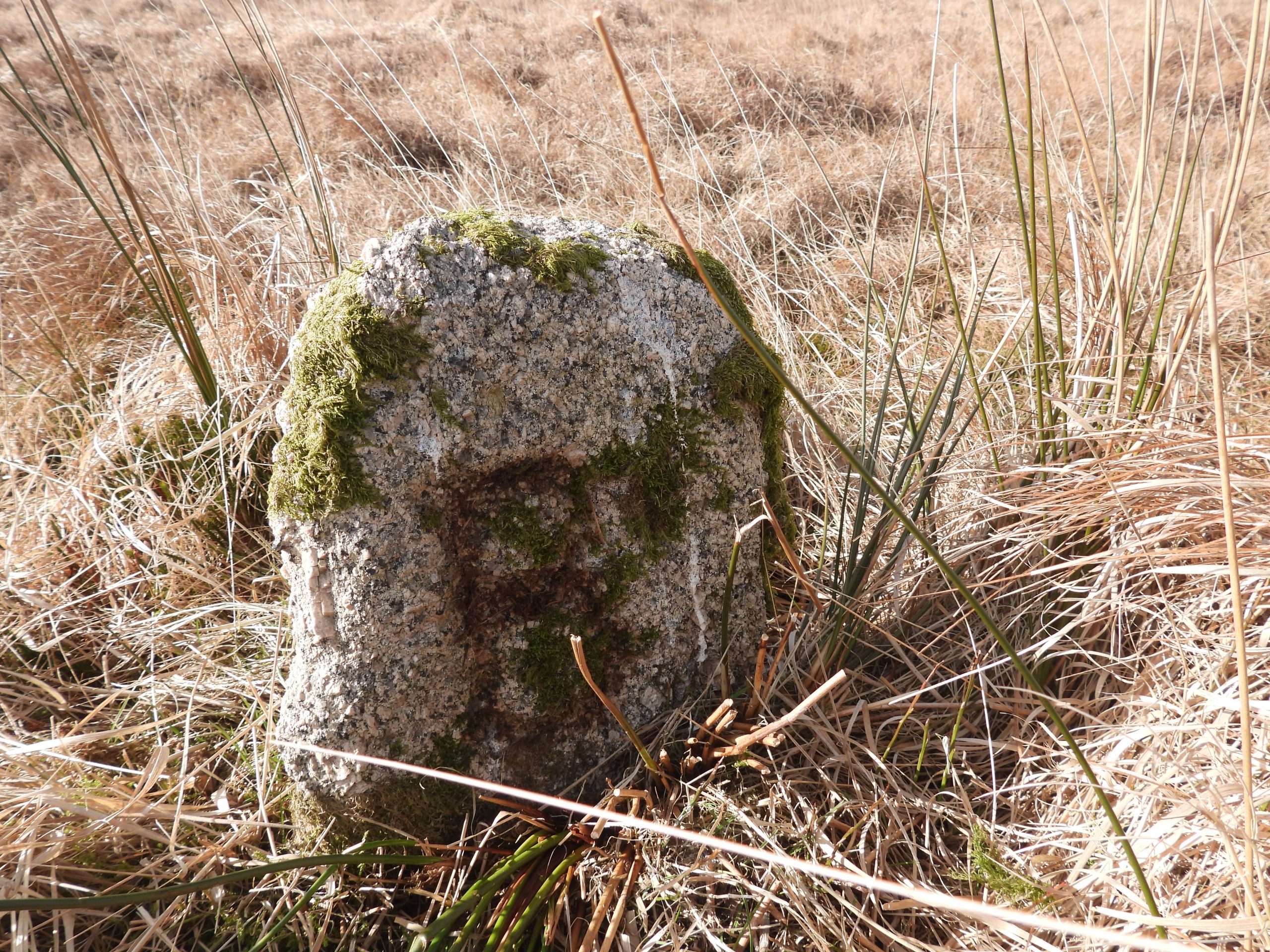
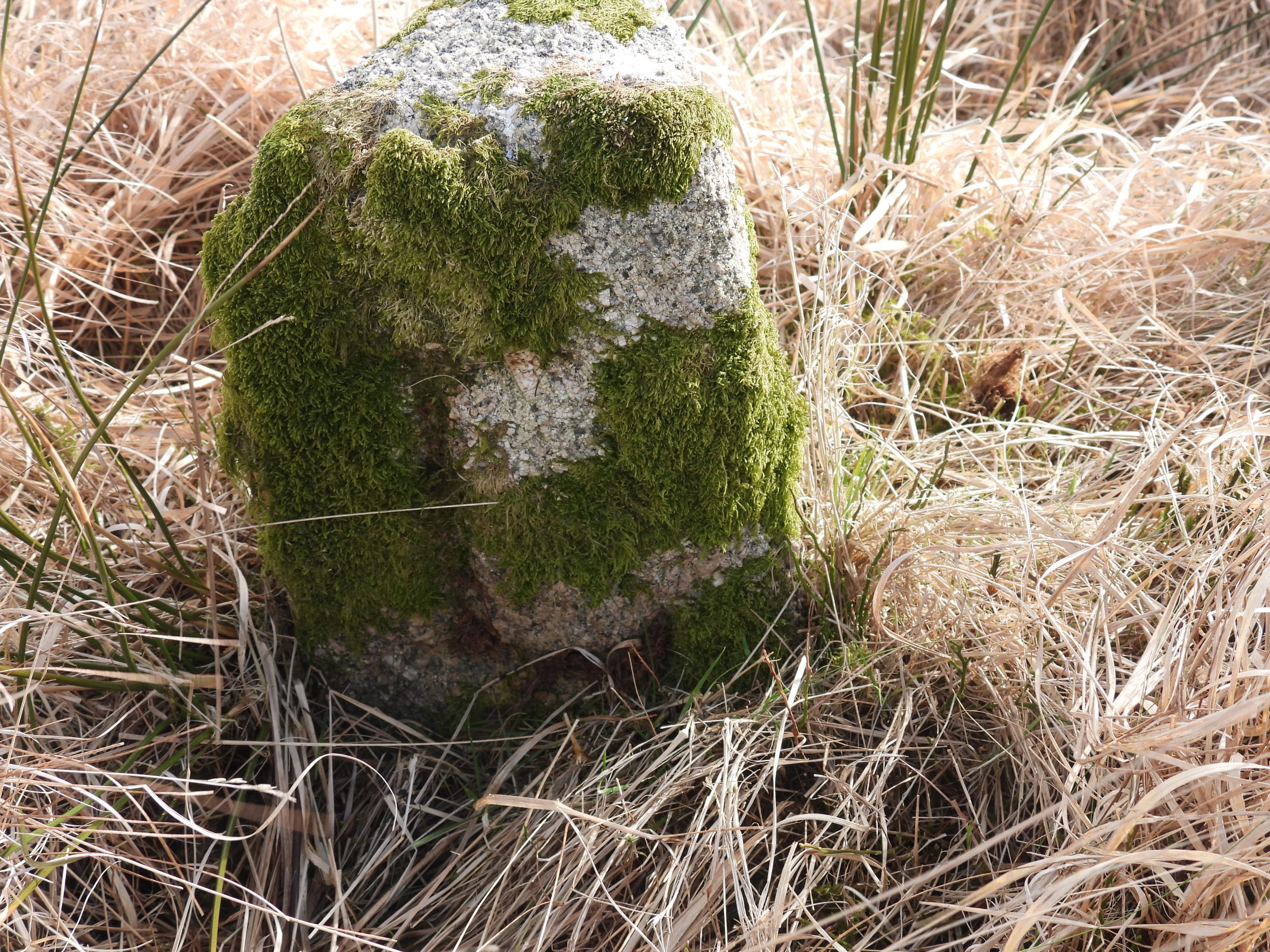
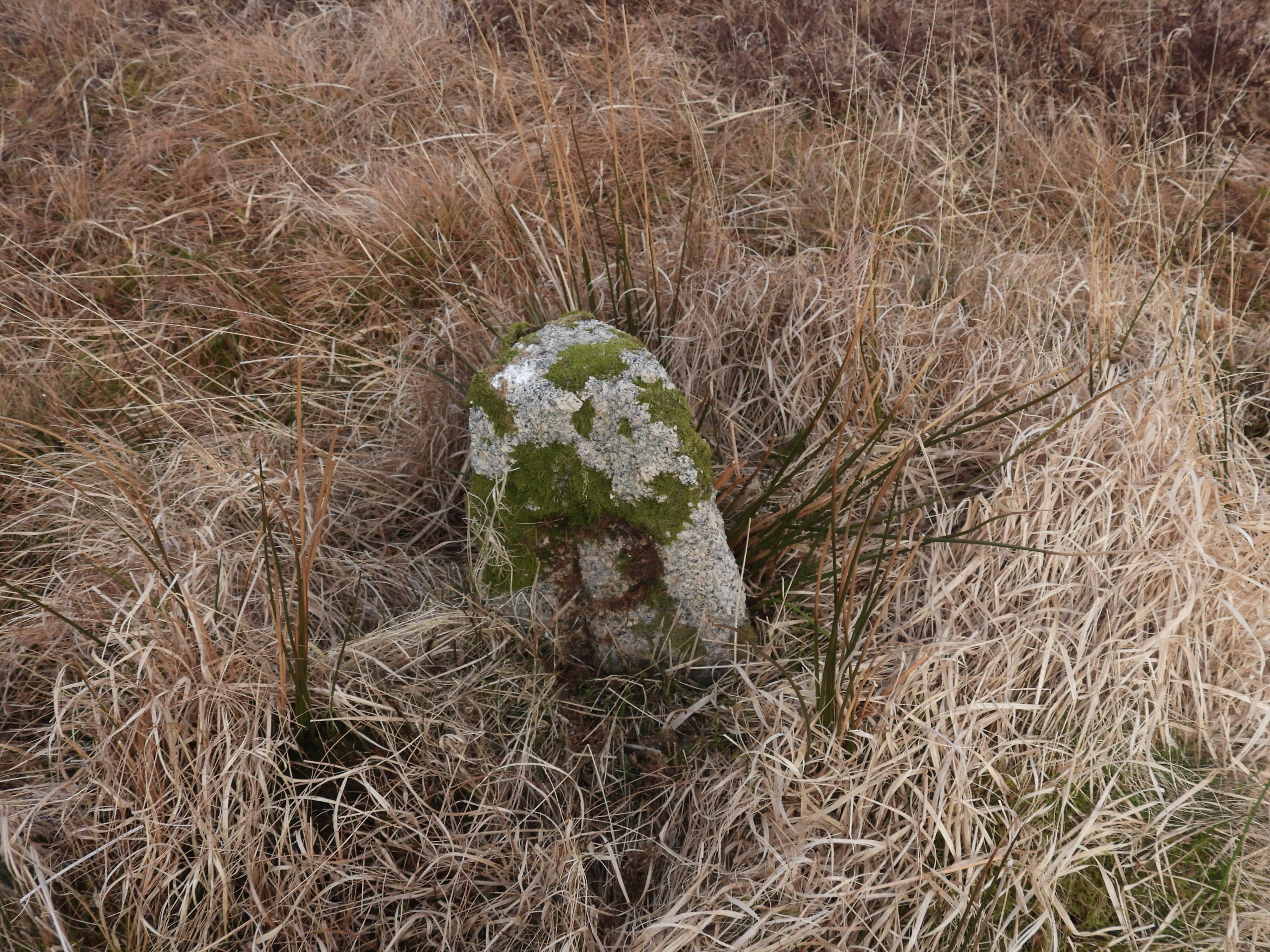
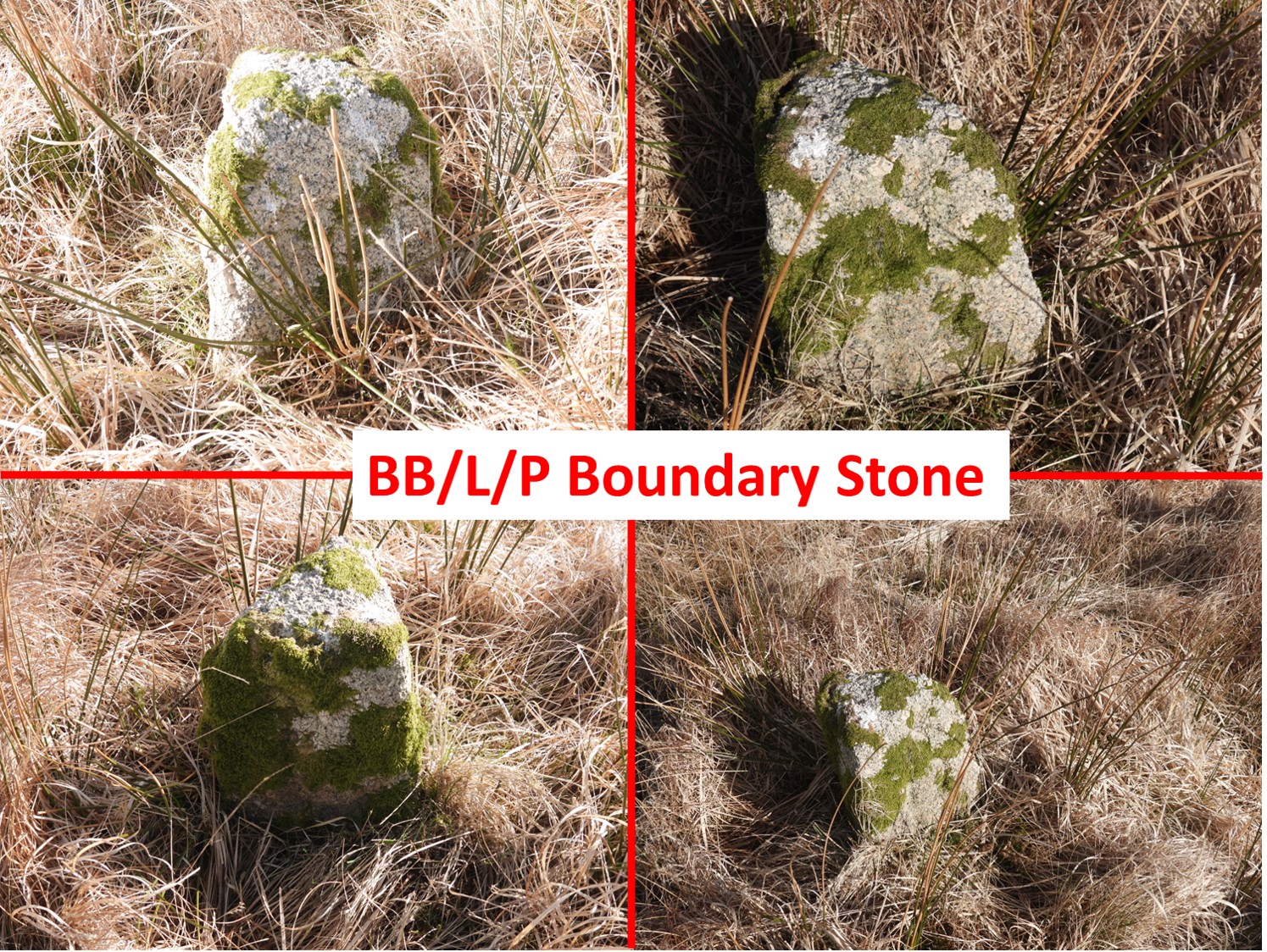
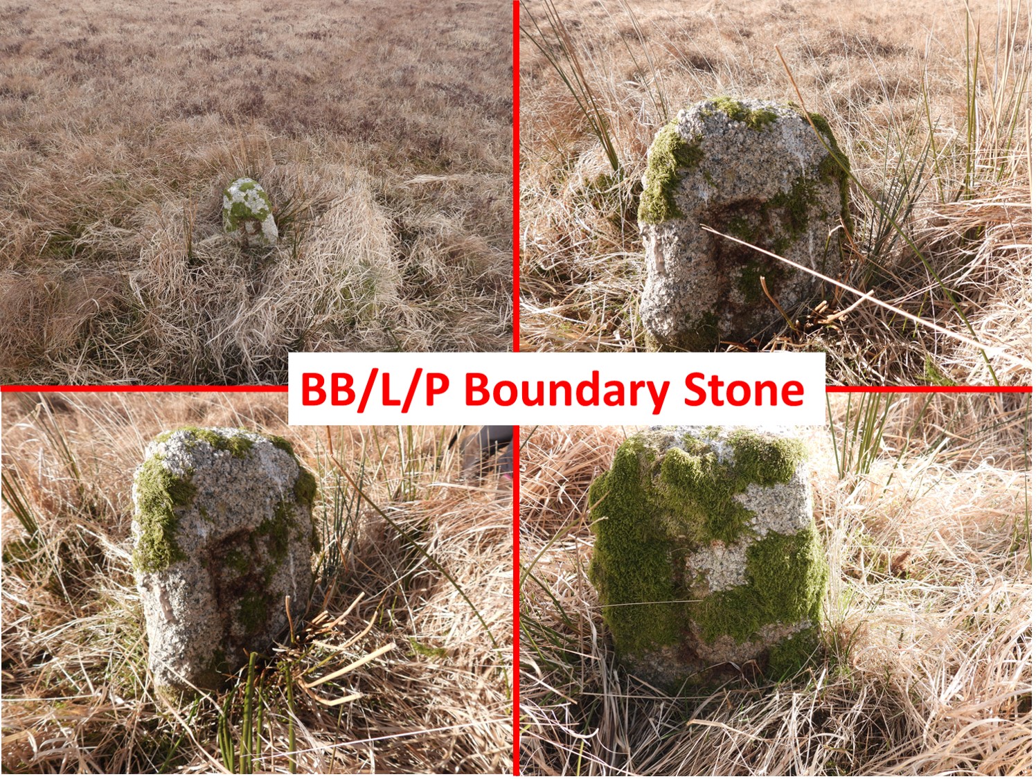
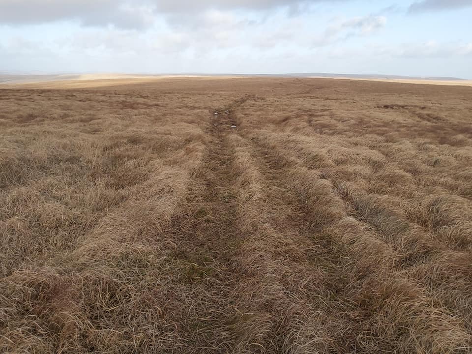
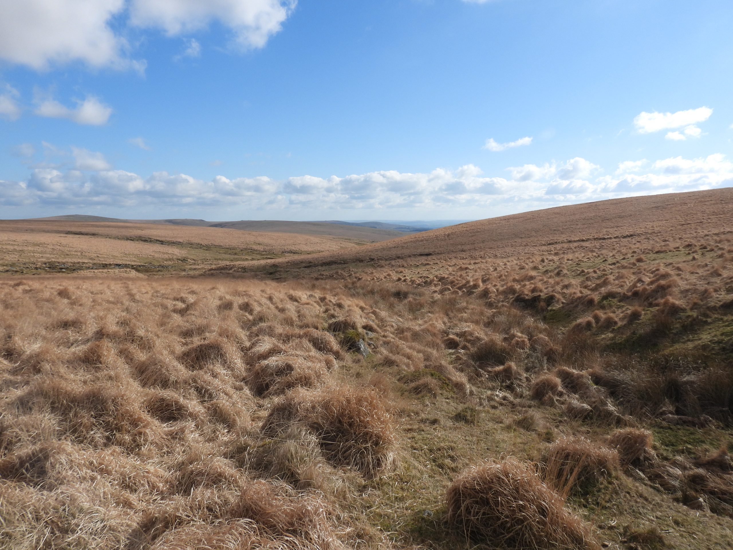
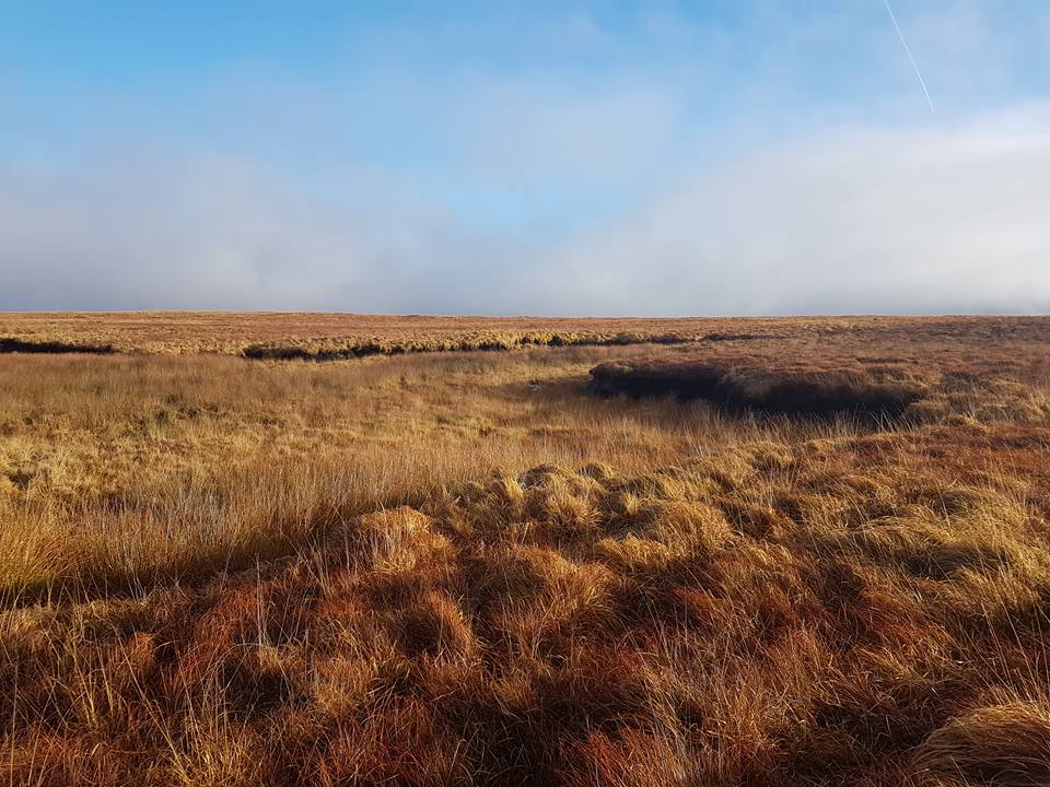
The high moorland bounds of the manor extend up the Erme to its head, follows the Cornwood / Shaugh Prior parish boundary across Langcombe Hill, then down to Yealm Head. Between the Erme and the Yealm there are 6 boundary stones / markers denoting this boundary, all of which are inscribed with various designations. Also, in the vicinity, at Shavercombe Head and at Broadall Head are two more inscribed rocks which are of interest and there is a 1930’s OS trig pillar on the south west end of Langcombe Hill. This post covers all the aforementioned items, which are located in a rather featureless, remote and often difficult terrain to traverse.
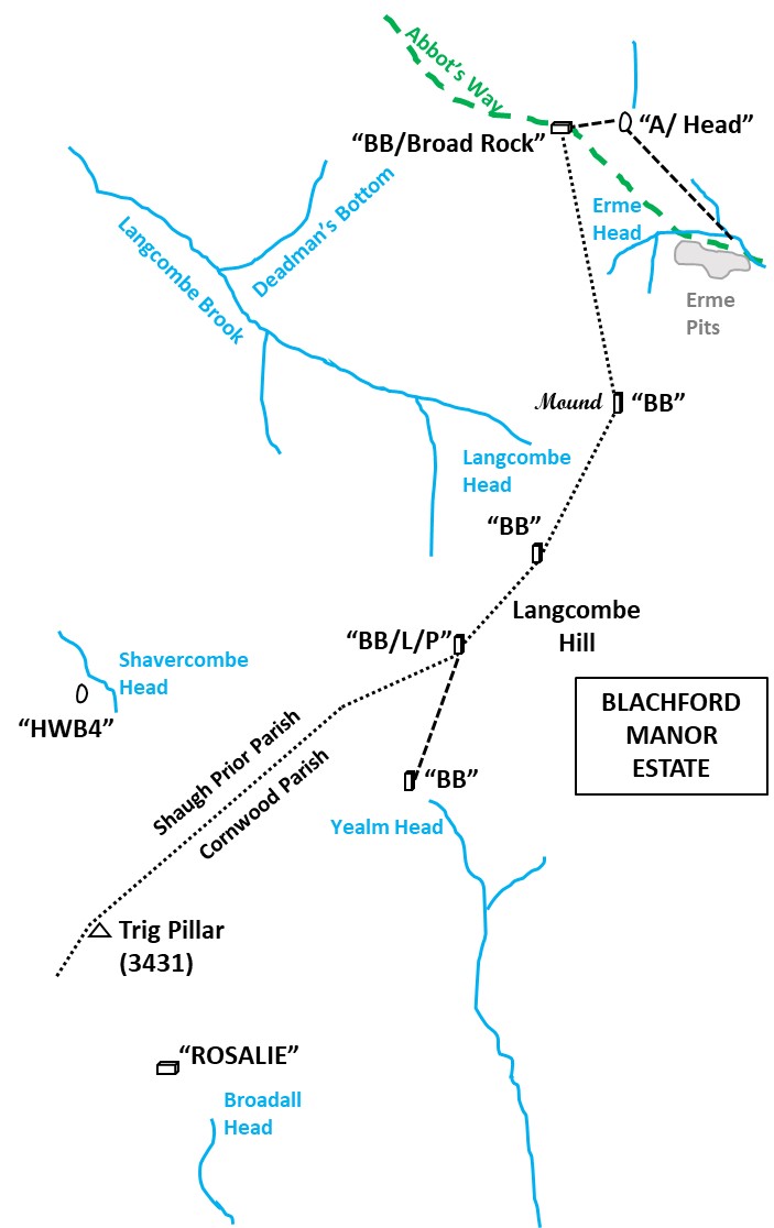
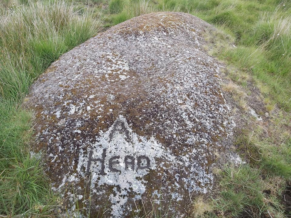
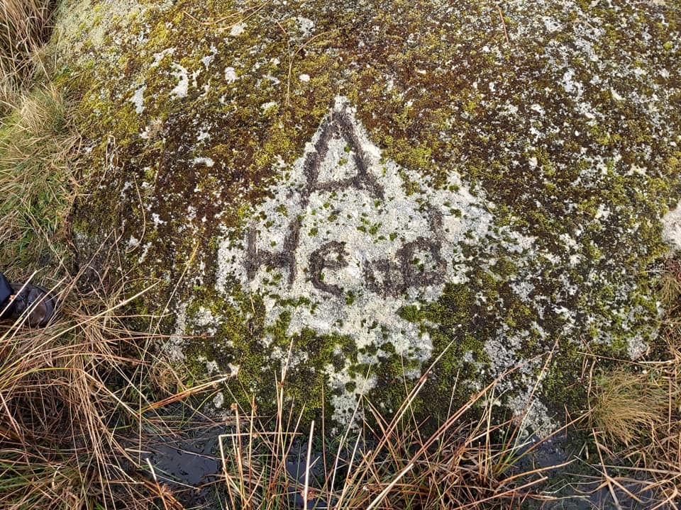
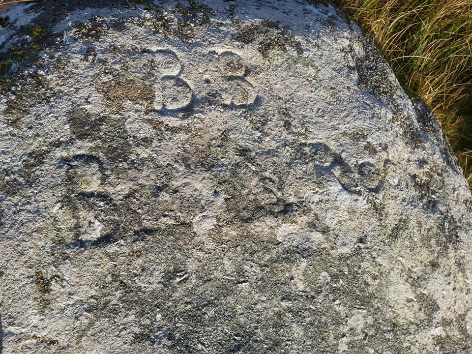
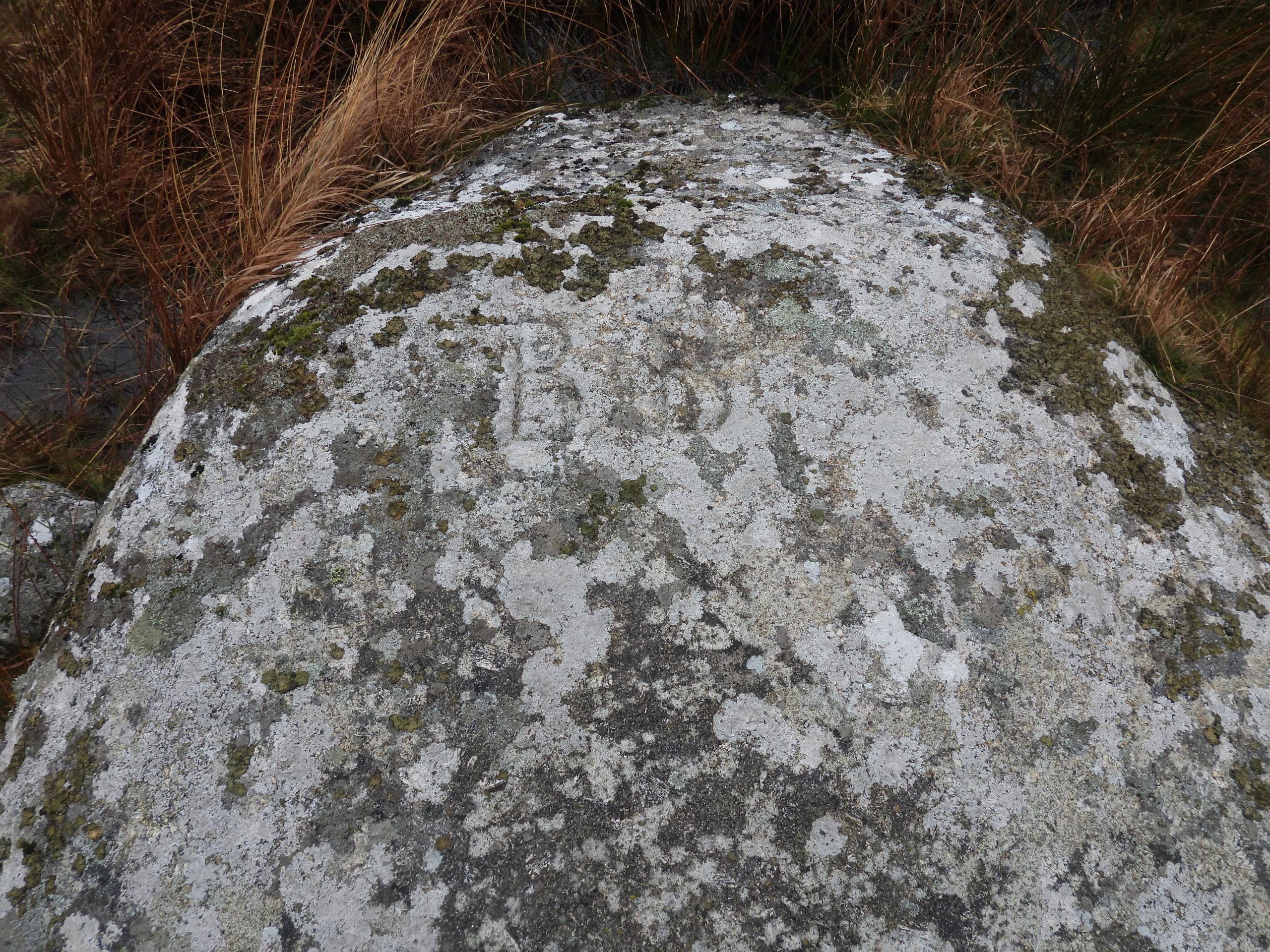
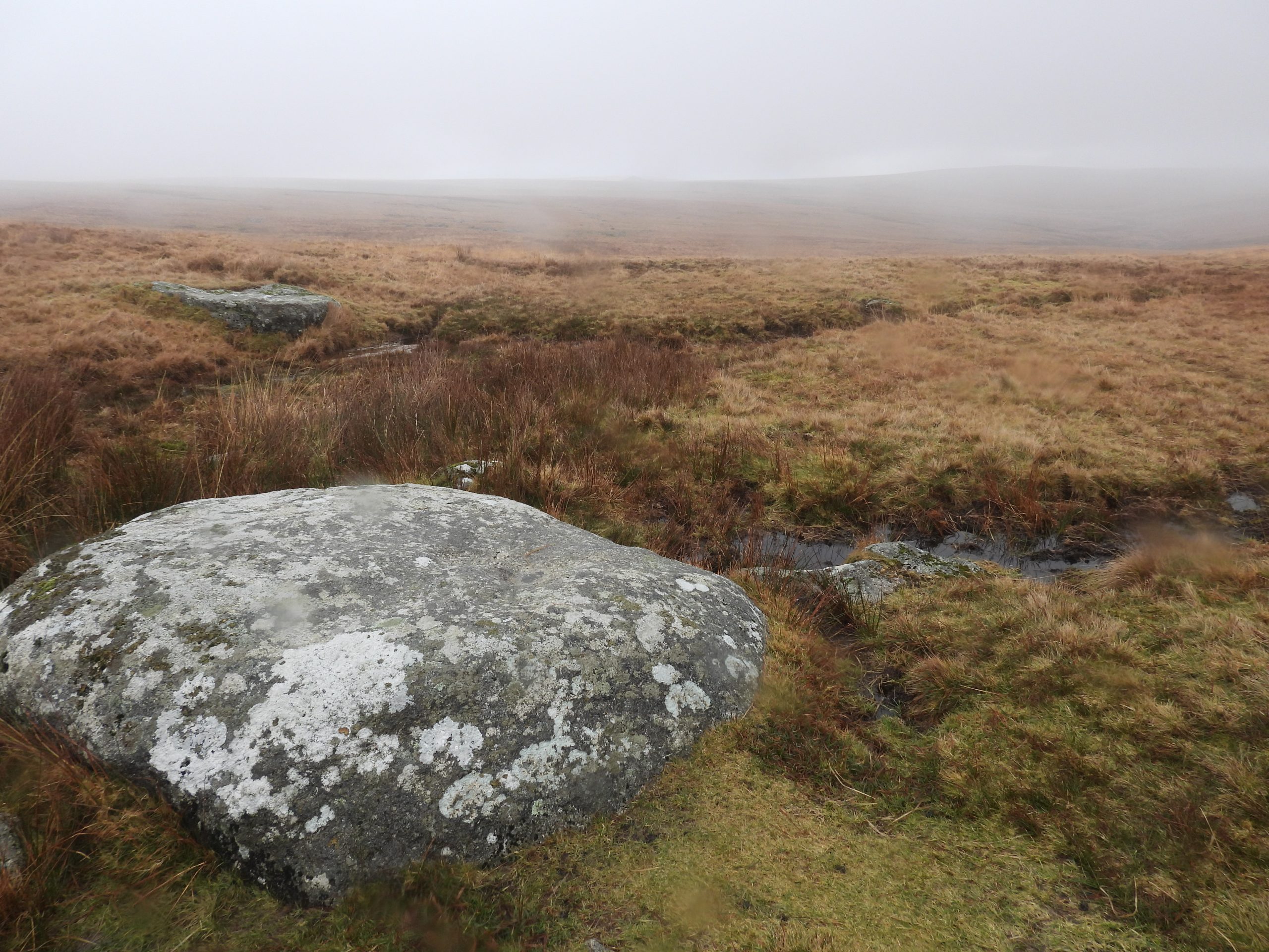
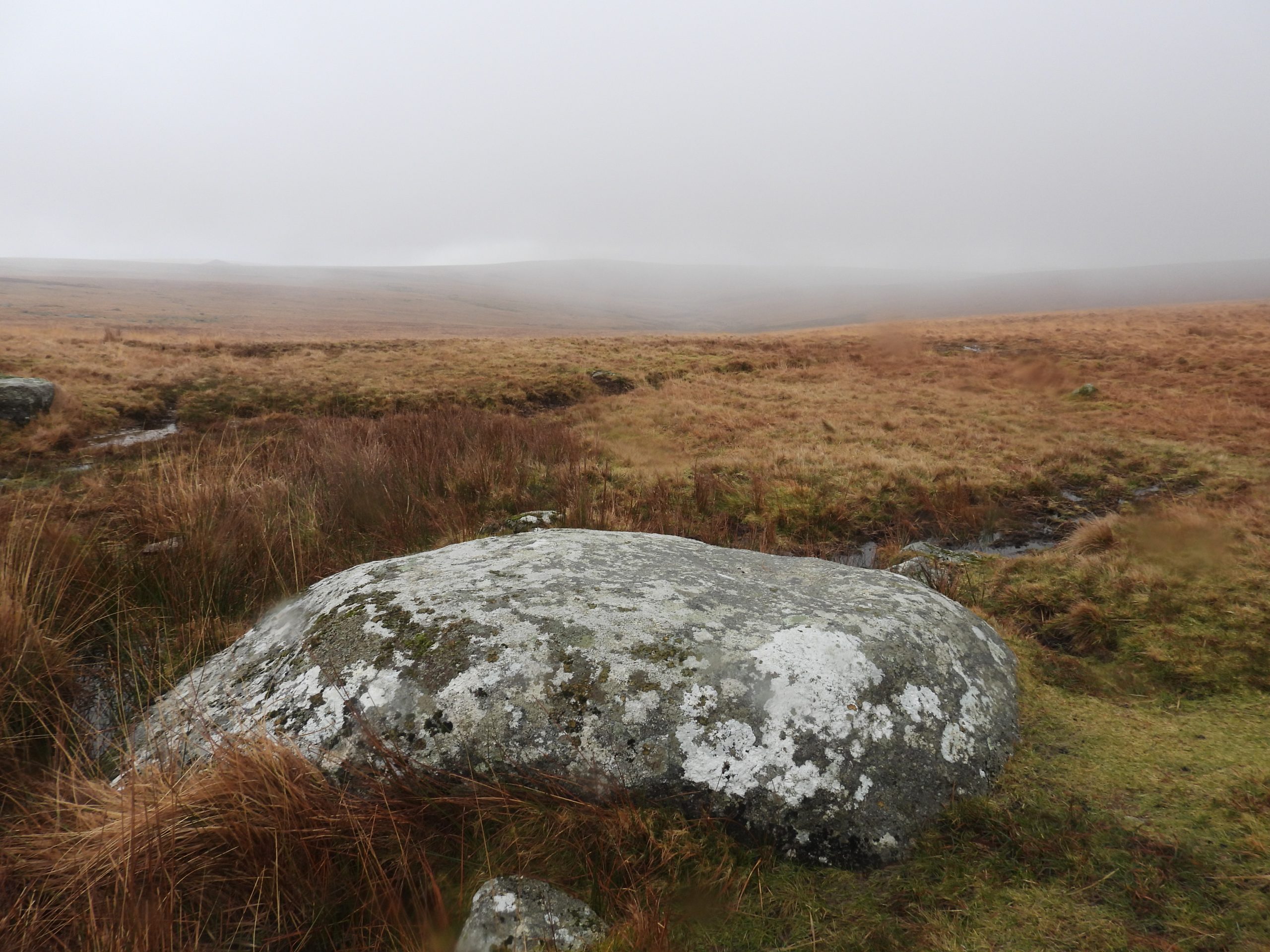
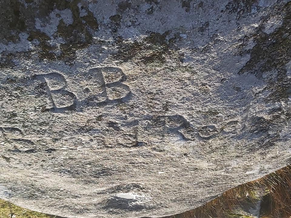
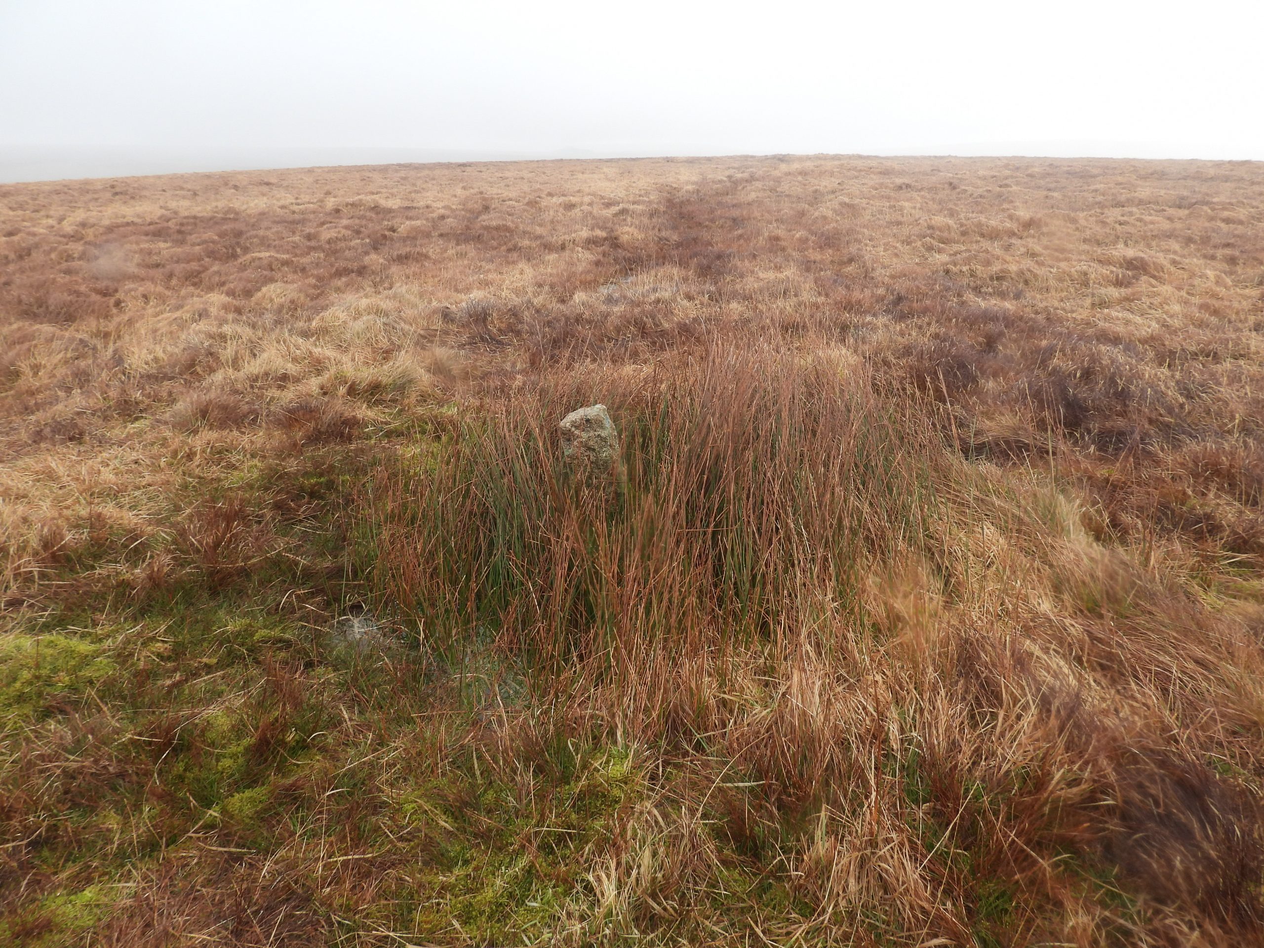
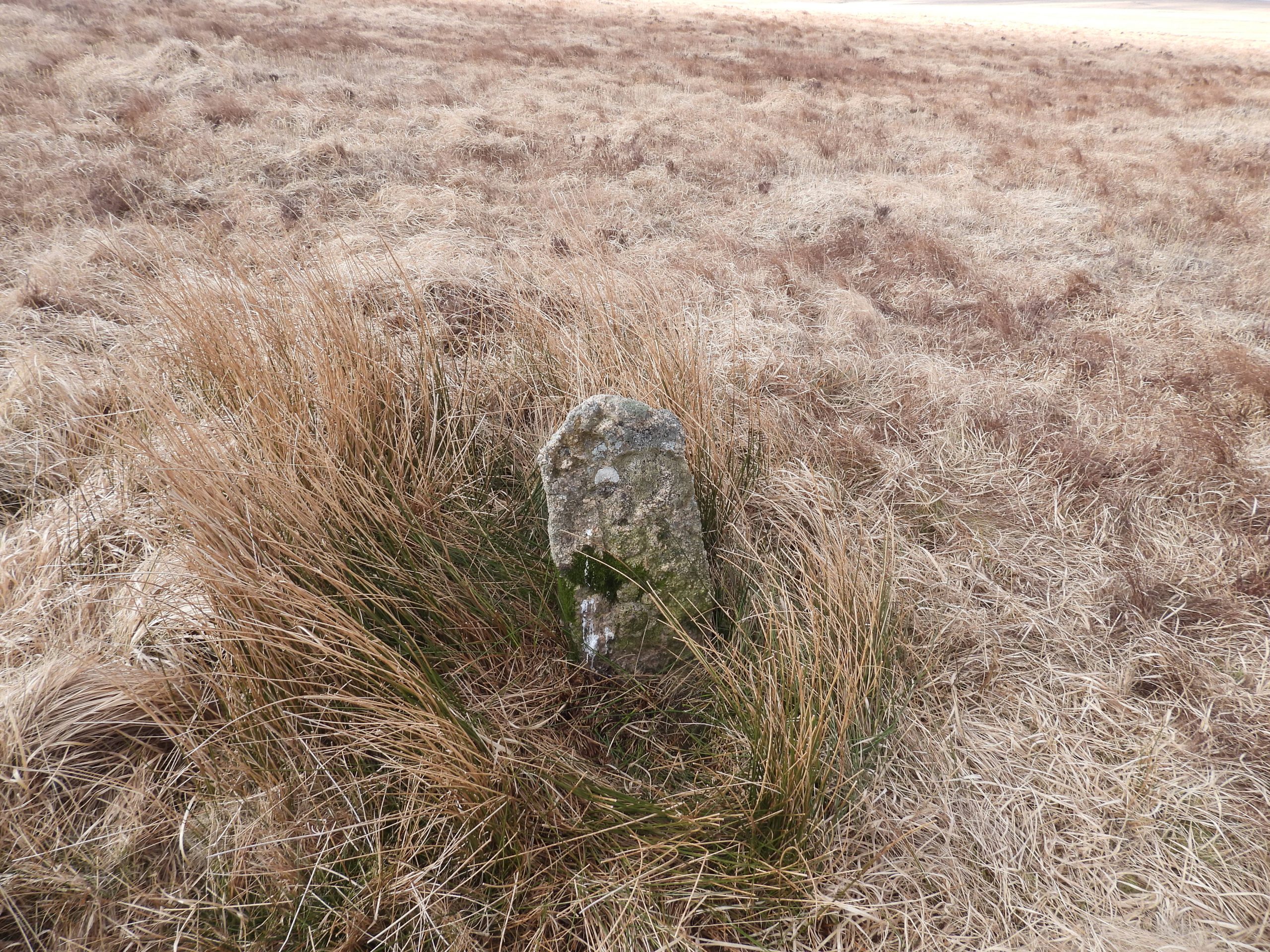
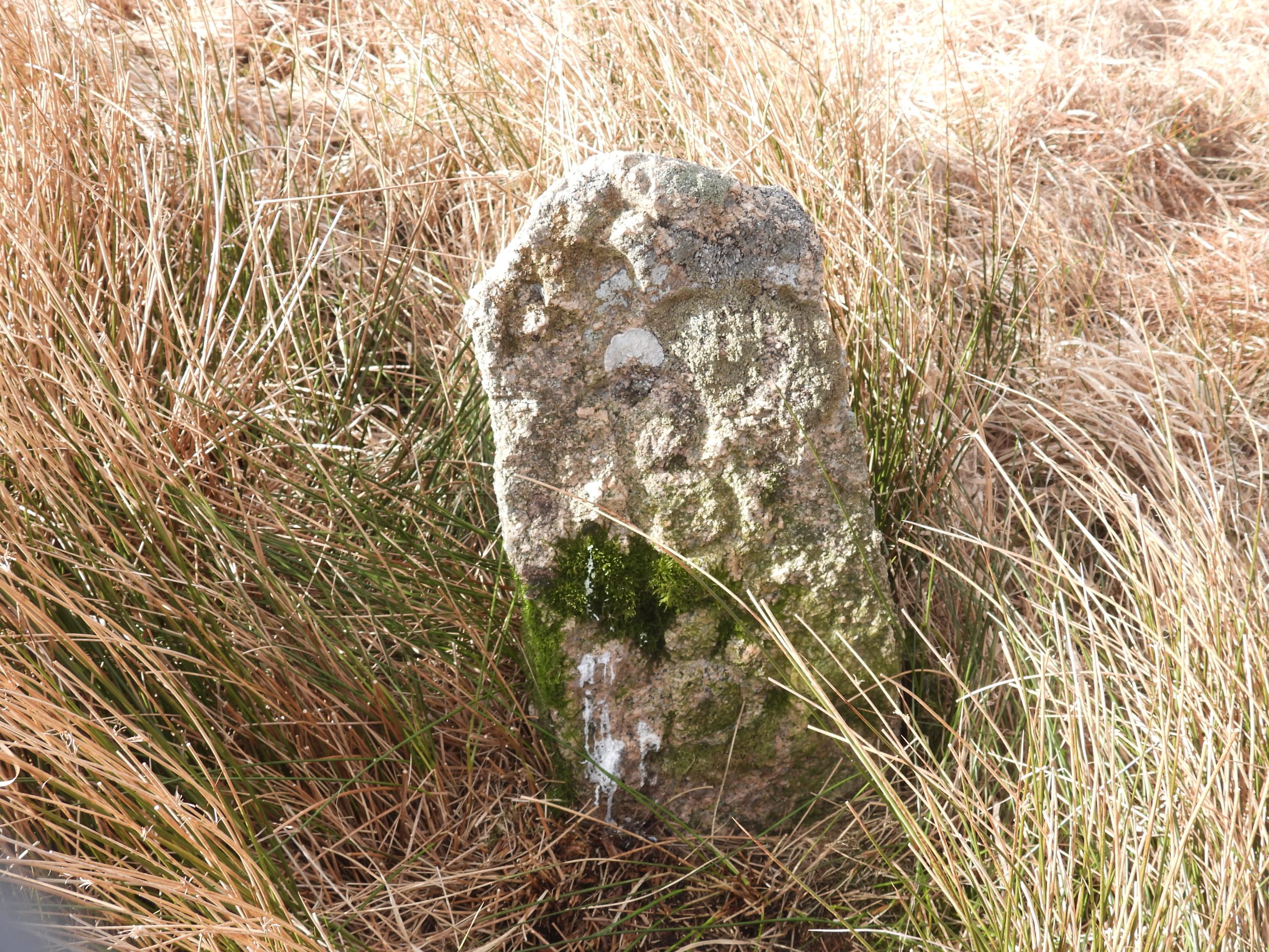
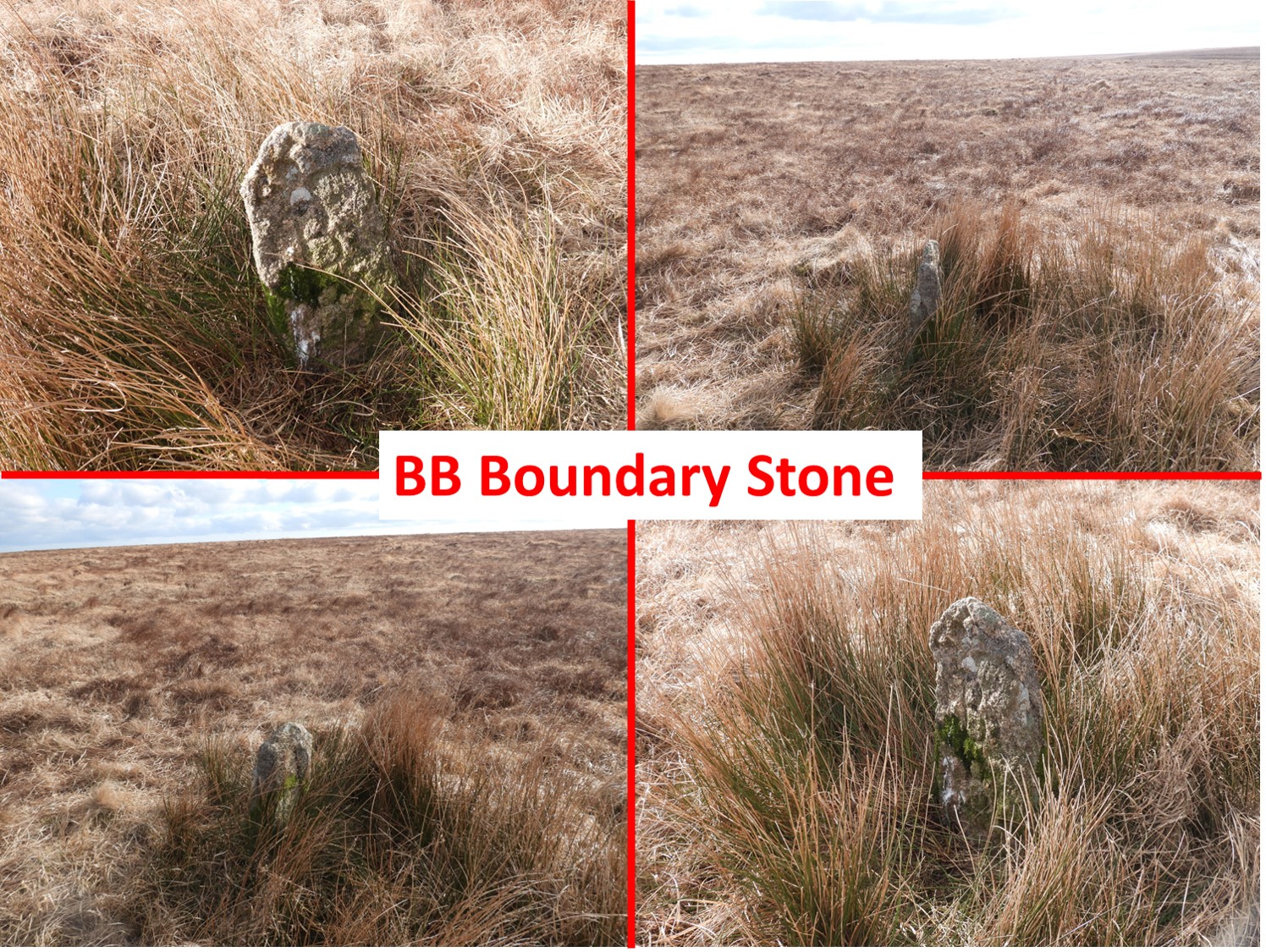
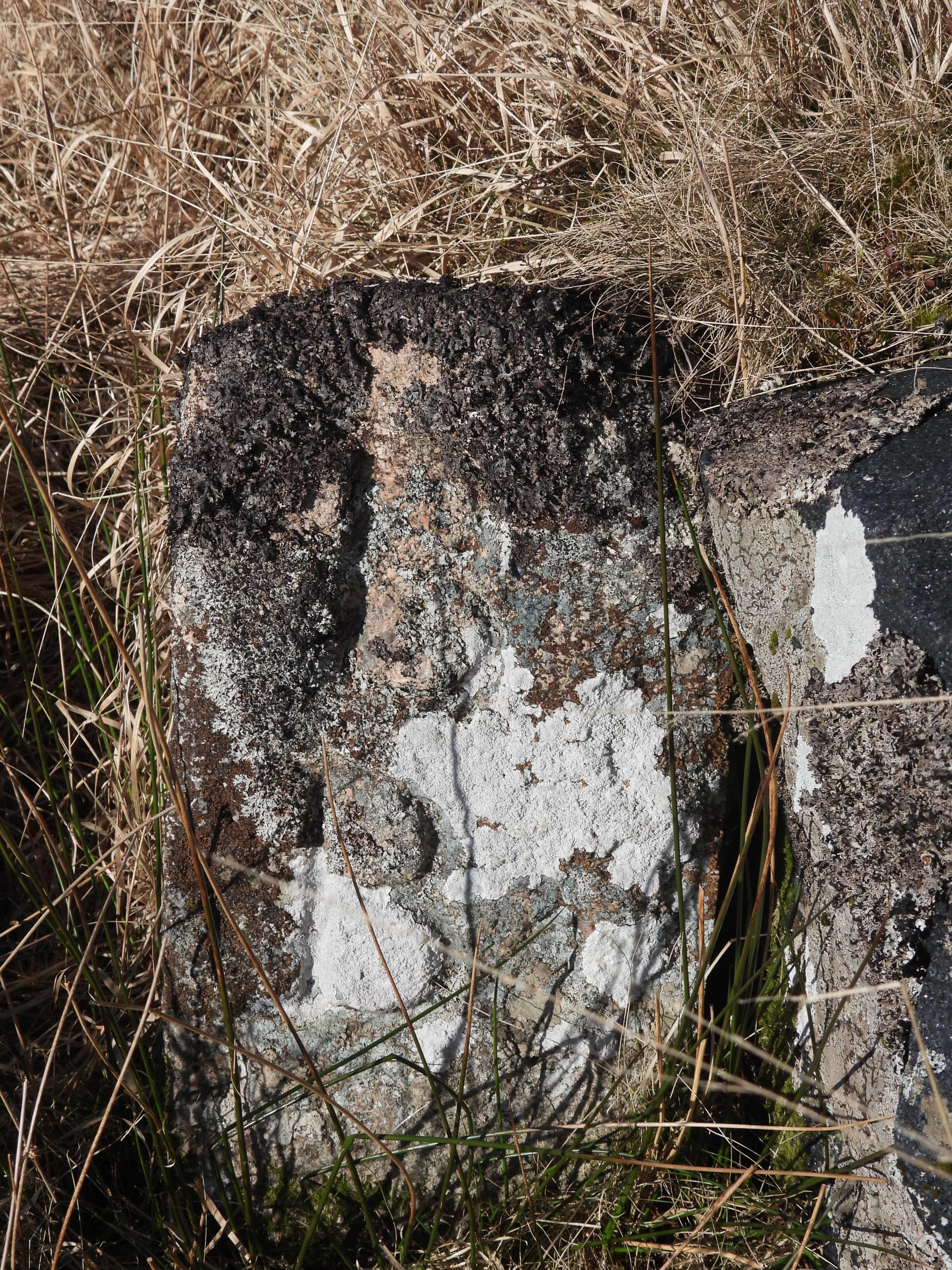
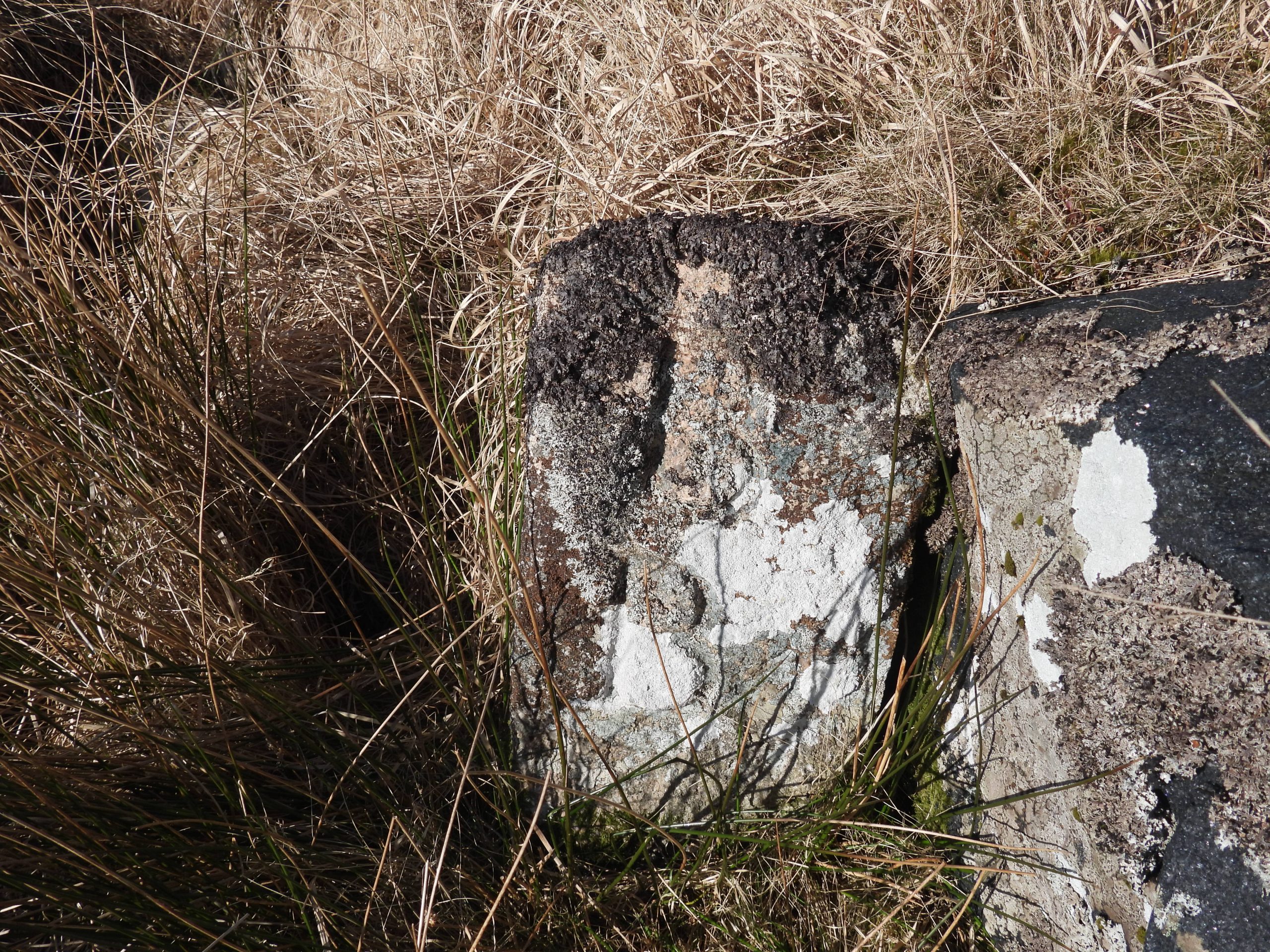
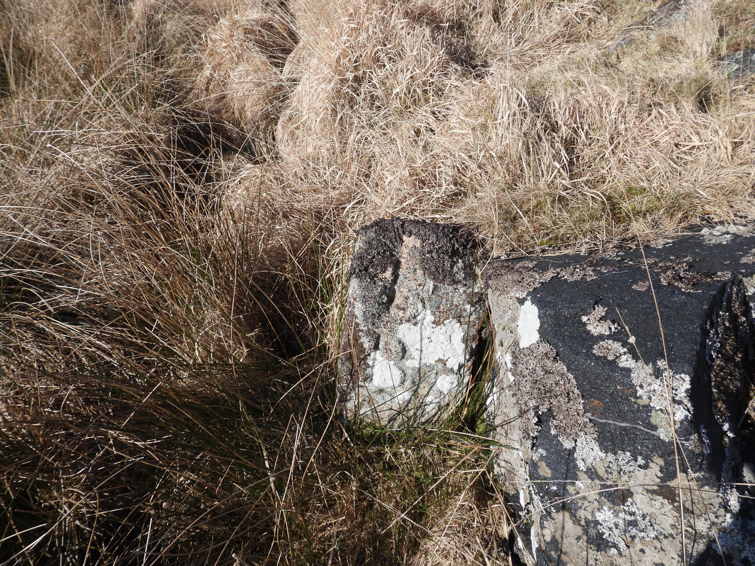
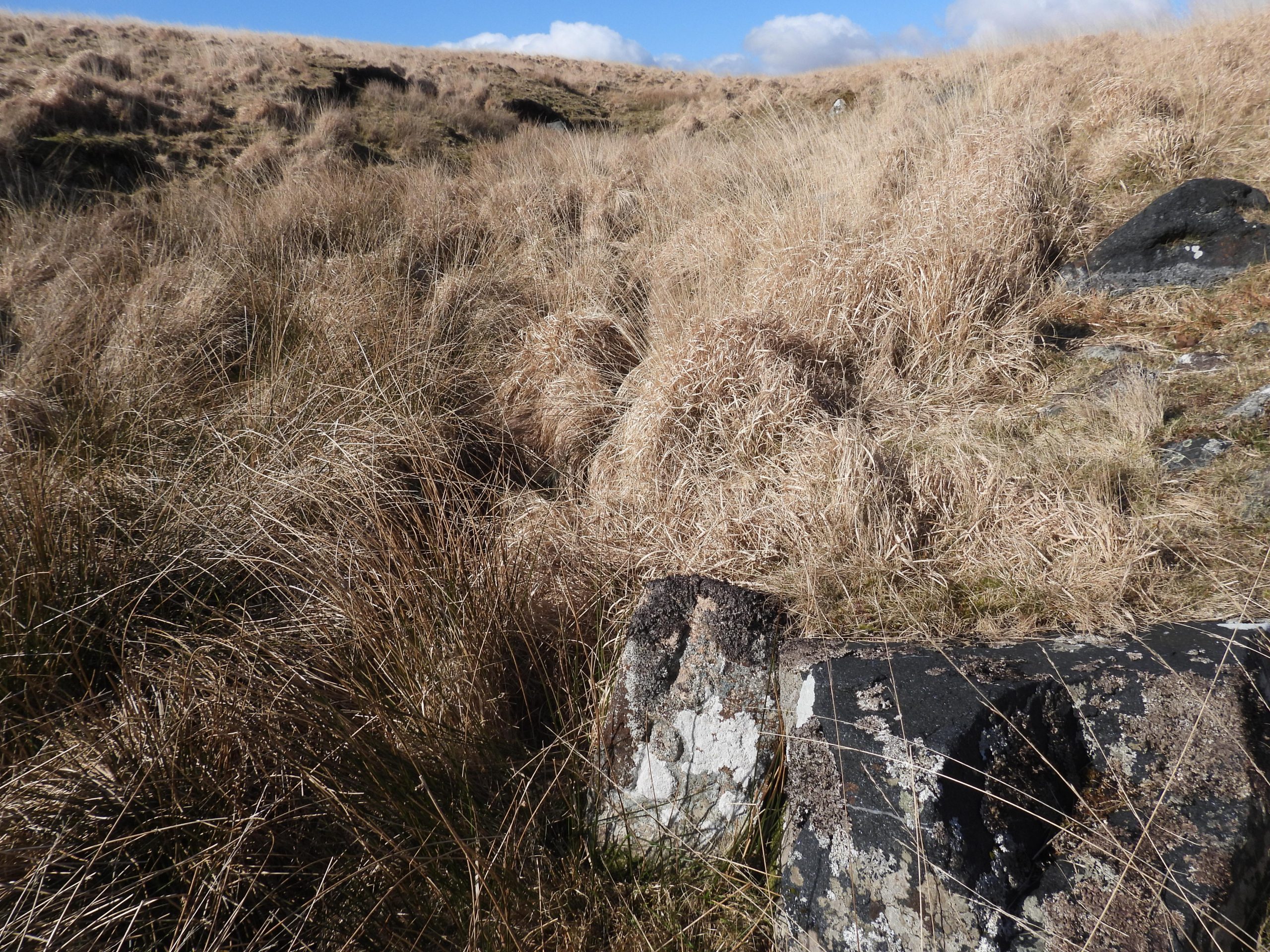
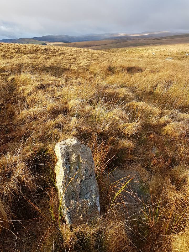
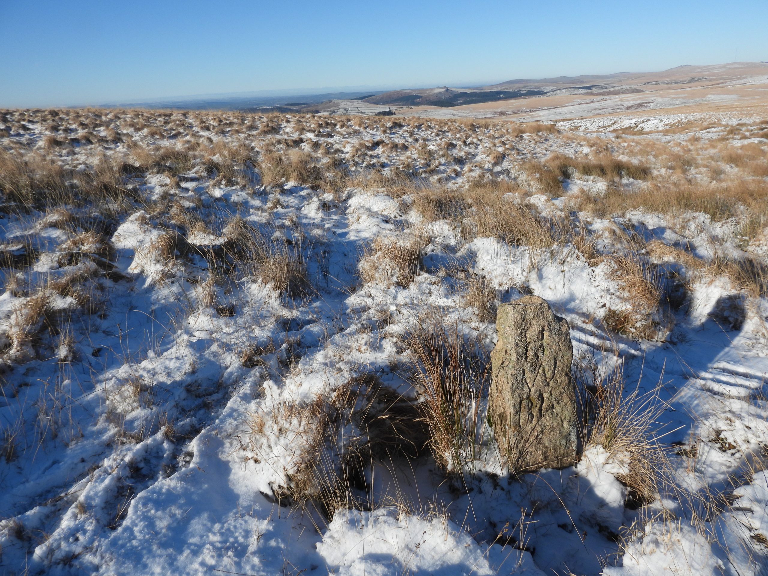
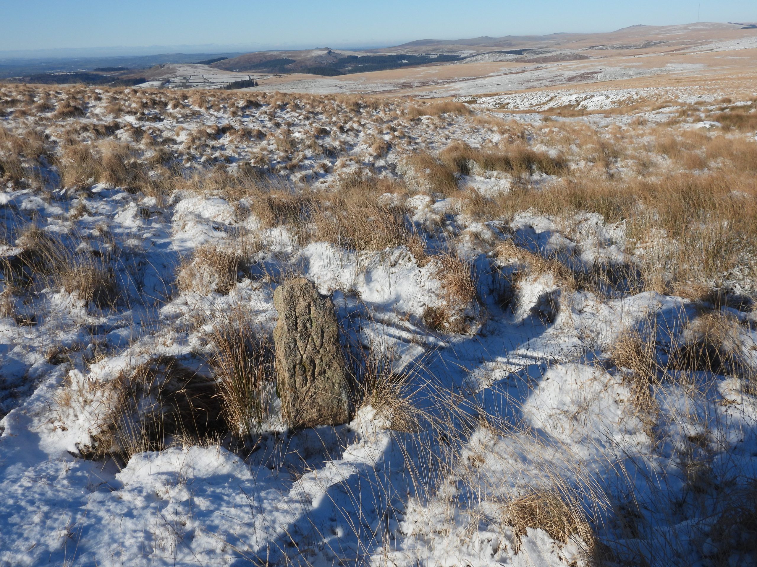
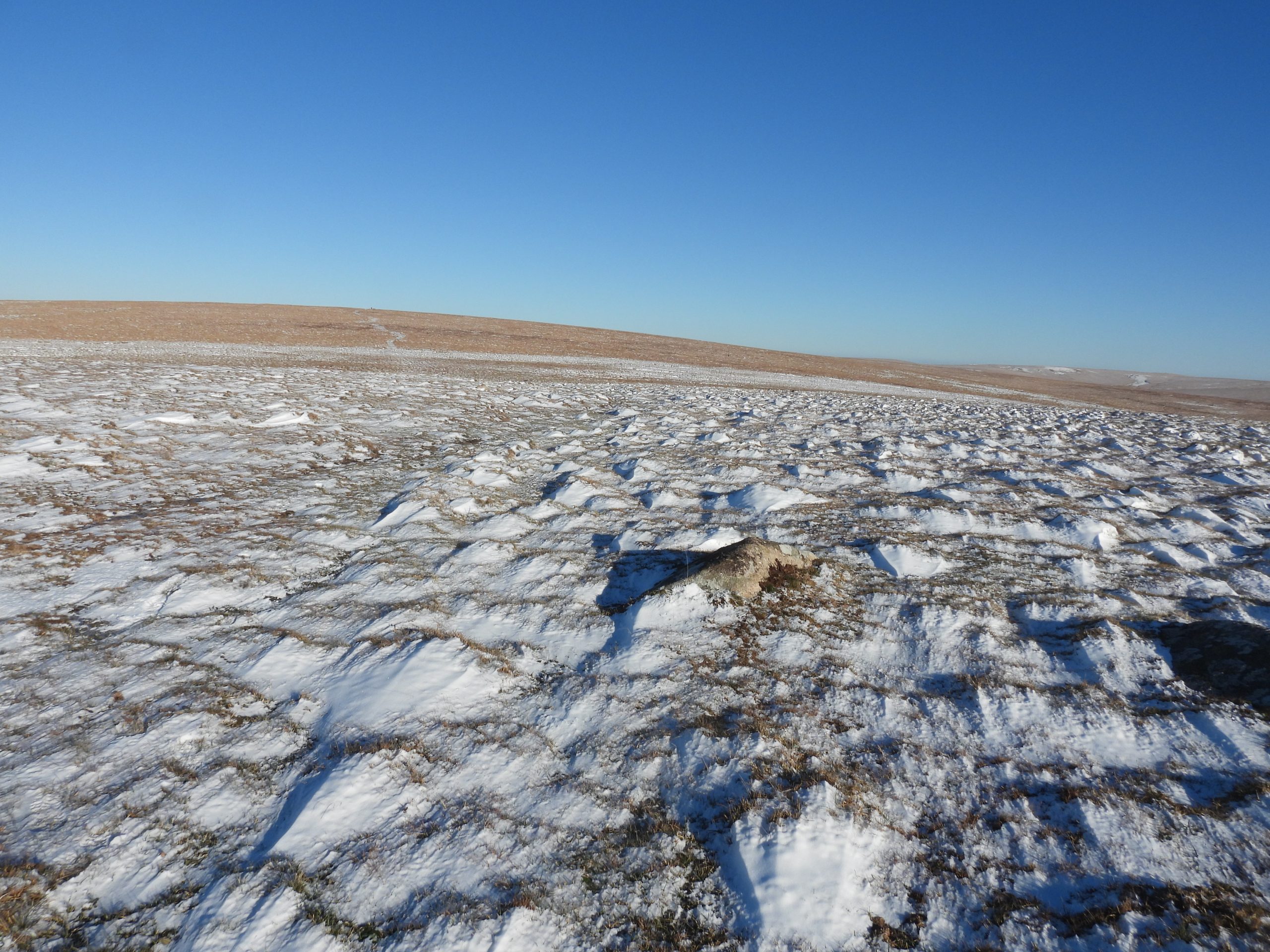
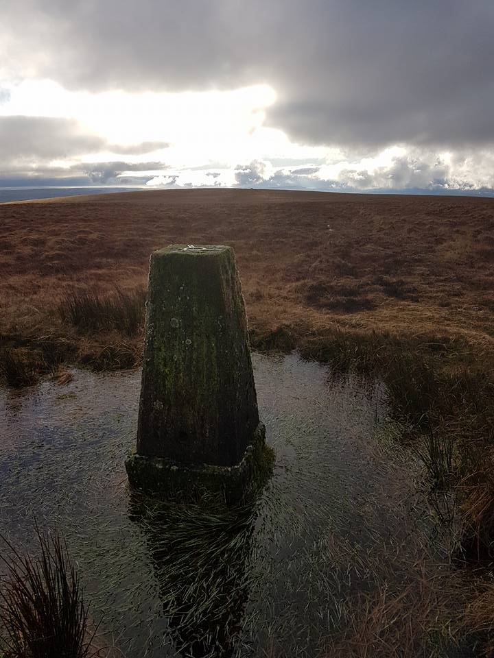
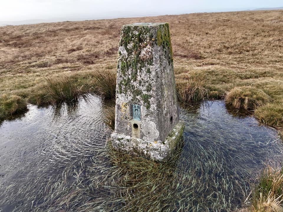
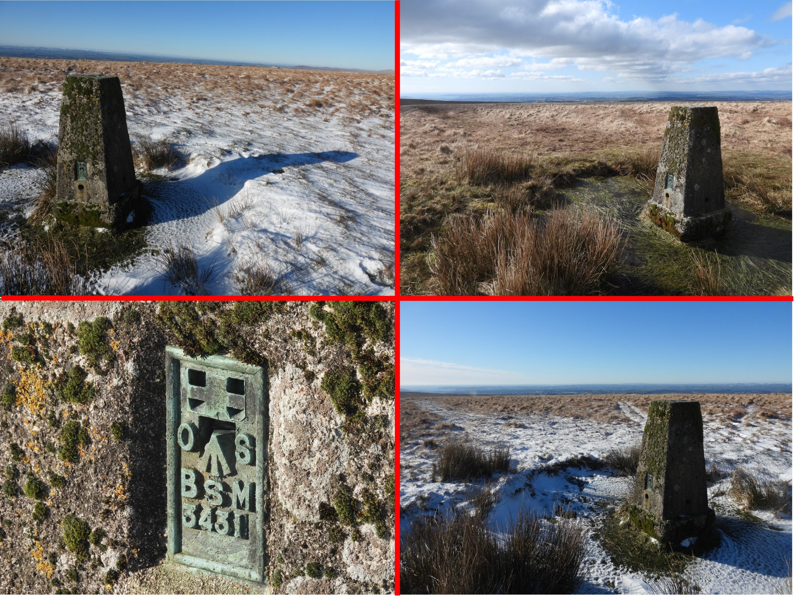
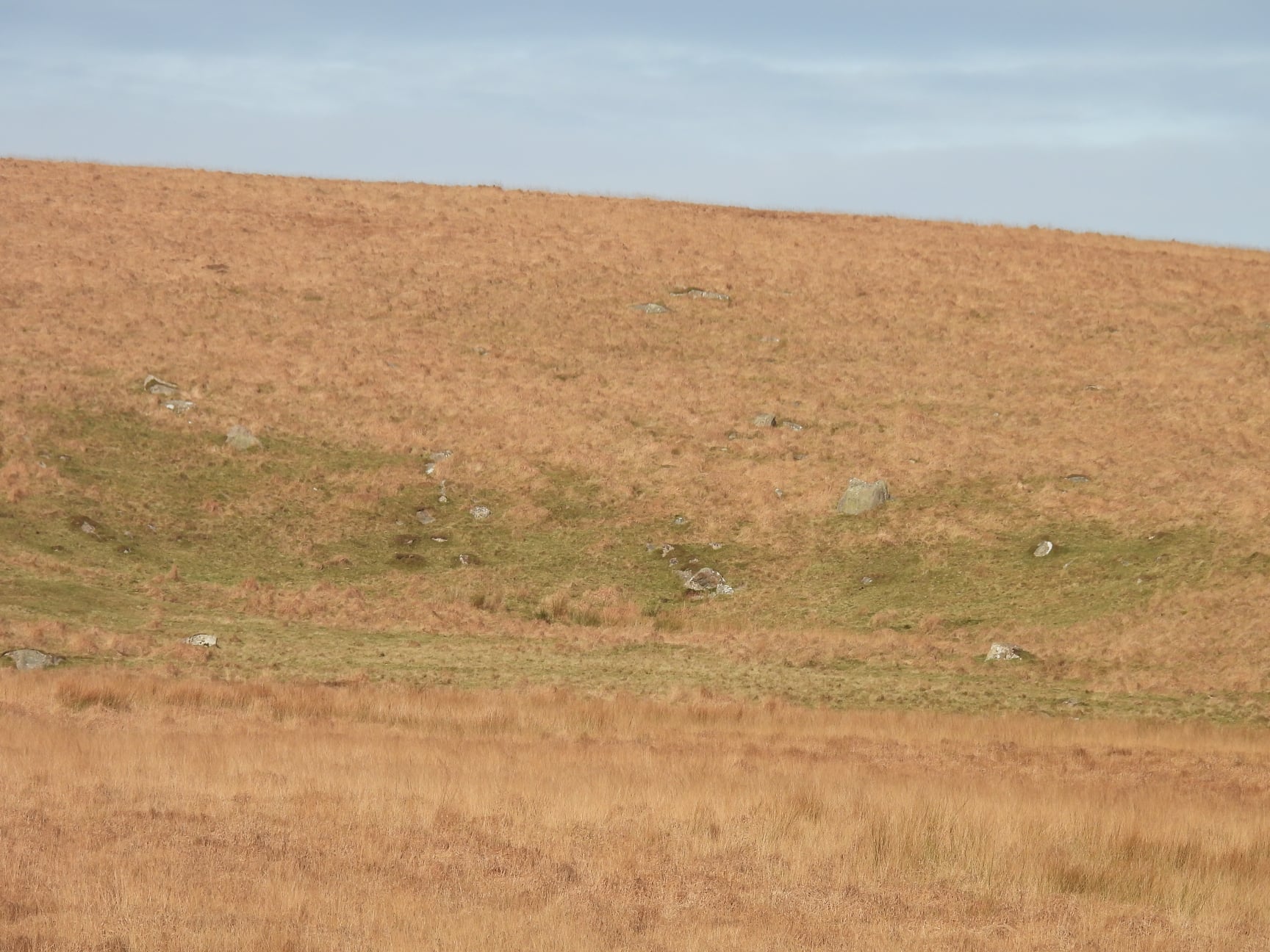
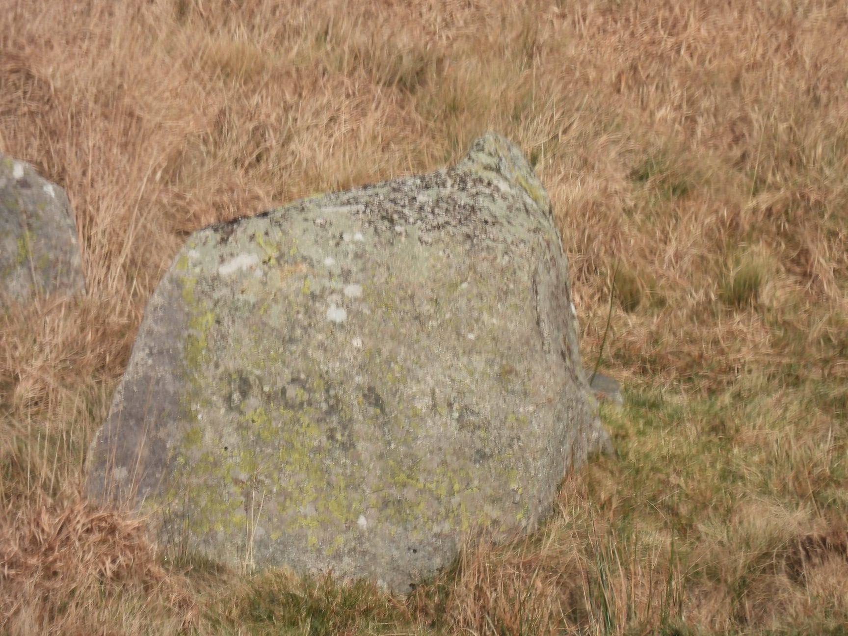
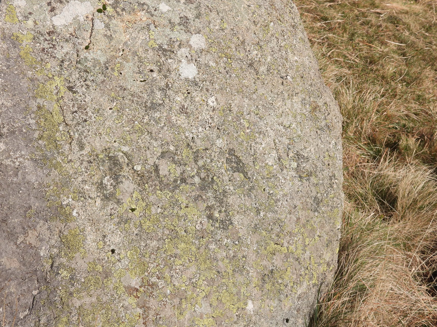
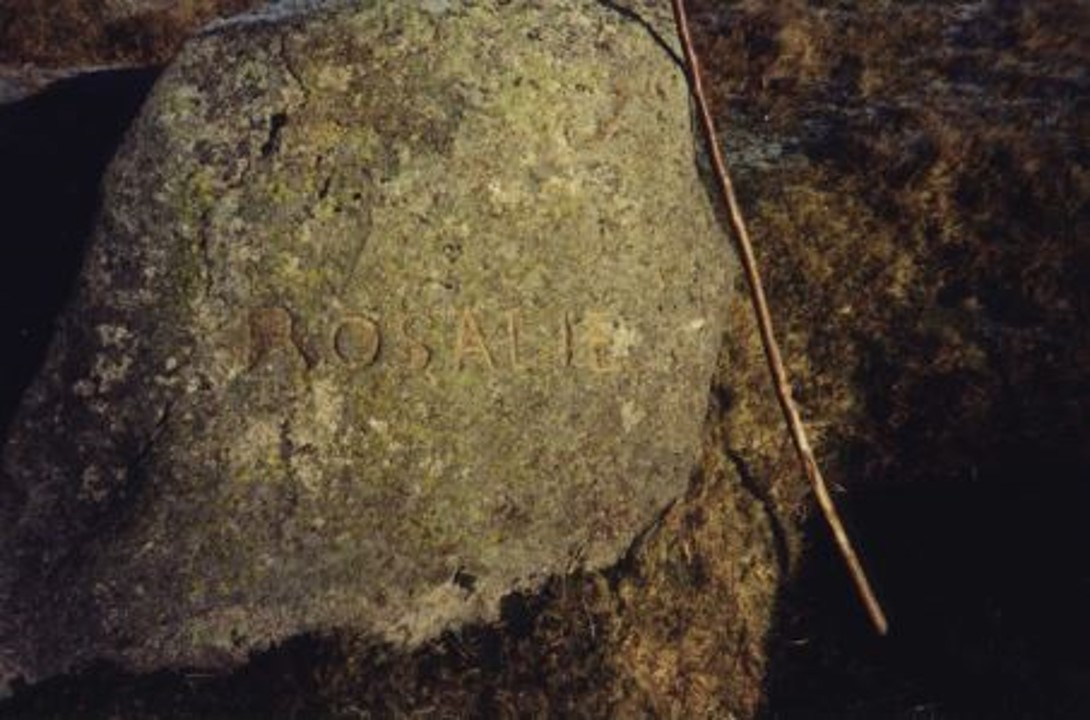
This sketch map indicates the locations of the 6 Blachford Manor Estate boundary stones / markers between the Erme and the Yealm plus the other inscribed stones (‘HWB4’ and ‘ROSALIE’) covered in this post.Erme Head would have been pronounced ‘Arme Head’ by the old moormen. This stone is inscribed ‘A Head’ for ‘Arme Head’ and is located in a marshy area to the north of where Erme Head is marked on modern OS maps. The stone lies on a small tributary (when there has been lots of rain) of the Erme which extends north westwards towards Great Gnats Head. The manor bounds here lie on the forest boundary and where the Abbot’s Way passes through.The ‘A Head’ stone is located at SX62057 67269. Arme Head was also known as Grimsgrove or Grymsgrove, a boundary point of the Forest of Dartmoor. Is this stone located at the true Erme Head or is the head where OS have marked it ?A short distance to the west of ‘A Head’ stone is a large rock which is inscribed ‘BB / Broad Rock’. The inscription on this rock can be difficult to discern in low light conditions. That said, the best time to visit for photographs is when the sun is low in the sky, so shadows across the inscription emphasises the inscription.‘BB’ in the inscription refers to ‘Blachford Bounds’.‘BB Broad Rock’ would once have had a pole marking its position. The author can recall his first visit here in the 1980s, believing the rock was going to be an upright and so walked passed it several times as the inscription wasn’t that obvious.‘BB / Broad Rock’ is located at SX61844 67254. The rock is just under 1m tall.This picture of the inscription was taken in the winter and from the north side of the rock (to avoid photographer shadow across inscription).Moving in a southerly direction from ‘BB /Broad Rock’ along the Shaugh Prior-Cornwood parish boundary, close to Langcombe Head is an upright inscribed ‘BB’ (for Blachford Bounds). It lies next to two clusters of peat charcoal hearths or meilers on the high ground of Langcombe Hill and near a feature (Bronze Age barrow) marked as ‘Mound’ on OS maps.This group of 4 pictures of the boundary marker were taken on a wet winters day and epitomises the featureless nature of Langcombe Hill. Dave Brewer records this ‘BB’ boundary stone has been repaired with cement. This boundary stone is located at SX62032 66280The tracks leading to and from the ‘BB’ boundary stone do not exactly follow the Shaugh Prior-Cornwood parish boundary. That said, it is advisable to follow them to avoid the worse of the tussocky grass in the area.To the south of the first ‘BB’ boundary stone (near the mound) is a second ‘BB’ boundary stone with a distinct pointThis ‘BB’ boundary stone is very well inscribed. Unusually, this stone is not recorded by Dave Brewer but is marked on OS mapsThis boundary stone is located at SX61760 65772This boundary stone is marked on OS Maps and on the sketch map on this post as ‘BB/L/P’The boundary stone is a triangular shape and has an inscription on each of its three sides. ‘BB/L/P’ is located at SX61492 65473The side of the boundary stone shown in the picture shows an inscribed ‘B’ (for Blachford). According to Dave Brewer (page 146, Dartmoor Boundary Markers), the inscription is ‘BB’ (for Blachford Bounds). If there is a second ‘B’ then it is be below ground level and the boundary stone would need to the dug around to reveal it.On another side is an inscribed ‘L’. Dave Brewer states this stands for Lee Moor as the boundary stone lies on the junction of Lee Moor, Penn Moor and Blachford Bounds. Eric Hemery surmises that the ‘L’ stands for Lydford, albeit this boundary stone does not lie on the Forest of Dartmoor boundary.On the third side is an inscribed ‘P’. Dave Brewer states this stands for Penn Moor as the boundary stone lies on the junction of Lee Moor, Penn Moor and Blachford Bounds. Eric Hemery surmises that the ‘P’ stands for Plympton.General views of the ‘BB/L/P’ boundary stoneMore views of the ‘BB/L/P’ boundary stoneTracks across Langcombe HillYealm Head.The sixth and final Blachford Bounds marker stone is located below Yealm Head.As with other markers in this series this stone is inscribed ‘BB’, once again for Blachford Bounds.This stone is very well inscribed. It is located at SX61320 64980Contextual view of the Yealm Head ‘BB’ boundary stone. This stone is not marked on OS maps as B.S. as other are across Langcombe Hill.Leaving Langcombe Hill and the Blachford Bounds, to the west is Shavercombe Head.Near Shavercombe Head is a Hentor Warren Boundstone. It is inscribed ‘H/W/B4’. R.G. Haynes, in his paper ‘Vermin Traps and Rabbit Warrens on Dartmoor’, refers to a 1807 lease granted to a Peter Nicholls for Hentor Warren. The warren extended from Spanish Lake in the west through Hen Tor to Shavercombe Head in the east. There are 4 extant boundary stones / markers (HWB1 through HWB4). There was a fifth marker near Shavercombe Foot (HWB5) but this has never been located in modern times. The author (amongst many others) has searched for the fifth stone without success.The stone was recumbent in 1987, was re-erected in 1989 but fell again. Since a second re-erection the stone has remained upright. The route onto Langcombe Hill (via Shavercombe Head) is one of the authors favourites. Langcombe Hill in the snow. Winter 2022.Another item in an otherwise featureless ridgeline is Penn Moor triangulation pillar. It is easy to find at SX60262 64497It is not uncommon to find the Penn Moor triangulation pillar surrounded by water. Between 1935 – 1962, Triangulation pillars were established which not only assisted with surveying heights but also assisted with improved accuracy of locations. Many of these pillars, of course use flush brackets which had been used since 1912. The OS flush bracket on this triangulation pillar is numbered ‘OS BSM 3431’. Flush Brackets were used by surveyors, who would have used a detachable bracket attached to it, to enable the levelling of their surveying polesLeaving the ridge line and heading to Broadhall Head, the location of the ‘ROSALIE’ inscribed rock can be found. It is the largest rock in the picture (mid-right).The inscription ‘ROSALIE’ has been a mystery to Dartmoor enthusiasts for a long time. To the authors knowledge, no one seems to know why it was inscribed or for whom it is dedicated to.The ‘ROSALIE’ rock can be found at SX60508 64034This picture of the ‘ROSALIE’ stone was taken by the author in the late 1980’s, when his walking pole was a wooden one.