A collection of walks, discoveries, insights and pictures of exploring Dartmoor National Park
March 22, 2023
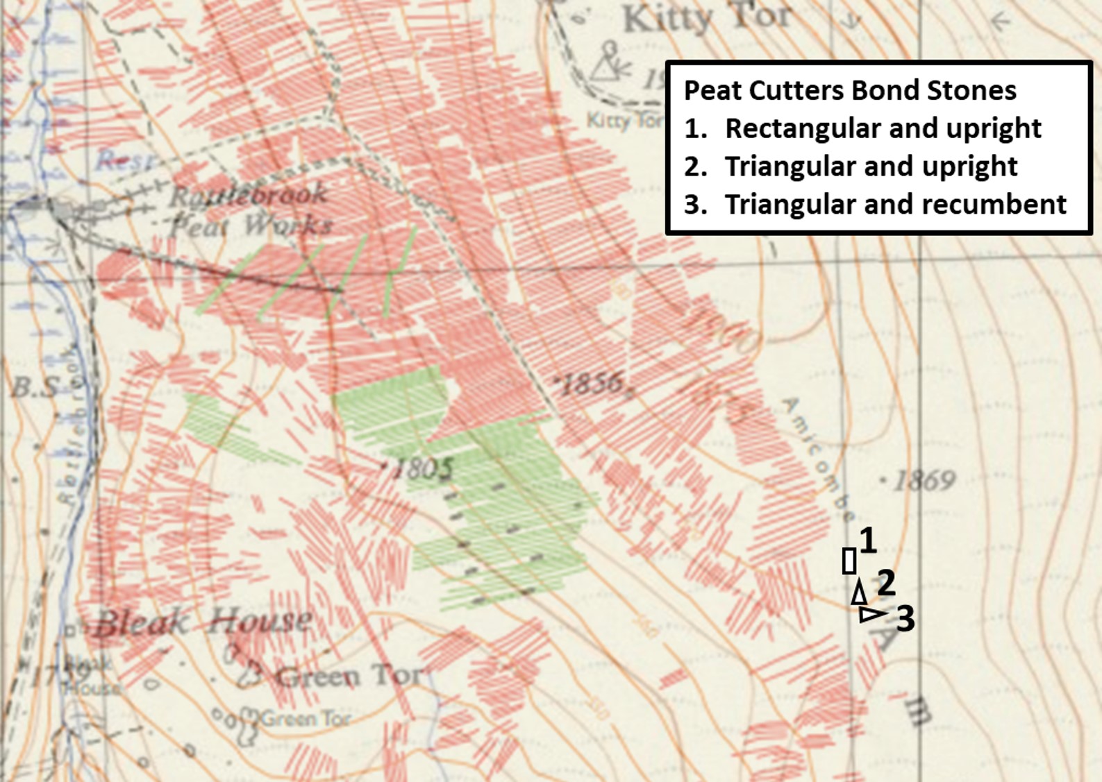
Amicombe Hill Peat Cutters’ Bond Stones
Historical records suggest the lifespan of the Rattlebrook Head Peat Works ran from around 1867 through to 1931 following the first sett licence being granted in January 1867. At that time a Doe Tor sett licence was also granted and the two setts combined. The main peat extraction (but not all) was undertaken to the east of the Rattlebrook and the peat / turf ties from the works can be easily discerned from most vantage points from near Dunna Goat Tors to the tramway embankment. The Rattlebrook was (more or less) the western boundary of the extraction with the eastern boundary being (more or less) from a point 500m north east of Rattlebrook Head following a line, past Kitty Tor to a point around 1km south east of Bleak House.
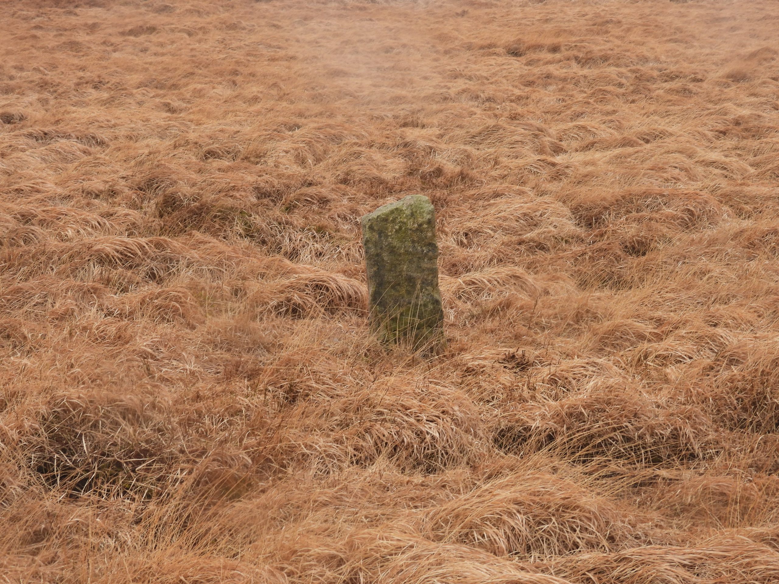
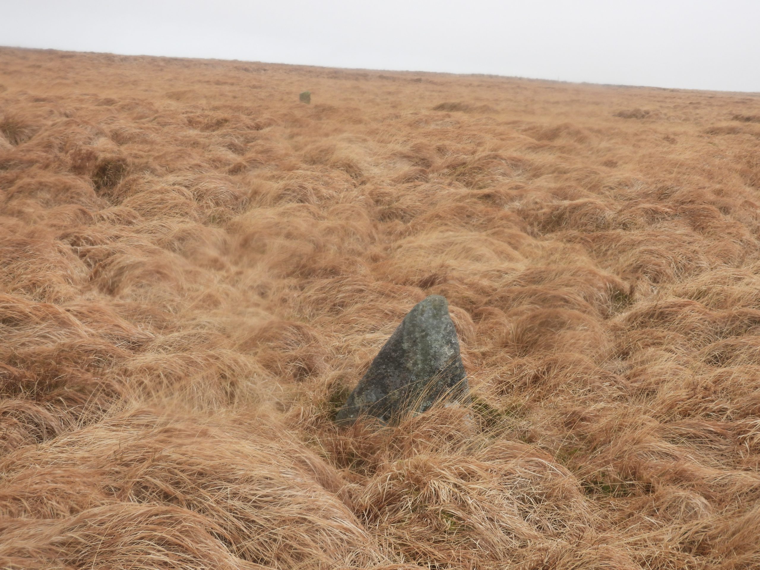
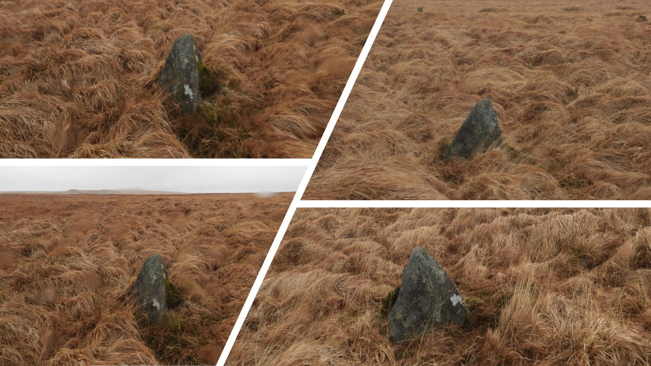
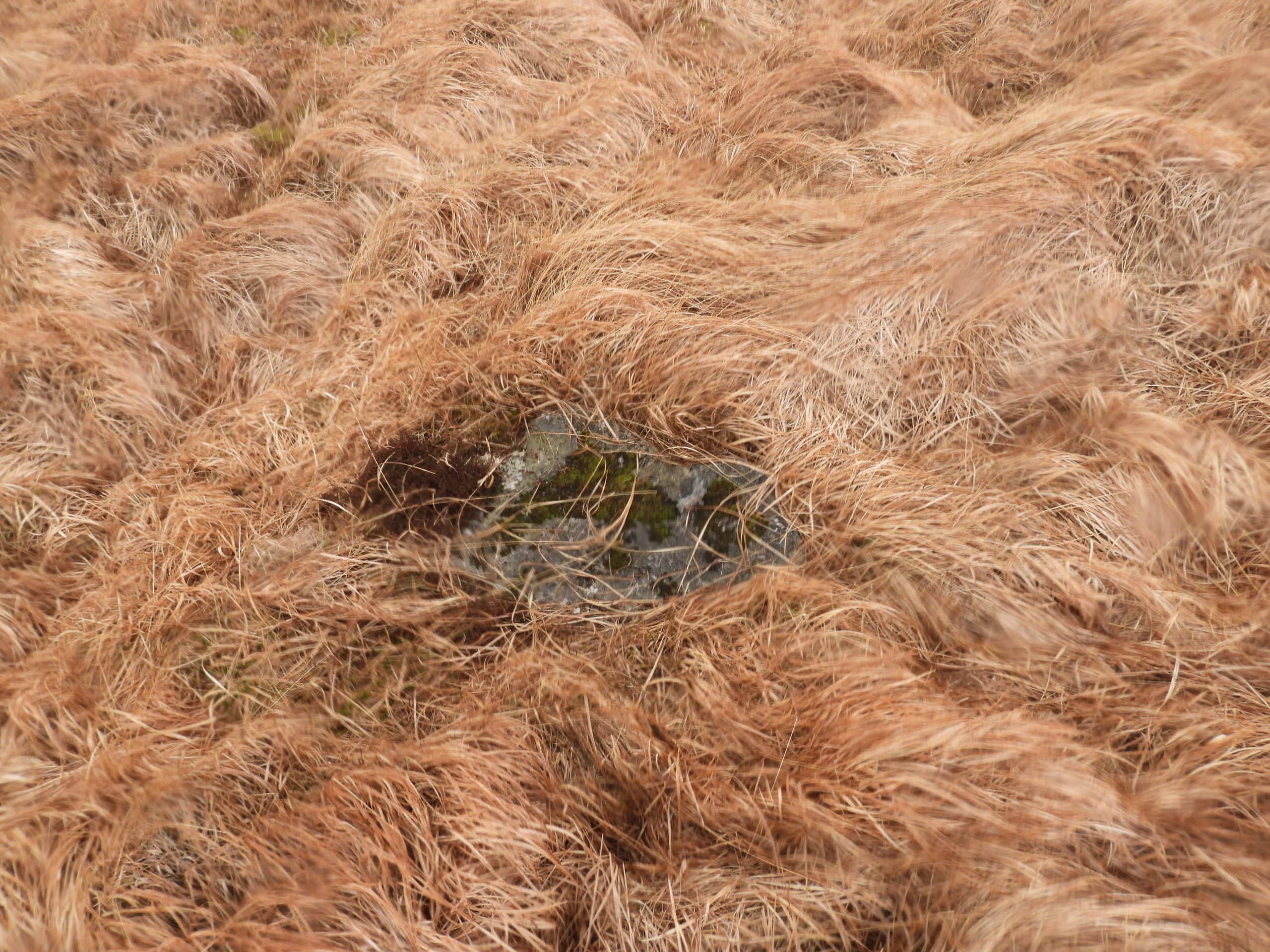
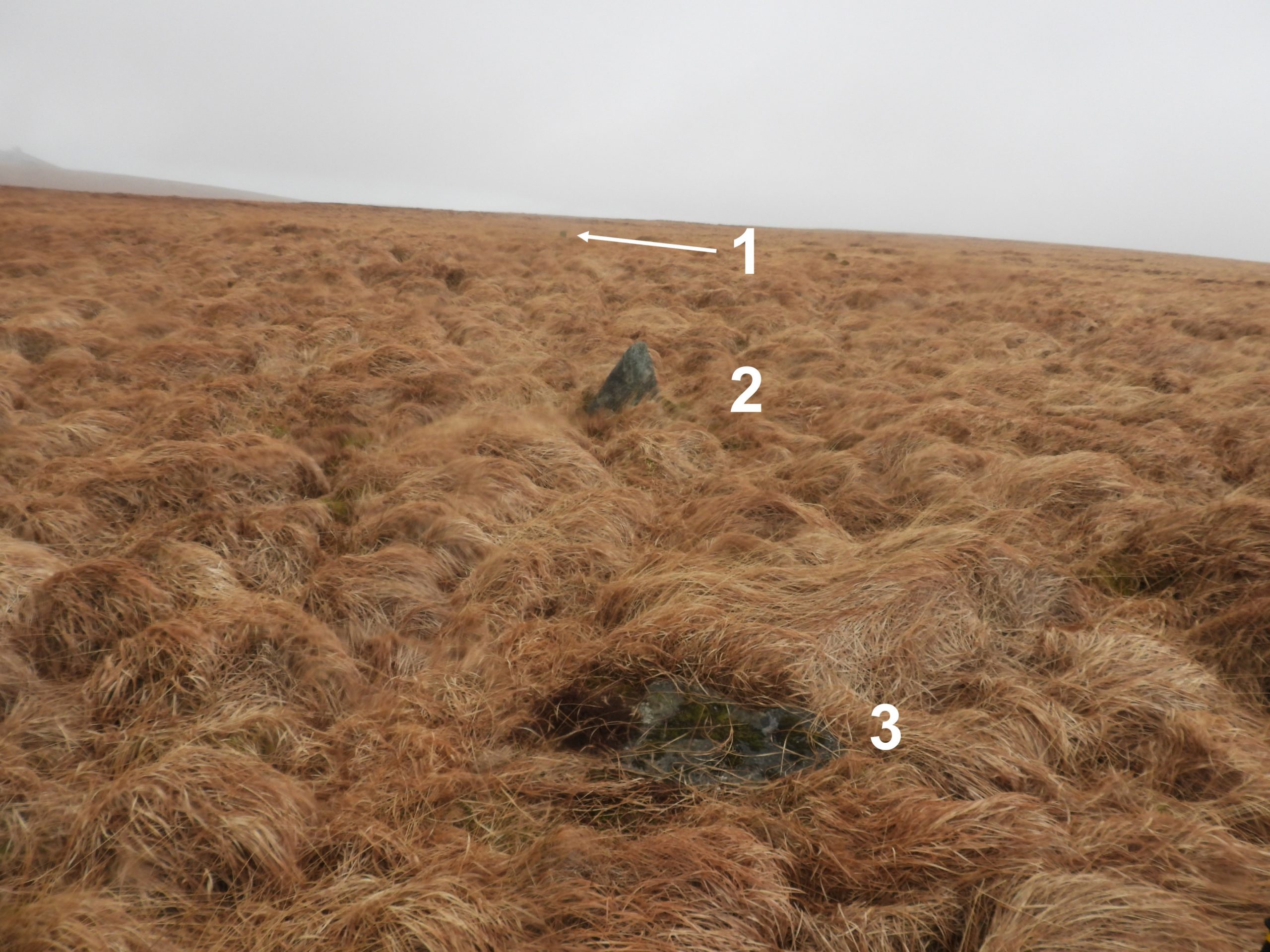
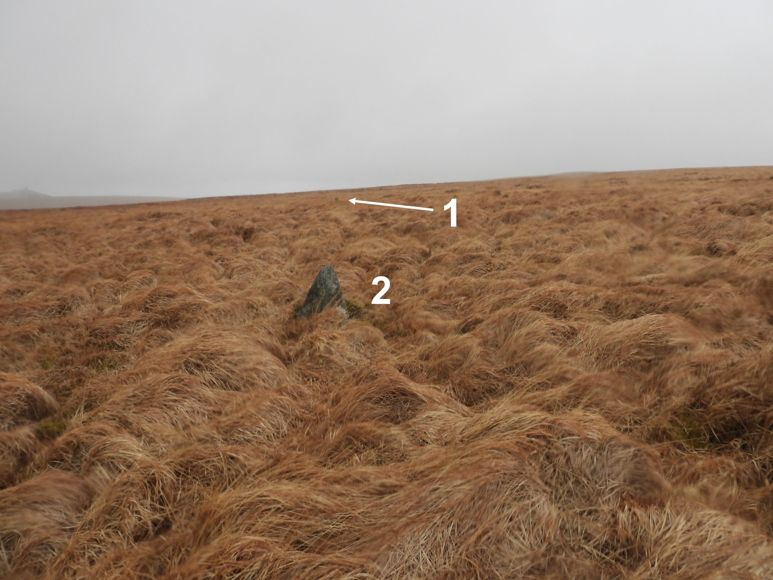
An entry in the Dartmoor Historic Environment Record records that there is a standing stone on Amicombe Hill at the south east corner of the aforementioned peat extraction area. The record further states that there was a further recumbent stone 5m away and that these were most likely erected by Peat Cutters. With this information, the author’s visit to the area not only discovered the aforementioned stones but also a third upright stone approx 40-50m away, which hadn’t been previously recorded. With further research, the author has established that these three stones lie on the eastern boundary of the main peat extraction area thus suggesting they may well represent the boundary and all three stones are Peat Cutters Bond Stones.
Bibliography:
Domestic and Industrial Peat Cutting on North-Western Dartmoor, Devonshire: An archaeological and historical investigation – Dr Phil Newman
M.Gillard, 2018, Standing stone at Amicombe (Correspondence). HER Reference SDV363717
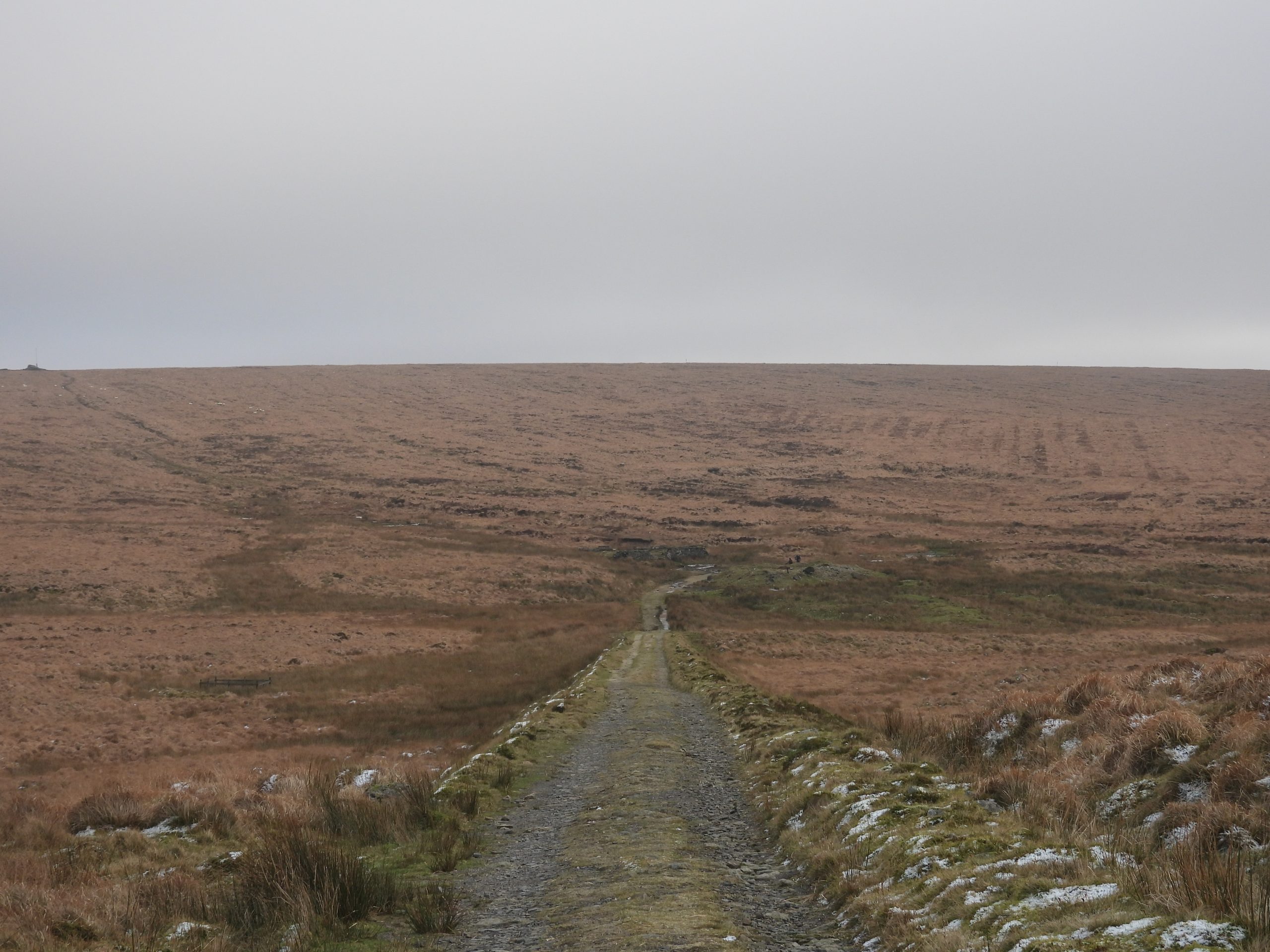
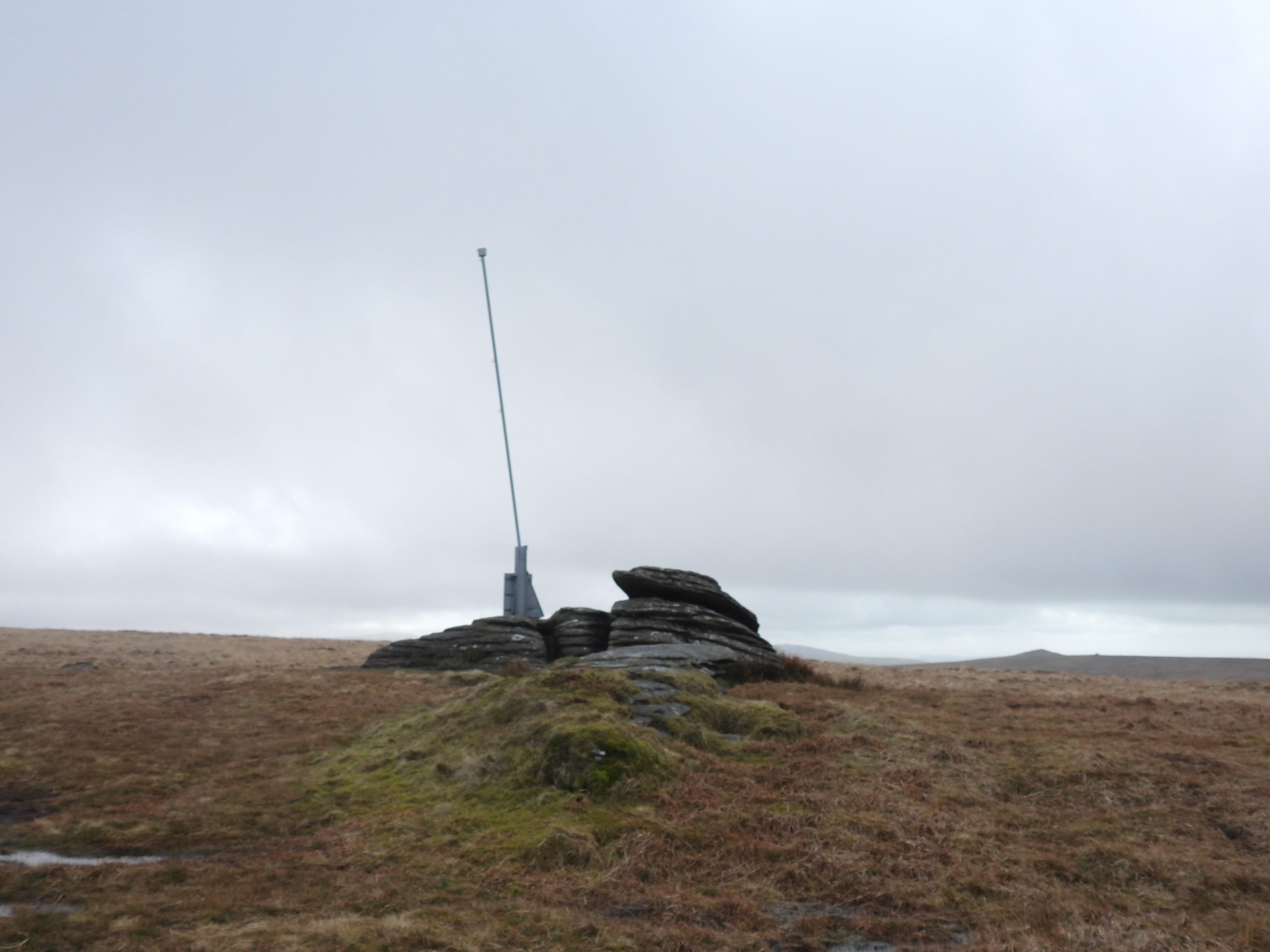
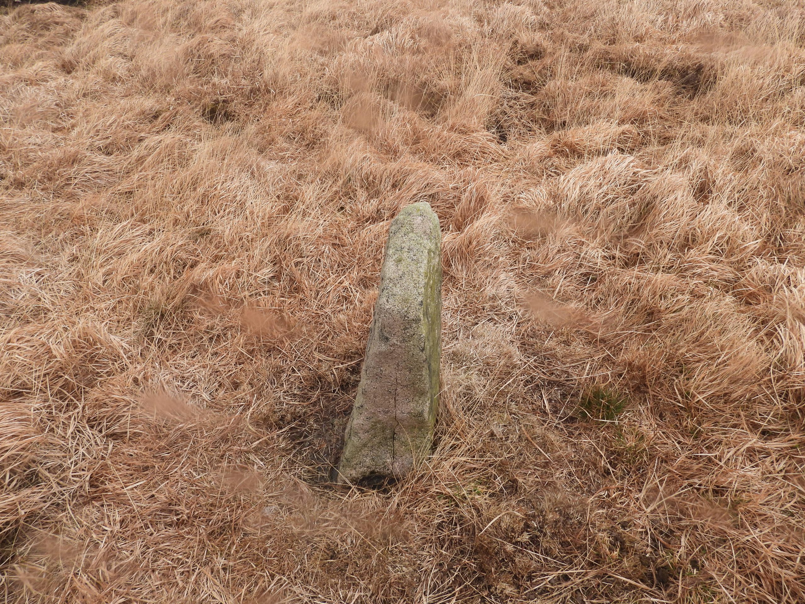
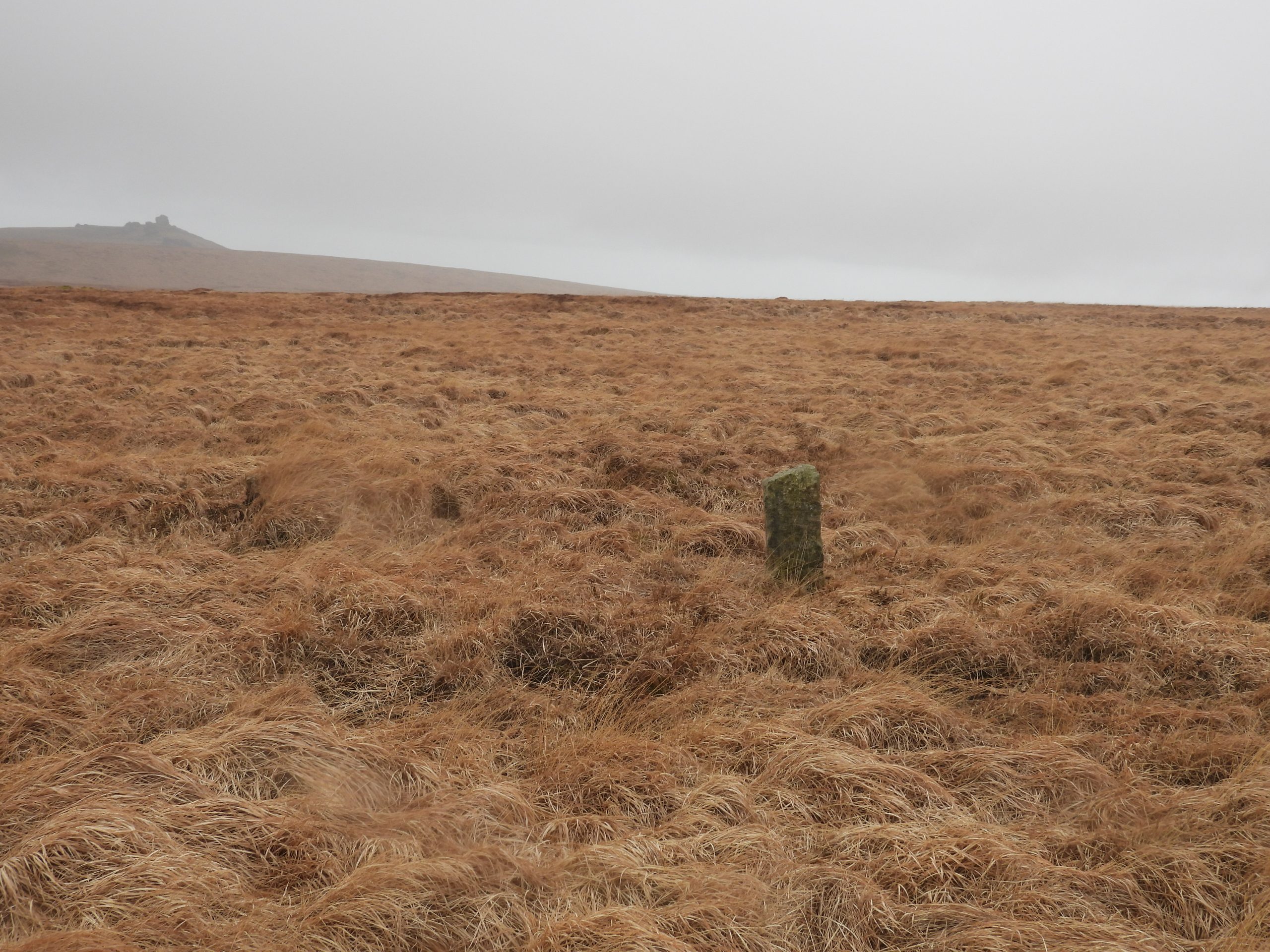
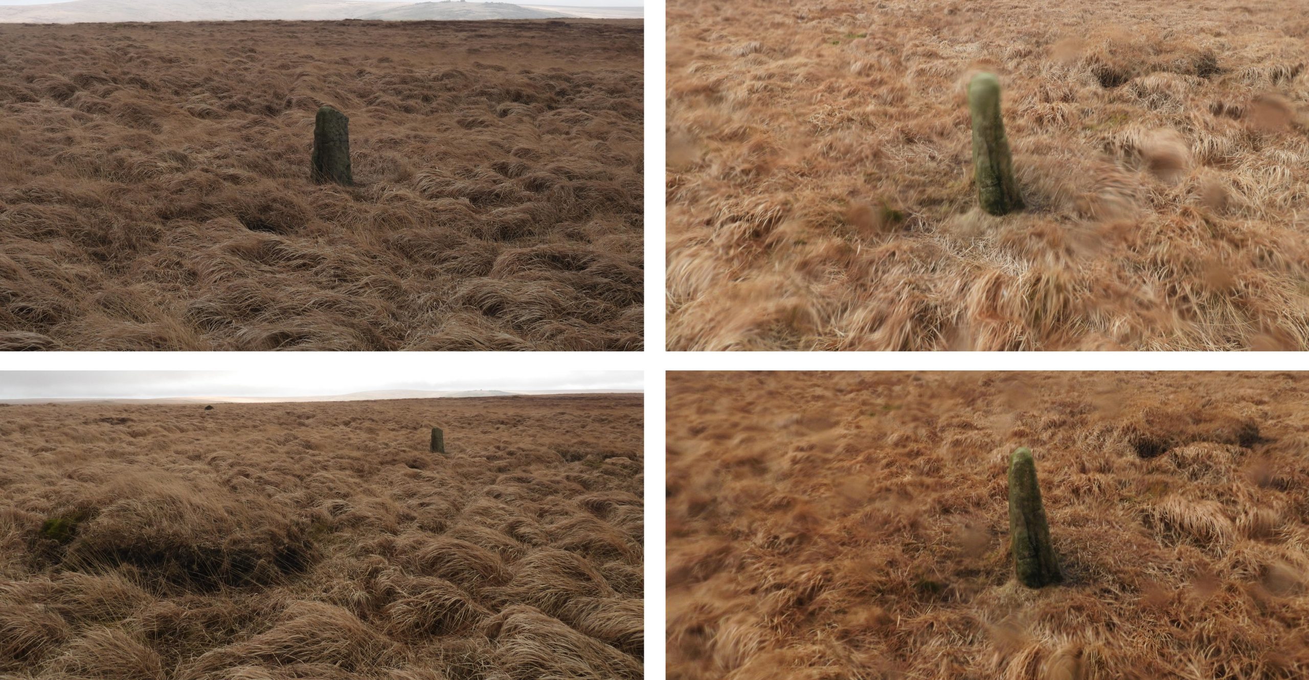
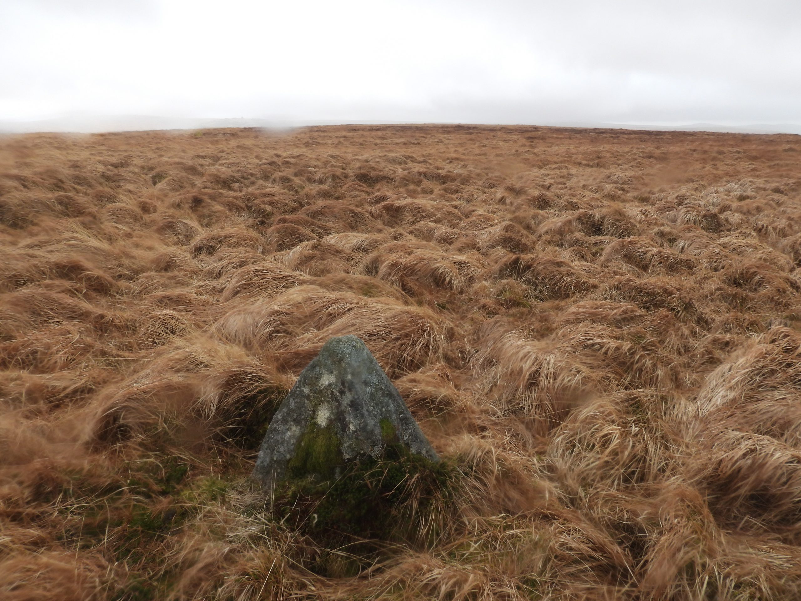
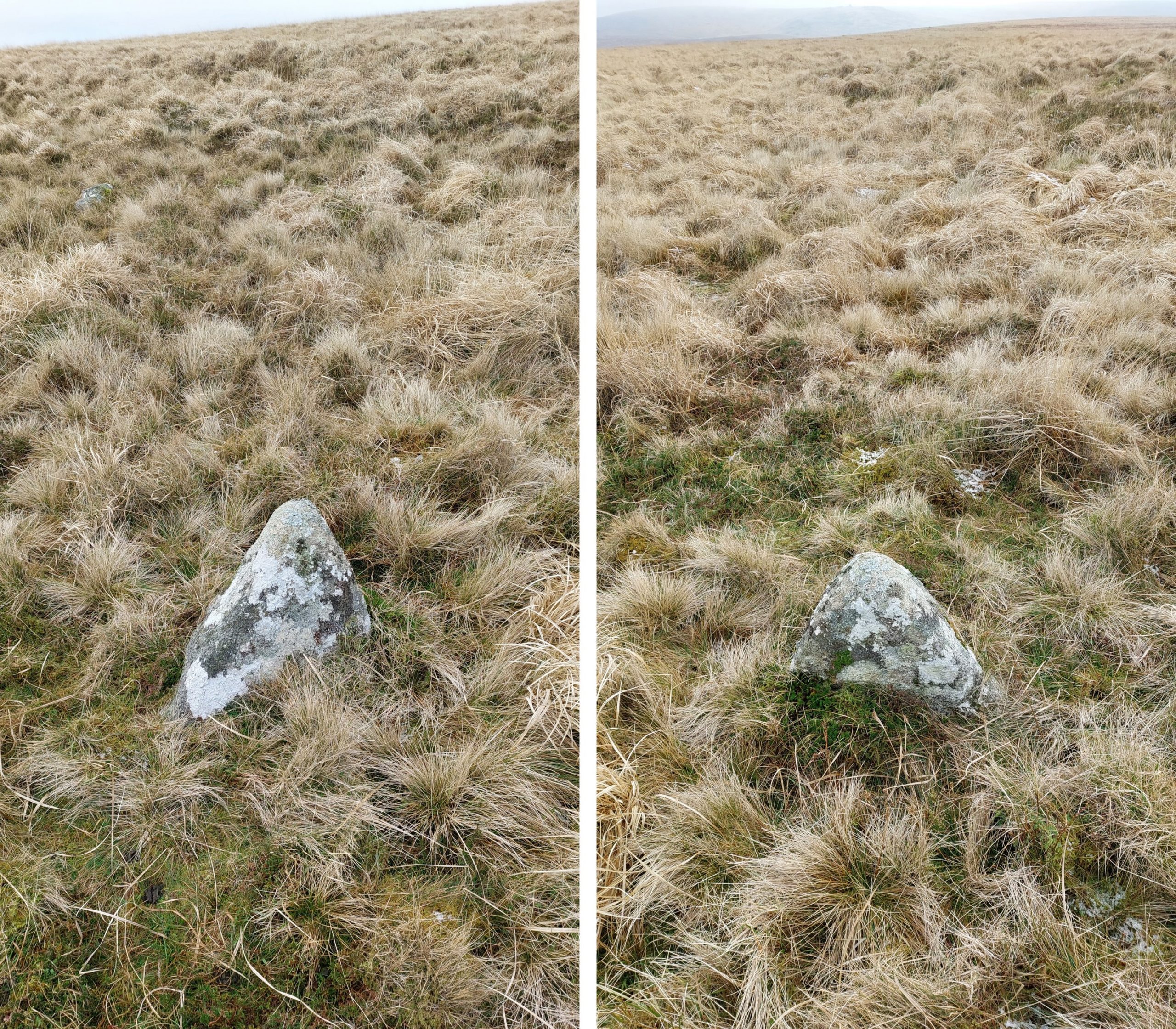
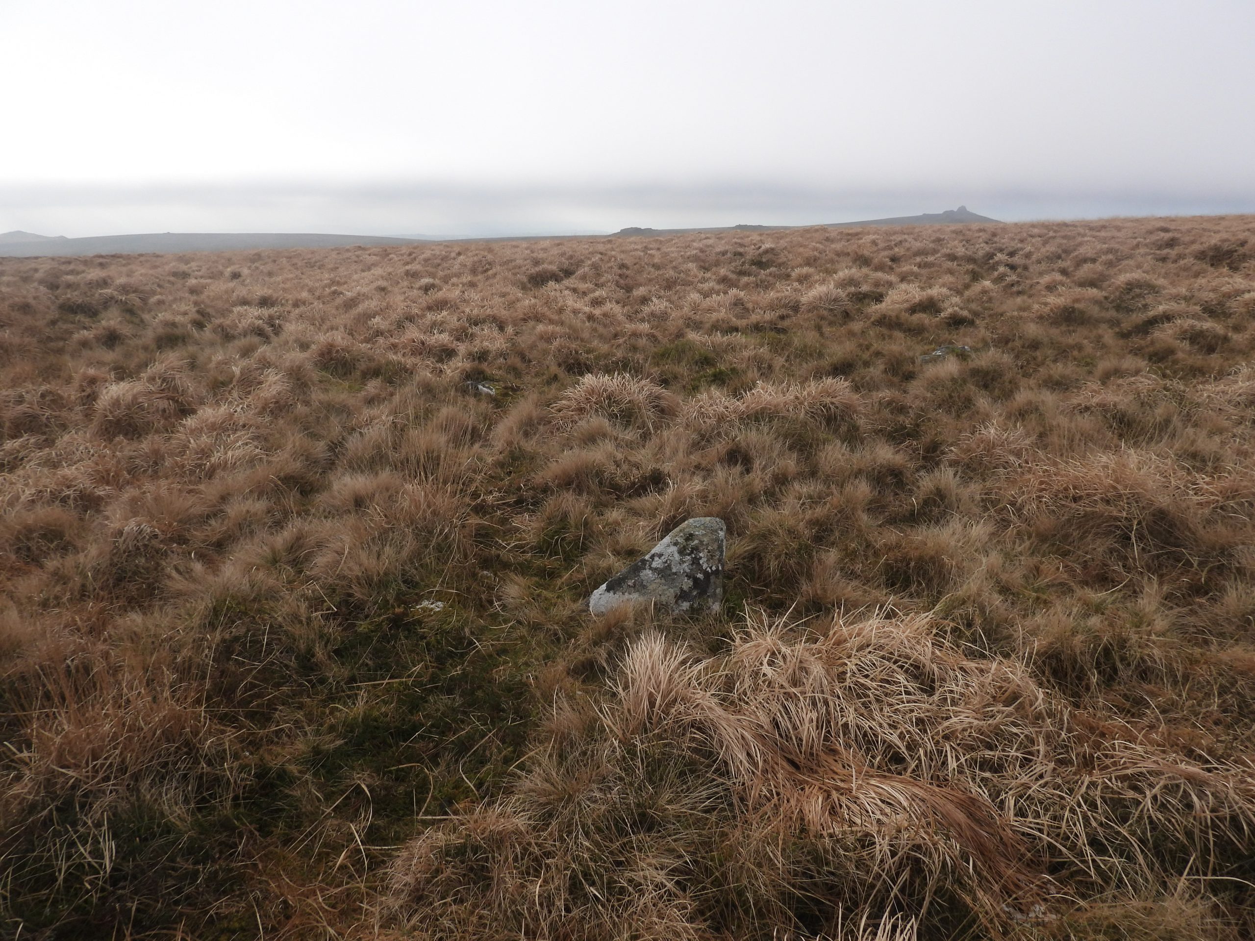
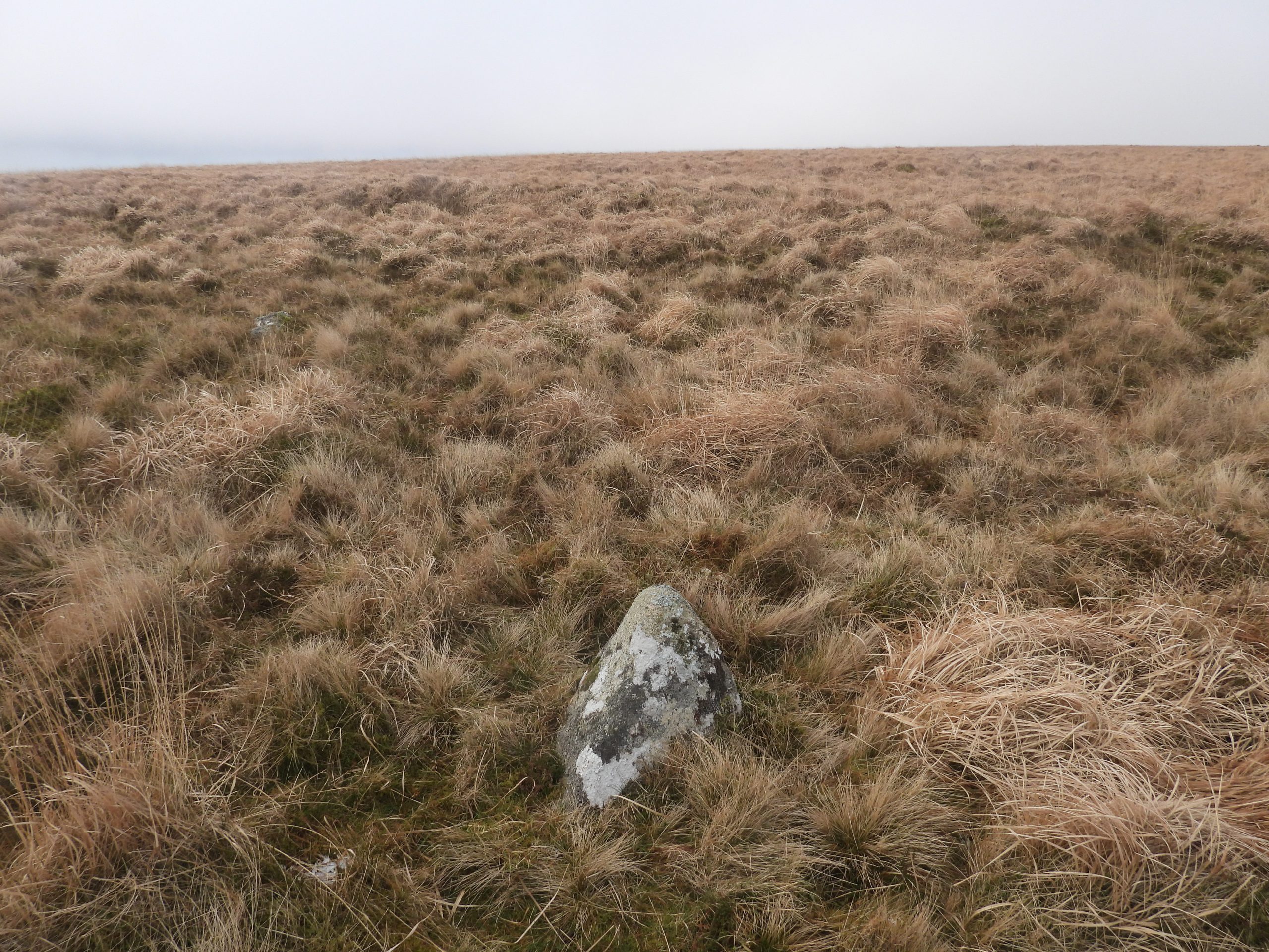
This picture is made up of three ‘layers’. The first layer is a ‘snip’ of the area from an OS map dated 1937-1961 (1: 25000). The second layer is overlaid shapes showing the locations (using 10 digit grid references) of the three stones discovered. The third layer is a ‘snip’ of a plan showing turf ties and drains and is based on a transcription 2009 LIDAR coverage in Dr Phil Newman’s report (Page 53). The overall picture gives a rather stark result showing the three Peat Cutters Bond Stones lie on the eastern boundary of the peat extraction area.Approaching the Rattlebrook Peat Works along the old tramway embankment with the turf ties clearly evident on the hillside leading to Amicombe HillIf making a visit to the area, a good starting point to avoid the poor ground across the peat / turf ties is Kitty Tor. From here a good path can be followed south across the northern flanks of Amicombe Hill. The final 100m or so will have to be made across tussocky terrainThis rectangular shaped upright stone has not been previously recorded (to the knowledge of the author). It is not the stone recorded in the Dartmoor HER. The stone appears to have been ‘worked’. It is a very conspicuous stone, which clearly isn’t natural and looks like other boundstones seen across the moor.Side on view of the rectangular upright Peat Cutters Bond Stone. It is approx 1m tall.The rectangular upright lies in a rather tussocky area on the rather featureless northern flanks of Amicombe Hill. The view of Great Links Tor (where another Peat Cutters Bond Stone can be found) contextualises the location.More views of the rectangular Peat Cutters Bond Stone. Fur Tor can be seen in the background on the top left picture. The stone is located at SX56989 86516This upright triangular stone is the one recorded in the Dartmoor HER. It is also approx 1m tall. The stone is more ‘natural’ stone that the rectangular one and doesn’t look like it has been worked.The Dartmoor HER entry states: “Visible on the Google Satellite aerial photographs. Photographs taken. Dating uncertain – it may have been erected by peat cutters after being uncovered”. What has intrigued the author is that the rectangular upright is only 40-50m away as can be seen in the photograph. Therefore, if a site visit was made why was the rectangular upright missed ?The triagular upright can be found (as suggested by the Dartmoor HER) at SX57025 86491The Dartmoor HER entry further states that the upright triangular stone is: “Located in a peat cutting with a recumbent stone about 5m to the south-east”. This picture shows the aforementioned stone. It too, is triangular. It is located at SX57029 86489This annotated picture (labelled as per the sketch map in this post) shows that the three stones are more or less in a line.The two upright stones. Although different (rectangular vs. triangular) the evidence does suggest these are likely to be Peat Cutters Bond Stones. They may well have been erected after 1867 (when the setts were established).
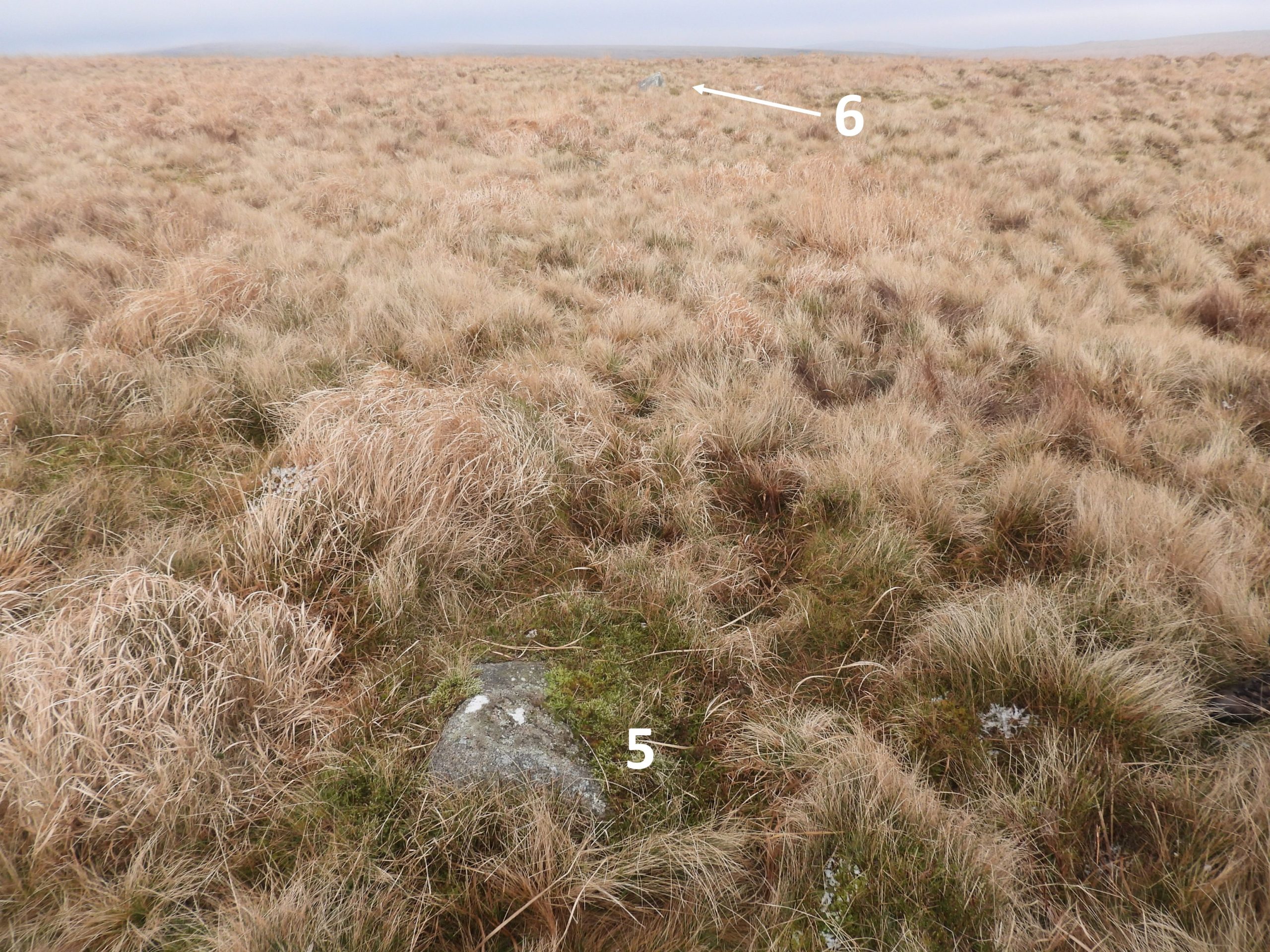
ADDENDUM: Approx 9 months after this post was originally published the author read and article in the Dartmoor News, Issue 192, Dec 2023 / Jan 2024 (pages 20-22), which was titled “Amicombe Hill Peat Cutters’ Boundstones”. The article referenced this post but intriguingly suggested that there were six boundstones (or bondstones) on Amicombe Hill not just the three covered in the original post. The article stated : “Returning to Kitty Tor, you will pass markers 4-6, which can be found at SX56946 86773, SX56951 86782 and SX56965 86797. Running to the east away from the turf ties, there may be more of these supposed markers as there appears to be a line of them here. None rise high above the ground”. With this information, the author decided to investigate and add to the original post.
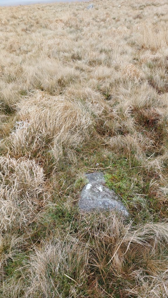
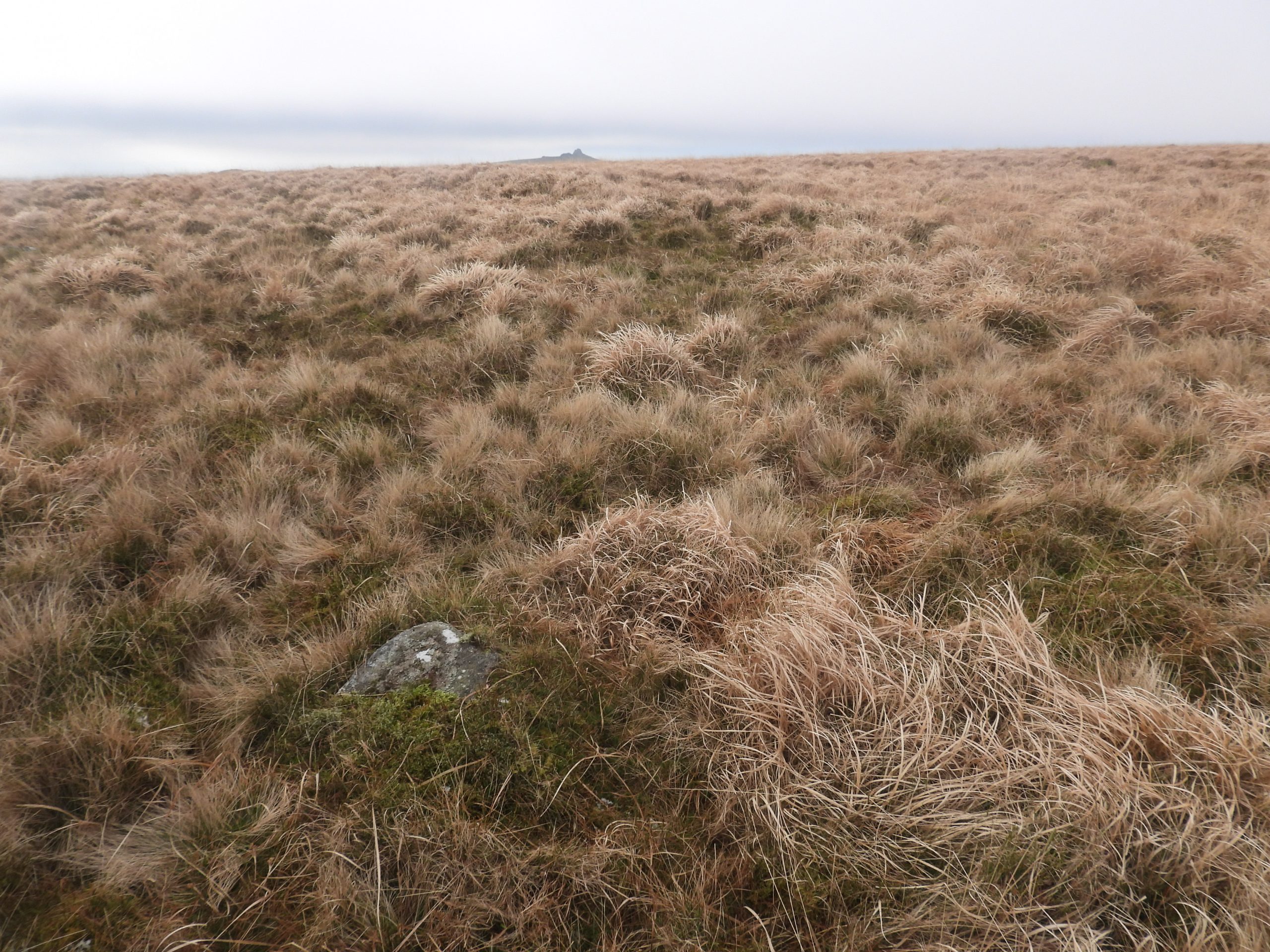
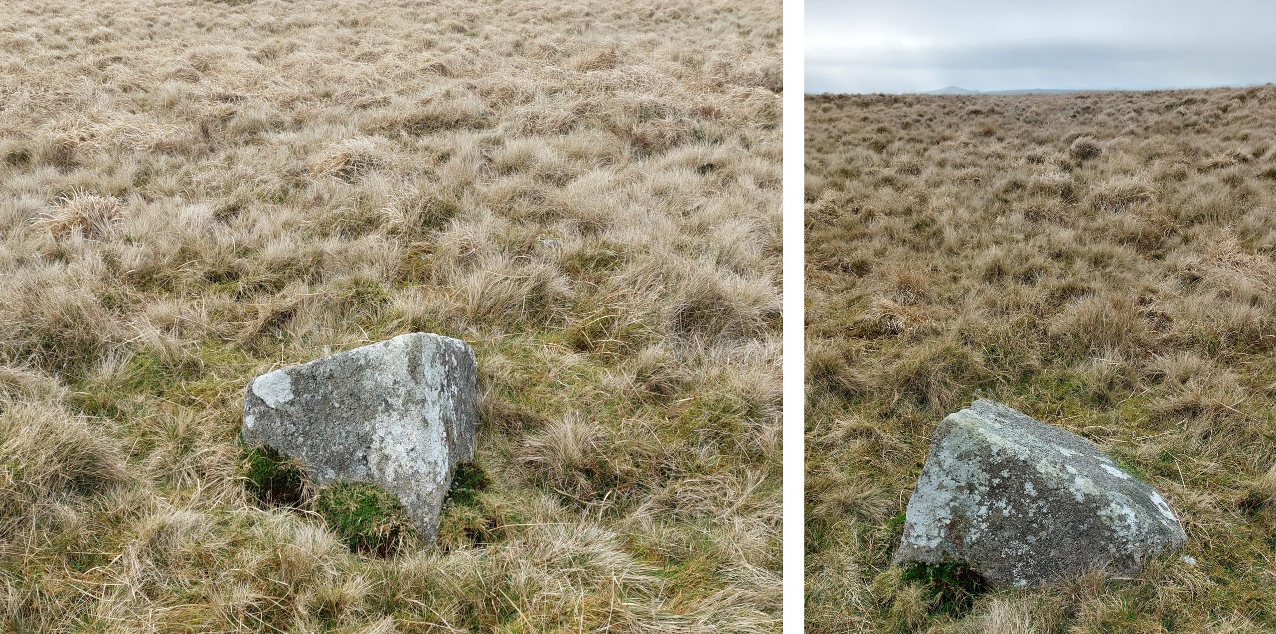
Boundstone / Bondstone 4 as mentioned in the Dartmoor News article was found at SX56946 86772. Contextual view of Boundstone / Bondstone 4 with views to Great Links, the Dunna Goat Tors, Chat Tor, Sharp Tor and Hare Tor.Boundstone / Bondstone 4 is an earthbound rock, which is similar to Boundstone / Bondstone 2 found and recorded by M. Gillard. The only difference is that it is located some distance from the turf ties (as per the lidar plots).Boundstone / Bondstone 5 as mentioned in the Dartmoor News article was found at SX56950 86778. It is a very low earthbound rock and very similar to dozens or similar rocks in the area. In the authors humble opinion, this does not look anything like a marker stoneContextual view of Boundstone / Bondstone 5 with Great Links in the distance. It is only a few metres away from marker stone 4 and is located some distance from the turf ties (as per the lidar turf tie plots).Boundstone / Bondstone 6 as mentioned in the Dartmoor News article was found at SX56966 86793. This rock is a large and earthbound and lies very close to the path running from Kitty Tor down the large whaleback of Amicombe Hill. Like markers 4 and 5 this lies outside the turf ties (as per the lidar turf tie plots).Contextual view of markers 5 and 6.
Having now visited the 6 possible peat cutter boundstones, in the authors humble opinion only numbers 1-3 would be strong contenders as marker stones by virtue of their ‘look’ and location on the boundary of the 2009 turf tie lidar plots. The author, on the balance of probability would discount markers 4-6 due to their ‘look’ (earthbound and very low to the ground) and their location (away from the turf ties). Of course, many artefacts on the moor are down to personal interpretation and opinion. The author would not wish to be disrespectful to others interpretations / opinions, especially the author of the Dartmoor News article and suggests if any readers of this post visit the area they draw their own conclusions.