A collection of walks, discoveries, insights and pictures of exploring Dartmoor National Park
May 18, 2022
Lakehead Hill Antiquities
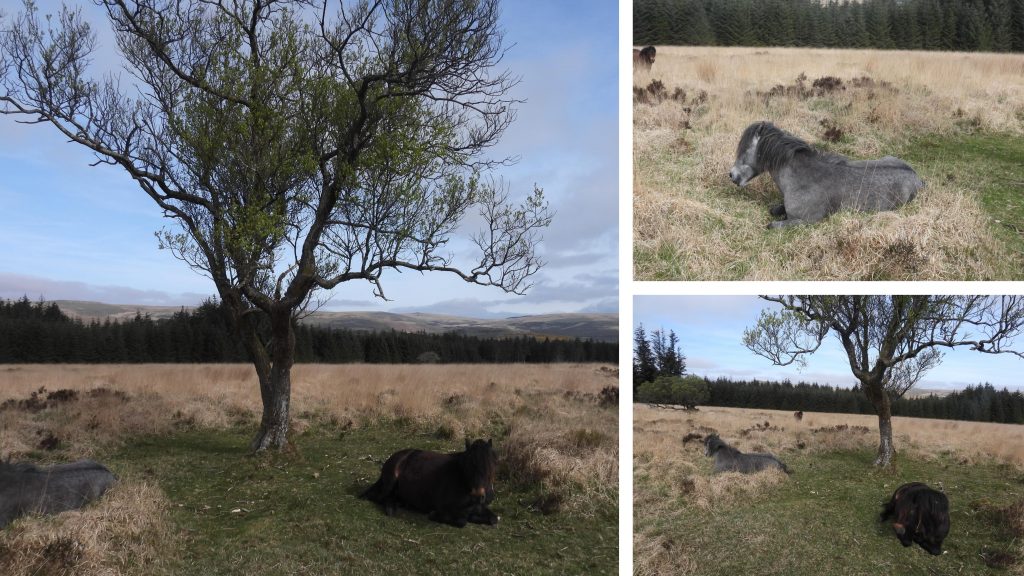
Volume two (the north) of the pentalogy of Jeremy Butler books titled Dartmoor Atlas of Antiquities, covers the commons of South Tawton, Belstone and Okehampton southwards to the Tavistock – Moretonhampstead road and Dartmeet. This post was inspired by map 27 (figure 27.12 on page 49) and the associated commentary within the aforementioned volume which describes the distribution of cists, cairns (with cists), stone rows (and alignments), hut circles and a bronze age enclosure to the north of Bellever Tor around Lakehead Hill. The author was fortunate enough to see Ten Tors helicopter manoeuvres around Longaford and Littaford Tors in the distance and seeing part of the Dartmoor Pony Heritage Trust (DPHT) herd whilst taking photographs for this post. The use of information from the Butler publication and the Dartmoor Historic Environment Record (HER) has been used in this post and is duly acknowledged.
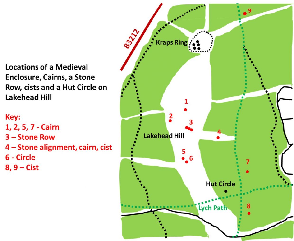
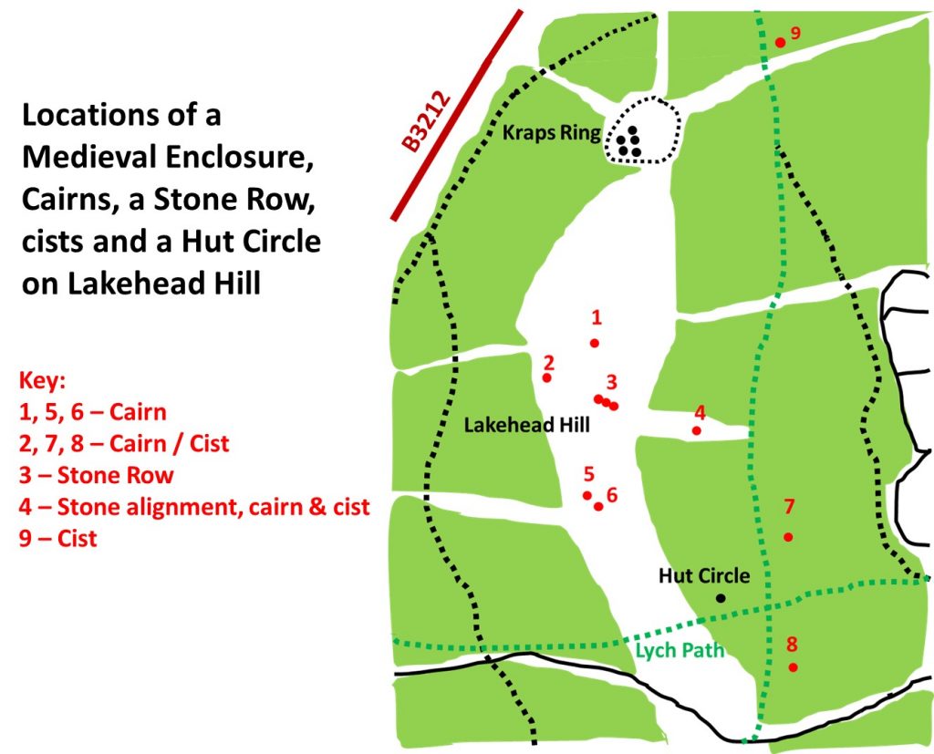
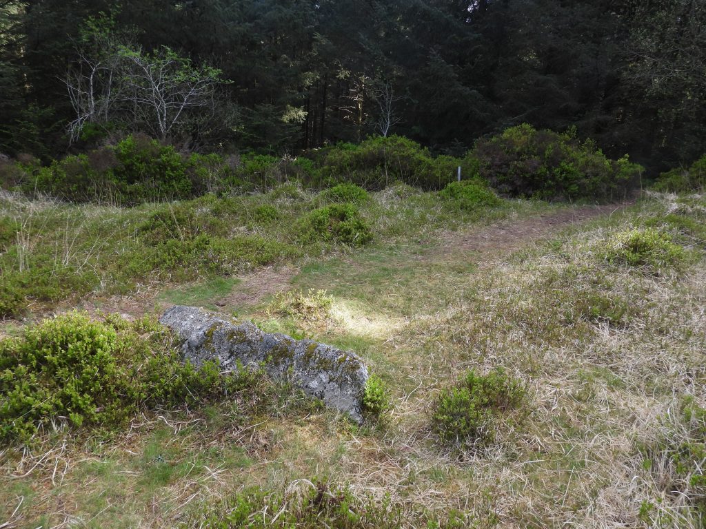
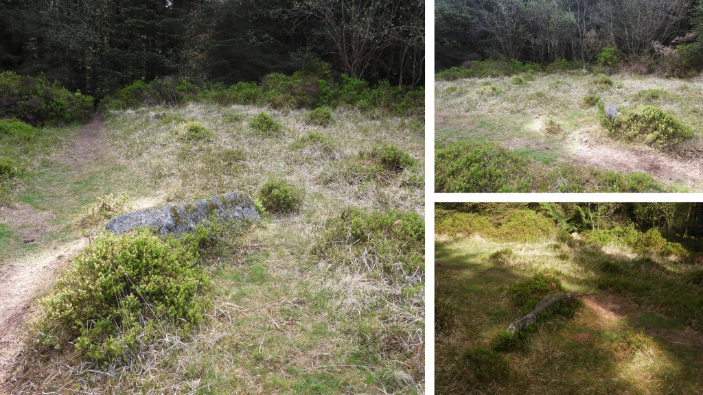
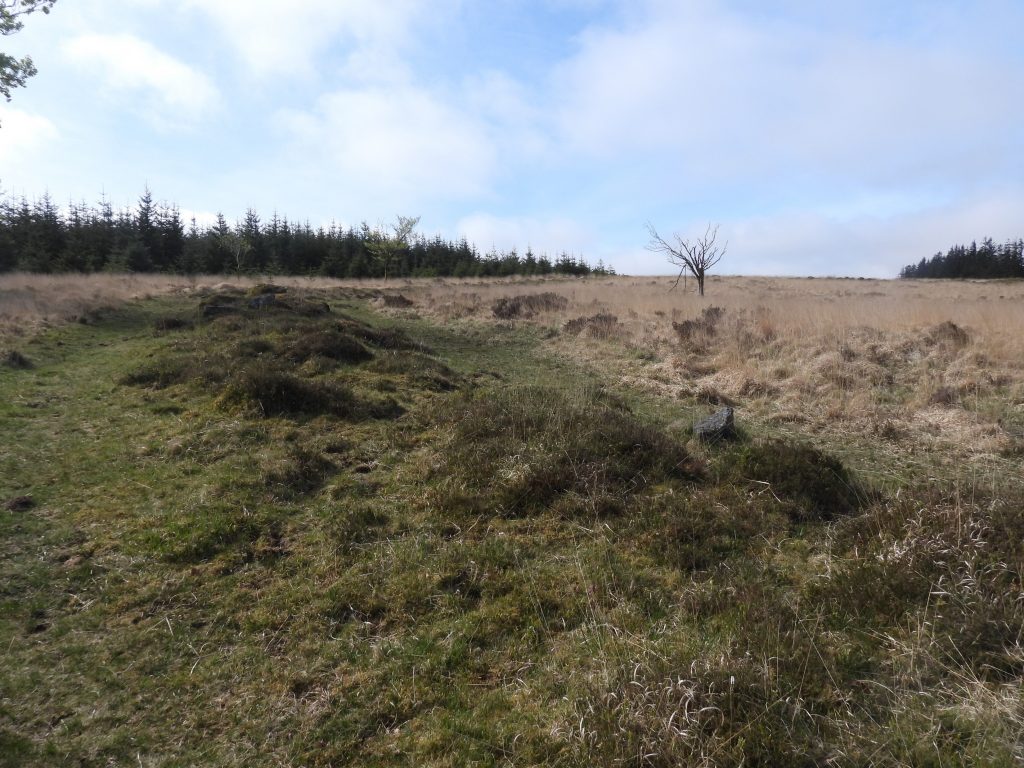
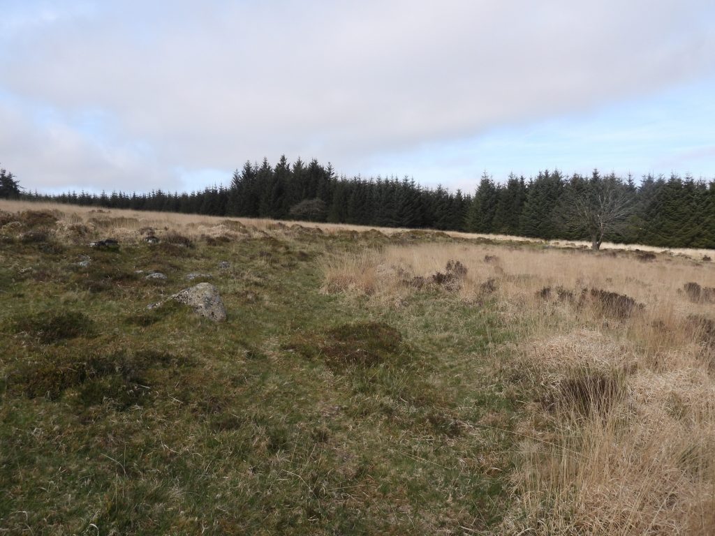
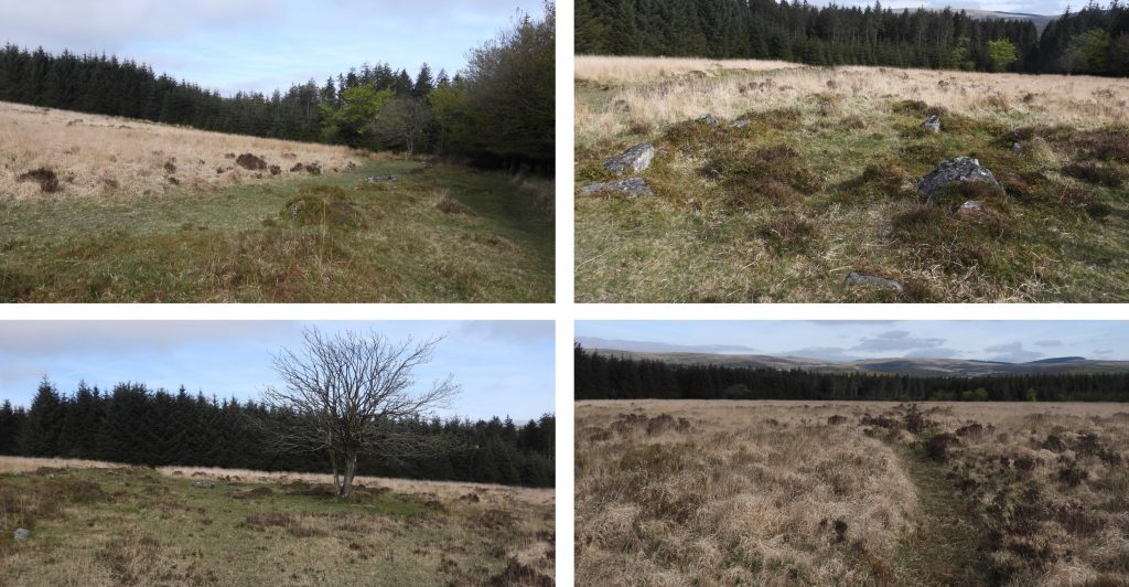
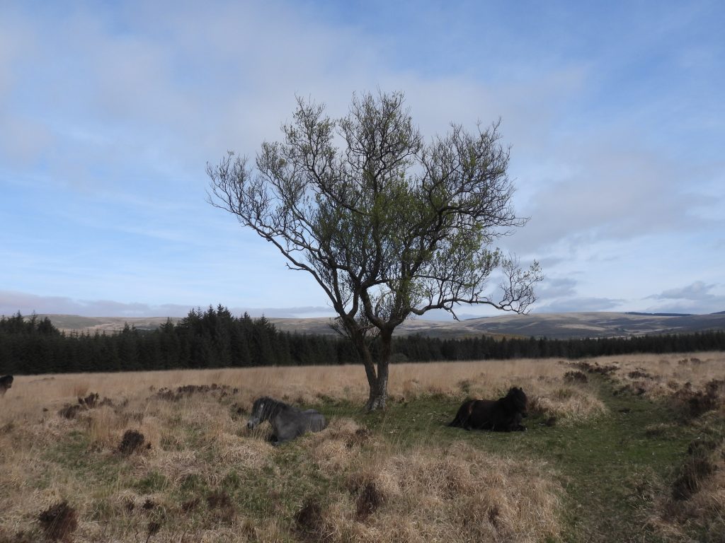
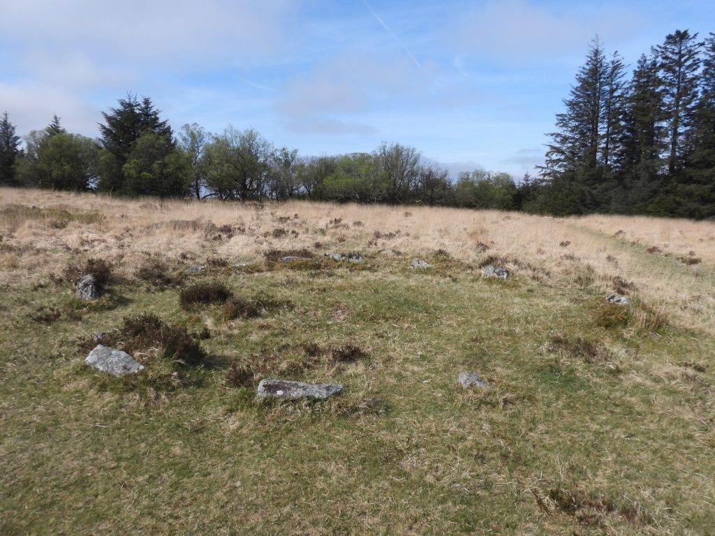
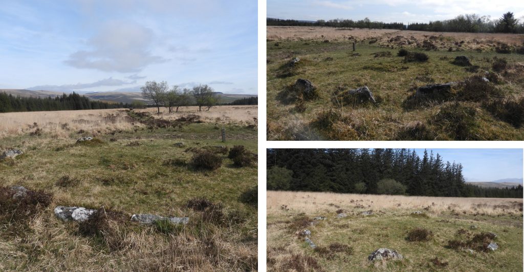
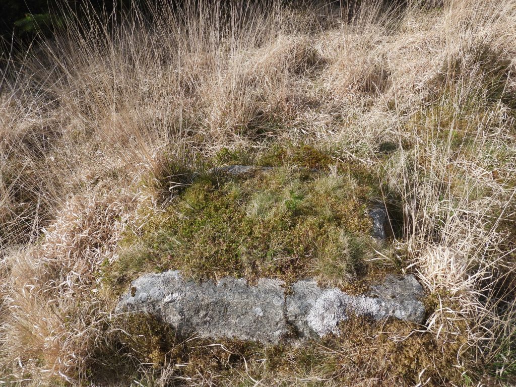
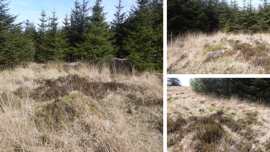
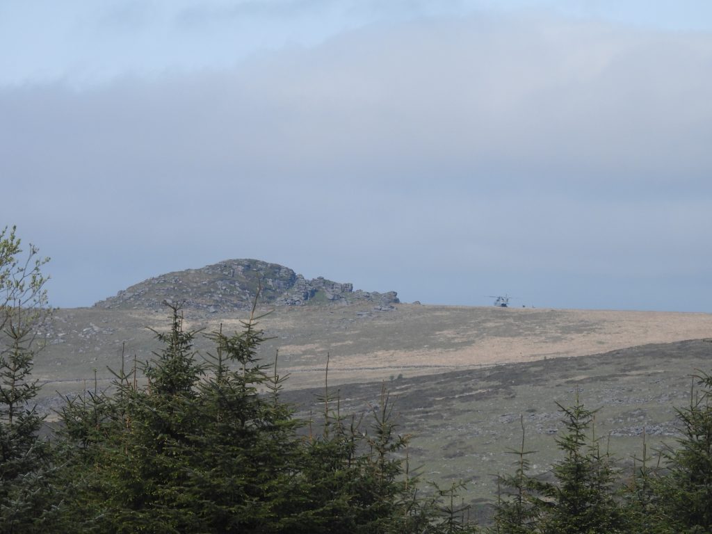
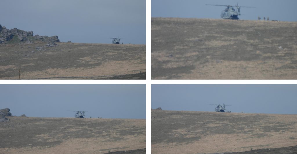
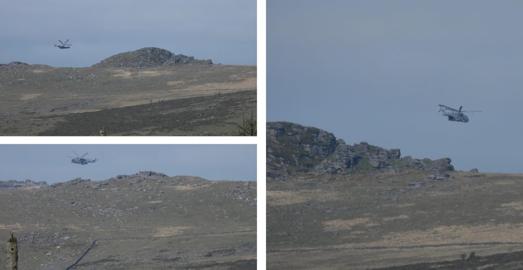
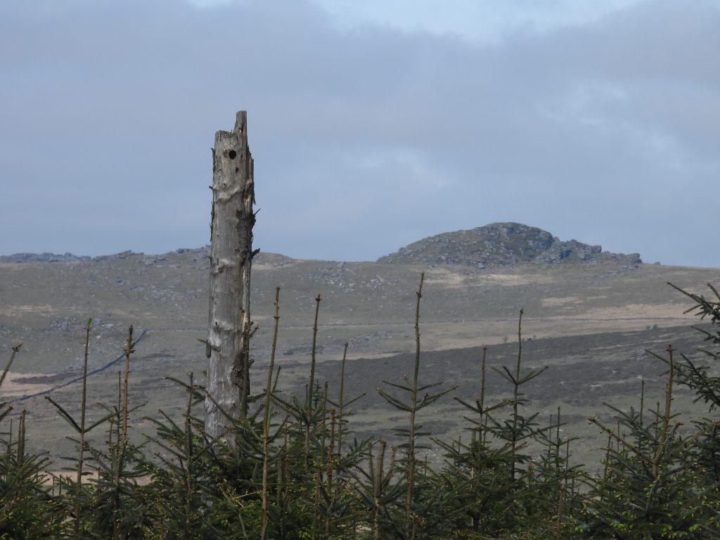
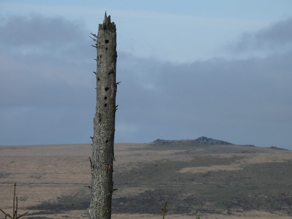
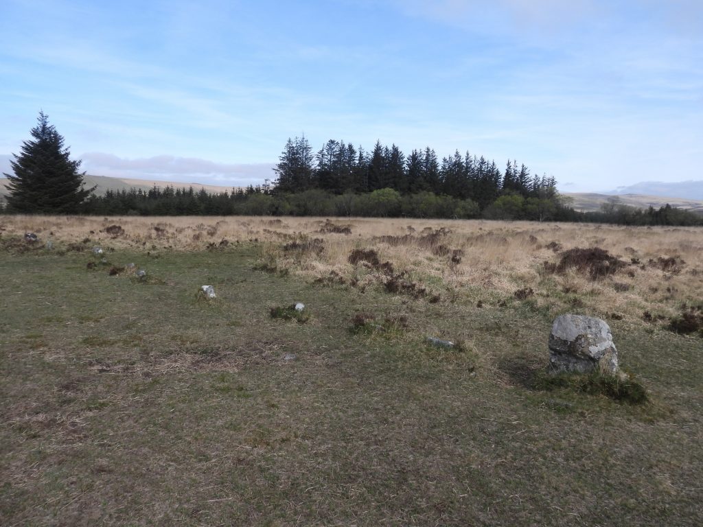
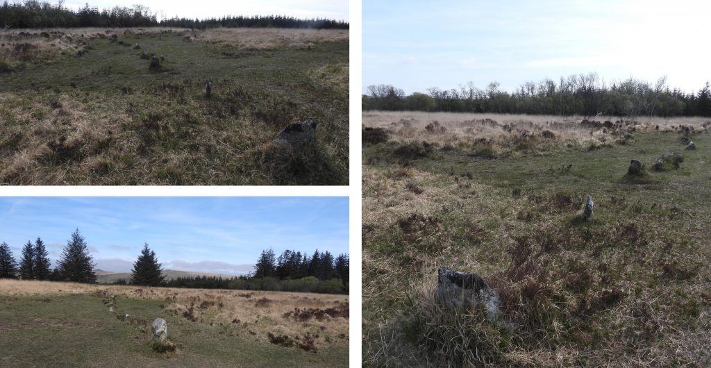
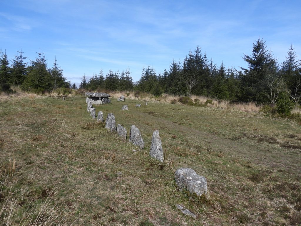
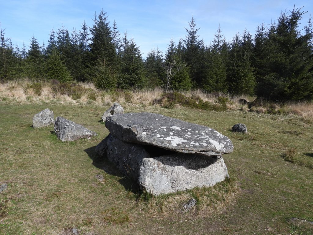
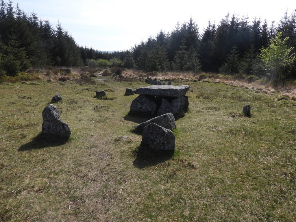
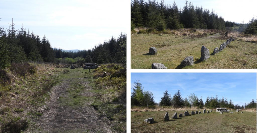
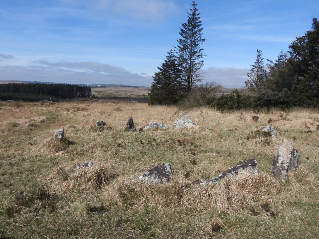
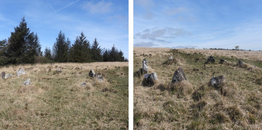
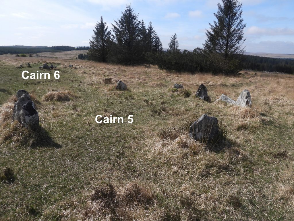
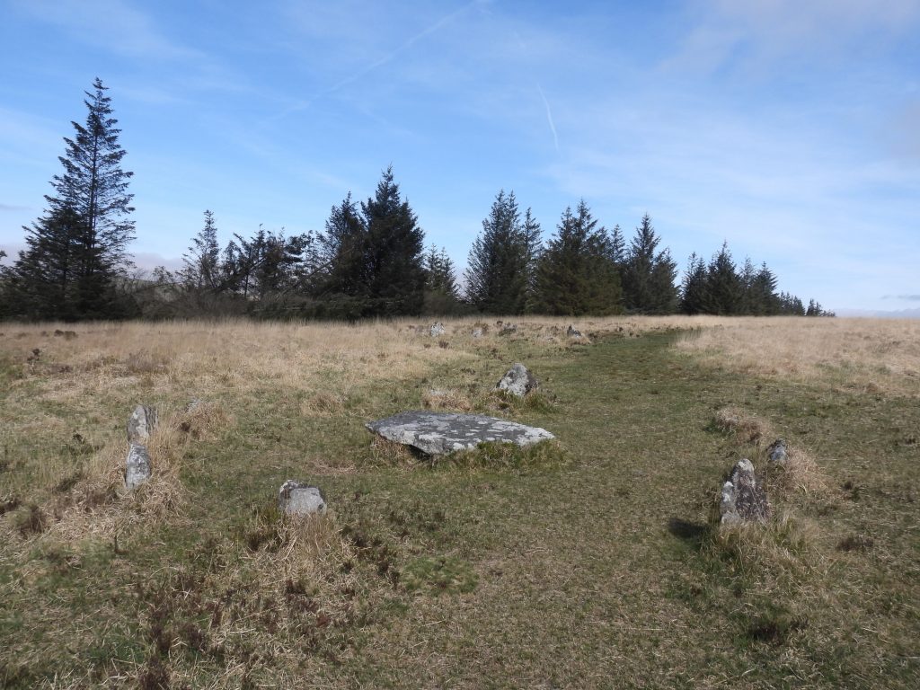
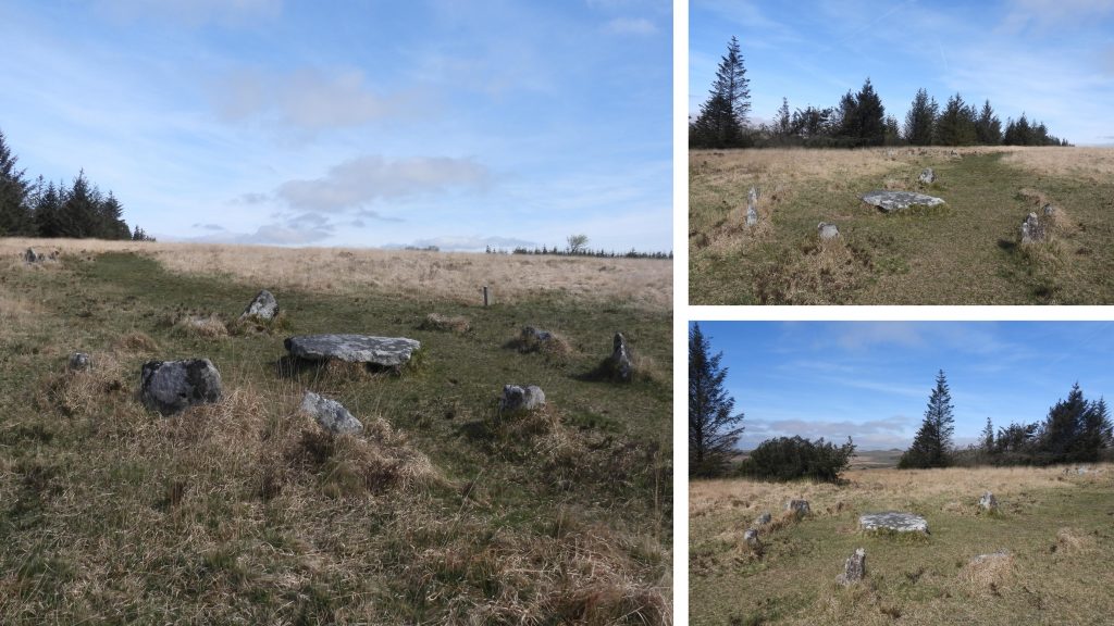
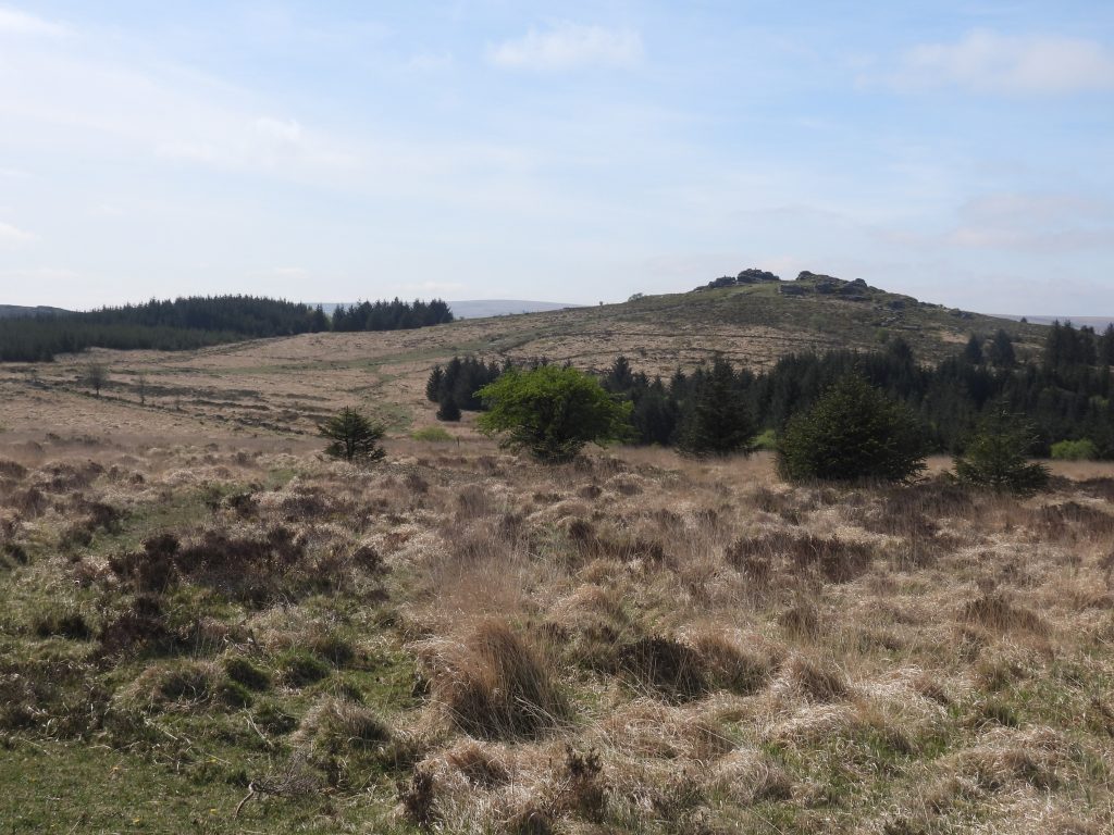
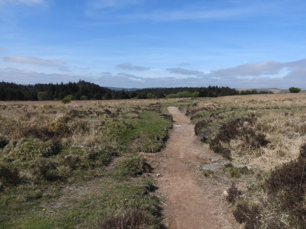
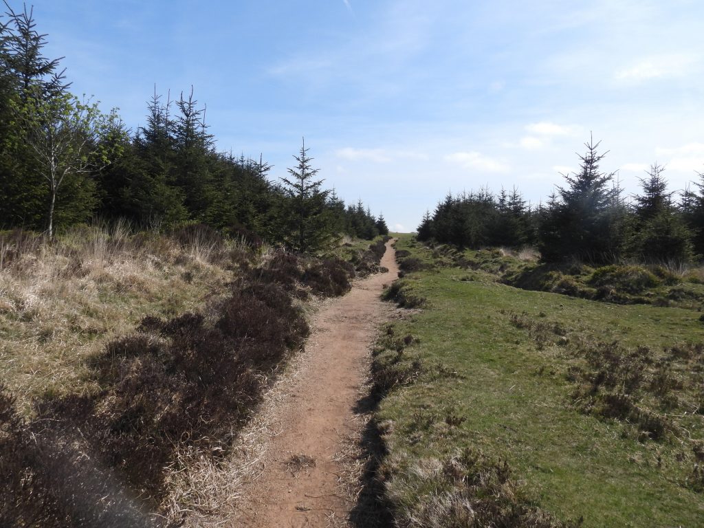
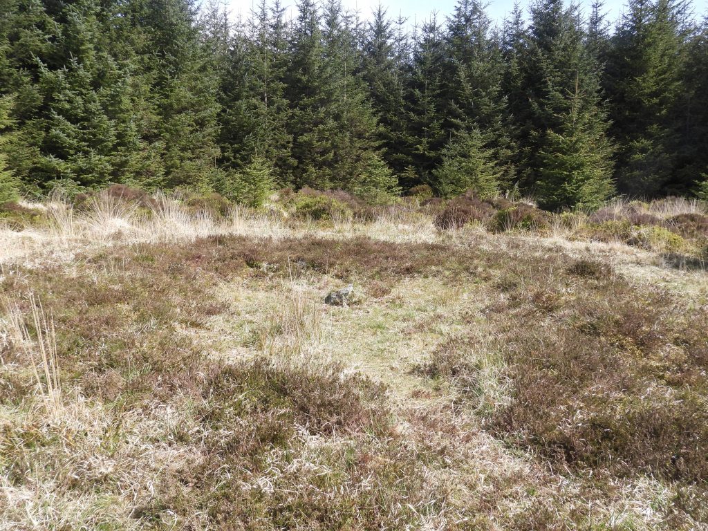
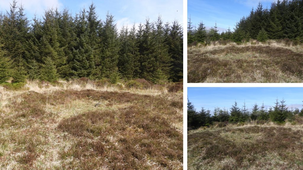
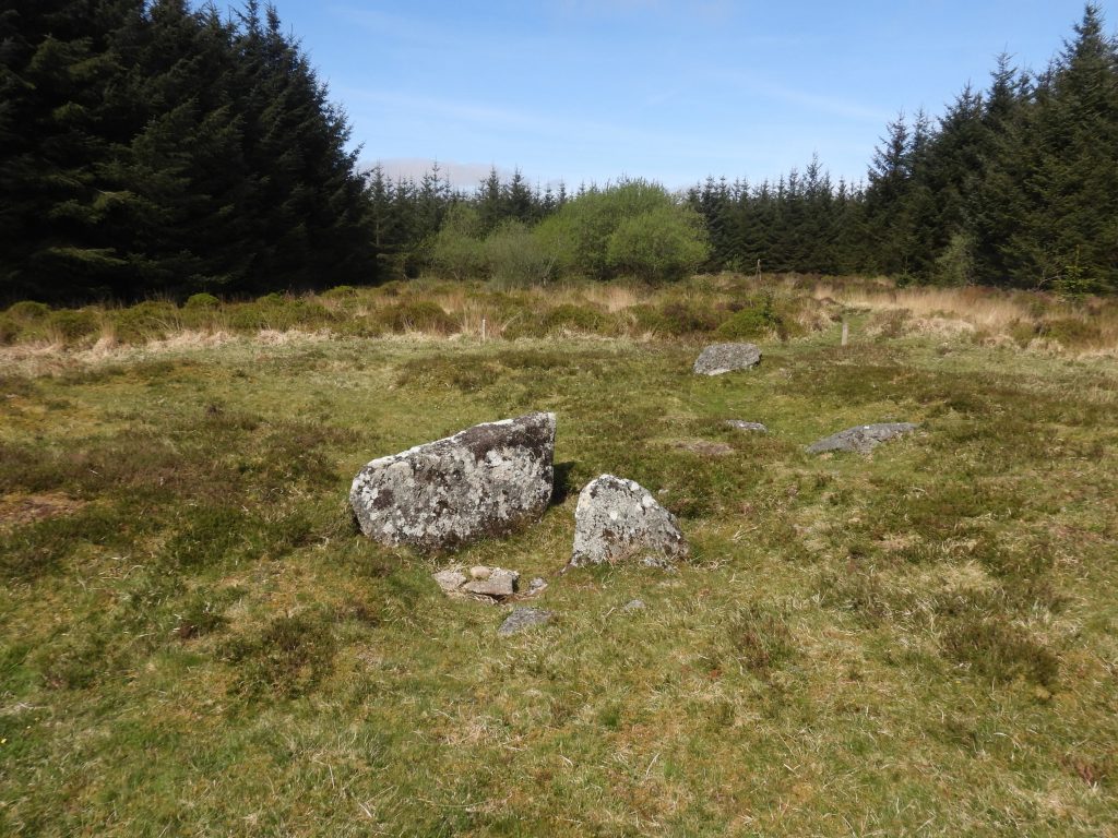
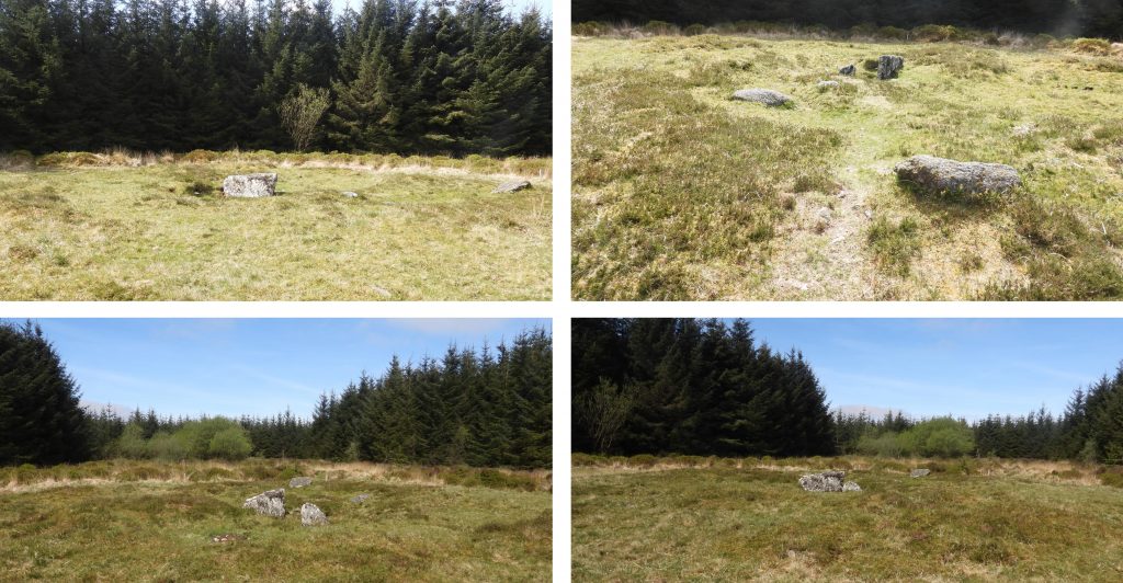
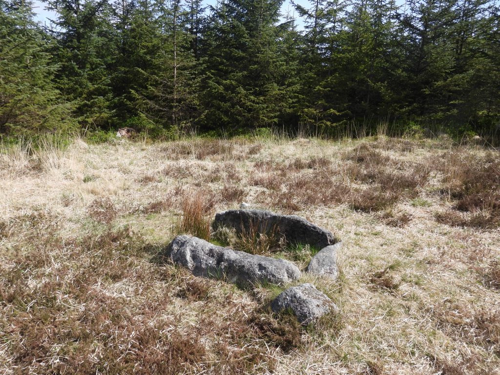
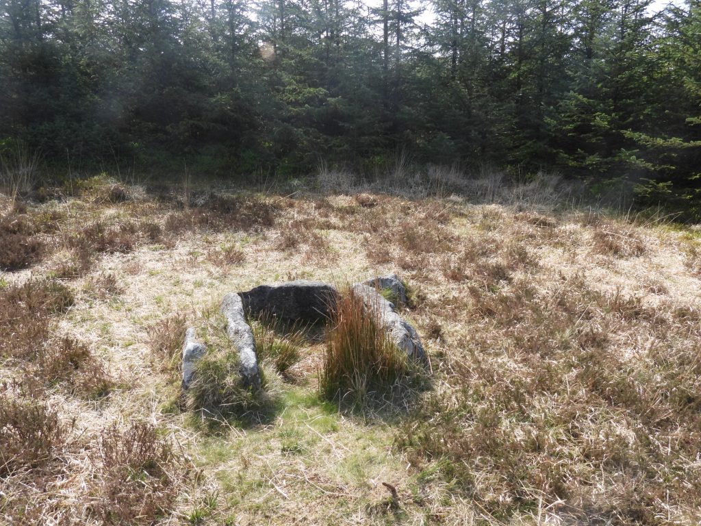
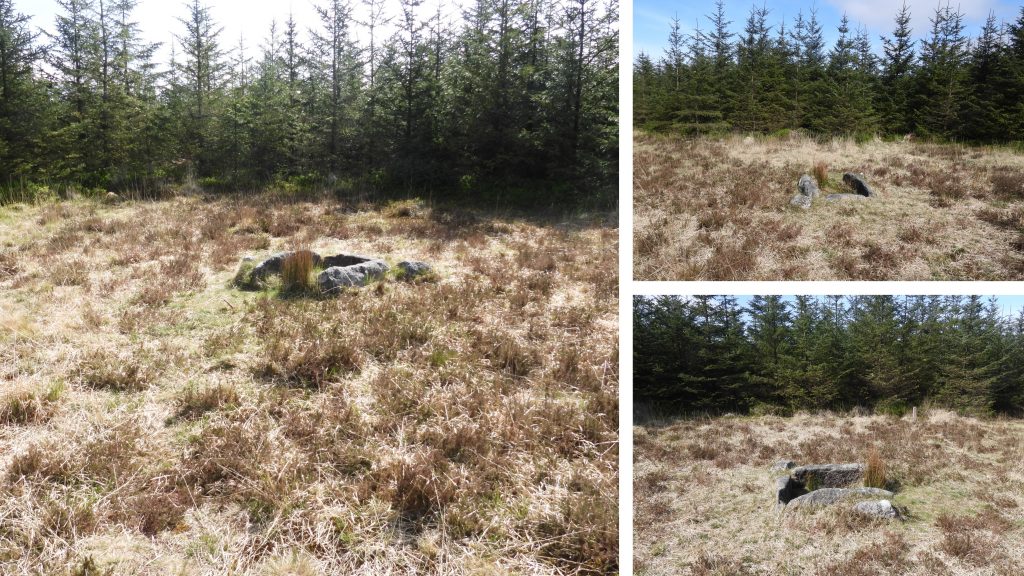
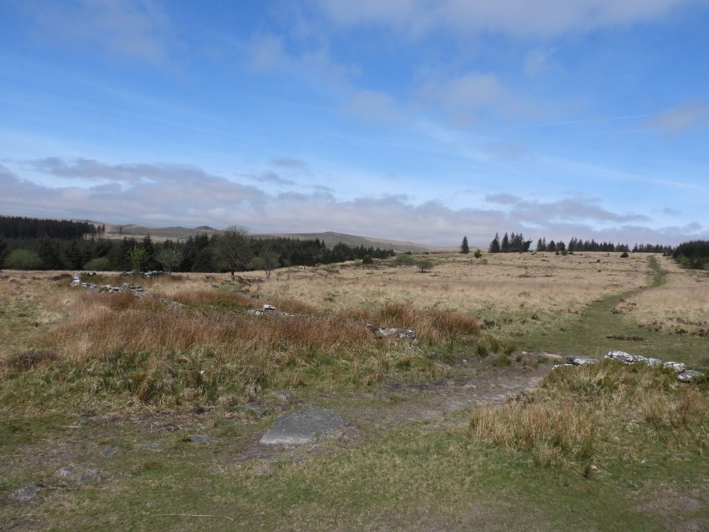
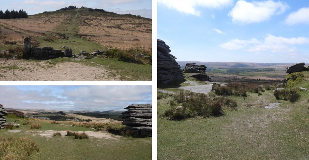
This map of Lakehead Hill and environs is based on Figure 27.12 from the Butler publication . The antiquity references 1-9 used throughout this post as the same reference numbers found on Figure 27.12 of the Butler publication.Antiquity 9 (but the first when approached from Postbridge) is a cist which is recorded as consisting of a single sidestone, partly buried and aligned NW/SE, measuring 1.3m by 0.2m and 0.3m high (ref Dartmoor HER)The cist (antiquity 9) is located at SX 64680 78370. It is theorised that there may have been a cairn here also but it was destroyed by afforestation.Kraps Ring is an oval shaped Bronze Age enclosure measuring approx. 120m long by 113m wide and is defined by a rubble bank standing up to 5.5m wide. The bank is up to approx. 1m in height. This view is looking from the north east corner towards Lakehead Hill.Kraps Ring is recorded as containing the remains of at least 11 huts (9 inside the enclosure and 2 outside the enclosure). A plan of 1891 suggests there may have been up to 15 or 16 huts (ref Prowse)Various views of Kraps Ring. It is centred SX6445 7815.Ponies near Kraps Ring sheltering under a lone tree. These ponies are part of the Dartmoor Pony Heritage Trust (DPHT) who are a “grazing tenant” within the moorland area surrounding Bellever Tor. More information about the DPHT can be found at : https://dpht.co.uk/Antiquity 1 is a ring cairn which is located near the summit of Lakehead Hill. The cairn is approx. 6 metres in diameter circle with around 12 upright slabs up to 0.4 metres high.Antiquity 1 lies at SX64351 77766Antiquity 2 is a cairn with a 0.1 metre high mound in the centre containing a north west to south east orientated cist which has been recorded as measuring 0.9 metres long by 0.55 metres wide. As shown in the picture the cist has been backfilled. The Dartmoor HER records that there was a “part excavation of the cist in 1898 by the Dartmoor Exploration Committee, which revealed flint knives and scrapers together with pottery fragments and charcoal”.The cairn of Antiquity 2 is recorded as measuring 8m in diameter and is located at SX64257 77696.Zoomed in from Lakehead Hill onto Longaford Tor to the west, where a helicopter (presumably as part of 2022 Ten Tors preparation)Helicopter at Longaford TorHelicopter flying around Longaford Tor and Littaford TorPossible woodpecker holes in old tree on west side of Lakehead Hill with Longaford Tor behindMore possible woodpecker holes in another old tree on west side of Lakehead Hill with Littaford Tor behindAntiquity 3 on Lakehead Hill is a single stone row of around 12 stones.The alignment of the stone row of antiquity 3 can be found at SX64378 77656Antiquity 4 is the most magnificent in the area, albeit the large cist has been restored. The antiquity comprises a stone alignment, a cairn and a cist. The stone alignment is a single row of 11 stones leading westward towards the cairn and cist.The large restored cist is formed by five substantial upright slabs supporting a capstone, which is recorded in the Dartmoor HER as measuring 2.2 metre long by 1.55 metres wide and 0.3 metres thick.The cairn around the cist measures 6.7 metres in diameter and is defined by several edge set stones.Antiquity 4 can be located at SX64498 77608Antiquity 5 is a cairn defined by a circle of edge set stones and which measures 7.8 metres in diameterThere are 10 erect slabs associated with antiquity 5 and each stand up to around 1m high. This cairn can be found at SX64348 77489 To the south east of antiquity 5 (cairn) is antiquity 6, which is also a cairn. The two antiquities are only 16m apart.Antiquity 6 (cairn) has 10 erect slabs, with a large slab in the centre.The cairn (antiquity 6) is recorded as measuring 5.6m in diameter and can be found at SX64359 77469To the south of antiquities 5 and 6 lies the magnificent Bellever Tor. The tor stand at 443m and is also known as Bellaford Tor (by William Crossing) and Belliver Tor. Crossings describes it as a “fine cluster of rocks“. Other Dartmoor writers such as Eric Hemery describes it as “the Avalon of Dartmoor’s Central Basin“.Between Lakehead Hill and Bellever Tor runs the Lych Path (or “The way of the dead”). The farm tenements in the area (e.g Hartland, Merripit, Runnage, Pizwell) in early 1200’s were all expected to travel (via the Lych Path) to Lydford to bury their dead and attend church services. This was simply because they were within the Forest of Dartmoor bounds thus were in the parish of Lydford (where the parish church was located). The photograph shows the Lych path looking west. (ref Legendary Dartmoor).Lych path looking east. In 1260 the tenement farmers / workers were so disillusioned by having to embark on their onerous journey’s to Lydford, they partitioned the Bishop of Exeter, Walter Bronescombe, for permission to attend the church at Widecombe (as it was closer). Permission was granted. The author has completed the full “Lych Path” walk between Widecombe Church and Lydford Church, a distance of 18 miles on two occasions, on each occasion walking this trans moor journey overnight.This hut circle is sited within a small forest clearing near the Lych Path.The hut circle is a oval shaped earth and stone bank with internal diameters recorded as being 4.4m by 5m with a bank up to 2m thick by 0.4m high. The hut circle can be found at SX64590 77292Antiquity 7 is a cairn which consists of an 18 metre diameter mound which stands just over 0.5 metres high.At the centre of antiquity 7 is a substantial cist, comprising two edge slabs approx. 1m high. This antiquity can be found at SX64715 77393Antiquity 8 is a cist, which lies in a small cairn which is recorded as being 4.5 metres diameter.The cist has three sides but the cap stone has gone. The Dartmoor HER records that it was excavated in 1914 when charcoal was found.Antiquity 8 can be found at SX64717 77168View of Lakehead Hill close to the wall just south of antiquity 8. A final view of Bellever Tor from this beautiful area.
SteveGriggDartmoor December 18, 2022 — Post author
Test comment
SteveGriggDartmoor December 18, 2022 — Post author
hlhjbl