A collection of walks, discoveries, insights and pictures of exploring Dartmoor National Park
January 10, 2023
Military artefacts between East Mill Tor and Okement Hill – Redoubts, Experimental Parapets, Observation Posts and a planned Target Railway
Having visited what the author thought were all the Military Target Railways / Tramways on Dartmoor (ie four at Willsworthy, one at Holming Beam, two at East Mill Tor, three at Blackdown and two at Rowter), he was intrigued to hear from John Deakin, the author of Dartmoor Observation Posts and from Lt Col Tony Clark OBE regarding of there being another possible one within the Okehampton range. The author was grateful to have been given sight of an early 20th century military map, which showed a proposed target railway / tramway (dated 3rd September 1914), whose course, with various branches off it, would have run from north to south from near Riddow Pits (approx 300m south west of East Mill Tor) to Okement Hill.
The first task was to try and use the provided (1914) map and overlay it onto a more modern OS map. The points of reference enabling this ‘overlay’ were East Mill Tor, OP10 (south), Black-a-Ven Brook, Sammy Arnolds Lane and the portion of the military ring road which had been only part constructed at that time. Of interest is that the (1914) map identified that OP10 (south) was called splinter proof hut 5, OP 11 was called splinter proof hut 7 and OP14 (probably site) was an unnumbered splinter proof hut. Observations Post 13 and 15 appear to have been part of the plan in 1914 but are known not to have been constructed until around 1923 along with OP 12 (albeit this one did not appear on the (1914) map).
This post attempts to record as many (more obvious) military artefacts between East Mill Tor through to Okement Hill and to establish if there is any evidence of the proposed target tramway / railway has ever being partly of fully built. This includes recording of old redoubts, experimental parapets (and trenches), military tracks and Observation Posts (extant and dismantled).
Bibliography:
1. Extract of military map dated 3rd September 1914 with handwritten title: “Proposed Tramway from Okement Hill to Black-a-Ven Valley” (supplied by Lt Col Tony Clark OBE)
2. Dartmoor Observation Posts by John Deakins
3. Royal Commission for the Historical Monuments of England, 1993-1998, Dartmoor Royal Forest Project
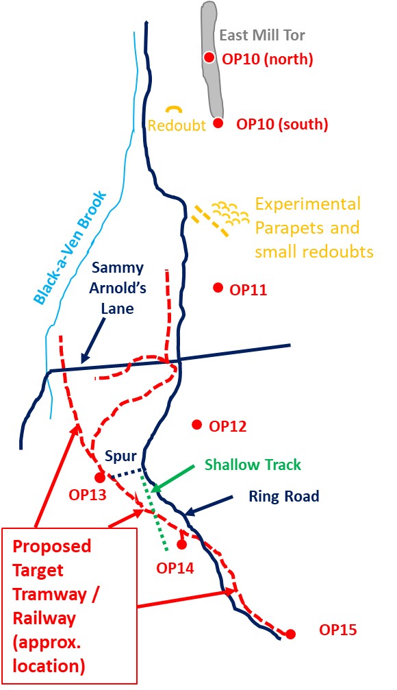
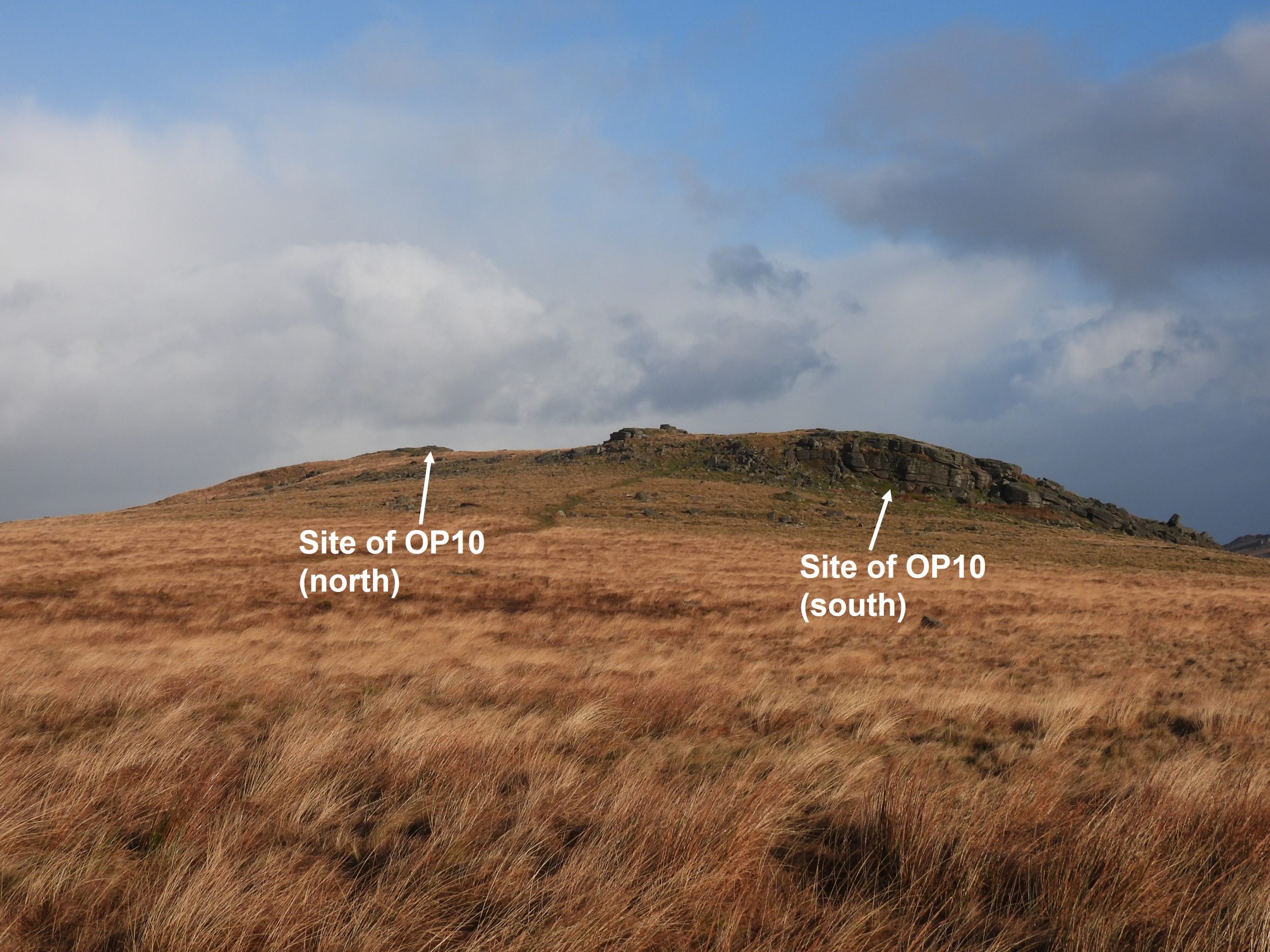
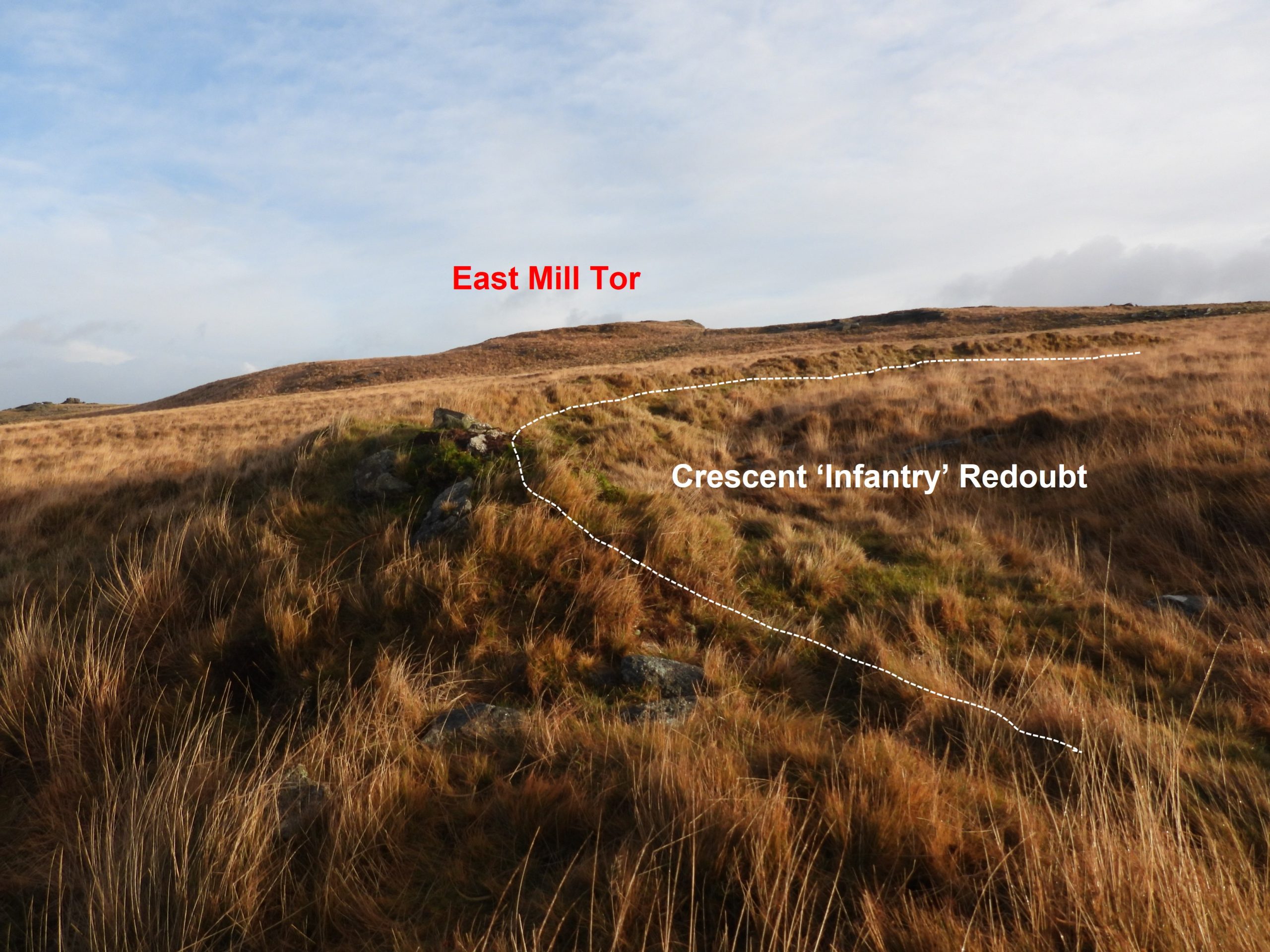
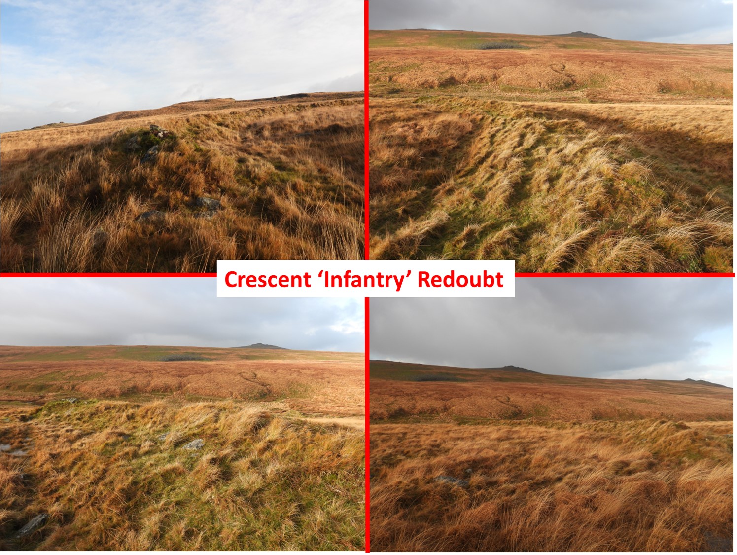
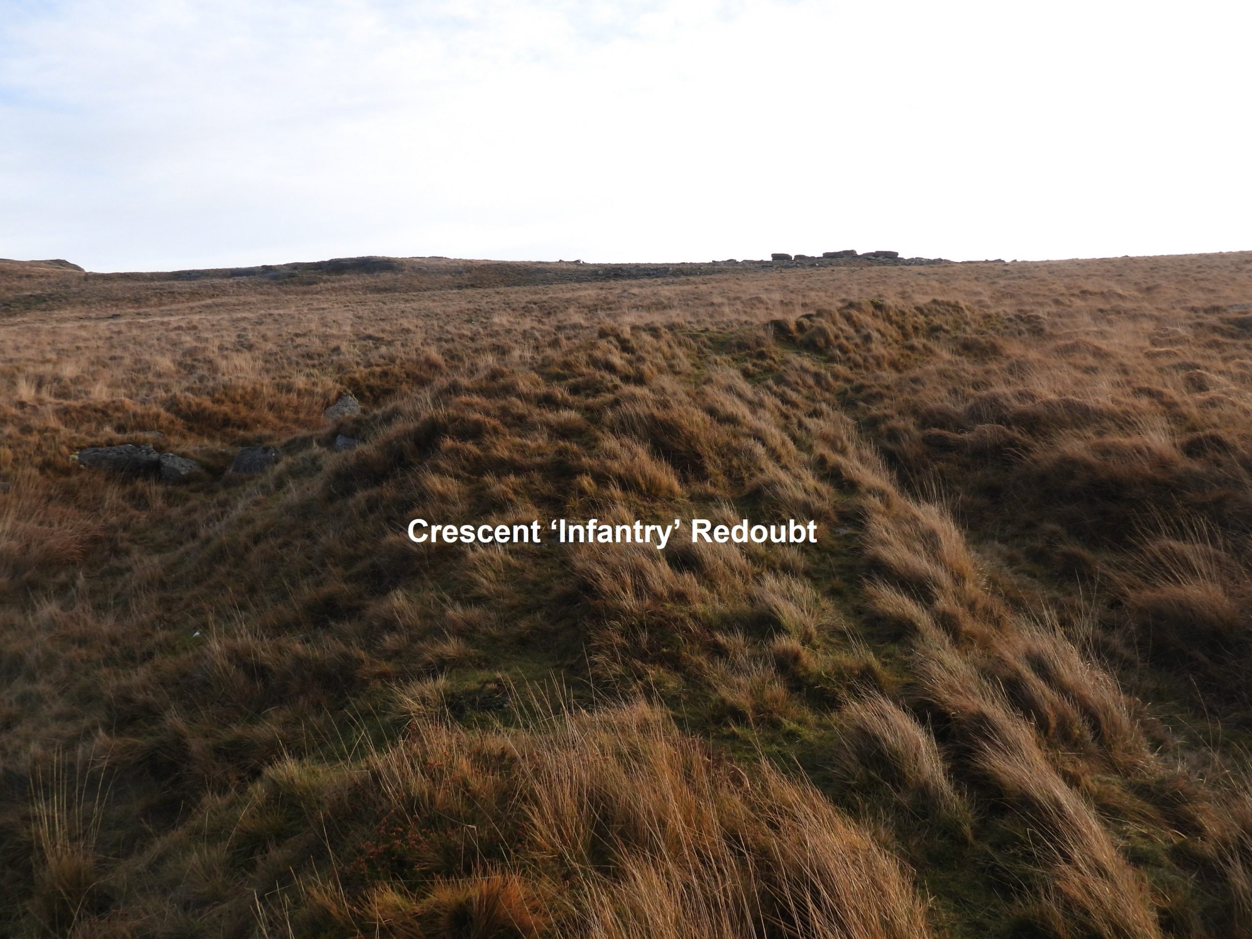
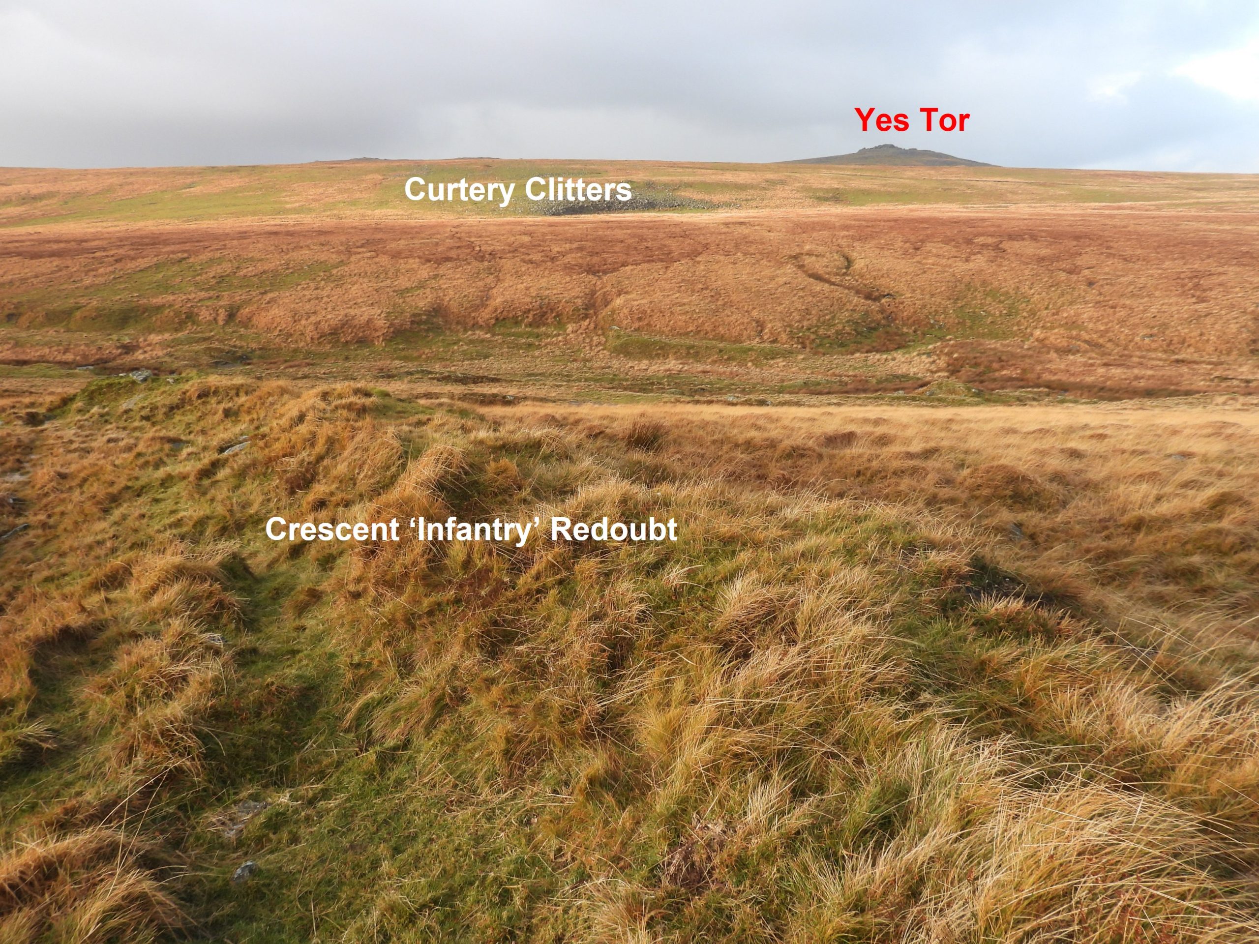
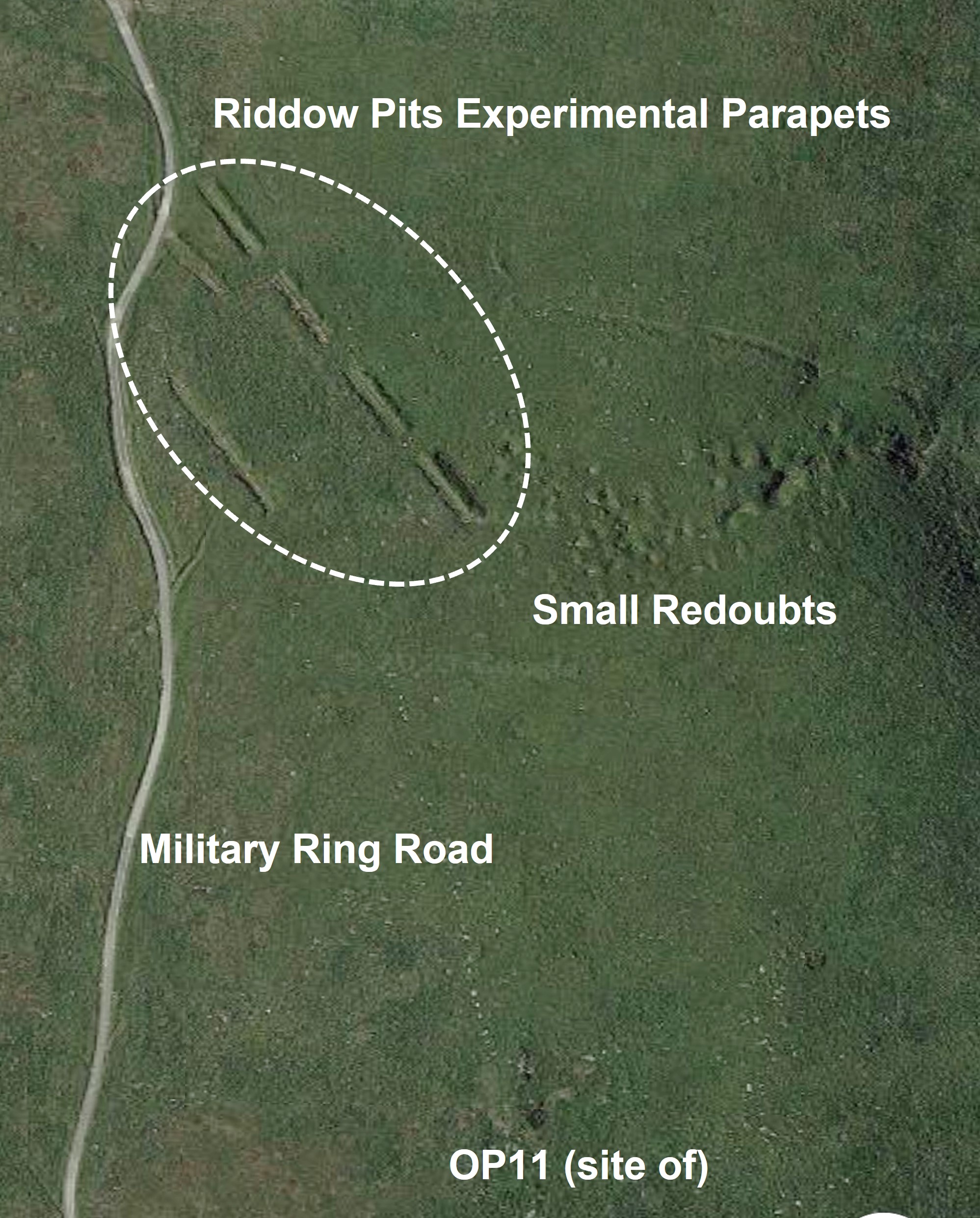
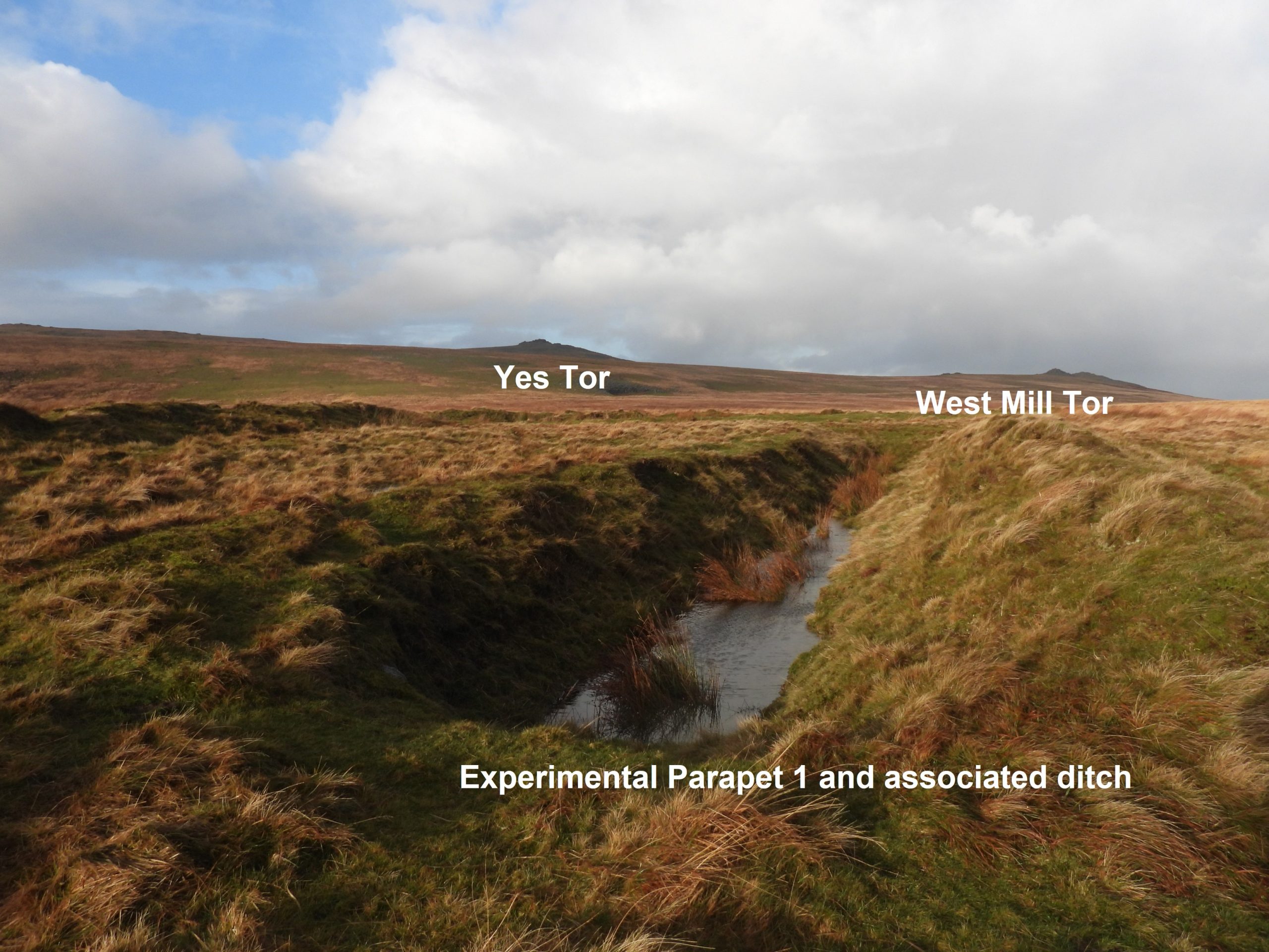
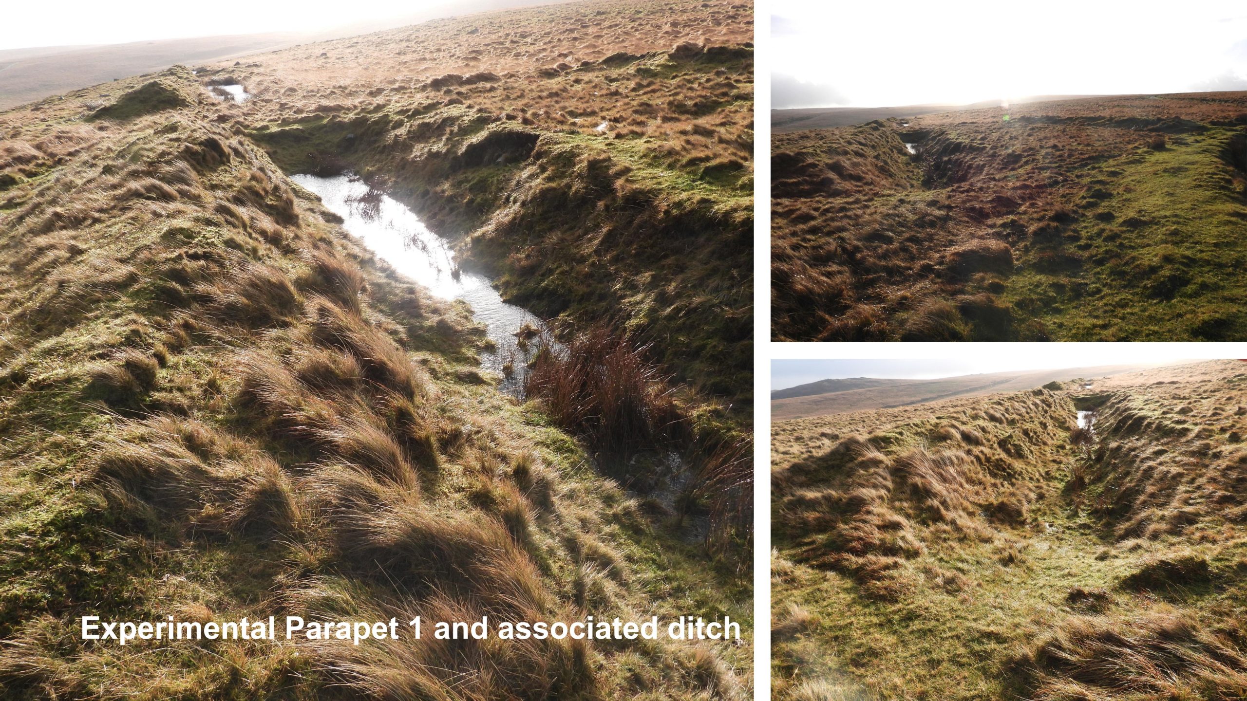
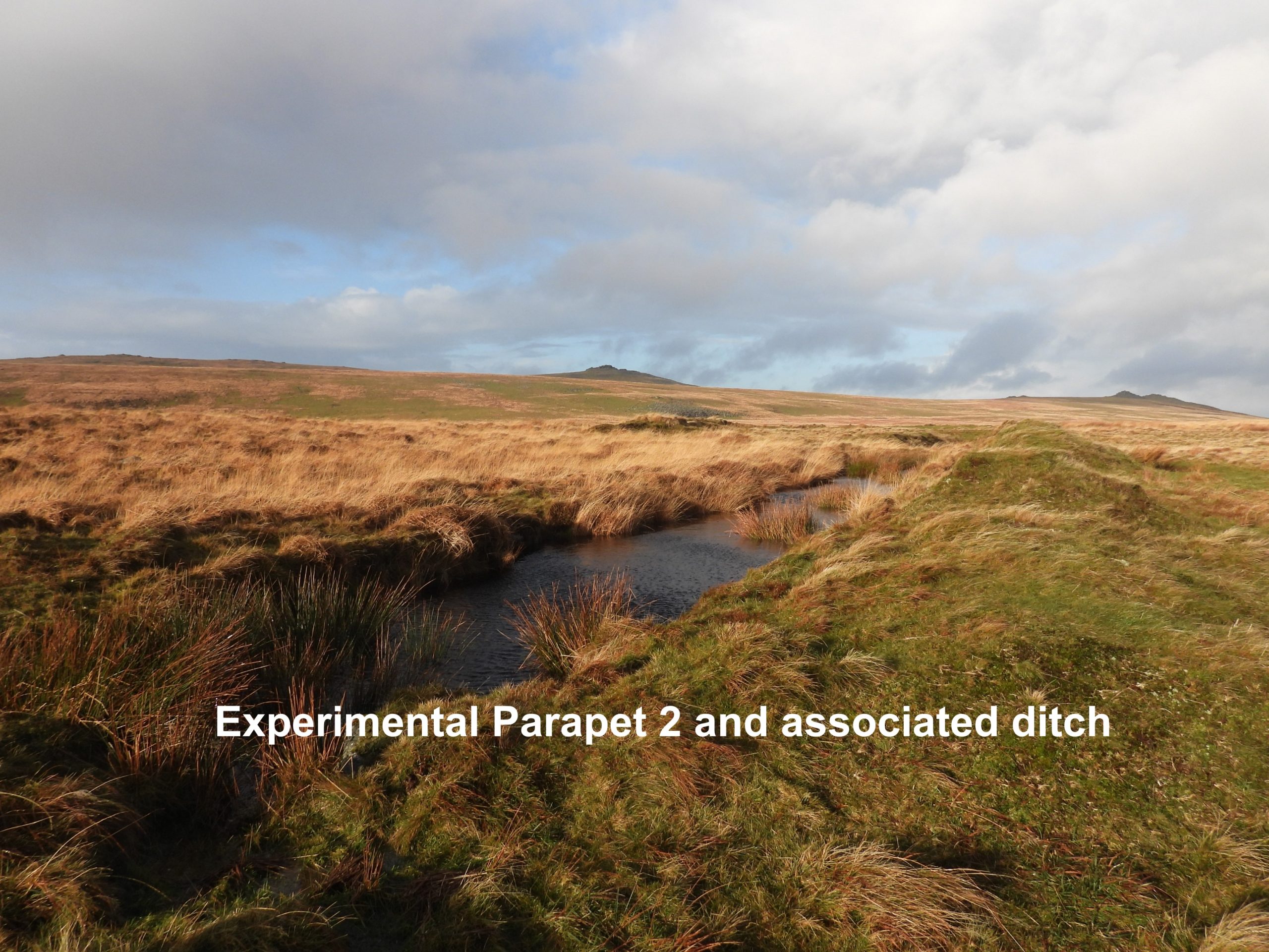
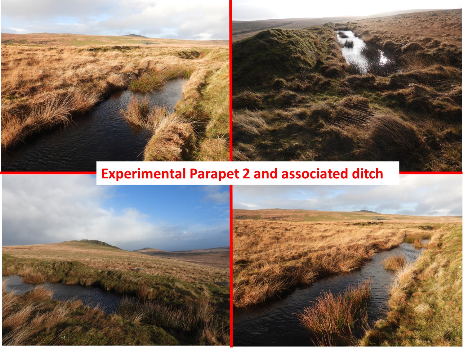
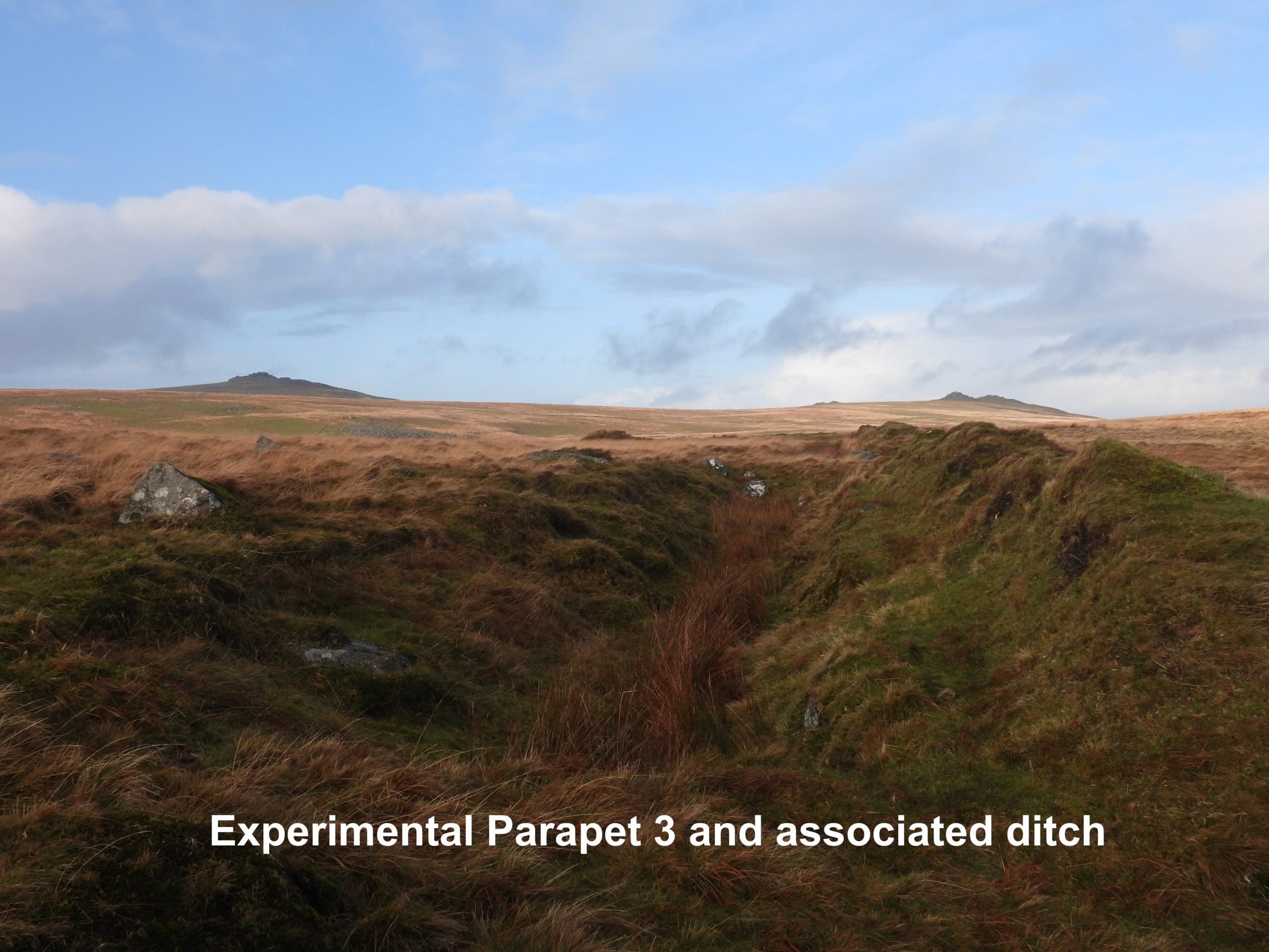
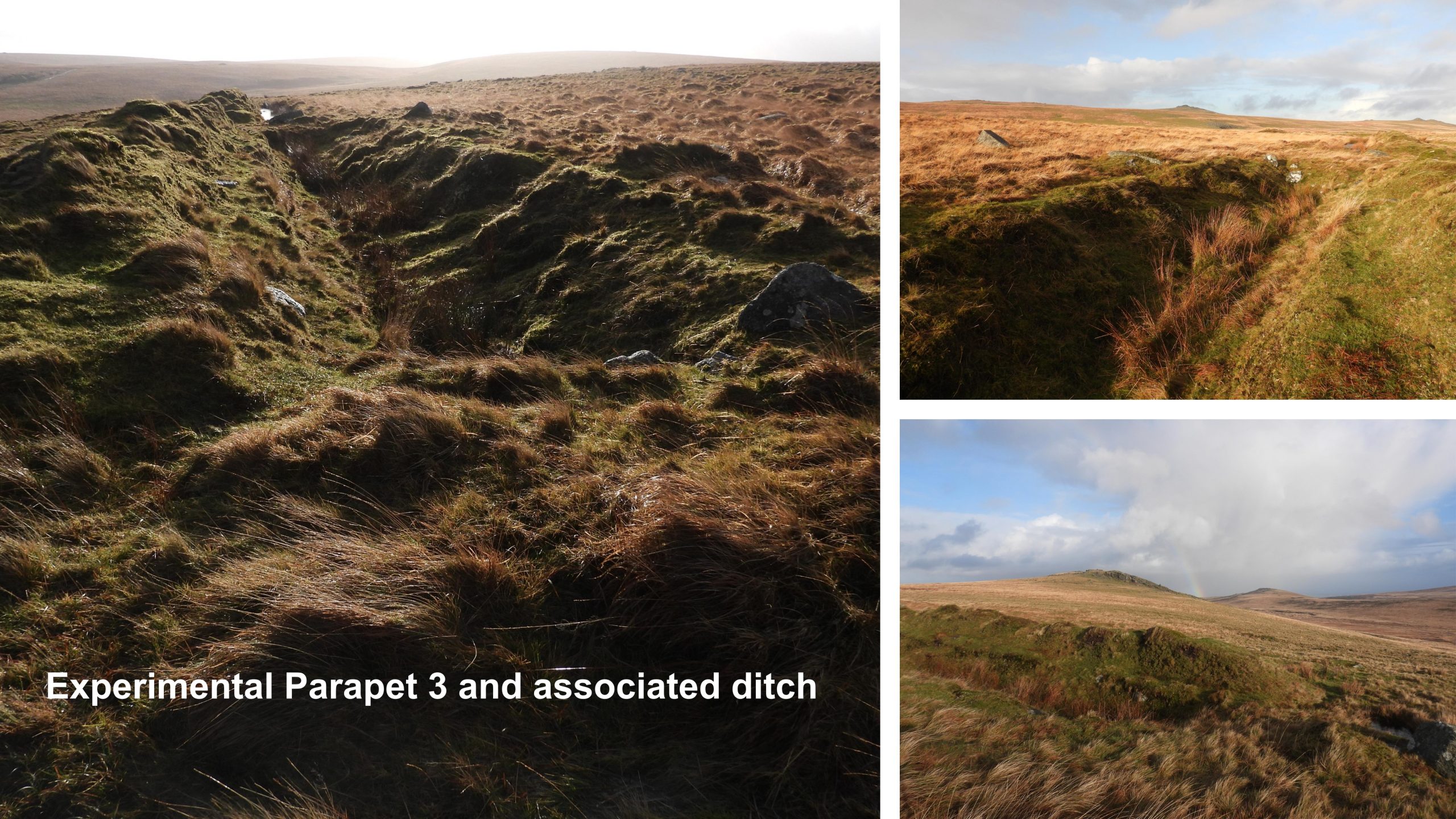
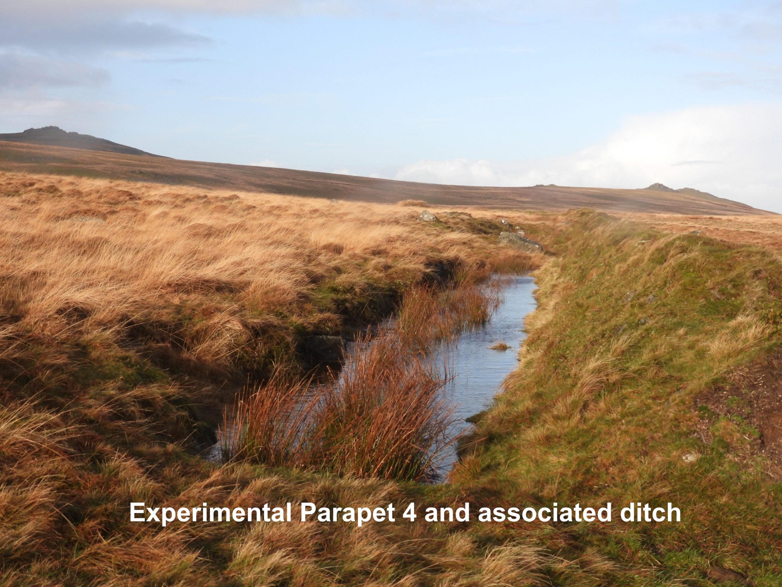
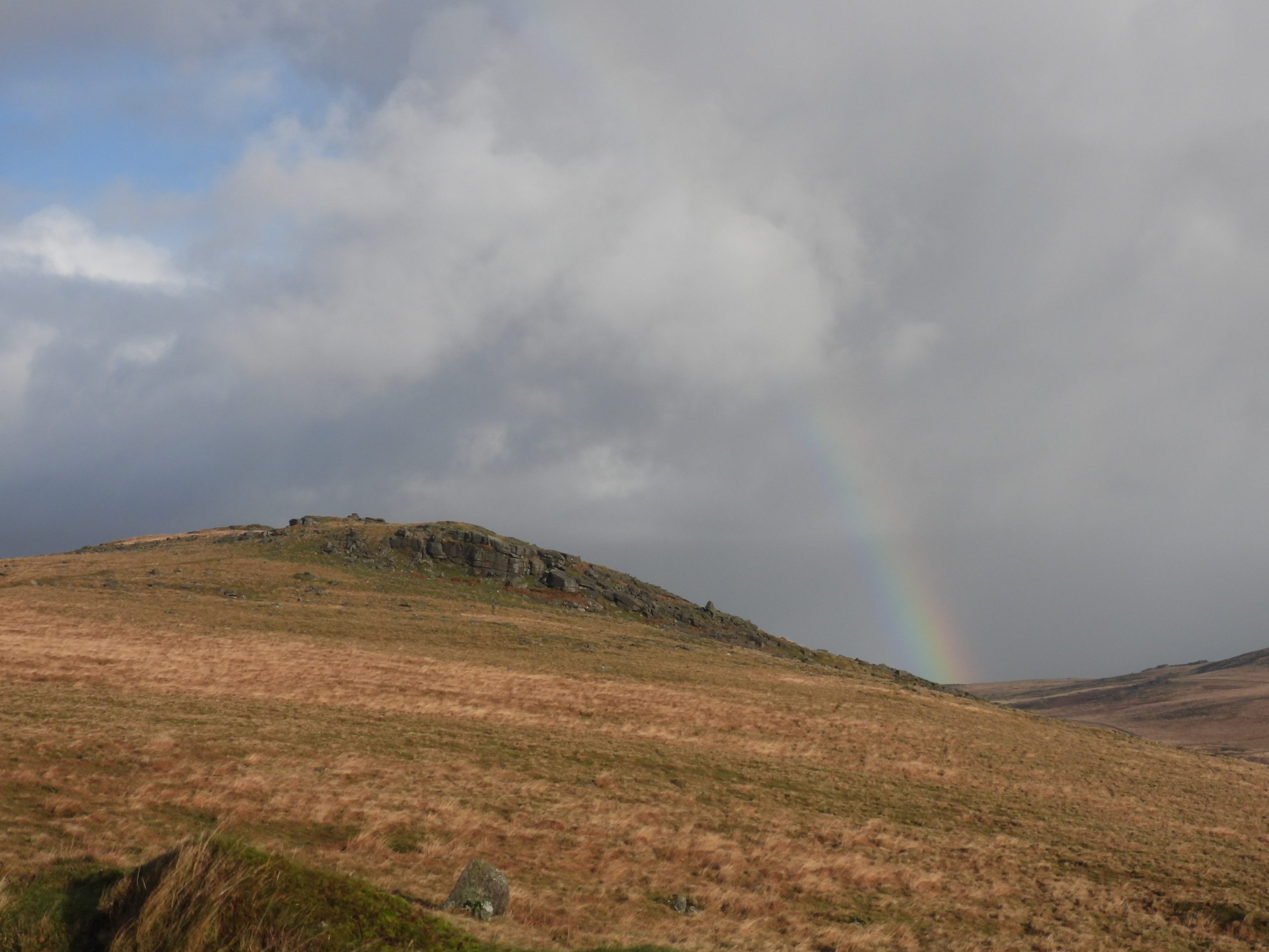
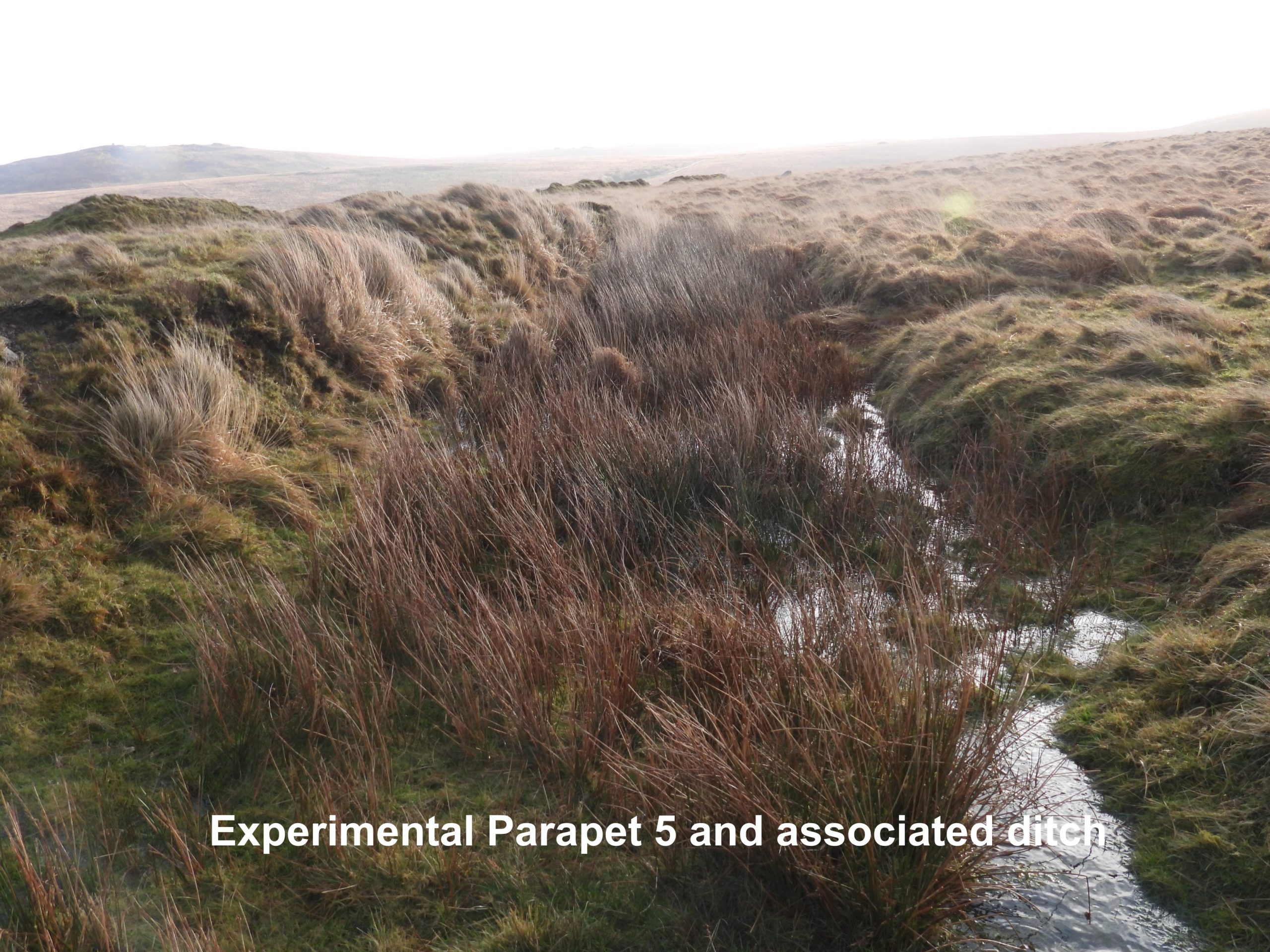
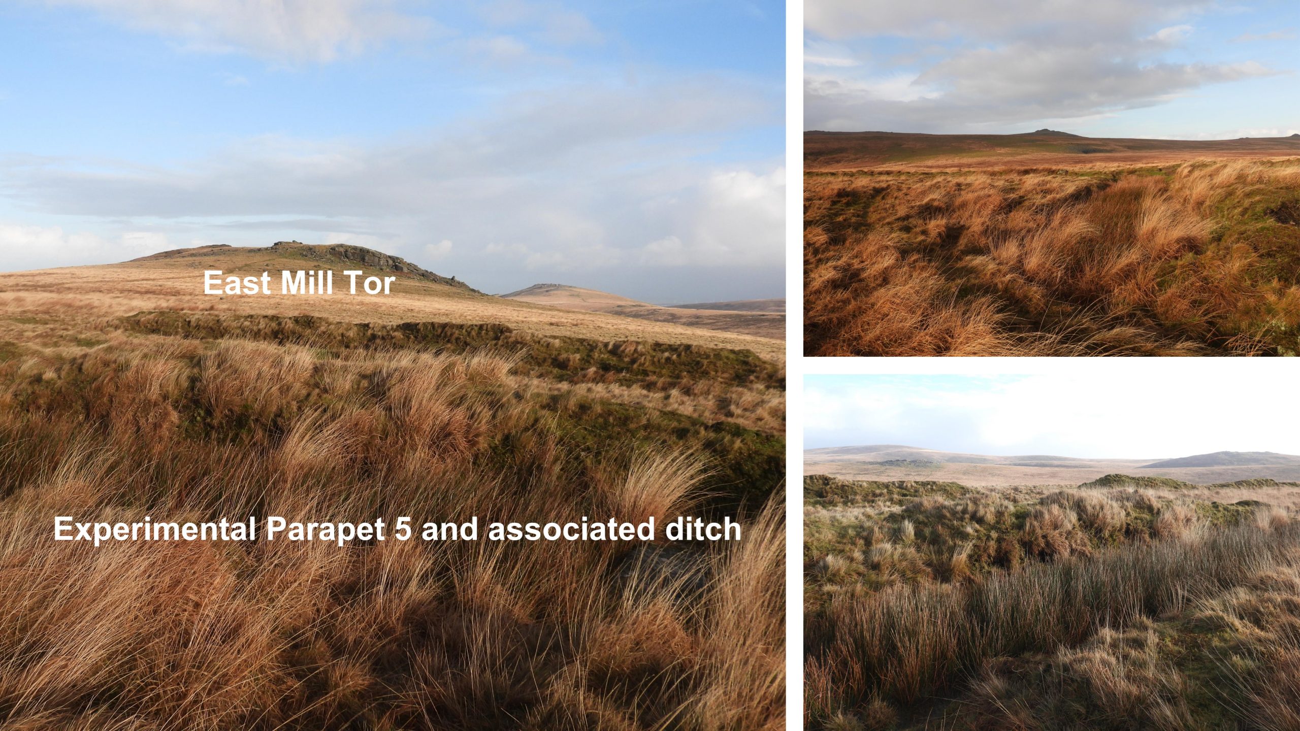
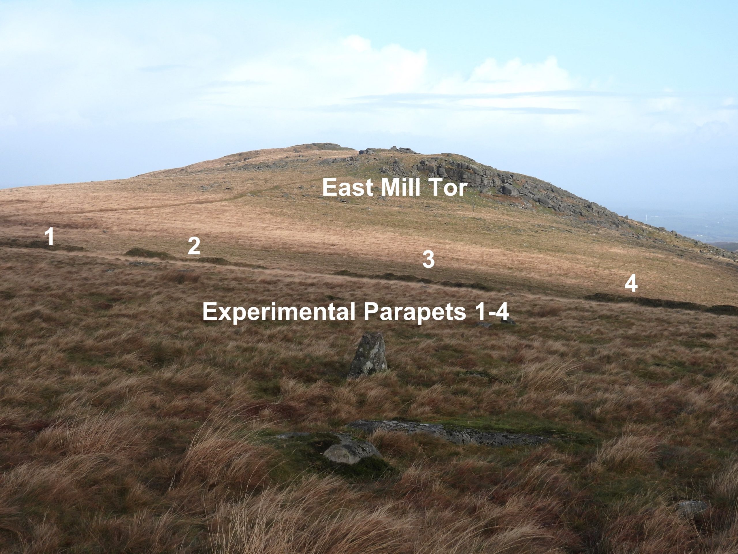
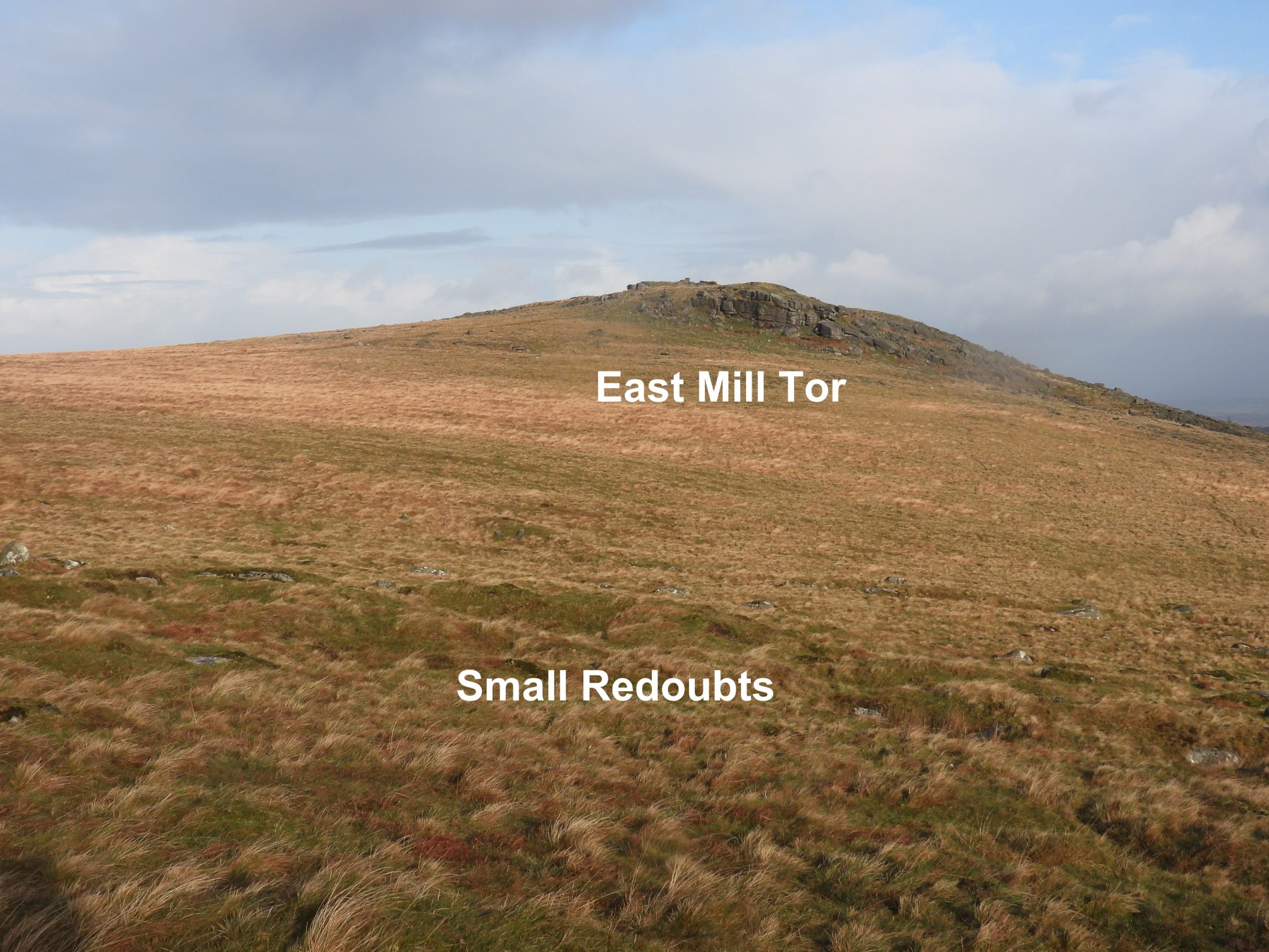
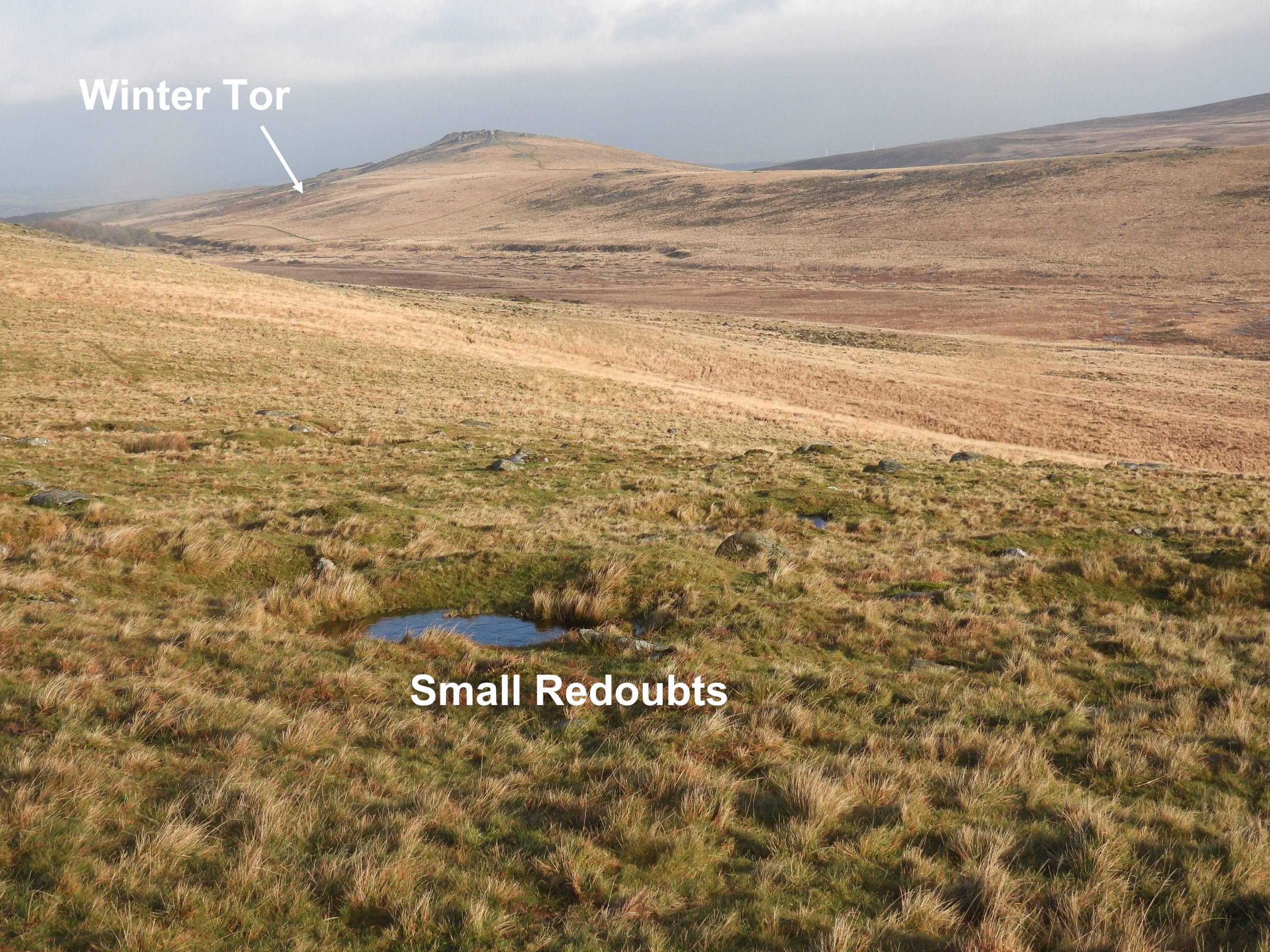
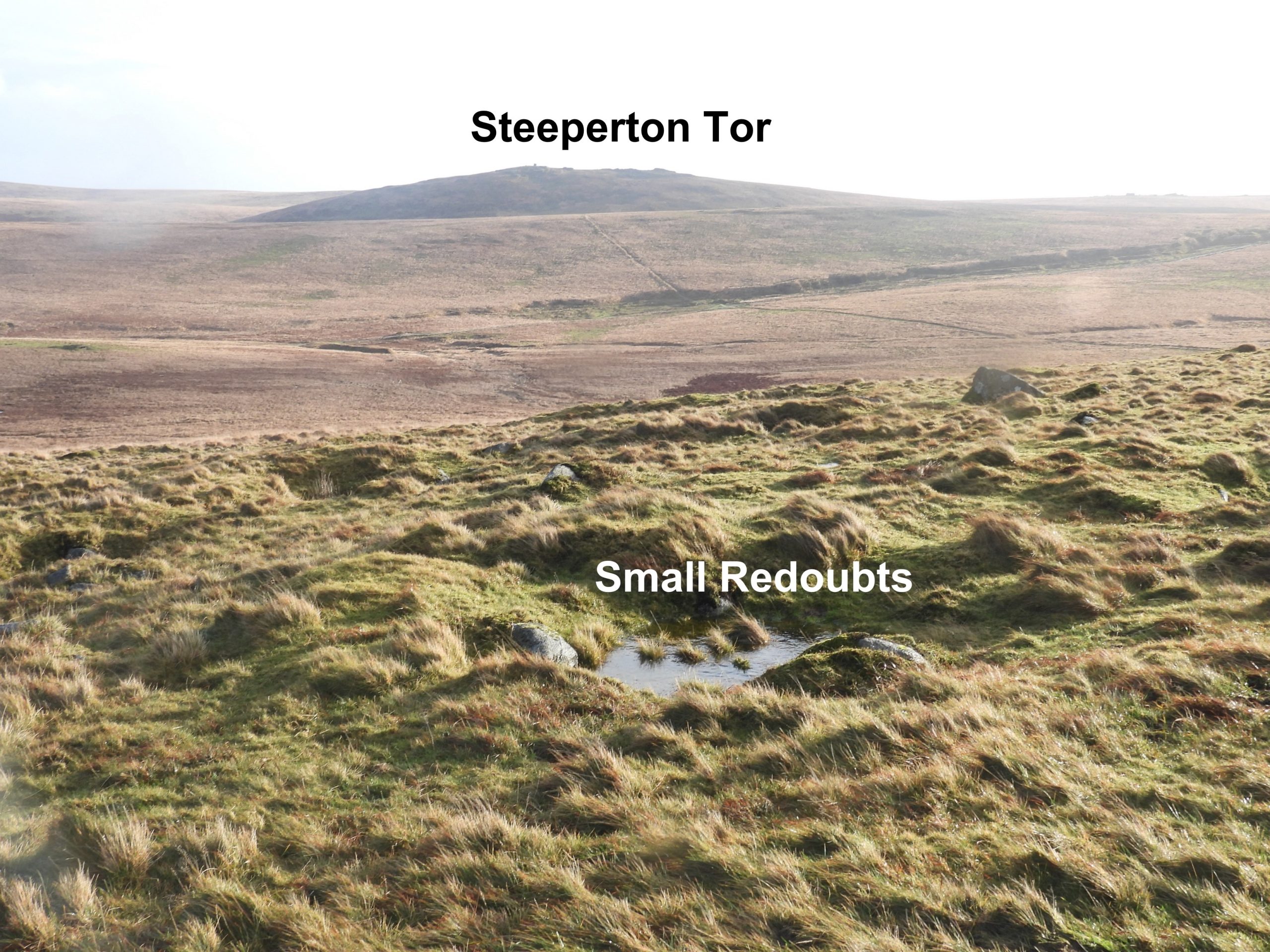
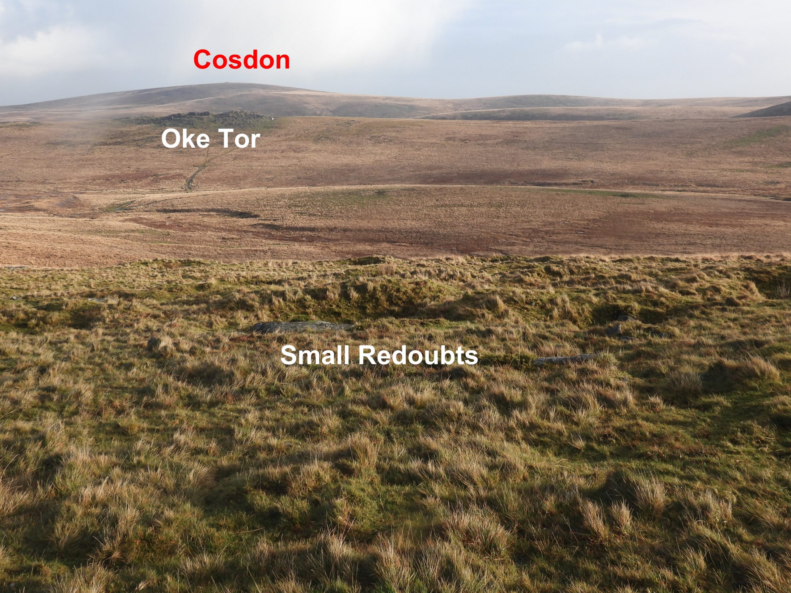
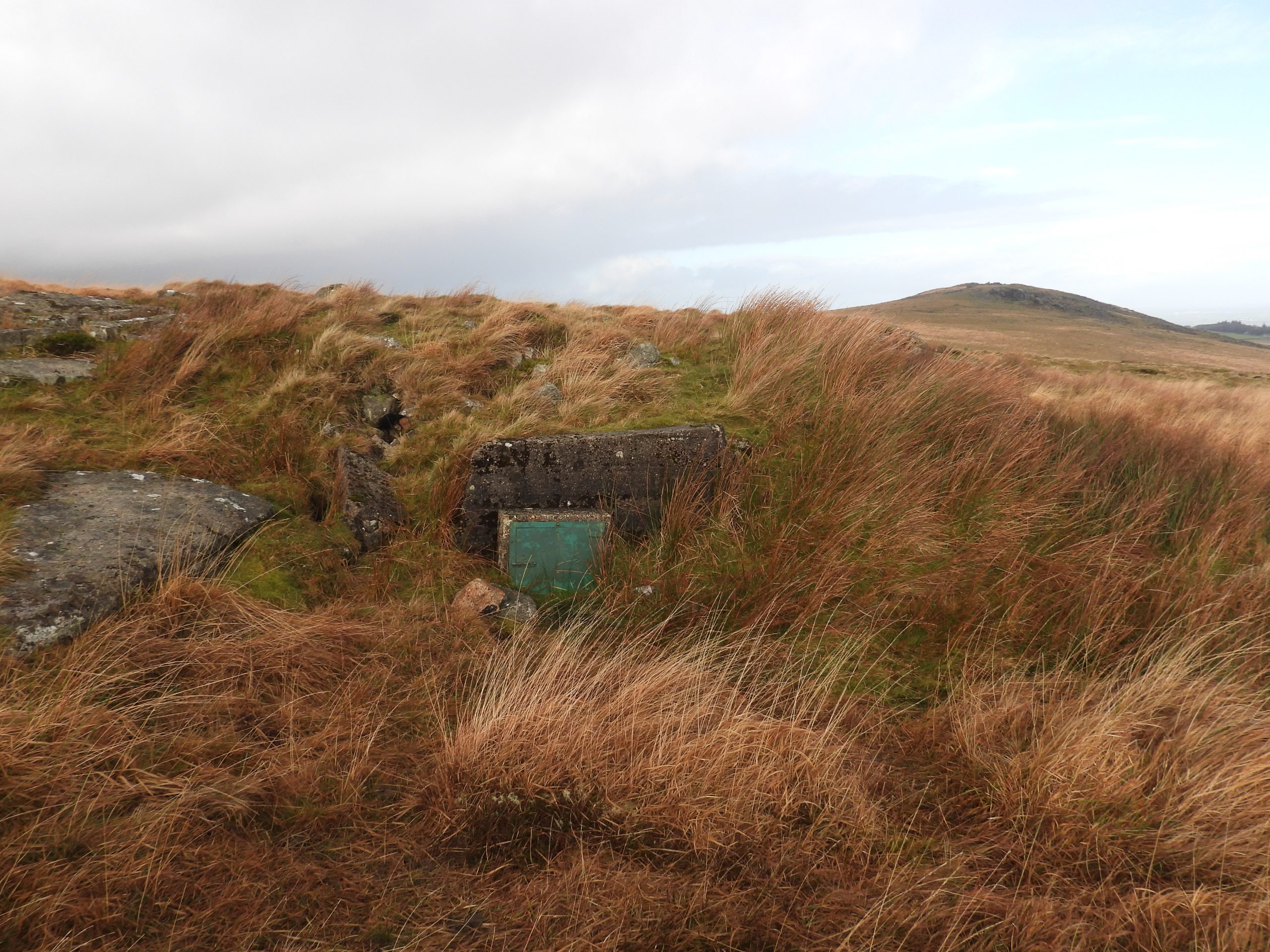
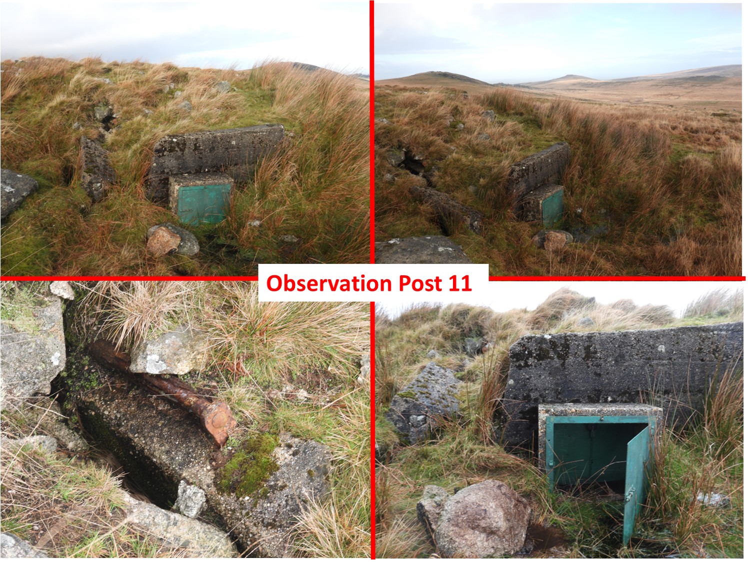
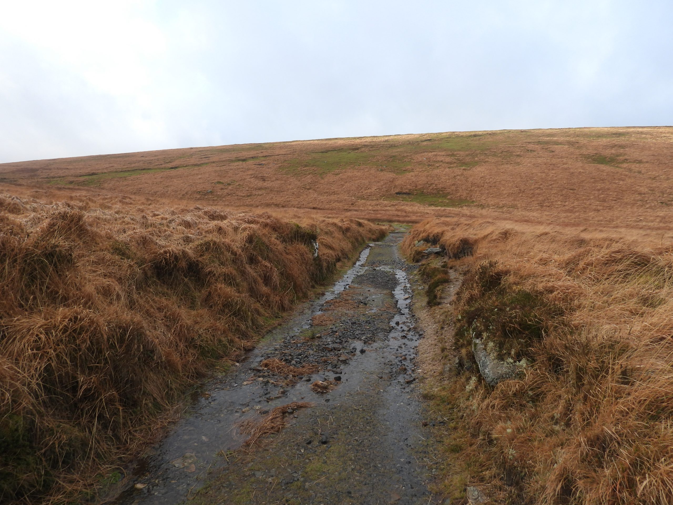
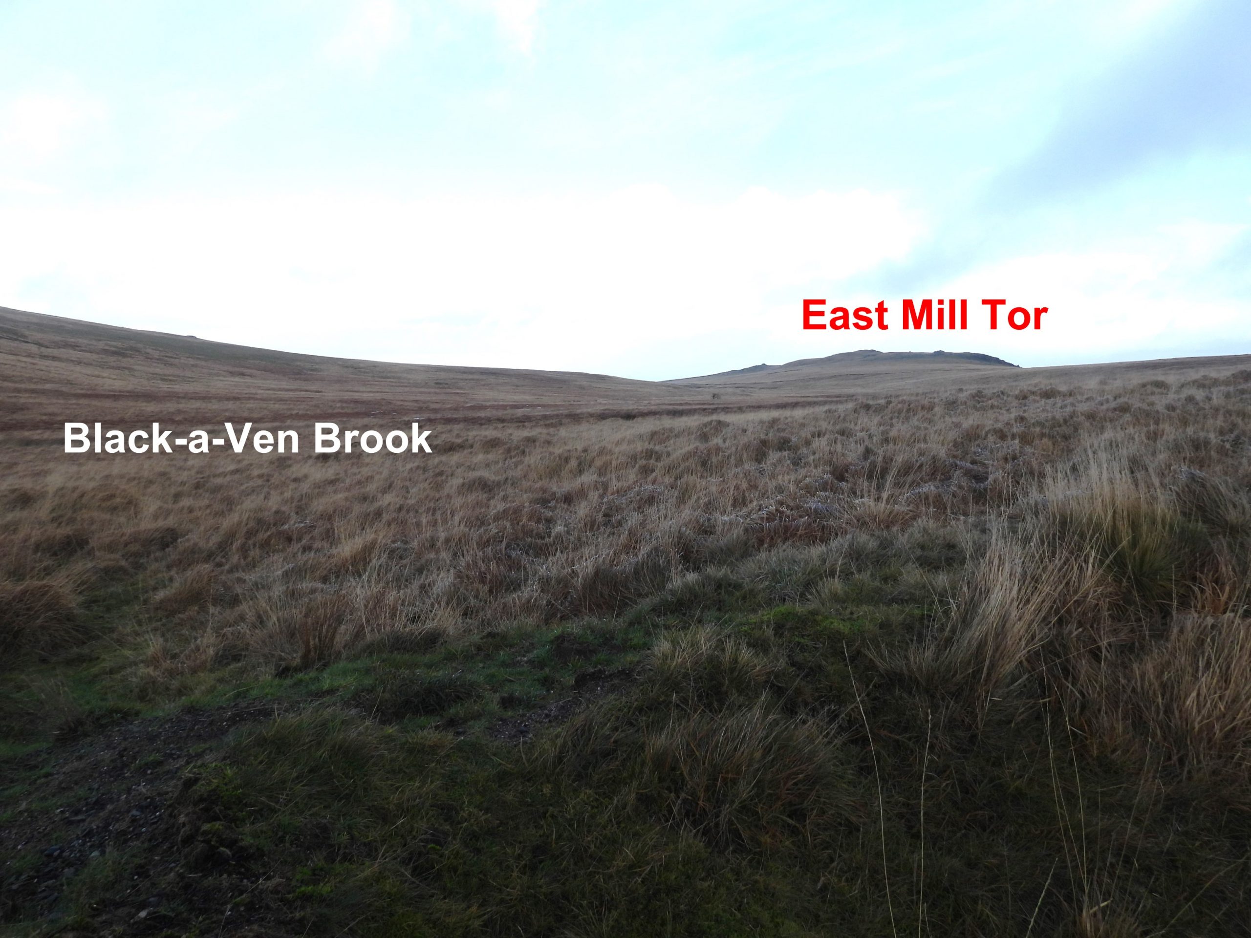
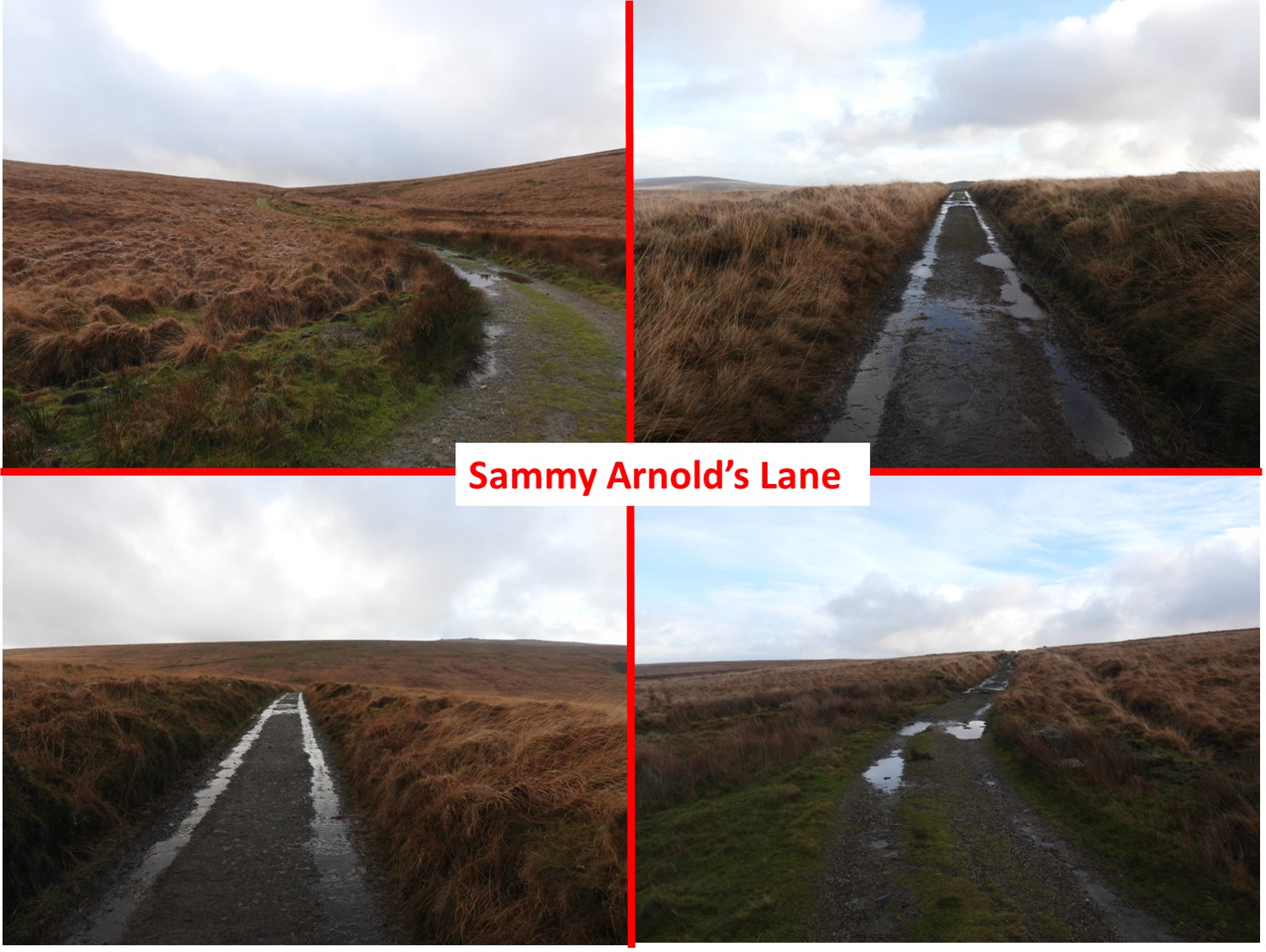
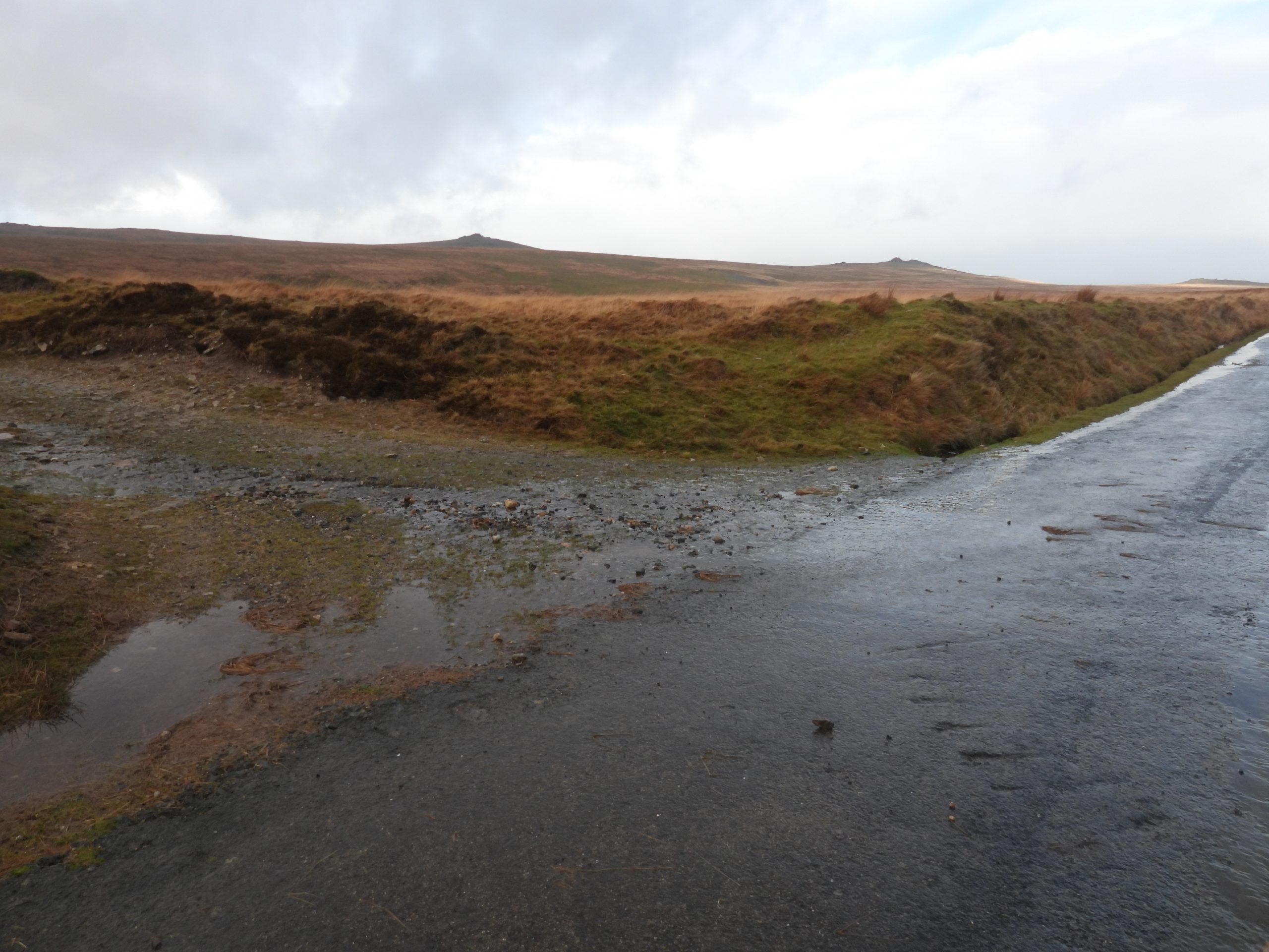
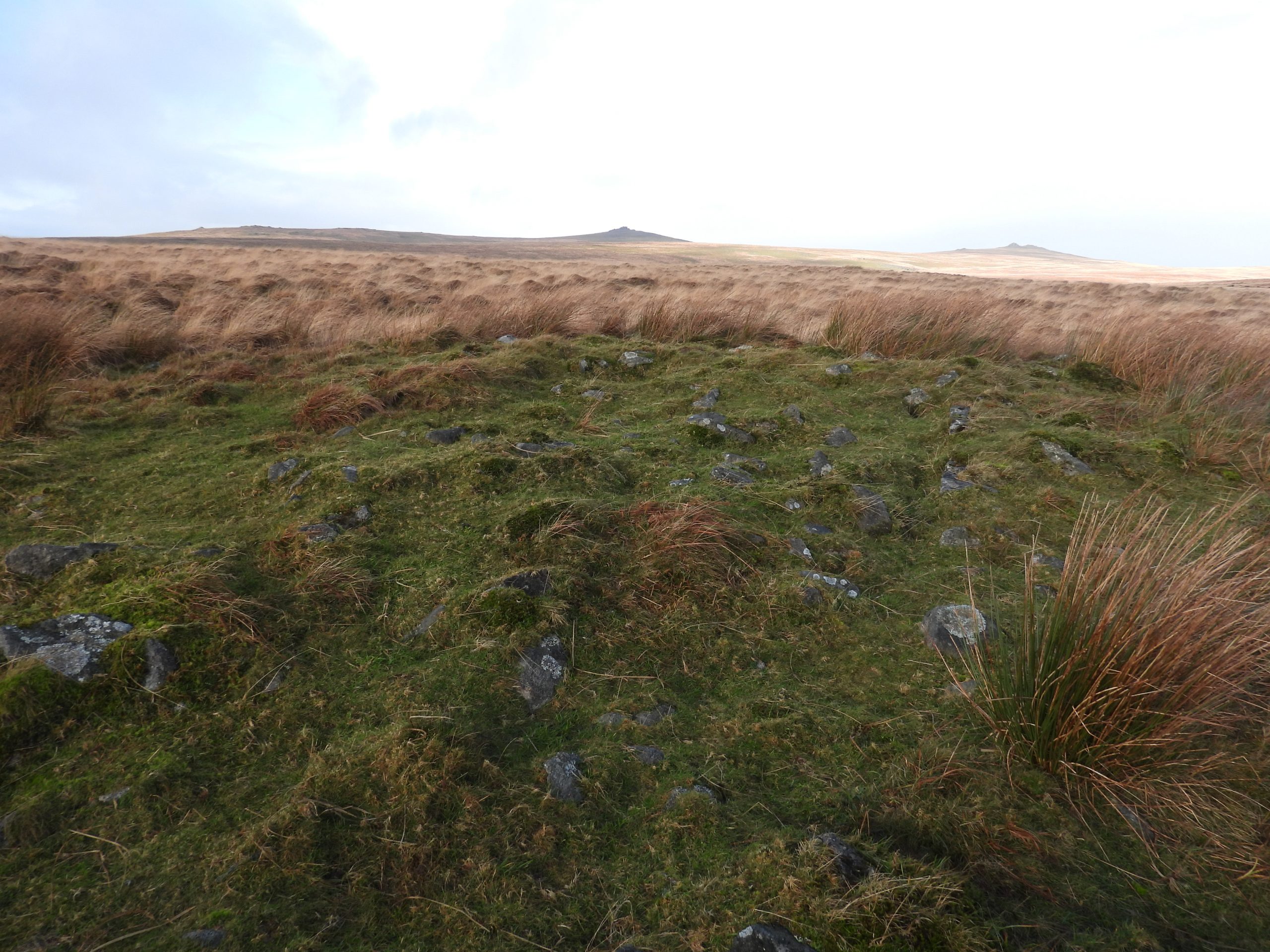
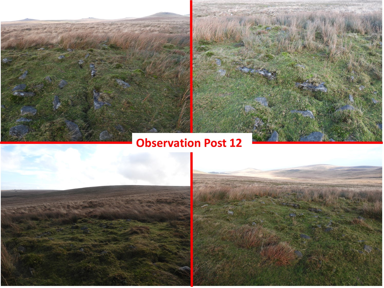
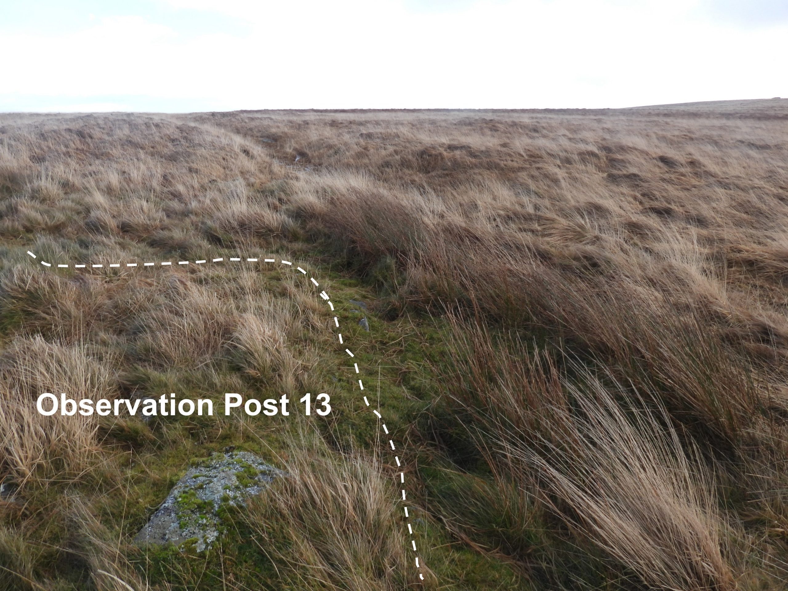
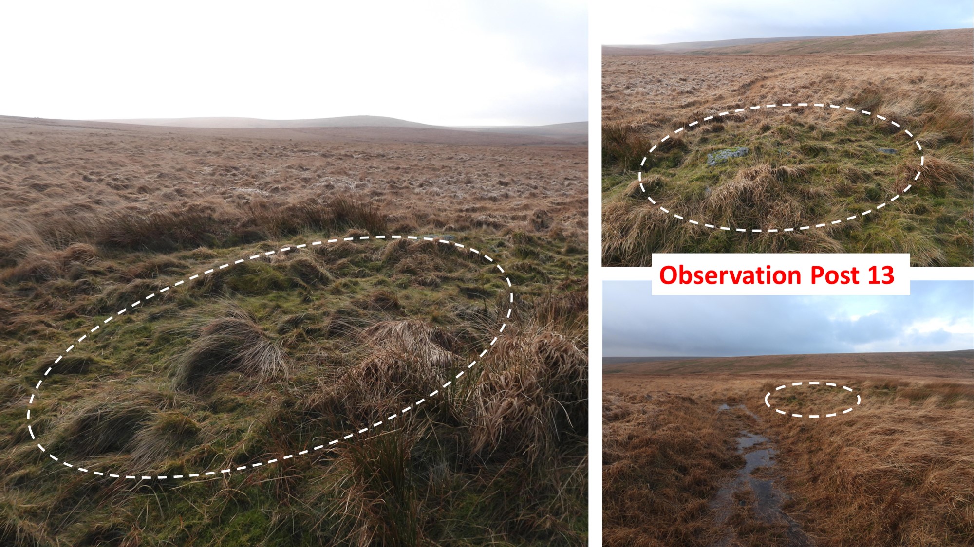
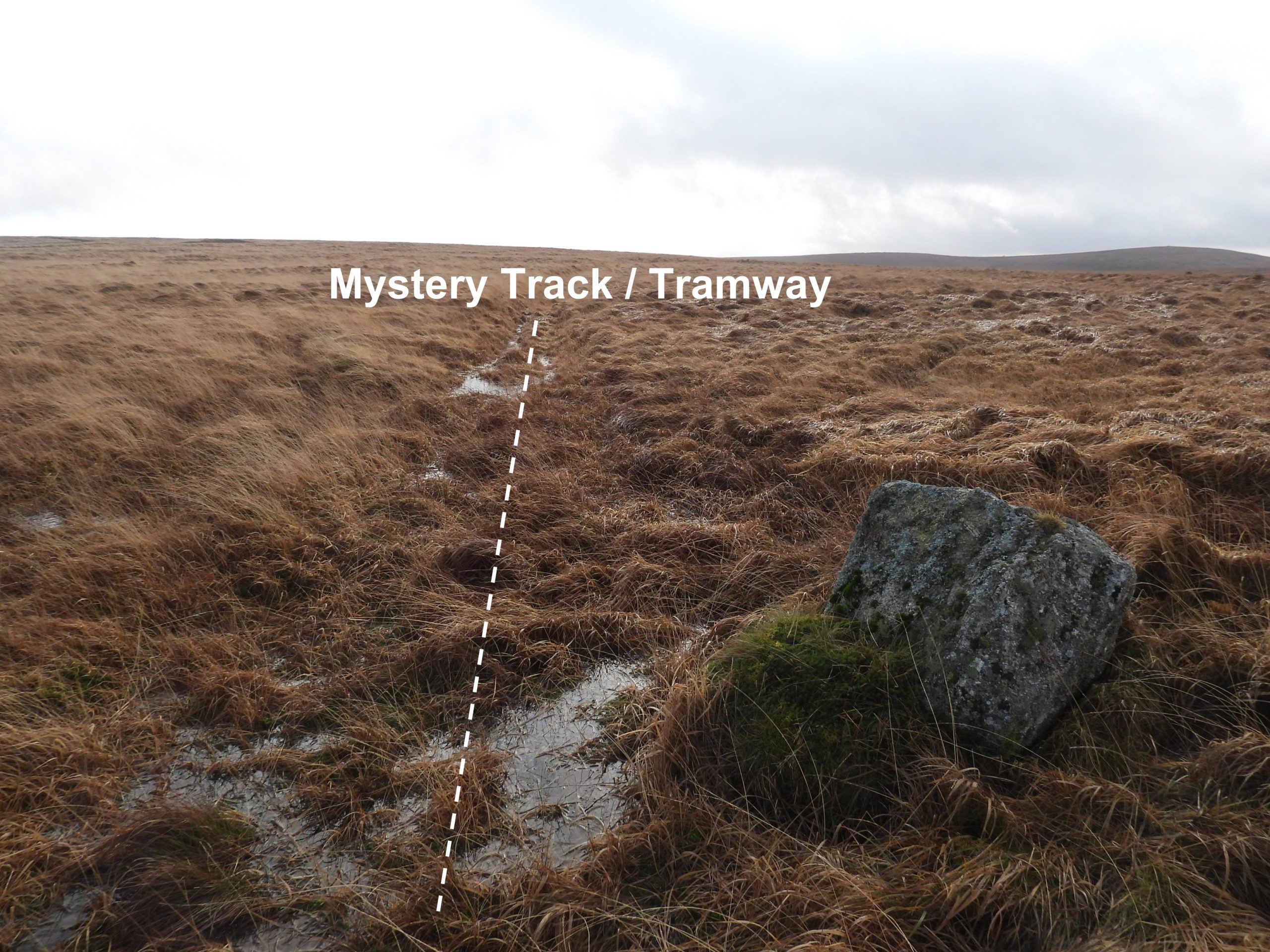
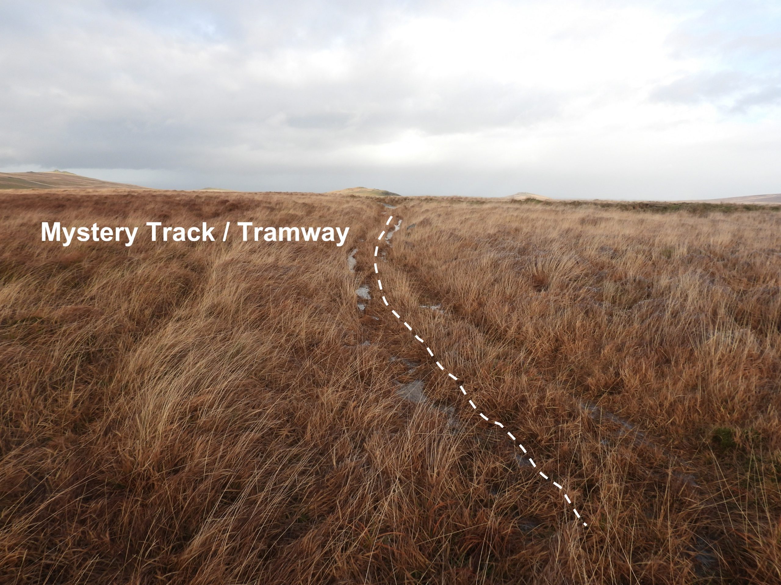
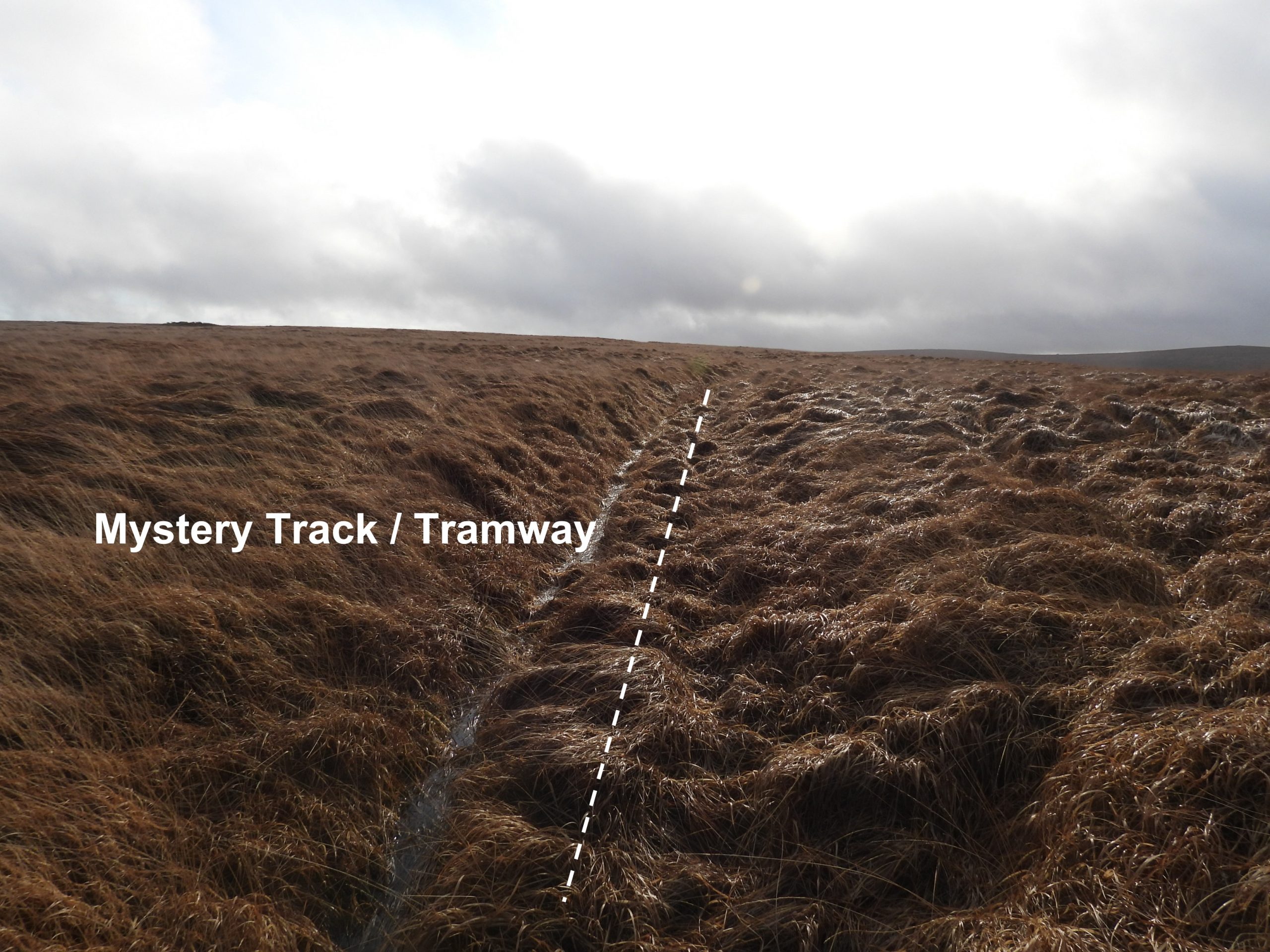
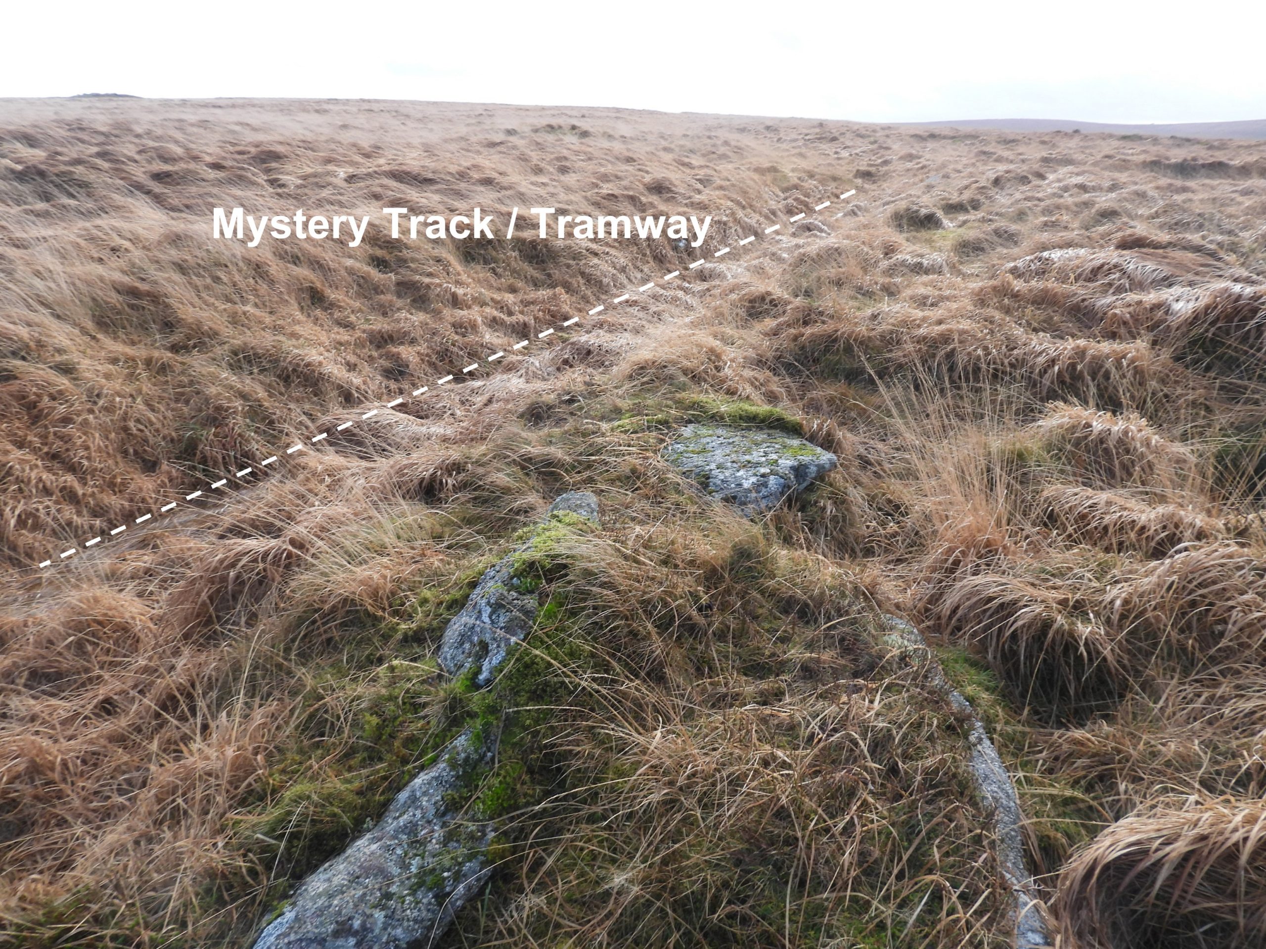
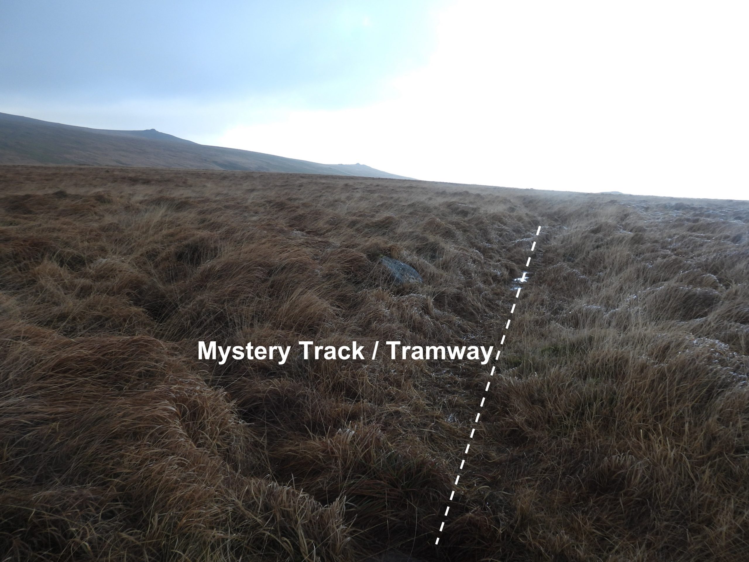
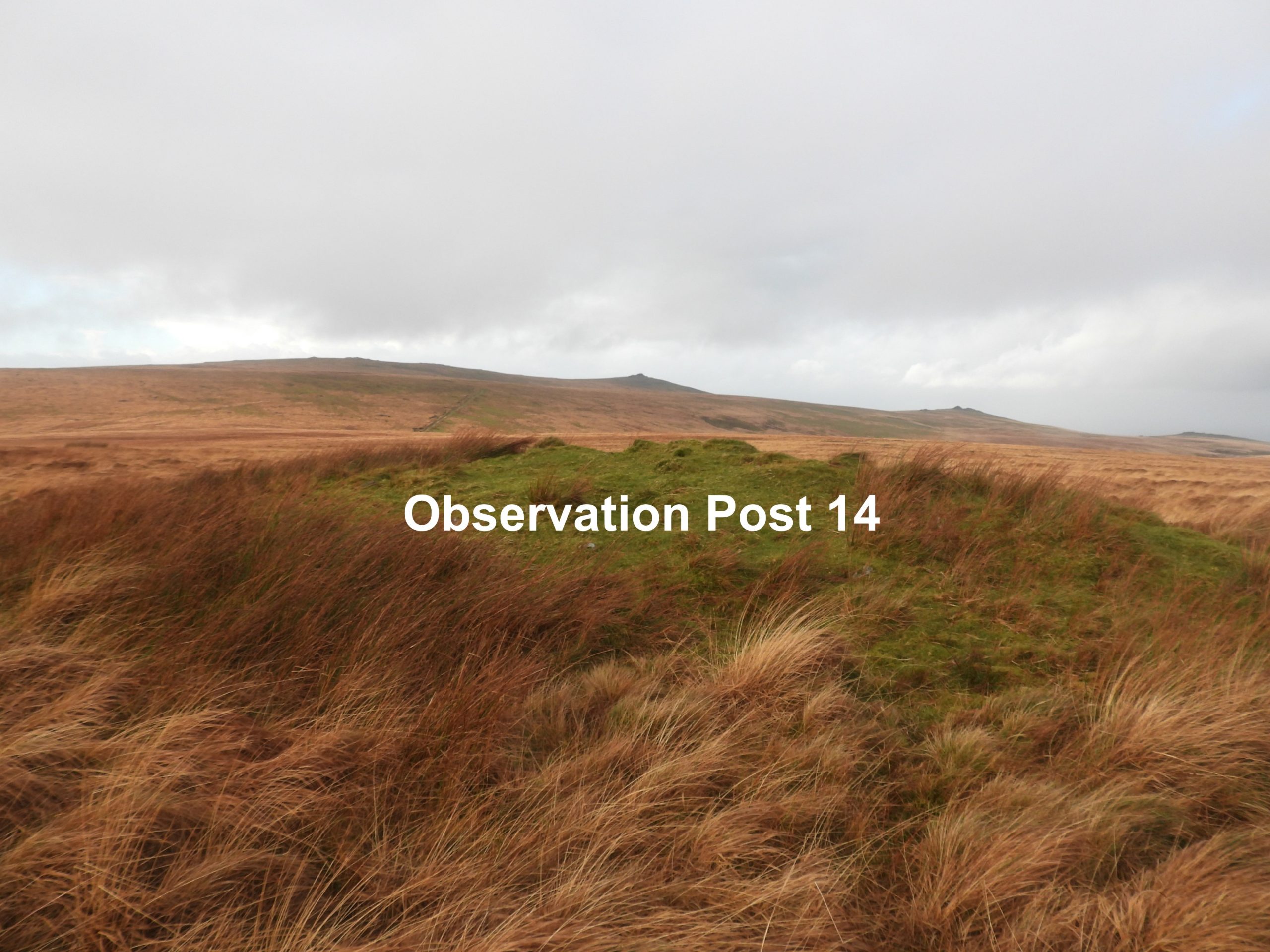
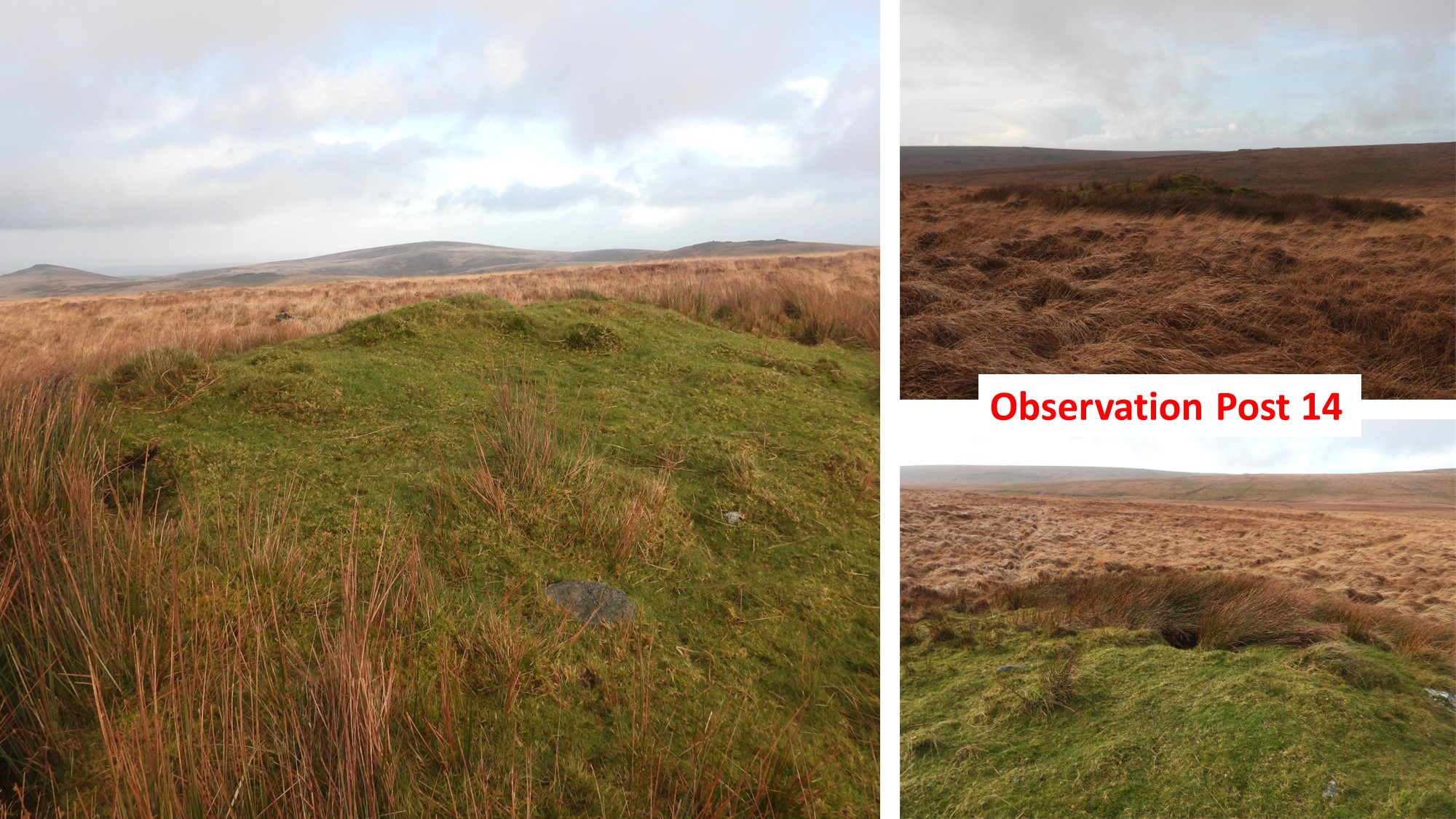
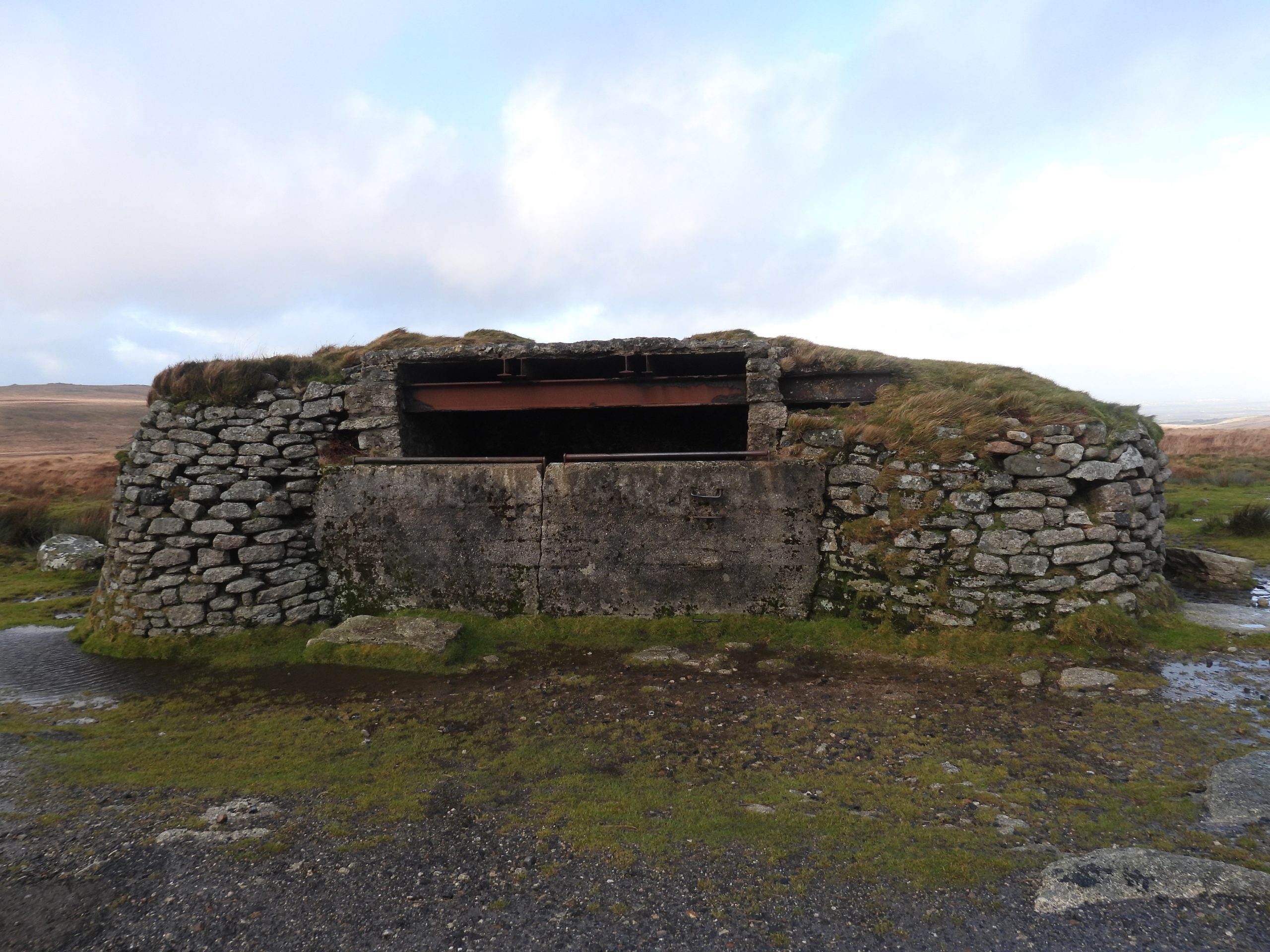
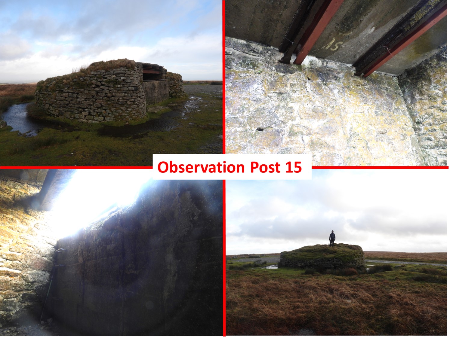
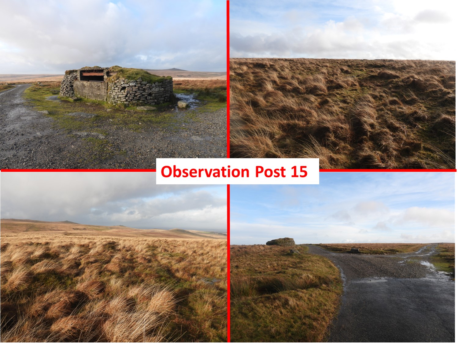
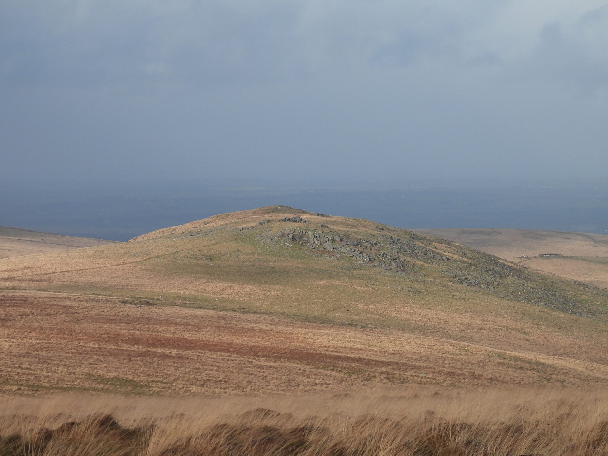
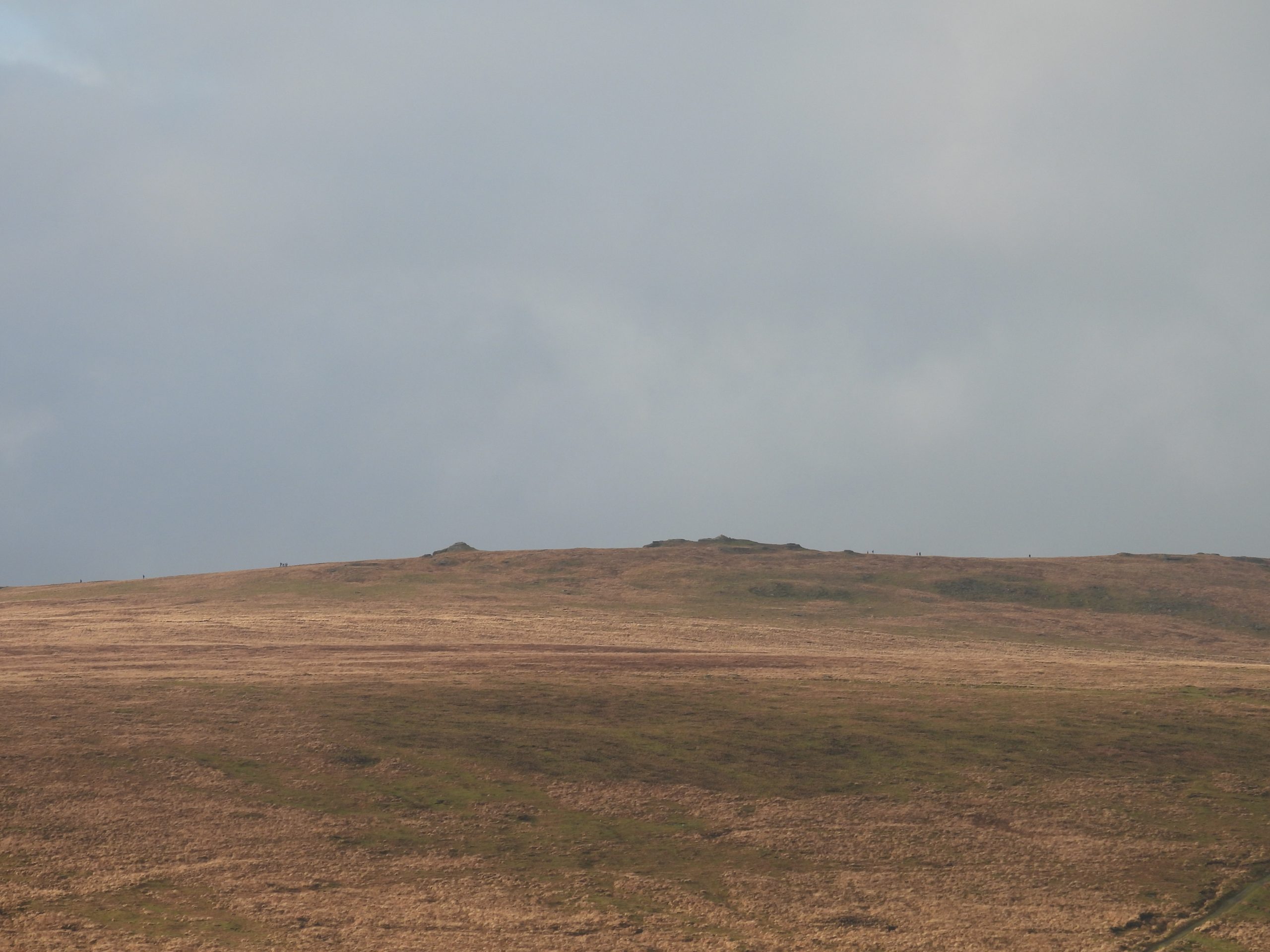
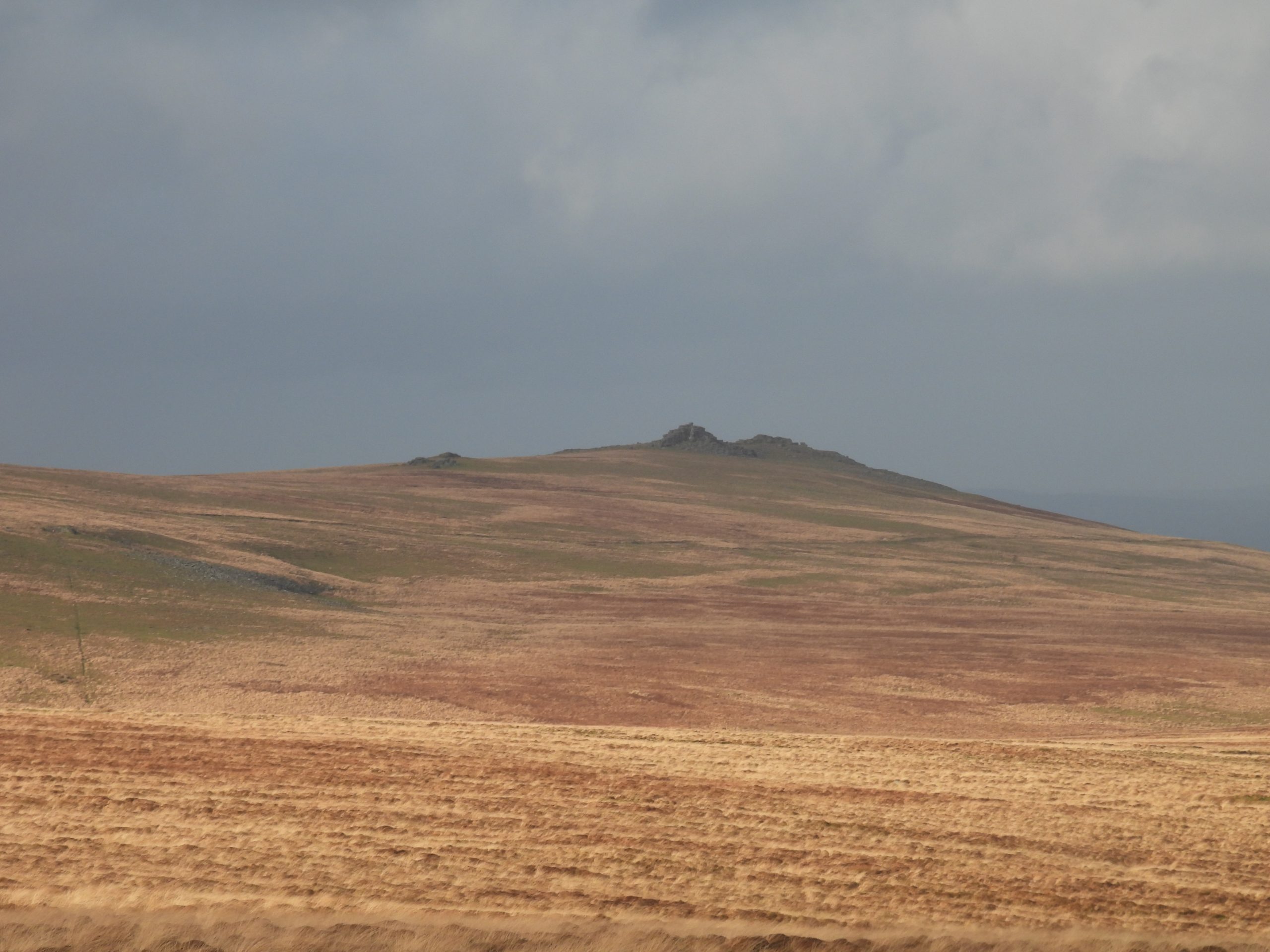
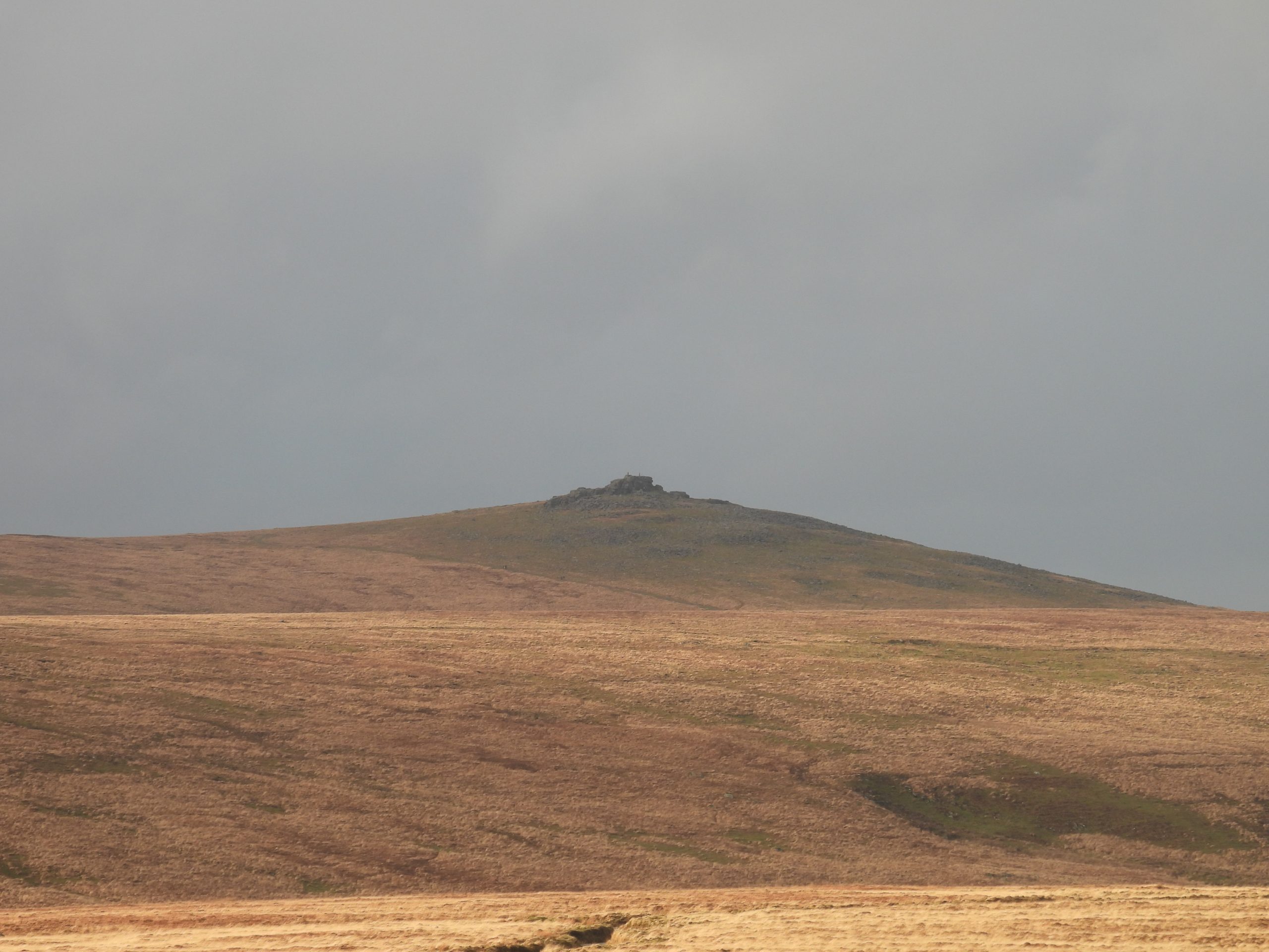
Sketch map of the features covered in this post. The inclusion of the location of the proposed target tramway / railway from the original 1914 map within this sketch was kindly agreed by Tony Clark. The original map will remain unpublished. Starting at Rowter parking area, access to the area covered in this post can easily be had by walking the military ring road (western section). The ring road was still accessible by private car until early 21st century.East Mill Tor once had two Observation Posts. This view was taken from near an old redoubt on the south west slopes of the tor. The two OPs were demolished around 1992. Further recorded information at : https://dartmoorexplorations.co.uk/target-railway-and-other-military-artefacts-on-and-to-the-north-of-east-mill-tor/On the south west slopes of East Mill Tor are the remains of a curvilinear military earthwork. It is described as an ‘Infantry Redoubt’ on the War Department 1907 map (Okehampton R A Camp and Practice Grounds Defence Estates Agency archives). The crescent infantry redoubt (near west end) was recorded at SX59741 89729. The Royal Commission for the Historical Monuments of England (RCHME) describe the earthwork thus: “……a roughly semi-circular turf and stone bank 7.5m wide and up to 2m high with a ditch 3m wide and 0.7m deep immediately to the north”. The structure is quite a impressive redoubt (given the fact its over 100 years old). There is evidence that it has been damaged by shell fire which suggests that it may have been target at some point.The features of Riddow Pits Experimental Parapets, their adjacent small redoubts and OP11 are easily visible on Google Earth. The author concedes that the ‘redoubts’ may be shell holes but in his humble opinion suggests they are too uniform for that and the earth ‘up thrusts’ are located all on the same sideThe first experimental parapet (as described on the 1914 military map) is located adjacent to the Military Ring Road. An old 1940s datum pole (F) was located in the area at SX59877 89302. It was one of a series of poles used to calibrate distances and direction of fire for the artillery (ref: Dartmoor Observation Posts by John Deakin).The first parapet was recorded at SX59855 89320There are four main parapets with associated ditches which are positioned ‘end to end’ (about 9m apart) in a north-west to south-east orientation.The second parapet was recorded at SX59875 89294RCHME describe the four main experimental parapets and associated ditches thus: “The banks are, on average, 28m long and measure between 3.8 and 5.2m wide and around 1.5m high; the ditches are 2.8 to 3.5m wide and 1.1m deep”. The third parapet was recorded at SX59902 89257All the parapets have sharply defined edges but some seemed to have been damaged by shell fire. RCHME states that “The function of these features is unclear (but) they may have acted as static artillery target butts with fire being directed from the north-east”.The fourth parapet was recorded at SX59924 89233View from the fourth parapet looking towards East Mill Tor with rainbow in East Okement valleyThere is a fifth parapet / ditch to the south of the main four. There is also a sixth further south still.The fifth parapet was recorded at SX59846 89301View of the four main parapets with East Mill Tor beyond. In the foreground is an upright boulder(SX59888 89091), which is possibly not a natural feature and was placed upright for (as yet) an unknown reason.To the east of the four main parapets are a series of well defined earthworks, which the author believes are redoubtsView across the small redoubts into the East Okement valley.View across the small redoubts to Steeperton TorView across the small redoubts to Steeperton TorTo the south of the experimental parapets is an un-named outcrop close to where Splinterproof Hut 7 / OP11 were located. The outcrop is at SX59954 89041The remains of Splinterproof Hut 7 / OP11. This stony mound is approx measuring 8m x 8m and around 2m high. It is located at the southern end of the small granite outcrop shown in the previous picture.OP11 has an old telephone point still intact adjacent to an old concrete blast wall. A grab rail can be seen in the bottom left picture. The location is SX59953 89023….and so onto the search of the ‘planned’ target tramway / railway. The picture is Sammy Arnold’s Lane, which was named after a local peat worker who worked around Dinger Plain and Knack Mine area. This part of the lane is near the Black-a-Ven Brook. One spur of the tramway was planned to have crossed Sammy Arnold’s Lane near to the Black-a- Van Brook and extended northwards. No evidence has ever been found by the author. Google Earth also, doesn’t yield any results.Another spur of the tramway was planned to have crossed Sammy Arnold’s Lane (approx half way between the Military Ring Road and the Black-a- Van Brook). No evidence has ever been found by the author. Google Earth also, doesn’t yield any results.Junction of Sammy Arnold’s Lane and the (still partly tarmac’d) Military Ring Road. Leaving the search of the old tramway briefly, this picture is the remains of OP12, which is believed to have been built in the 1920s. The remains are on a roughly circular stony mound measuring 15m in diameter.A mortared stone wall is visible slightly east of centre (see the top left and top right pictures) and fragments of concrete lie on the SE corner. It was demolished prior to 1992. The remains are at SX59888 88488Observation Post 13 lies at the end of a short spur track to the west of the Military Ring RoadThe author is uncertain if he has ‘nailed’ the exact spot of the old OP, but the stony mound next to the track spur seems a probable location at SX59558 88301. It was originally a basic stone granite shelter with a corrugated roof. The remains were cleared in 1995.Close to the spur track to OP13 and extending in a southerly direction, the author noted a small track, which was barely 2m wide and looked unnatural. Is this part of an tramway or just old vehicle tracks? The rock in the picture was recorded at SX59691 88255The mystery track / tramway (?) can be followed for several 100s of metres. Its location is close to but not exactly where the planned target tramway / railway was supposed to be. Could this an old tramway (just partly built) or just an old vehicle track. The track is up to 1m deep (against the surrounding area) in parts.This part of the mystery track / tramway has deep (ish) sides and curves. It can also be seen on Google Earth. More views of the mystery track / tramway, where some rocks were avoided. The track curves (top right of picture) and OP14 (mound) can be seen as a feature (top left of picture on the horizon).Looking back north along the track. It does seem man-made and unlikely to have been just wear from tyre tracks due to the depth. The track peters out to the west of OP14. The track at this point crosses where the original planned target tramway / railway was planned. Was this a scaled down version of the original plan ?The remains of the destroyed Observation Post 14 lie at the end of a short track branching from the military ring road.There are few remains of the original structure today at SX59849 88035. The grass-covered pile of stones measuring approx 15m by 20m and is around 2m high. After demolition, the granite used in its structure was used to repair Deep Ford (East Okement) on the east side of the Military Ring RoadOP15, probably one of the most well known of the Observation Posts near the top of Okement Hill. It was, up to early 21st century a popular parking spot for those wishing to reduce their hiking distances and get to the upper reaches of the Rivers Taw, East Dart and West Okement (Cranmere Pool). It was constructed around 1923.OP15 was originally built with thick wooden joists, which have been replaced (it looks like on more than one occasion) by metal girders. The OP is located at SX60254 87754The start / termination point of the planned target tramway / railway was in the vicinity of OP15 (which hadn’t been built at the time). There is a little ground disturbance to the north west of the OP (top right / bottom left pictures) but this doesn’t look like a track of any description. The track veering to the right (seen in the bottom right picture) heads towards Ockerton Court and the upper reaches of the River Taw. View from OP15 area – East Mill TorView from OP15 area – High WillhaysView from OP15 area – West Mill TorView from OP15 area – Yes TorAfter demolition, the granite from OP14 was used to repair Deep Ford (East Okement). The author can recall having driven through this Ford in a Ford (Cortina) in 1986 en-route to OP15 (there was little clearance as I recall !)