A collection of walks, discoveries, insights and pictures of exploring Dartmoor National Park
March 6, 2024
Lesser well known bridges across and adjacent to the River Swincombe
Whilst exploring the Swincombe Valley from Swincombe meet (where the river joins the West Dart) and Swincombe reservoir, you would be forgiven to think there were only a three bridges in this area, namely; the road bridge to Sherbeton Farm, the footbridge (aka Fairy Bridge) to the ruins of John Bishop’s House and Upper Swincombe Farm and the bridge at Swincombe Reservoir.
There are, however, three more (lesser well known) bridges in the area, which are covered in this post. One for these bridges is a five granite impost clapper, which is located close to Fairy Bridge and once was used by travellers on the old Tavistock – Ashburton Pack Horse Track when they as they crossed a leat which had been constructed to feed water to Gobbett mine further down the valley. The second and third (lesser well known) bridges are located between Gobbett mine and the road bridge to Sherbeton. The second and third bridges appear to have utilised an island in the river to enable access to an unknown building or possibly the former bee hives associated with Brother Adam of Buckfast Abbey.
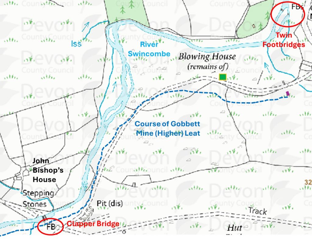
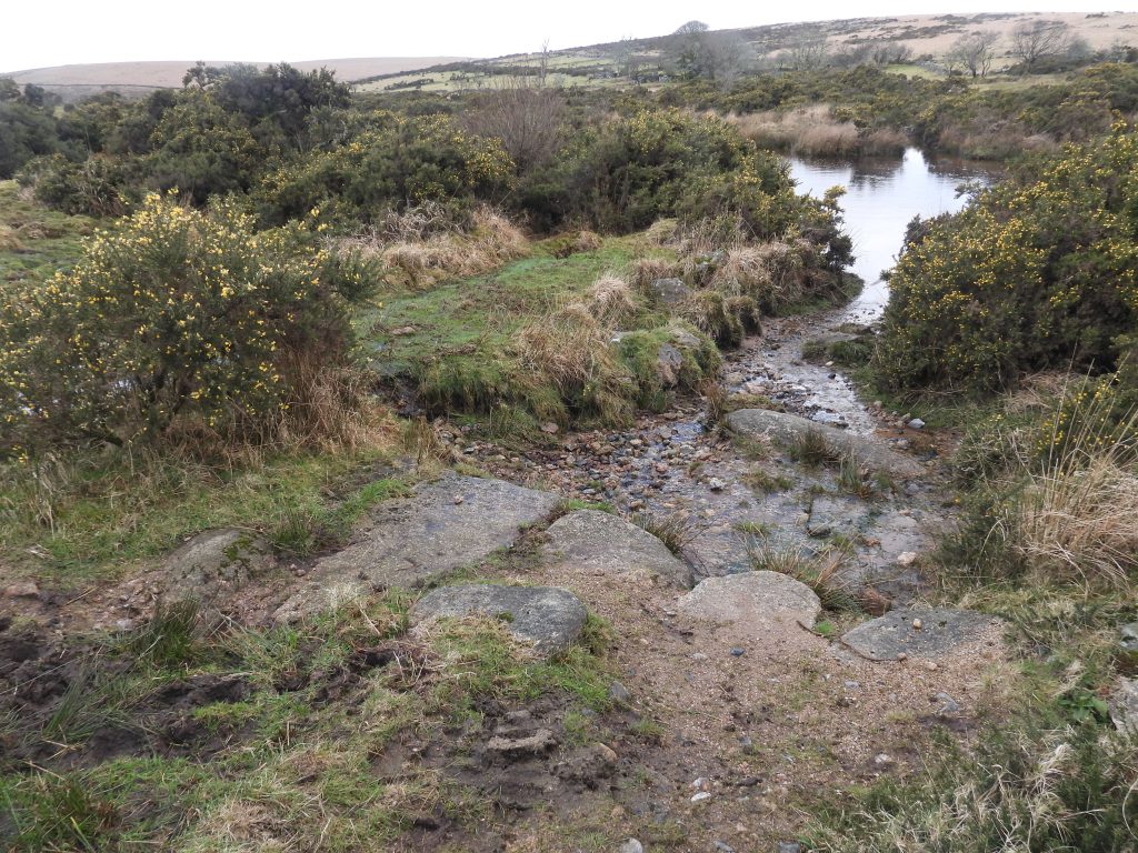
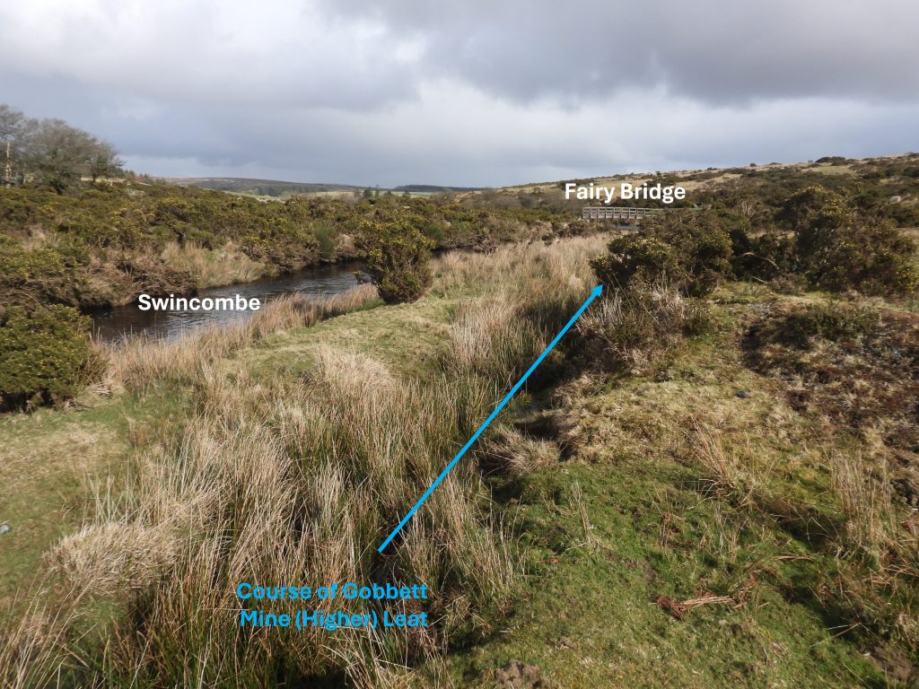
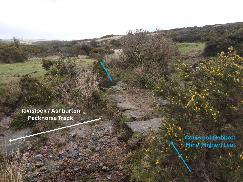
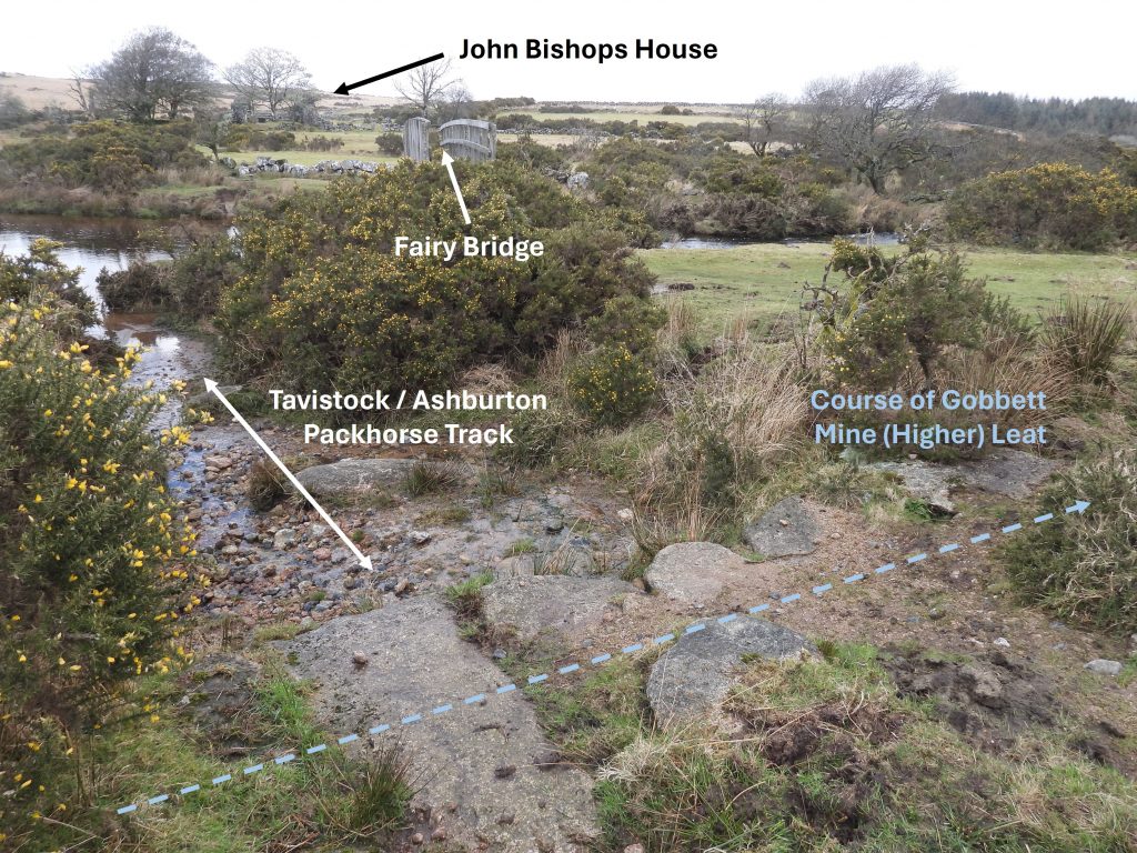
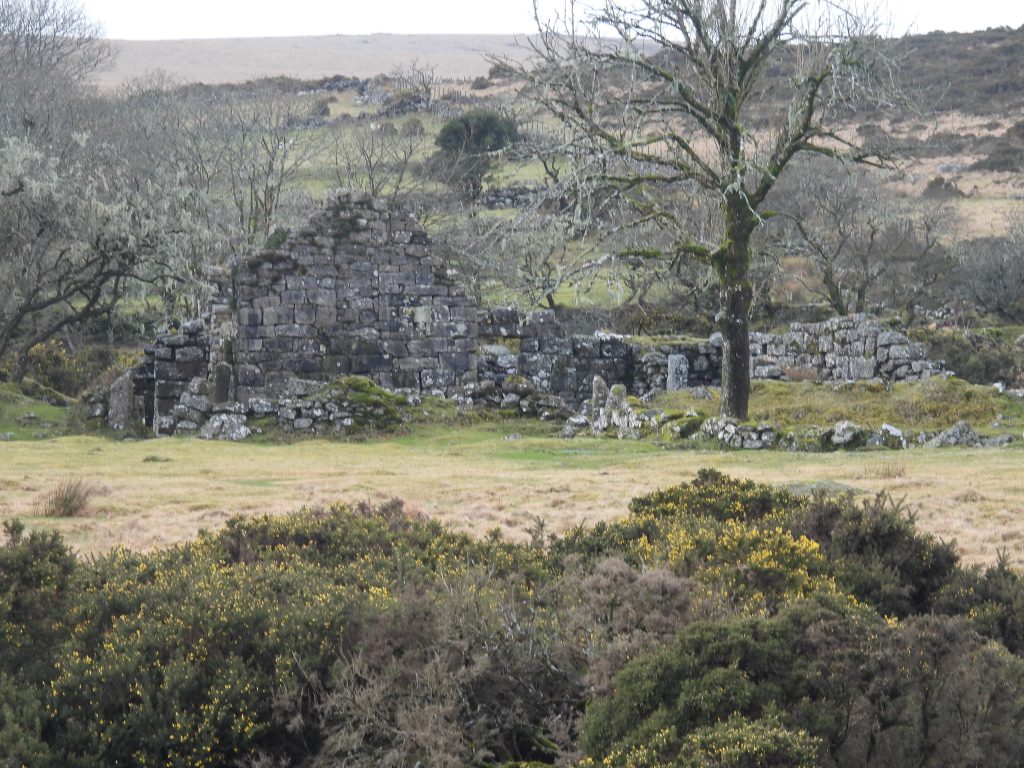
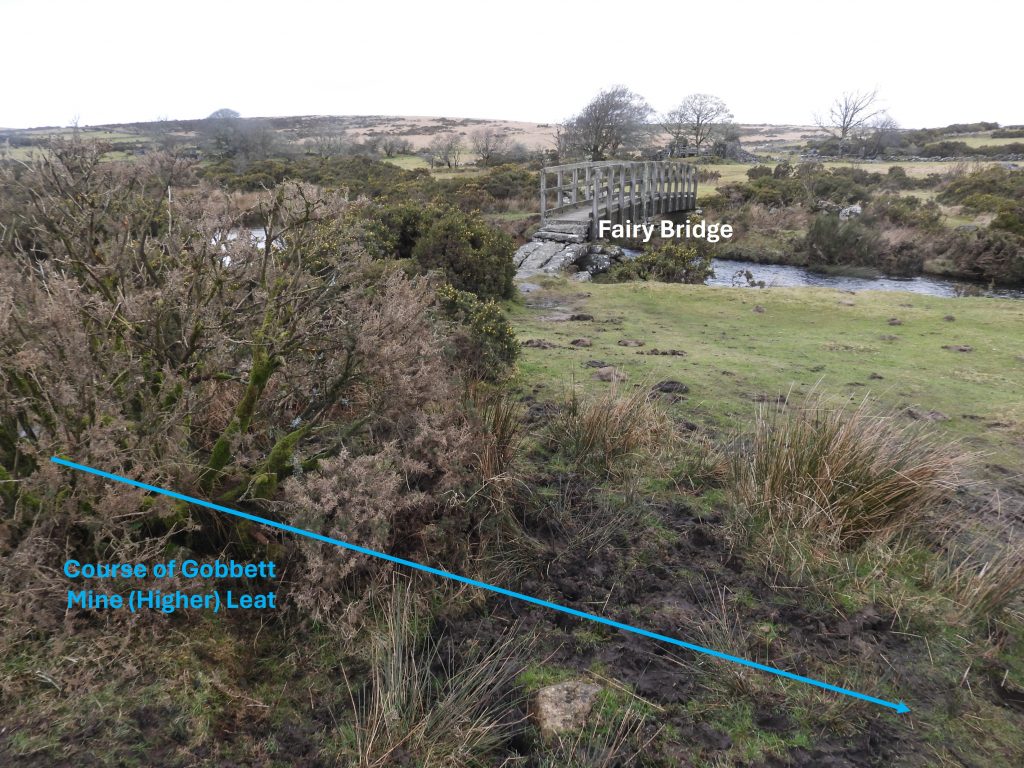
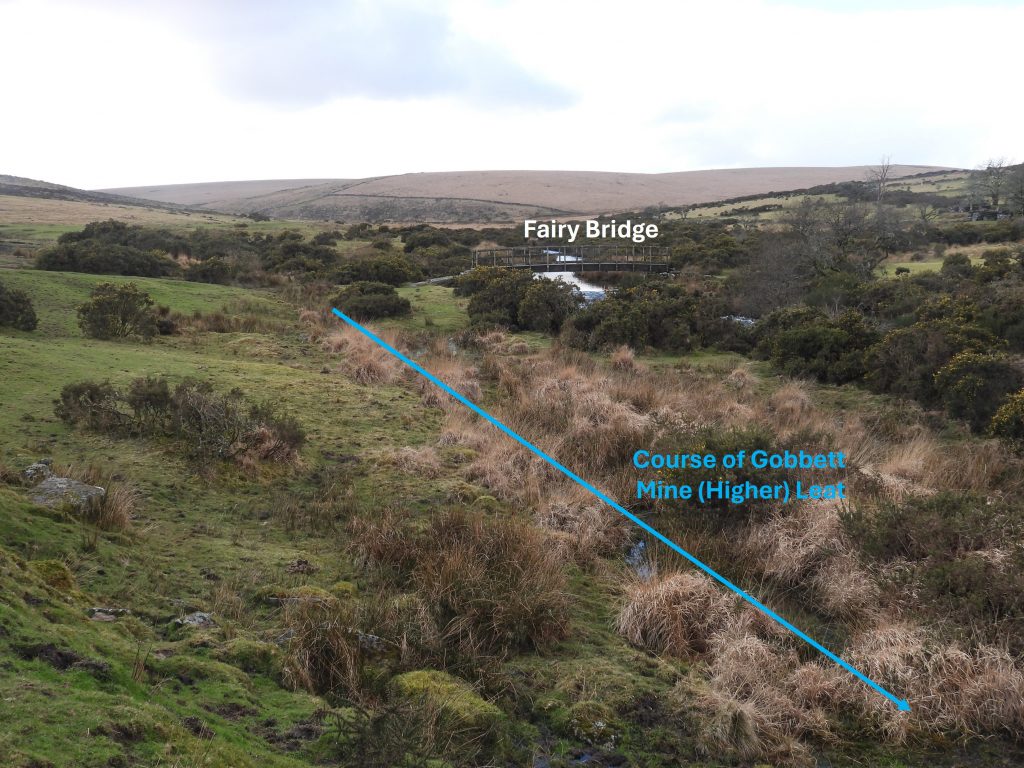
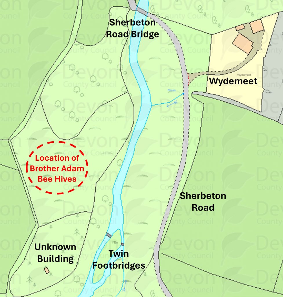
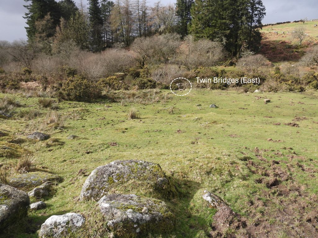
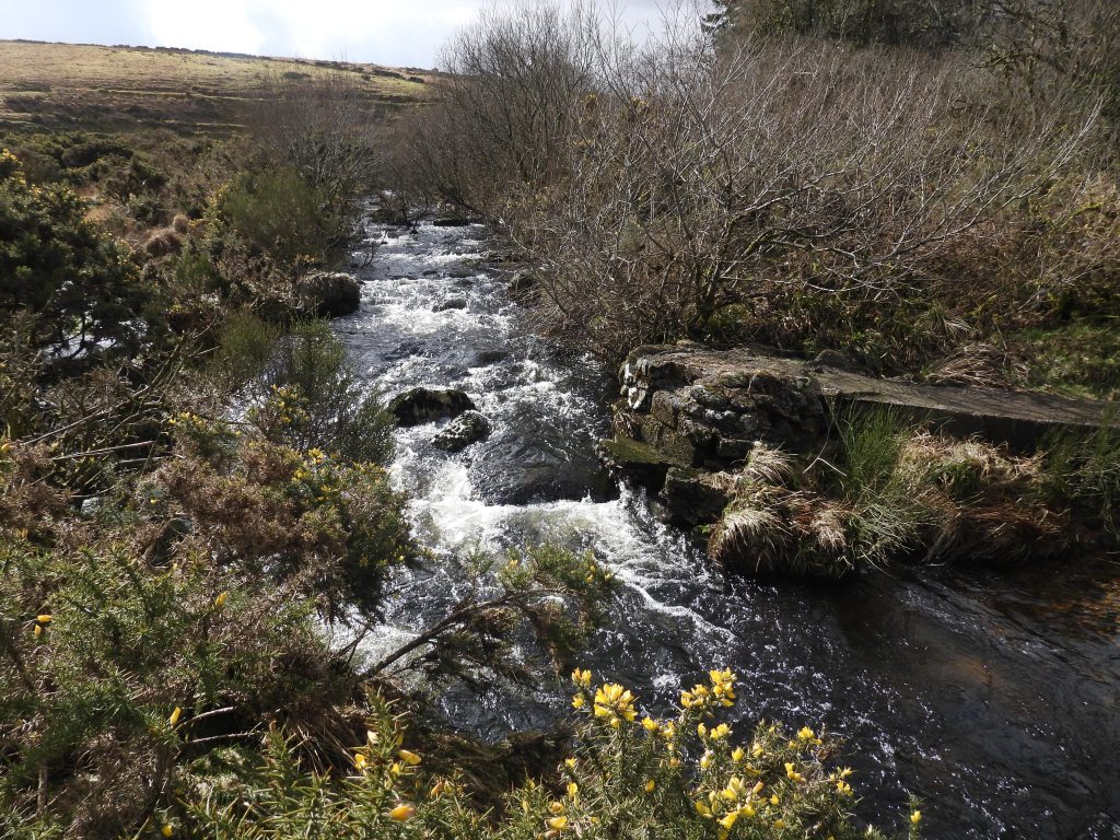
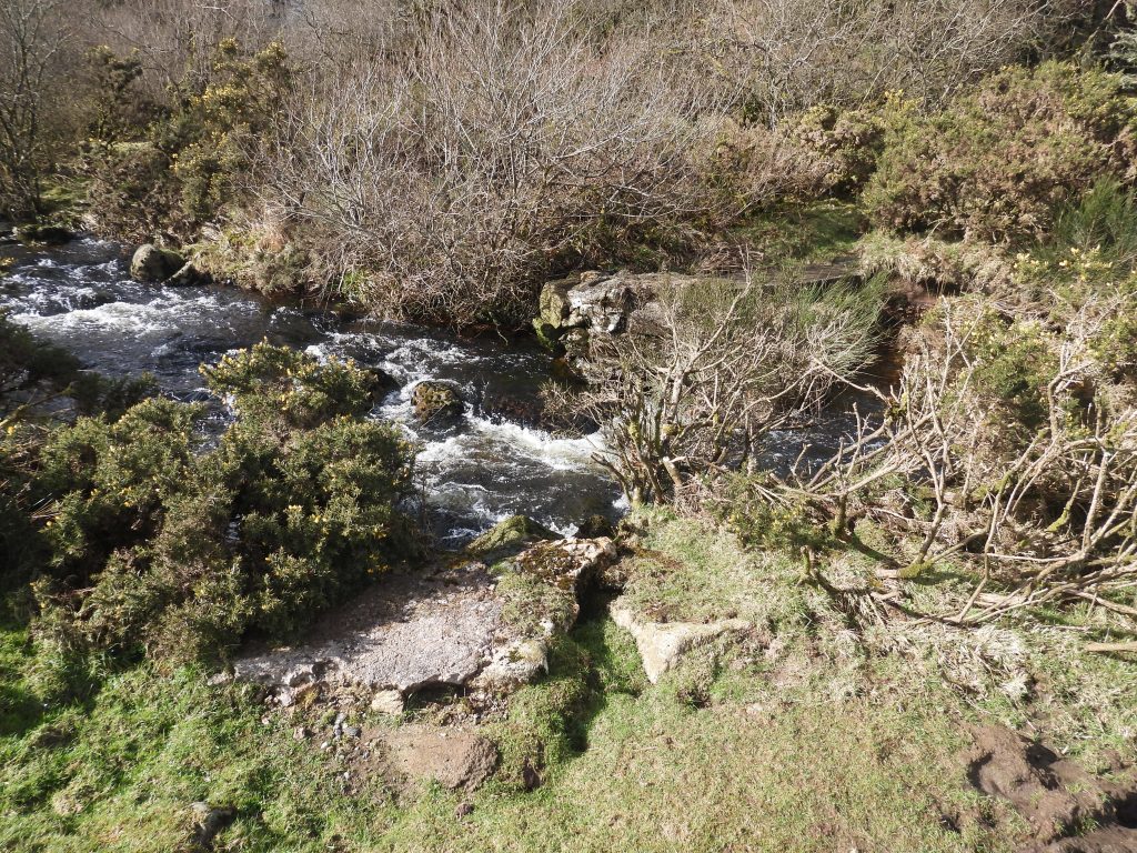
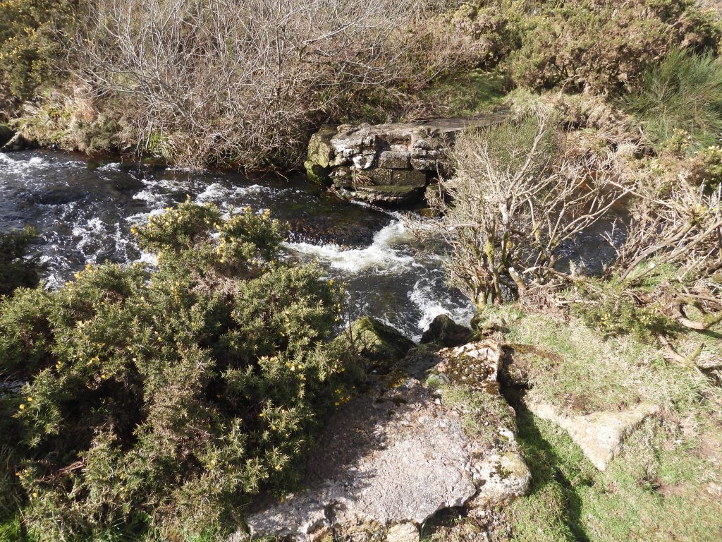
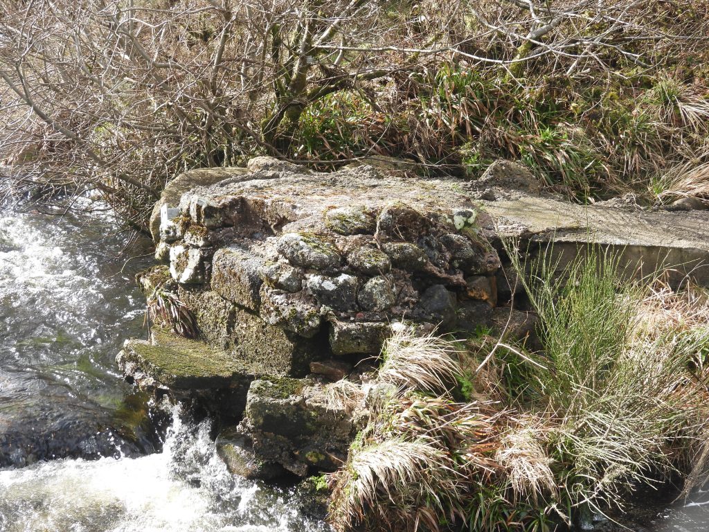
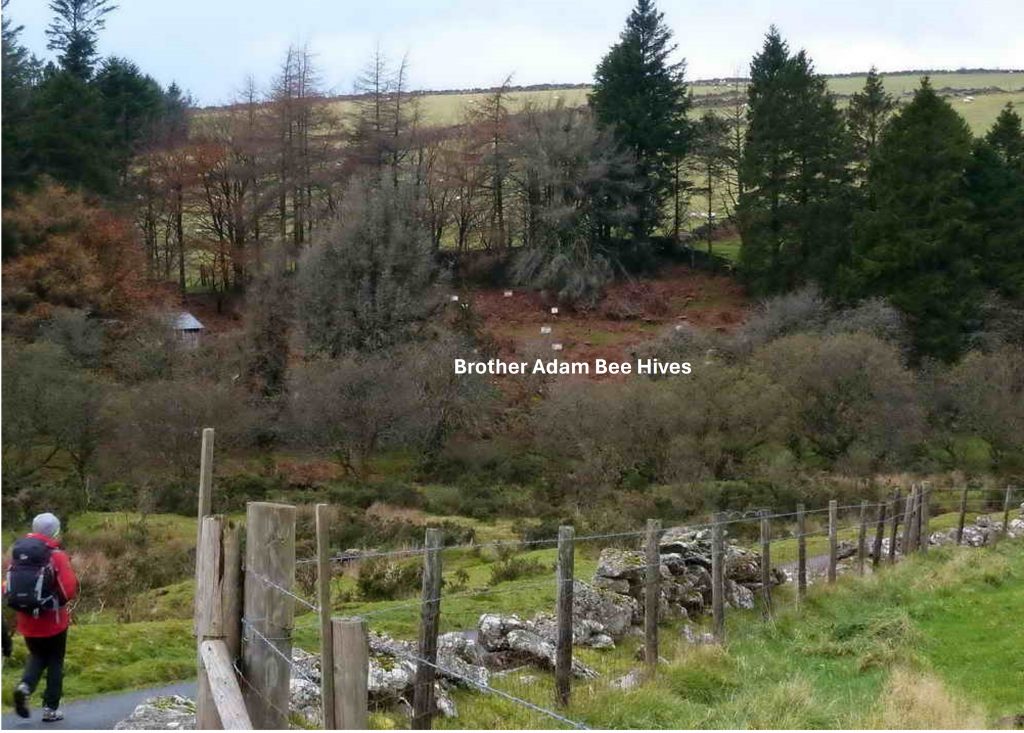
This annotated map shows the locations of the Clapper Bridge and the Twin Bridges covered in this post. Of note is the course of a leat which was dug in the mid-19th century to feed water to Gobbett Mine (42ft stamps wheel). There were two leats feeding the mine, but only one is annotated on the map as the ‘higher’ leatThese rather unassuming granite slabs near to the ford and Fairy Bridge on the Swincombe are (or at least appear to be) a five impost clapper bridge on the Tavistock / Ashburton Packhorse Track. They are located at SX64181 72491To understand the history a little more, a short distance upstream from the ford and Fairy Bridge, the course of the Gobbett Mine Leat can be found. The take off point for the leat can be located at SX64031 72460The leat will have been supplemented by the run off from Deep Swincombe, which probably influenced the tinner’s choice of leat course and length (a distance of over 600 metres). This is why the leat runs parallel to the Swincombe for some distance including running past the ford and Fairy Bridge. The tinners only obstacle at the time the leat was constructed would have been the Tavistock / Ashburton Packhorse Track leading to John Bishops House and Upper Swincombe Farm. The photograph above shows the relative course of the leat and the track. This does strongly suggest these imposts are an old clapperThis picture shows the clapper, ford, packhorse track, Fairy Bridge and John Bishop’s House in one compositionZoomed in view of John Bishop’s House. There were two small buildings shown here on the 19th century Tithe Map surrounded by four small fields. The Tithe Apportionment states this was : ‘Tenement near Swincombe’ and lists Field Number 1222 as ‘Cot House and Garden. With the tithe, circa 1840, the leat and therefore clapper and leat construction would post dates these ruins. The course of the leat runs very close to Fairy Bridge and is not that discernible here. However a few ten’s of metres upstream and downstream from this location the course of the leat can easily be found.The author assumes that the leat was dug just before or around 1865 when ‘machinery’ (e.g flat rods and stamps?) were installed at Gobbett Mine (reference Helen Harris – Industrial Archaeology of Dartmoor)The second and third (less well known) bridges in the area are shown on the annotated map. The main road bridge to Sherbeton is likely to have been extant when these bridges were constructed (as they do not appear on 19th century maps). The question is why were they here? There appears to be two options, namely: a) They may have enabled access to the unknown building in the woods on the west side of the river. The unknown building also is not shown on 19th century maps, which may further cement the argument that it relates to the twin bridges construction or b) They provided access to some bee hives, once associated with Brother Adam of Buckfast Abbey were located to the north west of the Twin Bridges (source: Liz Miall). It is, of course possible the bridges were access to both the hives as well as the unknown building.When walking the tarmac road from Gobbett Mine to Sherbeton the remains of the easterly of the twin bridges can be seenNext to the river the remains of the abutments of the easterly of the twin bridges. At this point, one could be forgiven to believe this was the only bridge and the other side of the river is the west bank and not actually an island.The two abutments of the easterly of the twin bridges. The location of the abutment nearest the camera was SX64667 72920Close up of the abutment on the island. Sadly access to the west side of the river is difficult (private land), so finding the western bridge and unknown building in the woods wasn’t possible. The author may paddle across the river in the Summer to explore further. In the meantime, if anyone has any information relating to these bridges, the author would be grateful in receiving it. Thank you.Picture from 27th November 2013 from the Dartmoor CAM ‘archived’ website showing Brother Adam Bee Hives across the river from the Sherbeton tarmac’d road. The leader of that walk (Liz Miall) is shown in the picture in red and kindly has agreed for this picture to appear on this post. Liz also, has kindly provided the author with her notes from the walk, thus: “Buckfast Abbey bees – here Bro. Adam (1898-1996) developed the Buckfast Bee (a docile, highly productive, low swarming strain). This was the breeding station and was known as the moor mating station (!). Bro. Adam planted the trees for shelter. Now, with the bees in crisis, this place has been re-activated by International bee keepers keen to preserve the bee, now known as the Buckfast Superbee. Re-activated Summer 2012, land part of Sherbeton Fm”.
hi Steve,
I’ve also found another possible crossing point at SX 63311 72066 consisting of two rocks protruding into the river with drilled holes that possibly supported a handrail to assist with a short jump across?

Matthew Johnson October 5, 2024
hi Steve,
I’ve also found another possible crossing point at SX 63311 72066 consisting of two rocks protruding into the river with drilled holes that possibly supported a handrail to assist with a short jump across?
SteveGriggDartmoor October 5, 2024 — Post author
Hi Matt,
Great find. I must go an investigate next time I’m in the area.
Kind Regards,
Steve