A collection of walks, discoveries, insights and pictures of exploring Dartmoor National Park
June 14, 2023
Lych Path – Crossing the Tavy and Baggator Brook
The Lych Way (or Lich Way) was a Medieval ‘Way of the Dead’, a route by which the deceased of the early farm settlements on the east side of the Forest of Dartmoor would have been carried in their coffins to Lydford Church. This practice continued until 1260, when the tenants of the farms were granted an episcopal dispensation to use the parish church of Widecombe in the Moor if that were closer.
William Crossing wrote of the Lych Way (in 1912): “Although portions of it are now obliterated, it can still be traced for a considerable distance”. The author has completed the ancient trackway on two occasions (both overnight) and has always been intrigued by the exact historic route that would have been taken to cross Baggator Brook and the Tavy. This part of the route between what is now Brousentor Farm and Higher Willsworthy might be a portion of the way which Crossing wrote as being obliterated in 1912.
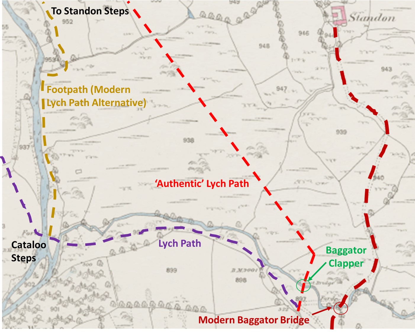
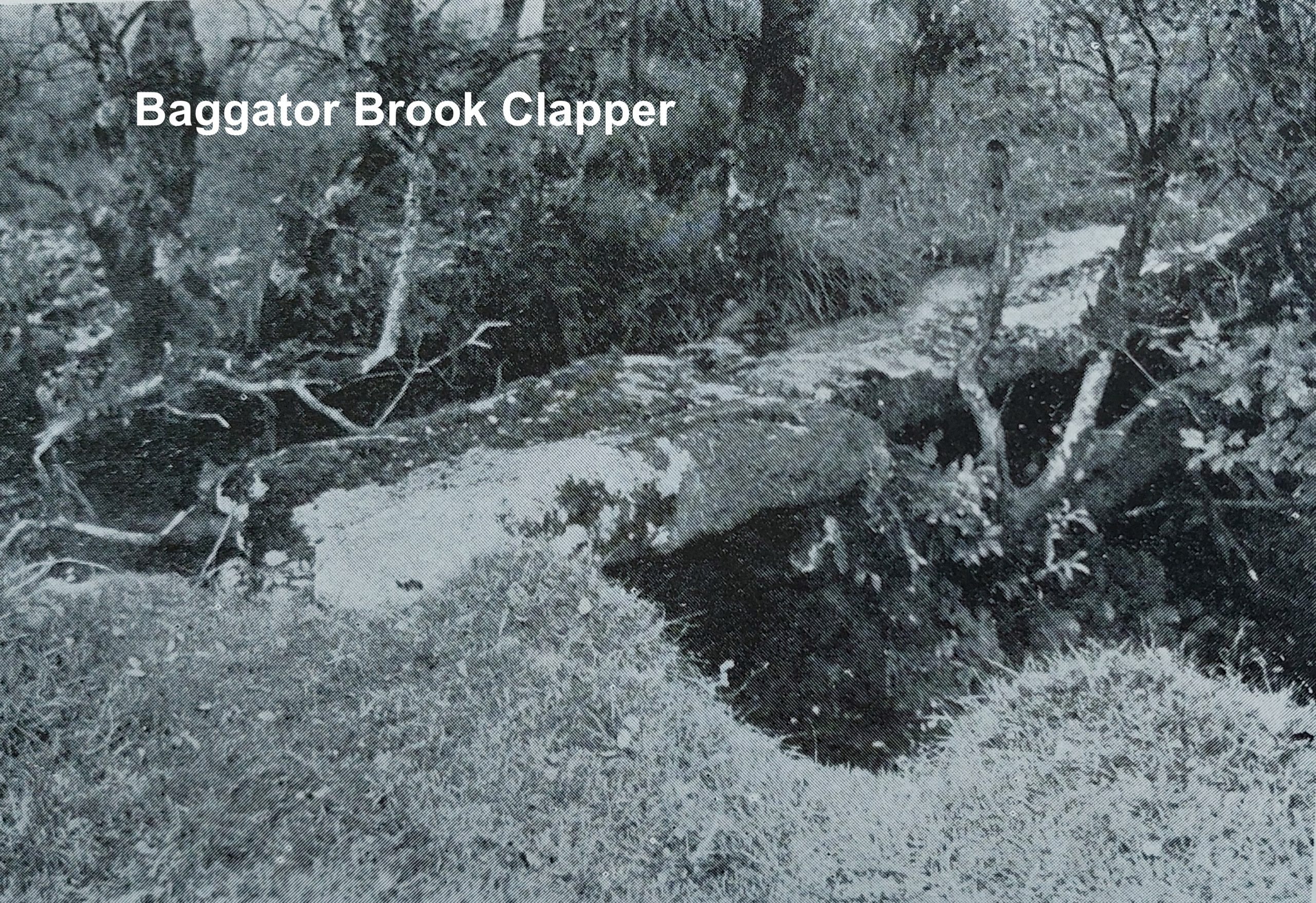
Richard Hansford Worth (in Worth’s Dartmoor) and Eric Hemery (in Walking Dartmoor’s Ancient Tracks) offer an ‘authentic’ Lych Way route which crossed the Baggator Brook by means of an ancient clapper (just downstream from the more modern bridge linking Brousentor and Standon), skirting Baggator Marsh, passing through Standon Farm enclosures to Standon Steps, where the Tavy was crossed. The ancient clapper was photographed by Worth (Plate 78 in Worth’s Dartmoor) and was sketched by Eric Hemery (approx 40-50 years later) in his publication. In spite of the information provided by Worth and Hemery, the aforementioned clapper is very difficult to locate and the author suspects hasn’t been visited for a considerable number of years.
This post provides a photographic record of the state of the ancient Lych Way clapper (in June 2023) and considers all the alternative routes for the Lych Way crossing both Baggator Brook and the Tavy.
Bibliography
Worth’s Dartmoor, Page 396 and Plate 78 – Richard Hansford Worth
Walking Dartmoor’s Ancient Tracks, Pages 233 to 236 – Eric Hemery
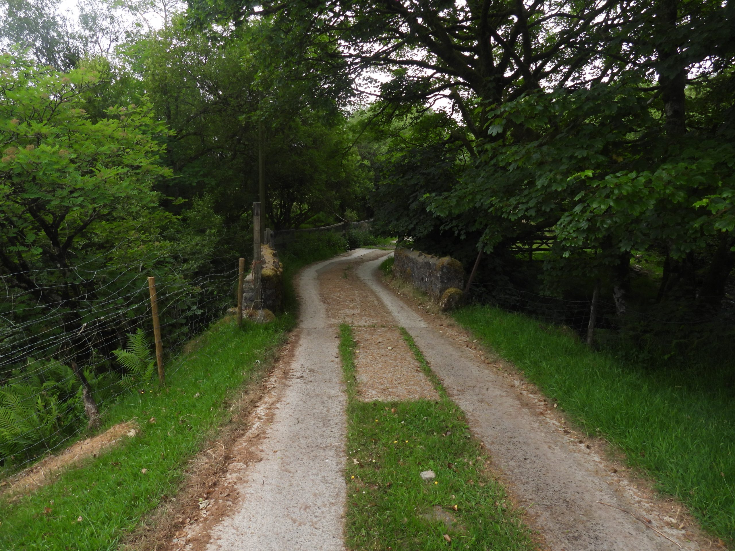
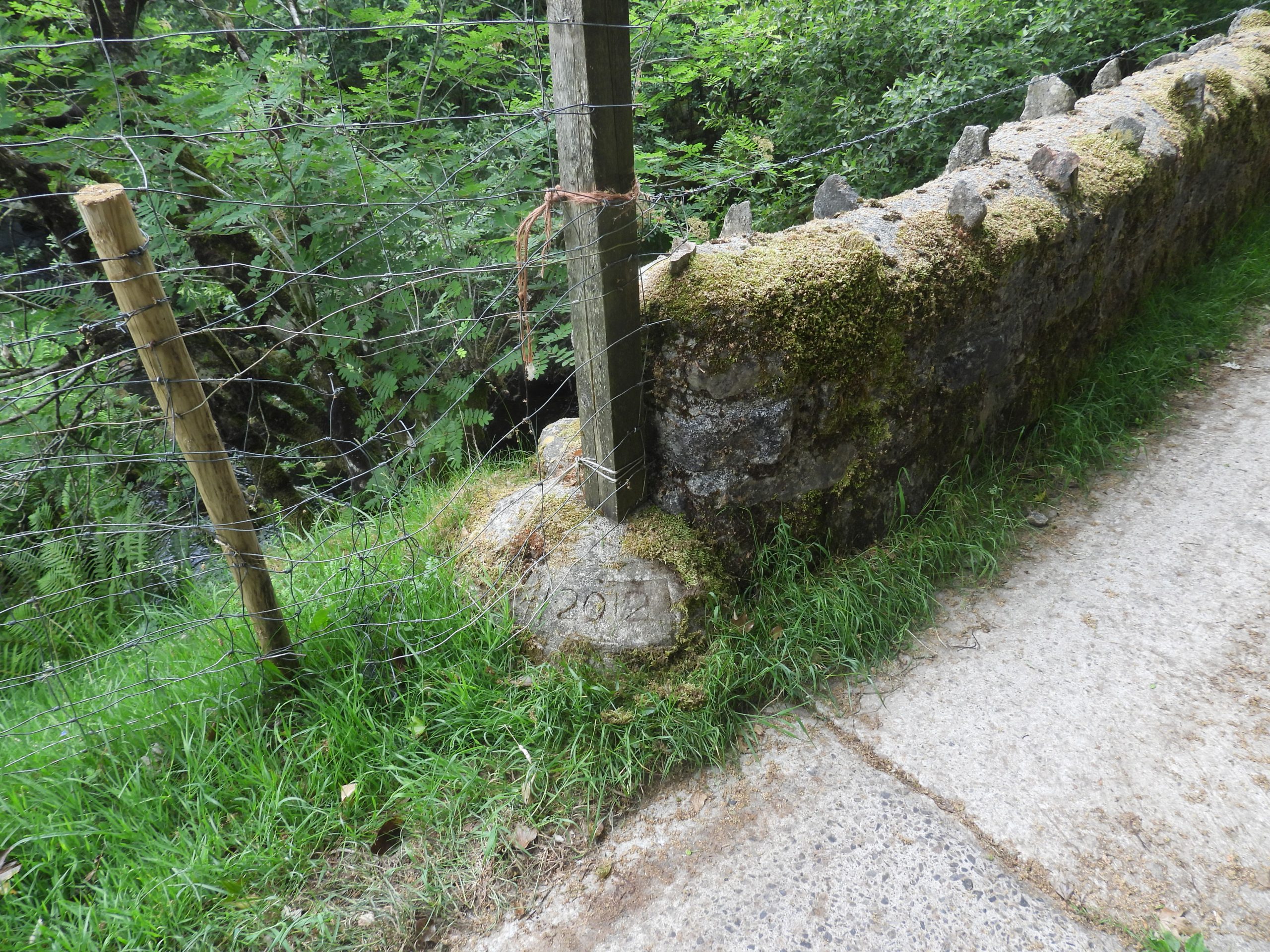
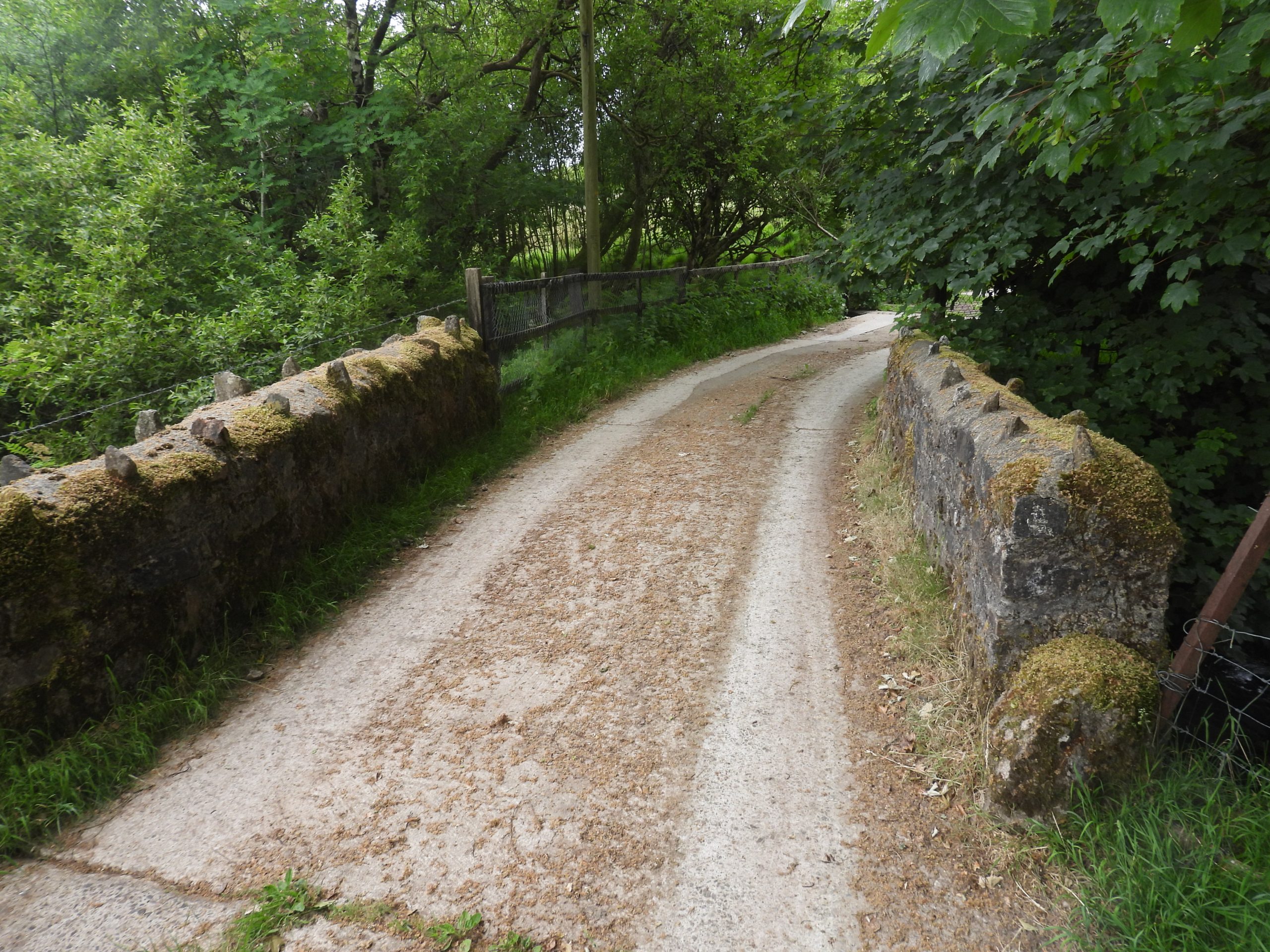
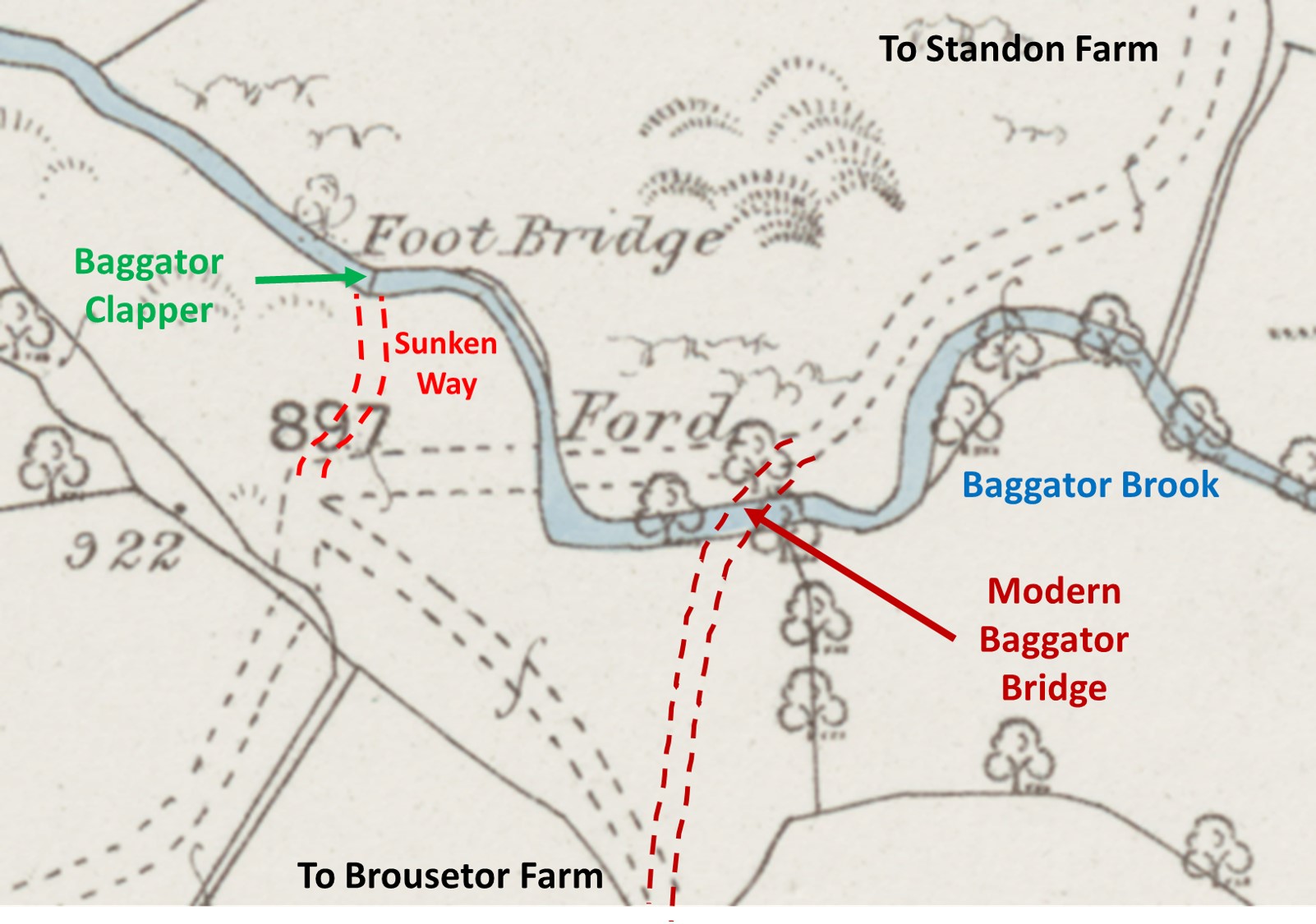
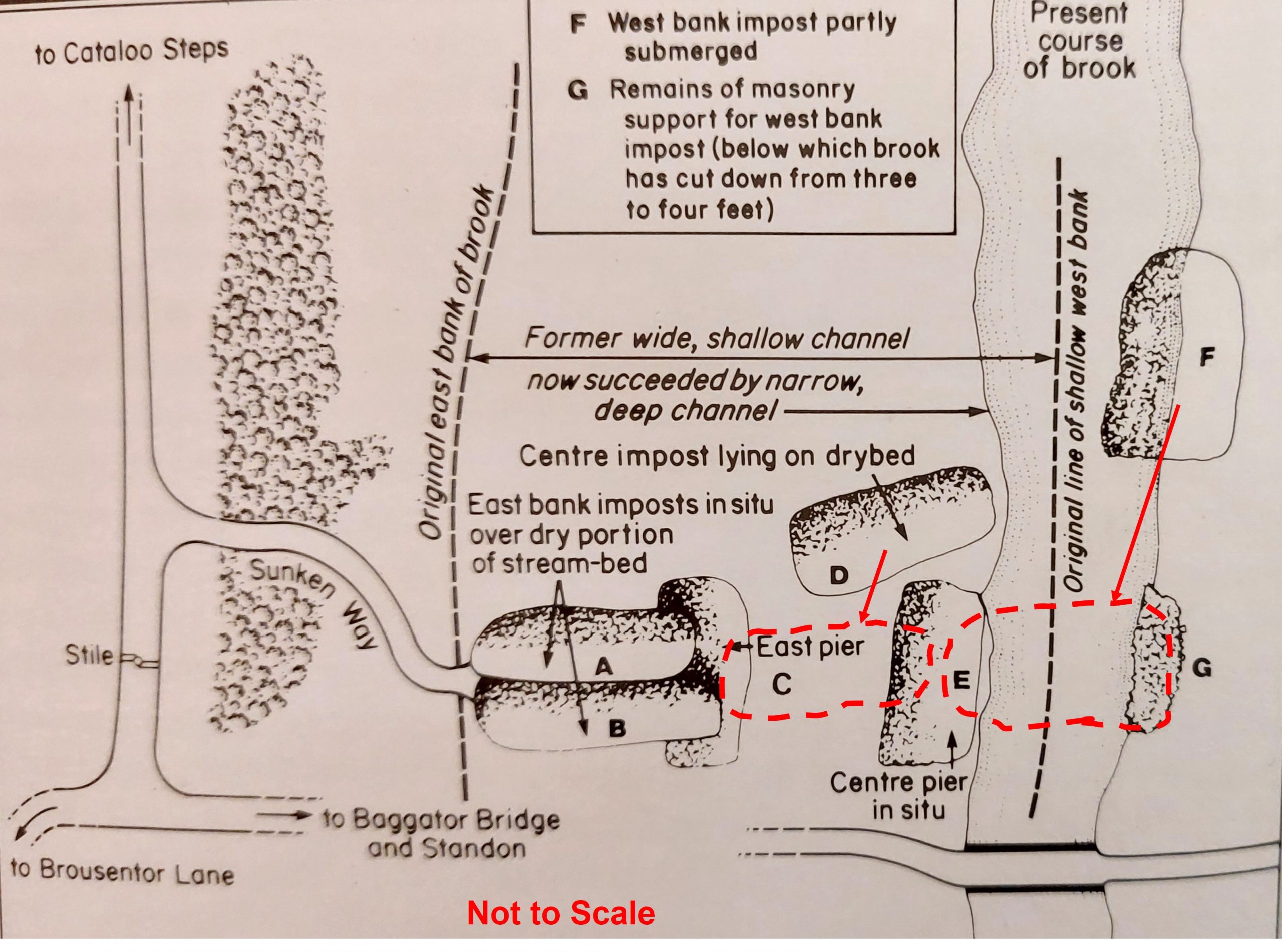
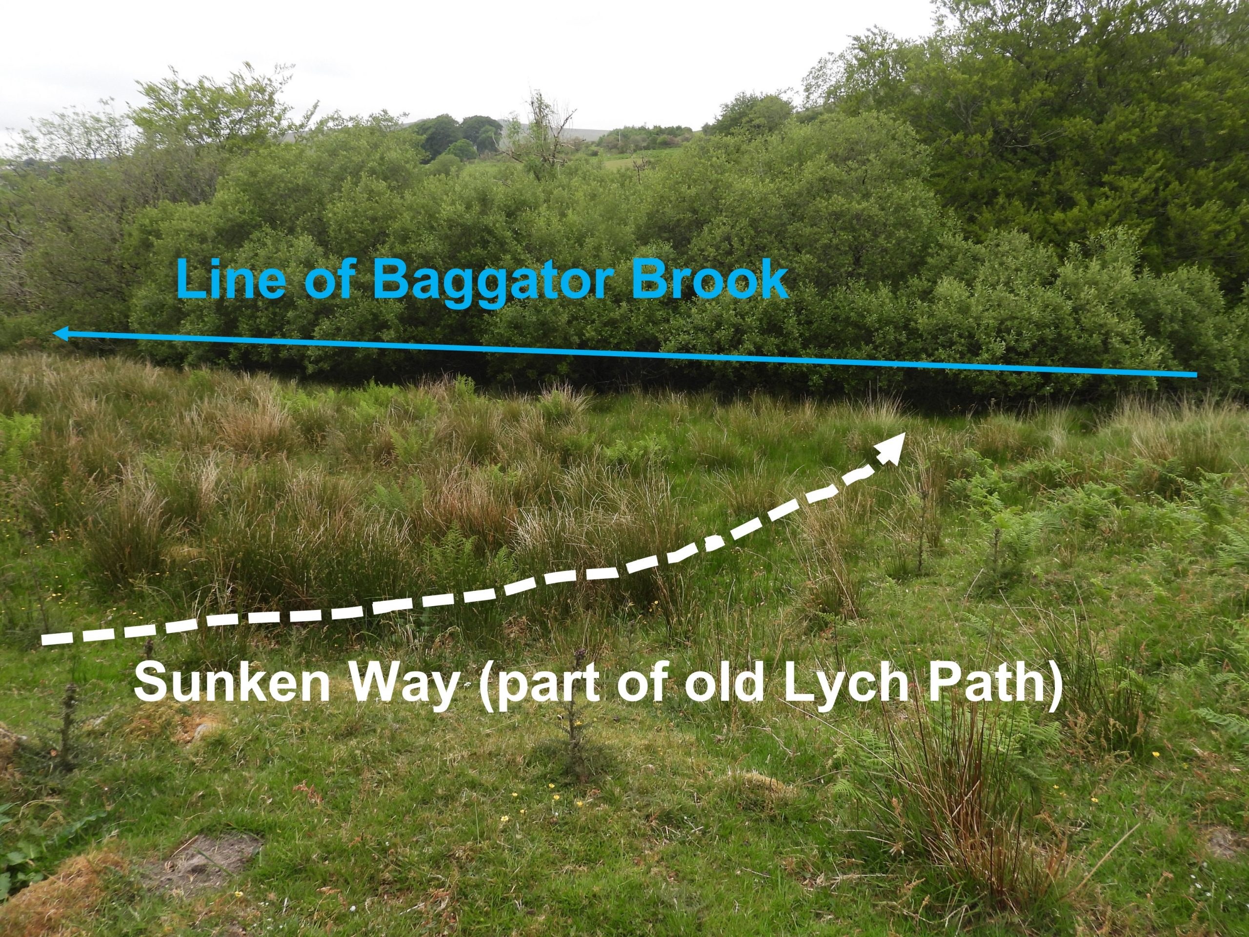
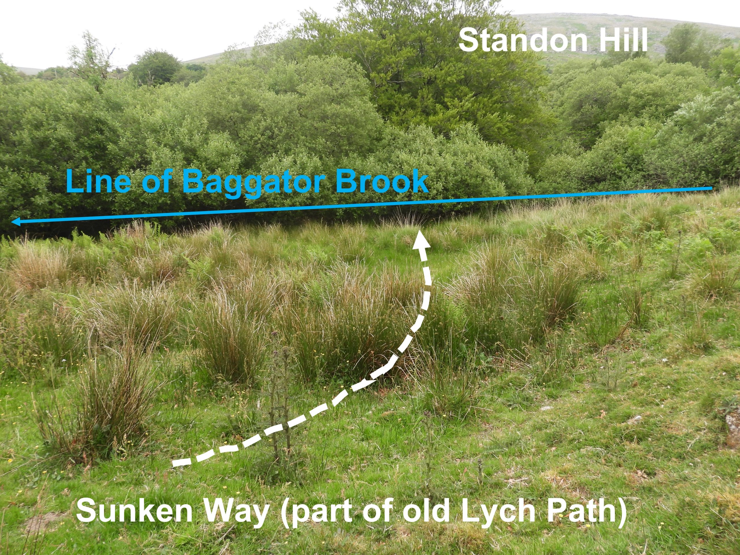
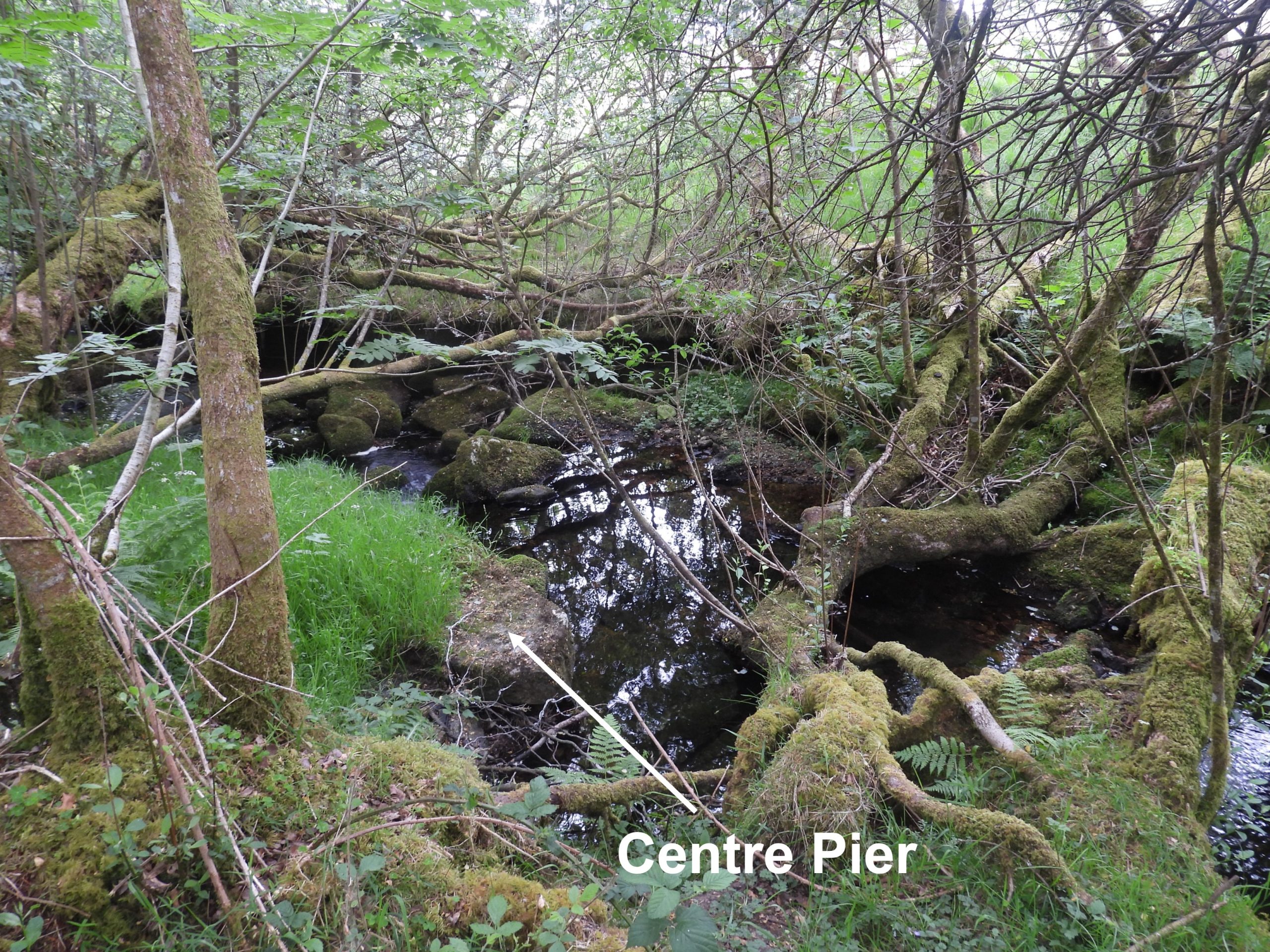
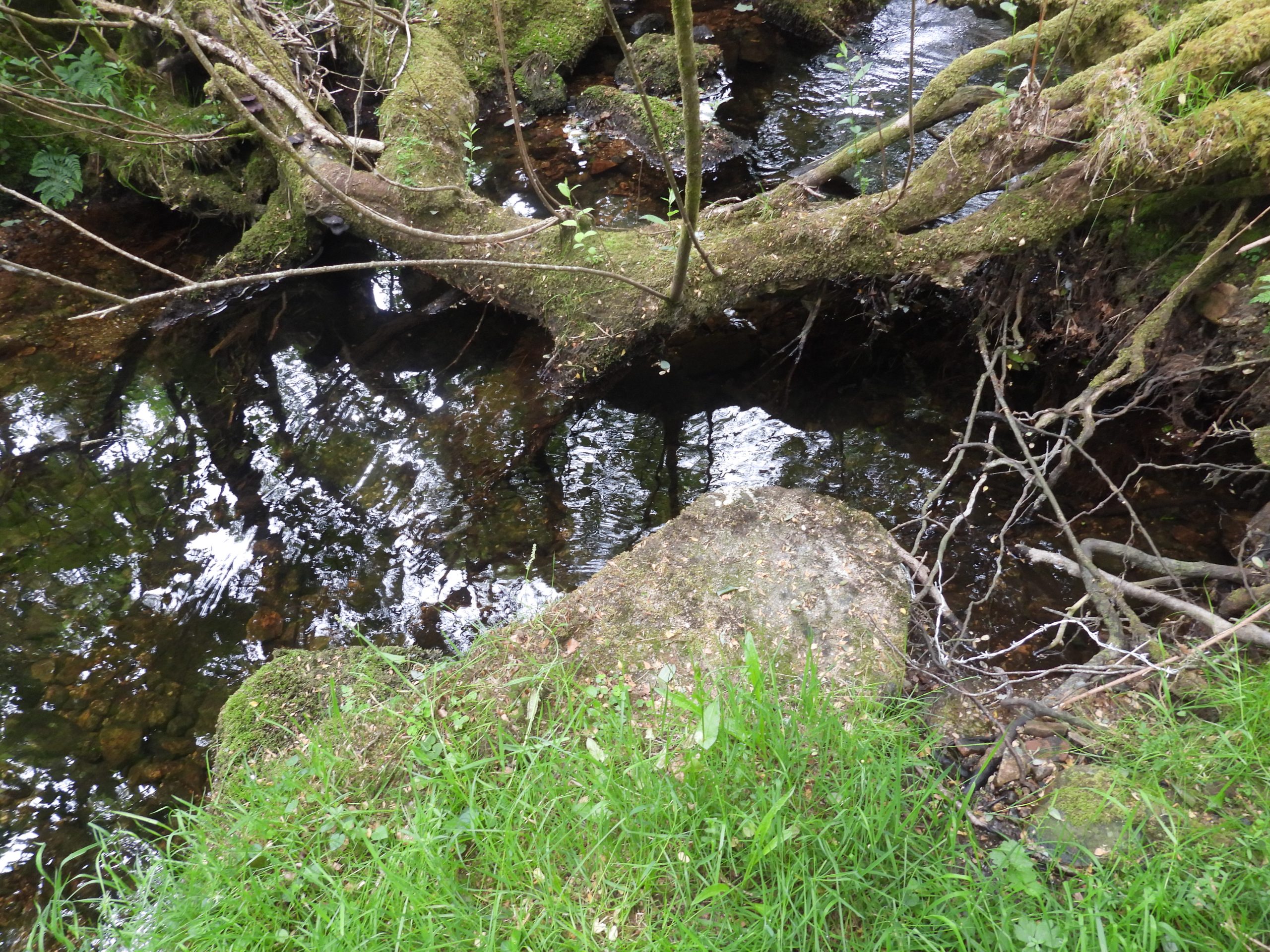
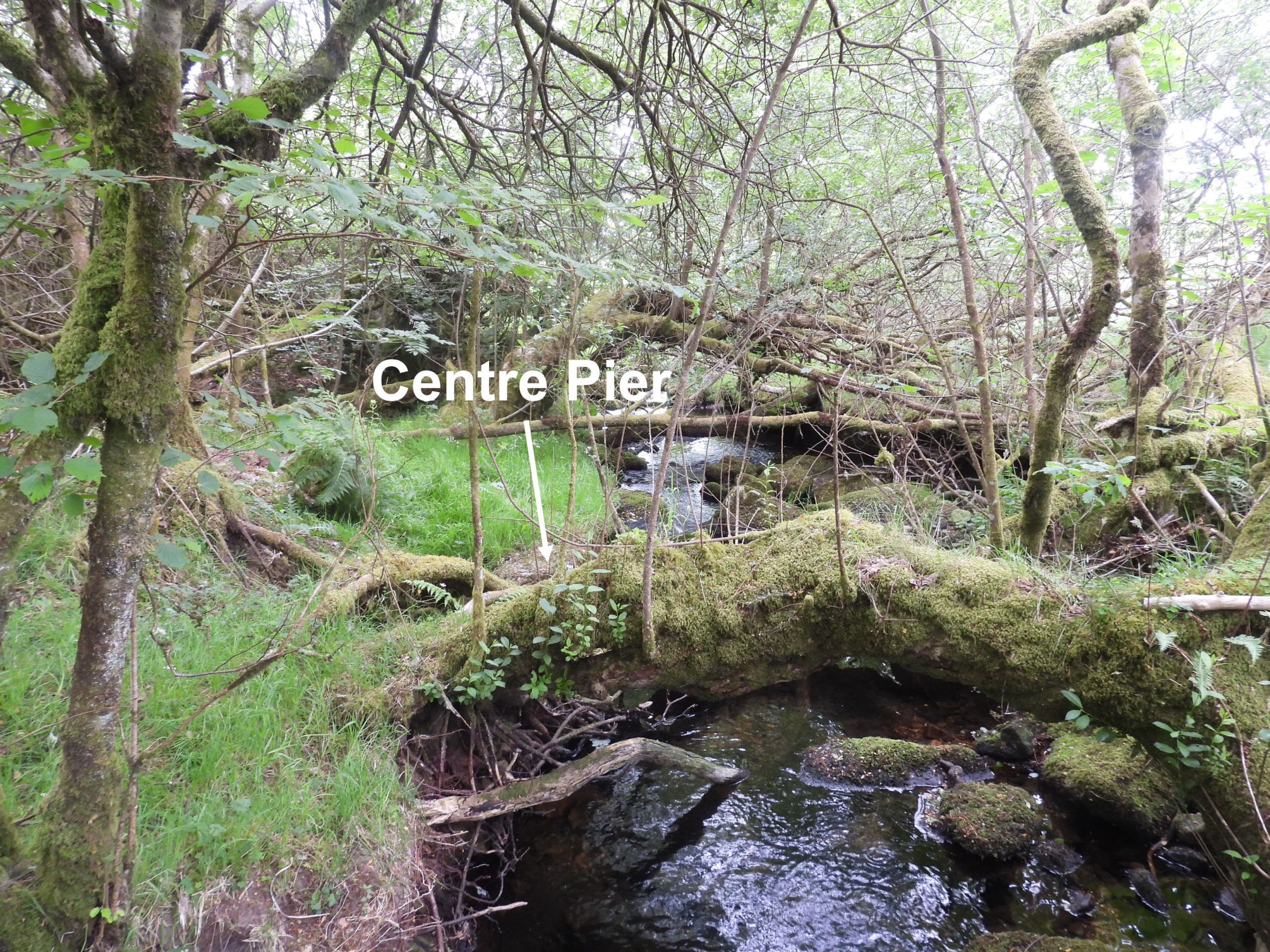
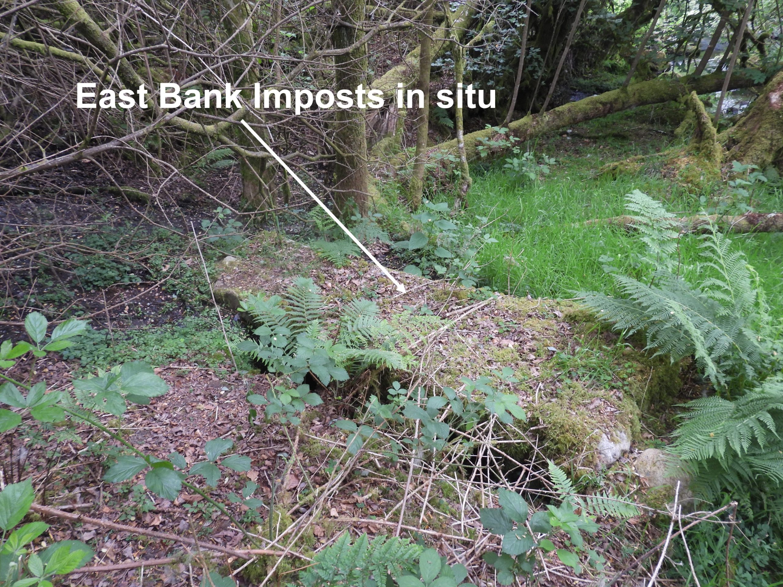
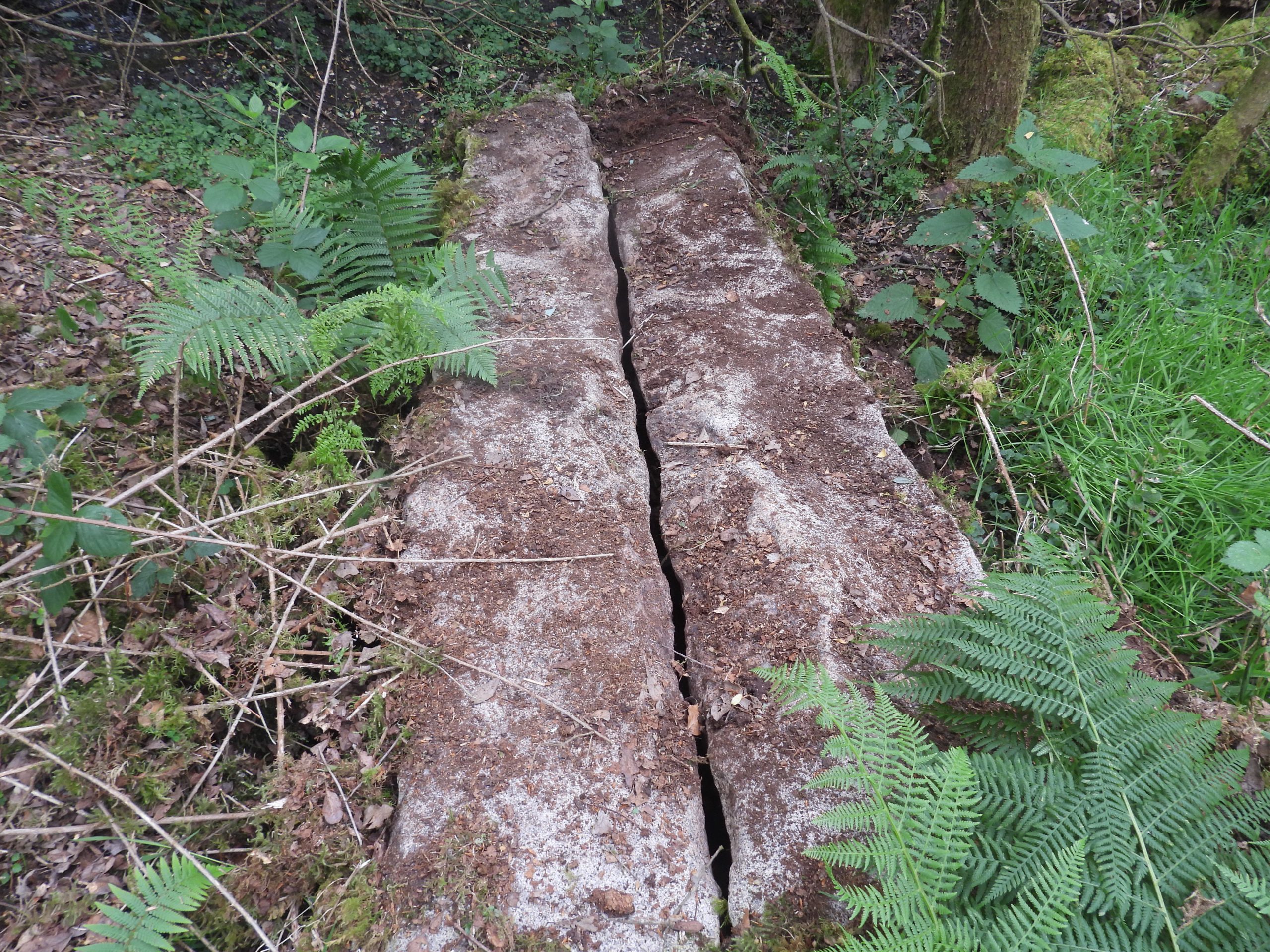
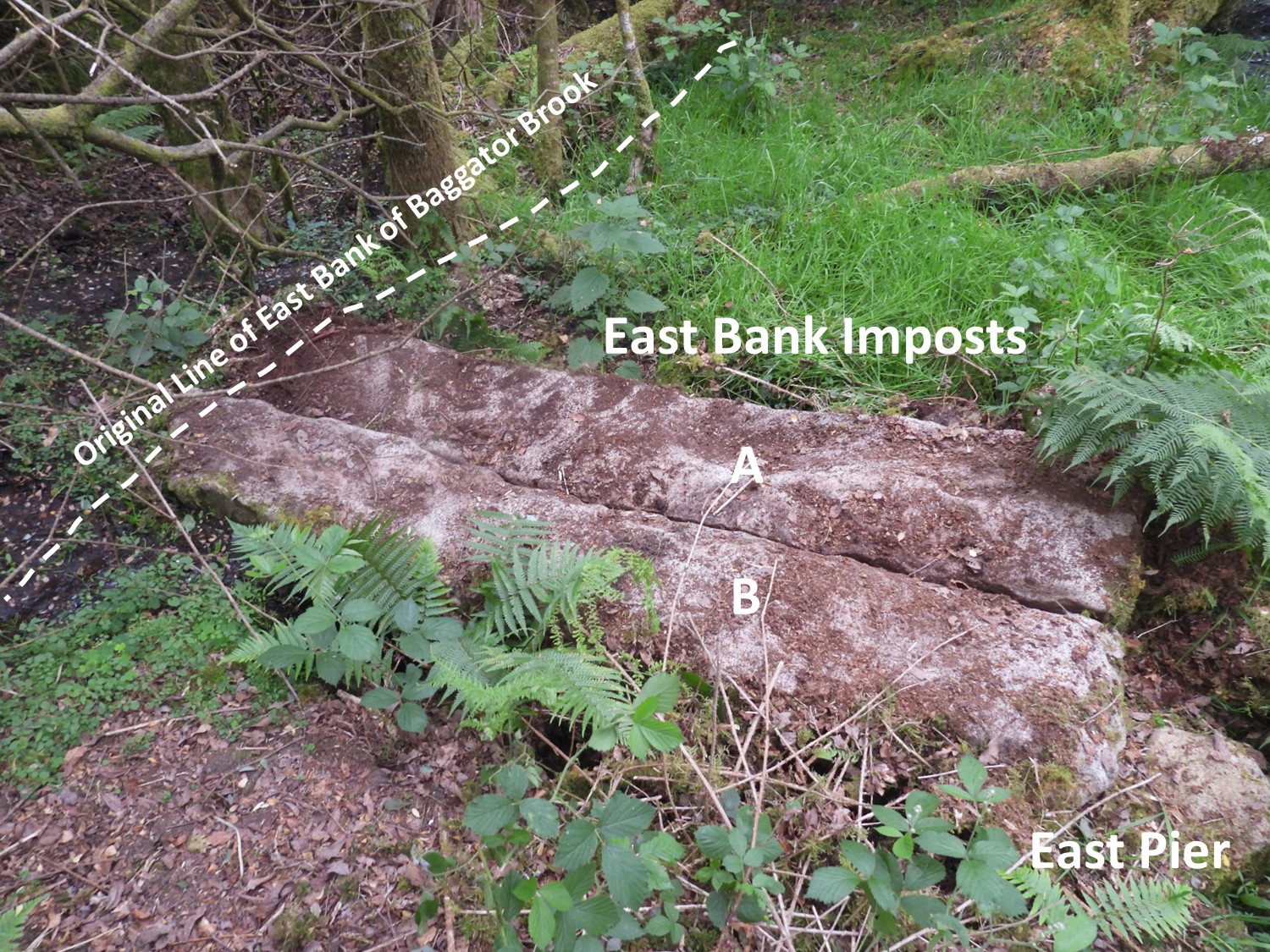
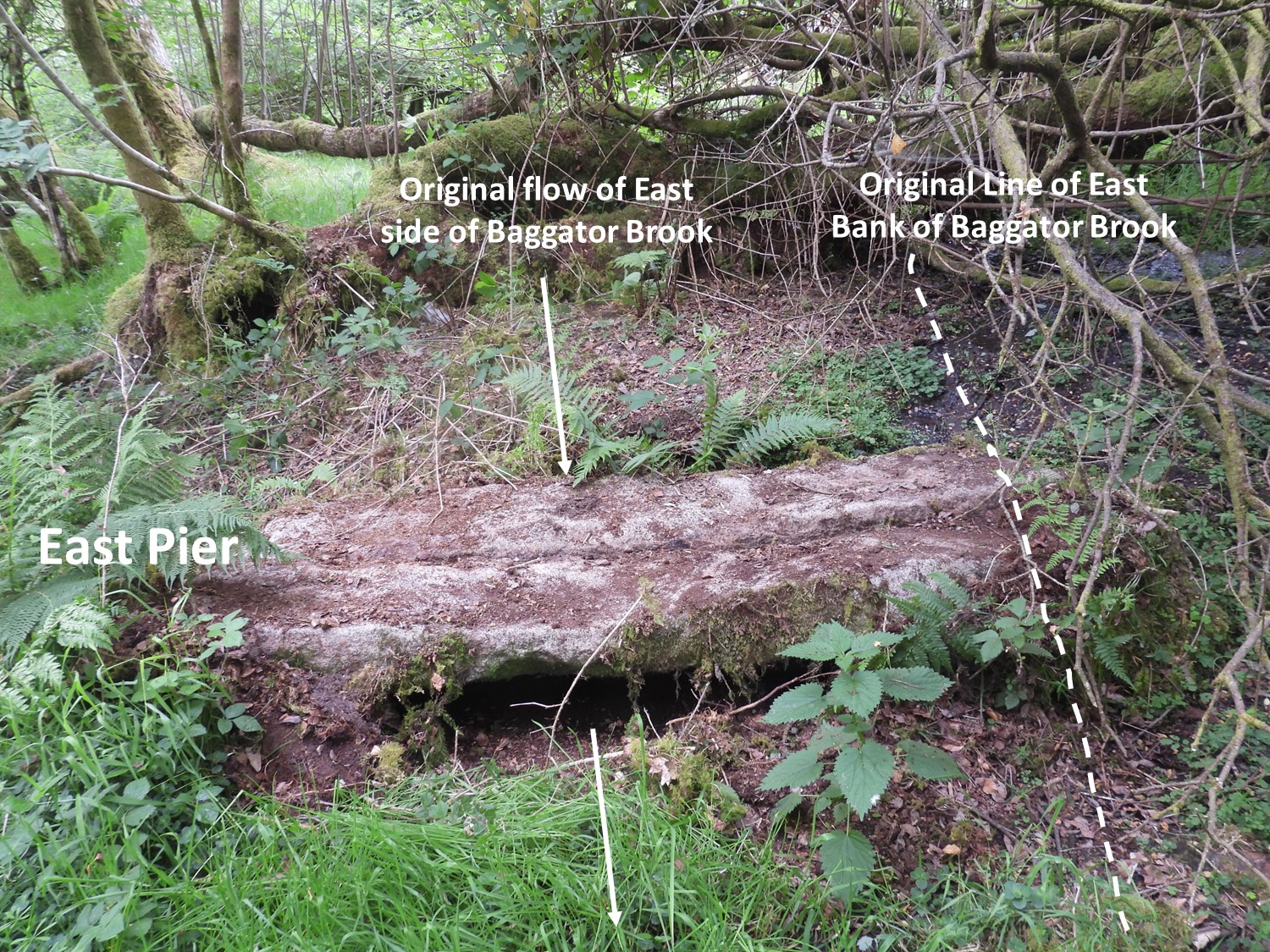
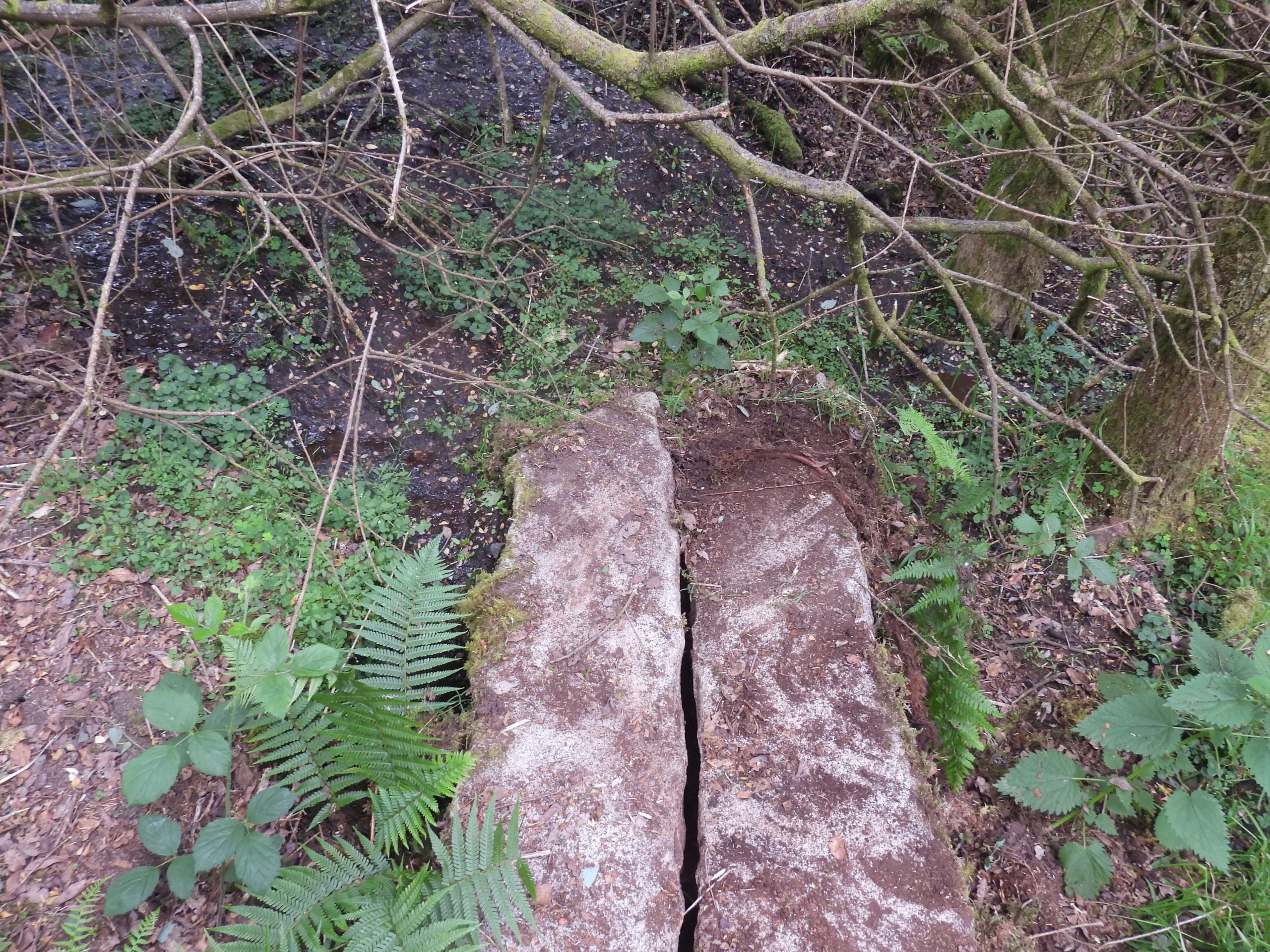
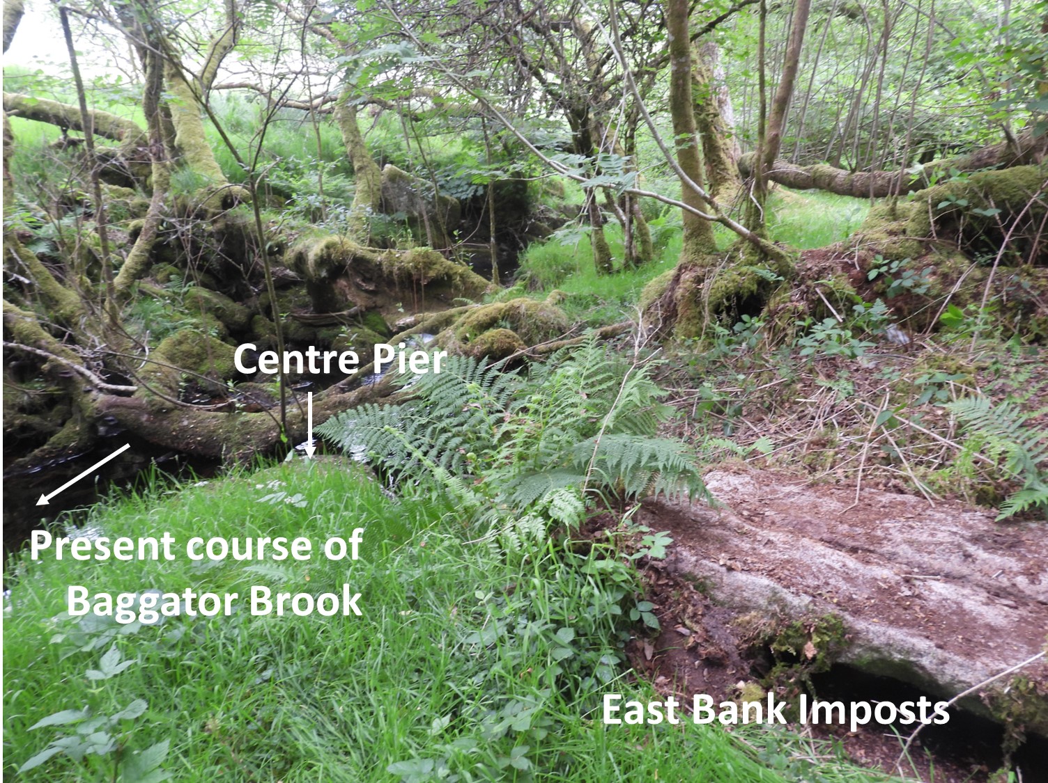
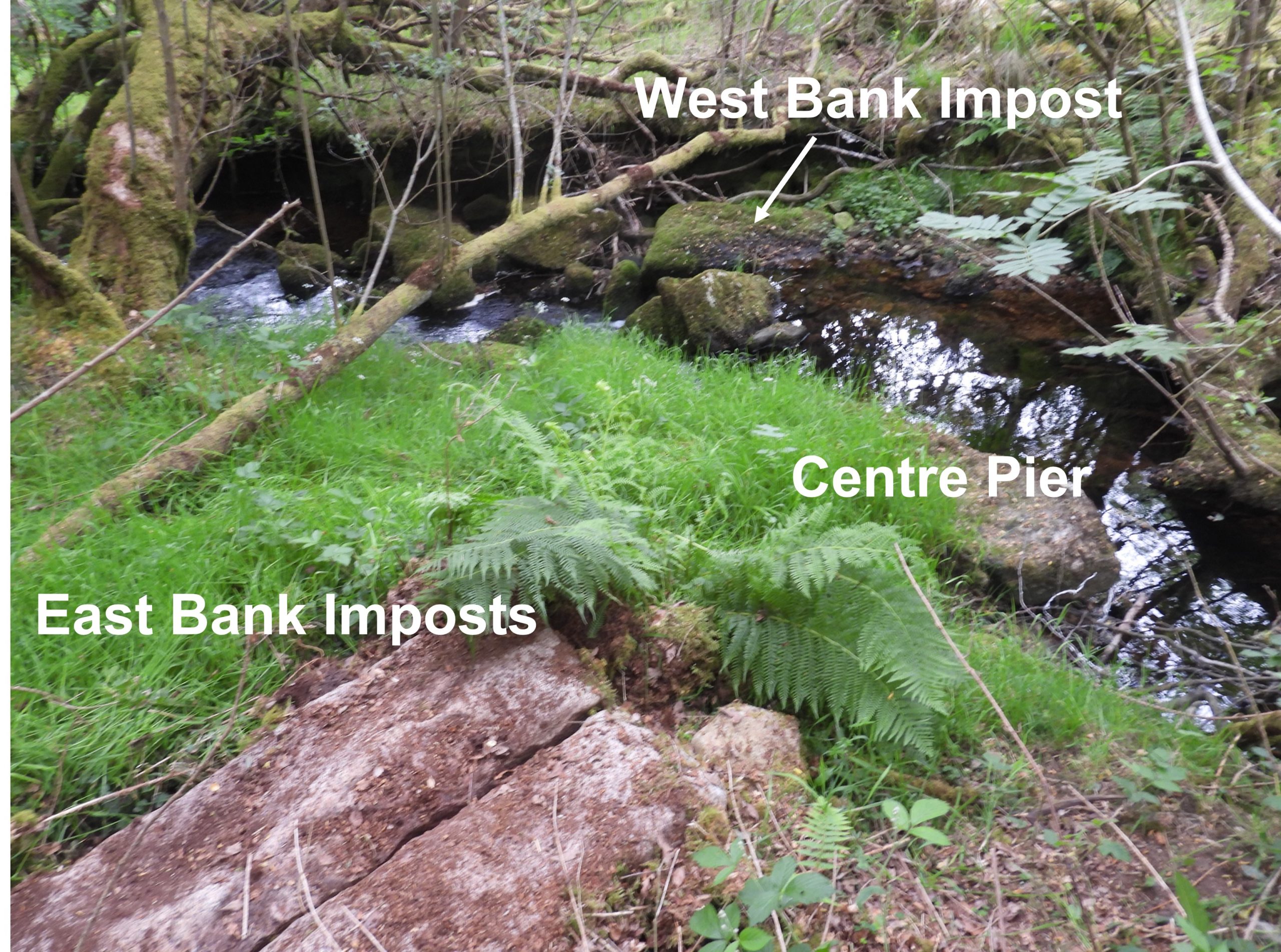
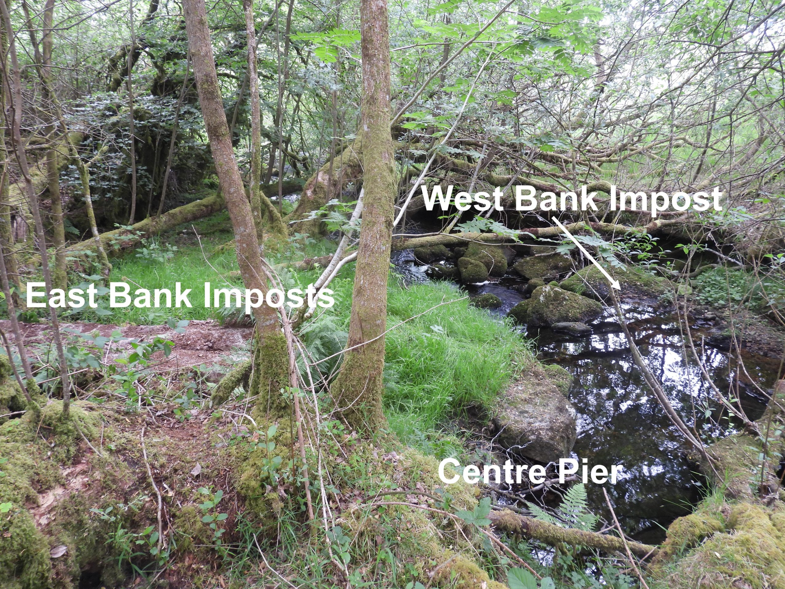
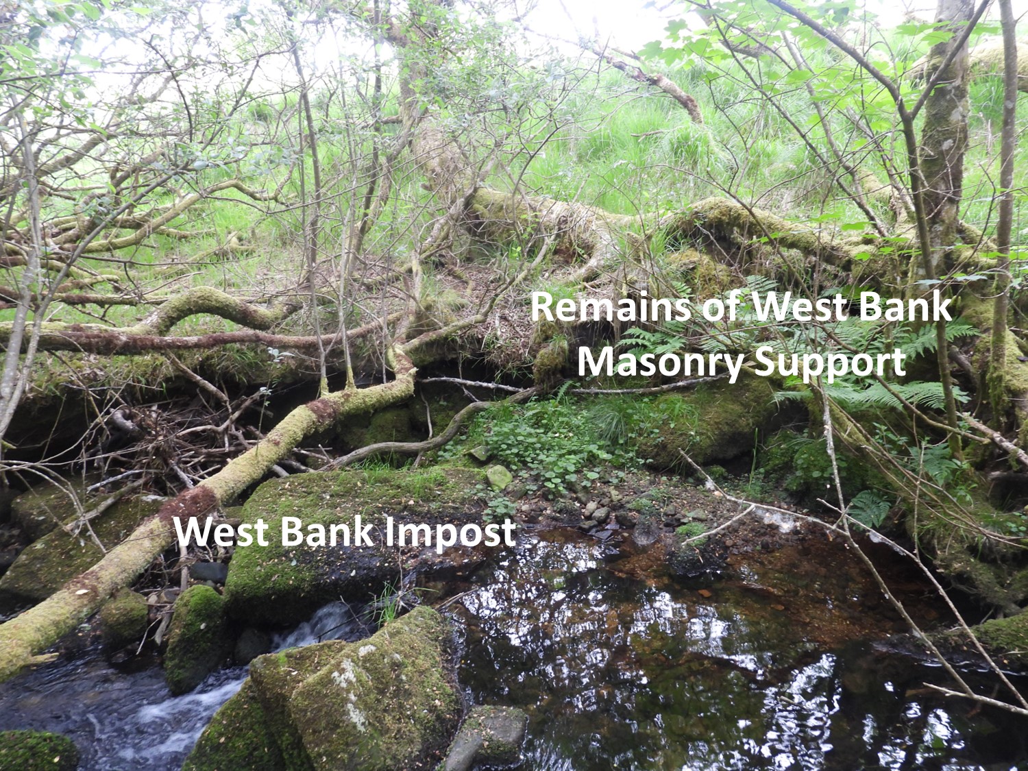
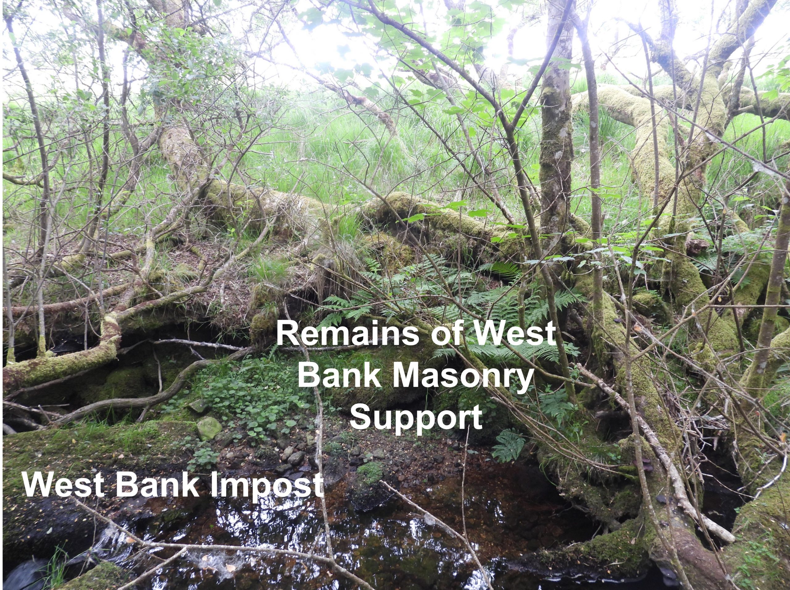
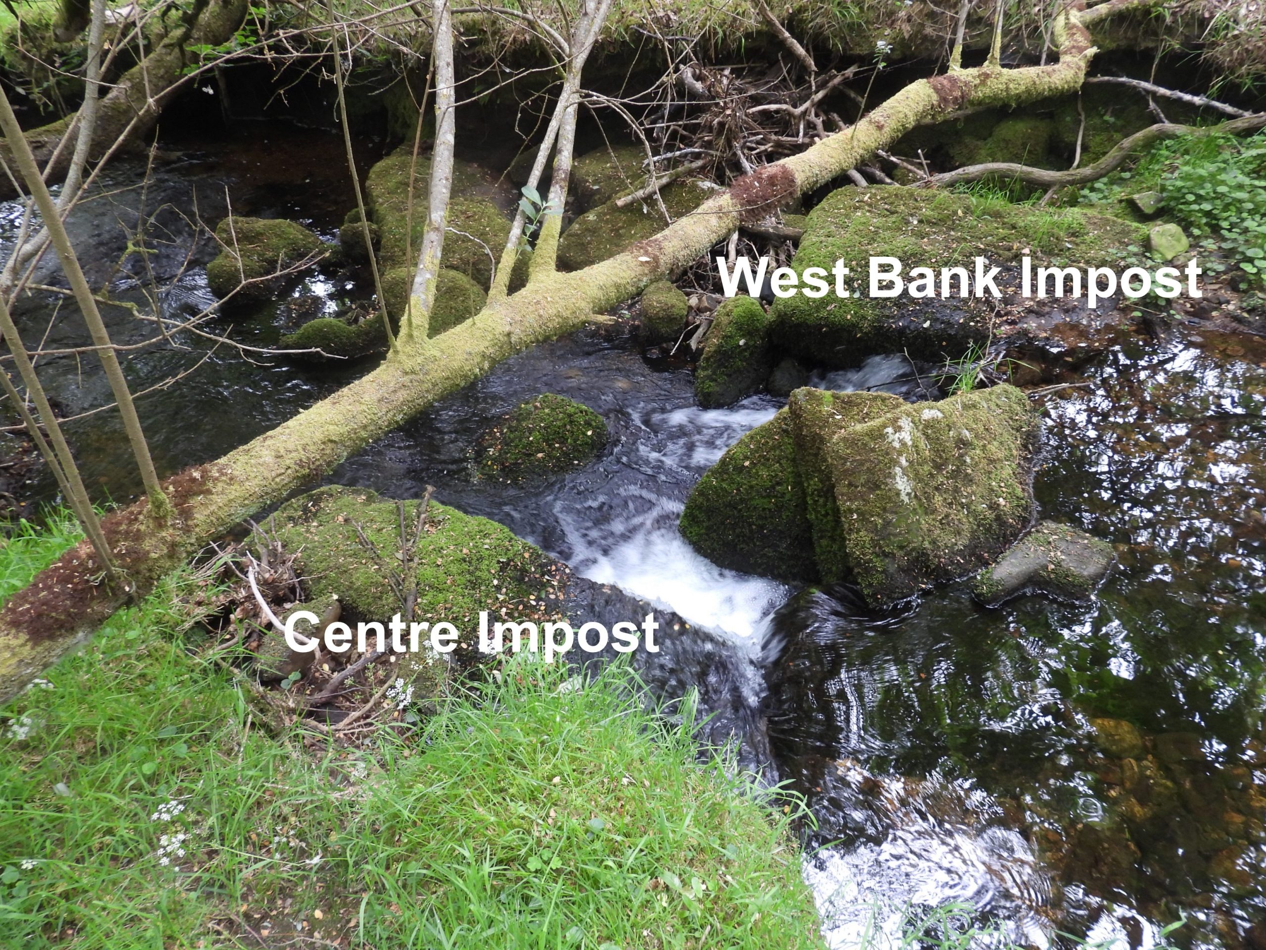
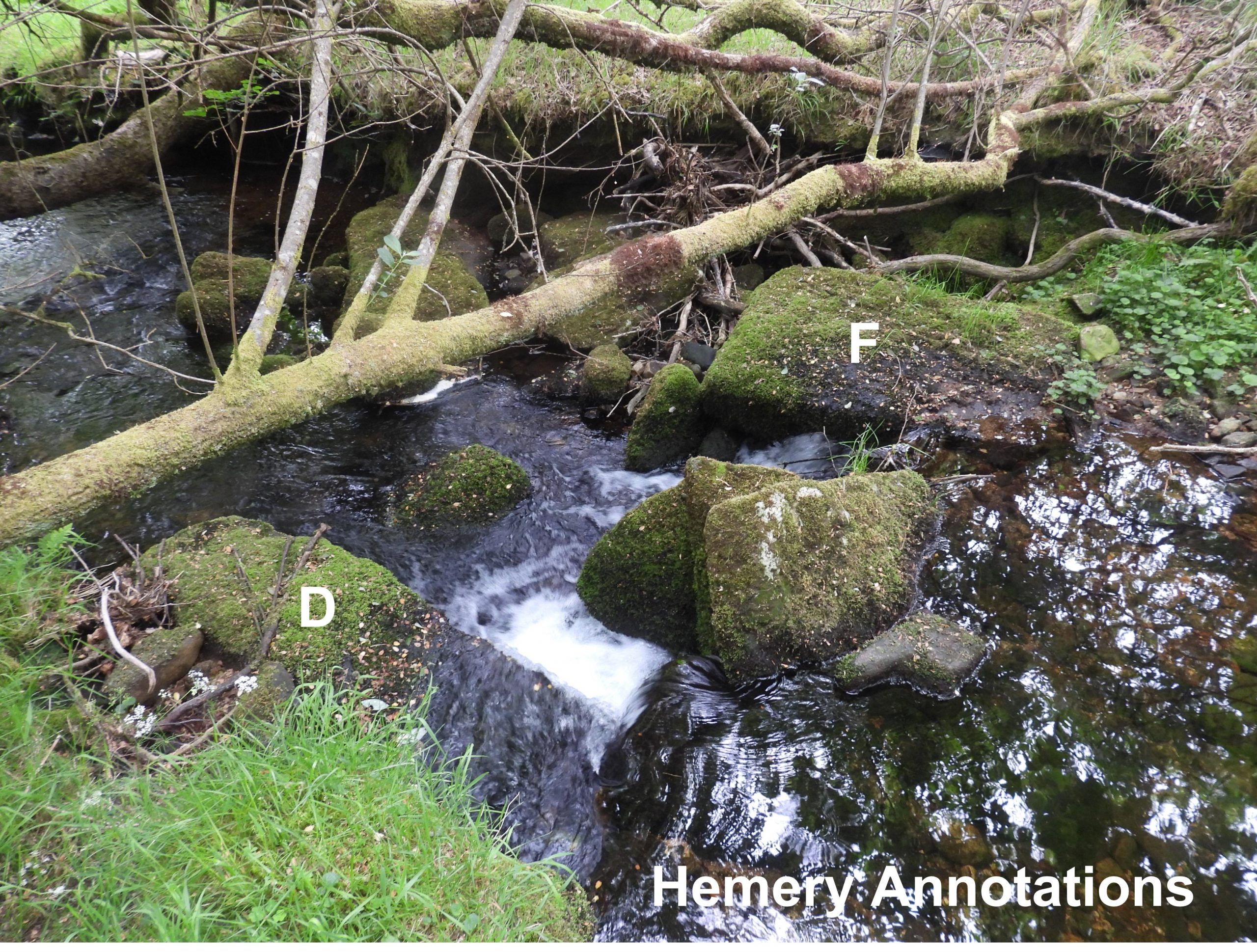
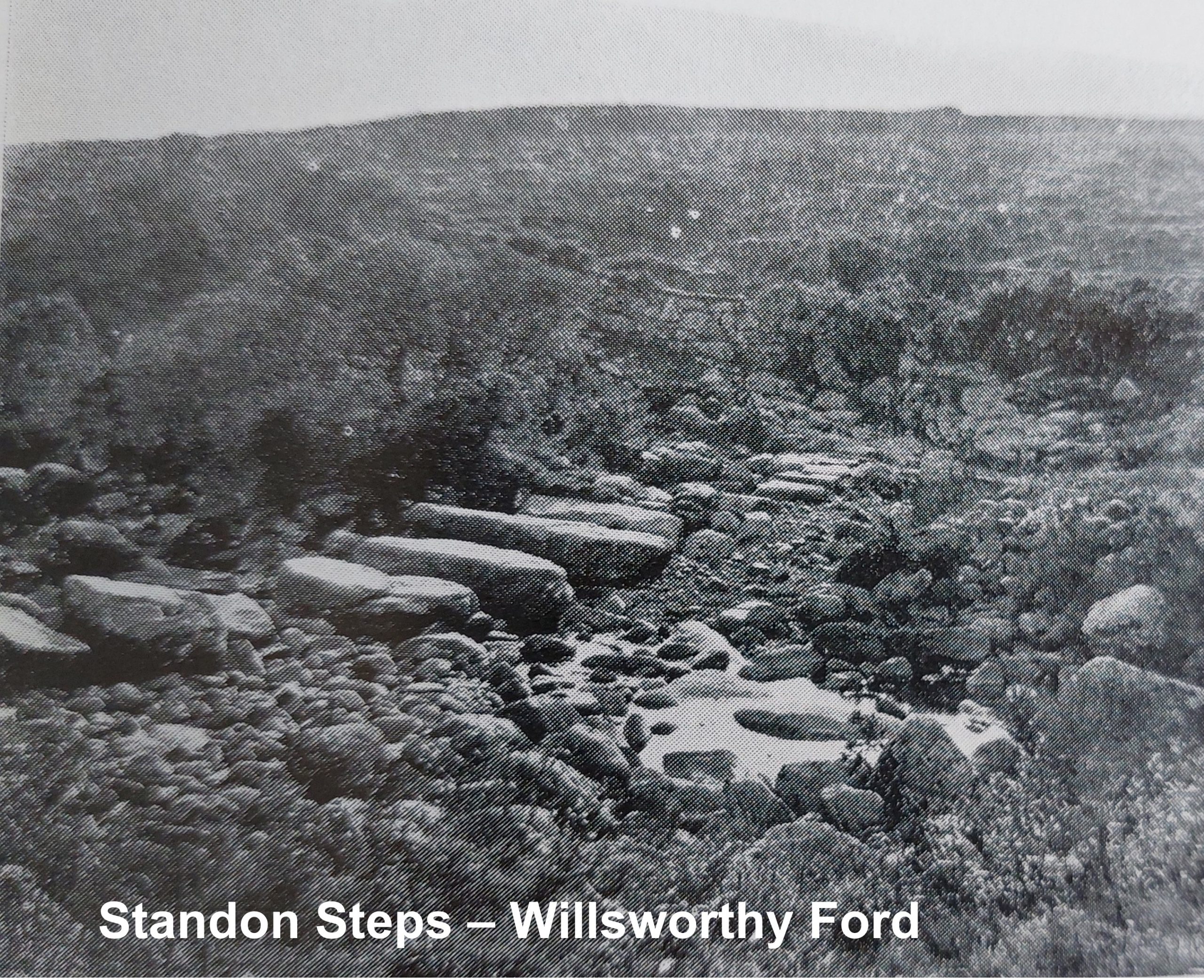
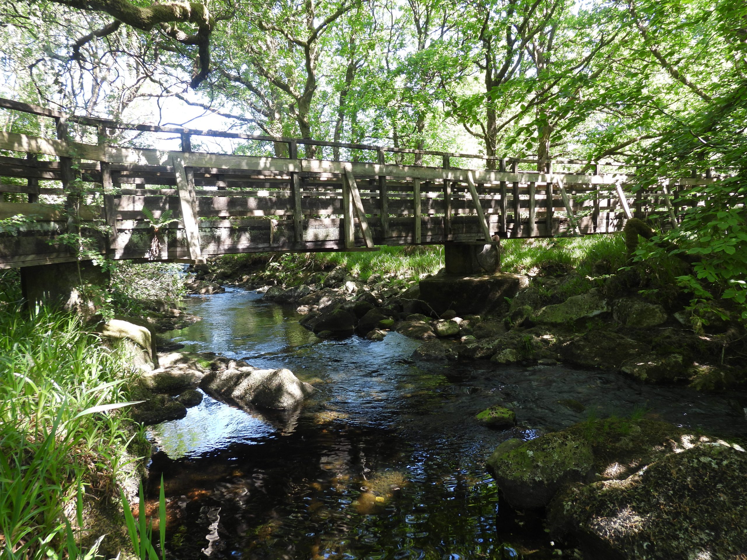
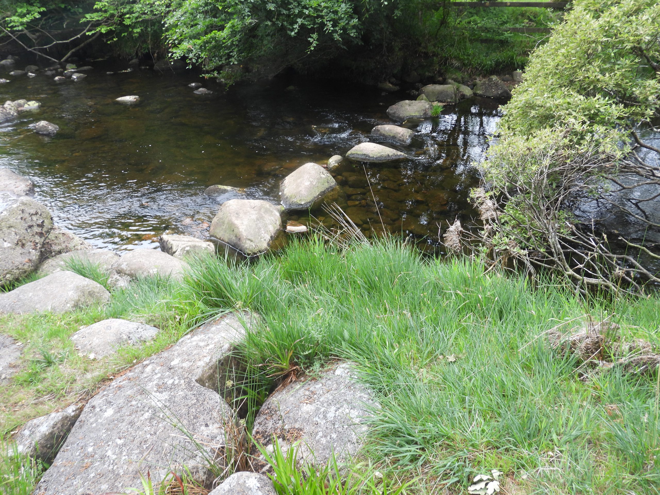
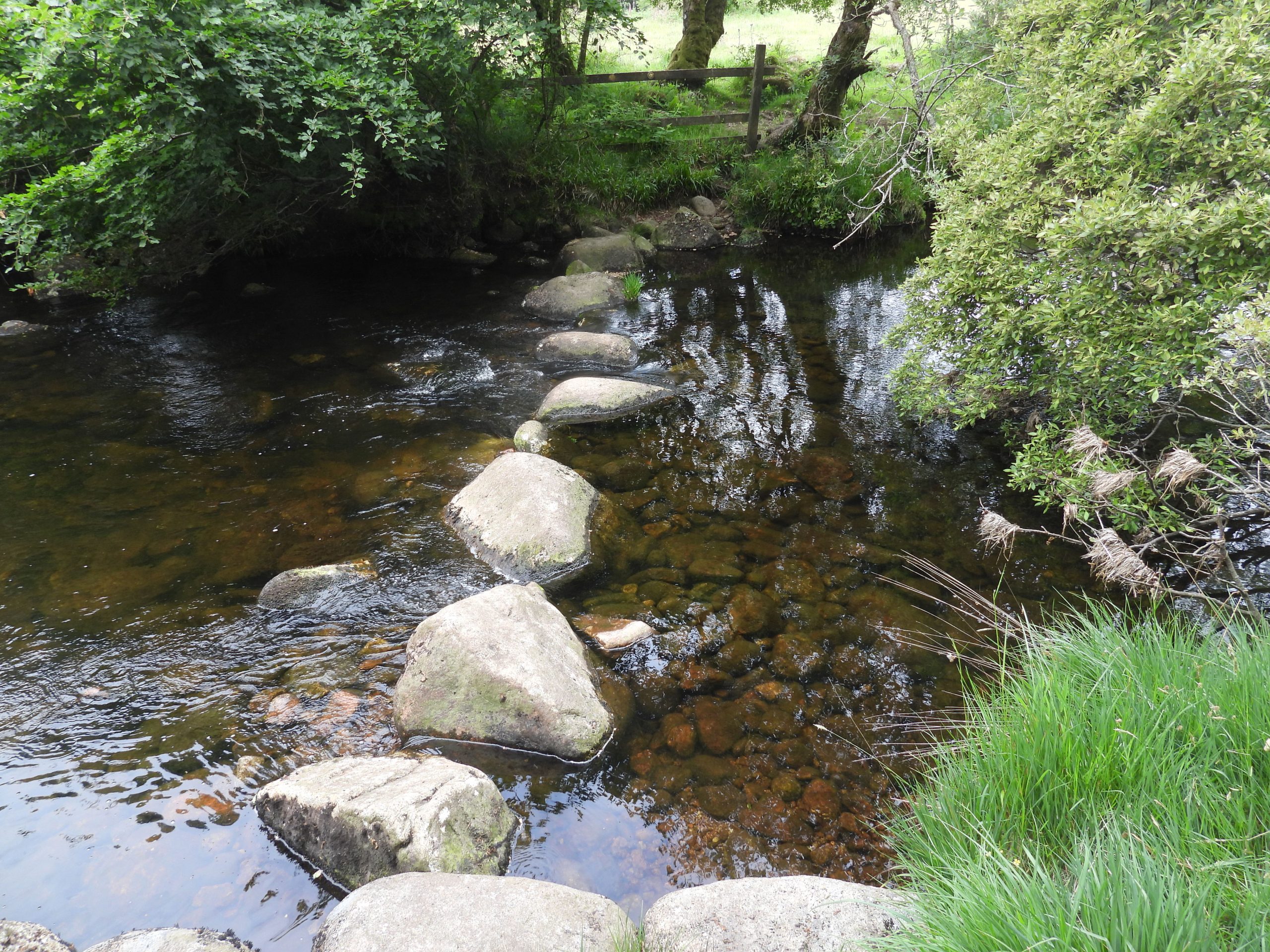
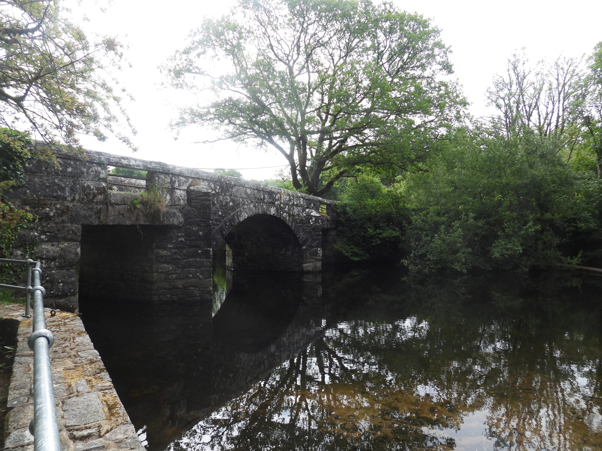
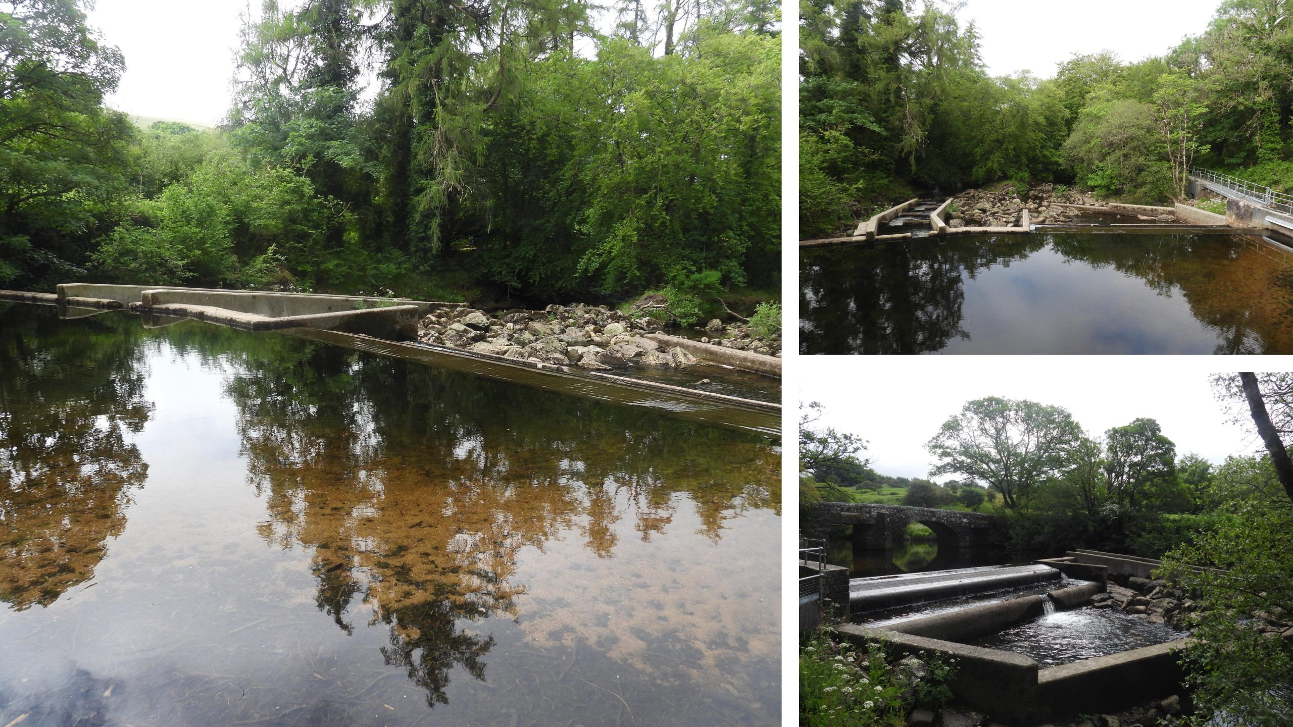
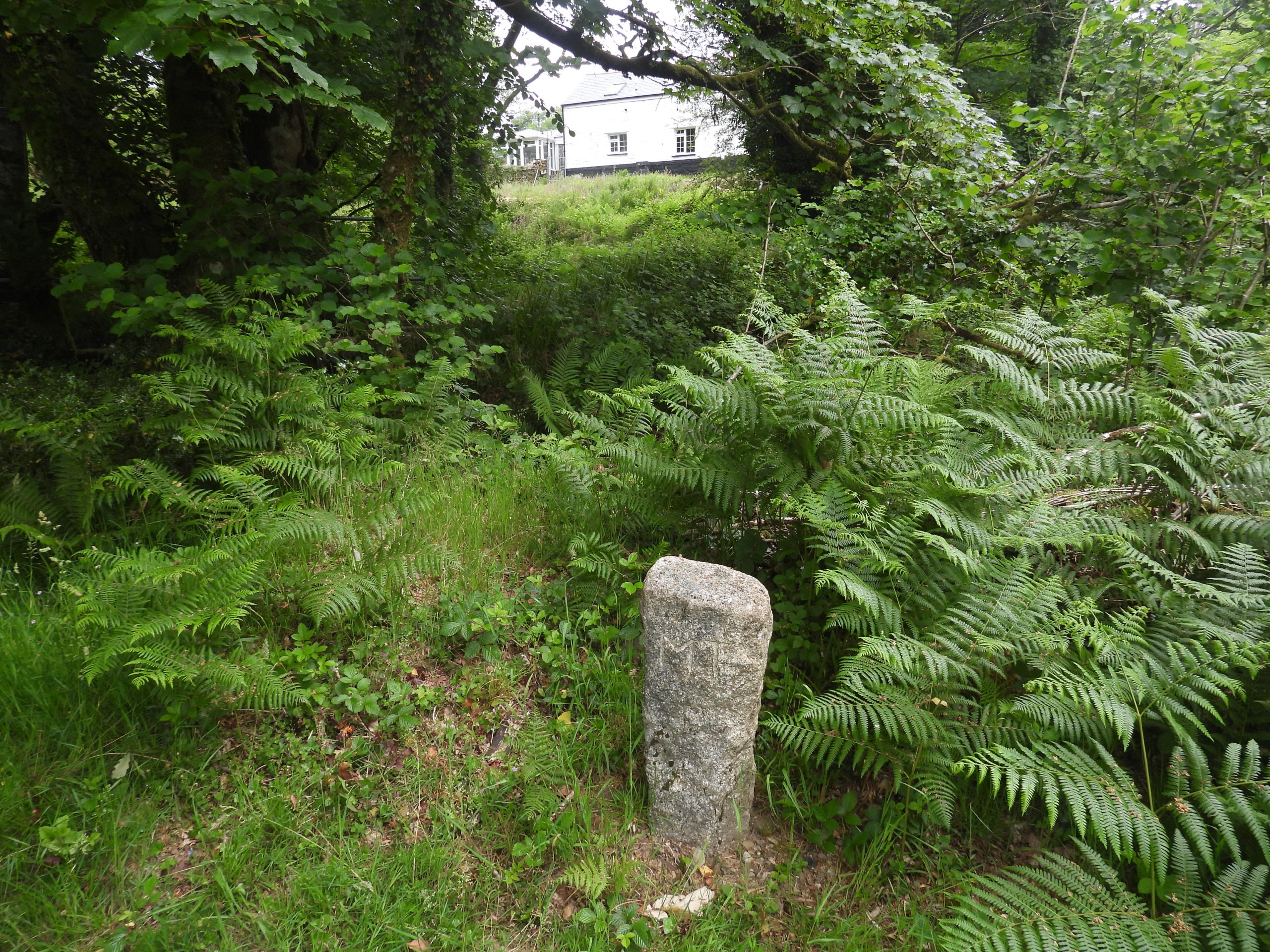
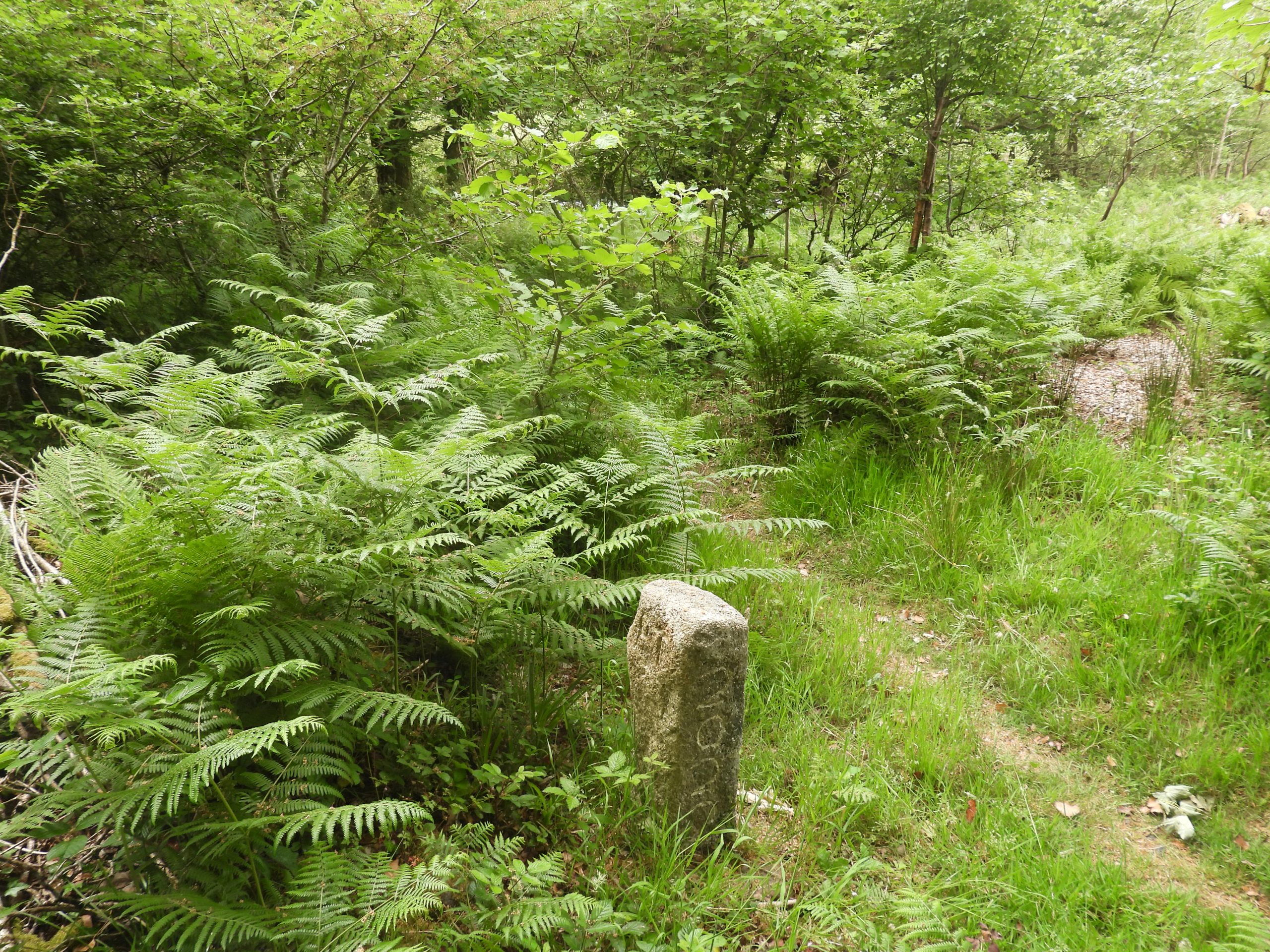
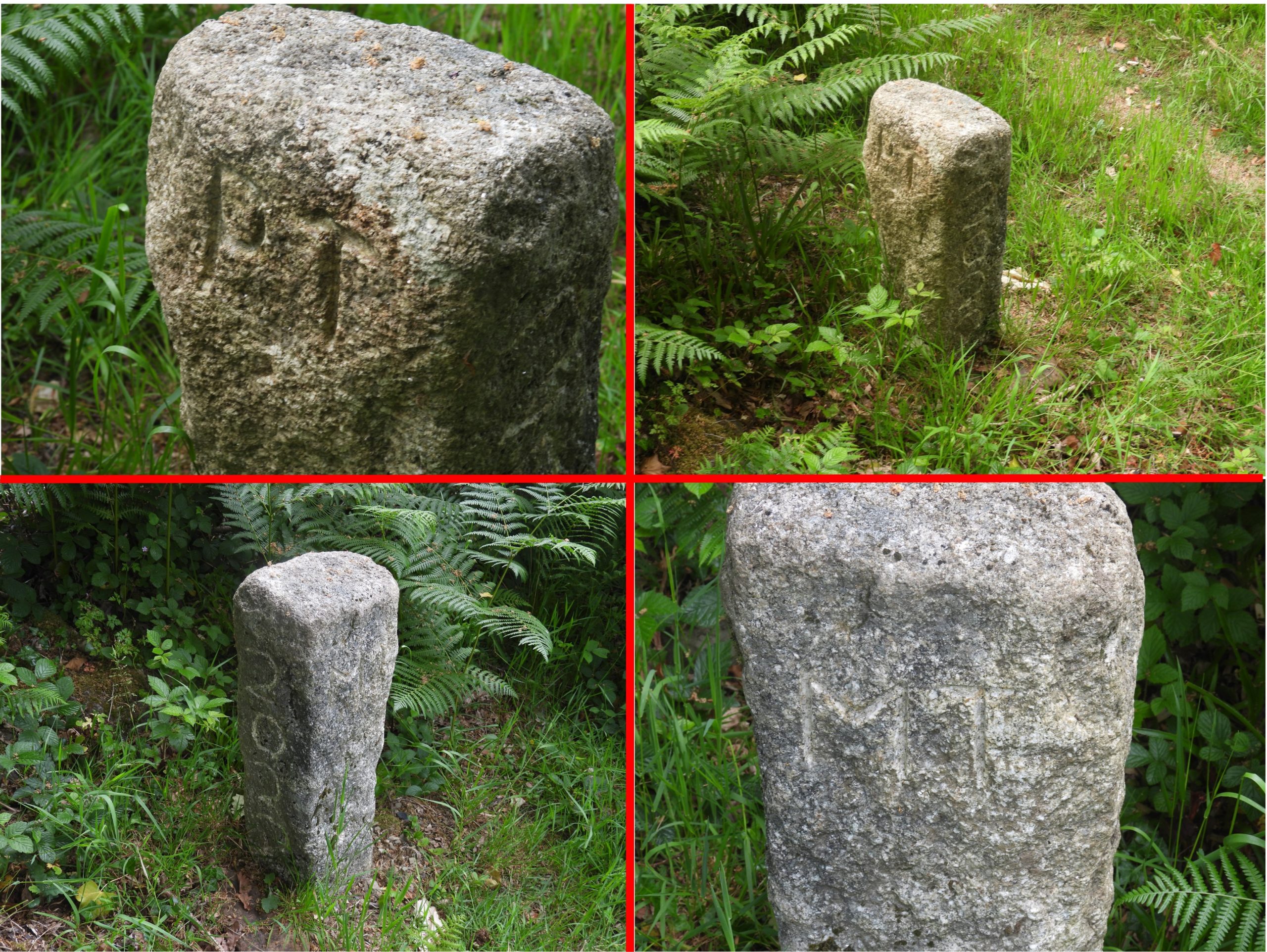
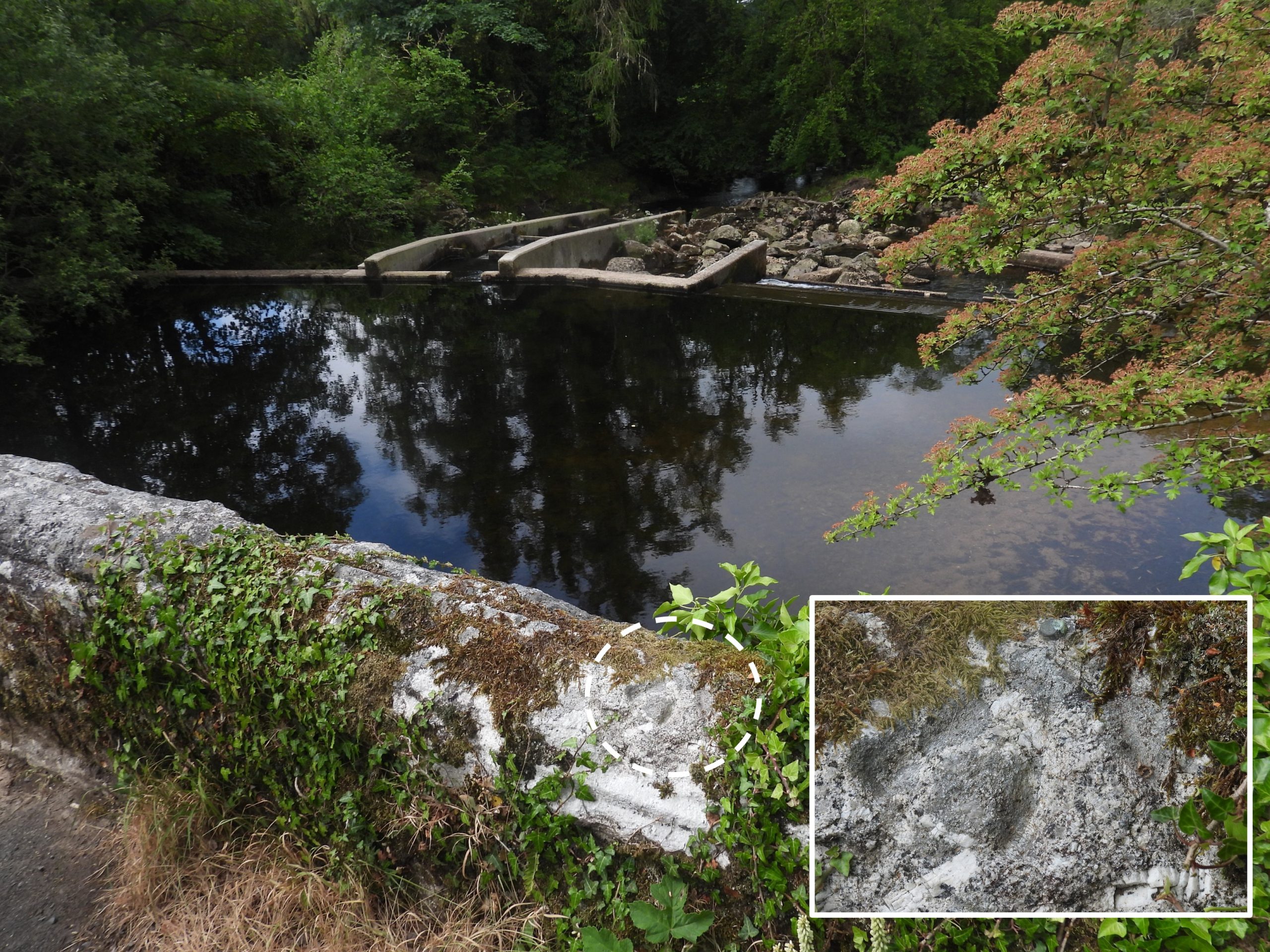
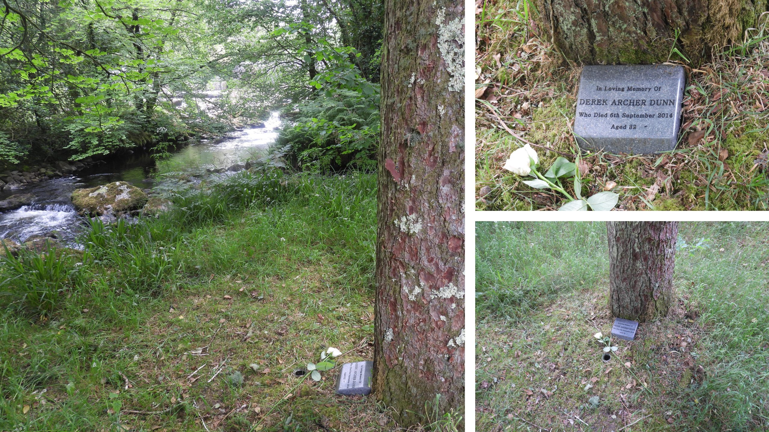
Map showing the location of Baggator Clapper and the two possible Lych Path routes. Modern Baggator Bridge. The Baggator Brook ancient clapper lies downstream from this bridge.The modern Baggator Bridge was strengthened in 2012One wonders why the parapets here have ‘decorative stones’ atop them.Heading north from Brousentor Farm to Standon Farm down the concreted lane, just before the modern Baggator Bridge, the explorer should bear left (slight north west) through a gate and down hill towards Cataloo Steps and the junction of Baggator with the Tavy. On the right side of this path is a (rather subtle) sunken way leading to some trees in a rather boggy area. This is the route where the ‘authentic’ Lych Way is said to have taken.This annotated sketch is on page 235 of Eric Hemery’s ‘Walking Dartmoor’s Ancient Tracks’. Please note that it is not to scale and the stile recorded is no longer there. The sketch was a perfect guide to the remains of the ancient Baggator clapper and the scene today, nearly 40 years after Hemery’s publication has changed a little but not so much as the piers and imposts can’t be identified. The clapper had two piers and three spans. The author suggests that Hemery’s ‘East Pier’ was in fact the ‘West Pier’, the ‘East bank imposts’ are in fact ‘West bank imposts’ and the two banks (east / west) as labelled should be transposed. That said, minor errors aside this is a fabulous sketch and record. (NOTE: All the authors annotated photographs are consistent with the Hemery sketch)The ‘subtle’ sunken way shown on the Hemery sketch. The treeline hides Baggator BrookFollowing the Sunken Way to the treeline is the easy bit. At the treeline there is a very boggy area and an old fenceline (which is now at ground level). Worth’s Baggator Brook clapper picture (Plate 78) from Worth’s Dartmoor. This picture might well have been taken early to mid 20th century and although around 100 years old, clearly shows the clapper is quite wide and therefore perfect for travellers carrying their load (coffin) across the brook. The clapper was (even then) surrounded by trees and undergrowth.Having skirted around bog and fallen trees, the first glimpse the author had of the clapper was the centre pier. The centre pier. At one time Baggator Brook waters would have flowed either side of this pier.This picture shows how overgrown Baggator Brook has become with many fallen trees across it. The brook would have been much shallower when the clapper was in use. It appears that the water under the former east span has deepened over the years and both the former centre span and still extant west span no longer have water under them. This point made very well by Hemery (page 235).The still extant imposts of the ancient clapper. These twin imposts are the pair shown nearest the camera in Worth’s picture (plate 78). The author has kept Hemery’s nomenclature and labelled them ‘East Bank Imposts’ whereas truthfully they connect to the (former) west bank of Baggator Brook.The author cleared the vegetation from the imposts to get a clearer view. The centre of these imposts was measured as being at SX54433 81017Annotations as per the Hemery sketch (‘East’ should read ‘West’). This span is around 1m wide (both imposts included) by around 2.5m long.The imposts are now high and dry. The point of view from the camera would once have been part of the book. Note, once more the annotations are consistent with Hemery and ‘East’ should read ‘West’. The dry channel is very choked and can now be stood on.The two imposts are about 0.2m thickThis picture gives a real sense of the location of the extant imposts in relation to the centre pier and the present course of Baggator Brook.Using Hemery’s sketch the probable ‘West’ (actual ‘East’) Bank impost in the brook can be identified stillAnother views of the imposts and centre pier. The ‘West’ (actual ‘East’) bank still has evidence of a probable masonry support. Hemery describes that the Lych Way would have left this bank onto the Standon Farm enclosures. En-route there is a break in an ancient reave and an area where stones have been laid to provide a firm path around Baggator MarshOne wonders when this impost fell. It still looks extant in the Worth photograph. This bank is in reality the ‘East’ bankIn the Hemery sketch there is a suggestion of a centre impost lying on a drybed. If the author has correctly identified the same piece of granite, it appears to have moved over the last 40 years now being partly submerged.The ‘D’ and ‘F’ annotations as per the Hemery sketch.The Lych Way would have crossed the Tavy at Standon Steps / Willsworthy Ford. The width of the steps seem very appropriate for coffin bearers who needed to bear their load abreast as opposed to ‘fore and aft’. Of course today this location is built on by a bridge (which was first built by German P.O.W’s in 1946). The ‘modern’ bridge at Standon Steps. Further information relating to Standon Steps and Bridge can be found here: https://dartmoorexplorations.co.uk/standon-steps-and-footbridge/An alternative crossing on the Tavy is at Cataloo Steps, which are not as substantial as those at Standon Steps. Hemery notes there are ‘five substantial stones remain in place’. There appears to be seven stones, so one assumes two have been added in the last 40 years or so.The author can recall crossing these stones in the pitch dark on his Lych Path walk from Widecombe to Lydford in November 1991. The third crossing point of the Tavy considered by Hemery for the Lych Path. That said, Hill Bridge is considered only to have been built (in its current form) in the 19th century. In 1938, Henderson and Jervoise, recorded in a publication called ‘Old Devon Bridges’ that there were two clapper bridges near here, namely: “Higher Hill Bridge having four openings and Lower Hill Bridge with only two openings”.The weir at Hill Bridge is also from 19th centuryWhilst at Hill Bridge, the author noted a new parish boundary marker (on boundary of Mary Tavy and Peter Tavy parishes). The boundary marker was erected as part of the platinum jubilee celebrations for Queen Elizabeth II. Thanks to Amanda Barton for this information.The inscriptions are ‘MT’ (Mary Tavy), ‘PT’ (Peter Tavy) and ‘2022’. It is located at SX53085 80350Another artefact on Hill Bridge is a benchmark (with a rivet) on the south west parapetThis memorial is located in a delightful spot close to Hill Bridge.
Mark Ollis August 26, 2023
I love the detective work here, thanks for sharing.
SteveGriggDartmoor September 10, 2023 — Post author
Mark,
Thank you for your kind comment. It’s always nice to (re) find artefacts which are being lost in the undergrowth.
Kind Regards,
Dartmoor Explorations (Steve)