A collection of walks, discoveries, insights and pictures of exploring Dartmoor National Park
April 24, 2022
Knack Mine (aka Steeperton Tin Mine and Wheal Virgin)
As with most Dartmoor mines the site at Knack Mine first aroused interest due to the Medieval openworks dug by the ‘old men’. On the western valley slopes of the upper River Taw there is evidence of tin lodes worked from surface sometime around the 16th century. Working of these openworks at depth probably started in the late 18th century.
Early Duchy records (Solon Luxmoore, controller of the stannaries) show that in 1799 a mine known as Wheal Virgin owned by Gill & Co and was ‘raising tin fast’ – this possibly could be this mine as it was once known by this name but equally might be a reference to a mine of the same name at Beardown Hill.
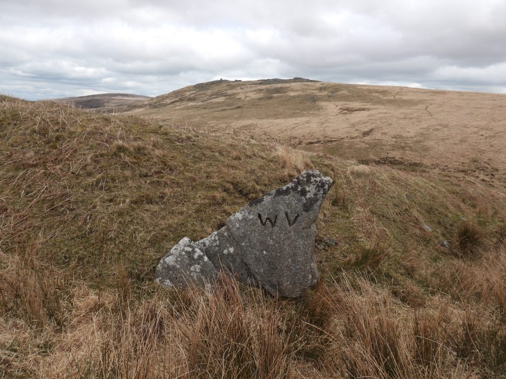
The mine was first referred as Nack or Knack when it started operating in 1835 (Greeves). This first operation was short lived as the mine resumed in 1836 when a licence was granted to three men from Tavistock – Henry Prenton, Francis Prout and John White. The licence was to run for twelve months at the cost of 1/18 share or dues. The bounds of the mine were set as being: “From a certain rock or stone marked WV on the eastern side of the shaft known by the name of Wheal Virgin Shaft to the length of three hundred fathoms eastward and four hundred fathoms westward, being together seven hundred fathoms on the course of the lode on which the said shaft is now sinking and one hundred and fifty fathoms north and south thereof…” It was around this time the mine was known as Wheal Virgin as in 1837 there was a sale of shares with the mine being referred by this name.
The ‘halcyon days’ of the mine (when it was called Steeperton Tin Mine) appear to have been between early 1850s and 1879. A licence for the “Steeperton Tor sett” was granted in 1853, but it wasn’t until the 1870’s that the majority of mining activity in the area took place. The 1853 licence was a one year lease granted to Michael Stevens from Lydford. However, there in no evidence of any production in tin at this time.
In the years 1875-1876, the Chief Agent was R M Jeffery, during which time the mine was deserted and reported as being in a dangerous condition. However, in the following year (1877) mining recommenced when the Steeperton Mining Co Ltd was formed and it is this company that installed the plant and buildings, the remains of which are still visible. The plant, waterwheel and stamps were purchased from Gobbett Mine, near Hexworthy for £65.
It was recorded that in 1878, one ton of black tin was sold and at that time 27 men were employed (13 underground and 14 on the surface) just one year after a waterwheel and plant had been purchased. The apparent success proved short lived as the following year (1879) the mine was in liquidation. In 1879, only one person had been working at the mine (presumably just for maintenance). In the following two years (1880-1881), the mine was reported as being inactive (Burt et. al) and it is likely the plant was sold off during this period. Between 1880-1882, the mine was in the ownership of the Steeperton Tor Mining Co Ltd, which may have been a reconstruction of the earlier company (interestingly the Chief Agent from 1877-1882 was S M L Aldridge, which would suggest some sort of restructuring).
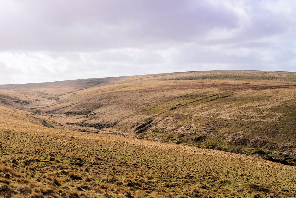
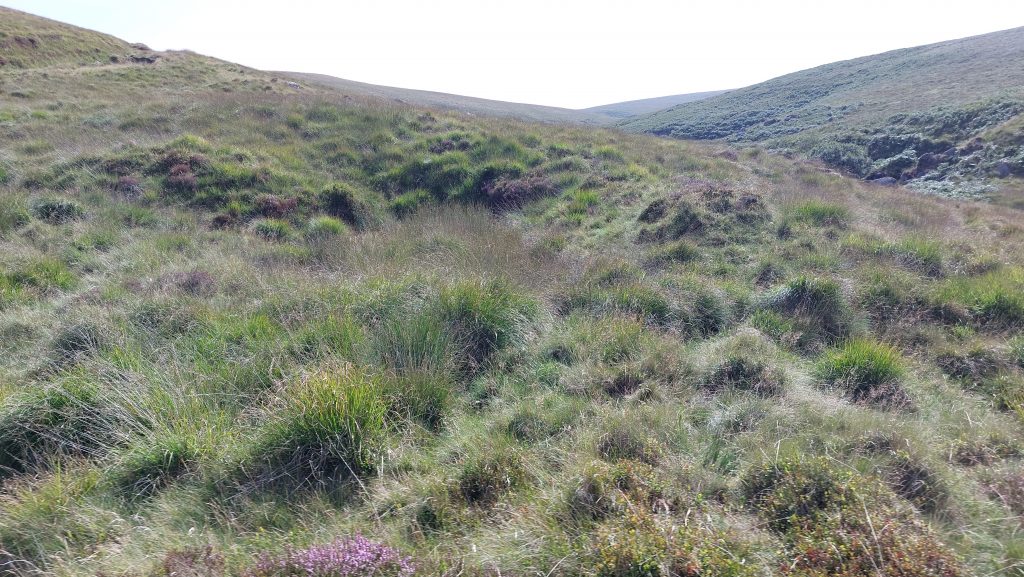
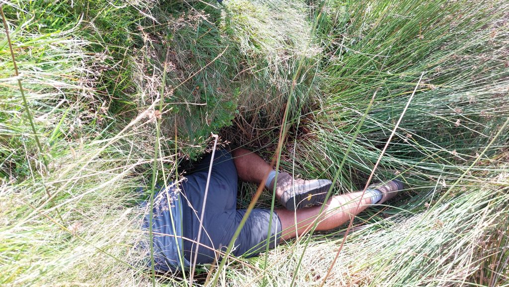
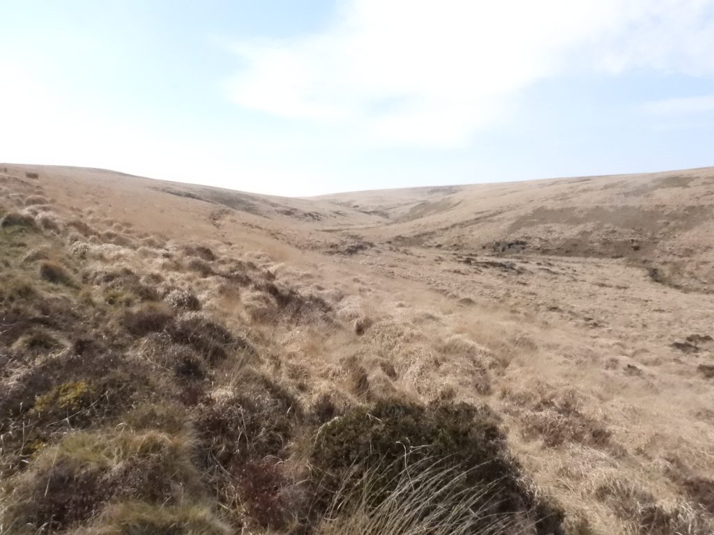
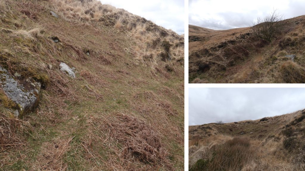
Walking the military track between Oke Tor and Hangingstone Hill, one may assume that the area has little of interest (albeit it lies in the beautiful Taw valley). However, the explorer can still discover many remnants of the mining activities which once took place. This post attempts to record the most prominent features of the mine and its immediate environs, which includes some military artefacts.
Bibliography
Dr. T.A.P Greeves (1985) – Steeperton Tor Tin Mine, Dartmoor, Devon Trans. Devon Assoc. 117, 101-127
Helen Harris (1968) – Industrial Archaeology of Dartmoor
R. Burt et. al (1845-1913) – Devon and Somerset Mines – The mineral Statistics of the United Kingdom
H.G. Dines (1956) – The Metalliferous Mining Region of South-West England Vol 2
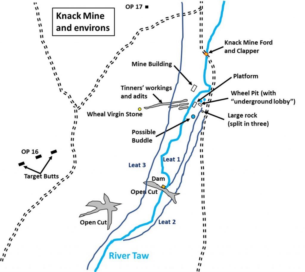
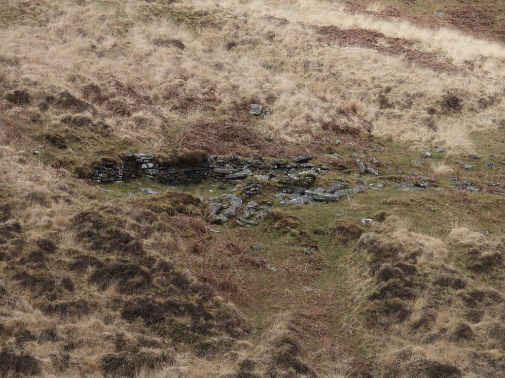
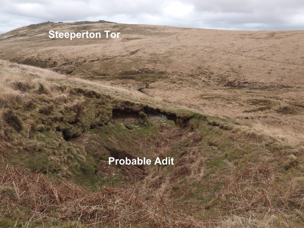
Sketch map showing the key features covered in this post. Helen Harris (1968 – Industrial Archaeology of Dartmoor) described the mine as follows: “At the foot of the western slopes of Steeperton Tor are the remains of Steeperton Tor or Knack Mine which was active for tin during the nineteenth century on the site of earlier workings up to the 1880’s. The remains include a hillside reservoir, gullies, adits, shafts and pits, parts of a dam across the Taw, a leat, wheelpit and buddle site, as well as building ruins”. This contrasts with Dines (1956) who stated that Steeperton Mine (aka Knack Mine) was an unsuccessful trial on the western slopes of Steeperton Tor.View of the mine from the slopes of Steeperton Tor
The early days of the ‘modern’ working of the mine is recorded in 1837 as this sale of shares indicates: “Valuable Shares for Sale – An Auction will be held, on Thursday, the 27th of April instant, by three o’clock in the afternoon possibly at the Beford Arms Inn, Tavistock, Devon for the disposal of the following highly valuable Mining, & other Shares. 3 – 200th Shares in Wheal Virgin Tin Mine, at Belstone Tor, near Okehampton, Devon. The Tin already raised by this Sett, which has been set on work within the last twelve months, is found to be of high standard value, and is sufficient in quality to encourage speculation on a larger scale and render shares valuable. 7th April 1837, Tavistock. (Ref: Devonport Journal: Thursday 20th April 1837)
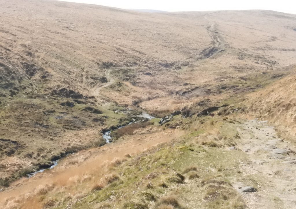
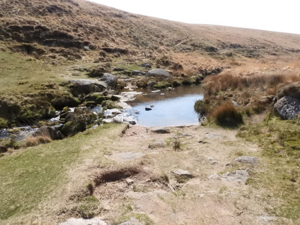
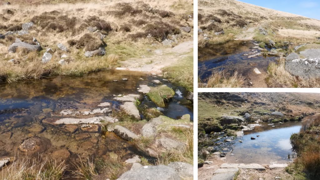
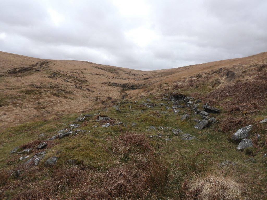
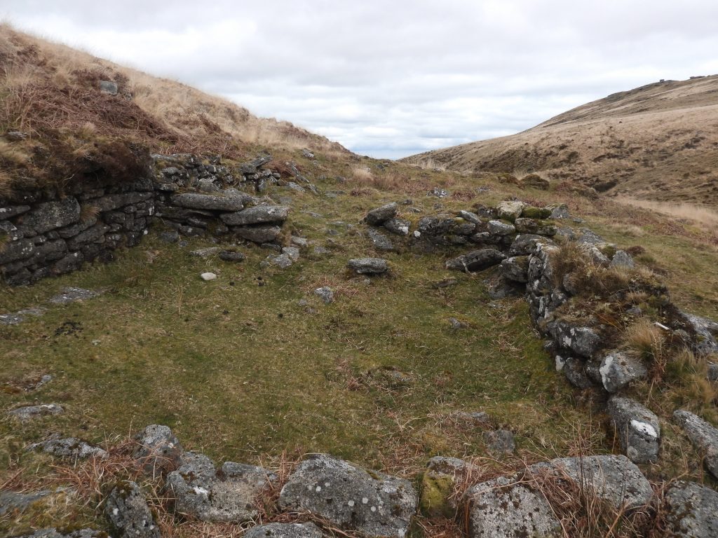
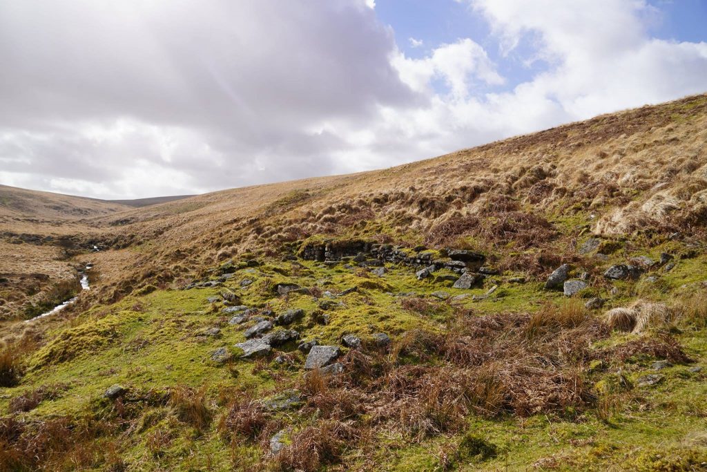
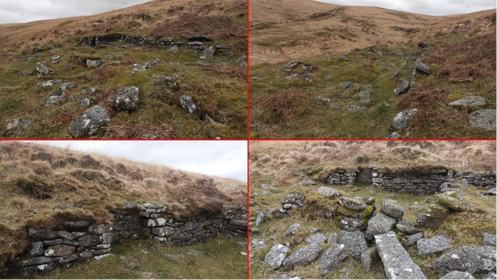
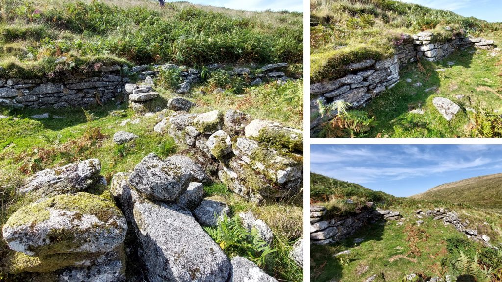
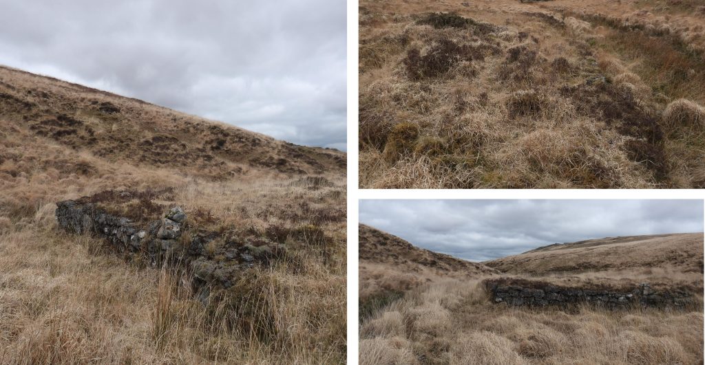
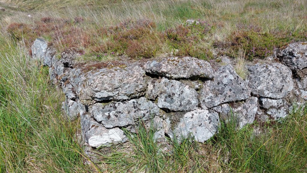
Military Track (known as Steeperton Road) from Oke Tor leading down to Knack Mine FordKnack Mine Ford, which on the 1949 OS map states there were remains of a clapper bridge here. The clapper bridge was reported to have spanned the River Taw by Prowse in 1890.There are a number of imposts at the ford whose orientation is their long sides lie north / south, in line with the flow of the River Taw. This ford is now part of a military track and it is believed that these imposts were robbed from the former bridge. The date of destruction is unknown. The main Knack mine building, lies on a flat ledge above the Taw. It comprises 2 compartments which are separated by a cross-wall. Both compartments have entrances on the East (river side). The building is recorded as probably being the Smithy and the Mine Office. Most likely constructed around 1877-8The Dartmoor HER records the Northern compartment as measuring internally 9.8m x 4.5m and the southern as 7.5m x 4.3m.View of the mine building, looking south up the Taw ValleyA fireplace has been constructed in the West wall of the South compartment. The centre of the building was recorded by the author as being at SX61401 88474Mine building in the summer (August 2025)Zoomed in view of the Mine Building taken from across the Taw by the Hangingstone Hill track.
By 1879, the outlook of the mine was bleak and it was put into liquidation as recorded by this newspaper article: Steeperton Mining Company Limited: At an extraordinary General Meeting of the members of said Company, duly convened and held in London, on the 23rd day of April, 1879, the following Special Resolutions were duly passed; and at a subsequent Extraordinary General Meeting of the Members of the said Company, also duly convened and held at the same place, on the 14th day of May, 1879, the said Special Resolutions were duly confirmed: – “The recent operations at the Mine having been attended with such unsatisfactory results and unprofitable expenditure it is expedient that the Company should be dissolved, and it is therefore the opinion of this meeting that the Company shall be wound up voluntarily and a Liquidator appointed forthwith. That in pursuance of the above resolution, Mr Moses, of 54, Gracechurch Street, be appointed Liquidator”. J.Stroud Short, Chairman (Ref: London Gazette: 20th June 1879)
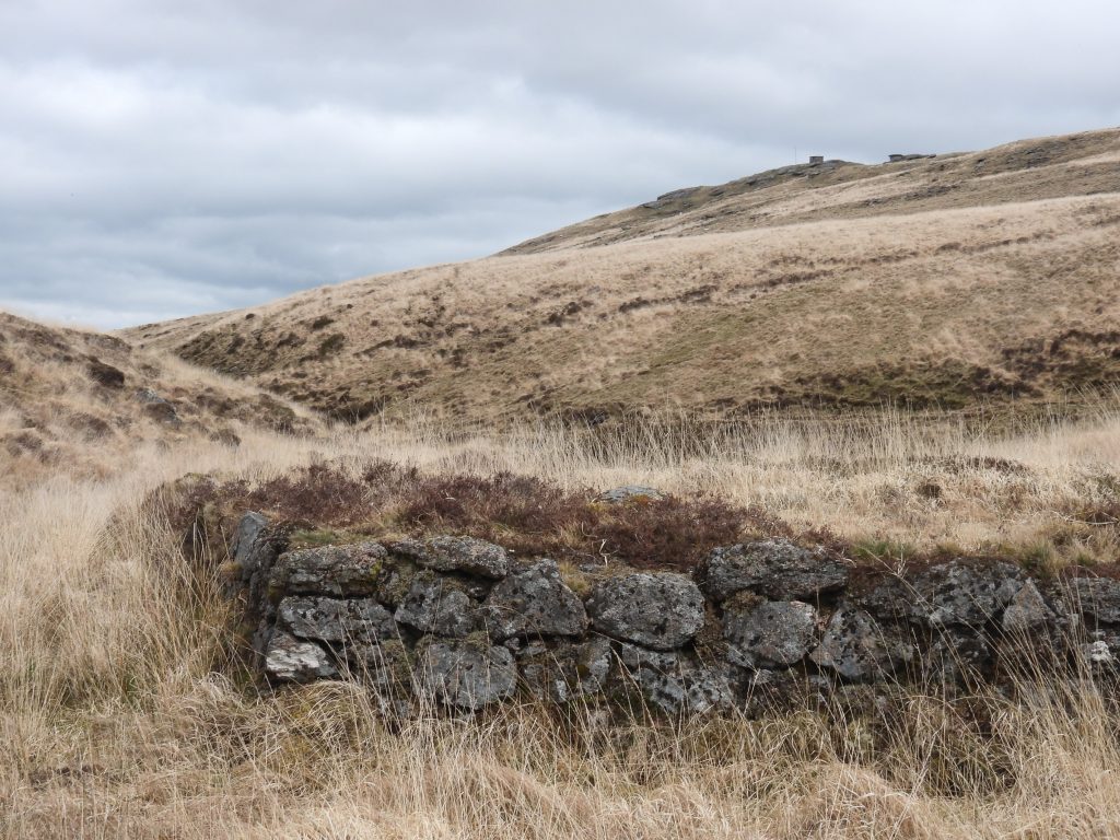
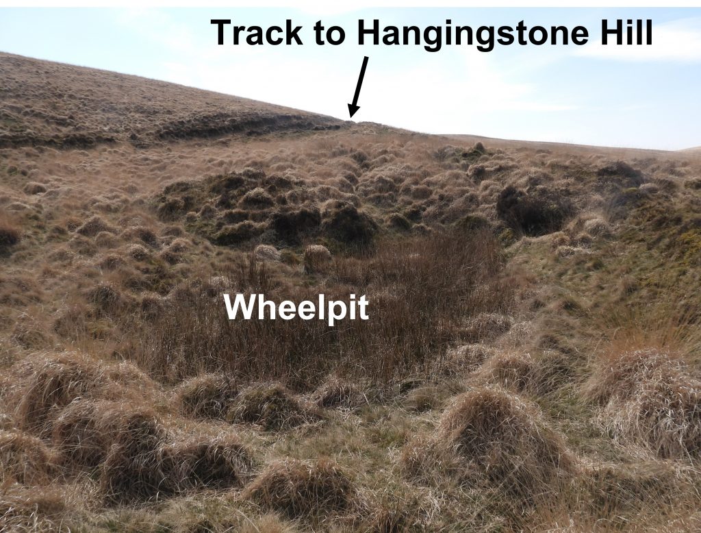
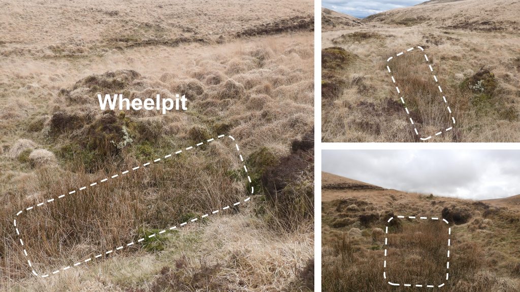
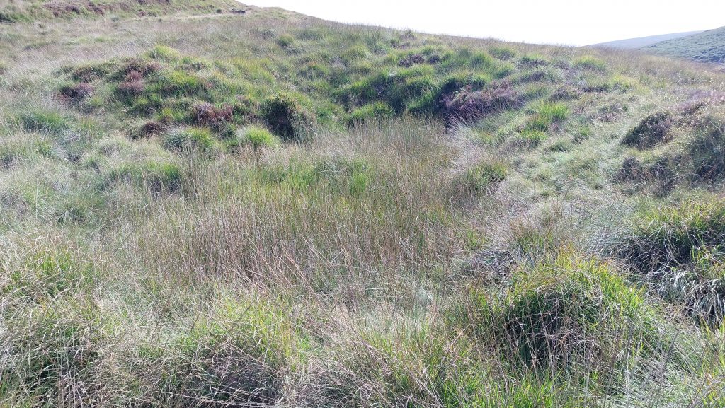
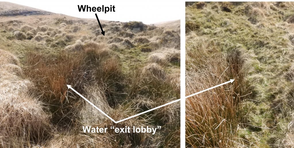
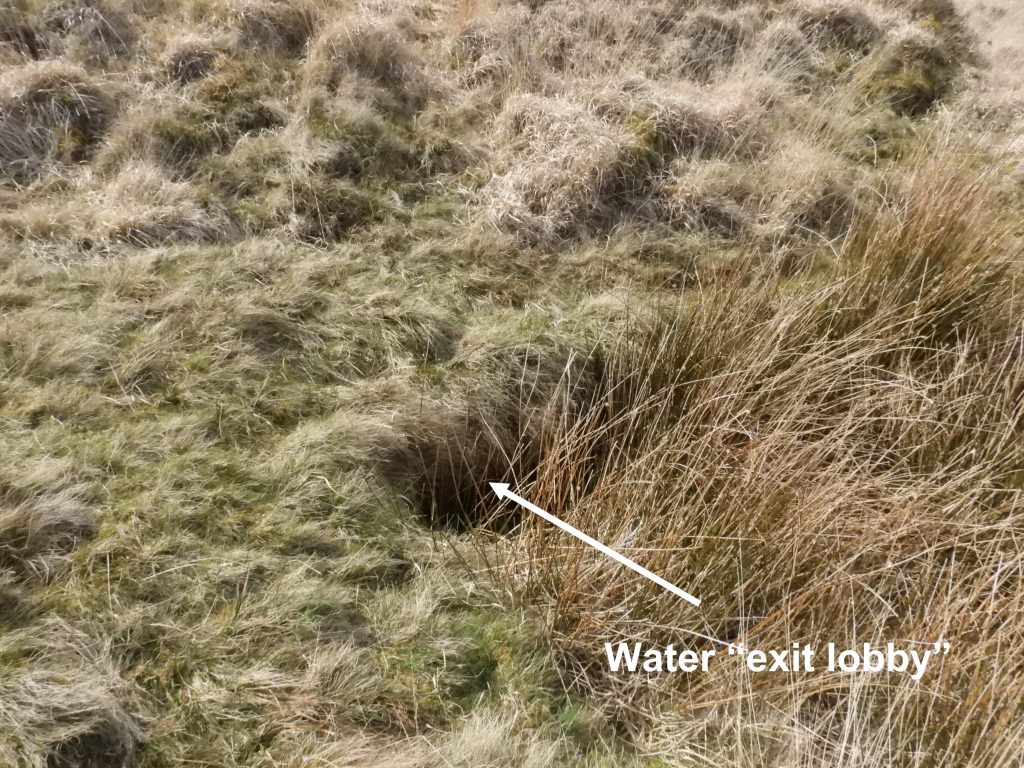
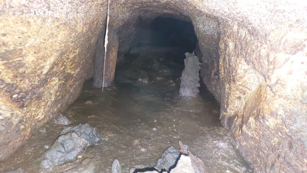
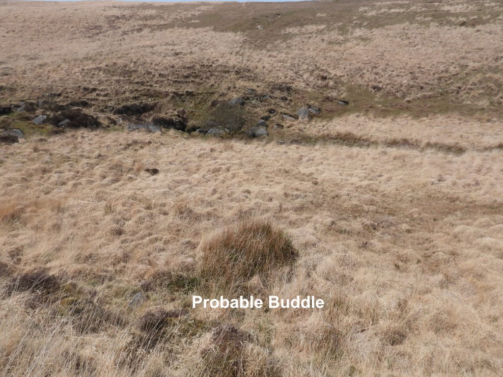
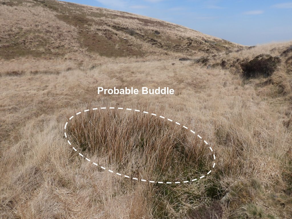
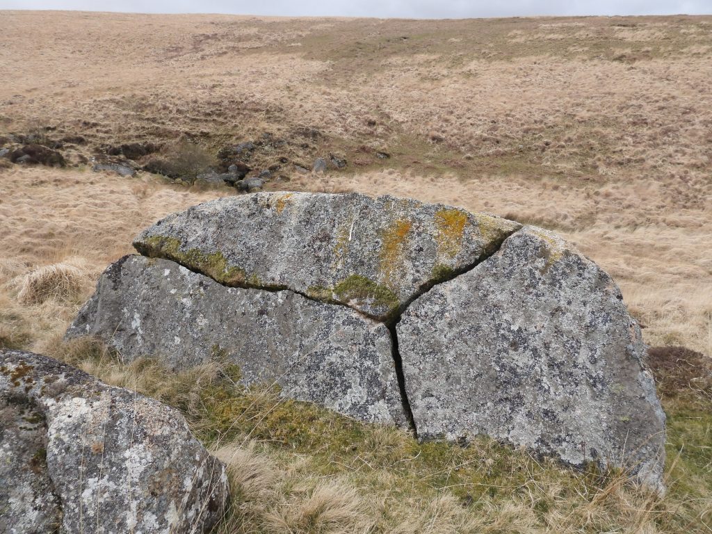
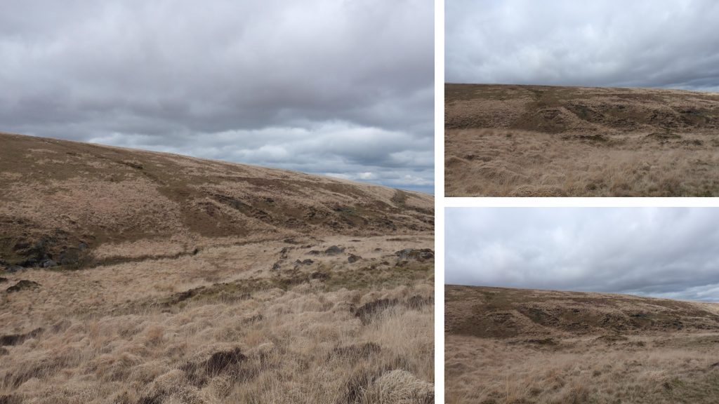
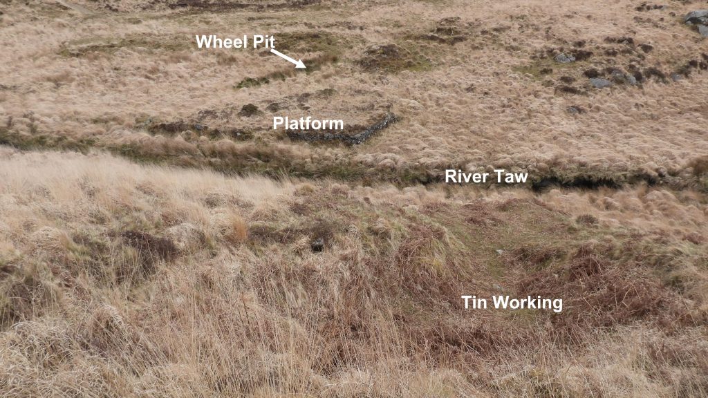
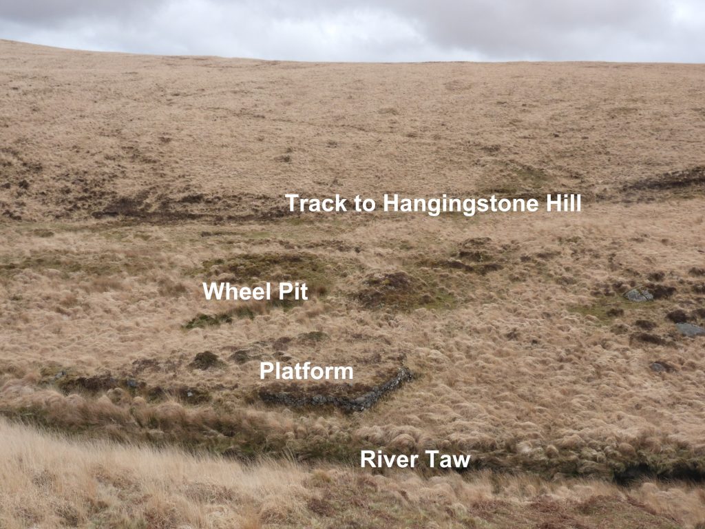
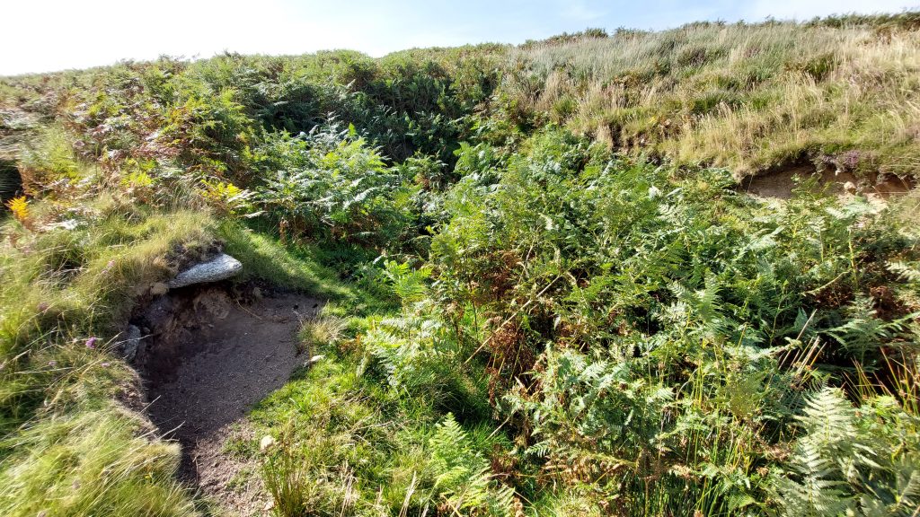
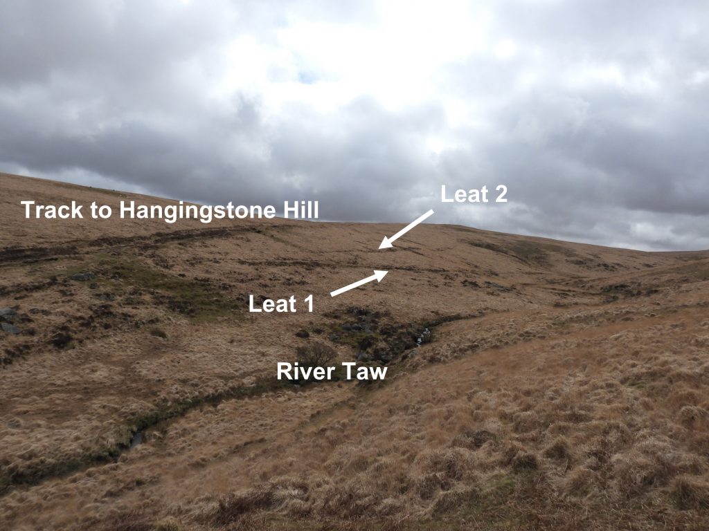
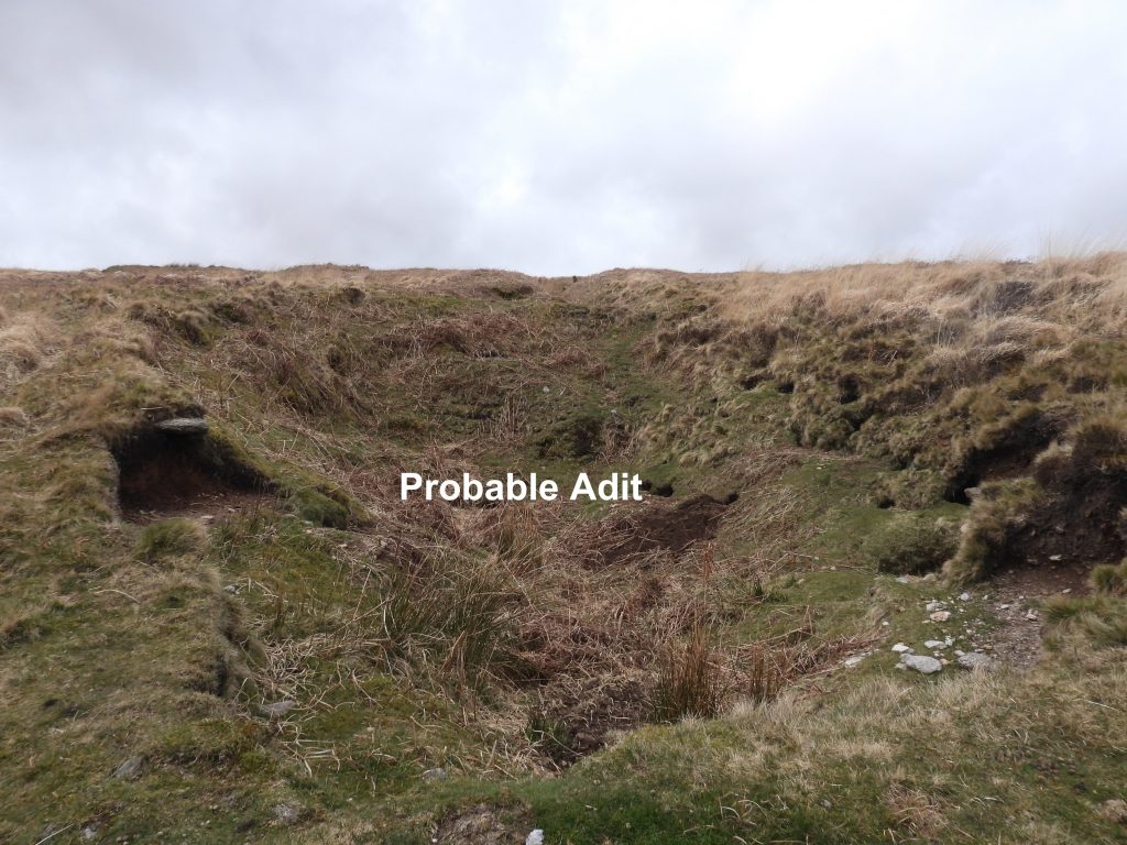
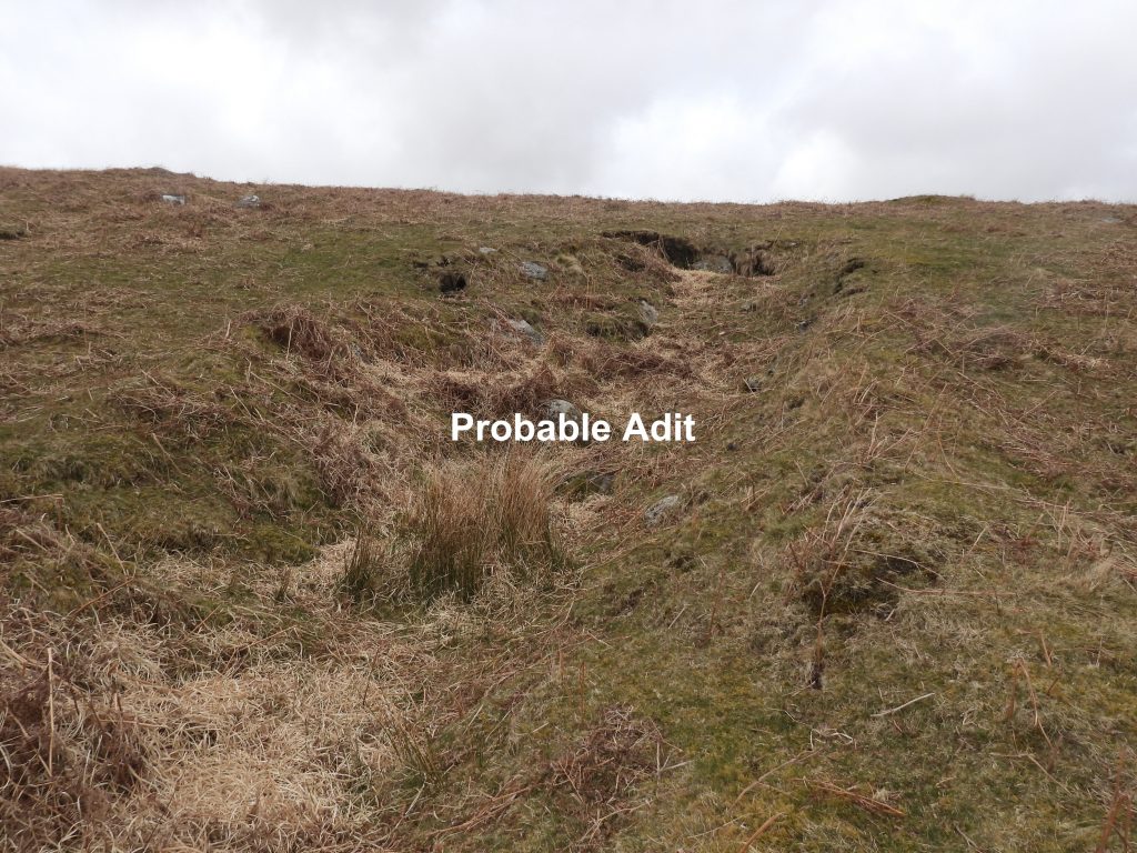
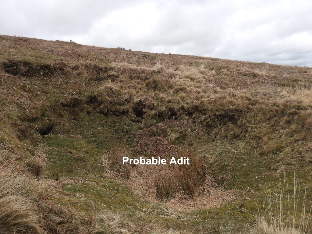
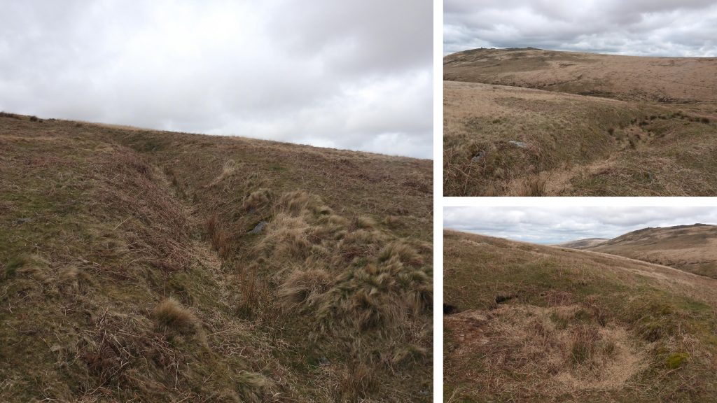
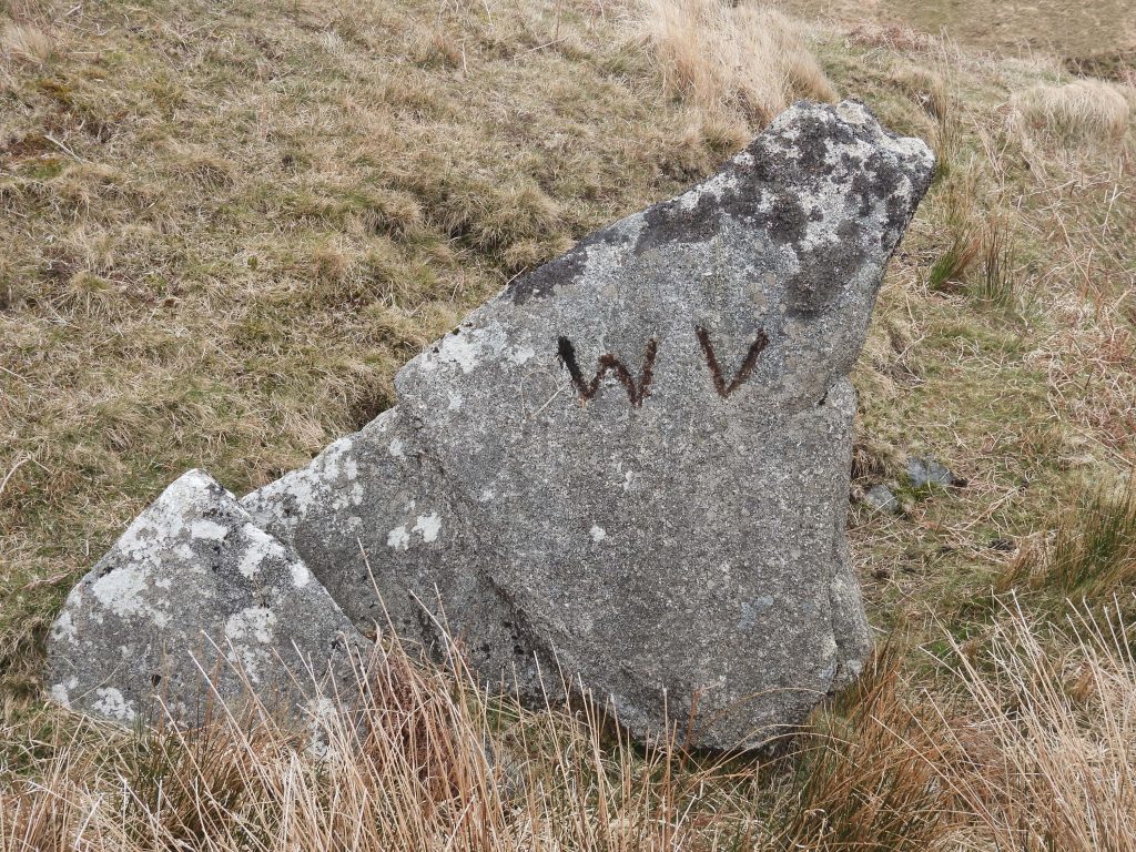
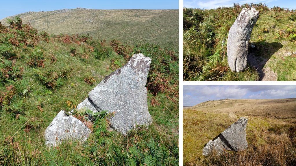
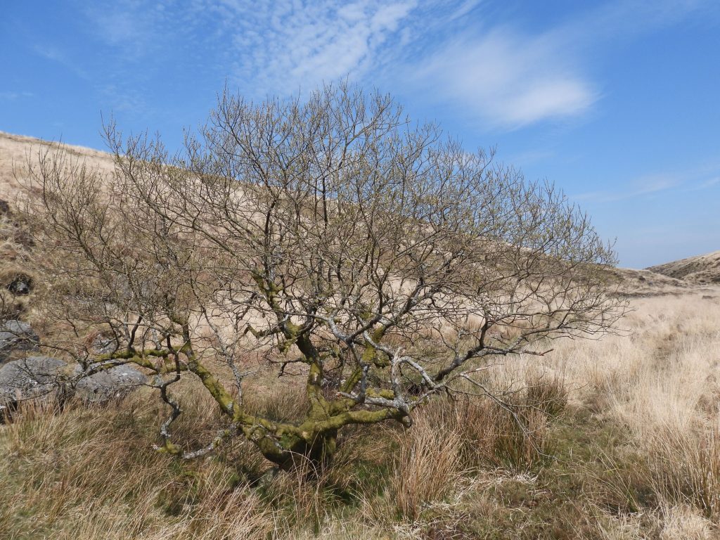
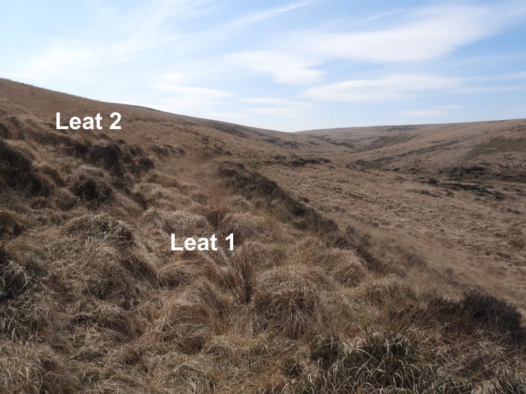
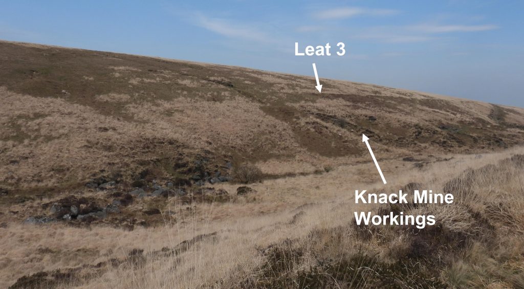
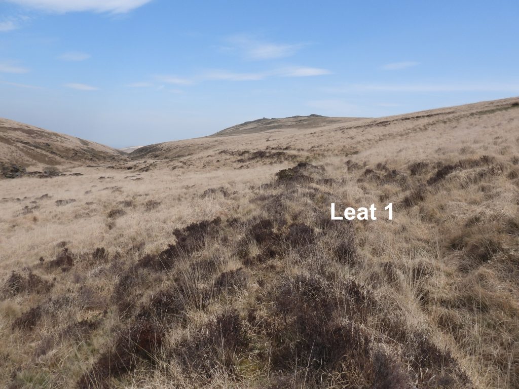
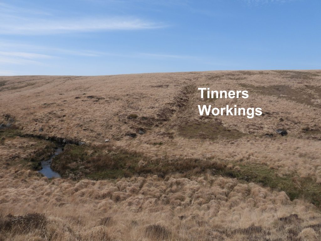
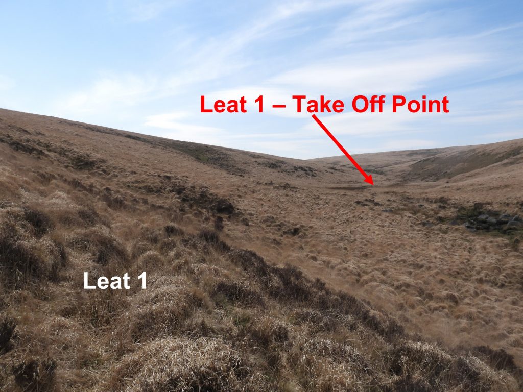
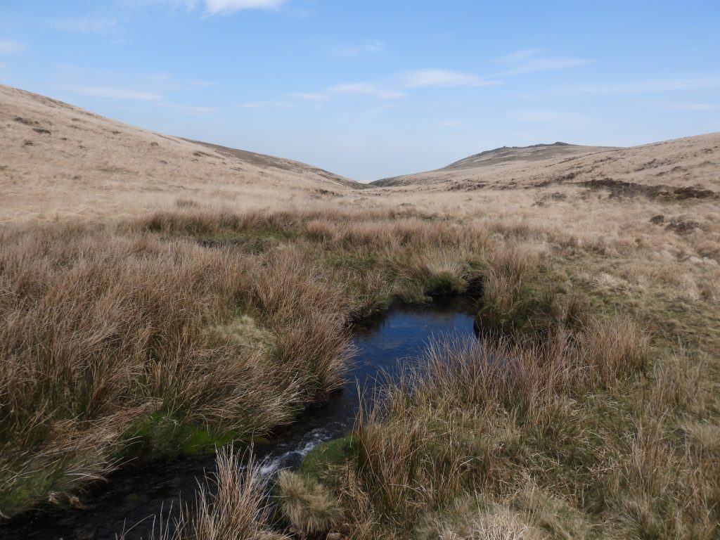
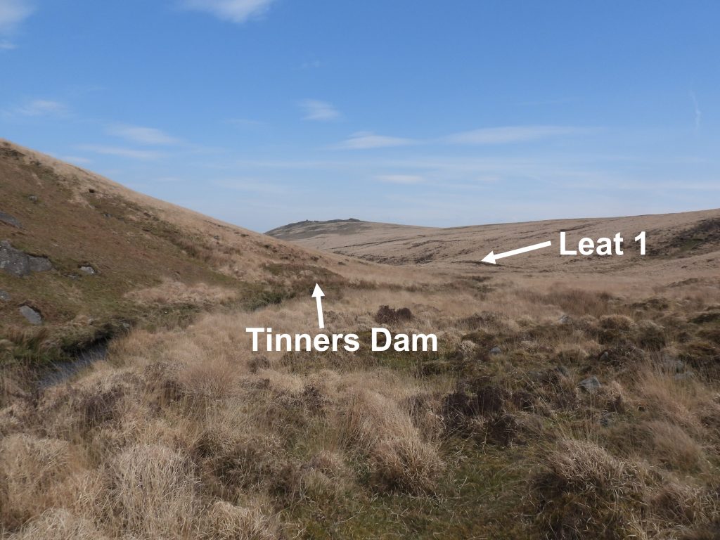
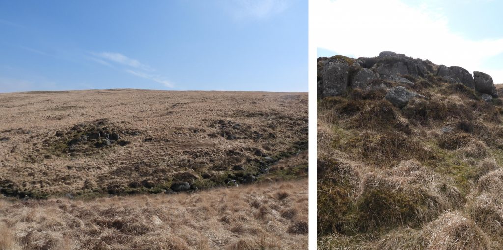
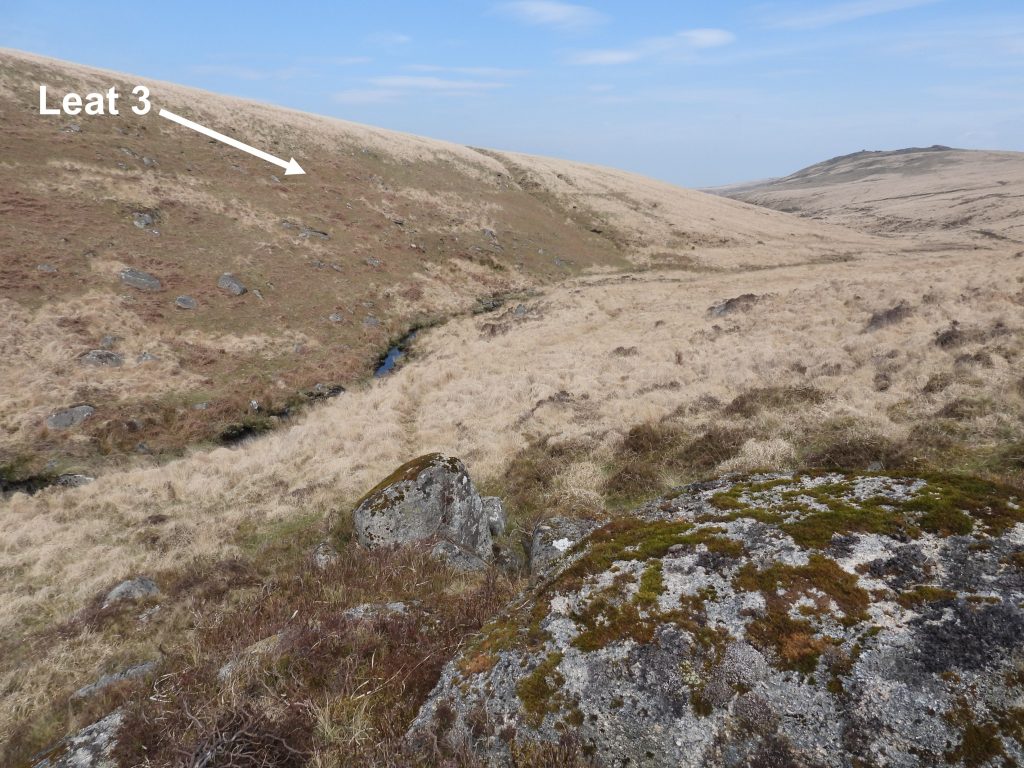
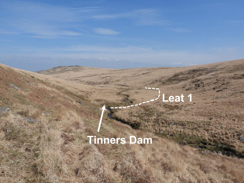
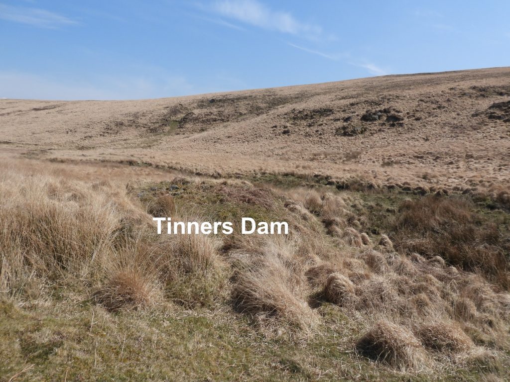
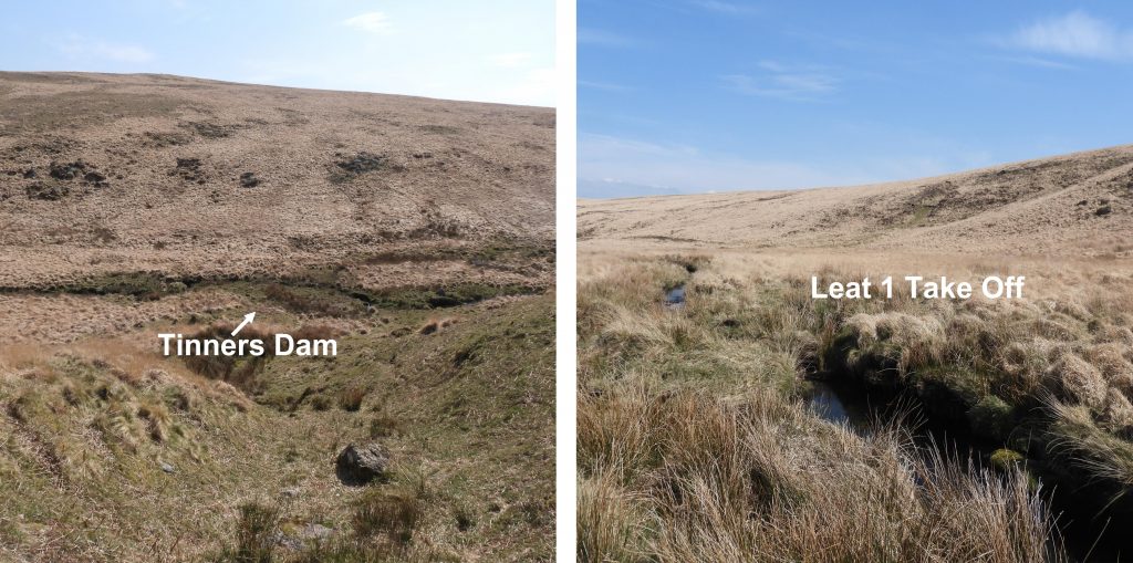
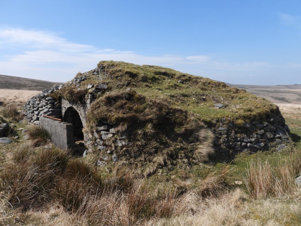
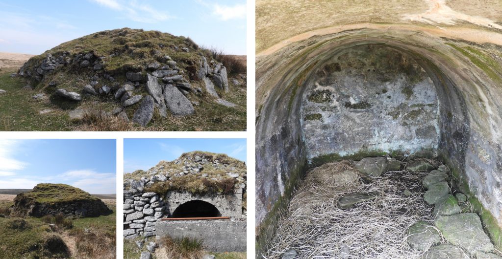
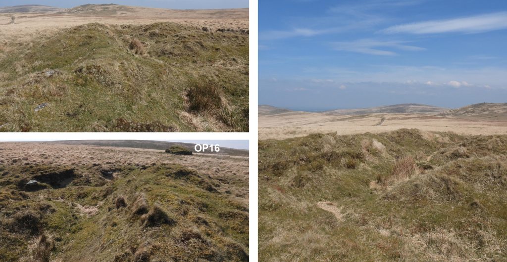
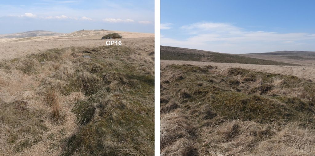
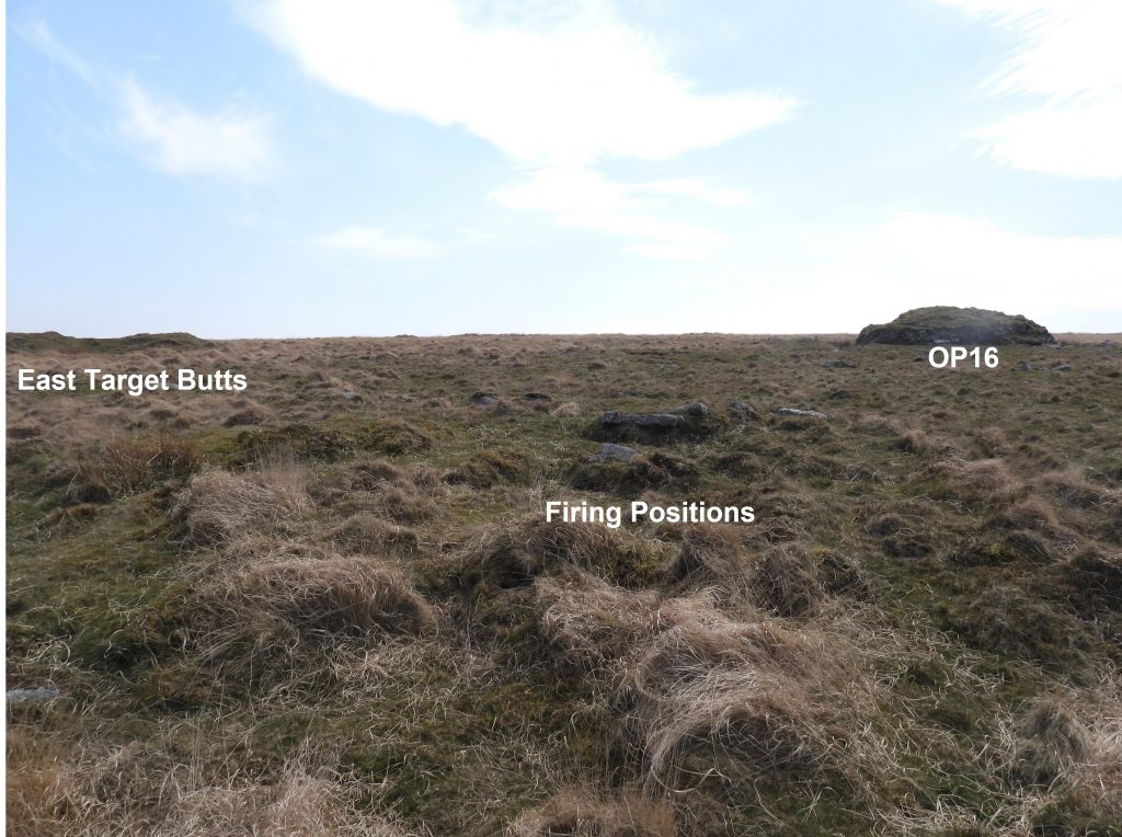
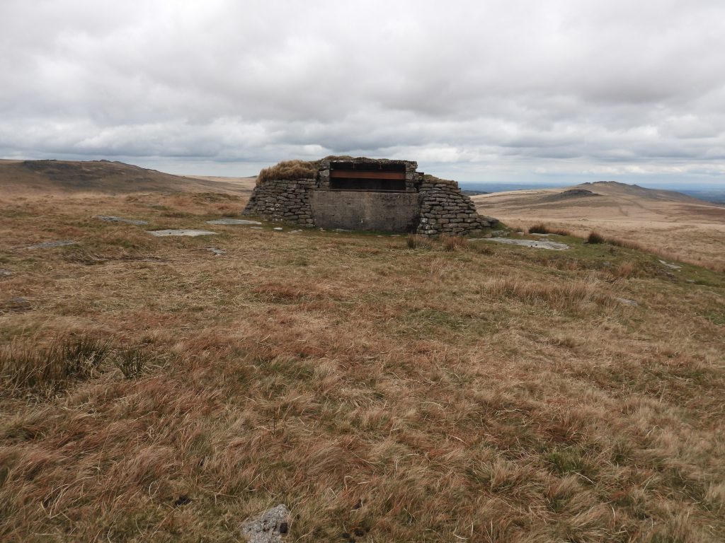
This stone built platform measures approx 16m x 11m and is related to Knack Mine. However, its purpose is unknown, albeit it is located close to a buddle and a wheel pit.The walling on the platform survives to a height of around 1m. The platform can be found at SX61388 88391During a Dartmoor Tinworking Research Group visit to the mine in August 2025, it was considered that the platform might have been part of a structure which transferred tin ore from the shafts and adits on the west side of the Taw to the Stamping Mill and Dressing Floor on the east side of the TawThe wheelpit was dug in 1877 for a 30ft waterwheel which was brought from Gobbett Mine. The Dartmoor HER records that at one point there was a Stamping Mill here with machinery purchased from Gobbett Mine at a cost of £65 in 1877. The purchase included a stamps water wheel, spur wheel shaft bearings, a stamp axle with frames and 12 heads. The location of the stamping mill is now very difficult to discern.The wheelpit is recorded in the Dartmoor HER as being “filled-in and forming an ill-defined rectangular depression approx 9m x 2.5m”. The wheelpit can be found at SX61419 88379. Wheelpit in the summerClose up of the WheelpitThe wheelpit has an associated underground ‘lobby’ which is still visible. It is approx. 9m from the end of the pit. It is rock-cut and is recorded as being 0.9m wide with a height of 0.7mThe wheelpit “exit lobby” can be found at SX61411 88390Exploring the waterwheel exit ‘lobby’ during a DTRG trip in August 2025Inside the waterwheel exit ‘lobby’. Evidence of wood props and pick axe marksPossible buddles to the north of the wheelpitLooking up the Taw valley showing the line of Leat 1 (see map), which fed the waterwheel at the mine.Dr Tom Greeves records that there is a round buddle at the mine which can still be located. The author believes this reedy area in this photograph is the most likely location of the buddle.The reedy area is approx 5m diameter, which is consistent with the description of the buddle. The description also states the buddle has a depth of 0.4m which is also consistent with this location. The probable buddle location is SX61393 88327.This unusually split rock has evidence of the “hand of man”. If this splitting isn’t natural, or at least man assisted, one wonders what use the pieces would have been. The rock can be found at SX61409 88345.General views of Knack Mine looking across the River Taw as viewed from the south east.There are two parallel gullies near to the river bank between adits (see later pictures) and the mine building. Assuming the author has correctly identified these (from Dartmoor HER description) these may be trial adits or possible quarries for the mine structures.Ascending the hill to get a better perspective of the mineThe wheelpit and platform in relation to the Hangingstone Hill track and the River Taw.Probable shaft at SX61326 88417On the west side of the valley there were two leats. Leat 1 seems to have been the main water supply for the waterwheel. Leat 2 may have been an newer “cut”. Dr Tom Greeves in the Dartmoor HER states that Leat 2 possibly provided supplementary supply when the dam (relating to Leat 1 and shown later in this post) was in use.The Dartmoor HER records the mine having at least 3 blocked adits dating from the 1870s.This probable adit was recorded at SX61281 88365.All the workings associated with the mine are on an east-west alignment. All the shafts / adits now appear as depressions in the hillside.This picture is taken from above (in relation to the previous picture) and shows the adit position above the valley and in relation to Steeperton Tor. The east-west alignment of the workings most likely represent the ‘black lode’ with the adits being for ‘shallow level’ and ‘deep level’ entry into the hillside.A shallow gully in the workings on an east-west orientation.The Wheal Virgin Stone is a Tinners’ bound stone. It can be found at the west end of one of the Knack mine gullies.The Wheal Virgin Stone has the letters “WV” incised on its west face. The stone can be found at SX61257 88428The stone is relate to the sett when the mine was called Wheal VirginWheal Virgin stone contrasts between summer and winterA solitary tree by the Taw and close to the mine. At the time this picture was taken, the tree had a number of bees buzzing around the upper branches.Following Leat 1 south to its take off point with Leat 2 above.Following Leat 1 upstream to its take off point and looking across the mine workings the distinct line of another leat (marked Leat 3 on the map) can be discerned. The leat passes through the workings of the mine, though it is not associated with them.Leat 1 looking northMore tinners’ workings or “open cut” to the south of the main mine, looking across the Taw from Leat 1.As the Taw valley enters a shallow basin the take off point for Leat 1 can (just about) be discerned.The approx position of Leat 1 take off point. The location is not fully obvious.The tinners built an earth dam in 1877 to divert water from the Taw into Leat 1 in order to provide power for the waterwheel.Just above Leat 1 take off are a number of isolated rocks. Upstream are rocks named by Eric Hemery as “Taw Rocks”. These rocks may simply be “outliers” of Taw Rocks, albeit they are are some distance away. In the absence of a name, the this author will refer to them as Ockside Rocks (as they are at the base of Ockside Hill). They can be found at SX61048 87740.On top of Ockside Rocks looking south. Leat 3 take off is quite a bit further to the south from this point. The whole leat can be traced from the Taw to a point on the ridge mid-way between the Knack mine and Oke Tor. Its purpose is unclear.Taken from Leat 3. Looking down on the tinners dam and the route of Leat 1.The tinners dam is described as consisting of a large linear mound approx 1.5m high and 8m wide at the base. The mound in the picture fits the description, so the author assumes this to be the correct location. It can be found at SX61108 87899.The tinners dam was breached when Knack Mine closed in 1879.To the west (over the hill and across the military ring road) from the Tinners’ Dam, the explorer can find Observation Post 16 (OP16), which is a fine example of a stone and earth covered concrete splinter-proof shelter. The OP is located at SX6808 88189.OP16 also has a cast-concrete “shelter” being protected by a large mound of turf and boulders. It measures 3.2m north to south by 2.0m internally with coursed granite walls and an arched roof. A further description of the Observation Post found by the author states that: “The front (south) side is protected by a cast-concrete blast wall 1.5m high with a handrail on top that would have been used to feed a system of cable pulley that the movement of targets positioned within the flanking trenches”. Ref: Dartmoor HEROP16 is flanked by two target butts. The east butt is centred around SX60870 88218. The east butt is the largest of the two and comprises a disturbed bank approx 30m long running east to west. It also has a ditch on the south side.The west butt associated with OP16 is a smaller, single trench and measures approx 15m long. It is centred around SX60748 88167.About 30-40m to the north of OP16 and the east target butt, is what appears to be “dug-in” firing positions. More of these appear to extend to the north.Observation Post 17 (OP 17) can be found on the ridge above Knack Mine Ford and a short distance to the north of the Wheal Virgin Stone. It is identical design to OP15 (found on Okement Hill) and is a natural stone walled shelter. It has, however, a reinforced concrete roof supported by rolled steel joists. (Ref: Dartmoor HER)