A collection of walks, discoveries, insights and pictures of exploring Dartmoor National Park
April 22, 2022
An Exploration around the area of Holloway’s Field, near Belstone.
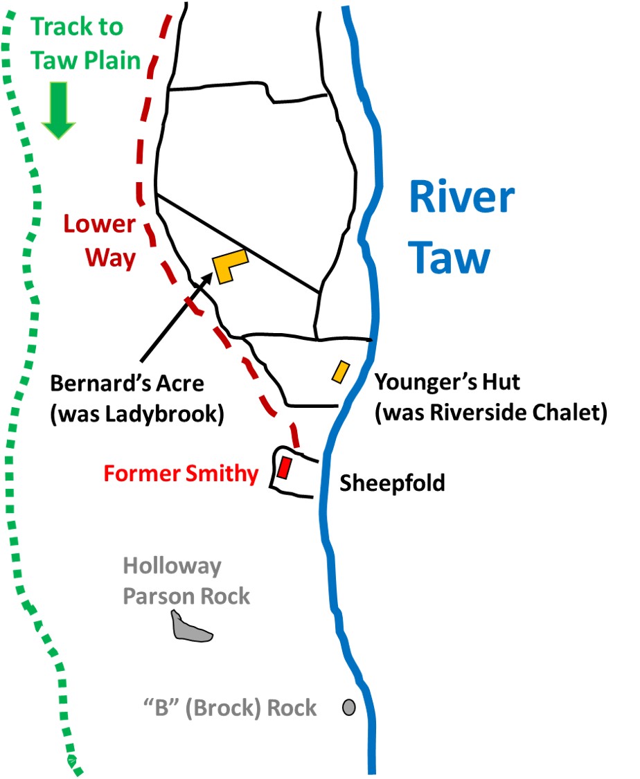
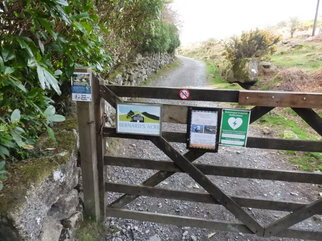
The area to the south of Belstone / Birchy Lake where a series of fields alongside the River Taw ends at the sheepfold (shown on modern OS maps) is called Holloway’s Field. The track from Tawcroft moor gate to Holloway’s Field is known locally as “Lower Way” and enables access to two properties near the sheepfold, namely Bernard’s Acre and Younger’s Hut. Also, in the area are two inscribed rocks bearing the initial “B”, one being the well known Holloway Parson rock. This post covers the all features of interest around the Holloway’s Field area and includes the aforementioned properties, the inscribed rocks and the sheepfold (which was a former smithy). My thanks go to Chris Walpole and his “Book of Belstone” publication for much of the information contained herein.
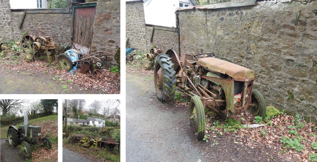
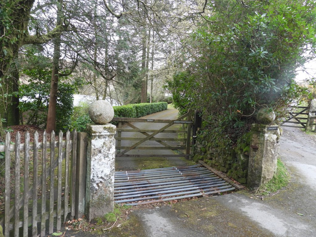
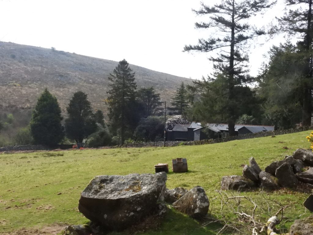
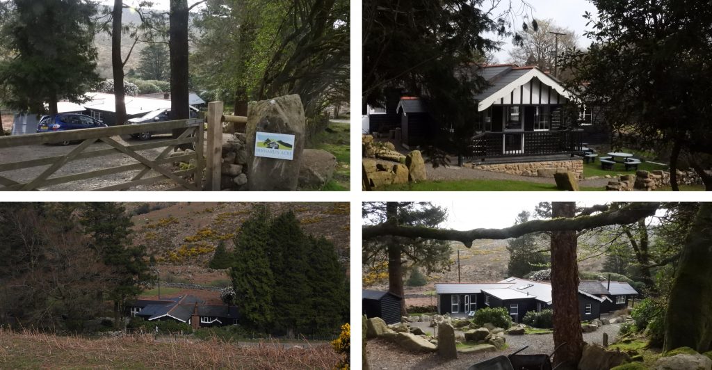
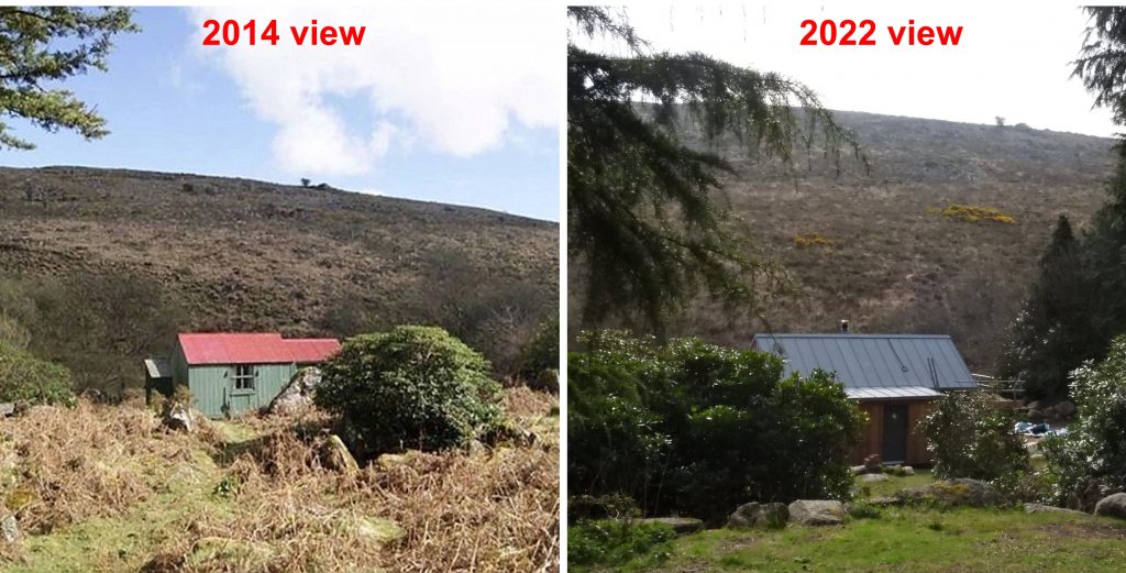
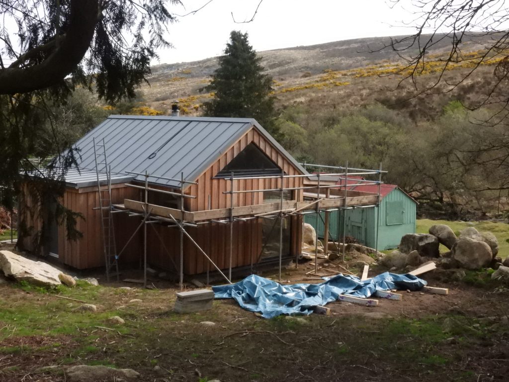
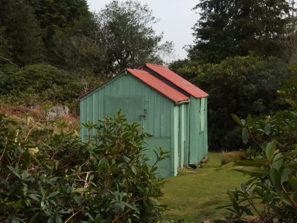
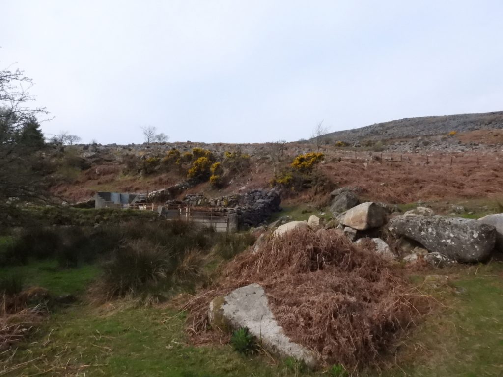
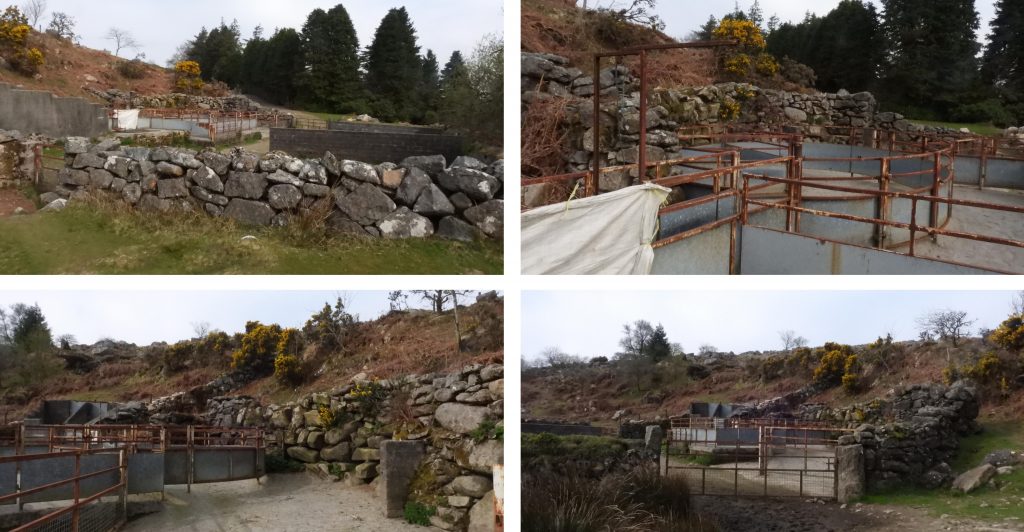
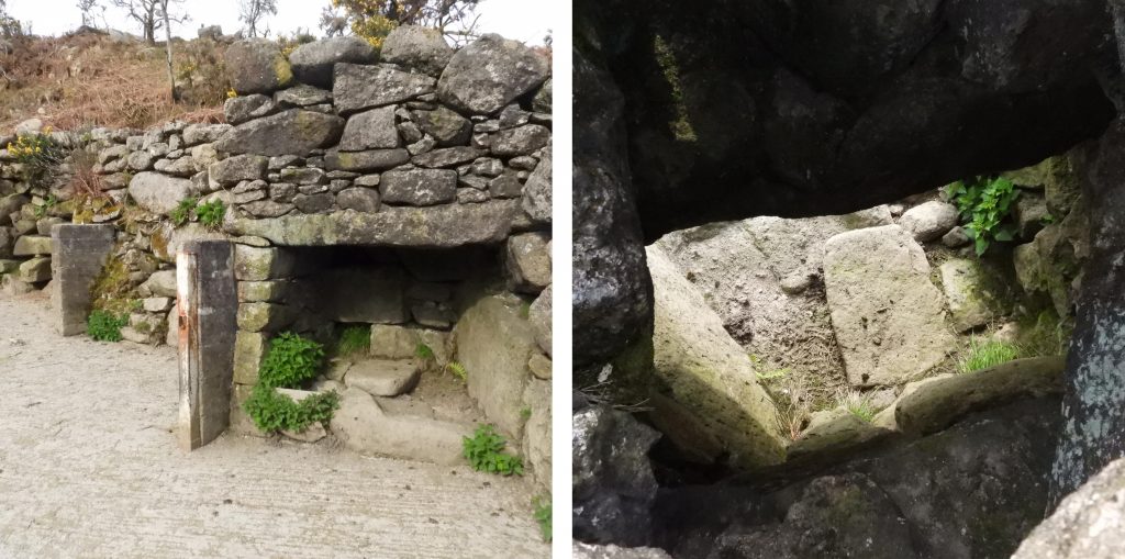
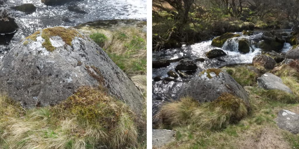
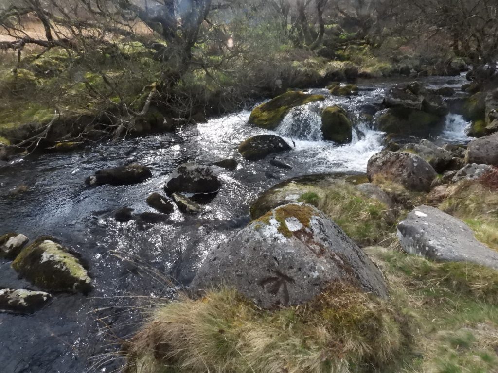
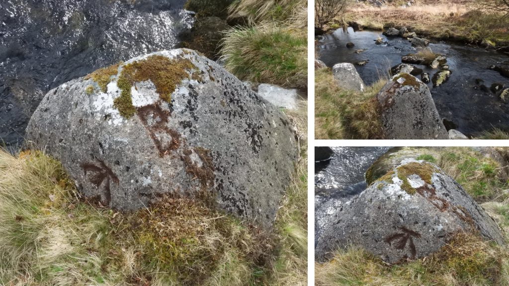
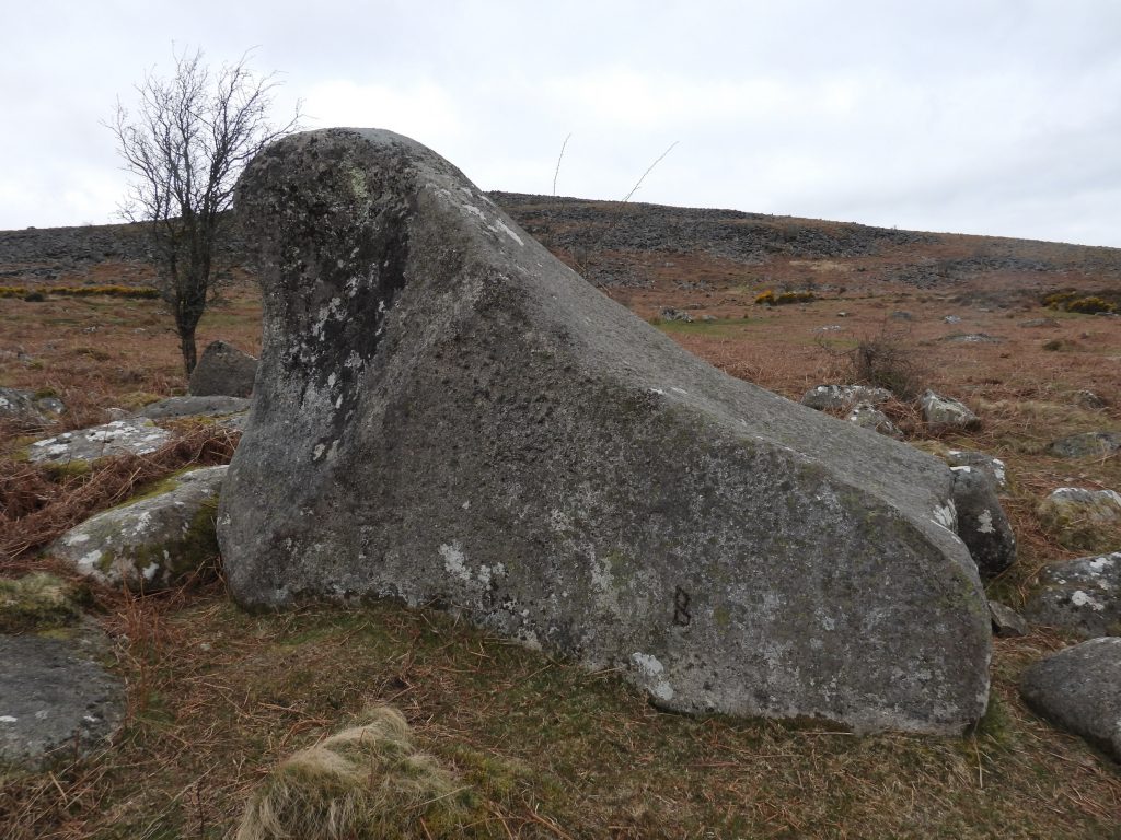
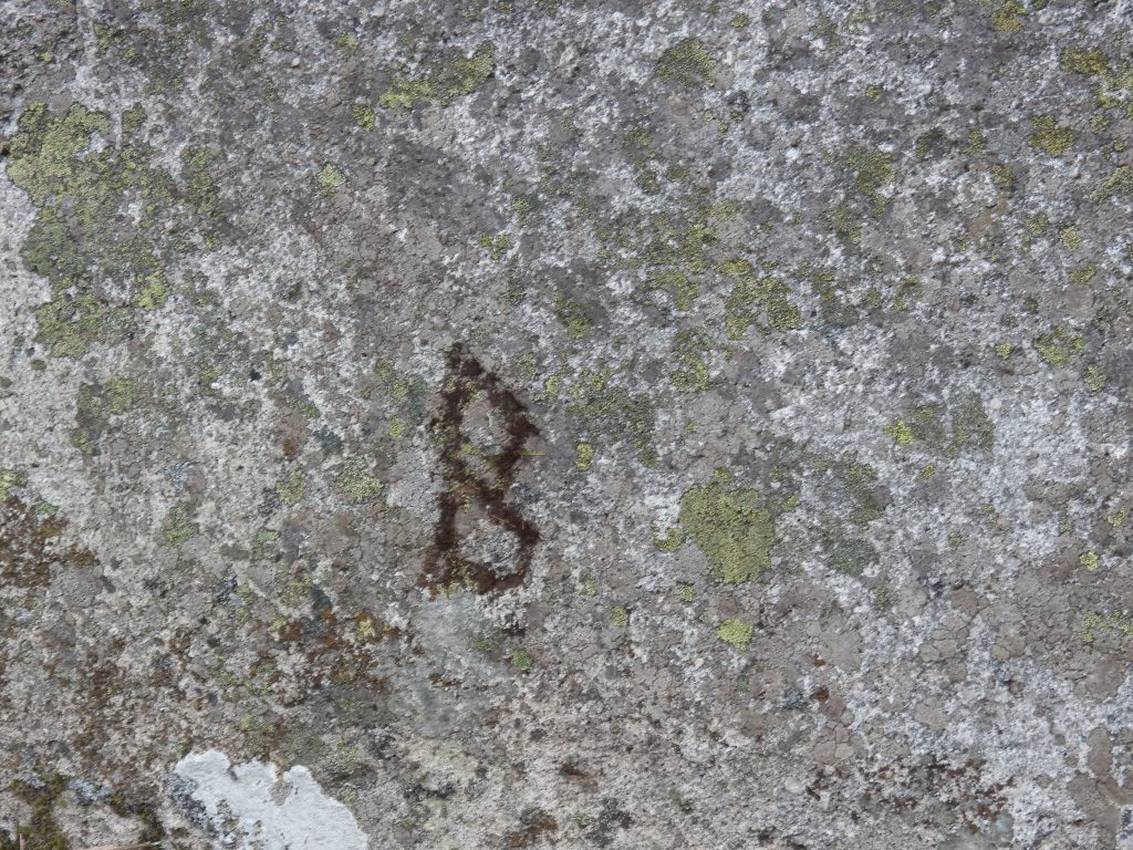
Sketch map of the area covered in this postBirchy Lake hamlet, en-route between Belstone and Holloway’s Field. The “Lake” (celtic word for small stream) is the stream found here which runs down to the Taw. In 1841, Birchy Lake house, stood on the last piece of enclosed land before the open moor and was occupied by John Luscombe and family. Entrance to Tawcroft with the gate leading to “Lower Way”. In 1905, a Dr Neville Gwynn MB, BS, physician and surgeon acquired ground from William Gillard and three years later obtained permission from the Office of the Prince of Wales to erect Tawcroft as a sanatorium. Gate at the start of “Lower Way” leading to Holloway’s FieldView of Bernard’s Acre from “Lower Way” with Ladybrook Tor beyondThe Christian centre called Bernard’s Acre was originally called Ladybrook, after the tor across the valley. It was built in the early 1920’s and was originally a weekend retreat of the Rowsell family who were Exeter builders. In 1978, the building was bought for £15,000 by friends of the late Bernard Partridge, a youth worker at Belmont Chapel in Exeter. It was established as a family and young people’s centre for church groups on Dartmoor. Today, according to their website, groups of up to 24 can stay here. https://bernardsacre.org.uk/Younger’s Hut. The view looking down to the hut and over the valley to Ladybrook Tor, has changed over the last 8 years or so. The two-roomed chalet of Younger’s Hut was sold for around £100,000 in 2014 and although the original hut is still there (see later photographs) a more modern structure is being built on the 1/2 acre site.The old and the new. Around 1923, the artist Edwin Burleigh Younger arrived at Riverside Chalet (known locally as Younger’s Hut, The Artist’s Hut or Riverside Studio). At first he lived there all year round but eventually moved to lodgings in Okehampton during the winter. The original Younger’s Hut, Artist’s Hut or Riverside Studio. Apparently (ref: Book of Belstone) Mr Younger put all his finished canvasses were underneath the hut. One assumes it was clean and dry place for their storage. For at least 40 years, after the Younger occupancy, the became the holiday retreat of the Lycett family. Area known as Holloway’s Field with the sheepfold and former smithy. The enclosure is now used for sheep dipping.The Sheepfold at Holloway’s Field was once used as a stone-cutters yard and a blacksmiths shop. It is believed to date from 19th century with the sheepfold being built within an earlier enclosure. It is recorded in the “Book of Belstone” that a William Reddaway converted the old sheepfold into the stone-cutters yard and a blacksmiths shop. A man called William Brock also worked here, who will be mentioned later in this post.In the north west corner of the Sheepfold is massive fireplace, testament to this being a former blacksmiths shop. Late 19th century maps label this building as a smithy.About 100m upstream from the sheepfold is an inscribed riverside rock. It has a “B” on its upper (west face) and a benckmark on its vertical (north face). It is located next to a delightful small waterfall on the Taw.After a “mud makeover”, the inscriptions become very enhanced for pictures. The great-grandson of William Brock, a Clifford Pike believed that the initial “B” on this rock, stood for Brock and it was William who carved it. The benchmark, doesn’t appear on maps referenced by the author.The Brock Rock (name given by the author) can be found at SX62205 92383The distinctively shaped rock between the track to Taw Plain and Holloway’s Field sheepfold has several names by which it is known. The author has heard it called the Sea-lion, the Whale, the Walrus or even the Belstone Clanger. One other name it is known by is Holloway Parson (or Passon) and it is this name that is shown on the map, tying in the name “Holloway” for the post. One assumes the name Holloway Parson and Holloway’s Field are related in some way.Near the base of the Holloway Parson Rock is another inscribed “B”. It is unlikely this relates to Belstone as it is not close to the parish boundary. The letter seems a lot cruder than that found at the Brock Rock. That said, could the two be related ?