A collection of walks, discoveries, insights and pictures of exploring Dartmoor National Park
October 12, 2020
HUNTINGDON WARREN
Steve Grigg
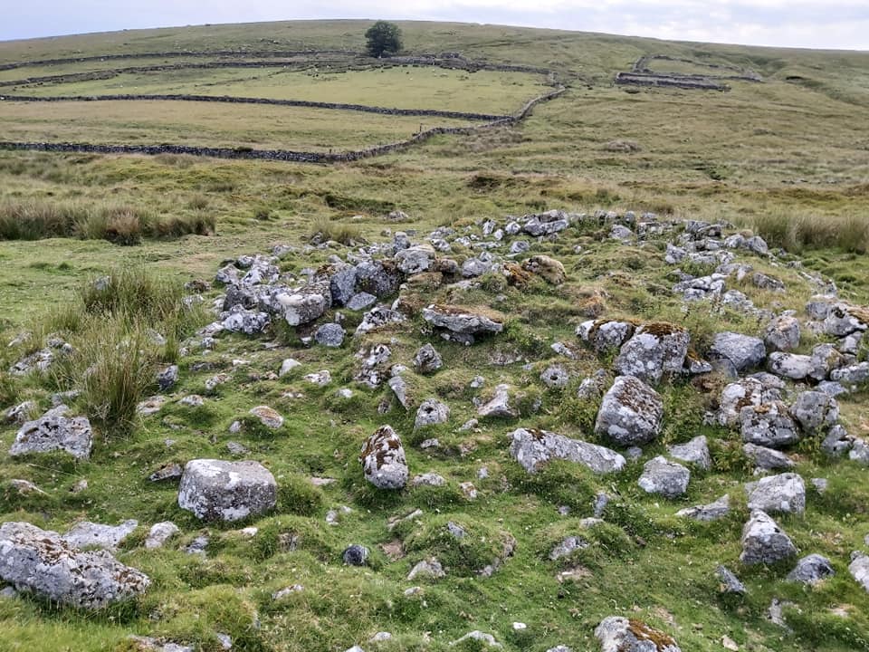
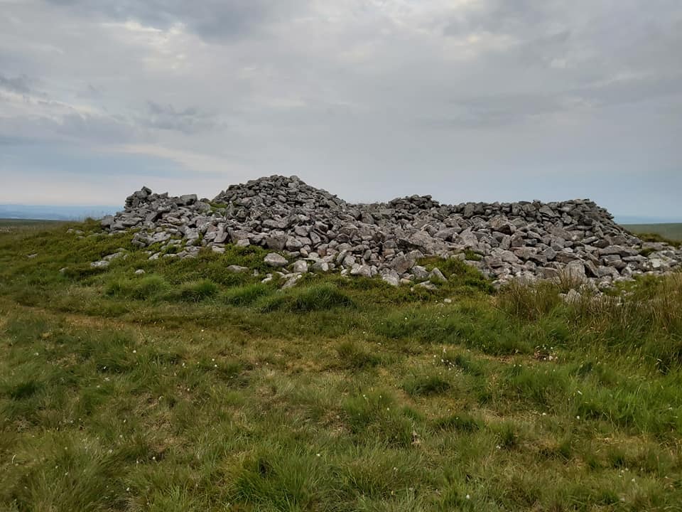
The 700+ acres of the warren is bounded on three sides by the River Avon (West and South) and Western Wella Brook (East). At the centre of the Warren is the dome shaped Huntingdon Hill topped by a cairn known as the Heap of Sinners. The first mention of Huntingdon was in the 15th century and the site is believed to have had a longhouse during the 17th century. At the start of the 19th century, the warren came into its own when Thomas Michelmore took on a lease from the duchy (1806). The warren is believed to contain around 116 buries (pillow mounds) and at least 4 vermin traps, which are synonymous with the majority of warrens throughout the moor. This post contains photographs of each of the 4 vermin traps, some of the buries and many of the features from the area. There is an excellent article on the warren on the Legendary Dartmoor website, which is worth a read and from which some information for this post has been gleaned;
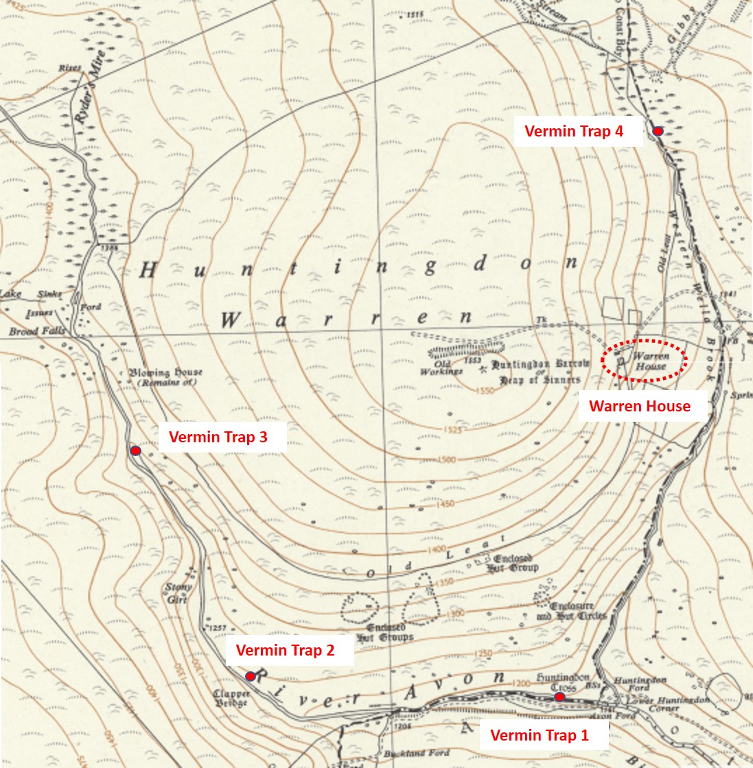
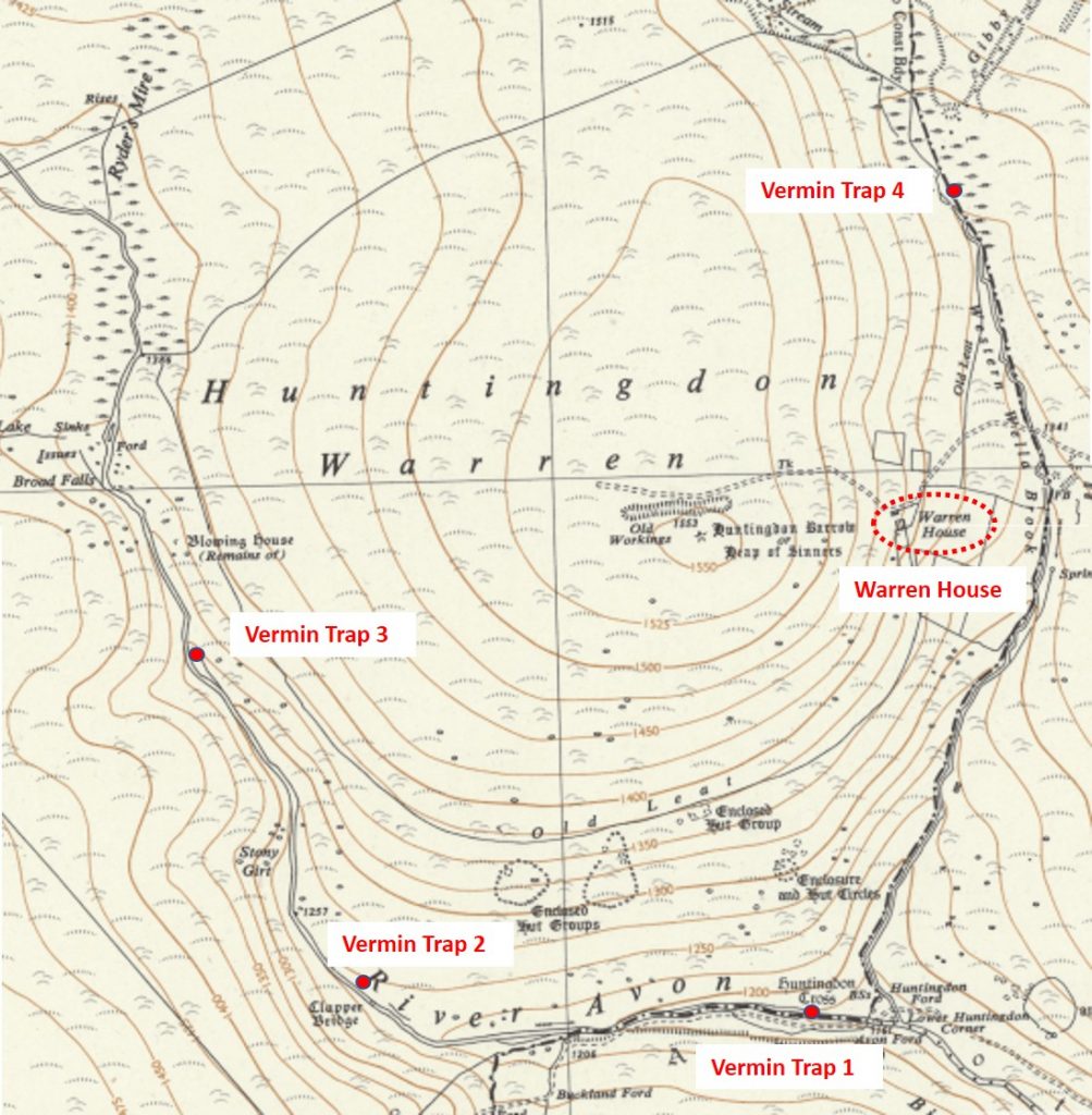
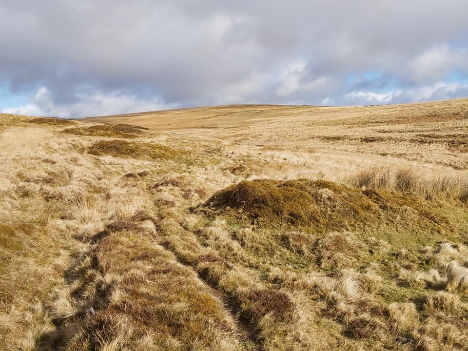
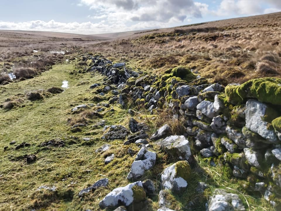
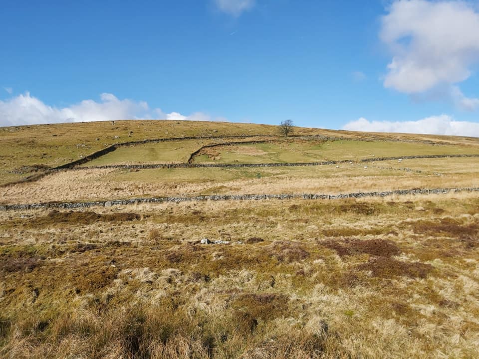
Map of Huntingdon Warren showing the location of the Warren House and locations of the four vermin traps, each of which is alongside a water course (3 on the River Avon and 1 on the Western Wella Brook).Approaching the warren from the East, the field systems of the warren can easily be seen. The Heap of Sinners cairn can be seen on the top of the hill (Huntingdon Hill). The mounds in the foreground are those from the Huntingdon Tin Mine. There is a clapper over Western Wella Brook, which marks the entrance to the warren on the East side. Turning north from the clapper and the Warren House there is a series of four pillow mounds heading. First mound is at SX66619 67109An old wall on Eastern boundary of Warren
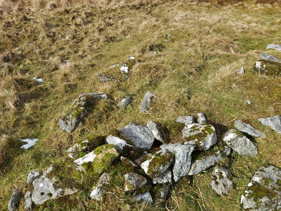
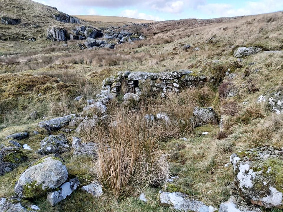
RG Haynes conducted a survey of Vermin Traps in the 1970’s. Of his survey, the Huntingdon Warren number 4 was described as: “A ruinous and broken trap built against the ancient eastern boundary wall”. This site is at SX66608 67421
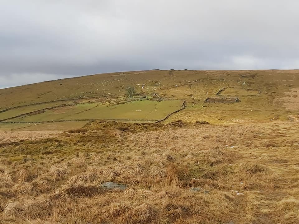
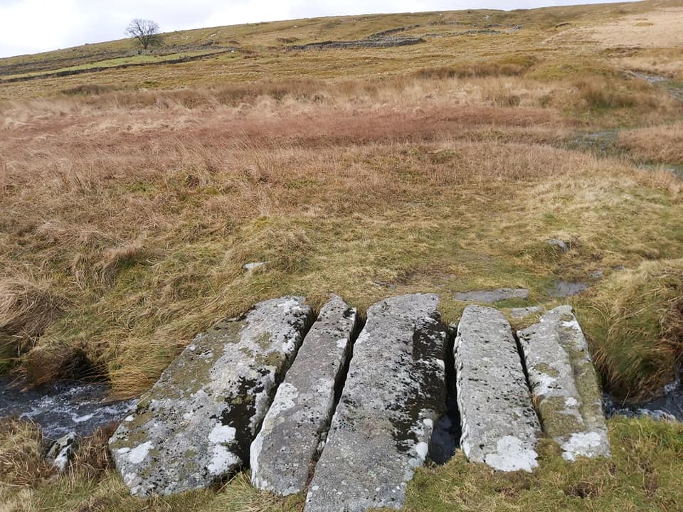
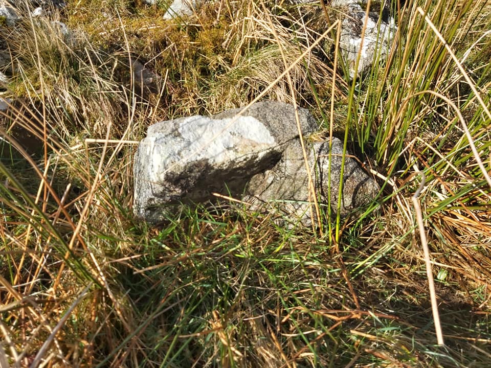
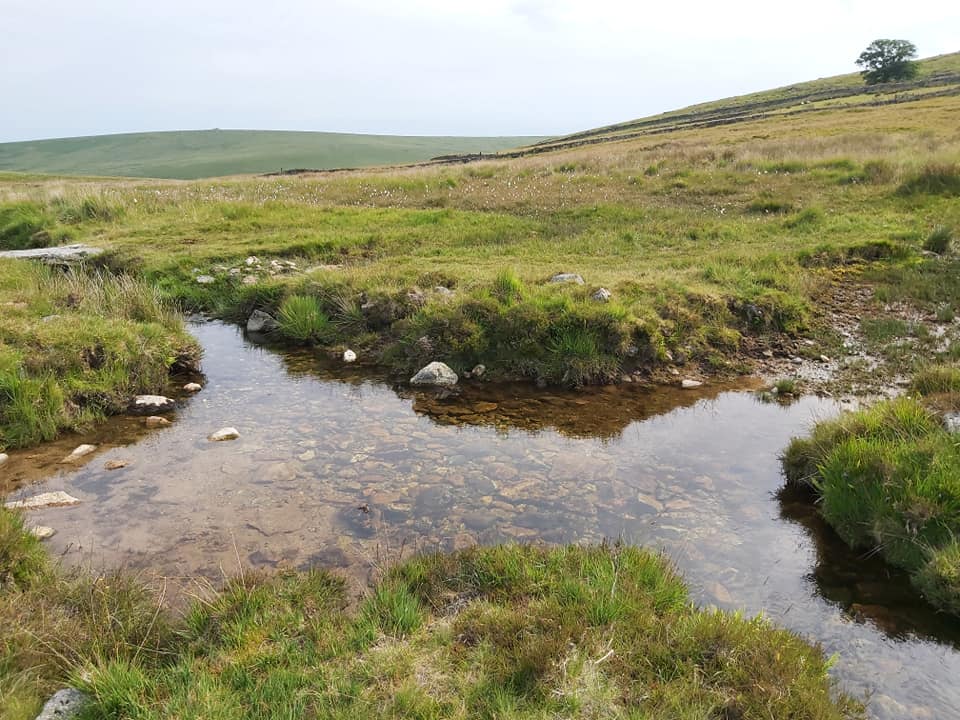
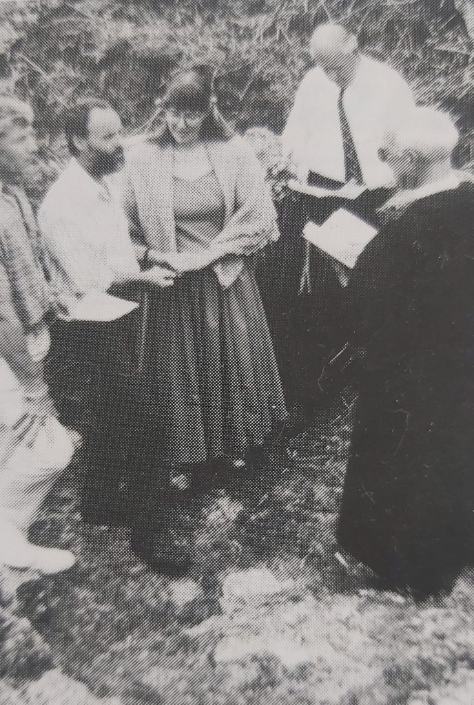
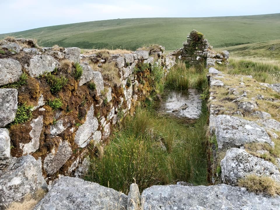
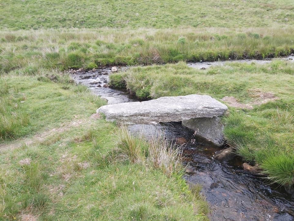
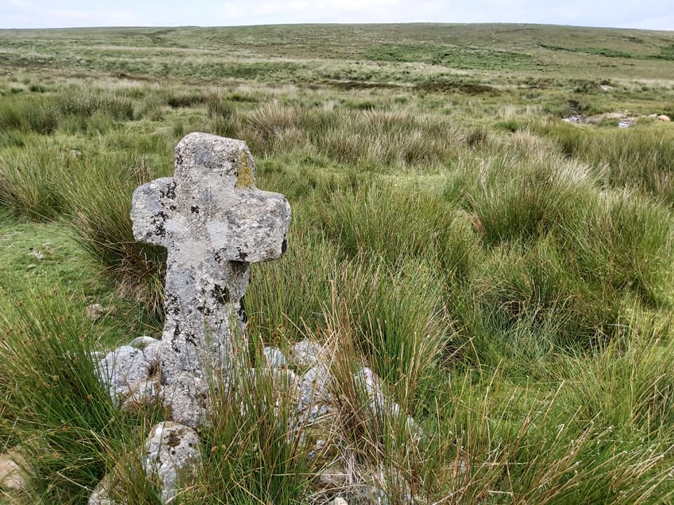
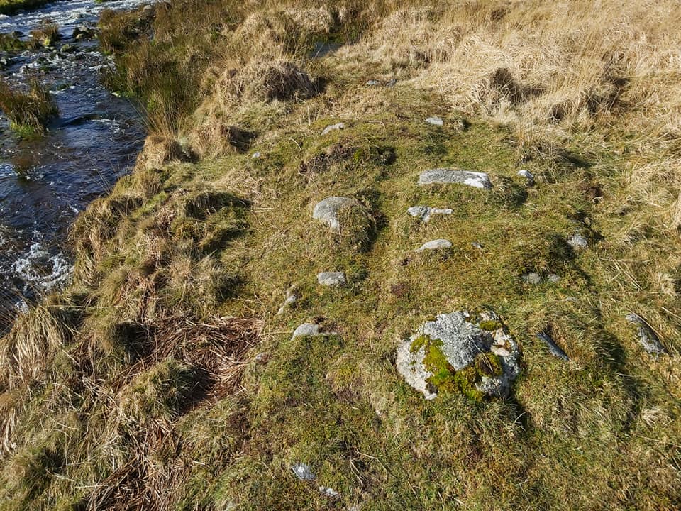
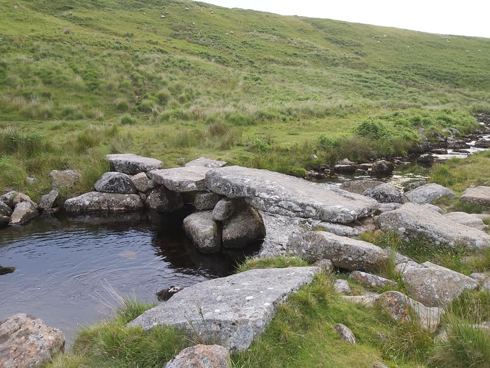
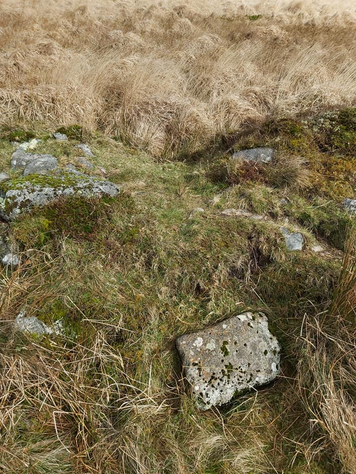
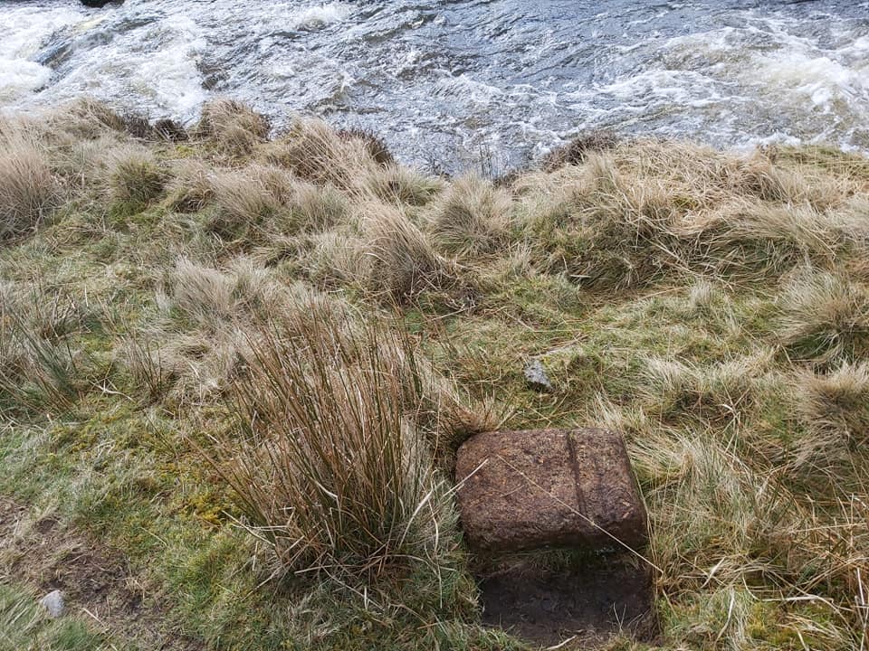
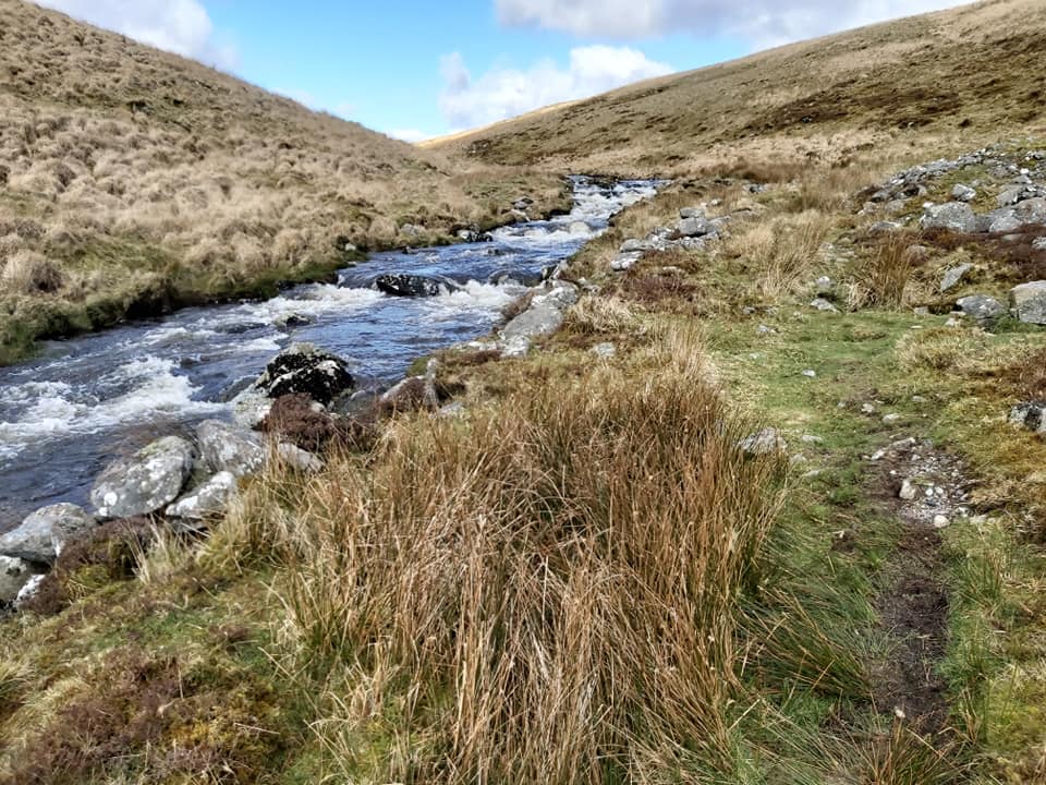
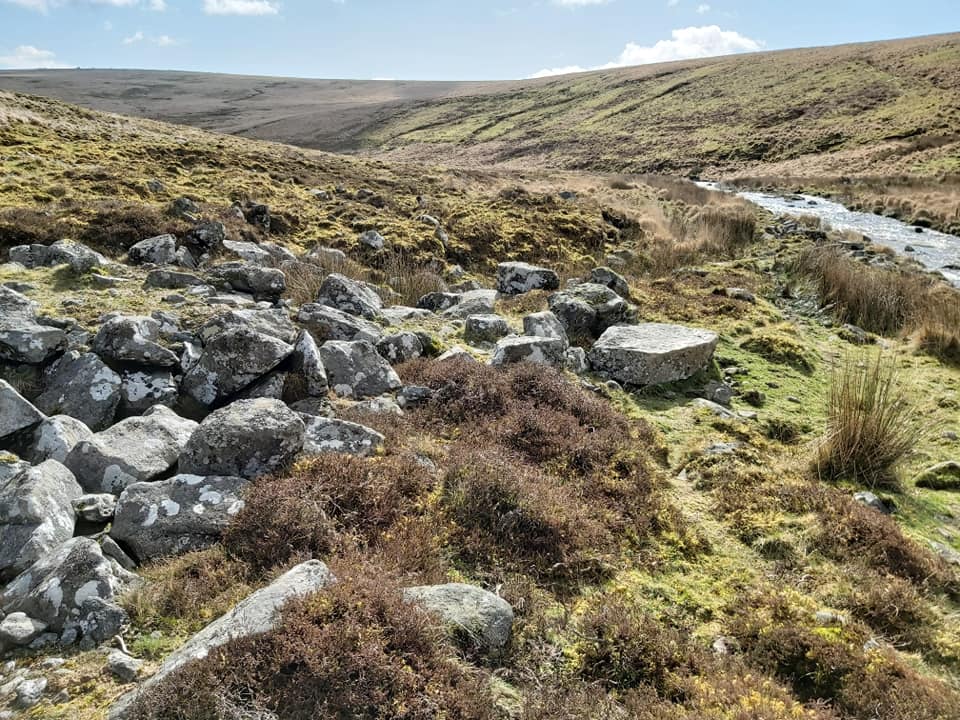
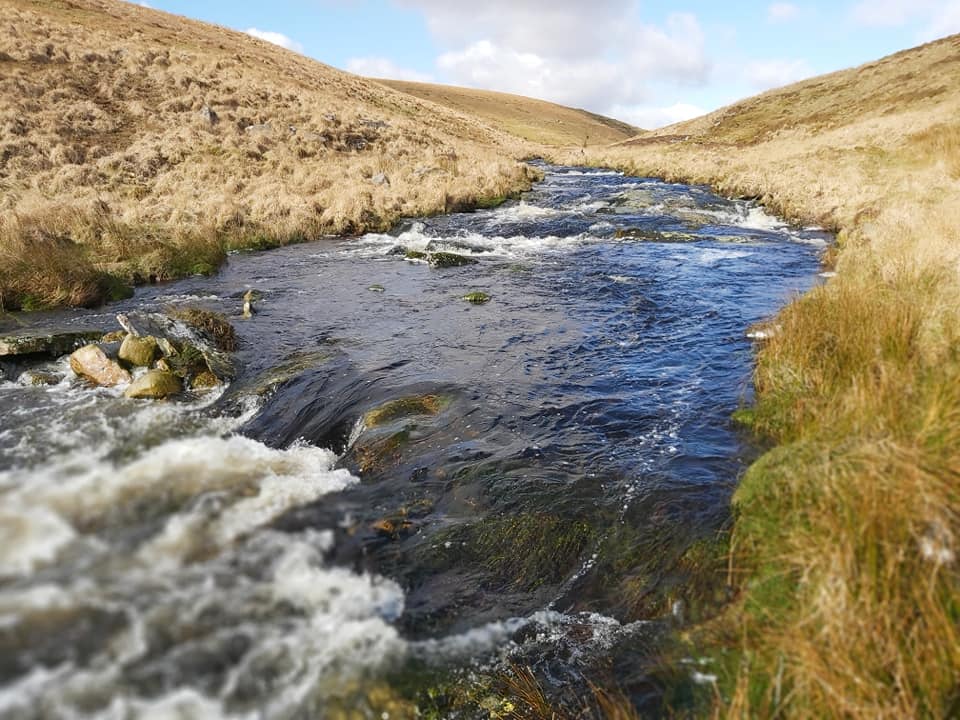
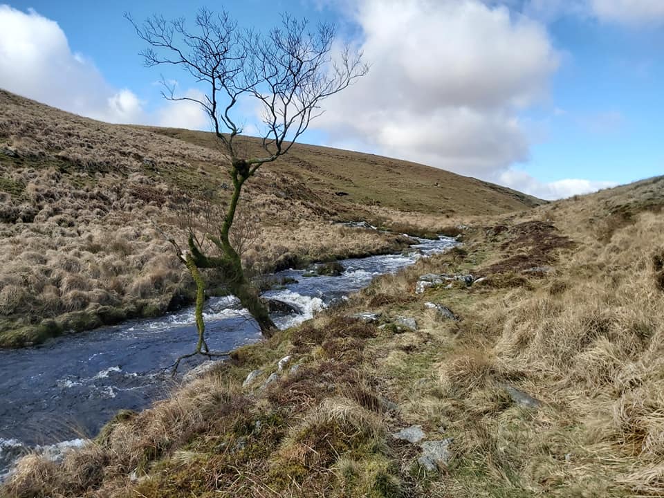
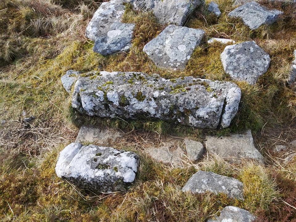
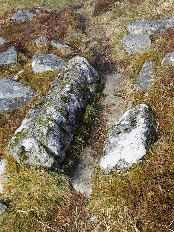
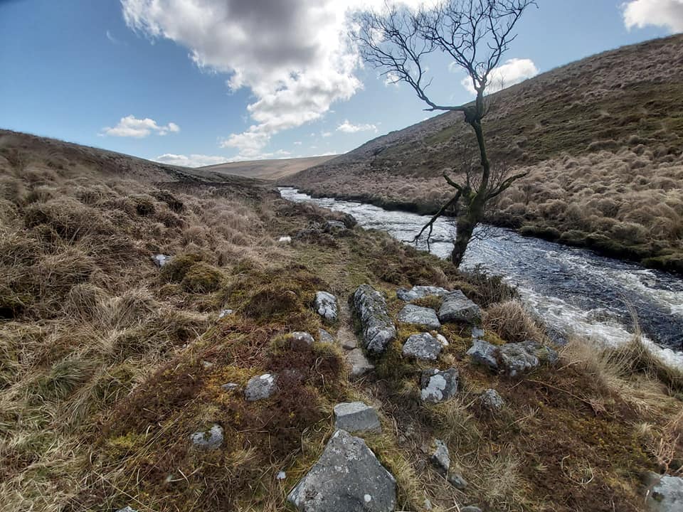
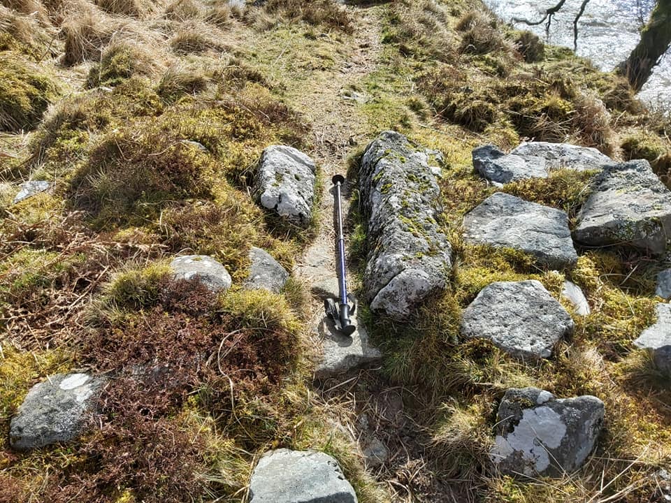
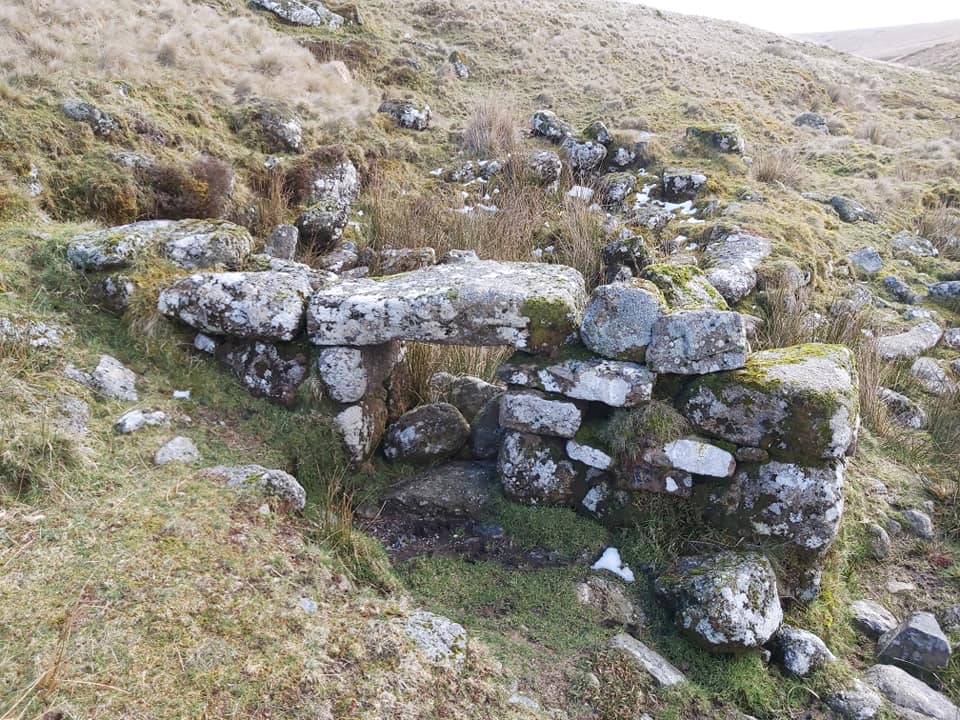
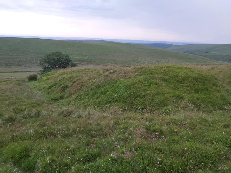
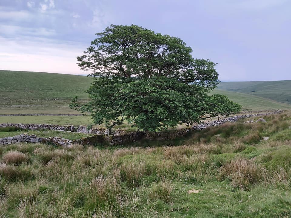
Just upstream from the clapper is an upside down stone trough next to Western Wella Brook. It is located at SX66691 67119. Just follow LH bank of Western Wella Brook upstream from the clapper approx 100mFord on Western Wella Brook just upstream from the clapper, which can be seen in the above photograph.Ruins of “the barracks” at Huntingdon Tin Mine looking across to the Warren House and fieldsView of the warren house and enclosures from lower end on the tin mine. According to the Tithe Apportionment for 1840 there are nine plots attached to the warren house. Keble Martin Chapel. In 1909, the Rev W. Keble Martin and some companions began annual summer trips when they would explore the Moor. They built a crude shelter in which they would stay. It was located at ‘Mattins Corner’. The Rev. William Keble Martin (9 July 1877 – 26 November 1969) was also a botanist and botanical illustrator and is best known for his Concise British Flora in Colour.Cross at Keble Martin Chapel. It is interesting to ponder that the grid reference at this point is SX666 666.The black and white image is of Derek Newman and Caroline Atchley, who had their marriage blessed at Keble Martin Chapel on 12th May 1990. The groom had camped overnight on 11th, so not to be late ! Information and photograph taken from Dartmoor Magazine, Autumn 1990 editionJust below the “chapel” is a rather conspicuous, wheel house (40ft) associated with the tin mineAdjacent to the confluence of the Western Wella Brook and the River Avon lies a new clapper Huntingdon Cross. It was originally erected as a waymarker for the Abbots’ Way. However, in the mid 16th Century it was utilised by Sir William Petre, as one of four crosses used to mark the boundary of his manor, Brent, with the parishes of Dean Prior, Harford, and Princetown. The other three crosses were sited at Three Barrows, Western Whittaburrow and Buckland Ford, although the latter is now missing.RG Haynes Vermin Trap (Huntingdon Warren) number 1. “Funnel walls much overgrown and inconspicuous. Based on River Avon. SX66365 66168Avon Clapper. William Crossing tells us that the old Huntingdon Clapper got washed away in a flood and a Mr. Pearse (who was a labourer at the warren) made an alternative method of crossing the Avon by use of a plank. In modern times this became known as ‘Pearse’s Plank’.RG Haynes Vermin Trap (Huntingdon Warren) number 2. “Also on river bank and making use of a collapsed wall, now turfed over”. SX65691 66211. The square rock looked man made so I turned it over…….……and found a “slot” for the trap mechanism ! Really pleased with this find. I wonder when the last time this stone was turned over ? (I did turn it back over…..)Heading up the AvonStony GertThe Avon heading towards Broad FallsLone tree close to another (and best) vermin trap in the area.Slots in the long and short side walls very evident in Vermin Trap 3.Very clear and obvious VT.RG Haynes Vermin Trap (Huntingdon Warren) number 3. “A good trap, based on river. Long side stone still in position and one short side stone beside it in trap”.Scale using walking pole. SX65510 66668Broad Falls Tinners Hut / Blowing House, a fine example.Lintel still intact.Heap of Sinners Cairn atop Huntingdon HillPillow mound just above the Warren HouseTree next to the Warren House
I came across this write-up after reading your Reddaford Farm one and was wondering whether the following would be of interest to you. I also have two photographs.
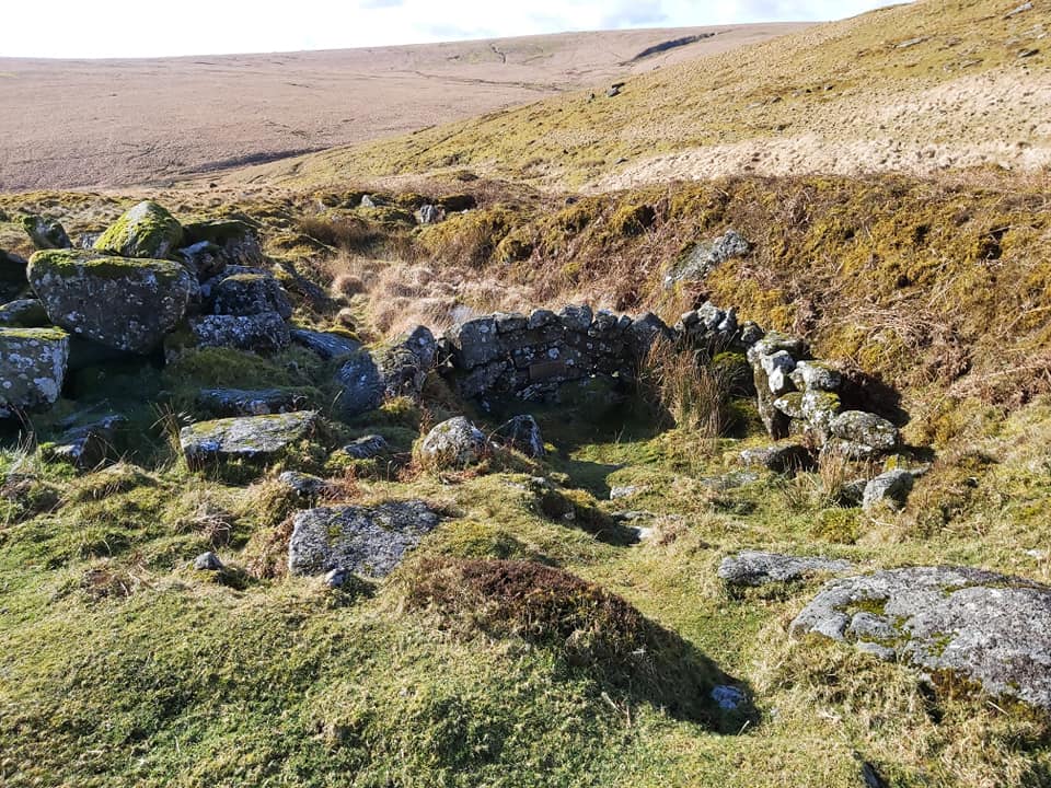
Above the blowing house at Broad Falls (Higher Bottom) are the clear remains of a structure mentioned by William Crossing in his Guide to Dartmoor (1912 Edition – pages 366 and 372 of the David & Charles 1976 reprint). Crossing writes of a little shelter (watch- house) used for keeping an eye out for workmen from the Red Lake Mires turf ties making incursions into Huntingdon Warren to supplement their diet with rabbits.
The knowledgeable Eric Hemery pours scorn on this comment in High Dartmoor (page 352) saying there are no traces of such a shelter on Huntingdon Hill above Higher Bottom, and any wary poacher would have been able to see it.
Having encountered this relic many years before High Dartmoor was published I felt Crossing had been done an injustice. What Hemery failed to appreciated was the shelter being built into the hillside rather than on it.
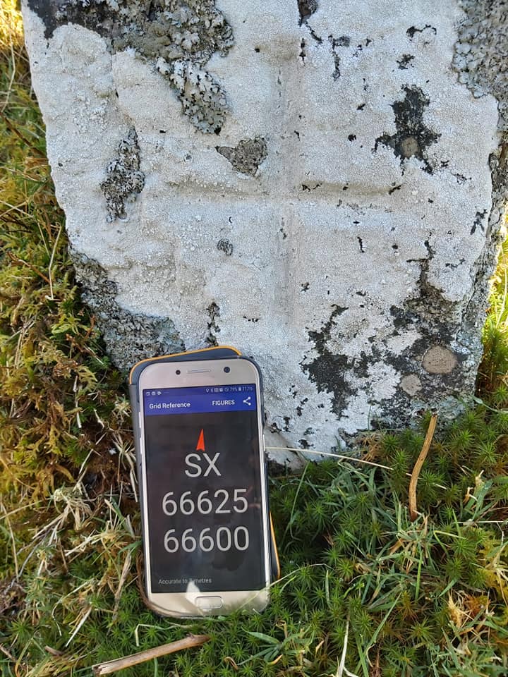
The shelter’s OS grid reference is SX 65524 66950. I also have two photographs.
Many thanks for your comments. I am aware of the shelter, which Dartefacts describe as a Tinner’s Hut (incorrectly in my opinion). The Royal Commission for the Historical Monuments of England (in the Heritage Gateway) state: “It does not resemble a tinners hut in form or location and would seem to be more closely linked with the warrening activities in the area”.
I think Crossing (as you say) has been done an injustice as the shelter is built into the hillside (old spoil tip). The timeline fits (for Crossing) as the Red Lake activites started circa 1911. I wasn’t aware of the Crossing interpretation so thank you for that.
I do plan to create a post on Heng Lake and the Avon tinner’s activites sometime so when I’m out there next time, I really ought to photograph and add this little shelter into my previous post on Huntingdon Warren (with its 4 vermin traps). I could of course (with your agreement) publish your photographs of the shelter onto this website, should you wish to send them to me !
Thank you for your reply and some information that I was unaware of. I am intrigued by the subjects you have dealt with on Dartmoor Explorations and share have to make time to read through them all.
Returning to Huntingdon, in his Guide, Crossing also refers to the occupants of a “house” built on the cairn of Western Whitaburrow as the “poachers” in question.
I would be only too happy to forward you the two jpeg images I have of the shelter. Just give me a means to send them to you.
” High Dartmoor” the best of all Dartmoor books. Hemery however is not always correct, any more than Crossing, Worth, Gill or anybody else. He’s a bit too ready IMO to see things as black or white. There’s supposed to be an old potato cave at Huntingdon Warren but Ive never been able to find it.
I agree ‘High Dartmoor’ is a fabulous book, which given its publication date of 1983 makes it all the more remarkable. In the days of the internet, information is much easier to obtain, so in spite of a few short comings I am more that ok with forgiving Eric, which also goes to other Victorian or 20th century Dartmoor observers and researchers.
I am sure my humble website has errors in it and will always welcome any new information which leads to fresh understanding.
Robert Woodland August 14, 2023
I came across this write-up after reading your Reddaford Farm one and was wondering whether the following would be of interest to you. I also have two photographs.
Above the blowing house at Broad Falls (Higher Bottom) are the clear remains of a structure mentioned by William Crossing in his Guide to Dartmoor (1912 Edition – pages 366 and 372 of the David & Charles 1976 reprint). Crossing writes of a little shelter (watch- house) used for keeping an eye out for workmen from the Red Lake Mires turf ties making incursions into Huntingdon Warren to supplement their diet with rabbits.
The knowledgeable Eric Hemery pours scorn on this comment in High Dartmoor (page 352) saying there are no traces of such a shelter on Huntingdon Hill above Higher Bottom, and any wary poacher would have been able to see it.
Having encountered this relic many years before High Dartmoor was published I felt Crossing had been done an injustice. What Hemery failed to appreciated was the shelter being built into the hillside rather than on it.
The shelter’s OS grid reference is SX 65524 66950. I also have two photographs.
SteveGriggDartmoor August 14, 2023 — Post author
Hi Robert,
Many thanks for your comments. I am aware of the shelter, which Dartefacts describe as a Tinner’s Hut (incorrectly in my opinion). The Royal Commission for the Historical Monuments of England (in the Heritage Gateway) state: “It does not resemble a tinners hut in form or location and would seem to be more closely linked with the warrening activities in the area”.
I think Crossing (as you say) has been done an injustice as the shelter is built into the hillside (old spoil tip). The timeline fits (for Crossing) as the Red Lake activites started circa 1911. I wasn’t aware of the Crossing interpretation so thank you for that.
I do plan to create a post on Heng Lake and the Avon tinner’s activites sometime so when I’m out there next time, I really ought to photograph and add this little shelter into my previous post on Huntingdon Warren (with its 4 vermin traps). I could of course (with your agreement) publish your photographs of the shelter onto this website, should you wish to send them to me !
With kind regards,
Dartmoor Explorations (Steve)
Robert Woodland August 14, 2023
Hi Steve,
Thank you for your reply and some information that I was unaware of. I am intrigued by the subjects you have dealt with on Dartmoor Explorations and share have to make time to read through them all.
Returning to Huntingdon, in his Guide, Crossing also refers to the occupants of a “house” built on the cairn of Western Whitaburrow as the “poachers” in question.
I would be only too happy to forward you the two jpeg images I have of the shelter. Just give me a means to send them to you.
Roger Dyer June 17, 2026
” High Dartmoor” the best of all Dartmoor books. Hemery however is not always correct, any more than Crossing, Worth, Gill or anybody else. He’s a bit too ready IMO to see things as black or white. There’s supposed to be an old potato cave at Huntingdon Warren but Ive never been able to find it.
SteveGriggDartmoor June 18, 2026 — Post author
Hi Roger,
I agree ‘High Dartmoor’ is a fabulous book, which given its publication date of 1983 makes it all the more remarkable. In the days of the internet, information is much easier to obtain, so in spite of a few short comings I am more that ok with forgiving Eric, which also goes to other Victorian or 20th century Dartmoor observers and researchers.
I am sure my humble website has errors in it and will always welcome any new information which leads to fresh understanding.
Thank you for your message
Kind Regards,
Steve (Dartmoor Explorations)