A collection of walks, discoveries, insights and pictures of exploring Dartmoor National Park
April 23, 2023
Huckentor Farm
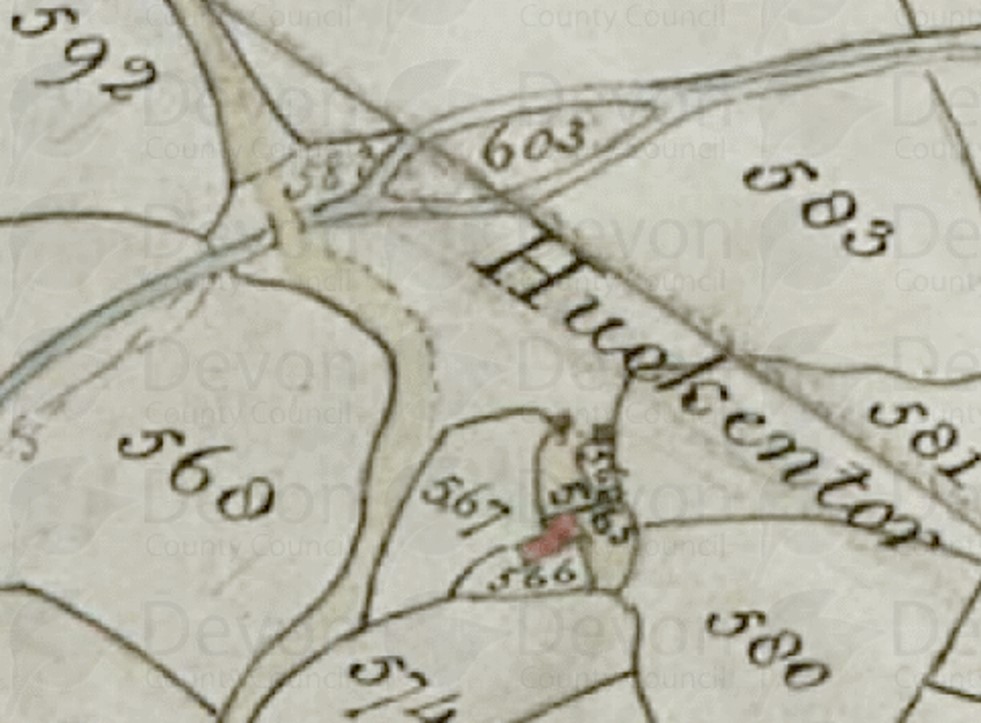
Huckentor farm first appears in surviving documents as early as the fourteenth century, when it was named as Holk or Hulken. It is thought to have been the home of ‘Agnes atte Holk’ (1317) and ‘Richard atte Hulken’ (1340). By the early sixteenth century names more closely resemble the modern form, when it was called Hulkentorr or Halkyntorr. The farm was named Hulkynctore in an 1846 publication but was depicted as ‘Huckentor’ on the Tithe Map (565 on the Walkhampton apportionment with a house, court and mowhay, with gardens and meadows).
During the 18th and early 19th centuries, two or three generations of Leamans farmed here. In May 1837, in a letter written by a George Giles to Sir Ralph Lopes (owner of both Longash and Huckentor farms) suggested that the last members of the Leamans family were enduring hardship following the death of Thomas Leaman, the principal leaseholder. The letter is recorded by Mike Brown in his Guide to Dartmoor (2001). George Giles in this letter (and another) also referred to the poor quality of many of the enclosures belonging to the farm, and observed that: “It (the farm) consists of 90 Acres on the edge of the Common, but I doubt whether it will fetch much above 5/- [25p] Per Acre in Rent”. Shortly afterwards, the Leamans’ term of occupation at the farm came to an end, when Huckentor and Longash were let as a united holding to Edward Doidge. The Giles letter requested of Sir Ralph Lopes that widow Leahman “may be permitted to remain in the house until she can suit herself with some other — or rather until Lady day next”. This suggests she would have left by May 1837 and March 1838 (Lady Day). The author has been unable to ascertain when the farm was finally abandoned, but assumes it was late 19th or early 20th century.
Bibliography:
Gover, Mawer and Stenton, 1931, The Place-Names of Devon: Part One
Linehan, 1965, Deserted Sites on Dartmoor
Haynes, 1966-1969, Ruined Sites on Dartmoor
Mike Brown, 2001, Guide to Dartmoor CD
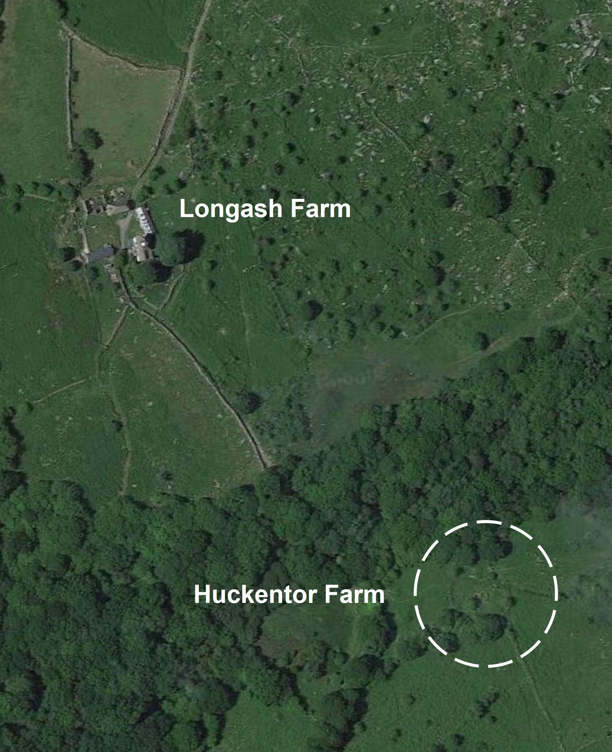
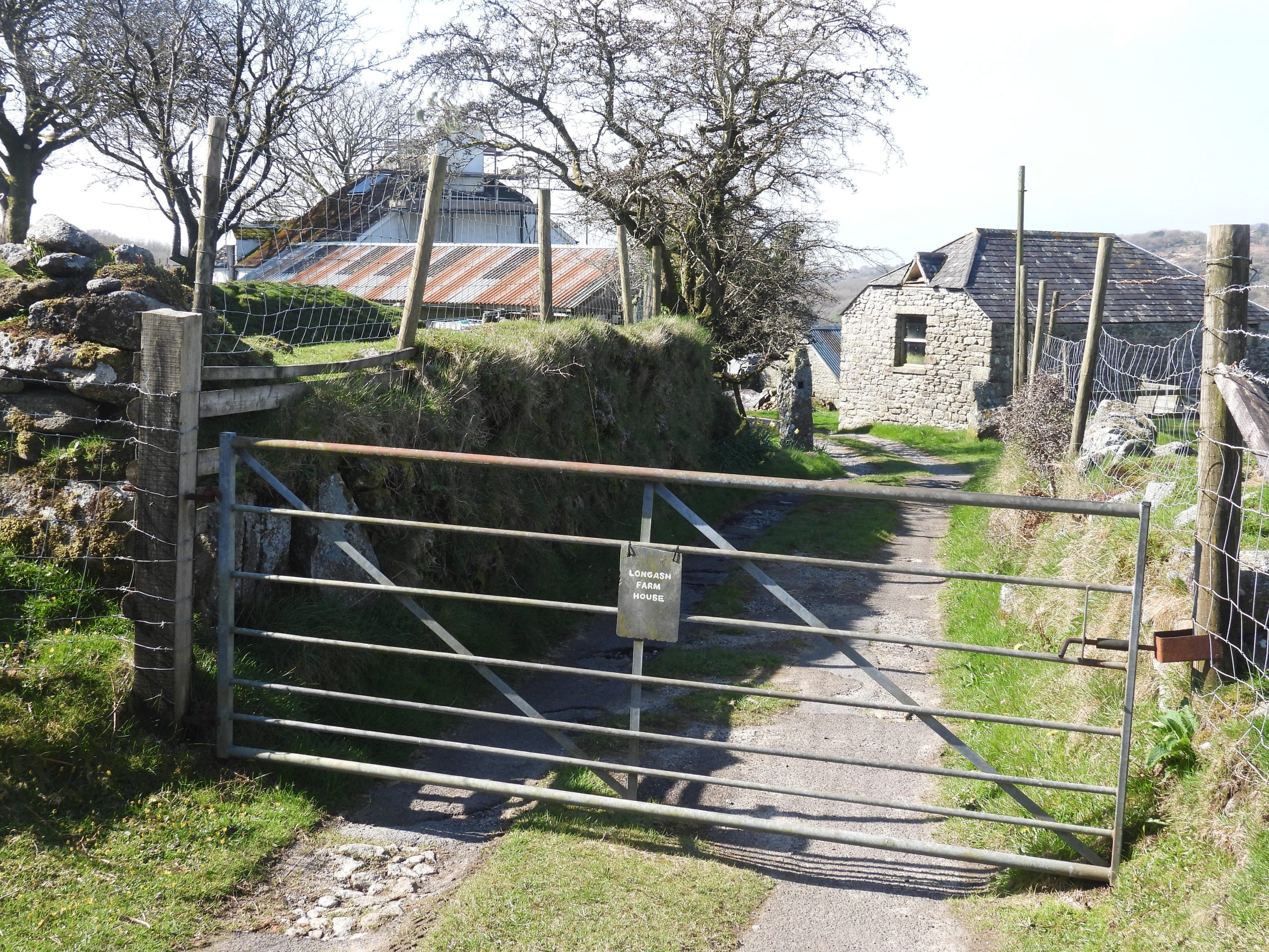
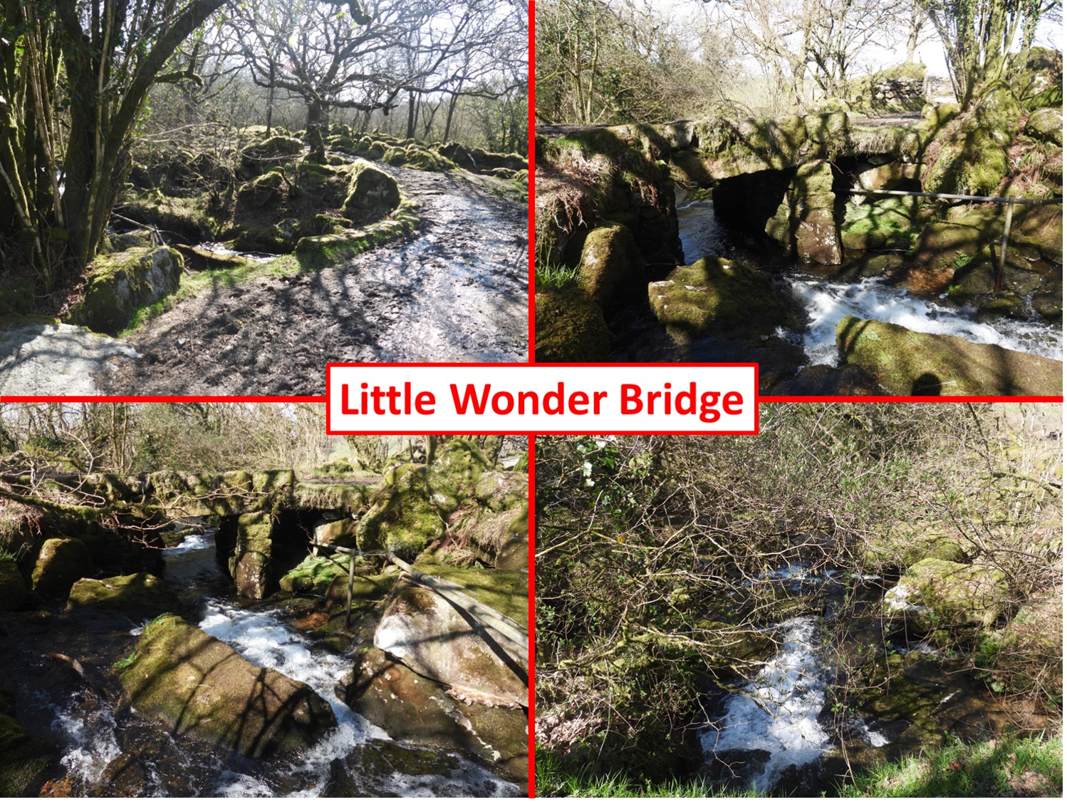
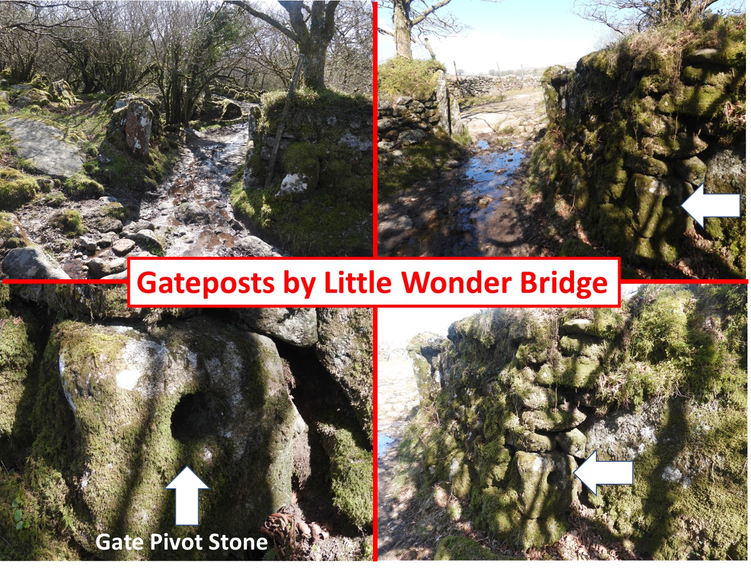
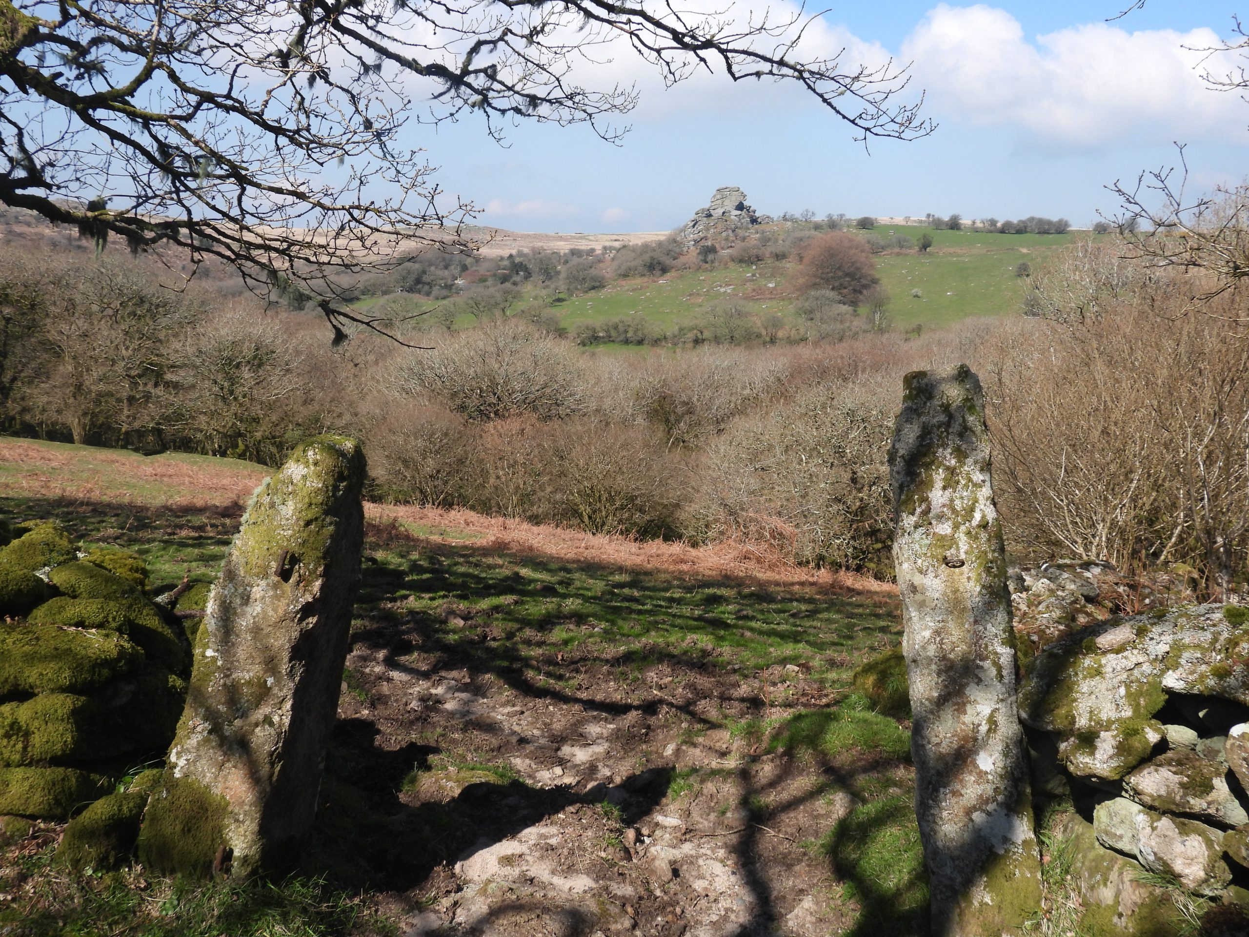
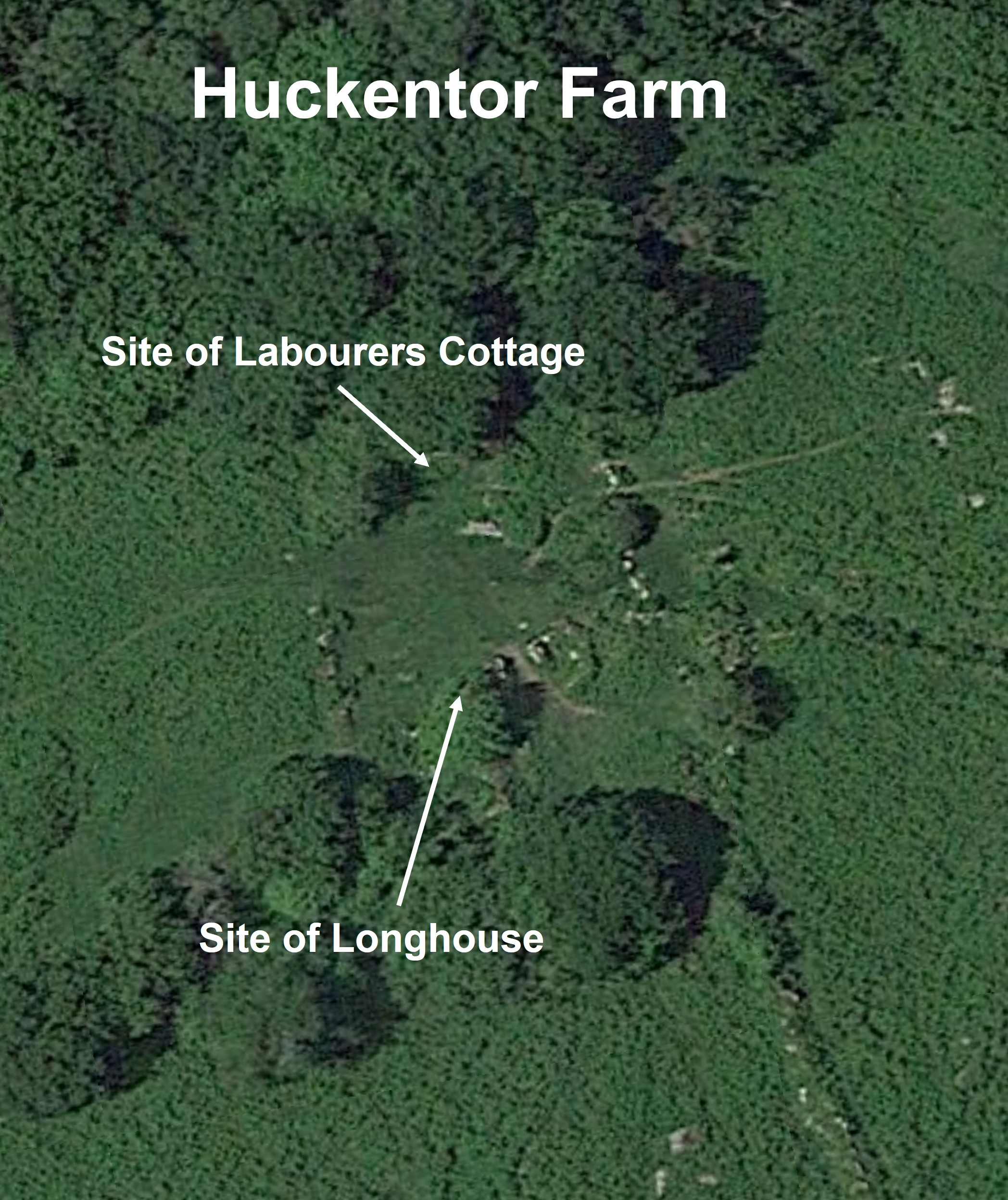
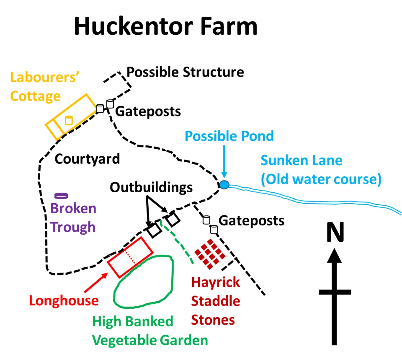
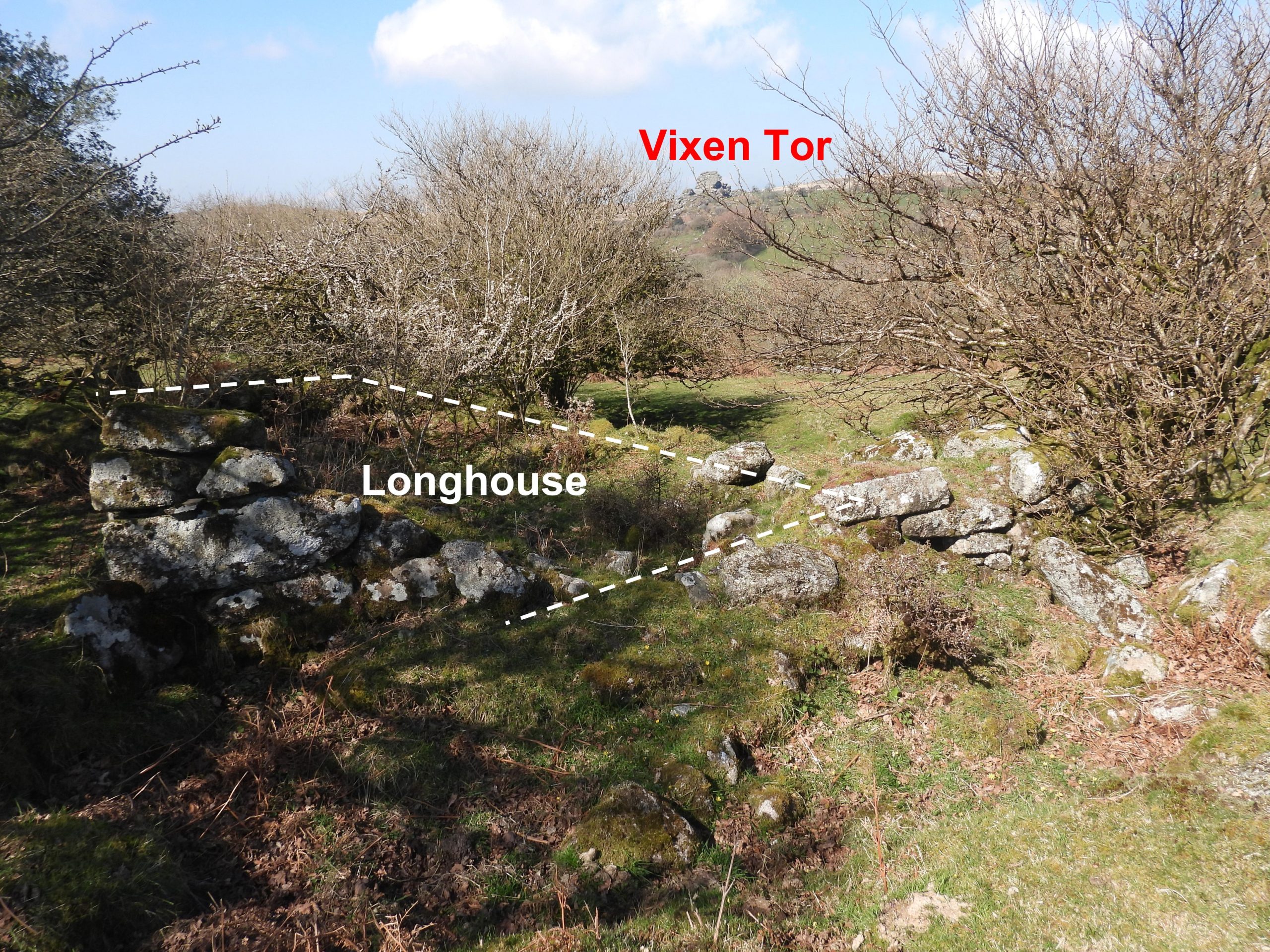
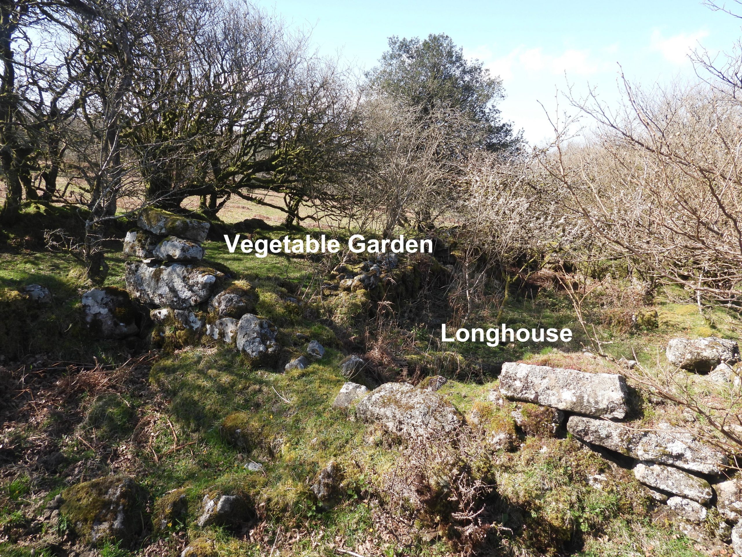
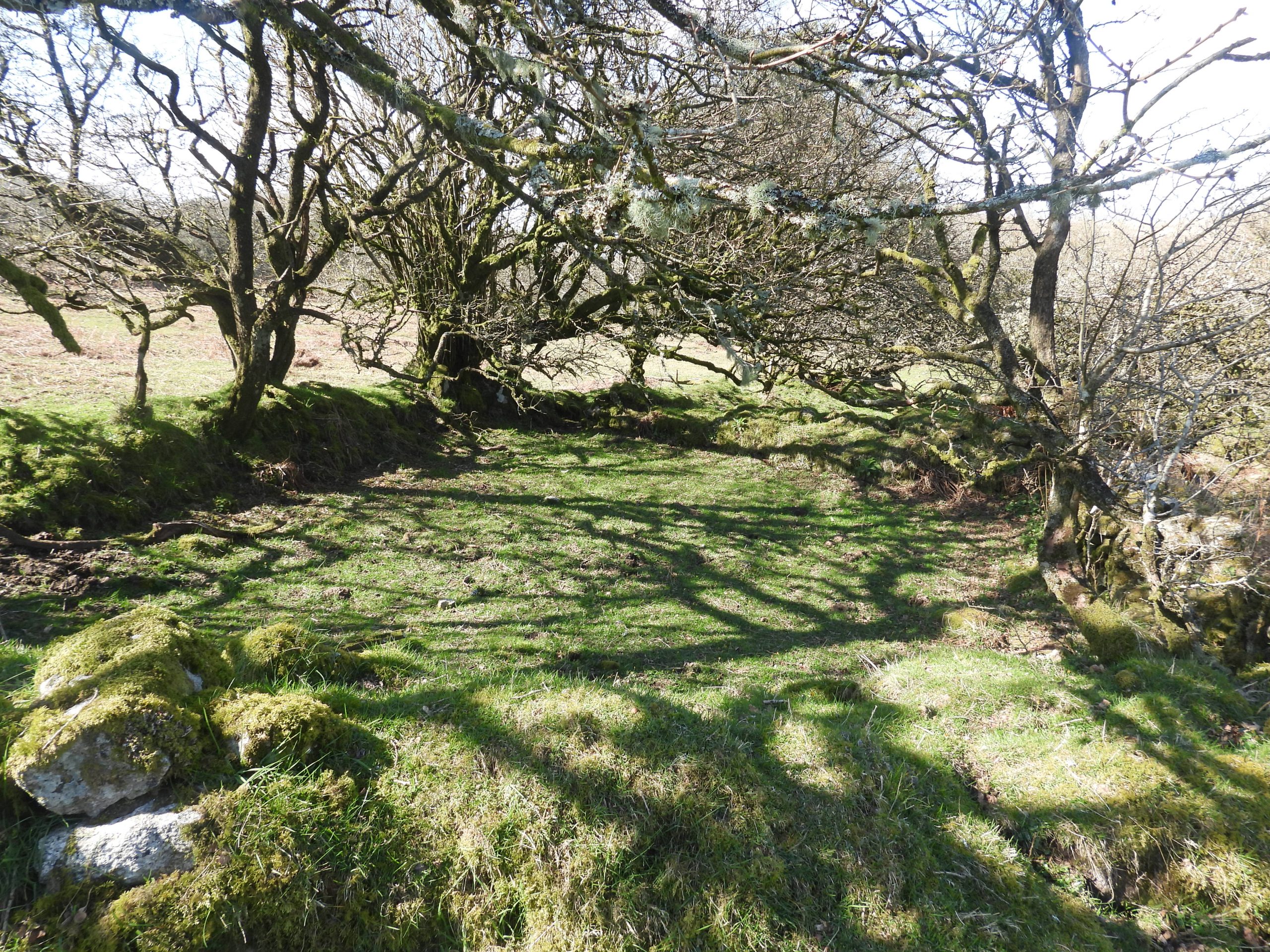
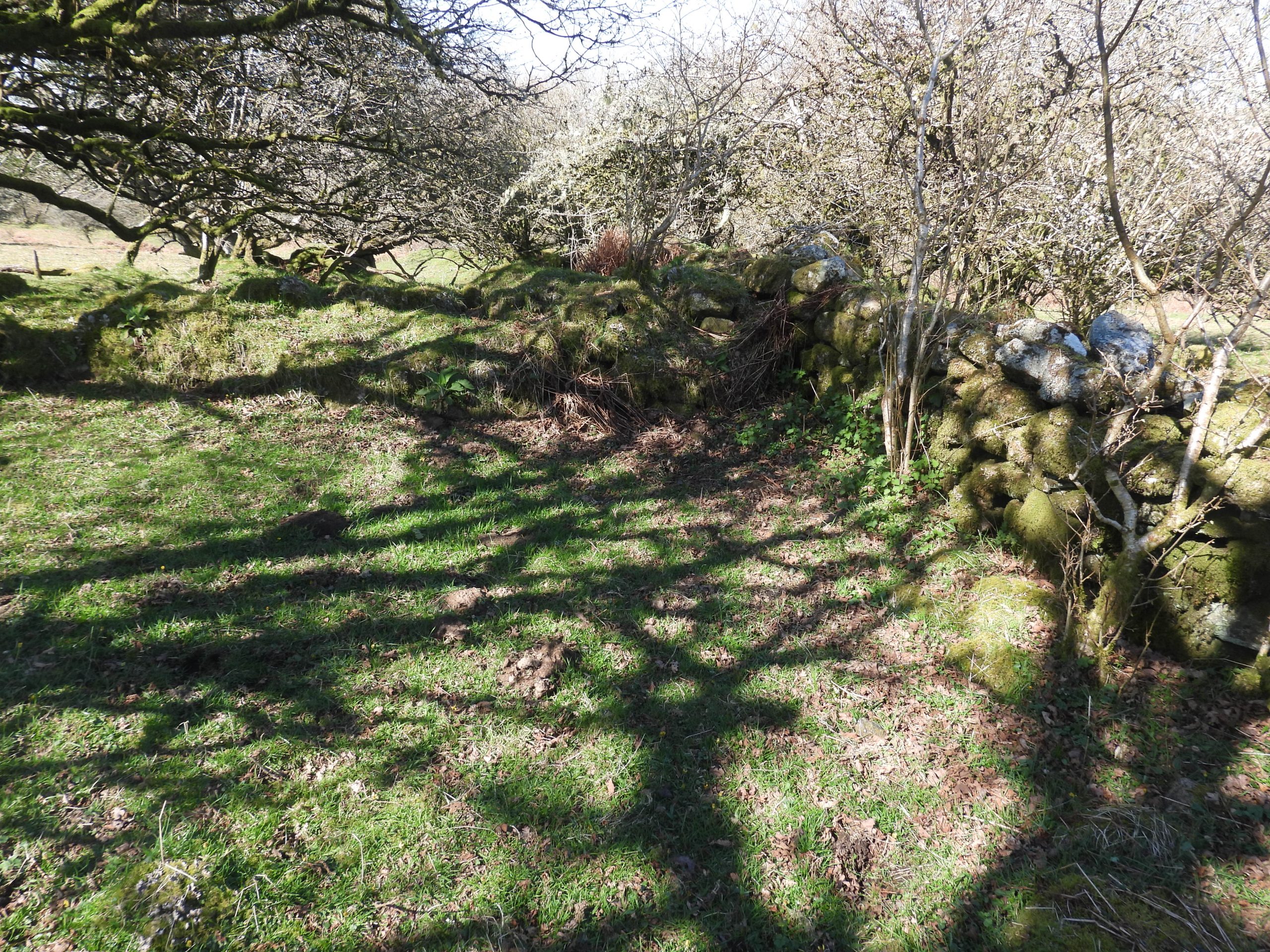
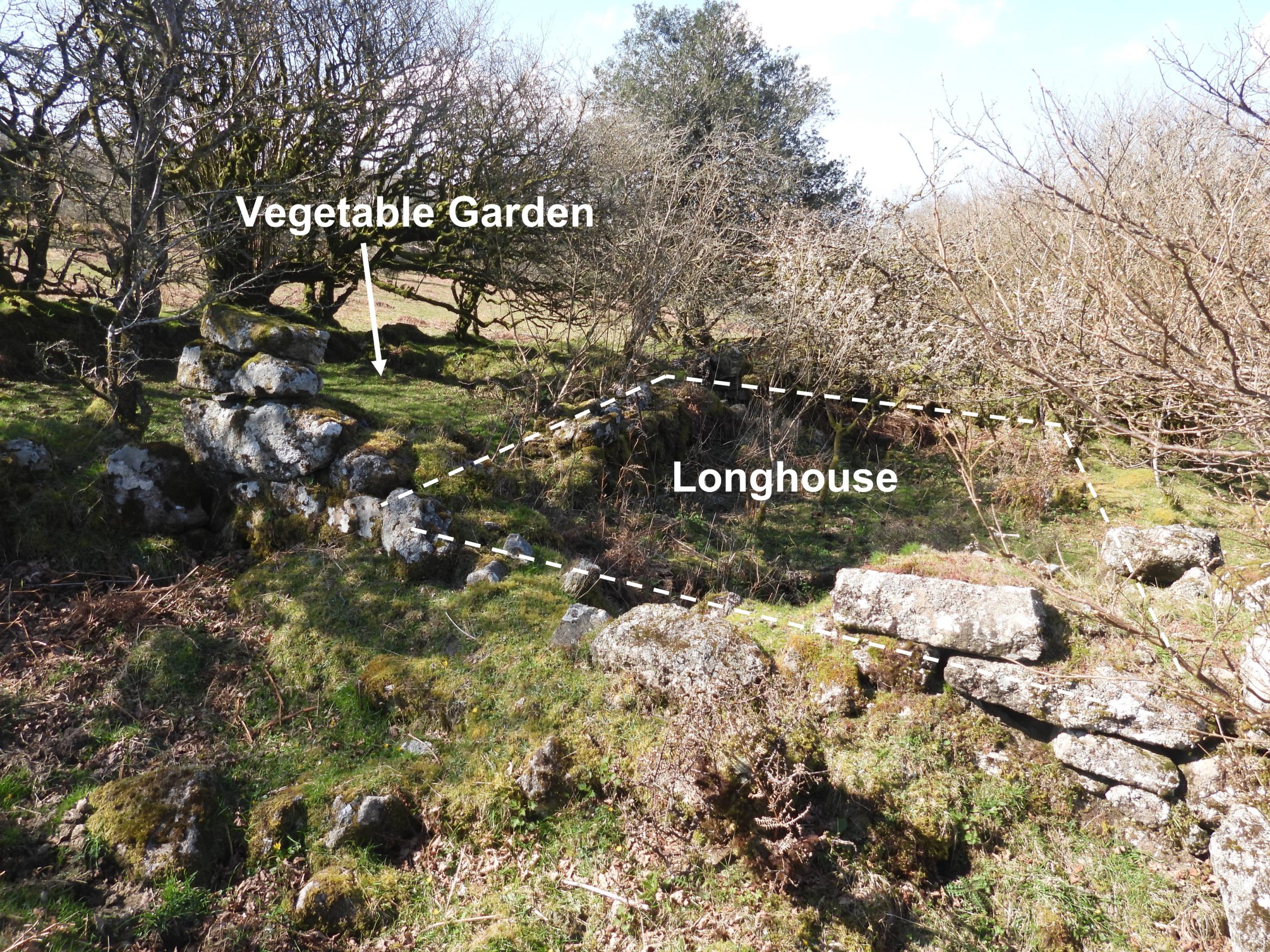
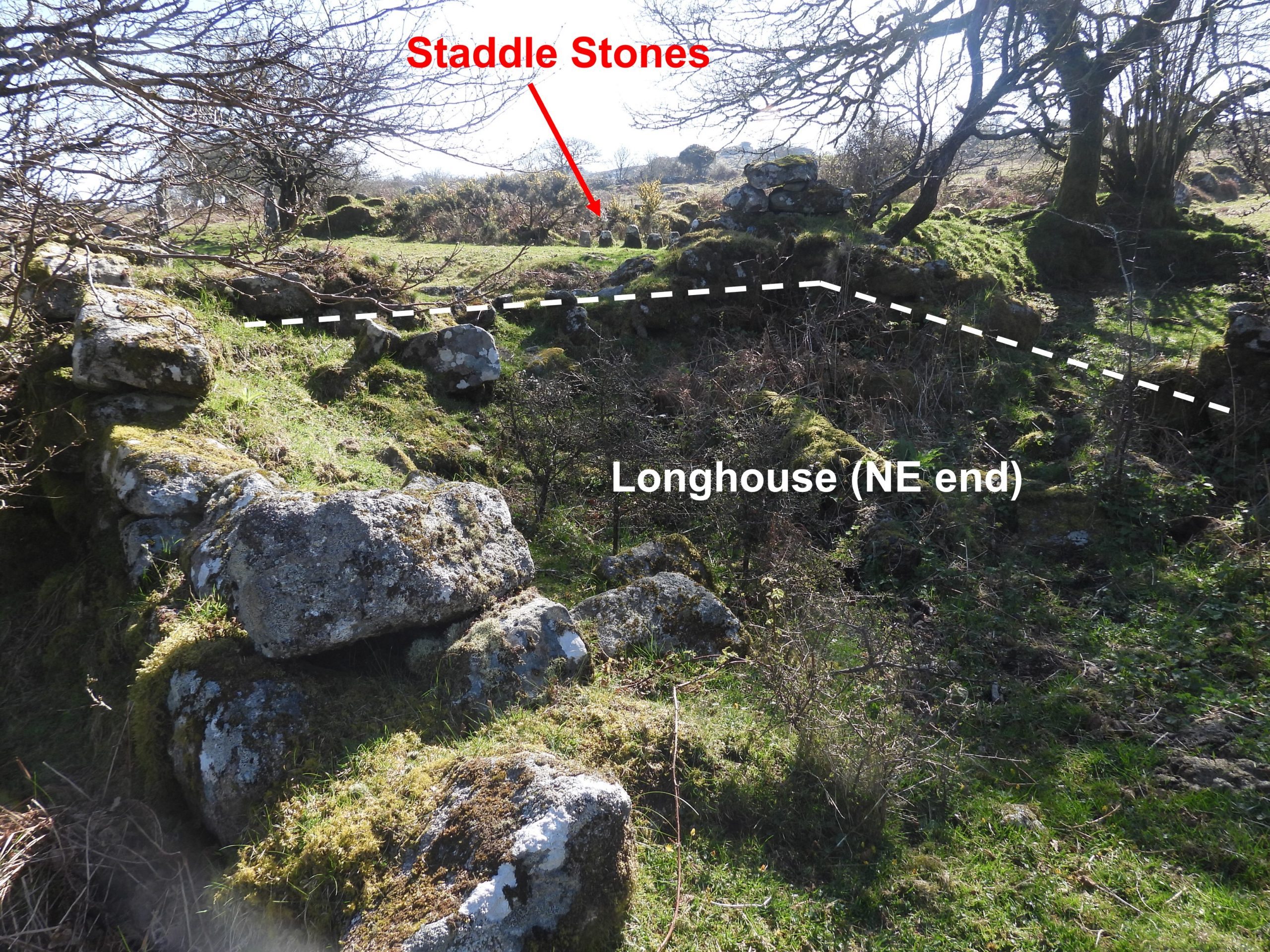
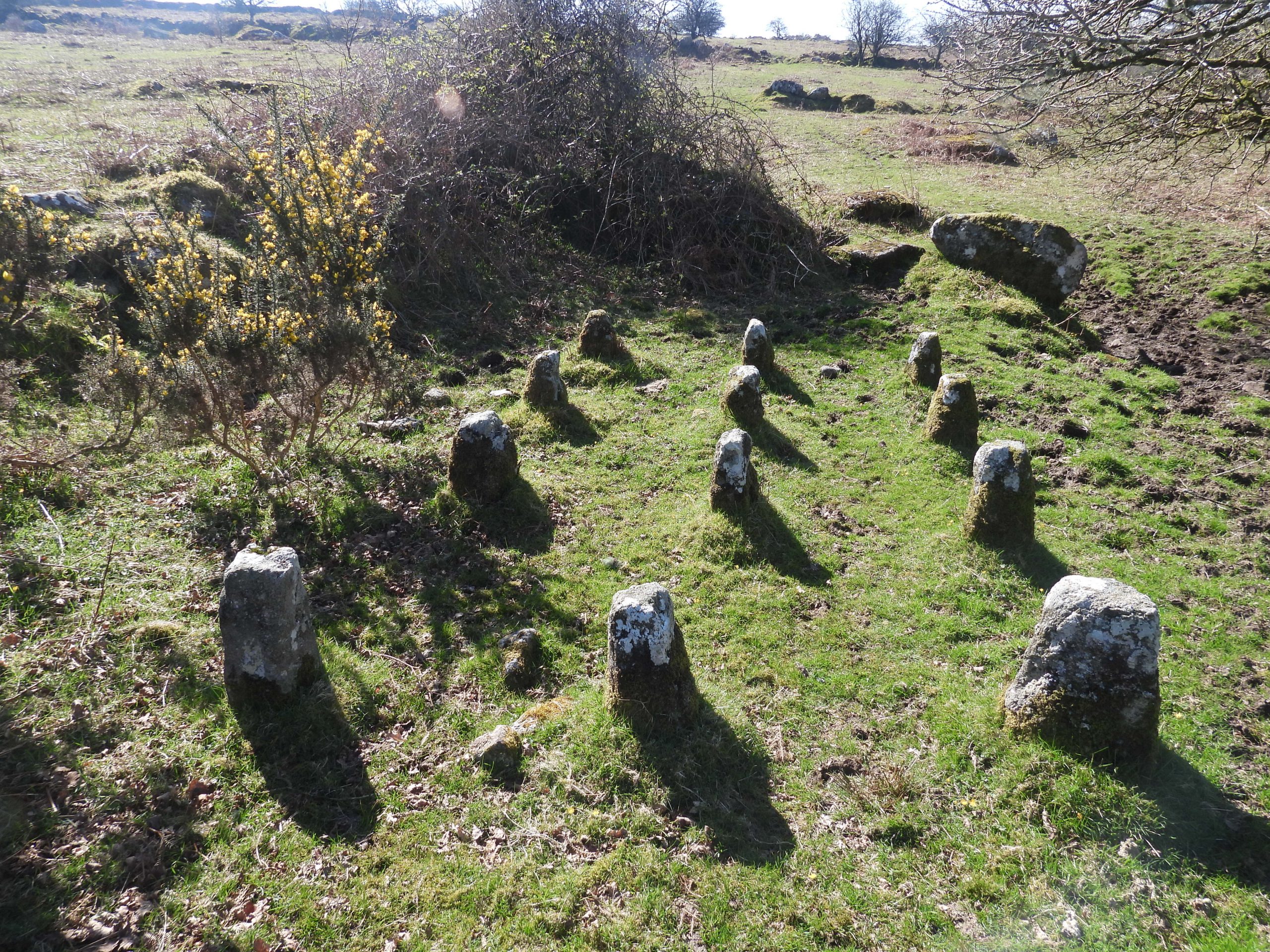
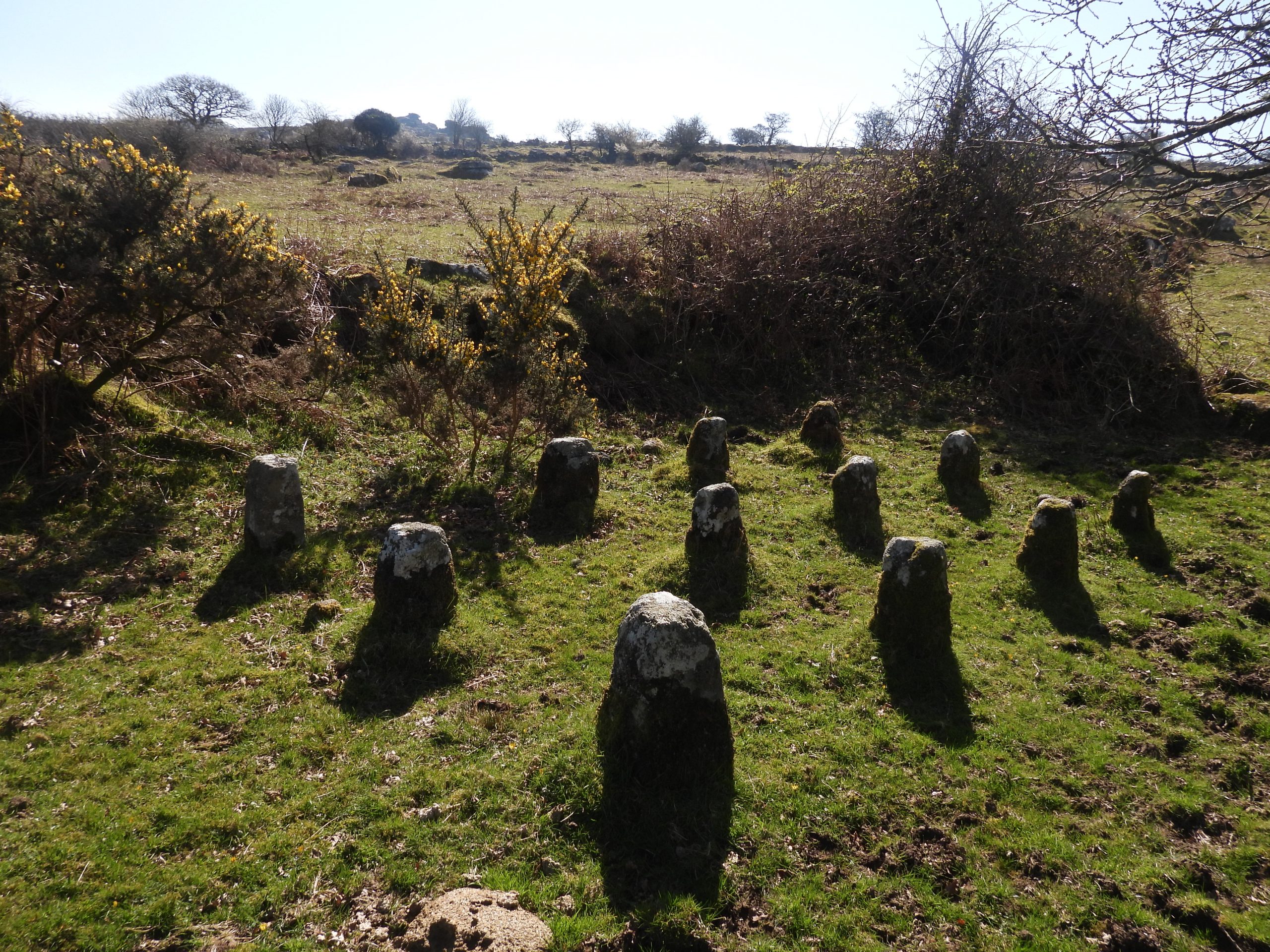
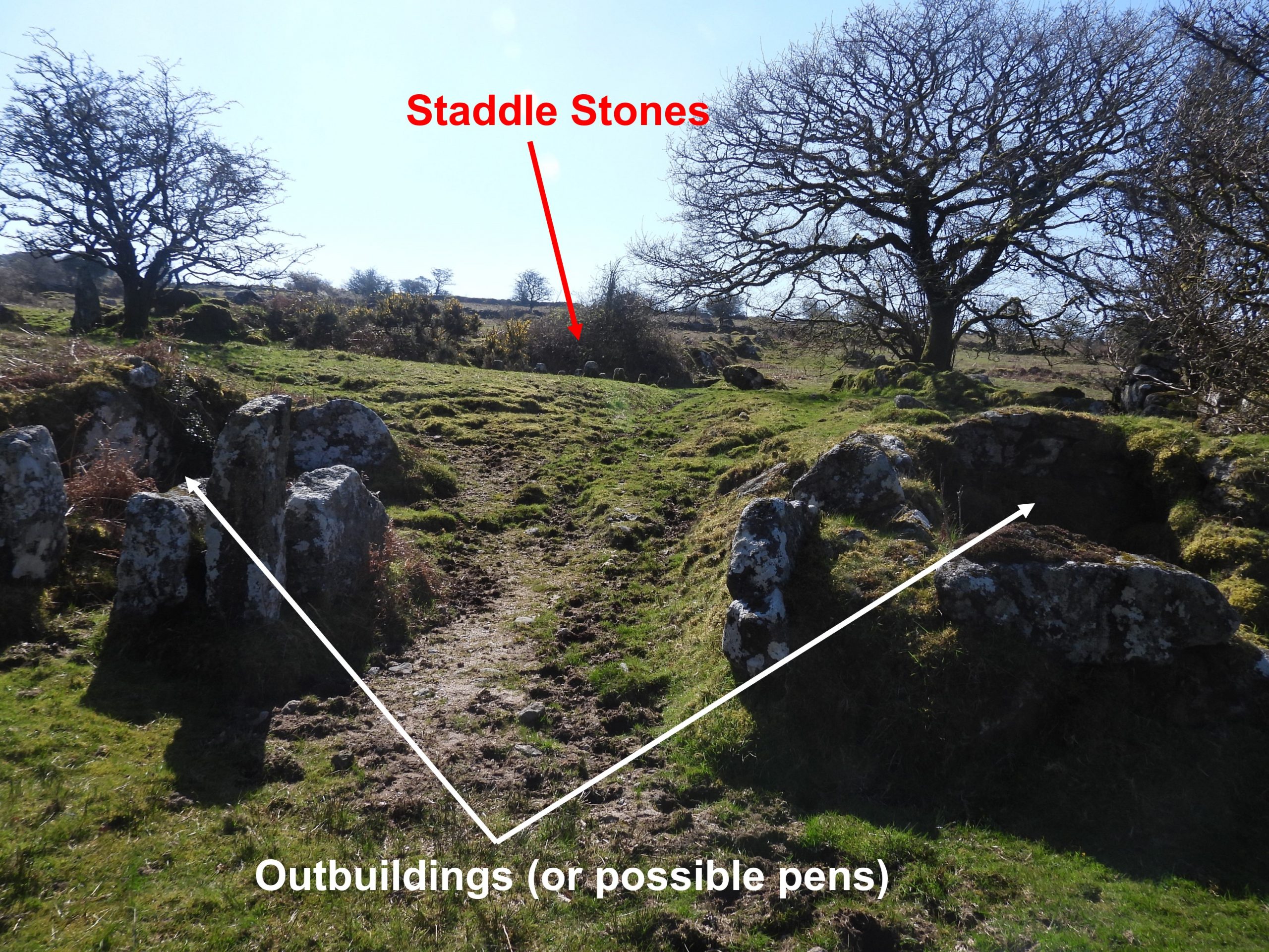
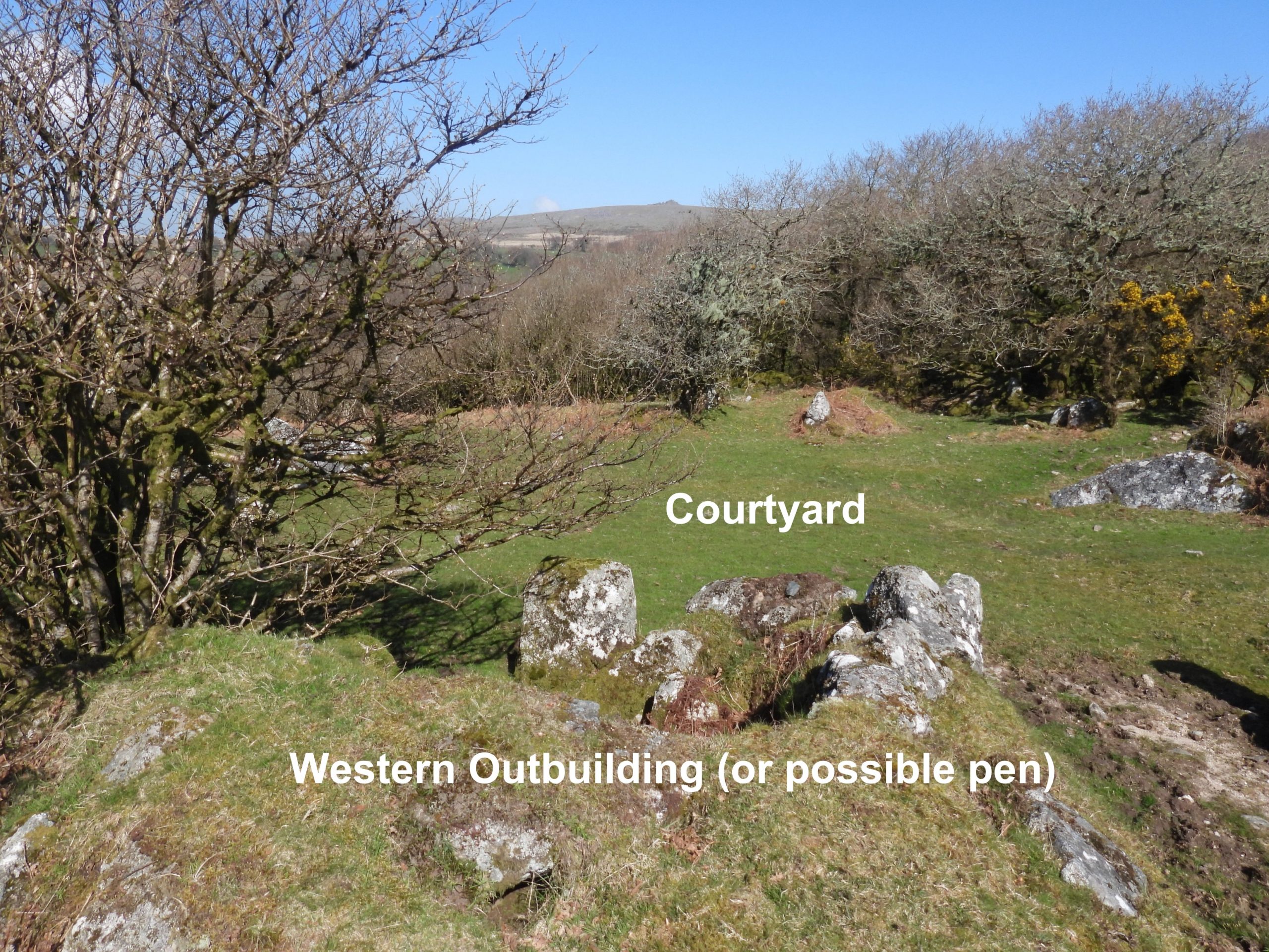
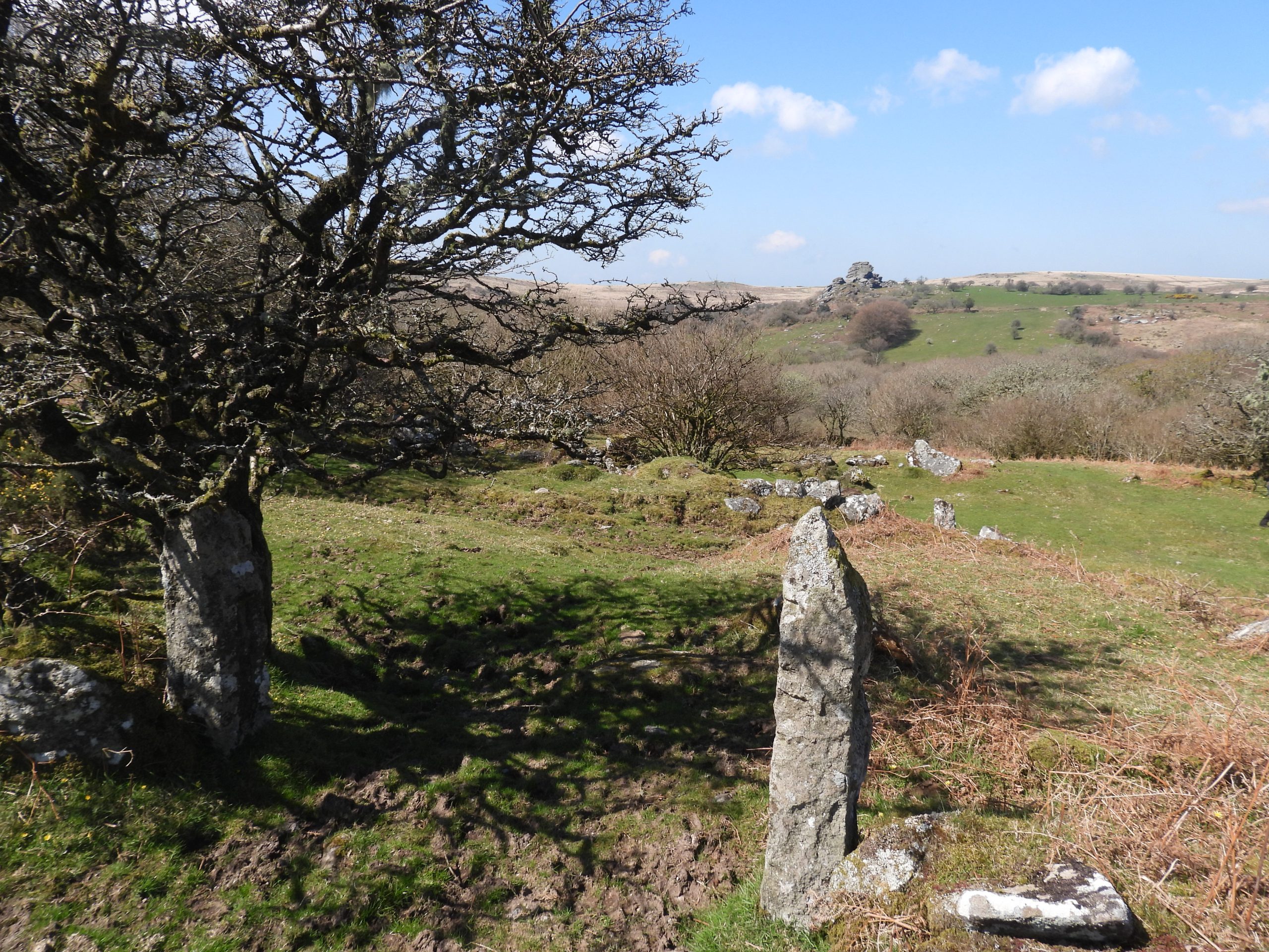
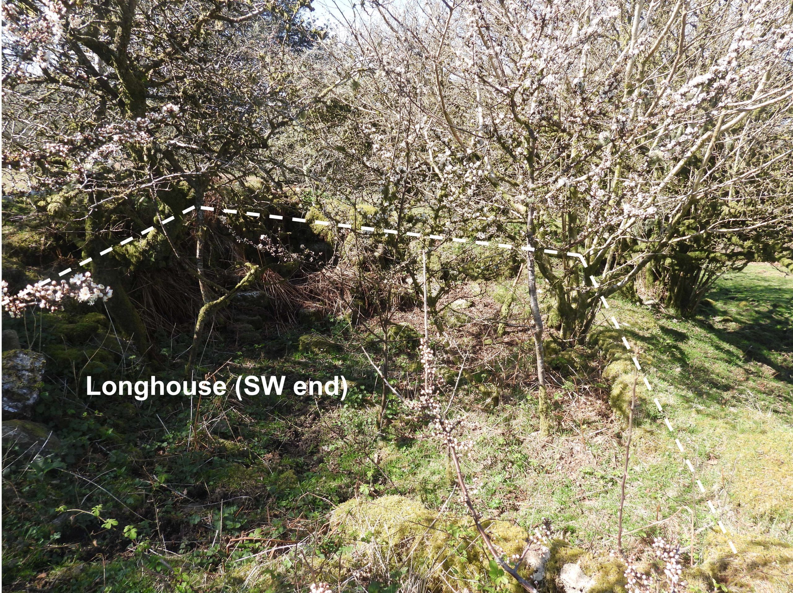
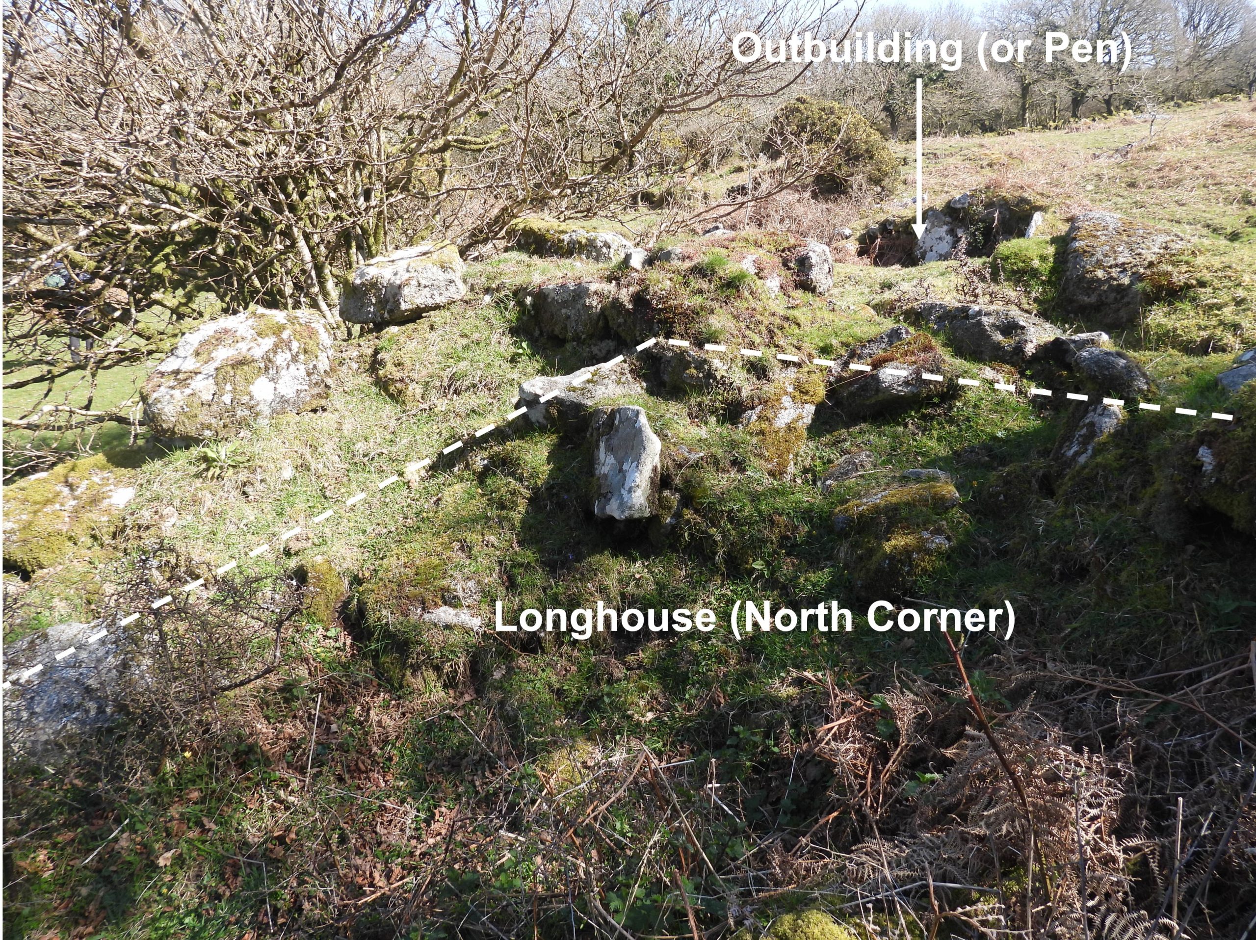
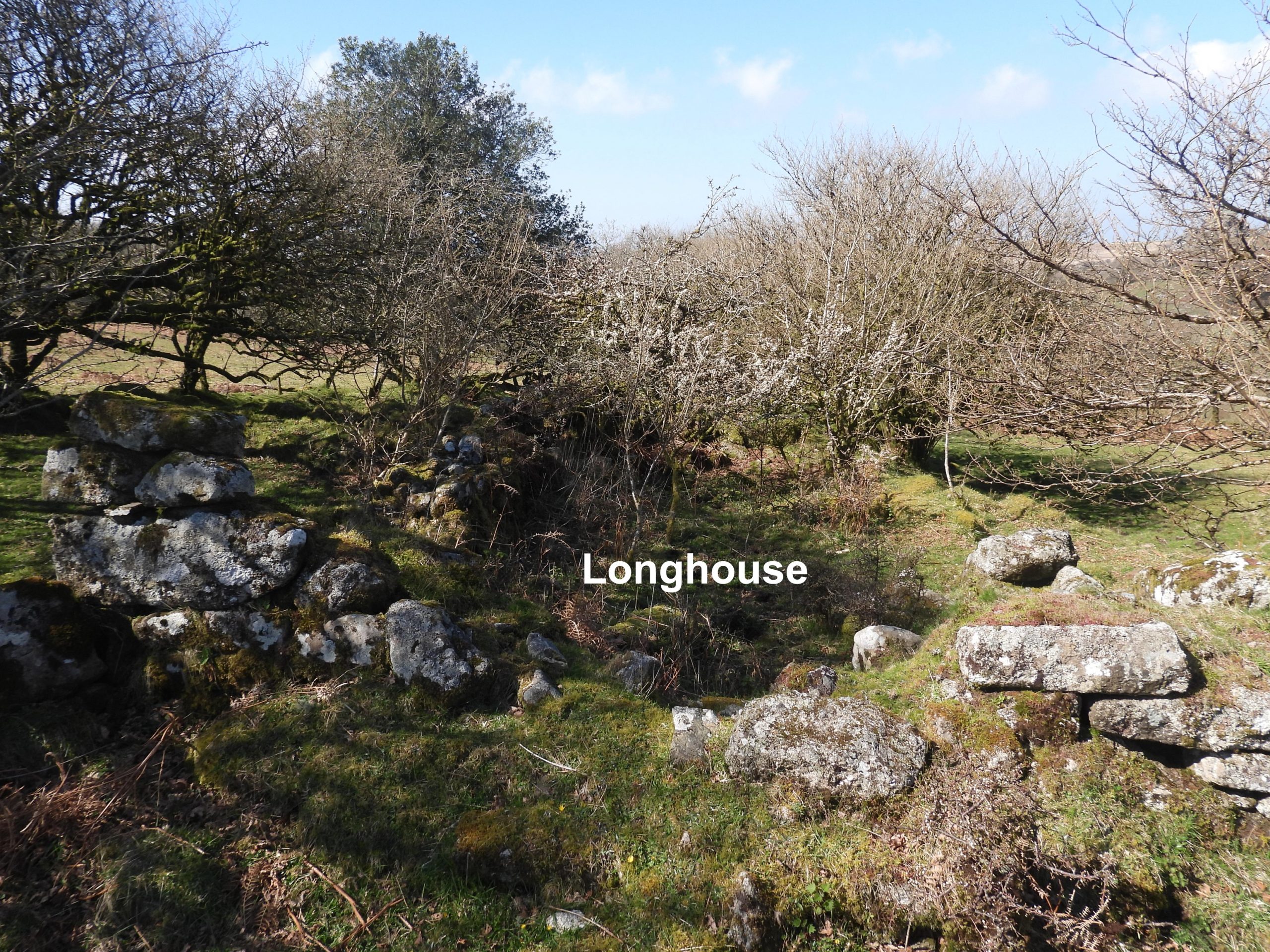
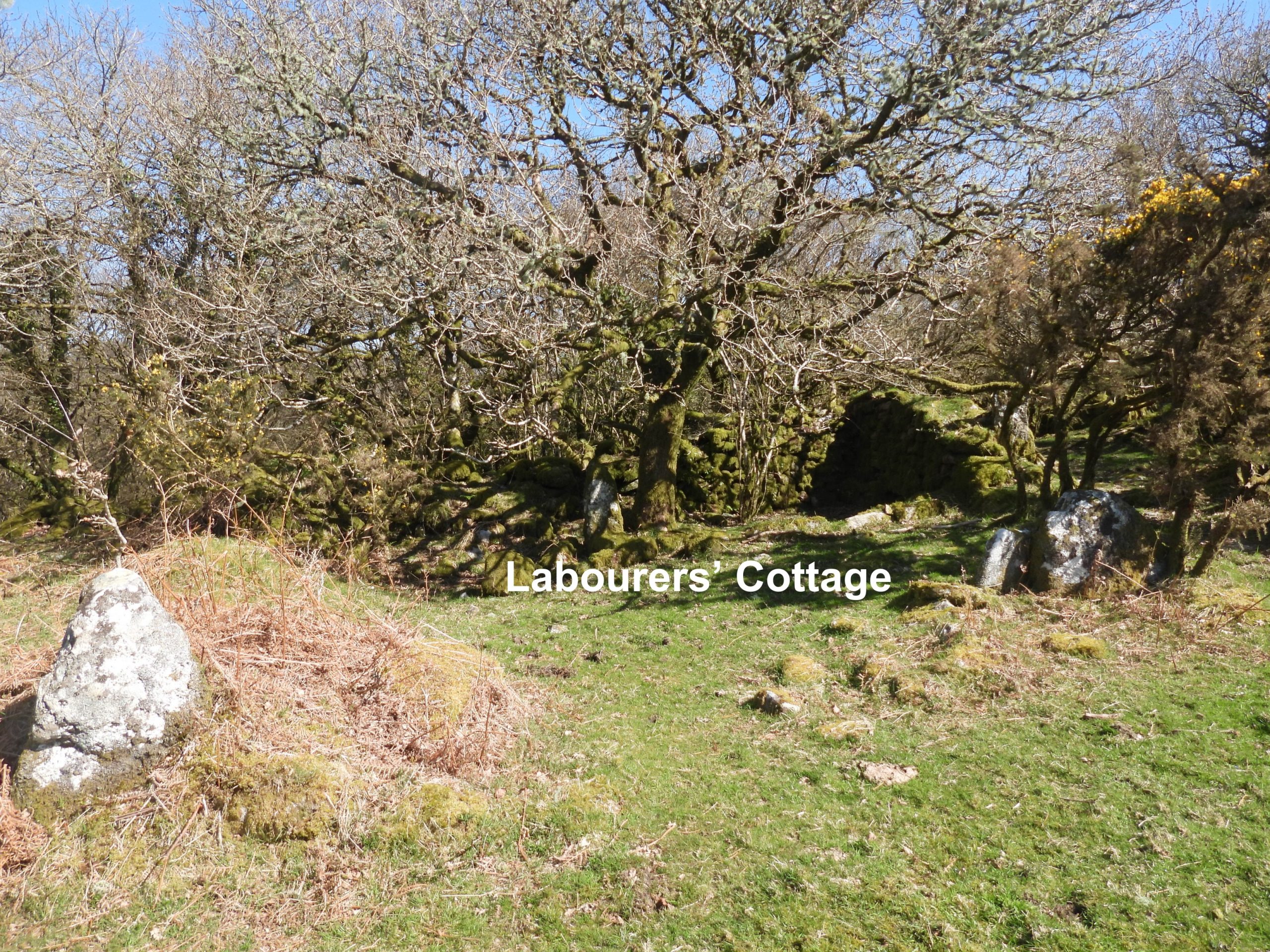
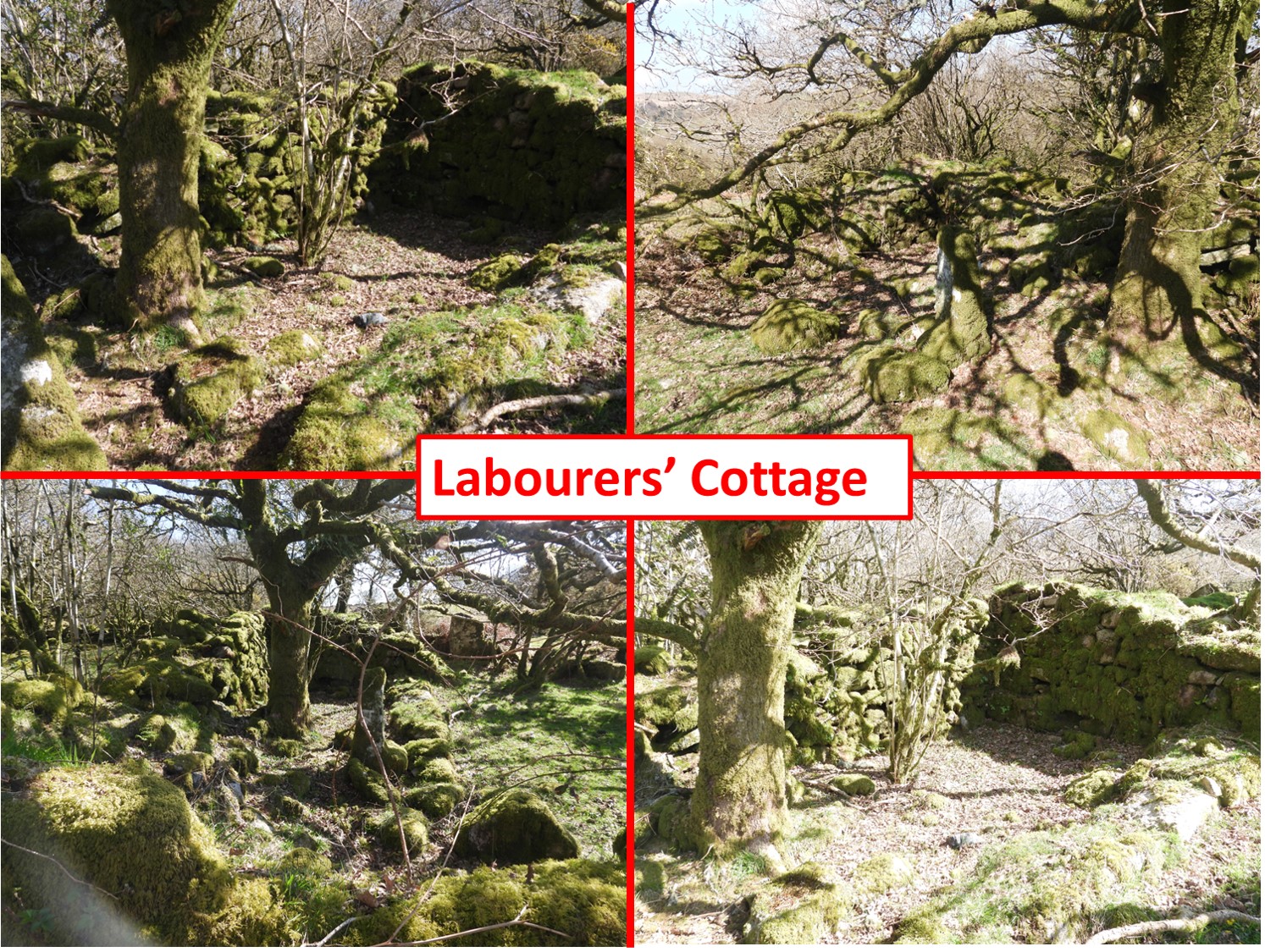
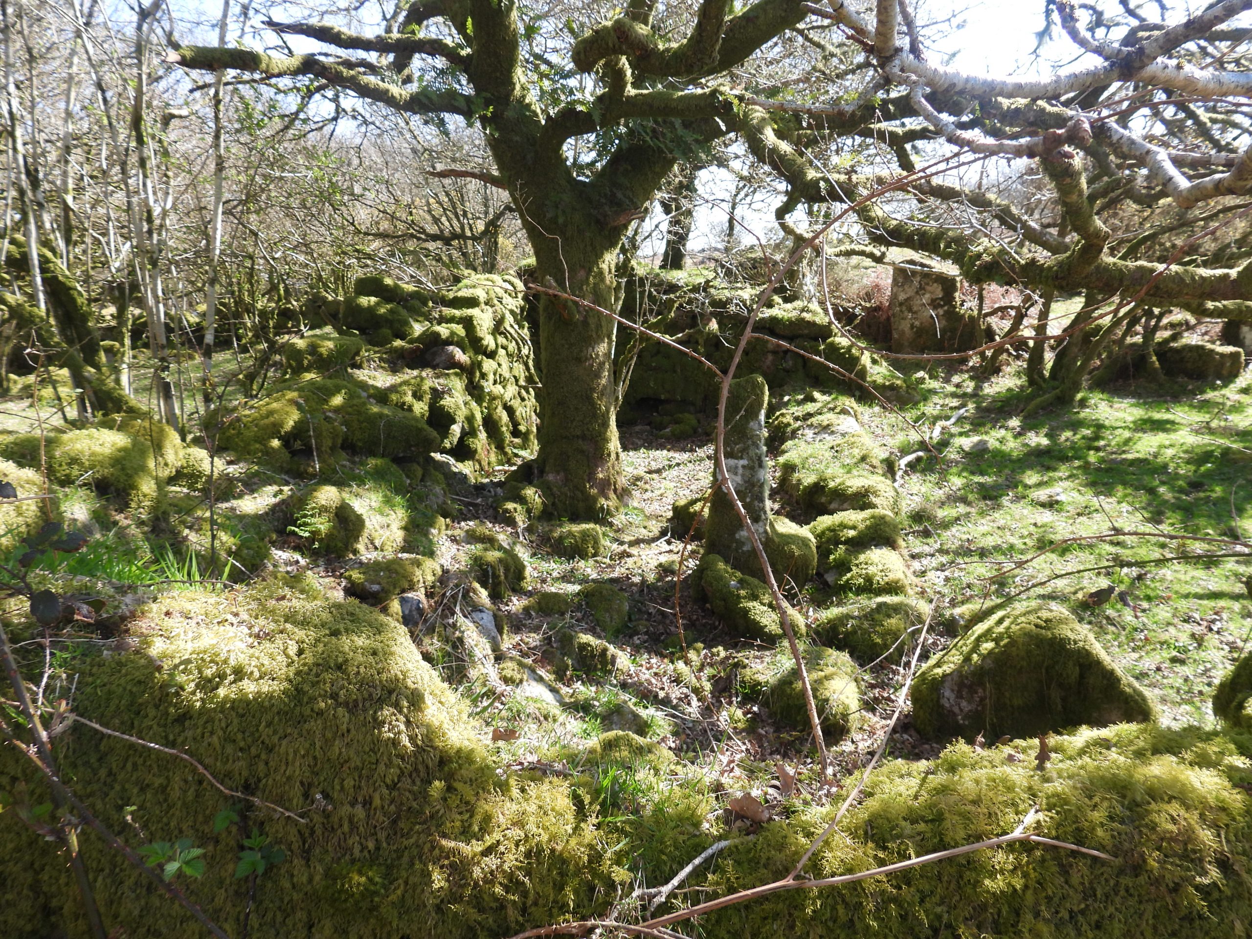
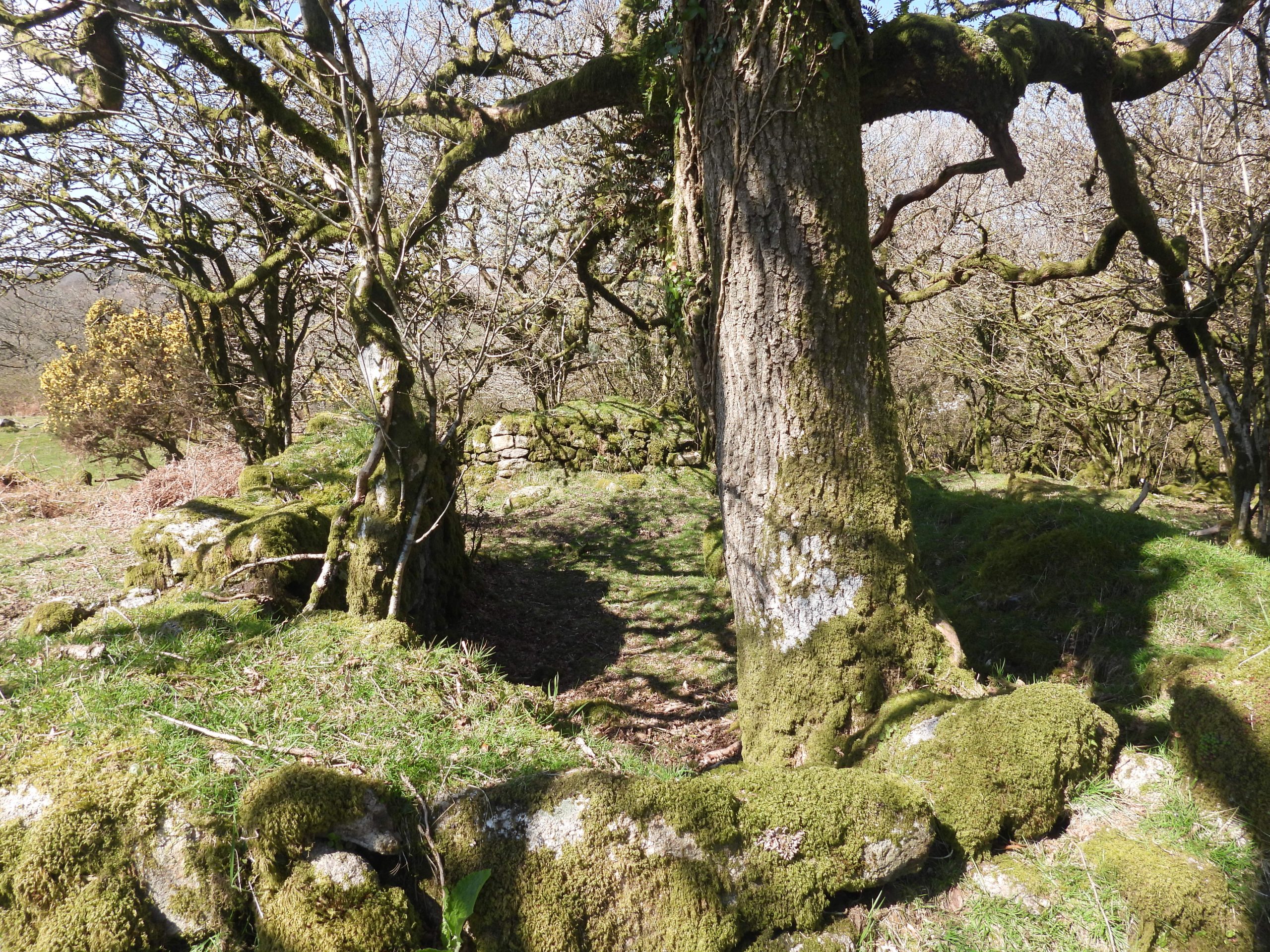
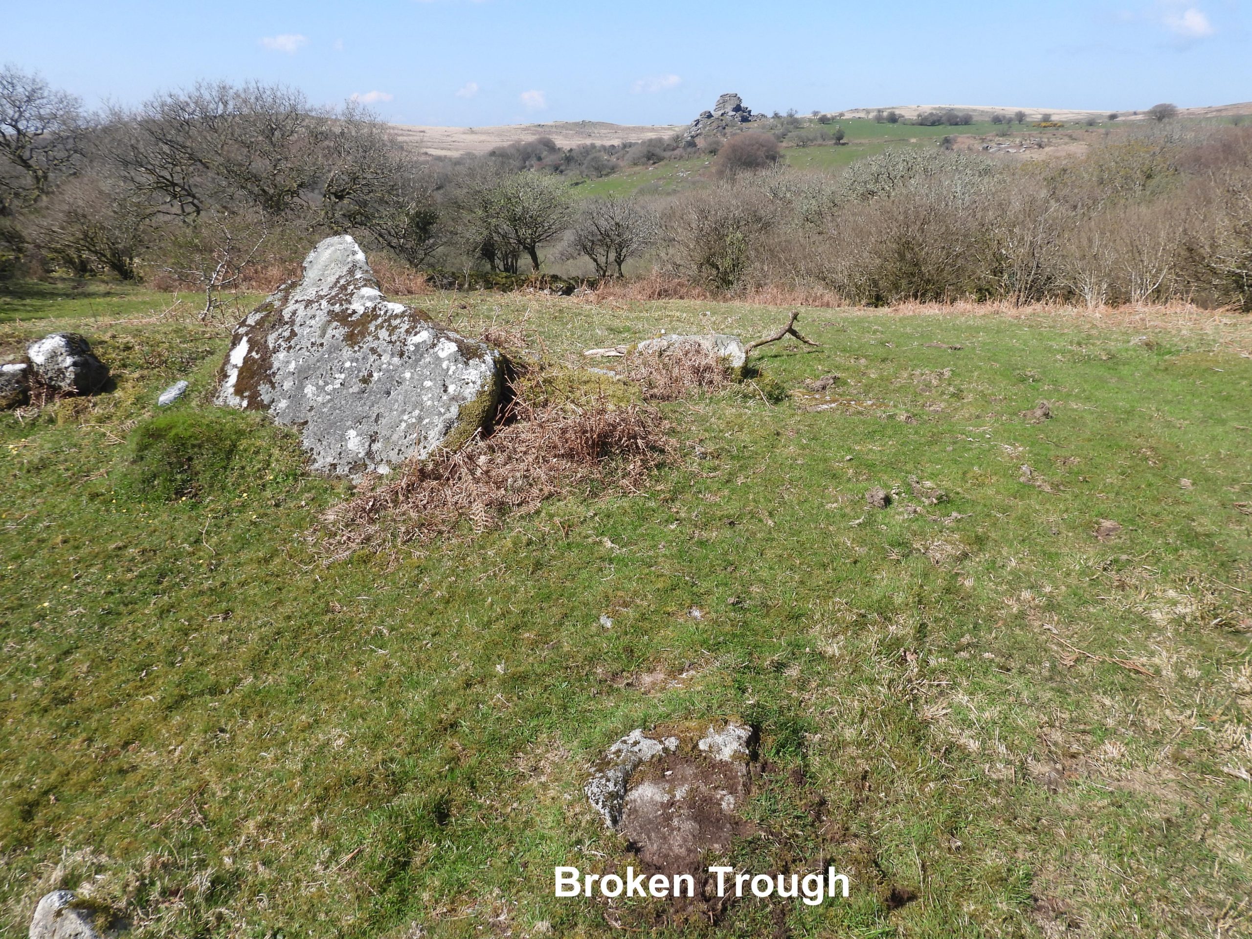
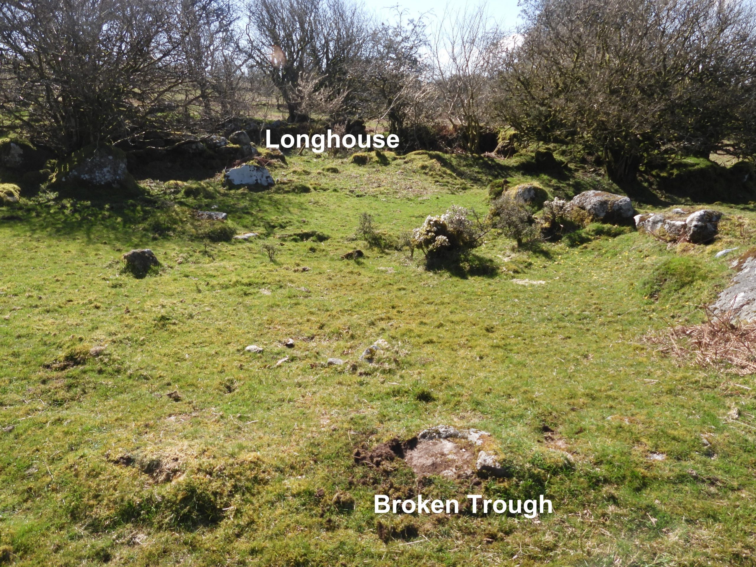
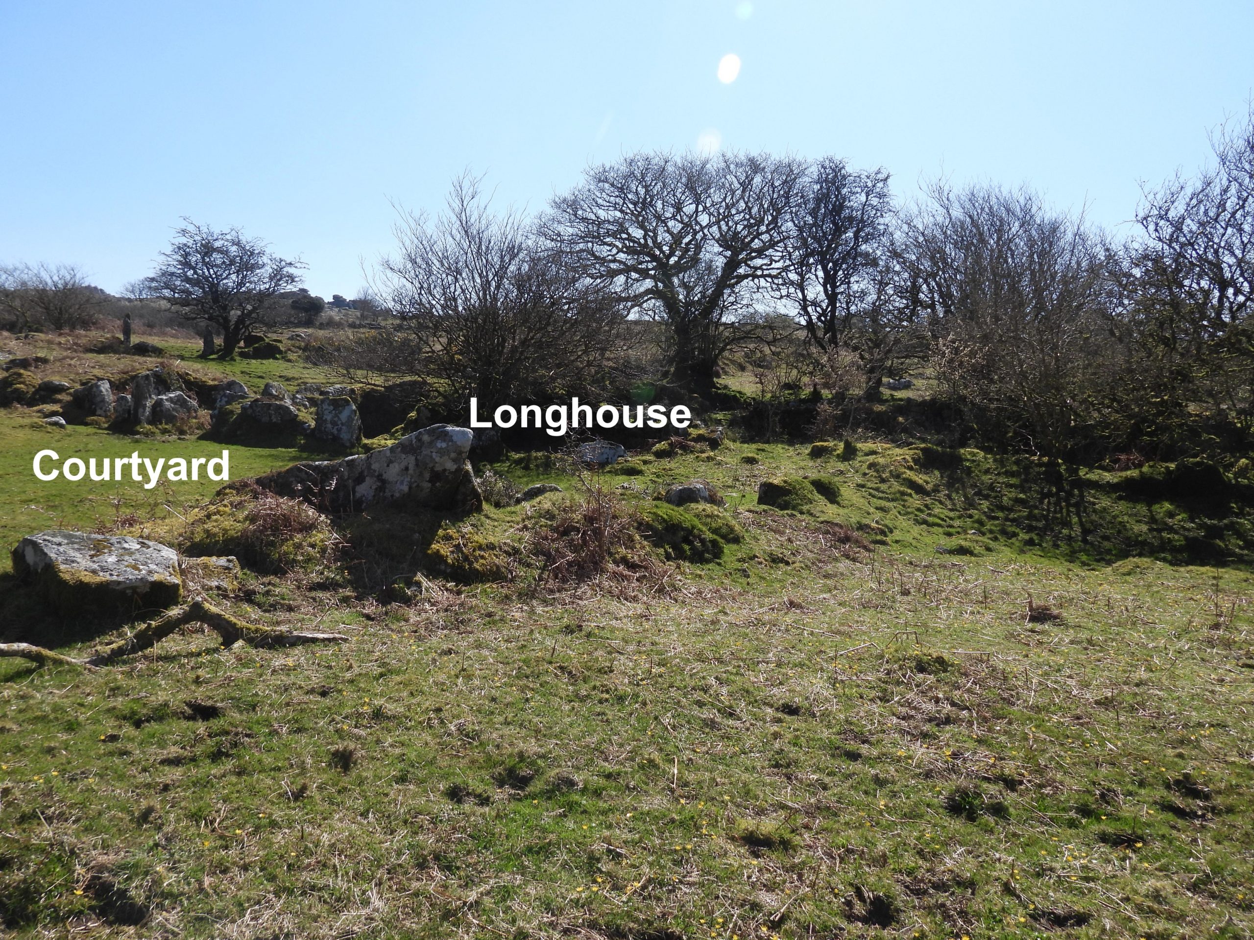
Google Earth view of location of Huckentor Farm in relation to Longash Farm. It is located just south of the belt of trees and east of the track from Longash Farm.Travelling south along the ancient track from Merrivale towards Davytown, the Longash Farmstead is reached and must be passed through to get to Huckentor Farm. Longash is a modern farm on an ancient site and was abandoned around 1960, but since has been renovated. Of interest, Longash was taken over by two school teachers about April 1967 for boys adventure training.On the track south of Longash Farm is a small clapper bridge called Little Wonder Bridge. The waters of the Pila Brook tumble over the moss-strewn boulders beneath the bridge.Near to Little Wonder Bridge (north side), built into the foot of the wall is the broken top of an old gatehanger stone, the circular pivot hole clearly in view. It is located at SX54820 74189.From the ancient track between Merrivale and Davytown, superb views across the Walkham Valley towards Vixen Tor can be enjoyed.Aerial view of Huckentor Farm. The ruined buildings are under trees. The large open area between is the main courtyard.On the tithe map of ‘Huckentor’ the main dwelling is depicted at the southern side of the farm (in red), with two smaller structures shown either side of the entrance at the northern side. One of these two structures are believed to have been a Labourers’ Cottage.This sketch map is the authors interpretation of the key features of Huckentor.The old farmhouse has the appearance of a longhouse.Behind the ruined farmhouse (longhouse), is a large high-banked garden plot (vegetable garden).
In the introduction to this post, there is a mention of a letter written by George Giles to Sir Ralph Lopes in May 1837, which was recorded in Mike Brown’s Guide to Dartmoor. The letter is a insight of what hardships were being endured : “The poor old Widow Leaman, with one of her sons, & his wife, are still residing in the house at Huckentorr. The old woman declares she cannot find a house to remove into any where — and as her income is all gone, she appears much distressed lest her children, though she has four sons and three daughters (but all very poorly off) should be unable among them to afford even a scanty maintenance. Her present petition is, that she may be permitted to remain in the house until she can suit herself with some other — or rather until Lady day next — until which time she says her late Tenants would be glad to hold on the Land — for which they have paid her Twenty Pounds a year…Under the circumstances I don’t see what otherwise can be done than to make terms with Price & Vigars [the under tenants] for the remainder of the year — and in the mean time look round for some hard working industrious family who might live upon and occupy it. The buildings are in a tolerable repair, and many small plots of land, although very rocky, are of a grassy nature, and other parts may be much improved by Manure and Labour”.
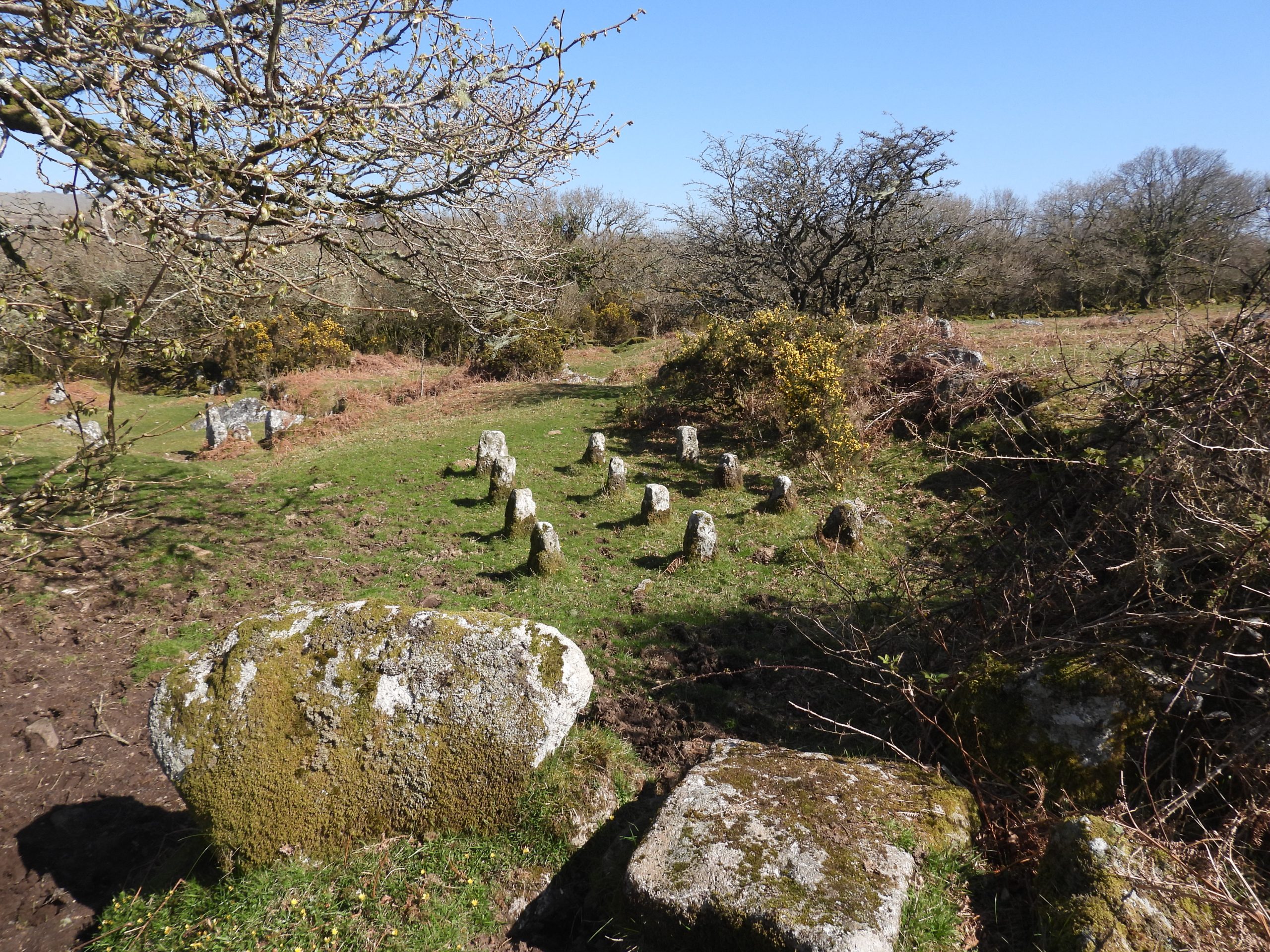
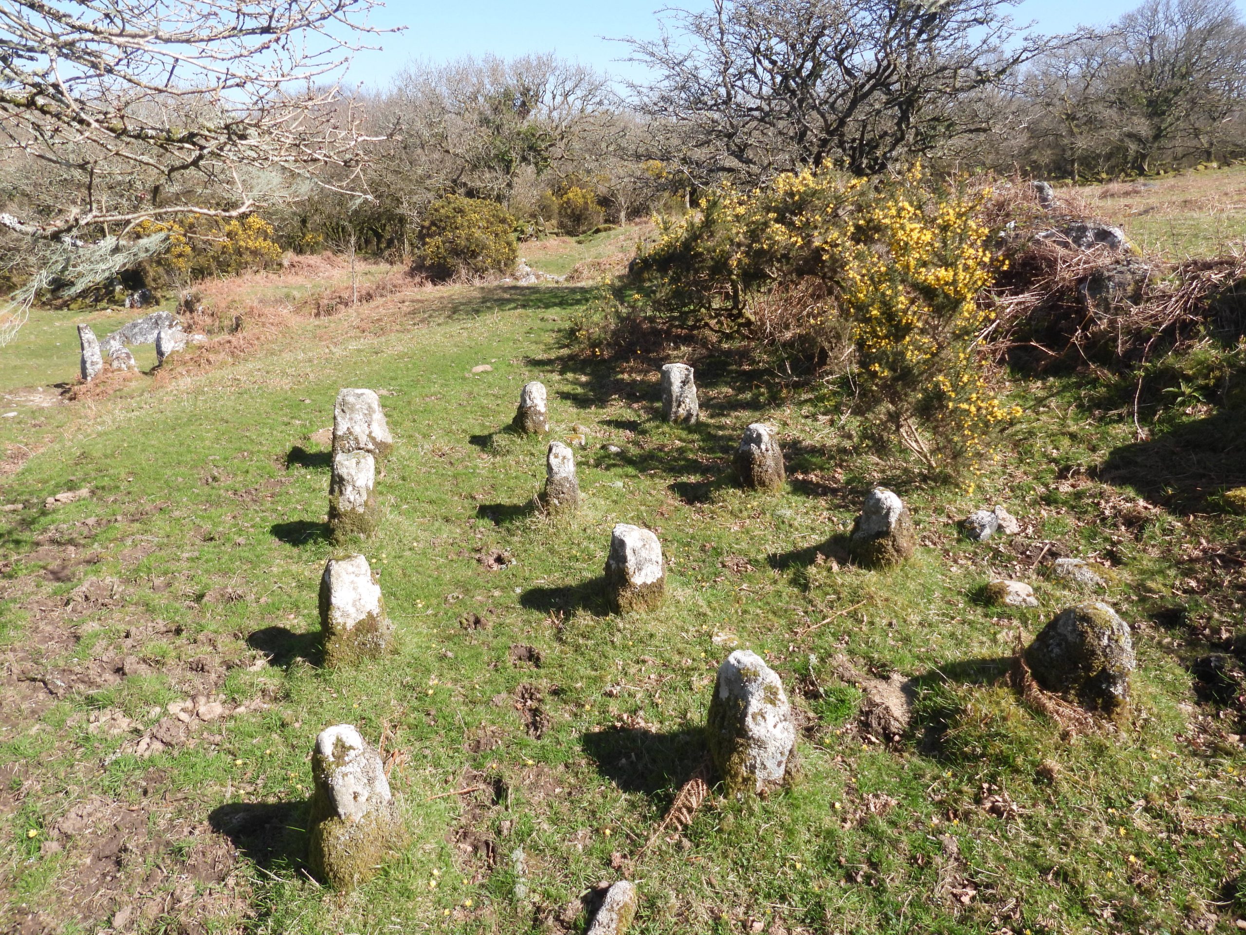
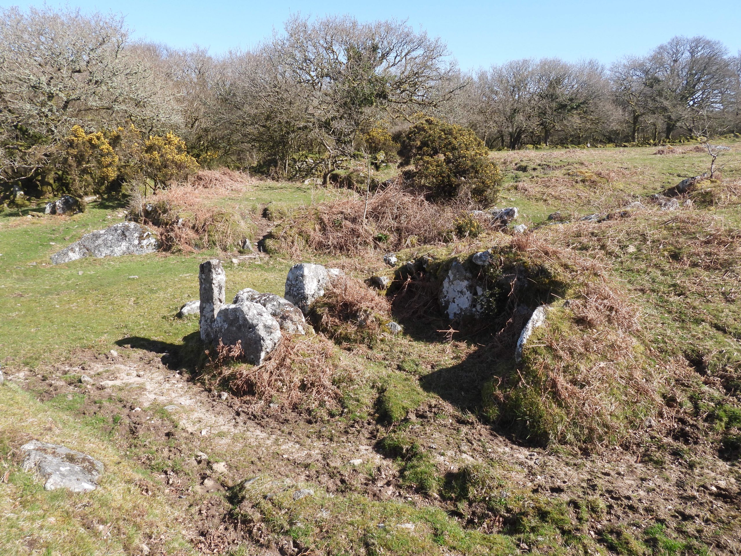
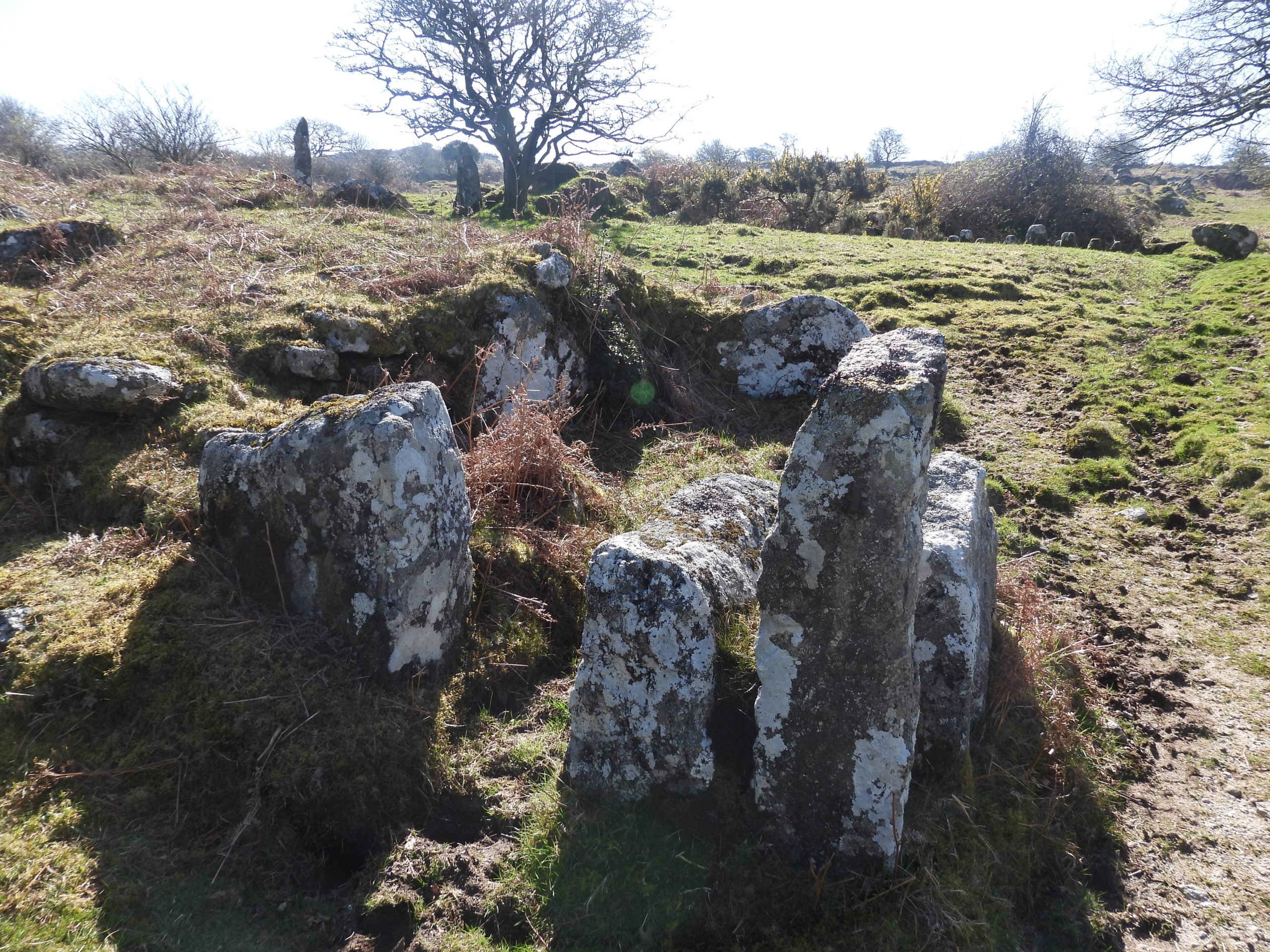
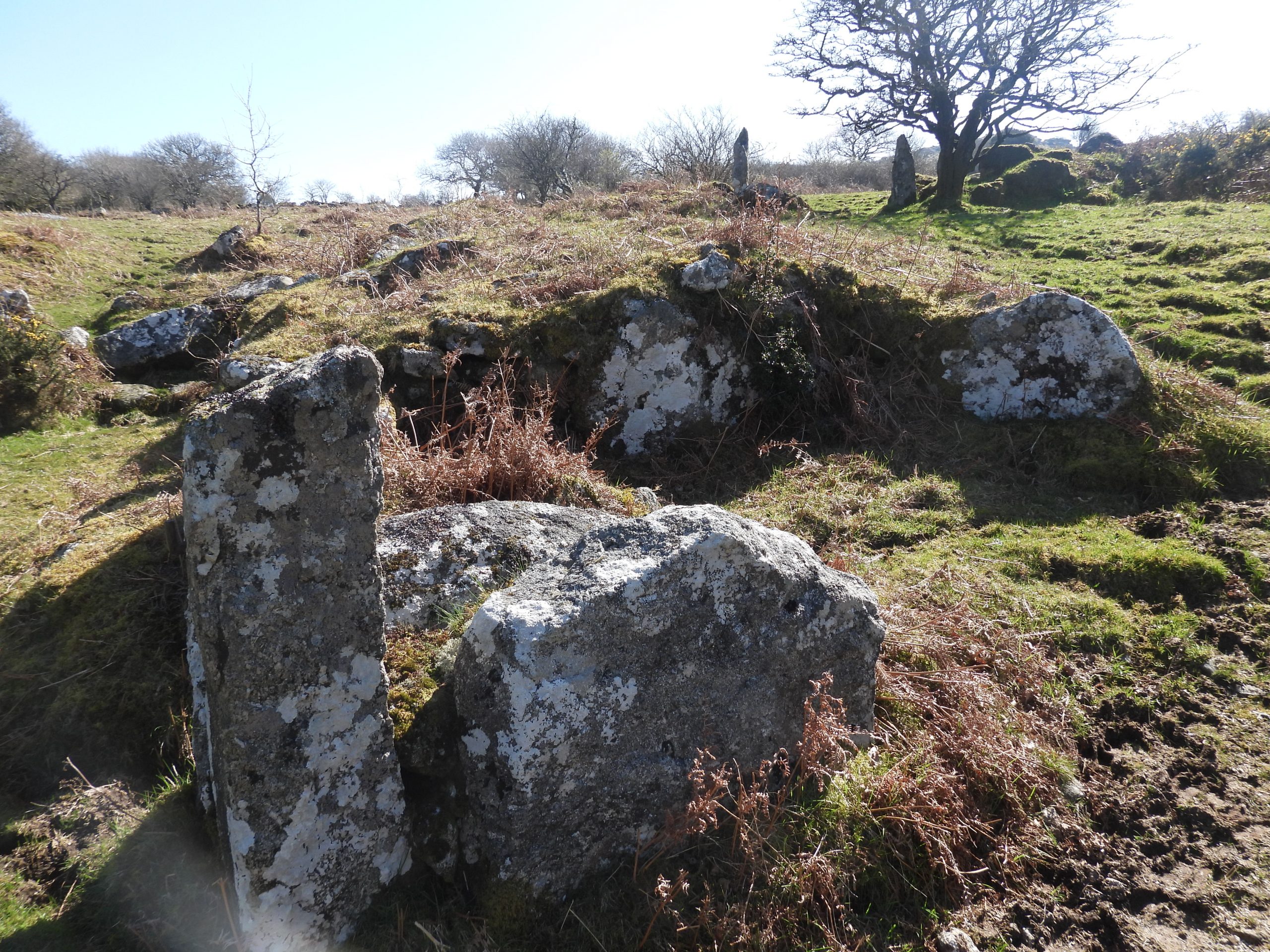
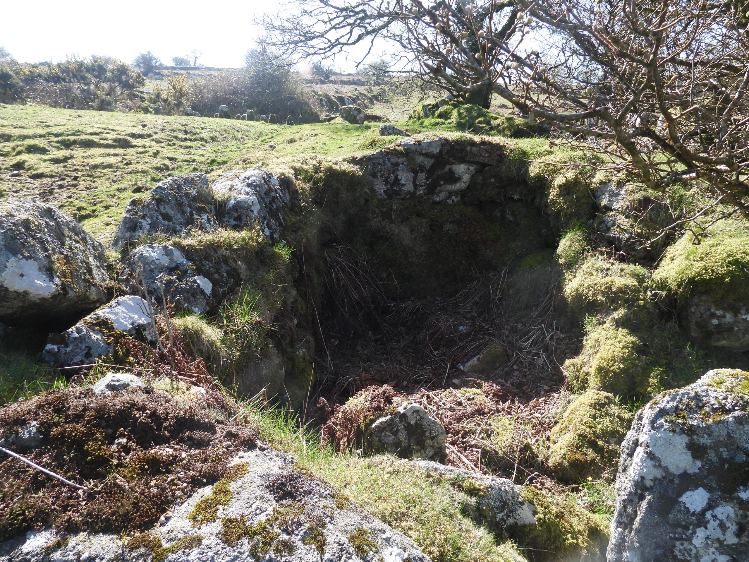
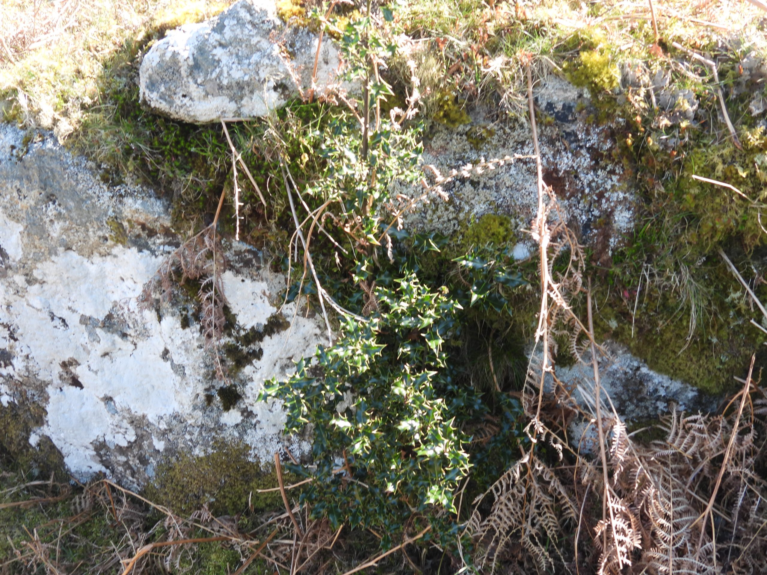
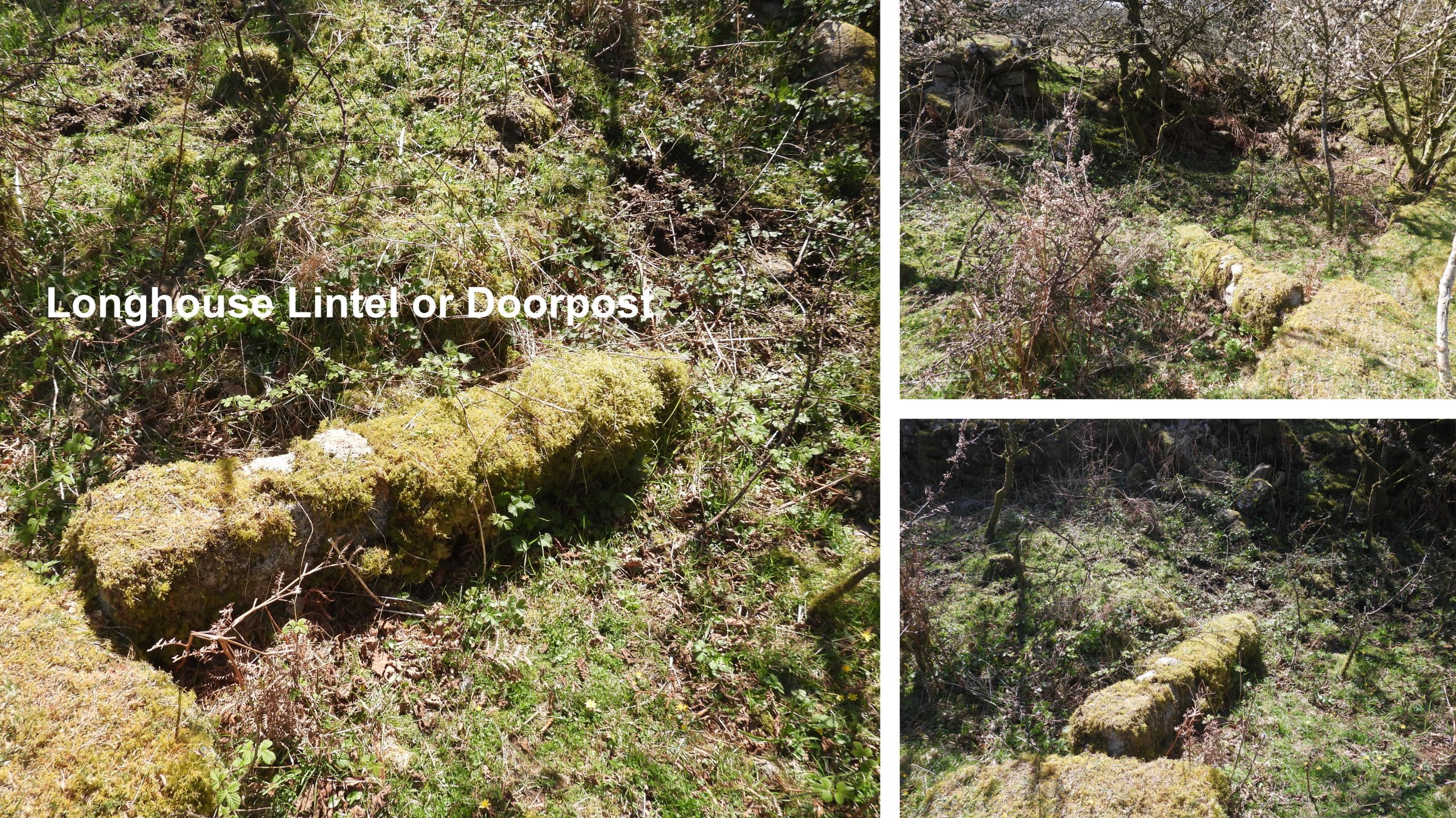
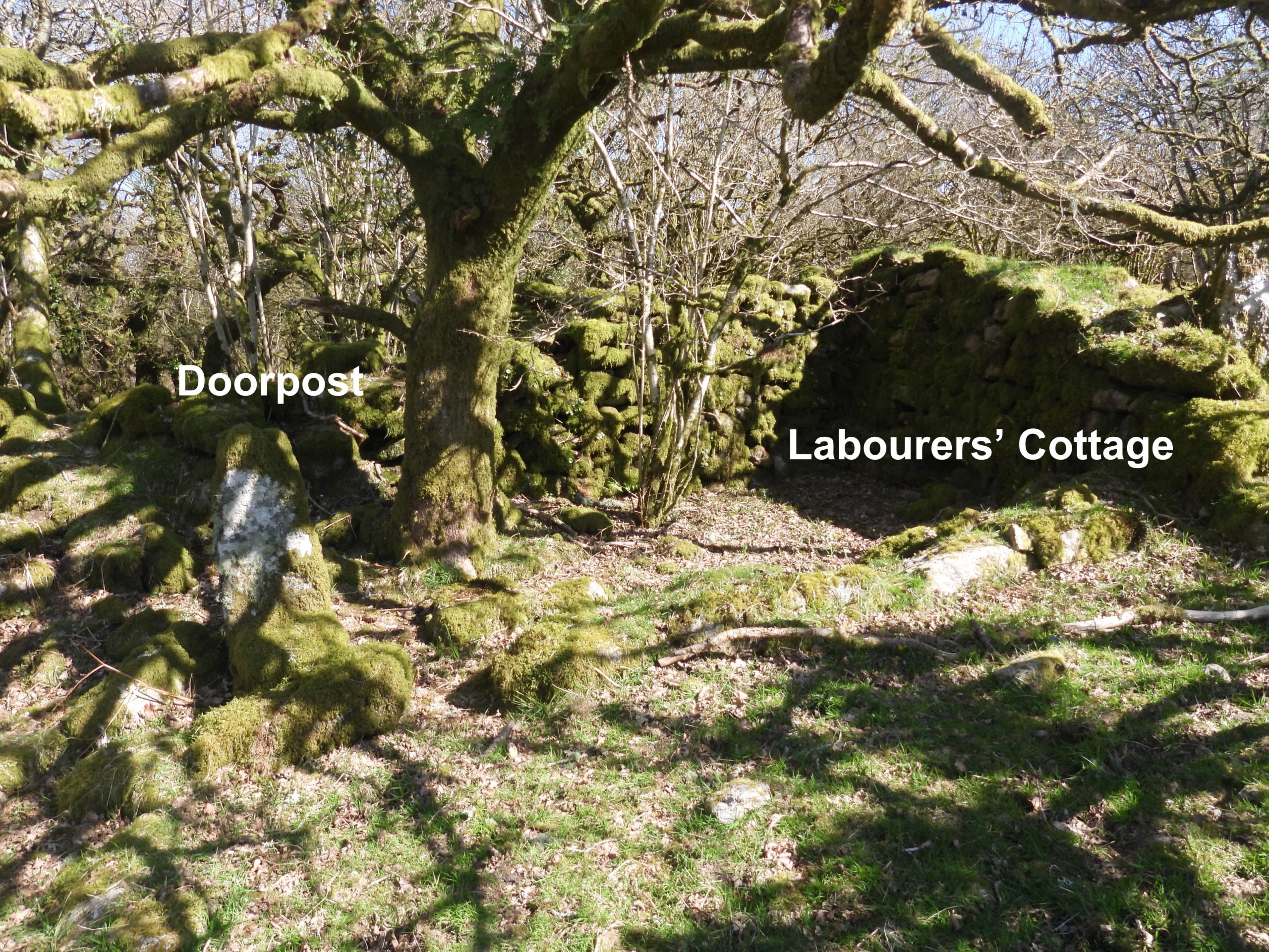
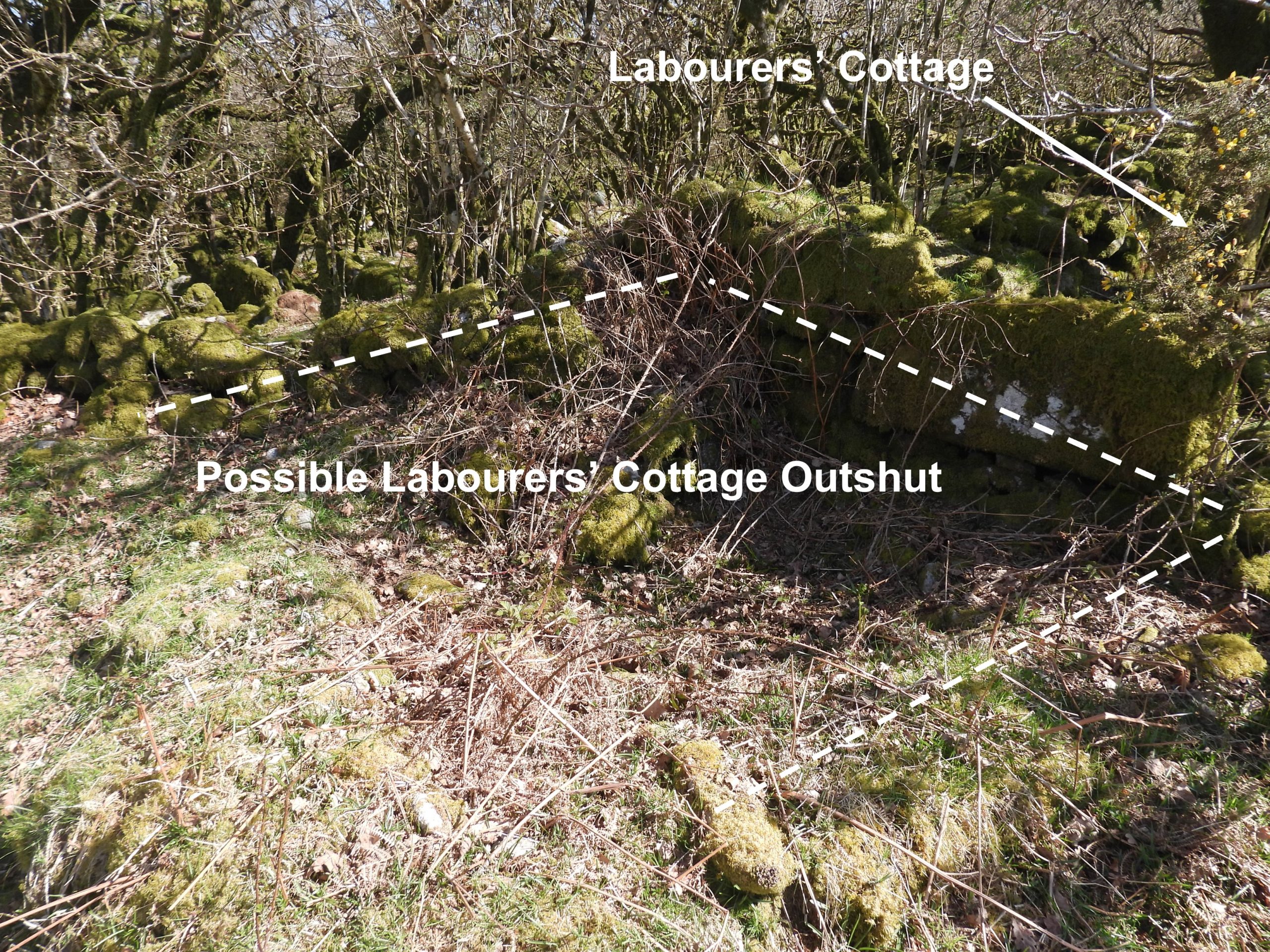
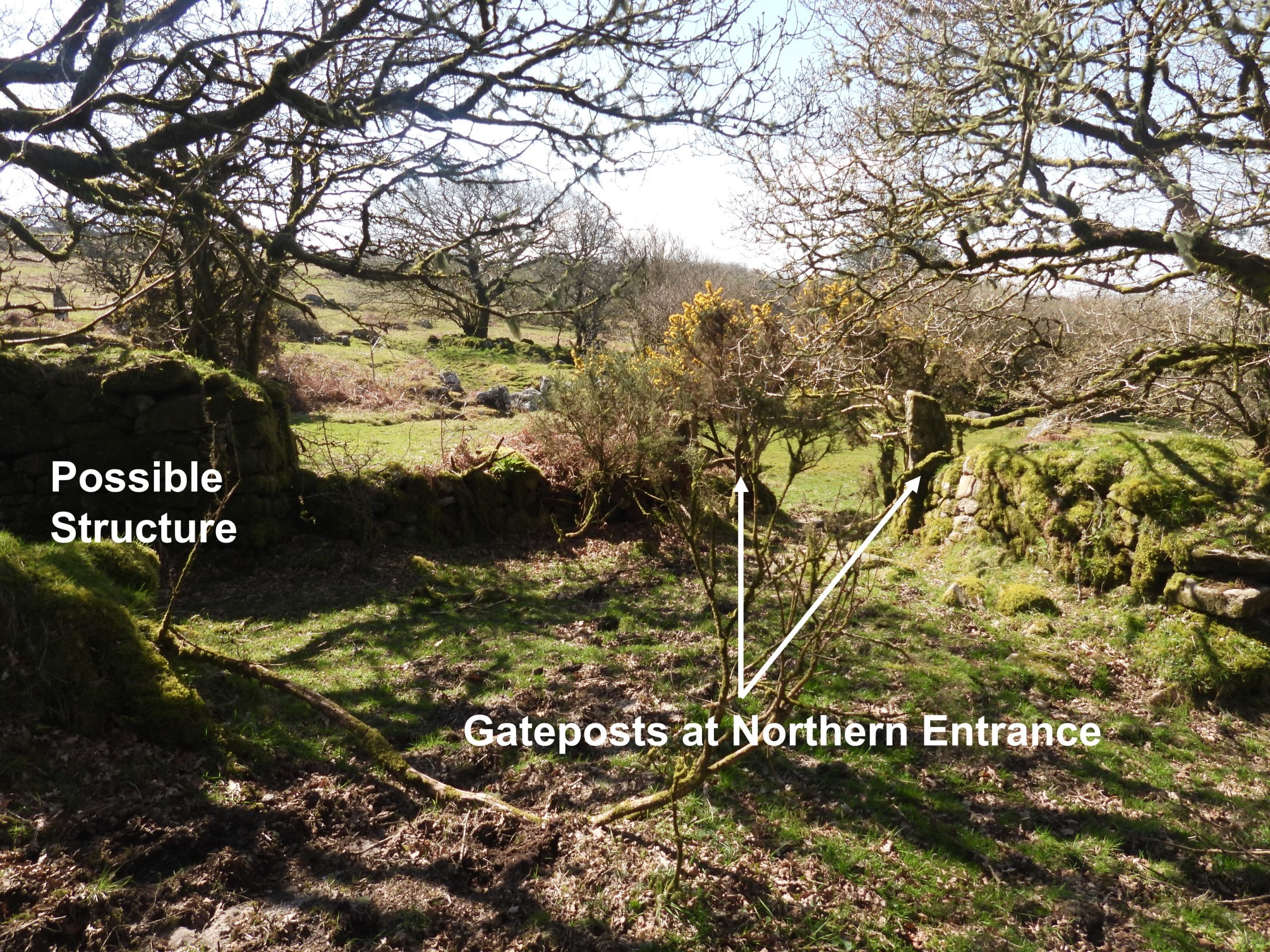
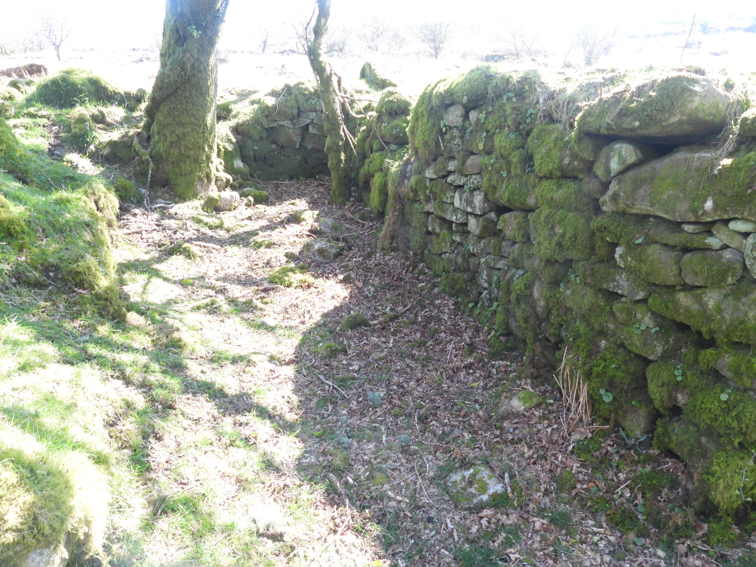
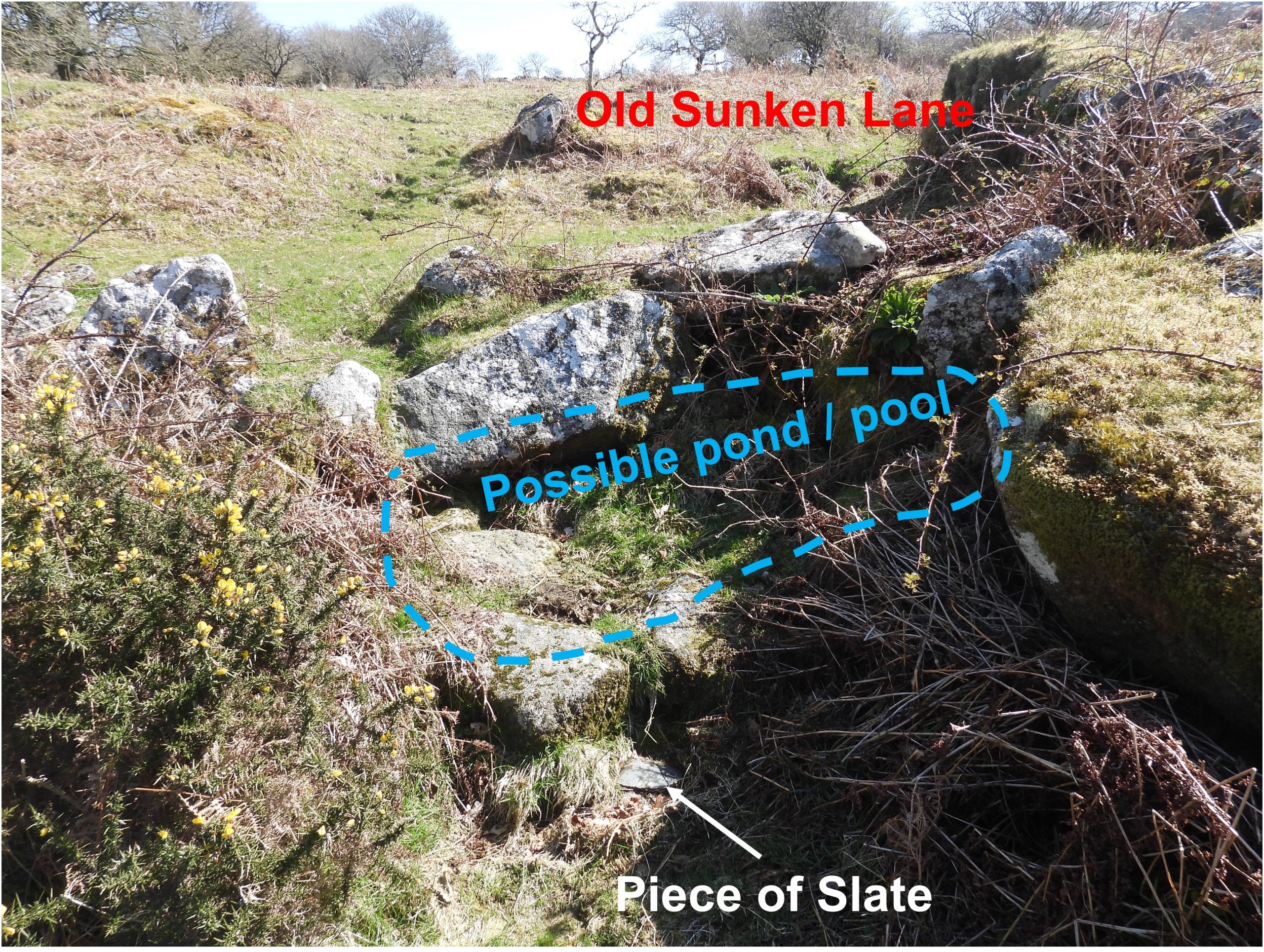
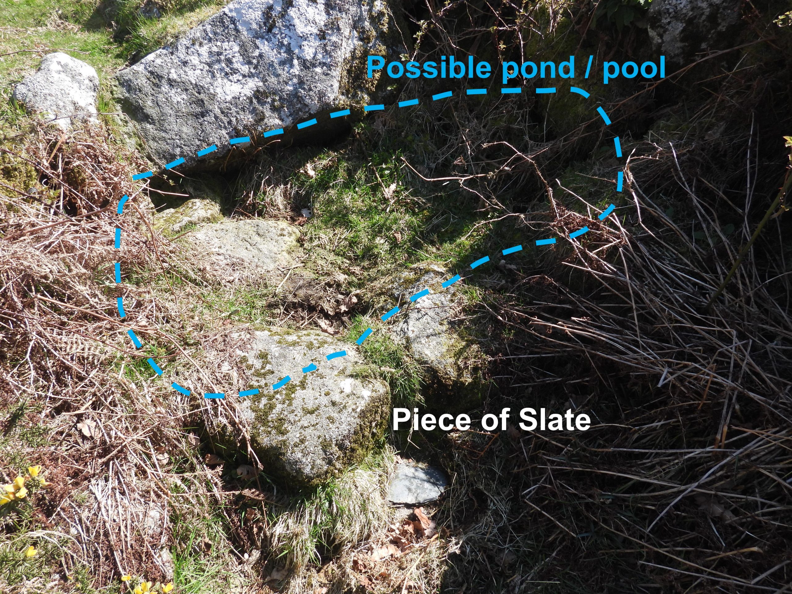
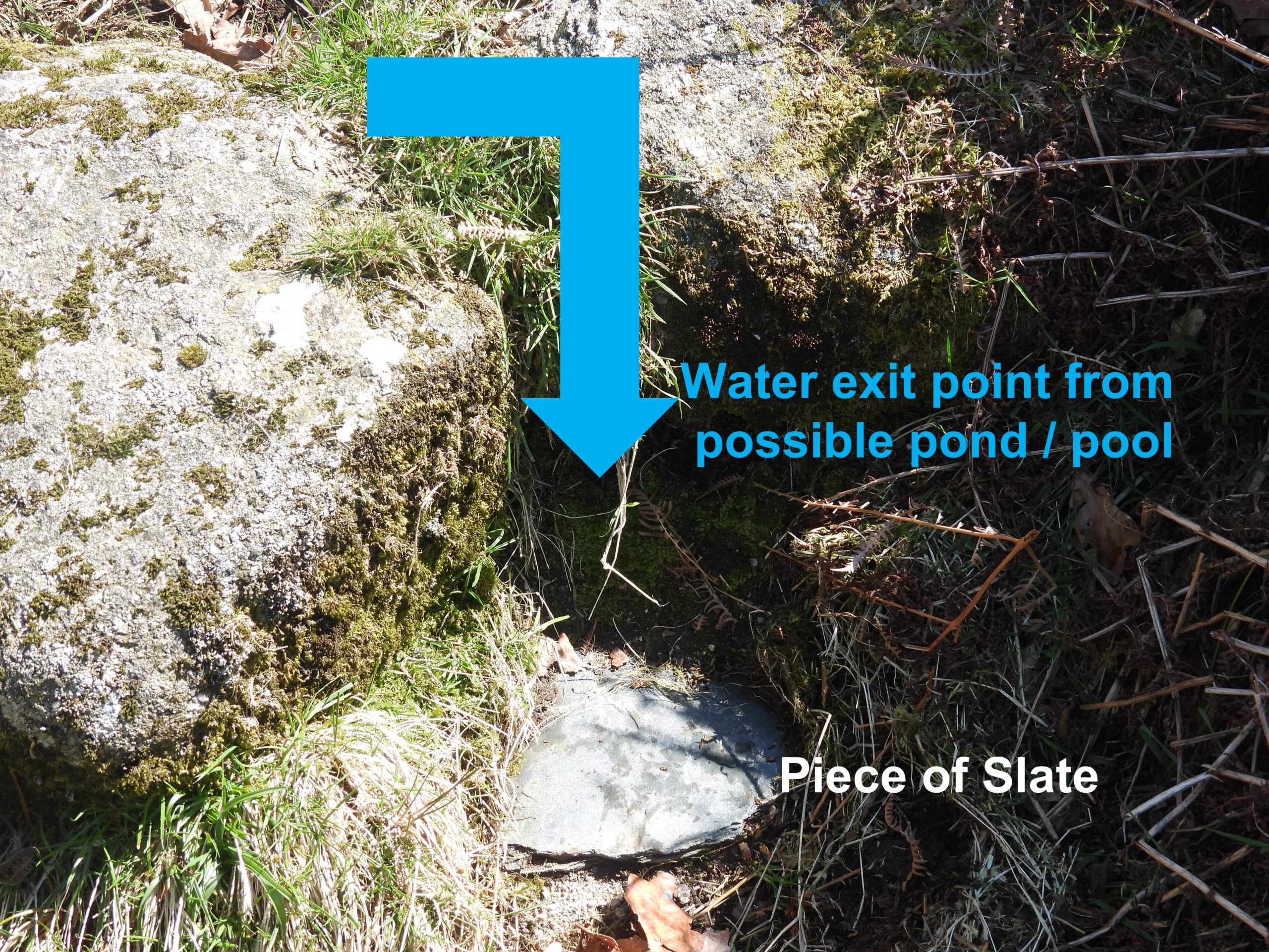
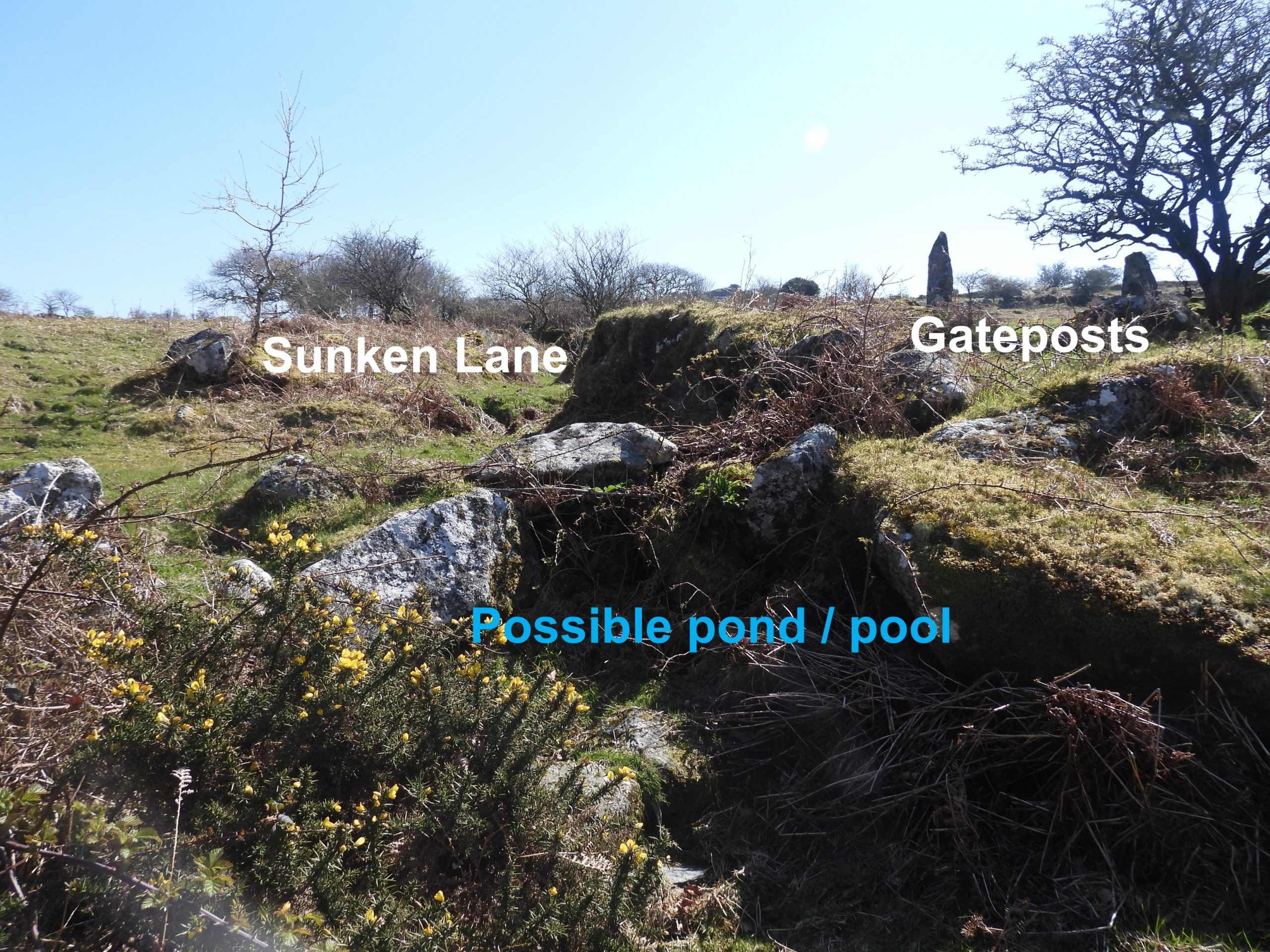
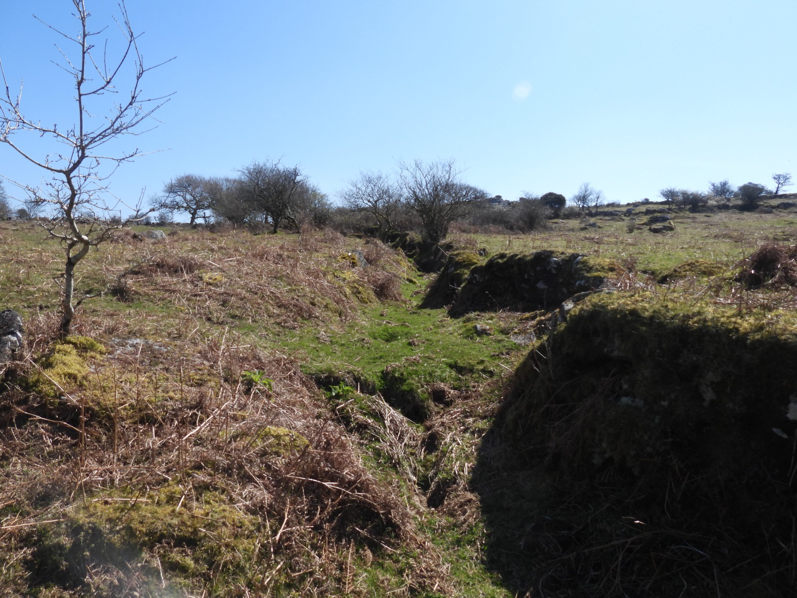
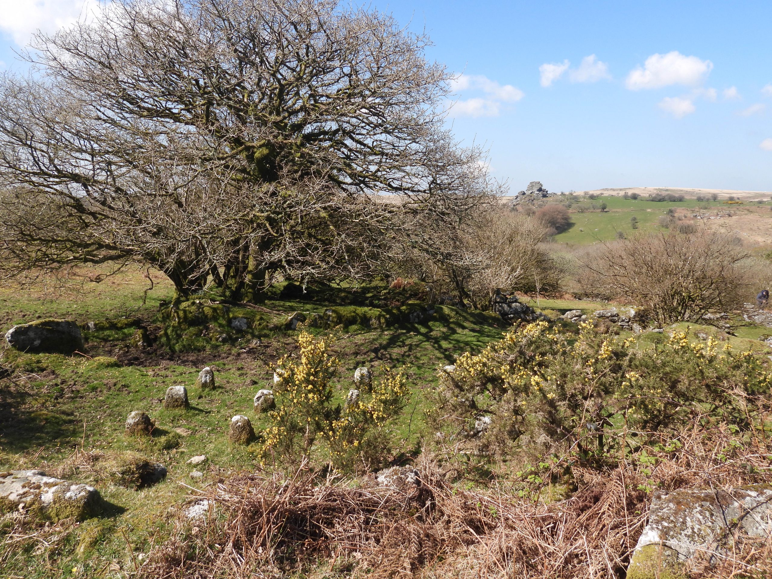
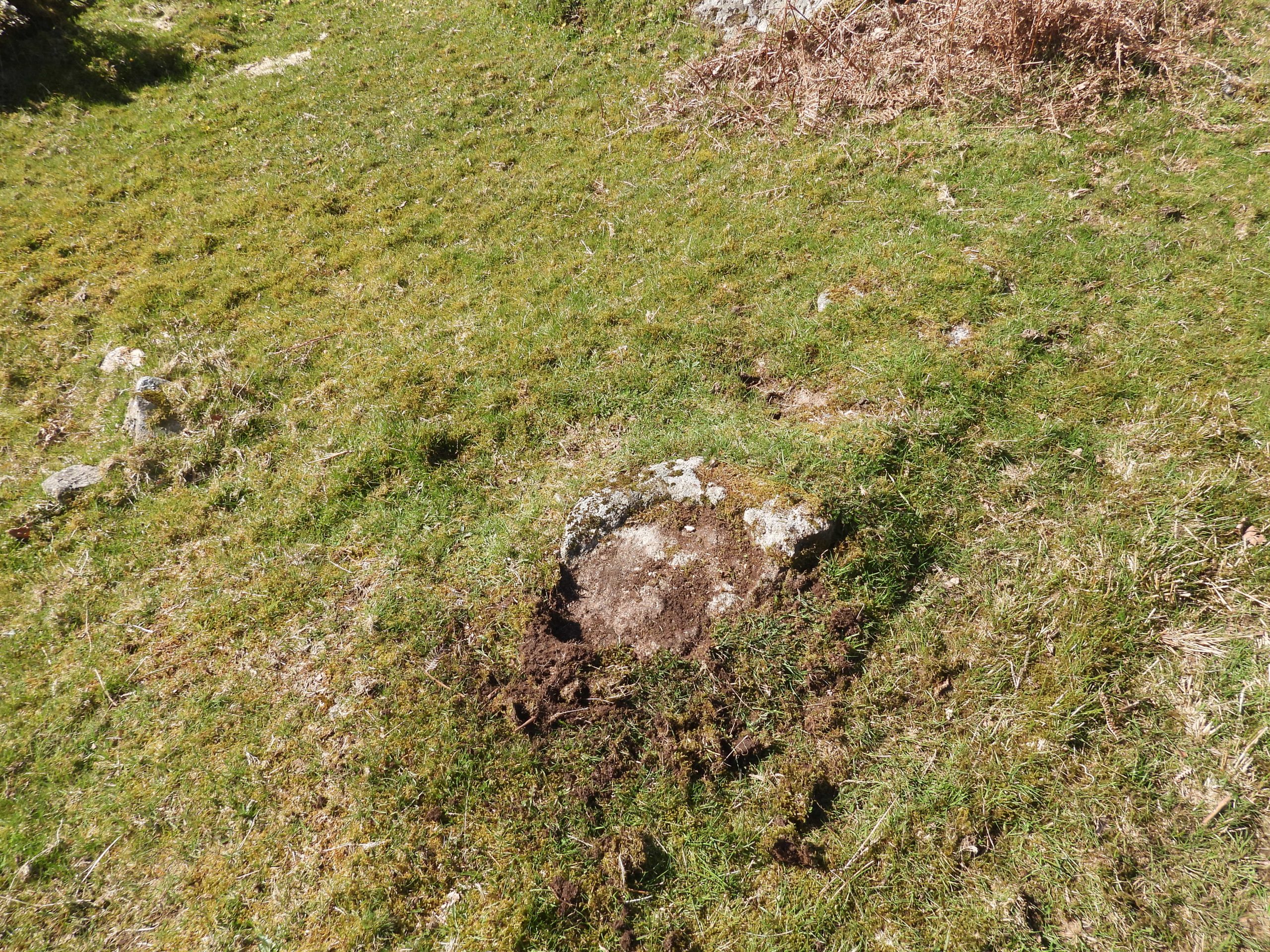
The garden plot (or vegetable garden) is likely to have been 566 on the Tithe Map.The middle of the garden plot or vegetable garden is at SX54898 74100Views of the Longhouse and Vegetable Garden from east sideInside the Longhouse looking east, a noticeable feature can be seen, a set of a dozen rick staddles.Staddle stones (or steddle stones) were originally used as supporting bases for graneries, hayricks and game larders amongst other things. At the farm, the staddle stones would have lifted the probable hayrick above the ground thereby protecting it from vermin and water seepage.According to Wikipedia, in Middle English staddle or stadle is stathel, comes from Old English stathol, a foundation, support or trunk of a tree. The twelve staddle stones can be located at SX54915 74094The staddles were originally made of wood. However, as one would expect stone staddles replaced wooden ones being longer lasting and a more reliable means of supporting structures which were sometimes a considerable weight. These staddles at Huckentor may be of 18th or 19th century origin (authors estimation).Either side of the old gate entrance leading from the higher level (where the staddle stones are located) are two tiny outbuildings, outhouses or possible pens with massively-built walls. The north eastern most ‘outhouse’ has a surviving gatepost and comprises two huge upended slabs forming a double-skinned wall with an infill of turf and small rocks.The north eastern most ‘outhouse’ is located at SX54904 74117To the east of the north eastern most ‘outhouse’ another pair of old gatepost can be found. These are marked on the sketch map.View of the western ‘outhouse’ (outbuilding / pen).The western ‘outhouse’ is located at SX54903 74107Holly tree growing inside the ‘outhouse’View from the eastern most gateposts. The occupiers of the farm had a splendid view of Vixen Tor across the valley.Back to the longhouse. It lies on an east-west axis (with possibly having a cross passage)The Longhouse is recorded as being 13m longThe centre of the Longhouse is at SX54898 74102Just inside the Longhouse is a fallen lintel (or door post) from the doorwayOn the opposite side of the outer courtyard from the Longhouse are the ruins of what Mike Brown believes must have been a Labourers’ CottageLittle survives in the Labourers’ Cottage except for the rear and end walls and a solitary granite doorpost withinThe Labourers’ Cottage is likely to be one of the two smaller structures shown either side of the entrance at the northern side of the farm on the tithe map.At the west end of the Labourers’ Cottage is a possible ‘outshut’ or second room. By the gateposts at the northern entrance to the farm is another possible structure (also shown on tithe map). The Labourers’ Cottage outside wall is on the far right of this picture.Inside the possible structure.Looking into the Labourers’ Cottage (from the ‘outshut’). The cottage is located at SX54899 74135View of the Labourers’ Cottage from the northern entrance. Mike Brown records it as being a small two-roomed building.In the 1960’s, Haynes recorded that “There appears to be a sunken approach from the heights to the south-east of the farm. This is blocked by a wall at the entrance to the yard”. He concluded that it could have been designed to hold surface water in a pond. Of interest regarding the possible pool / pond is a piece of slate below. The author suggests this is a deliberate placement (of the slate) where water would have cascaded out of the pool / pond.Was this possible pond / pool used for general washing – possibly meat or vegetables ? The Pila Brook is not too far away, where drinking water may have been sourced.Contextual picture of the sunken lane and the gateposts on the east side of the farm.The ‘sunken approach’ as described by Haynes.Outside the eastern wall of the farm, looking across the staddle stones toward the vegetable garden and Longhouse.Just inside the western perimeter of the courtyard is what is thought to be a broken trough.The broken trough is located at SX54896 74118Contextual view of the broken trough in relation to the Longhouse.Outside the perimeter of the western side of the farm.