A collection of walks, discoveries, insights and pictures of exploring Dartmoor National Park
August 27, 2020
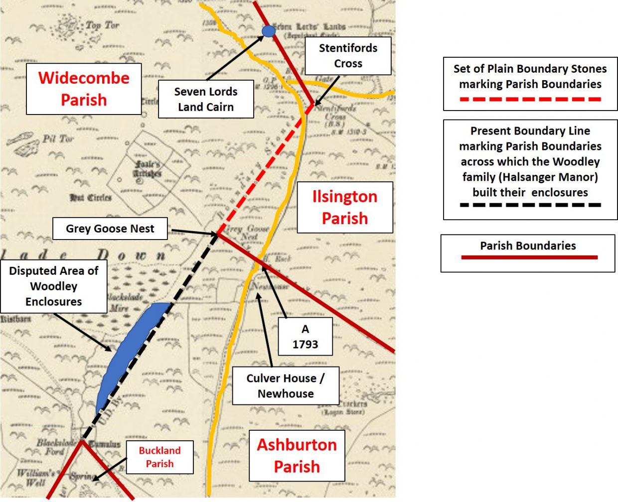
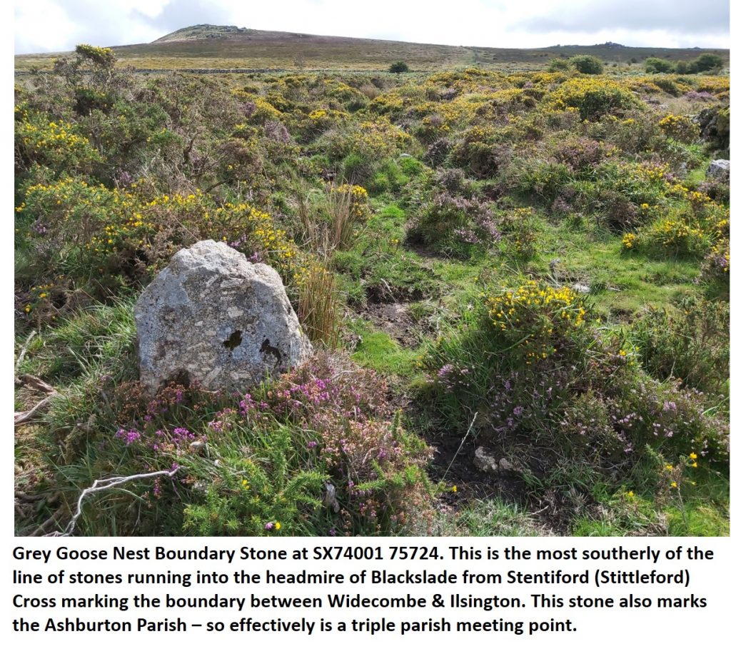
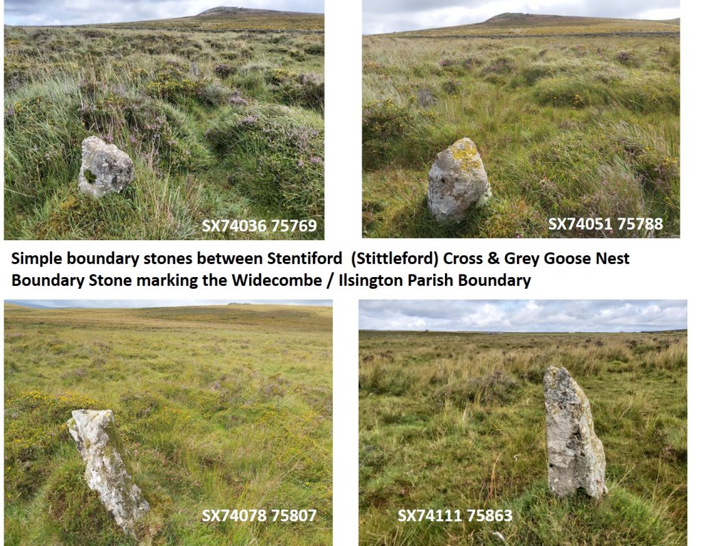
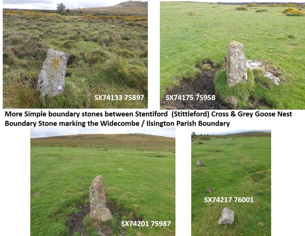
GREY GOOSE NEST TO STENTIFORDS CROSS ON WIDECOMBE / ILSINGTON PARISH BOUNDARY
This post covers a small area adjacent to the Ashburton / Widecombe road between the ruins of Newhouse Inn and Hemsworthy Gate area. There is a triple Parish meeting point (at Grey Goose Nest Boundary Stone), where the Parishes of Ashburton, Widecombe and Ilsington come together. Not far away, to the south near Blackslade Ford is Buckland Parish.
Map and overlay of the area covered in this post.
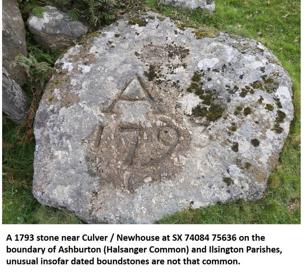
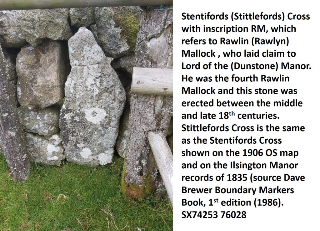
Of interest is the disputed area in blue, which lies just outside the modern parish boundary. It is believed that the Ashburton Parish Boundary might have extended at one time to include the area as its extent is close to where there was an ancient trackway. The Woodley family of Halsanger manor in the Parish of Ashburton built their enclosures (low walls) from Culver House / Newhouse close to the said trackway. However, in 1771 the Lords of the Manor of Buckland too the Woodleys to court over the matter, winning their case as they claimed the boundary was a straight line (as seen on the map). The confusion was partly caused by the original description of the perambulations changing over the centuries. To add insult to injury, the Woodleys were forced to breach the walls of their own enclosures. The Woodleys, who were custodians of Halsanger manor from 1586 to 1925, took the matter to court again in the early part of the 20th century but again lost as the straight line Parish boundary was very well established at that time. The source of this information is Dave Brewer Dartmoor Boundary Markers (1st edition – 1986 and 2nd edition – 2002).
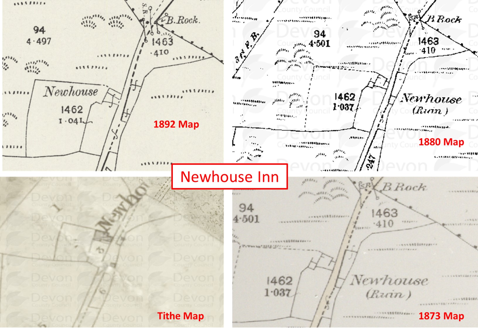
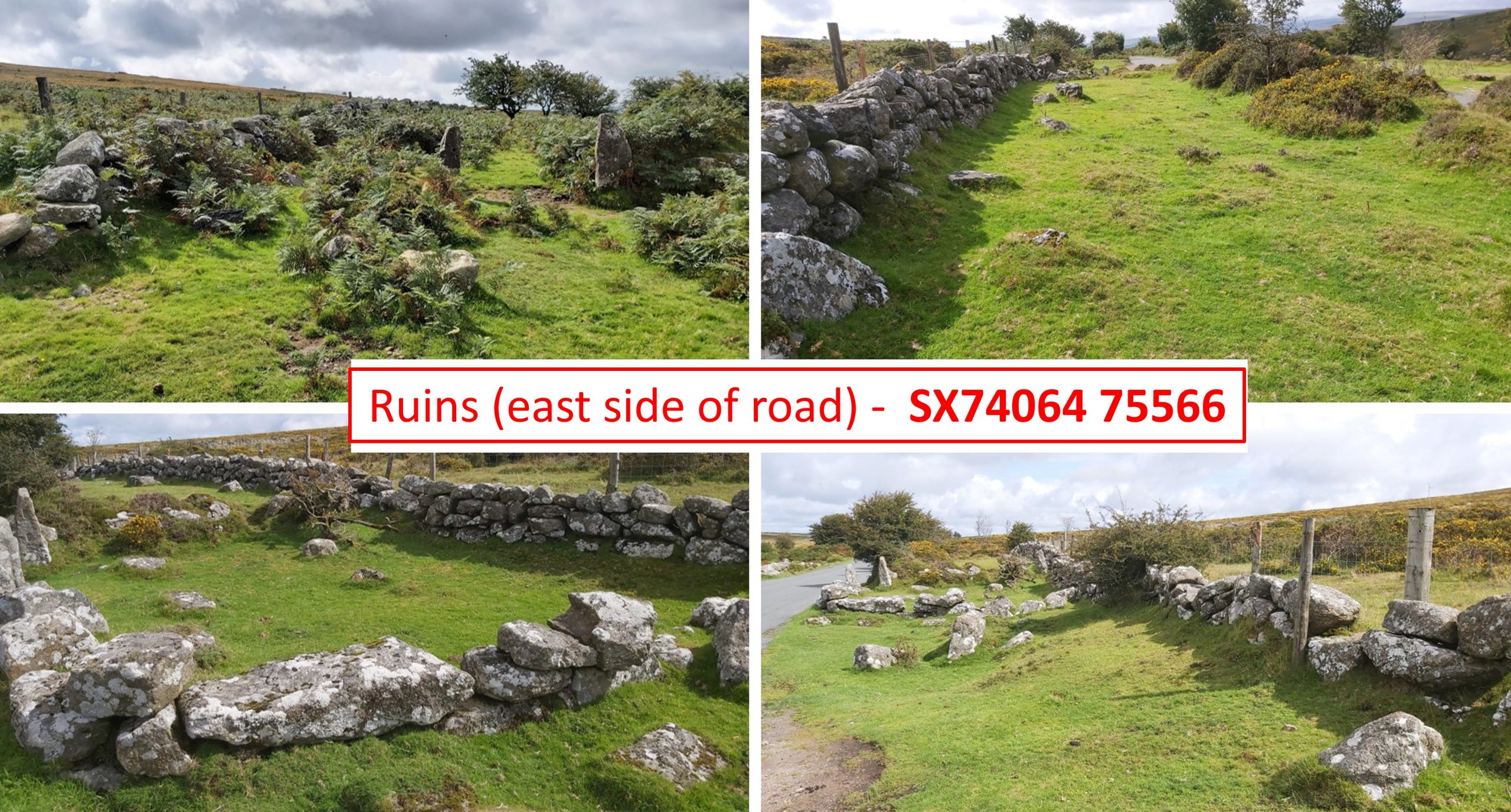
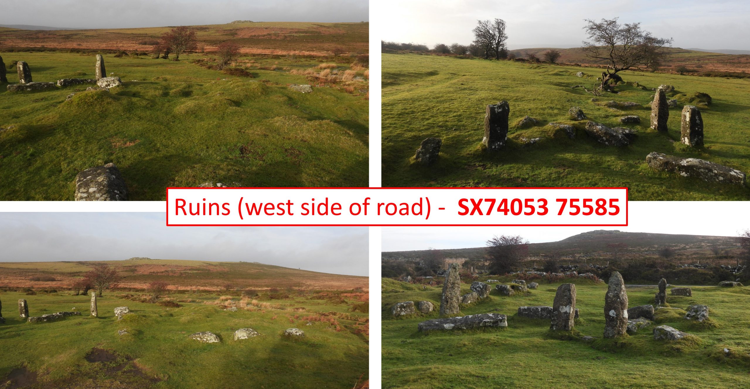
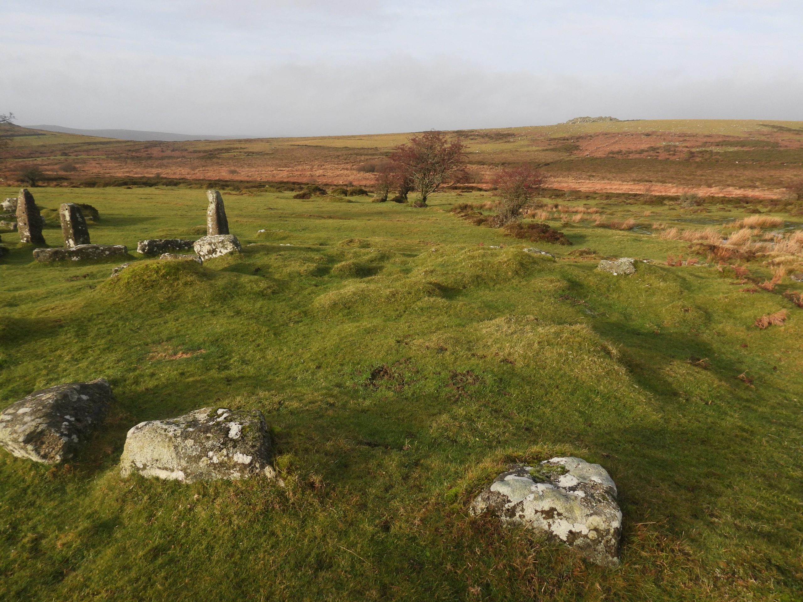
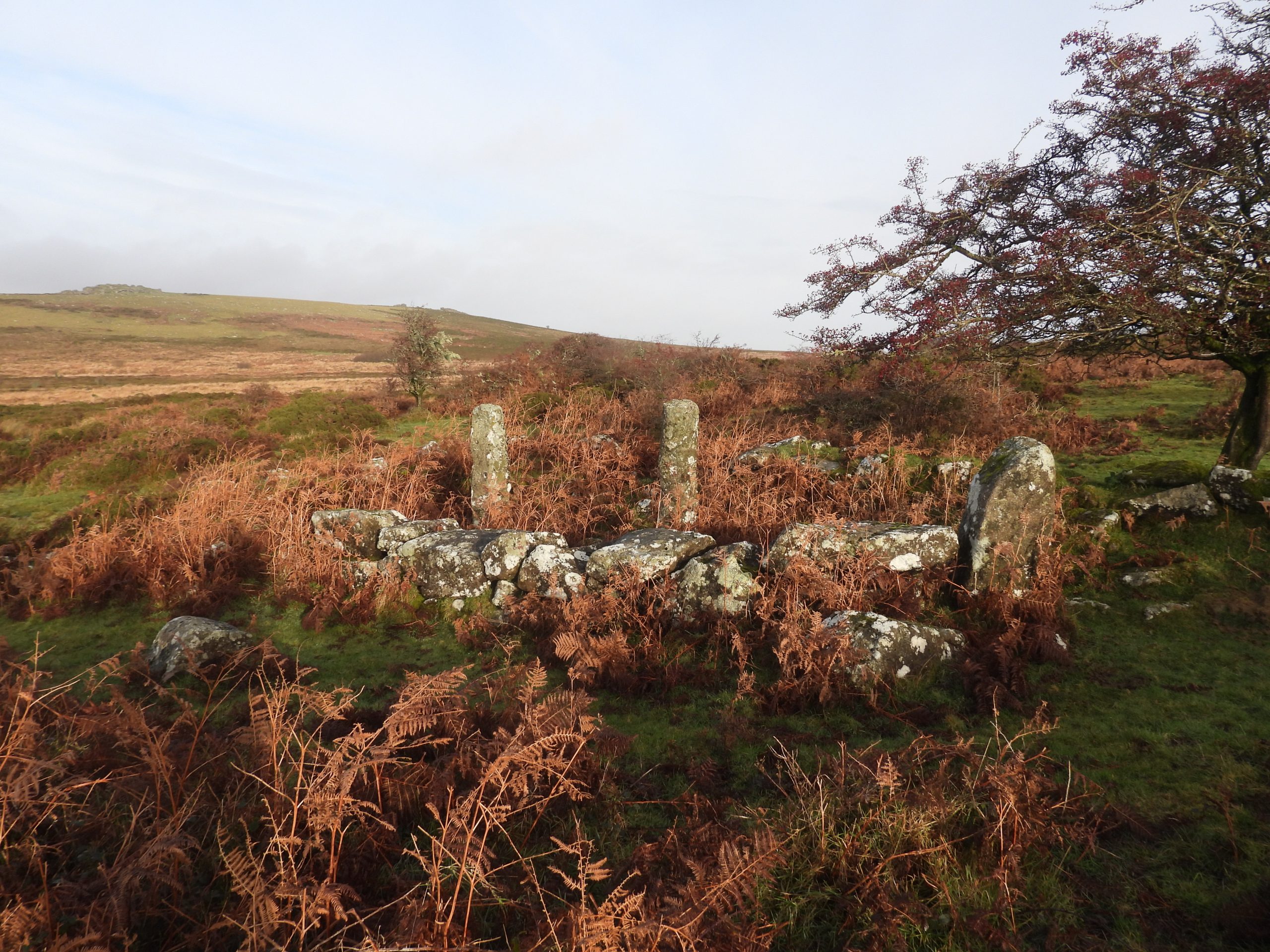
The location of the Newhouse Inn where Foale was the landlord isn’t very obvious when looking at late 19th century maps, where the labelling suggests it might have been located either on the east side of the road (1873 and 1880) or west side side of the road (1892). That said the Tithe Map (circa 1840) places the Inn on the west side of the Ashburton to Manaton / Widecombe road. The Tithe map location is at SX74053 75585.The ruins on the east side of the Ashburton – Widecombe / Manaton road where the 1873 and 1880 maps suppose Newhouse Inn may have once stoodThe ruins on the west side of the Ashburton – Widecombe / Manaton road where the 1892 and Tithe maps indicated Newhouse Inn may have once stood. There are faint earthwork foundations here together with a few upright granite posts which mark the locations of the buildings of Newhouse. They are set within a series of stone walled enclosures totalling 4.2 hectares. These ruins are almost certainly those of Newhouse Inn as the Tithe map indicates this side of the road as being the correct locationNewhouse Inn replaced an earlier inn known as Culver House having been built by the Woodley family. Landlords on the Inn include a Leaman who was host in the late 1700’s, as well as the Hannafords. The Foale family also ran the Inn, when the ‘Arrishes’ were being created. Foale’s Arrishes can be seen in the distance below Pil Tor. There is story which suggest the womenfolk of Widecombe had this burned down because the men spent too much time and money on their on their way back from market. It appears to have been abandoned and demolished in the 1840s.A short distance away from Newhouse are the ruins of a stone outbuilding. The foundations of a ruined granite outbuilding suggest a probable barn. It is built against the south-west side of an enclosure wall around 300 metres south-west of Newhouse. The granite posts used to support the roof.