A collection of walks, discoveries, insights and pictures of exploring Dartmoor National Park
April 11, 2021
ROOS TOR (PROTECTIVE BOUNDARY MARKINGS TO PREVENT ENCROACHMENT BY QUARRYMEN)
Steve Grigg and Frank Collinson
In the 19th Century, leases giving the right to cut granite on Western Dartmoor needed to be obtained from the Duchy of Cornwall. However, such was the demand for granite at the time, it resulted in damaging encroachments from the quarrymen on the tors themselves. The problem around Pew Tor, was addressed in 1847, when limits were set, within which it was forbidden to remove stone. It is probable that the limits were also set at this time around Roos Tor as well. All contractors to whom leases were made were obliged to conform to these limits. References: a) Nineteenth Century Granite Working on Pew Tor and Staple Tor Western Dartmoor Transactions of Devonshire Association 1981 by Helen Harris and b) Dartmoor Boundary Markers (1986, 1st edition and 2002, 2nd edition).
This post records the inscribed natural rocks and Duke of Bedford pillars, which in the 19th century defined the boundary of encroachment around Roos Tor. Also in this post are two parish boundary markers (one a pillar and one a natural boulder), described by Dave Brewer and close by, in the saddle between Roos Tor and Great Staple Tor, so worth a visit for the Dartmoor Explorer.
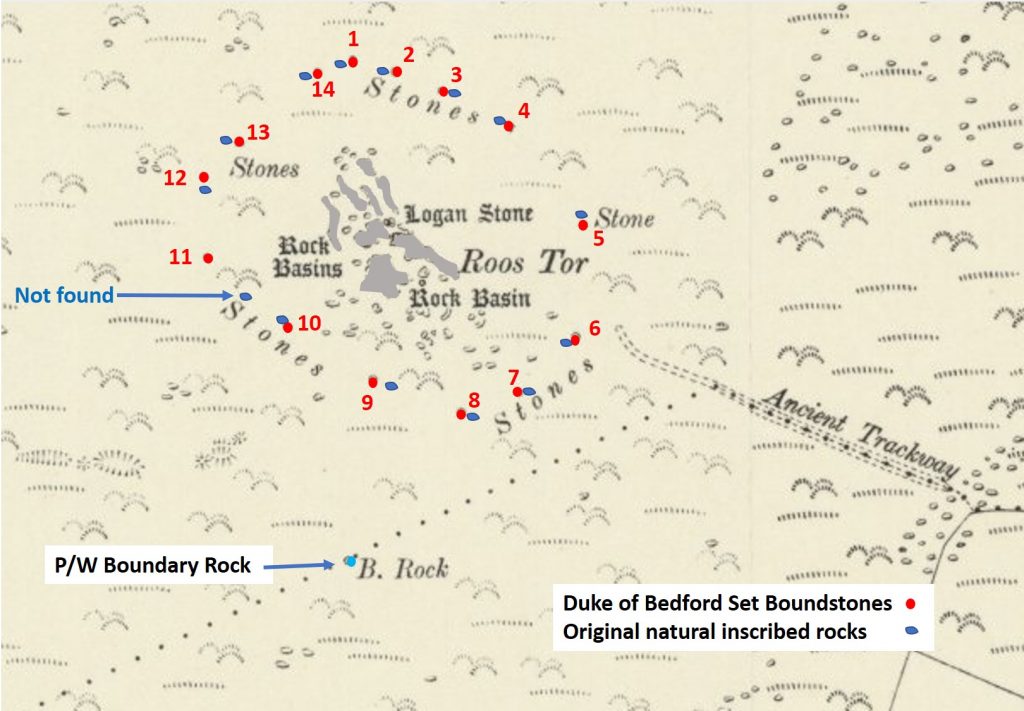
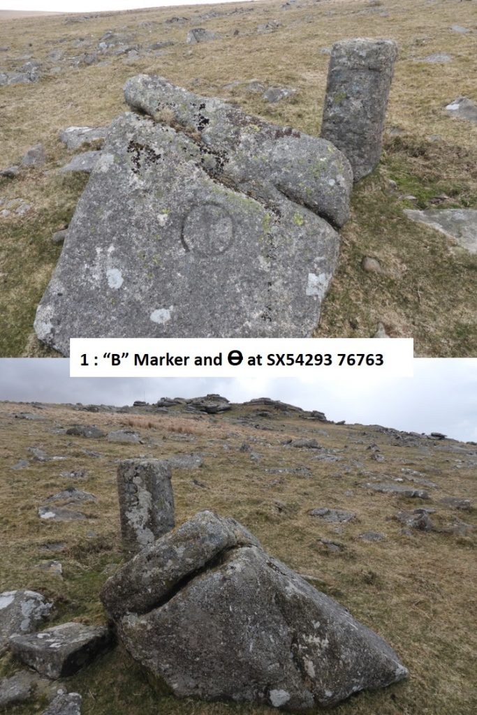
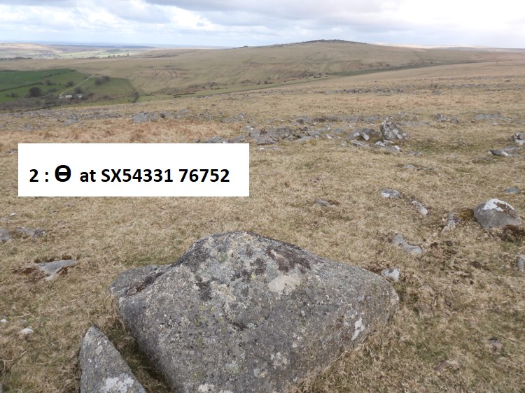
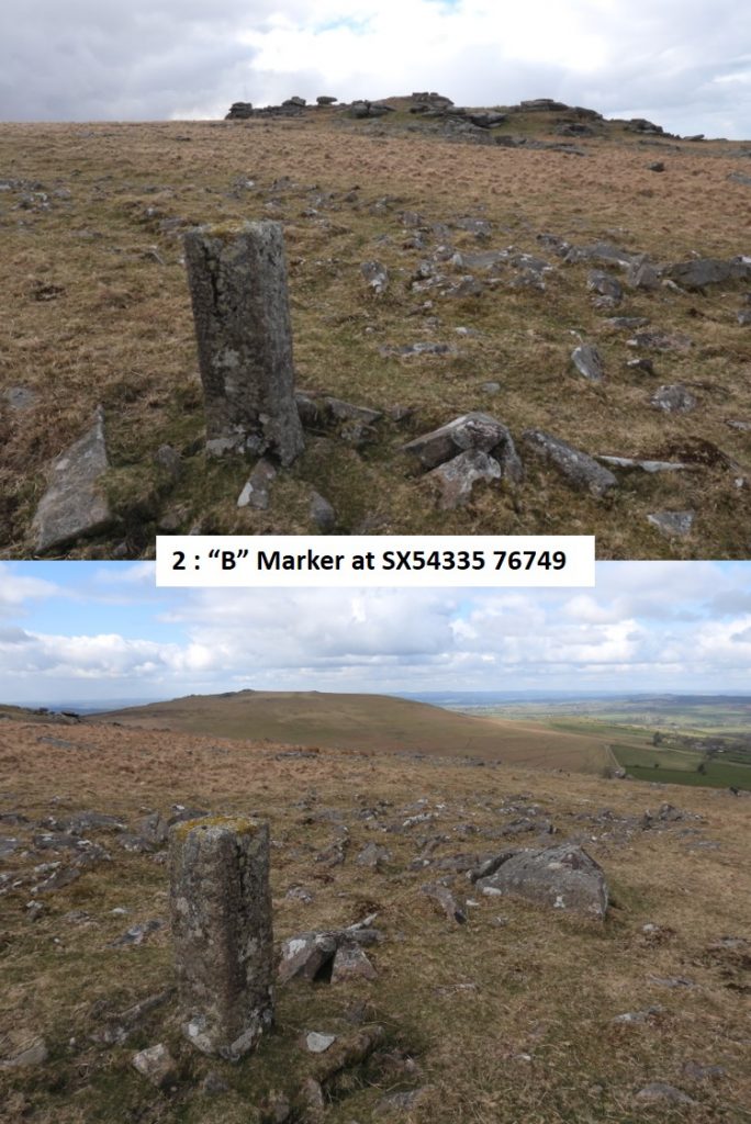
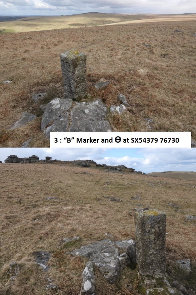
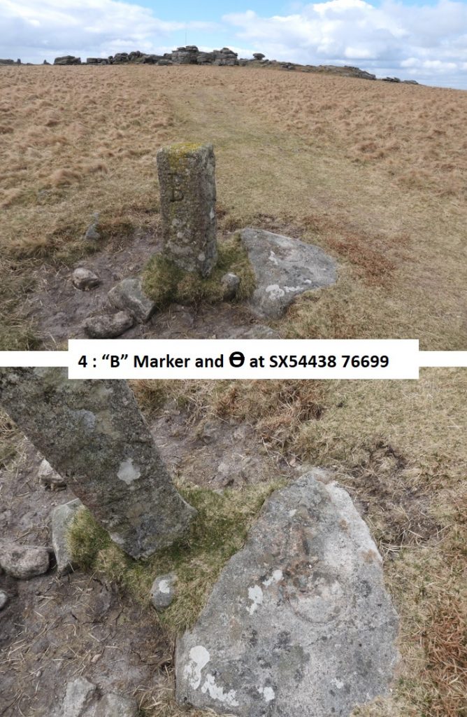
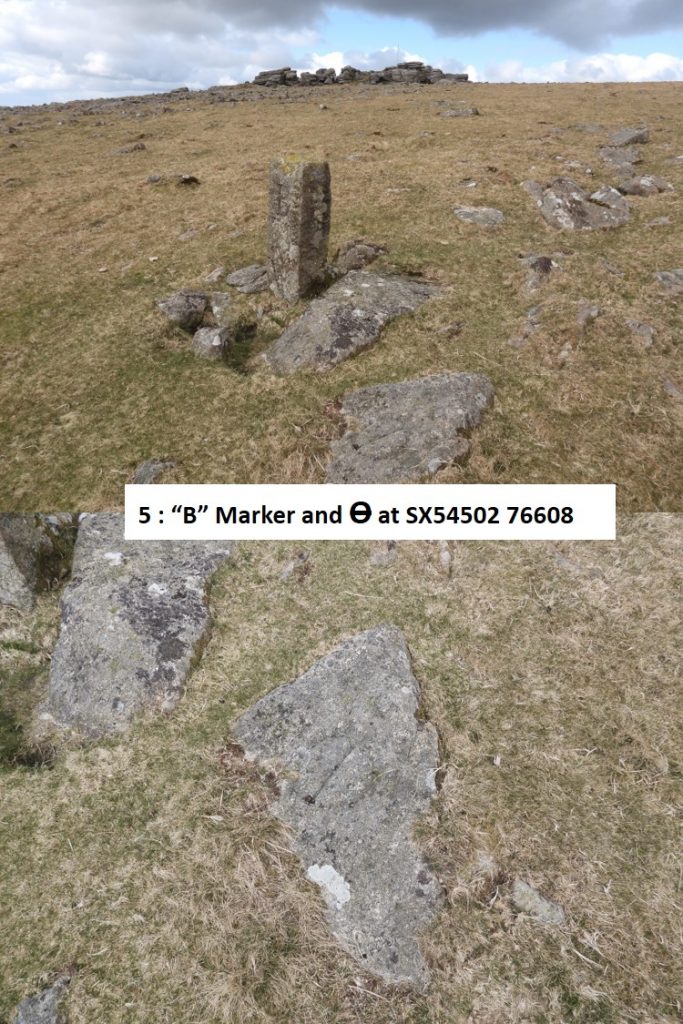
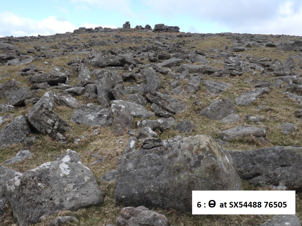
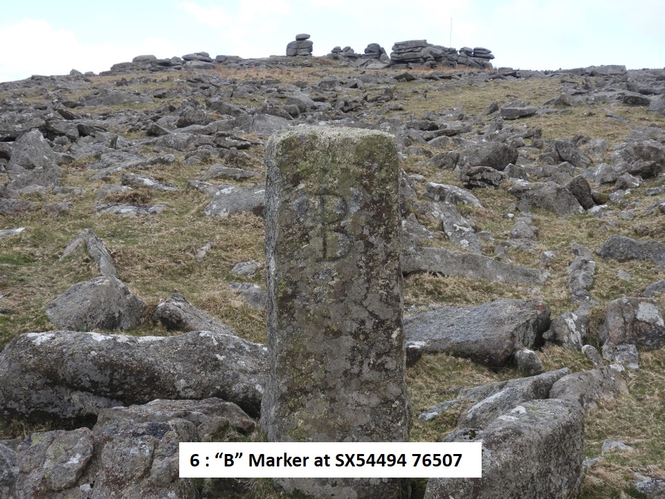
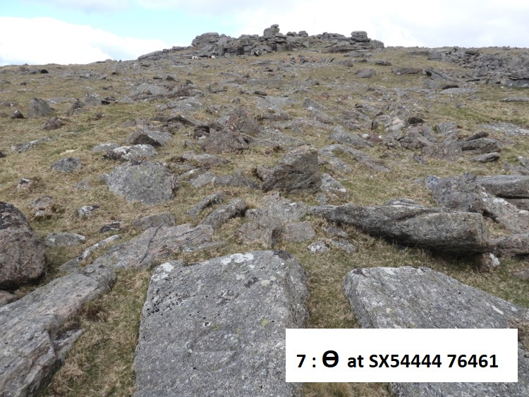
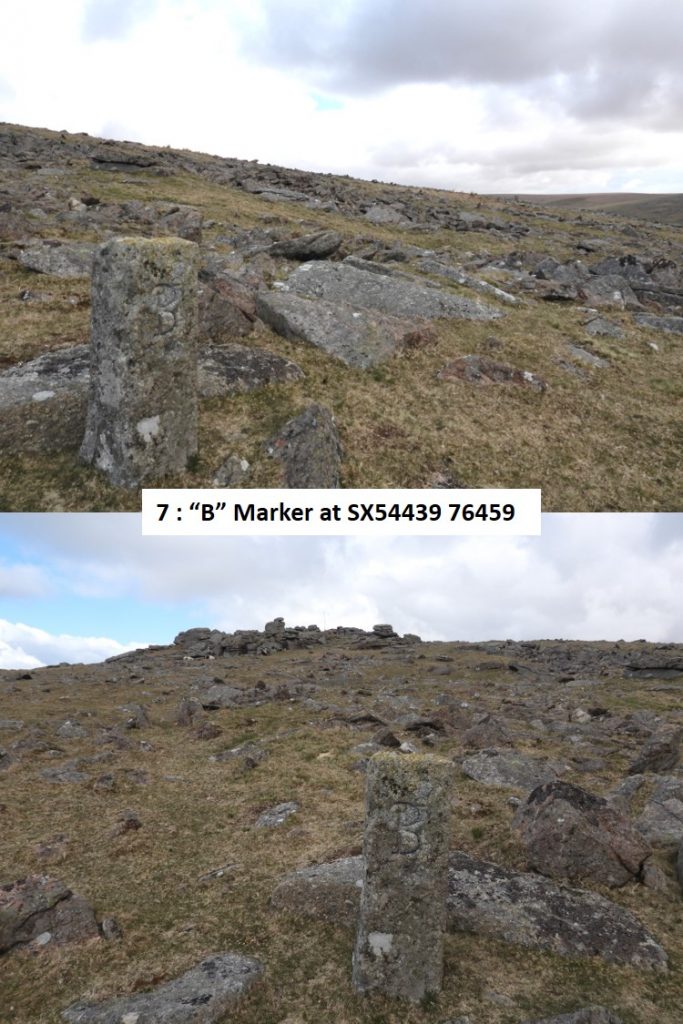
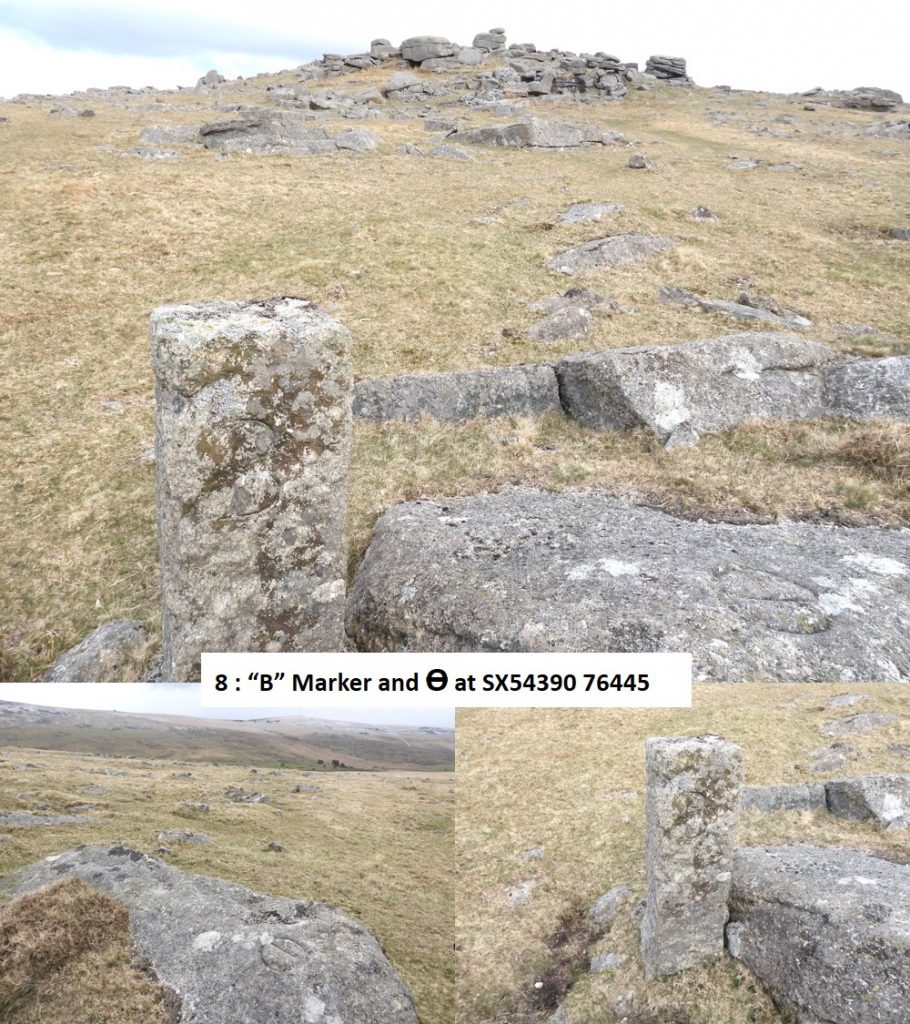
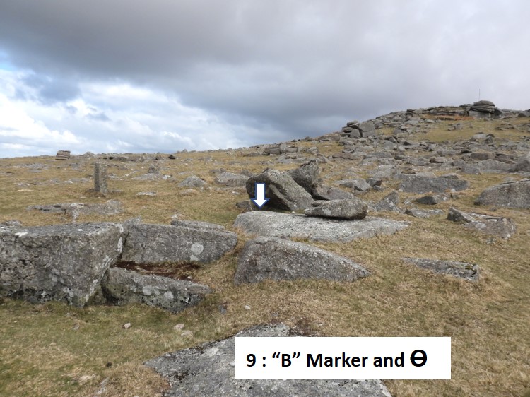
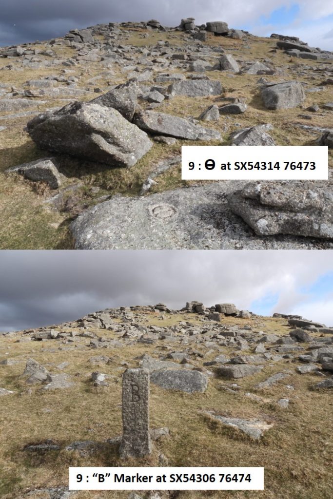
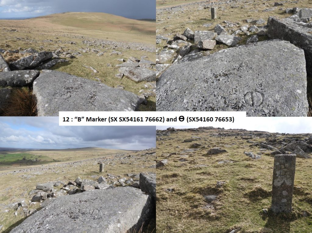
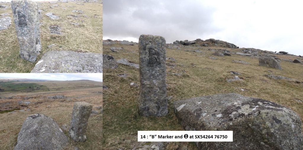
It is believed the cut (inscribed) marks, which are a circle about 6 inches in diameter with a line through them were cut into granite boulders around Roos Tor about 1847. There are thirteen boulders around the tor, each so inscribed. The Dave Brewer first edition of Dartmoor Boundary Markers states there are thirteen but the 2nd edition states there are fourteen. These original markings are not all that conspicuous, so Duke of Bedford had fourteen granite pillars some four or five feet high erected around the tor beside or close to each of these natural rock markers. The pillars bear the letter ‘B’ and date from about 1880. Roos Tor Protective Boundary Marking (1847) and Duke of Bedford Granite Pillar (1880) – No. 1Roos Tor Protective Boundary Marking (1847) – No. 2. The 7th Duke of Bedford (1788-1861), who was alive when the original markings were inscribed was also MP for Peterborough (1809 for three years) and then for Bedfordshire until 1832Roos Tor Protective Boundary Duke of Bedford Granite Pillar (1880) – No. 2. Roos Tor Protective Boundary Marking (1847) and Duke of Bedford Granite Pillar (1880) – No. 3Roos Tor Protective Boundary Marking (1847) and Duke of Bedford Granite Pillar (1880) – No. 4Roos Tor Protective Boundary Marking (1847) and Duke of Bedford Granite Pillar (1880) – No. 5Roos Tor Protective Boundary Marking (1847) – No. 6Roos Tor Protective Boundary Duke of Bedford Granite Pillar (1880) – No. 6. The 8th Duke of Bedford (1809-1872), was MP for Tavistock, 1832-1841.Roos Tor Protective Boundary Marking (1847) – No. 7Roos Tor Protective Boundary Duke of Bedford Granite Pillar (1880) – No. 7. The 9th Duke of Bedford (1819-1891), was MP for Bedfordshire and also owned Woburn Abbey, 1847-1872. It is probable that he instructed the pillars to be erected.Roos Tor Protective Boundary Marking (1847) and Duke of Bedford Granite Pillar (1880) – No. 8Roos Tor Protective Boundary Marking (1847) and Duke of Bedford Granite Pillar (1880) – No. 9Roos Tor Protective Boundary Marking (1847) and Duke of Bedford Granite Pillar (1880) – No. 9Roos Tor Protective Boundary Marking (1847) and Duke of Bedford Granite Pillar (1880) – No. 10Roos Tor Protective Boundary Duke of Bedford Granite Pillar (1880) – No. 11.
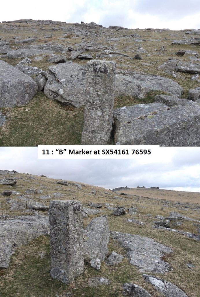
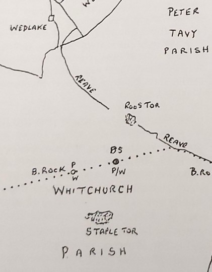
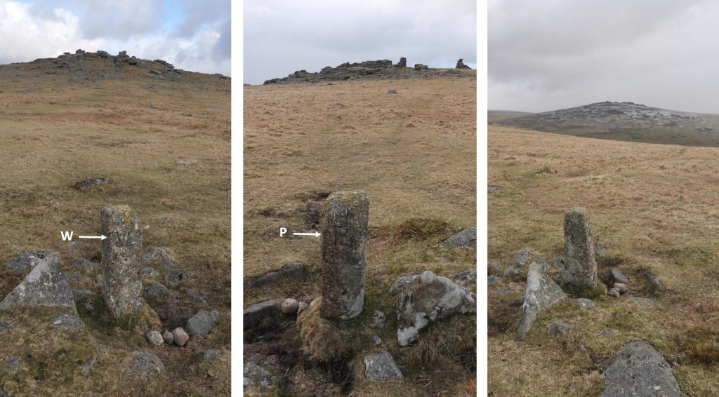
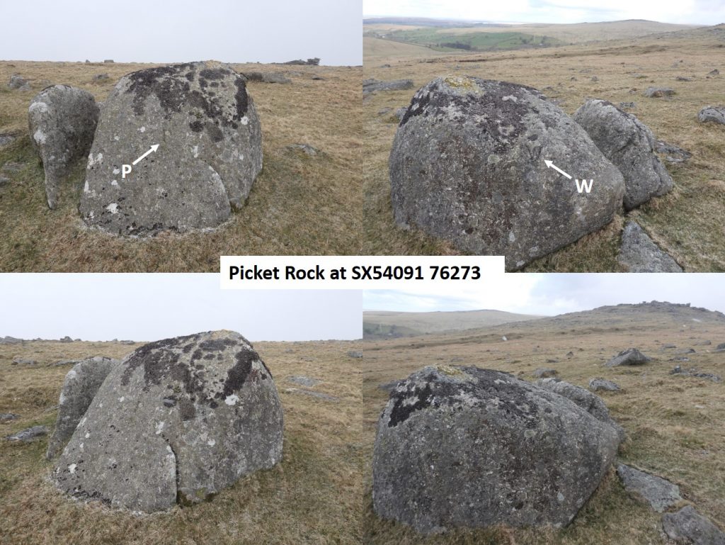
Does the possible 1847 (circle with line through it) inscribed boulder actually exist? If one looks at the map, the distance between the 10th and 12th “B” pillars and associated inscribed rocks are quite substantial – is it possible that this pillar (no.11) just filled the gap as there was previously no inscribed boulder ? An exhaustive search for the elusive inscribed stone proved fruitless. That said, there is rather a substantial boulder in the vicinity which is partially covered on it’s upper surface with earth and grass – is it possible the inscription is underneath this ?Roos Tor Protective Boundary Marking (1847) and Duke of Bedford Granite Pillar (1880) – No. 12Roos Tor Protective Boundary Marking (1847) and Duke of Bedford Granite Pillar (1880) – No. 13Roos Tor Protective Boundary Marking (1847) and Duke of Bedford Granite Pillar (1880) – No. 14Taken from the Dave Brewer Dartmoor Boundary Markers 2nd Edition. There are two boundary markers which help delineate Whitchurch from Peter Tavy parish, which are worth closer inspection to complement the exploration of the protective boundary markings around Roos Tor. They are located on the saddle between Roos Tor and Great Staple Tor.The first of the two boundary markers on the saddle between Roos Tor and Great Staple Tor is inscribed with a “W” (for Whitchurch) and a “P” (for Peter Tavy). This boundary marker was the subject of a violent dispute recorded by William Crossing between the men of Whitchurch and those of Peter Tavy regarding the stone’s precise location. (Source: Dartmoor Atlas of Antiquities, Volume Two, The North by Jeremy Butler)The second of the two boundary markers on the saddle between Roos Tor and Great Staple Tor is a natural earth bound boulder. It too is inscribed with a “W” and a “P”. It is also known as either “Picket” or “Picke” Rock. Dave Brewer in the second edition Dartmoor Boundary Markers describes the rock thus: “It (the Parish Boundary) then turns more east-north-east to Picke Rock another natural boundary rock similarly inscribed and passes between Great Staple and Roos Tors.“

Sandra Leonard February 23, 2026
Very interesting and informative.
SteveGriggDartmoor February 23, 2026 — Post author
Thank you