A collection of walks, discoveries, insights and pictures of exploring Dartmoor National Park
October 1, 2020
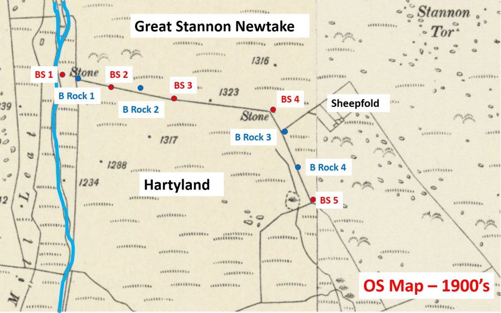
HARTYLAND NEWTAKE
Steve Grigg and Frank Collinson
Hartyland was first recorded as an ancient tenement in 1521. By 1750 it was also permitted to be enclosed as a “newtake”. It was only supposed to enclose 8 acres, this was allowed to exclude bog and rock, but this privilege was much abused. This information is referenced from “Dartmoor Boundary markers”, 2nd edition by Dave Brewer.
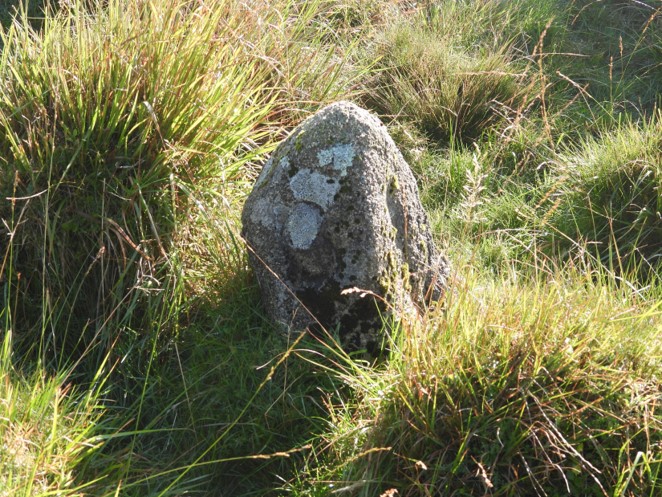
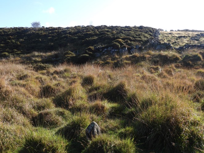
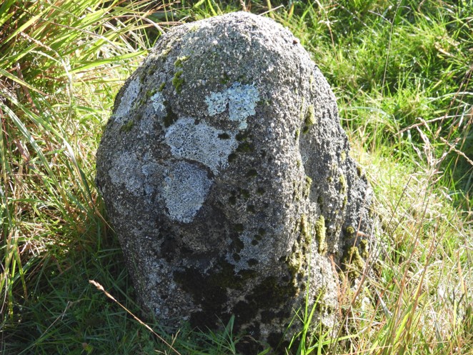
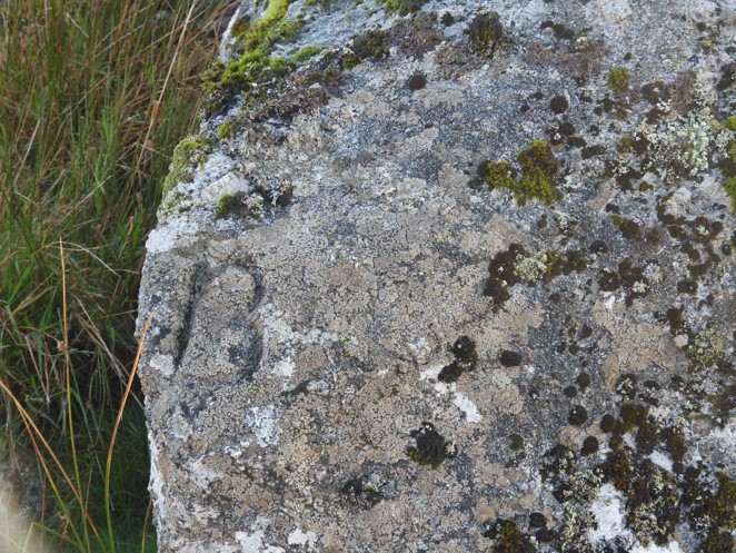
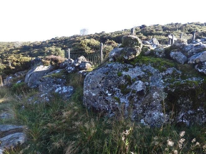
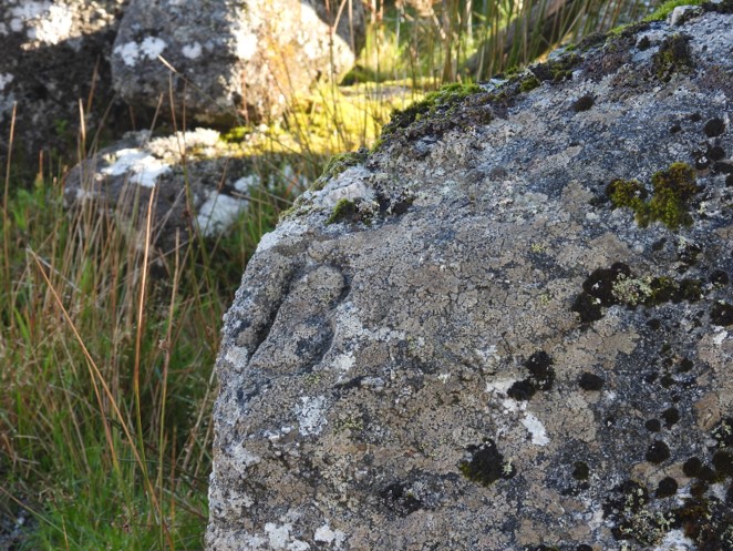
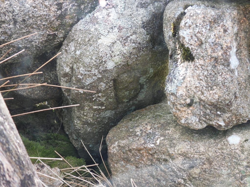
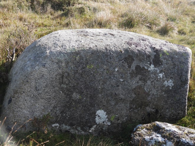
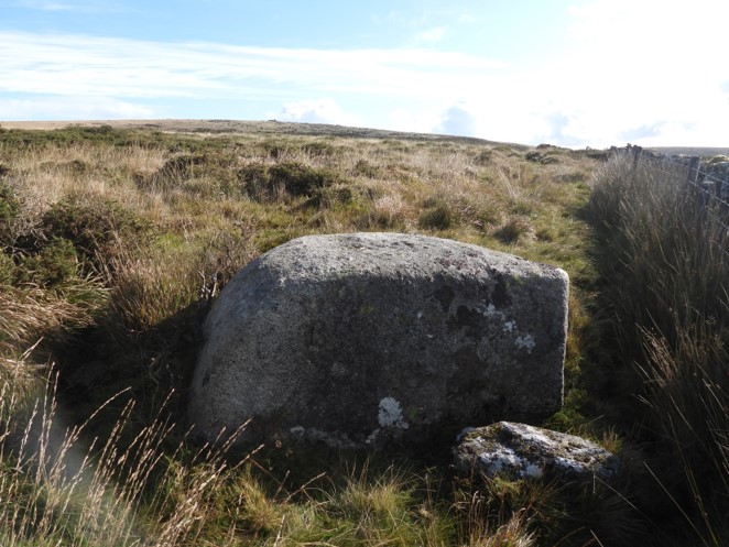
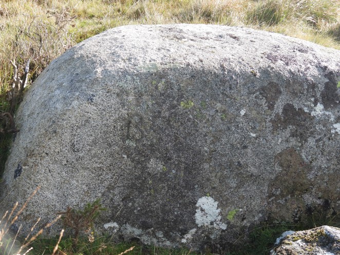
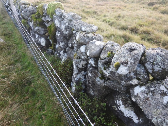
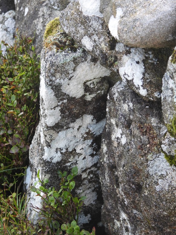
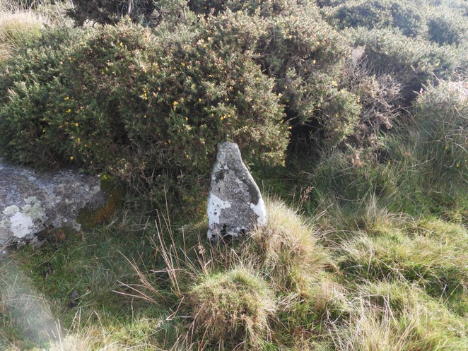
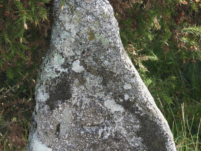
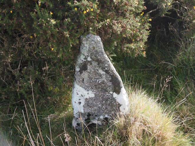
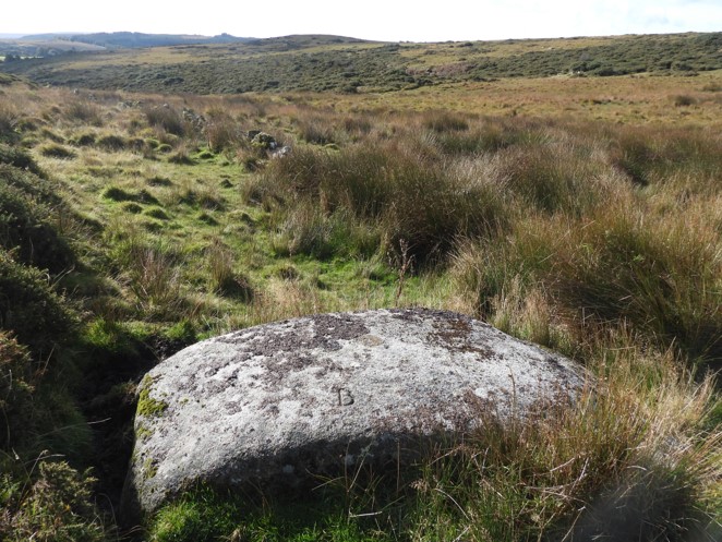
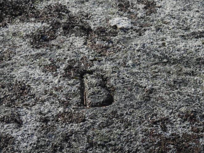
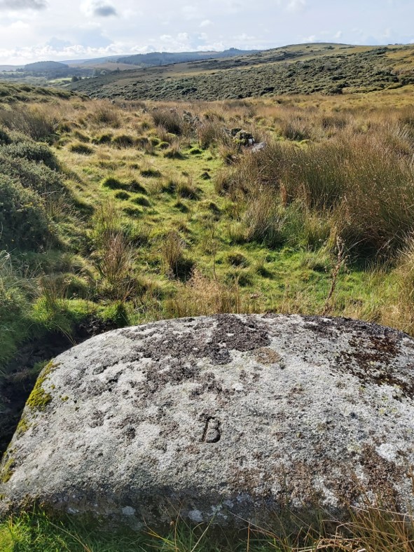
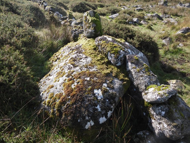
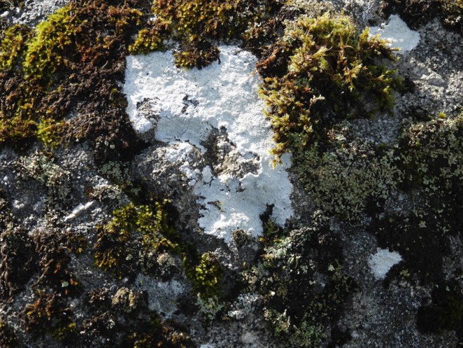
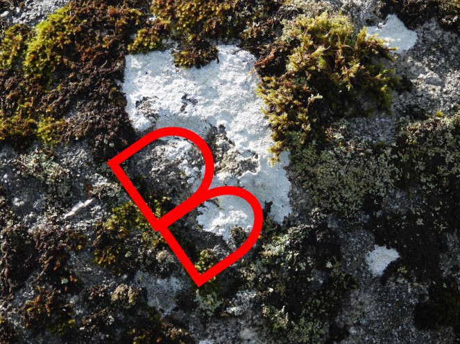
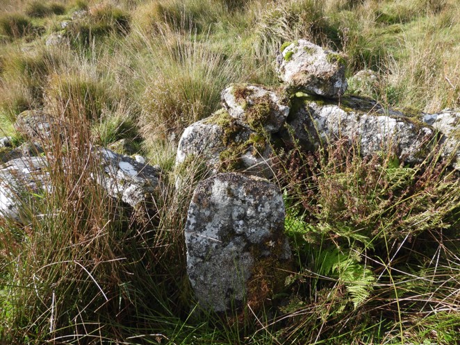
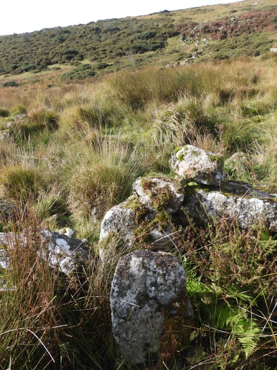
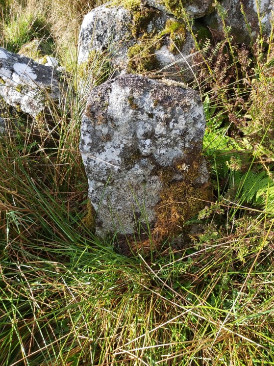
The Hartyland “newtake” boundary of 1750 has 9 known boundary stones (5) or boundary rocks (4) on it’s north and eastern sides. This is set between the East Dart river and the “Sheepfold”. All the boundary markers are inscribed with a “B”, presumably meaning boundary. There are two of the “stones” which appear on the 1890 and 1906, OS 6” maps (stone 1 and 4 on the map above).Hartyland Newtake Boundary Stone No.1 at SX 63932 80972Dave Brewer description: “Inscribed “B” on west facing side, 10 yds from the river, 1’ in height in long grass, on OS 6” maps”Hartyland Newtake Boundary Stone No.1, close upHartyland Newtake Boundary Rock No.1 at SX 63958 80962Dave Brewer Description: “Inscribed “B” on west facing side, rock forms corner of wall.”Hartyland Newtake Boundary Rock No.1, close upHartyland Newtake Boundary Stone No.2 at SX 64017 80947Hartyland Newtake Boundary Rock No.2 at SX 64069 80940Dave Brewer Description: “Inscribed “B” on its west facing side, outside (north) of wall, approx. 6’ long”Hartyland Newtake Boundary Rock No.2, close up. Hartyland Newtake Boundary Stone No.3 at SX 64117 80921Hartyland Newtake Boundary Stone No.3, close up.Dave Brewer Description: “ Inscribed “B” on west facing side, set partially in wall, 2’ 6” in height”Hartyland Newtake Boundary Stone No.4 at SX 64336 80891Hartyland Newtake Boundary Stone No.4, close upDave Brewer description : “Inscribed “B” on west facing side, outside newtake wall, approx. 2’ 6” in height, on OS 6” maps”Hartyland Newtake Boundary Rock No.3 at SX 64358 80842Hartyland Newtake Boundary Rock No.3, close upDave Brewer Description: “Inscribed “B” on west facing side, just within the Sheepfold enclosure, i.e.outside the Hartyland wall”Hartyland Newtake Boundary Rock No.4 at SX 64378 80760Dave Brewer Description: “Inscribed “B” on north facing side, built into wall”Emphasising the “B”Hartyland Newtake Boundary Stone No.5 at SX 64400 80722Dave Brewer Description: “Inscribed “B” on east facing side, approx. 2’ 6” in height”Hartyland Newtake Boundary Stone No.5, close up