A collection of walks, discoveries, insights and pictures of exploring Dartmoor National Park
September 28, 2020
CROWNLEY PARKS (BAGTOR MINE)
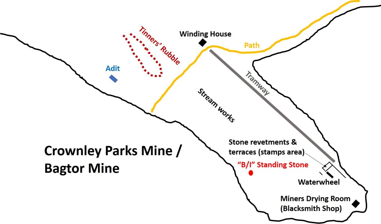
This post shows some of the features that can be found on the public access land in an area known as Crownley Parks amongst the workings of Bagtor Mine / Haytor Consols. There were underground works recorded at Crownley Parks and an adit shown in this post shows one driven into the floor of the disused streamwork. In 1851 the mine was worked as Haytor Consols and mine is known to have produced some tin and a small amount of copper. The whole mine was closed in 1856, then reopened in 1862 as the Bagtor Mining Company. Work finally ceased in 1866. (Source Dartmoor HER – SDV346395 – Dr Phil Newman).
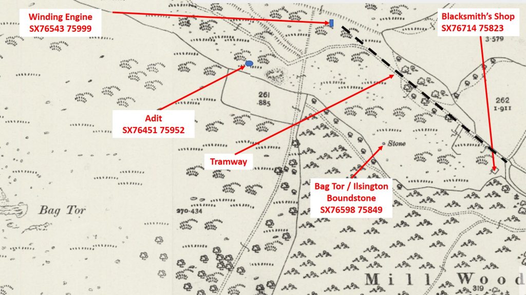
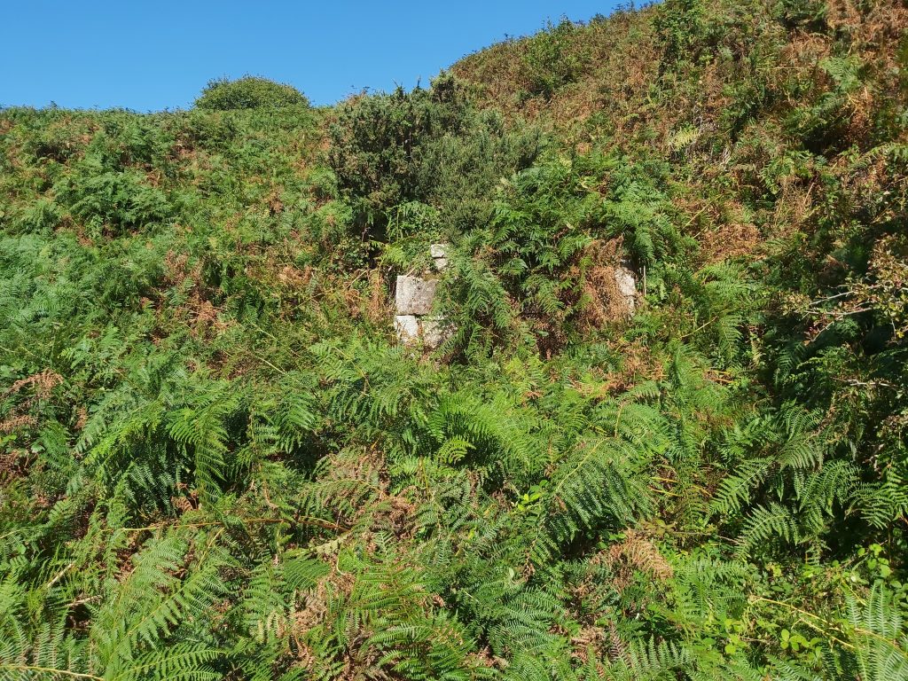
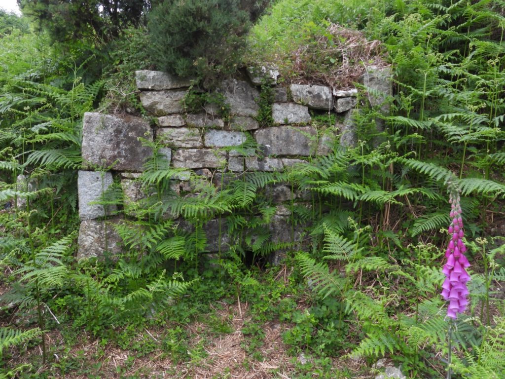
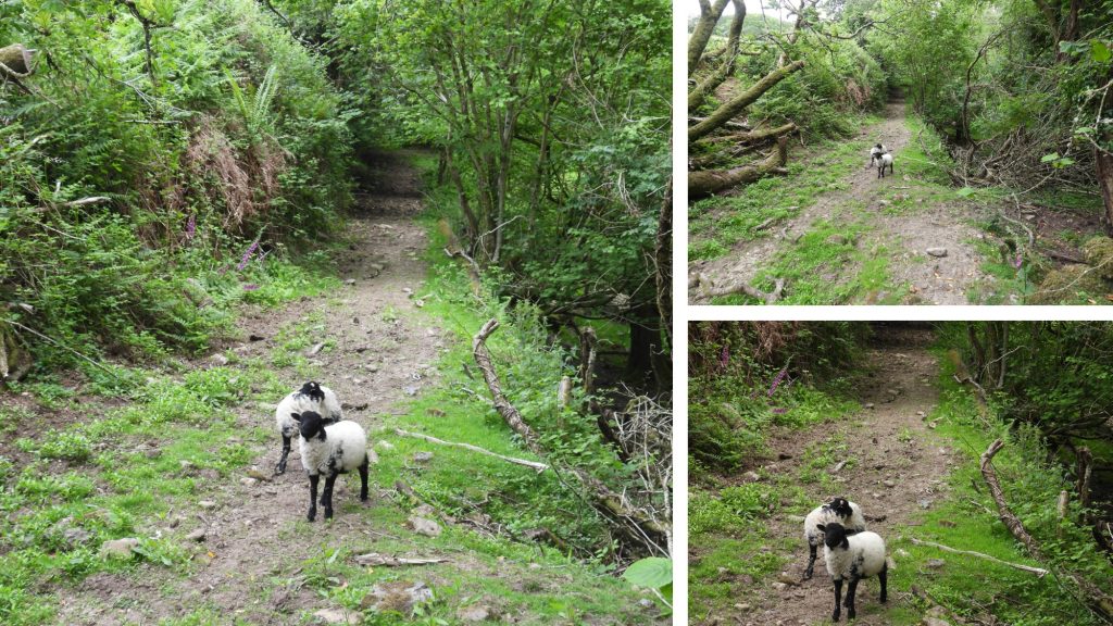
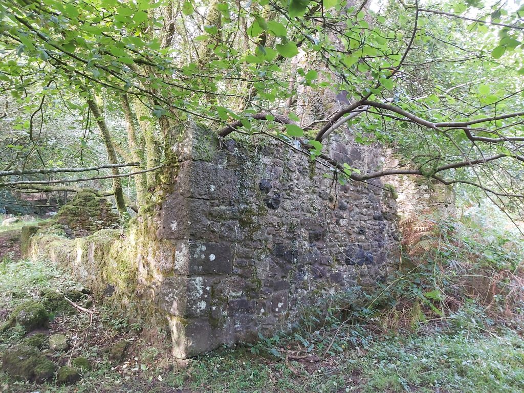
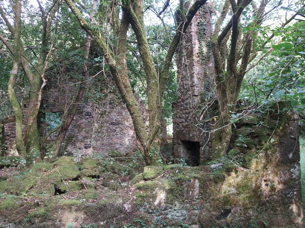
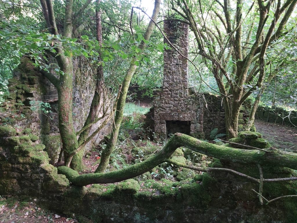
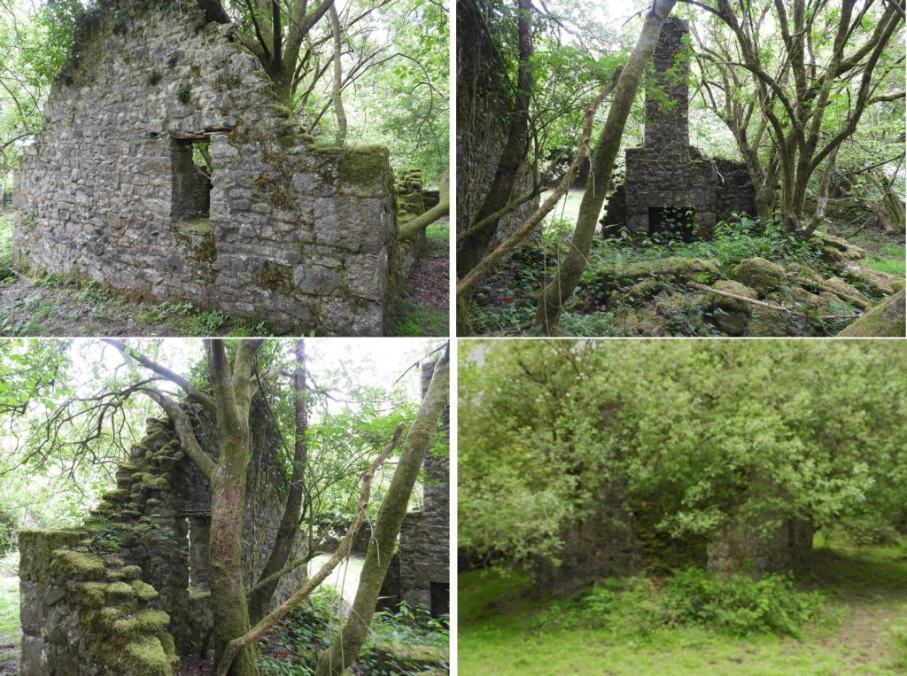
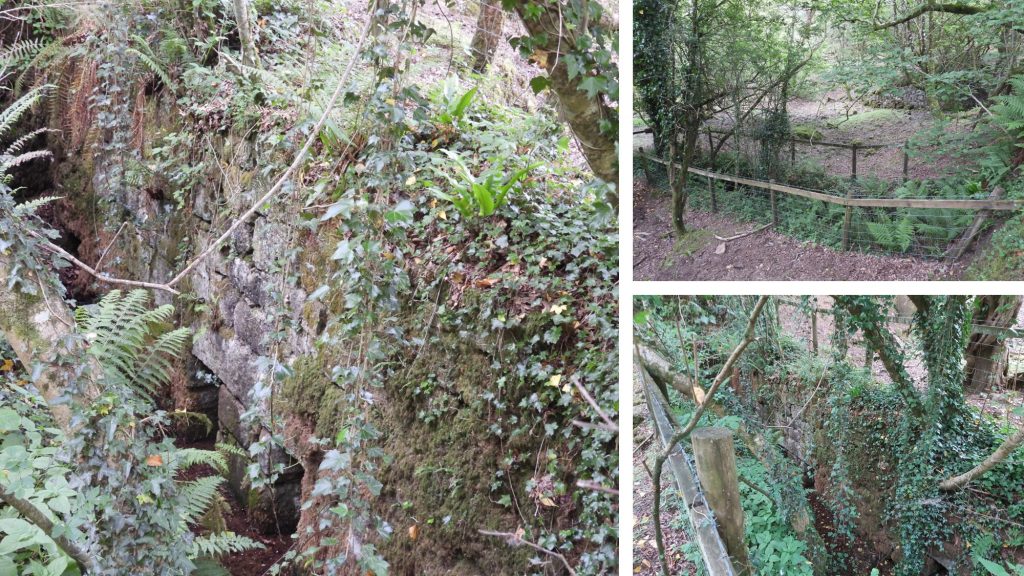
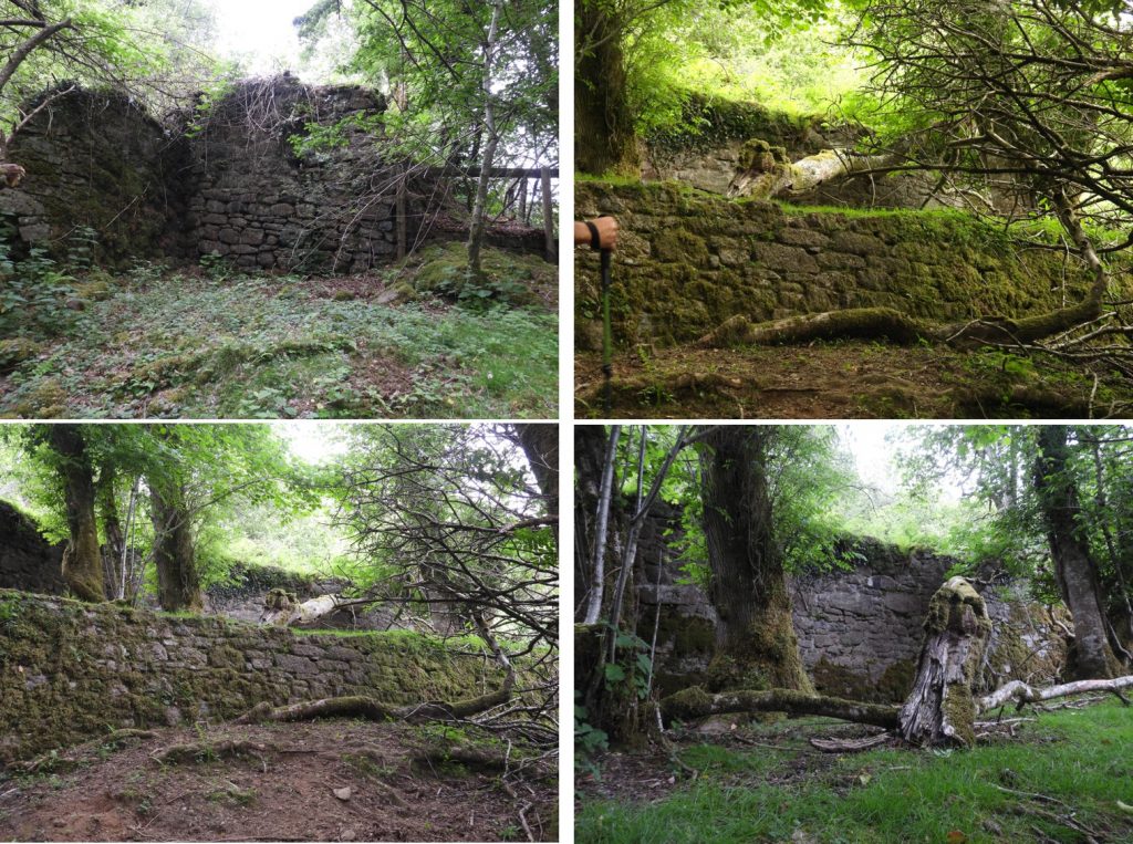
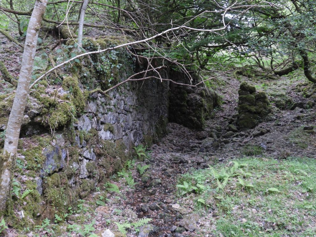
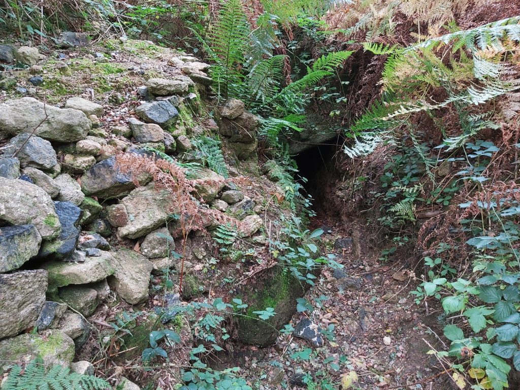
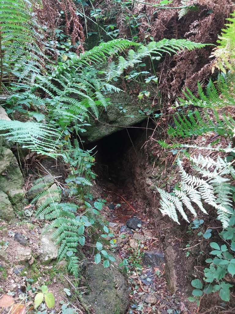
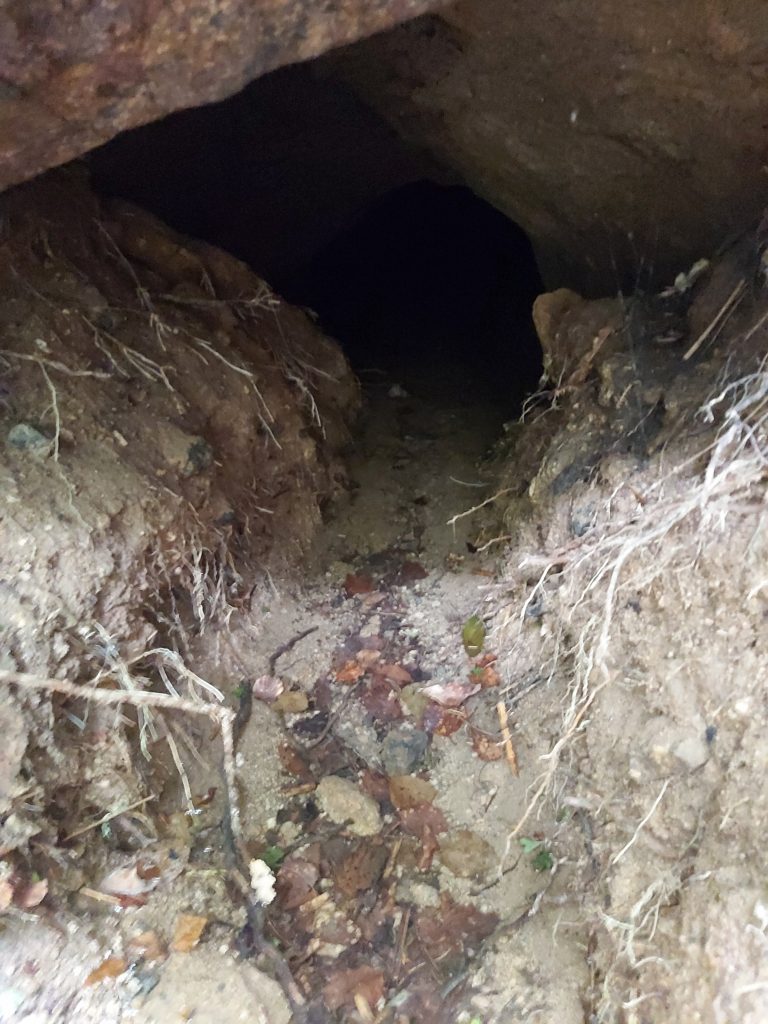
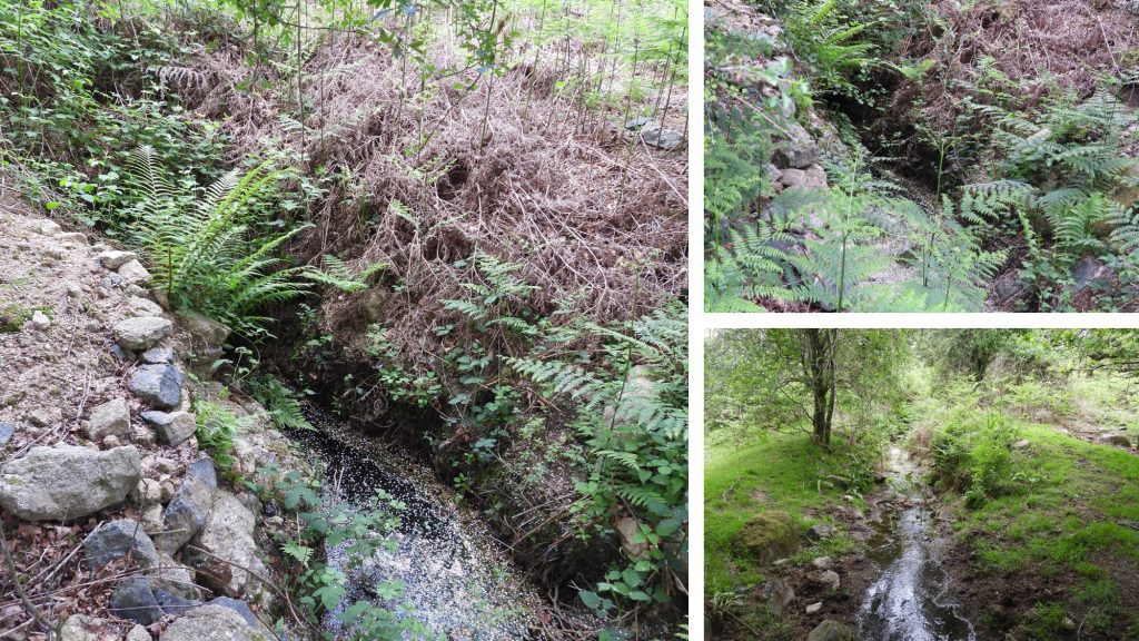
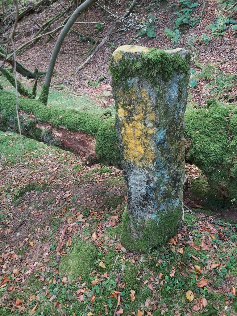
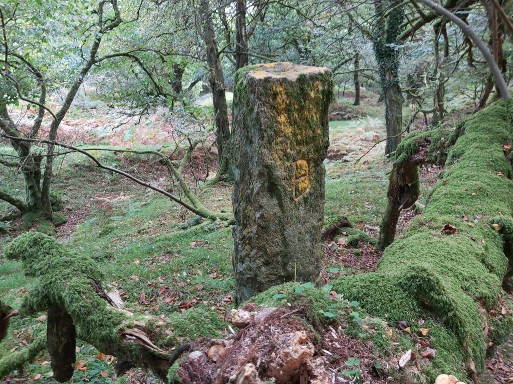
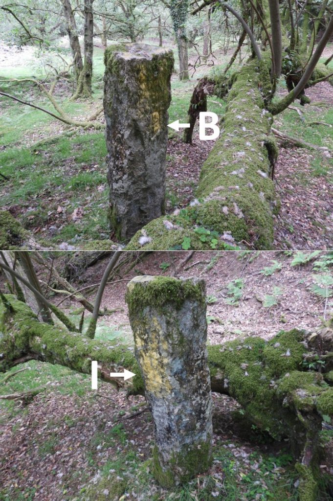
This map shows items covered in this post. Note that Mill Wood and the access from Bag Tor Mill from the south is not possible as these are on private land.Sketch plan of the public access area of Crownley Parks Mine / Bagtor MineAt the top of a steep, stony track bed running north-east to a small stone structure (picture) which is believed to be the winding house for the incline.Winding house for the incline. This small, stone structure, at the north-western end of a tramway was part of the mechanism that transported ore to the dressing floors. This can be found at SX76543 75999.Two young lambs on the tramway. As described in the Dartmoor HER, “the tramway extends to the workings in the Sig valley and beyond to the Hemsworthy part of the sett. The stony trackbed in Crownley Parks is well-preserved, beginning as a steep, revetted incline.”Building at SX76714 75823. Dartmoor HER (SDV346395) by Dr Phil Newman states this is a “Well -preserved ruined building with a chimney to full height is traditionally known as the ‘Blacksmith’s Shop’ though its function may not be determined on current visible evidence.”Dartmoor HER (SDV359684) by C.Everett states this is a “Small square building facing north east with doorway in north east corner. Two fireplaces, one on north east wall, one on south west wall. Possible drying room for mineworkers. Small window in north west gable end. North west and north east walls are best preserved. South east wall stands to 0.5 meters and south west wall to 0.6 meters south of fireplace and chimney. Both the places well preserved with hearths in situ.”Dartmoor HER (SDV344873) by D. Griffiths states this is a “Square, granite rubble building which may have been a miners drying room. Small, single storey structure measuring 6 by 6 meters internally, with one door and two fireplaces with stacks. Likely to date to the later part of the 19th century, as the mine opened in 1851. A large ash has fallen and demolished the south western wall of the structure.”Collage of the Blacksmith Shop / Miners Dry at SX76714 75823.The mine reopened in 1862 as the Bagtor Mining Company when further adits were driven and a new 60 foot waterwheel erected to drive the stamps. The author believes the picture collage is the location of the 60 foot waterwheel. It can be located at SX76681 75858.Next to the stamps wheelpit are the remains of stone revetments and terraces which make up the stamping area of two level stances. These can be located at SX76681 75872.This walling is beside a “gap”, which looks like the location of an old water course. In the Dartmoor HER it describes originally that a 30 foot wheel drove 32 heads of stamps before a second wheel was added (the 60 foot wheel). Is this the site of the original wheel (or part thereof)? This can be located at SX76676 75848.The tramway from the winding engine levels out and runs south-west across the streamwork, heading towards Bagtor Mine Cottages in the next valley. This adit is just north of the level portion of the track at SX76451 75952.Close up of the adit.Close up of the adit entranceThe same adit as above but this time after rain with quite a water discharge.This is the most southern of the known Bagtor / Ilsington boundstones that mark that manoral boundary. It was erected in 1835 and is sited near overgrown tinners waste, near the head of the stroll, giving access to the commons from Bagtor and Bagtor Mill. The picture shows the side of the boundstone inscribed with an “I”. It is sited at SX76598 75849This boundstone is on the Western boundary of Ilsington Manor and the Eastern boundary of Bag Tor Manor. It was recorded on old OS maps (but not the modern one). This side of the boundstone is inscribed with a “B”.“B” and “I” inscribed boundstone marking the Western boundary of Ilsington Manor and the Eastern boundary of Bag Tor Manor.