A collection of walks, discoveries, insights and pictures of exploring Dartmoor National Park
February 16, 2022
Golden Dagger Mine and Miners
Golden Dagger Mine is situated about 800m in a southerly direction from the Birch Tor and Vitifer Mine down the Redwater Valley. The first workings would have been of medieval origin. It is recorded that structures such as a cottage (at Dinah’s location) and a stamping mill were known to have been in the area from the early nineteenth century. That said, the first mention of the mine, with its unusual name, didn’t come until the mid-nineteenth century. From 1880 to 1913, it is known that men were almost continuously employed at the mine. The underground working ceased in August 1914, but after the First World War and into the 1920s ‘surface’ work carried on which exploited the waste heaps left by earlier generations. The workings at the mine finally came to an end in November 1930 owing to the low price of tin. There were some very small quantities of tin extracted in the 1930s but nothing of significance. This post and information contained herein has made reference to two superb books, namely: “Tin Mines and Miners of Dartmoor” by Dr Tom Greeves and “Mines of Dartmoor and the Tamar Valley” by P.H.G.Richardson. To add to the post, the author has added a few letterboxing stamps, which his father created in the 1990s.
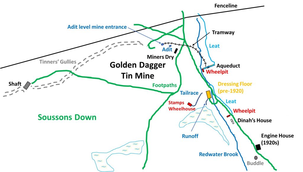
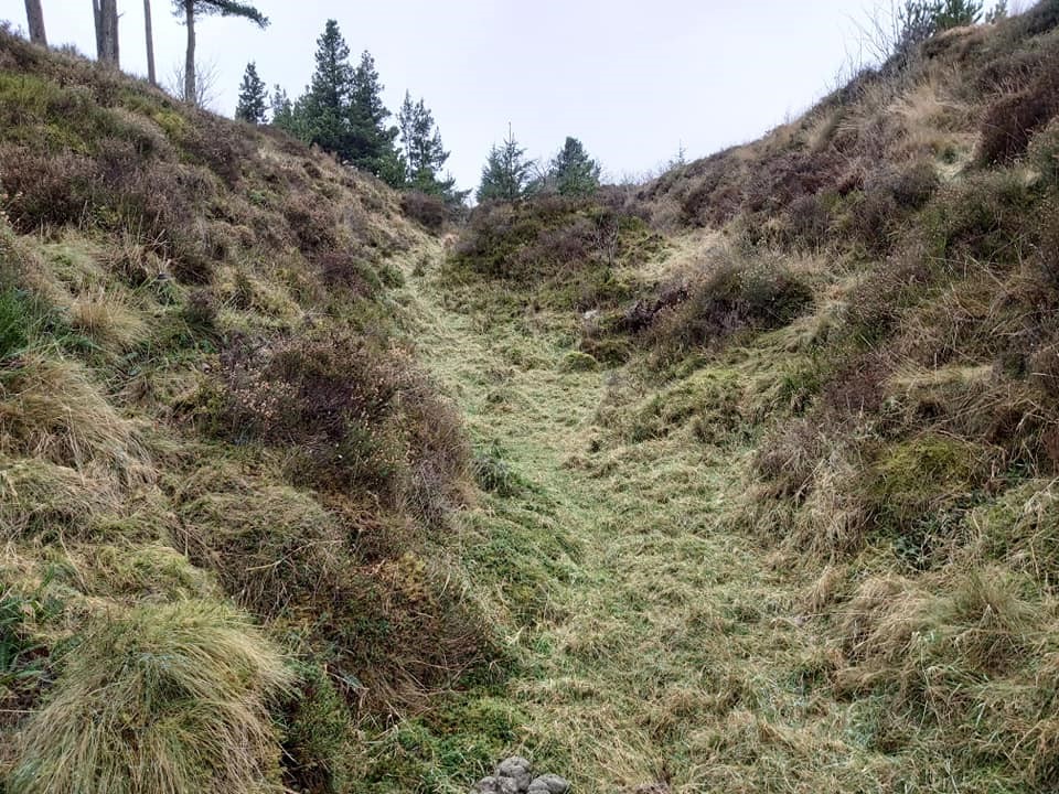
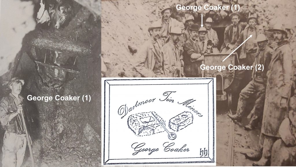
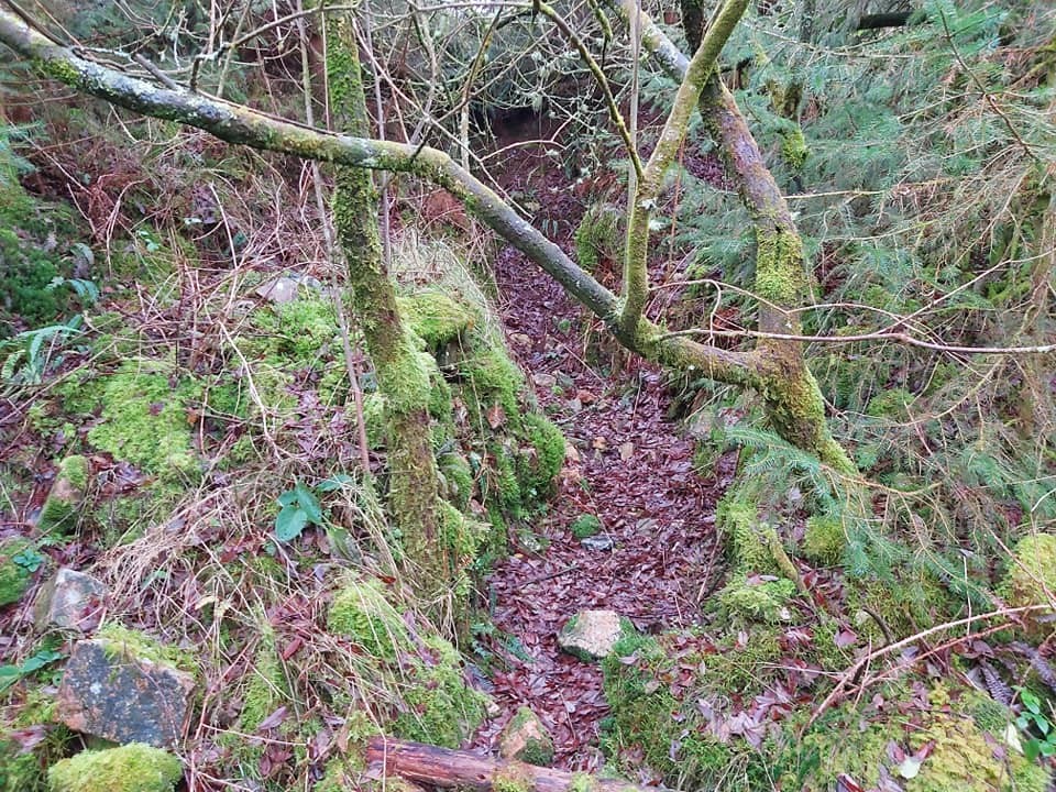
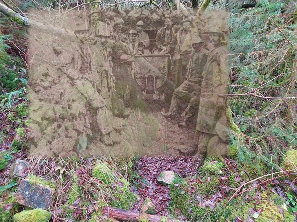
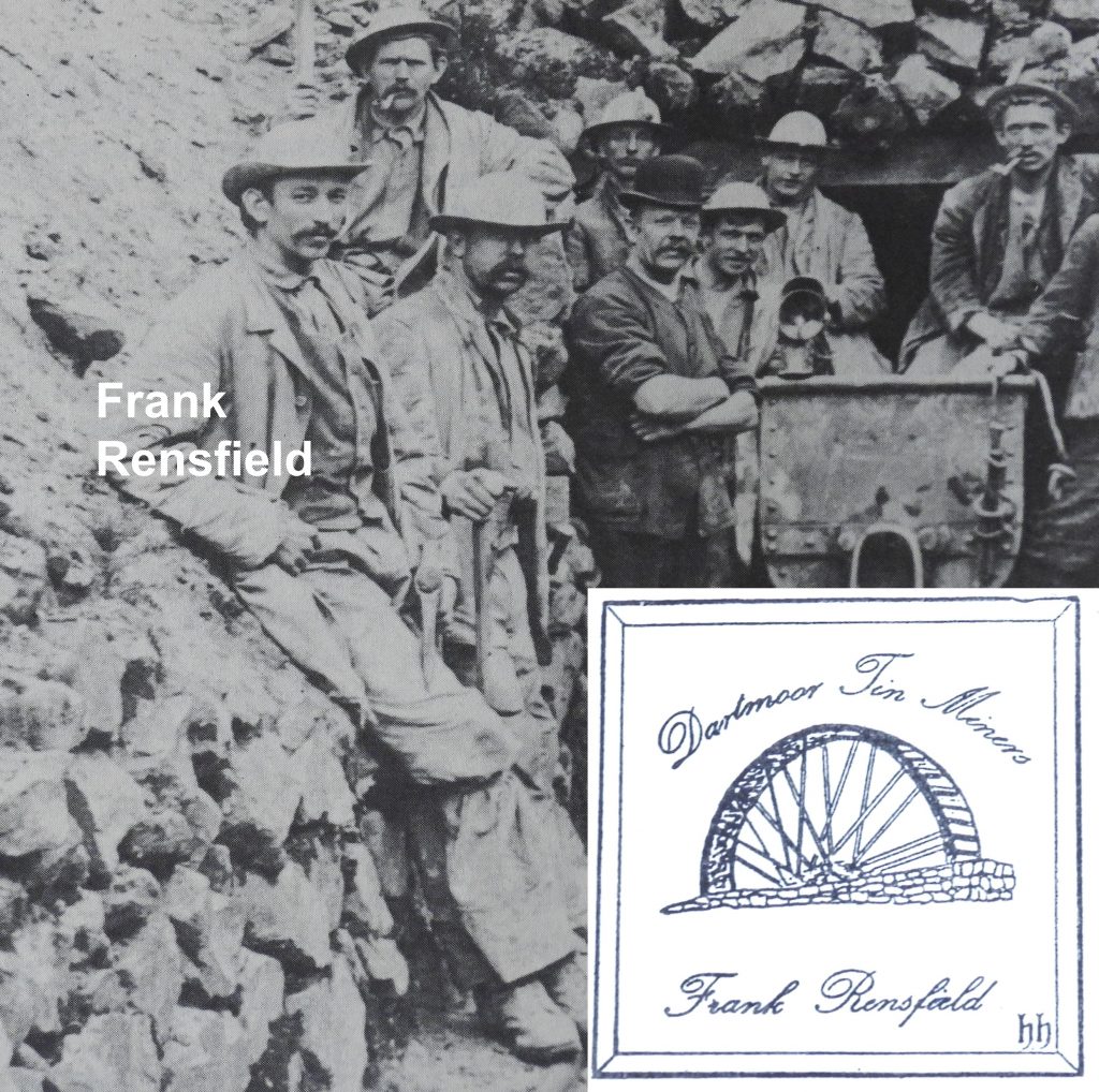
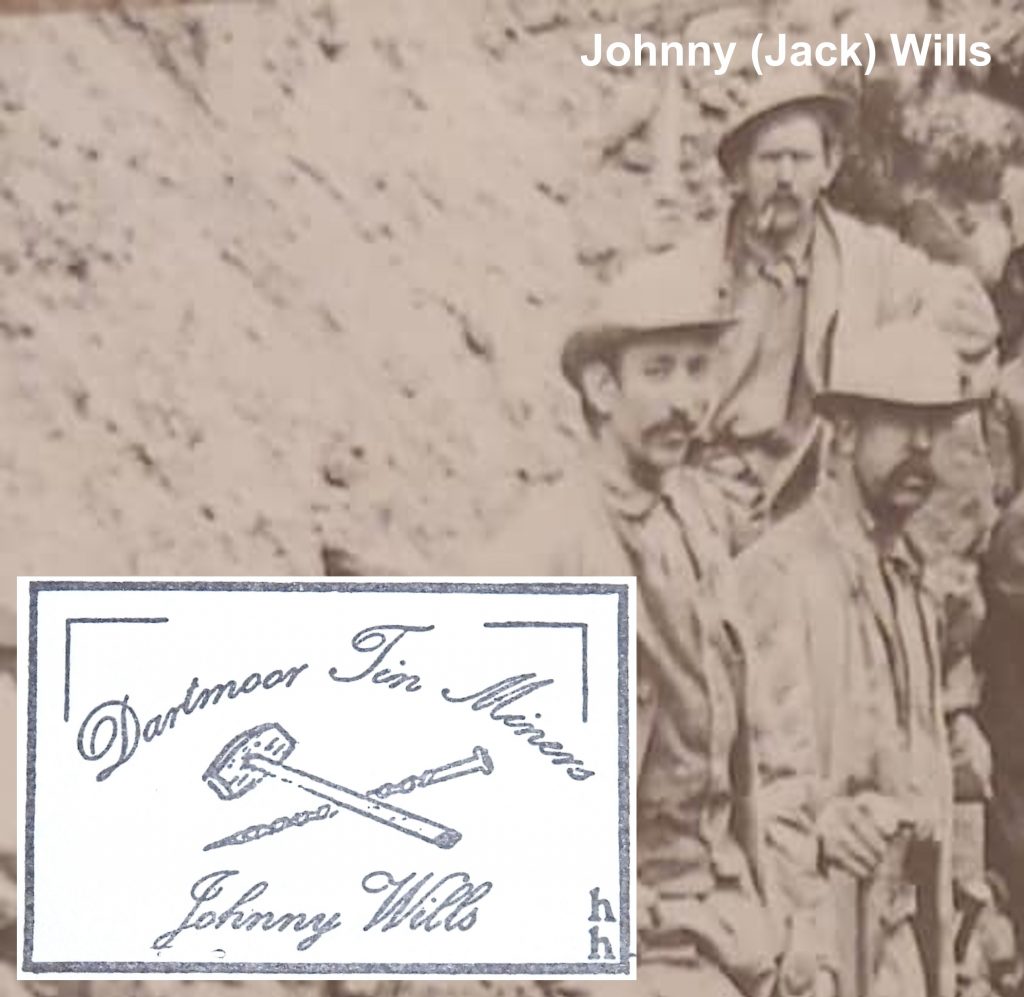
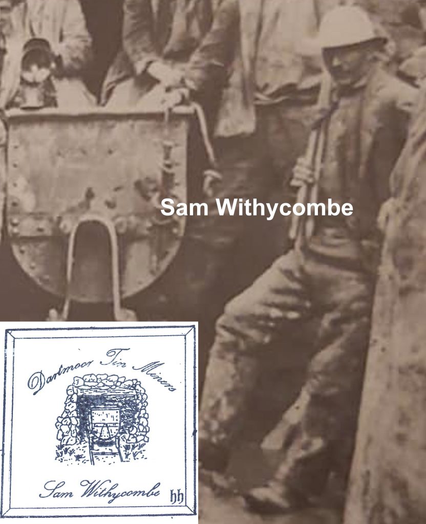
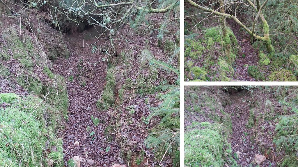
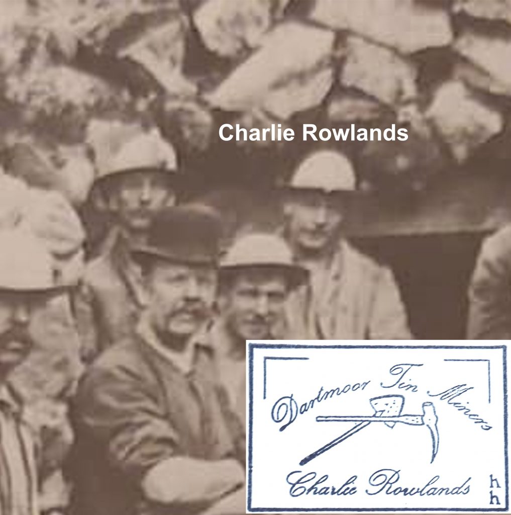
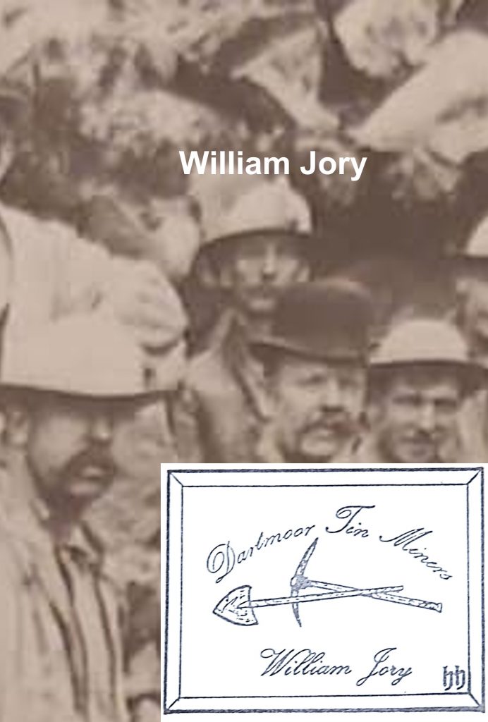
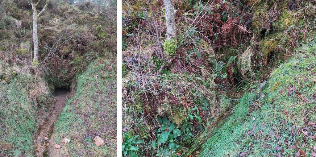
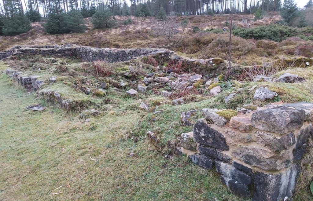
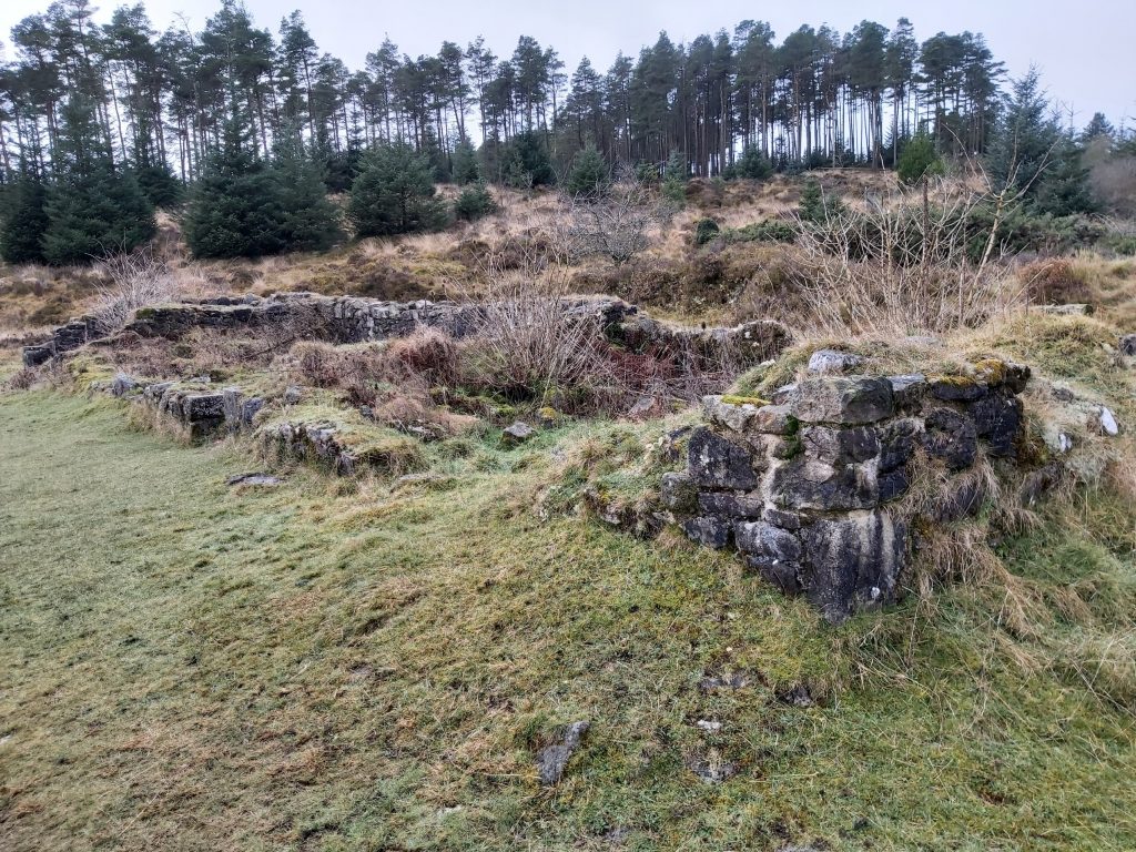
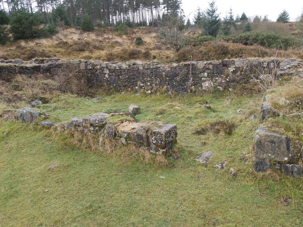
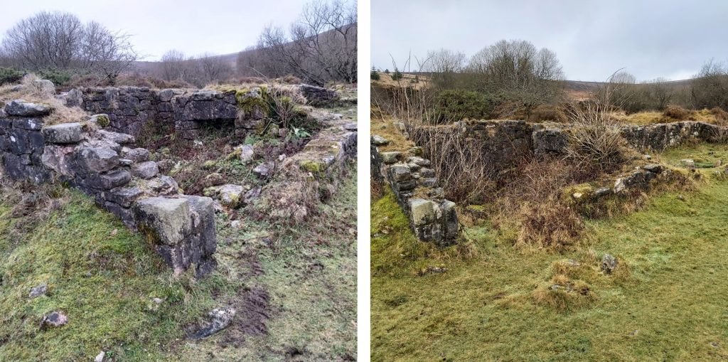
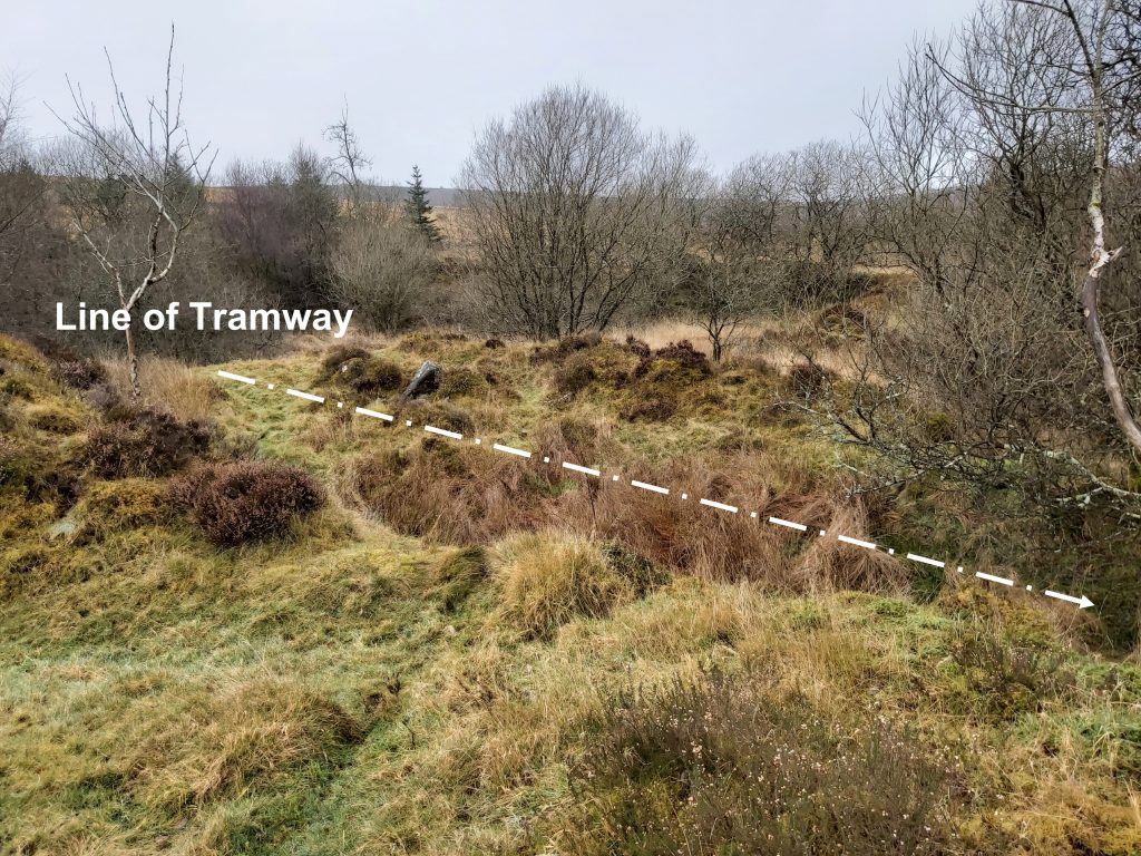
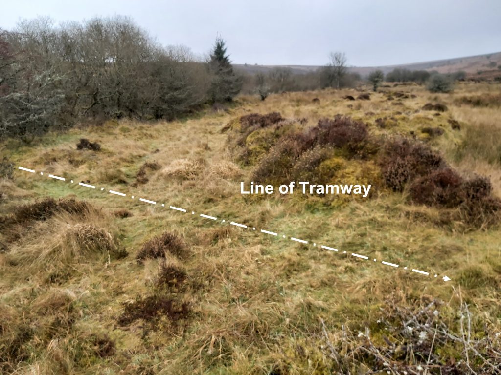
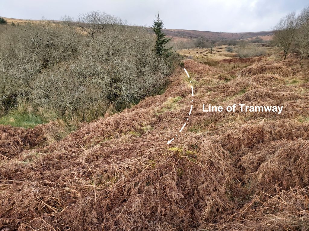
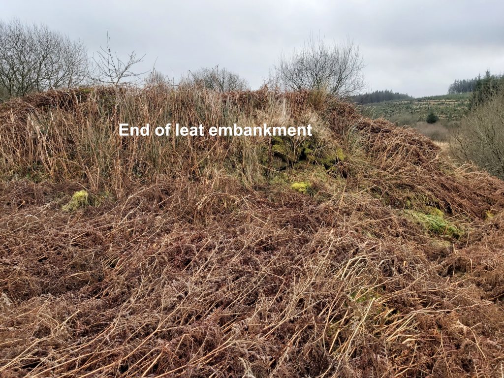
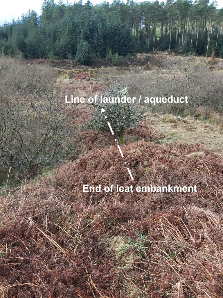
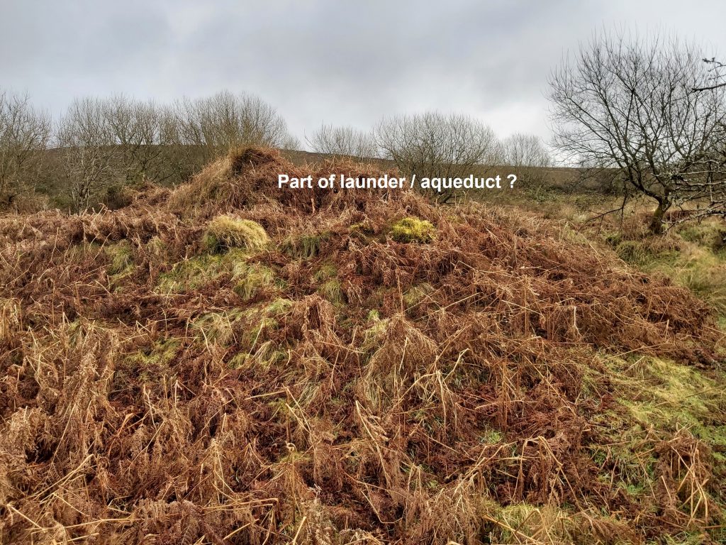
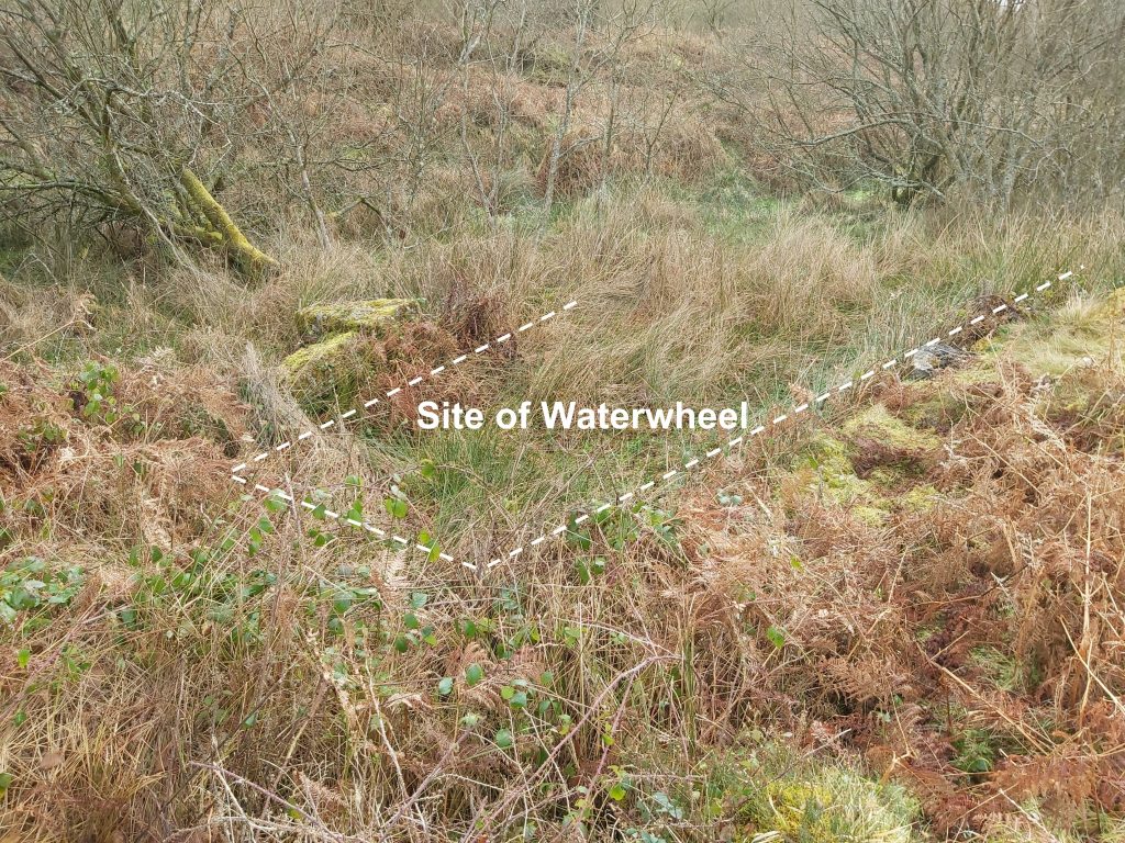
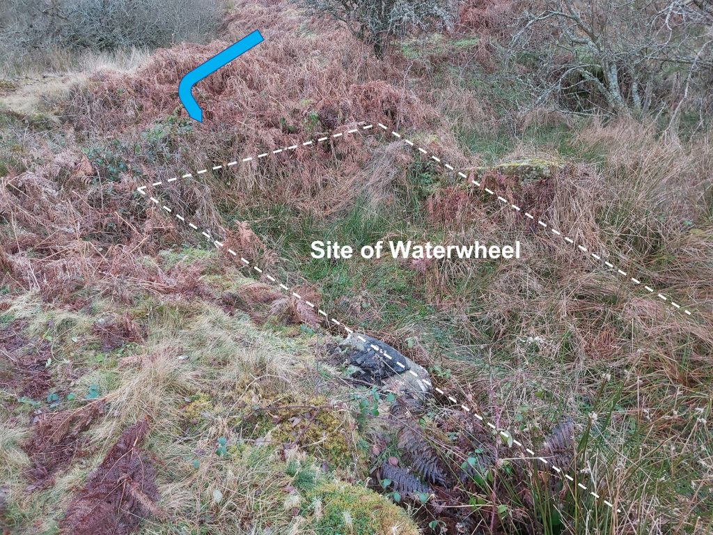
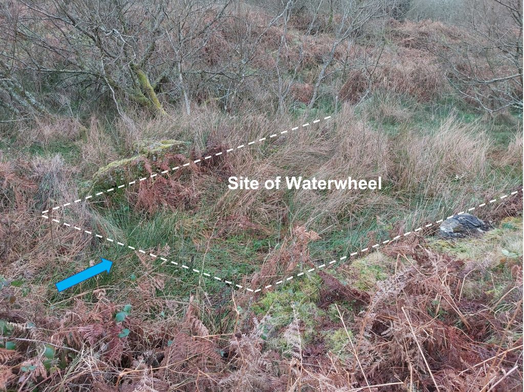
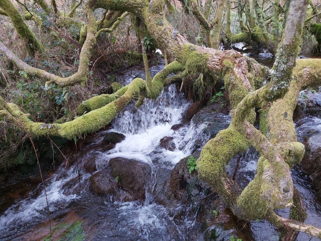
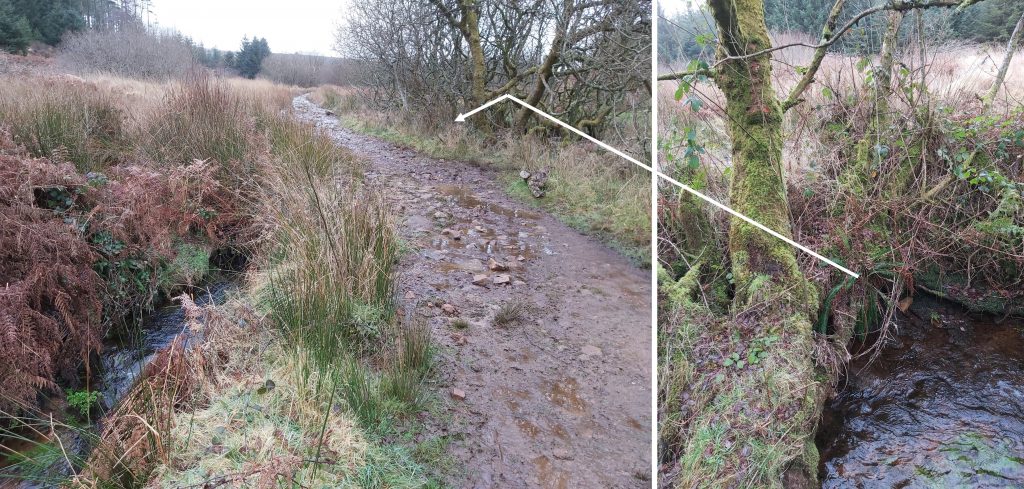
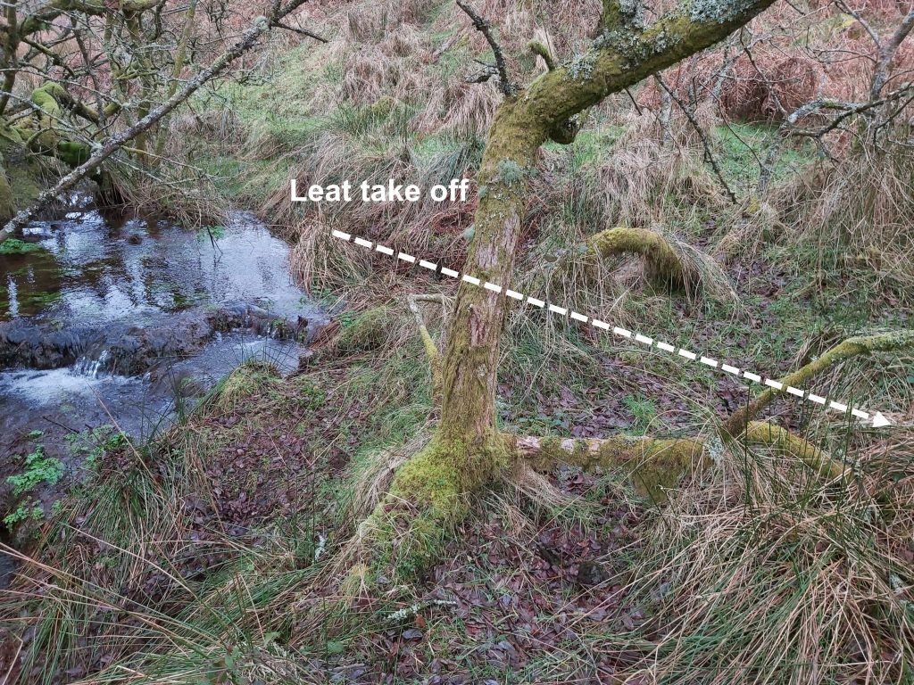
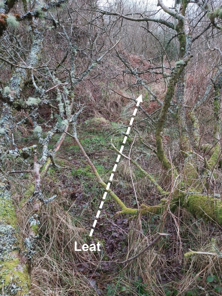
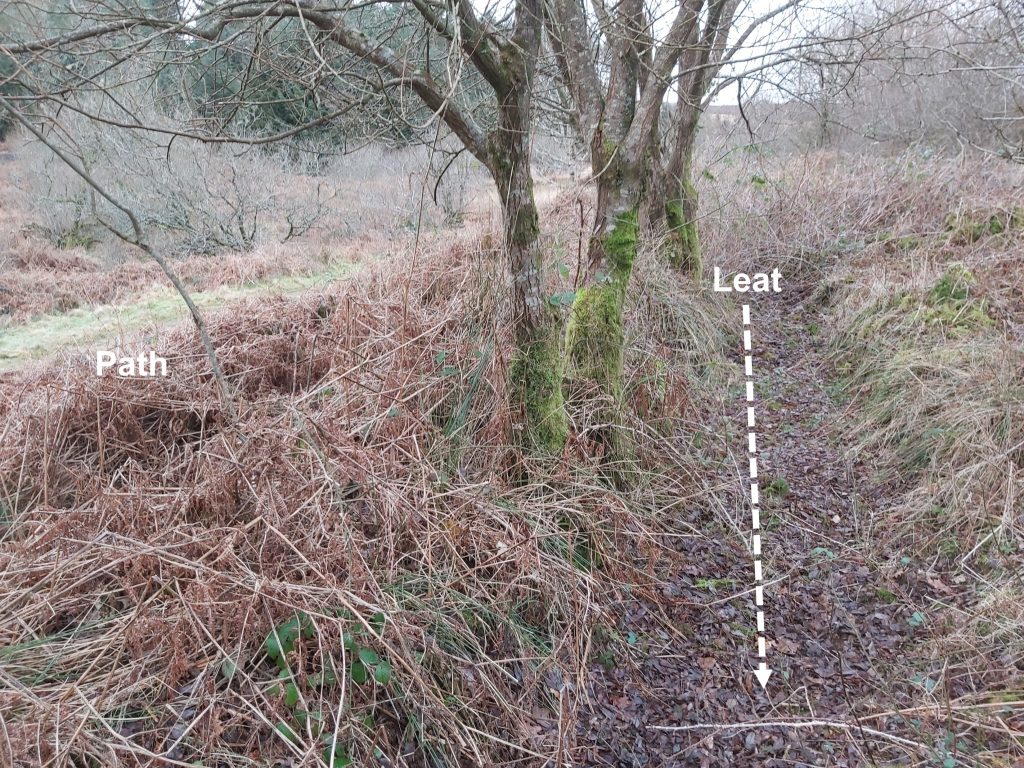
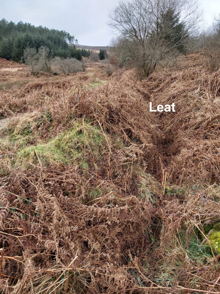
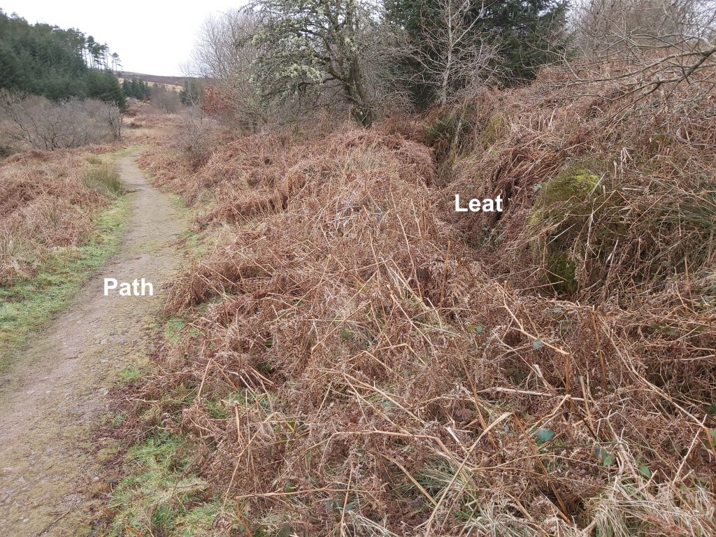
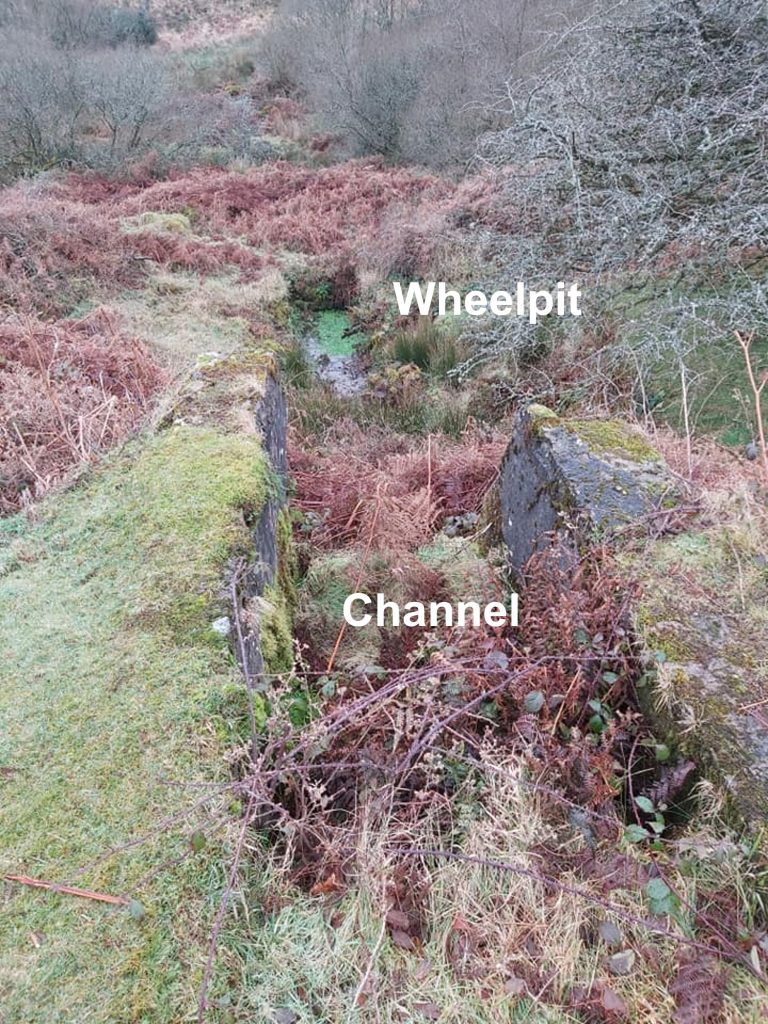
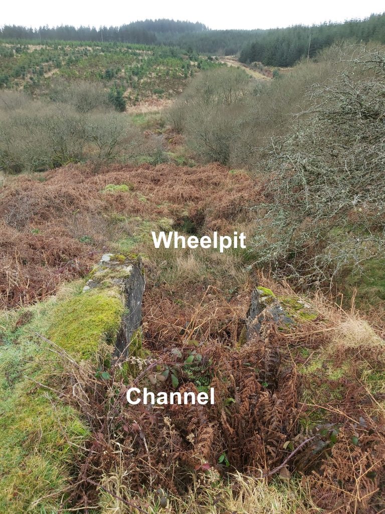
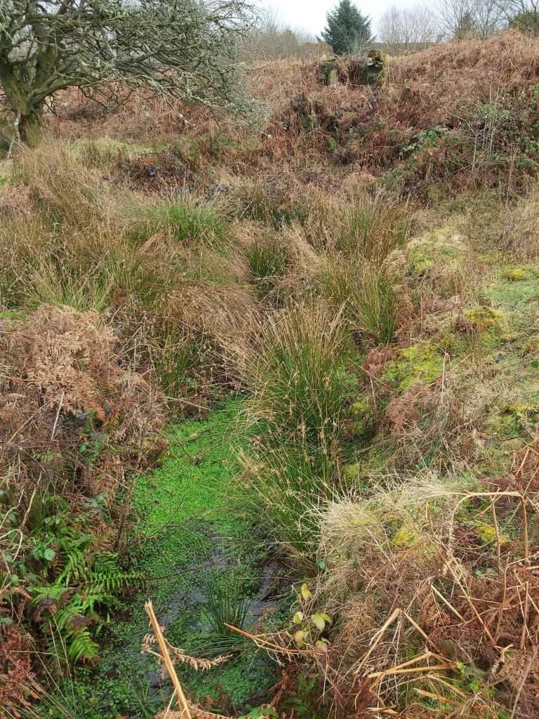
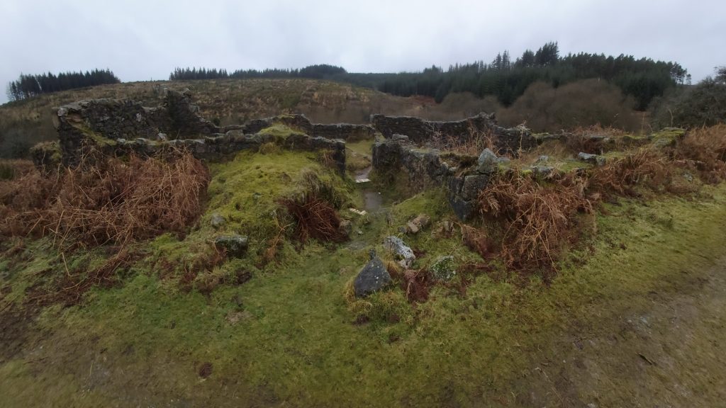
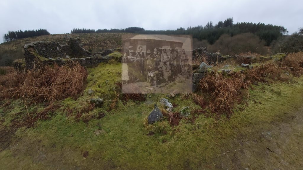
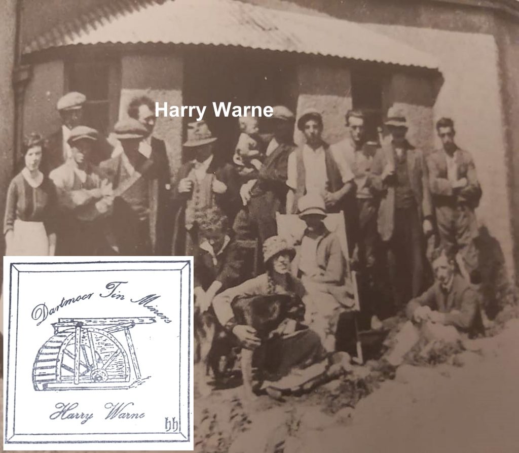
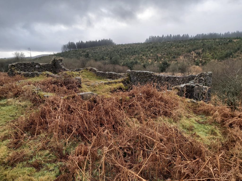
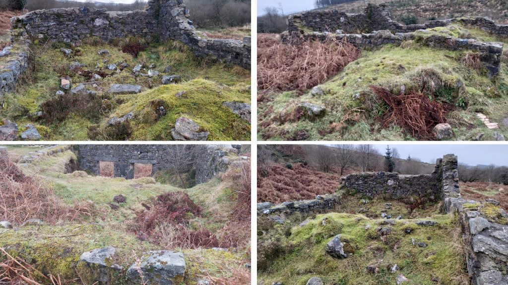
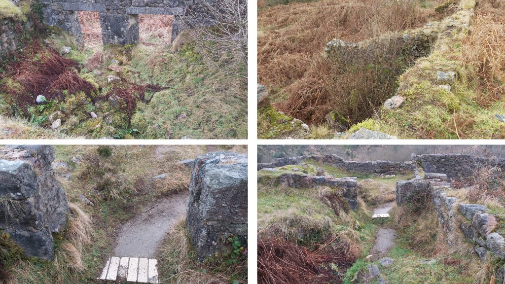
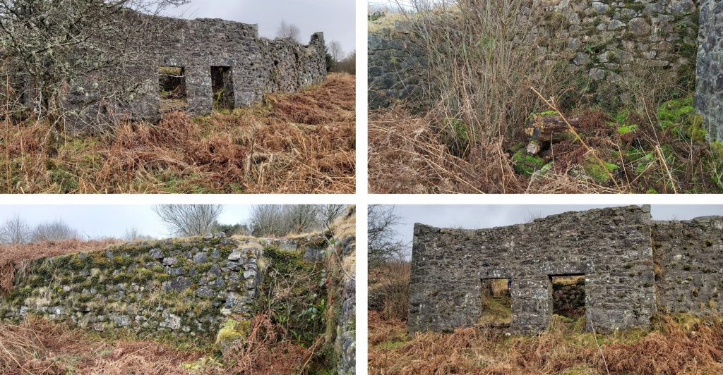
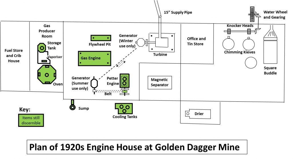
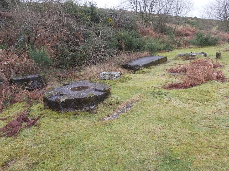
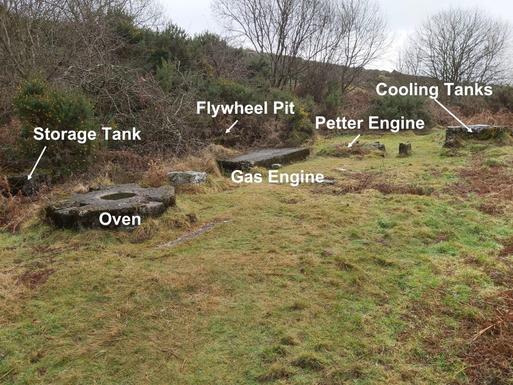
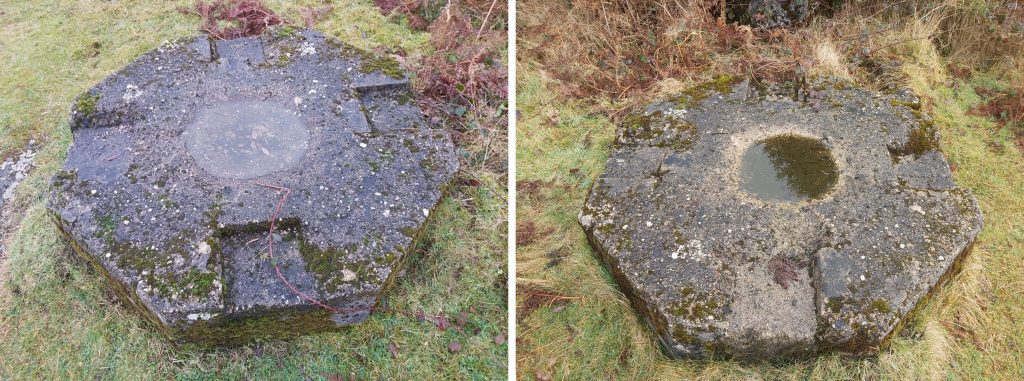
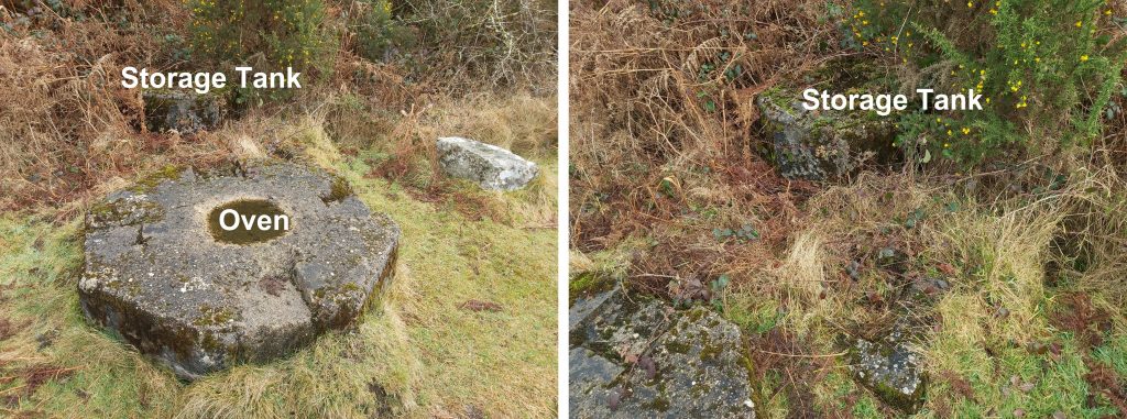
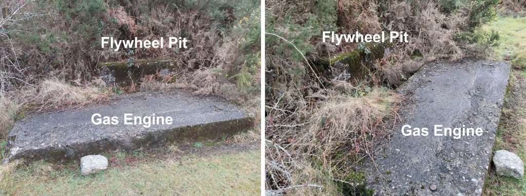
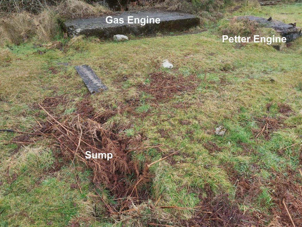
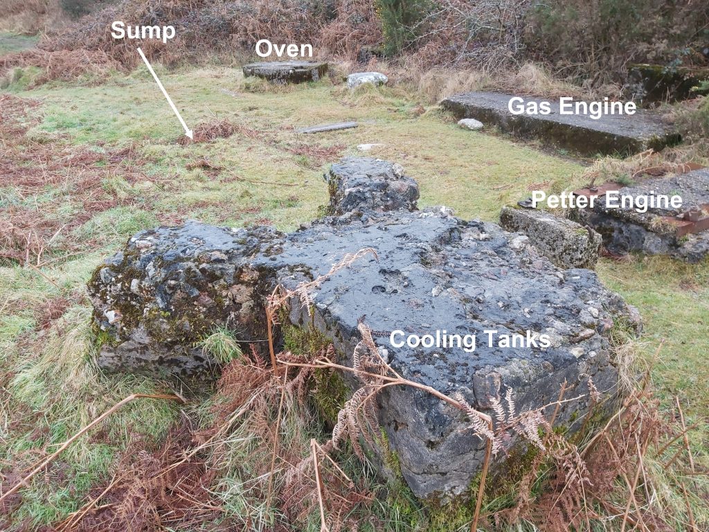
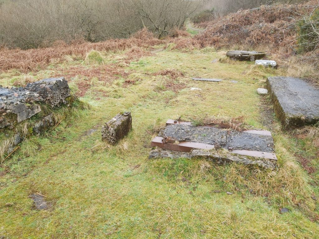
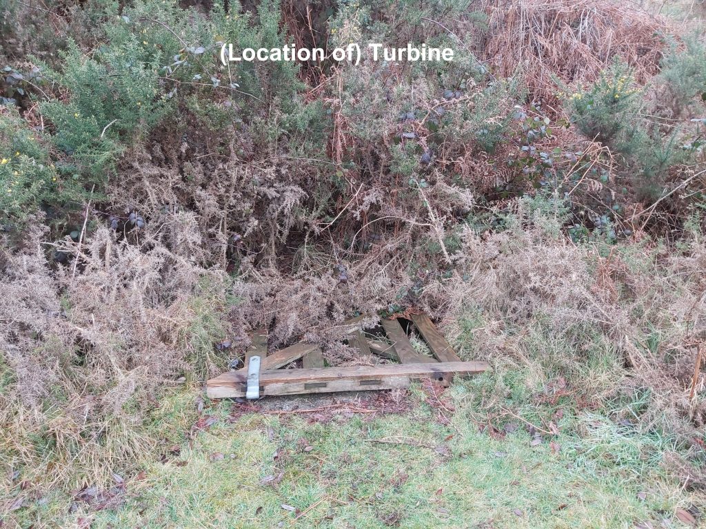
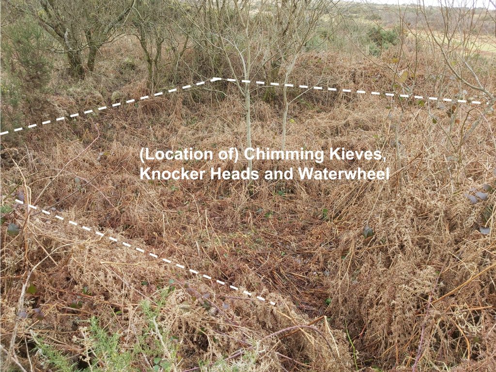
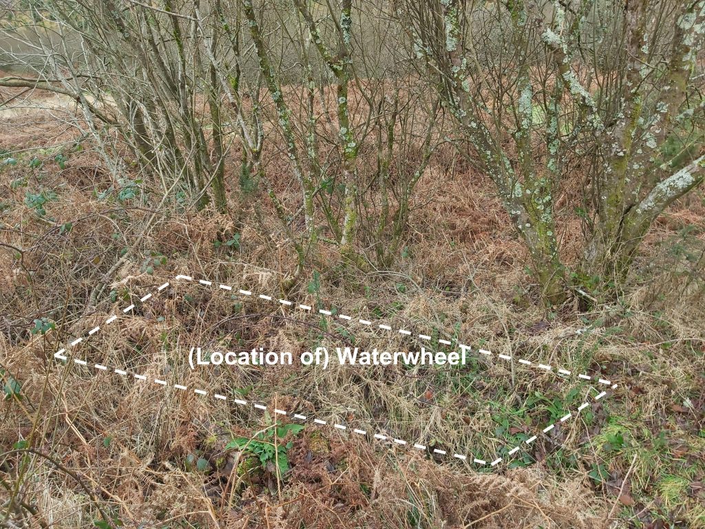
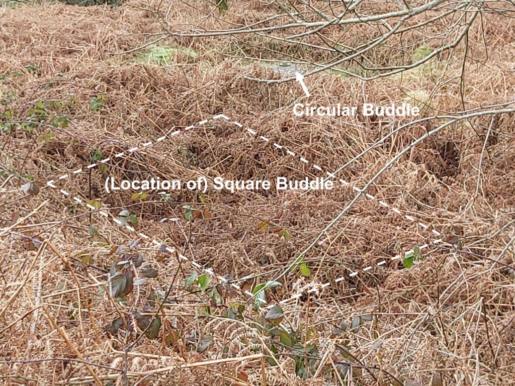
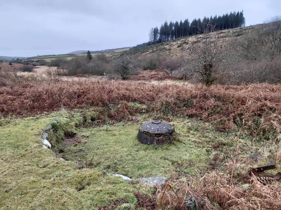
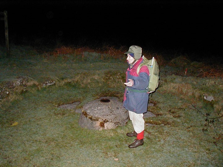
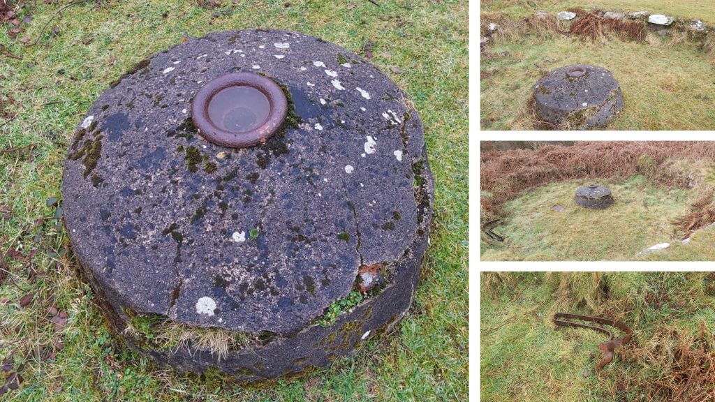
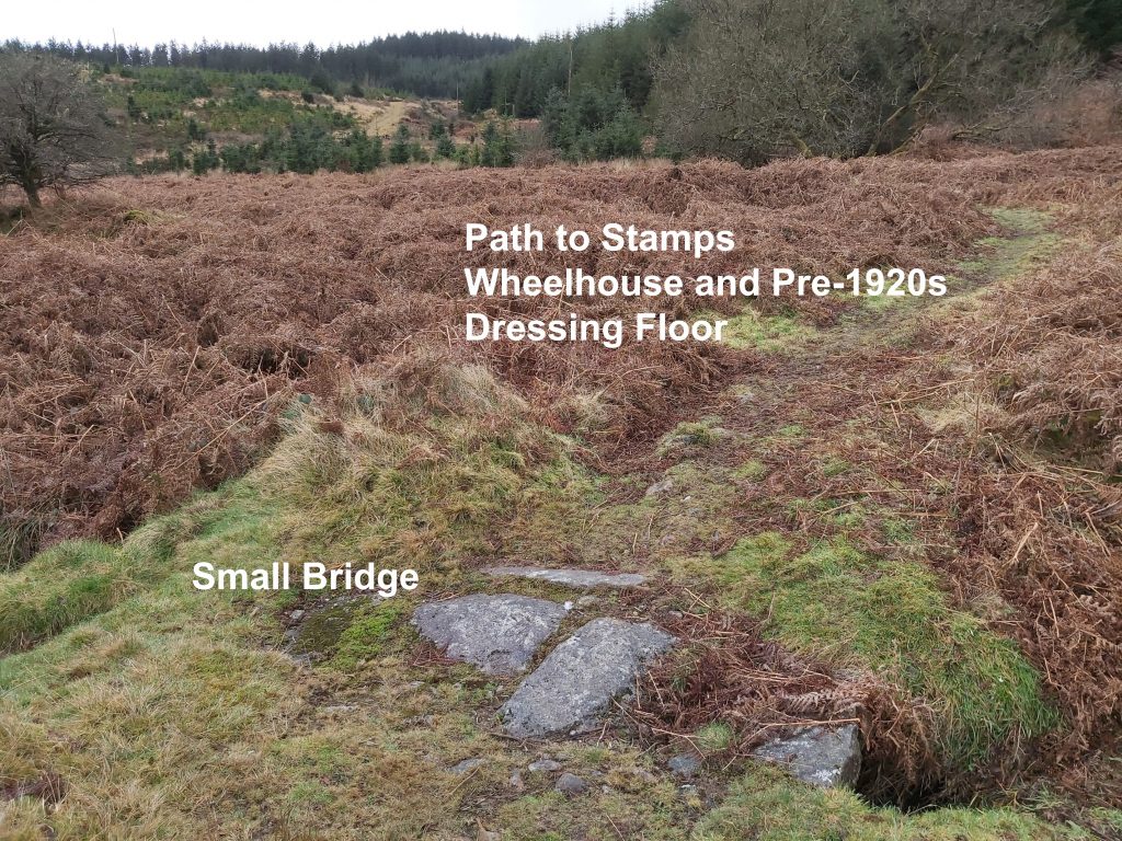
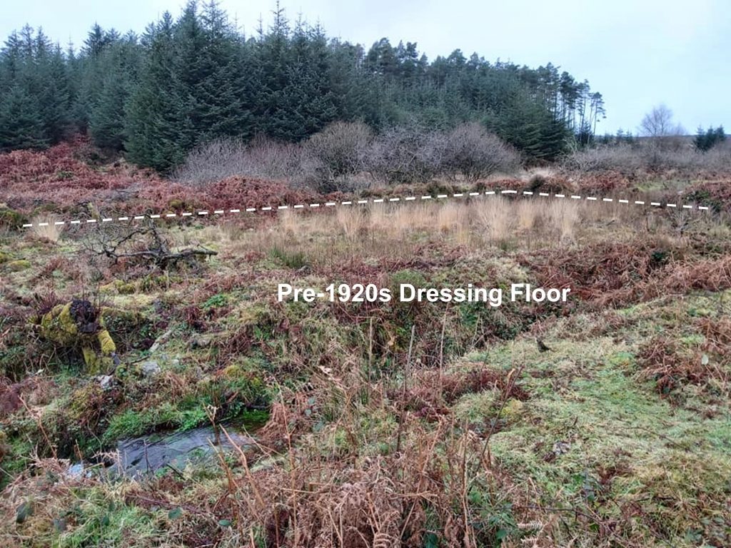
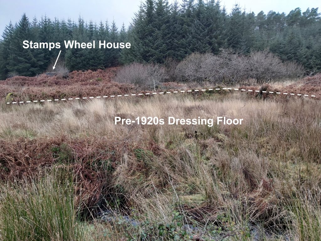
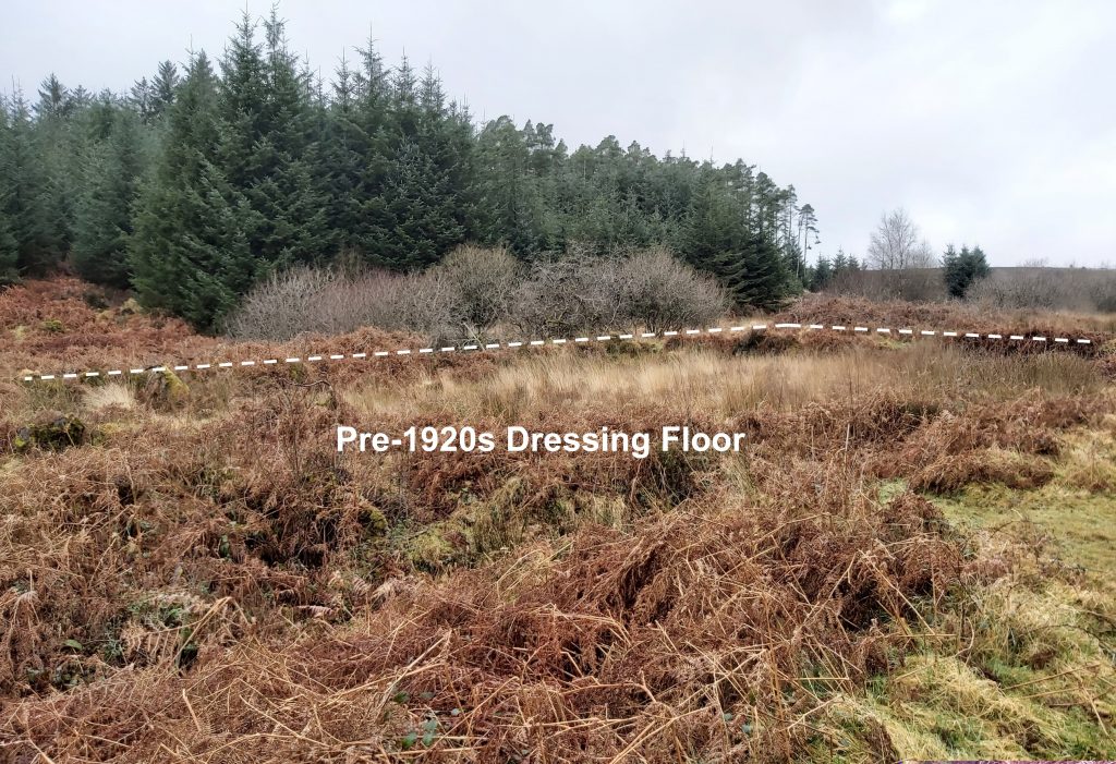
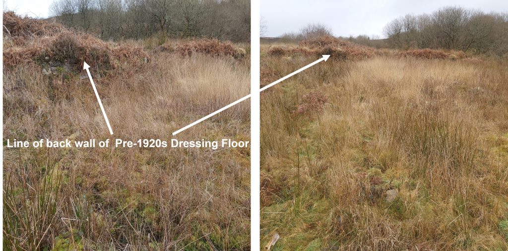
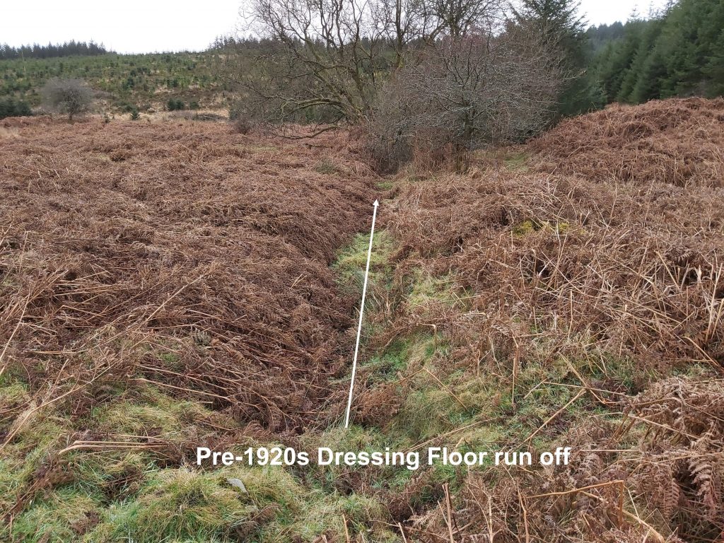
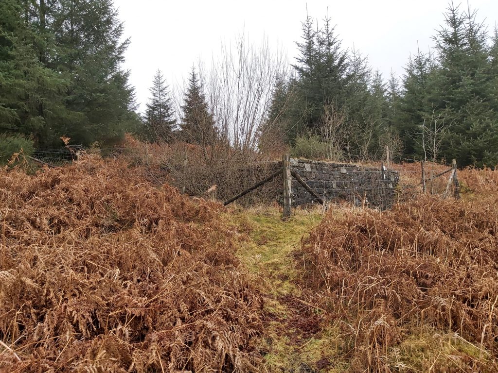
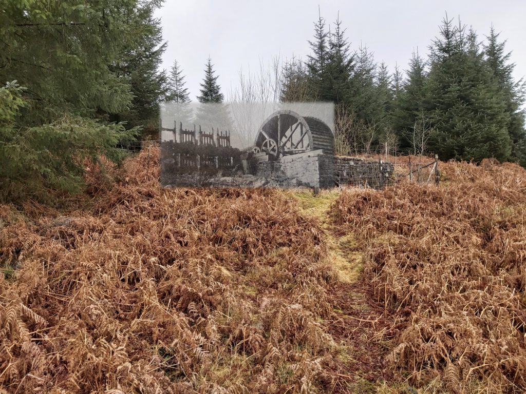
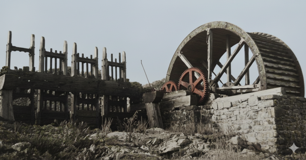
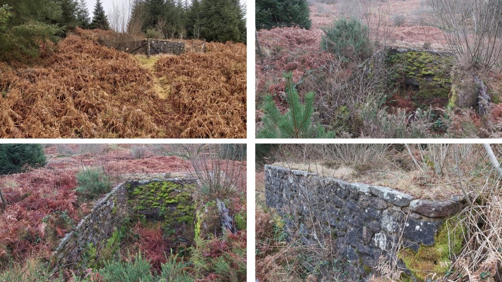
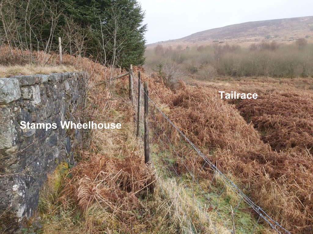
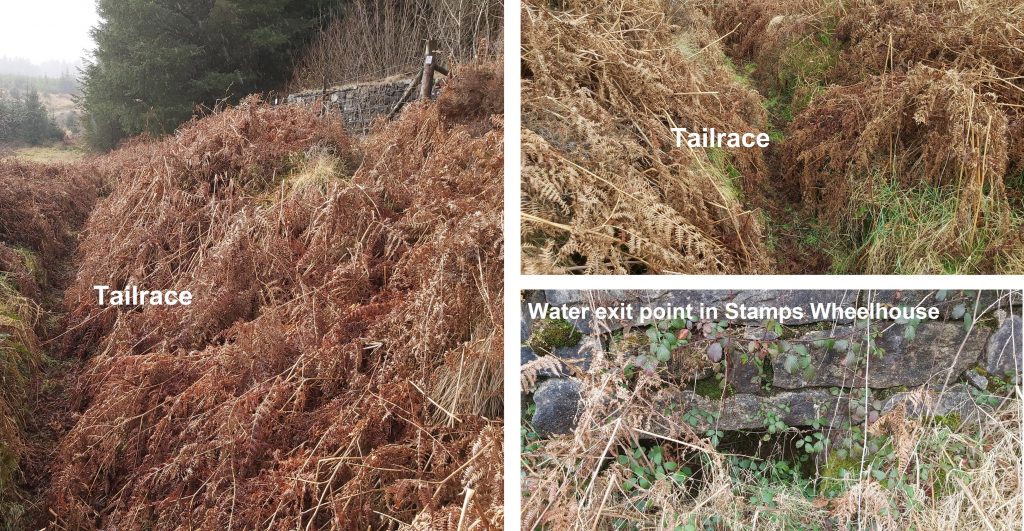
Sketch map of the features covered in this post which, in the main date from the period 1880 through to 1930. There would have been many more features but which are no longer discernible having been removed or lost to vegetation.At Golden Dagger, tin ore historically had been recovered from Redwater Brook valley floor. The main veins or lodes, however, ran east-west (the Redwater Brook runs approx north-south) and the tin ore was recovered from these in latter days by either opencast or by underground mining. The picture shows a typical open cast gully which had been dug. The lodes were only a few feet wide.Miners from Golden Dagger: George Coaker (1) lived at Cape Horn (or West Bungalow) near Warren House Inn was the brother of Captain John James (man on far right of adit entrance photograph) and the first cousin of George Coaker (2). George Coaker (2) also came from Postbridge and was the son of Jonas Coaker of Pizwell. Both the underground picture and the adit level entrance are from Golden Dagger and both taken c. 1912. The ‘hh’ designation on the letterbox stamp was the authors fathers letterbox “nom de plume”.Adit Level mine entrance in January 2020.Adit Level mine entrance with Tin Miners from c.1912 superimposed.Frank Rensfield was one of the few miners who did not come from either the Postbridge or Ashburton area. It is not recorded where he came from. The letterbox stamp shows a large water wheel which is most probably the one located at Whiteworks.Johnny (Jack) Wills came from Ashburton.Sam Withycombe came from Postbridge. The letterbox stamp looks like it is the adit level mine entrance of Golden Dagger.The Adit Level Entrance can be found at SX68213 80351Charlie Rowlands came from Plymouth. He had been an orphan and it is recorded that he was brought to Postbridge by a Mr Balkwill. He passed away in Postbridge in 1968.William Jory would have been around 35 years old when this picture was taken (he was born in 1877). He was the son of Captain Richard Jory of Vitifer. He died in 1927 aged around 50. He has taken over from his father as Captain of Vitifer. He briefly went to work at a mine at Gunnislake (Clitters Mine) around 4 years after this picture (c. 1916).Adit to the south east of the Adit Mine Entrance which is located at SX68240 80354. Water still discharges from this adit. The dry (and blacksmiths shop?) at Golden Dagger is located approx 100m from the adit level mine entrance.The north-eastly room of the Miner’s DryThe middle room of the Miner’s DryThe Miner’s Dry has three distinct rooms. The most south westerly room appears to have a fireplace.Shown on late 19th century maps, a tramway led from the ‘golden dagger’ mine adit entrance, crossed the valley in an easterly direction before turning in a southerly direction and ending at a aqueduct / wheelpit. The line of the tramway can still be discernedLine of the tramway looking north up Redwater ValleyThe tramway curves at its terminus near the aqueduct. The leat embankment (aqueduct) near the terminus of the tramway. The top of the embankment is located at SX68391 80262.View from the top (and end) of the leat embankment looking west to where a launder / aqueduct would have been located.A small mound is located between the end of the embankment and the wheelpit. The small mound is located at SX68381 80258.At the end of the aqueduct / launder a wheelpit lies perpendicular aligning approx north-south.The course of the water turning 90 degrees onto the water wheel.It is speculated that the waterwheel may have powered early stamps. The water wheel is located at SX68372 80248.This small waterfall on the Redwater brook can be found near where a path crosses the brook.The pathway crosses the Redwater Brook at SX68394 80174.Near the small waterfall on the Redwater Brook, an old leat take off point is (just about) discernible.Looking south from the leat take off pointMoving further south the leat channel alongside the path becomes more easily discernible.The leat is easily traceable in winter but would be covered in bracken during the summer months.The leat leads to a crossing point (underneath the pathway) a few metres to the north of Dinah’s House.The leat cross under the path (east to west). Next to the path lies a concrete channel where water would have flowed onto an overshot waterwheel. The wheelpit can be seen below.Another view of the concrete channel and the wheelpit (taken approx 2 years after the first photograph). The concrete channel by the path was recorded at SX68456 80064.The wheel pit is approx. 2m wide x 8m long (estimate). The concrete channel can be seen above. The wheelpit is unrecorded on the Dartmoor HER so its purpose is unknown, although it might have been used for powering stamps. It can be found at SX68438 80061. Dinah’s House is 19th century origin. It was variously known as Dinah’s Cottage, Dinah’s Bungalow, or just as “Dinah’s”. Dinah Hext and her children lived here in 1860s and 1870s, having moved from Challacombe, which is presumably how it got its name. It was also known as stamps cottage, which probably relates to the waterwheel a short distance up the track (which might have fed a stamping mill).Group standing outside Dinah’s House in 1927 superimposed onto a picture taken 95 years later. It is suggested that the 1927 picture was taken on a Saturday when wages were paid.Harry Warne was known affectionally as “Silvertop”. The waterwheel on the letterbox stamp is that the stamps wheel from Golden Dagger.At Dinah’s House, there were five rooms and a storeroom.To the left of the doorway was a lounge and ahead of the doorway was an office.To the right of the doorway were two bedrooms and a kitchen, which was located over a storeroom.View of the back (west side) of Dinah’s House. The storeroom was located behind the two rectangular openings.Although underground mining ceased at Golden Dagger around 1914, the recovery of tin ore from alluvium continued until around 1930. The material used included incompletely processed waste washed down from previous workings. During the 1920s an engine house was constructed including a gas engine and gas producing plant which was followed by a generator. The plant used a magnetic separator to remove iron ore and additional buddles and kieves to remove other waste materials from the tin. The plan shown in the sketch is based on one contained in “Mines of Dartmoor and the Tamar Valley” by P.H.G.Richardson. The Engine House as it looks in 2022, looking south. The gas producing plant is on the left (hexagonal) shapes, with the site of the gas engine (concrete slab beyond). Finally the site of the Petter Engine is shown by the concrete structure towards the top right of the photograph. The locations of items which are still discernible (shaded green on the plan). Close ups of each of these features are covered in this post.The oven concrete slab, located in the gas producing room.The storage tank and oven blocks (both hexagonal) lie at the north end of the site. Between these two items was a vaporiser. This gas producing plant was introduced by Dartmoor Tin Mines Ltd. in around 1923, which supplied a gas engine a short distance to the south. This facility was short lived as in 1925, Torr Trust took over the operation and used a smaller engine (a petter semi-diesel engine).The author has assumed that the gas produced was coal gas which is a flammable gaseous fuel made from coal being produced when coal is heated strongly in the absence of air. The gas (however it was created) fed a gas engine, which sat on the concrete plinth shown in the photograph. If anyone knows the exact process used in the generation of gas the author would be most obliged to hear from them.The gas engine was superseded by two sources of power which would have supplied the magnetic separator (for iron deposit separation). The two sources were a small petter engine (for use in the summer or dry season) and a water turbine (for use in the winter or wet season). The petter engine fed a generator (via a belt as shown in the sketch plan). The generator was fed by the petter engine in the summer and the water turbine in the winter. View of the petter engine plinth in foreground (right) and its associated cooling tanks plinth (left). The petter engine was 36 horse power (twin cylinder). Petters were a company from Yeovil. At the top of the photograph (north) are the concreate plinths of the oven and storage tank which were part of the gas production room.The water turbine location is now lost to undergrowth. It was used in the winter only and had been transferred (with the generator) from Vitifer Mine from further up the Redwater Valley. There is a lovely story in the P.H.G. Richardson book, which tells the tale of a 21 year old, called Freddy Warne (of the Postbridge mining family if that name) who had the task of transferring the turbine and generator from Vitifer and that it musty have been a great moment in his young life when he opened the inlet water valve for the first time and the meter on the generator read 240v for the first time !The location of the Chimming Kieves, Knocker Heads and Waterwheel does not have any evidence of them once being here. The kieves were open tubs in which a mixture of ore, water and sand waste was stirred and allowed to settle. The waste at the top was skimmed off. the settlement was aided by the Knocker Heads (mechanical hammer heads) which were driven by a small water wheel (see the sketch plan). The chimming process wasn’t the last process as the mixture still had amounts of specular iron which were removed, using the magnetic Separator. Prior to using the magnetic separator the mixture was dried – see ‘drier’ on the plan. After the magnetic separator the material was ready for sale.Approx location of the small waterwheel which powered the Knocker Heads. There was a square buddle which was located near the Chimming Kieves. The square buddle was simple inclined plane and was the process prior to the kieves. The material fed into the square buddle came from a circular buddle. The photograph shows the circular buddle in relation to where the square buddle used to be.In the 1925-1930 period (under Dartmoor Tin Mines Ltd) there was no crushing of the alluvial material. Instead the material was sized in a trommel (a large revolving iron cylinder pierced with holes). The fine material from the trommel was transferred to a circular buddle (before the squaure buddle and finally the kieves). Ted Birkett Dixon who lead Workers Education Association (WEA) night walks on Dartmoor is pictured explaining the operation of the circular buddle at Golden Dagger Mine on 22nd March 2002.The round buddle was introduced to Dartmoor in the mid-nineteenth century and was the means of the one of the first stages of separation. A wooden launder would have lead to the central buddle ‘cone’ and material would have been shovelled into the launder mixed with a stream of water and thus fed into the circular buddle . A small water wheel would have powered several ‘sweeps’ which would have rotated around the buddle (centred on the ‘cone’). The ‘sweeps’ had rags or thin sacking hanging below them. The process would have collected the heavier good quality material against the rag / thin sacking and so would not be washed away with the surplus water and waste.Leading off the main path, a side path can be followed to explore the pre-1920s Dressing Floor and a well preserved Stamps Wheelhouse. A small bridge is crossed at SX68408 80105.The pre-1920s Dressing Floor which probably was a large shed (like the one at Vitifer up the valley). Tin ore would have been crushed by the adjacent stamps before being passed through round buddles, after which the material was known as ‘Tin Concentrate’, which would have have been delivered to the dressing floor. The Dressing Floor, would have had kieves, which were filled with water and tin concentrate before being stirred by the ‘tin dresser’. The heavier material would have settled at the bottom of the kieve. Once water was removed, the material was scraped away – the top surface was known as ‘tailings’, the next couple of inches the ‘middles’ and finally the bottom section as ‘heads’.The back wall of the of the Dressing Floor. The author is unaware if this was part of the building structure, which most likely was located here.In the south west corner of the Dressing Floor and run off channel for the waste can be found. It appear to run through a small tunnel (below where the photograph is taken from).The remains of the stamps wheelhouse. This housed a 22.5ft x 9 ft (6.9m x 2.7m) wheel which drove 16 Cornish stamps for crushing the tin ore. The stamps were located to the left (west) of the structure.A superimposed picture of the water wheel from 1937 onto a 2022 photograph, showing the cornish stamps. The wheel had ceased operation circa 1914. The stamps were housed within a shed when they were operational. It is believed that the wheel was a ‘pitchback’ variety (rotating anti-clockwise from the viewpoint in the photograph).Colourised photograph of stamps wheel and stampsThe wheelhouse is recorded as measuring 24.5ft x 11.3ft (7.47m x 3.45m). The leat which fed the waterwheel is virtually impossible to trace as it would require negotiating the thick and dense conifer forest.On the west side of the wheelhouse, the framework for the gearing associated with the wheel connecting it to the stamps can still be seen over 100 years after the wheel ceased operation.Down slope from the wheel house a tailrace can be traced, which leads off in the direction (east) of the pre-1920s dressing floor.Views of the stamps wheel house tailrace and the water exit point from the base of the construction.
hi Richard, interesting to see the detailed explanations and photos of the above ground remains. Myself and a friend spent many days exploring the accessible underground shafts, gunnels, winzes and stopes in the mid 1980’s. We have many photos of the underground remains including the remains of a steam boiler at the foot of the mid-way shaft. let me know if they would be of interest to you too.
I’m Steve (not Richard) who runs this website as a small retirement project. If you had any pictures which you would like me to add to the website for the Golden Dagger entry I’d be delighted to add them with due acknowledgment. Kind Regards.


William Hill March 14, 2023
Have just got back from a visit to the Golden Dagger. Very interesting to read your explanation of the site. Thank you.
SteveGriggDartmoor March 14, 2023 — Post author
Thank you William
Richard Crouch June 3, 2023
Thank you for the excellent photographs and explanations having just returned from a visit to the site. Most helpful
SteveGriggDartmoor June 3, 2023 — Post author
Hi Richard,
Thank you for your comments.
Kind Regards,
Dartmoor Explorations (Steve)
jeffrey c lindley October 29, 2024
hi Richard, interesting to see the detailed explanations and photos of the above ground remains. Myself and a friend spent many days exploring the accessible underground shafts, gunnels, winzes and stopes in the mid 1980’s. We have many photos of the underground remains including the remains of a steam boiler at the foot of the mid-way shaft. let me know if they would be of interest to you too.
SteveGriggDartmoor October 29, 2024 — Post author
Hi Jeffrey,
I’m Steve (not Richard) who runs this website as a small retirement project. If you had any pictures which you would like me to add to the website for the Golden Dagger entry I’d be delighted to add them with due acknowledgment. Kind Regards.