A collection of walks, discoveries, insights and pictures of exploring Dartmoor National Park
February 15, 2022
Wisdome Bridge (also known as Vicarage Bridge and formerly as Parsons or Parsonage Bridge)
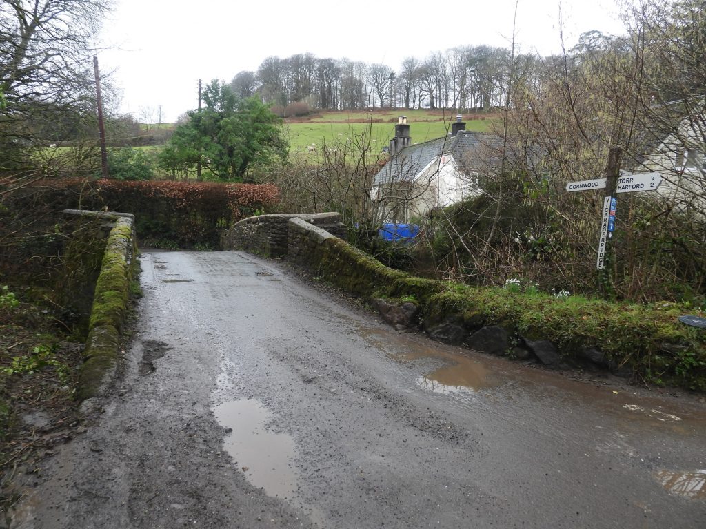
Wisdome Bridge spans the River Yealm on the Cornwood (1 mile away) to Harford (2 miles away) road. It is believed the current bridge was constructed either in the 17th or 18th century. Although named Wisdome Bridge on modern OS maps, there is a signpost next to it suggesting it is called Vicarage Bridge. Further investigation reveals that at some point it was also known as either Parsons or Parsonage Bridge. No doubt the name Wisdome Bridge comes from the nearby Wisdome Barton, a 16th-17th century farmhouse, which was the home of the Rogers family (purchased by John Rogers in 1690). There are no photographs of the farmhouse in this post as it is currently (February 2022) covered with scaffolding and a protective covering whilst undergoing renovations.
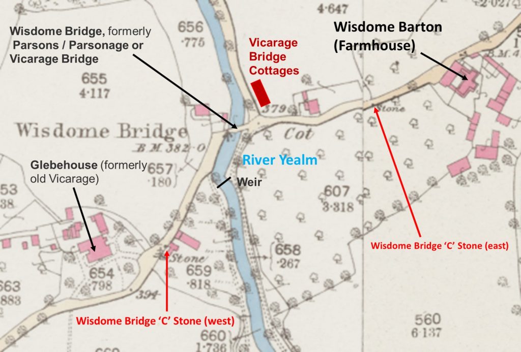
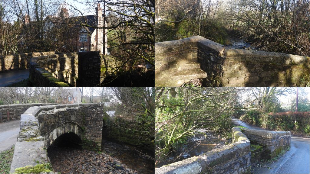
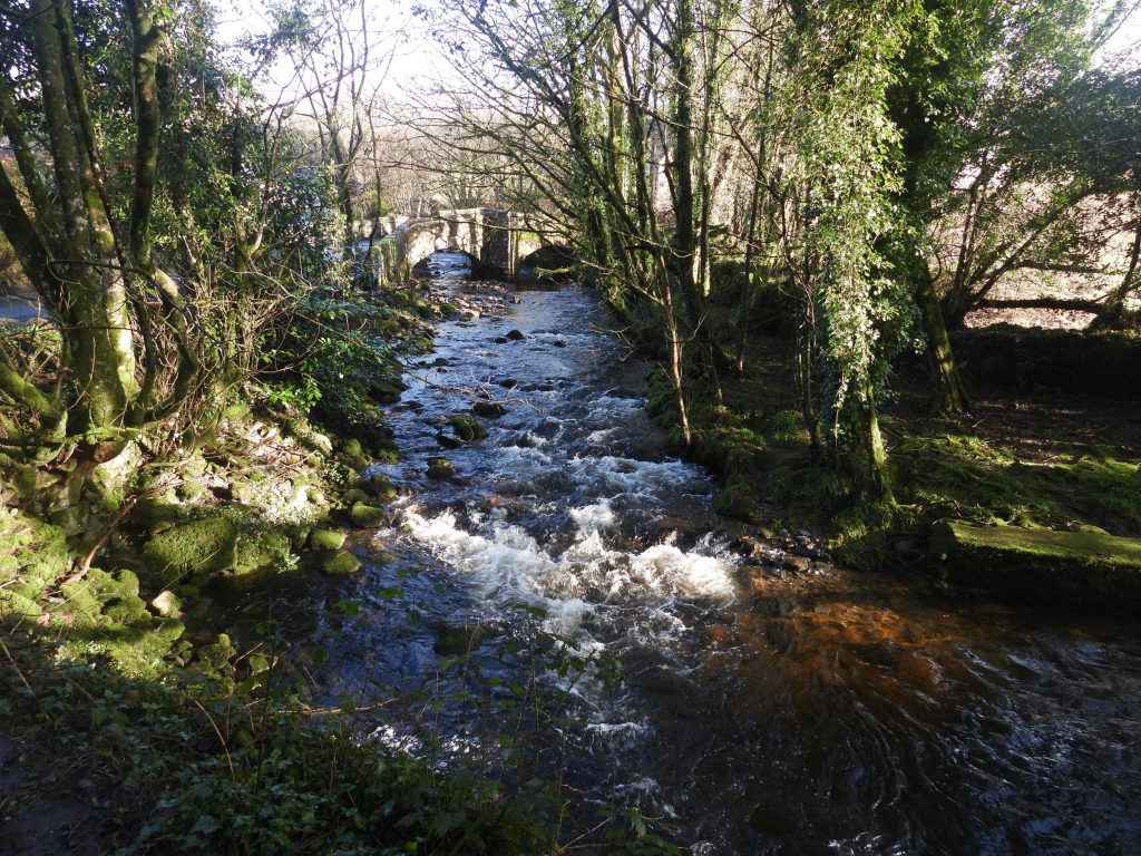
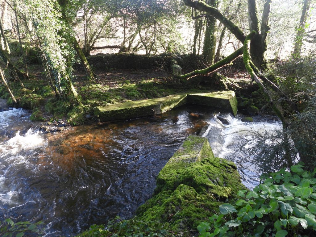
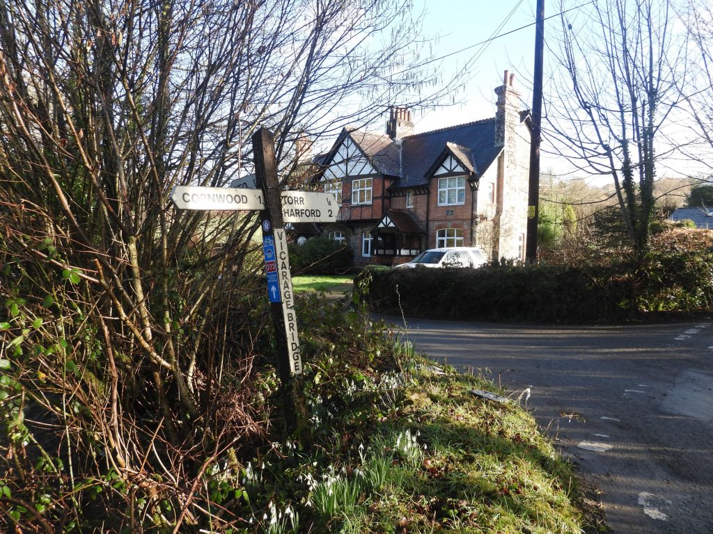
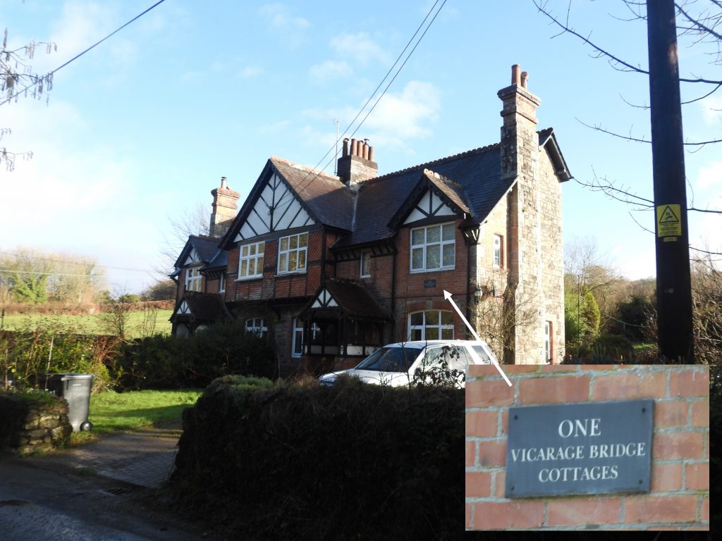
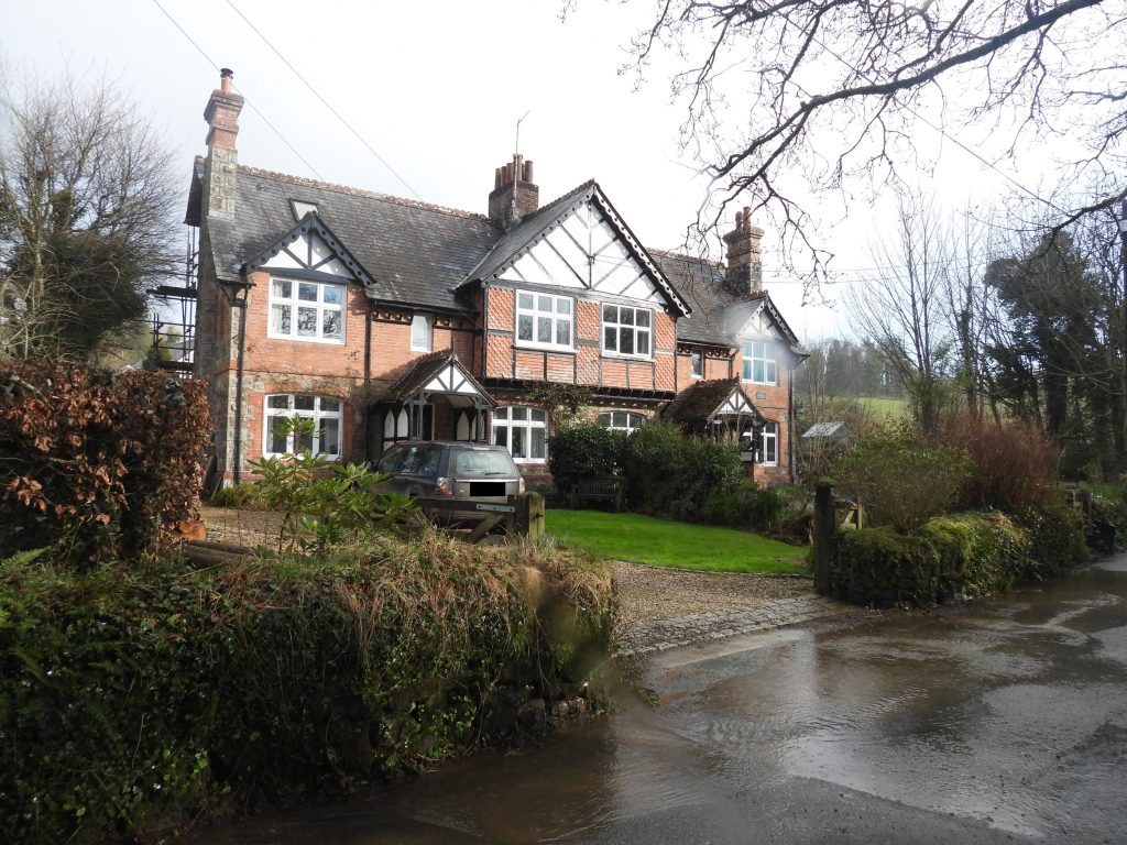
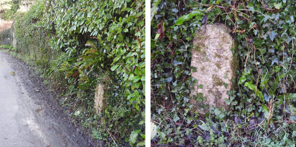
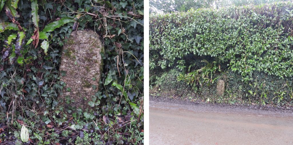
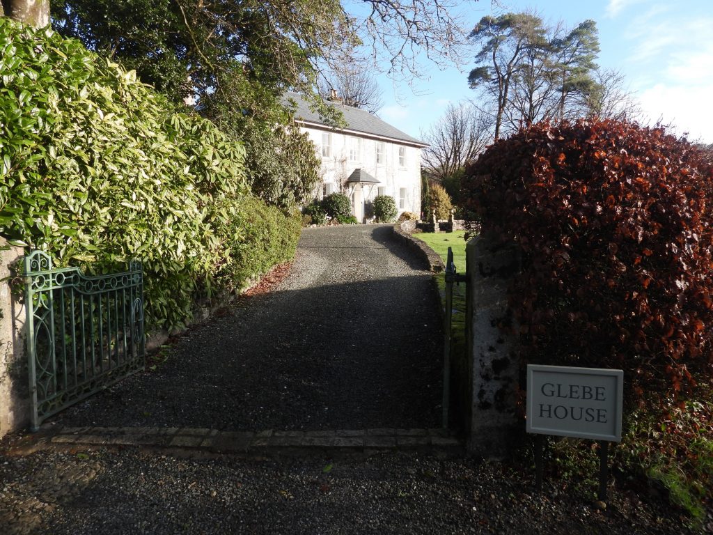
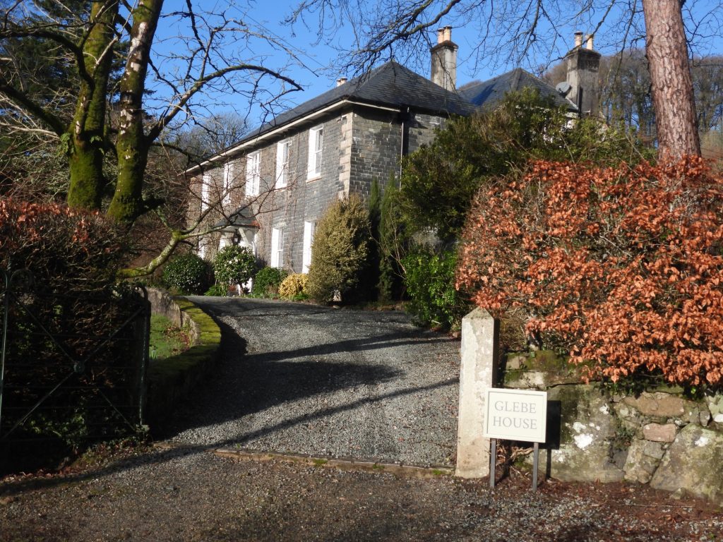
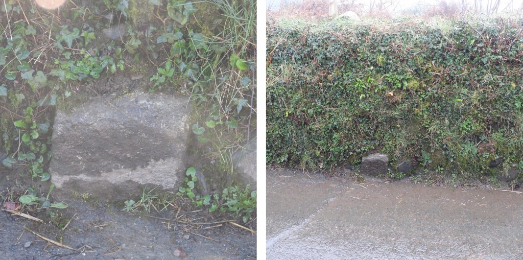
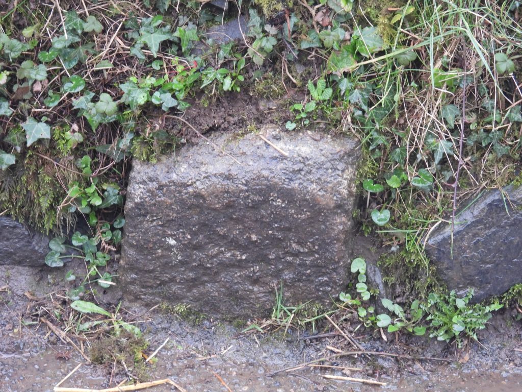
19th century map showing Wisdome Bridge and its environs. This post covers the Bridge itself, the nearby cottages, the old vicarage and the two ‘C’ (County) stones which can still be found.Wisdome Bridge (or Vicarage Bridge) is built from granite rubble with dressed granite segmental arches. The original ‘Parson’s Bridge’ was reported to be in decay in 1668. It is recorded as being possibly rebuilt in the vernacular style soon afterwards. Ref: Dartmoor HERThe bridge has two arches with two refuges in the parapets above. The parapets have chamfered granite coping. Unfortunately, the bridge seems to have been “hit” a few times in recent years and repairs are evident.View of the bridge from downstream.About 50m downstream from the bridge lies a modern concrete weir.The signpost near the bridge name it as ‘Vicarage Bridge’Vicarage Bridge cottages appear on maps from 1890’s, so must have been built at that period as they do not appear on maps before that date. Strangely, when these cottages were built the bridge was named Wisdome on OS maps.Vicarage Bridge Cottages taken from road alongside the River Yealm.On the west side of the bridge, on the opposite side of the road to Glebe House, is one of two ‘C’ (County) stones. Bridges either constructed by the county, or taken over and therefore maintained by them and sited within the county of Devon would have had a set of two ‘C’ stones erected on either side of the bridge. ‘C’ stones around the county date from 1841. Most of the ‘C’ stones (but not all) around Dartmoor are made of granite, around 2ft (0.6m) tall and are at a distance of 300ft (91m) from the bridge. This ‘C’ stone is located at SX61374 60270.Glebe House was formerly the vicarage and it is assumed that the bridge (now Wisdome) was named after the vicarage. It is grade II listed and was built circa 18th century (at the rear) with the front of the property being circa early 19th century. The front part is slate hung with rusticated granite quoins. The original circa 18th century house adjoins at rear parallel to front. It is recorded as being stuccoed and with slate hung ends. At two storeys, it would have been a rather magnificent building for the period. As this building was the former vicarage, one assumes this is why the nearby bridge got its alternative names of Parsons / Parsonage Bridge and latterly Vicarage Bridge.On the east side of the bridge, near Wisdome Manor, is the second of the two ‘C’ (County) stones associated with the bridge. It appear to have been “re-set” lower than the modern day road level. The ‘C’ appears to have been buried by the modern road level.Close of the east ‘C’ stone. It can be found at SX61520 60362. The location being consistent with the 19th century map.