A collection of walks, discoveries, insights and pictures of exploring Dartmoor National Park
April 10, 2026
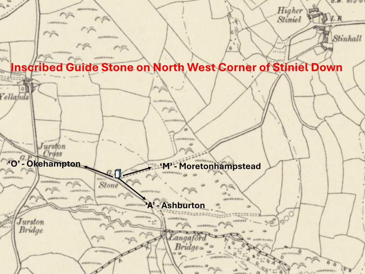
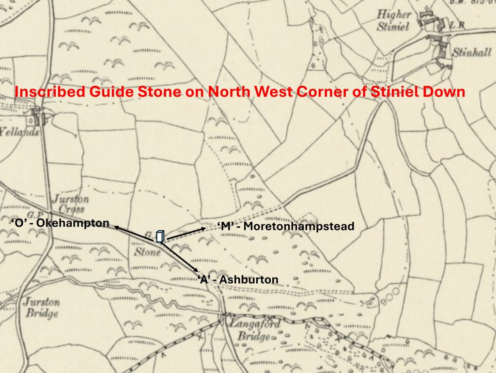
Guide Stone with Inscriptions on Stiniel Down
At the north west corner of Stiniel Down there is rough granite guide stone inscribed on 3 faces with the letters ‘O’, ‘M’ and ‘A’. These letters appear to refer to the Okehampton, Mortonhampstead and Ashburton, with the faces on which the letters appear facing the direction of the aforementioned towns.
Its location perhaps indicating this point was once an important junction, albeit the location these days is relatively quiet and not on any well used through roads. The author speculates that it is of 18th or 19th century in origin
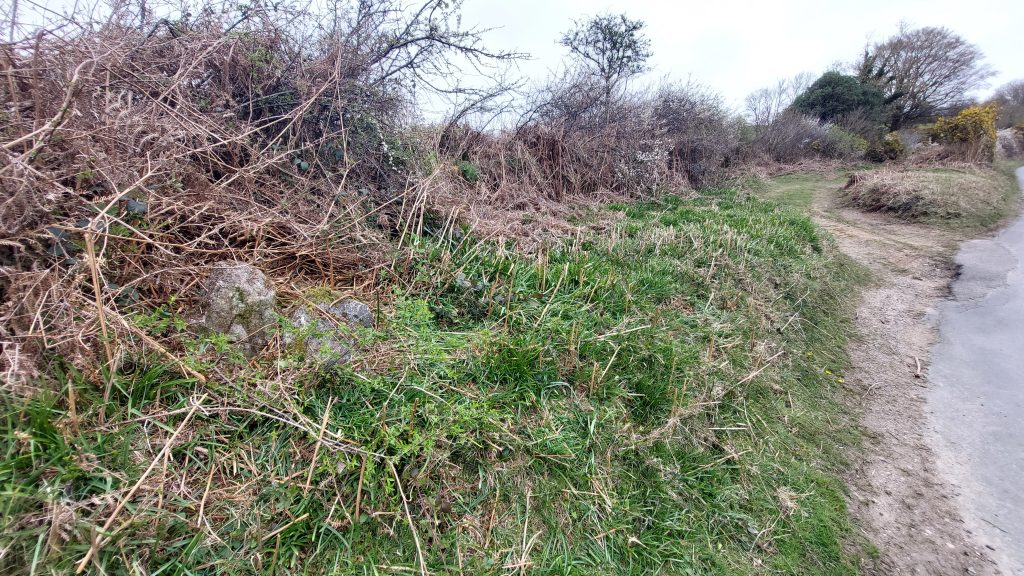
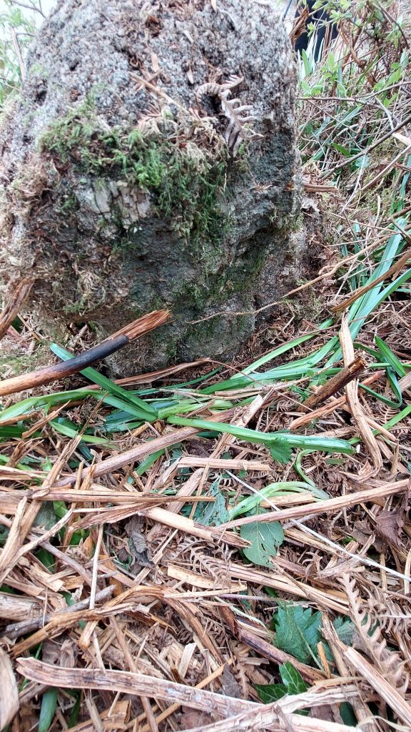
When the guide stone was visited by the author (April 2026), it could not be seen as it had been engulfed with vegetation. The pictures in this post of the stone are following a small amount of ‘gardening’. That said, additional cleaning and clearance is still required and the author will look to do this on his next visit
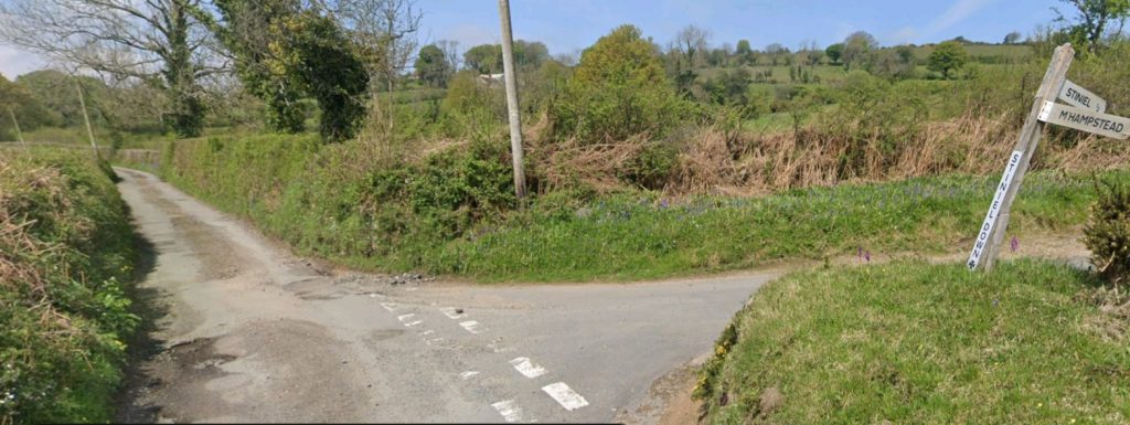
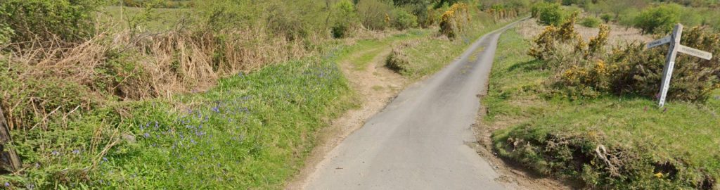
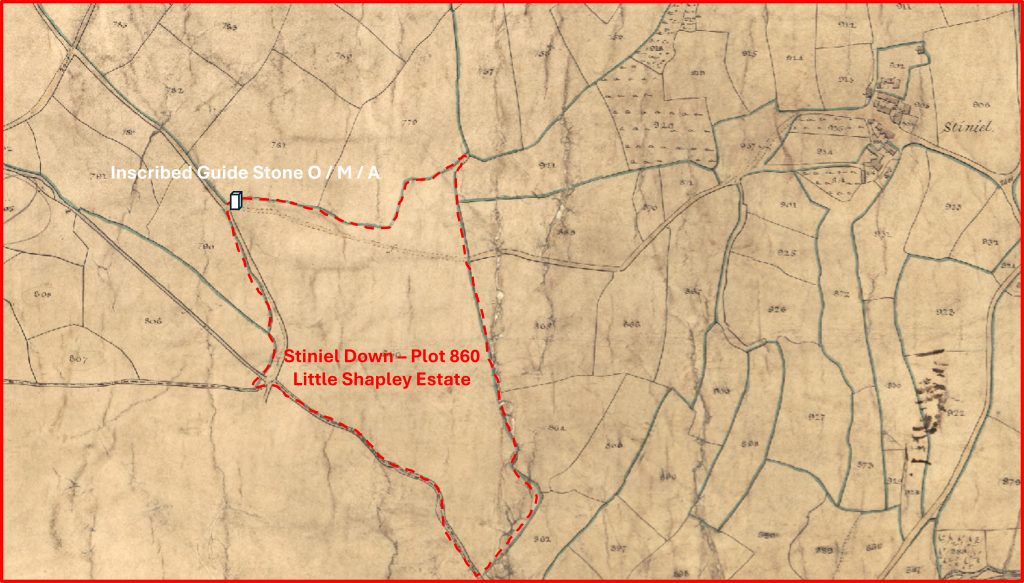
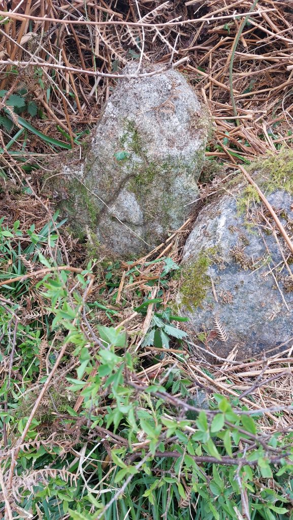
This annotated 19th century map shows that the ‘Stone’ was mapped here, between Langaford Bridge and Jurston Cross (which is now known as Yellands Cross). The three roads emanating from the junction are to the three towns represented by the letters on the guide stone.The road junction where the guide stone is located. It is on the verge in front of the telegraph pole. Adjacent to the guide stone is another unmarked stone, which is just visible on the picture. The junction is known as Stiniel Down Cross. The road to the right is to Stiniel / Stinhall in the direction of Moretonhampstead. The lane direction as shown in the photograph is from Ashburton to OkehamptonMoretonhampstead direction at Stiniel Down CrossThe guide stone contextual picture. The letter ‘A’ can just be seen on the guide stone, which is adjacent to a second stone. The guide stone is located at SX70053 85109Location of guide stone annotated onto the Chagford Tithe map of 1841. Stiniel Down was plot 860 on the apportionment and was part of the Little Shapley estate. The land here was described as ‘furze and pasture’ and was recorded as being 16 acres, 3 roods and 30 perches (around 6.85 hectares). The ‘occupiers’ of the land (presumably for grazing) in 1841 were John Ellis, William Ellis, Charlotte Boyer and William Floud
‘A’ for Ashburton. This face is the clearest of the three
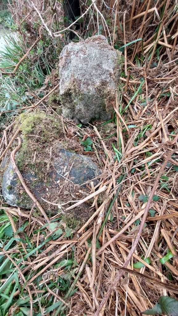
‘M’ for Moretonhampstead. Some further clearance needed to show off this face
‘O’ for Okehampton. Some further clearance needed to show off this face