Dartmoor Explorations

A collection of walks, discoveries, insights and pictures of exploring Dartmoor National Park

Yelland Tin Mill

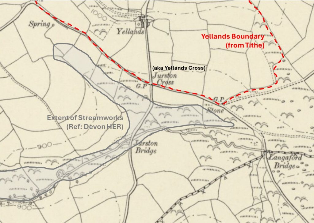
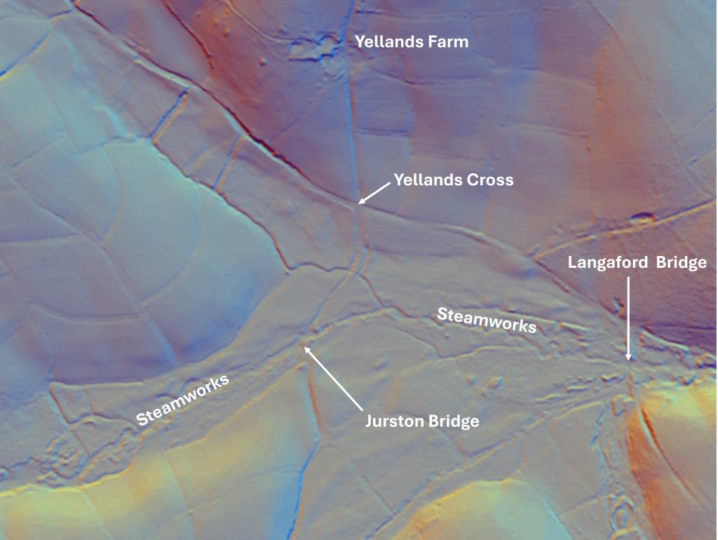
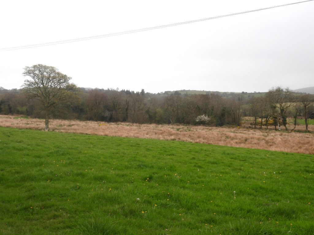
When researching areas of tinners activities in the Chagford area, the Devon Historic Environment Record (Environment Viewer) indicates that there is evidence of an extensive area of streamworks which runs from Yellands Cross in the north, running southwards up the River Bovey valley the past Jurston and Hurston farmsteads and onto Chagford Common and thence to the North Walla Brook and West Vitifer Tin Mine (aka New Vitifer Consols).

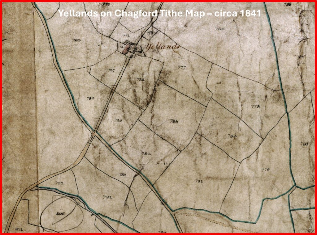
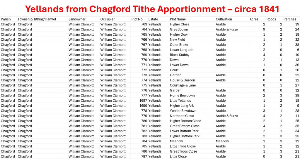
The first documentary evidence of tinworking on the Bovey dates (ref: Passmore-1997) dates from the sixteenth century. Towards the upper reaches of the river at Boveycombehedd, there is evidence of elluvial streamworks (pre-nineteenth century) and alluvial streamworking which occurred earlier, Passmore suggesting the latter probably predates the Medieval settlements of Lakeland and Ridge Lay. Towards the northern end of the section of streamworks, there was possibly once a 18th century Stamping Mill at Yelland. This mill is has been recorded by Dr Tom Greeves through documentary evidence from 1755. Its location is unknown but is likely to have been along the streamworks immediately to the south of Yellands Cross (formerly known as Jurston Cross) and most likely either east of Jurston Bridge towards Langaford Bridge or west of Juston Bridge towards the Higher Corndon / Hurston road. All of this land in private giving limited opportunity to conduct any further research.

Bibliography

  1. The Tinworking Landscape of Dartmoor in a European Context – (2016) – Paper presented by Dr Tom Greeves – Lodges and Mills: The Field Archaeology of Tin Accommodation, Stamping and Smelting on Dartmoor at the conference (6th – 11th May 2016) at Tavistock – Mill number 174
  2. A.J. Passmore -(1997) – Boveycombehedd, Chagford, Devon: an archaeological investigation of a Diachronic landscape, (Post-Graduate Thesis). SDV360382
  3. Department of Environment – (1987) – Chagford, 76 (List of Blds of Arch or Historic Interest). SDV350463
  4. Ordnance Survey Archaeology Division, – (1953/1974) -SX68NE1 (Ordnance Survey Archaeology Division Card). SDV274553.
0. Map
This annotated map indicates the extent of streamworks (according to the Devon HER) immediately south of Yellands Cross (formerly known as Jurston Cross). It is within these streamworks alongside the River Bovey that the author suspects the recorded Stamping Mill from 1755 most probably was located. The document researched by Tom Greeves mentions Yelland (which is on the hillside to the north). It appears very unlikely a Stamping Mill would have been located within the boundary of Yelland(s) Farmstead due to the area topography.
1. LiDAR
LiDAR plot of the area of interest below Yellands Cross, which indicates the streamworks alongside the River Bovey
2. Yellands Cross
The modern sign at Yellands Cross, which was formerly known as Jurston Cross
3a. View from Yellands Cross
View from Yellands Cross over private land towards the River Bovey. It is down near the tree line where the author suspects Yelland Stamping Mill may have been located
3b. View from Yellands Cross
Another view from Yellands Cross over private land towards the River Bovey (between Langaford Bridge and Jurston Bridge)
4a. Yellands Tithe Map
Yellands on the 1841 Chagford Tithe Map. It is noteworthy that Yelland (from the Stamping Mill documentary evidence of 1755) was recorded as Yellands by the time to the tithe with an ‘s’ on the end of the name
4b. Yellands Tithe Apportionment
Yellands Tithe Apportionment. As no plot name mentions the word ‘mill’, this perhaps strengthens the argument that the ‘Yelland Stamping Mill’ was located to the south in the River Bovey valley and merely took it name from the farmstead. The landowner / occupier was William Clampitt
5. Yellands Farm
Yellands farmhouse and barn in April 2026 is beautifully maintained. The Department of Environment record that the farmstead is probably 17th century in origin and was likely to have been modernised in mid or late 19th century. Before 19th century it was probably all thatched.
6. Yellands Ash House
A short distance up the lane from the farmhouse is a rather splendid Ash House. The Ash House still in good condition with classic circular walling and a corbelled stone roof.
Total Page Visits: 521 - Today Page Visits: 12

Next Post

Previous Post

Leave a Reply

© 2026 Dartmoor Explorations

Theme by Anders Norén

Social media & sharing icons powered by UltimatelySocial