A collection of walks, discoveries, insights and pictures of exploring Dartmoor National Park
December 12, 2022
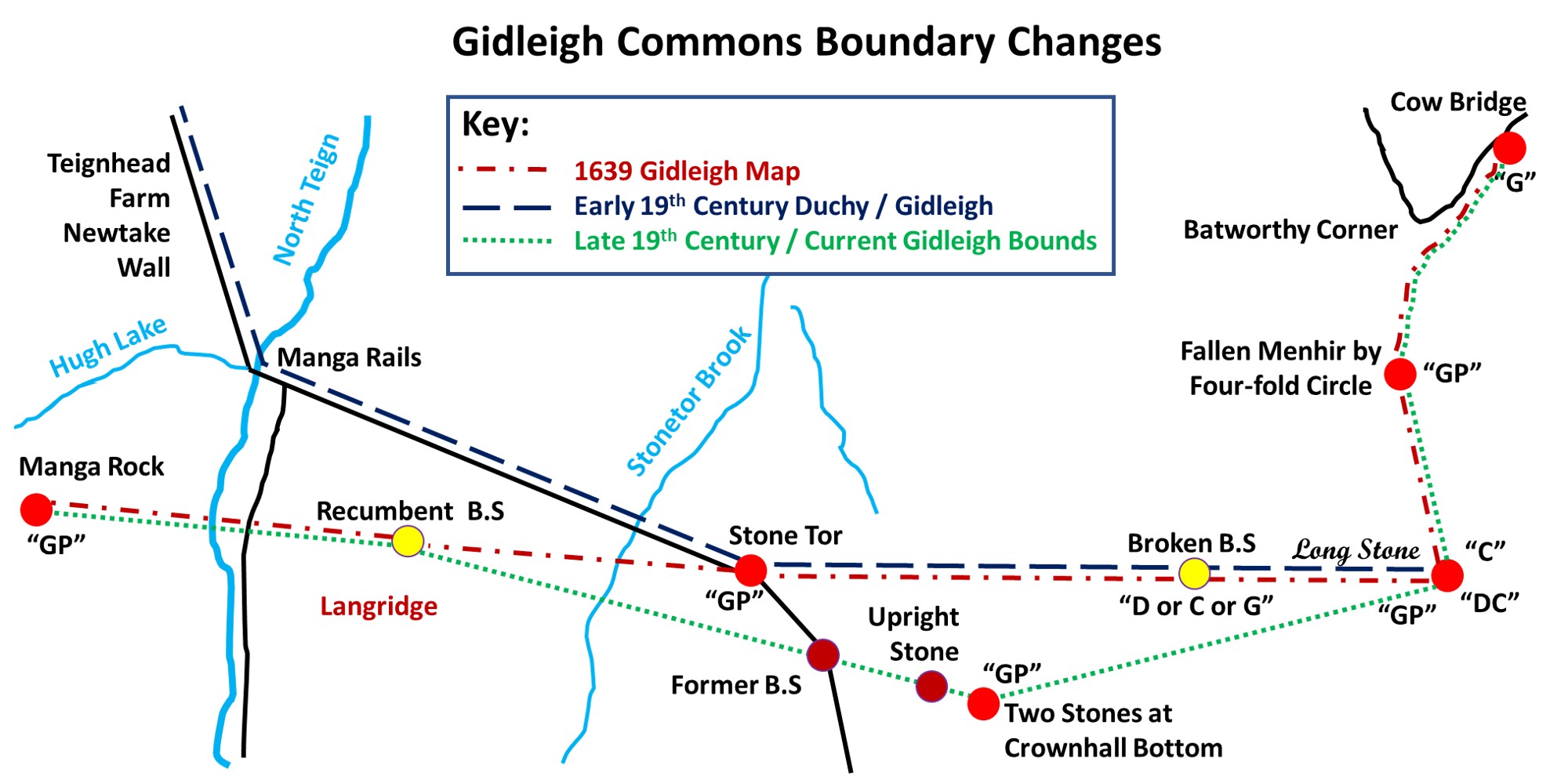
Gidleigh Commons 19th Century Boundary changes from ‘Cow Bridge’ to ‘Manga Rock’
Gidleigh Commons bounds border the parishes of Chagford to the east and Lydford (the Forest of Dartmoor) to the south and west. During the first part of the 19th century there was a dispute between the Commoners of Gidleigh with the Duchy regarding the Gidleigh Commons southern boundary. The dispute appeared to have been resolved through a 1842-43 settlement for which the author has referred to “Dartmoor Boundary Markers” (second edition) by Dave Brewer.
The cause of the uncertainty of the boundary appears to have started during the 1608 forest of Dartmoor Perambulation where the jurors misinterpreted Wotesbrokelakesfote (Hew / Hugh Lake Foot) as Whoodlake (Walabrook) from the Heigheston (Longstone). Thus the forest boundary in 1608 continued north from the Longstone rather that turning west and must have placed the Gidleigh and Throwleigh boundaries into some doubt. Around this time the Gidleigh commoners conducted their own perambulations and a map dating from 1639 reveals that a number of points of reference for their purposes “crept in”.
Fast forward to 1791, a House of Commons petition sought authority to enclose large parts of central Dartmoor which resulted in the Duchy granting leases to enclose huge newtakes to enlarge farms such as Teignhead Farm (circa 1808). This brought sharply into focus the Gidleigh bounds as the Teignhead Farm enclosures extended far beyond the line of the forest bounds accepted by the commoners of Gidleigh (by around 700 / 800 acres). The Teignhead Farm newtake enclosure was emphasised by the building of the newtake wall. Effectively, there had been around 200 years of uncertainty over the Forest of Dartmoor and Gidleigh Common boundaries, which were now being challenged even further by the erection of a drystone newtake wall. The wall represented a poignant physical barrier which must have caused much controversy with the Commoners. Although the original wall was rebuilt (on a different line and which is the one we see today as the original one was ‘cast down’ by the commoners), it was the supervisor of the construction of the wall (William Rogers) who was instrumental at the 1842 enquiry (which led to the settlement) as he gave evidence in favour of the Commoners.
This post considers the outcome of the 1842-43 settlement and the how the various iterations of the boundaries have been marked by inscribed boundary stones and other features over the centuries leading up to this point.
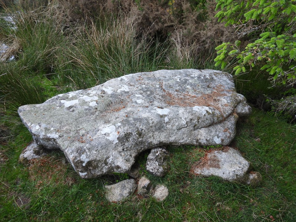
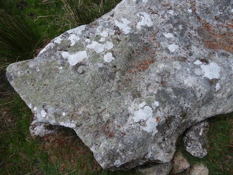
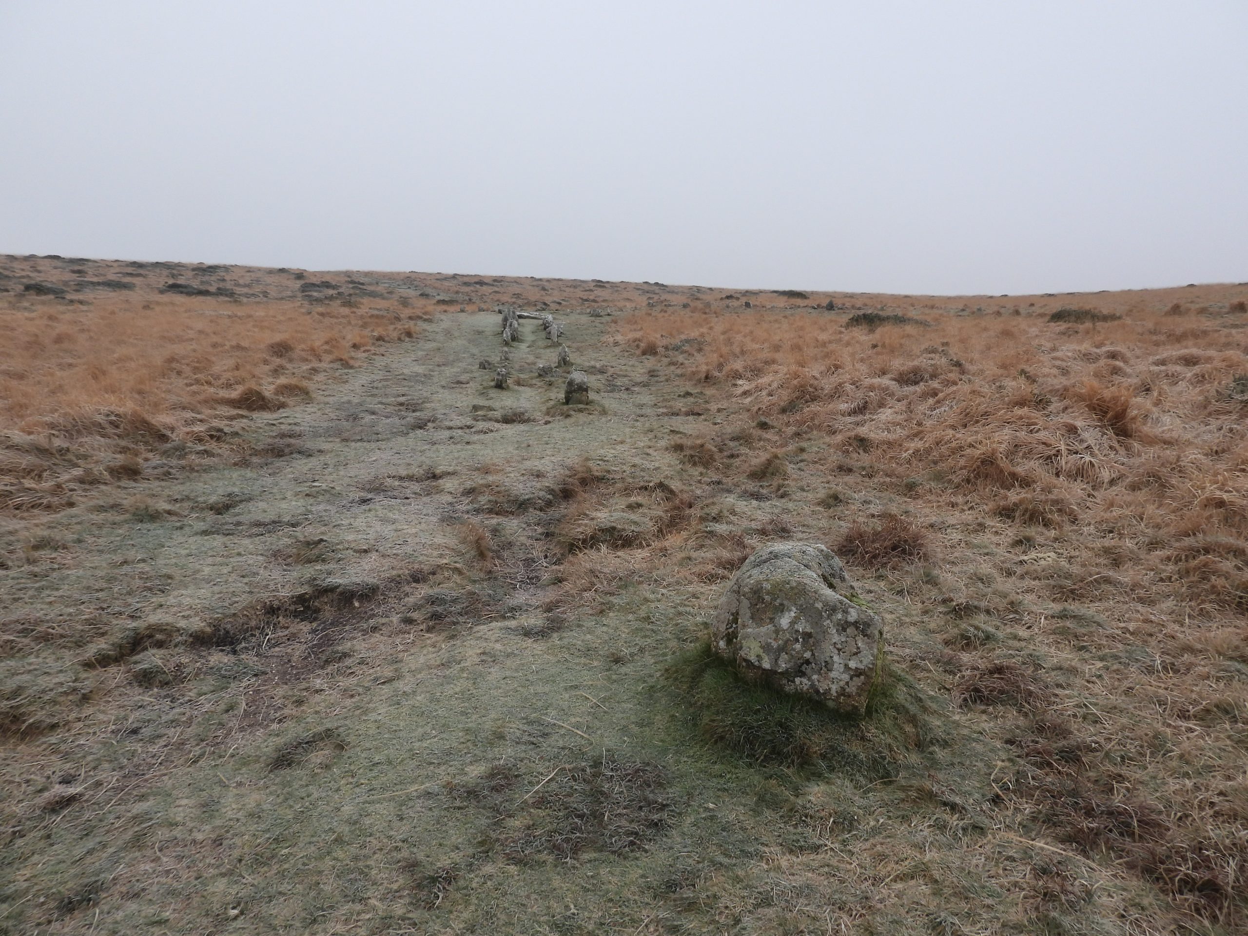
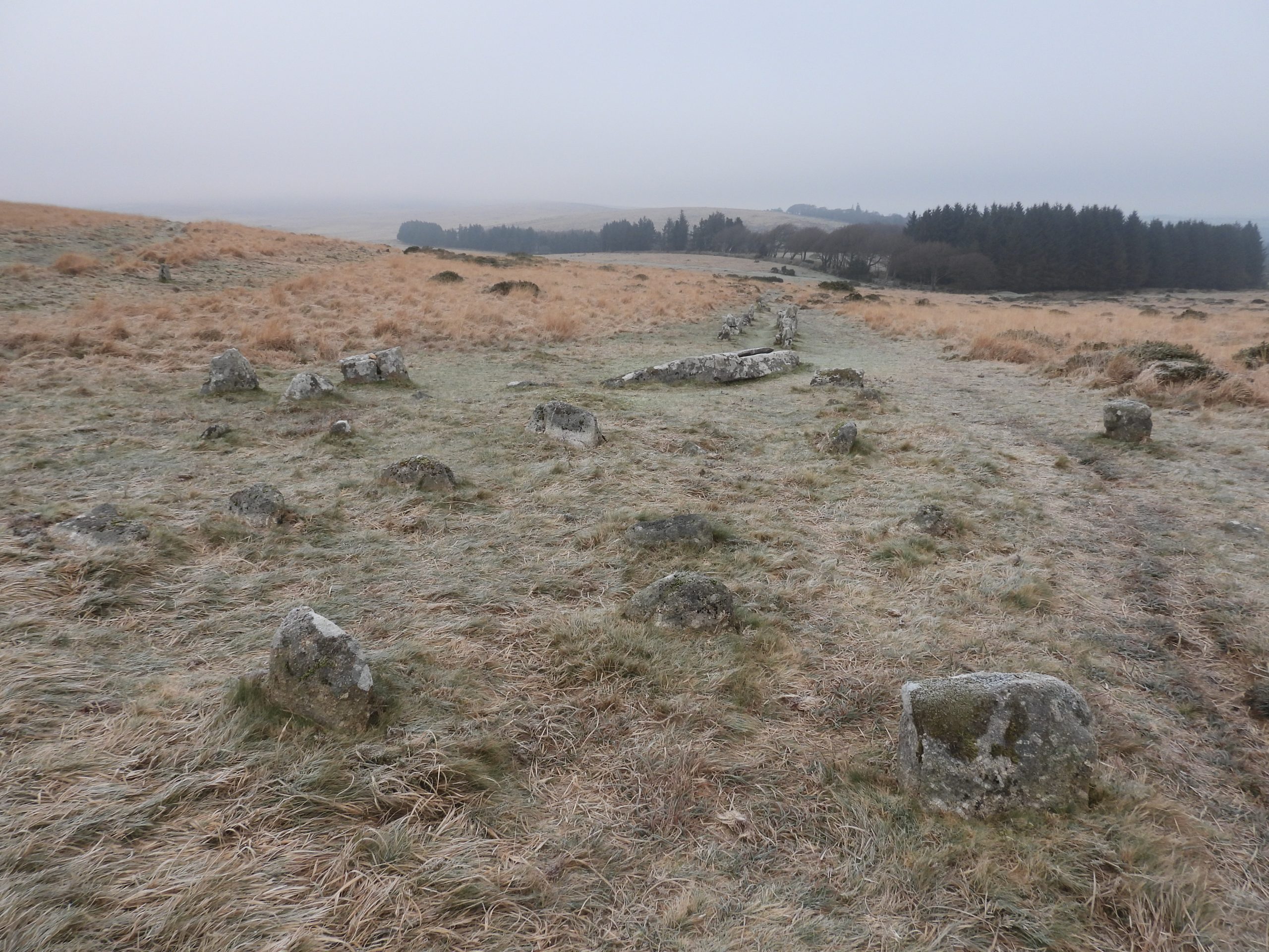
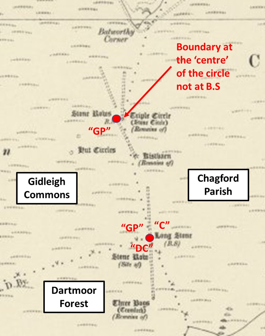
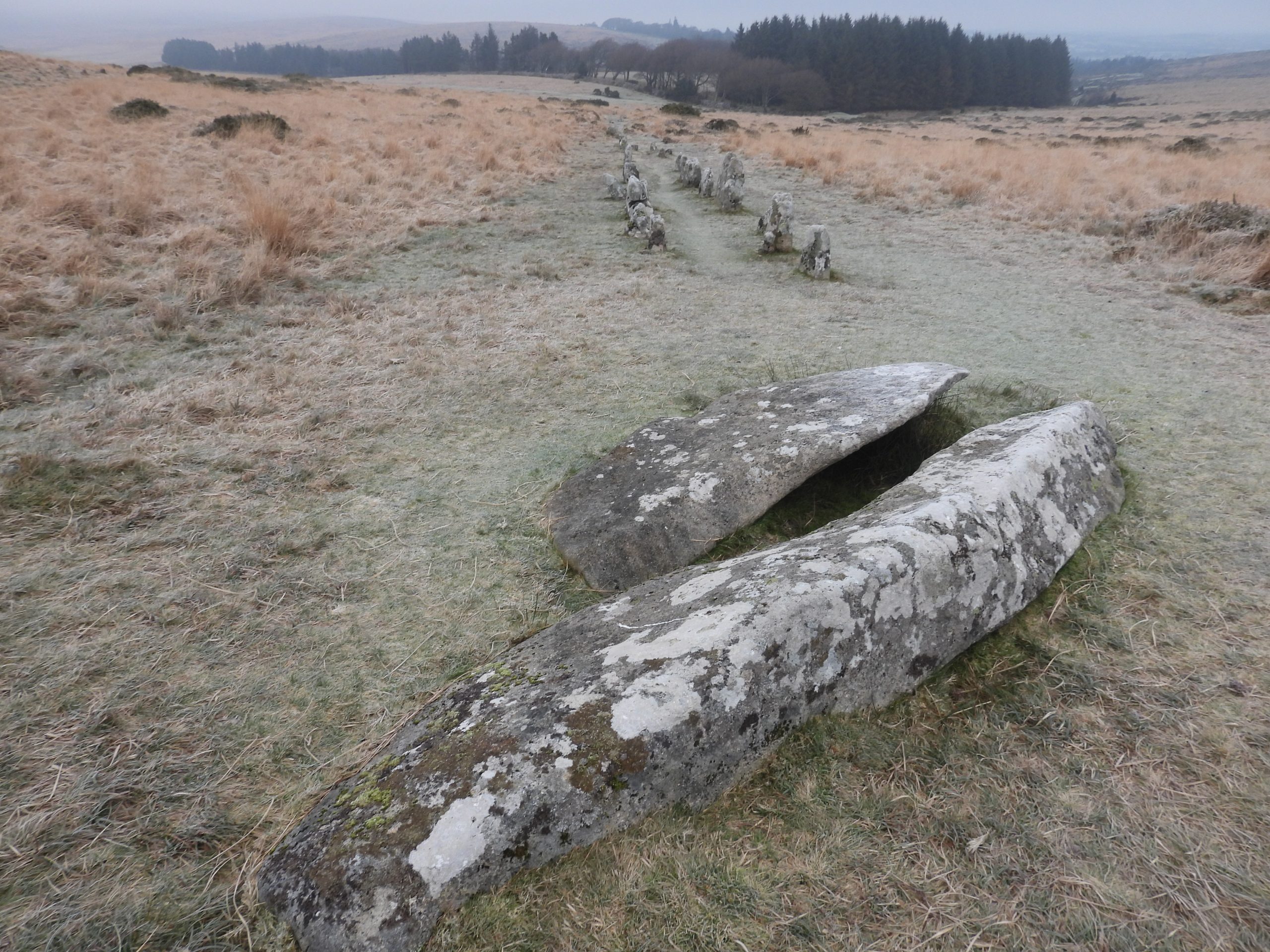
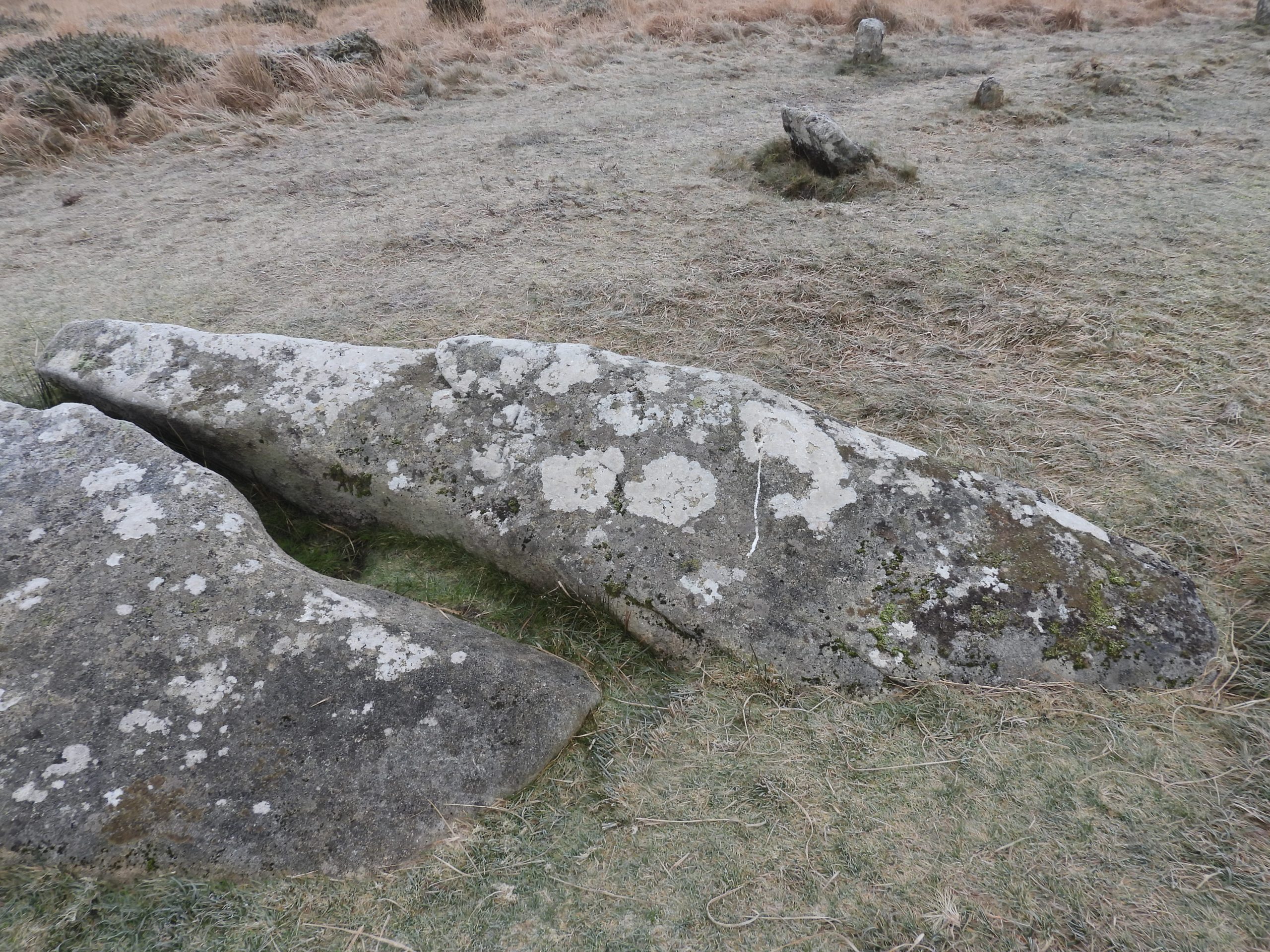
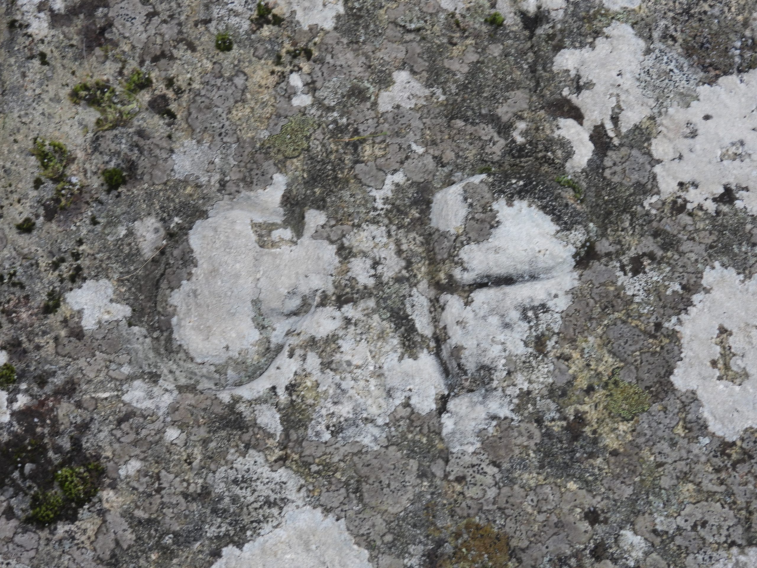
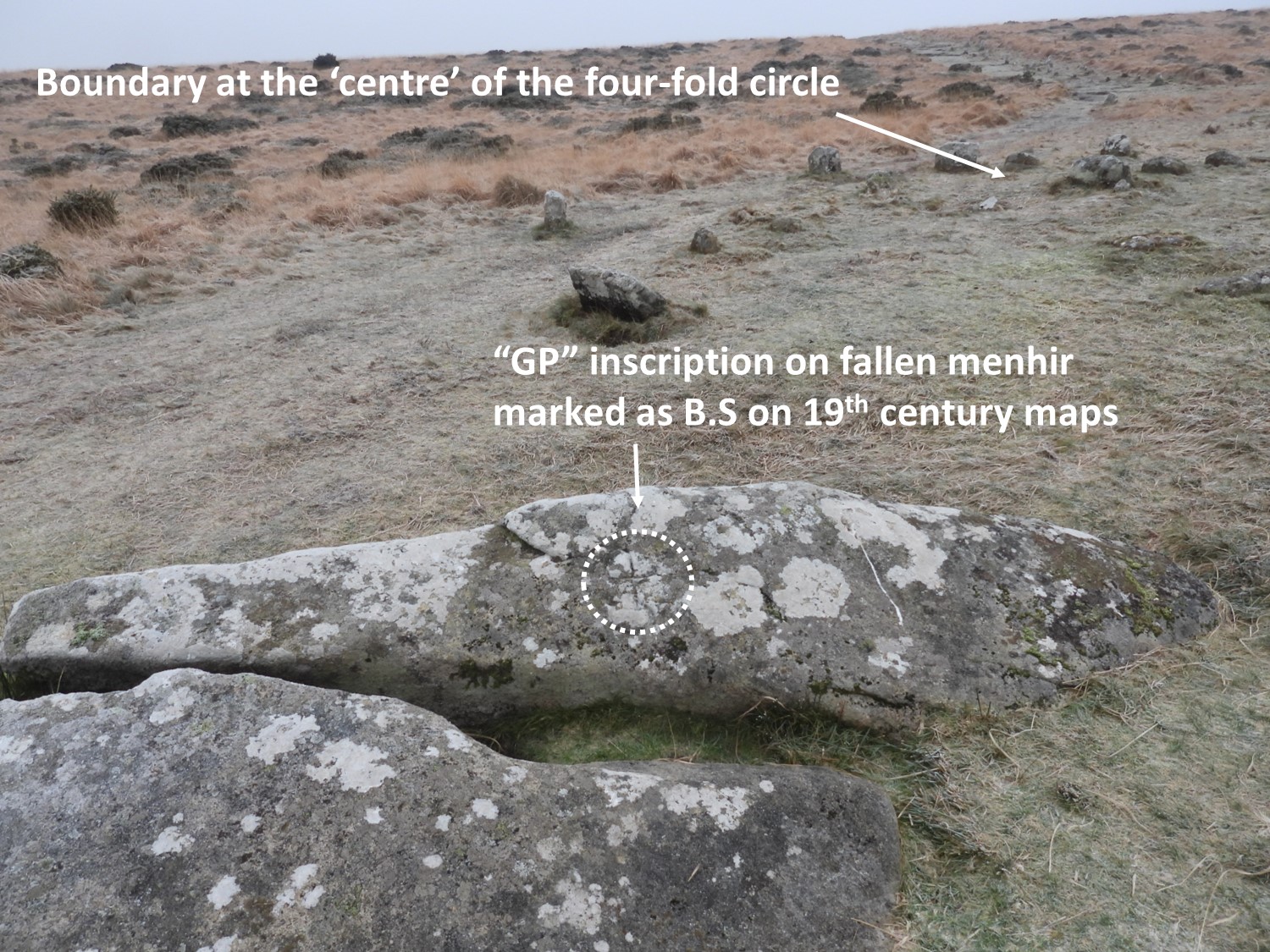
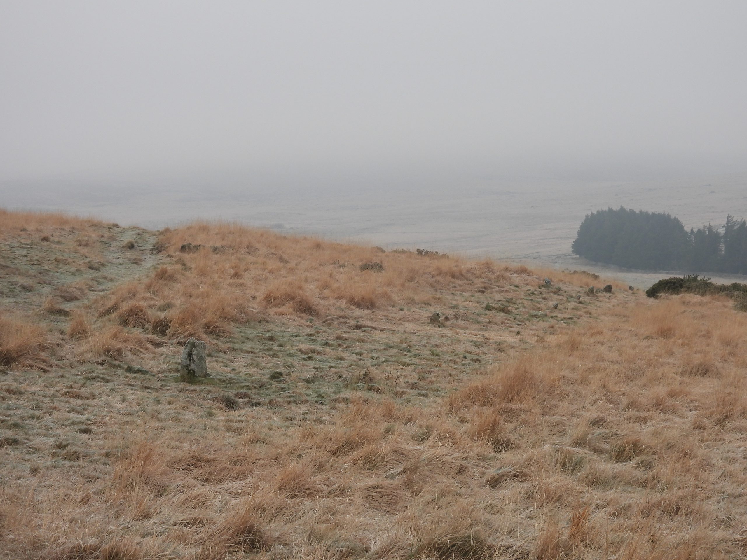
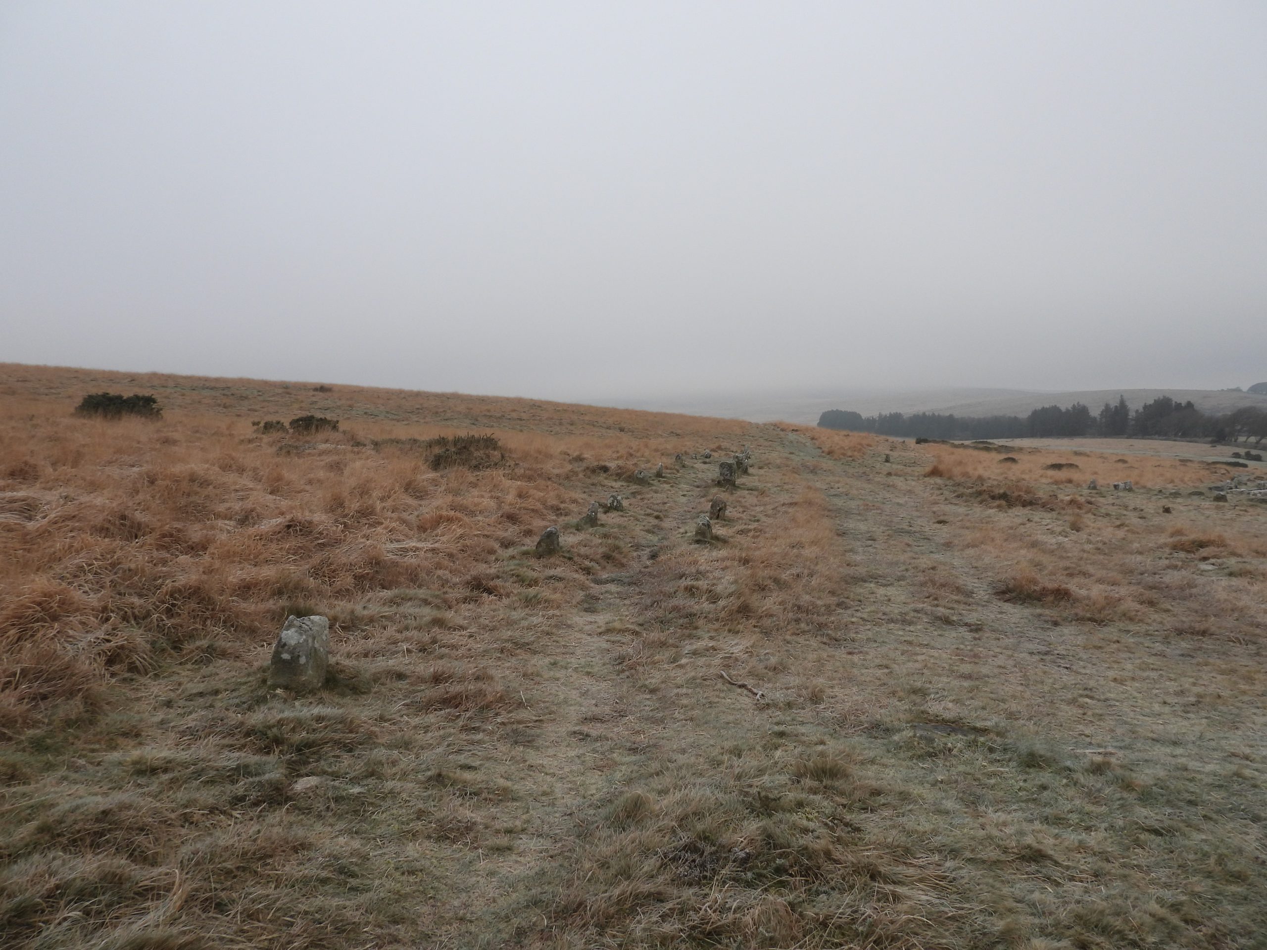
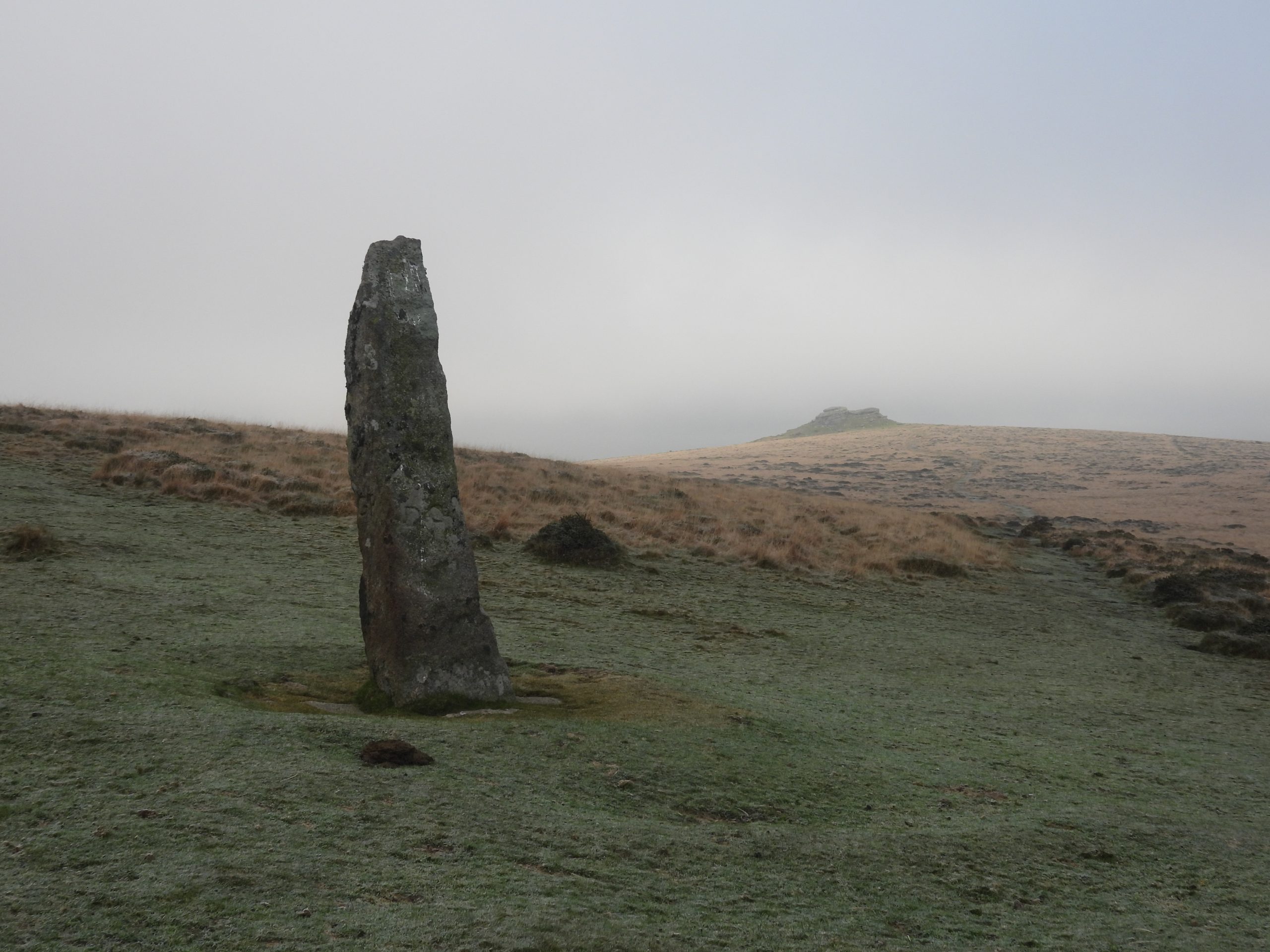
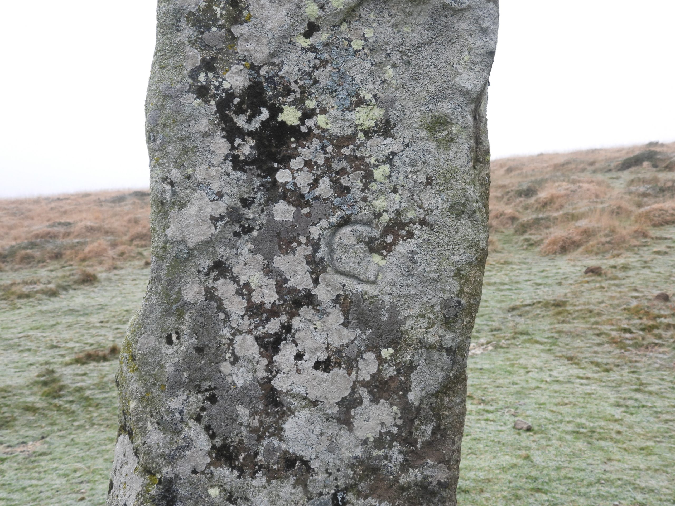
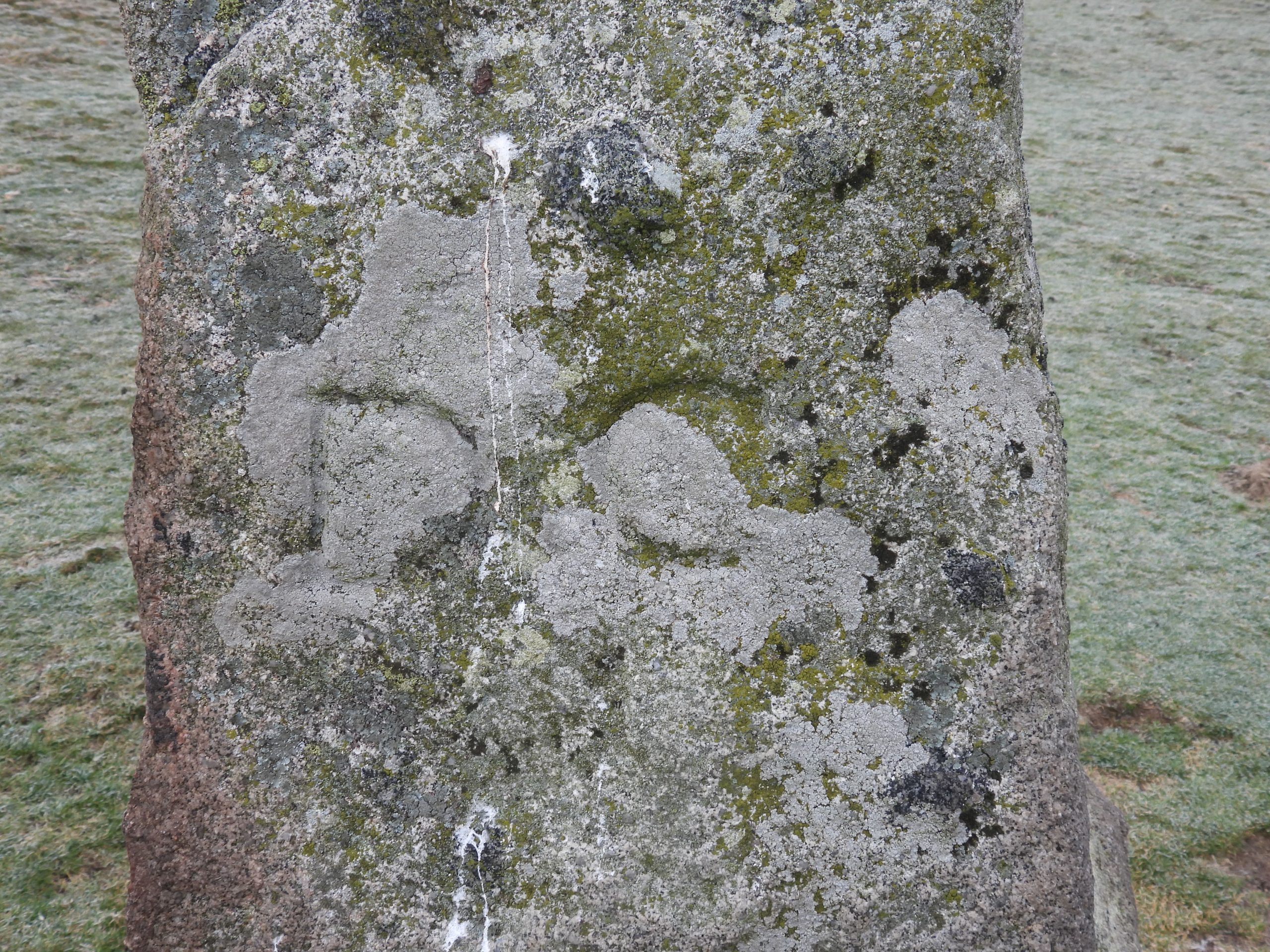
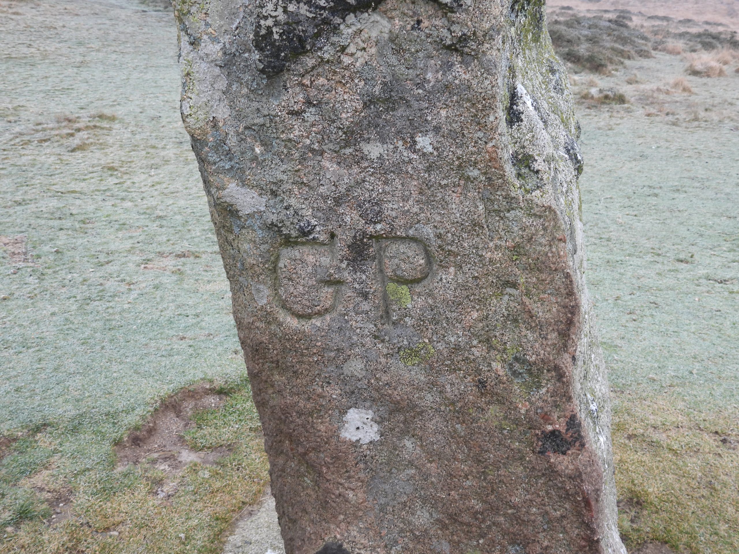
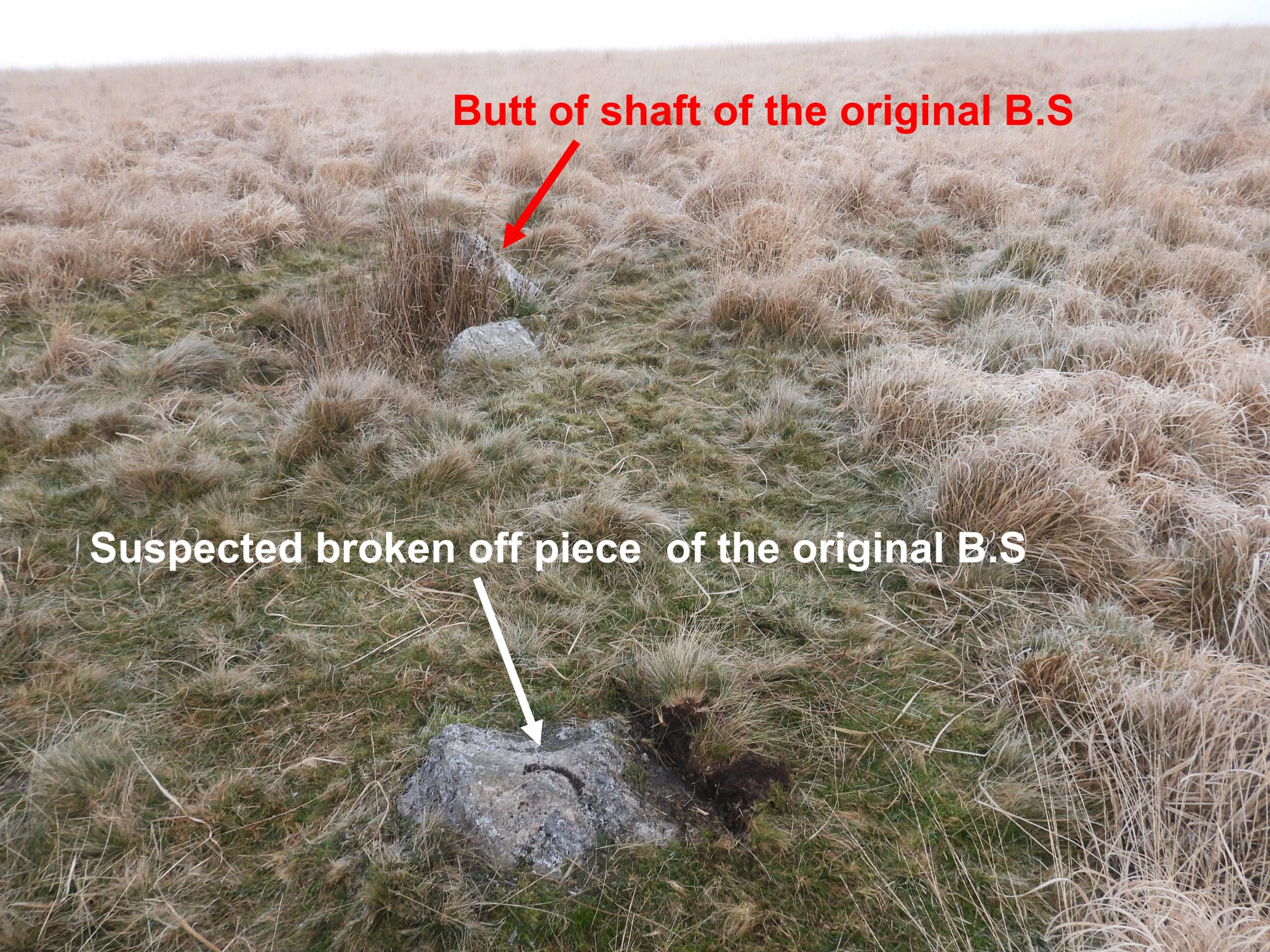
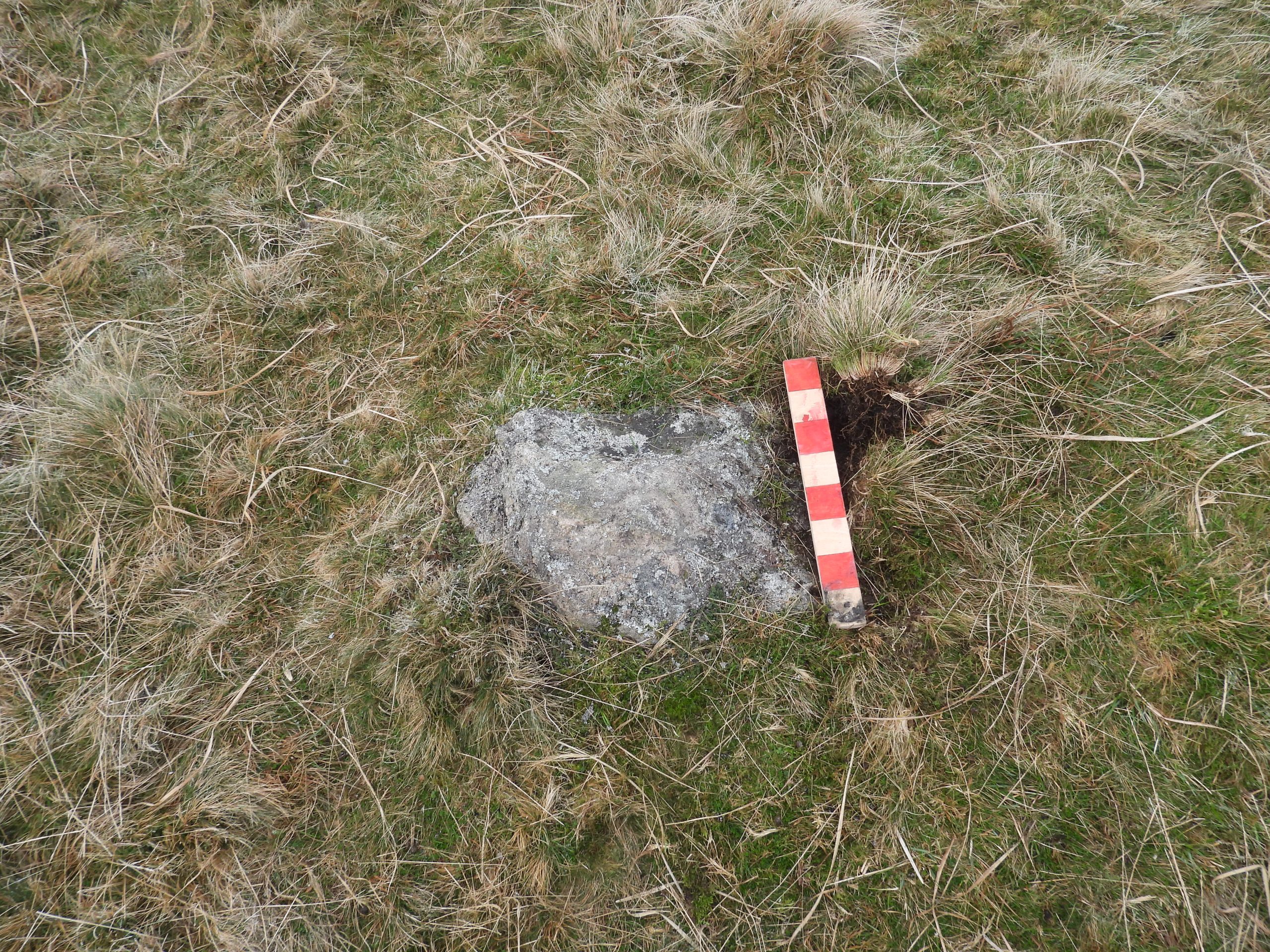
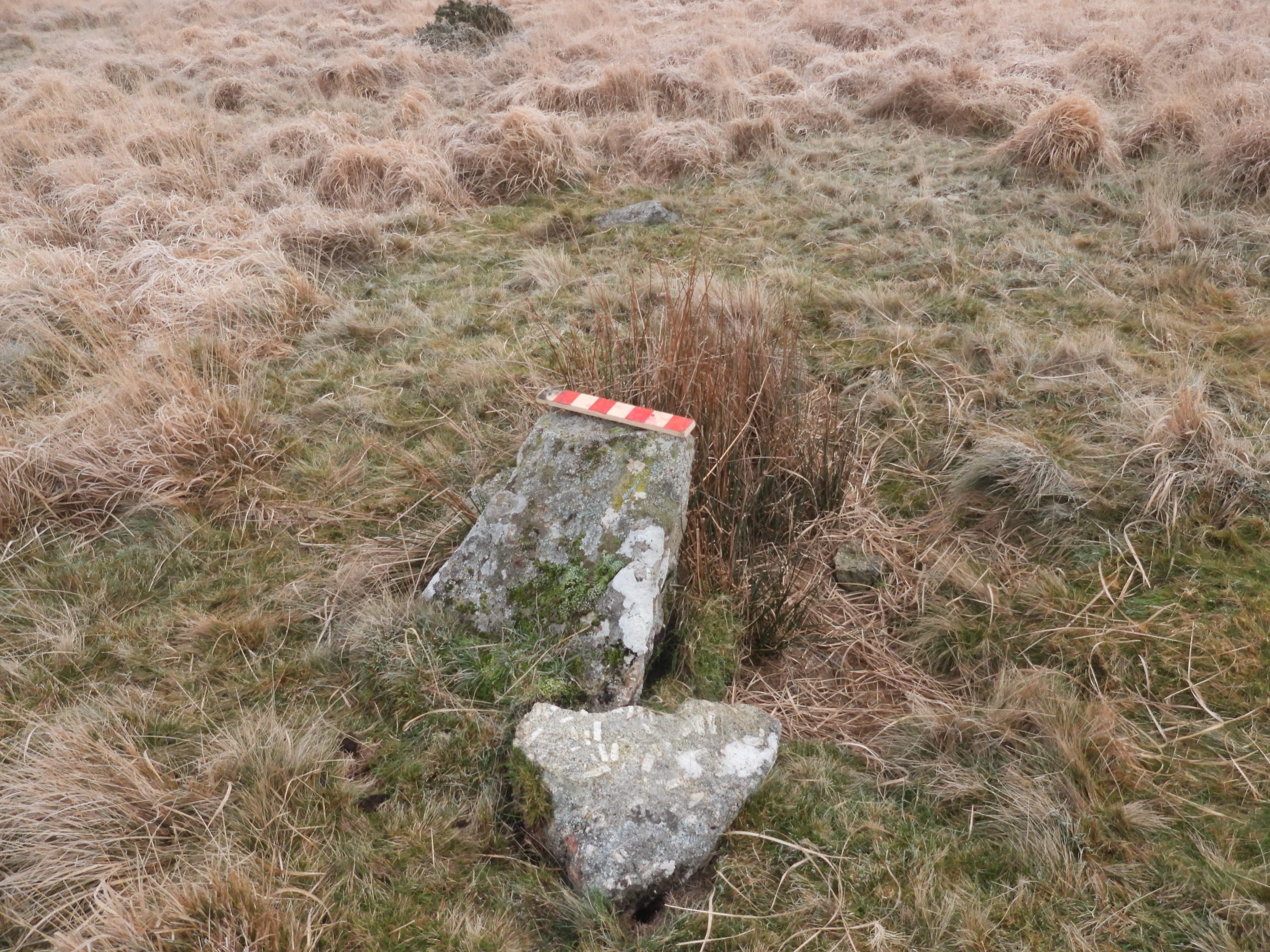
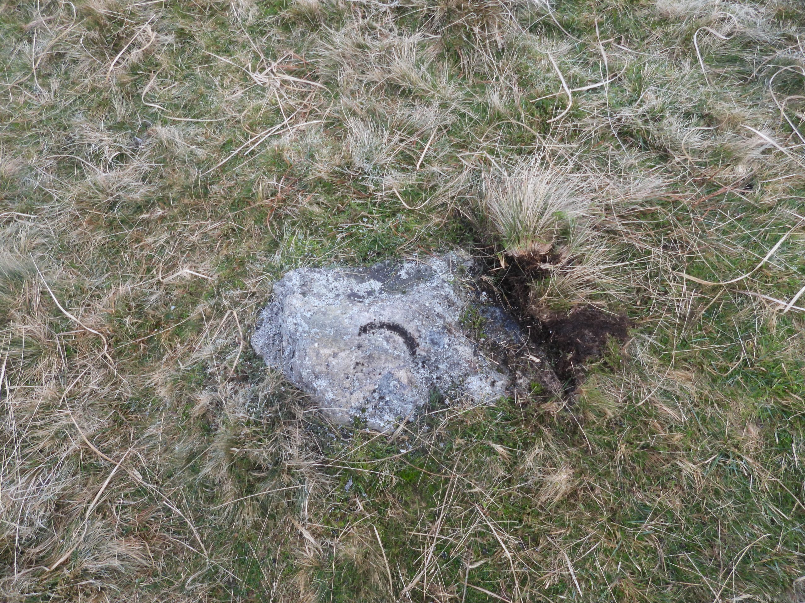
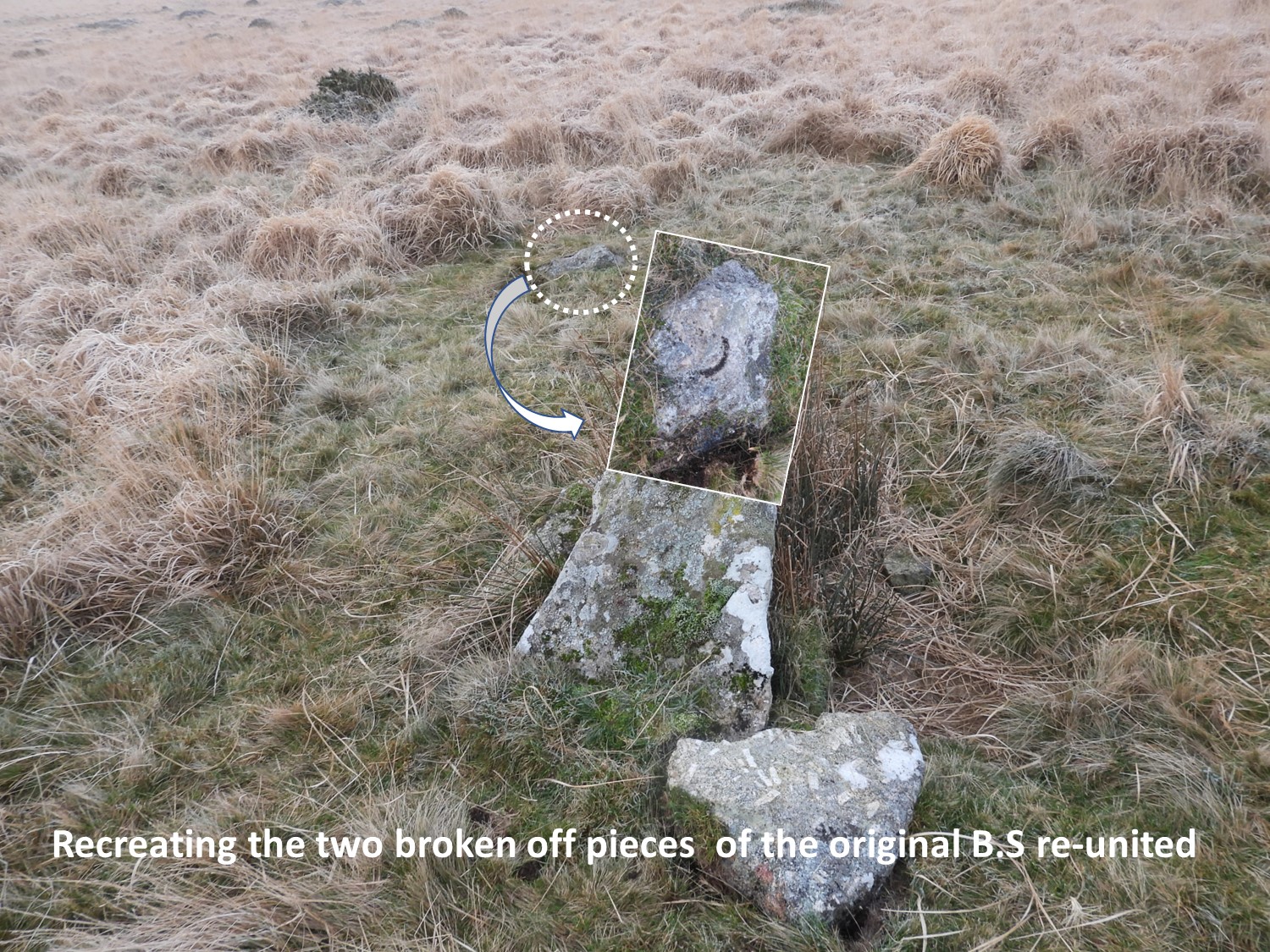
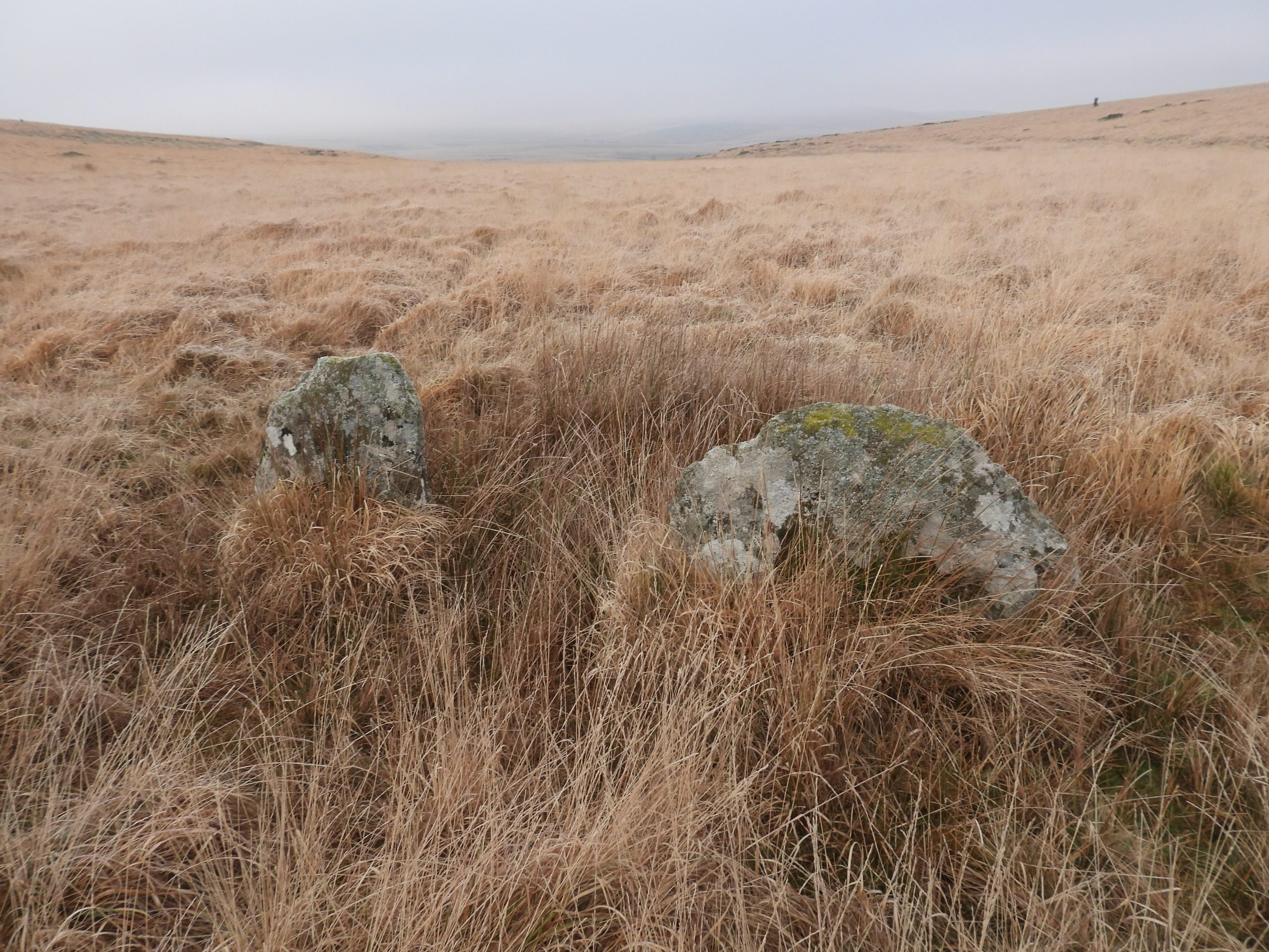
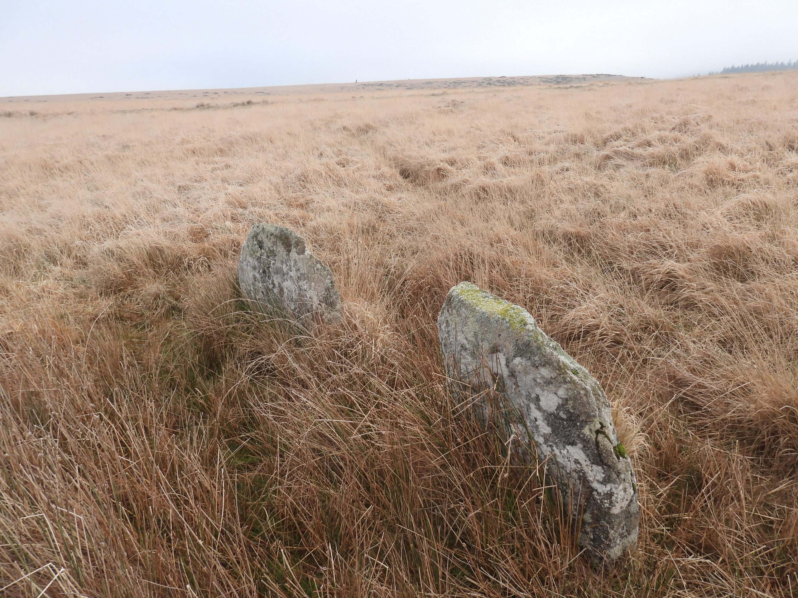
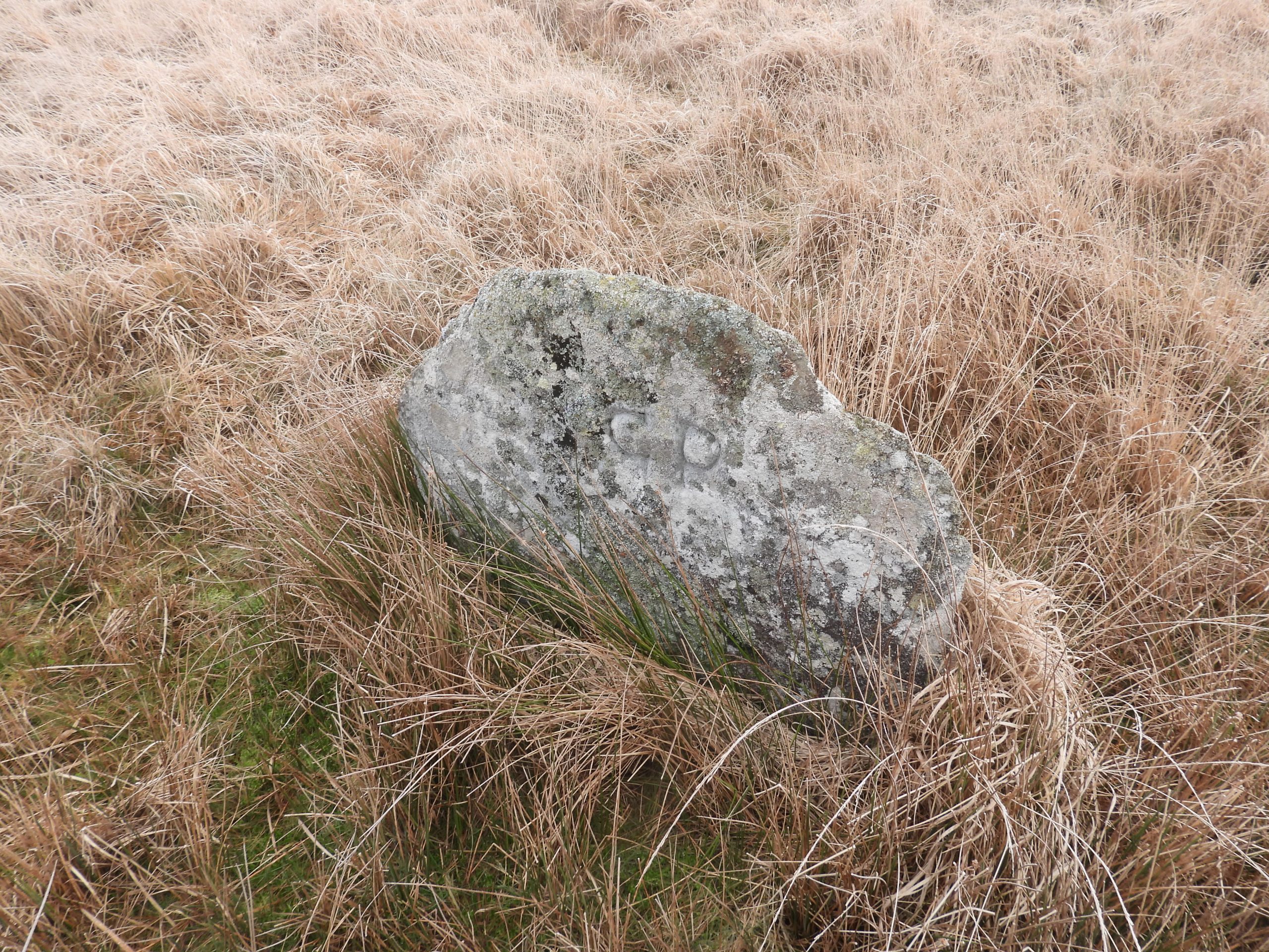
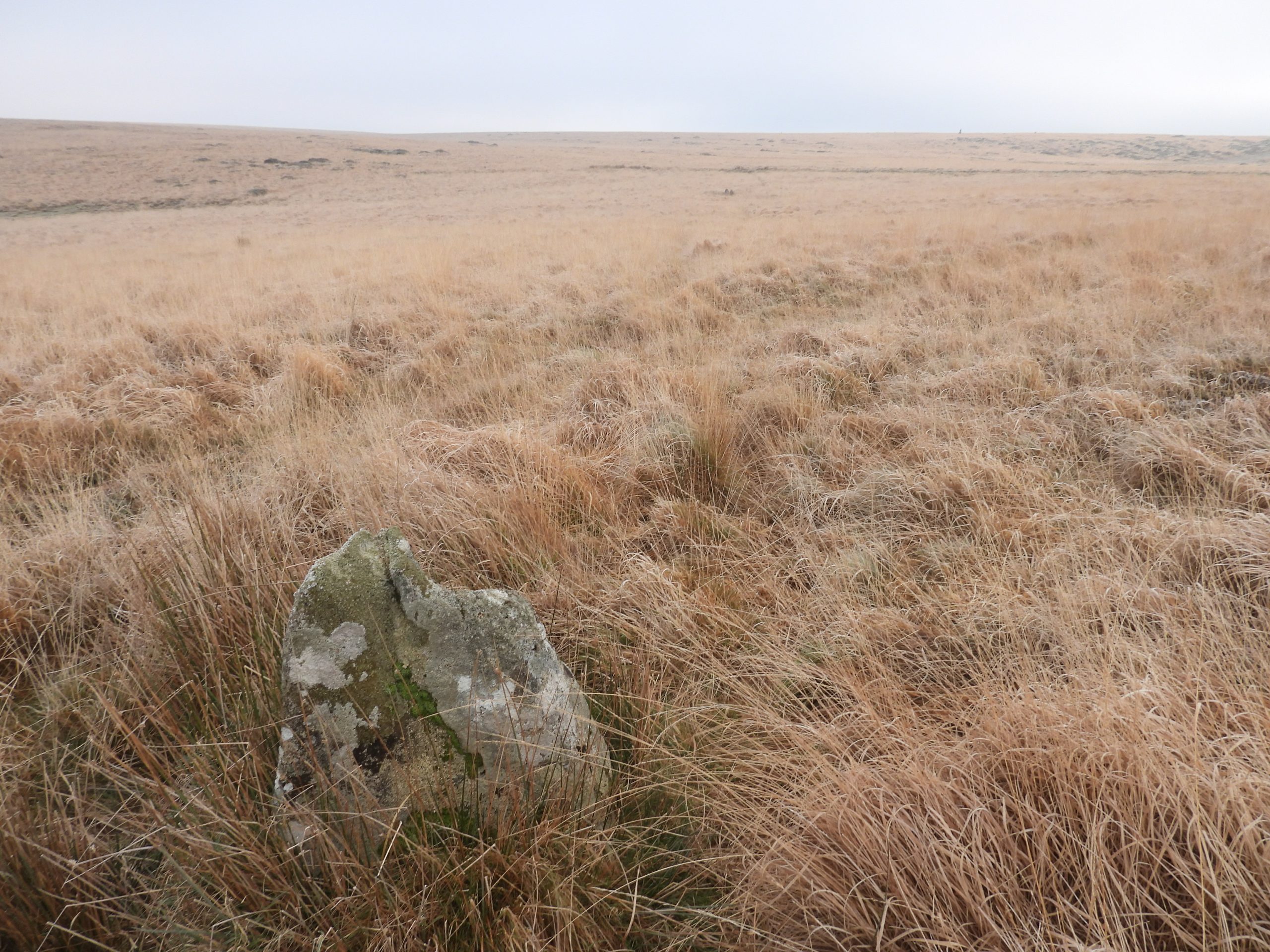
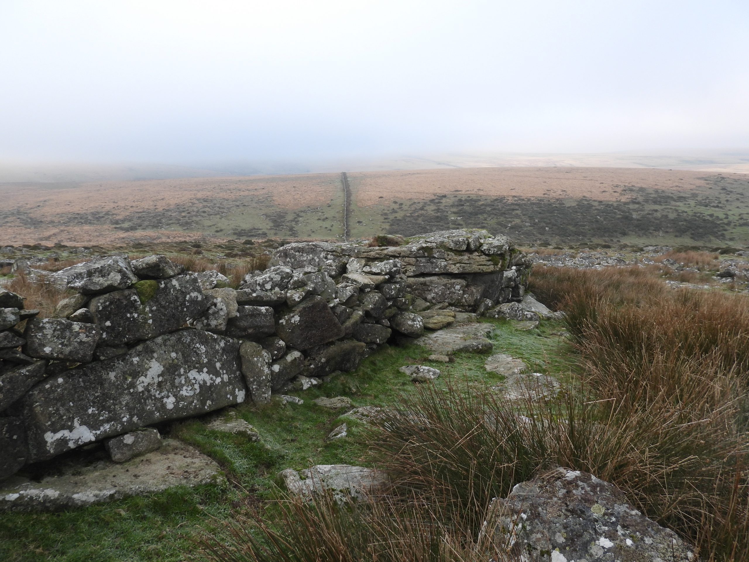
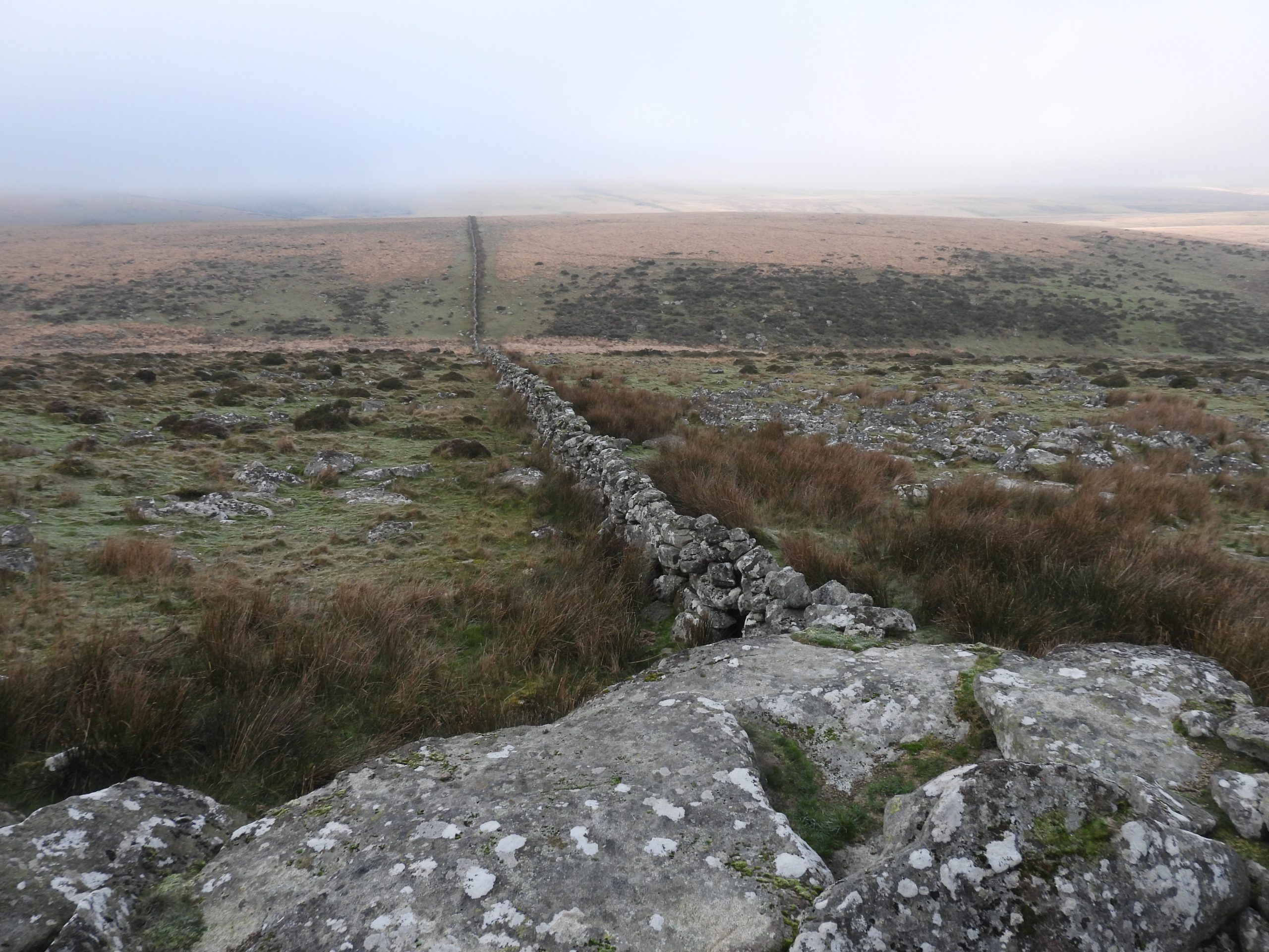
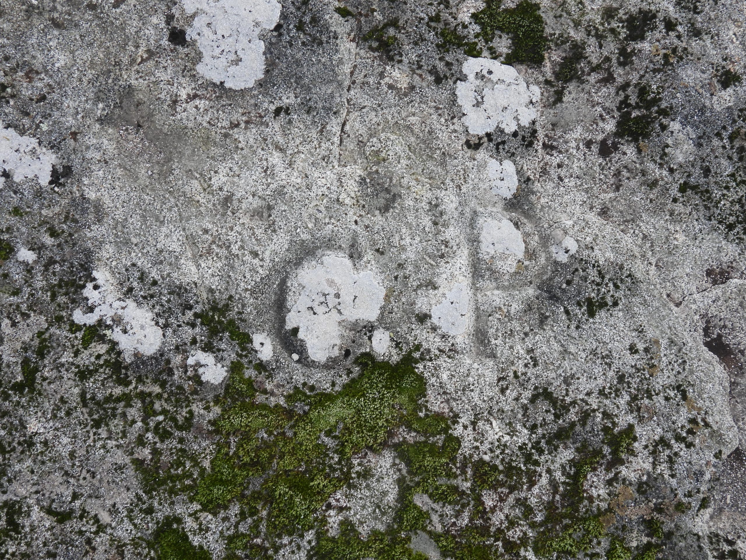
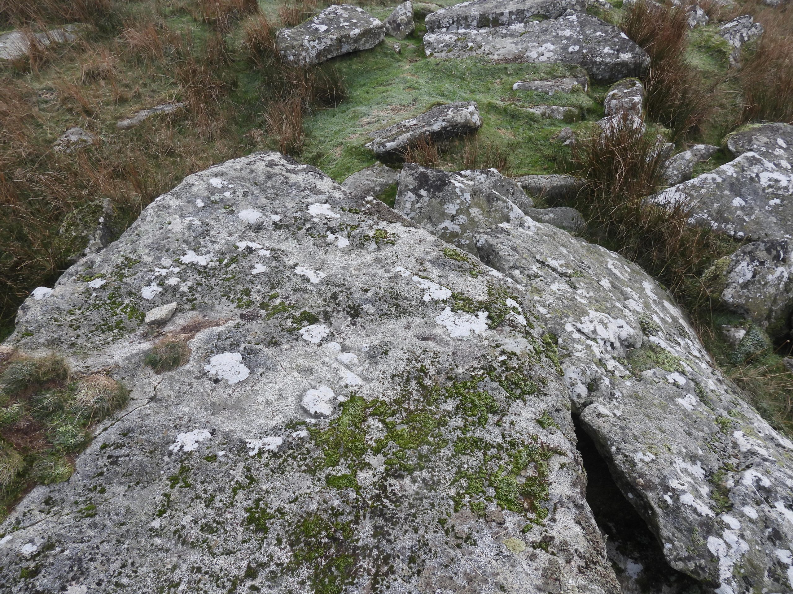
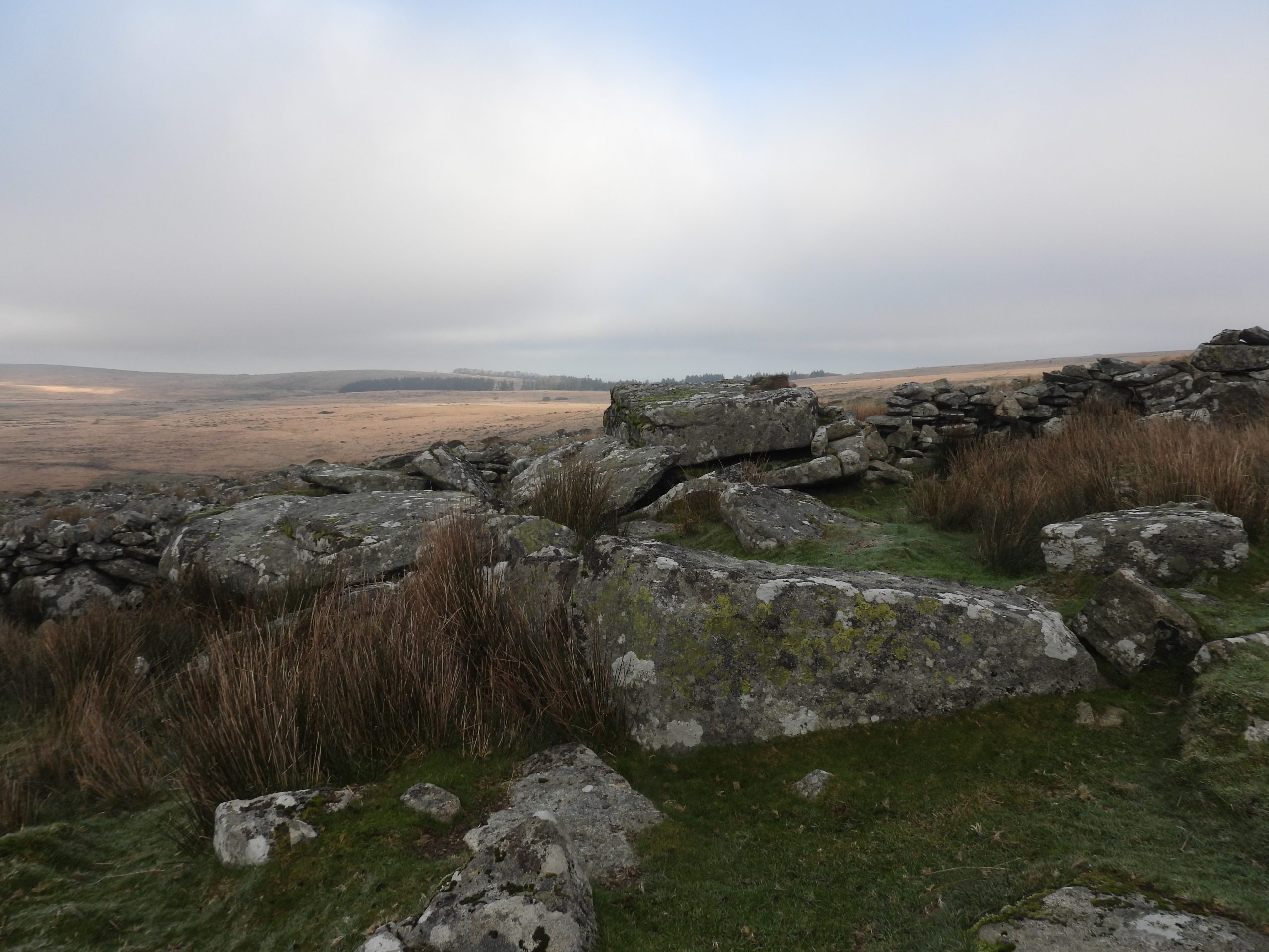
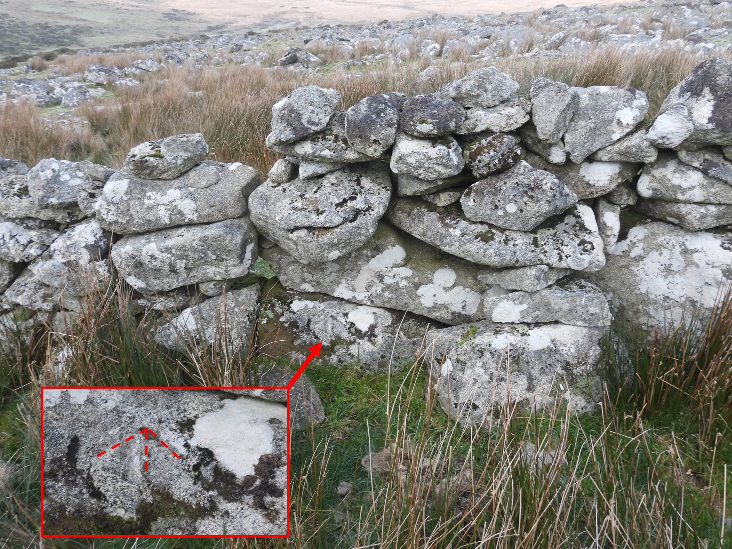
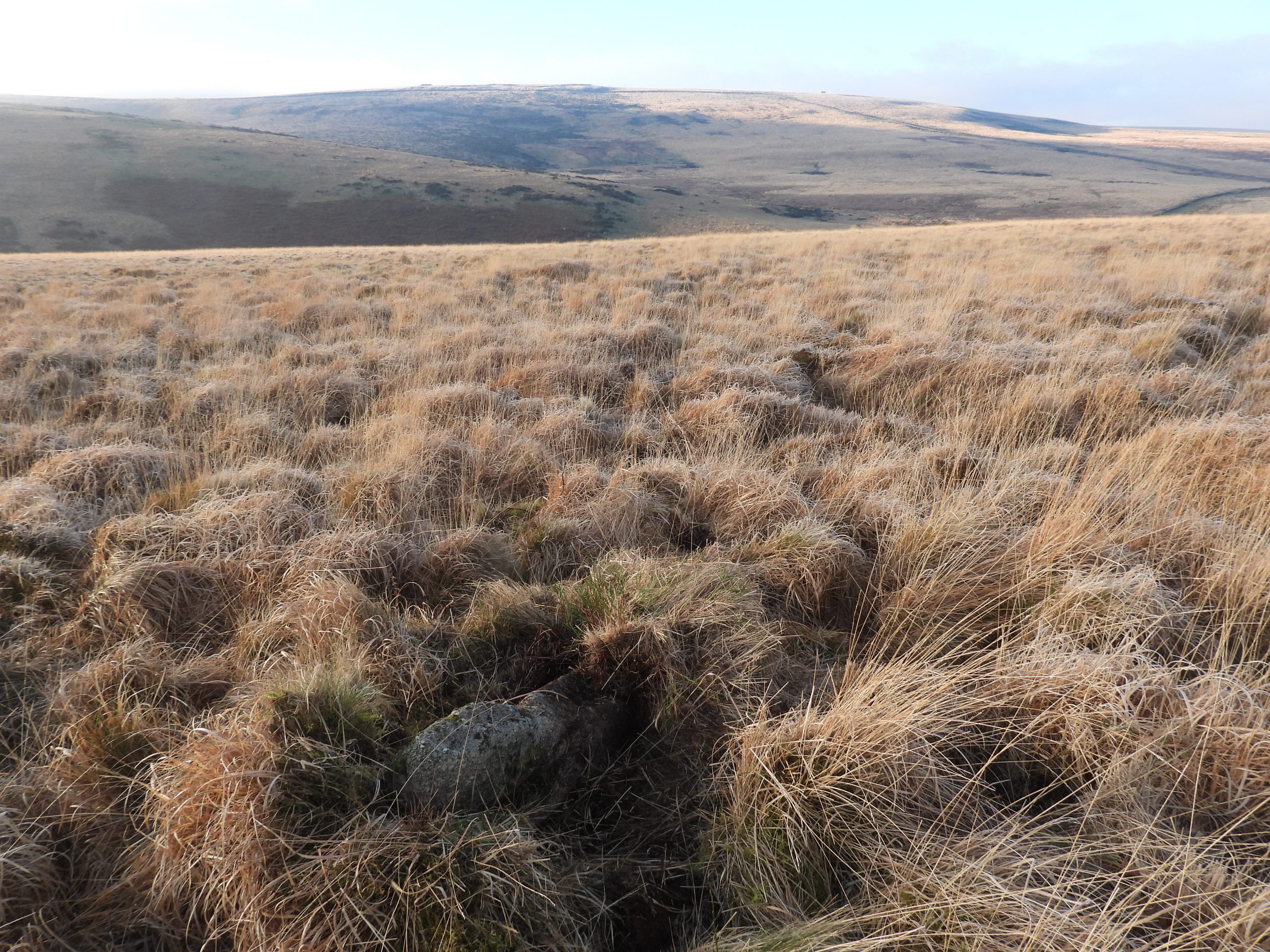
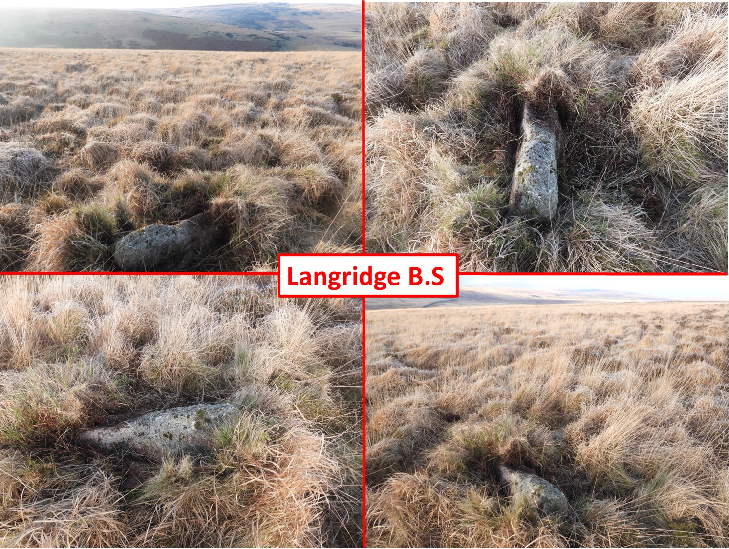
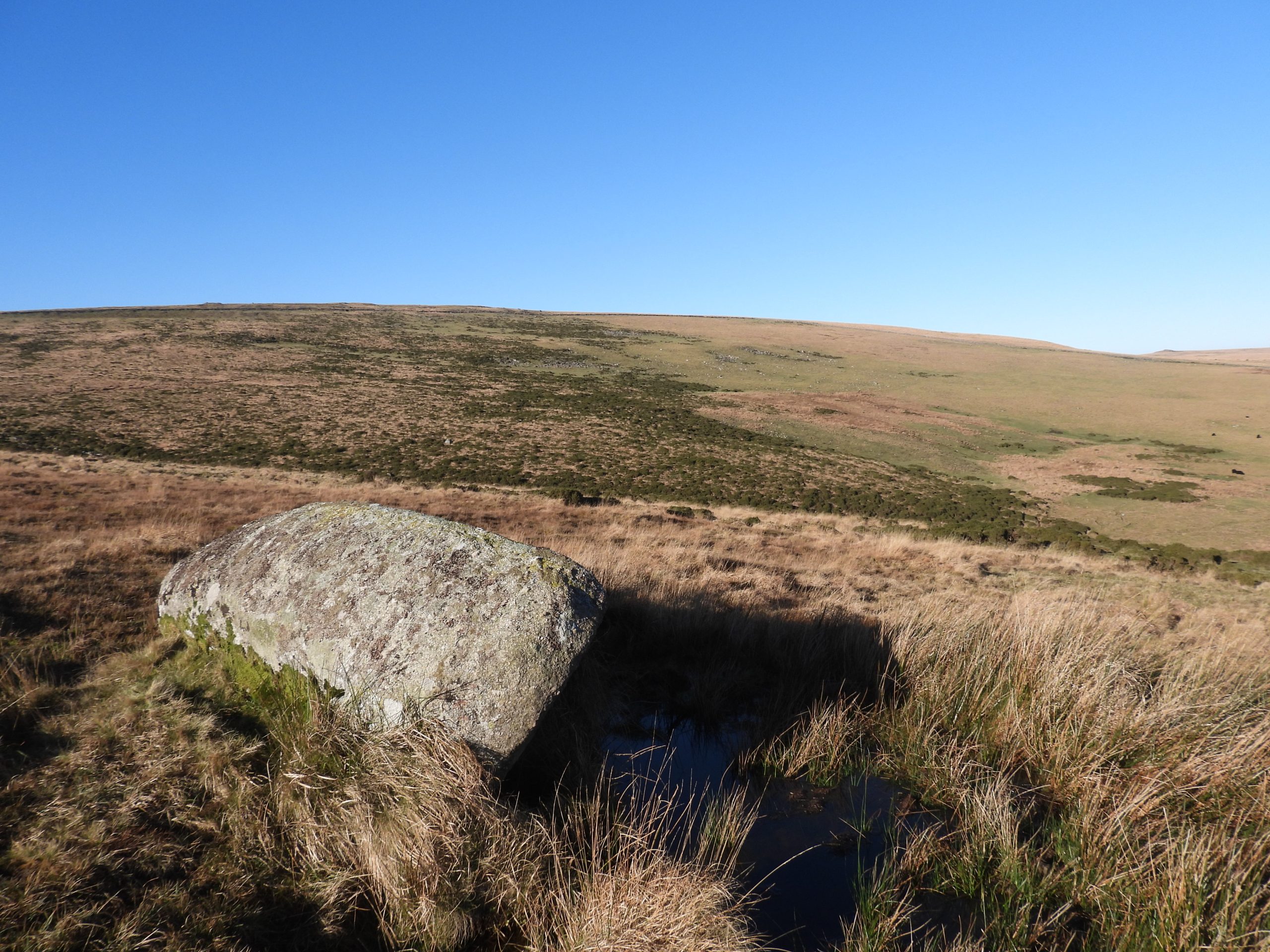
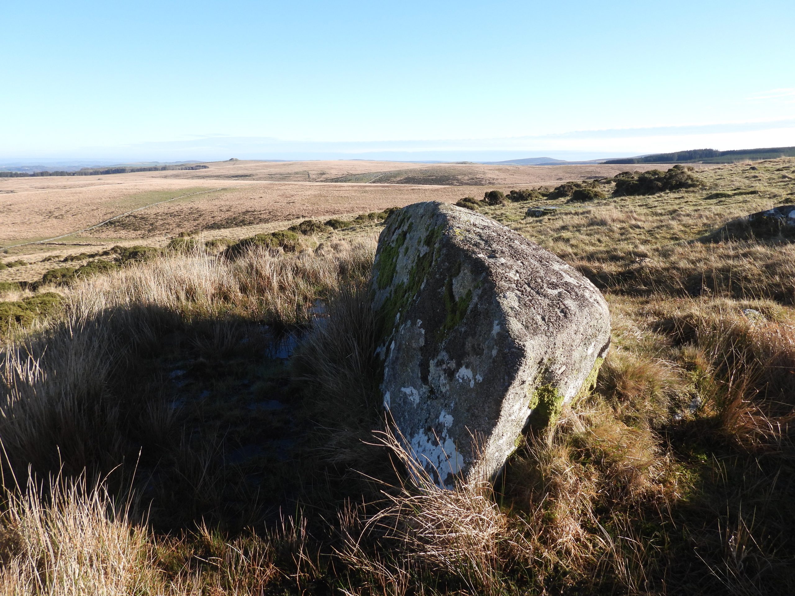
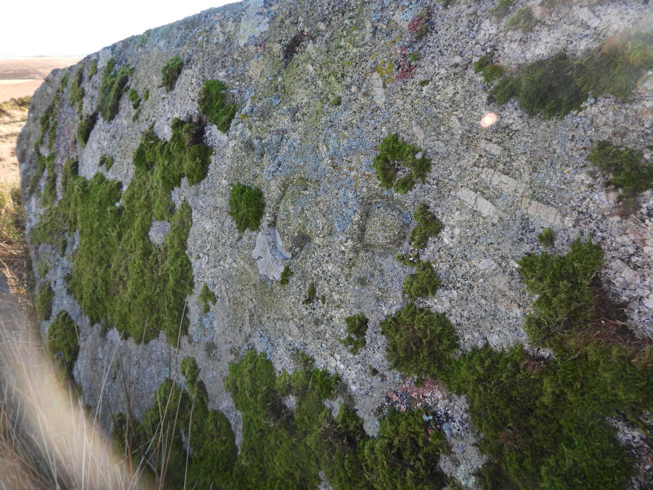
This sketch map is based on a couple of maps published in the Dave Brewer book. This post records and follows the line from ‘Cow Bridge’ near Batworthy Corner through to Manga Rock and records all the boundary markers and how they relate to the 1842-3 settlement.Cow Bridge at SX66132 86430 is simply inscribed with a “G” for Gidleigh and is likely to date from 17th or 18th centuries.The Cow Bridge slab is considered as being a small clapper. The Cow Bridge boundary point appears not to have been in question around the time of the 1842-3 settlement.Leaving Cow Bridge and passing Batworthy Corner, the Gideligh Commons bounds turn south and follow the line of one of a number of stone rows in the area. This double stone row measures approximately 175 metres in length and is recorded as having around 40 stones. The south end is aligned on a cairn ‘Fourfold Circle’, which is where the next boundary point is located. The four fold circle consists of four concentric stone rings. It is essentially a low turf-covered cairn measuring 10 metres in diameter which has a central cist which has been robbed. In the Ordnance Survey Boundary report dated 14th July 1882, the Gidleigh boundary is shown to change direction at the ‘centre’ of this feature. In 1932, RH Worth observed: “The outer circle, consisting of nine standing stones and one fallen stone, is approx. 29 feet in diameter to the internal faces of the stones. Possibly seven stones are missing. The inner circle, approx. 19 feet in diameter, has six standing stones and possibly once had four more. The third circle, approx. 15 feet in diameter, consists of eight standing stones and possibly once had two more. The innermost circle has four stones, two standing, and possibly once had two more”. This extract from a late 19th century map, emphasises the boundary change of direction was located at the centre of the ‘four fold circle’. The centre of the circle is a few metres from a marked inscribed menhir, which presumably is the B.S marked on the map. It is interesting to note that the ‘four-fold circle’ is marked on the map as a triple circle! On the map, the Longstone is marked as the ‘triple’ boundary between Gidleigh, Chagford and the Dartmoor Forest. Adjacent to the four fold circle are two large recumbent menhirs, which is one of which is around 3.5 metres long and the other a slab is just over 2 metres long.The larger of the two menhirs is inscribed with “GP” (for Gidleigh Parish). Close up of the “GP” inscription is at SX65956 86030These two menhirs are recorded by Ordnance Survey Archaeology Division, (1974) as probably having stood facing each other at the end of the stone row. That said, if the large inscribed menhir is the one marked as B.S on the 19th century map then it will have been recumbent by then. Looking north from the area of the four-fold circle to the junction of two stone rows (as depicted on the 19th century maps). The trees at Batworthy Corner can be seen at the top right of the picture.Another stone row. This one leads south east from the ‘four-fold circle’ area.The classic view of the Longstone with Kes Tor behind. This was taken on a rather cold and frosty December morning. The Forest of Dartmoor Perambulators called this point Heigheston. It was from this point that the boundary disputes started with the 1608 perambulators considering their boundary went north but the Gidleigh Commoners maintaining it went in a westerly direction.The “C” for Chagford inscription on the LongstoneThe “DC” for Duchy of Cornwall inscription on the LongstoneThe “GP” for Gidleigh Parish inscription on the LongstoneThe 1639 Gidleigh Map previously mentioned in this post, showed the Commoners recorded their boundary as following a direct straight line from the Longstone to Stone Tor. On this line there is a broken boundary stone, which was erected in 1813 (as one of three). Brewer records that the three stones were erected and inscribed on October 12th / 13th and cost £2 and 17 shillings. These three B.Ss were erected on behalf of both Gidleigh and the Duchy, thus showing by this time the Forest Bounds were now considered as bearing west from the Longstone not north as per the 1608 perambulation.Probert recorded this stone as : “A defaced boundary stone formerly marking the edges of Gidleigh Parish and the Forest of Dartmoor. The earthfast block measures 0.4m by 0.5m and has a heavily pitted surface. An inscribed curve about 0.11m high probably formed part of the letters G or D”. The rule is 40cm long and is located where the author believes it was broken off the main shaft.The probable main shaft of the boundary stones seem to match the size of the broken off piece. The main shaft is located at SX65585 85675Probert through this ‘curve’ was part of either a letter G or D. Dave Brewer recorded that this fragment “appears to bear a man-made curved line, part of either a letter C or D”. The only way to truly know what letter this is would be to dig out and ‘flip’ the stone as we know the three stones (of which this is one), which were erected in 1813, were inscribed “DC” on one side and “G” on the other. The author has attempted to recreate the B.S with the two pieces re-united. Of interest in the Dave Brewer book, page 64 is that during the 1842 enquiry of the tithe commissioners, William Rogers (the supervisor of the Teign Newtake wall construction) stated in his evidence that at Manger Stone (Manga Rock) he found an upright rock marked “G” and he was ordered by his employer to obliterate the “G” to lead Gidley (sic) people astray. Rogers stated: “I knocked out the letter with a pick”. Although this B.S is quite a distance from Manga rock, one wonders if more shenanigans took place at this location, albeit it would have had to have taken place after 1813 ?The ‘Two Stones’ at Crownhall Bottom, lie on the late 19th century / current Gidleigh bounds (south of the line between the Longstone and Stone Tor). One of these stones is inscribed with a “GP” (Gidleigh Parish).These ‘two stones’ are shown on the boundary of the tithe map of 1843, which showed the revised boundary line from the Longstone to Manga Rock, via Langridge. Of note, Stone Tor (which is also inscribed “GP”) appears to have been taken off the boundary at this point. The author can only speculate that the hearing of the disputed boundaries in 1842, lead to the map change in 1843.The “GP” inscription on one of the ‘Two Stones’ is located at SX65243 85463. Was this inscribed after the 1842 settlement ? The hearing in 1842 of the disputed boundaries between Gidleigh, Lydford (the Forest), Chagford and Throwleigh was held on 20th August 1842 with James Jerwood, Barrister at Law appointed as Assistant Tithe Commissioner.On the new 1843 (tithe map) boundary, there is another prominent upright rock (at SX65153 85490), which possibly may form part of the boundary, albeit not recognised on maps.Stone Tor is located on the line of the Teign Head farm newtake wall (supervised / built by Rogers). The tor was on the 1639 Gidleigh map and was part of early 19th century duchy claims (circa 1813). Looking west from the top of Stone Tor along the newtake wall. Of interest, is that the wall has only single line of rocks in its construction and has many uprights strategically placed along its length to give it strength.The “GP” inscription on top of Stone Tor. The tor appears to have been part of the Gidleigh bounds from at least 1639 to 1842 (according to Gidleigh) and from at least 1813 to 1842 (according to the Duchy). From 1842/3 to today this tor is no longer on the Gidleigh / Duchy boundary.Another view of the “GP” inscription. Of note, is that the new boundary (from 1843) passed through the newtake wall to the south east of the tor and was marked by another B.S (see sketch map at the beginning of this post). That B.S is no longer extant.Another view of Stone Tor looking north east towards Batworthy and Scorhill.A short distance to the west of Stone Tor, a benchmark (B.M 1354.0) at SX64843 85675 can be found. It probably dates from the first OS geodetic levelling period 1840-1860.In the Brewer publication, a sketch on page 68 (Figure 18) suggested that on Langridge where there is a (very slight) change in direction of the 1843 boundary, that there ought to be a boundary rock inscribed “GP”. The author used an old 19th century map on the national library of Scotland Maps (side by side) to determine an approximate grid reference. This area is very devoid of rock. That said, within a few metres of the approximated location, the fallen stone shown in the picture was located.The author has called this stone the ‘Langridge B.S’. The stone looks like a fallen boundary marker and does not appear natural. Unfortunately, the narrow end of the B.S. has been made earthbound and despite best efforts, the author could not discern any inscriptions due to this. The B.S is located at SX64243 85737.The final inscribed boundary marker in this post is Manga Rock. This rock is the turning point of the 1843 to present day Duchy / Gidleigh boundary, from a east/west direction to a more south/north direction.Manga Rock looking east. The newtake wall leading up to Stone Tor can be made out in this picture.The “GP” inscription on Manga Rock.