A collection of walks, discoveries, insights and pictures of exploring Dartmoor National Park
September 27, 2023
In search of Monkey’s Castle (or Monks Castle)
This post was inspired by an intriguing description found in William Crossing’s ‘Excursions from Tavistock’ in his 1912 Guide to Dartmoor. On page 145, Crossing describes a journey across Whitchurch Down including a visit to a cross (Pixie’s Cross) on the Abbot’s Way. He concludes this paragraph by stating : “On the edge of the down to the R. are some ruined walls, which bear the name Monkey’s Castle, but which it is not unlikely is a corruption of Monks’ Castle“. But what was Monkey’s Castle ?
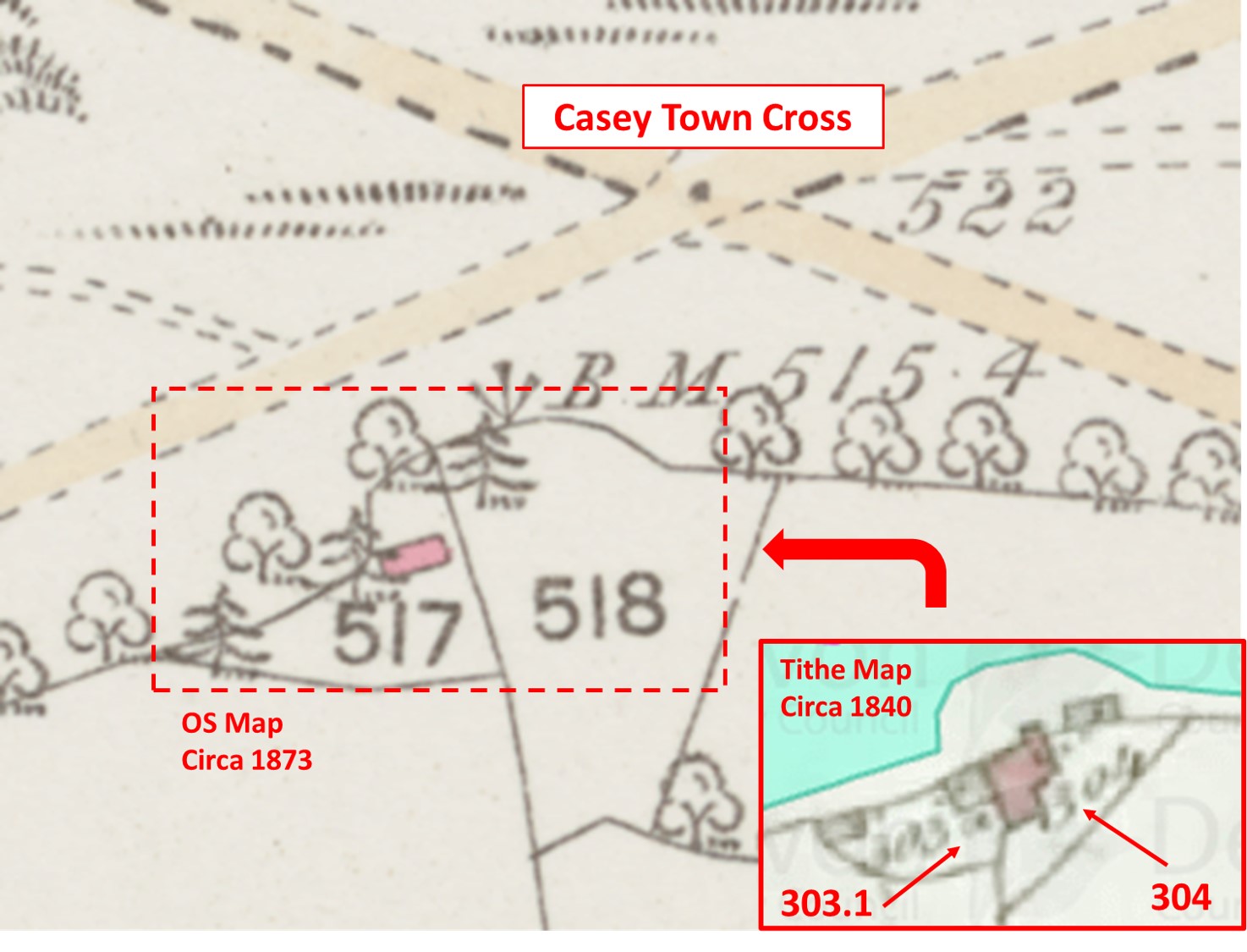
Crossing, by his description appeared to be travelling west to east so when he stated “R” (right) by which this means on the ‘south’ side of the down. Looking at the Heritage Gateway, 19th century maps and the tithe map and apportionment for Whitchurch, the location of Monkey’s Castle (or Monks’ Castle) was established as being a few 10’s of metres from Casey Town Cross and was confirmed as being a House and Garden.
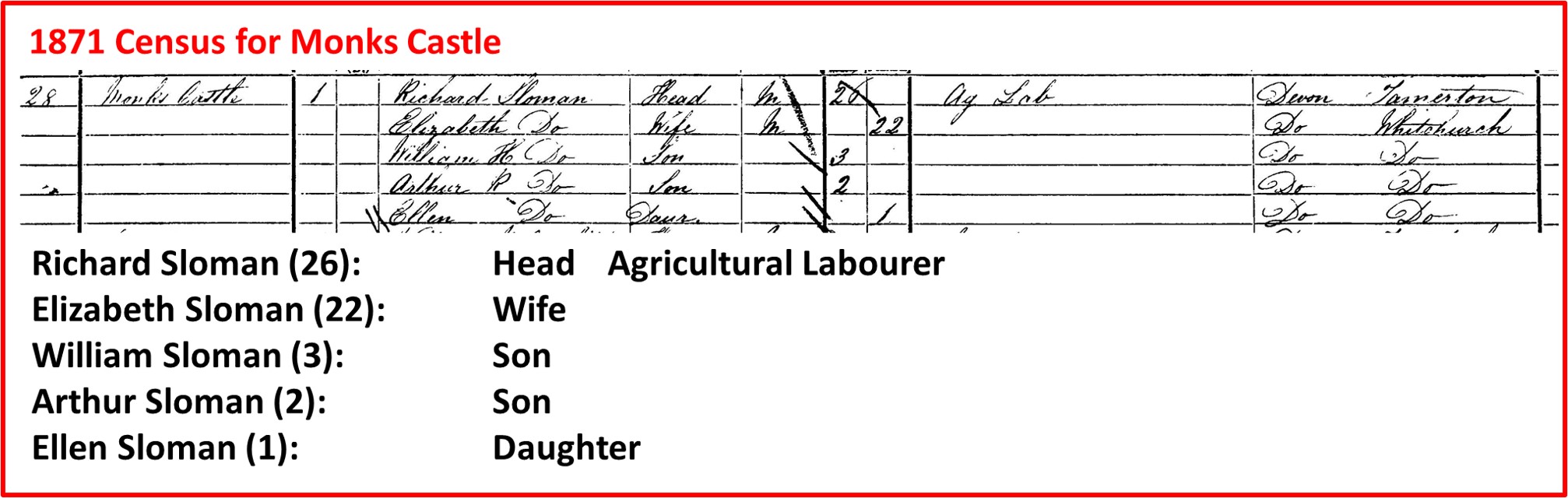
With further research, the author was able to obtain census information for Monkey’s Castle (Monks Castle) for the years 1851, 1861 and 1871 with thanks to dwresearchservices.co.uk. This information together with the tithe information made for interesting timeline. In Summary: 1840, ‘Monks Castle’ was recorded; 1851 and 1861 known as ‘ Monkey’s Castle’; 1871, reverted back to ‘Monks Castle’. This post records what is left of Monkey’s Castle or Monks Castle in the 21st century. One assumes the name Monks’ may have related to the nearby Abbots’ Way.
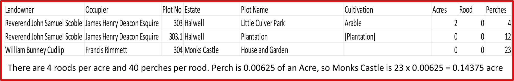
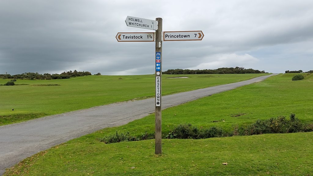
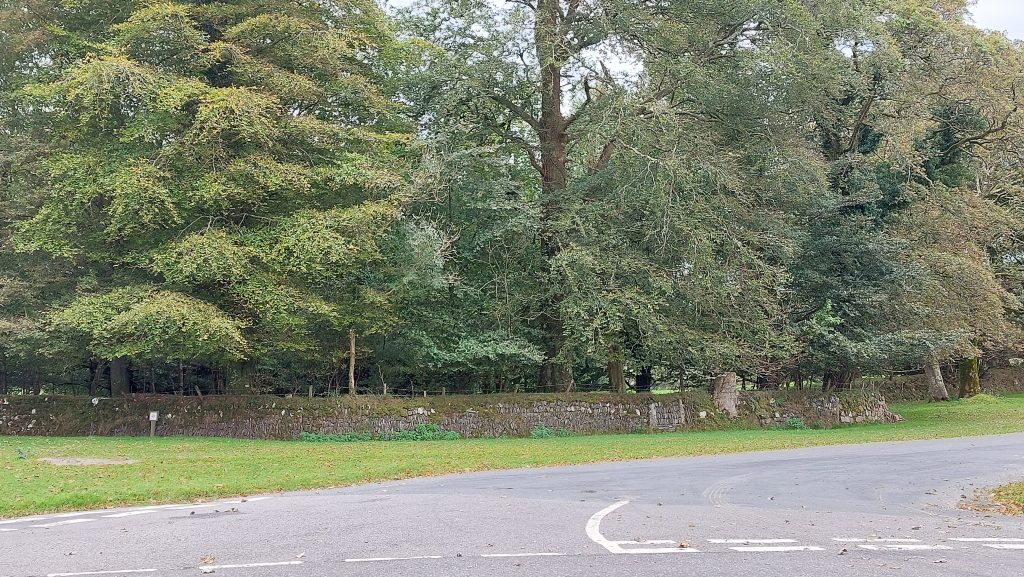
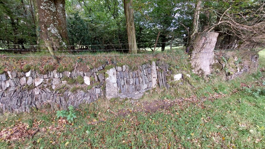
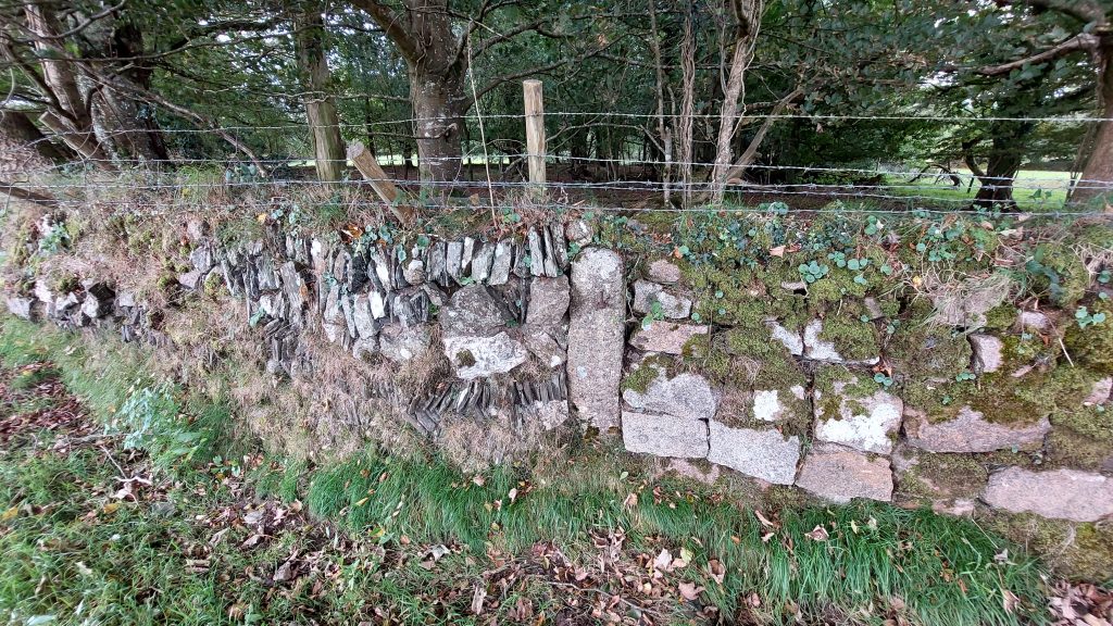
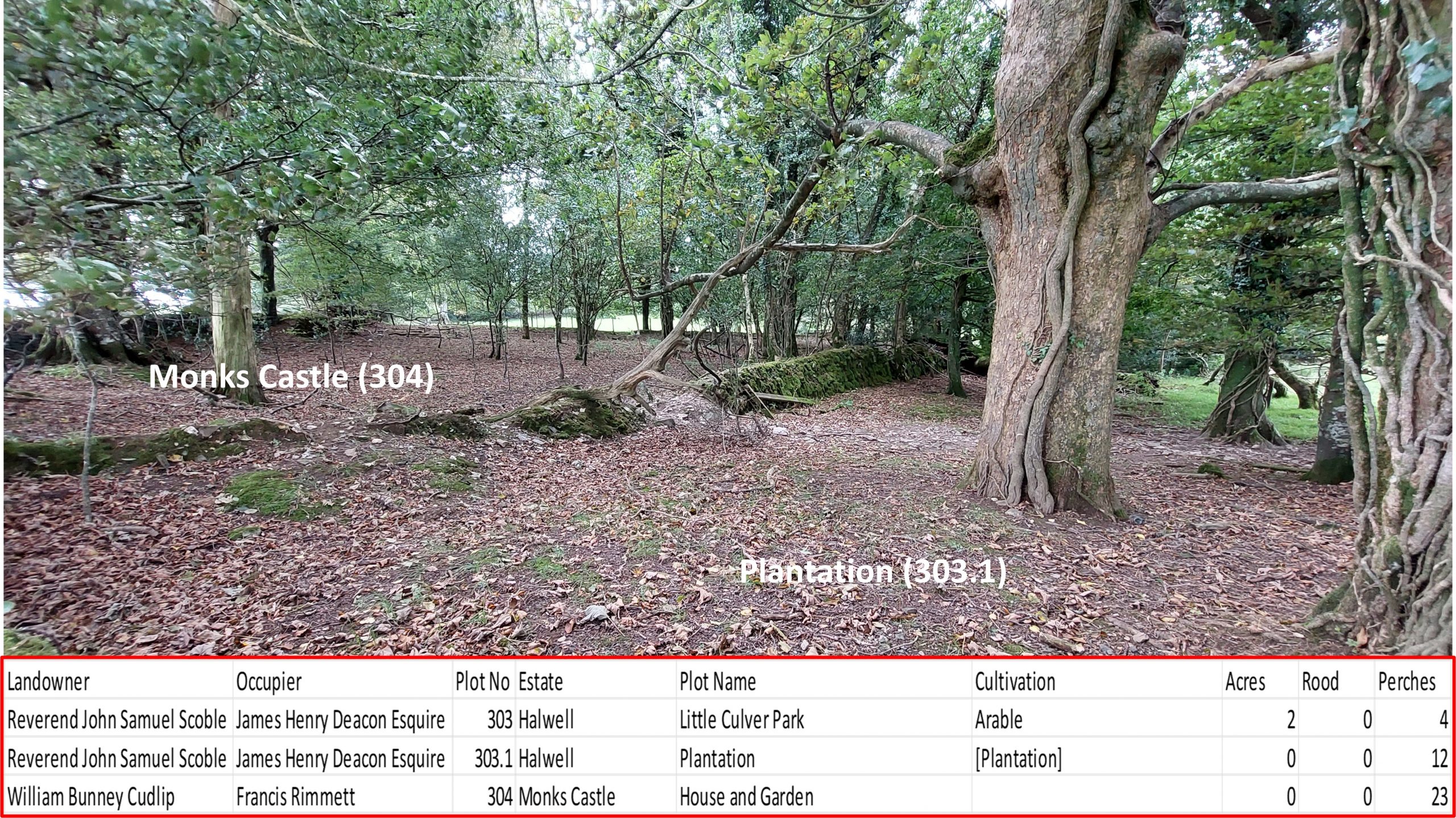
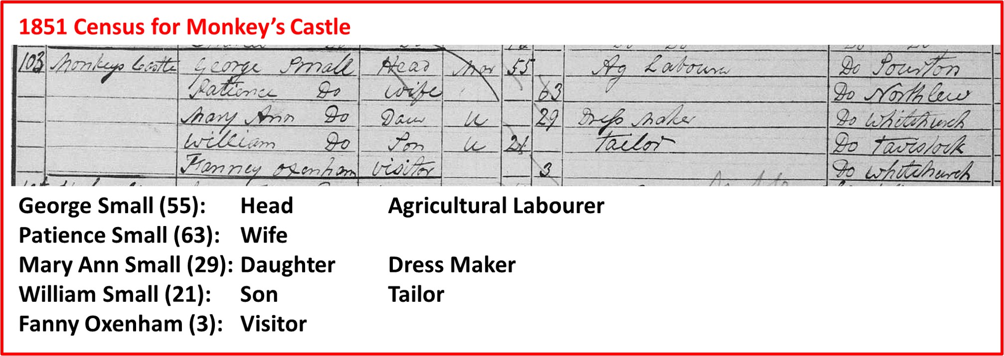
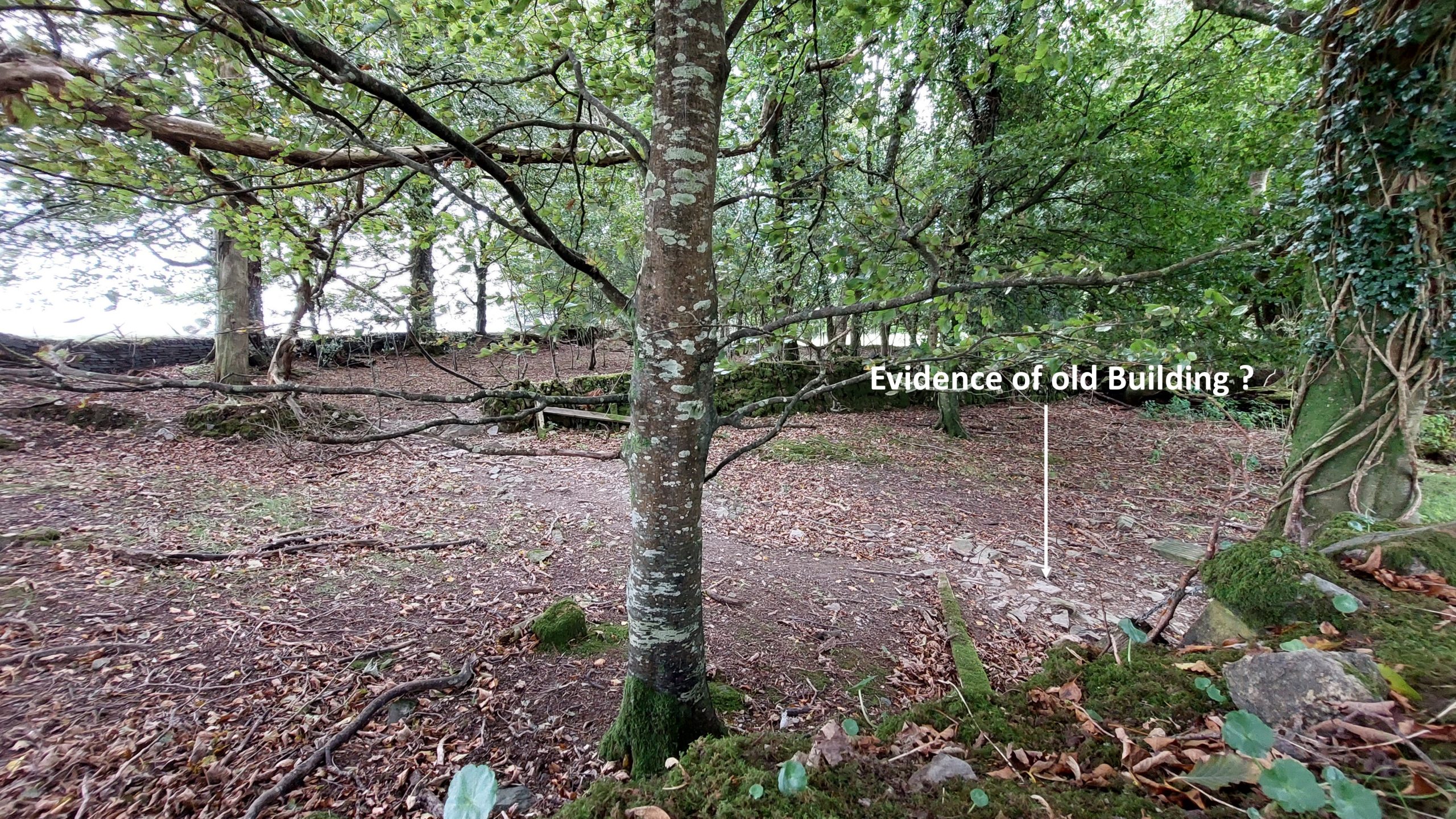
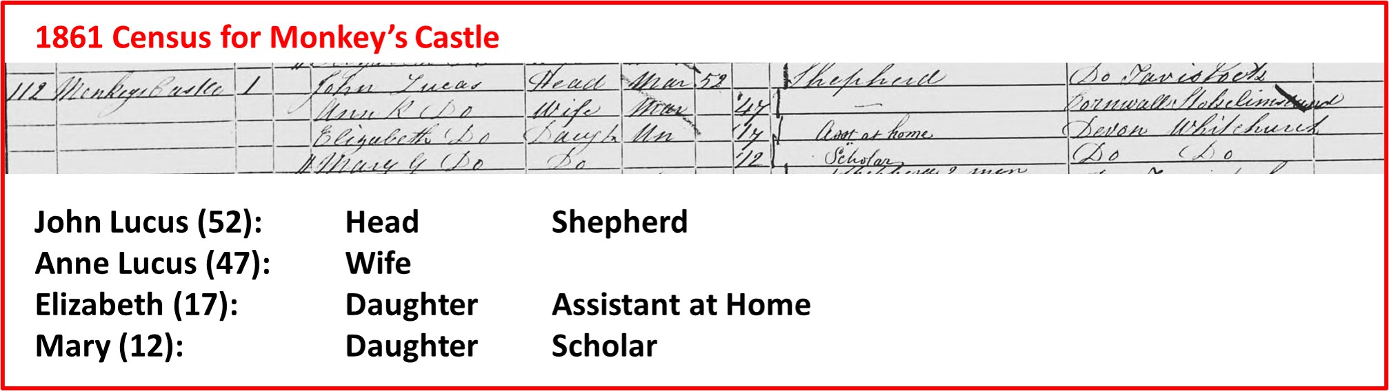
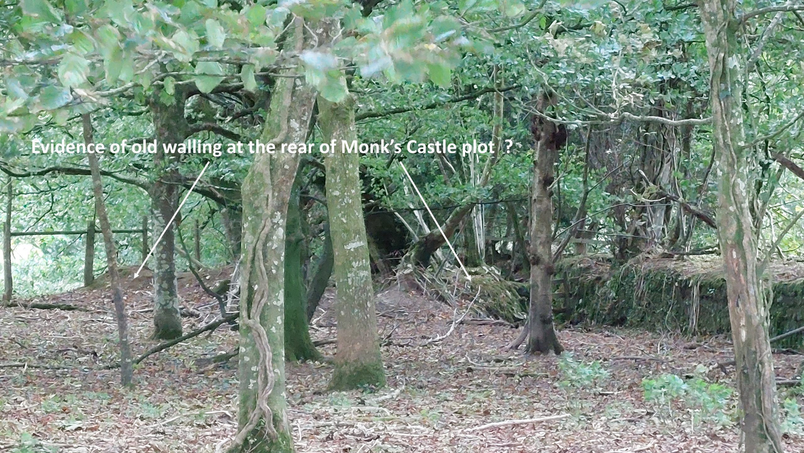
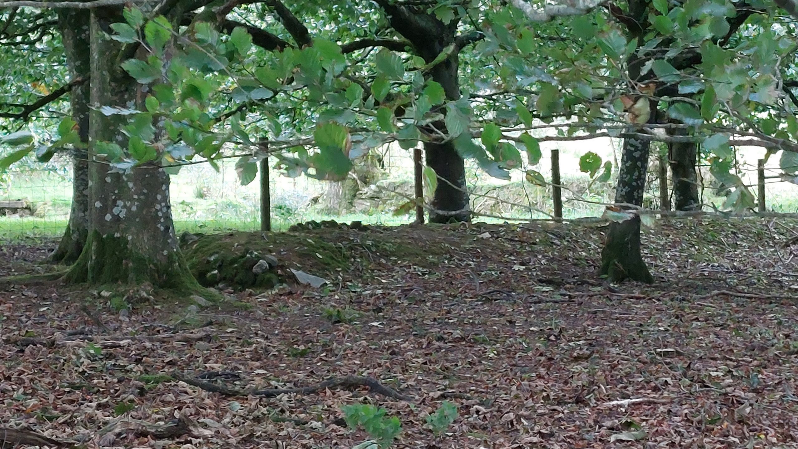
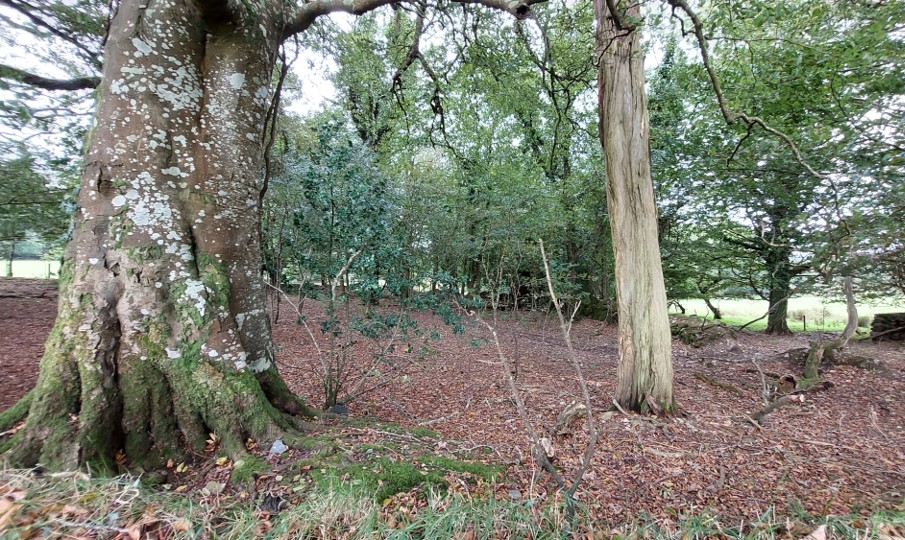
Annotated map(s) from 1873 (OS) and 1840 (Tithe) near to Casey Town Cross reveal that there was or were building(s) here at one time. Of interest, the curved wall where the benchmark B.M 515.4 is marked on the OS map does not appear on the tithe map. Was this curved wall built between 1840 and 1873 ?The tithe apportionment indicated that ‘Monks Castle’ (plot 304) was a House and Garden of 0.14375 acre. The land owner was William Bunney Cudlip and the occupier was Francis RimmettThe sign post at Casey Town Cross looking north. There are five roads which meet at this cross roads. Monkey’s Castle lies with a few 10’s of metres from hereCasey Town Cross looking south across the road which leads to Whitchurch. The first possible evidence of Crossings ‘Monkey’s Castle’ (or Monks’ Castle) appears to be a walled in gate (just to the left of the tree located within the drystone wallThese walled in pair of gateposts lie at SX50156 73435. The benchmark indicated on the 1873 OS map appears have been located here. The author is unsure whether this (curved) wall was extant at the time of the tithe apportionment. However, the gateposts may well have been an entrance to Monks’ Castle in 1840.This walled in gatepost lie at SX50148 73431. Interestingly, the drystone wall appears to have been built at two different times. The author guesses that the wall to the right of the gatepost and the gatepost itself were extant before the wall to the left of the gatepostThe land where Monks Castle is located is on private land, so the author had to resort to photographs over the wall. The 1840 tithe apportionment mentions both Monks’ Castle (304) and a Plantation (303.1), which has been interpreted in the photograph.By 1851, Monks’ Castle was known as Monkey’s Castle and was occupied by the Small family. One assumes that George Small would have worked locally as an Agricultural Labourer, maybe for William Bunney Cudlip the landowner. Of interest, at the census there was a 3 year old ‘visitor’…one wonders what the story was behind this.Without a close up view, it is difficult to ascertain definitively where a house may have been. There are fragments, which may have been from a house.By 1861, Monks’ Castle was still known as Monkey’s Castle and was occupied by the Lucas family. John Lucas died in 1863, aged just 54 and was apparently a faithful servant to W B Cudlip (landowner) for over 30 yearsTowards the back (south) of the Monks’ Castle plot, there is evidence of old walling. Was this a building ?Walling on the eastern boundary of Monks’ CastleBy 1871, Monkey’s Castle appears to have reverted back to Monks’ Castle and was occupied by the Sloman family. Richard and Elizabeth had three very young children. One assumes, Richard worked locally.General view of Monks’ Castle. It is interesting that by 1912, the names Monkey’s Castle and Monks’ Castle were still being used (by Crossing).