A collection of walks, discoveries, insights and pictures of exploring Dartmoor National Park
March 24, 2024
Sheep Farming artefacts at Brimpts Outer and Little Newtakes
There are a couple of interesting sheep farming artefacts, which probably date back to 18th or 19th centuries which are located within or just outside the two Brimpts (Outer and Little) Newtakes. The artefact most visited is the sheepfold located between Lough Tor Man (Menhir) and Laughter Tor.
A less well known sheep farming artefact, a sheepwash, can be found in an area near Blackator Rocks alongside the East Dart River within Little Brimpts Newtake. This artefact is mentioned in two books to the knowledge of the author, namely:
a) DARTMOOR – A New Study – Edited by Crispin Gill (1970). In this book chapter 5 is about Farming and is written by Michael Havinden and Freda Wilkinson. In the aforementioned chapter, there is a case study on Babeny Farm, where the sheepwash is mentioned and shown on a sketch map.
b) HIGH DARTMOOR by Eric Hemery (1983) on page 559. This was brought to the attention to the author by Emma Cunis (aka Dartmoor’s Daughter) who is Eric’s Grand-daughter.
This post covers these two ‘sheep’ artefacts plus explores the (most prominent) stone row (or two) and terminal menhir (Lough Tor Man) just to the south of the sheepfold.
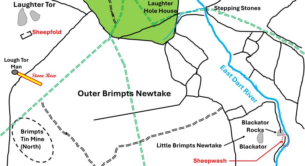
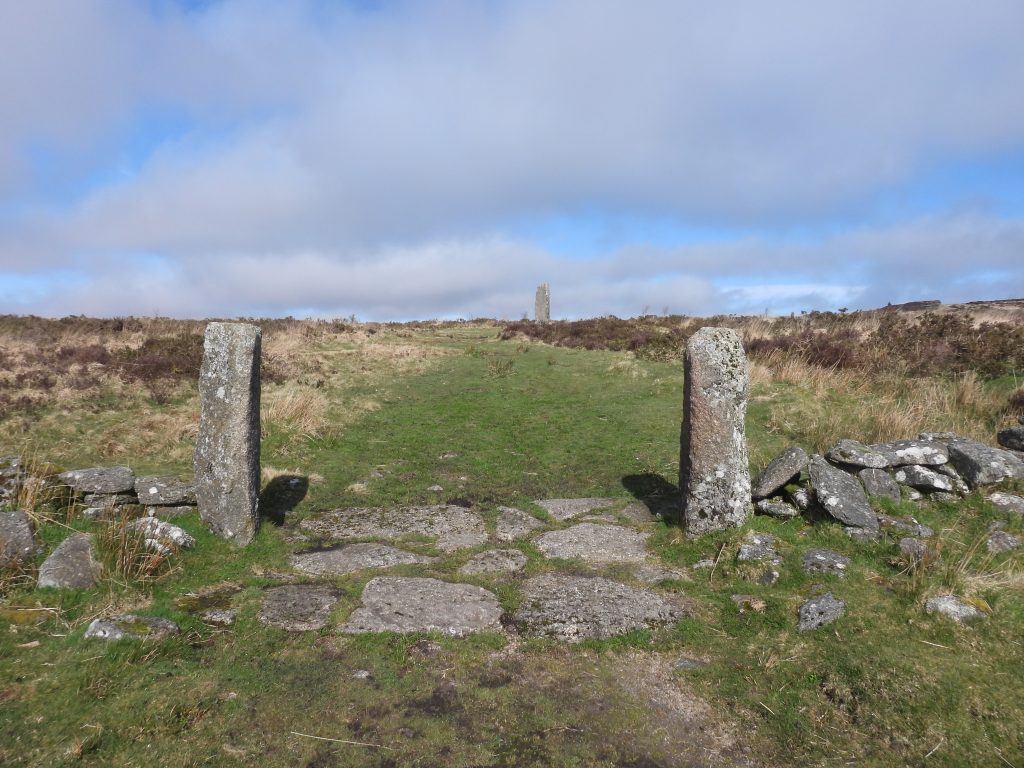
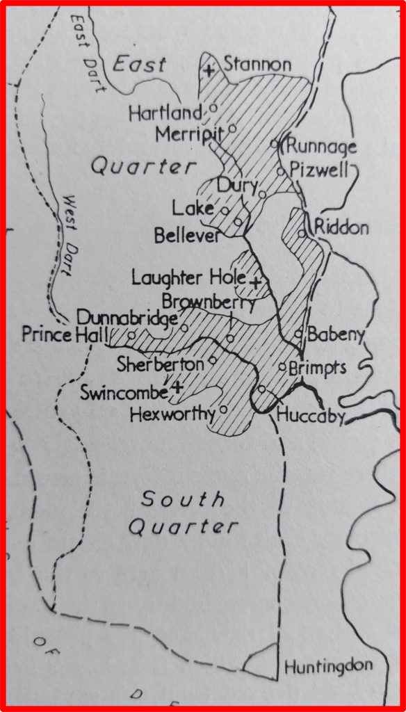
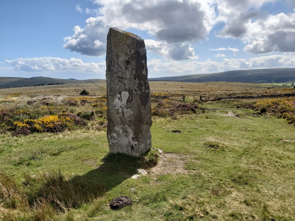
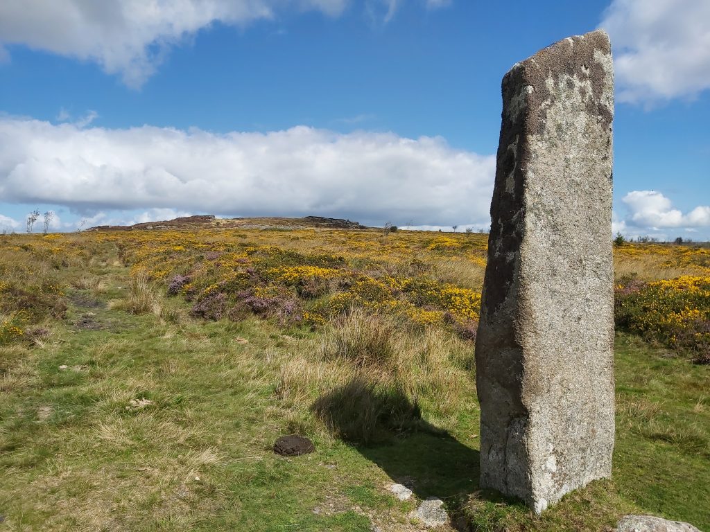
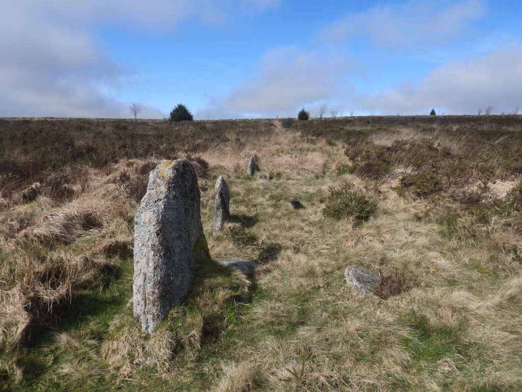
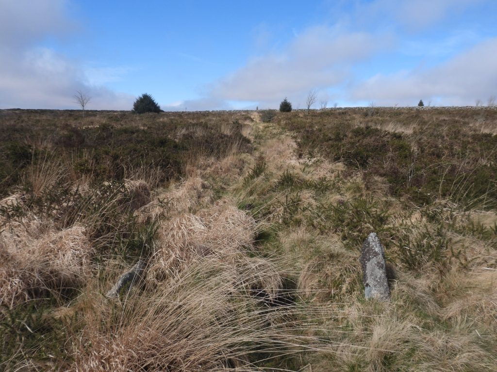
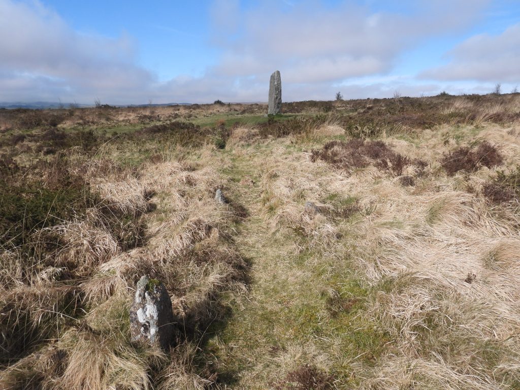
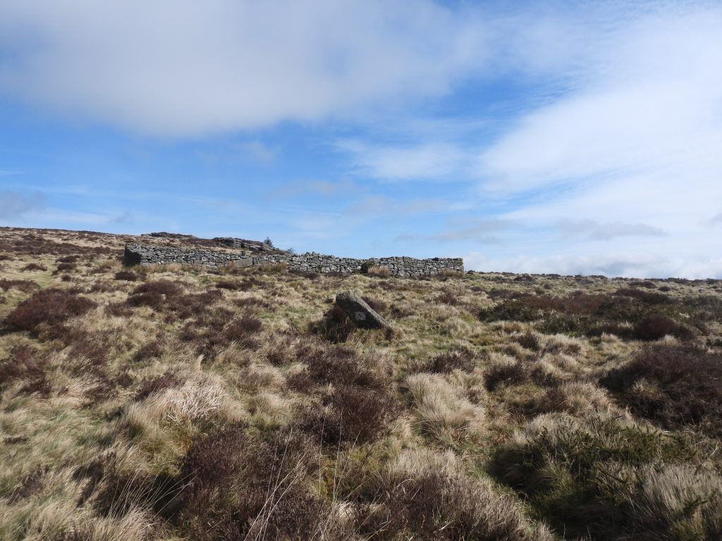
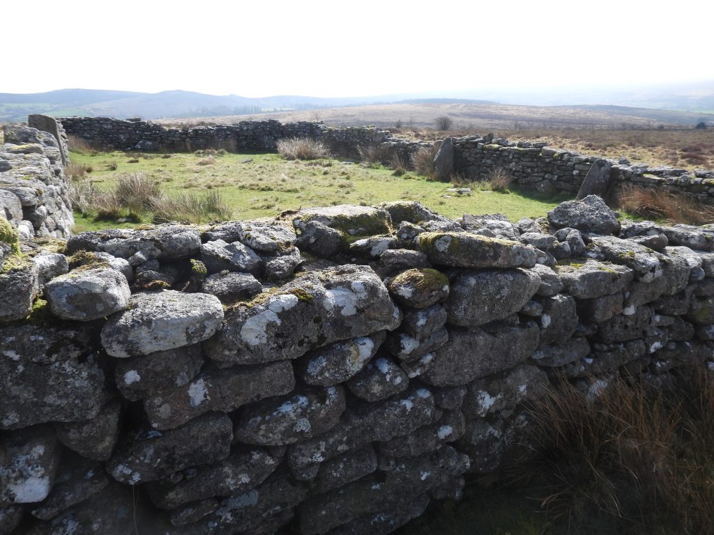
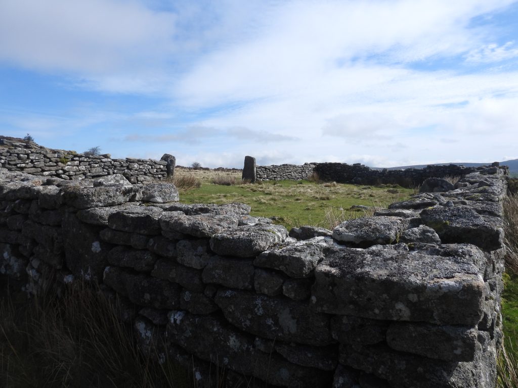
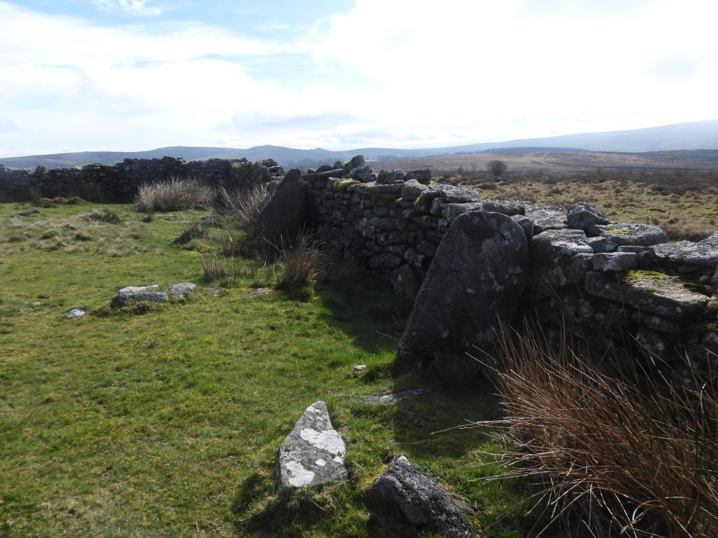
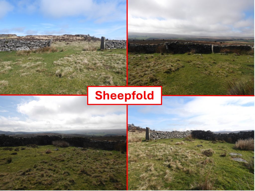
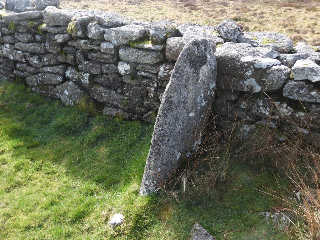
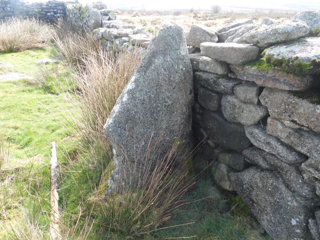
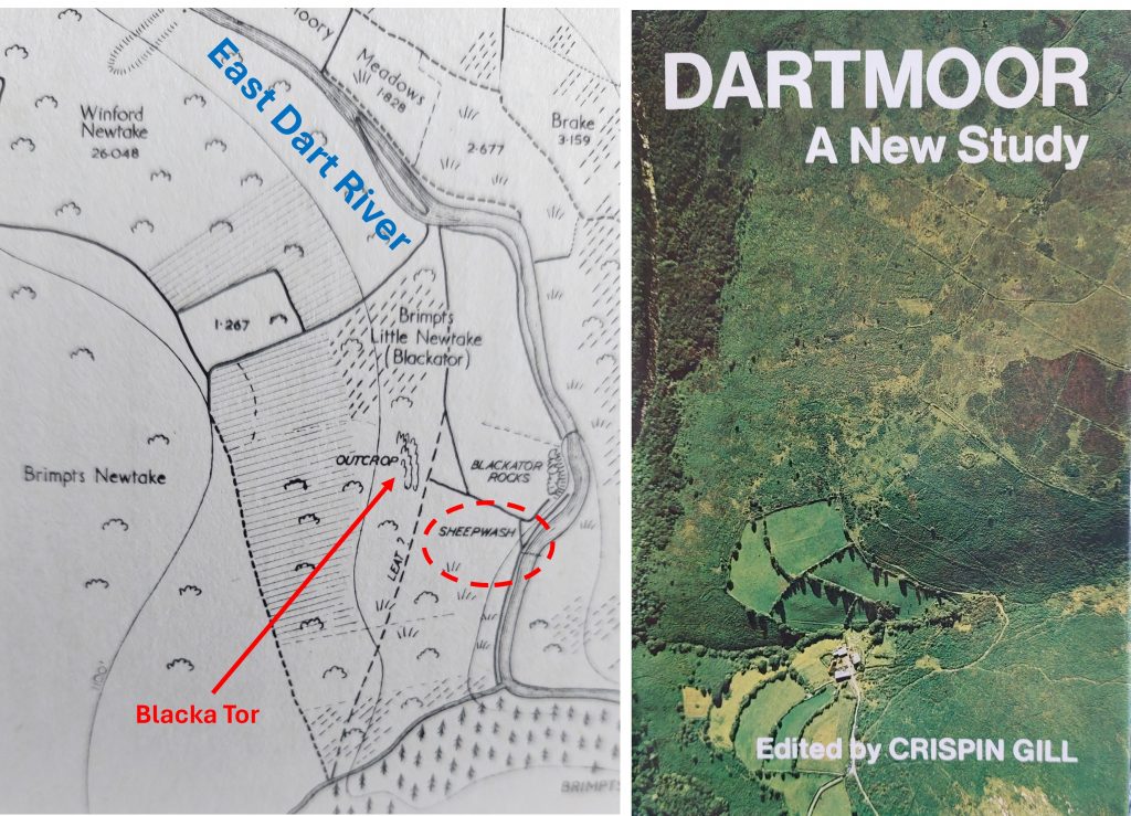
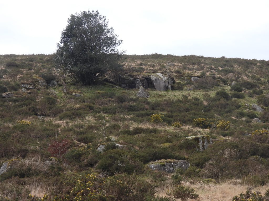
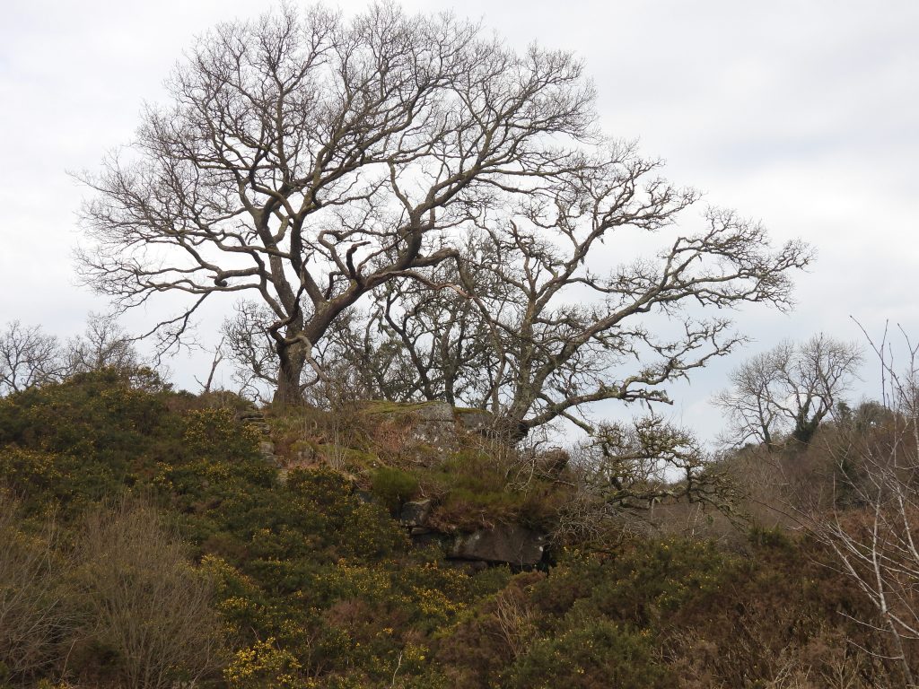
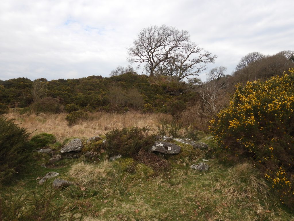
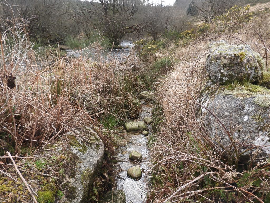
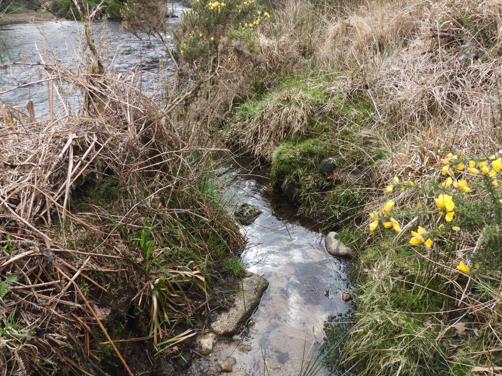
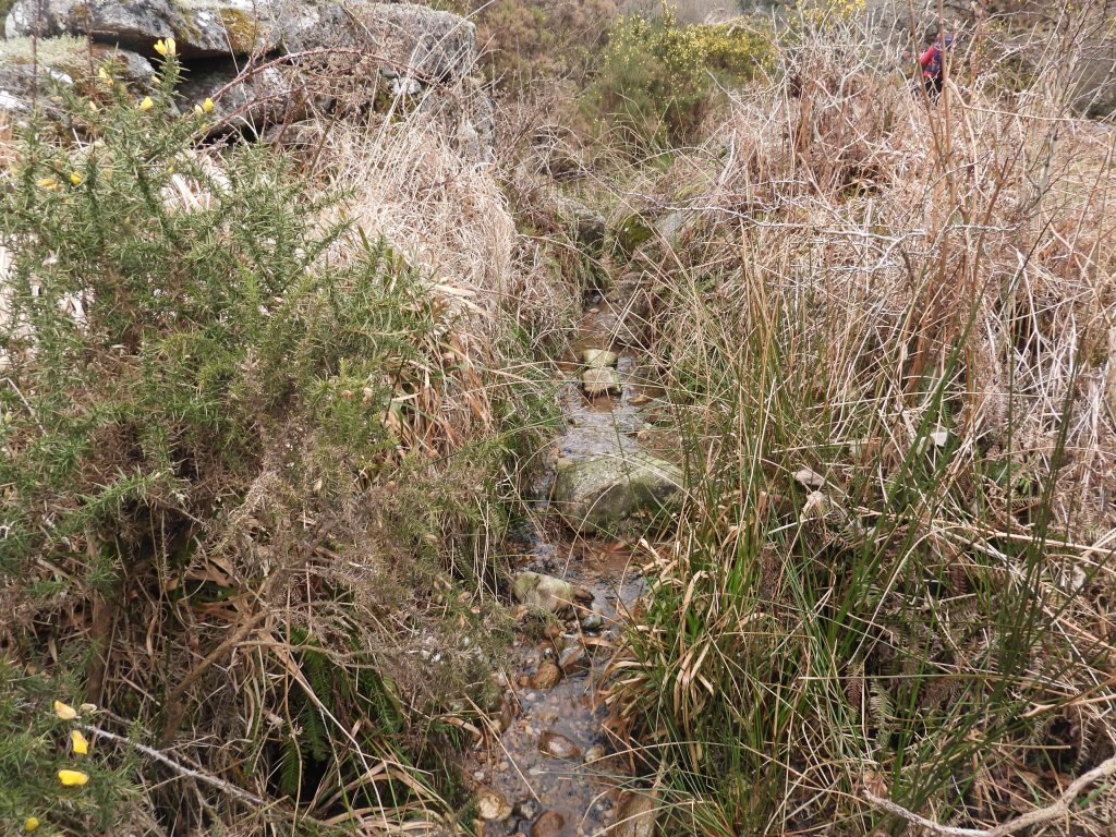
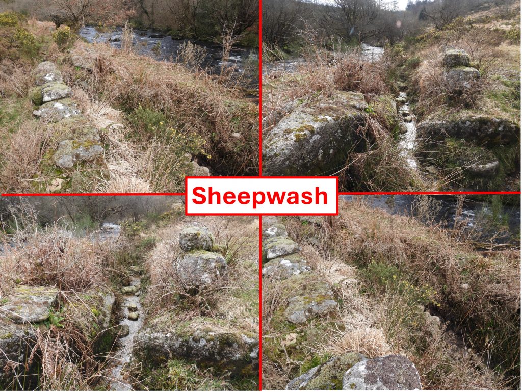
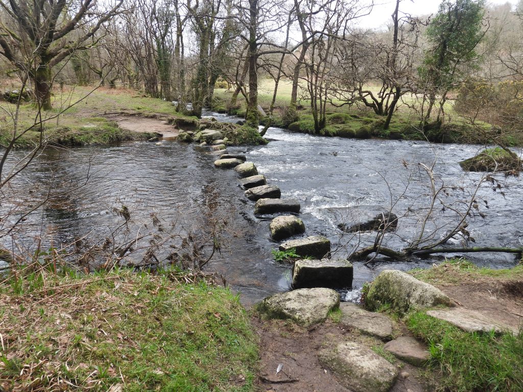
Sketch map of the features covered in this postThe gateway in the Outer Brimpts Newtake Wall (probably 18th century) looking north to Lough Tor Man Menhir. The walls are from one of three newtakes (Outer Brimpts, Little Brimpts and Winford) depicted in the Jeremy Butler, (1991) publication, Dartmoor Atlas of Antiquities: Volume Two – The North, map 28Ancient tenements and new enclosures in the early 18th century. This map ‘snippet’, created in 1970, shows tenements (circles), enclosed land (shaded areas) and newtakes (+ sign) in 1702. Brimpts is the ancient enclosure area covered in this post.This Menhir / Standing stone is known as ‘Laughter Man’ or ‘Lough Tor Man’ and stands at 2.65 metres high. It is 0.7 metres wide by 0.52 metres thick (ref: English Heritage). There are two stone rows leading off this menhir, one to the south east (which can be followed easily) and one to the west (which starts about 12m away but whose stones barely break the turf).Lough Tor Man is positioned at the northern end of a stone row (which is crossed by Brimpts Outer Newtake wall). It was re-erected in 1893, and again in 1911 by the Duchy of Cornwall. Eric Hemery in High Dartmoor, pages 488-491, records: “Slightly west of south from the pound stands the fine menhir known as ‘the Loughtor Man’. Standing 8 feet 7 inches above ground, its greatest width is 2½ feet and its thickness, at base, eighteen inches, tapering to nine inches at the tip. The menhir formerly marked the termination of a double stone row, much robbed by the wall-builders, the remnant length of which Worth gives as c.657 feet. The increasing size of the stones at the south-east end of the row, including that of a fallen one, points to the former position of the now vanished grave”The south-eastern end of the stone row has some very prominent stones. Lough Tor Man is (just) discernible in the photograph between the two prominent trees. Butler recorded the largest stone here as being 1.27m tall. Furthermore, he measured the row as being 164m longThe stone row to the south east of Lough Tor Man is a ‘double’ and in places is in danger of being swallowed up by gorse and Molinia grassButler records there is a 17m gap between Lough Tor Man Menhir and the first group of 8 small stones in the double stone row. The tallest stone is only 45cm tall. The stones in the ‘double’ row are around 1.7m apart.The sheepfold with one of the Laughter Tor outcrops beyond. Note the semi-erect stone in the foreground. It is known usually as Laughter Tor pound.The sheepfold is a Post-Medieval roughly coursed rectangular enclosure. William Crossing wrote of the enclosure: “The moormen used to speak of the pound as the sheep measure”The enclosure measures 22m ESE-WSW by 11m internally, with a roughly coursed wall 0.8m thick standing to a maximum height of 1.7m (ref: Royal Commission for the Historical Monuments of England)Internal to the enclosure are two upright ‘stall’ slabs (between 1.2m to 1.5m high) which stands at right angles to the SW wall. There is a third of similar dimensions which lies fallen 5.7m from the SE corner. Eric Hemery supposes these uprights possibly formed the sides of a small shelter.William Crossing (in 1912) thought this enclosure was probably for sheep or cattle. The entrance is 5.9m wide. The enclosure is often known as the ‘Sheepfold‘(ie for enclosing and counting sheep). That said, some believe the two upright standing stones internally indicate these were cattle stalls.One of the two upright stones against the sw wall. Maybe part of cattle stalls?The second upright stone against the sw wall of the enclosure. The two uprights plus one nearby has been suggested by some (ref: Dartmoor CAM) were once part of a Dolmen (or Cromlech)To the east near the East Dart river is the second sheep farming artefact covered in this post. In the book, DARTMOOR – A New Study – Edited by Crispin Gill (1970), chapter 5 is about Farming and is written by Michael Havinden and Freda Wilkinson. In the aforementioned chapter, there is a case study on Babeny Farm, where the sheepwash is shown on a sketch map. Interestingly, in 1970, the outcrop above Blackator Rocks was simply labelled ‘Outcrop’. Today, the outcrop has been named on the ‘Tors of Dartmoor’ website as Blacka Tor (East Dart).When leaving Outer Brimpts Newtake and entering Little Brimpts Newtake, the explorer must carefully descend the rather boggy, Molinia grass and gorse terrain might come across this small outcrop / tor with its large resident holly tree. The picture is of the ‘OUTCROP’ on a map on page 158 in the publication DARTMOOR – A New Study – Edited by Crispin Gill (1970). Fifty years later, this outcrop has been named Blacka Tor (East Dart)Blackator Rocks are down hill from Blacka Tor, in a lovely quiet location next to the East Dart. Eric Hemery in High Dartmoor (page 559) enthused about Blackator Rocks, writing: “A grey squirrel, outlawed as vermin but still a lovely creature, alarmed by my intrusion, scurried up an old oak above my head, releasing on me a shower of pellets that disturbed two dragonflies at the river’s brink. I watched them fly downstream, in that eccentric and uncompanionable manner that dragonflies have, until they vanished at the old sheep-wash”.In DARTMOOR – A New Study (Chapter 5 – Farming) Michael Havinden and Freda Wilkinson describe the walling here as being the remains of pens leading to the sheepwash. Eric Hemery describes the walling near Blackator Rocks as granite pens.The sheepwash is described by Eric Hemery as a ‘miniature river creek’ with ‘funnel-walls’The end of the sheepwash as it joins with the East Dart. Michael Havinden and Freda Wilkinson describe the sheepwash as being located alongside a wide shallow stretch of the river. Referring to the sheepwash and walling / pens they further state: “All these remnants of an ancient farming economy appear to be several hundred years old”.Emma Cunis (Dartmoor’s Daughter) describes the location as being approximately 100 metres south of Blackator Rocks on the East Dart (south east of Winford steps at Laughter Hole House, and north of Brimpts Farm). The author recorded the location as SX66685 74971The author has estimated the ‘sheepwash’ (miniature river creek) as being 8m long by 1m wide. A final thought shared by Emma (Cunis) is that it is “unknown if there are other parallels on the moor”. The author agrees with this statement.Following the East Dart downstream from the sheepwash along a rather faint and overgrown path the stepping stones by the Wallabrook (leading to Babeny) can be found. A short distance further downstream a path up to Brimpts Farm can be followed to complete a different route out of the East Dart valley (as opposed to climbing the hill at Little Brimpts Newtake).