A collection of walks, discoveries, insights and pictures of exploring Dartmoor National Park
March 1, 2022
Royal Observer Corp on Western Beacon
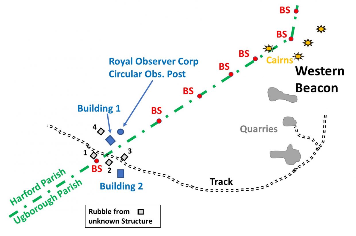
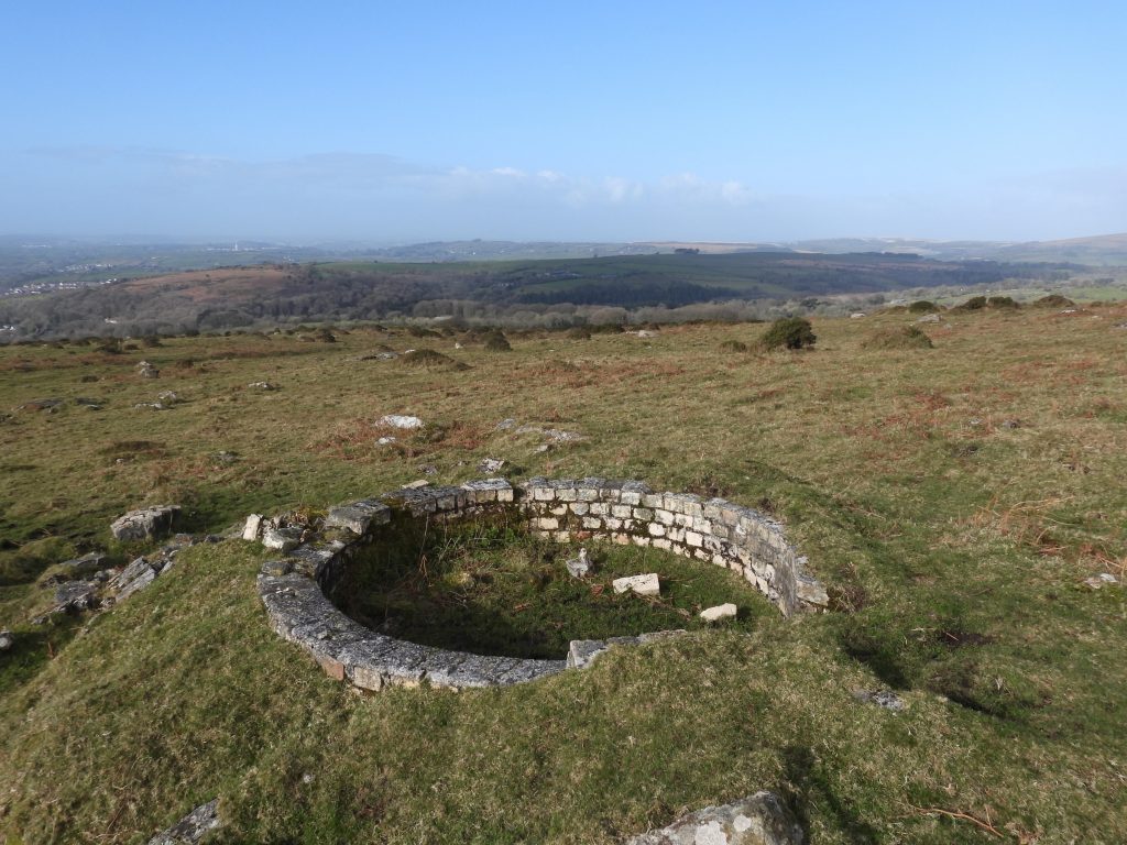
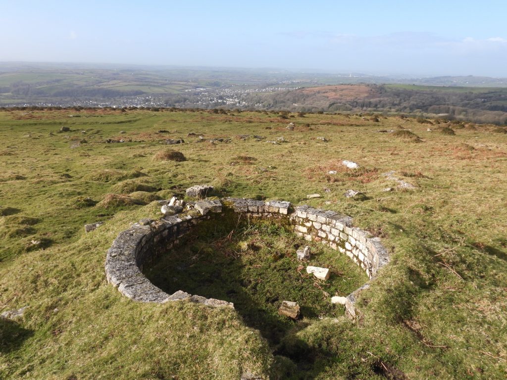
On the south west slopes of Western Beacon lies the Ugborough / Harford parish boundary, along which lies many boundary stones (upright and recumbent), which are easily followed by the explorer. Also on this parish boundary are the ruins a Royal Observer Corp “look out” (circular obs. post) plus two buildings and 4 unknown structures, which the author believes were also part of the of the Royal Observer Corp infrastructure. Unusually, the Dartmoor Historic Environment Record (HER) reveals very little about this site and the authors search for additional information has been fruitless, except for an article which appeared in the Ivybridge Magazine in September 2014. The author would be grateful if anyone can point the author to any further information relating to this site.
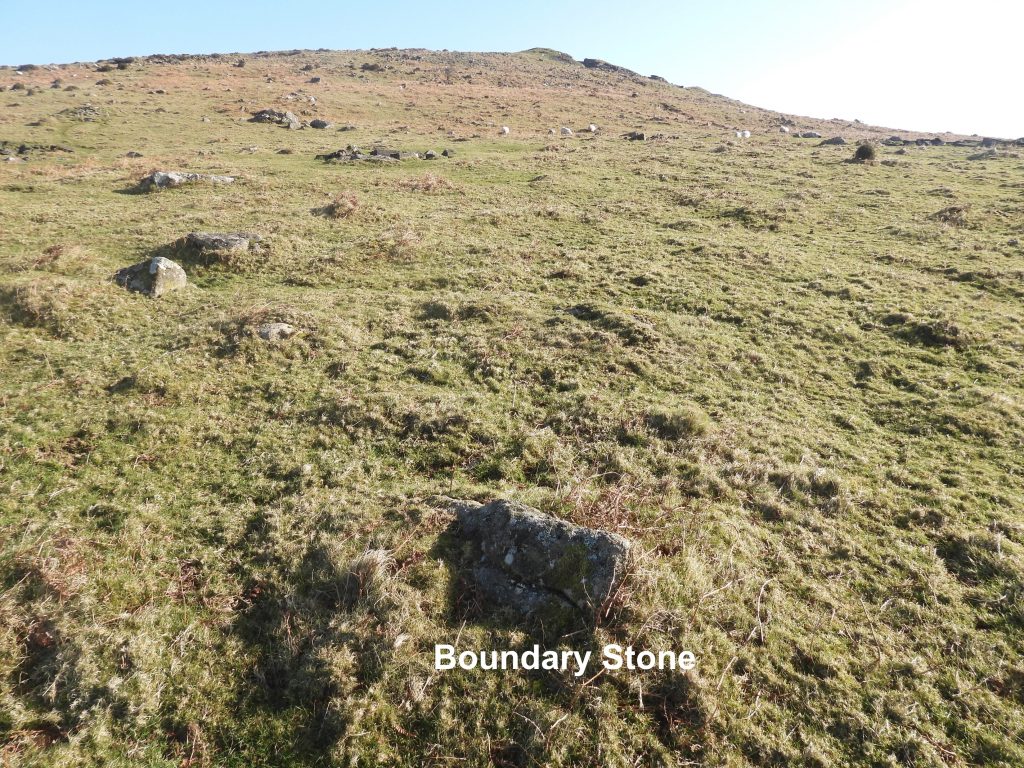
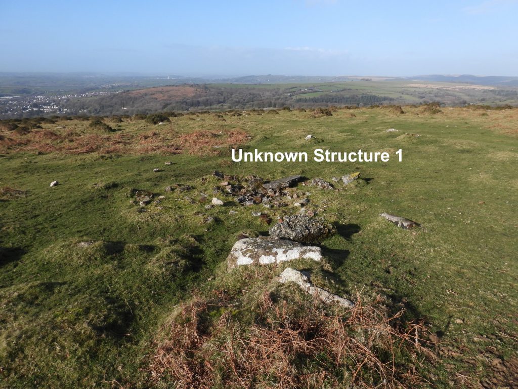
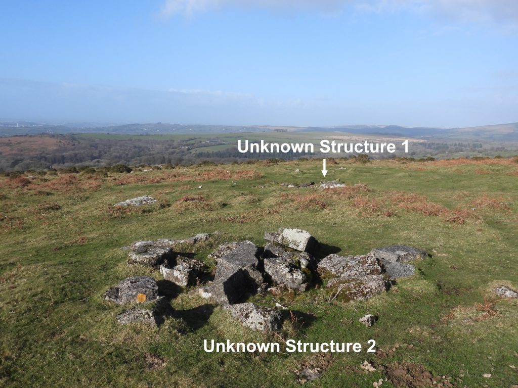
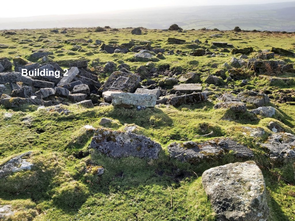
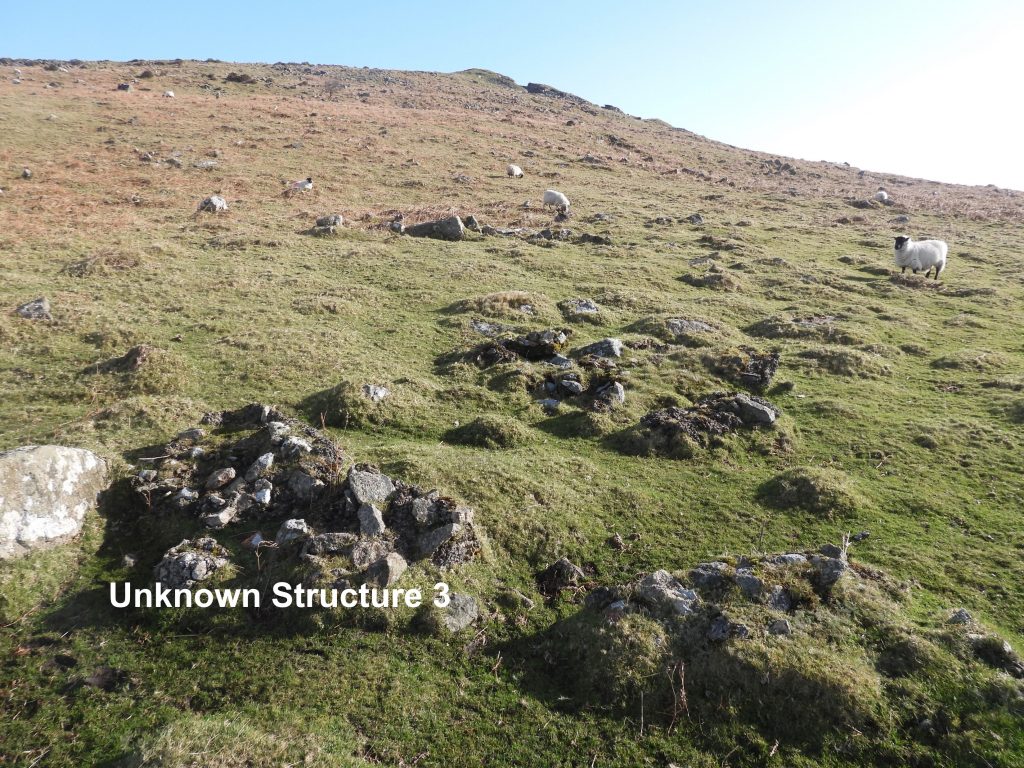
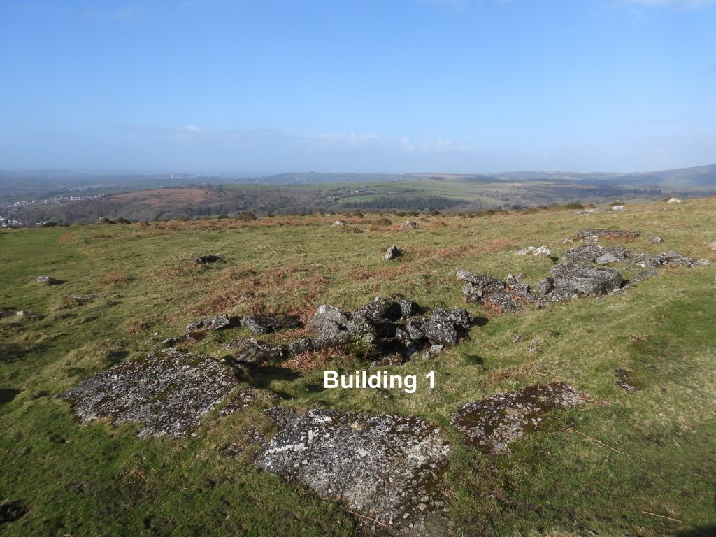
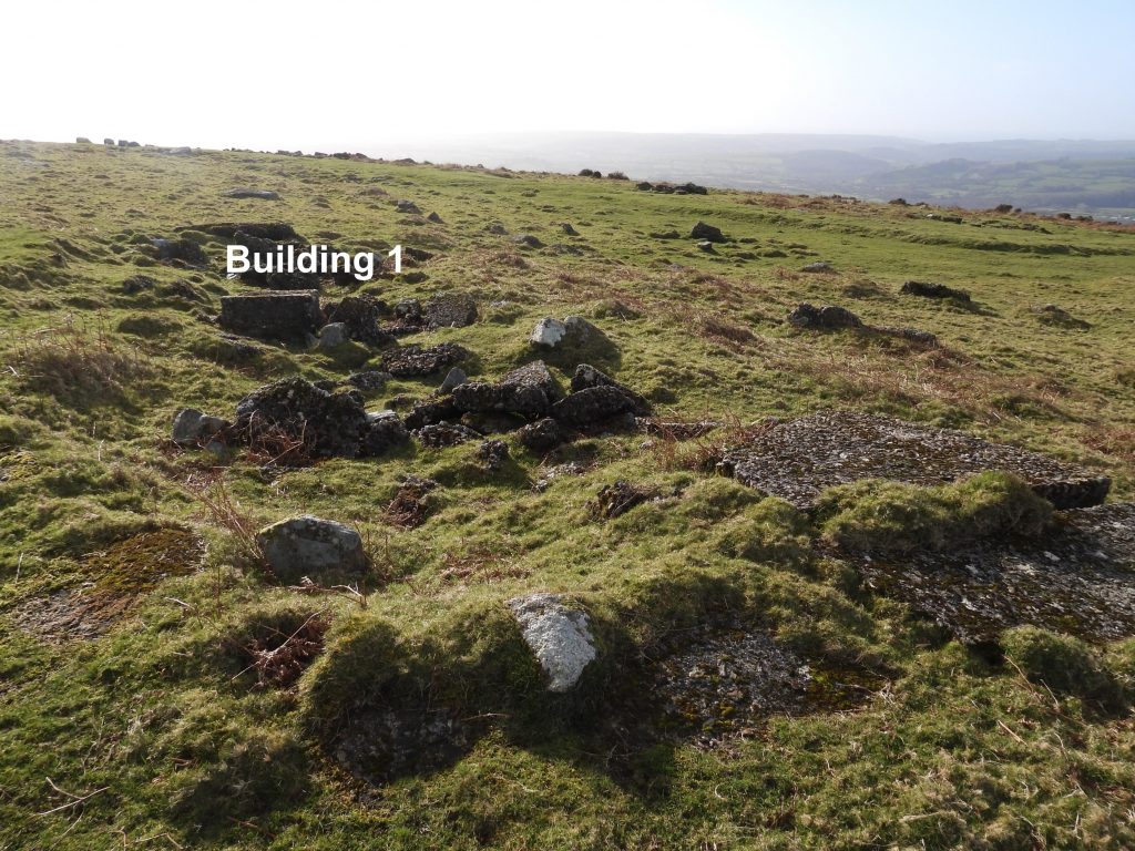
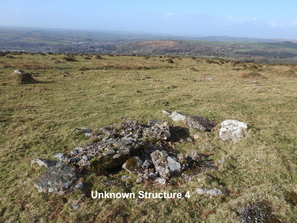
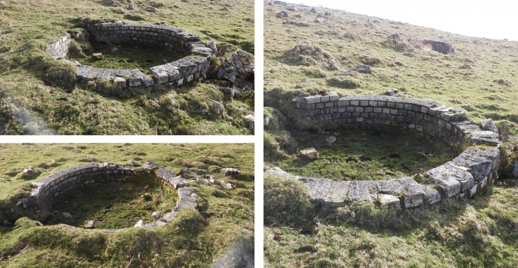
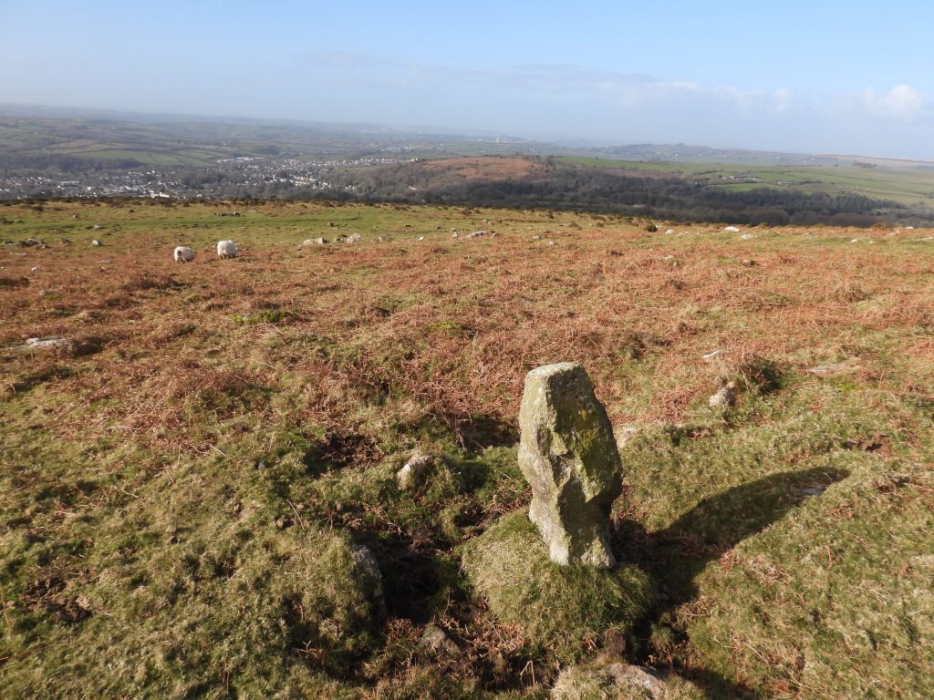
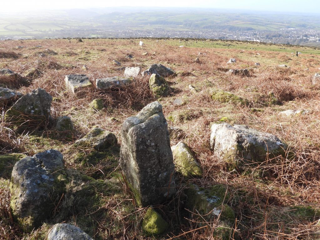
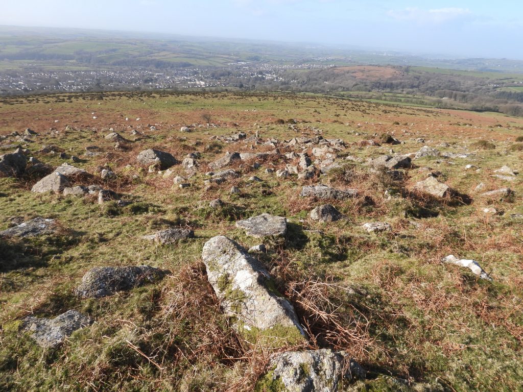
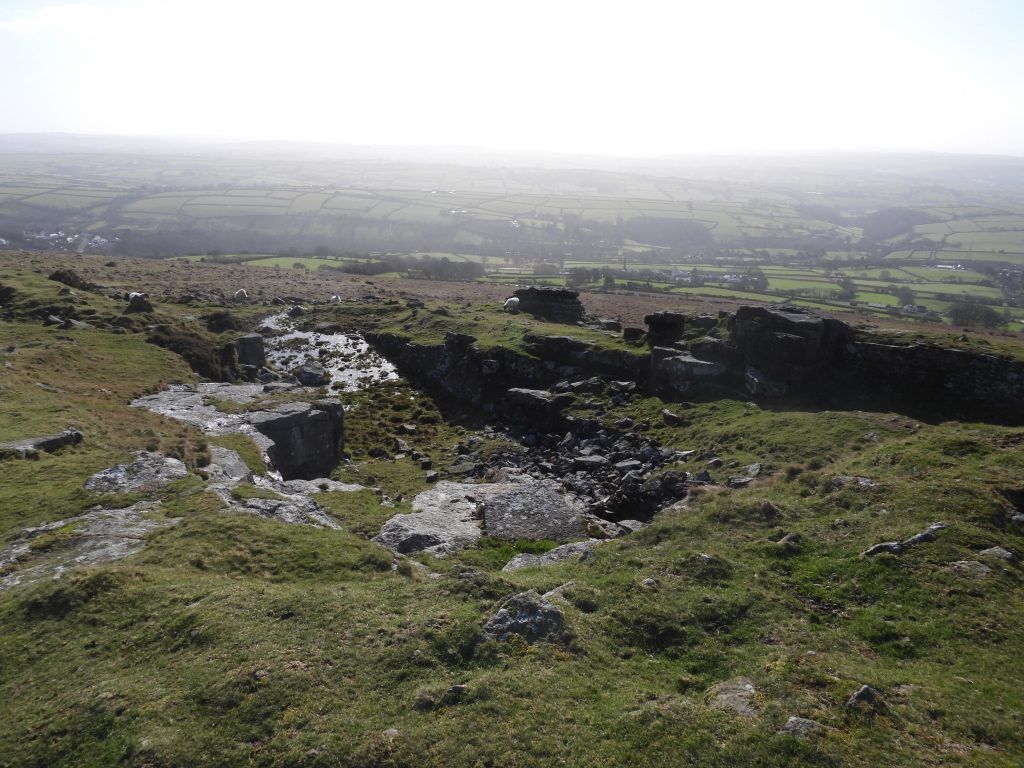
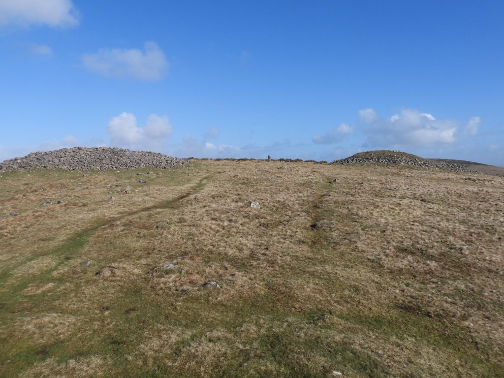
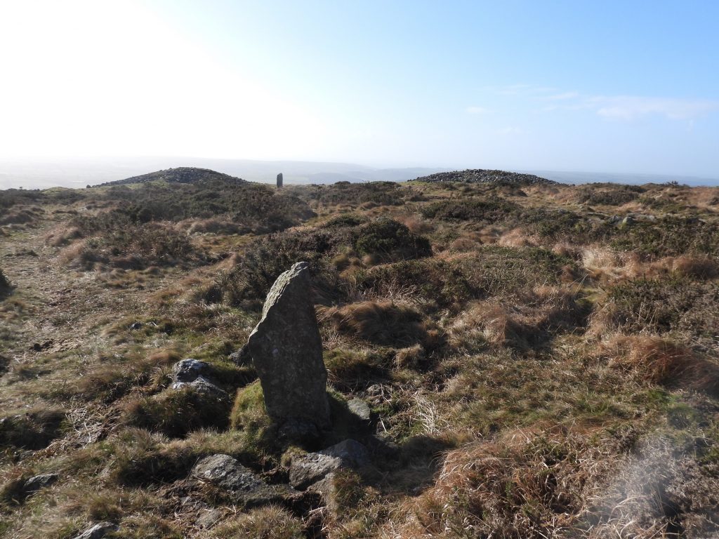
Sketch map showing the items covered in this post.Using side-by-side maps (National Library of Scotland), and Dartefacts the explorer can find the location of the Ugborough / Harford parish boundary stones as they progress up the hill. The numbering of the BSs are believed to have come from Mark Fenlon. This is boundary stone (2) which the author recorded at SX65150 57475.Close to BS (2) lies the first unknown structure at SX65149 57492.Unknown structure 2 lies at SX65166 57486. The Royal Observer Corp were known to have field telephones. The author speculates that some of these structures may have been aerial installations.The ruins of a rather large building (marked 2 on sketch map) lies at SX65187 57470. All the ruins lie next to a levelled track, which leads up to the quarries on Western Beacon. Most of the ruins are constructed out of concrete and not granite, which adds to the evidence of them being from 20th century (and most probably WWII).Unknown structure 3 lies at SX65189 57479.Another building (indicated 1 on the sketch map) is also quite large and is just below the circular Royal Observer Corp. circular look out post. Was this building for accommodation ?Another angle showing building 1 which is located at SX65169 57518.The final structure found by the author (there maybe more) is labelled unknown structure 4 and is located at SX65153 57528.Royal Observer Corp “look out” post is the structure highest on the hill. In WWII, German raids on Plymouth came across the moor using the clay pits as ‘navigation markers’. The Royal Observer Corp “look out” is only a few metres in diameter and was constructed out of brick.The Royal Observer Corp “look out” is located at SX65191 57529.This is boundary stone (3) which the author recorded at SX65244 57534.This is boundary stone (3A) which the author recorded at SX65283 57556.This is boundary stone (4) which the author recorded at SX65318 57581.This is boundary stone (5) which the author recorded at SX65356 57598.Western Beacon QuarryTwo of Western Beacon Cairns plus the Ugborough / Harford Boundary Stone (6) in the centre. The cairn on the left of the picture is labelled number 5 by Jeremy Butler in the Dartmoor Atlas of Antiquites, Volume Four, The South West (Map 53). He states it is 24m across by 3m high. The cairn on the right is labelled number 6 and is stated as being 21m across by 2.5m high.This is boundary stone (6) which the author recorded at SX65427 57642. It is inscribed “U” for Ugborough (as shown in the photograph) with “H” for Harford on the reverse.This is boundary stone (7) which the author recorded at SX65430 57677. Boundary stone (6) is in the background between cairns 5 and 6.