A collection of walks, discoveries, insights and pictures of exploring Dartmoor National Park
August 2, 2022
Dartmoor Way – Stage 6 – Chagford to Okehampton
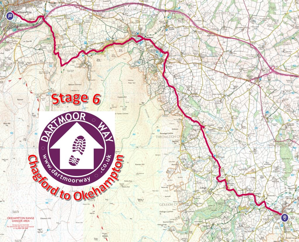
This sixth stage of the Dartmoor Way is stated on the official website (dartmoorway.co.uk) as being 12.25 miles (19.5 km) starting at Chagford and finishing at Okehampton. The elevation climb is 2096 ft (639 m), with the longest individual climb being through Belstone Cleave. This post of the sixth stage was recorded by the author as being 21.31 km (around 13.3 miles) in length. That said, the author made a couple of minor deviations / side trips from the official route, namely: A circumnavigation of Throwleigh village and church and a wander up the road to Finch Foundry in Sticklepath. As with all other post recording the Dartmoor Way, this post records historical features, shows pictures of some far reaching views, shows pictures of wildlife and shows pictures of points of interest – all photographs taken by the author along the route are annotated.
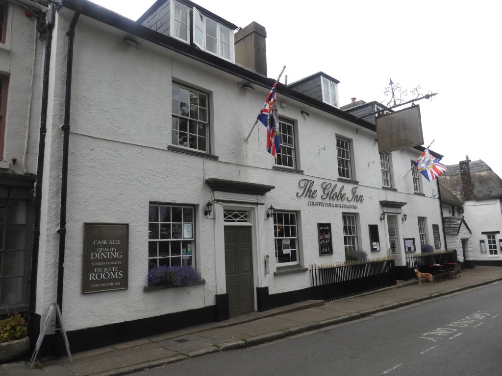
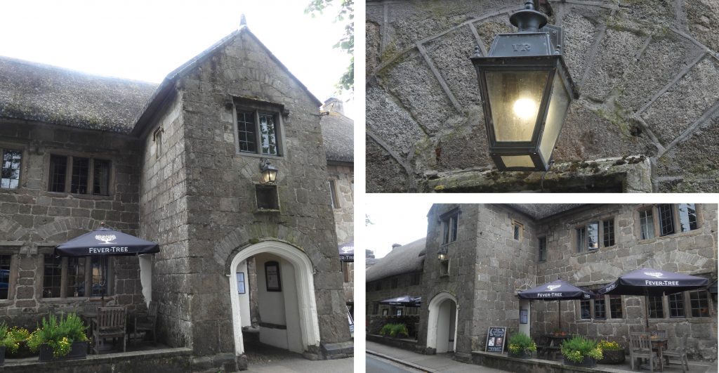
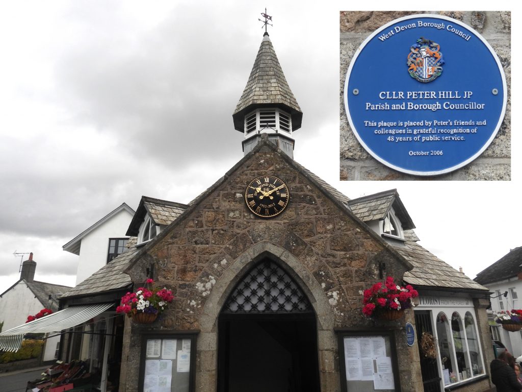
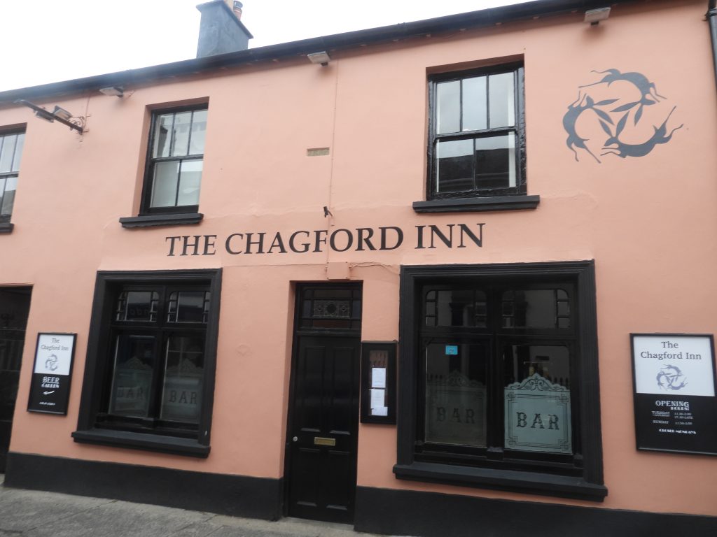
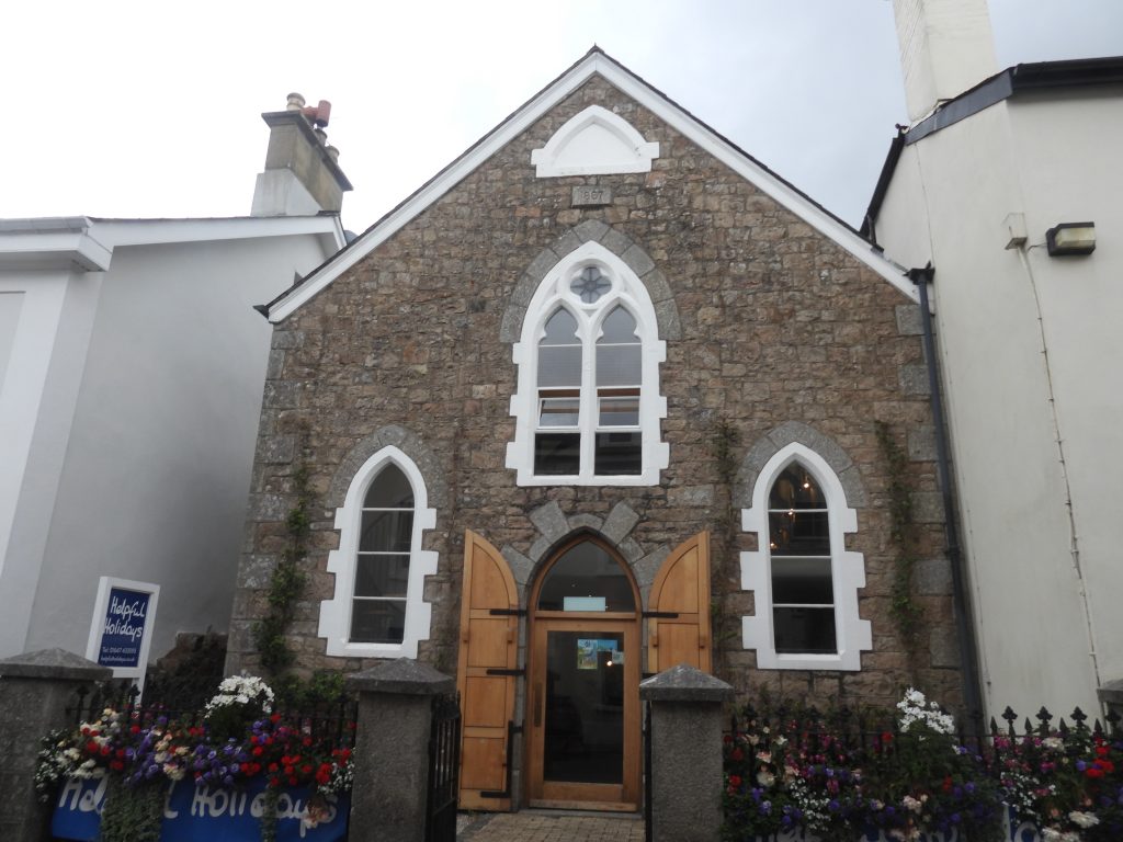
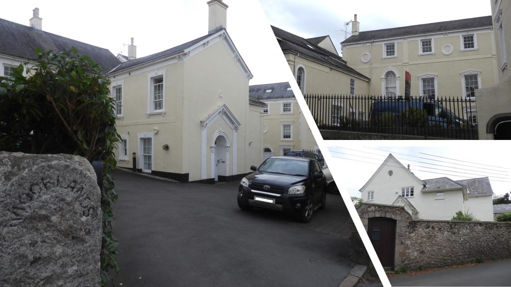
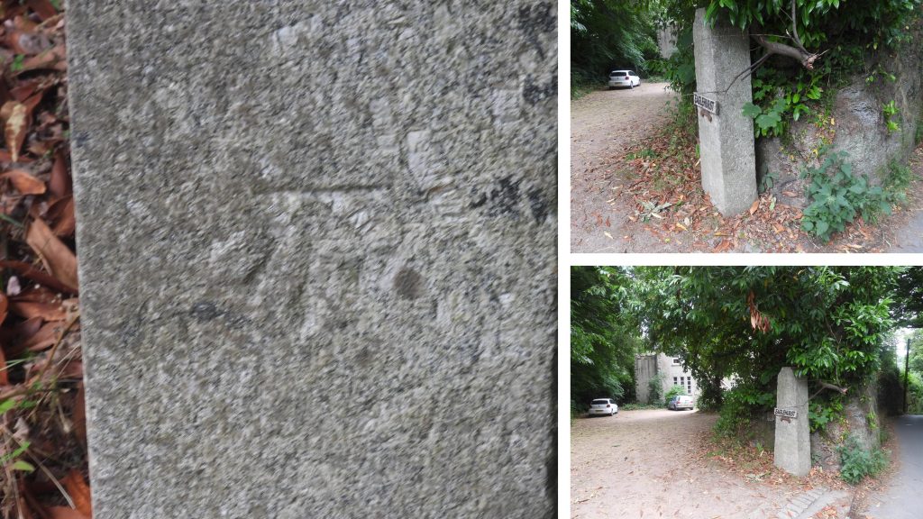
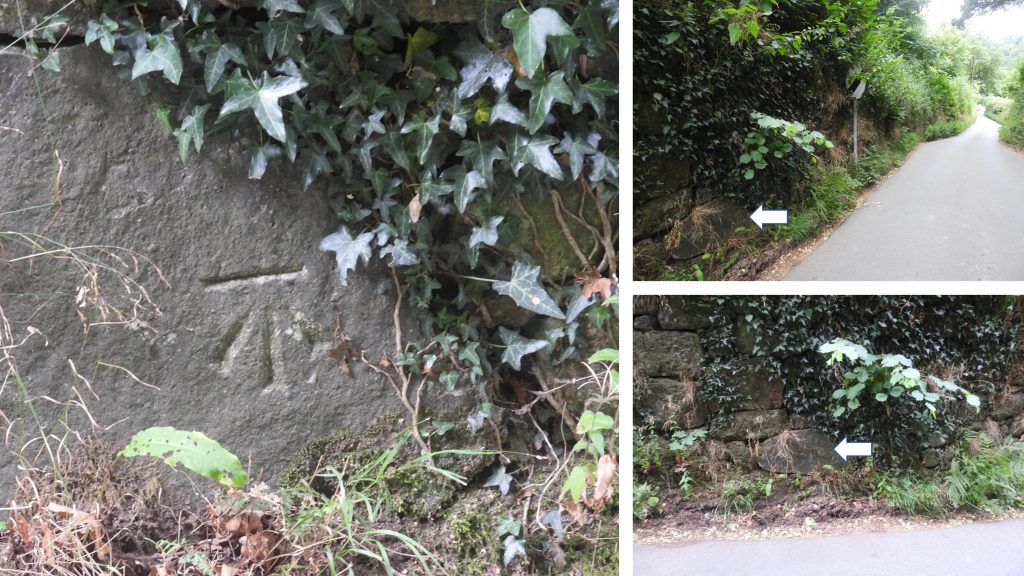
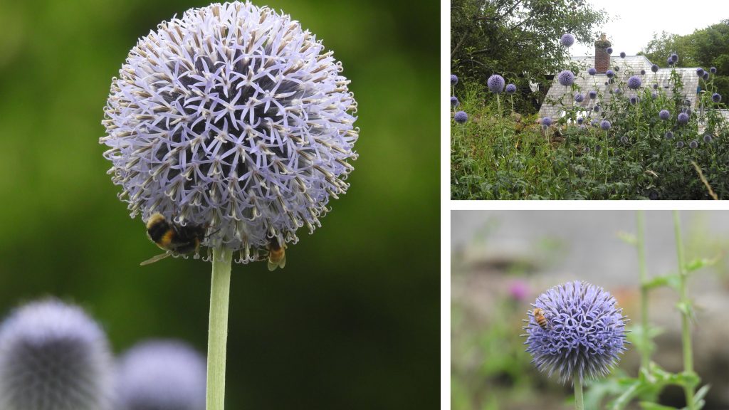
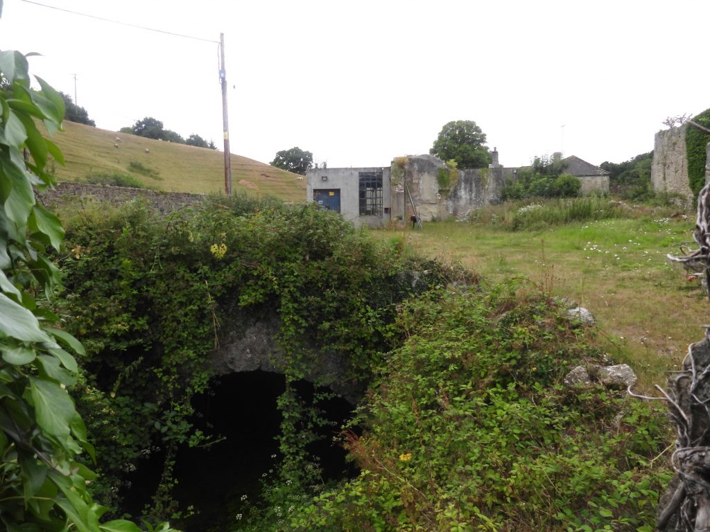
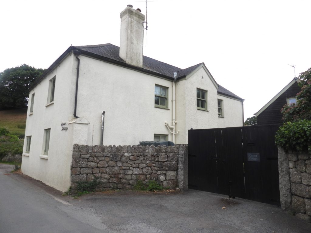
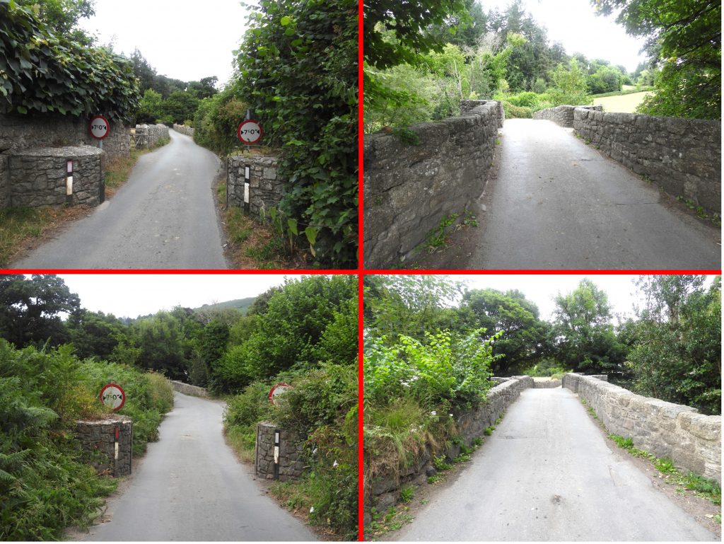
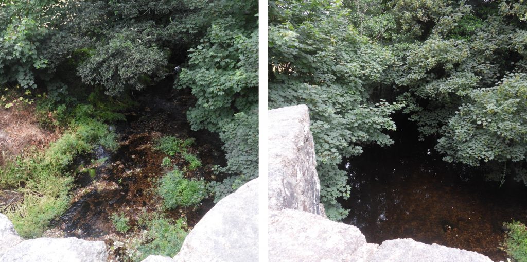
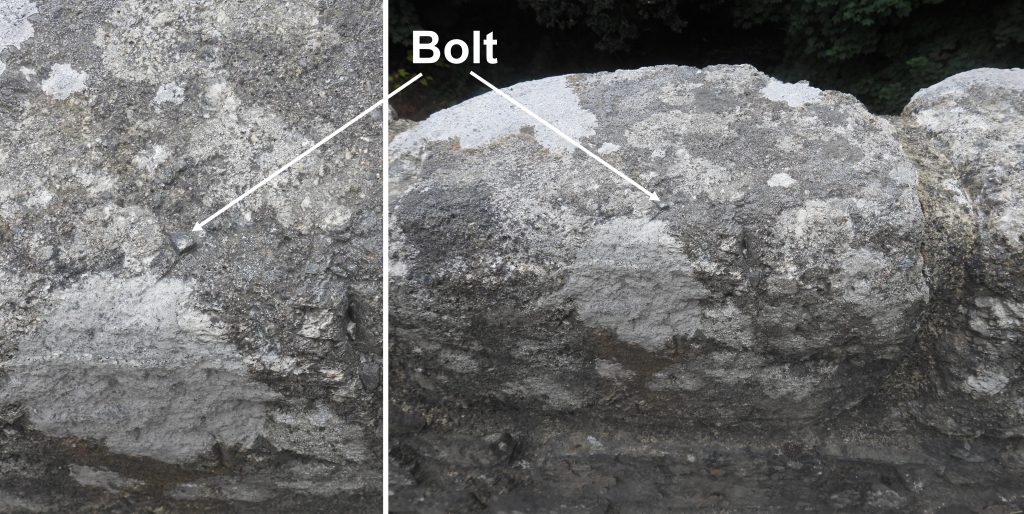
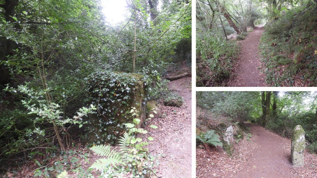
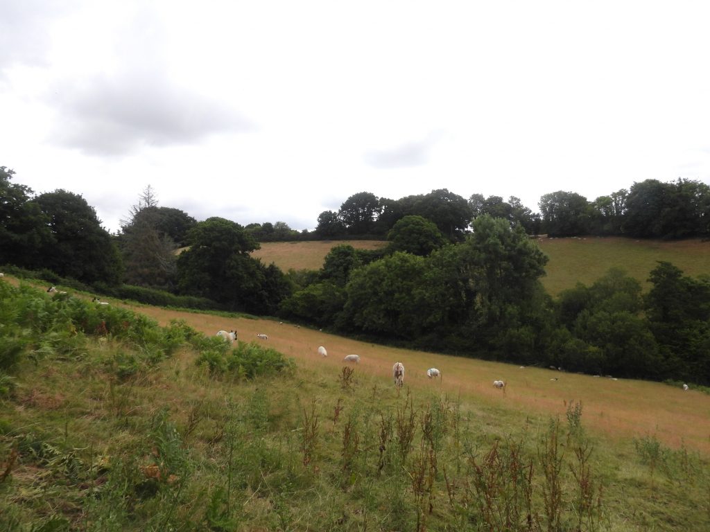
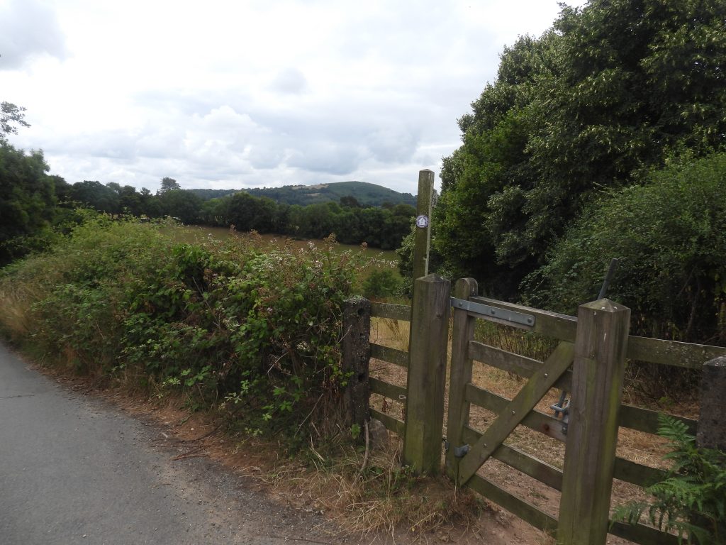
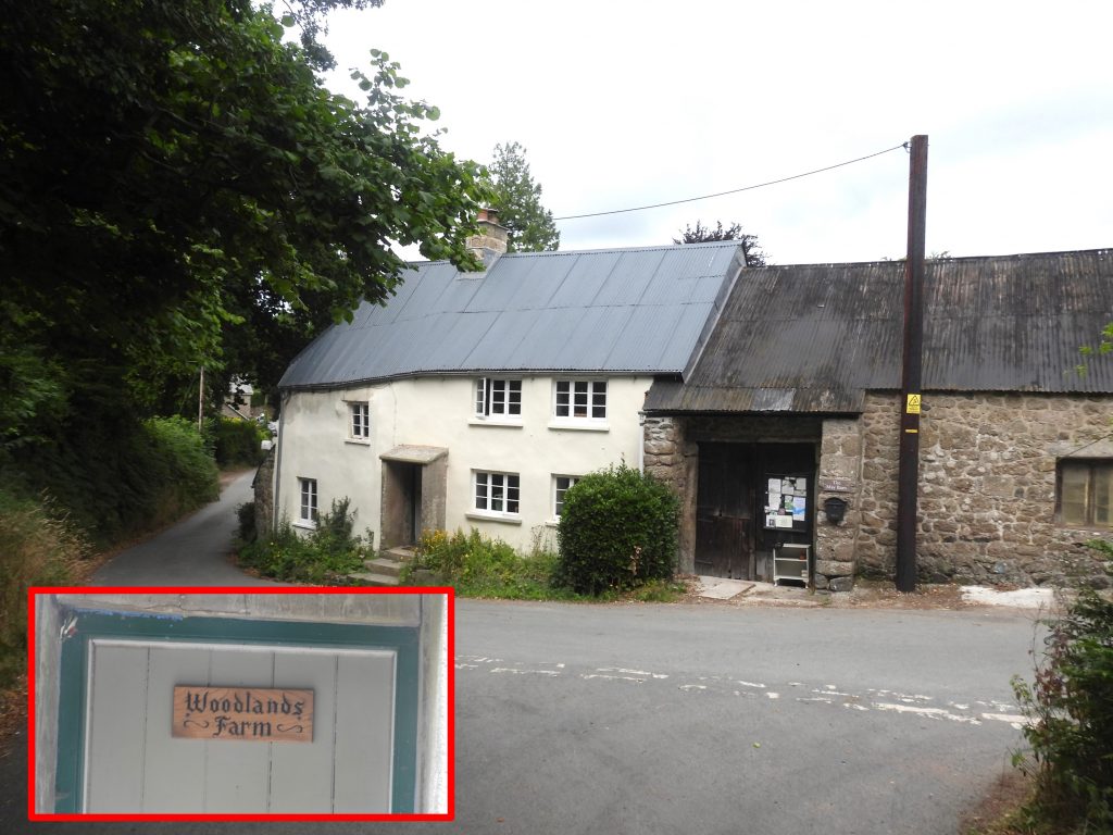
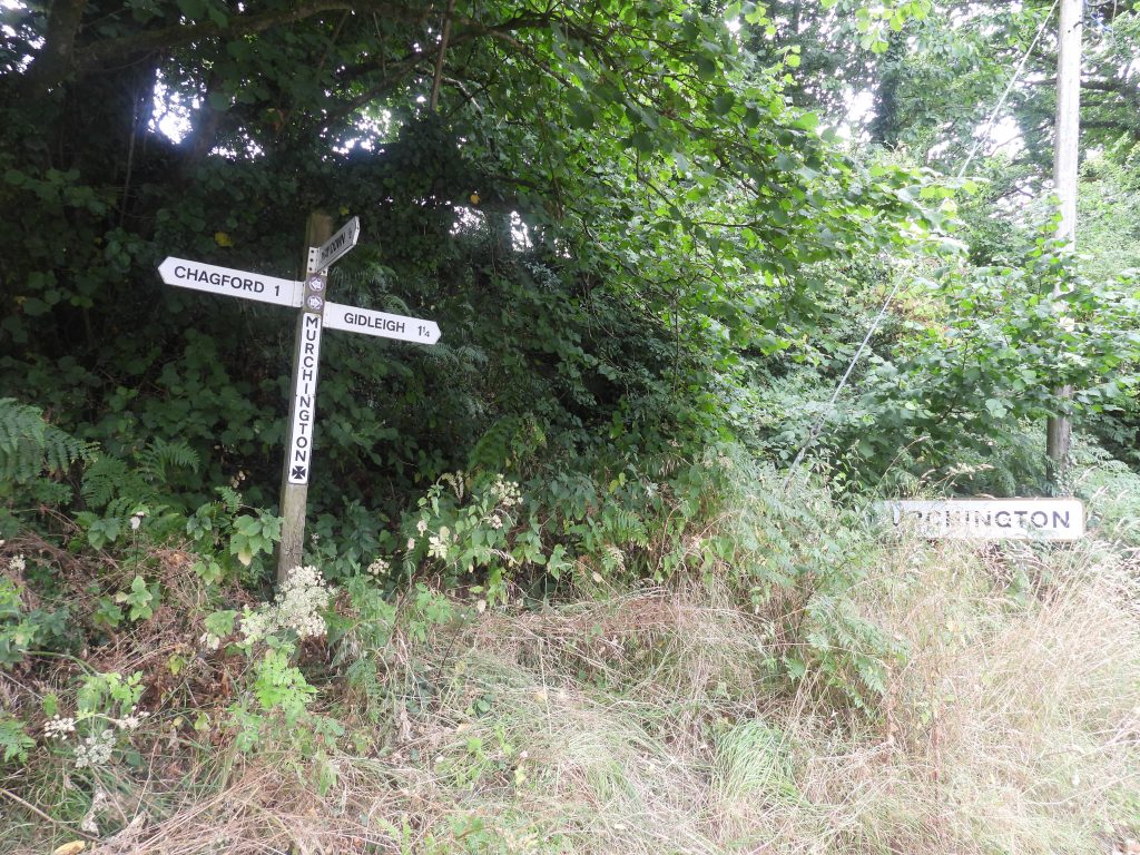
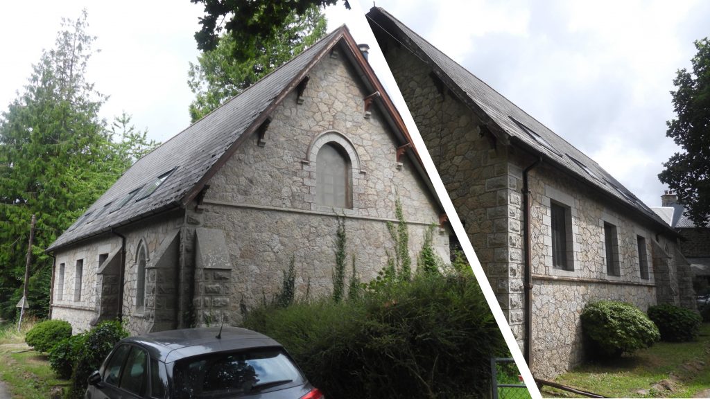
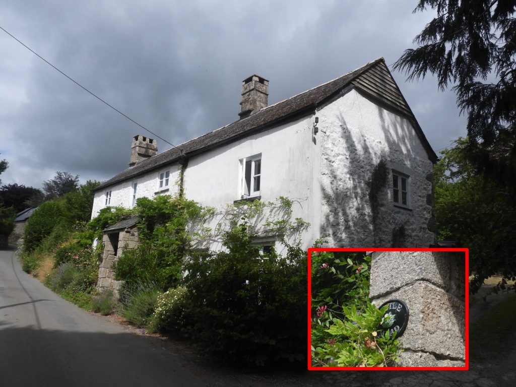
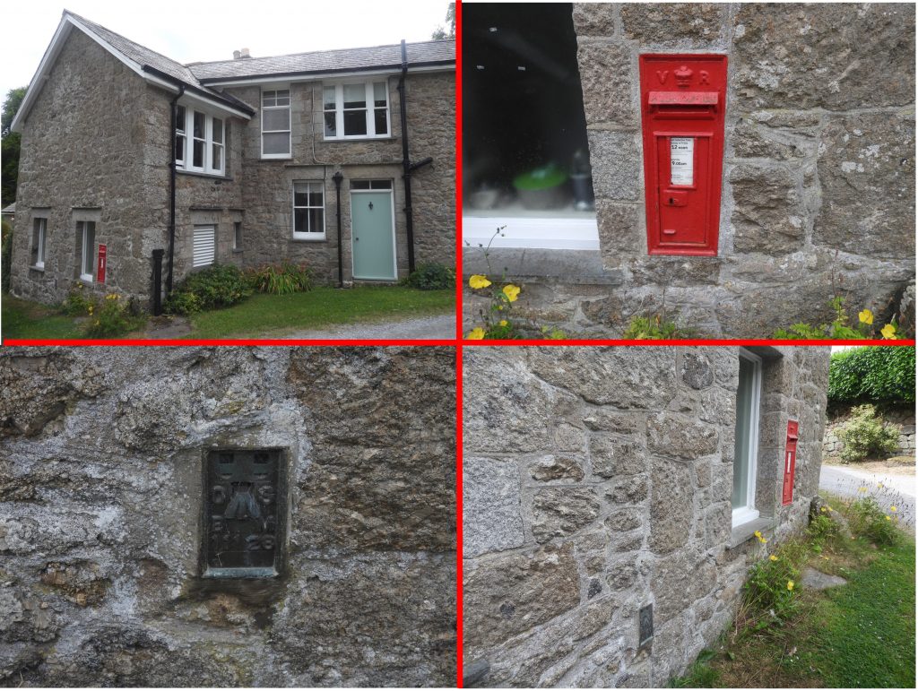
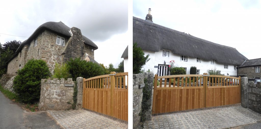
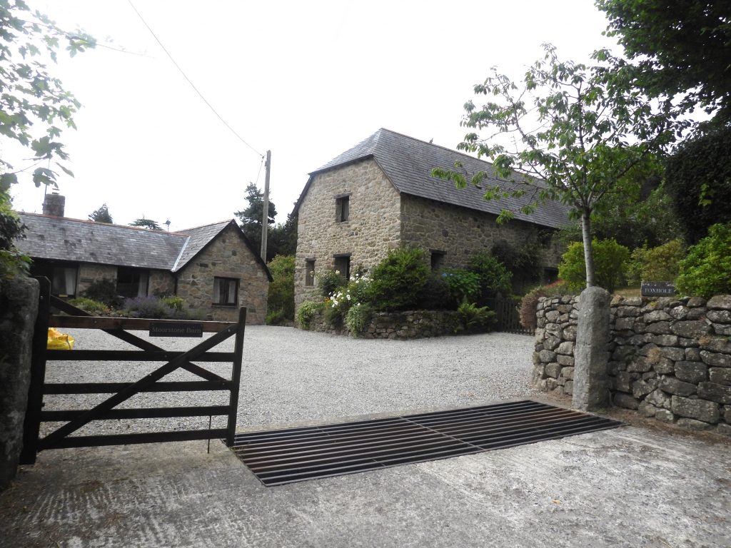
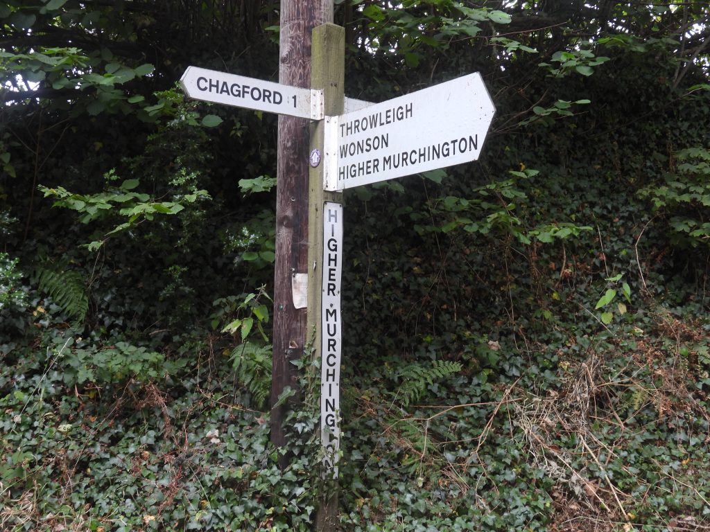
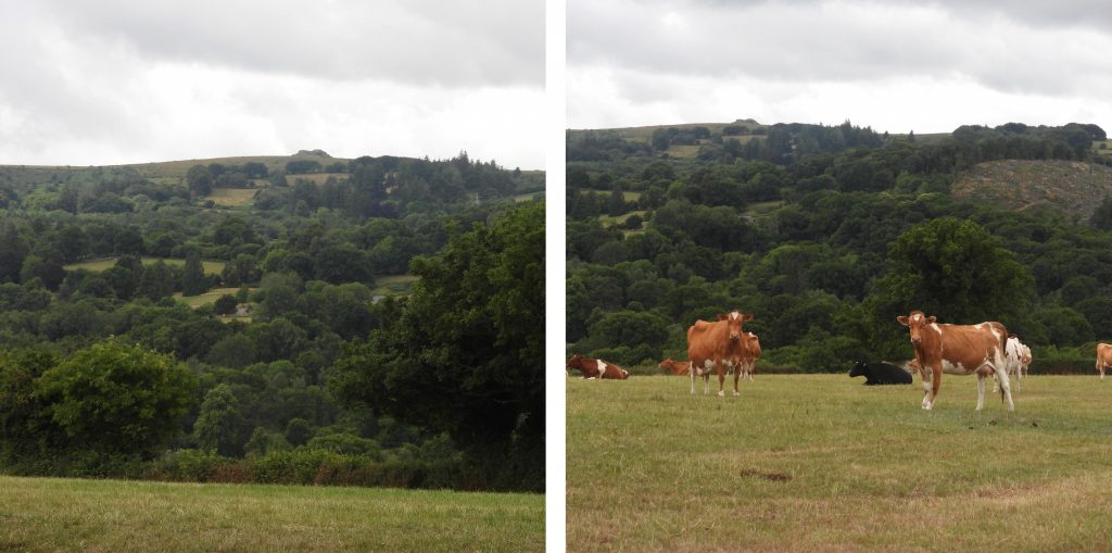
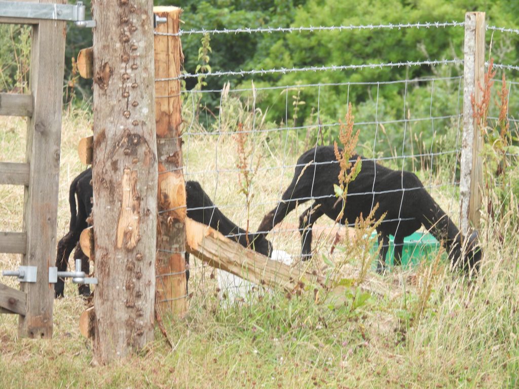
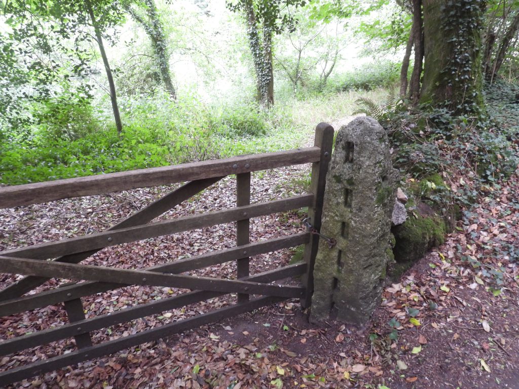
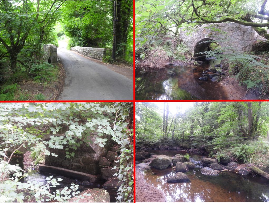
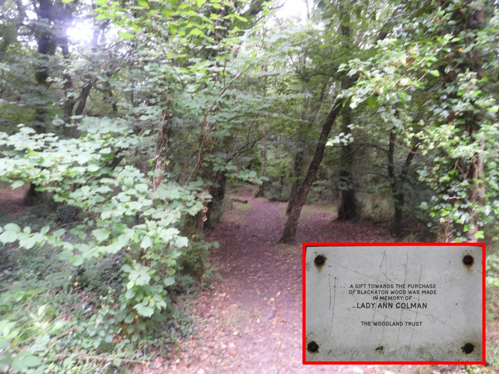
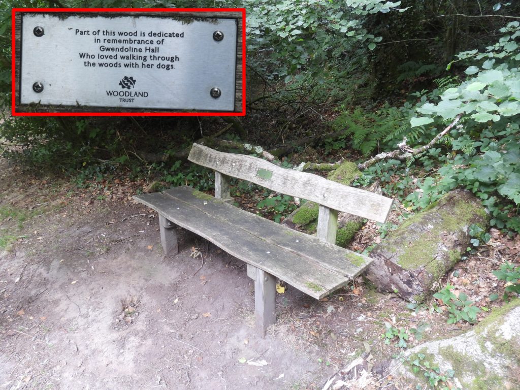
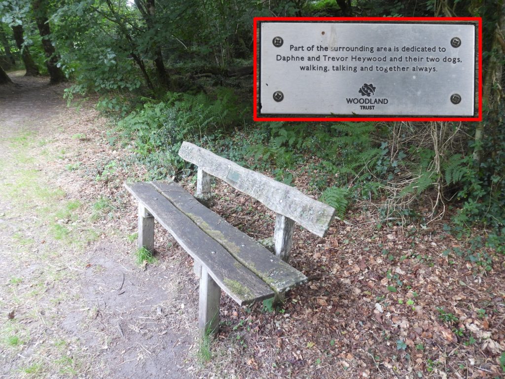
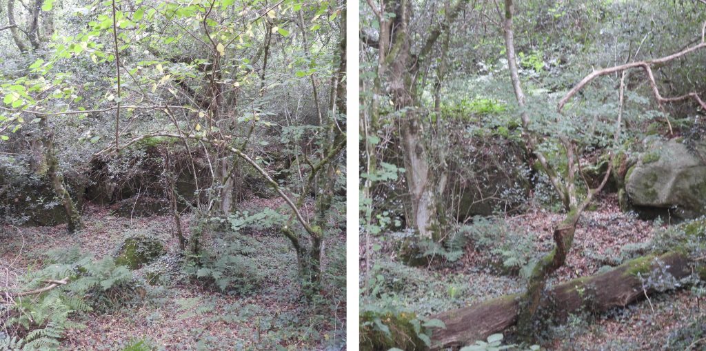
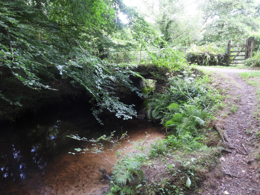
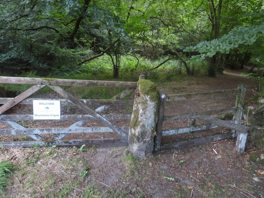
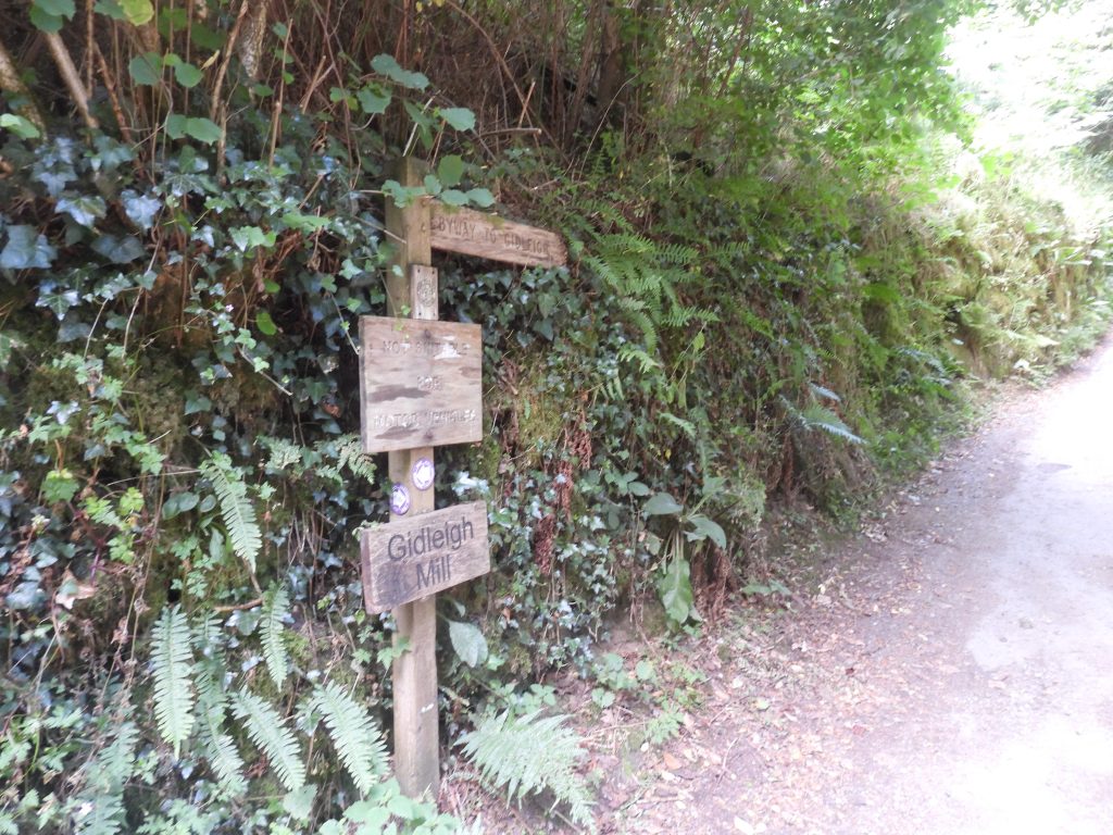
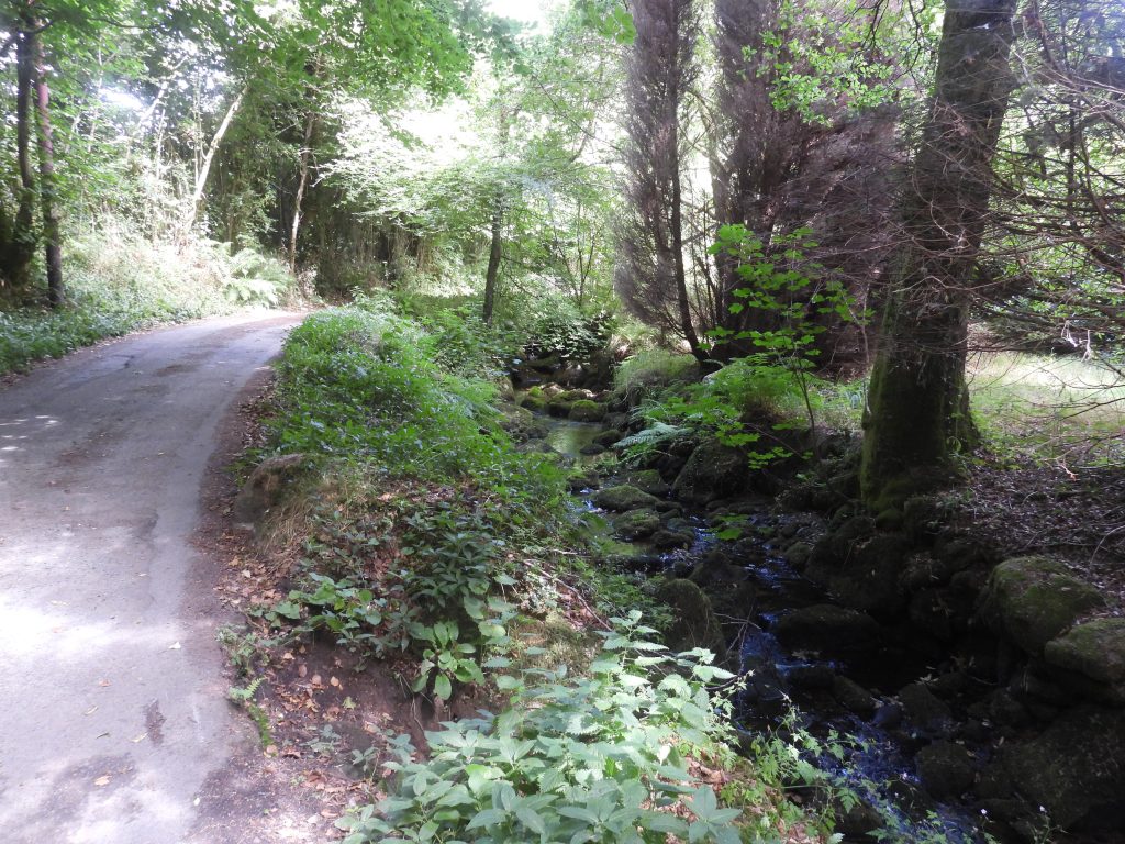
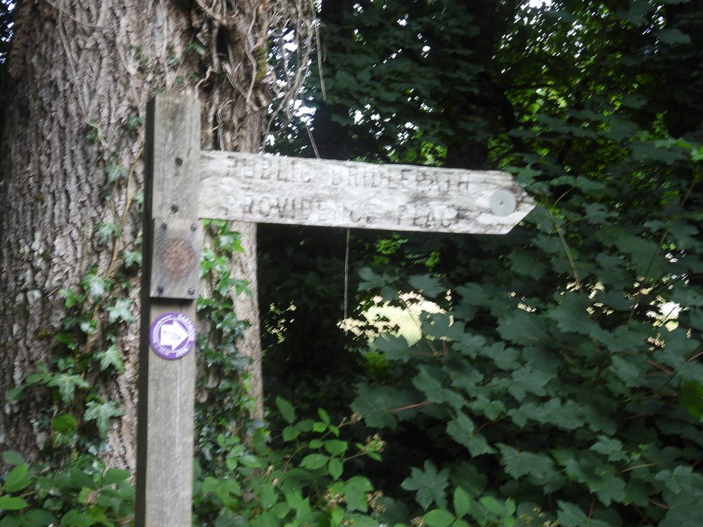
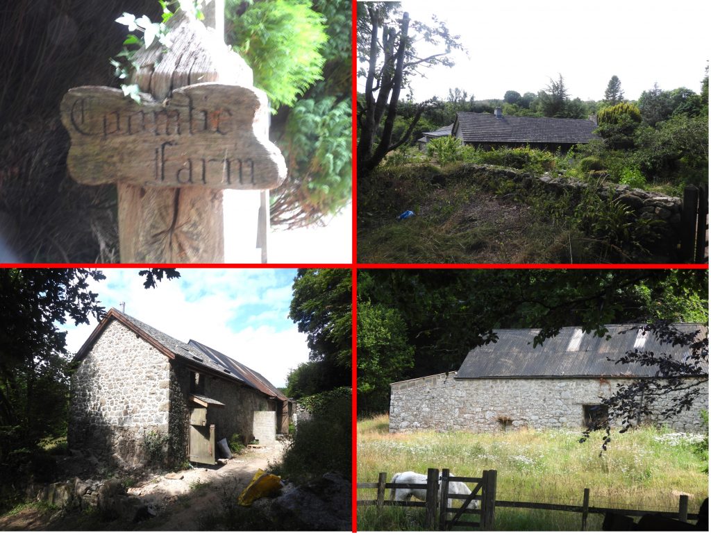
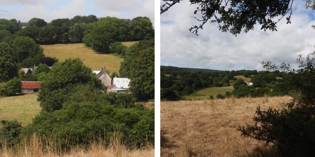
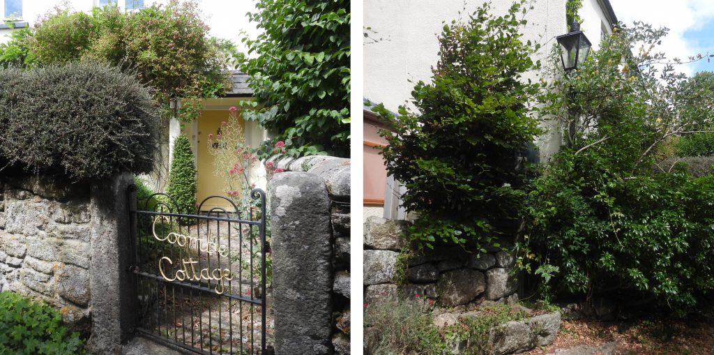
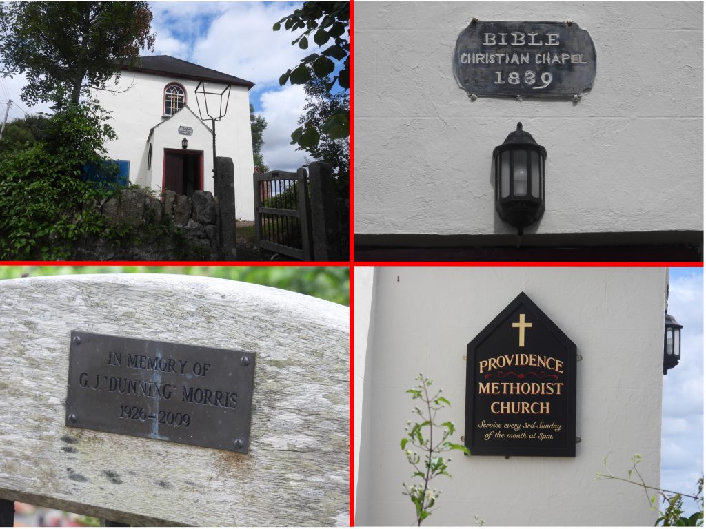
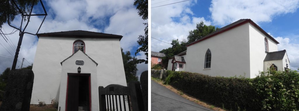
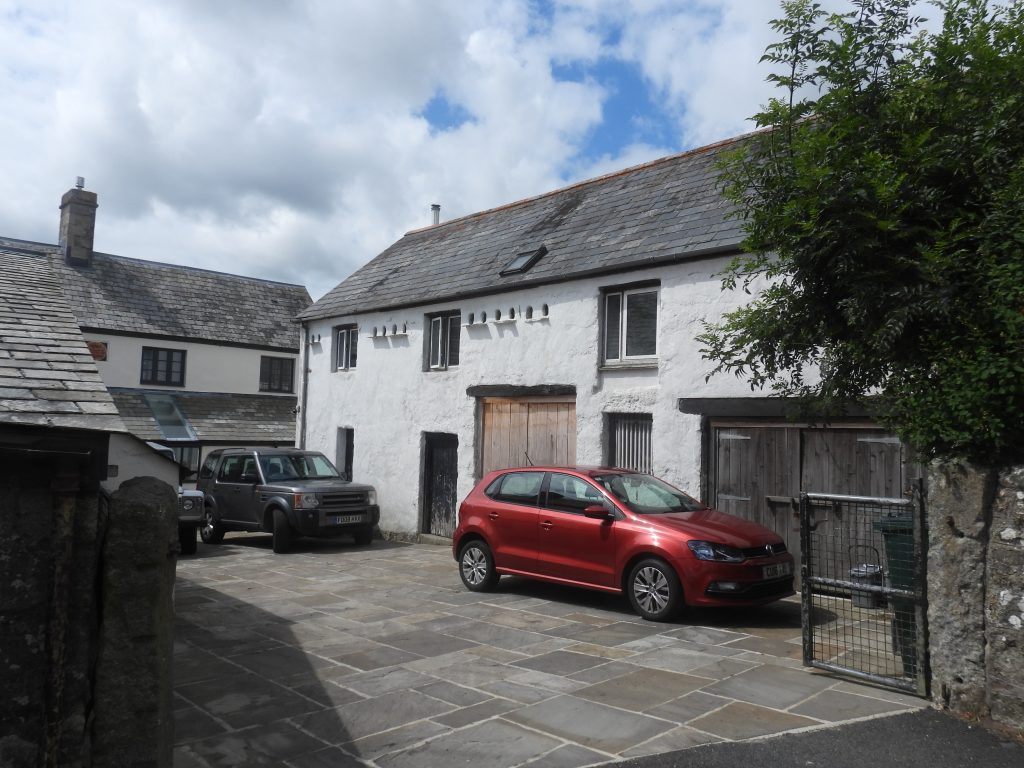
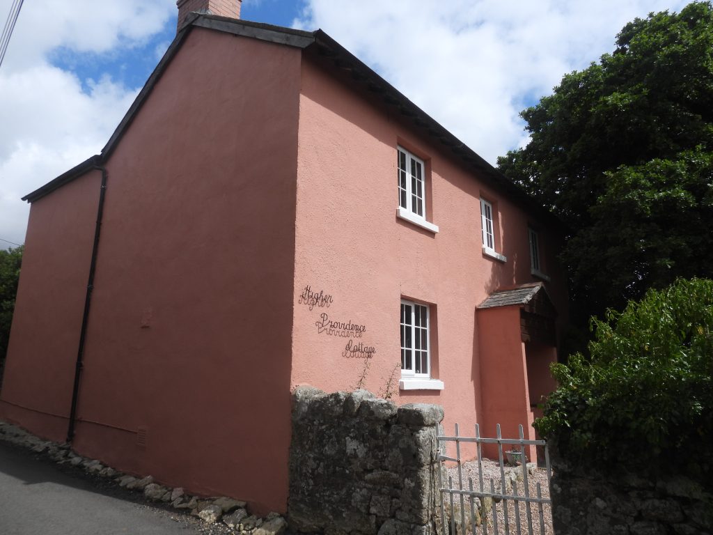
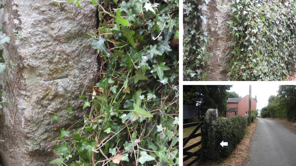
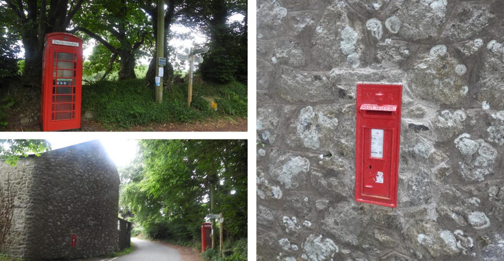
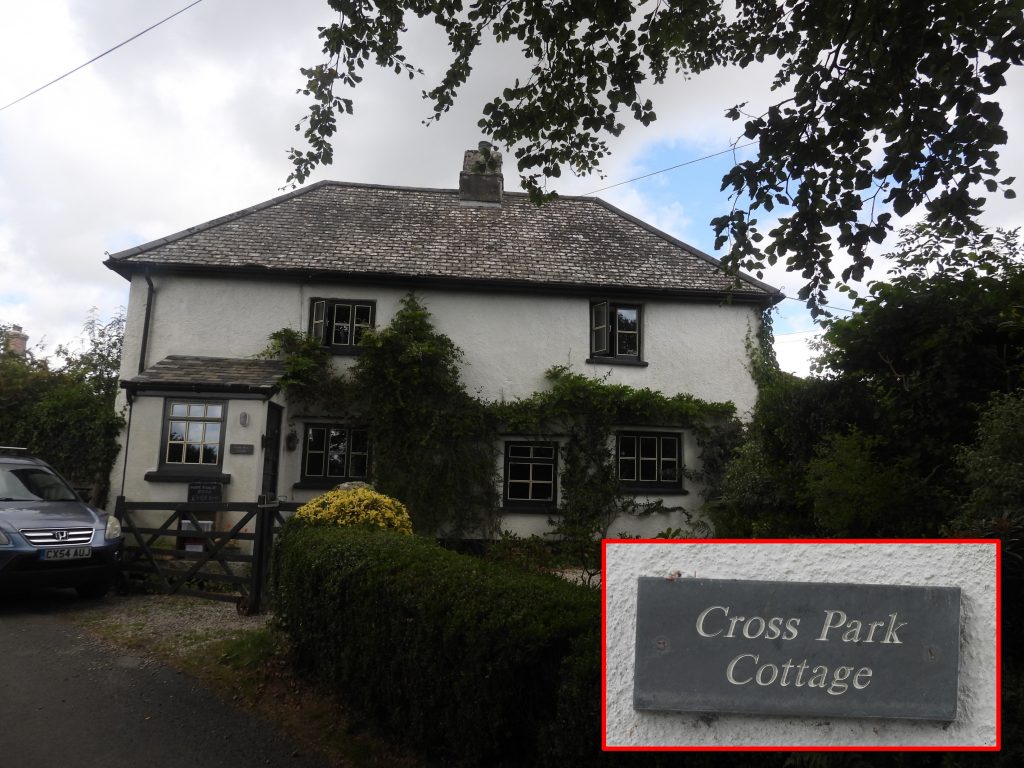
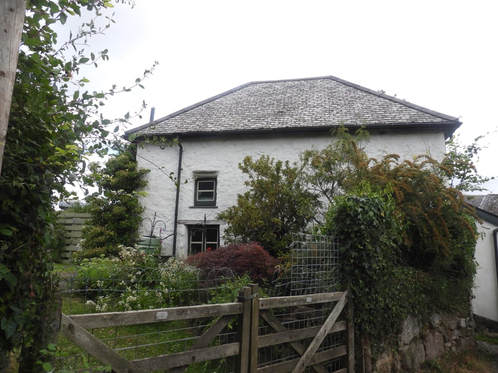
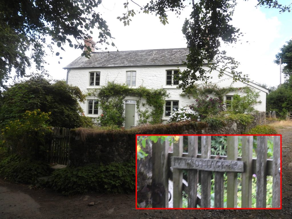
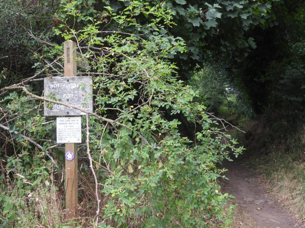
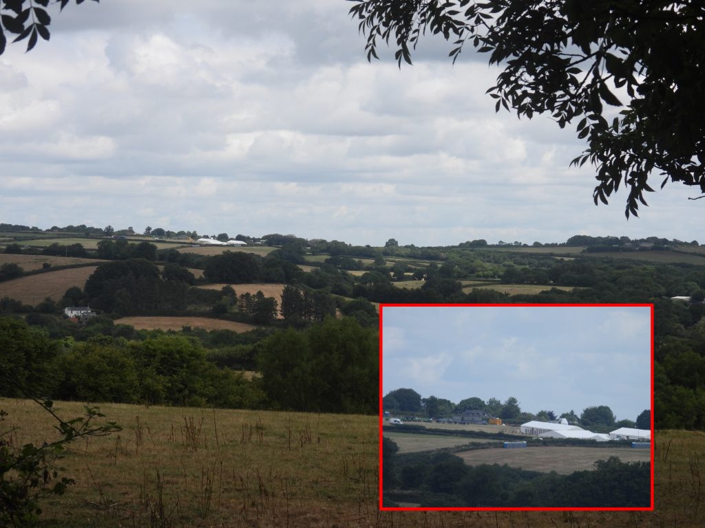
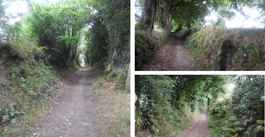
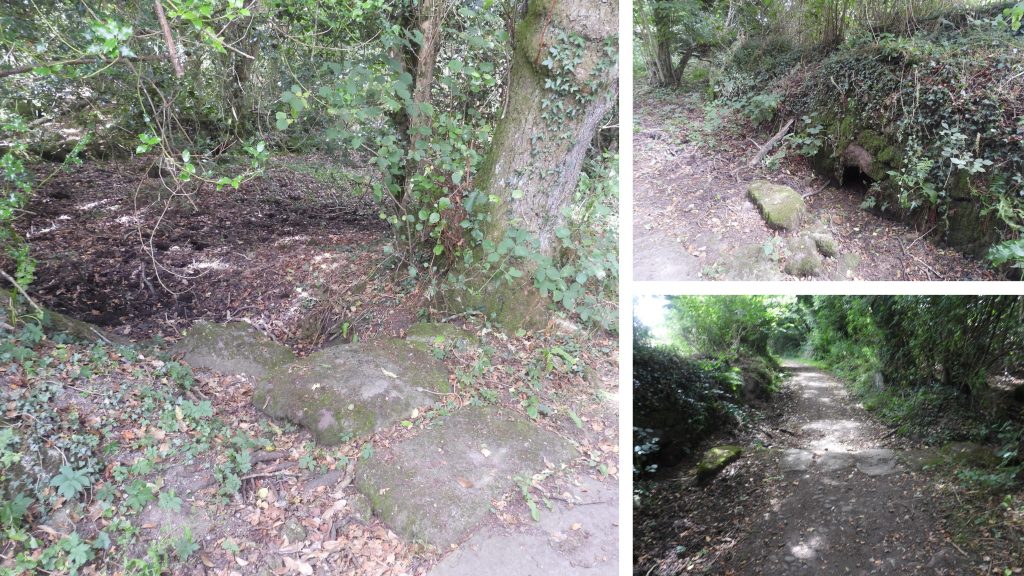
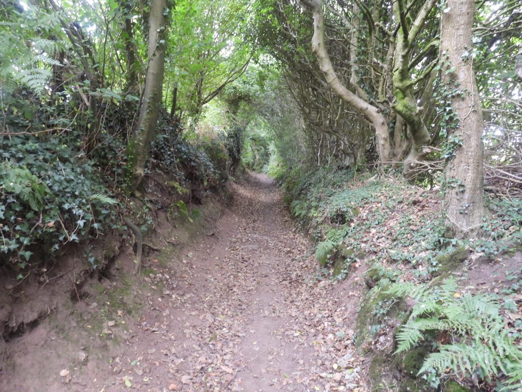
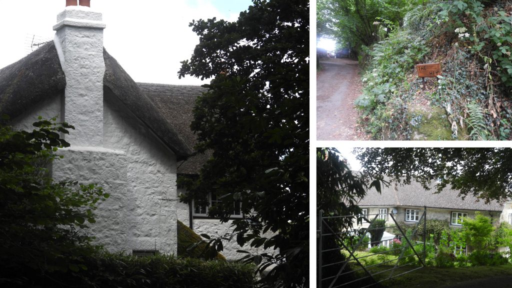
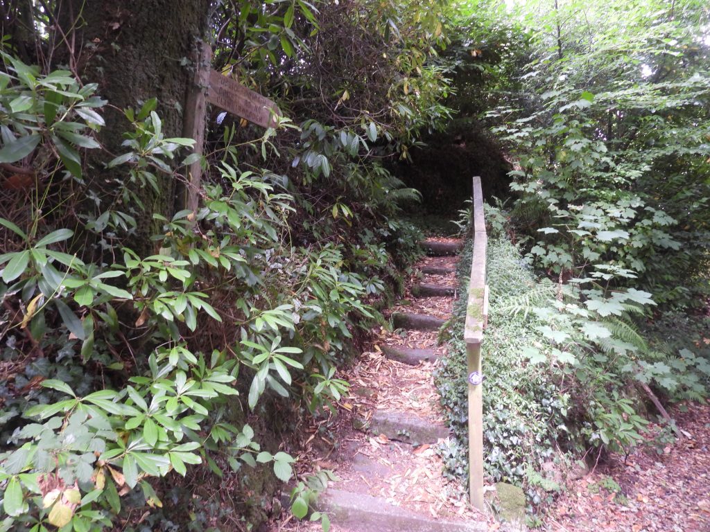
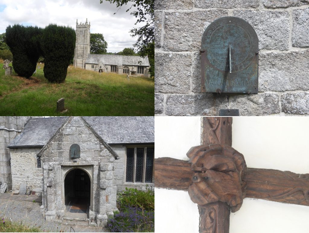
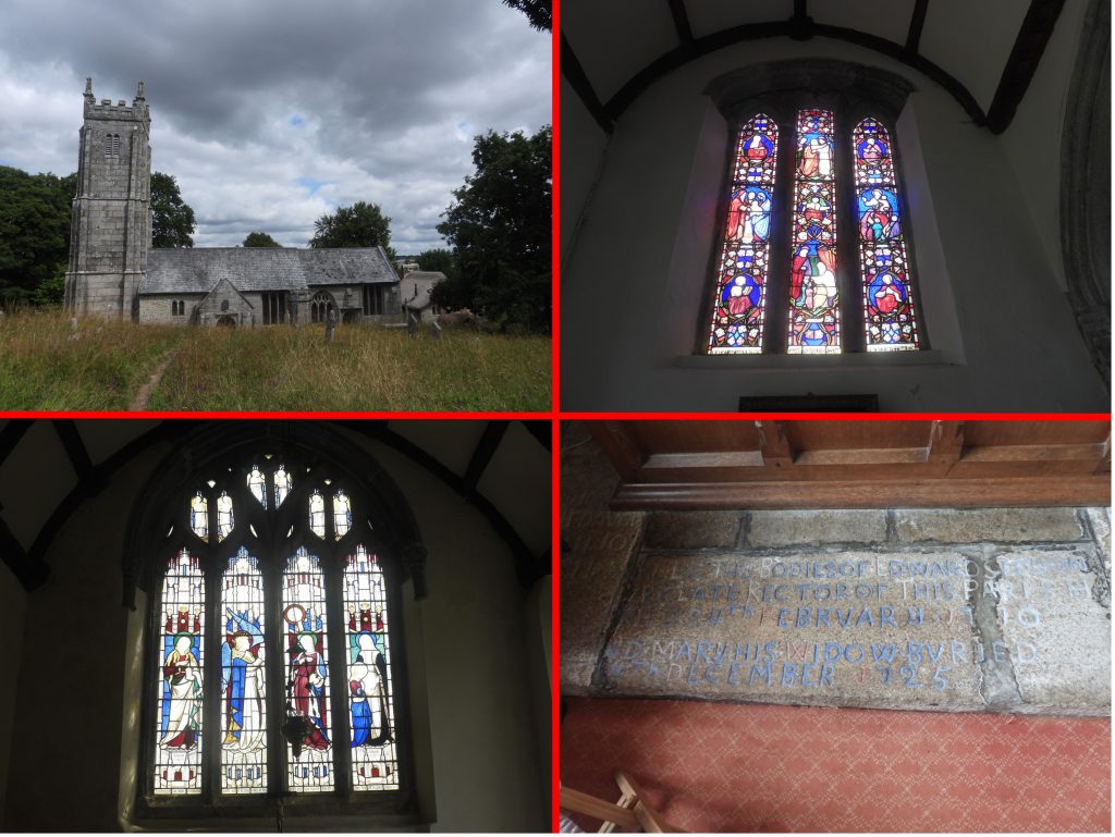
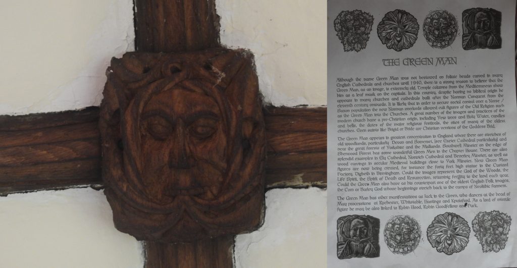
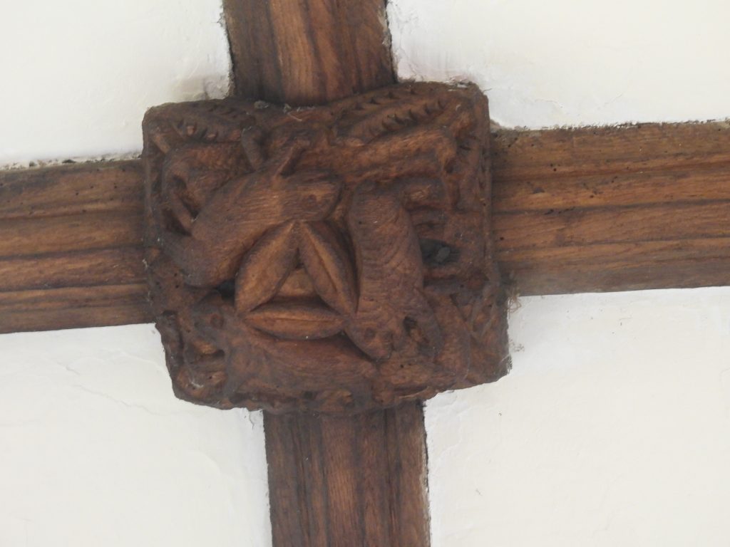
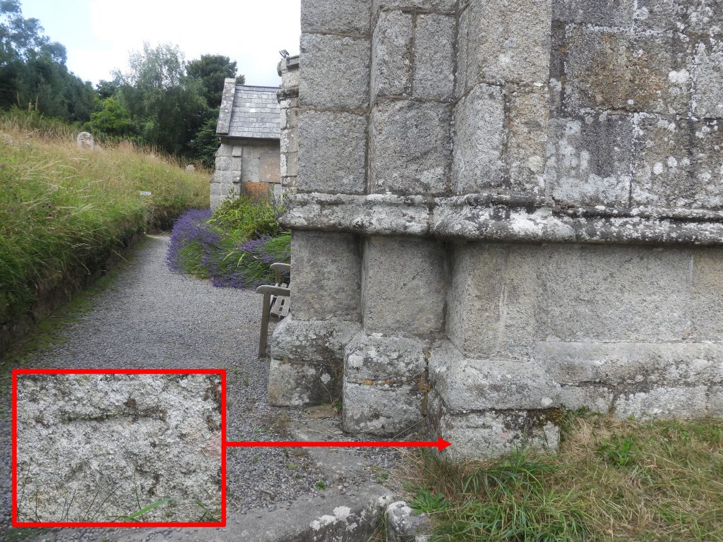
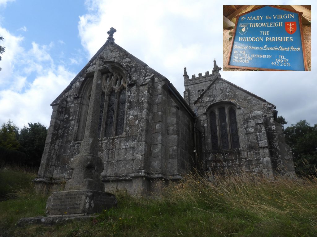
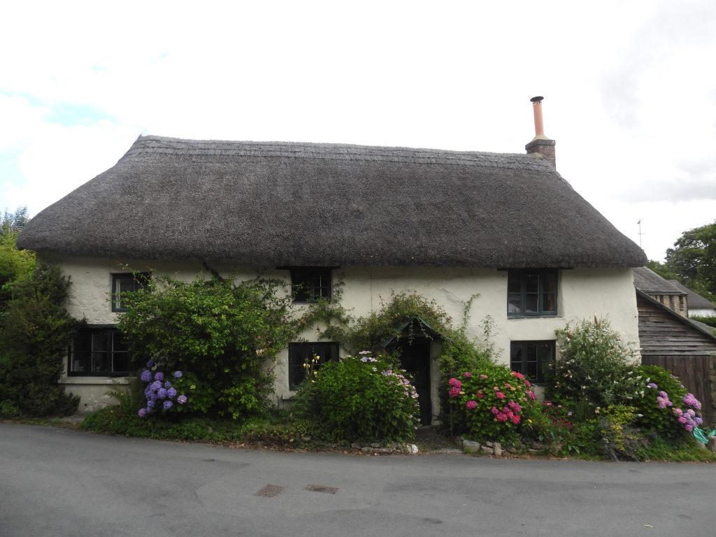
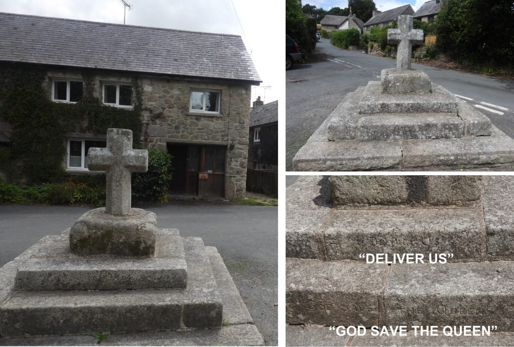
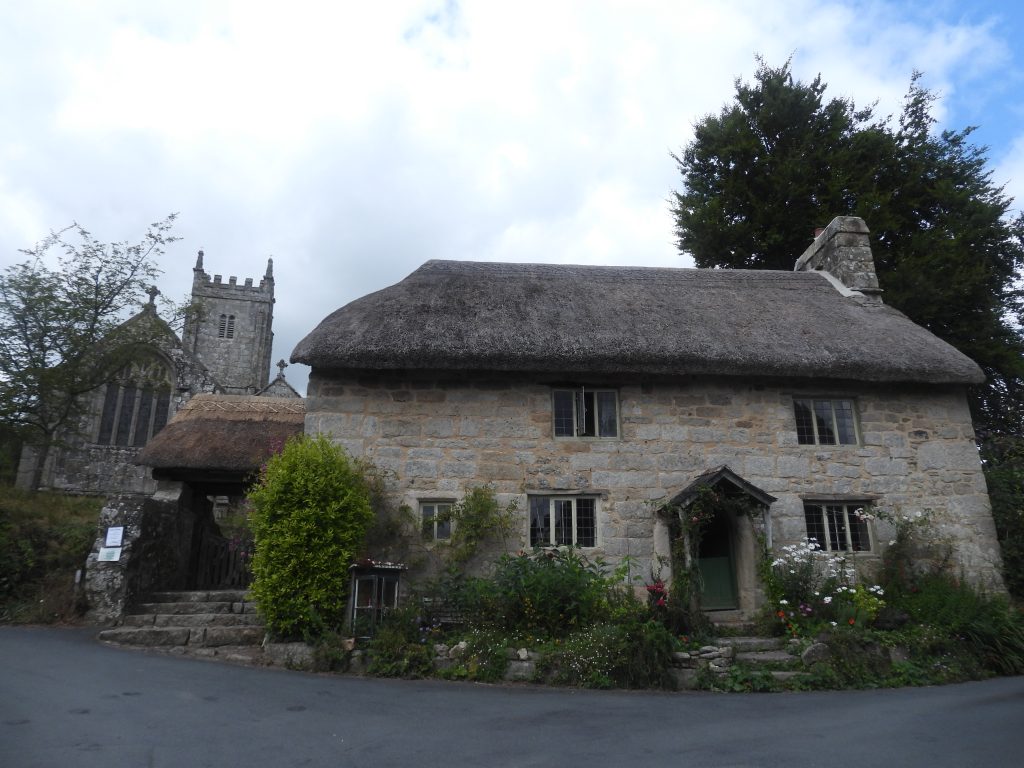
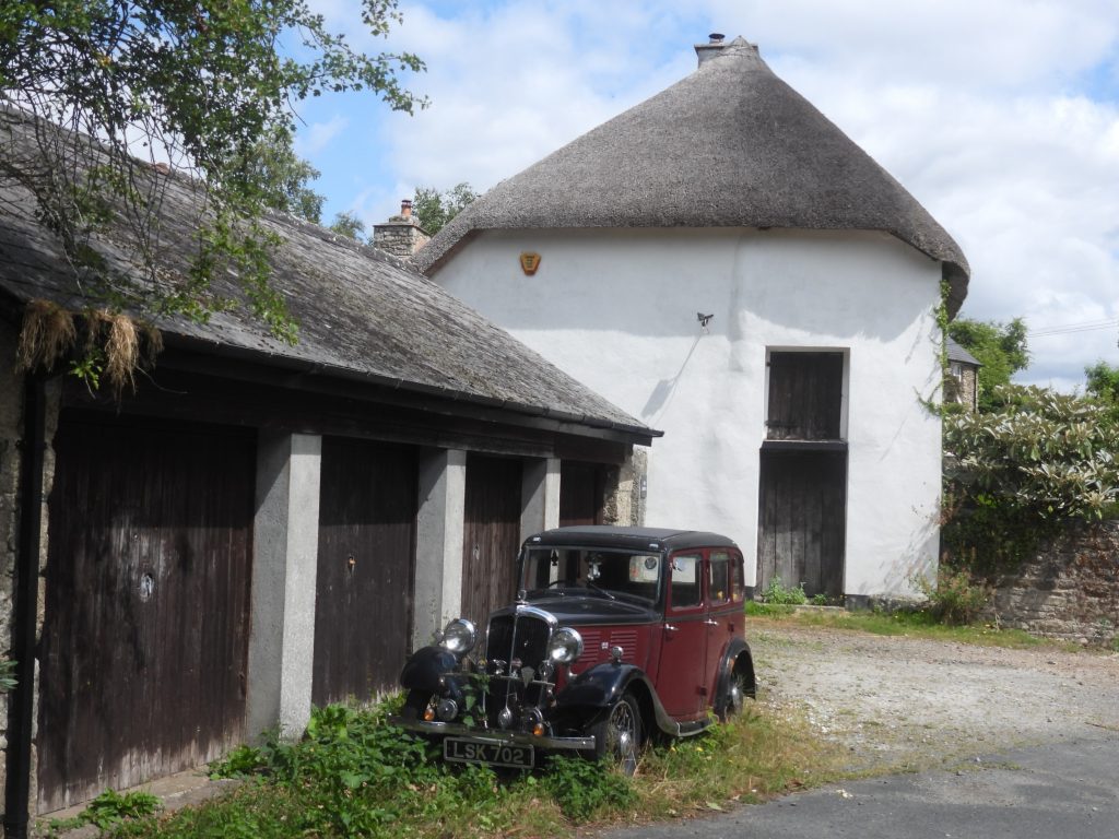
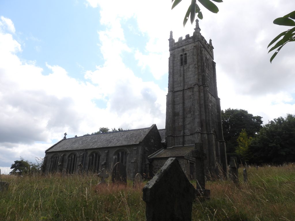
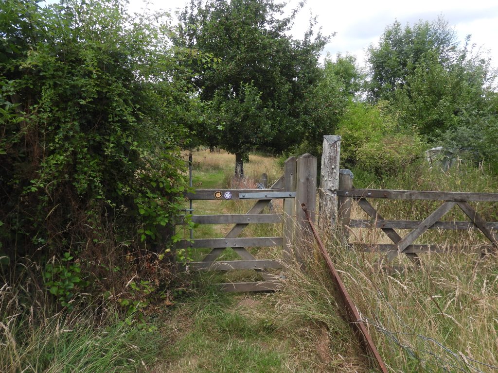
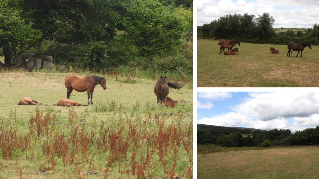
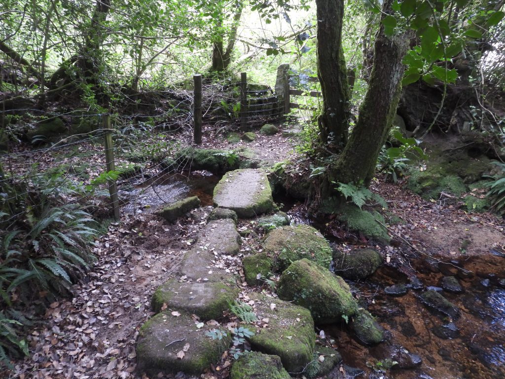
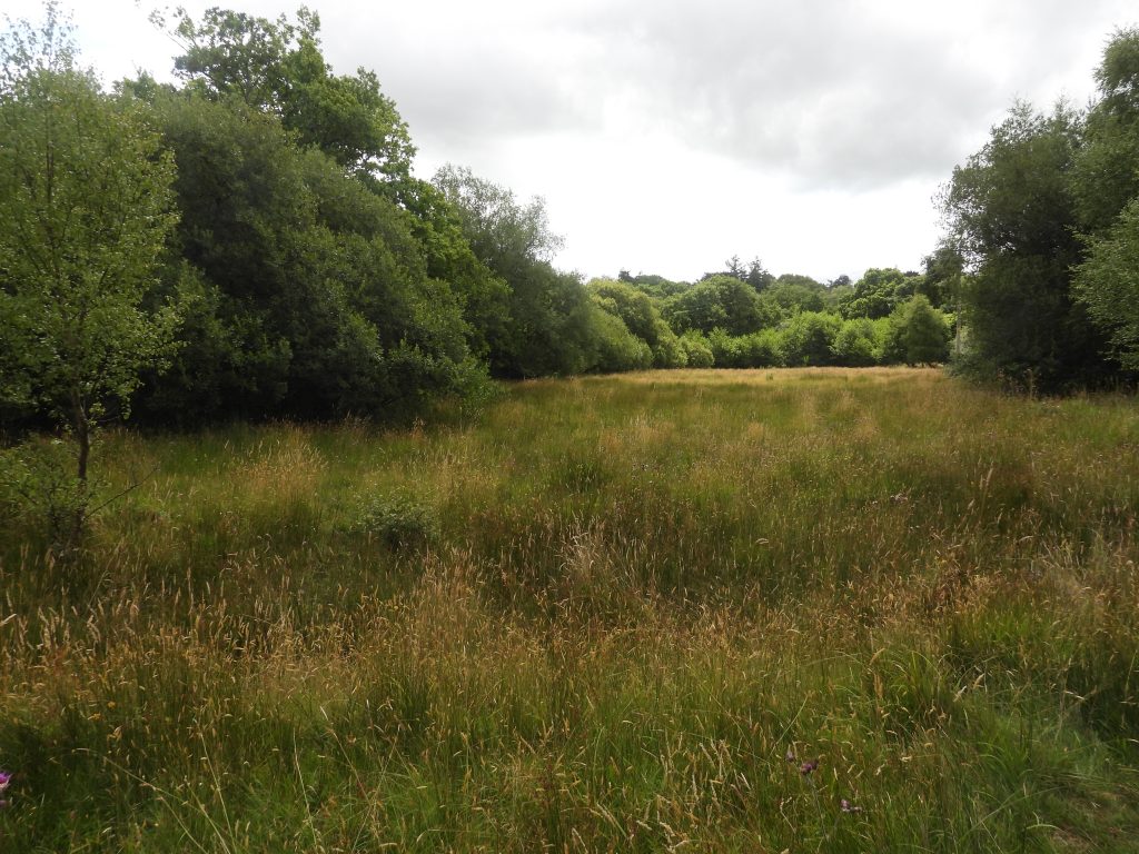
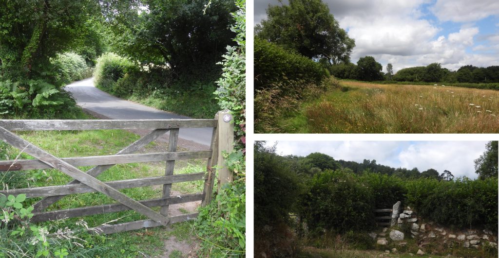
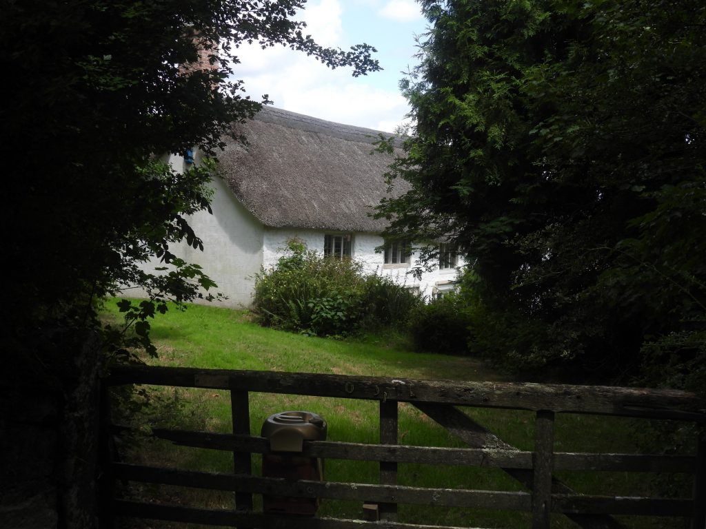
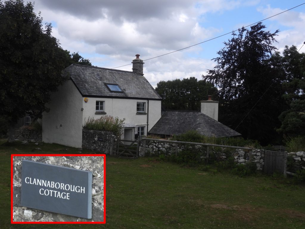
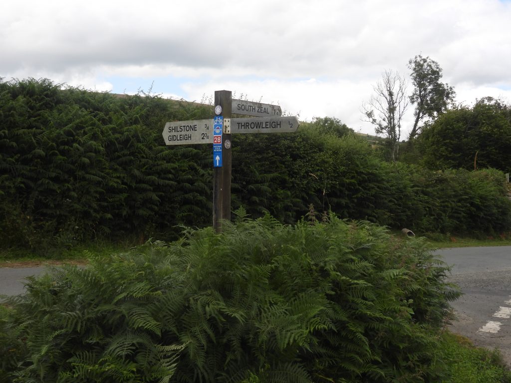
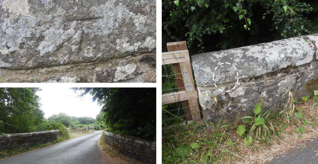
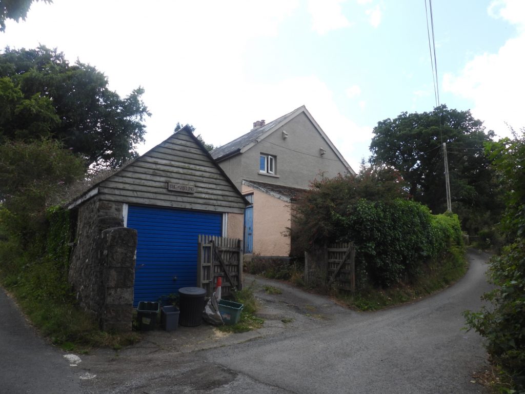
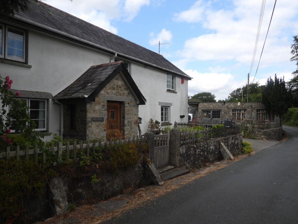
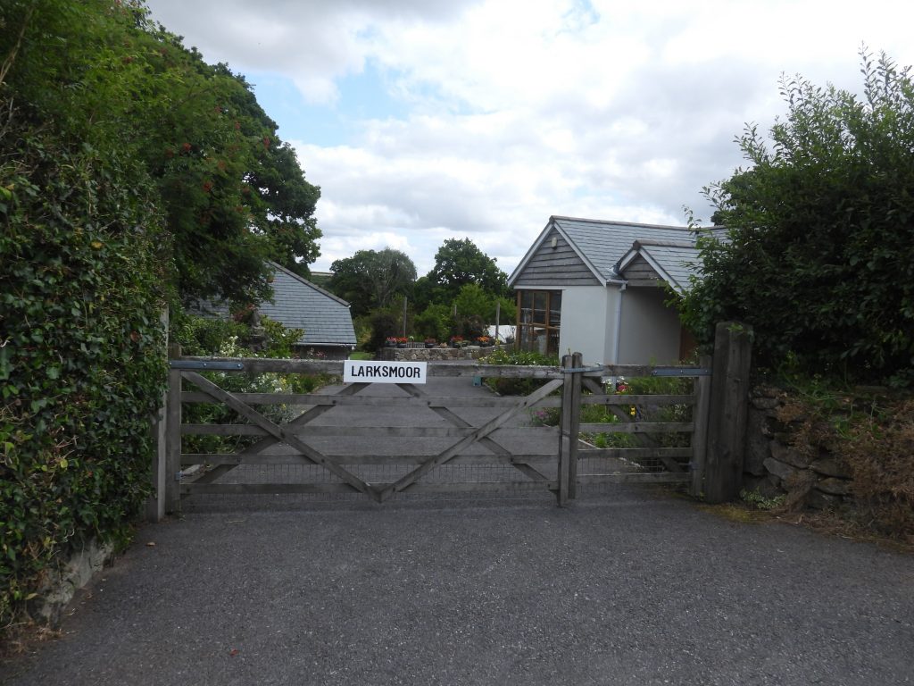
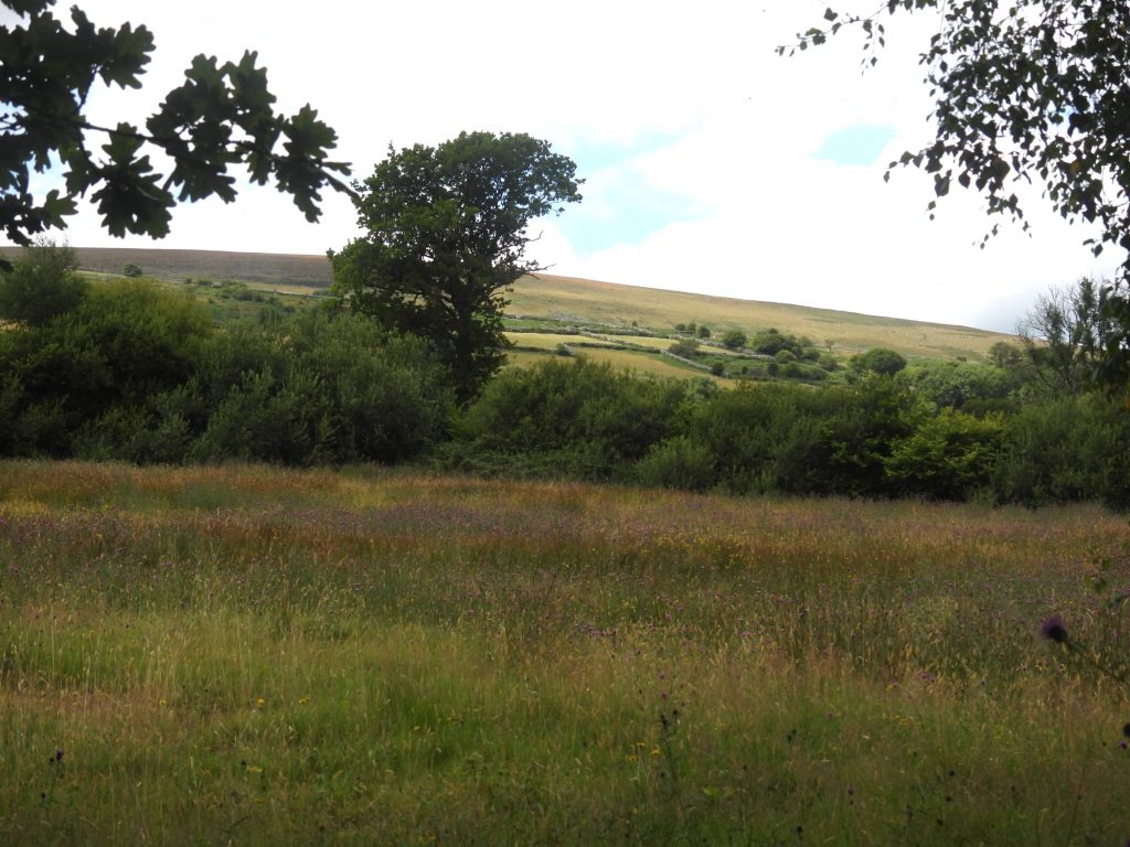
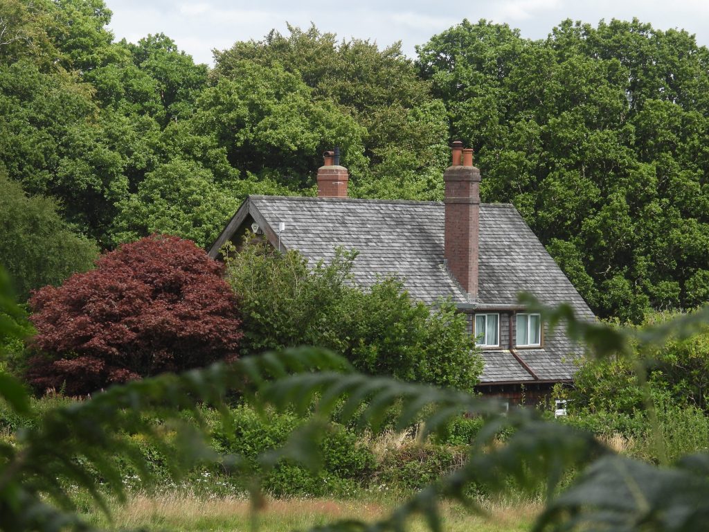
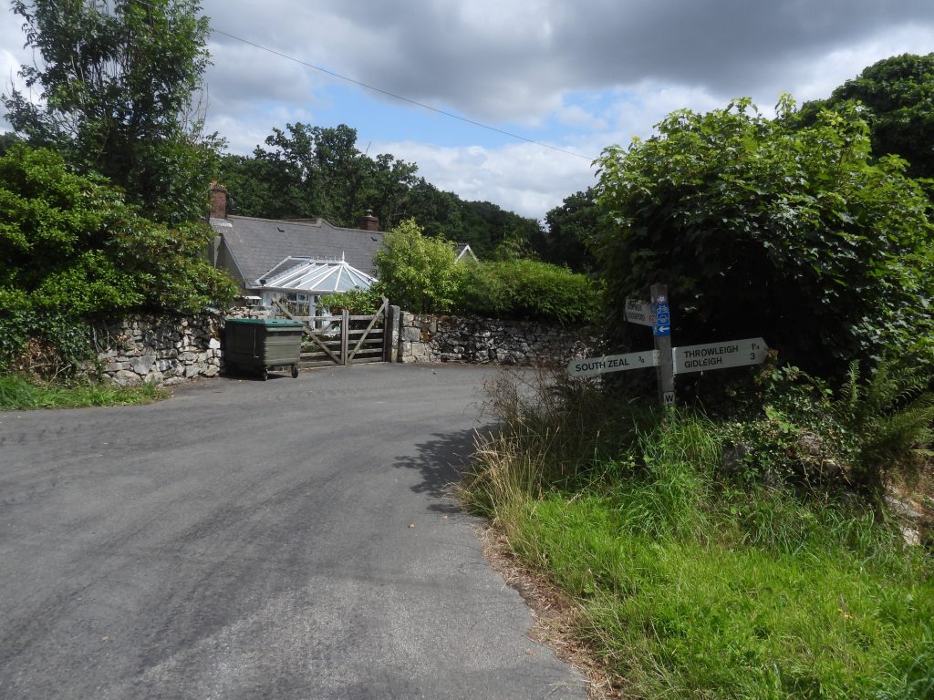
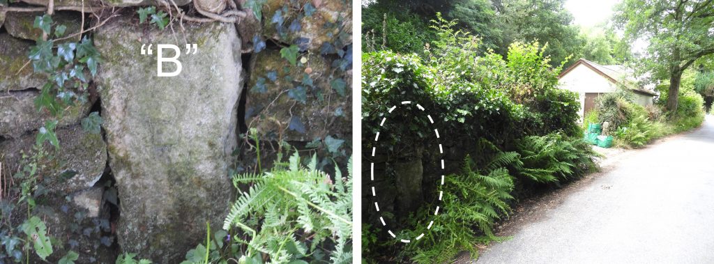
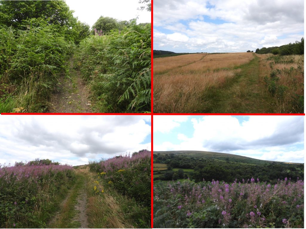
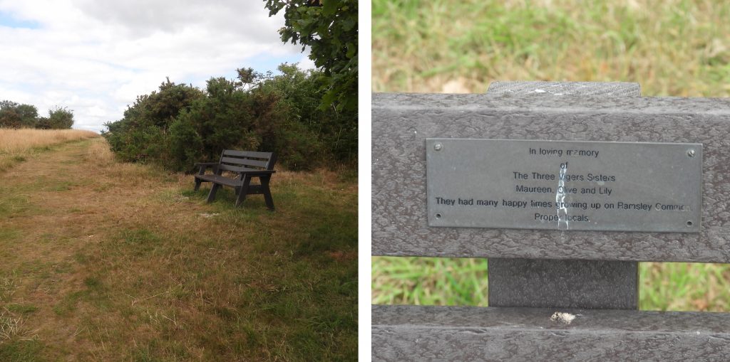
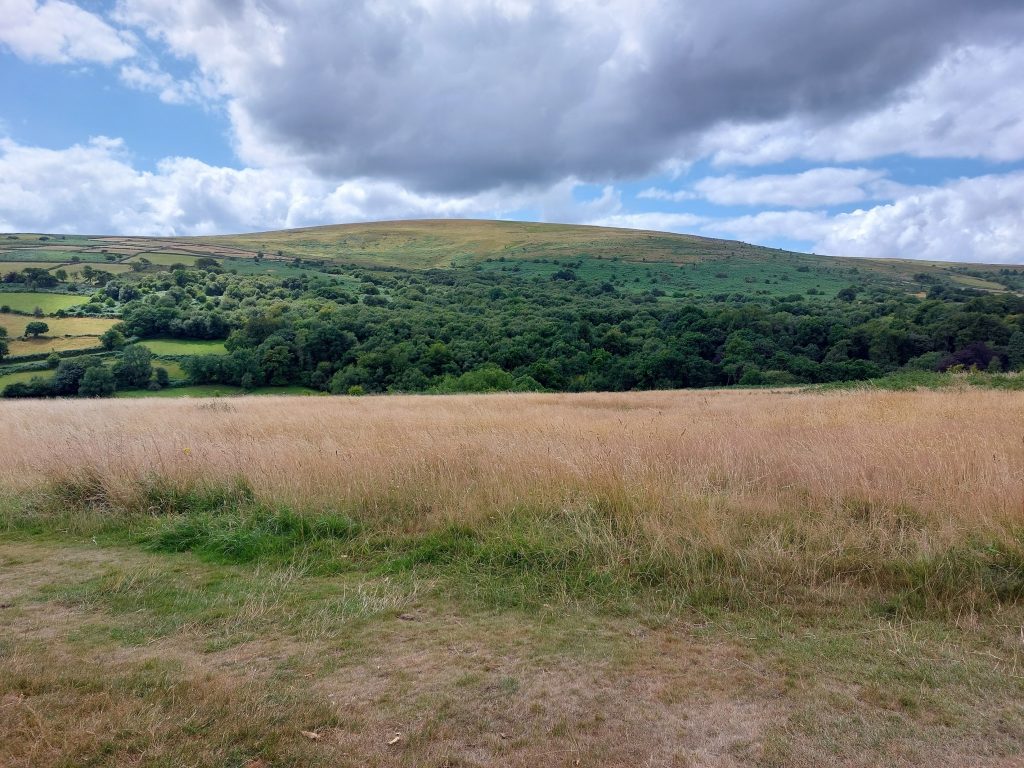
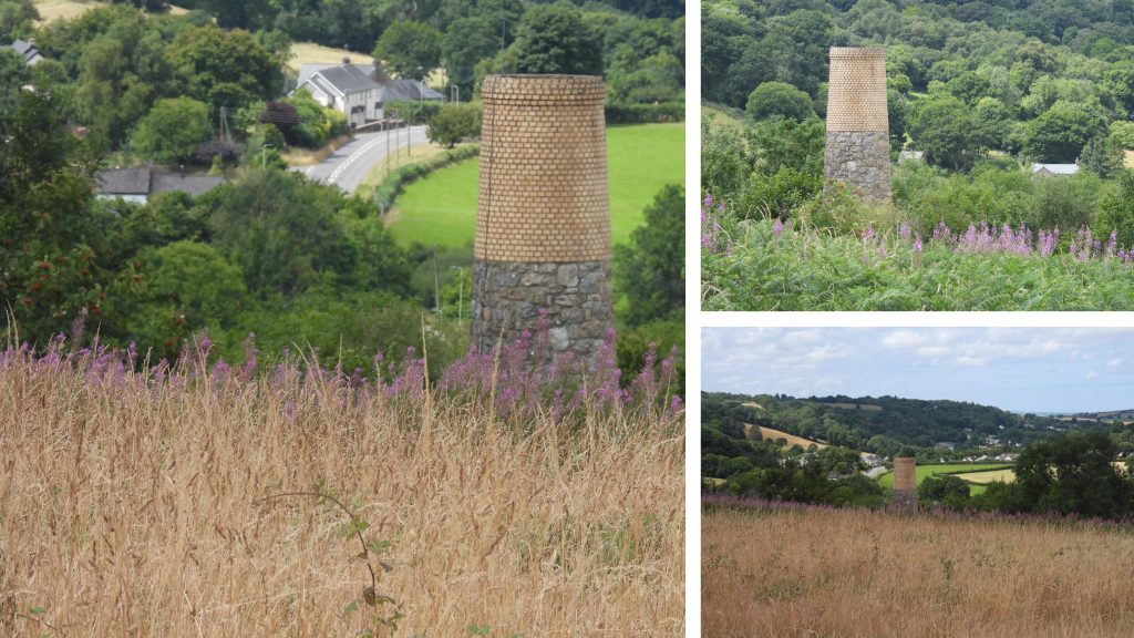
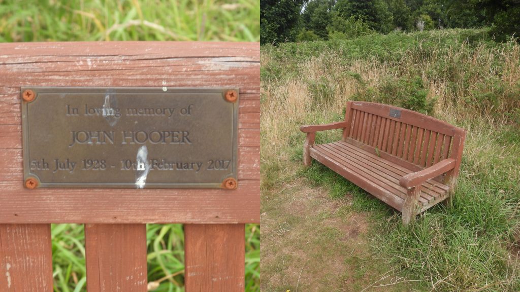
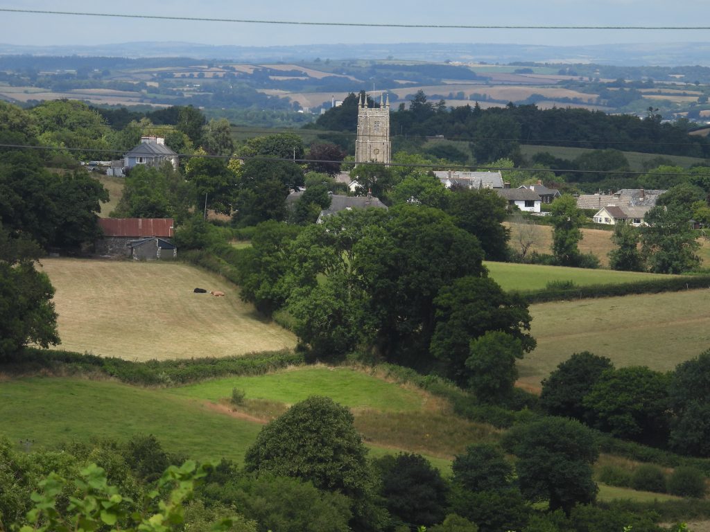
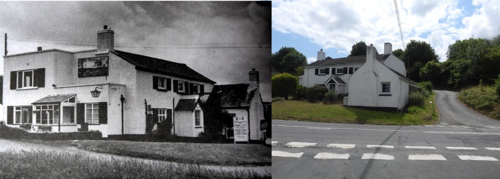
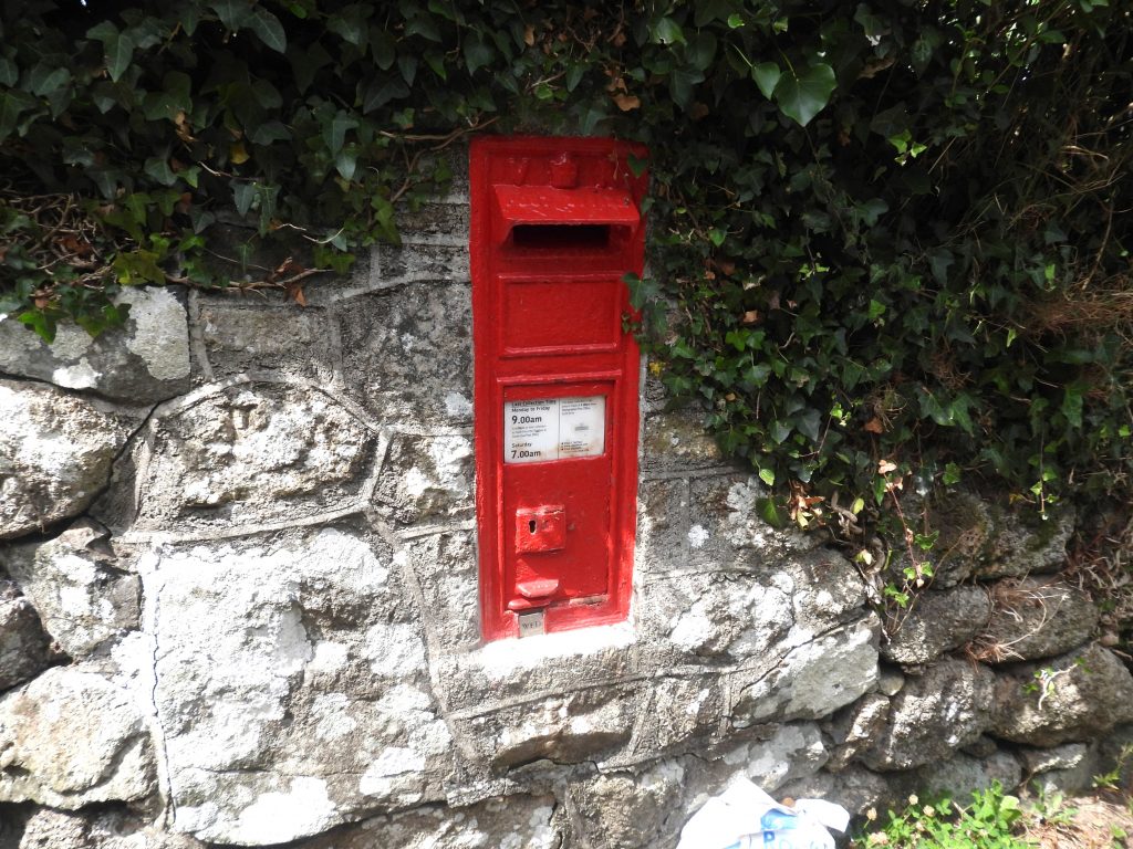
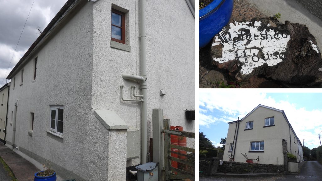
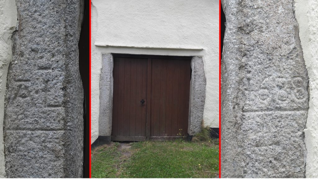
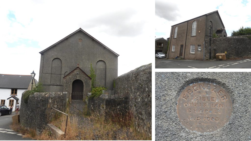
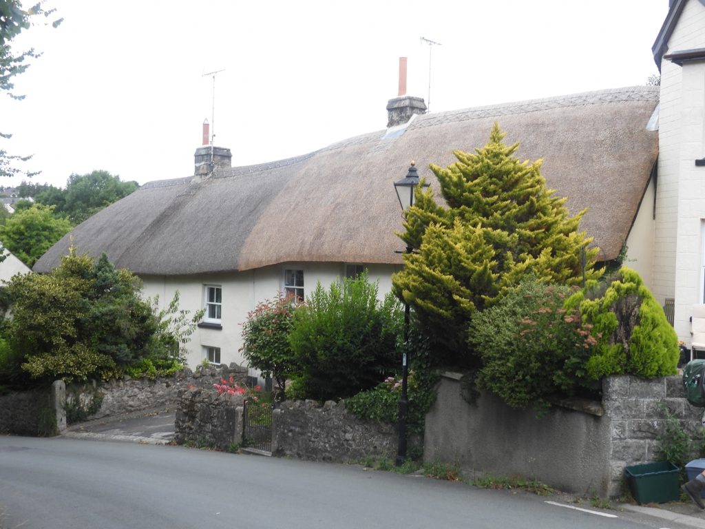
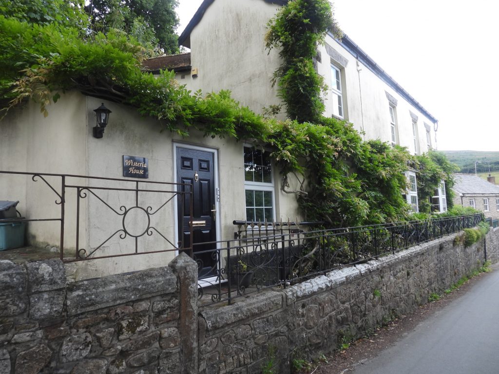
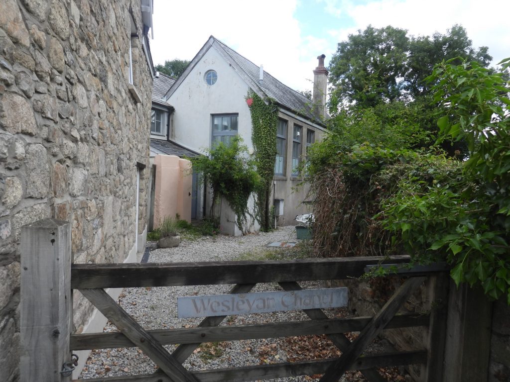
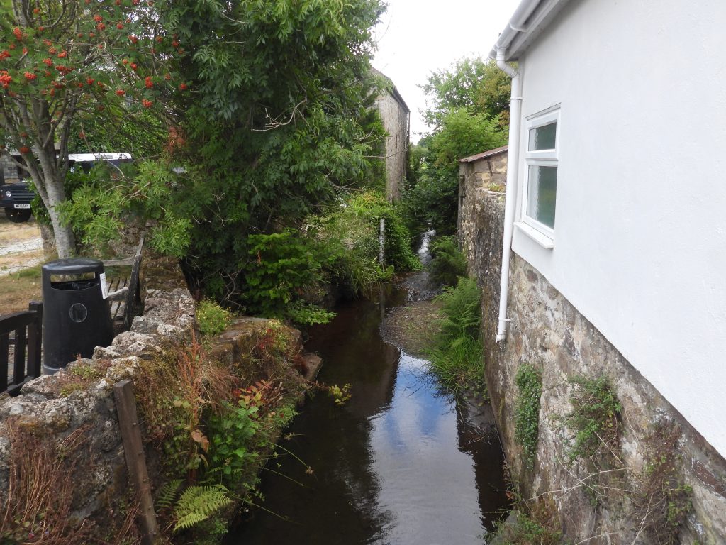
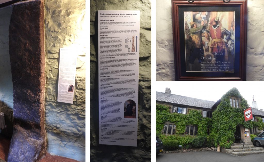
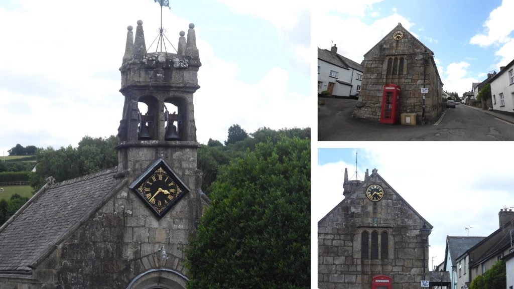
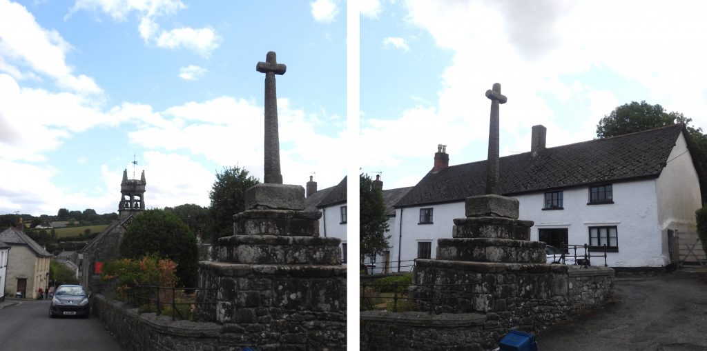
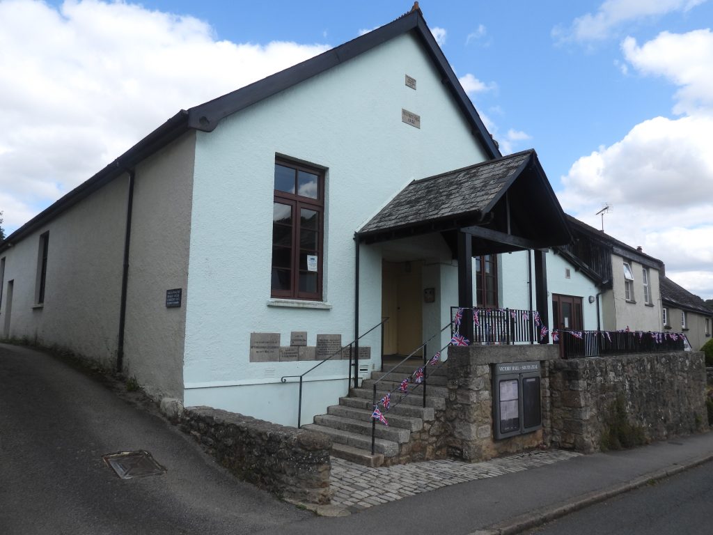
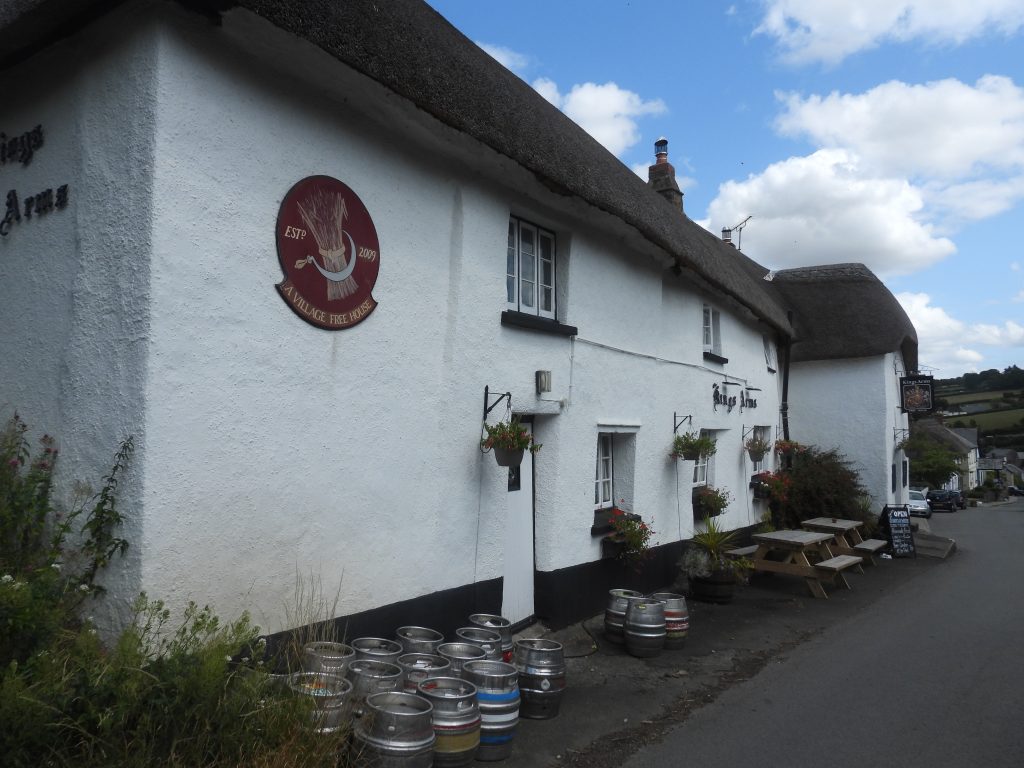
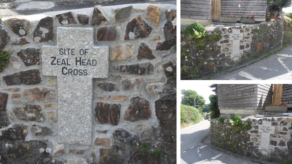
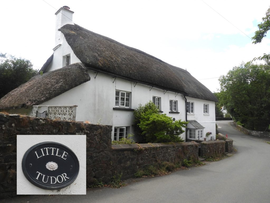
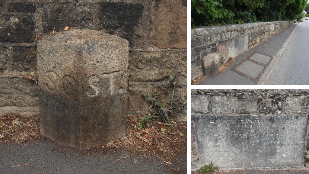
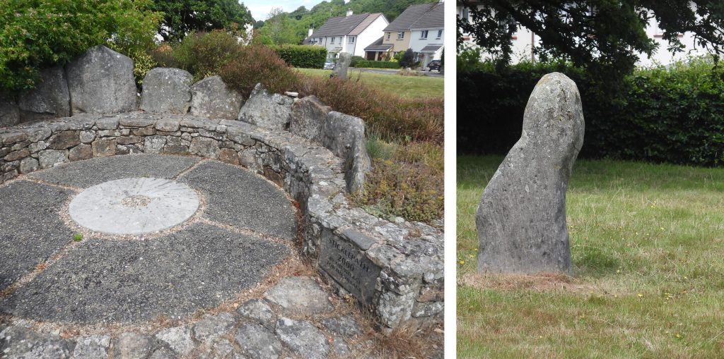
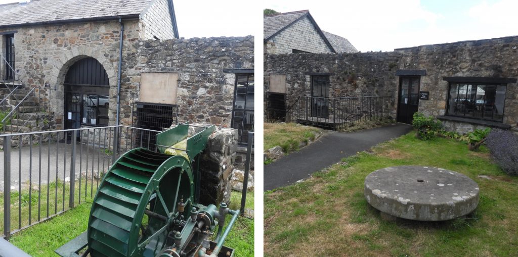
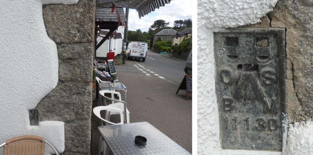
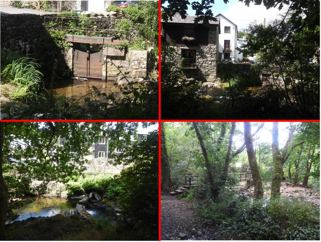
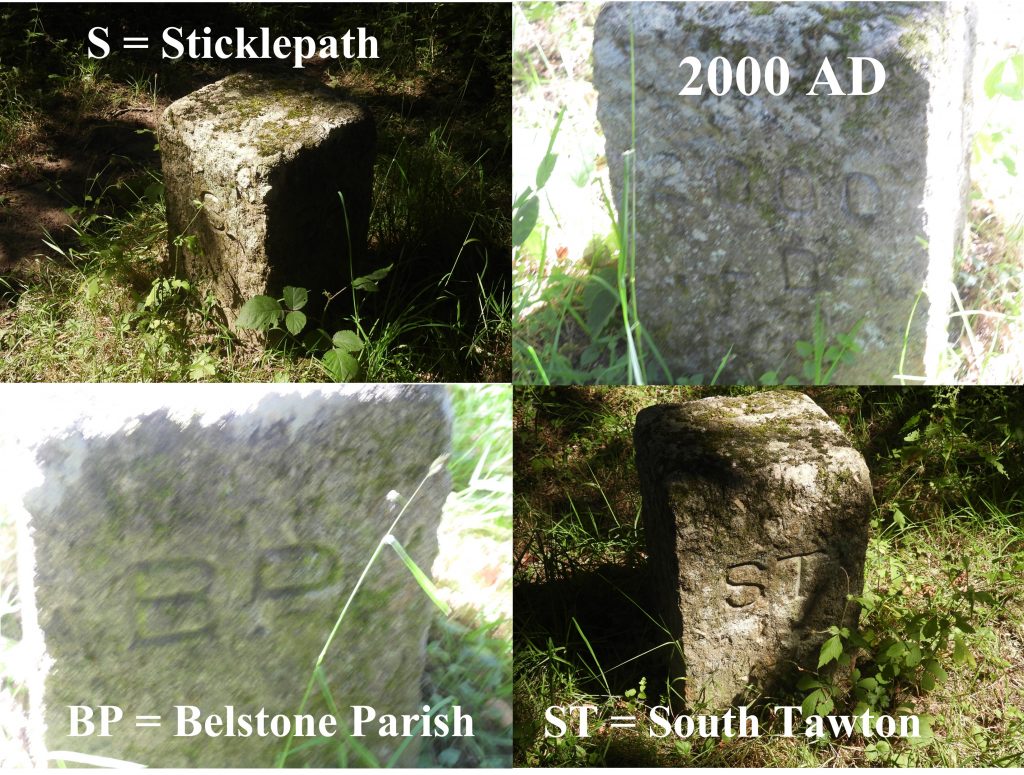
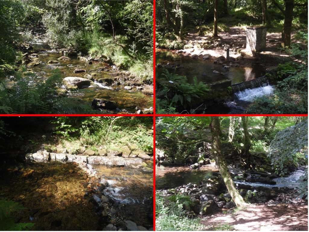
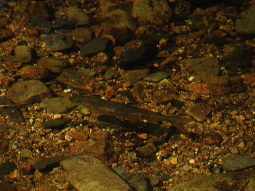
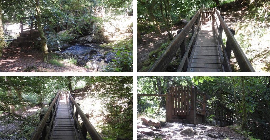
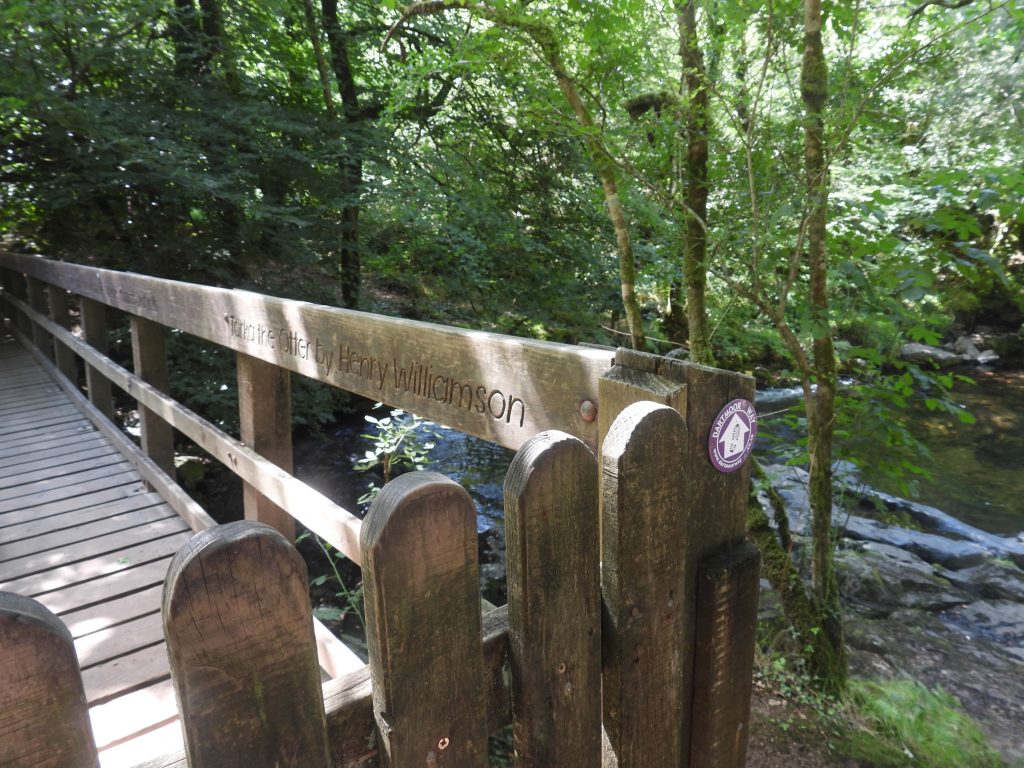
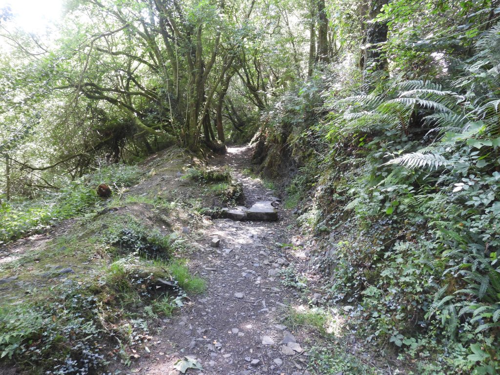
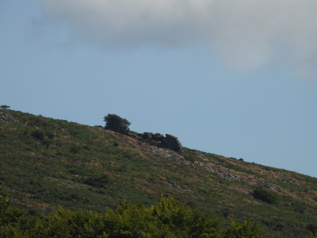
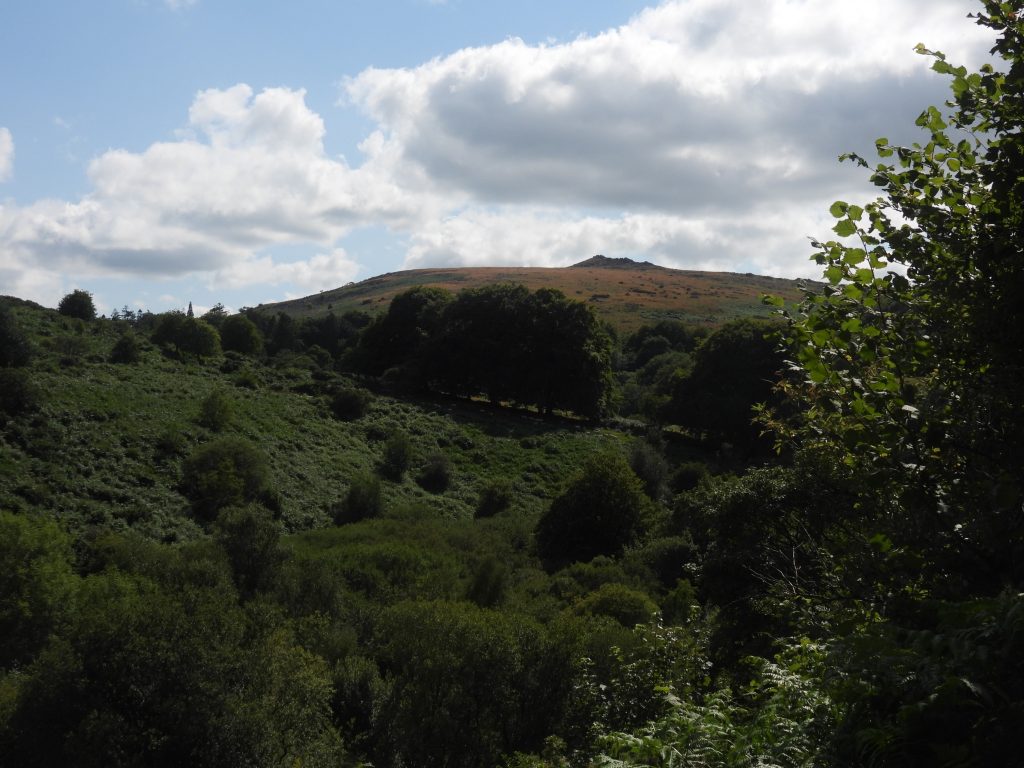
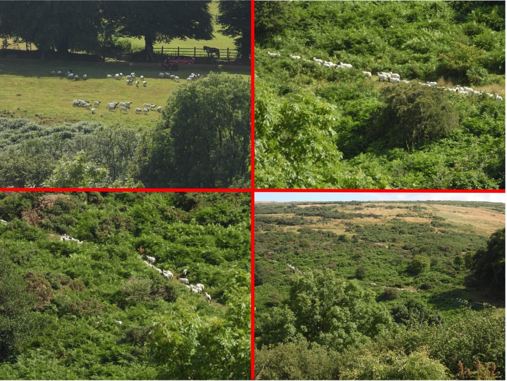
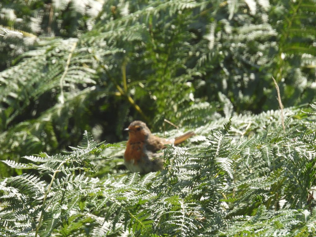
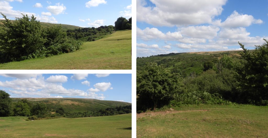
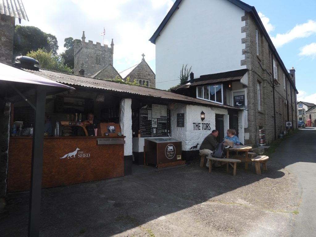
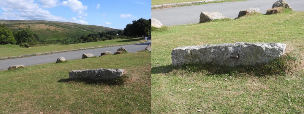
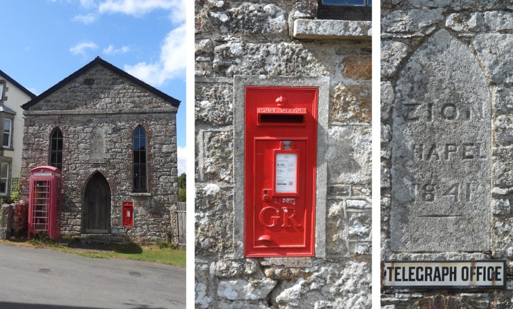
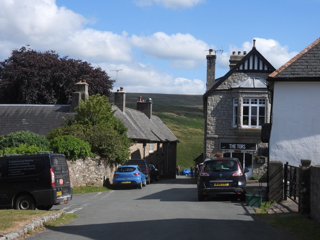
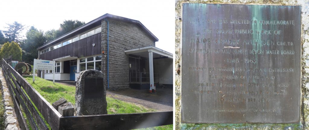
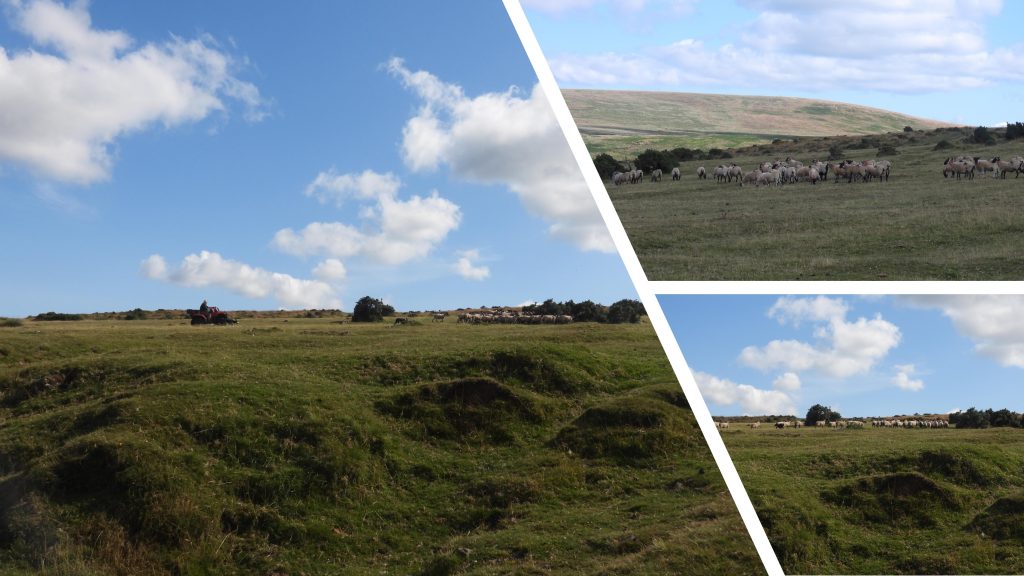
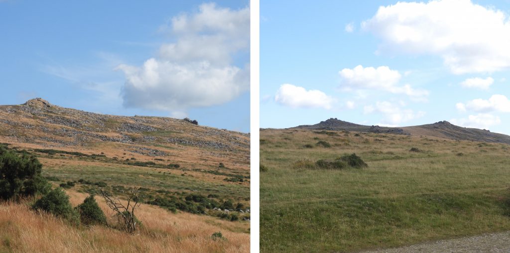
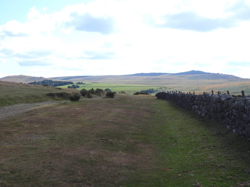
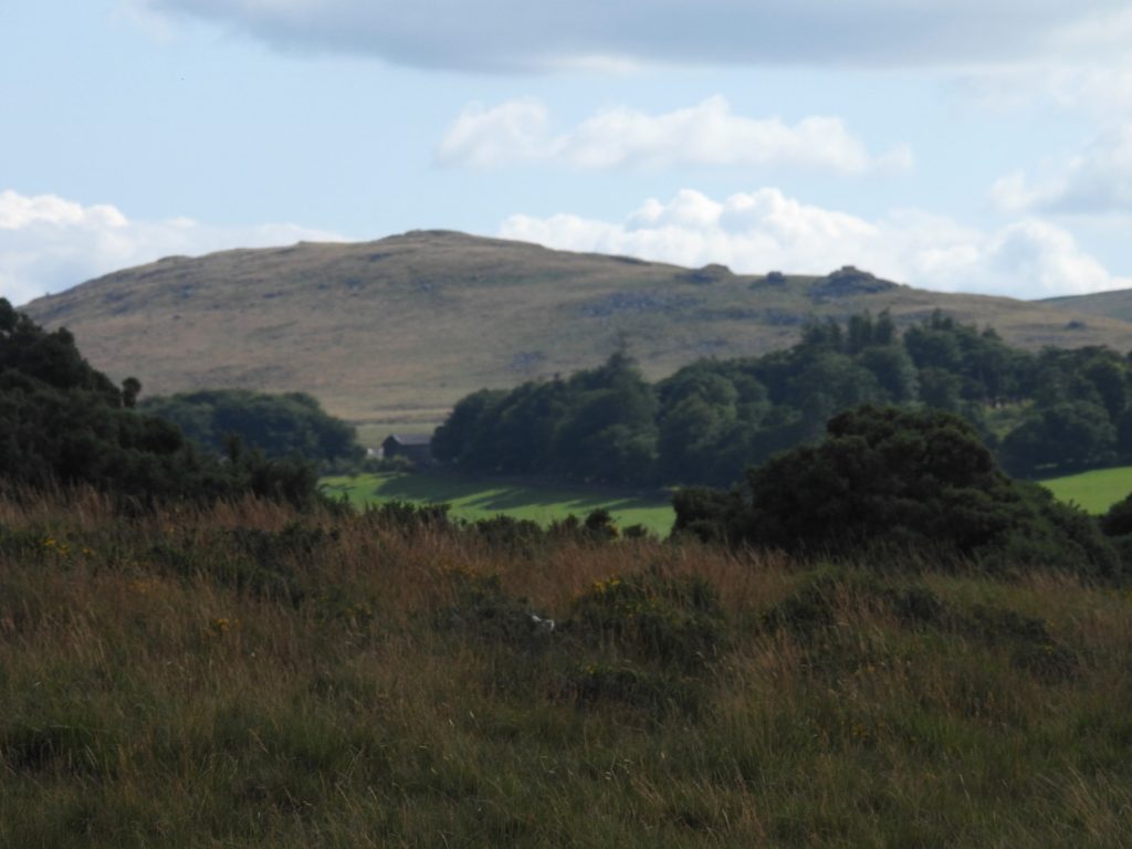
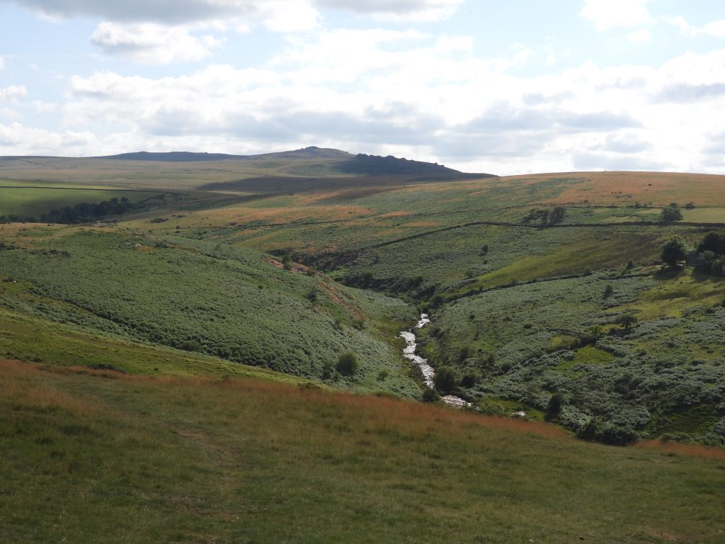
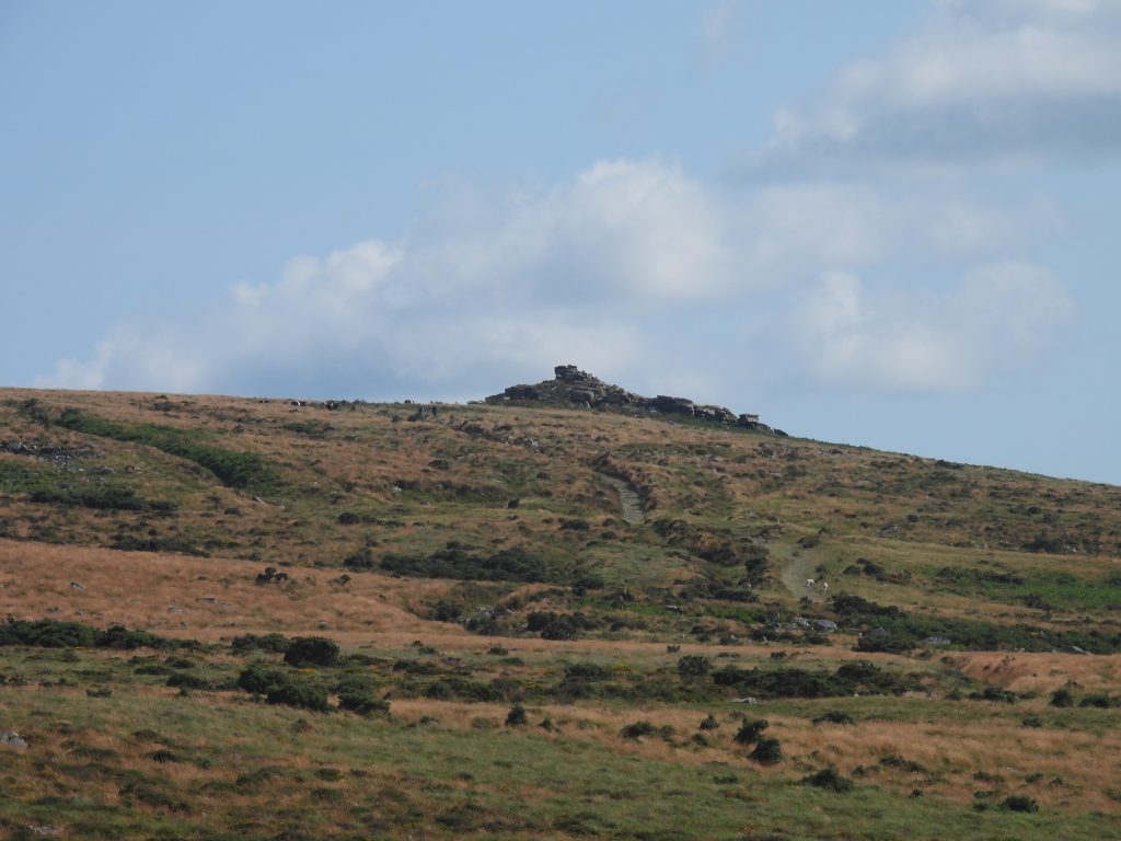
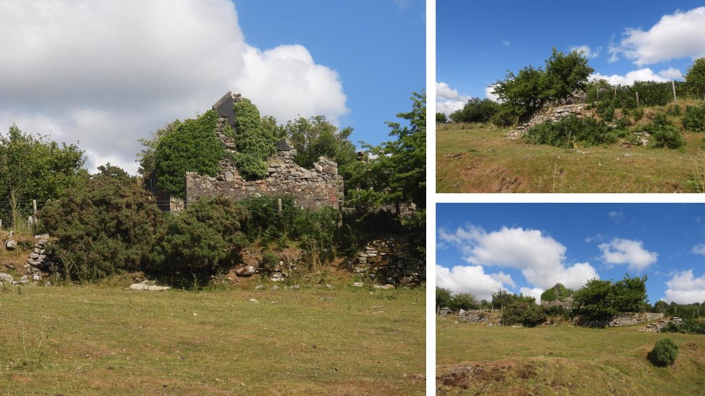
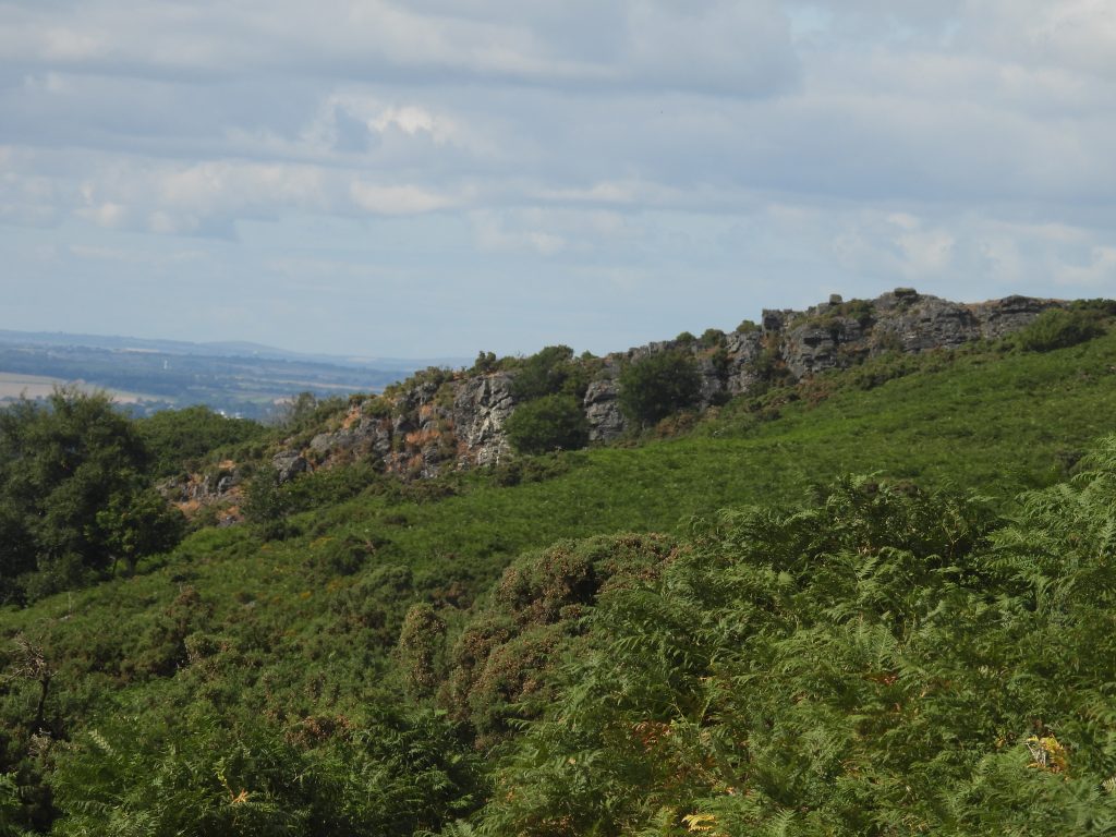
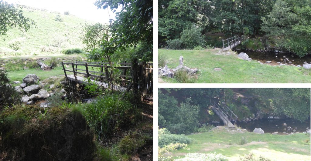
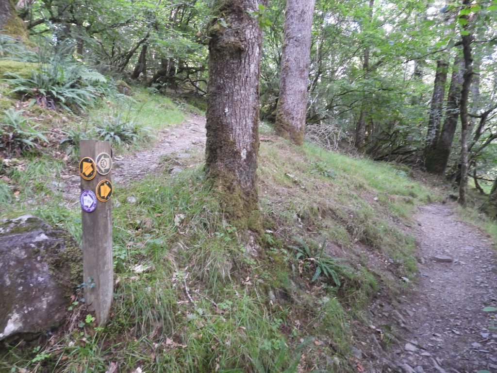
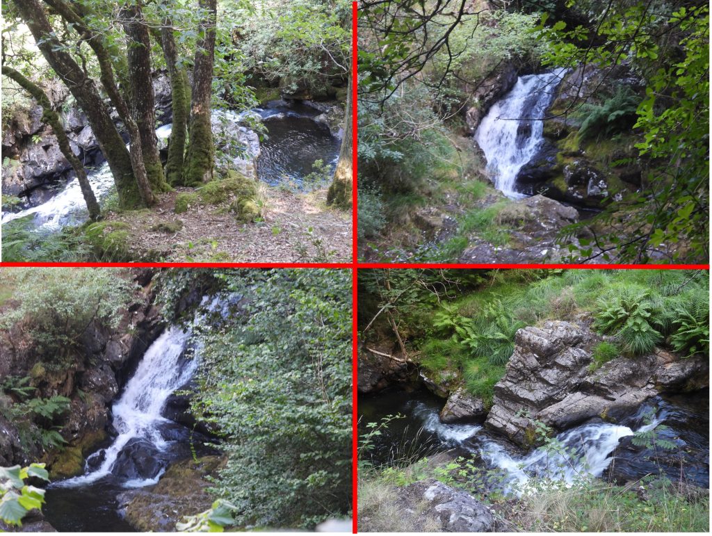
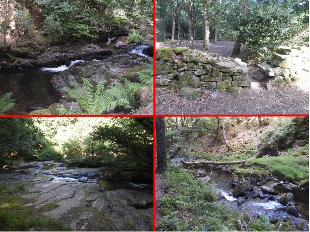
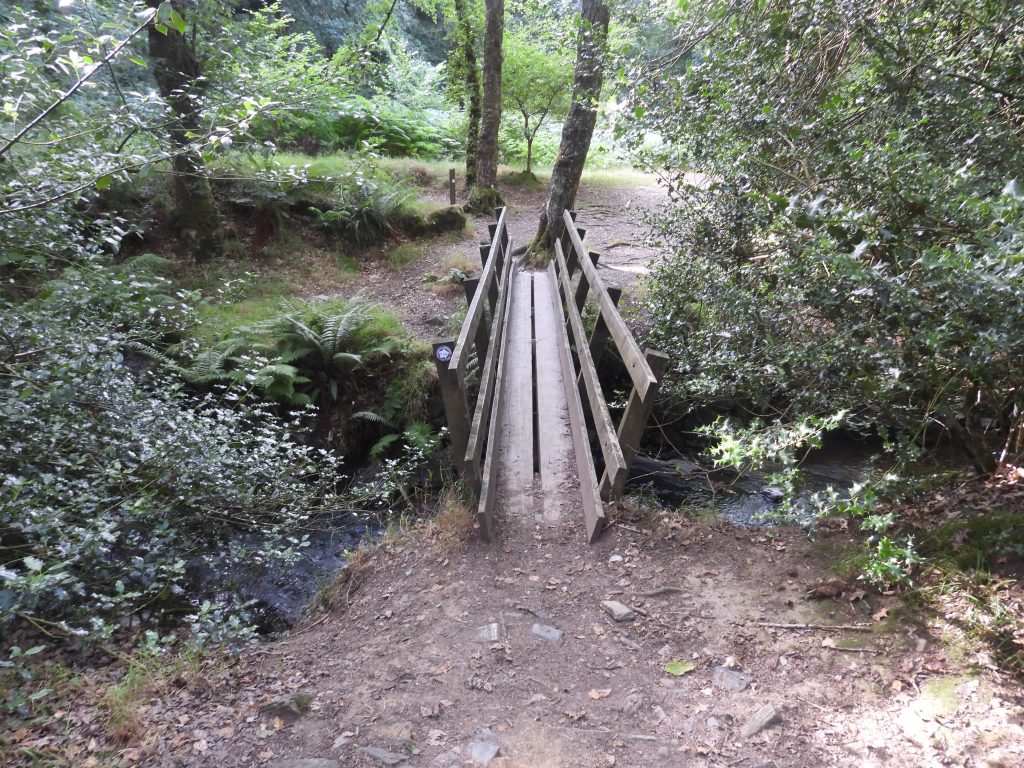
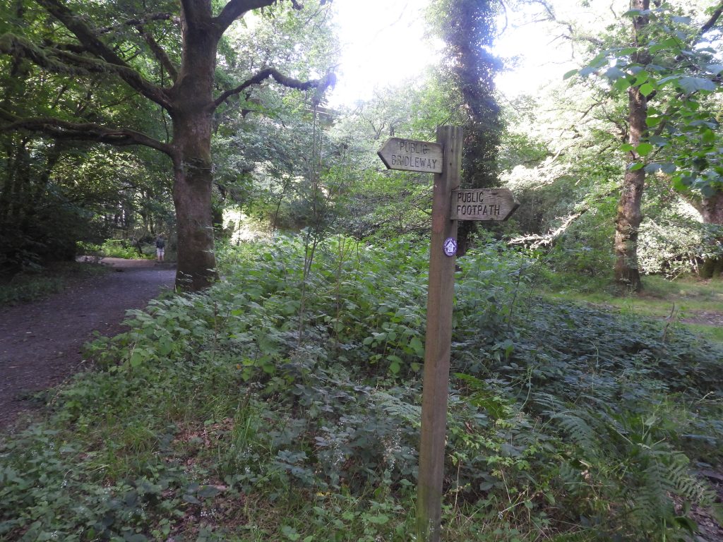
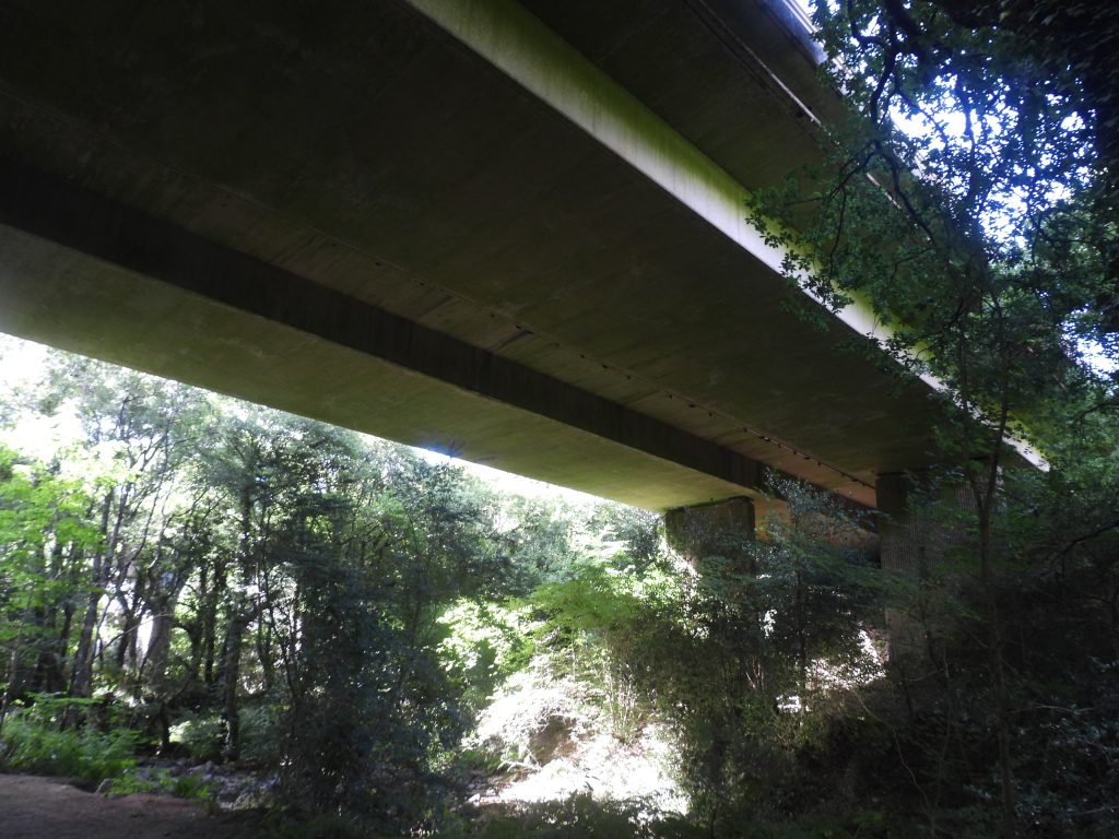
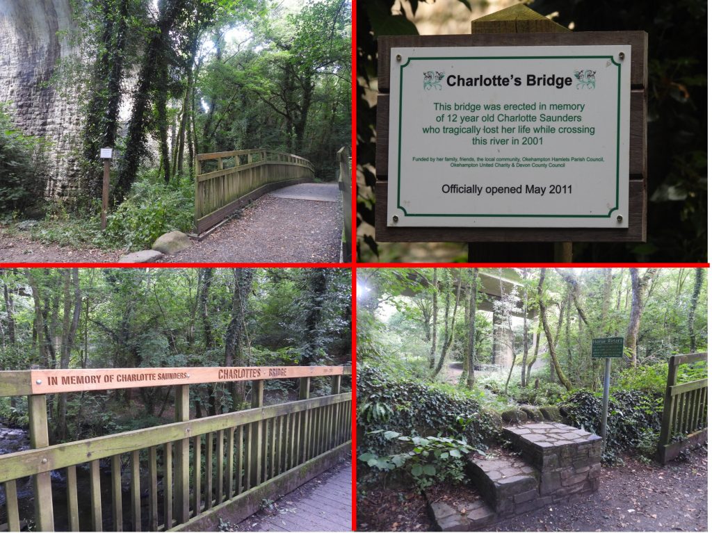
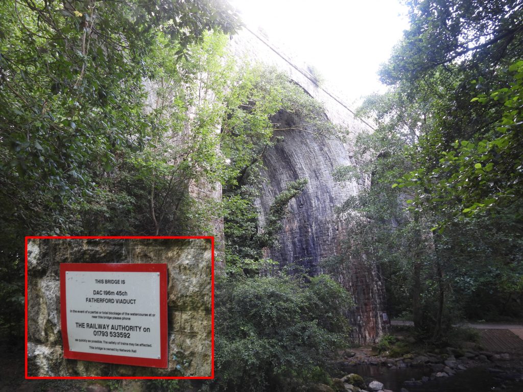
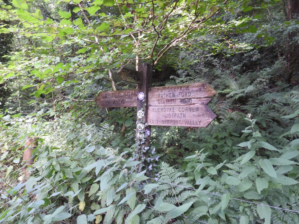
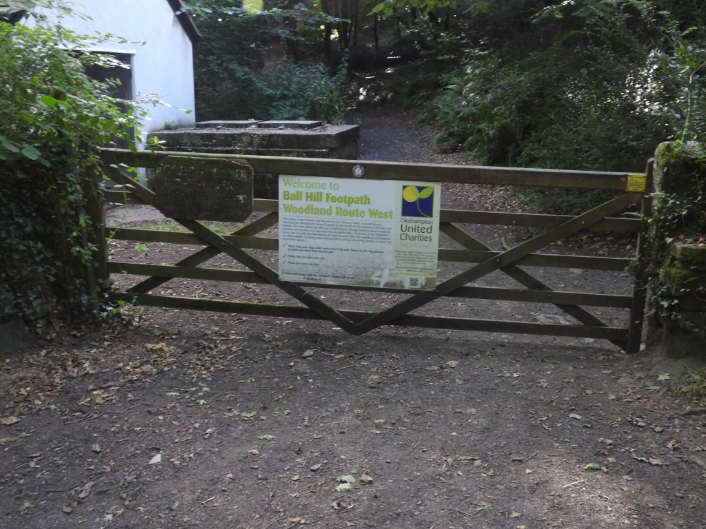
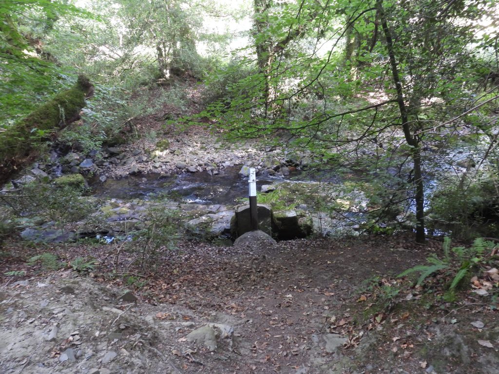
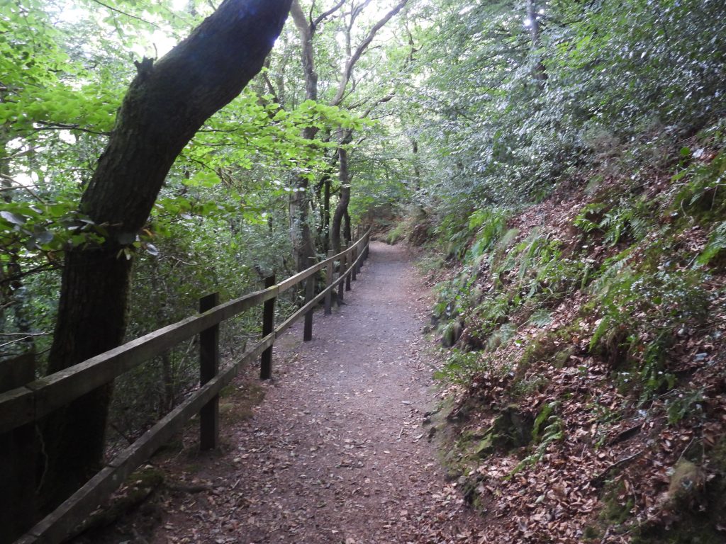
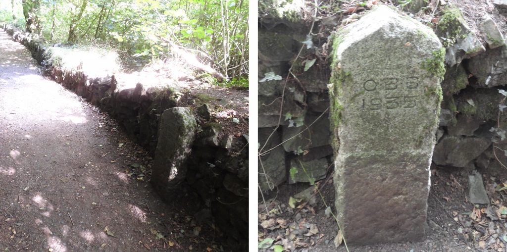
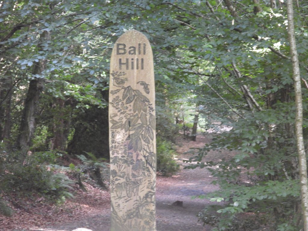
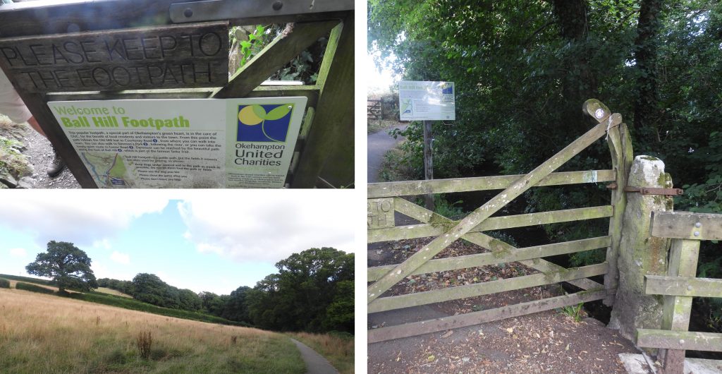
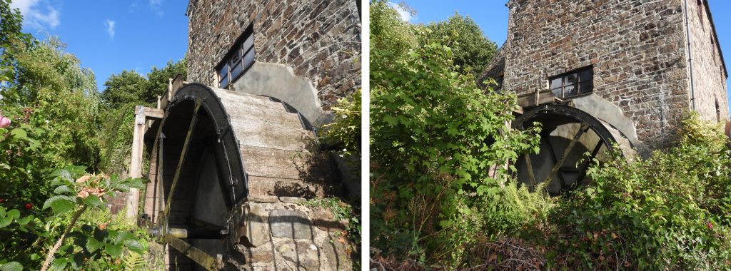
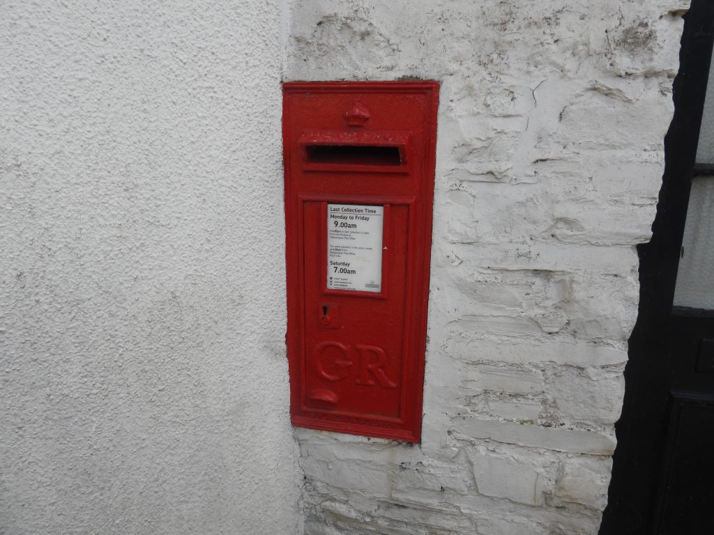
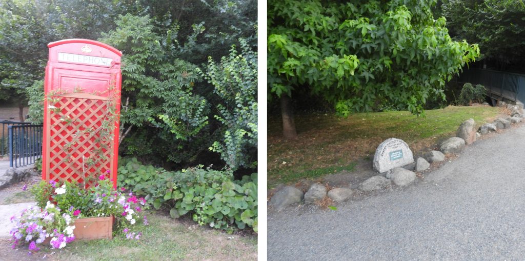
The Dartmoor Way Stage 6 route. The “side trips” taken are obvious from the GPS plotThe Globe Inn is a 16th century coaching inn and is believed to have originally been named the Gregory’s Arms. It dates from at least the mid 19th century but some sources indicate it could be as early as the 16th century. At the rear of the inn there were formerly stables for the spare horses required by coaches. A view of the old stables and courtyard can be had by walking up the “Drang”, a small lane between The Globe and Endecott HouseThree Crowns is early Tudor and is grade II listed. It was owned by Sir John Whiddon who died in 1575. During the English Civil War a young royalist poet, name Sidney Godolphin from Cornwall was shot nearby and carried to the porch in 1643. His presence is still felt by women (in the ladies) – allegedly. Also, the ghost of Mary Whiddon (who was shot by her former lover on her wedding day in 1641) is said to reside here. The story of Mary Whiddon is said to have inspired R.D. Blackmore to write Lorna Doone. The author has been coming to Chagford for decades and for the first time noticed the lamp above the porch has a “VR” on it, which The octagonal Market House (aka Pepperpot) was built in 1862 to replace the Shambles, a thatched building which fell into disrepair. There is a blue plaque celebrating the 48 years of public service given by Cllr Peter Hill JP.The Chagford Inn dates from 1844. It has previously been named Bakers’ Arms and the Buller’s Arms, the latter relates to Sir Redvers Buller (from Exeter) after the Boer War. This ex-Methodist Chapel and former school room was closed as a religious building in 1998 and is now used by “Helpful Holidays”. It was built in 1861.Moorlands is now residential flats. However, at one time it was one of the woollen factory buildings in the area used for finishing cloth. The last military order was for horse blankets in the Crimea. When the woollen factory closed (late 19th century) Moorlands became a hotel until the early 21st centuryThe granite pillar at Eaglehurst has a benchmark on it.Benchmark in the lane between Chagford and Chagford Bridge. Reference B.M. 0540.2Allium (I believe) with resident bees.General view of the site of Chagford Woollen Factory, which operated between early-mid 19th century until around 1880. The site was used after 1890 by a Mr Reed who set up as an agricultural merchant, threshing and haulage contractor, millwright and engineer. (ref Dartmoor HER). Note the outfall of “Mill Leat” in the picture which supplied water to the Woollen Factory and Lower Factory Woollen Mill further to the east in the direction of Dogmarsh Bridge.Corner Cottage was part of the site of Chagford Woollen Factory, established by John Berry after 1800Chagford Bridge is believed to be either 16th century or 17th century.Views of the Teign from Chagford BridgeThis bolt is on the east parapet of Chagford Bridge and is possibly a bridge surveyors bolt not a benchmark. That said, B.M. 499.2 was located on the bridge as depicted in some 19th century maps.Entrance to War Cleave woods from the Chagford – Murchington roadWar Cleave woodsWar Cleave Woods – small waterfall / weir and stepping stones. There was once a “lion” here once but, sadly, has disappeared from this site as of February 2020Ascending the hill from War Cleave woodsLeaving Throwleigh footpath 2 having ascending the hill from War Cleave woodsWoodlands farmhouse and barn dates from the late 18th centuryMurchington signpostSt. Andrews Chapel was built in 1889 when a pair of buildings just west of Woodlands Farm were demolished. It was built in connection with St Mary’s Church at Throwleigh. (ref: Dartmoor National Park Authority, 2011, Murchington Conservation Area Character Appraisal)Little Mead dates to at least the early 19th century and once functioned as an inn, called Star Inn.Springwood and Woodlands House, Murchington dates from the late 18th/early 19th century. The original house is depicted here on the Tithe Map, being a part of plot 737 (‘House and garden’), owned by Henry May, occupied by Edward May. Today, modern maps depict two dwellings. Note the OS “flush bracket” (B.M 11128) and the “VR” inset letterbox on the buildingHaycroft (or Moorcroft). The left hand picture maybe a detached bakehouse from 17th century. The right hand picture is of a house which formerly was Haycroft farmhouse. Originally 16th century and 17th century with later extensions, being modernised circa 1980. Moorstone Cottage (aka Foxhole). The Dartmoor HER states that the house dates to at least the late 18th/early 19th century. Furthermore is was depicted on the Tithe Map, and may have been combined dwelling with a farm building at the western end.Higher Muchington sign post.View of Kes Tor across the area of Gidleigh Park.Goats near Woodland Copse.A great example of a slotted gatepost near Highbury BridgeHighbury Bridge over Blackaton Brook is probably 19th century.Blackaton Copse is a a lovely National Nature Reserve. A plaque indicating a gift by Lady Ann Colman was made to purchase the wood.Bench in Blackaton Copse dedicated to Gwendoline Hall.Bench in Blackaton Copse dedicated to Daphne and Trevor Heywood.An un-named group of rocks in Blackaton Copse (Blackaton Copse Rocks perhaps ?)Blackaton Bridge (East) is one of two bridges located here virtually side by side. This bridge spans Blackaton Brook, the other bridge spans Chapple Brook. The waters of the two brooks combine here just a short distance away. It is a 19th century bridge with 20th century railings on top.Exit gate / stile from Blackaton CopseSignpost to Gideligh Mill, which is located up an unmade trackForder Brook on side of road between Gidleigh Mill and Coombe FarmsteadSignpost at Coombe Coombe Farmstead.View of Chapple from the lane (Throwleigh Bridleway 13) leading from Coombe to Providence PlaceCoombe Cottage is one of three dwellings at Providence Place built in mid 19th century. Recorded as being a workers cottage.Taken from the following reference: Howis Croxford, C. A., 1988, A Walkabout Guide to Throwleigh). “Providence Chapel. In the 1830s, a Mrs Callard, a widow and Bible Christian living in Chagford, bought Combe (now known as Combe Farm), to start up a dame school. She found the lanes leading up to the village hazardous when attending Sunday services, which were mostly held in private houses. A nonconformist minister in Chagford encouraged her to set up a chapel in Throwleigh and with the help of Mr Richard D. Gay (a member of the Church of England who had converted to Wesley’s Methodism), and with the gift by the Lord of the Manor of a piece of land at the top of the hill on the Wonson holding, they built the chapel in 1839 at a cost of £136.7s4d. It became allied to the Methodist movement and was followed by a Sunday School room in 1864 (costing £62.16s2d)”Side porch of the ‘Bible Christian Chapel’ as it is marked on the late 19th century historic map.Providence Place. This mid 19th century building (now part of three dwellings) was built around 1840 by Richard D. Gay who supervised the building of the Providence Chapel with Mrs Callard in 1839. Note the lovely dovecotes.In the mid to late 19th century this dwelling was built to house nonconformists, who were part of a community that grew here after the construction of the Providence Chapel in 1839. (ref: Howis Croxford, C. A., 1988, A Walkabout Guide to Throwleigh)Benchmark on a gatepost at Higher Providence Cottage.A modern dwelling between Providence Place and Wonson called ScathoBarrow Way crossroads with a “VR” letterbox set into a wall.Cross Park CottageCross Park Cottage (side view)Ivy Cottage at the turn to Deave Lane. South end of Deave Lane with signs indicating no motor vehicles.The “Chagstock” site as viewed from Deave Lane. This picture was taken just a few days after the July 2022 event.Deave Lane is an ancient trackway between Wonson and Throwleigh and may possibly have been an ancient “lich way” . A water course crosses Deave Lane. Note the care taken to cover with granite blocks.Beautiful Deave LaneAt the end of Deave Lane is “The Hey”Footpath to the churchChurch of St. Mary the Virgin, Throwleigh. There is a metal sundial over the south porch door, which was bought at a junk shop in Exeter in 1910 and erected in memory of ‘Robert Fitzgerald Penrose’ who died in August 1914. (Ref: Crowley, 1961, Sundials in South Devon). The east window stained glass is by Comper and east window of the nave is by Bell of Bristol. There are some other interesting features inside the church such as on the chancel floor where there are group of 17th and early 18th century graveslabsGreen Man Boss with explanation leaflet, which can be found in the churchThree Hares Boss. There are 29 “Three Hares” bosses across 17 churches in Devon. The earliest examples of this symbol (three hares in a circle with ears joined giving the illusion that they each have two ears) dates from 581 A.D, which was found in Buddhist caves in Mogao, Dunhuang, China. They are thought to have been brought to the UK via the Silk Route where they are found mainly in medieval churches. Dartmoor Tinners’ appear to have adopted the symbol and are often referred to as “Tinners’ Rabbits”A benchmark can be found on south-east corner of the church. B.M 0817.7The cross in the churchyard commemorates those who died in the First and Second World Wars.This thatched cottage (Wayside) opposite the Church House dates from late 16th-early 17th century. It was enlarged in the 18th or 19th century. It is recorded as having been the Royal Oak beer house in the 19th century. Interestingly , site of the wrestling bouts that took place as part of the annual Throwleigh Whitsun Revels. (Ref: Howis Croxford, 1988, A Walkabout Guide to Throwleigh).Throwleigh village cross stands on a modern pedestal of three square steps. The cross is modern (19th century) but the socket stone is that of a 14th or 15th century cross. An inscription on the steps records the “modern” restoration in 1897 (to commemorate Queen Victoria’s Diamond Jubilee). (Ref: Masson Phillips, 1937, The Ancient Stone Crosses of Devon)The Church House is early 16th century. Dartmoor HER states: “It functioned as a building for baking and brewing ale as well as for feasting and gatherings. It was converted into three cottages in the 18th or 19th century but reunited into one house circa 1980”.Throwleigh Barton farmstead with a “Standard 10” (from 1936) outside. The farmstead dates to at least the mid-16th century.Throwleigh Parish Church was rebuilt in the 15th century with the north aisle being added in the 16th century.The Dartmoor Way continues through Throwleigh churchyard exiting to the north east (on Throwleigh Footpath 9)Foals having a lie down on the Dartmoor WaySmall clapper bridge over the infant Blackaton BrookWild flower / grass meadow alongside the Dartmoor WayViews of Throwleigh Footpath 9Clannaborough Farm was first documented in 1498. Clannaborough Cottage is a short distance to the north west of Clannaborough FarmCrossroads by Clannaborough CottagePayne’s Bridge crosses over Shilley Pool stream. It is probably early 19th century. As with many bridges on Dartmoor, there is a benchmark. The Shieling to the north of Payne’s BridgeRose CottageLarksmoorGlimpse of Cosdon across a wild flower / grass field A glimpse of another house (name unknown)Week CrossBoundary Post inscribed with a “B” (aka SZ5/DC5) embedded into a wall opposite Moor View. This is one of five stones erected in relation to the ‘Conveyance of lands in the Parish of South Tawton’ which was completed on 20th November 1884 following a dispute between South Zeal inhabitants and the Duchy of Cornwall. The other stones are inscribed SZ / DC. The full story can be found in an excellent post here: https://moorlandwalker.co.uk/2021/09/01/dartmoor-the-south-zeal-duchy-of-cornwall-stones/WheatleyA view of Cosdon across part of the enclosed common land along the Blackaton Valley. The enclosed common land was the dispute between South Zeal inhabitants and the Duchy of Cornwall.The Dartmoor Way ascends onto Ramsley Hill.Bench on Ramsley Hill dedicated to “The Three Vigers Sisters”. A fabulous spot for lunch.View of Cosdon from the “Vigers Sisters” benchRamsley Mine Chimney is a 19th century stack which once was used in copper mining process at Ramsley Mine. The mine operated in the 19th century and finally ceased in use in 1909. The chimney stack was damaged in a storm in early 1998 (3rd January) but has been repaired.A second bench on Ramsley Hill is dedicated to John Hooper. RIP.Descending Ramsley Hill has a fabulous view towards South Tawton including St Andrew’s Church.Former Rising Sun Inn on old A30. The original building may have dated from the 16th century. The Inn had a lounge, a dining room, a public bar and a children’s room. It closed as an inn sometime in the late 20th / early 21st century, which probably was as a result of the opening of the Okehampton bypass in July 1988.Descending into South Zeal, this “VR” letterbox is passed.Watershed HouseShilhayes in South Zeal has two old granite post on either side of a doorway. The left hand post is inscribed “AL” (with an inscribed line above each letter and an inscribed line underneath) and the right hand one “1688” (inscribed line underneath). The author is unawares of the significance of these inscriptions and would welcome any information.Shilhayes Cottage.Ebenezer Chapel on Shelley Hill in South Zeal opened in 1866. It was originally built as the Bible Christian Chapel. Shelley house dates from mid-17th century being modernised in 1986.Wisteria House is spelt Wistaria on the Dartmoor HER mapTucked away at the eastern end of South Zeal is the former Wesleyan Chapel (which is now converted into a dwelling). Brook flowing largely unnoticed in South Zeal. Oxenham Arms was originally built in the 12th century as a monastery, but wasn’t first licensed until 1477. It was a dower house of the Burgoynes and then the Oxenham family (Captain John Oxenham is celebrated in one of the bars). Inside the snug bar is ‘The South Zeal Menhir’ (see pictures), which is thought to be 5000 years old and is incorporated into a wall. Famous visitors have included Charles Dickens, Sir Francis Drake, Admiral Lord Nelson, the Reverend Sabine Baring Gould (Dartmoor Explorations Committee), Prince Charles, Rolling Stones and David Bowie.Chapel of St. Mary, has probable 15th or 16th century origins but officially dated 1713. It was in use as a school-house from 1773 to 1877.The South Zeal cross, socket stone and plinth have medieval origins and probably date from 14th or 15th centuries. The cross stands approximately 2.5m high with the head being a separate piece. Victory Hall is not listed by Historic England. The foundation tablet suggests it dates from 1922. The foundation stone reads: “THIS STONE WAS LAID BY/ EX-SERVICEMEN OF THIS PARISH MAY 26TH 1922 IN REMEMBRANCE OF THEIR COMRADES. WHO FELL IN THE GREAT WAR. 1914 – 1918 WHOSE NAMES APPEAR IN THE ROLL OF HONOUR”. Kings Arms. T. Quick (1992), Dartmoor Inns, states that the inn isapproximately 400 years old. Furthermore, the upper level of the inn was used as a hayloft and store for grain and corn. It once was a cider house, selling refreshment to the Ramsey Copper Miners and tradesmen.A new cross has been erected into a wall at Zeal Head, a road junction to South Tawton. The Dartmoor HER records that Zeal Head Cross or Townsend Cross was mentioned by William Crossing as having formerly stood here. Crossing further stated that the original cross was destroyed by a man who was afterwards hanged for forgery.A delightful house (Little Tudor) on the approach to Sticklepath Sticklepath Bridge spanning the River Taw is 18th century in origin. From this point a short “side trip” off the Dartmoor Way is worth while. Features at the north end of the bridge include a boundary stone, dating from 1822 inscribed “SC” and “ST” (SC for Sampford Courtenay, ST for South Tawton). The ST appears to have beenpainted white. Next to the boundary stone is a tablet, which reads: “Sticklepath Bridge Widened 1928 At the Joint Expense of Devon County Council and Ministry of Transport”At Sticklepath village green there is an upright marker stone and a circular feature which celebrates the millennium. A small plaque reads: STICKLEPATH / 2000 / BY THE VILLAGE / FOR THE VILLAGE. The author has been told that locals call the circular construction “Sticklehenge”. What a great name !Finch Foundry is now owned by the National Trust. Outside there is a small (working) waterwheel and millstone, which are a nod to the fact this was originally the site of a grist mill and woollen mill. In 1814, the site was converted into a water-powered forge which produced edge tools and agricultural hand tools. It was owned by the Finch bros. and calling it a foundry was a bit of a misnomer.There is an OS “flush bracket” (B.M 11130), which is embedded into the wall of Sticklepath storesThe Dartmoor Way continues back at Sticklepath Bridge where a path is taken through Skaigh Woods and into Belstone Cleave.Views through Skaigh Woods overlooking the Taw, which include a weir at head of leat to Finch Foundry.A Millennium Stone can be found at SX63833 93975 near to (but not exactly at) the junction where three parishes (Sticklepath, Belstone and South Tawton) meet. It is located on the south bank of the Taw and is inscribed BP/S/ST/2000 AD. It was erected by Sticklepath parishioners as part of their Millennium celebrations.The river Taw has two further weirs each serving a separate leat to Cleave Mill, (which dates from late 18th century).Trout in River TawThe Dartmoor Way crosses a footbridge which is known as the Henry Williamson (or Tarka) bridge. Henry Williamson wrote the novel Tarka the Otter which was published in 1927. The storyline is the life and death of a male otter and is based around the Rivers Taw and Torridge. Short exerts from the novel are carved into the bridge. On the south handrail it reads: “By pools and waterfalls and rillets the river Taw grew, flowing under steep hills that towered high above. The river hurried round the base of the cleave on whose slopes stunted trees grew” and on the north handrail it reads: “amid rocks and scree that in falling had smashed the trunks and torn out the roots of willow, thorns, and hollies. It wanders away from the moor, a proper river, with bridges, brooks, islands and mills. Tarka the Otter by Henry Williamson”Part of the carved inscription on the “Tarka Bridge” alongside the Dartmoor Way sign.After crossing the “Tarka Bridge” the Dartmoor Way gently ascends through the woods towards Belstone village.Views from the path includes Ladybrook Tor which overlooks River TawViews of some of the tors on Belstone CommonThere was some sheep herding on the day of the walking of this sixth stage. The sheep were herded from Belstone green, down to the Taw and up onto the lowest slopes of Cosdon.Robin near the west end of Belstone CleaveAs the Dartmoor Way enters Belstone by way of the green there is a bench dedicated to James Norrish. RIP.Views of Belstone Green, a very pleasant spot for a rest and reflection.The Tors Hotel was built in the late 19th century, replacing the old inn that was destroyed by fire in 1896. It was built by local stonemasons from granite brought down from the tors nearby. (Ref T. Quick (1992) Dartmoor Inns). In recent years an outside bar called “The Shed” has been used to tempt the weary walker (the author succumbed!)Whilst taking a refreshment on Belstone Green, the author noticed a recumbent gatepost complete with iron hanger. Having visited the area for nearly 40 years, it is the first time the author has noticed this. Why it was placed her is a mystery.The Belstone (Zion) Chapel was built in 1841 as indicated by the inscription above the doorway. The building has had various uses: as a Sunday School in the mid-19th century and aa post office from the late 1930s (hence the “GR” letterbox built into the wall”View from Belstone Chapel looking towards the Tors HotelOn 19th September 1963, the Belstone Treatment Works and Taw Marsh Abstraction Scheme was opened. There is a plaque outside the building which commemorates Major Ormsby Allhusen, Chairman of the North Devon Water Board 1945-63; The plaque states that Major Allhusen is credited “Through His initiative, foresight and enthusiasm the benefits of a pure and wholesome supply of piped water were brought to many thousands of houses and farms in the area”. The latin is : Si monumentum requiris, circumspice, which is the famous epitaph that adorns Sir Christopher Wren’s tomb in St. Paul’s Cathedral and means “if you seek (his) monument, look around”. In the Book of Belstone (2002) by Chris Walpole it is recorded that “In 1957 the North Devon Water Board sank trial boreholes (in Taw Marsh), the success of which led to the North Devon Water Act of 1959. Objectors’ predictions were proved correct when the water was found to be radioactive (radon and carbon dioxide had to be removed in an aeration tank) and excessively acid and corrosive (lime had to be added at the Treatment Works)”. It is further stated that “The Act allowed up to 2.5 million gallons of water a day to be taken, which was conveyed to the Treatment Works in a 15 inch gravity flow main”. The treatment works, since the late 1990s uses water fed into the reservoir which originates from Meldon, being pumped up from Tongue End.More sheep herding, this time on the slopes of Watchet HillClimbing the lane to the north of Watchet Hill a benchmark can be found at the base of a wall. (B.M 1166.0)Views from Watchet Hill include Tors end Tor, Besltone Common Tor, Belstone Tor and Higher TorLooking west towards Row Tor, East Mill Tor, West Mill Tor and High Willhays.East Mill Tor behind East Okement FarmRiver Taw with Scarey Tor, Row Tor and West Mill Tor in view.Winter TorTurning north the Dartmoor Way passes Watchet Hill Cottage (aka the Black House), which was last occupied in 1960’s. It is approx 120 years old. Eden Phillpotts the writer, poet and dramatist and president of the Dartmoor Preservation Association stayed here and it was one of the main locations in his novel, The Secret Woman, which was published in 1905.Cleave TorFootbridge at Chapel Ford, Halstock Wood. The Dartmoor Way descends into the East Okement valley here and follows the river all the way into OkehamptonFootpath signsWaterfalls on the East OkementMore views of East Okement valley. At one point the path crosses through a low breached drystone wall.Footbridge over a tributary of East Okement called Moor BrookAnother signpost as the path flattens out as the A30 and Fatherford Viaduct are approachedThe route passes under the A30 which was opened in 1988Charlottes Bridge. A sad tale with a lovely tribute. There are steps here for horse riders to mount and dismountFatherford Viaduct carried the London and South Western railway which opened to Okehampton Station in 1871. The line was closed to passengers in the 1960s, but has recently been re-opened. The mileage plaque is 196 miles and 45 chains (to London)Signpost near Fatherford ViaductEntrance to Ball Hill footpathSluice at the head of the Okehampton Town leat as viewed from the footpathFootpath below Ball Hill. The footpath is designated as Okehampton Footpath 8.Okehampton Borough Boundstone (OBB) dated 1935 on Ball Hill footpath. It is one of eight boundstones which were set up at that time. Ball Hill postBall Hill footpath (eastern end)Okehampton Town Mill is dated from the 19th century. There has been an overshot wheel here dating from 1882. The mill is recorded as being worked into the 1960s, latterly producing fertilizer and powered by electricity. “GR” letterbox on Mill RoadSome features next to the car park at Simmons Park. An old telephone box and a memorial to Earnest Bassett
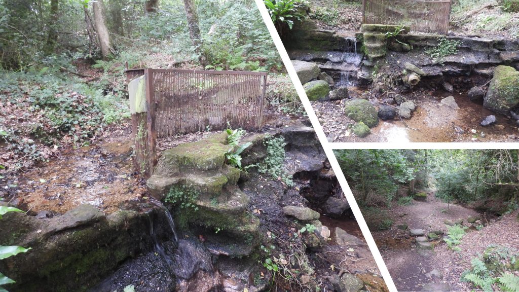
As always Steve, amazingly comprehensive and immensely enjoyable. Given it is so comprehensive I don’t feel too guilty noting that you missed the excellent Throwleigh butterwell on the opposite side of the road to Throwleigh Barton. One for next time 🙂


Nigel Machin August 18, 2022
As always Steve, amazingly comprehensive and immensely enjoyable. Given it is so comprehensive I don’t feel too guilty noting that you missed the excellent Throwleigh butterwell on the opposite side of the road to Throwleigh Barton. One for next time 🙂
SteveGrigg1961 August 18, 2022 — Post author
Thanks Nigel, thats the beauty of Dartmoor, always something new to explore. Thanks for the information.