A collection of walks, discoveries, insights and pictures of exploring Dartmoor National Park
July 17, 2022
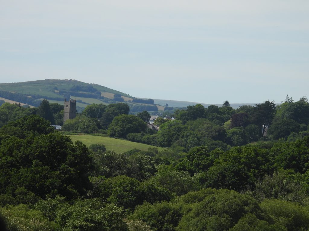
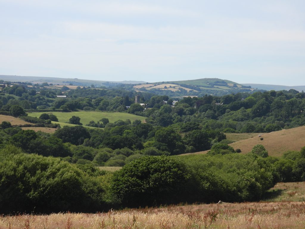
Dartmoor Way – Stage 4 – Bovey Tracey to Moretonhampstead
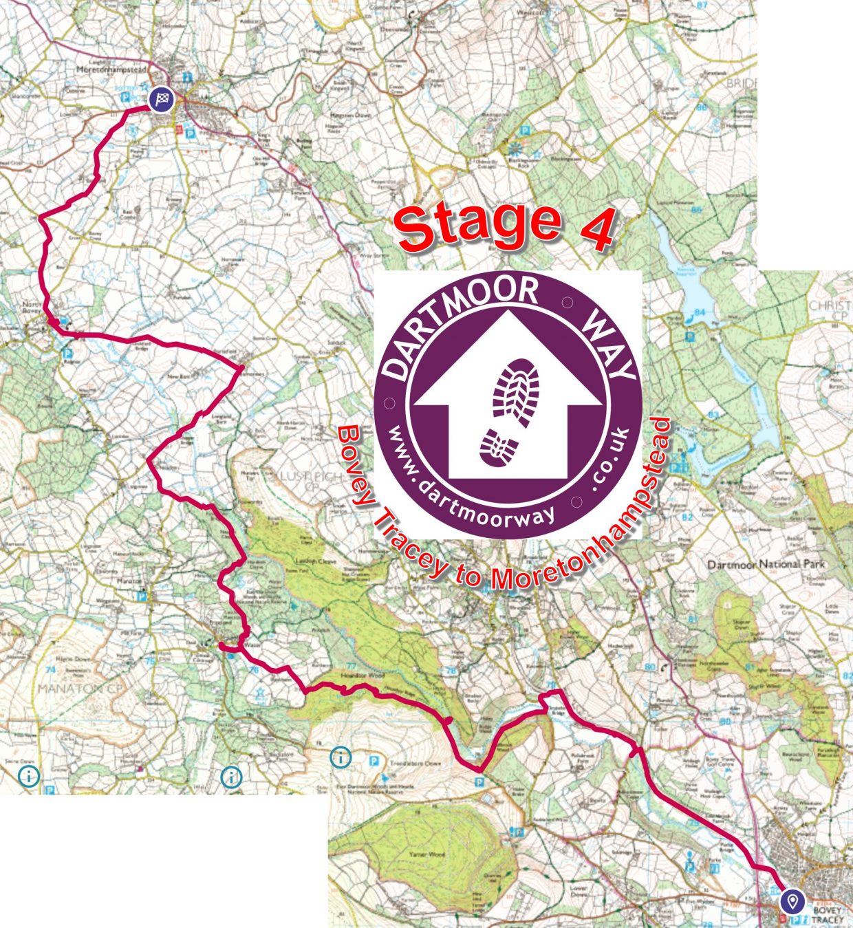
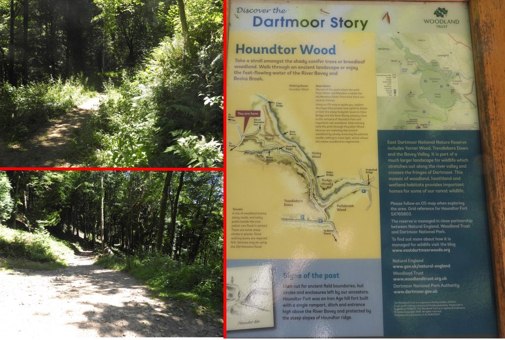
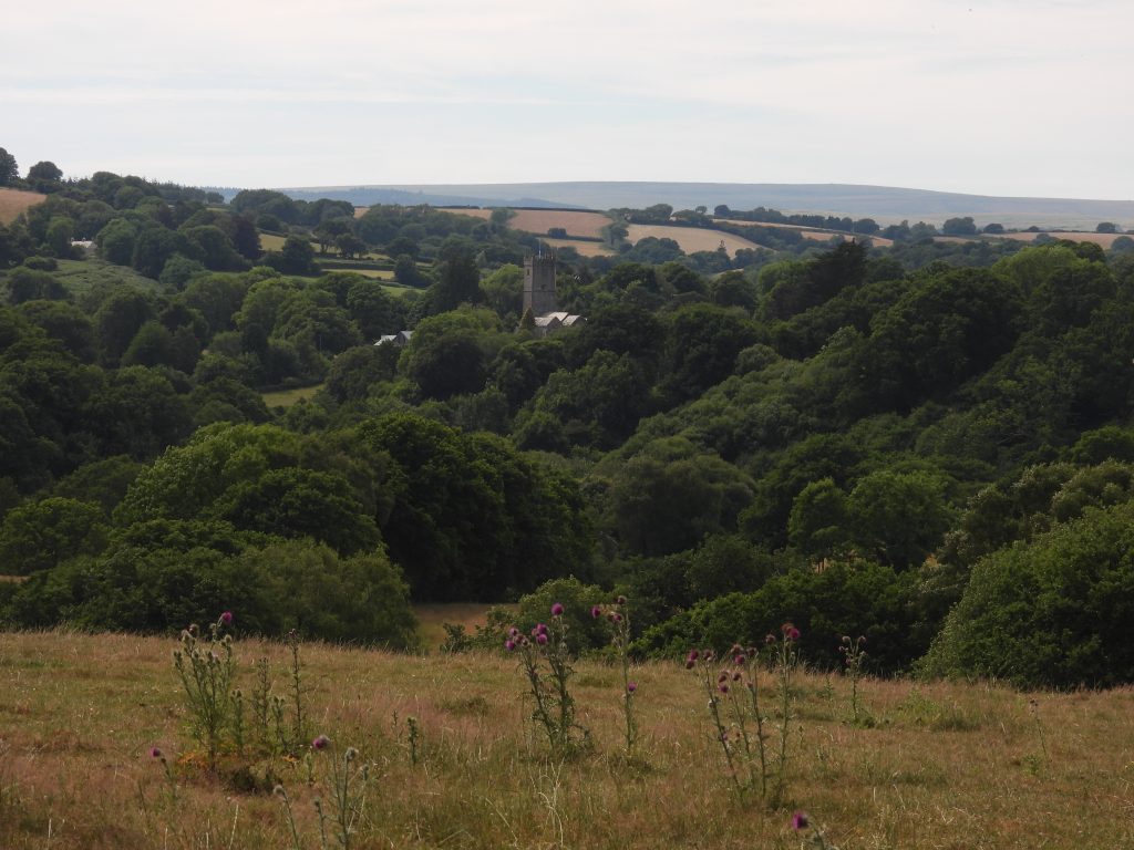
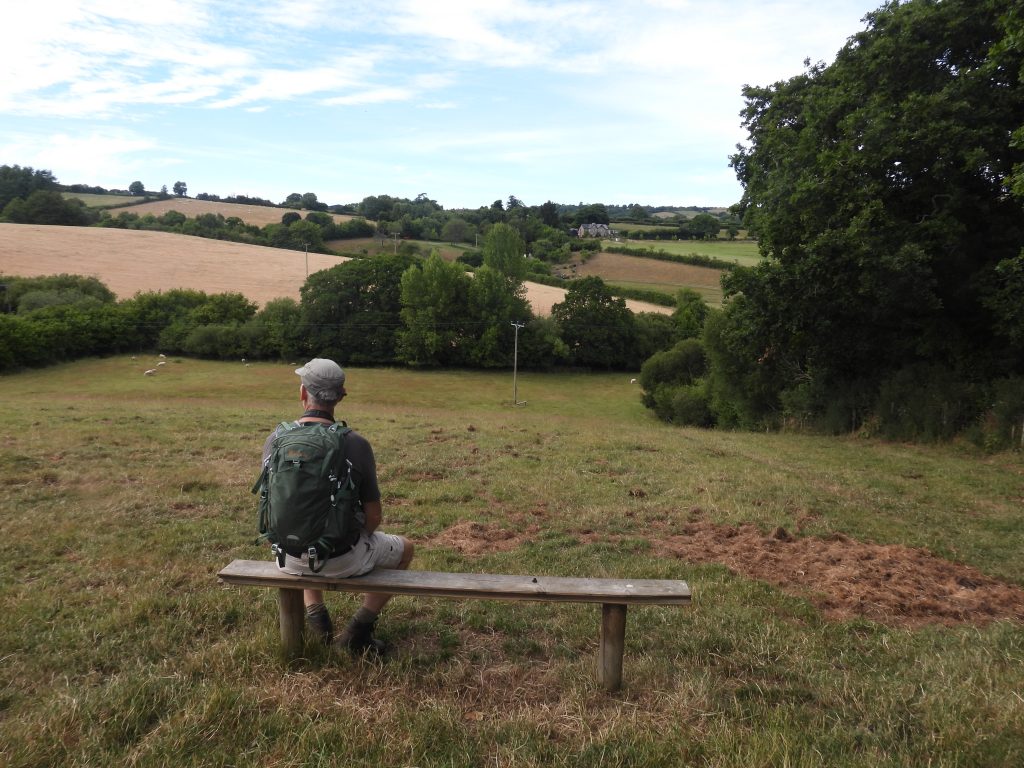
This fourth stage of the Dartmoor Way is stated on the official website (dartmoorway.co.uk) as being 10.5 miles (17 km) starting at Bovey Tracey and finishing at Moretonhampstead. The elevation climb is 1961 ft (598 m), with the longest individual climb being through Houndtor Wood from crossing the Becka Brook at the packhorse bridge up to the outskirts of the hamlet of Water. This post covering the fourth stage was recorded by the author as being 19.8 km (around 12.4 miles) in length. That said, the author made a slight deviation from the official route, by taking a route through Water (for a liquid refreshment at “The Kestor Inn”). As with all other post recording the Dartmoor Way, this post records historical features, shows pictures of some far reaching views, shows pictures of wildlife and shows pictures of points of interest – all photographs taken by the author along the route are annotated.
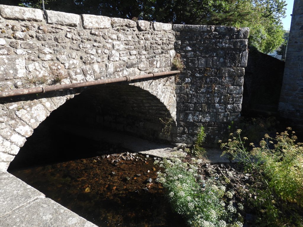
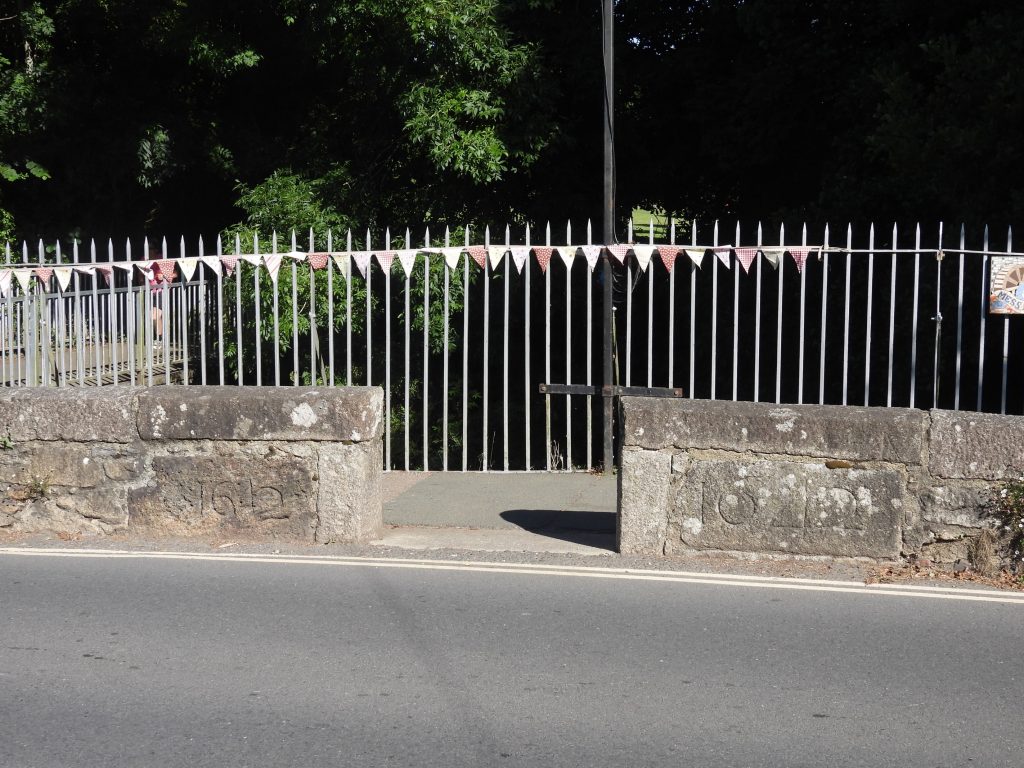
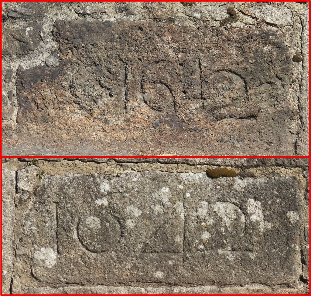
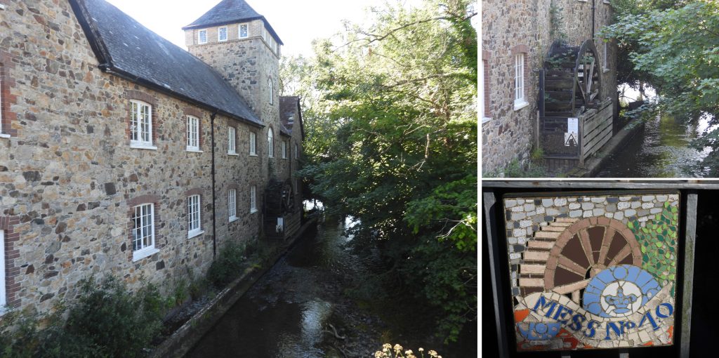
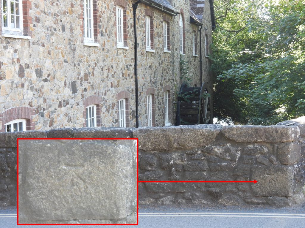
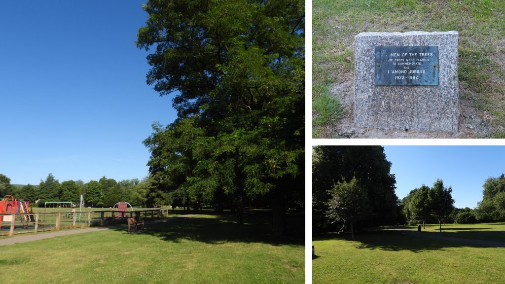
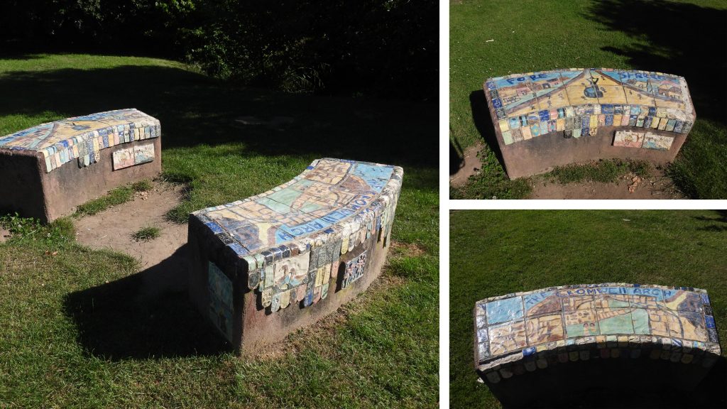
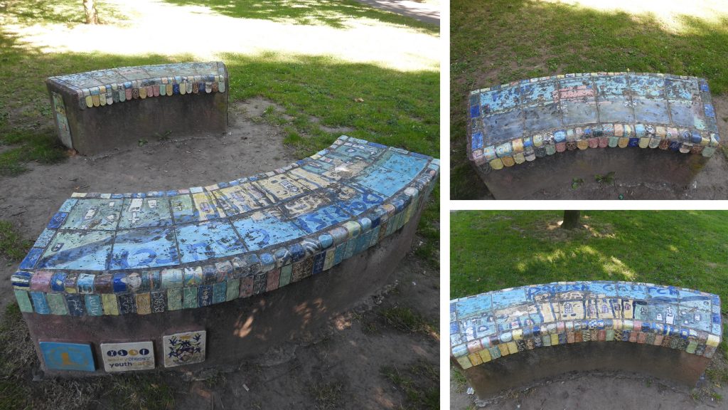
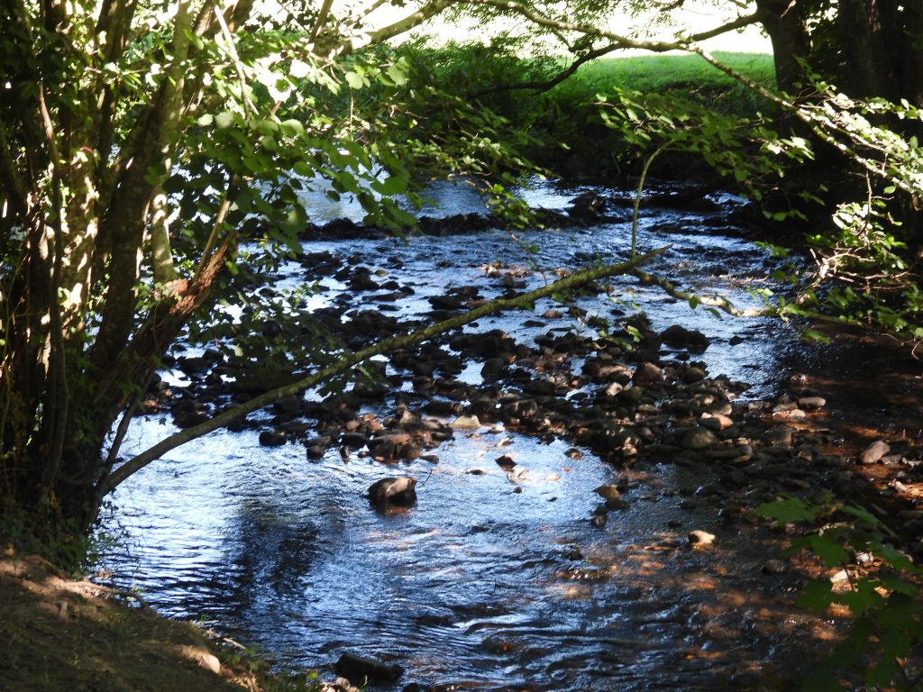
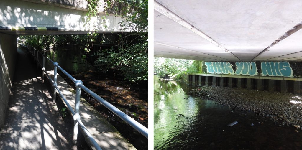
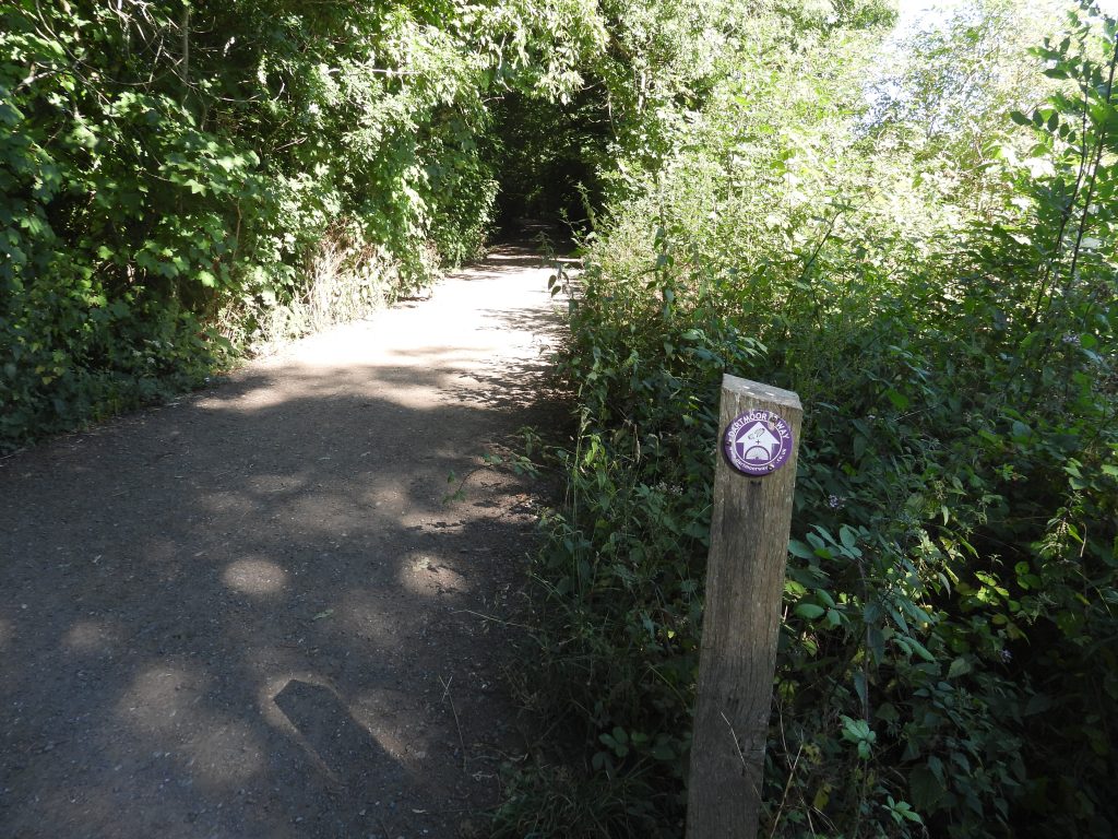
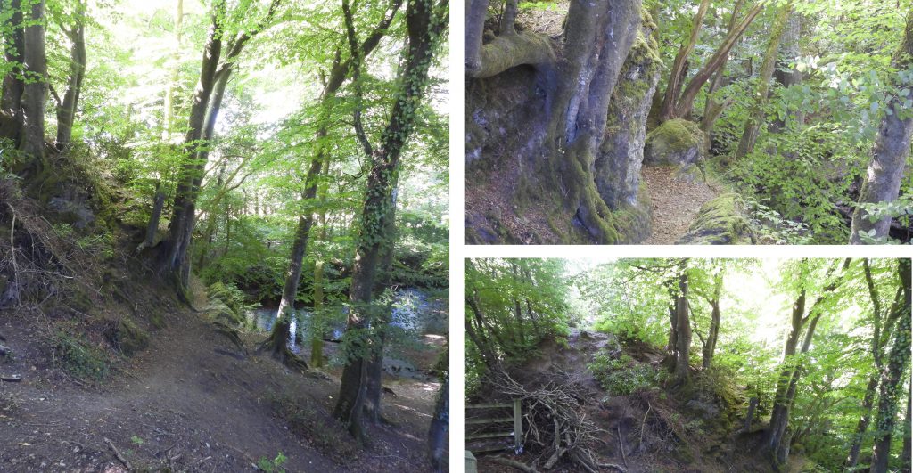
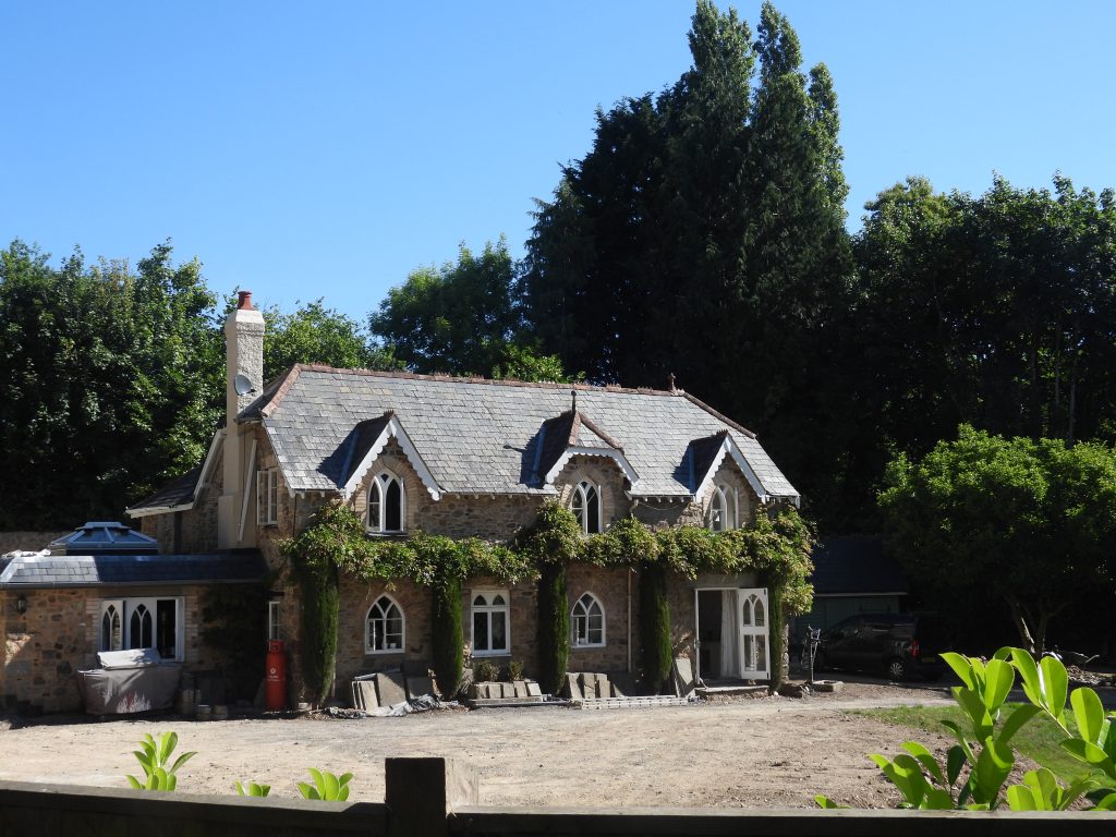
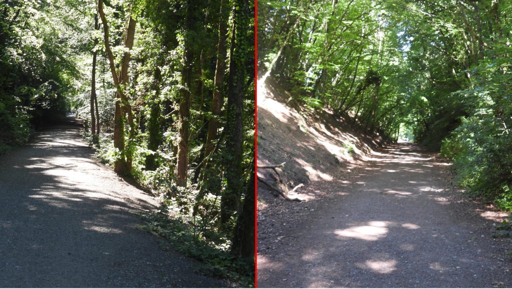
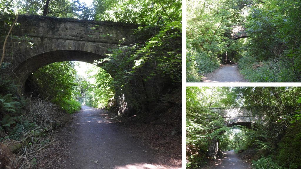
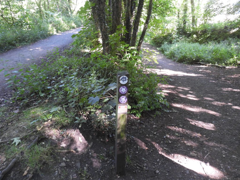
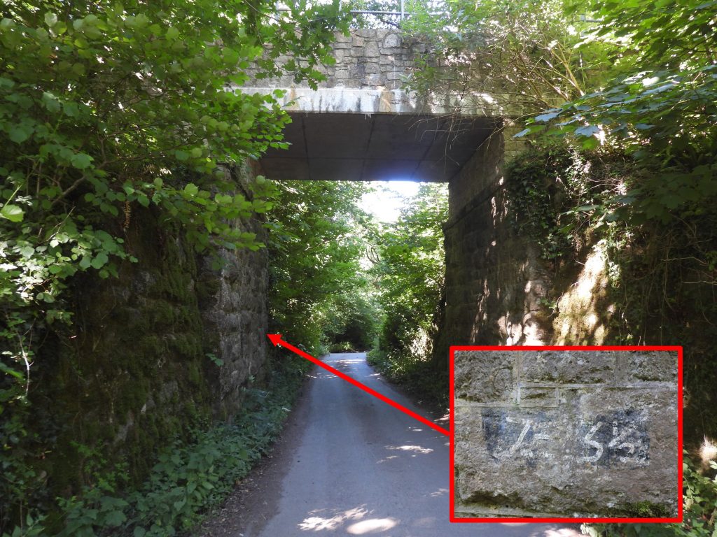
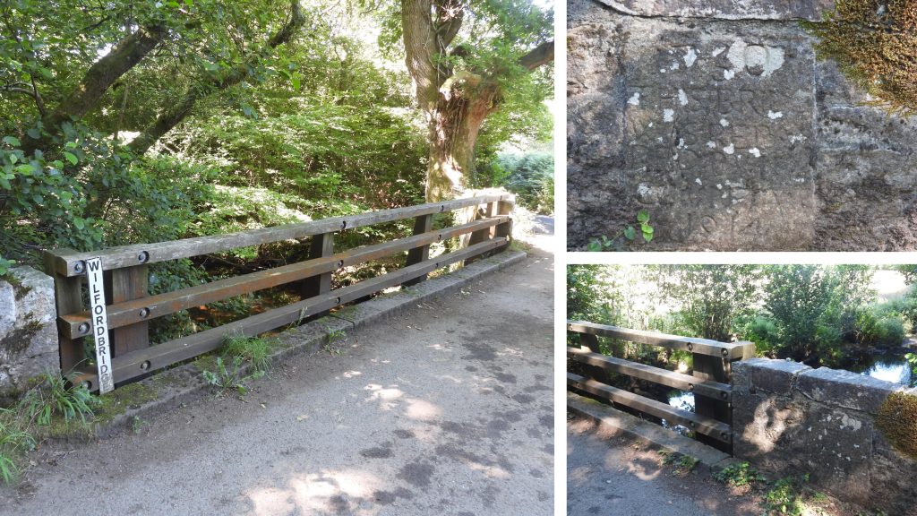
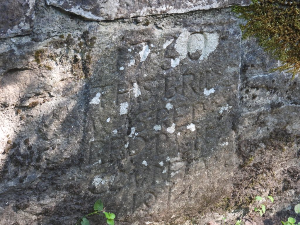
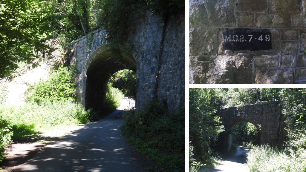
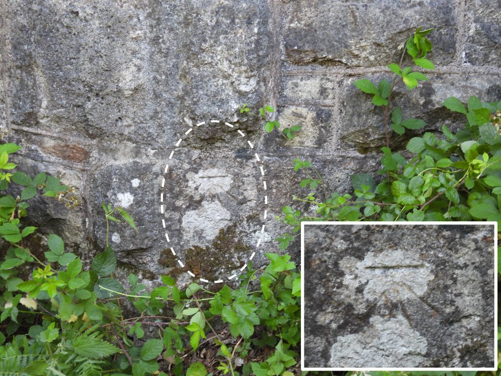
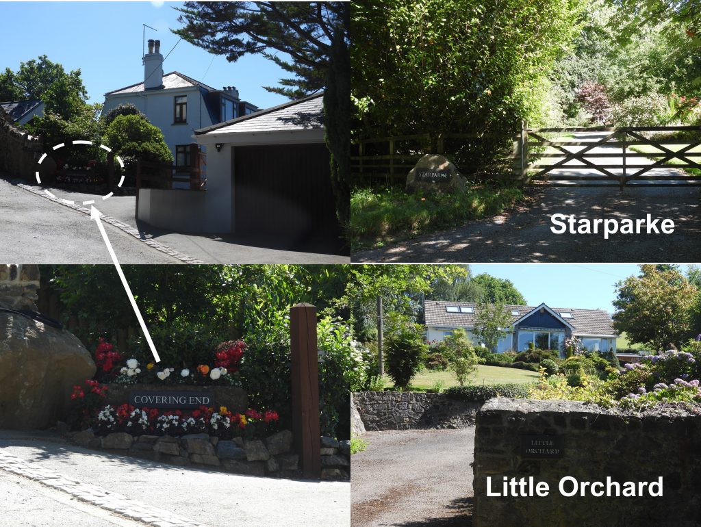
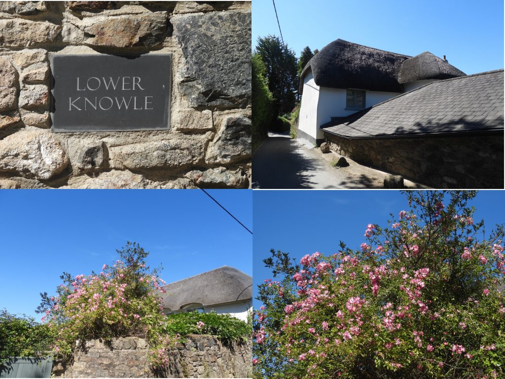
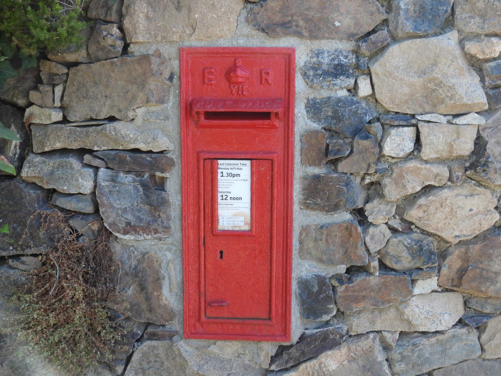
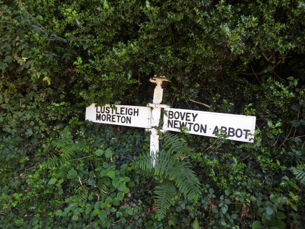
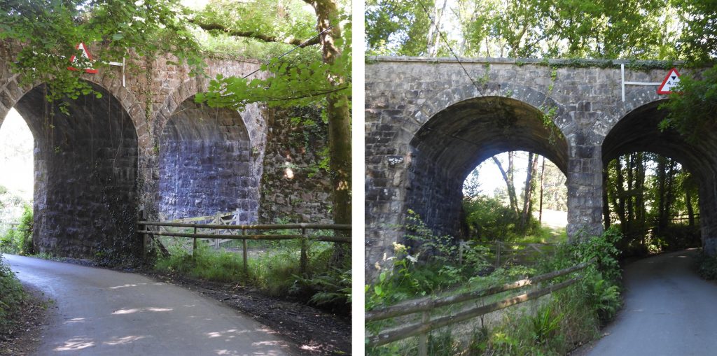
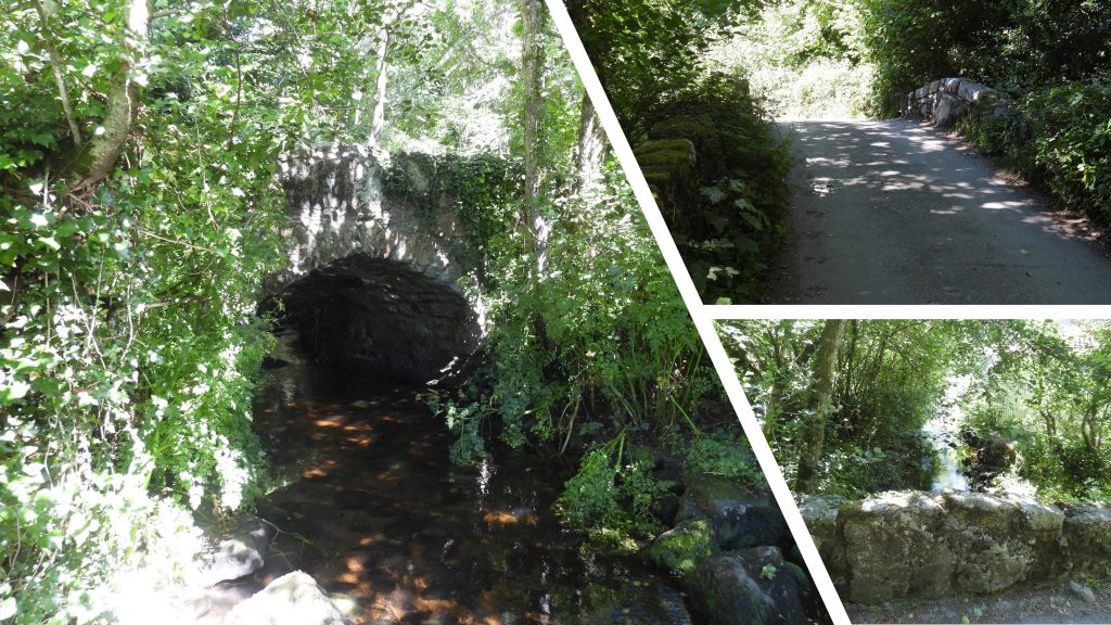
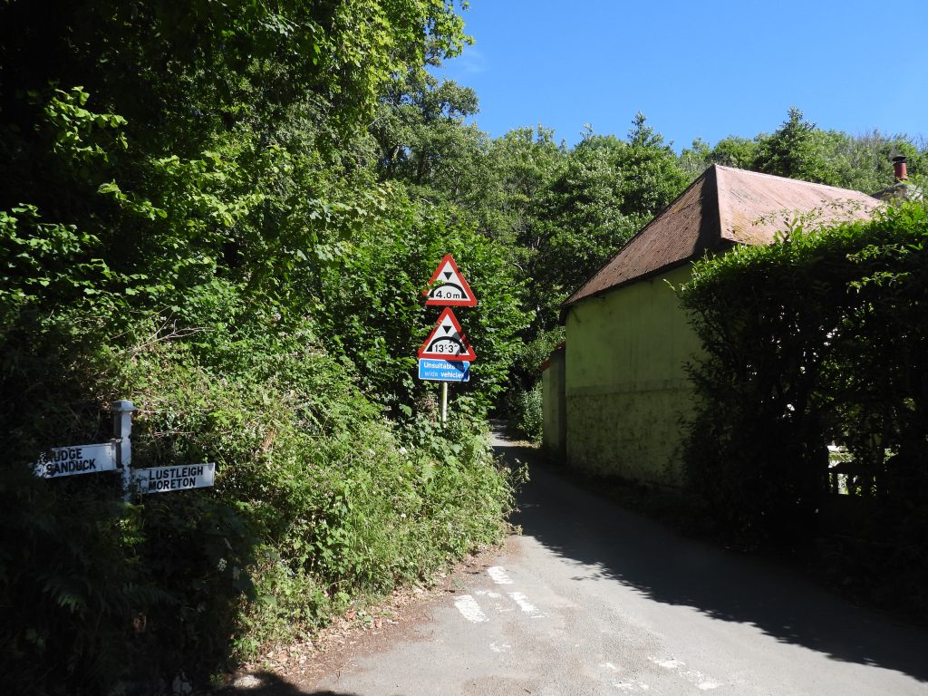
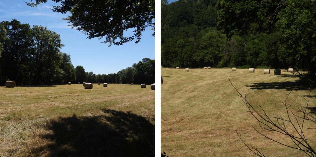
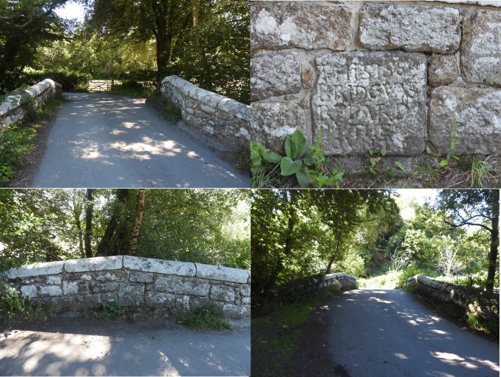
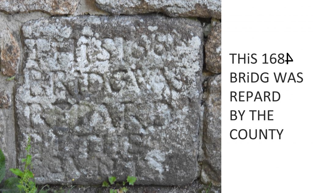
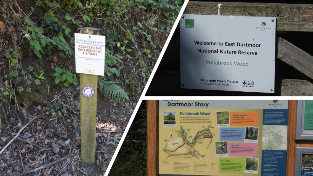
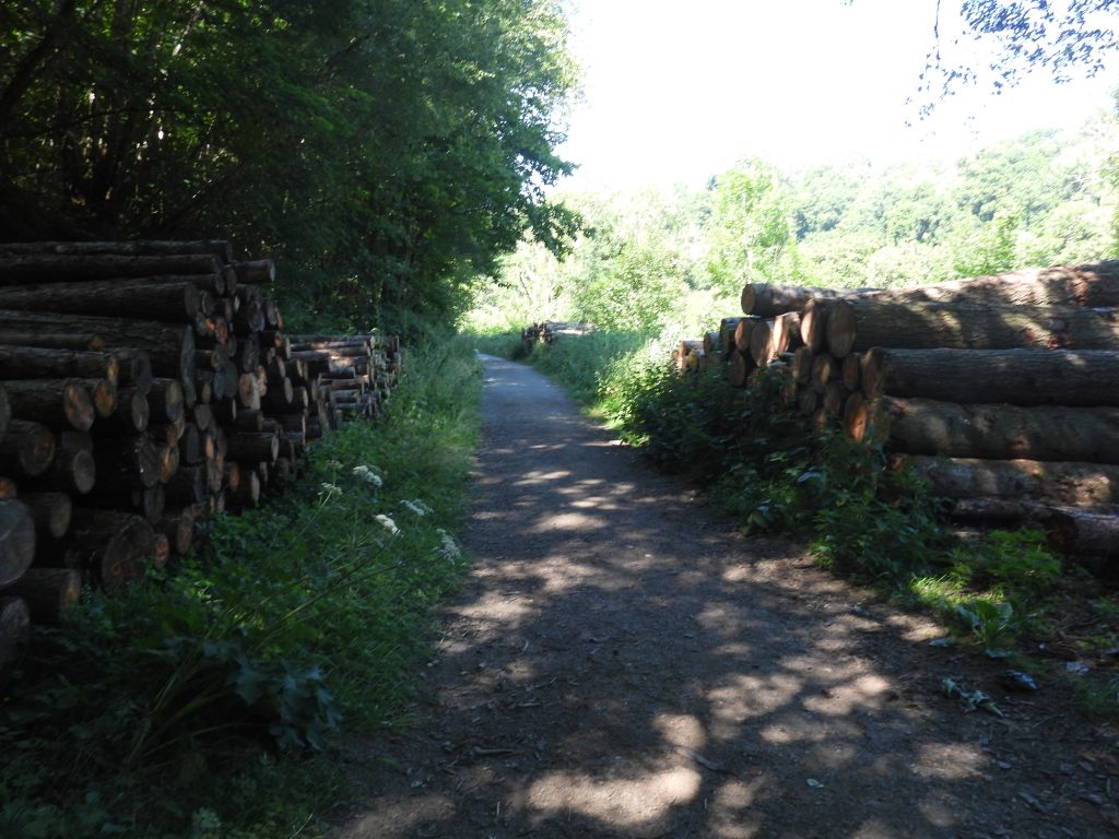
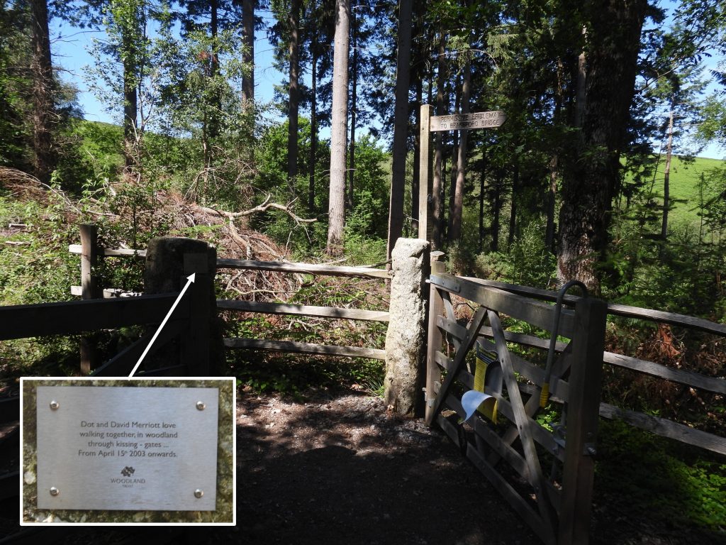
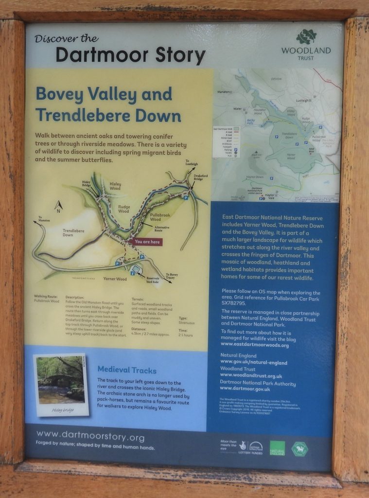
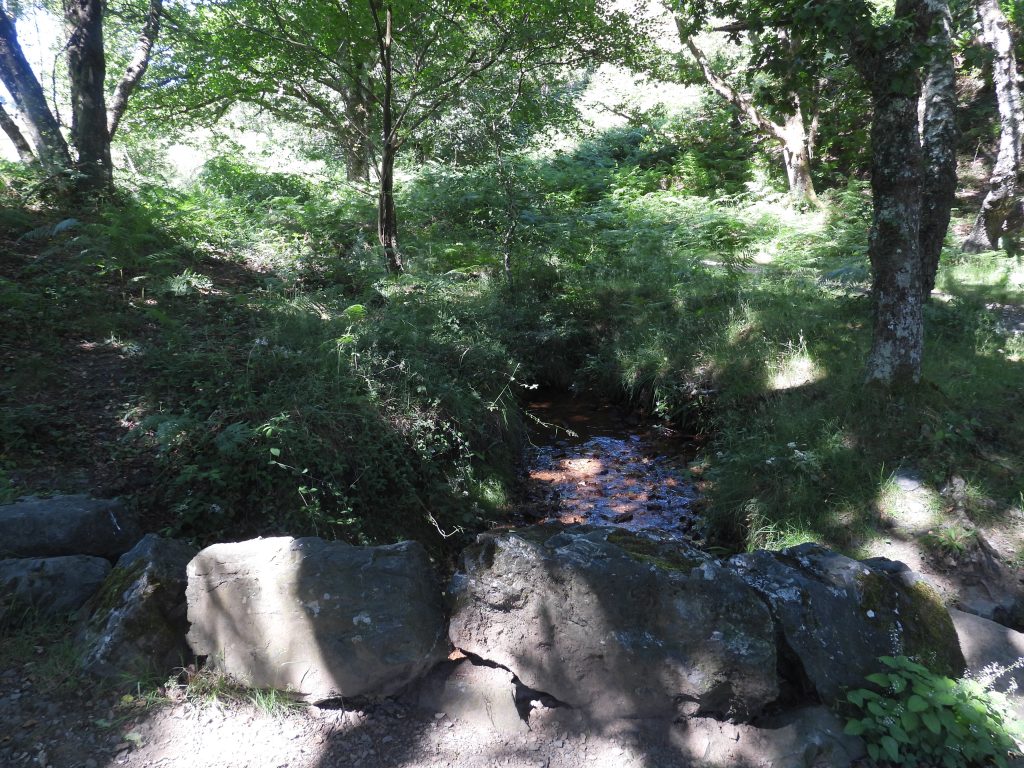
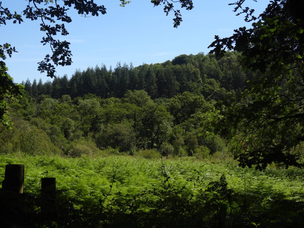
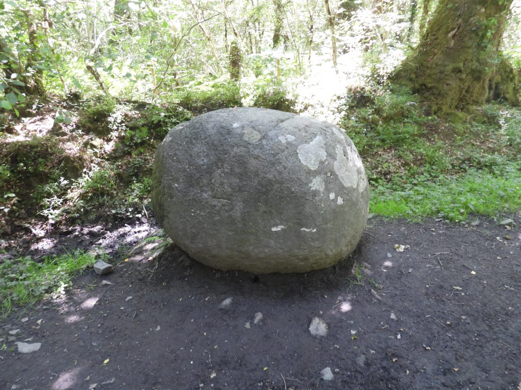
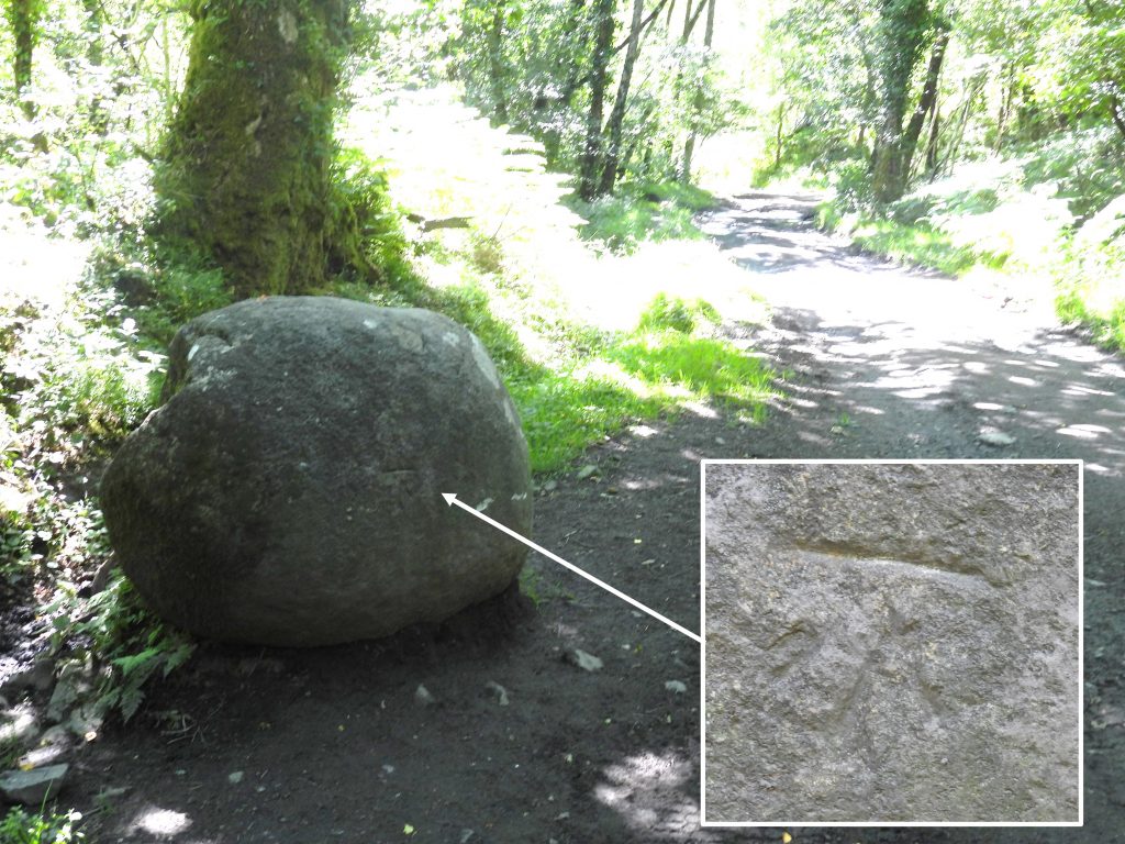
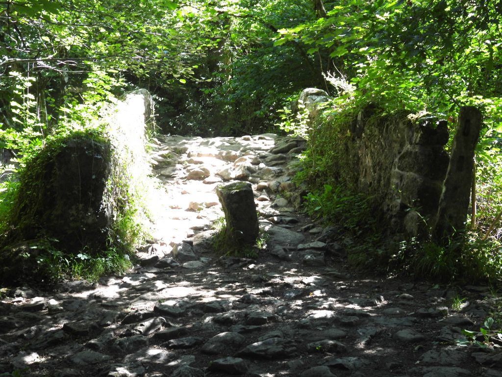
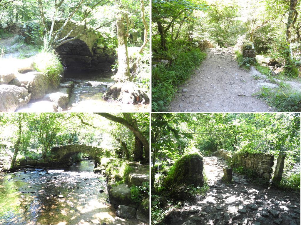
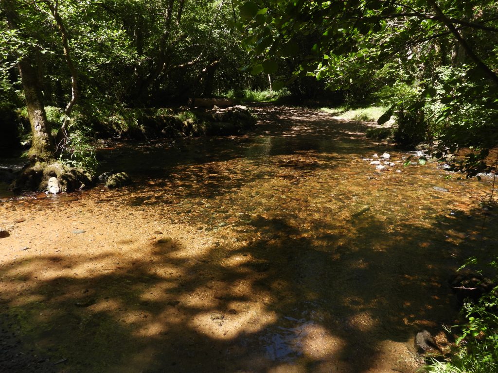
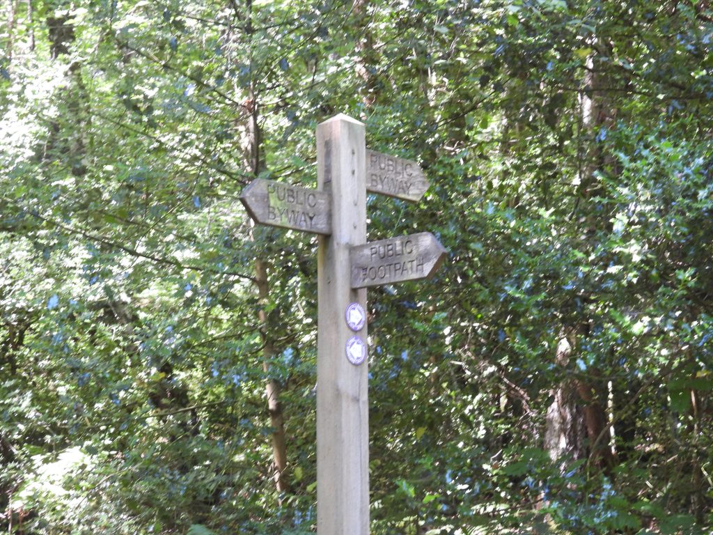
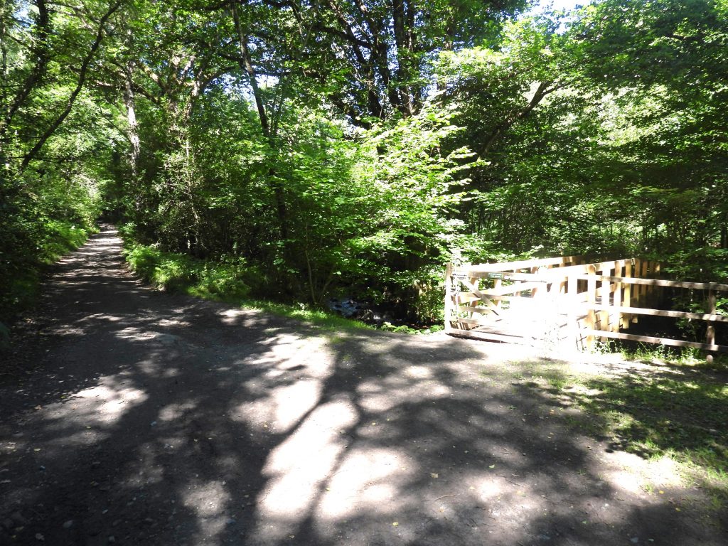
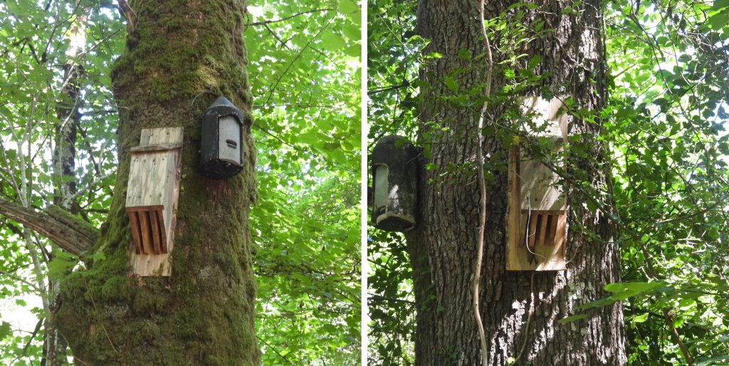
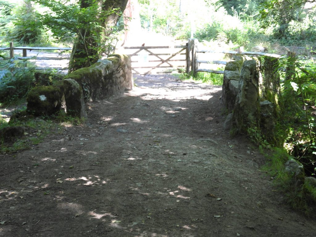
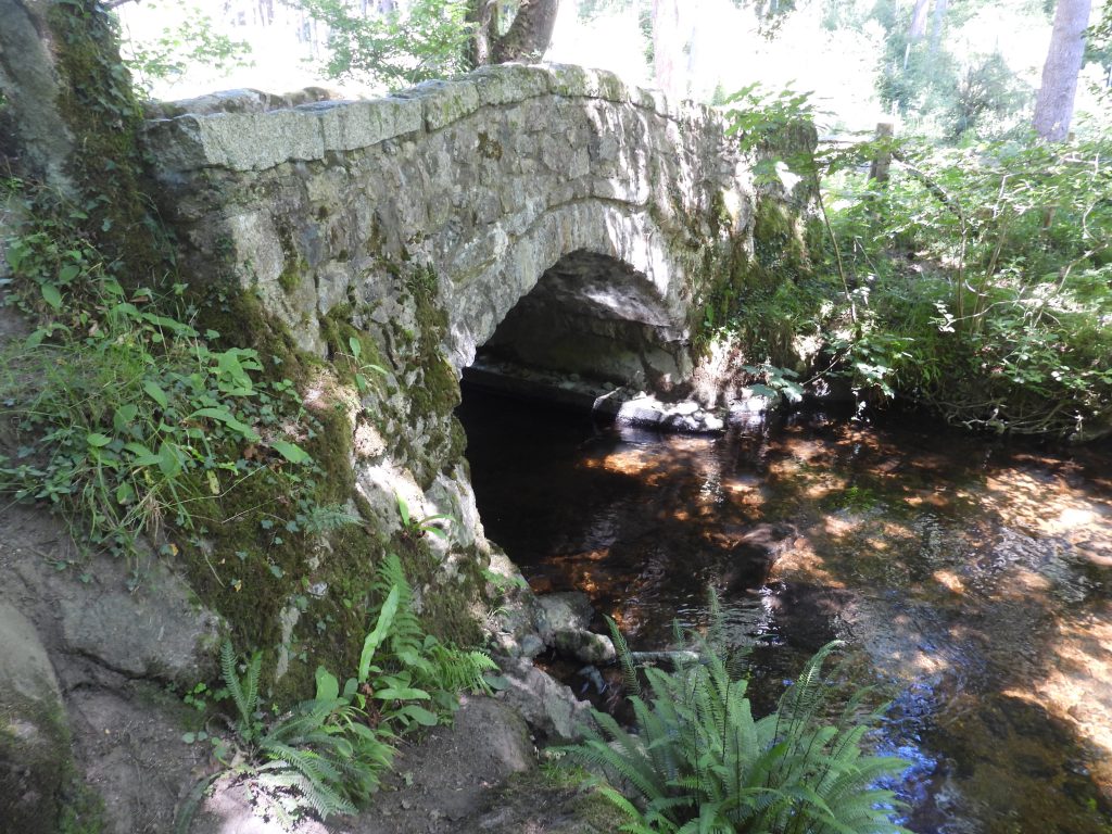
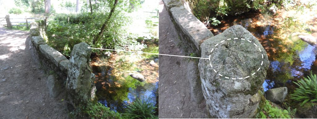
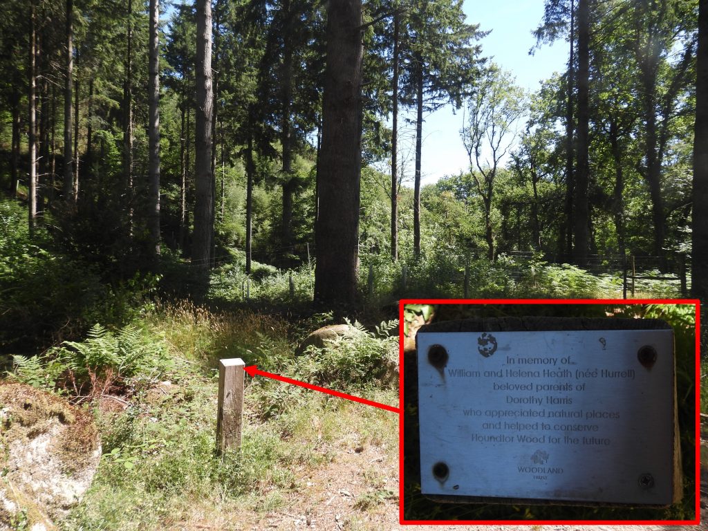
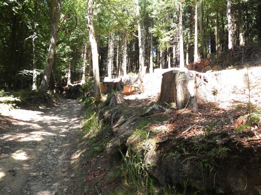
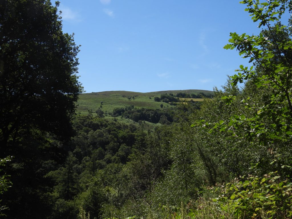
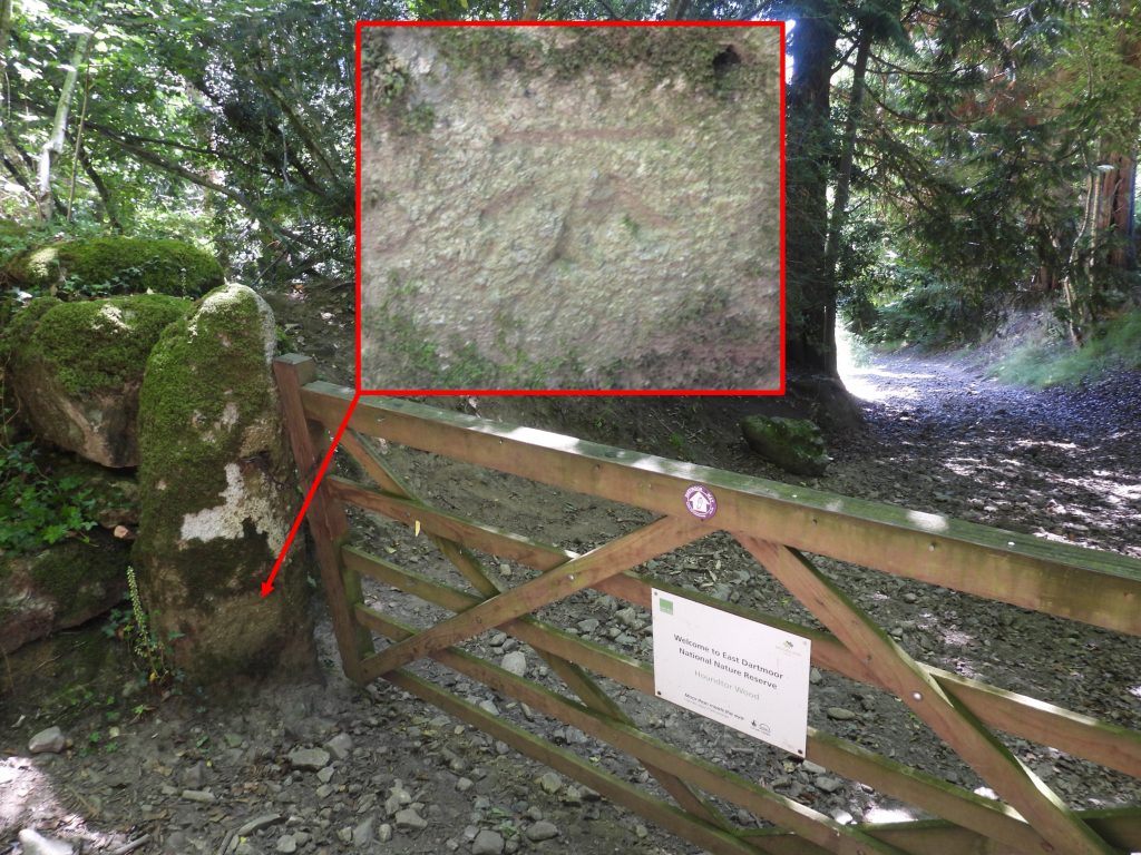
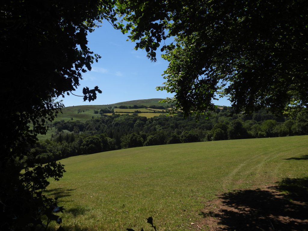
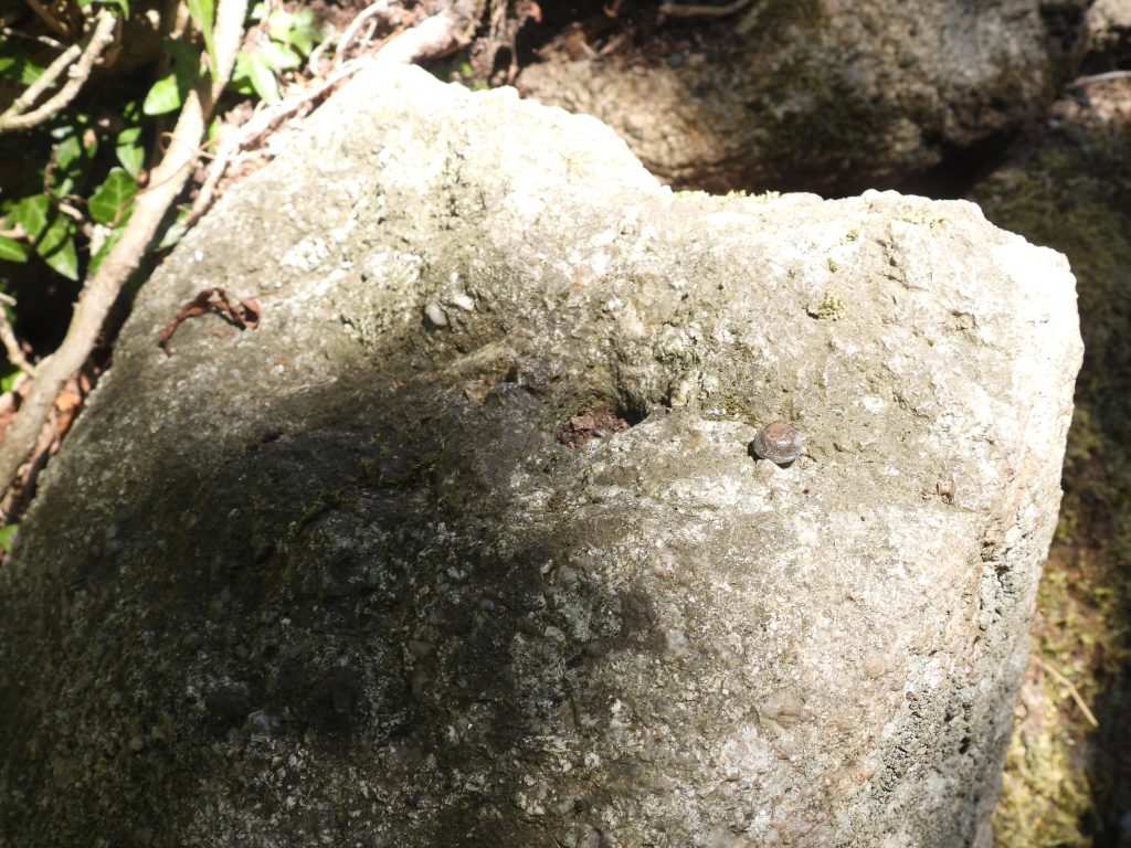
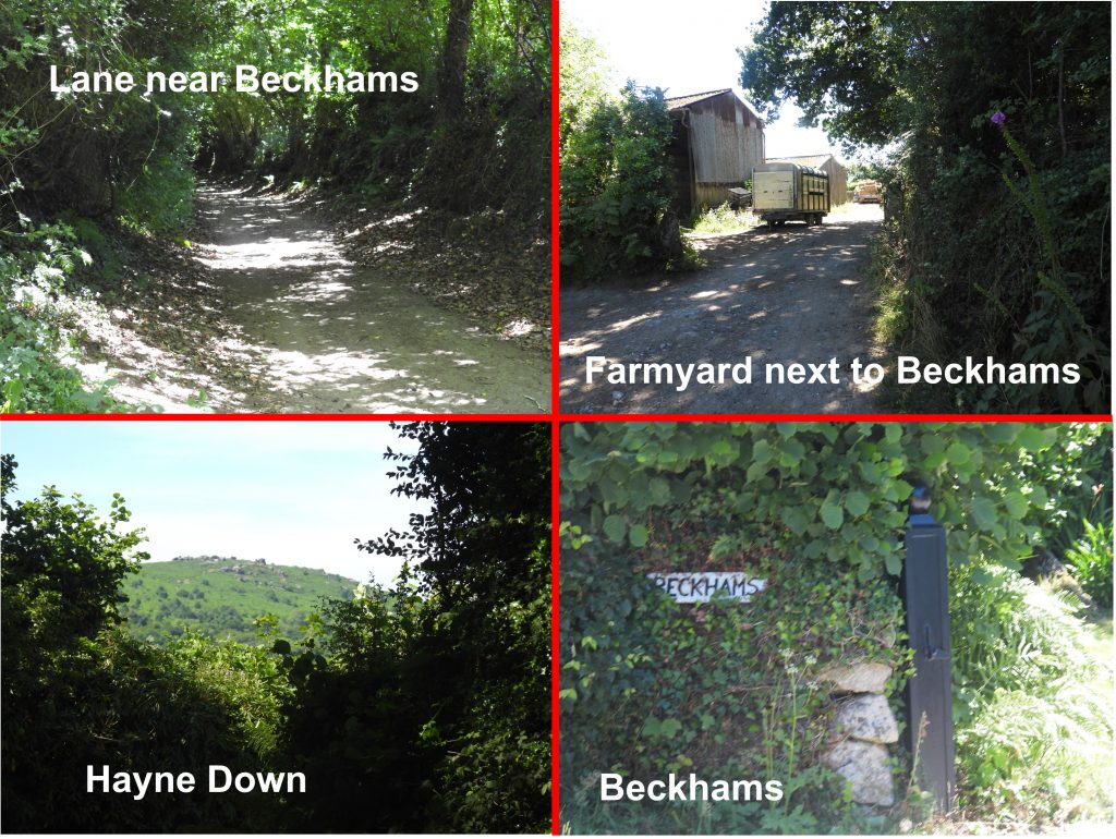
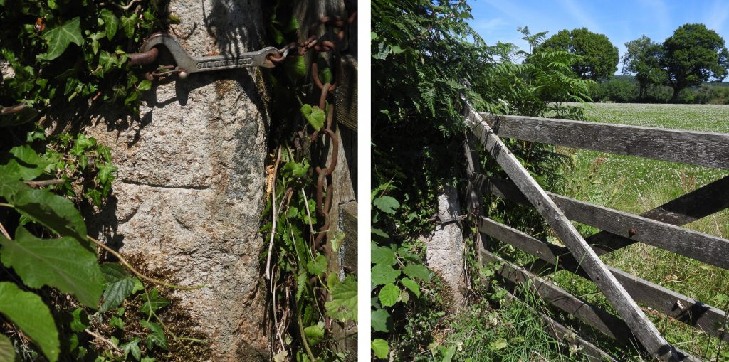
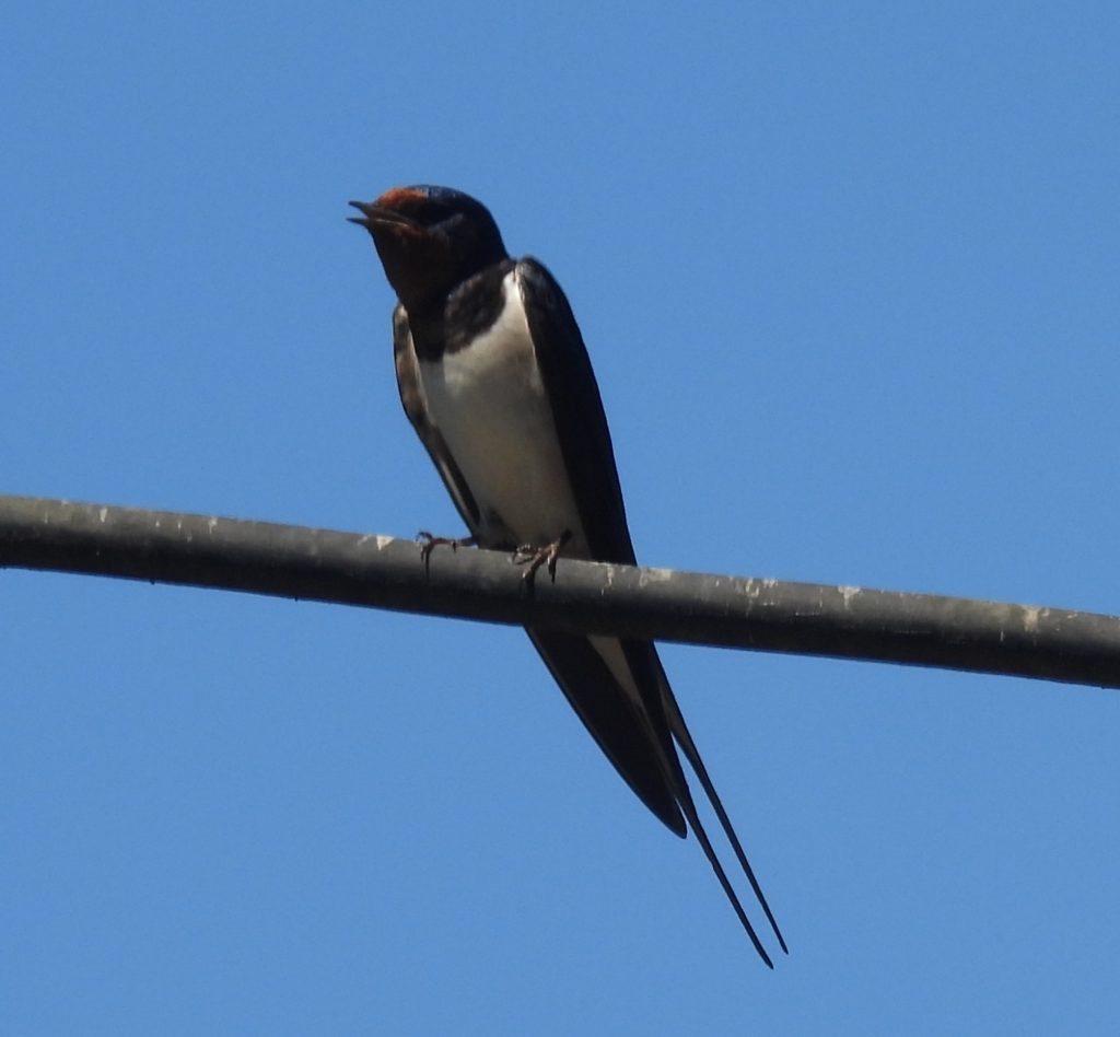
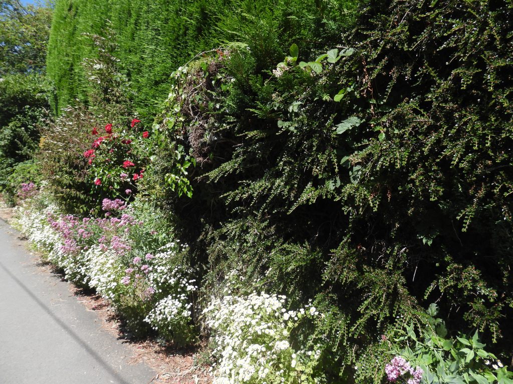
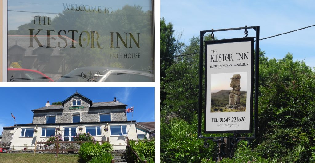
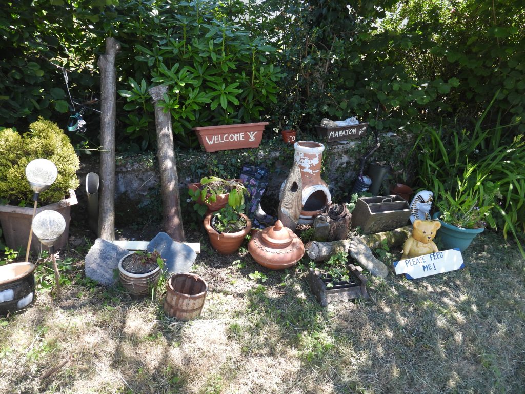
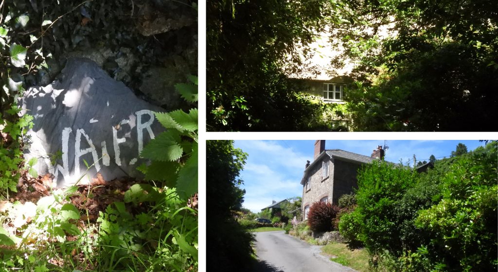
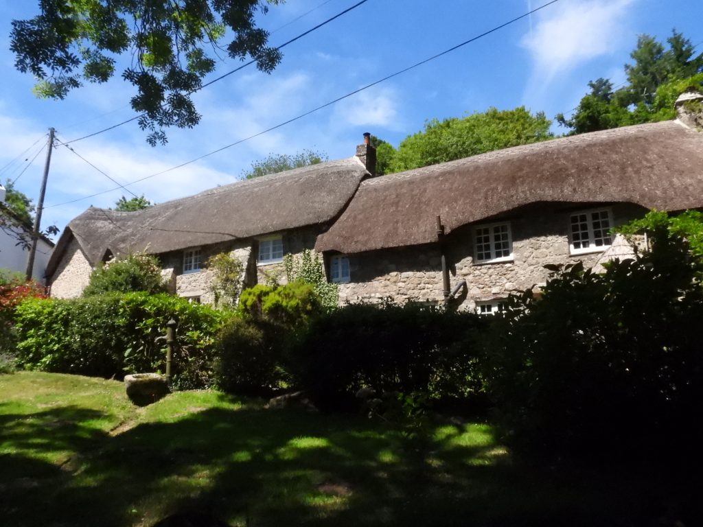
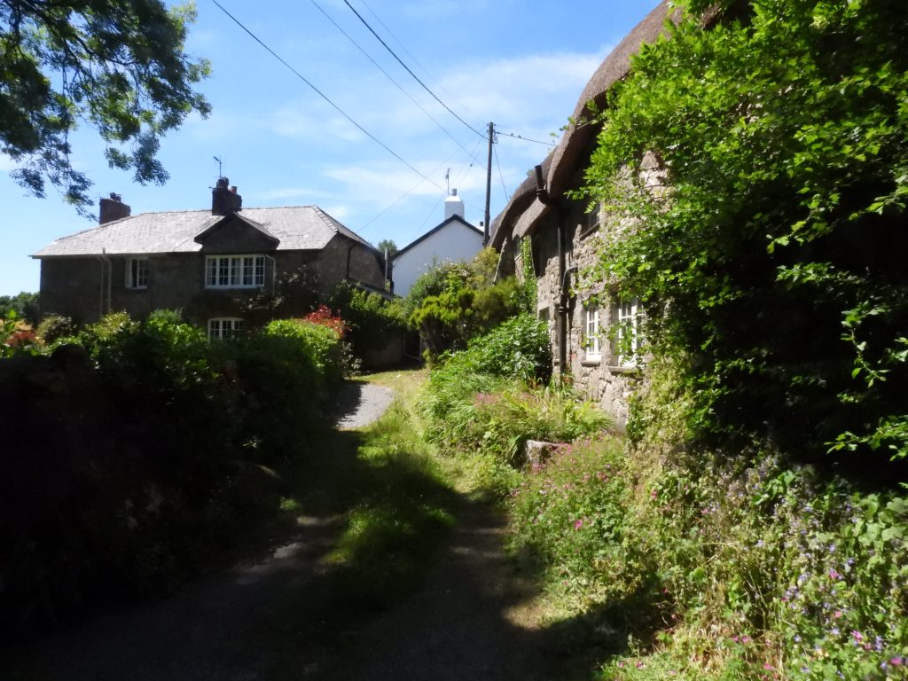
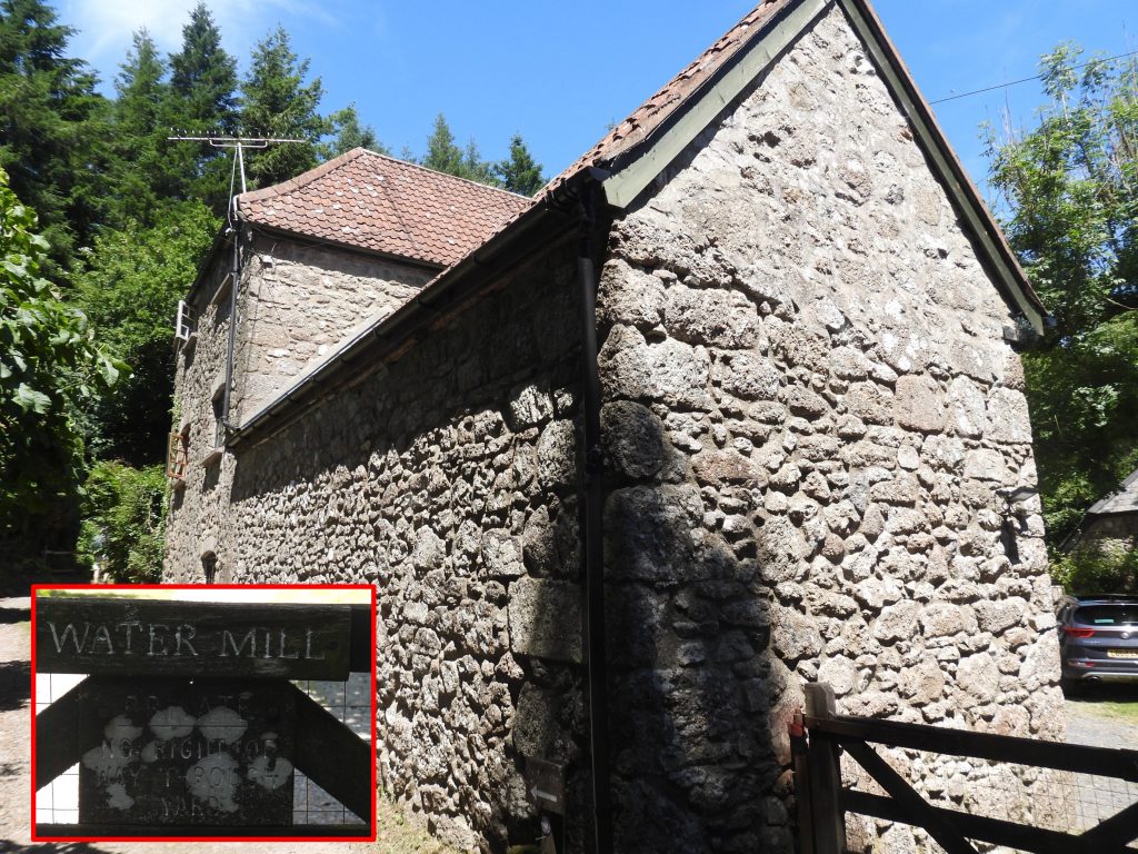
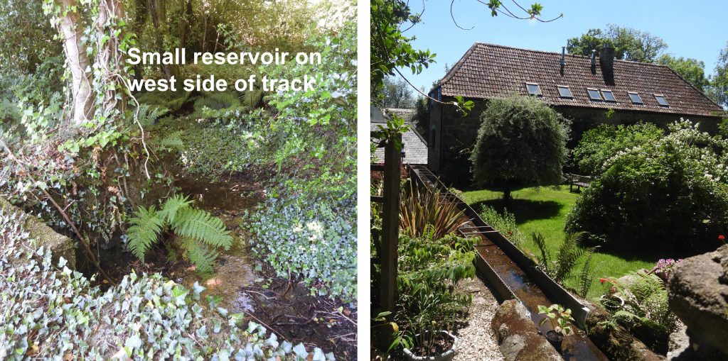
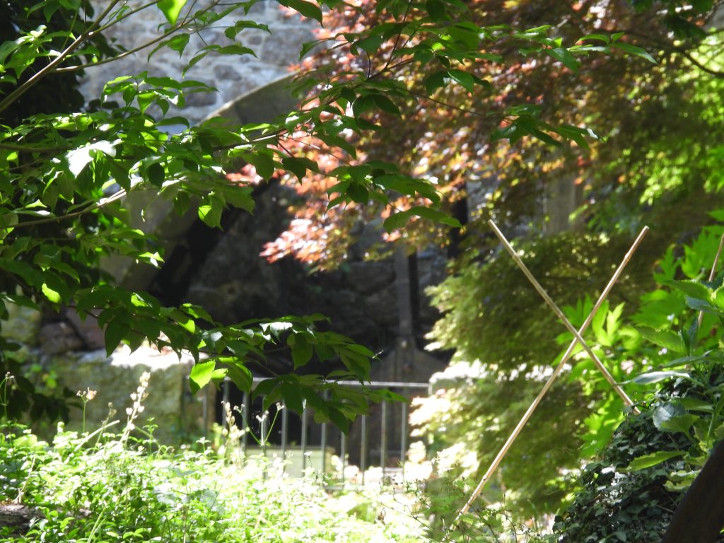
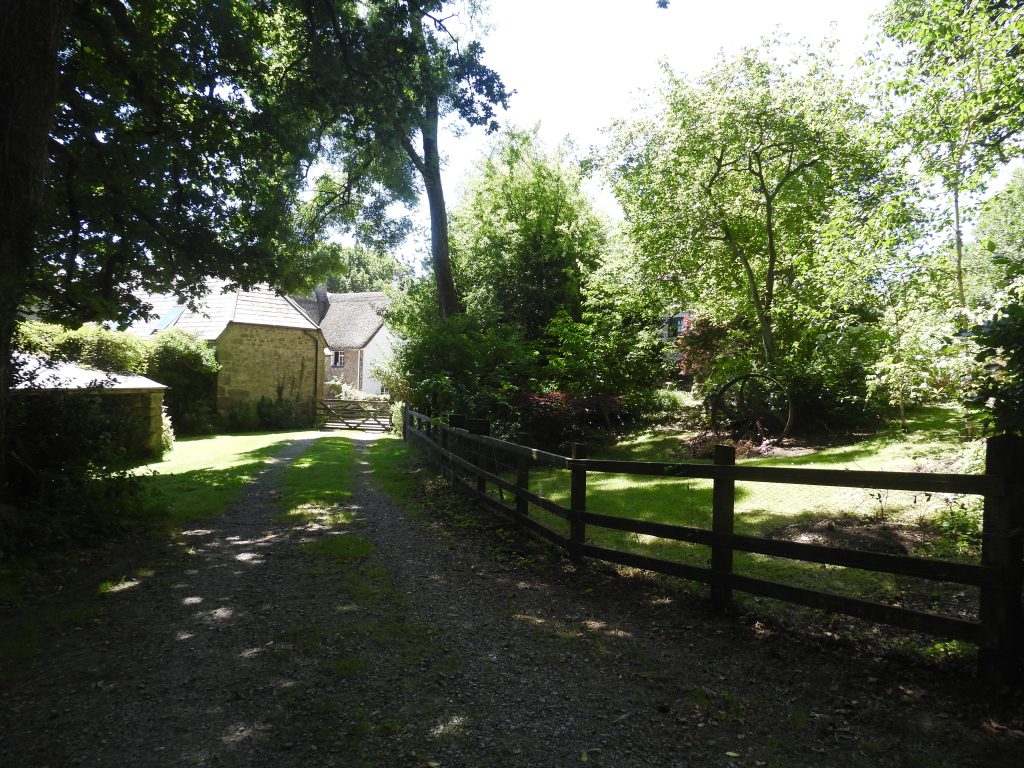
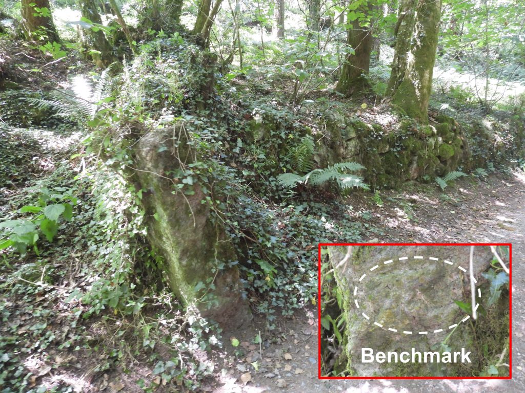
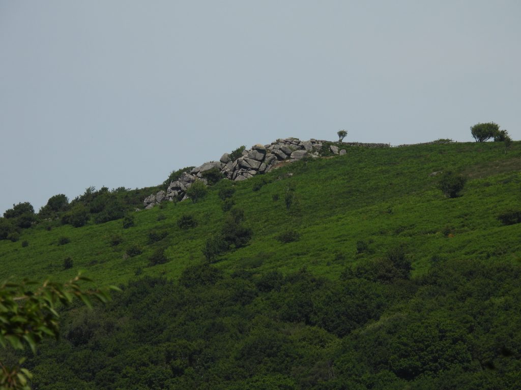
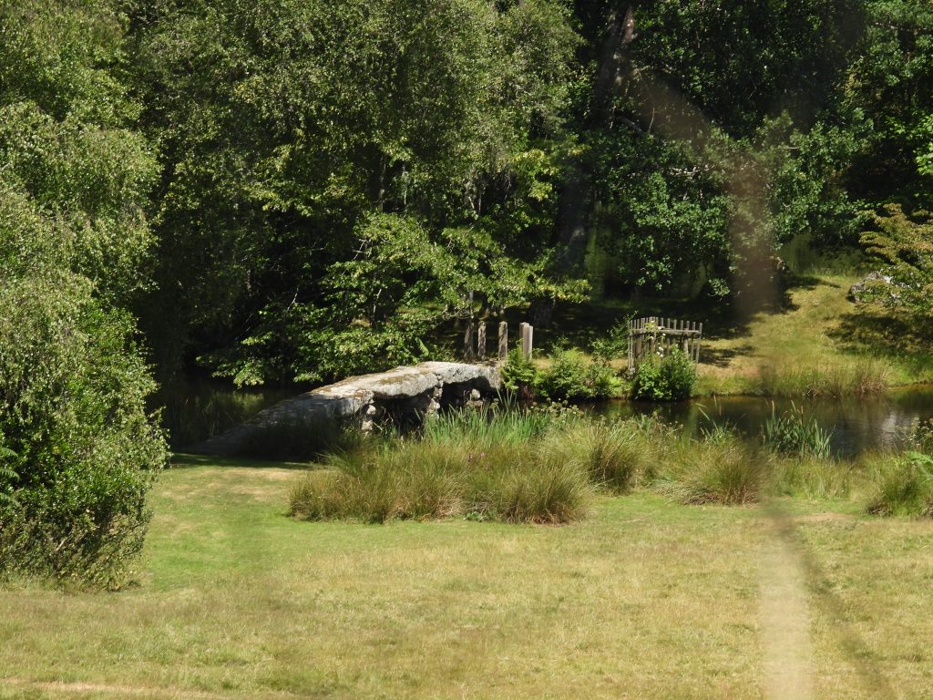
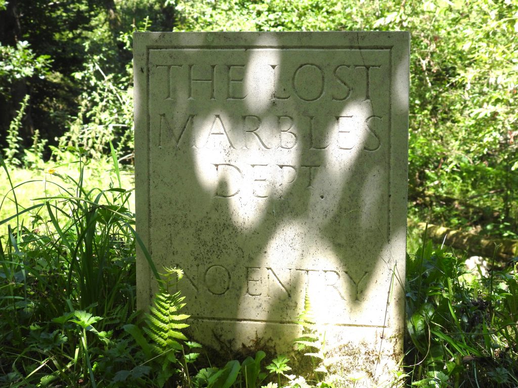
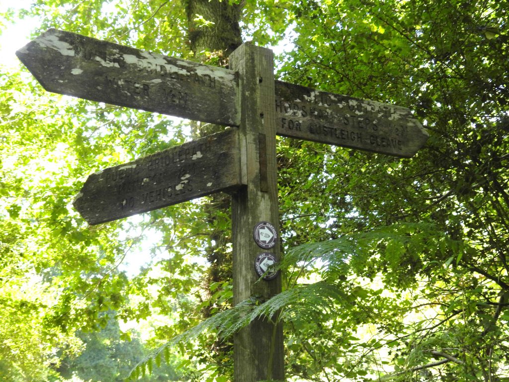
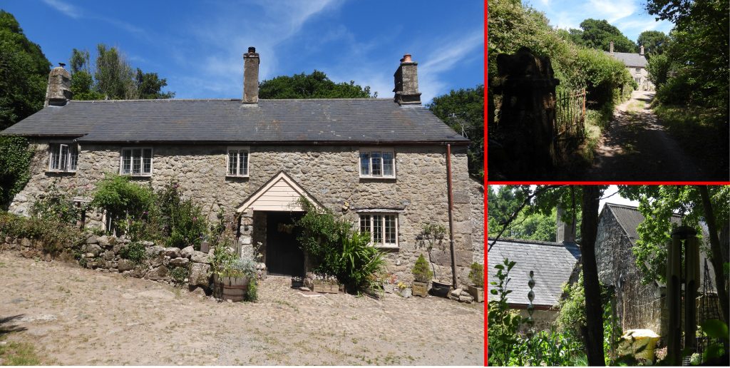
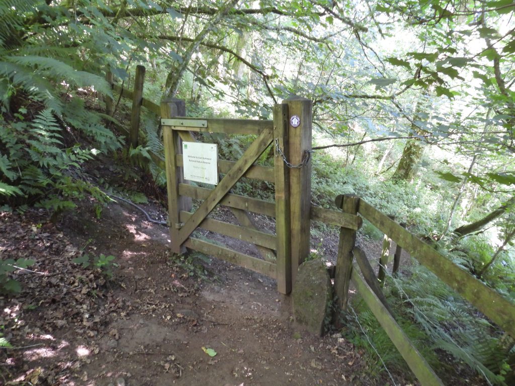
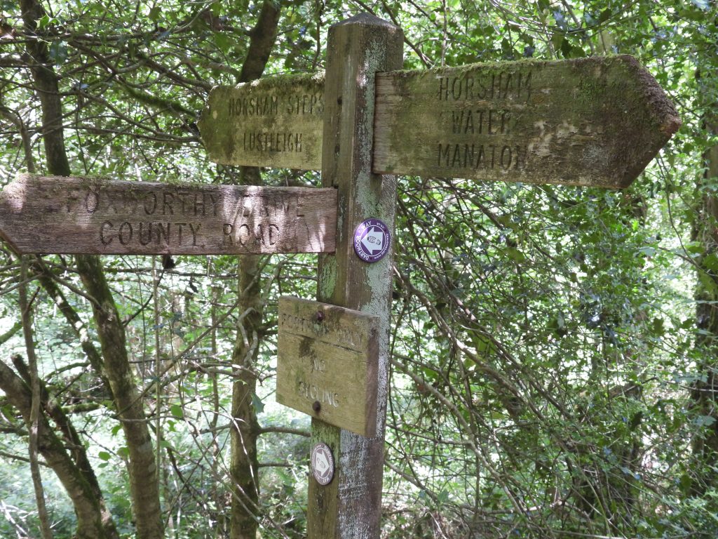
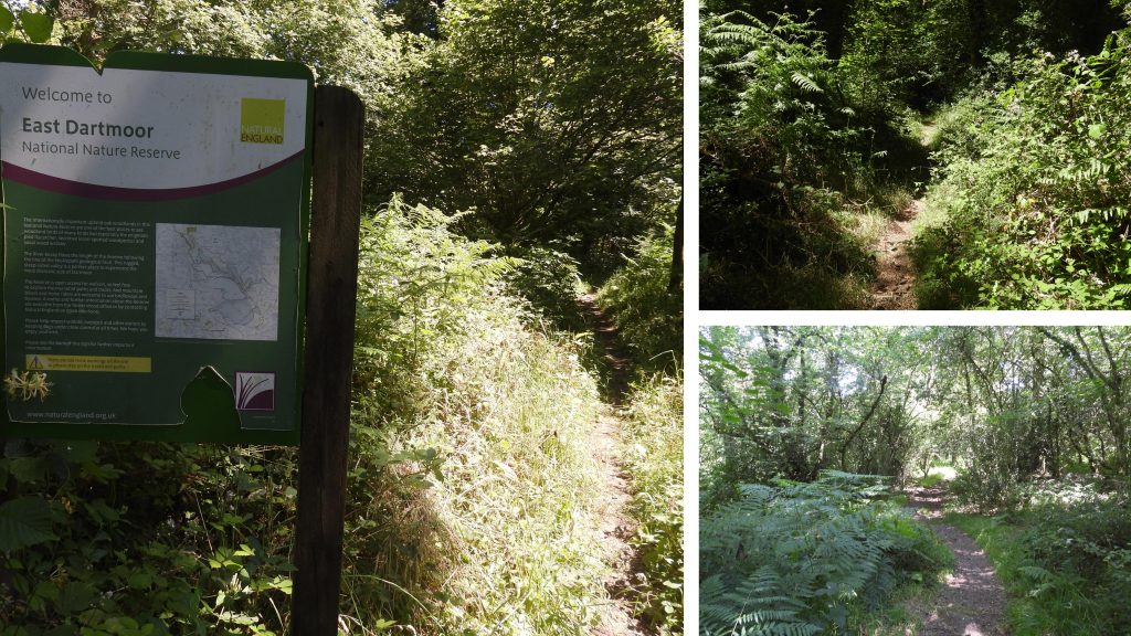
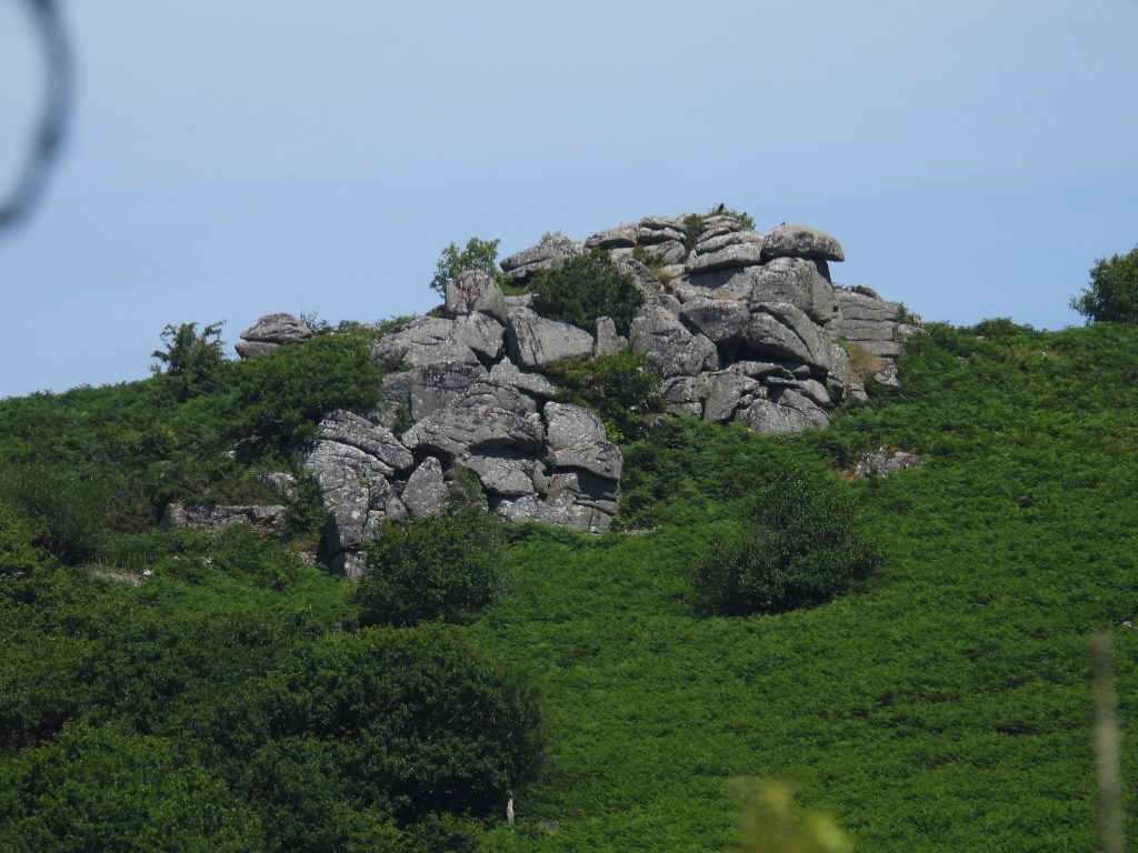
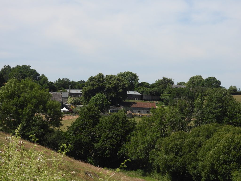
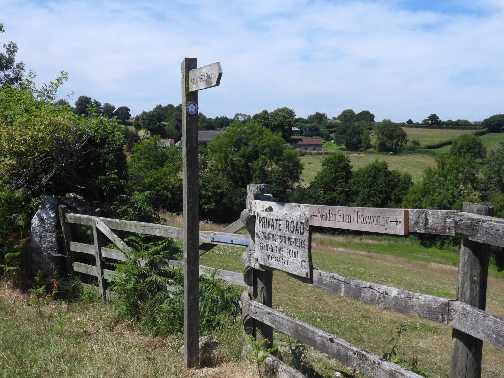
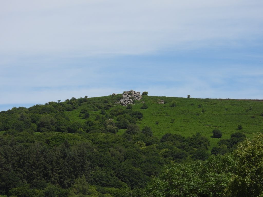
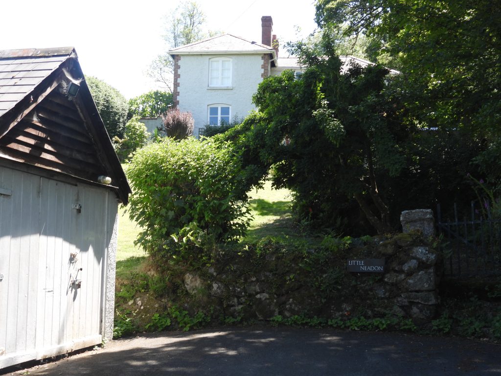
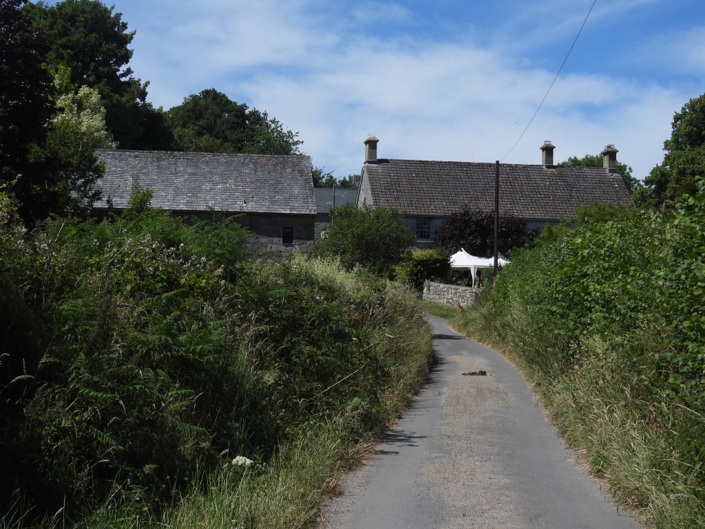
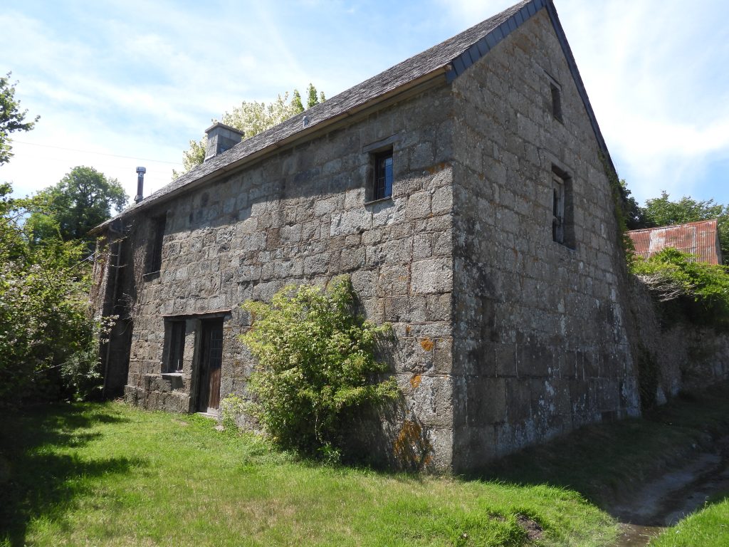
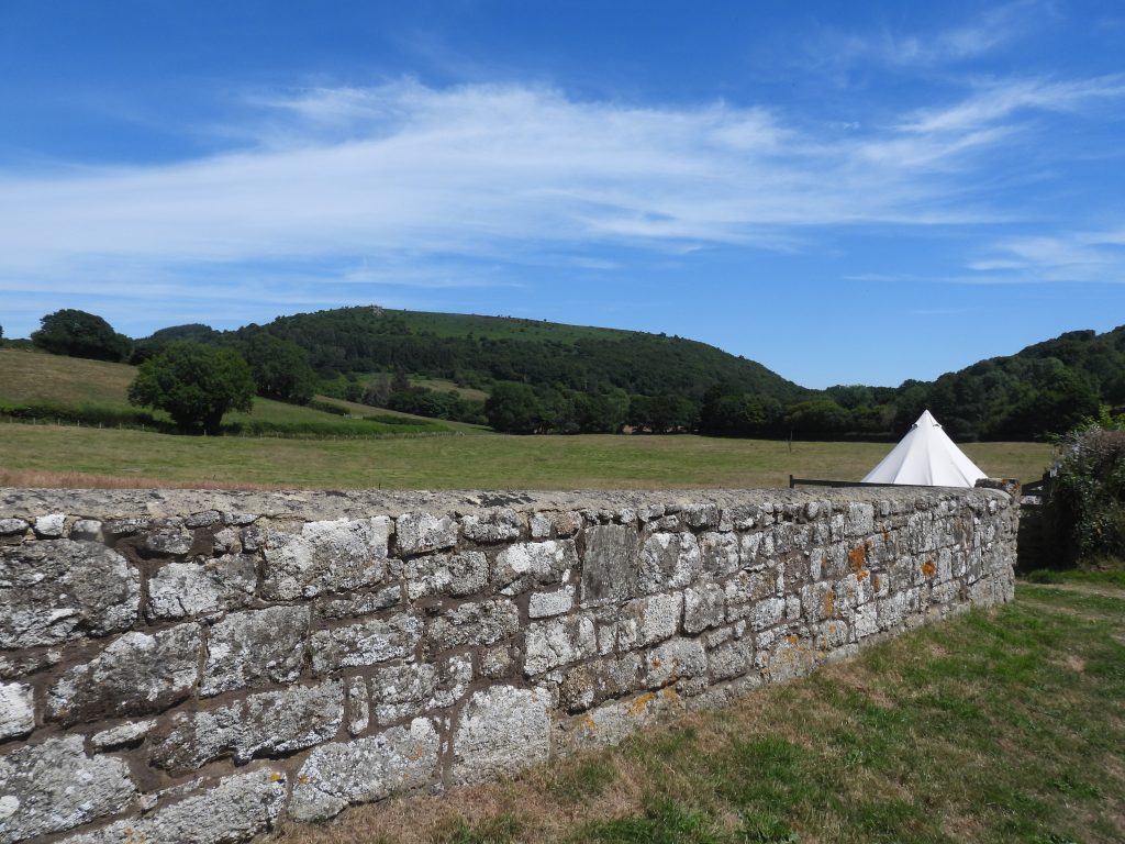
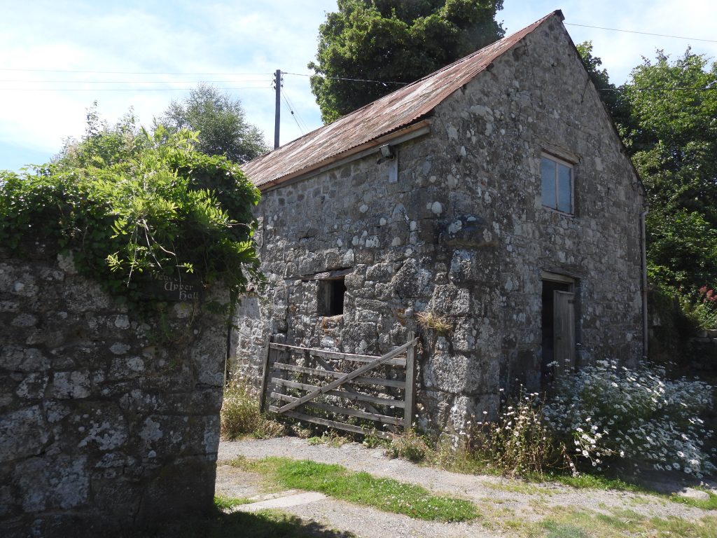
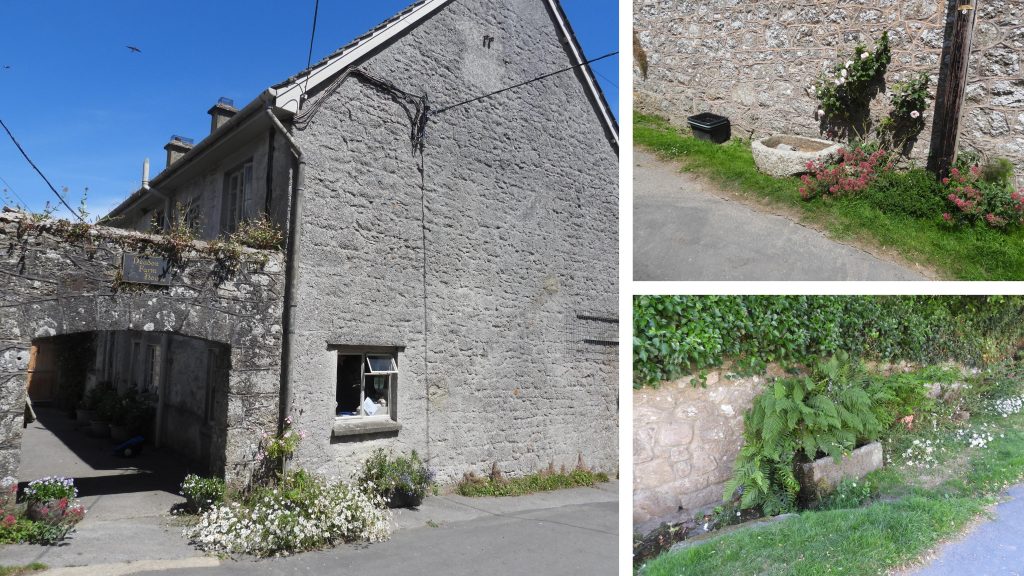
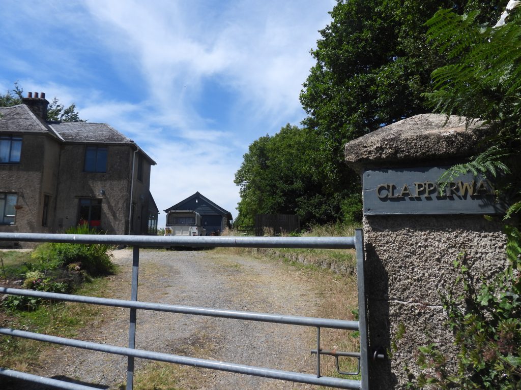
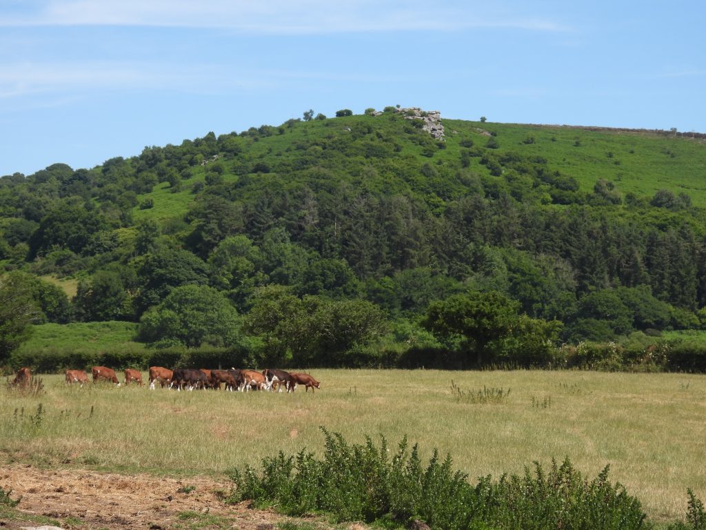
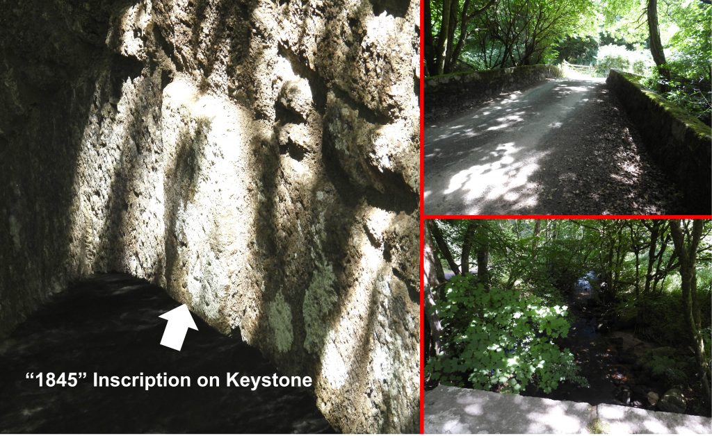
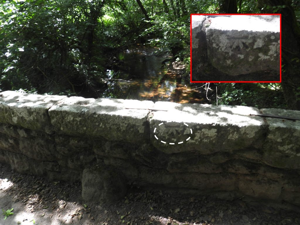
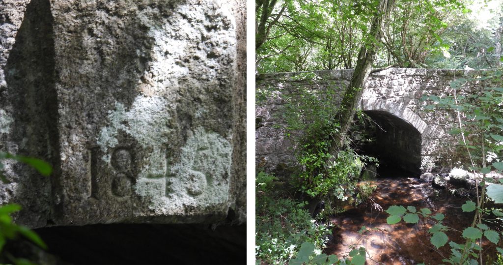
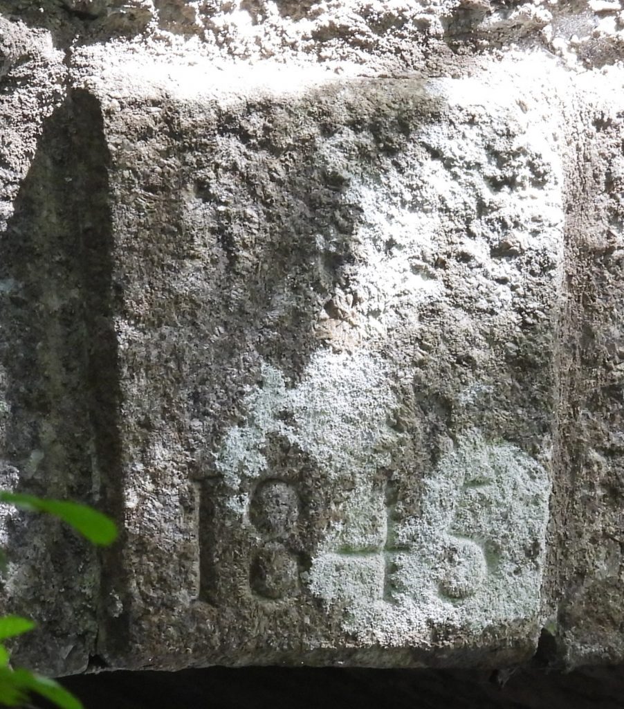
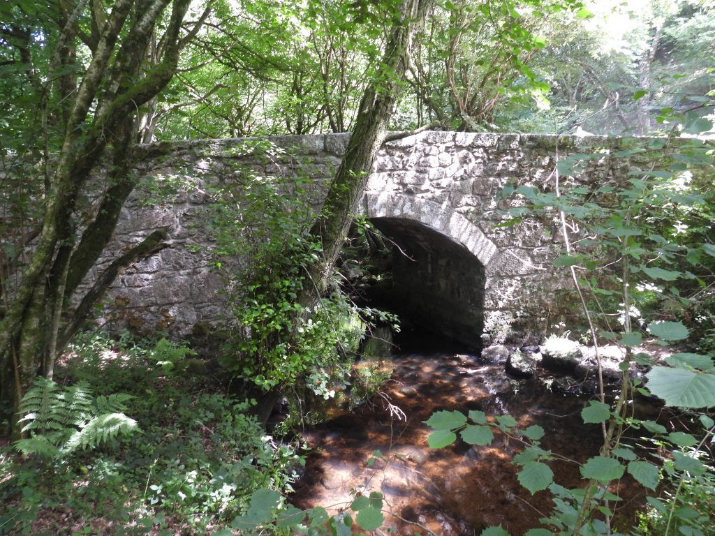
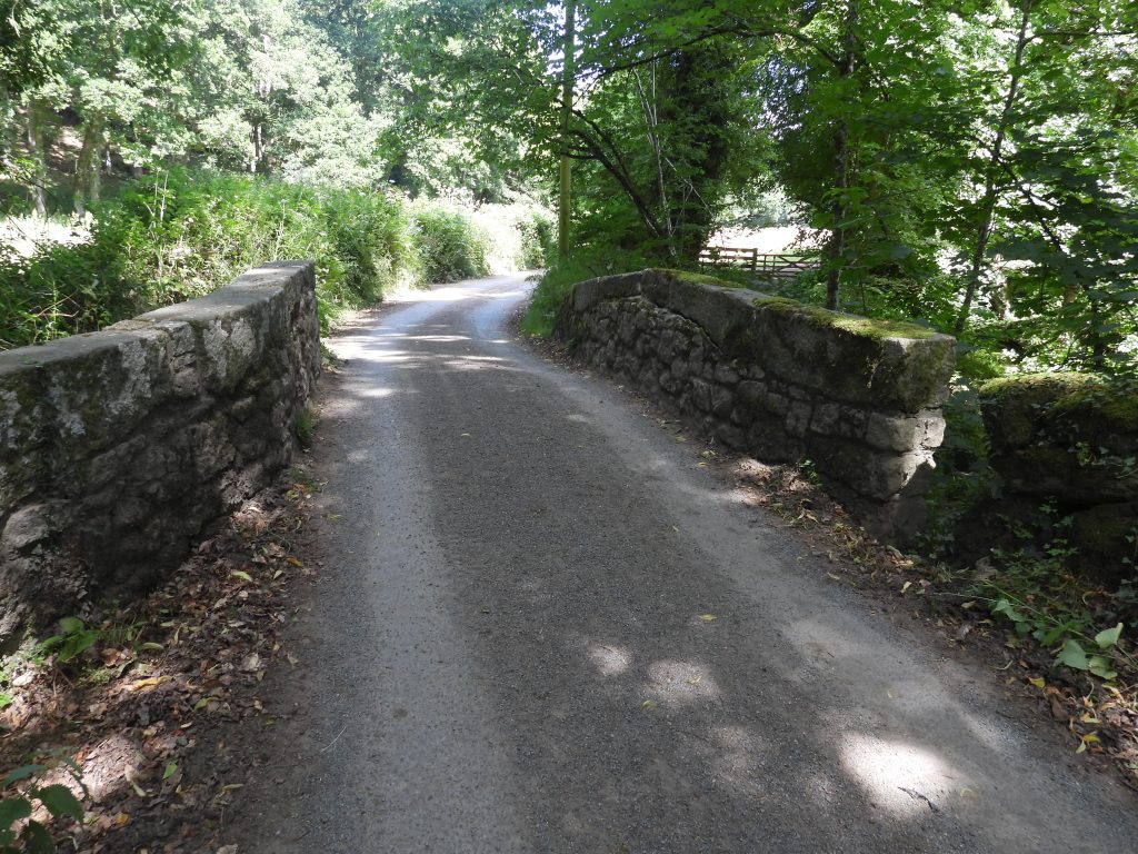
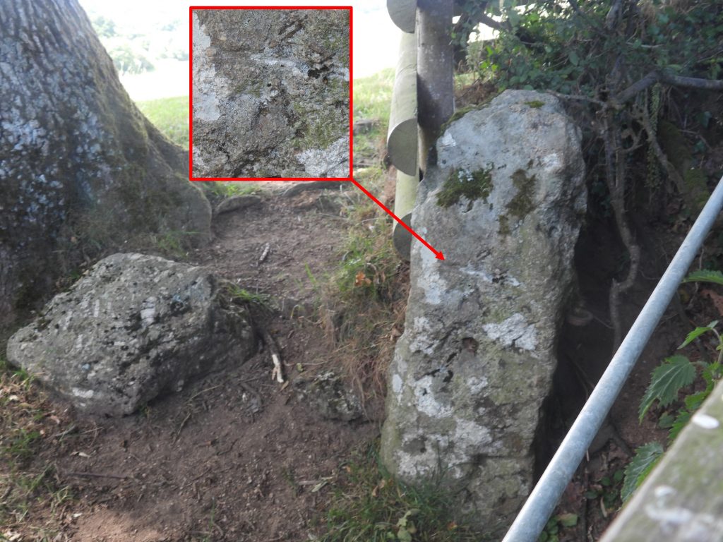
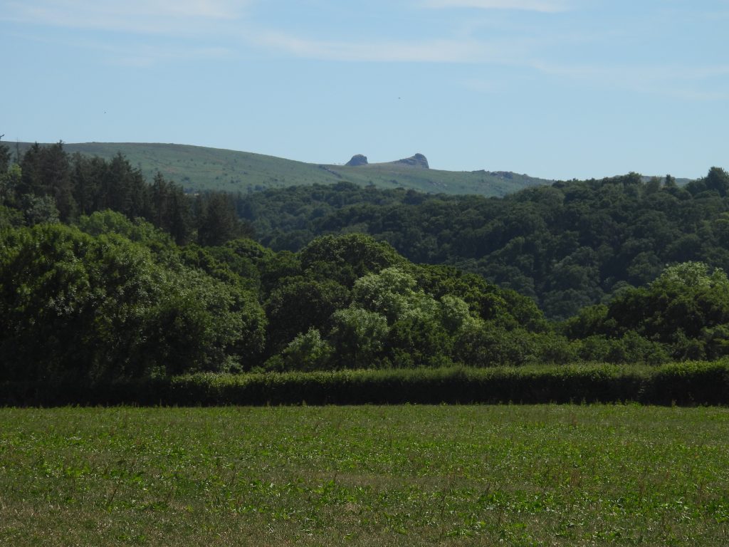
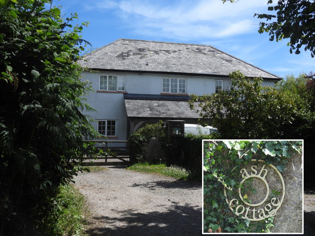
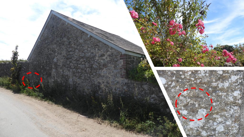
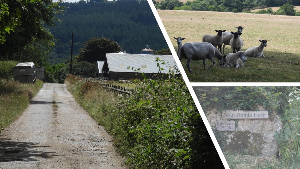
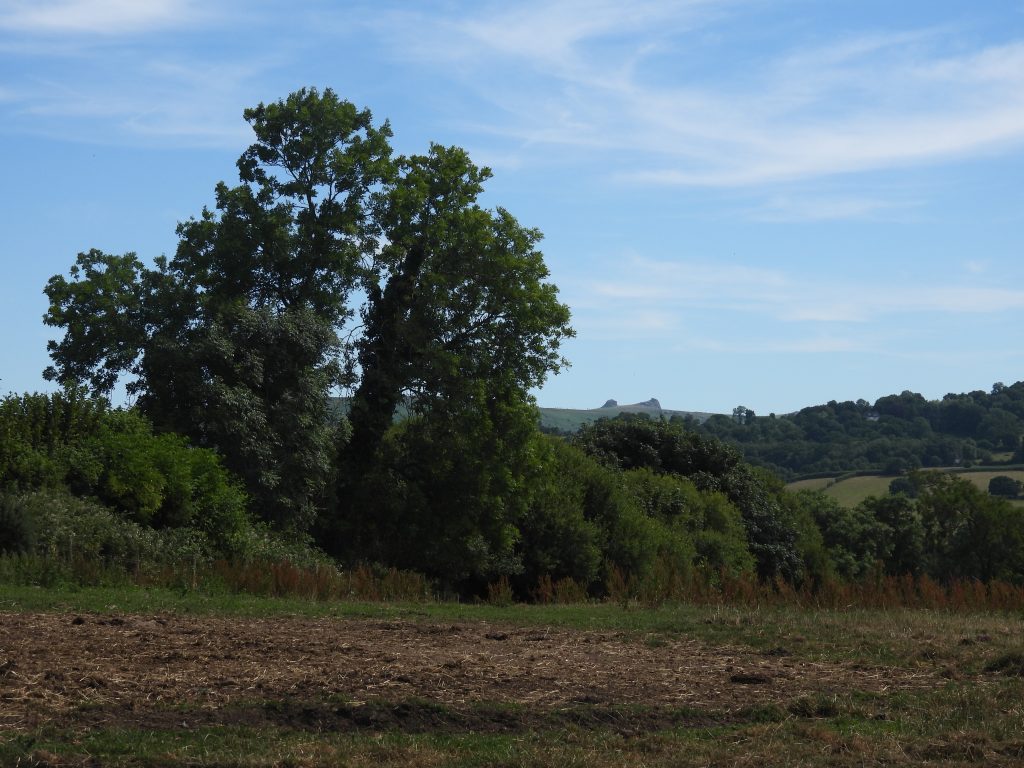
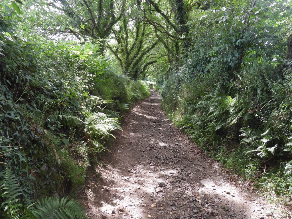
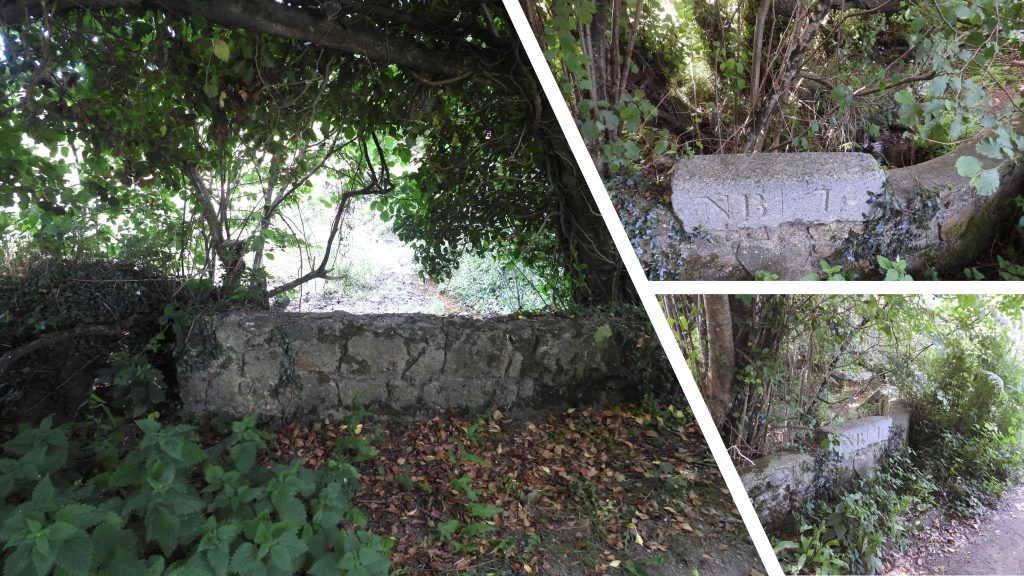
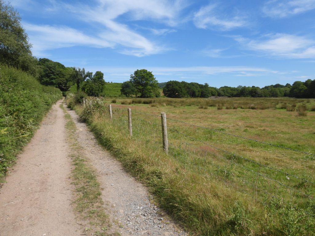
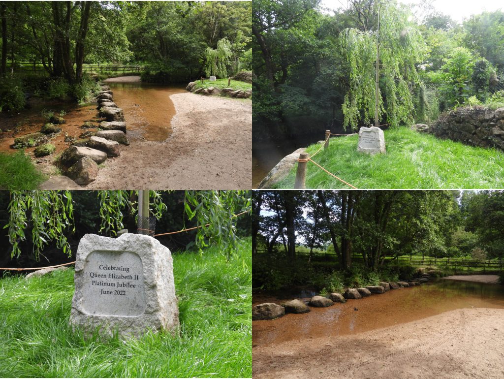
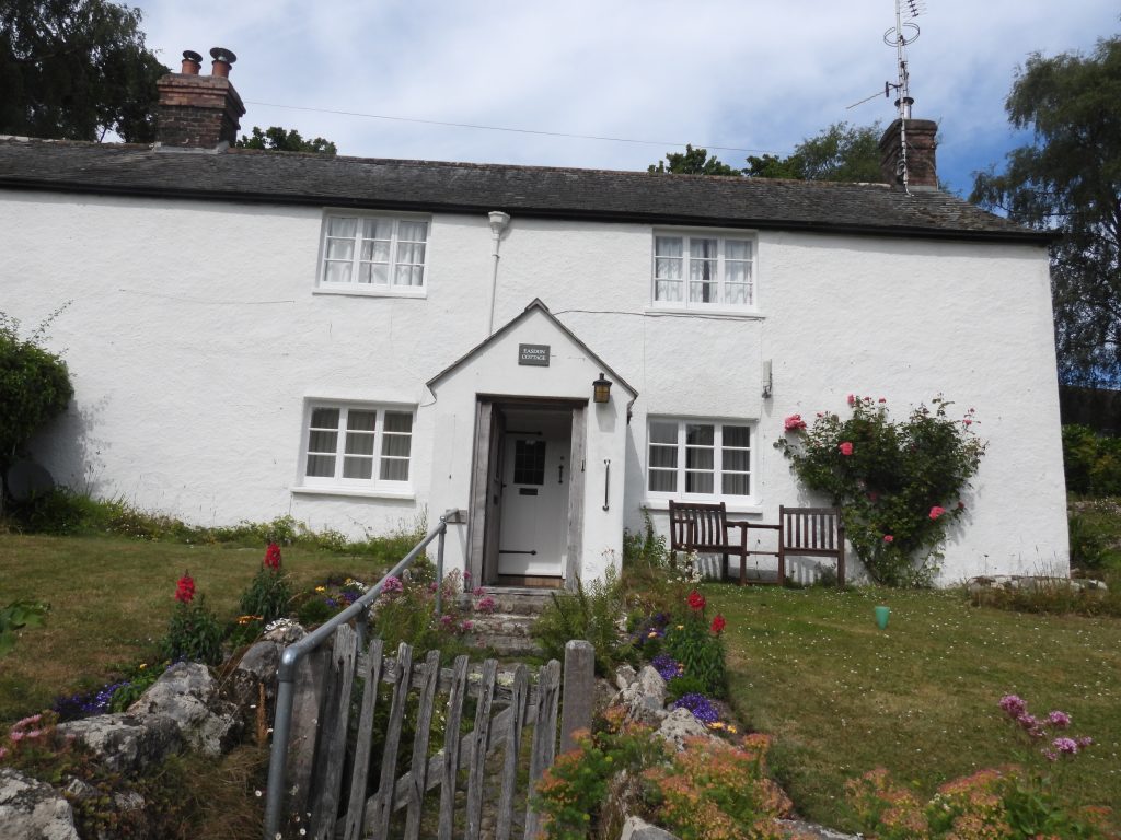
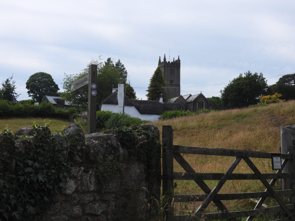
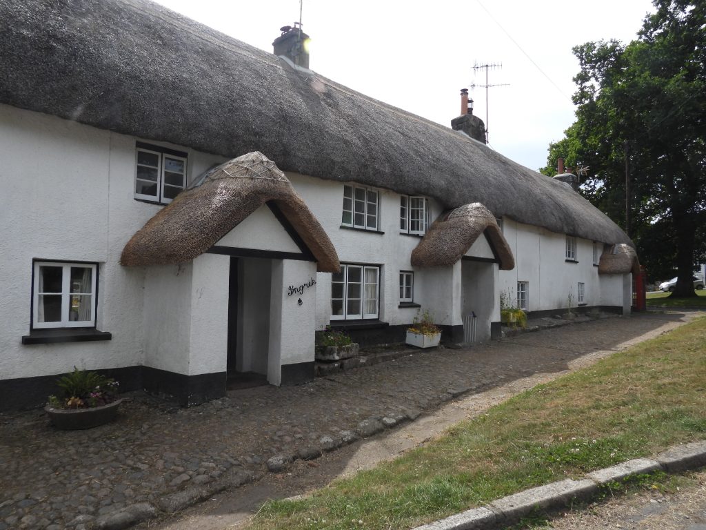
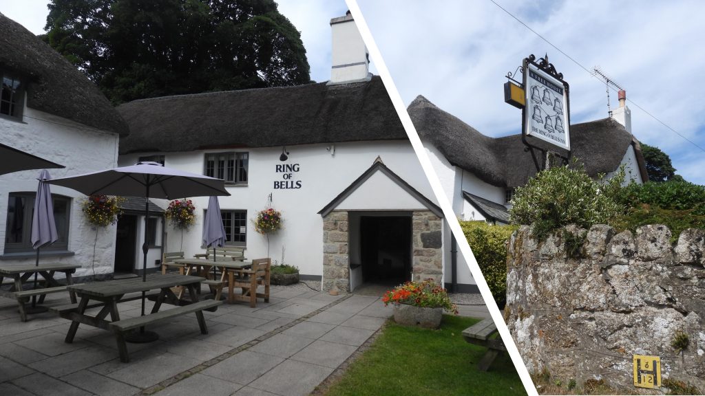
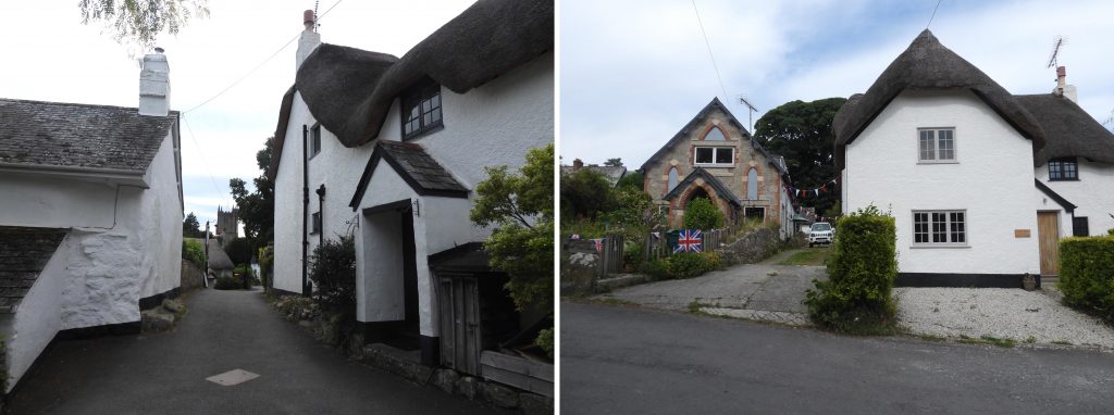
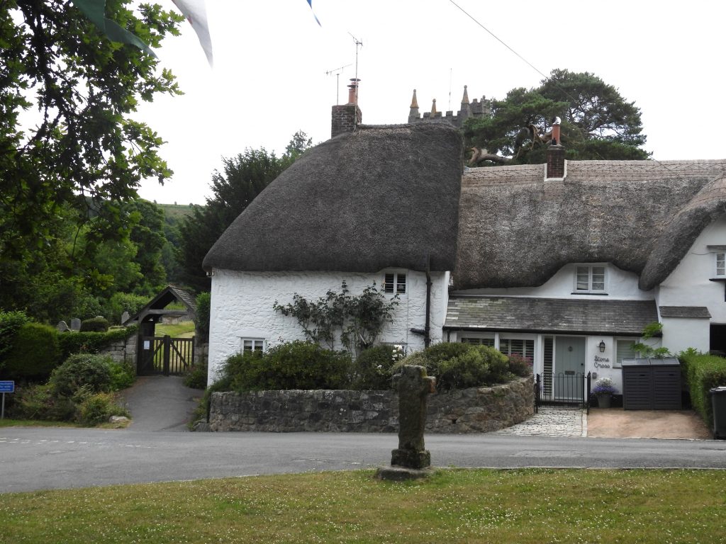
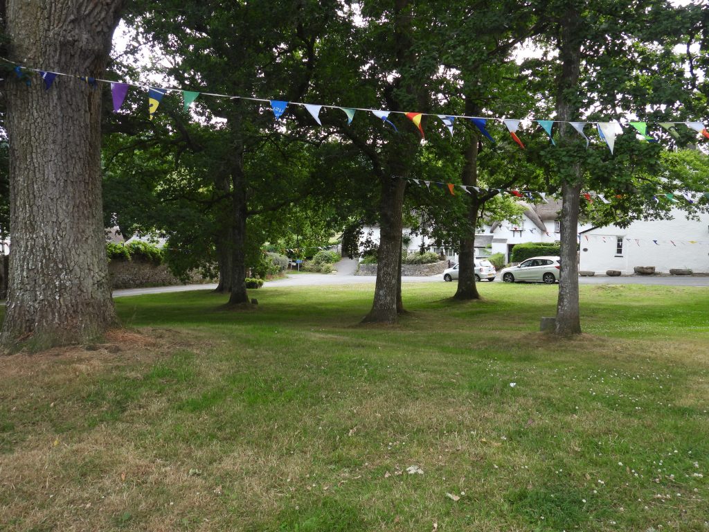
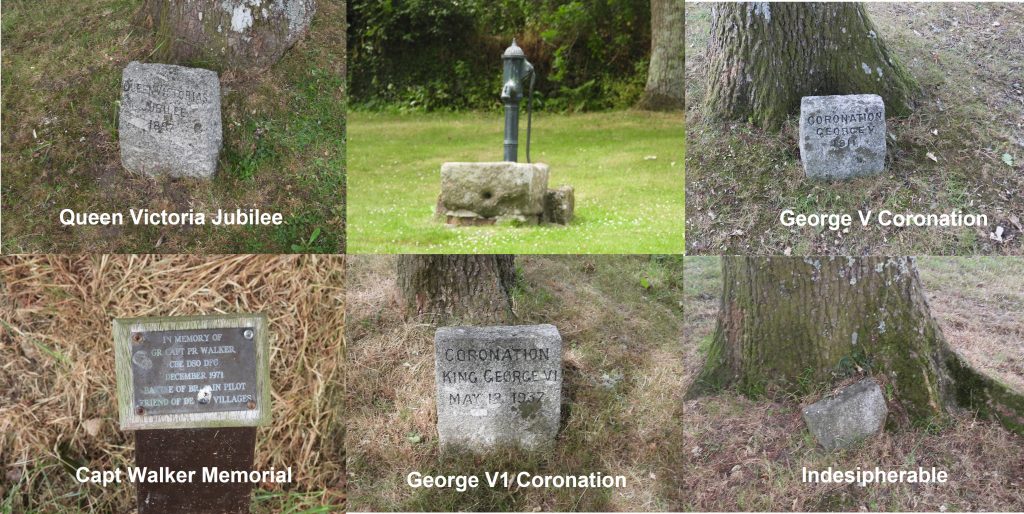
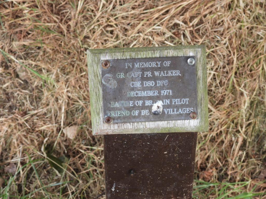
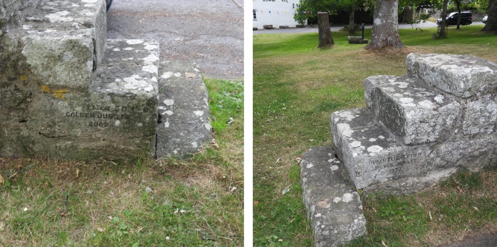
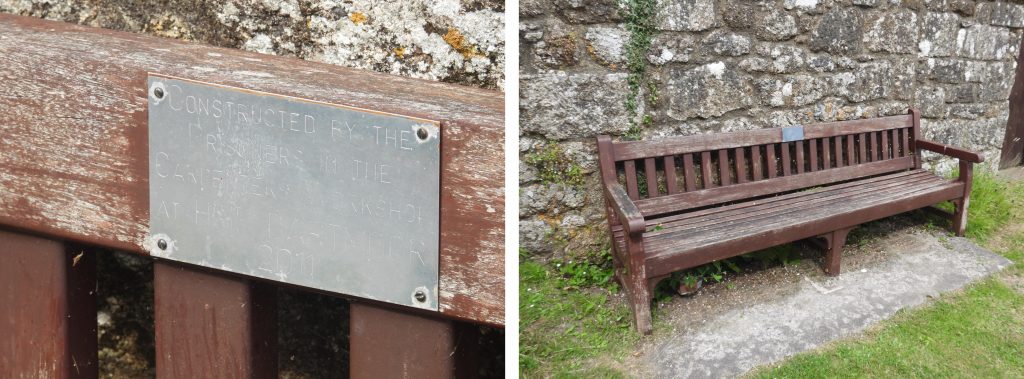
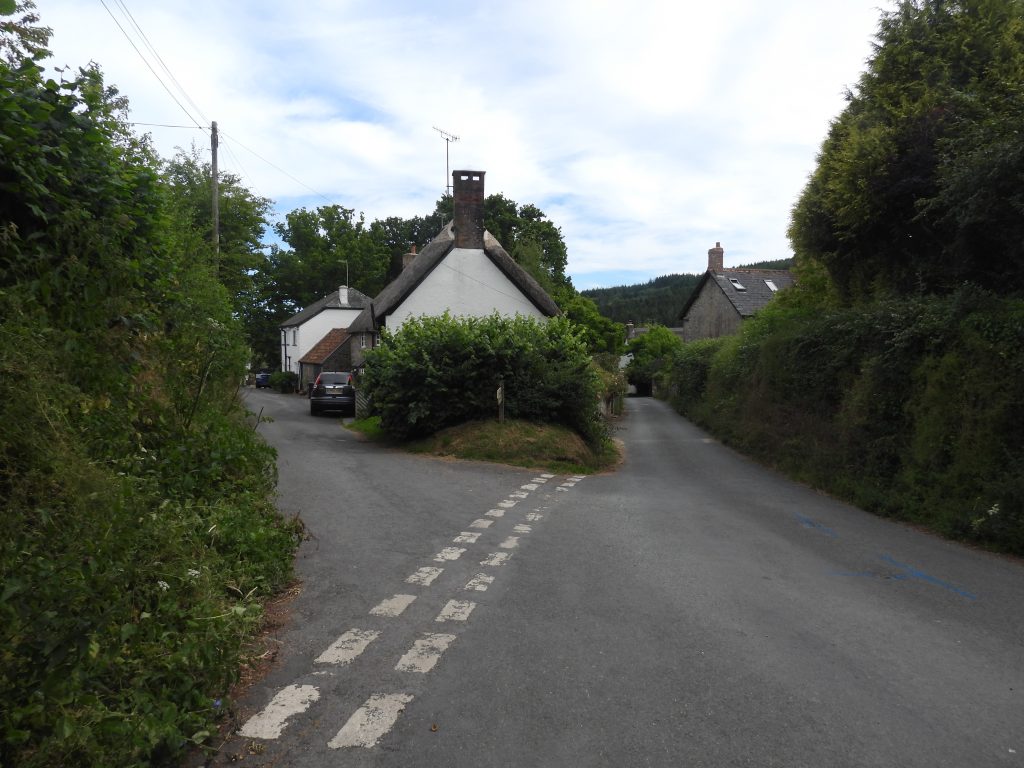
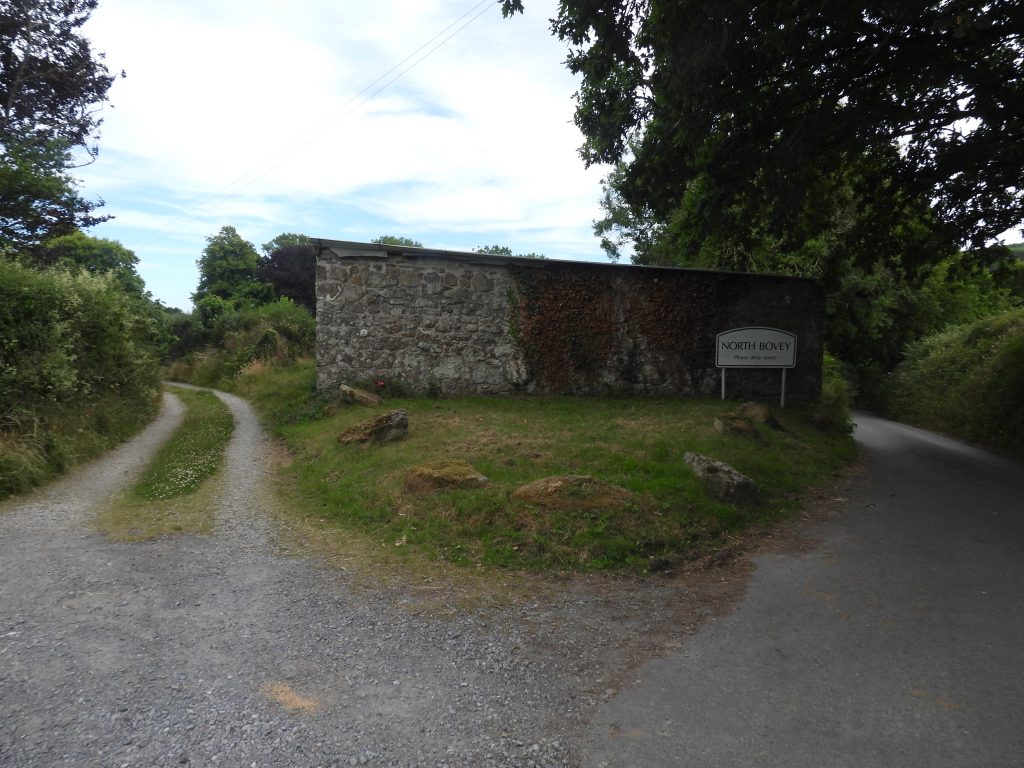
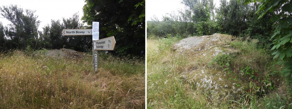
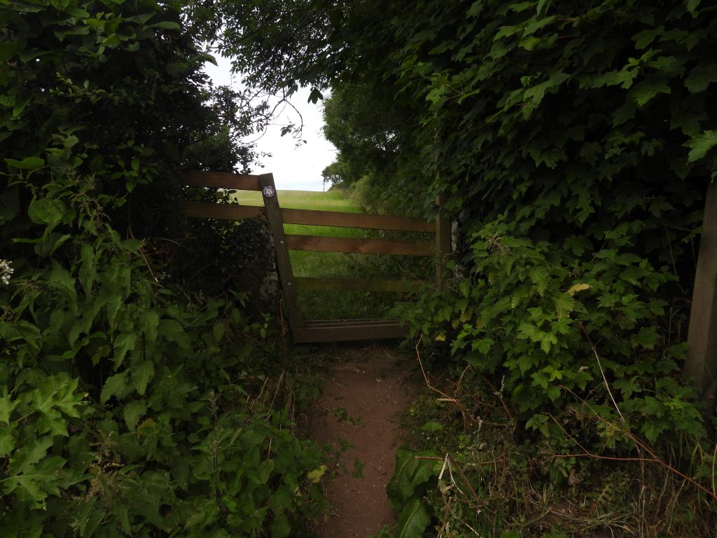
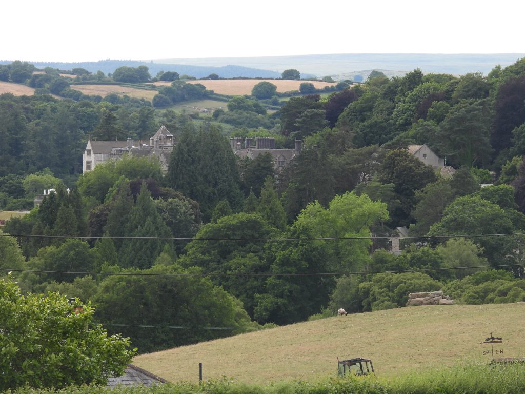
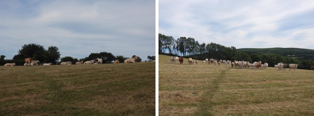
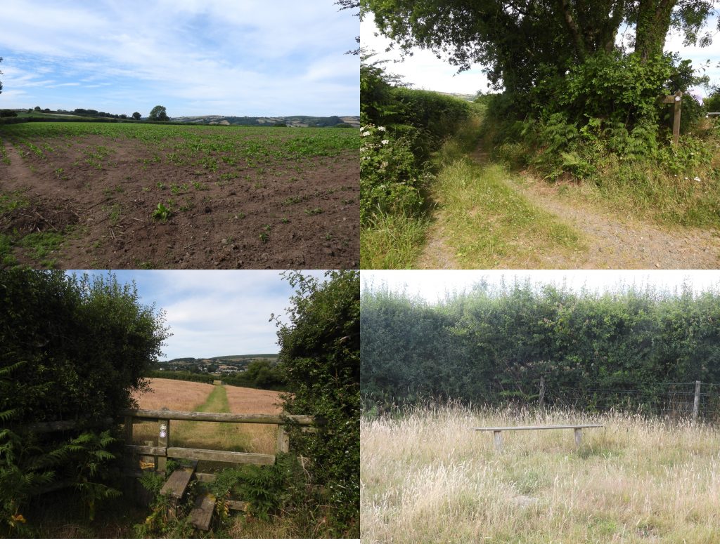
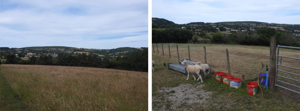
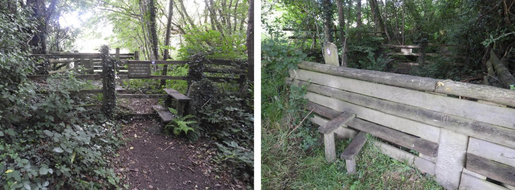
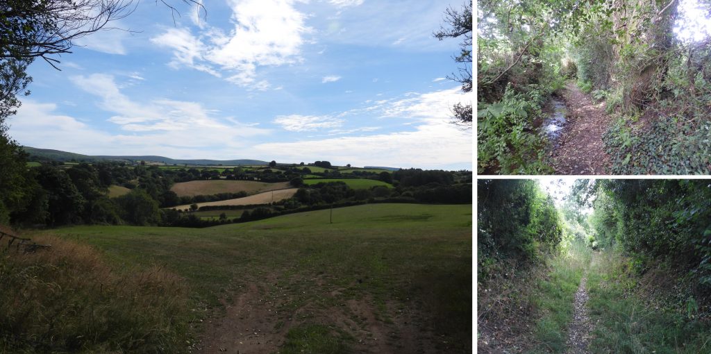
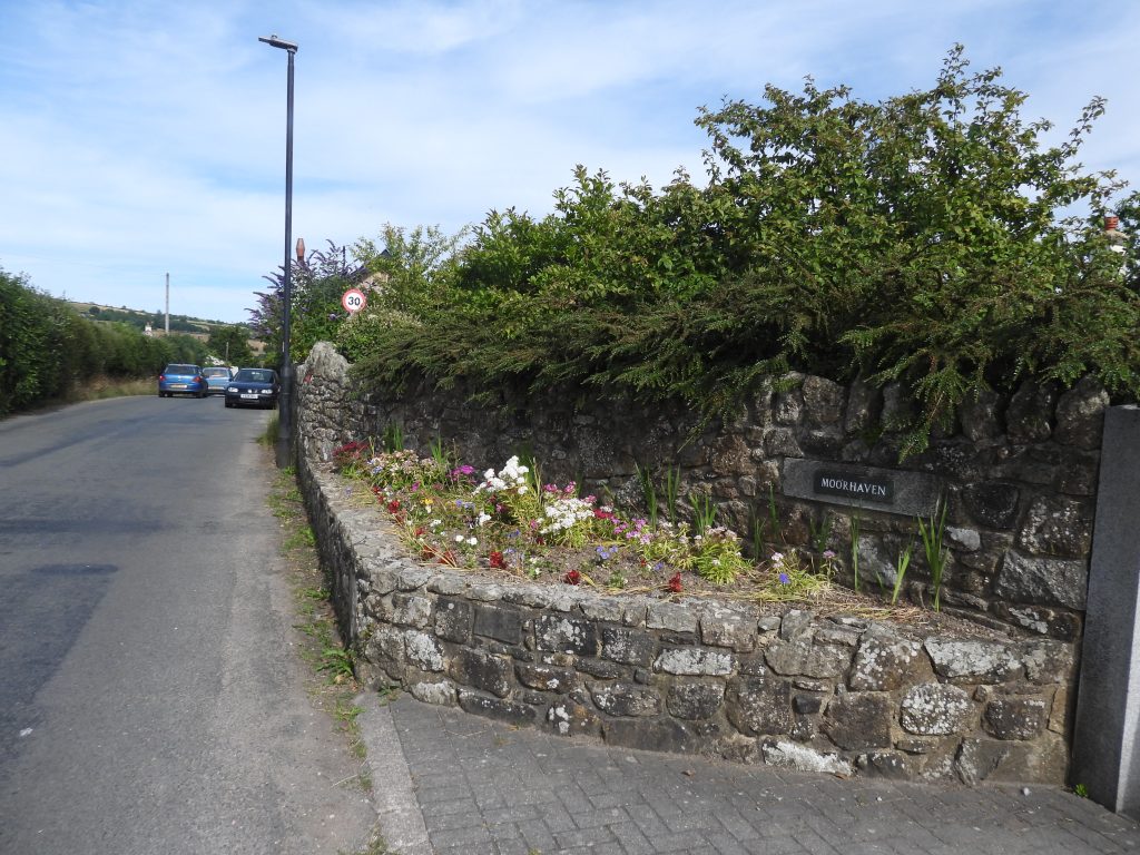
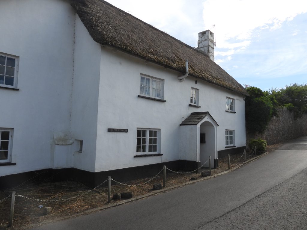
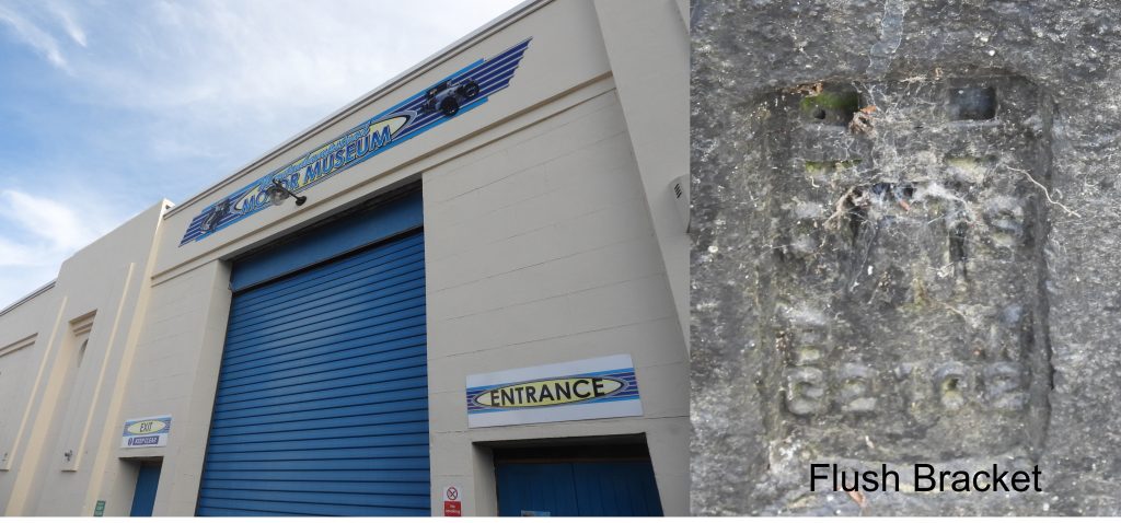
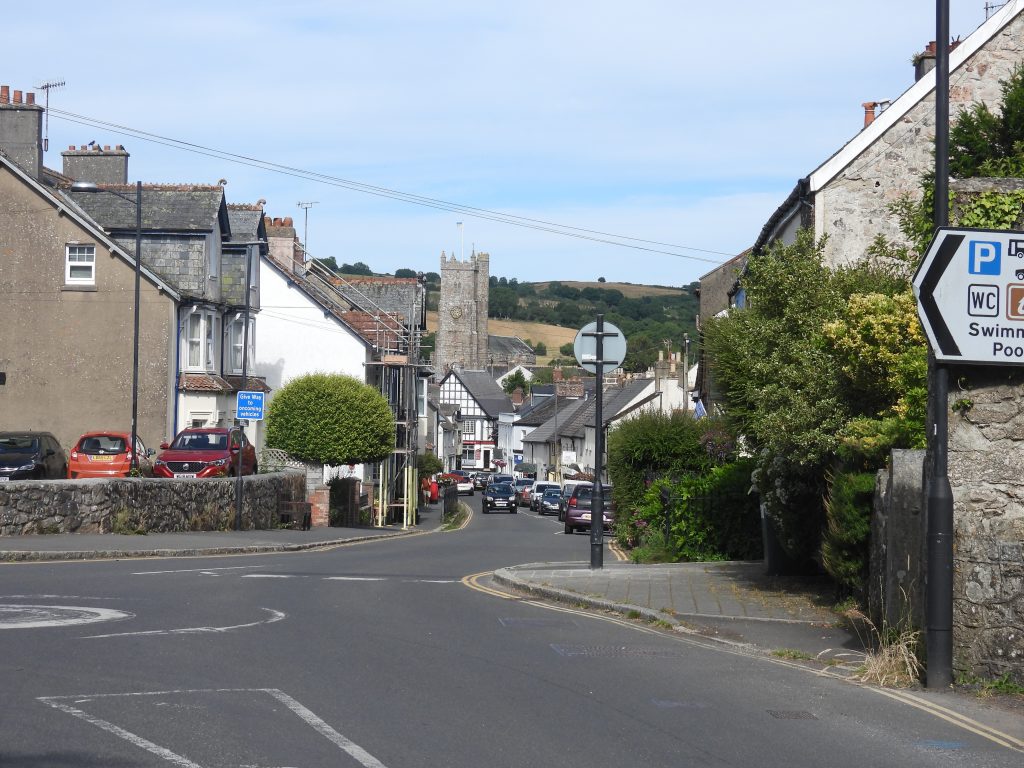
Stage 4 of the Dartmoor Way, which shows the route with some very minor deviations at Wilford Bridge, Hisley Bridge and in WaterBovey Bridge has two semi-circular arches. The first bridge here was probably at least 14th century but was rebuilt around 1642 before being widened in 1852.Bovey Bridge has a steel footbridge added on the northwest side. At a point where there is a gap between the road bridge and the footbridge are two dated stones are set in the upstream parapet.The date on the two stones on the north parapet of the bridge signify the date of the bridge repair/rebuild. Both stones are worn and marked “1642”.Downstream of Bovey Bridge is a building with a waterwheel attached at the base of the tower of a former 19th century stable block. The waterwheel aided the pumping of water up the tower thus providing a water supply to the stables and Bridge House. It was built in 1850 by John Divett. The waterwheel was last used circa 1920 and is now just a “feature”. Ref: Dartmoor HERAdjacent to the downstream cutwater there is a cut benchmark. The benchmark is recorded on maps as B.M. 100.8.Mill Marsh Park. A plaque indicates that some of the trees were planted circa 1982. The author believes the “Men of the Trees” is an organisation founded on 22nd July 1922 by Richard St. Barbe Baker in Kenya. Since then, there have been chapters of “Men of the Trees” in over 100 countries, which by some estimates, have been responsible for planting at least 26 billion trees, internationally. In 1992, Men of the Trees was renamed to the International Tree Foundation.There are two sets of tiled benches in Mill Marsh Park. This set shows tile designs representing Fore Street and Cromwell Arch from the town.The second set tiled benches in Mill Marsh Park includes representation of the Parish Church.River Bovey alongside Mill Marsh Park. The Dartmoor Way route passes under the A382 at Hole Bridge. Some interesting graffiti here reflecting the times.The Dartmoor Way follows the former trackbed of the Moretonhampstead / South Devon Railway branchline. The line opened on 4th July 1866 and passengers ceased to be carried on 2nd March 1959. Now a delightful footpath / cyclepath and part of the Wray Trail.This waterside cliff abuts the River Bovey and is known as Southbrook Rocks (Ref: Tors of Dartmoor), presumably named due to its close proximity to Southbrook Farm and Southbrook House. It is not labelled on any map the author has seen.Southbrook House.Moving north along the old trackbed on the eastern edge of the Parke Estate. The Moretonhampstead and South Devon Railway was a 7 ft 1⁄4 in broad gauge which linked the South Devon Railway at Newton Abbot with Bovey Tracey, Lustleigh before terminating at Moretonhampstead.Bridge crossing the old line between Evelyn Wood (to the north east) and Blackmoor Copse (to the south west). The bridge must have been constructed for the Parke Estate or for access to local farmland / woodlands as it does not carry any road traffic.Point where the cyclists route for the Dartmoor Way continues on the old trackbed (Wray Trail) and the walkers route descends a ramp towards Lower Knowle road.The Dartmoor Way route continues by passing under the old railway line heading towards Lower Knowle road. On the bridge there is a mileage marker “7 3 1/2”, which the author believes refers to this bridge being 7 miles and 3.5 chains from Newton Abbot. Note: There are 80 chains in a mile.A few yards / metres from the turning up Lower Knowle road is Wilford (Woolford) Bridge, which is worth a visit for the views of the River Bovey. The bridge also has a tablet stating when the bridge was repaired.The Wilford Bridge tablet reads : “1750 THIS BRIDG WAS REPA RED BY the COUNTY 1914″ In the 17th century some courts continued in their consideration of imposing levies for the repair of roads and bridges when presentment were made. The constables made these presentments to the Grand Jury at sessions. This tablet recognises the repair of this bridge in 1750, presumably following the process previously described. The tablet was the forerunner to “C” stones found elsewhere. The date 1914 has been added, which one assumes was when the old 17th century bridge was replaced as the present roadway is carried across the River Bovey on iron girders. (Ref: Dartmoor Boundary Markers, 2nd Edition by Dave Brewer)The Lower Knowle road passes under the Moretonhampstead branchline just to the south of Lower Knowle. On the bridge there is a mileage marker “M.O.B 7 .49”, which the author believes refers to this bridge being 7 miles and 49 chains from Newton Abbot. The M.O.B may refer to Moretonhampstead Branch.On the south east end of the bridge is a benchmark. This one does not appear to have a reference on 19th century maps or the Dartmoor HER.Dwellings near Lower Knowle: Starparke, Little Orchard and Covering End.Lower Knowle dates to at least the early-mid 19th century, but may be much older. It appears on the tithe map. This Edward VII post box is located in a stone garden wall on the east side of Lower Knowle Road. A part of the wall collapsed along with the box in 2021, requiring the box to be removed temporarily by the Post Office. The work done to reinstate it is evident with the cement looking out of place in a drystone wall.The Dartmoor Way turns west at this point towards Packsaddle Bridge and Drakeford Bridge. Note the shortened spelling for Moretonhampstead and Bovey Tracey.The Dartmoor Way passes under the Moretonhampstead branchline once again enroute to the Packsaddle Bridge and Drakeford Bridge. The bridge is a double arch, one being used for the road and the other appears to be for possible farming use.Packsaddle Bridge is a humpback bridge, with low walled large granite stone. There is lots of evidence of repair where it appear to have been repeatedly struck by traffic. Having watched a couple of drivers negotiating the bridge the author can see why it has been struck.Just to the south of Packsaddle Bridge is a small building called ‘Ivy Cottage’. It is marked on the late 19th century historic maps, but is not shown on the 1840s Tithe Map, thus dating it to the mid-late 19th century.Fields of hay near Drakeford Bridge Drakeford Bridge is a medieval bridge, which appear to have been repaired by the county in 1684 (it has a tablet like Wilford Bridge indicating this). It was widened by 6ft on the upstream side in 1809 by James Green (County Surveyor), under the 1803 Bridge Act.The Drakeford Bridge tablet is very well inscribed. It is interesting to note the use of upper and lower case letters, the spelling of “Bridge” and the reversed “4”. After leaving Drakeford Bridge, the Dartmoor Way enters Pullabrook Wood via a parking area. It passes through a gate then follows a broad the track through the woods signed to the old Manaton road. Pullabrook Woods / East Dartmoor Natural National Reserve are working woodlands, for which there is plenty of evidence en-route.As recorded on the Dartmoor Way website, “The East Dartmoor Woodlands are jointly owned and administered by Natural England and the Woodland Trust. They are a mix of ancient woodland and wildflower-rich wet meadows nestling in the steep-sided valley of the River Bovey”. Gate at the west end of Pullabrook Woods. There is a small plaque on one of the gateposts which reads “Dot and David Merriott love walking together, in woodland through kissing – gates…From April 15th 2003 onwards” (WOODLAND Trust).This sign can be located at the junction of the Pullabrook Wood track and the “Old Manaton Road”. The Dartmoor Way follows the “Old Manaton Road” which descends into the valley.The Old Manaton Road crosses a stream where it emerges from a steep-sided combe which leads to Trendlebere Down.Views from Old Manaton roadThe Pudding StoneThe Pudding Stone has a benchmarkThe iconic Hisley packhorse bridge is a very short diversion from the Dartmoor Way. The bridge is said to be medieval and appears on the tithe map.Hisley bridge is in a beautiful location, ideal for a coffee or lunch stop. It is recorded as measuring 12.5 metres long with 3 metres internal width and has a lovely arch / hump. Lustleigh Bridleway 14 crosses the bridge.There is a lovely ford upstream from Hisley Bridge. The Dartmoor Way leaves the River Bovey at this point as it enters Houndtor Wood and runs adjacent to Houndtor Ridge.Signpost on the old Manaton roadThe Old manaton road runs from Holne Brake to Water and then Manaton, through Houndtor Wood. It is a lovely path for the Dartmoor way to follow. The bridge crosses the Becka Brook. This route is depicted on the Tithe Map and was superseded as the main highway by the road built across Trendlebere Down in the mid-late 19th century.Bat boxes next to the path.Crossing the Becka Brook over an old packhorse bridge. It is at least 19th century as it appears on the Tithe Map. It is locally known as Houndtor bridge.Another view of the packhorse bridge over Becka Brook.There is a benchmark (with hole where rivet / bolt used to be) on a granite post on the south east side of the packhorse bridge. 19th century maps label a benchmark on the east parapet of the bridge as B.M 0311.9, but this is not in that exact location. Is the original map in error and this benchmark is B.M 0311.9 ? It would be unusual to have two benchmarks so close together.On a post just a few metres to the north of the packhorse bridge which crosses the Becka Brook there is a memorial plaque which reads: “In memory of William and Helena Heath (nee Hurrell) beloved parents of Dorothy Harris who appreciated natural places and helped to conserve Houndtor Wood for the future”. Climbing the hill through Houndtor Wood. A Dartmoor Way sign attached to a tree stumpView of Trendlebere Down from Houndtor Wood.The climb up through Houndtor wood from Houndtor bridge is the steepest ascent on this stage on the Dartmoor Way.Leaving Houndtor Wood. On the north gatepost is another benchmark (B.M. 0711.5 – ref: National Library of Scotland – side by side maps)Leaving Houndtor Wood and climbing the hill towards Beckhams, glimpses of Trendlebere Down can be had.Another benchmark, this one has a extant rivot / bolt. Ref: B.M. 0820.9. The benchmark is on right face of the gatepost below the rivot. Dartefacts records this benchmark at SX76349 80521Views around Beckhams. The house at Beckhams does not appear on 19th century maps but does appear on the 1949 OS map, so one assumes it was built in the first half of the 20th Century.In the lane just past Beckhams on a gatepost another benchmark can be found. Ref: B.M. 0797.9Entering the hamlet of Water, a Swallow (possibly a Barn Swallow) on a wire – photo is heavily cropped.Hedgerow in the hamlet of WaterA short distance off the Dartmoor Way is the Kestor Inn, which was a lovely lunch stop for the author. As recorded by T. Quick, in the publication Dartmoor Inns (1992): “The inn dates to the early part of the century and was built on behalf of the landlord of the Half Moon Inn, Manaton. It was intended to be a boarding house for farm labourers and other workers in the area but the landlord decided that Manaton did not require both establishments and closed down the Half Moon Inn, favouring the size and position of the Kestor. The building was extended around 1980”.An eclectic mix of items in a hedge near the Kestor InnThe hamlet of Water is shown on 19th century Tithe Map. It has extended to the west and now meets the hamlet of Freeland. The author believes the building which is shown amongst the trees (top right picture) is Water House Farm.There is an old pump on a green in Water. The picture shows a pair of cottages, which were originally one house. The original building is thought to be 16th century, but was much altered possibly in the 18th century.Another angle showing the pump and two cottages. The bird feeder had numerous birds on it just before the author took this picture.More views of Water hamlet, a delightfully tranquil locationThe Water Mill in the hamlet of water is a converted threshing barn which has a restored waterwheel. The mill building is thought to date from the early 19th century. (Ref: Bodman, M., 2003, Watermills and Other Water-Powered Sites in Devon).The water course feeding the mill. On the north side of the track a small stream with a small reservoir. The water course runs under the track and feeds a wooden launder which leads to the (overshot) waterwheel.Zoomed in view of the water wheel.The barns at Water House Farm are grade III listed buildings and date to at least the early 19th century as they are depicted on the Tithe Map.Benchmark on a post a short distance from Water en-route to Horsham (ref : Dartefacts – SX75931 80914)Zoomed view of Hunters Tor from Water / Horsham pathClapper bridge at the ponds near HorshamAn unusual inscribed slab near Horsham: “THE LOST MARBLES DEPT. NO ENTRY”.Water / Horsham signpost. The Dartmoor Way signs evident.Horsham is an early 16th century house and was originally a farmhouse. It is recorded as having been remodelled in the 18th century and extended at the rear in 20th century. (ref: English Heritage). The Dartmoor Way follows the path around this lovely property.Footpath descending towards the upper reaches of Neadon CleaveAnother signpost. The Dartmoor Way markers direct the walker towards Foxworthy and the county road which leads to NeadonThe final sections of woodland paths in Neadon CleaveAnother glimpse of Hunters Tor and the Dartmoor Way exits Neadon CleaveNeadonNeadon Farm / Foxworthy sign.Another view of Hunters TorLittle NeadonApproaching NeadonThe Upper Hall at Neadon. The building has a first floor hall. The building is believed to date from late 15th century and has been used as a barn and a house. It was restored as a house between 1982 and 1983. (ref: Historic England listing).View from Neadon, looking south east towards Lustleigh Cleave.This barn is around 15-20 north of the Upper Hall at Neadon. The original purpose of this building is surmised at being either a house or service building to Neadon Upper Hall. It is thought to date from late 15th century origin and was considerably altered in 18th or 19th century. (ref: Department of Environment from Historic Environment Record)Neadon Farm House with two troughs on either side of the road. The farmhouse is said to have 17th century origins with an 18th century house. It is recorded that it was probably remodelled in early 19th century. (ref Dartmoor HER).Clapperway. En-route between Neadon and Barnecourt.Hunters Tor (again) with field of cows – lovely sceneThere is a delightful bridge which is crossed on the Dartmoor Way between Neadon and Barnecourt which is labelled “Clapper Bridge” on modern OS maps. It has a date inscription on the keystone on the upstream side.The “Clapper Bridge” also has a benchmark (ref: B.M. 0644.1on National Library of Scotland, side-by-side maps)The date inscribed on the keystone is “1845”. It is thought this is when the bridge was built.A close up of the keystoneThe bridge spans the River Bovey.Just a few metres from the “Clapper Bridge” is a another bridge which spans a tributary of the River BoveyClimbing up the lane from the “Clapper Bridge” towards Barnecourt, view of North Bovey and its churchAnother benckmark! This one is next to the Barnecourt lane at SX75480 82994. (ref: 0709.9)North Bovey with Meldon Hill prominent behindHaytor Rocks from near BarnecourtAsh Cottage near BarnecourtBarnecourt Barn with its benchmark. From this point the Dartmoor Way follows first a tarmac road to Southlands Farm then a bridleway past Dickford Bridge onto North Bovey. There used to be a Medieval Manor House here which was demolished just before the Second World War. The Manor House was alongside the wall of the farmyard and barns were built where it stood. Southlands FarmAnother view of Haytor Rocks on the distant horizon. The rocks were visited on Stage 3 of the Dartmoor WayNorth Bovey churchThe tarmac ends and a bridleway begins as the Dartmoor Way descends to Dickford BridgeDickford Bridge over Dickford Water with the parish marker stone for boundary of North Bovey (NB) and Lustleigh (L)The path after Dickford Bridge alongside a mini flood plain for the River BoveyNorth Bovey ford and stepping stones on the River Bovey. A stone celebrating the Queen’s Jubilee has been erected next to the river here. It reads: “Celebrating Queen Elizabeth II Platinum Jubilee June 2022).Easdon cottage on the outskirts of North Bovey. It dates from early 19th century and was extended in the early 20th century.North Bovey Church (St. John the Baptist) has a 13th century chancel. The remainder is from the 15th century with various 19th and early 20th century restorations. (Ref Dartmoor HER).North Bovey. This row of 3 cottages are reputedly former wheelwrights workshop from mid-17th-18th century. (ref English Heritage)The Ring of Bells was originally a farmhouse dating from late 15th/early 16th century. It was altered in the 17th century before being modernised in the 20th century. It was badly damaged by fire in January 2016. (ref: Department of Environment)Methodist Chapel and Chapel cottage. The cottage dates from the 18th century and was formerly called ‘Thatchways’). It has a 19th century wing at the front. The Methodist Chapel (Wesleyan)’ is depicted on the late 19th century maps – the author has no further history on the building.North Bovey cross. socket stone that originally housed a different cross. The shaft was apparently used as a footbridge up to the early 19th century before it was erected on the green. A typical eastern Dartmoor wayside cross.North Bovey GreenOn North Bovey green there is a delightful selection of celebratory plaques plus and old pump and a memorial plaque. Top left: Queen Victoria Jubilee, Top Middle: Old hand pump with granite trough, Top right: George V Coronation 1911, Bottom left: Memorial plaque to Capt Walker dated 1971, Bottom middle: King George VI Coronation 1937, Bottom right: unfortunately is indesipherable. Close up of the Capt Walker memorial plaque. It reads: “IN MEMORY OF GR CAPT PR WALKER CBE DSO DFC DECEMBER 1971 BATTLE OF BRITAIN PILOT FRIEND OF DEVON VILLAGES”. RIP Capt Walker.On the edge of North Bovey green is a small flight of granite steps, presumably to assist with the mounting and dismounting of horses. The are two inscriptions on the steps, which commemorate the Silver Jubilee (1977) and the Golden Jubilee (2002) of Queen Elizabeth II.A bench next to North Bovey green states that it was “CONSTRUCTED BY THE PRISONERS IN THE CARPENTRY WORKSHOP AT HMP DARTMOOR 2011” Leaving North Bovey for the final few kilometres to Moretonhampstead.Site of the medieval North Bovey pound. This one-time pound is in use today as pig-sties.Pound RockThe Dartmoor Way leaves the tarmac road outside North Bovey and over this stile heading through fields towards Moretonhampstead. The footpath is North Bovey Footpath 10.A glimpse of Bovey Castle across the fields and through the trees. The “castle” was originally known as North Bovey Manor House, and was built between 1905 and 1907 as a country retreat for Viscount Hambledon. The land was bought by his father W.H. Smith from the Earls of Devon. Following Viscount Hambledon’s death in 1928 the house was bought by the Great Western Railway company and coverted to an hotel. (ref: Harmer, V., 2003, Manor House Hotel, North Bovey)Cows on the Dartmoor Way. The author took a short detour around this herd so as not to disturb them. There were quite a few calves around.Paths, stiles, benches, bridleways and fields en-route to MoretonhampsteadFirst views of Moretonhampstead, the final destination of stage 4 of the Dartmoor WayTaking a short breather to admire the sceneryDouble trouble near Wadley Brook, a pair of stilesThe final paths and views before reaching the B3212 and MoretonhampsteadEntering Moretonhampstead. There is no footpath here so best to take caution of traffic. This road was once known as “Carter’s Road”, after the contractor who built it. In 1772, the Moretonhampstead Turnpike Trust was responsible for 13 miles of new road between Cherrybrook on Dartmoor and Reedy Gate at Dunsford. (ref: Moretonhampstead History Society)The Courthouse is Circa an early to mid-17th century house alongside the B3312. The Court Leet was held in this house until about 1847. A court leet was a historical court baron (a type of manorial court). A group of tithings located within each manor were once called a leet.Mortonhampstead Motor Museum complete with its own OS “flush bracket”. Dating from the early 20th century, this building used to be an Omnibus Depot and on modern maps as a garage. It is now a motor museum. The flush bracket is labelled OSBM G2102, thus dating it from the 2nd Geodetic levelling of England and Wales between 1912 and 1921. (Note: flush brackets were away of accurately defining a height above sea level and used for the more important level control points. They can be found on set “flush” into trig pillars, and onto walls and buildings).Moretonhampstead, the end of stage 4 of the Dartmoor Way, looking down Court Street.