A collection of walks, discoveries, insights and pictures of exploring Dartmoor National Park
July 7, 2022
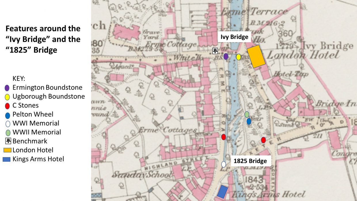
The “Ivy Bridge” and “1825” Turnpike improvement Bridge and environs in Ivybridge town.
This post covers some interesting features surrounding the two earliest bridges in Ivybridge Town. The features include the two bridges plus two boundstones, two county “C” stones, two war memorials, a Pelton wheel turbine and a benchmark.
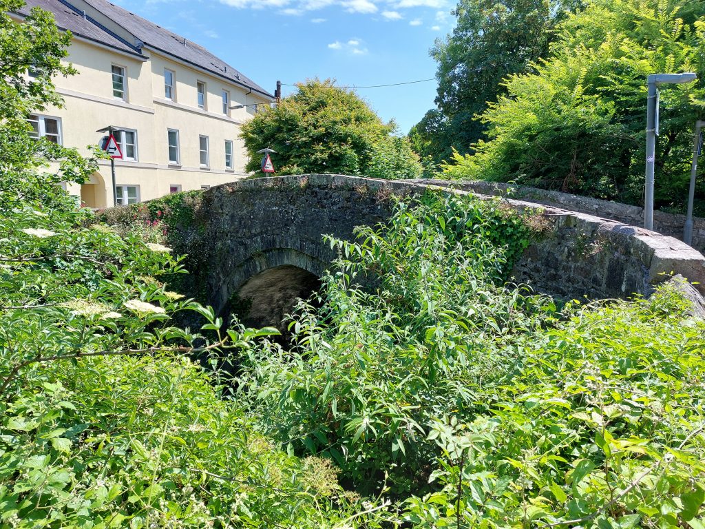
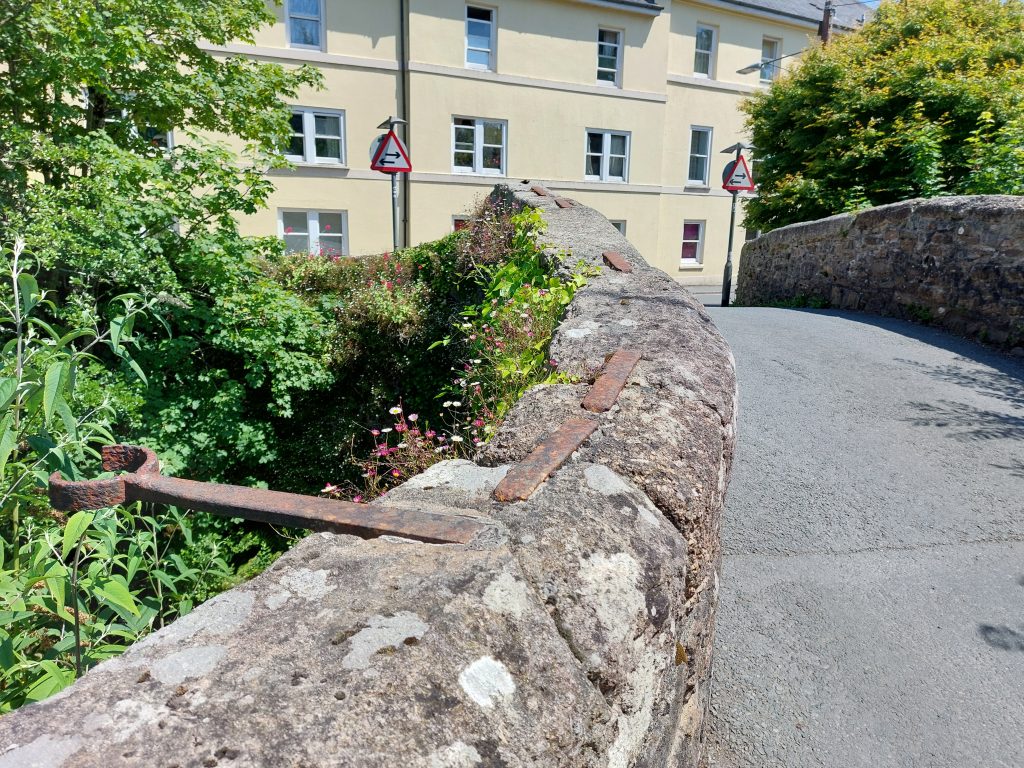
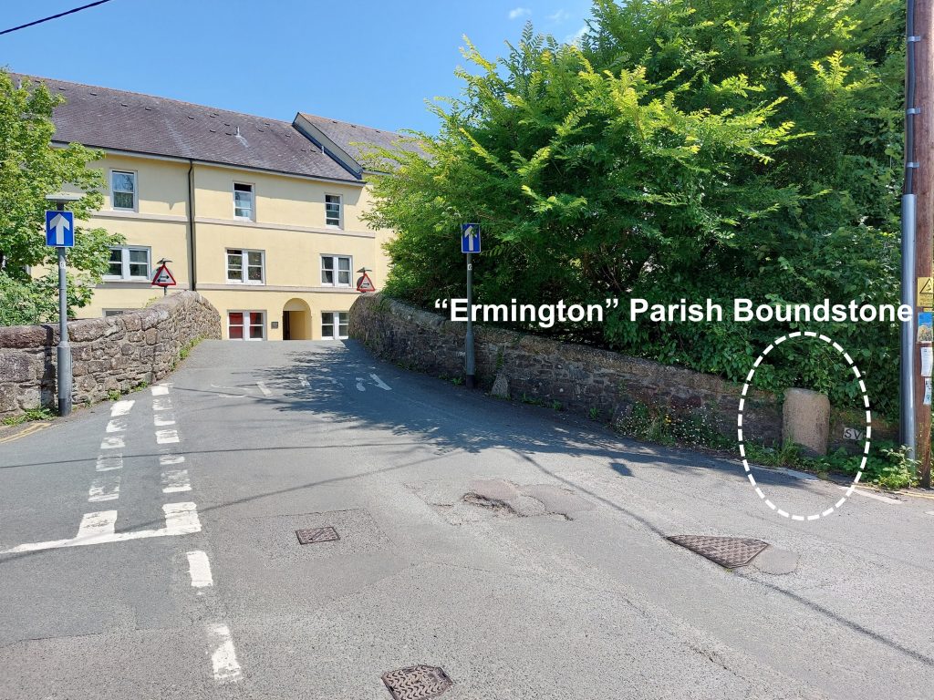
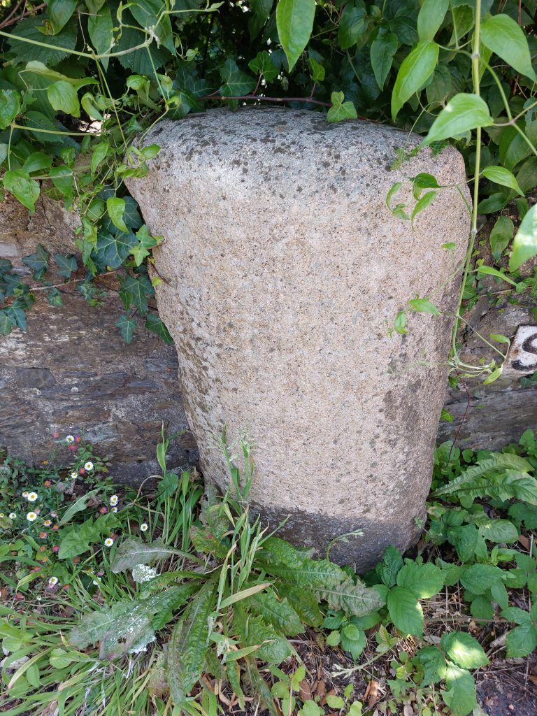
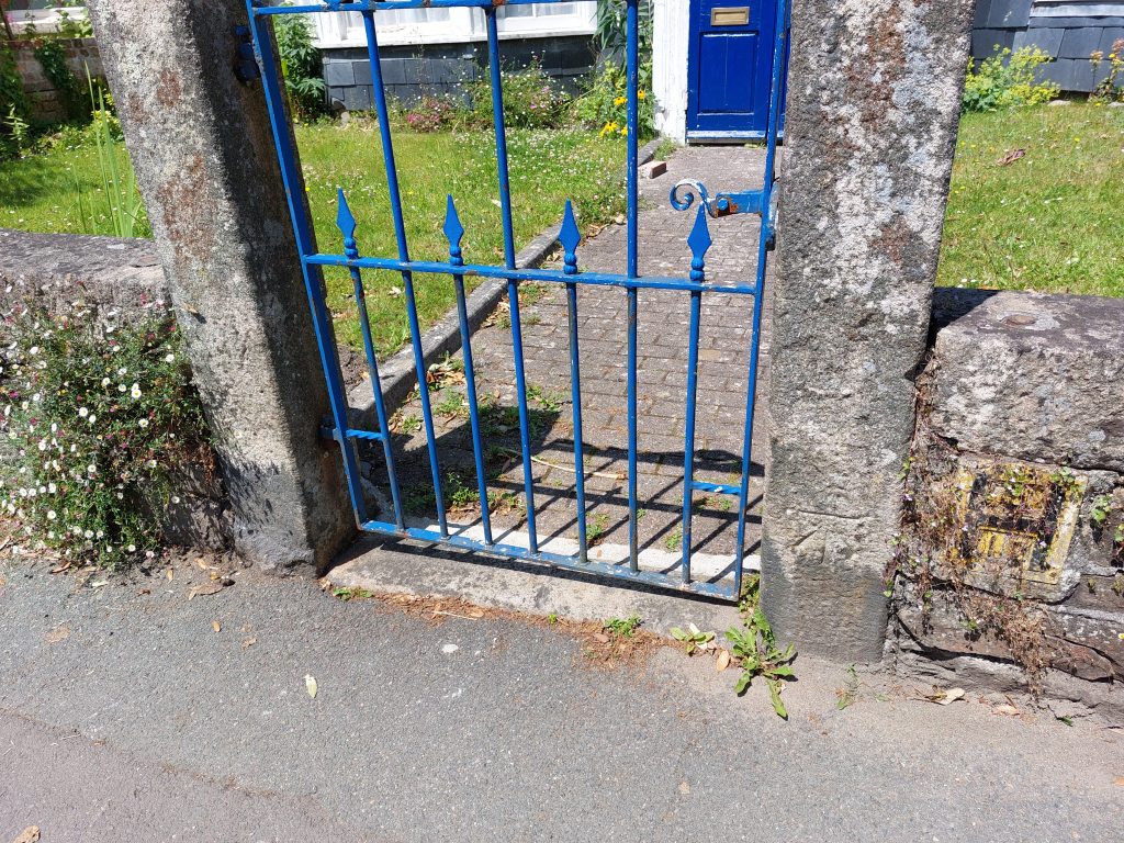
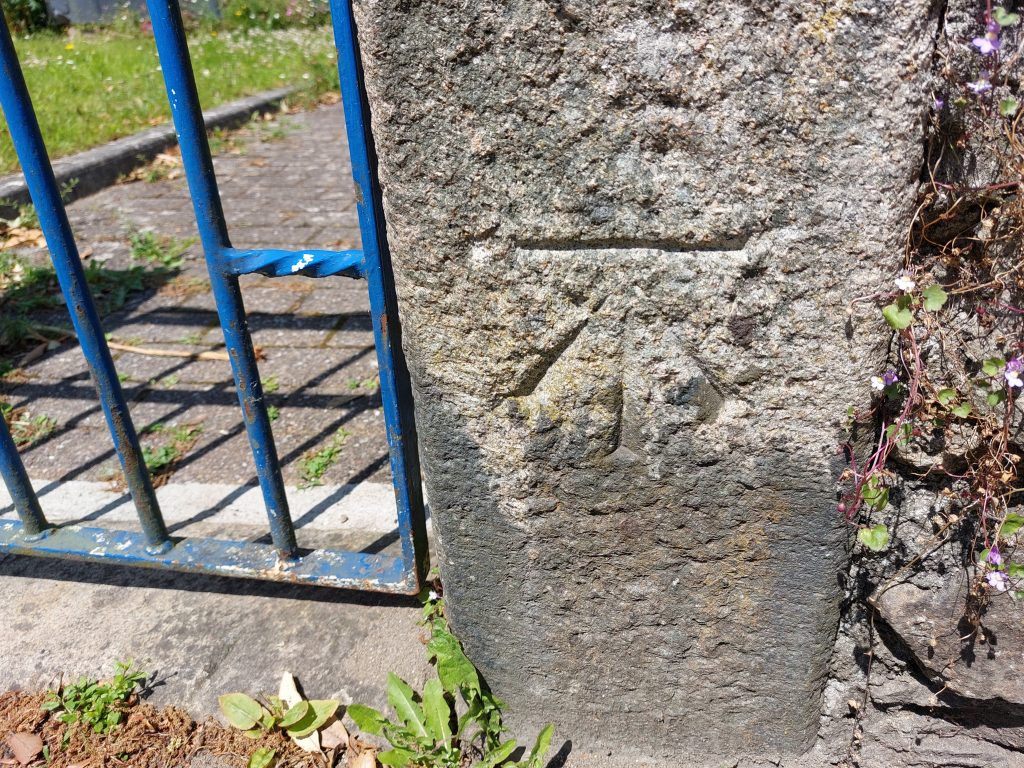
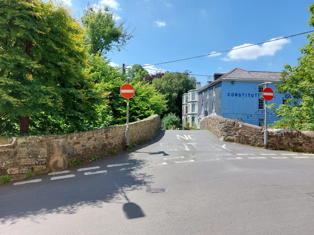
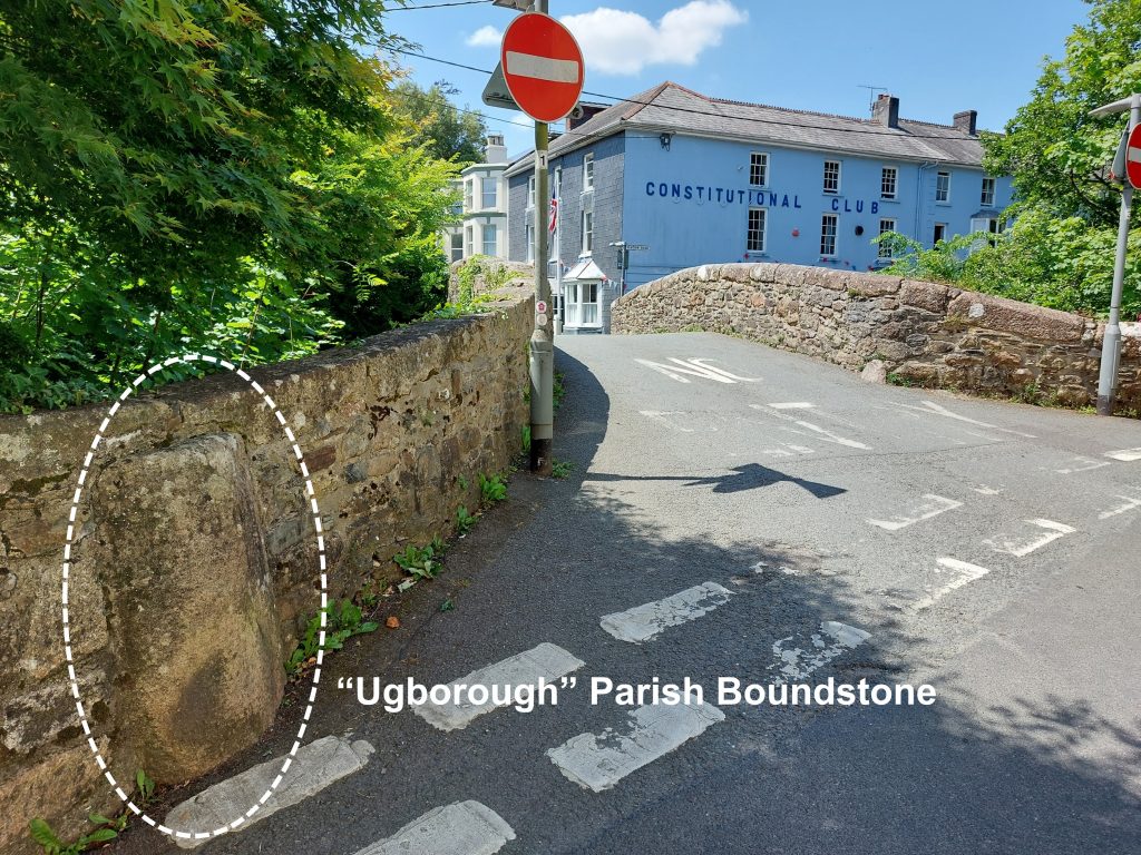
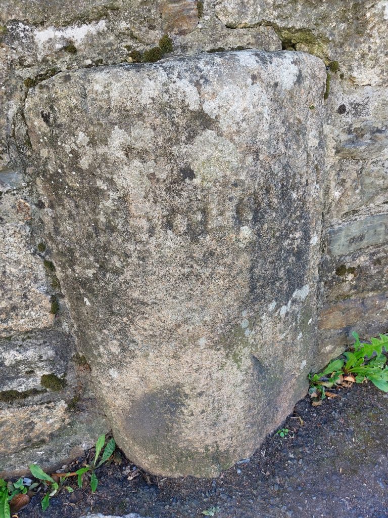
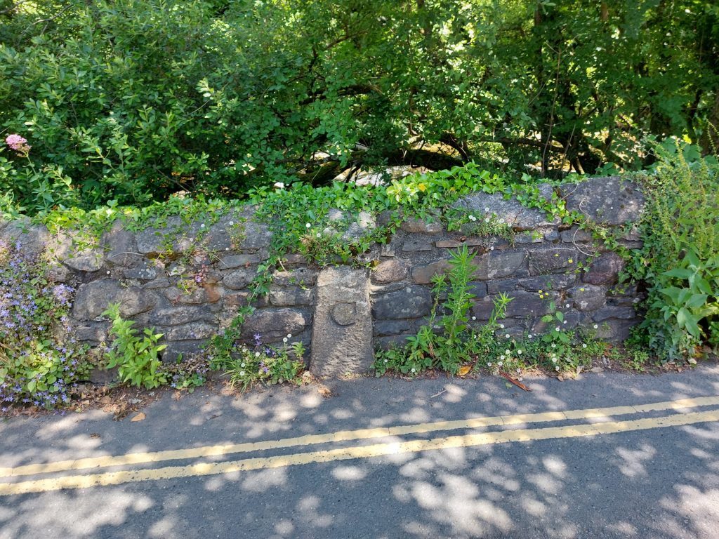
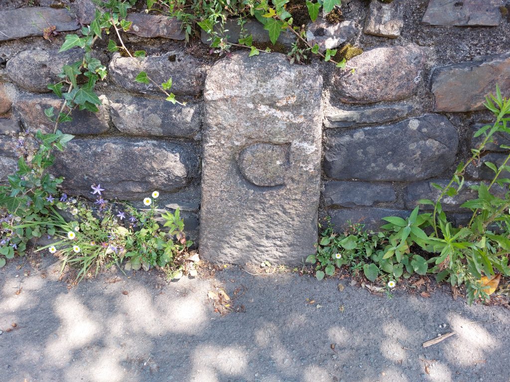
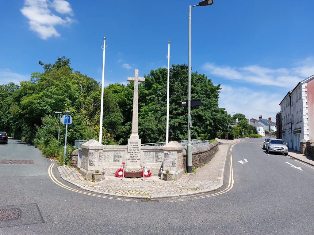
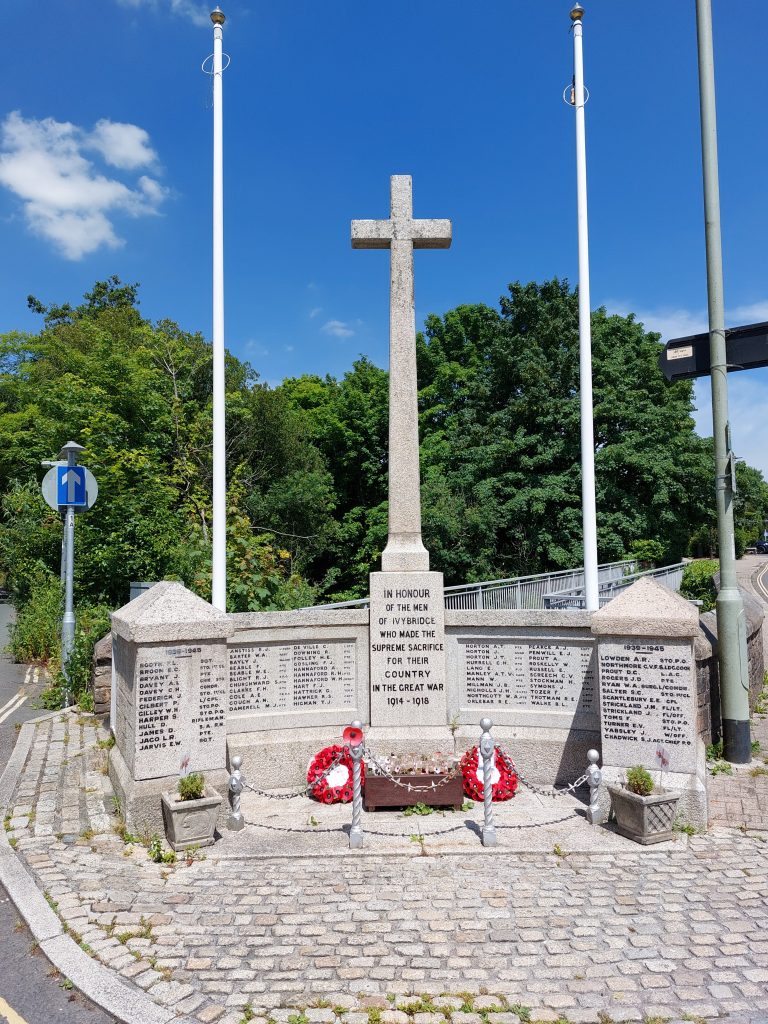
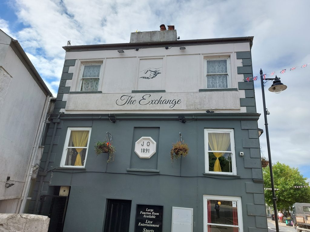
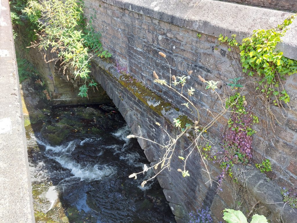
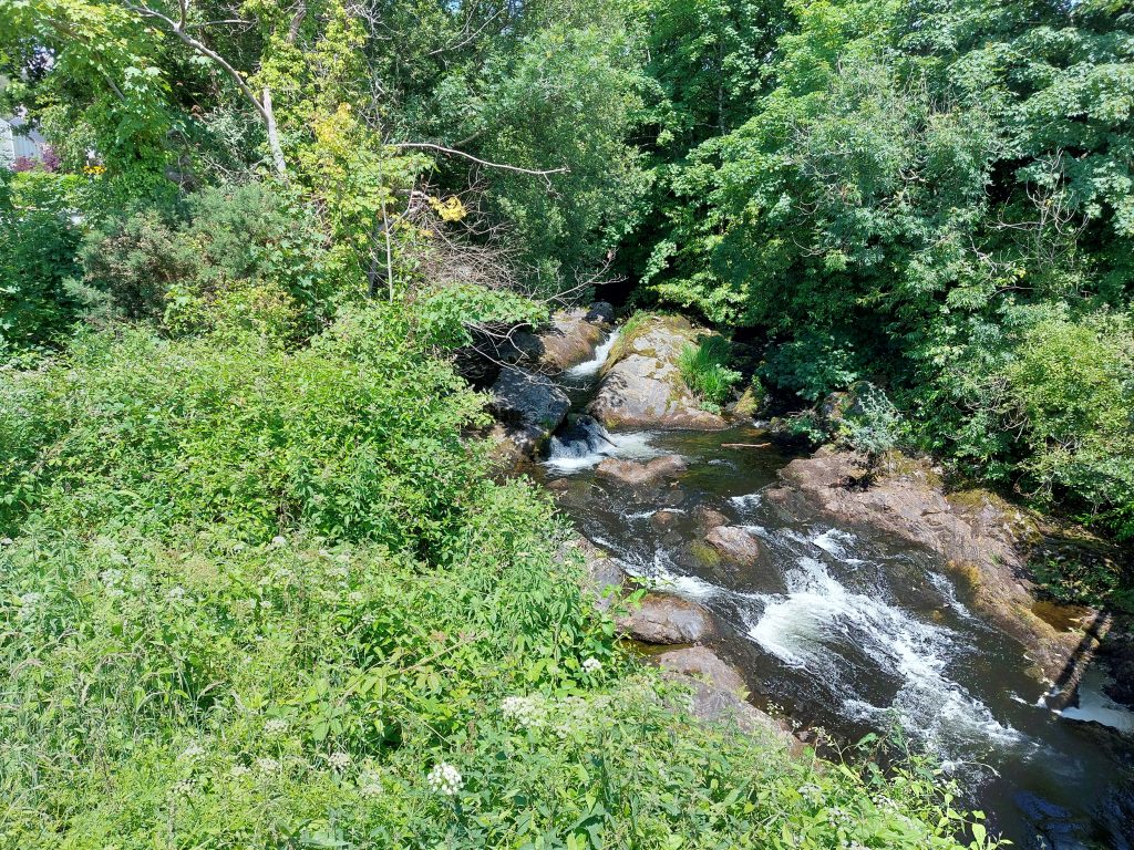
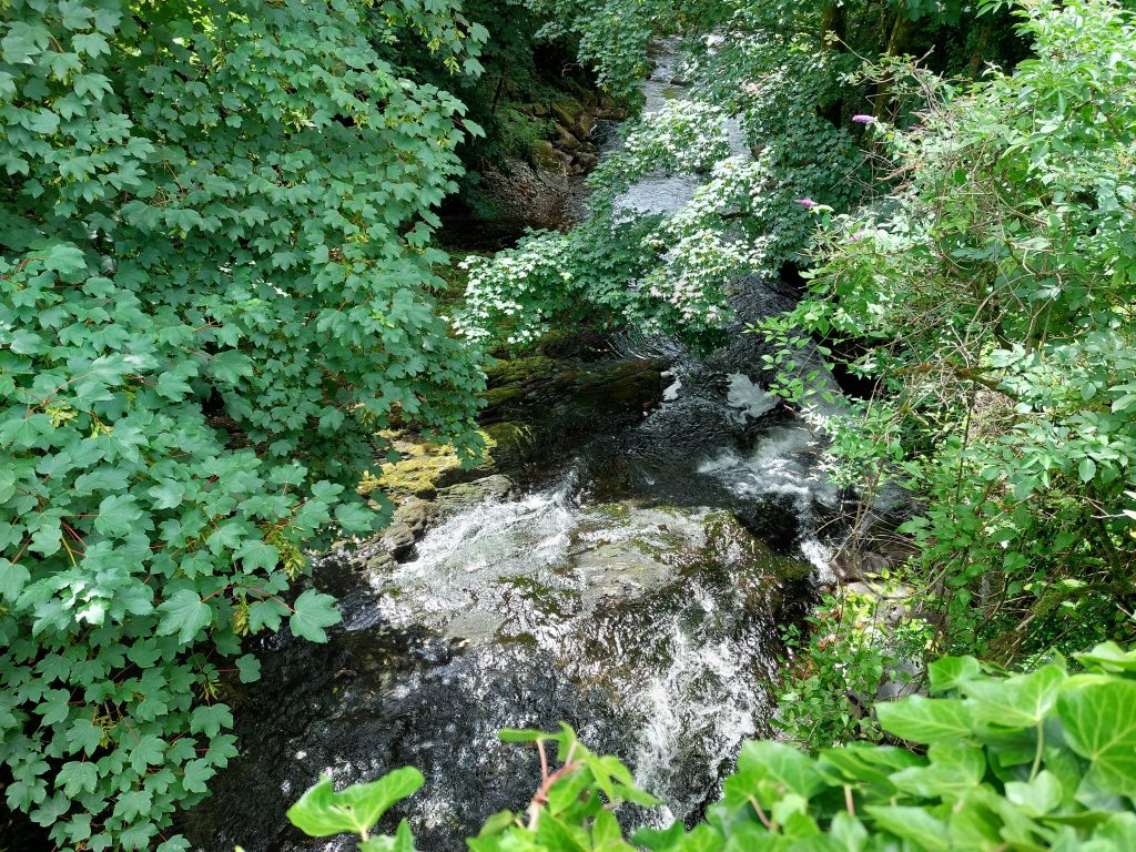
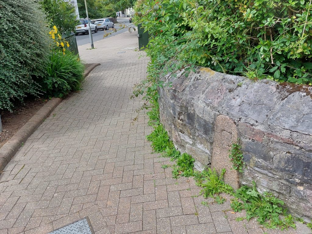
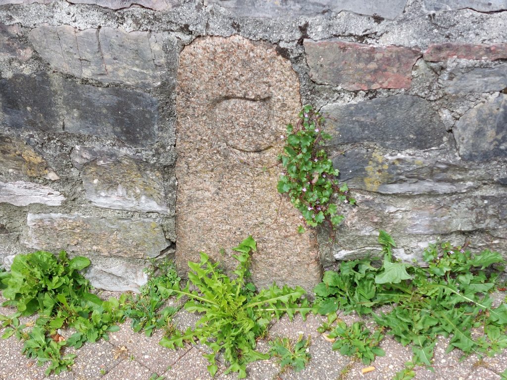
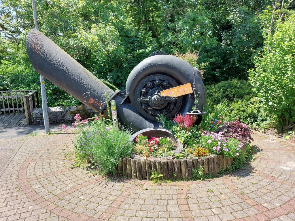
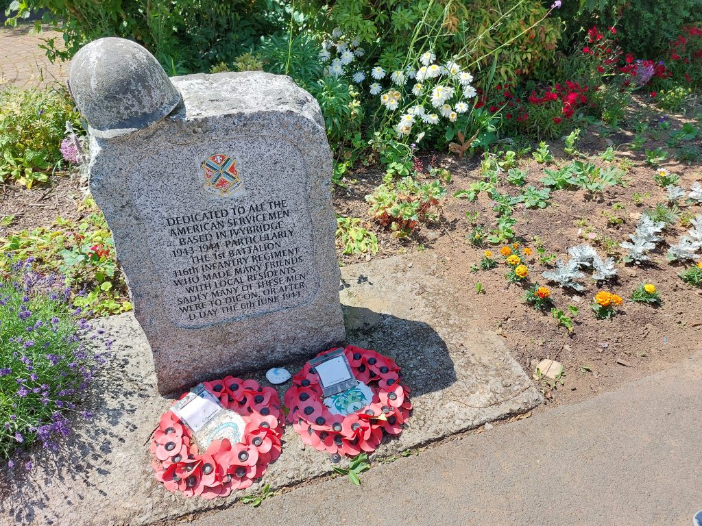
Map showing the key features covered in this post.The “Ivy Bridge” was built in 17th Century on the site of an earlier bridge and carried the main Exeter to Plymouth road until the construction of the lower bridge in 1825. The “Ivy bridge” was widened around 18th Century / 19th Century. The sand coloured building in the background is the former London Hotel. The first inn on the site dates from 1787, and is believed to have replaced an early c17 (1638) cottage (Ref HER). The inn would have been ideally located at the main crossing of the Erme at that time. The current building is of 19th century construction. The HER records that there is stabling and other outbuildings associated with the hotel which are all probably older and late 18th century in date. The river Erme is a parish boundary here and at each end of the old Ivy Bridge, against the southern parapets, are two boundstones. The parish boundary stone shown in the picture lies on the west side of the bridge and is inscribed “Ermington”. It was erected around 1758. Close up of the “Ermington” boundstone. The inscription is just about discernible.Benchmark on granite post close to the “Ivy Bridge”. The 1892-1914 map on the National Library of Scotland map (side-by-side) shows the benchmark, but the labelling on the map is poor. The benchmark reference might be B.M 213.0Close up of the benchmarkEast side of the “Ivy Bridge”The river Erme is a parish boundary here and at each end of the old Ivy Bridge, against the southern parapet, are two boundstones. The parish boundary stone shown in the picture lies on the west side of the bridge and is inscribed “Ugborough”.Close up of the “Ugborough” boundstone. The inscription is just about discernible.County “C” Stone on west side of the Erme. These stones were set up to mark the limits (around 100yds) where the county were responsible to maintain the bridge and access to it. This County Stone dates from circa 1841 and has a very clear and distinctive “C”. Tim Jenkinson in the HER records that this stone was damaged by a vehicle in early 2007, which is clearly seen in the photographWorld War I memorial – In January 1919, a public meeting was held to discuss the building of a memorial for all the servicemen who had lost their lives in the World War I. As recorded on the Ivybridge Heritage.org website “Mr H.J.F. Lee, Chairman of the Urban Council presided over the meeting where it was agreed that the unused monies of the Coronation Fund, Fire Relief Fund and Belgian Refugees Fund should be used for a public memorial. Other suggestions to commemorate the fallen included an arch with a central clock, a public library and public hall, which was strongly supported, alms-houses for the poor, and even a cottage hospital”.In a ceremony on Sunday 24th September 1922 the memorial was unveiled by Francis Bingham Mildmay, (Lord Mildmay of Flete) Conservative Member of Parliament for Totnes. There was a very large crowd in attendance as shown in the photograph on the Ivybridge Heritage.org website: http://ivybridge-heritage.org/armistice/An inn / hotel has occupied the current site of “The Exchange” since 1830. At that time it was called the King’s Arms Hotel and was exceptionally well placed, being close to where the new bridge (1825) was built across the River Erme. The new bridge and turnpike road effectively by-passed the London Hotel, which previously had great prominence. By 1850 the inn held the annual Manor Court dinner and in 1891 a Joseph Godfrey, who was a Plymouth brewer, had purchased the lease of the property. Godfrey undertook refurbishments to the property which was celebrated enough to warrant the placing of a plaque with the legend ‘J G 1891’ on an exterior wall, which is shown in the picture.The lower bridge was constructed c.1825 as part of a 170m long improvement to the turnpike road, this by passing older “Ivy bridge”. The bridge later carried the A38 until the 1970s.The Erme upstream from the “1825” bridgeThe Erme downstream from the “1825” bridgeThe “C” (County) stone on the east side of the Erme, which is at the junction of Harford Road and Exeter Road and is built into the wall.Close up of C Stone (east)This Pelton Wheel turbine was resited to Harford Road Car Park, next to the Erme, from the former Union Town Mills (now Glanville Mill area) a short distance downstream. It was built by Gilbert, Gilkes & Gordon in 1937. During the day a 22ft water wheel powered the mill, then by night the water turbine produced electricity for the town of Ivybridge.In the run up to D-Day on 6th June1944, troops from the 1st Battalion 116th Infantry Regiment (mainly from Bedford, Virginia), were based in the Ivybridge area. The 116th are reported as being the first ashore on Omaha Beach on D-Day. Tragically, by the end of the day, most of the men had died. This memorial (next to the water turbine at Harford Road Car Park) commemorates the friendships the troops had formed with local people.