A collection of walks, discoveries, insights and pictures of exploring Dartmoor National Park
March 27, 2024
6th-8th Century Inscribed Pillar near Sampford Barton
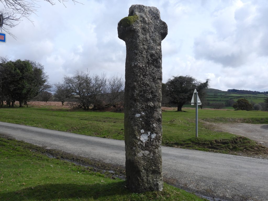
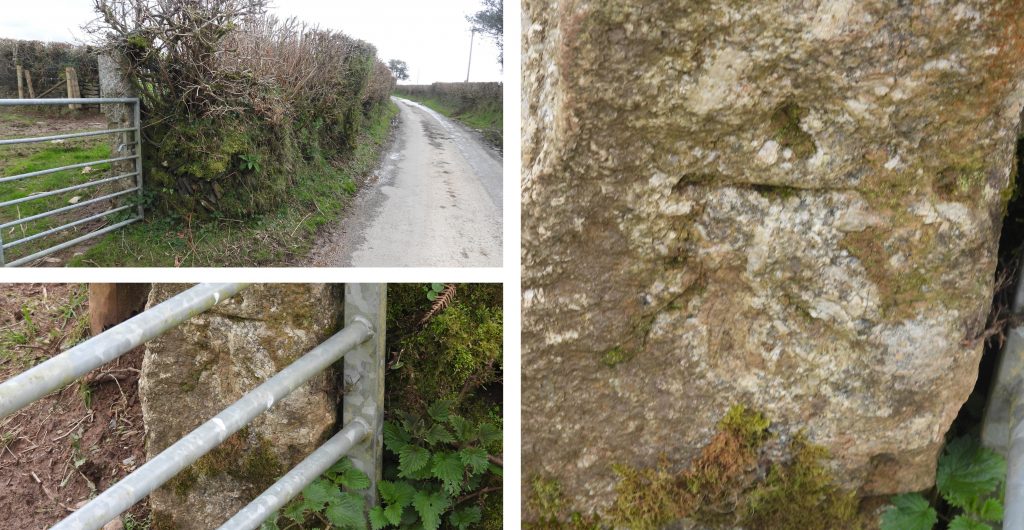
To the north of Huckworthy Cross in the Parish of Sampford Spiney is what on the surface is a typical Dartmoor lane. That said, the lane has two points of historical significance, namely; a) It lies on the route of the original ‘authentic’ Monastic Way between the two great Abbeys of Buckfast and Tavistock, b) There is a unusual (4 character) Inscribed Pillar, which is thought to date possibly from 6th – 8th century (and therefore pre-dates the Monastic Way).
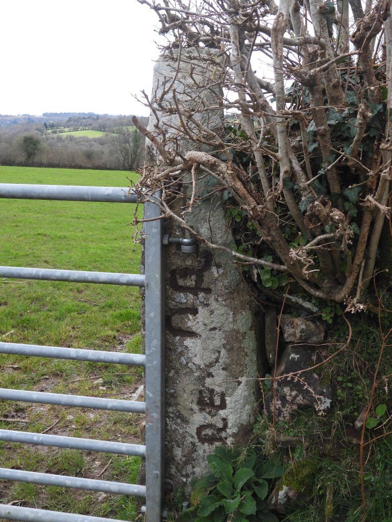
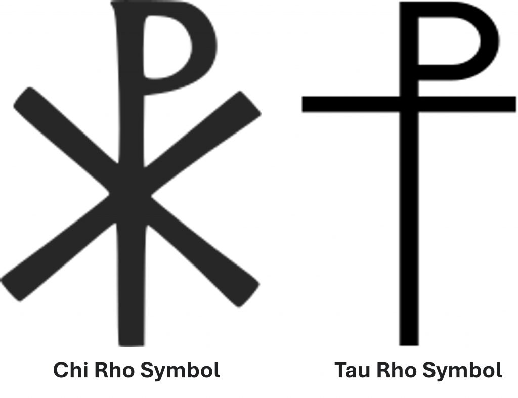
The inscribed pillar is one of around 80 related stones (pillars) which are scattered across West Devon and Cornwall, which date to the middle of the first millennium. They appear to be memorial stones and as Tom Greeves explained, recorded names of people who were obviously considered important and several have a Christian context with chi-rho symbols as does this stone.
The Inscribed Pillar is located around 300 metres north-north-east of Sampford Barton Farm and was first recorded by Dr. Tom Greeves in 1997. This post makes reference to the report from Greeves and that of Elisabeth Okasha (from 2002).
As the pillar is located in a narrow lane, a visit is best achieved through a short walk from Huckworthy Cross, where there is parking.
Bibliography
Dr Tom Greeves (1997) – The Start of History, Dartmoor Magazine, Issue 91, Pages 8-10
Elisabeth Okasha (2002), A Supplement to Corpus of Early Christian Inscribed Stones of South-west Britain, 140-142, (Ref 52a)
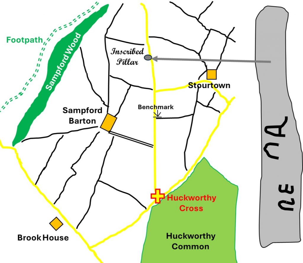
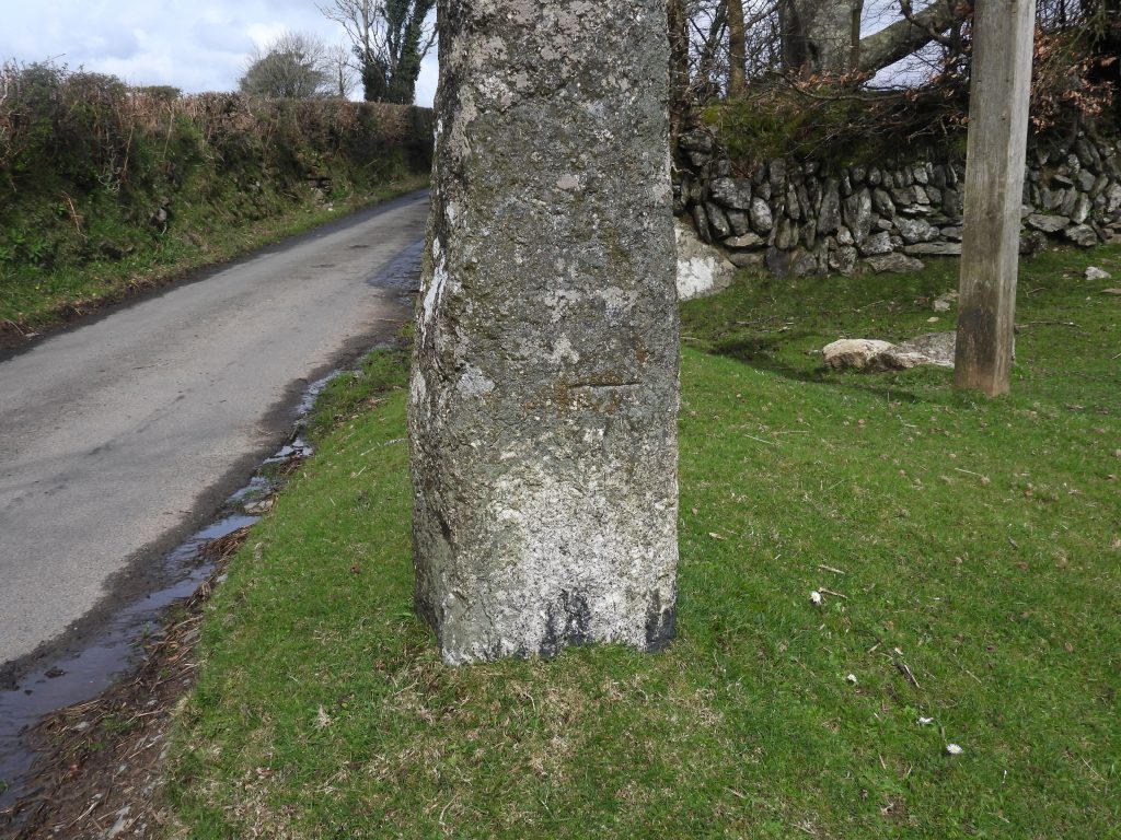
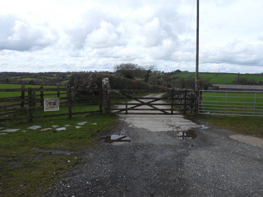
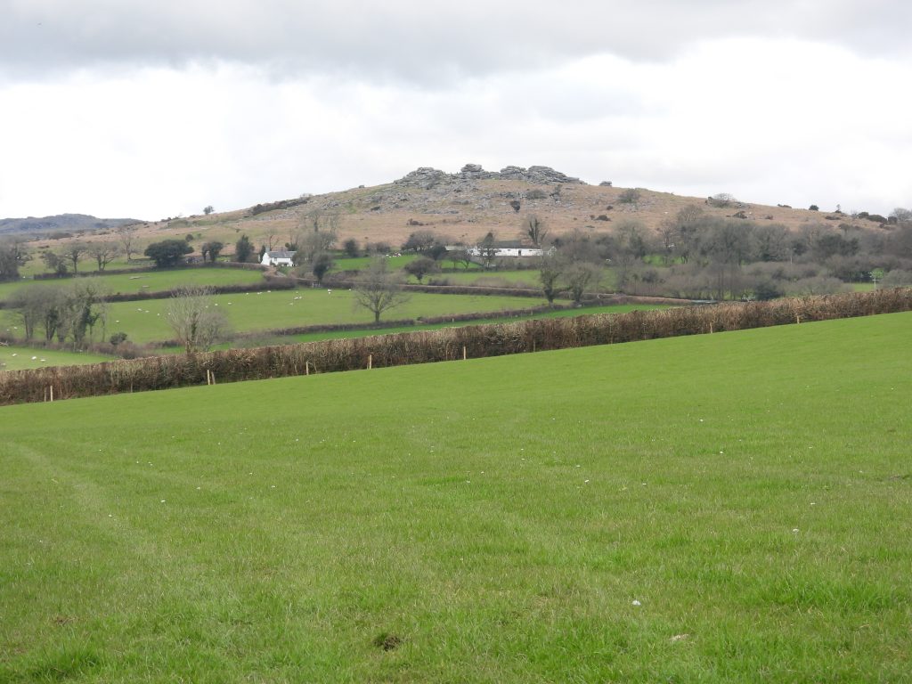
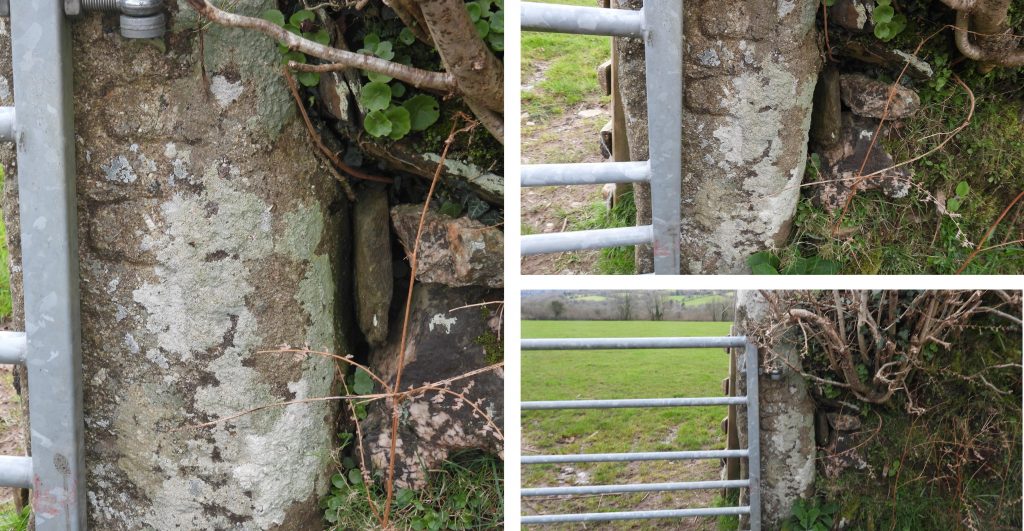
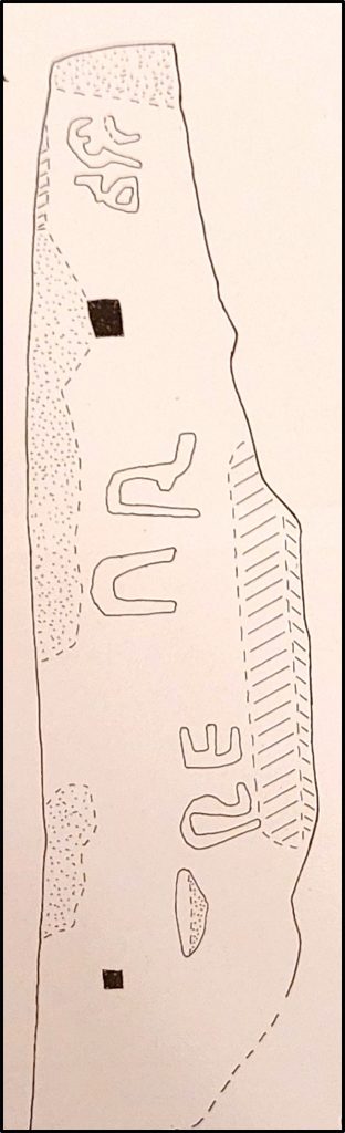
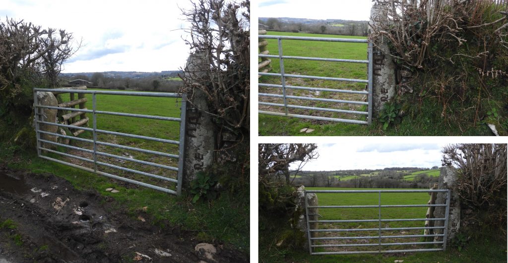
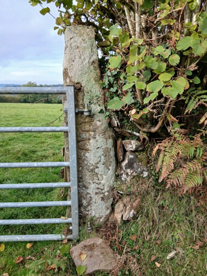
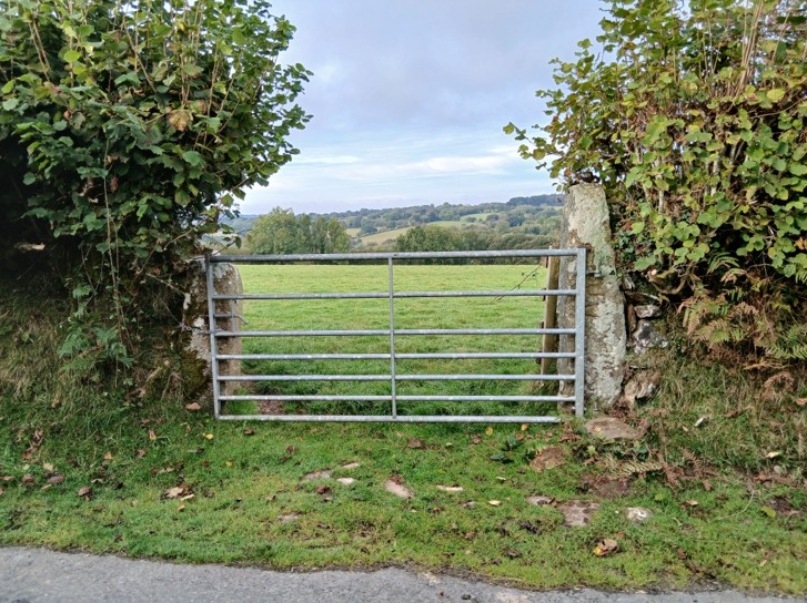
Sketch Map of the relative locations of the features covered in this post. Huckworthy Cross is Grade II listed. Although the cross does not appear to be of great antiquity, it lies on the route of the Buckfast – Tavistock Monastic Route (which dates from 11th century).There is a benchmark on Huckworthy Cross. The benchmark reference is B.M 642.8Entrance to Sampford Barton Farm. The farmstead is likely to date from the early 16th century, based on the age of the farm buildings. It is depicted on the Tithe Map from 1840.Between Sampford Barton Farm entrance and the Inscribed Pillar is a benchmark, inscribed into a gate post. The author is unaware of a reference number for this benchmark as it does not appear on 19th century maps. It is possible the benchmark dates from the 20th century. It is located at SX53006 71440Pew (Pu) Tor as seen from the laneThe Inscribed Pillar has been recorded (Greeves) as 1.6 metres high by 0.36 metres wide by 0.39 metres deep. It is located on the west side of the lane and now forms a gatepost on the north side of a gateway. The 4 character inscription when first viewed is difficult to discern, so some mud painting is required to enhance it. The pillar is located at SX52983 71680After a mud paint the letters on the pillar become quite clear. The letters appear to be in two parts (2 characters each) in a rather irregular line which seem to be read upwards facing right. The inscription has been cut into the east face of the pillar. Greeves records the letters as being 0.10 – 0.11 metres high and states letters ‘R’ and ‘E’ are set close to the chamfered edge (at the bottom) of the stone with an ‘N’ and an ‘A’ or ‘R’ (in the middle of the stone). This sketch was drawn in February 1998, by Dr Tom Greeves and appeared in Issue 91 (Summer 2008) of the Dartmoor Magazine. The two solid black squares are gatehangingsOkasha (2002) conjectures that the 4 character inscription(s) may indicate names and possible assertion of ownership of the pillar and suggest it is likely to date to the 6th-8th century.
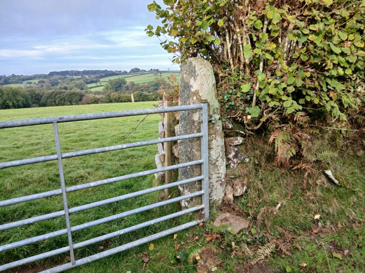
Vegetation clearance around the stone from October 2025 – photograph courtesy of Simon Dell
Vegetation clearance around the stone from October 2025 – photograph courtesy of Simon Dell
Vegetation clearance around the stone from October 2025 – photograph courtesy of Simon Dell
Greeves records “close to the top of the stone there are other incised marks which are difficult to interpret but could possibly be a ‘chi-rho’ or else a decorative feature” – this feature was difficult to photograph. From Wikipedia: The Chi-Rho symbol is also known as chrismon and is one of the earliest forms of the Christogram formed by superimposing the first two (capital) letters CHI and RHO (ΧΡ)—of the Greek word ΧΡΙΣΤΟΣ (Christos). Early symbols similar to the Chi-Rho were the Staurogram (also known as Tau-Rho). It might be possible that the inscription on the pillar is a Tau-Rho and not a Chi-Rho. The Tau Rho alongside the Chi Rho (and other variants), spread to Western Europe in the 5th and 6th centuries, which possibly assists with the dating of this pillar.