A collection of walks, discoveries, insights and pictures of exploring Dartmoor National Park
August 27, 2022
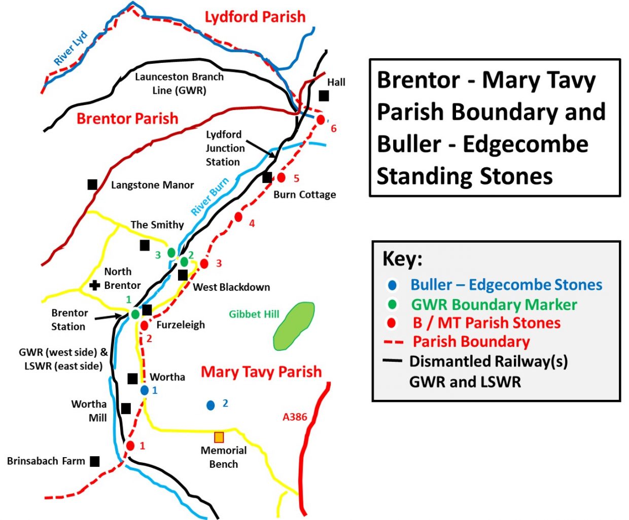
Brentor / Mary Tavy Parish Boundary (with Buller / Edgecombe Standing Stones and GWR Boundary Markers)
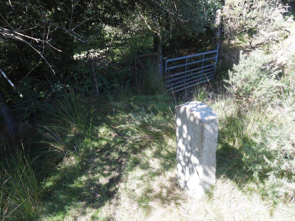
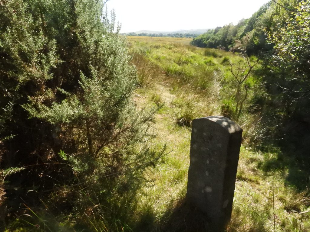
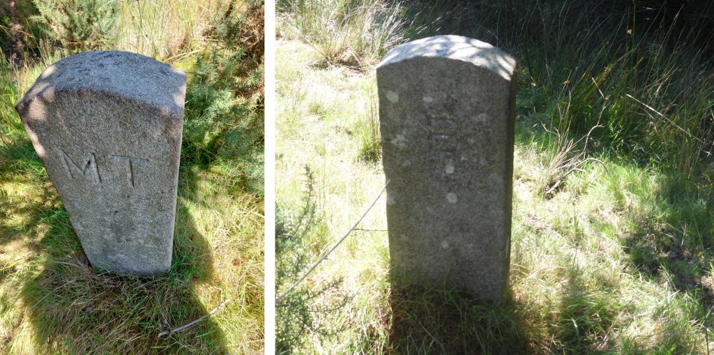
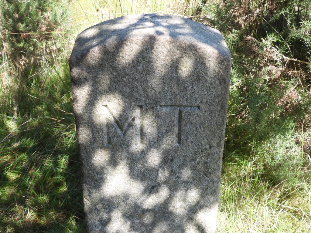
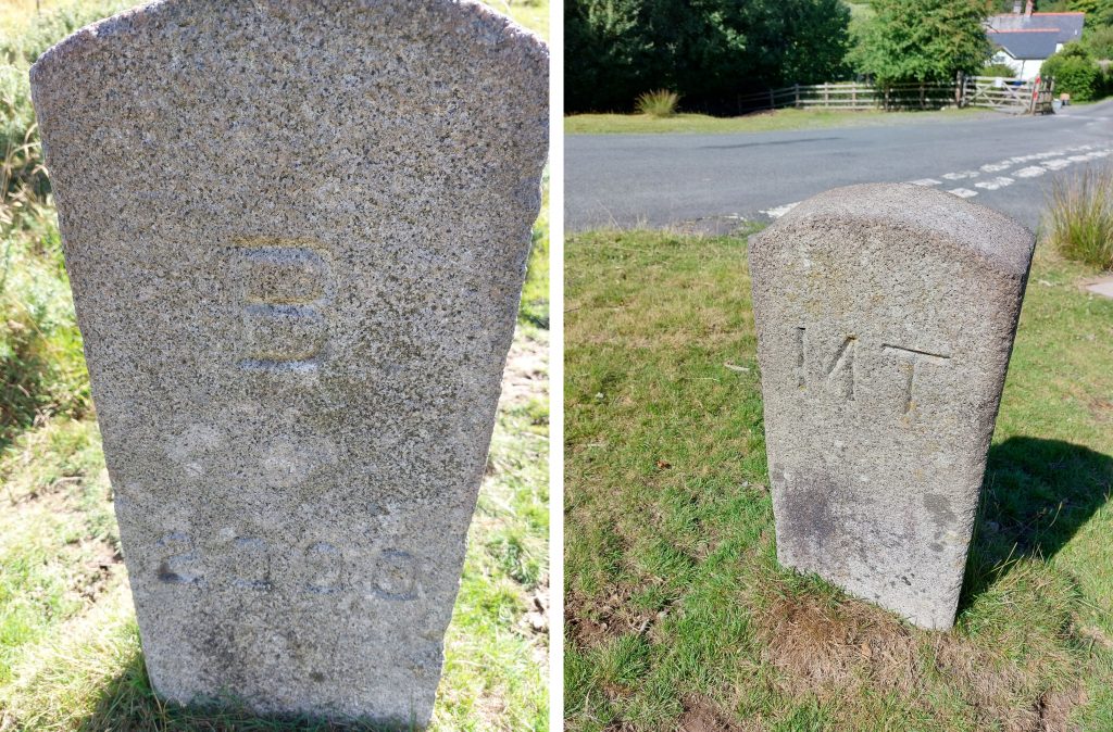
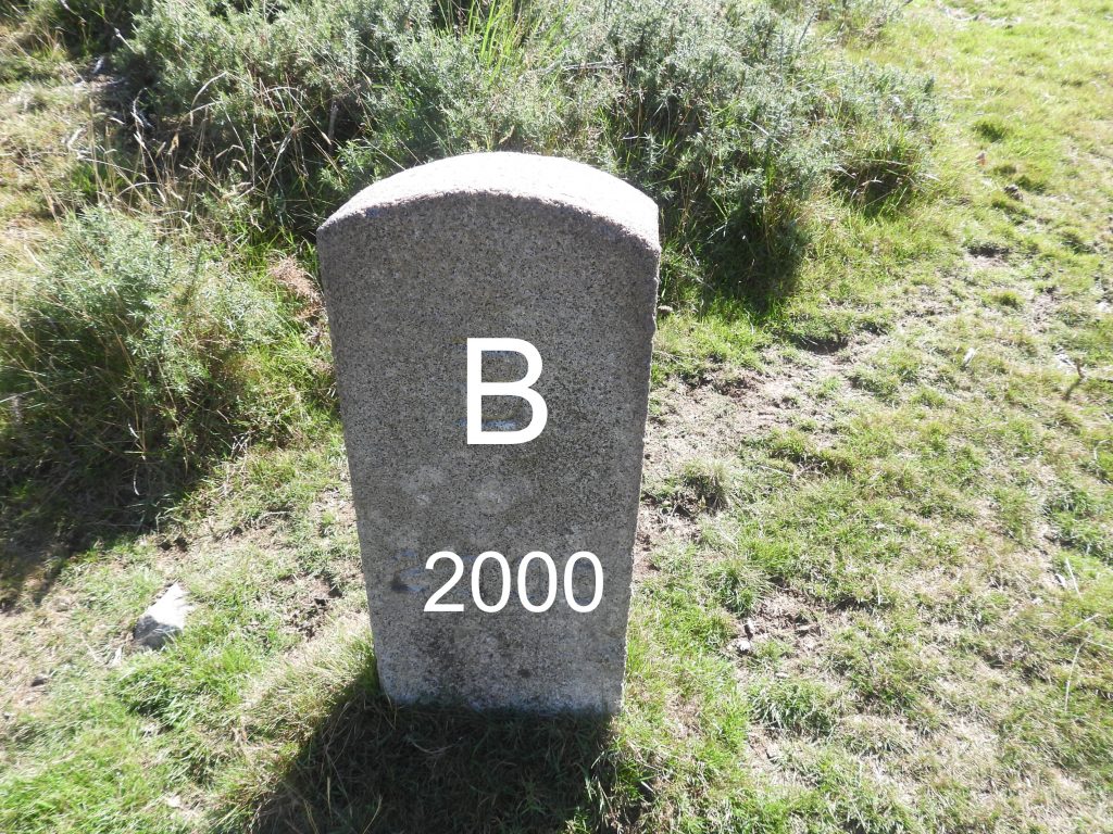
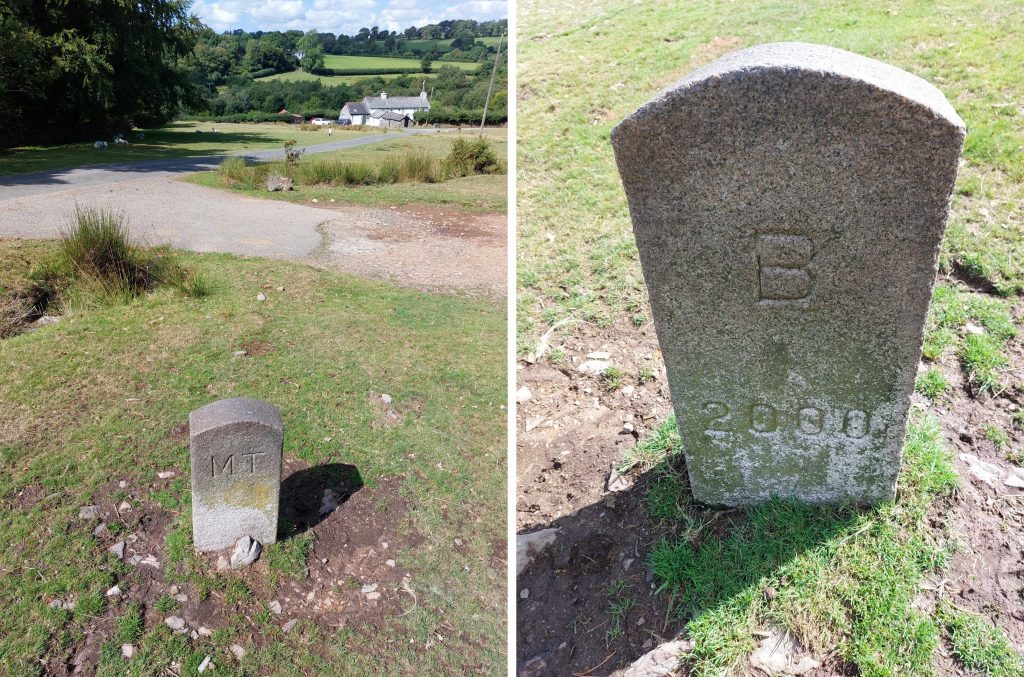
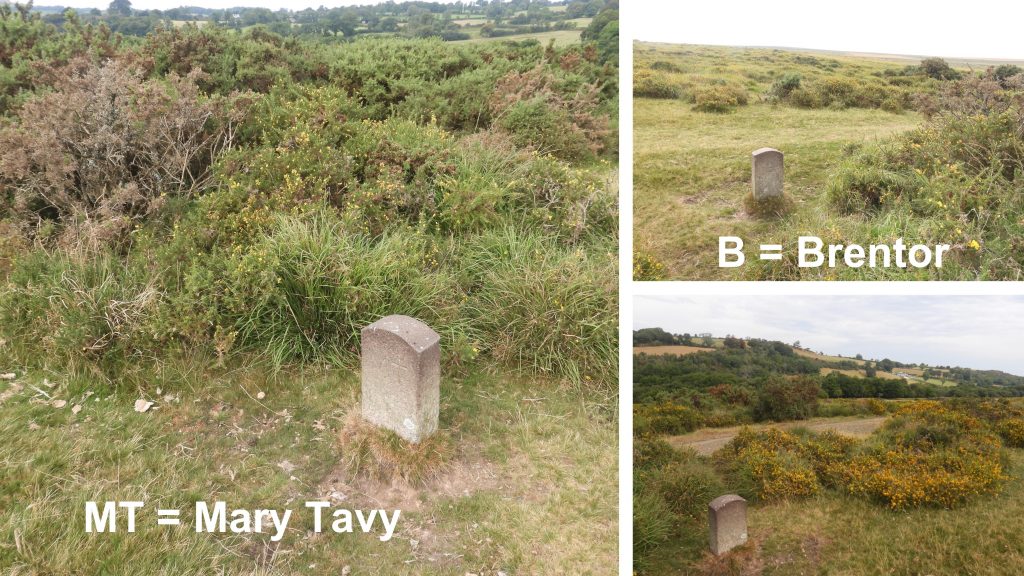
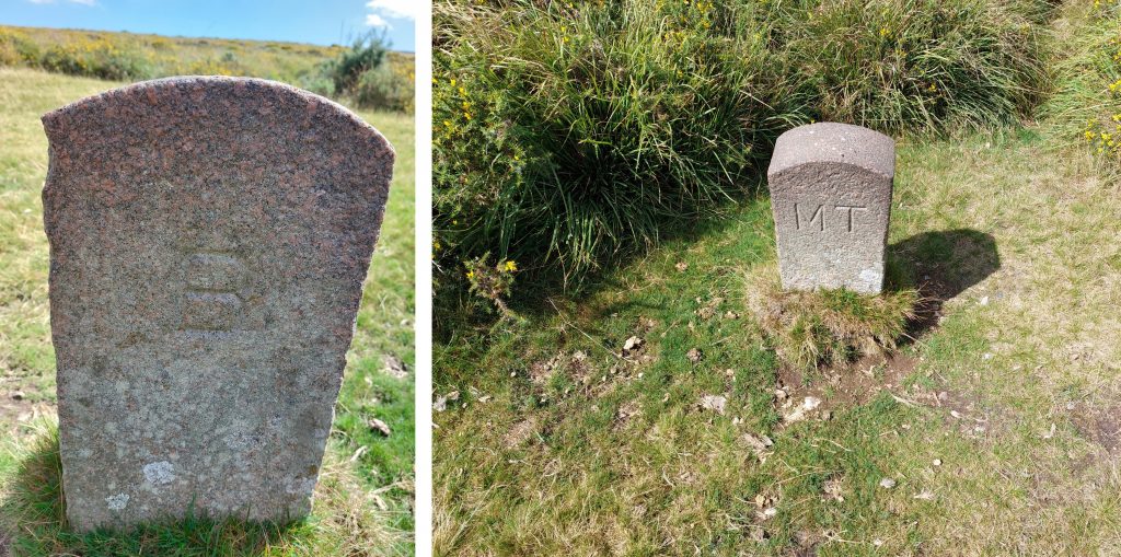
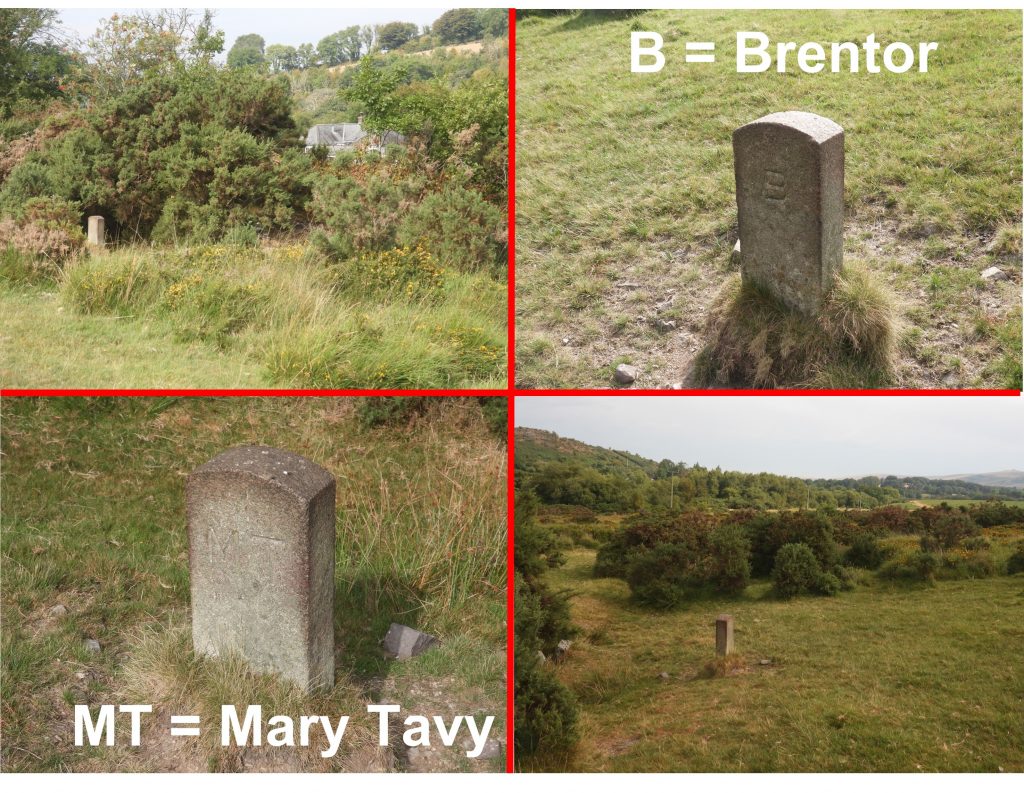
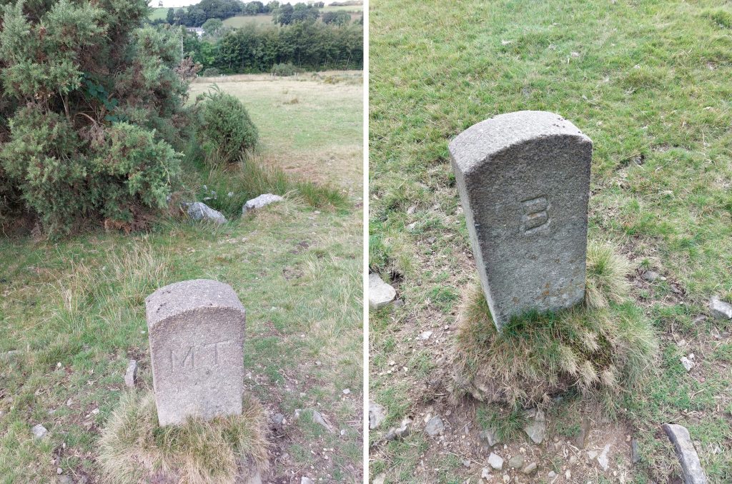
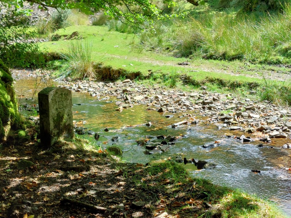
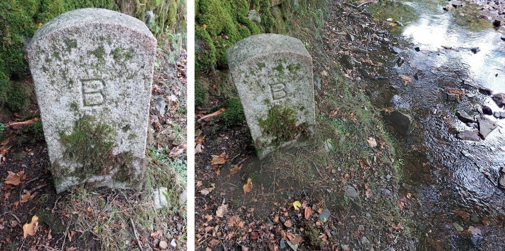
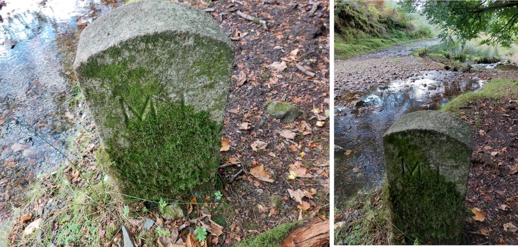
In 1987, the parish boundary of Brentor and Mary Tavy saw a change where the area east of the ‘White Lady Waterfall’ on the River Lyd transferred from Brentor to the new (smaller) Lydford parish* and an area on the west side of Blackdown, transferred to Brentor from Mary Tavy parish. Along these newly defined boundaries are six upright smooth finished granite posts, which are suitably inscribed to mark the changes. Five of the granite posts are inscribed “B” (for Brentor) and “MT” (for Mary Tavy) with the sixth granite post having an “L” (for Lydford) as well as “B” and “MT”. To add interest two of the posts have an additional inscription of “2000” on the “B” side of the post. The author is unaware of the exact year of erection of these posts but assumes that all the posts were extant by 2000.
*In 1987 the parish of Lydford finally lost its claim to be the largest parish in England as it was split into two civil parishes; Lydford and Dartmoor Forest, with the latter being largely the higher open moor.
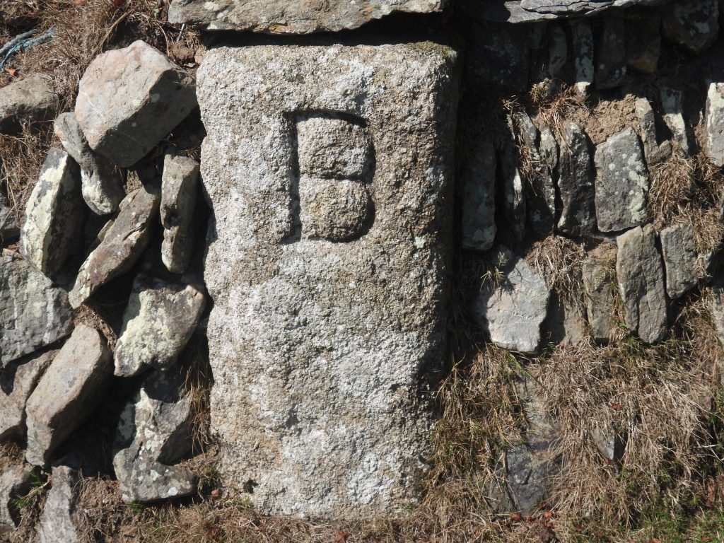
Also of interest in the area are two further boundary granite posts, which are believed to date from the early 19th Century and relate to lands owned by the Buller Family and Arthur Edgecombe and are the only extant ones left from a probable set of at least four stones. I am indebted to Mark Fenlon and his article in Dartmoor News (Jul/Aug 2021 : p36-39) – titled “Dartmoor Boundary Stones – Revisited” for information surrounding these stones.
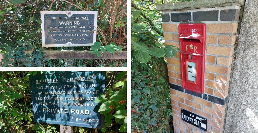
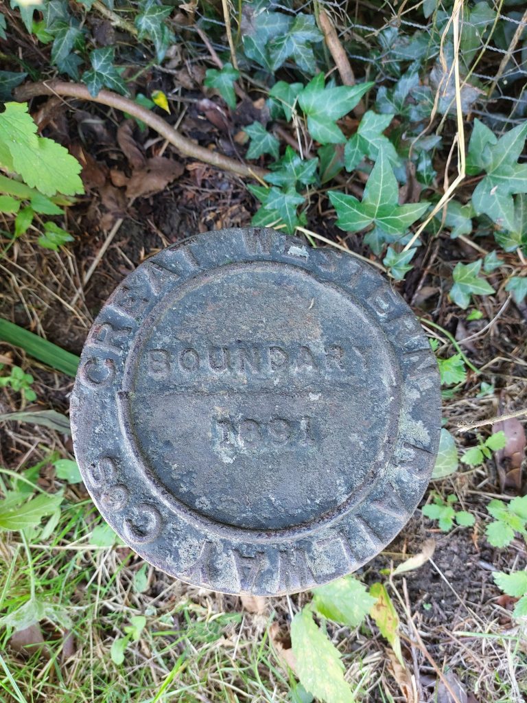
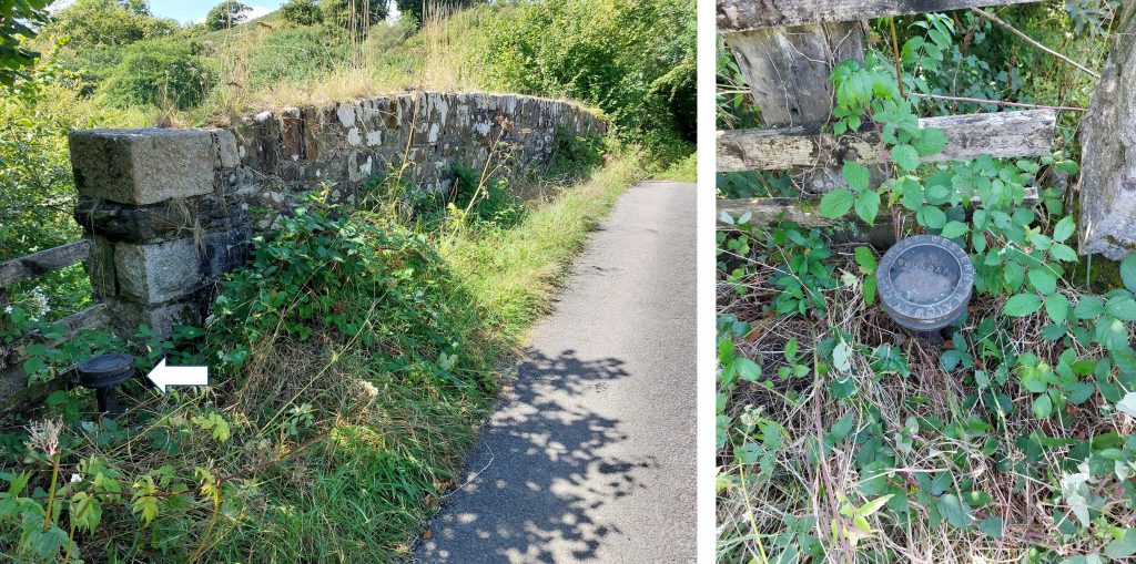
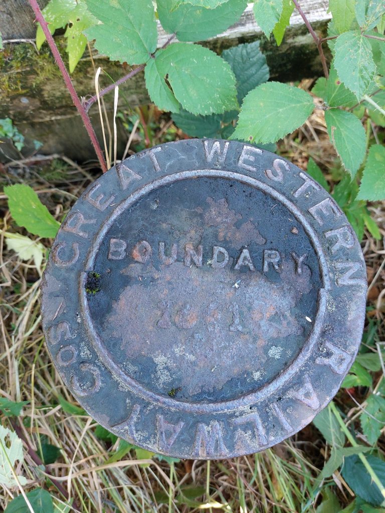
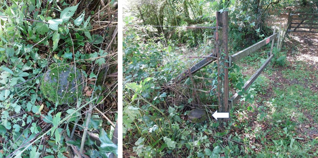
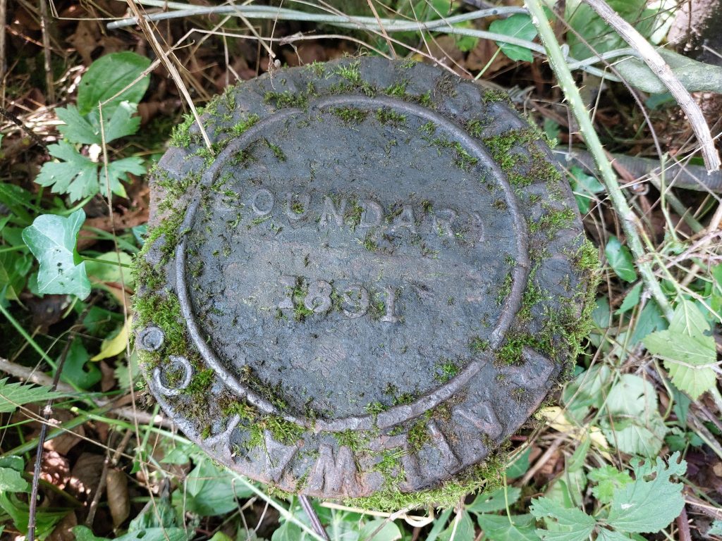
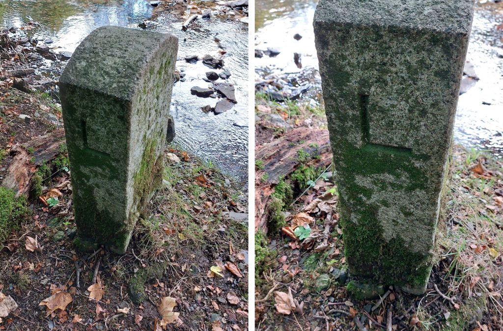
Finally, the post also covers a different kind of boundary in the shape of land owned by the Great Western Railway (GWR), who operated the branch line to Launceston from the mid-19th century. There are still (at least) three GWR iron marker with date inscriptions of 1891 in the areas around Brentor Station and Burn Lane bridge.
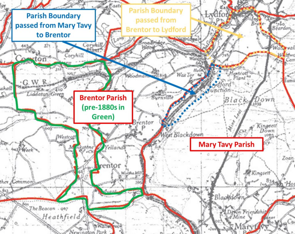
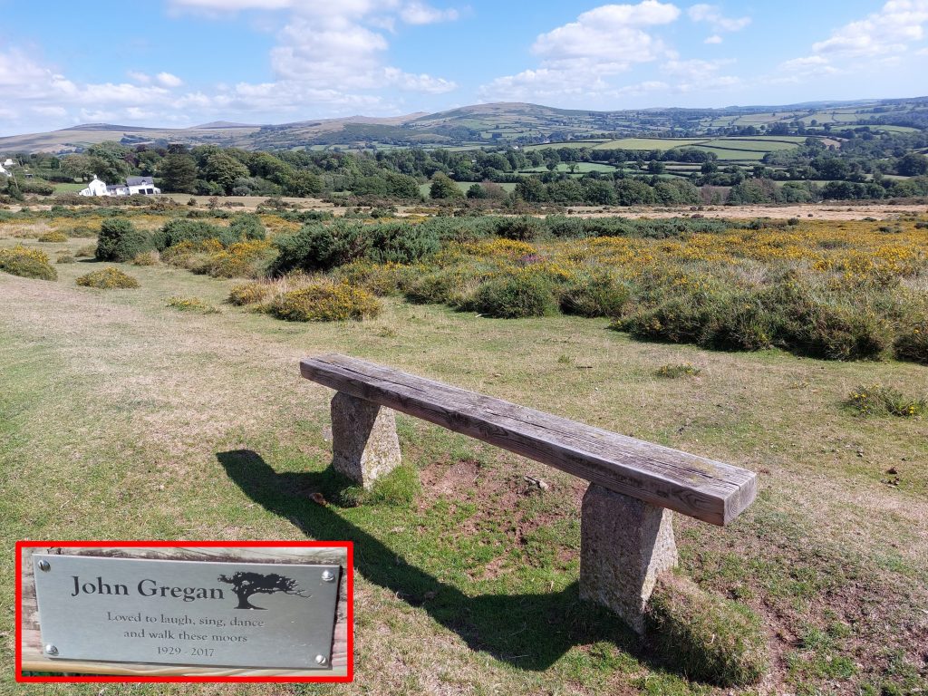
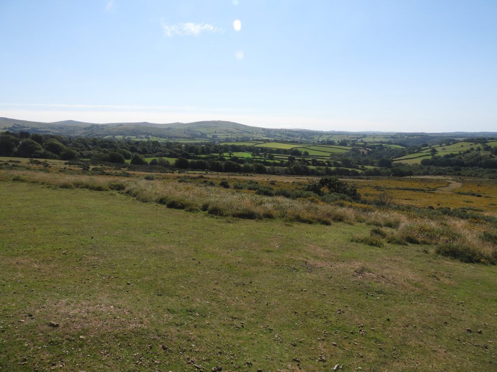
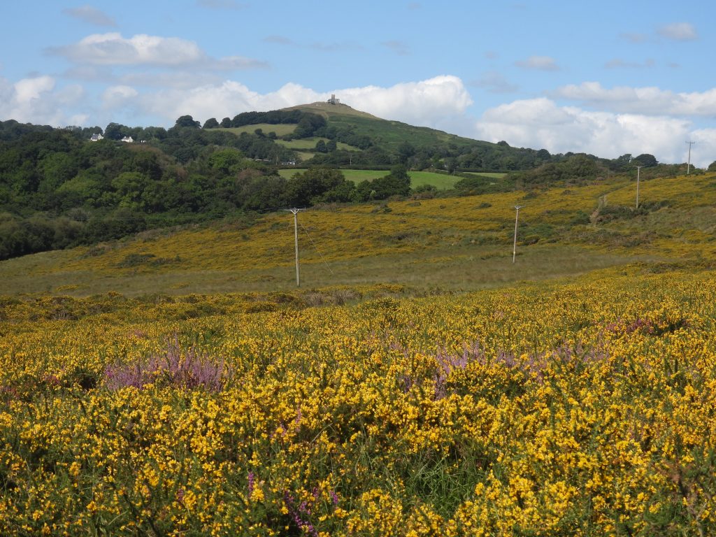
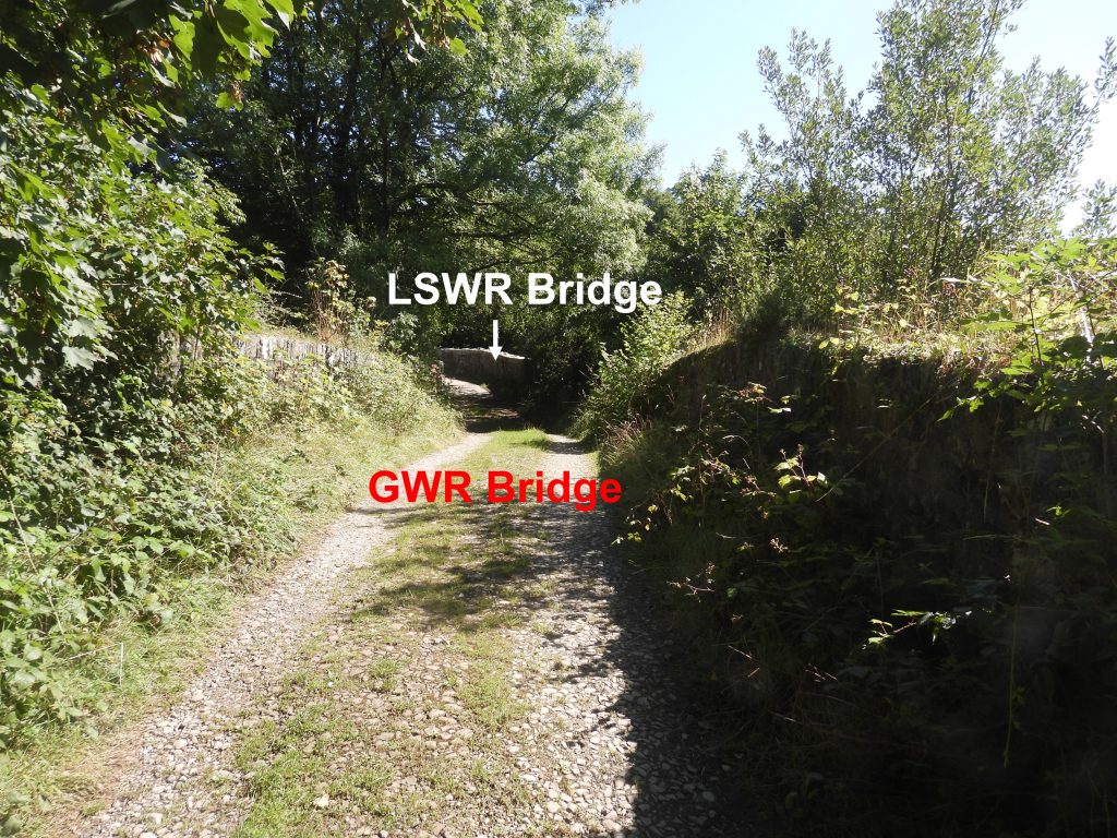
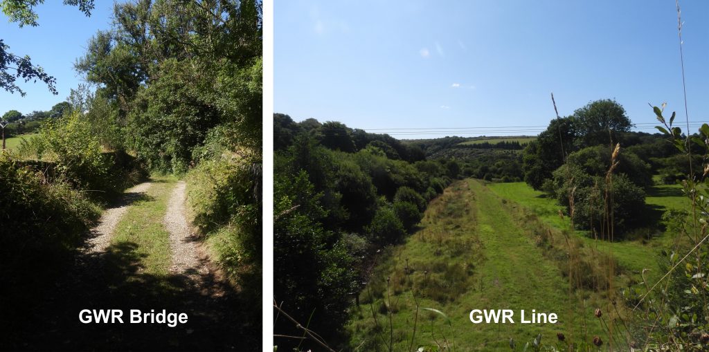
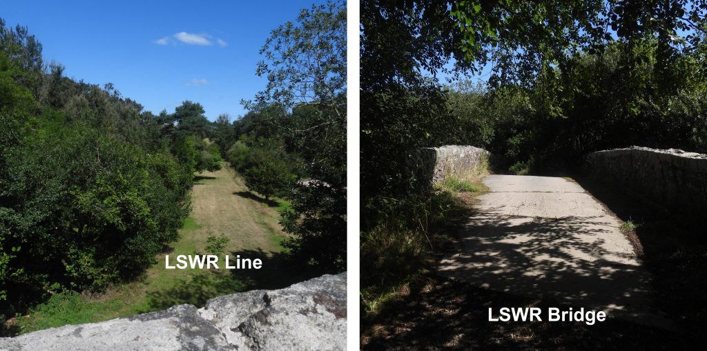
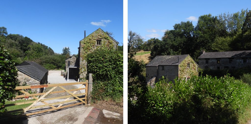
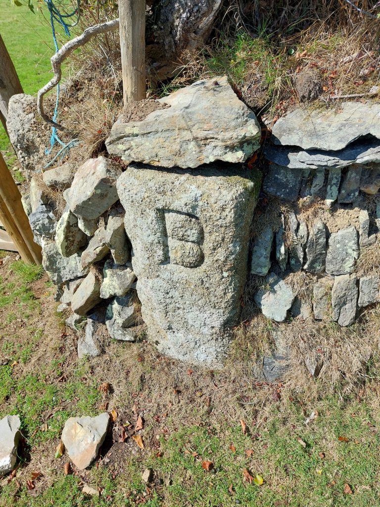
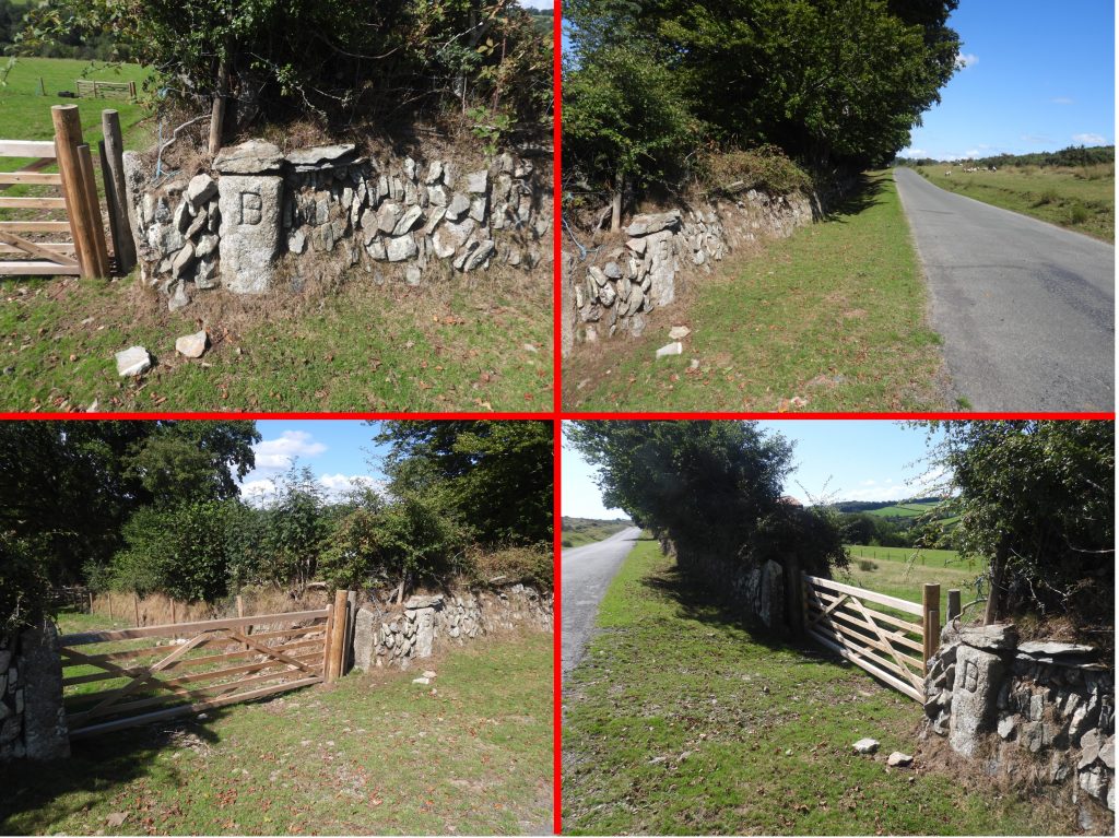
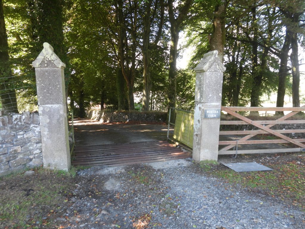
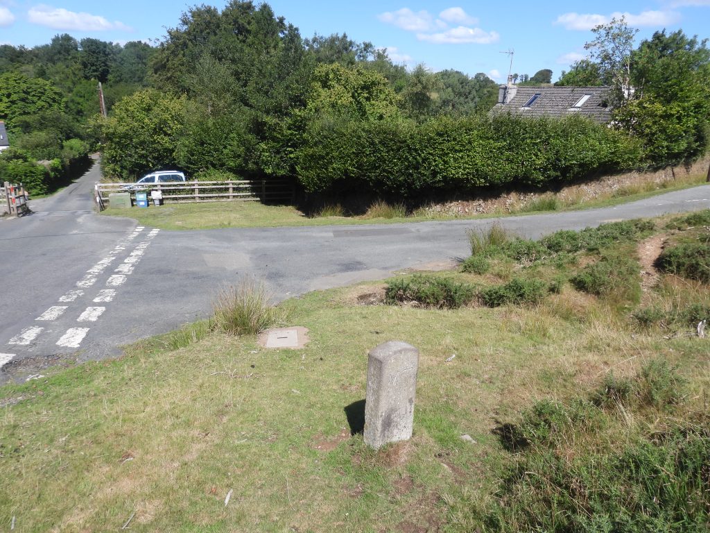
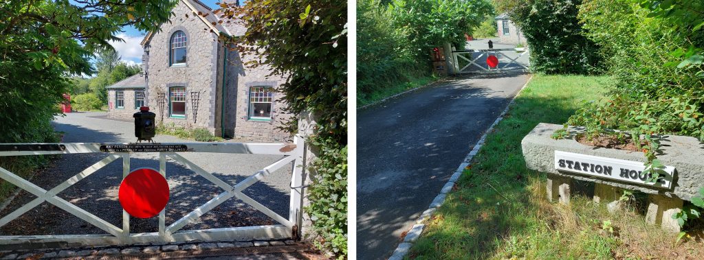
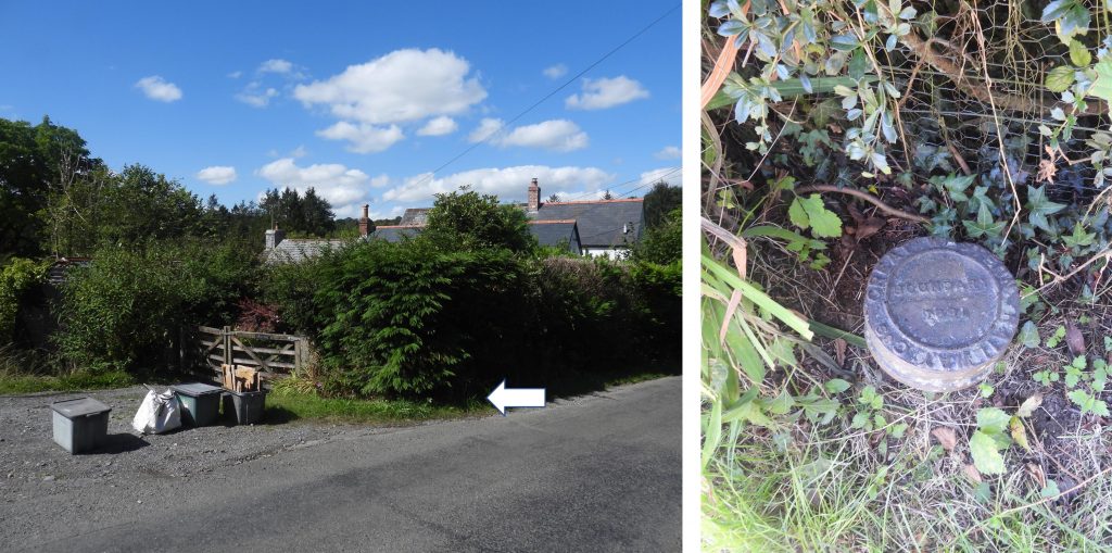
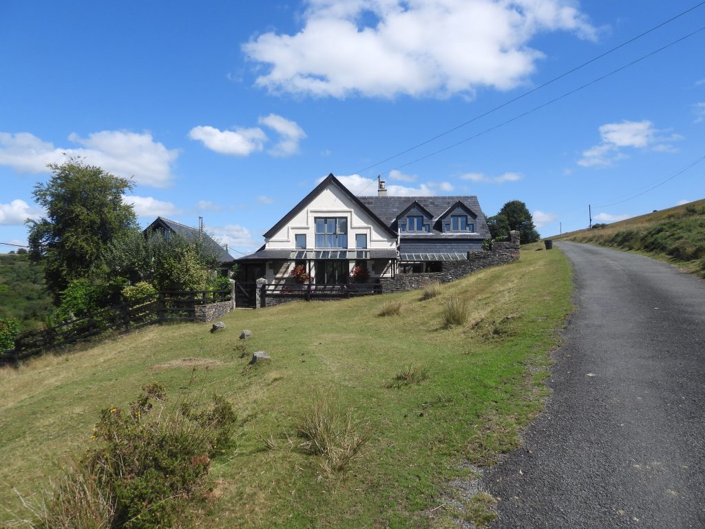
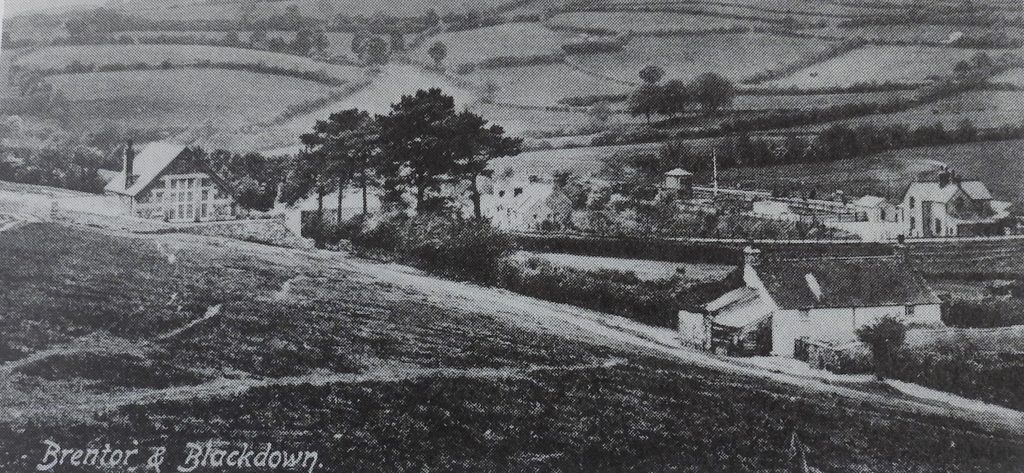
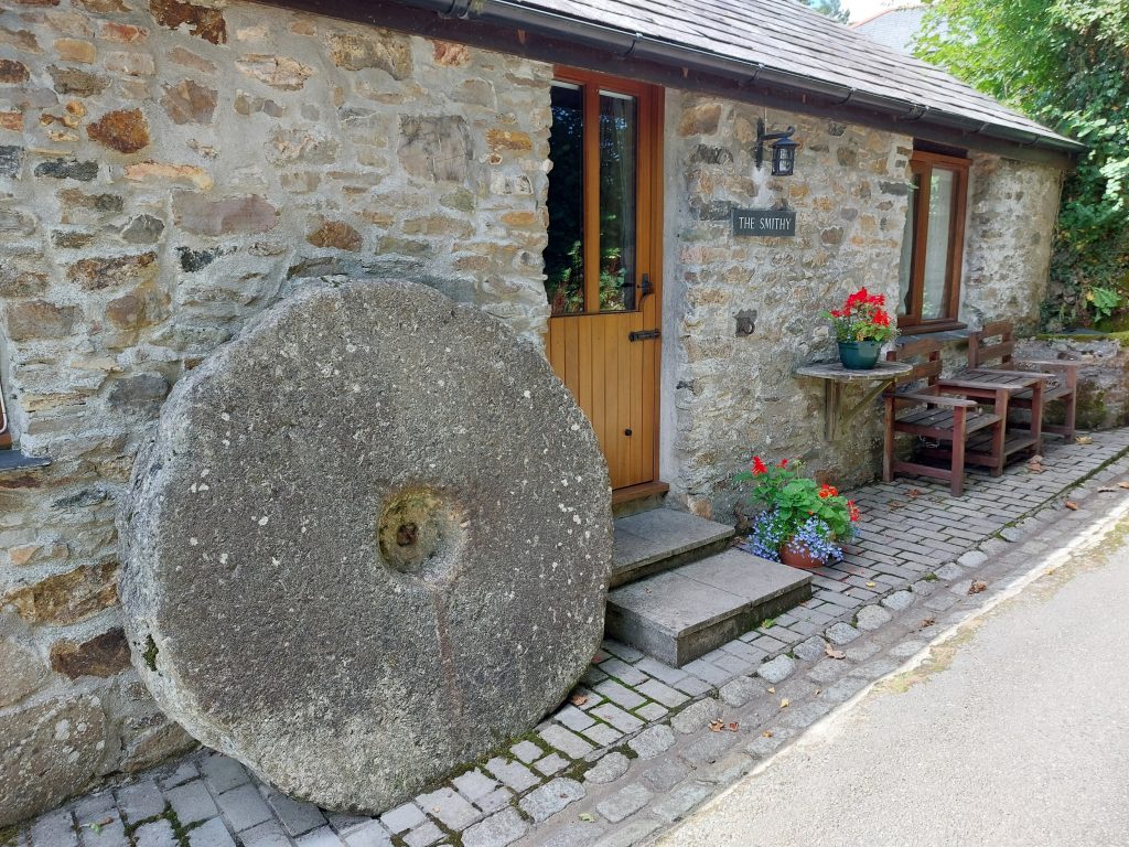
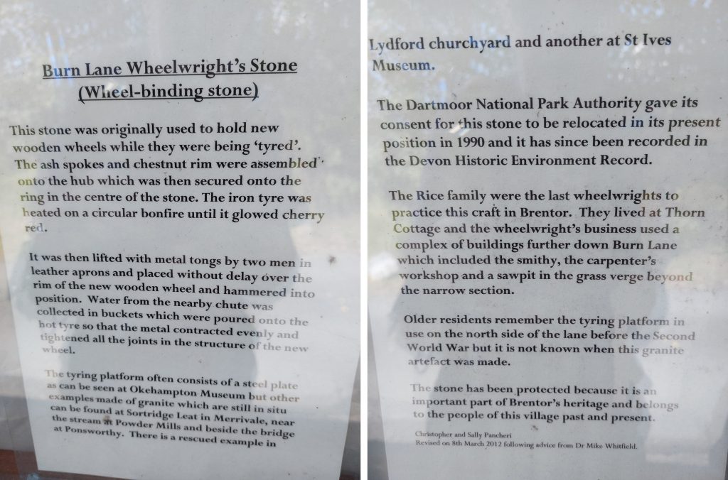
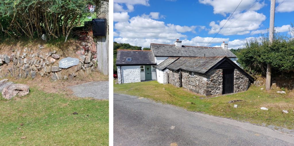
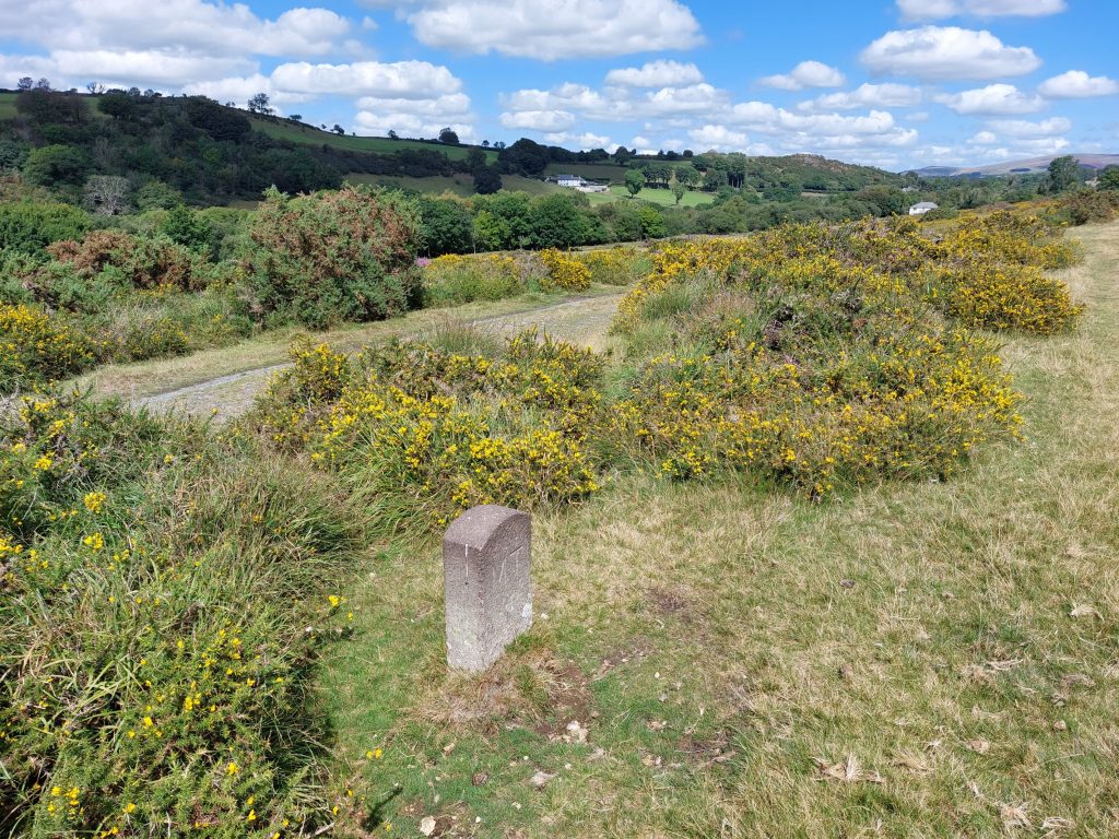
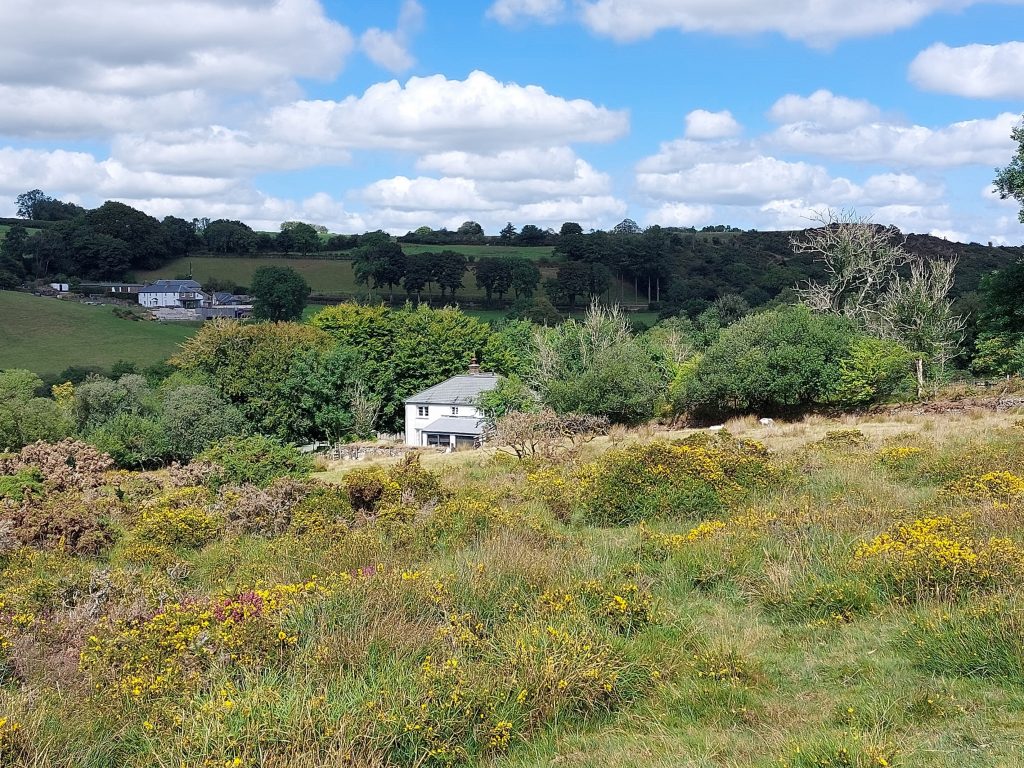
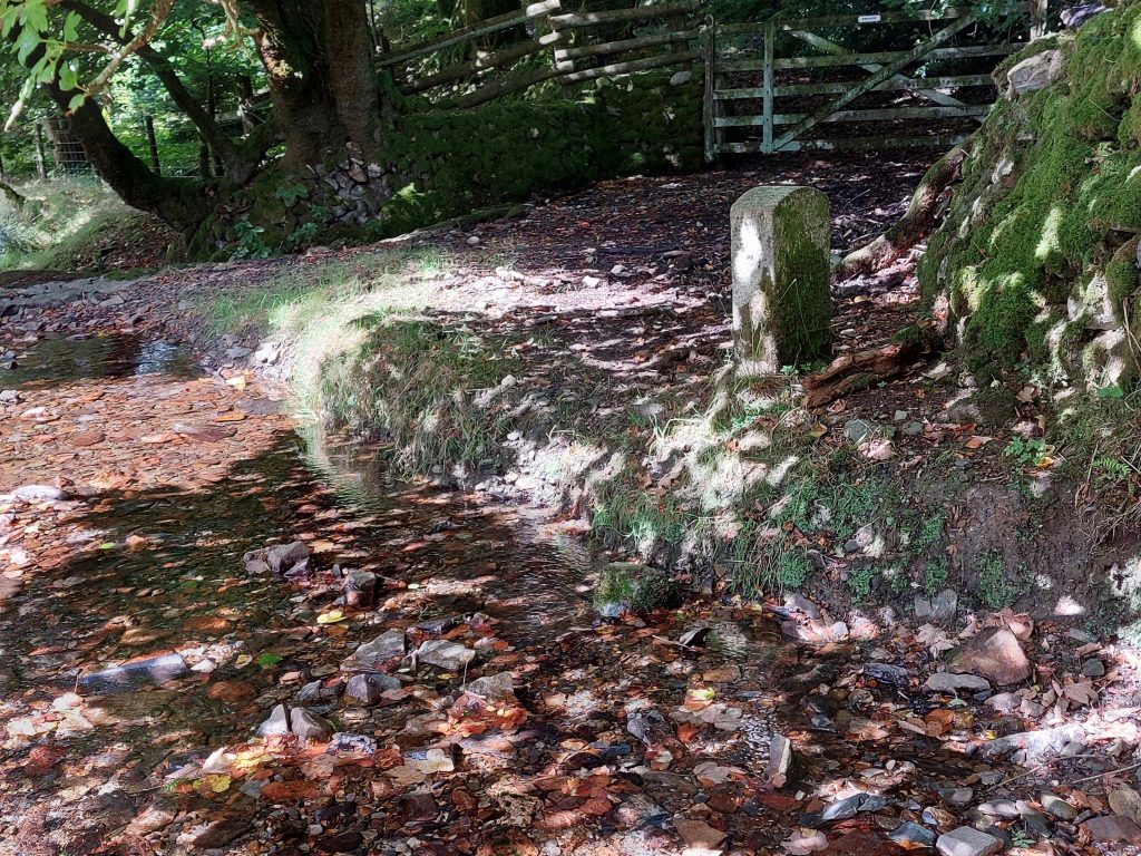
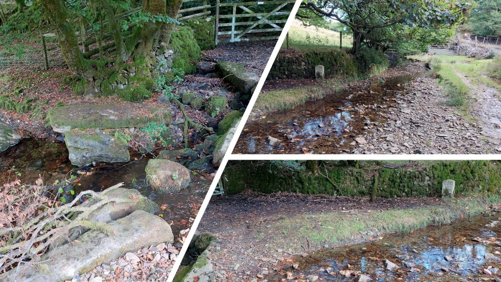
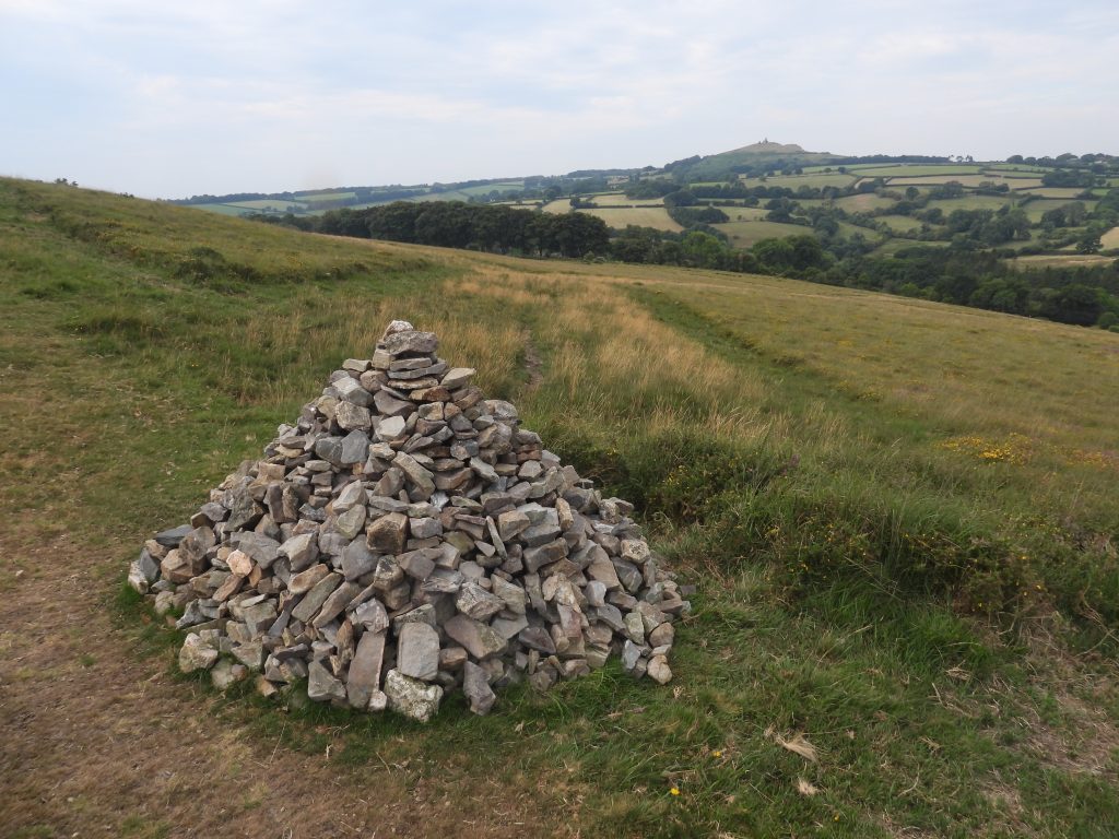
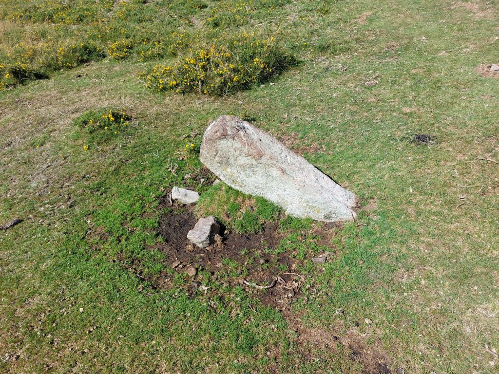
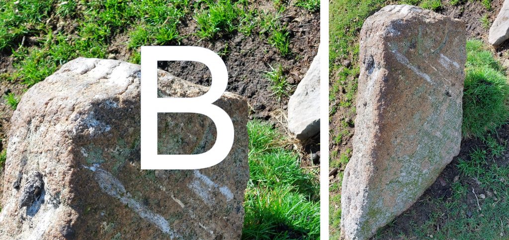
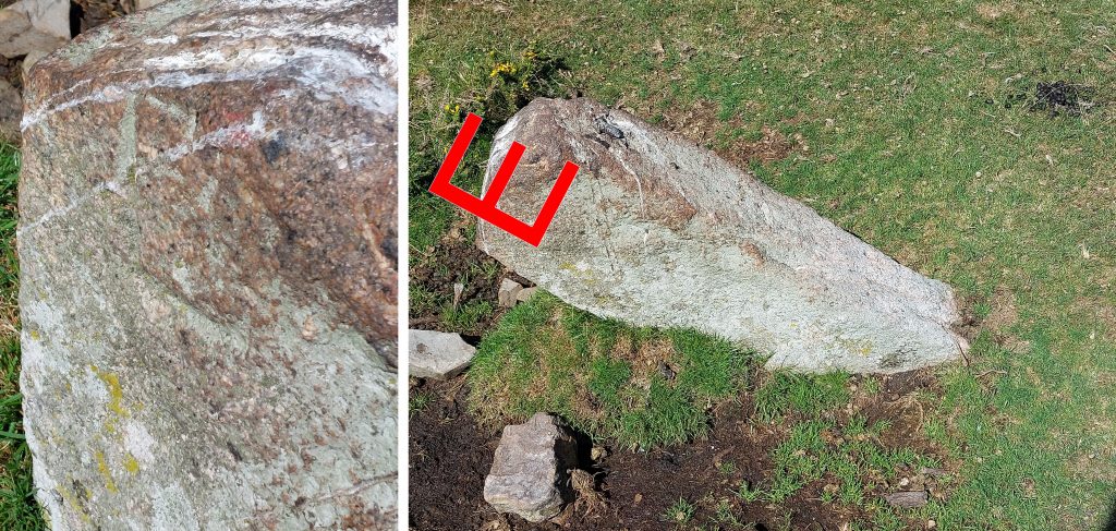
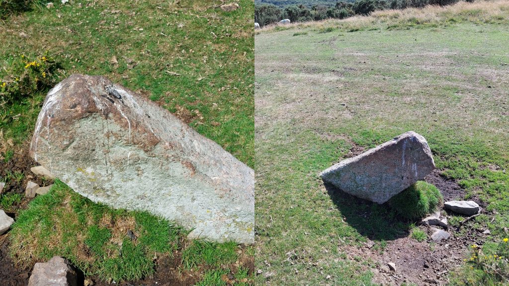
Sketch map of the features covered in this post. A good place to start any exploration of this area is from the small layby near the (John Gregan) memorial bench on the Mary Tavy – Brentor road.Before the mid-1880’s, Brentor parish was a relatively thin sliver of land encompassing Brent Tor in the south and reaching up to the River Lyd in the north. Its only settlement was Liddaton, since both North & South Brentor and Lydford Station lay in a detached portion of the neighbouring Lamerton parish. The boundary changes of the 1880s (ie ecclesiastical boundary change 1883, civil boundary transfer 1885) transferred the detached portion of Lamerton to the Parish of Brentor, more than doubling its size and population. (Source: Brentorvillage.org). The map above show the relative sizes of Brentor following these changes plus (dotted lines) the changes to the parish boundaries of Brentor and Mary Tavy as a result of the creation of Lydford Parish.The John Gregan memorial bench offers superb views of west Dartmoor and is close to a small layby. The inscription reads: “John Gregan – Loved to laugh, sing, dance and walk these moors 1929 – 2017″. RIP JohnViews from the John Gregan bench Brentor, enroute to the first B / MT inscribed granite post. The colours of the heather and gorse being very vibrant in August.The first (and most southerly) of the B/MT granite posts defining the new Brentor / Mary Tavy parish boundary.The granite post is located near Brinsabach Farm, albeit the farm cannot be seen from this location. The post can be found at SX48619 79775.Close up of the “MT” and “B” inscriptionsThe post is orientated (as one would expect), so that the relative inscriptions face inwards towards that parish. In this instance the “MT” is south east facing.Taking a mini detour from the Brentor / Mary Tavy parish boundary to Wortha Mill Bridge(s). Here the explorer can observe probably the best views of the two dismantled railway lines of: Great Western Railway (Launceston Branch) and London South Western Railway (LSWR). There are two bridges, one for each of the lines.GWR bridge and line (south). The Launceston branch was broad gauge and was opened in 1865. However, by 1876 a third rail was added, and narrow gauge trains of the LSWR ran from Okehampton to Plymouth by this route.The LSWR route was constructed “piecemeal” by independent companies, in most cases supported by LSWR. Trains first reached Plymouth in 1876 and the route took on its final form in 1891. The line was fully closed by 1972.Wortha Mill is a former corn mill, whose waterwheel used water from River Burn.Between the 1st and 2nd “B / MT” posts, just to the south of Wortha Farm, is a beautifully inscribed rough finished granite post which is deeply inscribed with a “B”. It would be easy to assume that the “B” stands for Brentor. However, this can be discounted as the inscription faces the wrong direction and faces Mary Tavy not Brentor. The stone is believed to relate to lands owned by the Buller Family and Arthur Edgecombe from early 19th century. If this is the case, the stone would (most likely) have an “E” inscribed on its reverse side. This stone can be found at SX48745 80629Contextual views of the Buller / Edgecombe stone. The stone is believed to define a boundary from Smallacombe Bottom and Gibbet Hill. Smallacombe Bottom was a part of the reputed Manor of Warne which was acquired by Buller in 1808. The Manor of Waven (or Warne) also at one time belonged to Arthur Edgecombe (and others). Source: Mark Fenlon from article in Dartmoor News (Jul/Aug 2021: p36-39) – titled “Dartmoor Boundary Stones – Revisited”Moving in a northerly direction along the Brentor / Mary Tavy parish boundary from the first Buller / Edgecombe stone is the entrance to Wortha Farm. It is a historic farmstead, dating to the mid-late 19th century.The second of the B/MT granite posts defining the new Brentor / Mary Tavy parish boundary is located on a verge near to the dwellings of Furzeleigh (old School House), Wortha Cottage and Woodford House.Close up of the “MT” and “B” inscriptions. On the “B” inscribed side there is also a date inscription (2000). This post can be found at SX48687 81080.This picture shows the relative size and locations of the “B and “2000” (as light conditions weren’t great for photographs)The former Brentor railway station is now a private dwelling. It was opened on 2nd June 1890 by the Plymouth, Devonport and South Western Junction Railway as part of its line from Lydford to Plymouth and finally closed on 6th May 1968. Source: http://great-devon-railway.uk/Near to the old Brentor station, there are still some Southern Railway artefacts. Such were the vagaries of the railways at that time, the South Devon & Launceston (GWR) line although running to the station did not allow passengers to alight as there was no platform. Any passenger wishing to alight at Brentor needed to change trains at Lydford Junction Station.Between the Brentor Station and the second B/MT posts is Woodford House. Outside the dwelling and at the base of the hedge line, lies a Great Western Railway boundary marker.The “Woodford House” GWR boundary marker is dated 1891. The author suspects this marker is not in its original location due to two reasons: Firstly, it is a few hundred metres from the former railways and secondly, it is on the LSWR “side” (ie east side of the two parallel railways). The marker is located at SX48660 81113.Continuing northwards along the Brentor / Mary Tavy parish boundary from the second B / MT post, the dwelling ‘Furzeleigh’ is passed. It was built in 1890 as a purpose-built single-roomed school. It is now called “Old School House”. Recorded by Mary Stanbrook in Old Dartmoor Schools Remembered, it was a struggle to get it built and keep it going before it finally closed in 1918 when the remaining pupils went to Brentor School. The site for a school building was donated by John Francis Buller.A postcard from around 1915 showing the school (on the left) and Brentor Station with smoke coming out of its chimney (on the right).The third B / MT post is located near West Blackdown Farm.Close up of the “MT” and “B” inscriptions. This post can be found at SX49266 81611. As with the second B / MT post, on the “B” inscribed side of this third post, there is also a date inscription (2000). From the third B / MT post a short diversion west was taken towards Burn Lane and associated bridge. On the east side of the bridge, a second GWR iron boundary marker can be found.Close up of of the second GWR boundary marker. It is dated 1891 and can be found at SX49050 81689.Crossing Burn Lane Bridge, a third GWR boundary marker can be found. When found, the author noted the marker was covered in moss.Close up of of the third GWR boundary marker, having cleared some moss. It is also dated 1891 and can be found at SX48980 81735.The Smithy in Burn Lane is a short distance uphill from Burn Lane Bridge. A large wheelwrights stone is located outside, which was placed at this location in 1990. The location is SX48928 81863The story of the wheelwrights stone (wheel-binding stone) can be found on two laminated sheets in the window of “The Smithy”.Returning to the parish boundary, West Blackdown cottage is passed. From this point the parish boundary leaves the road and enters open moorland.View of West Blackdown Cottage from near B / MT post number 3.The fourth B / MT boundary post lies alongside a track (also known as Mary Tavy Footpath 32).The fourth B / MT boundary post is located at SX49623 82105.Close up of the “MT” and “B” inscriptions on the fourth post.View from the parish boundary of Burn Cottage, Was Tor Farm and (behind the leafless tree) Was TorThe fifth B / MT boundary post lies alongside a track (also known as Mary Tavy Footpath 32).Close up of the “MT” and “B” inscriptions on the fifth post. This post is located at SX49955 82433The sixth and final boundary post lies next to a ford on a small brook near Hall Farm. It has three inscriptions, “B”, “MT” and “L” as it lies at the triple junction of the parishes of Brentor, Mary Tavy and Lydford.The B / MT / L post is located near a gate which leads to Hall Farm (note that there is a private sign on the gate).“B” inscription“MT” inscription“L” inscriptionThis sixth post is located at SX50556 83126Returning south across Blackdown (via West Devon Way / Dartmoor Way) several clearance cairns are passed.The leaning stone is the second one in this post which are believed to relate to lands owned by the Buller Family and Arthur Edgecombe from early 19th century. It lies uphill from the John Gregan memorial bench.The second Buller / Edgecombe stone is not only leaning but has its top broken off. On one side there is evidence of a half an inscribed “B” (for Buller).On the reverse side there is evidence of a half an inscribed “E” (for Edgecombe).The second Buller / Edgecombe stone is located at SX49248 80175
PS website is a map of Wayside Crosses in customise to your area. It was setr up for Gloucestershire but is extended to GB in hopes of people send images where the Milestone Society don’t have any.

Mr Red February 27, 2026
any idea where this stone with I B (or H B or L B) is? see https://www.facebook.com/photo?fbid=10239692042666348&set=pcb.25832482899695983 – from a collection in the area.
PS website is a map of Wayside Crosses in customise to your area. It was setr up for Gloucestershire but is extended to GB in hopes of people send images where the Milestone Society don’t have any.
SteveGriggDartmoor February 27, 2026 — Post author
It is located at SX 49838 79879 on the Mary Tavy to North Brentor road (left side as you climb the hill)
Thought to have been a marker stone for a mining sett
Kind regards,
Steve (Dartmoor Explorations)