A collection of walks, discoveries, insights and pictures of exploring Dartmoor National Park
May 15, 2023
Beardown Mine (Wheal Virgin)
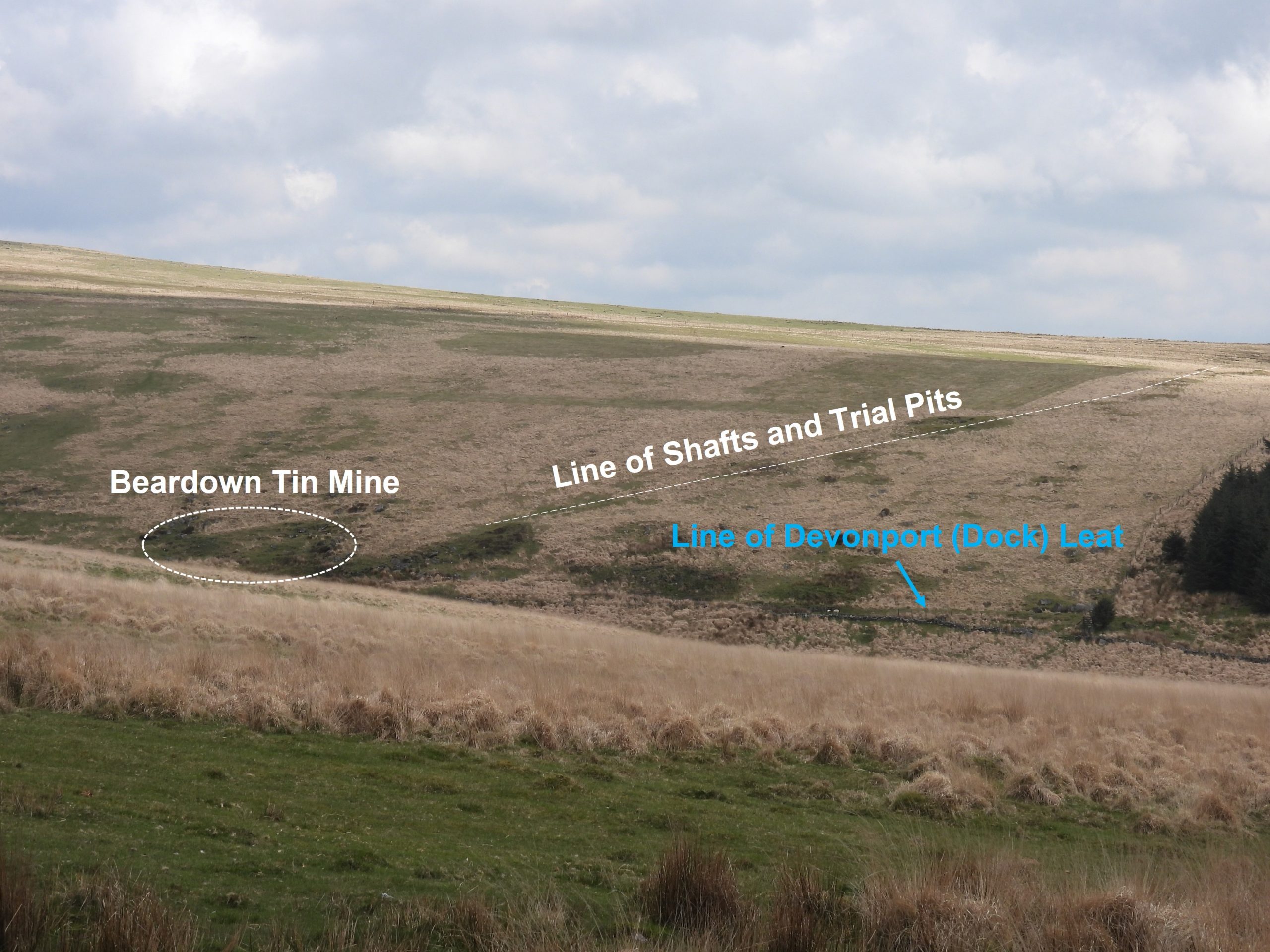
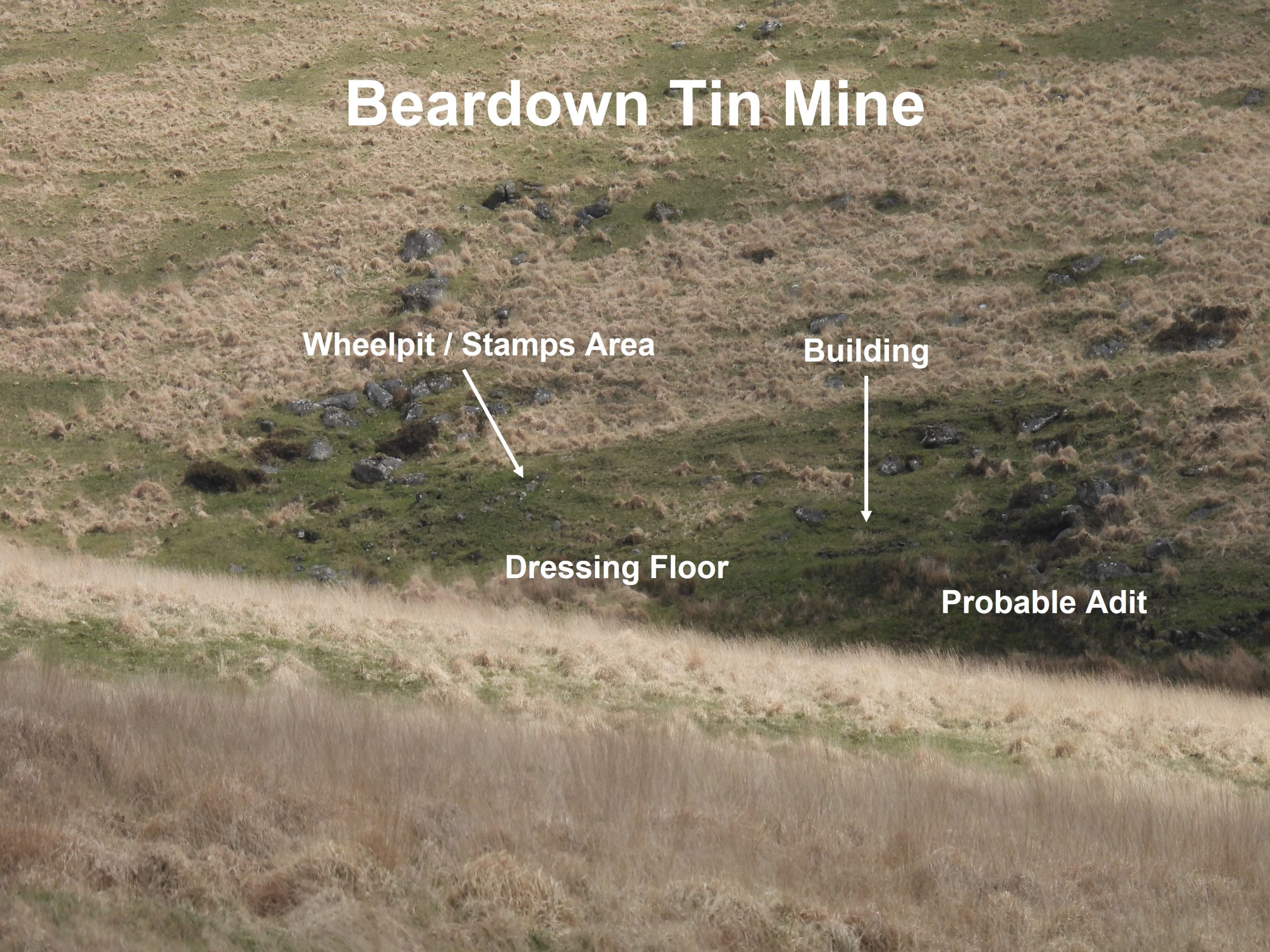
The author came across an article on this mine in a Dartmoor Tin Research Group (DTRG) newsletter (number 56), which provided a lot of information on this (probable) late 18th century / early 19th century venture. The article of the mine appears to have been penned as part of a field trip in January 2002 by Tom Greeves, Jamie Frost and Chris Kelland. The article introduces the mine as having all the characteristics of small mines of that era (ie leat, wheel pit, stamps area, dressing floor, building, adit and shafts).
The DTRG article also provided some fabulous reference material, which makes for interesting reading of the history of the mine from between 1797-1801, which is summarised here.
The original Dock (Devonport) leat borders the mine to the west, which was constructed in the 1790’s (Note: it wasn’t renamed to ‘Devonport’ until 1st January 1824). The dating of the cutting of this section of ‘Dock Leat’ provides a historical reference to the mine, viz; In 1797, a John Jenkins who had witnessed the cutting of ‘Dock Leat’, which was “through both enclosed and unenclosed ground, to ‘Bear Down’ mine”. Furthermore, there is a record that states that, “in April 1799, Capt Henry Branter was ‘raising tin fast’ from Wheal Virgin“. So, how do the names ‘Bear Down Mine’ and ‘Wheal Virgin‘ relate to one another ? The answer appears to be from a newspaper advertisement (discovered by Chris Kelland) from an auction of shares for the mine dated from 24th February 1801, which was held at Two Bridges. The auction was for “24 x 1/64 shares of a late discovered Tin Mine of Bear Down….called Wheal Virgin, about one mile from Two Bridges; to which there is a Stamping Mill of three hammers, and a Engine lately erected for drawing off water”. There was a mention of £200 (about £12,000 in 2023) worth of tin of ‘the best quality’ brought to the surface.
With this DTRG information coupled with a plan, the author undertook an ‘exploration’ of the mine remains and this post is the result.
Bibliography
Dartmoor Tin Research Group (DTRG) Newsletter Number 56 – Notes on mine by Tom Greeves (page 10)
Tom Greeves (2002) Beardown Mine/Wheal Virgin, Devon Mining Club Journal, 3(1) February 2002, 28-31
Agricultural Development Advisory Service, 1988, Beardown Farm (Report – Assessment).
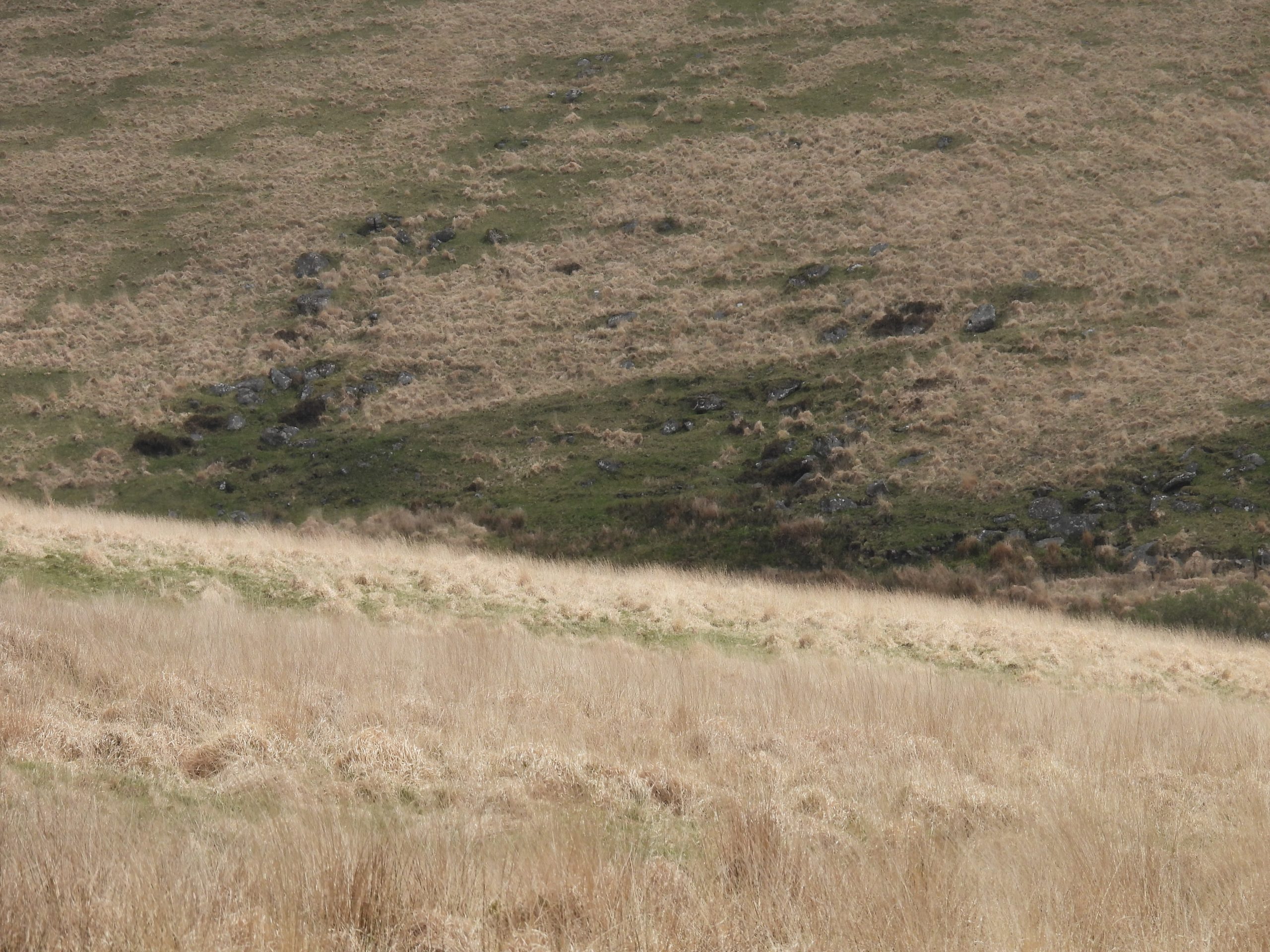
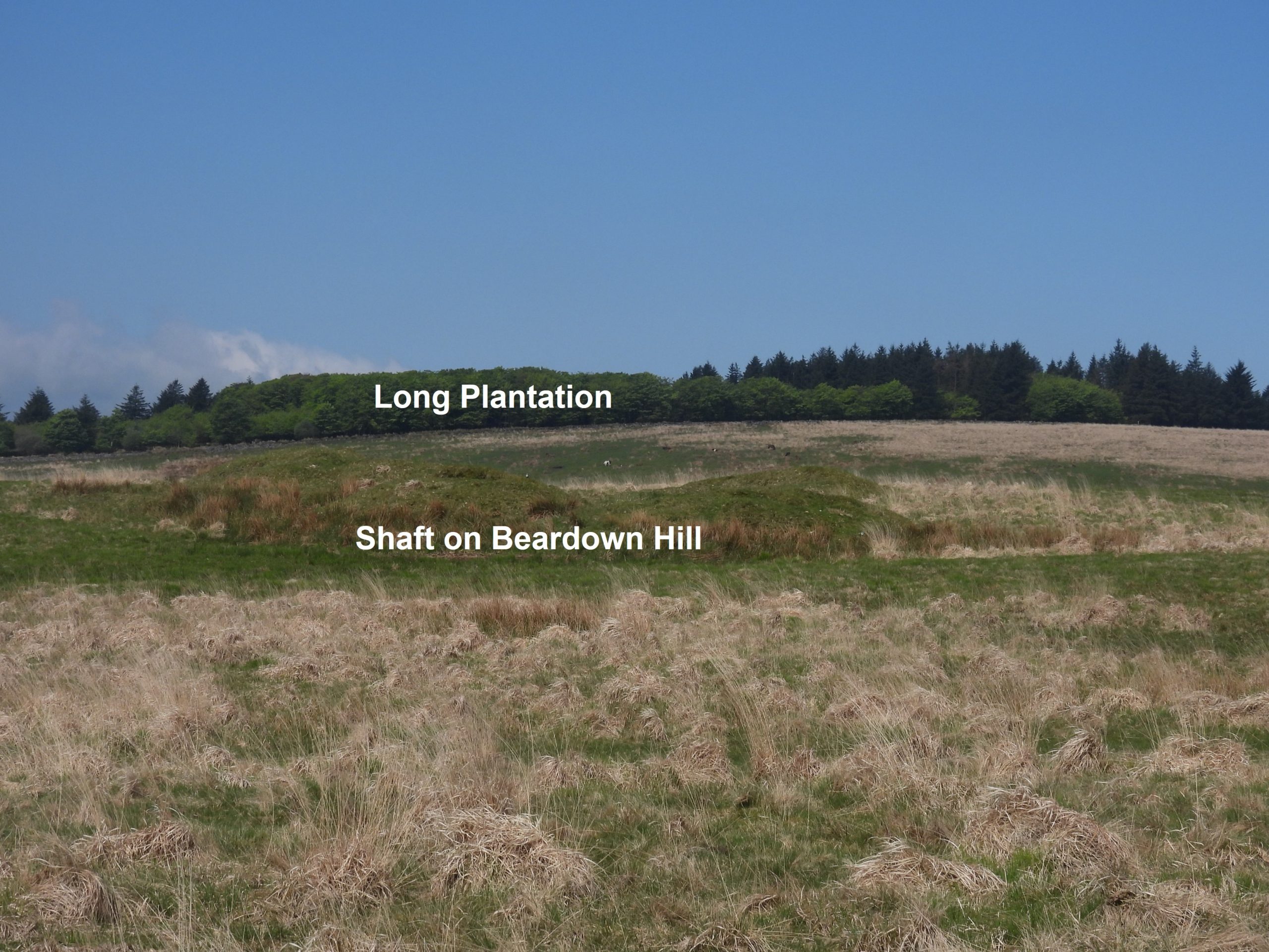
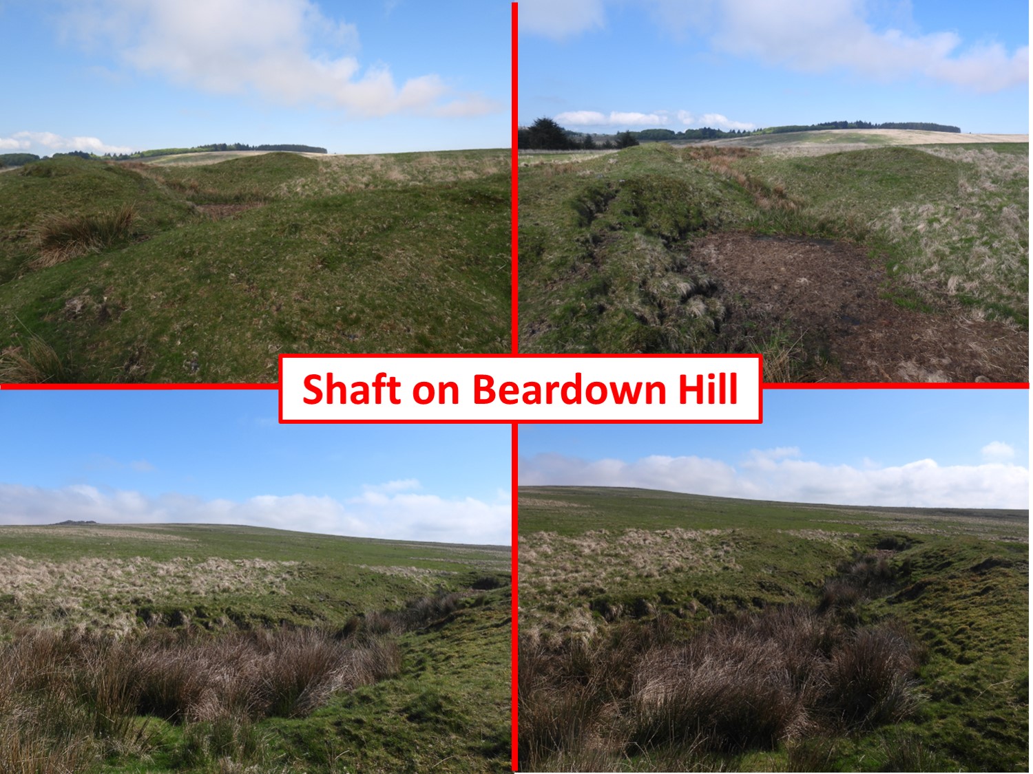
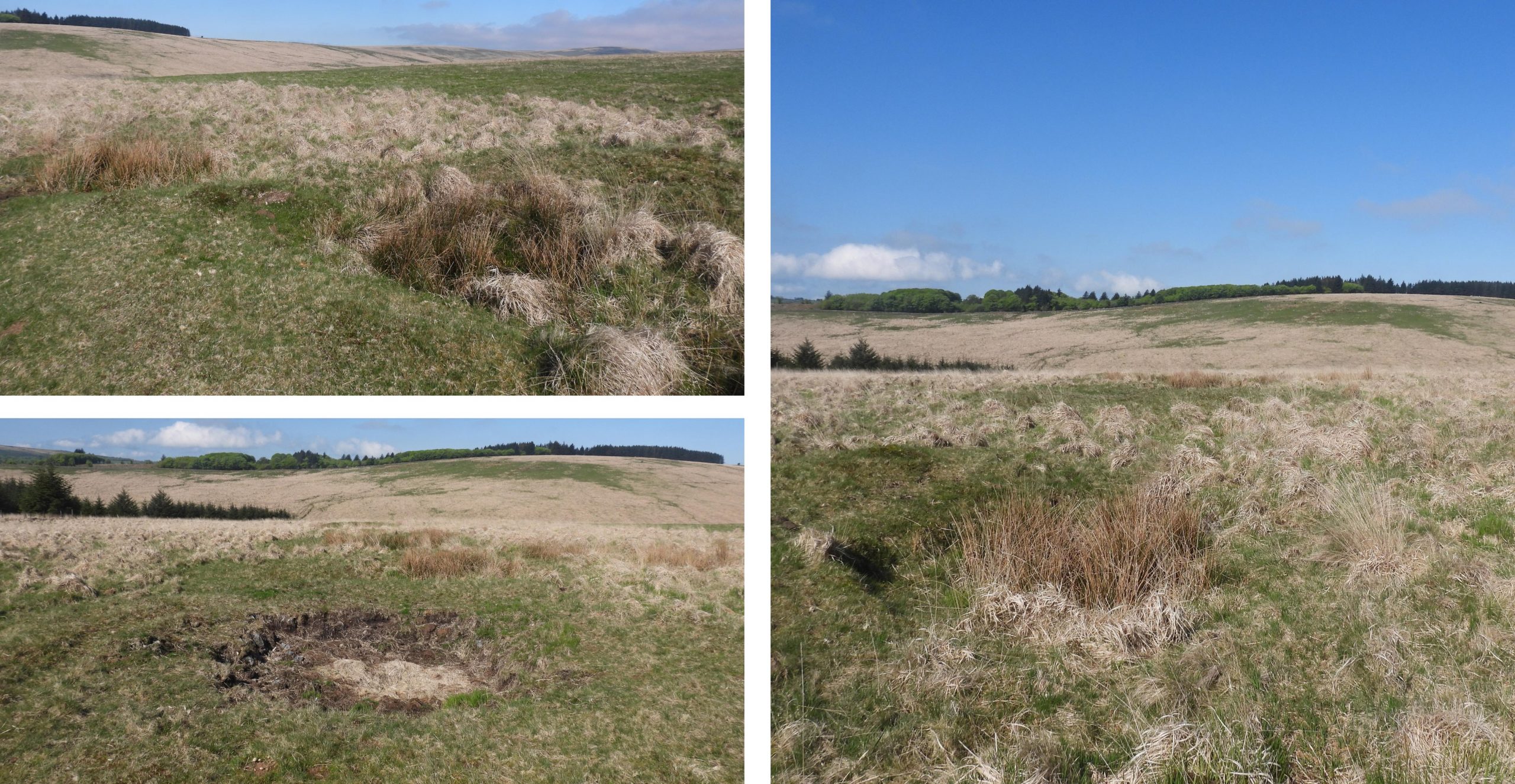
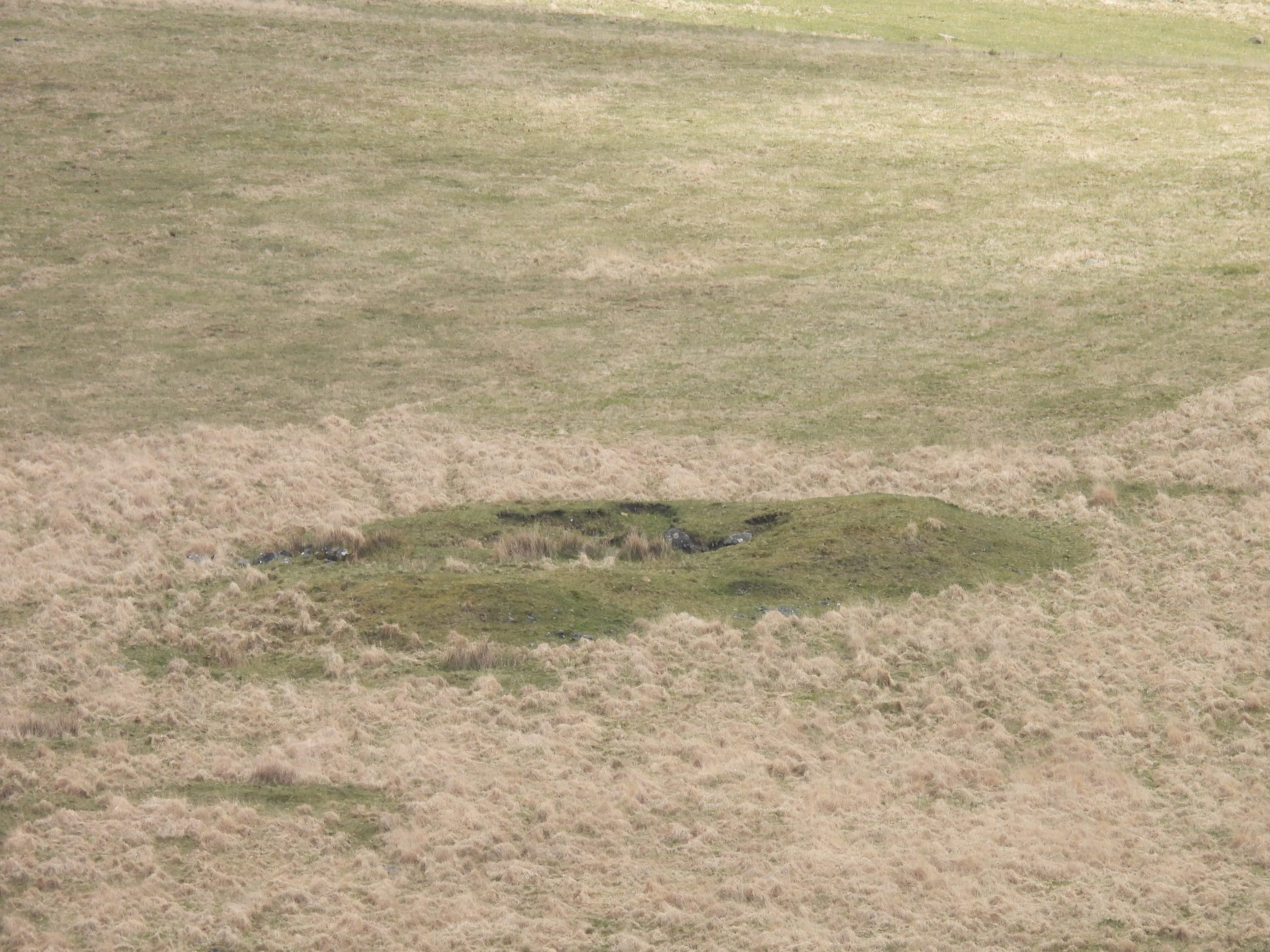
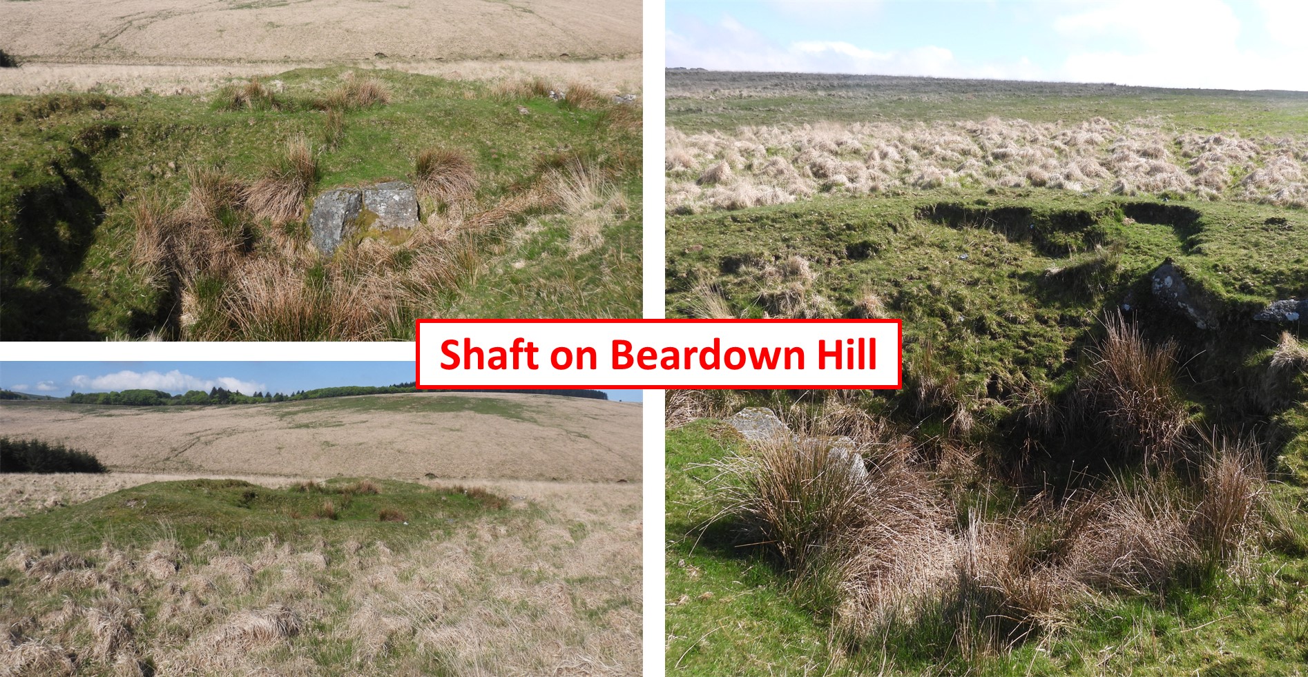
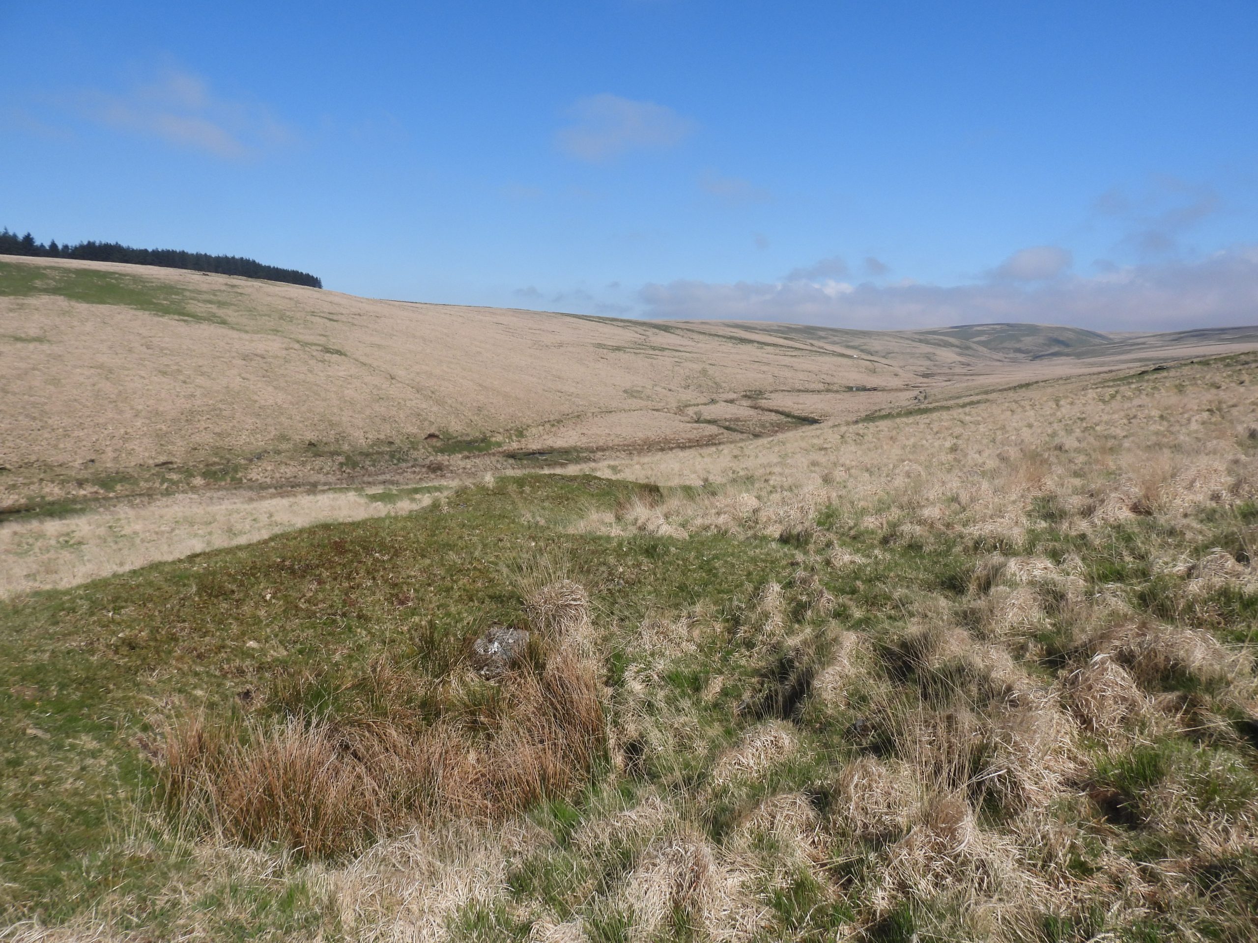
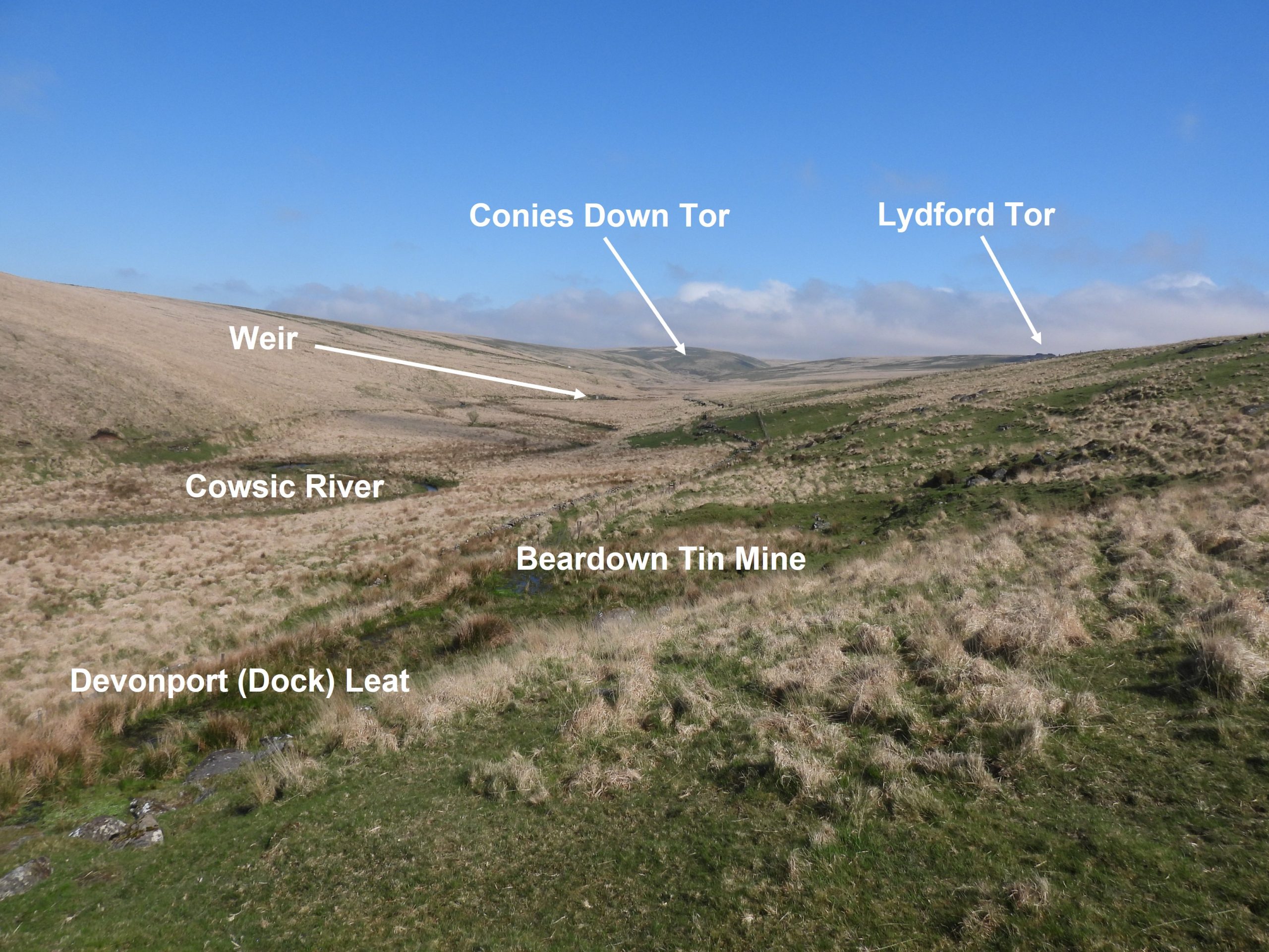
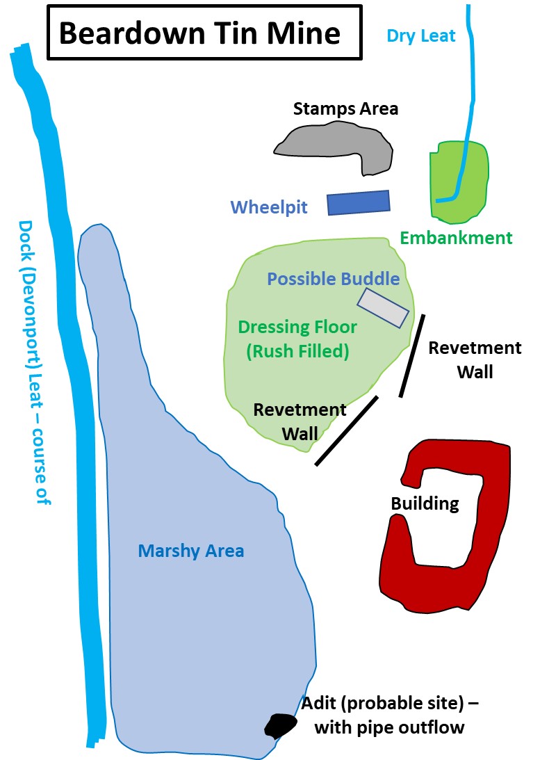
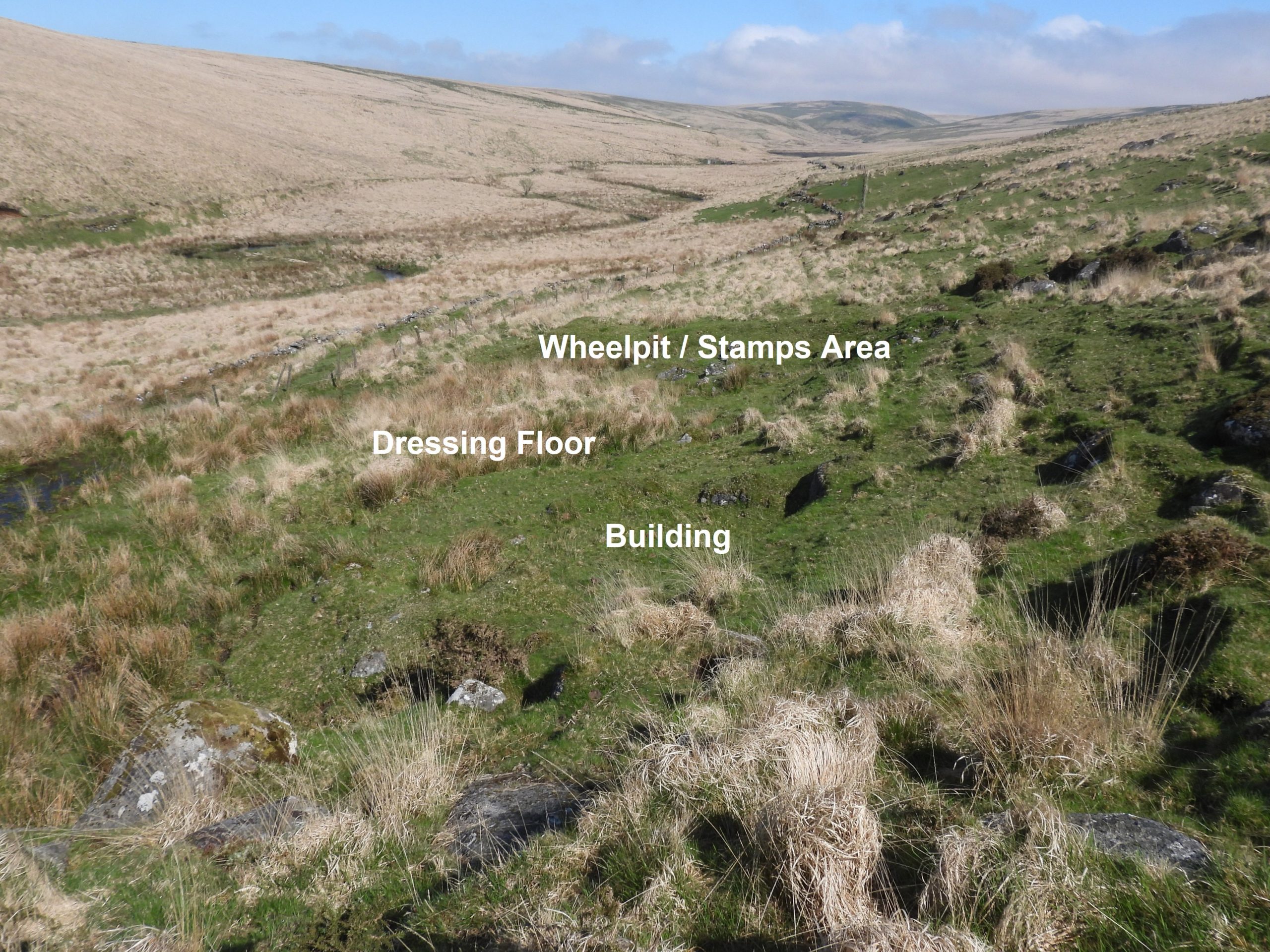
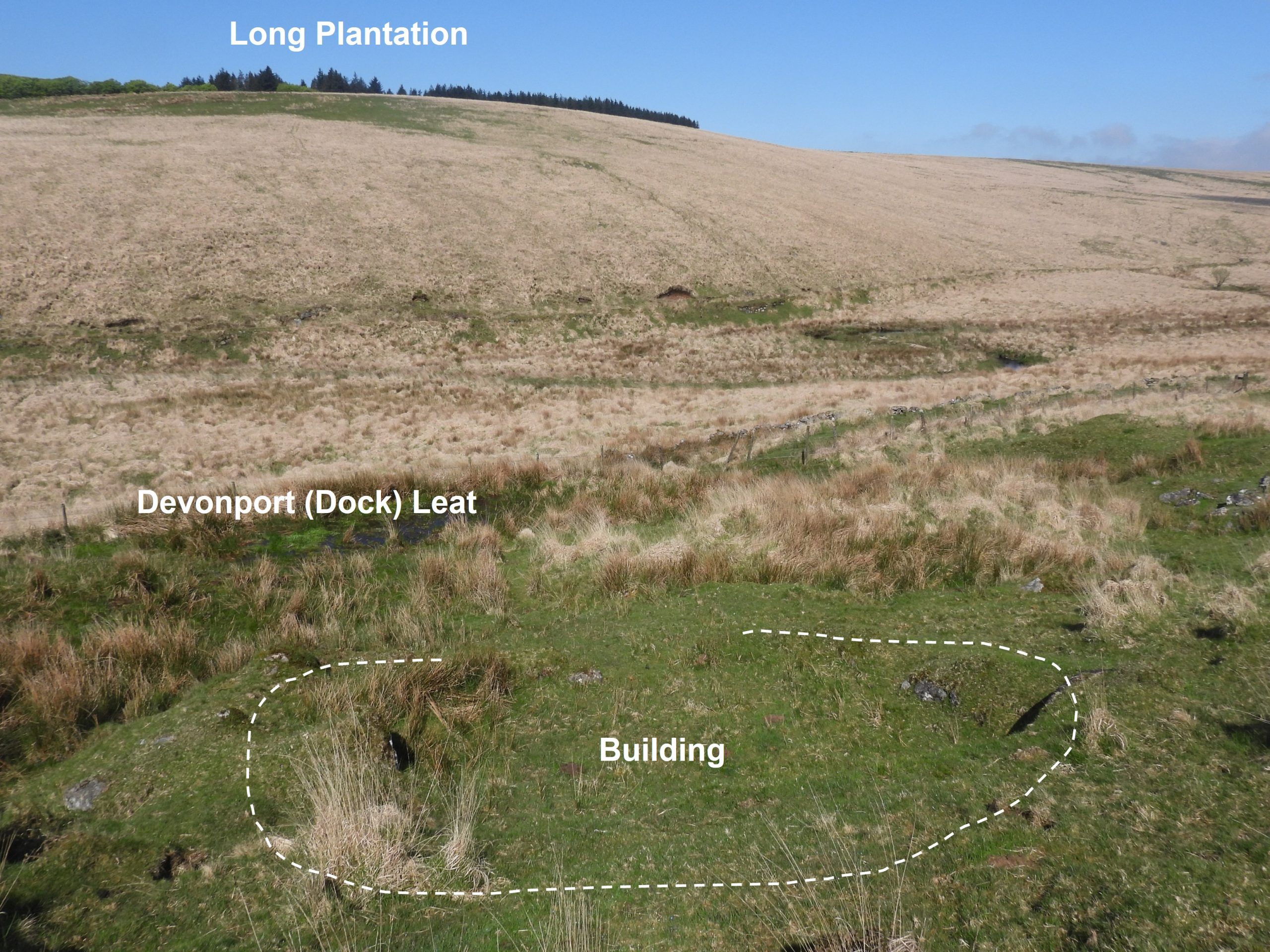
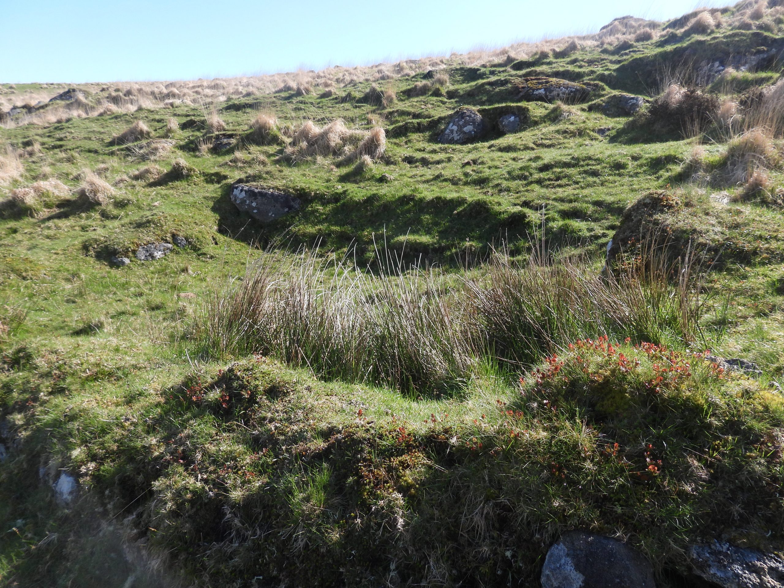
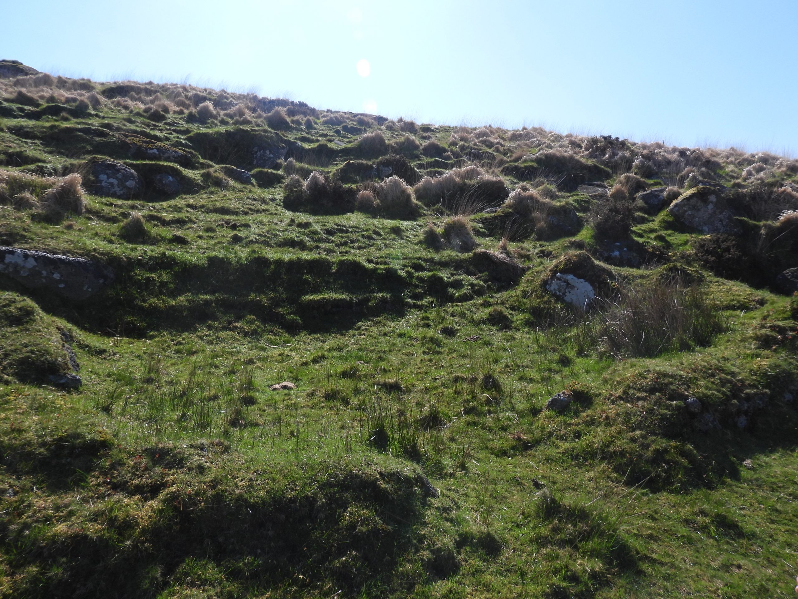
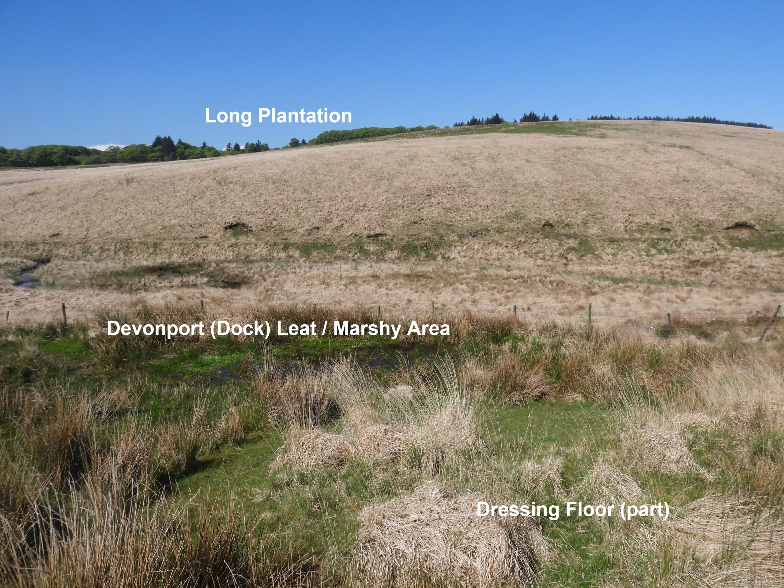
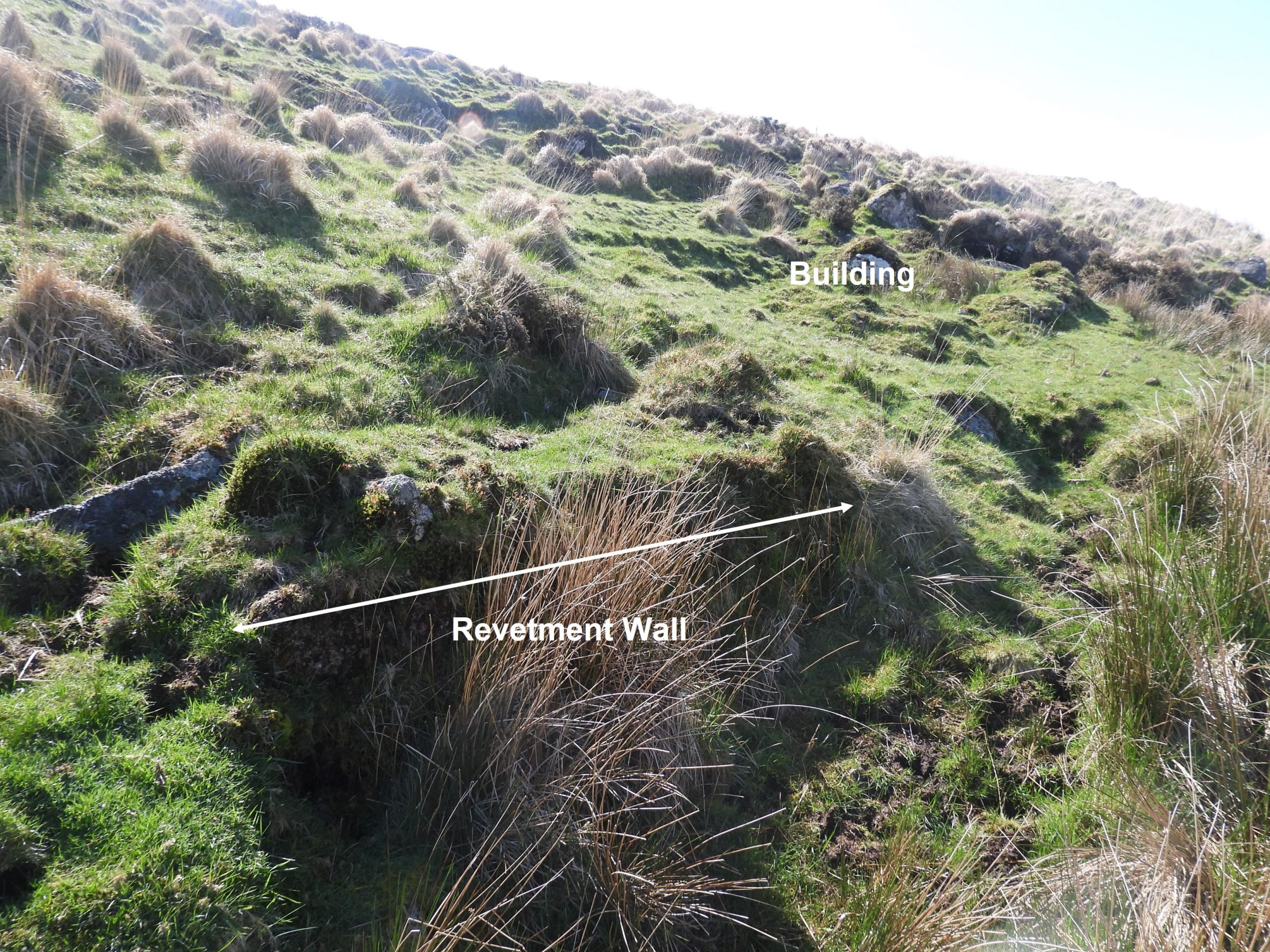
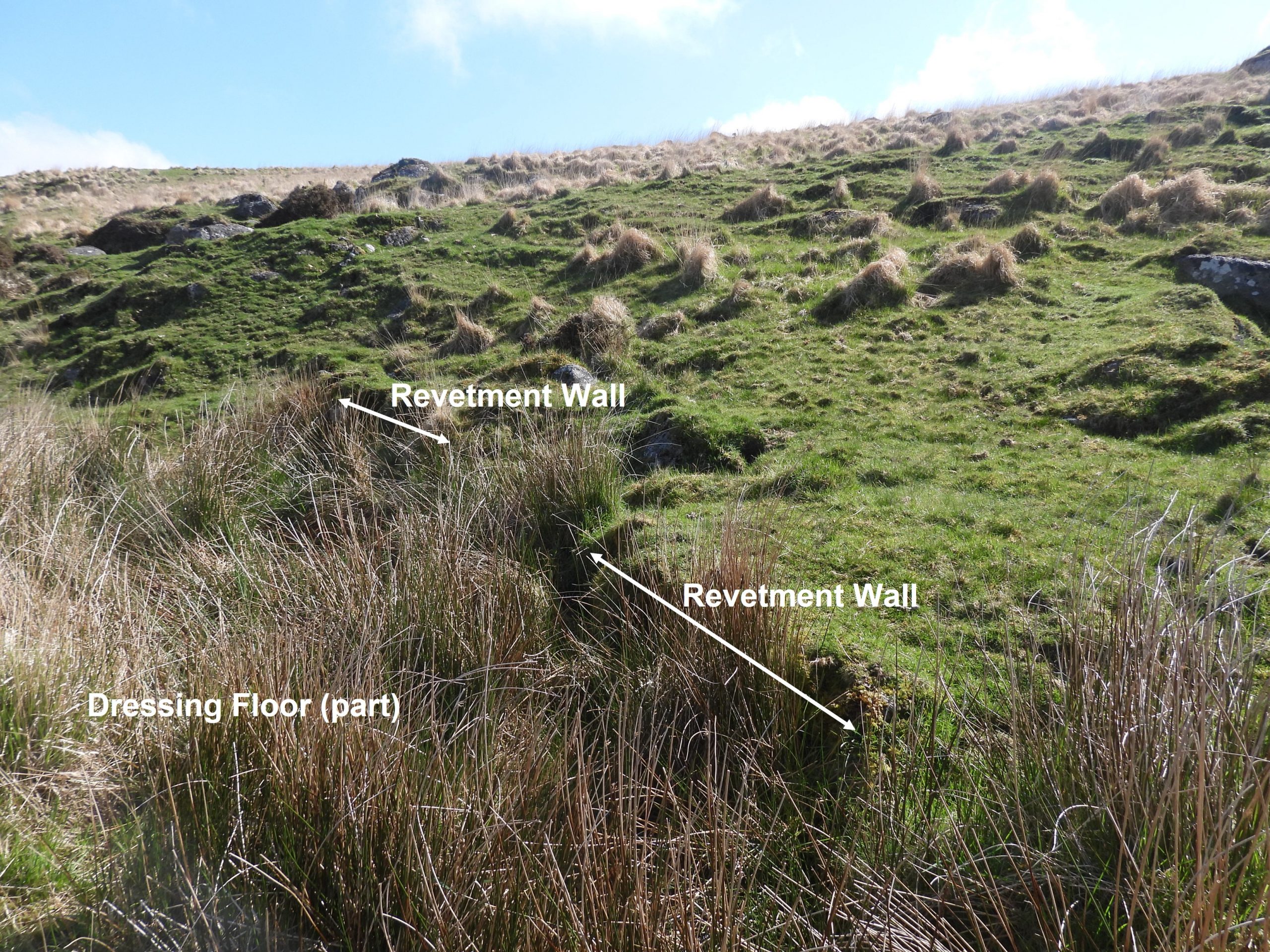
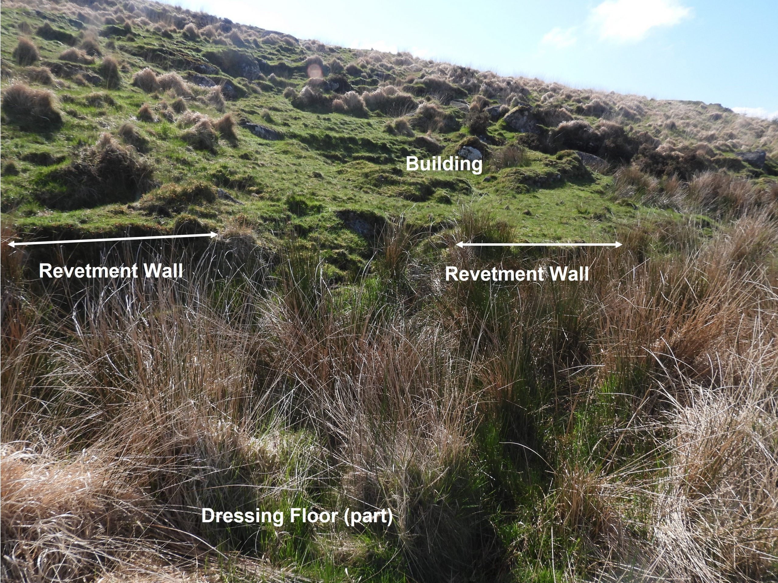
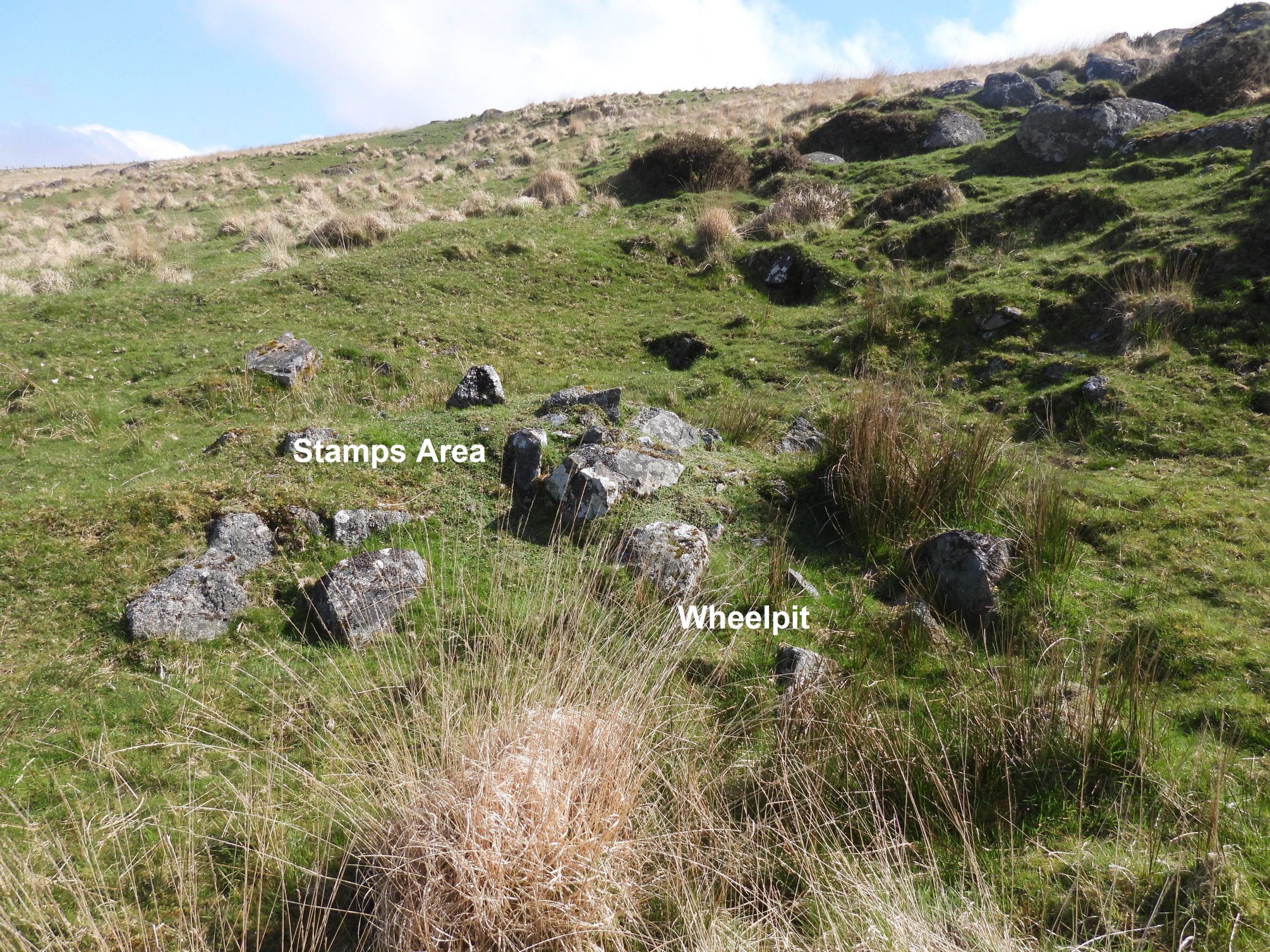
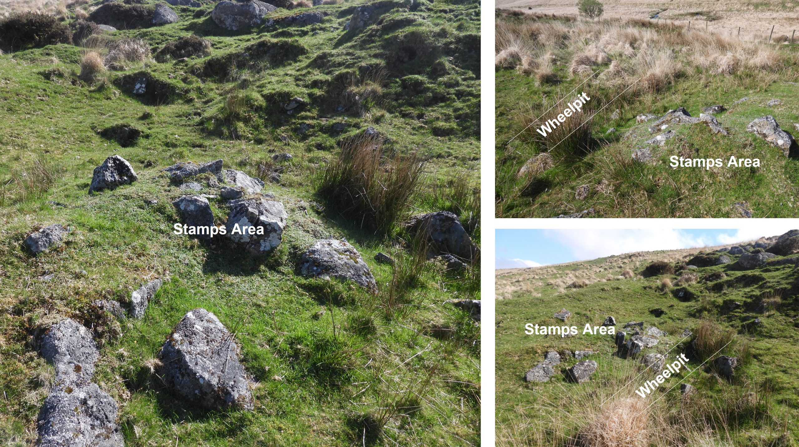
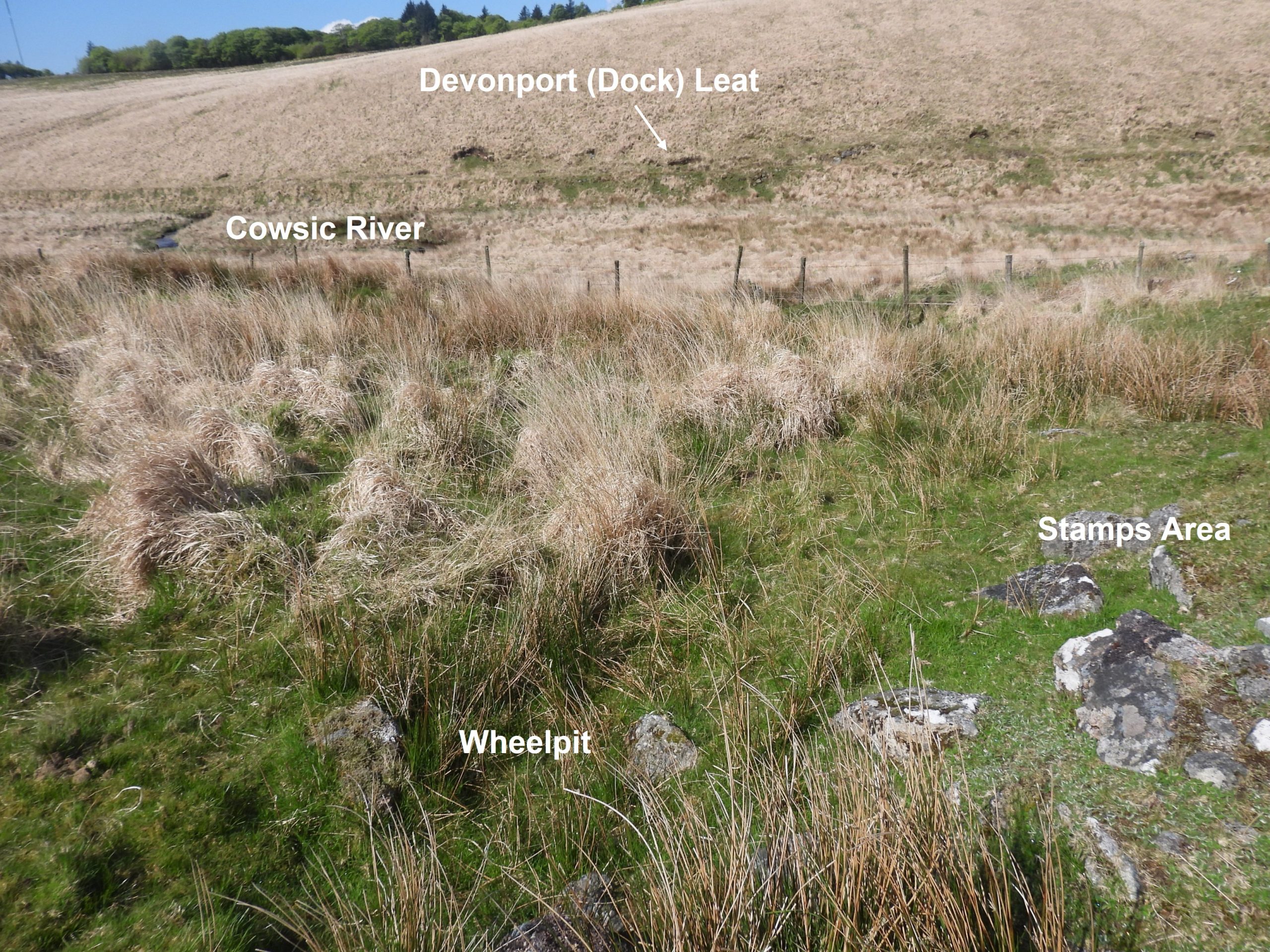
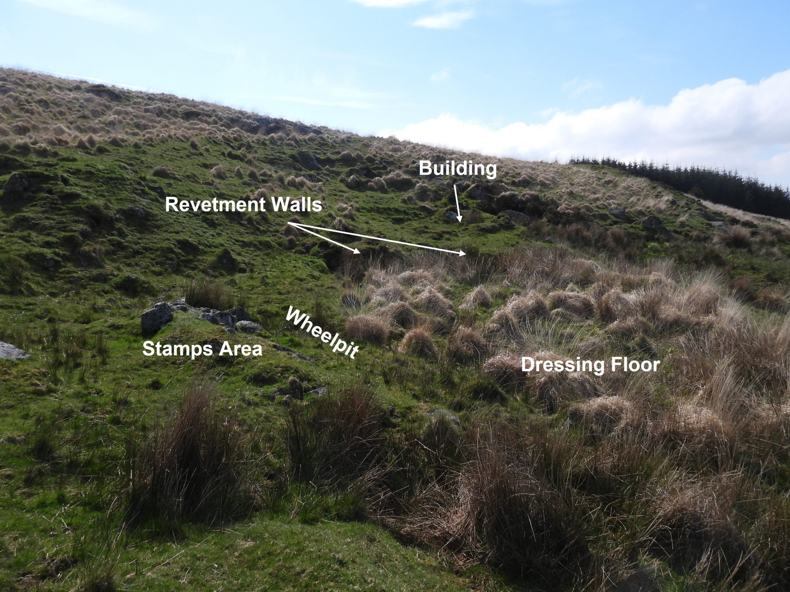
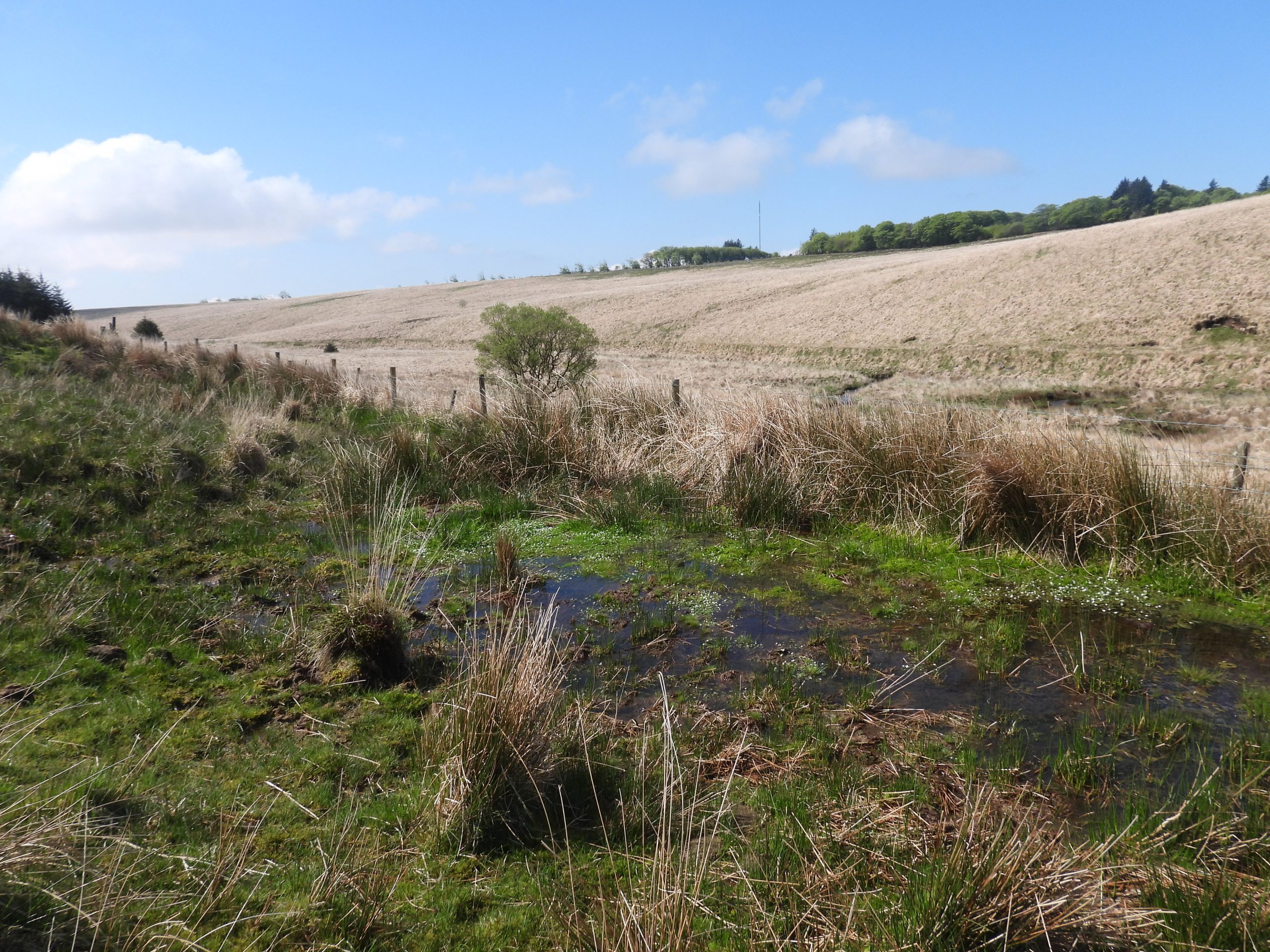
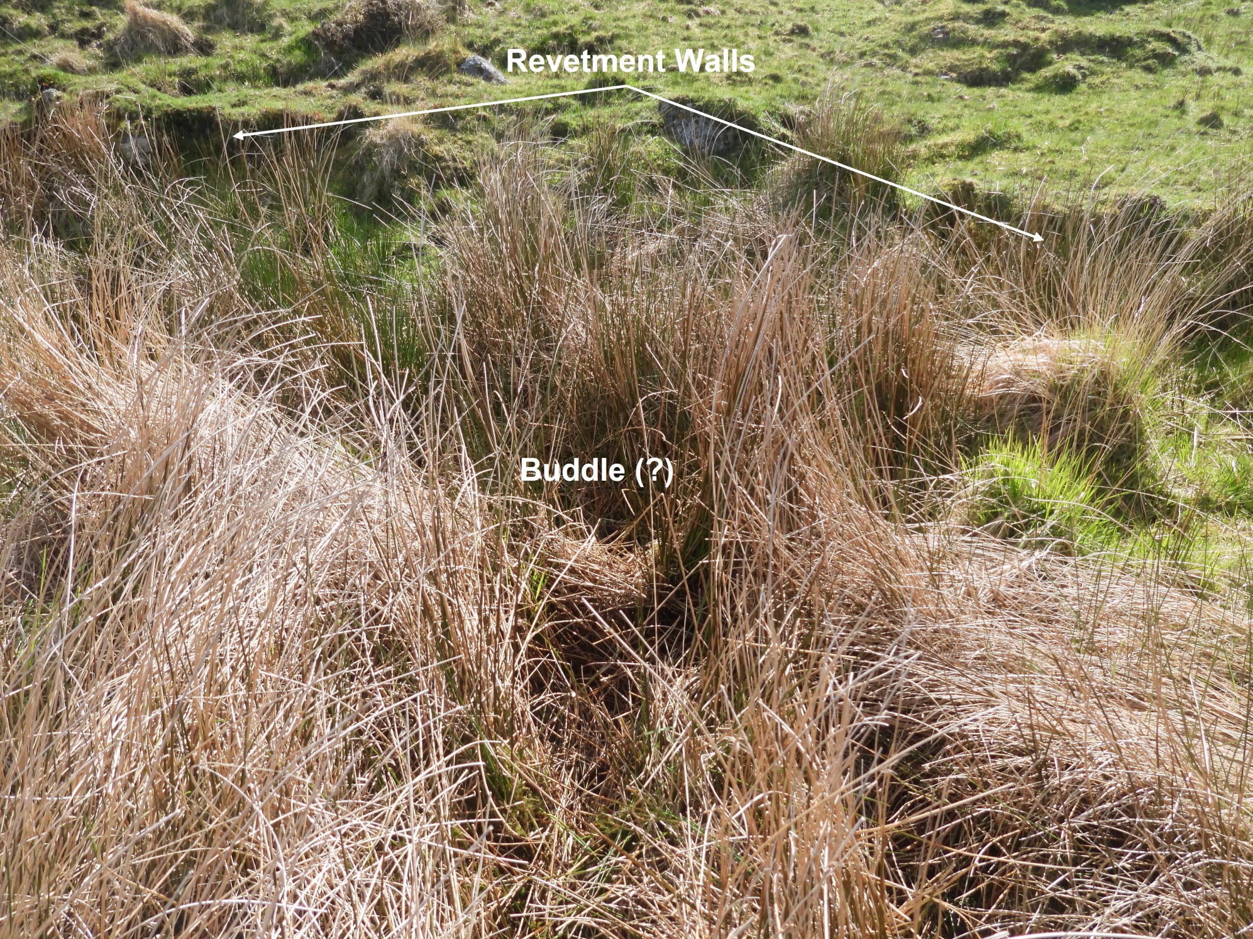
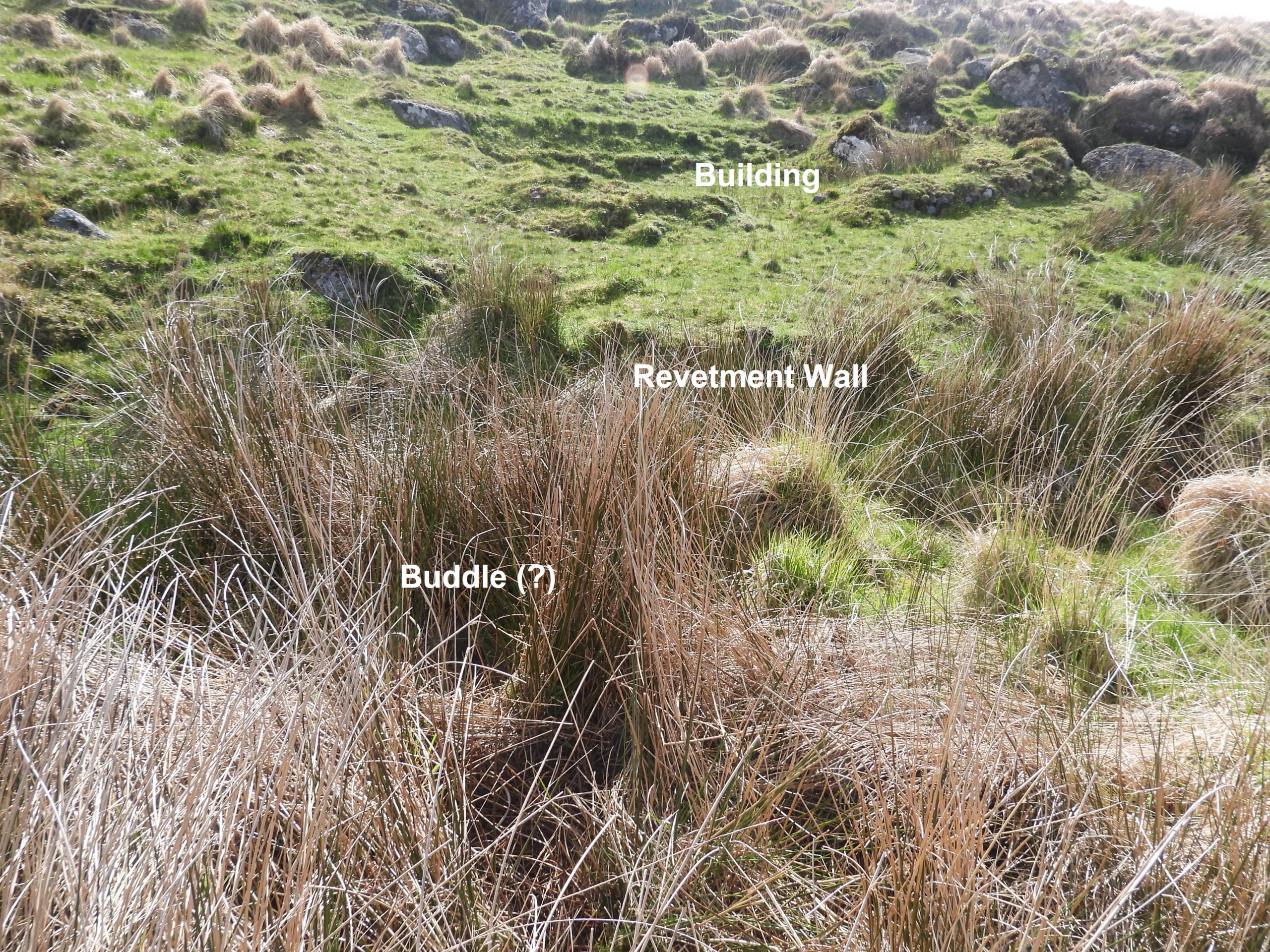
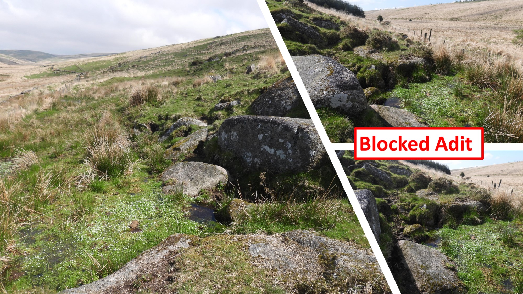
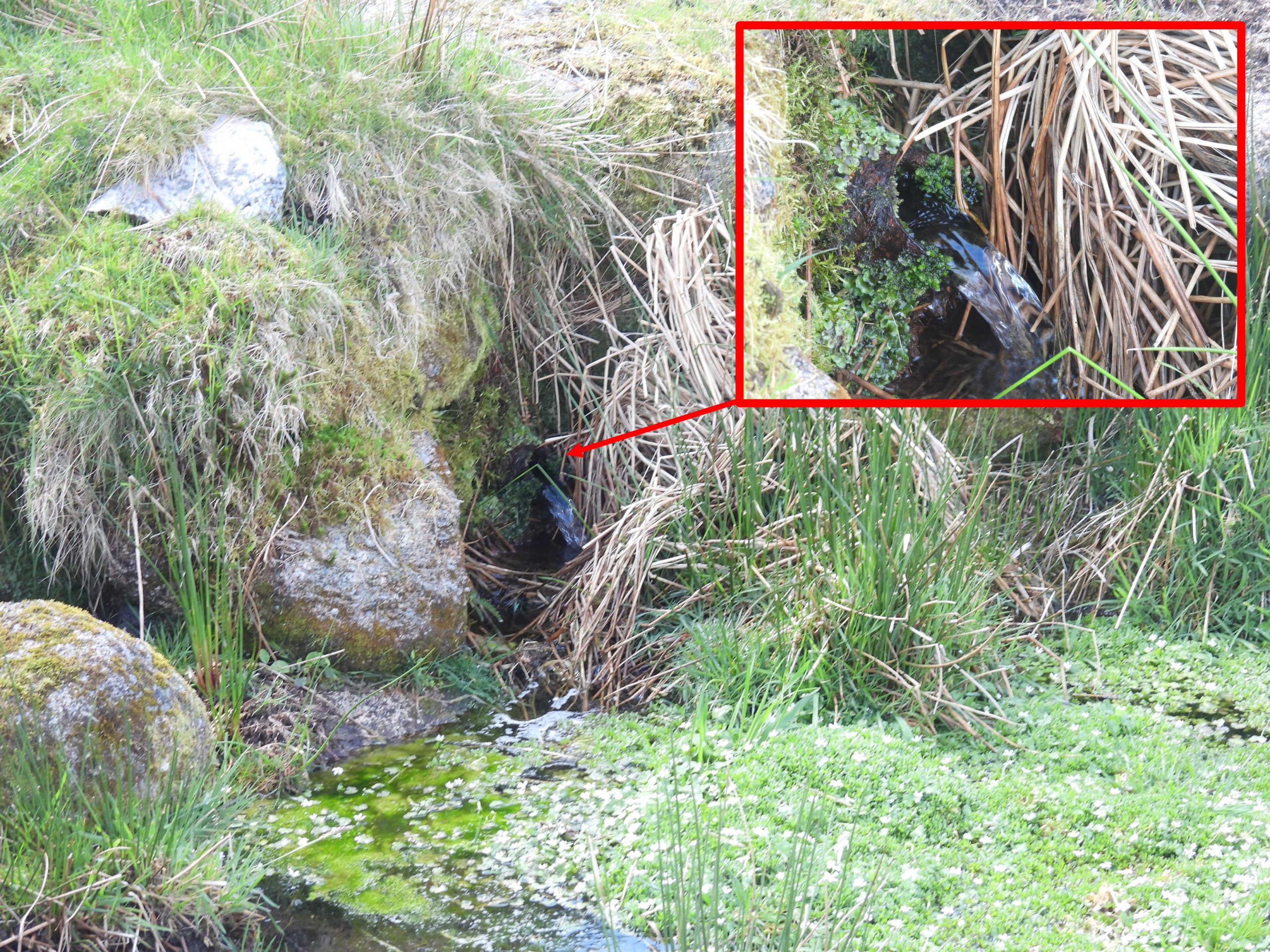
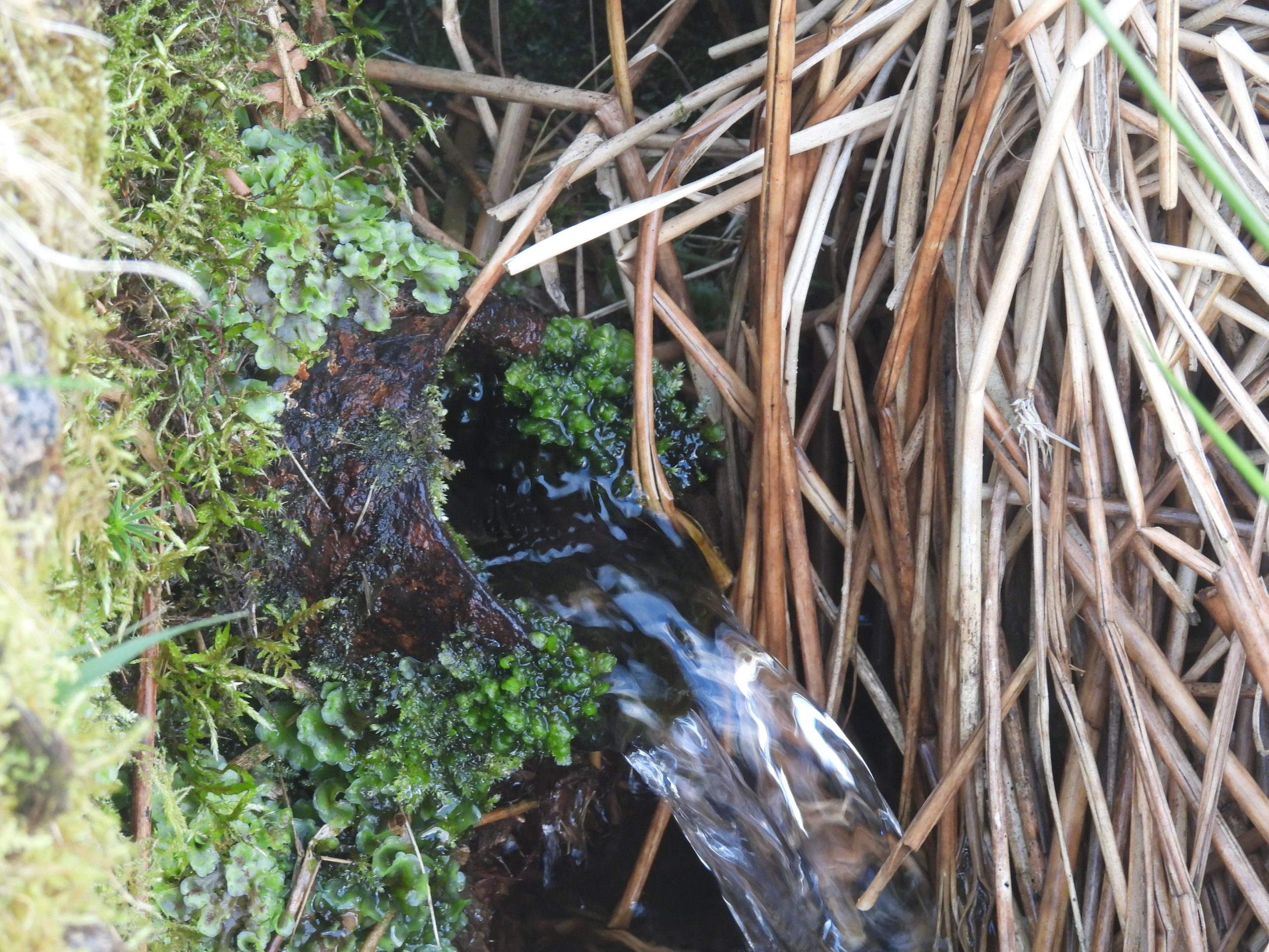
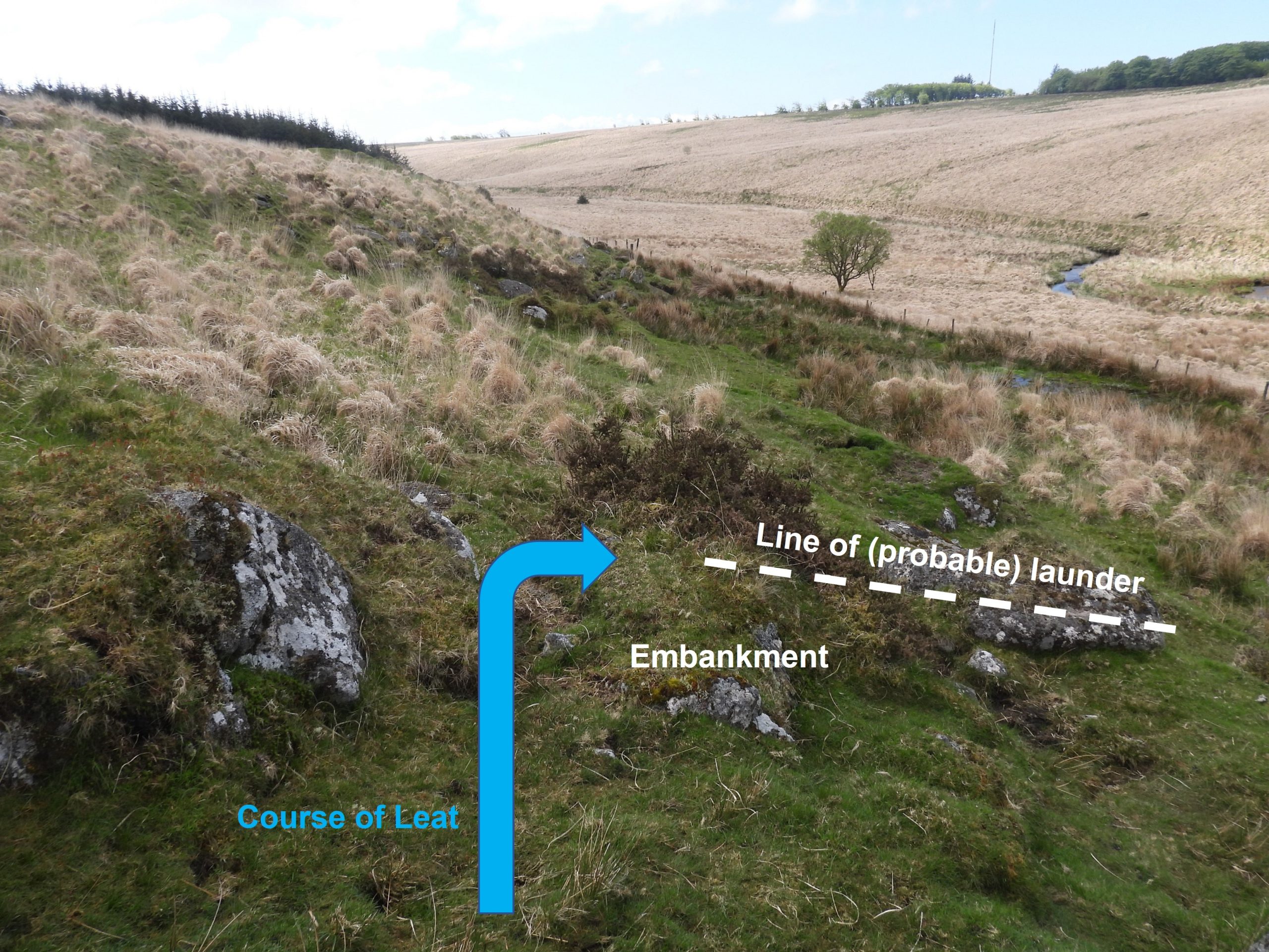
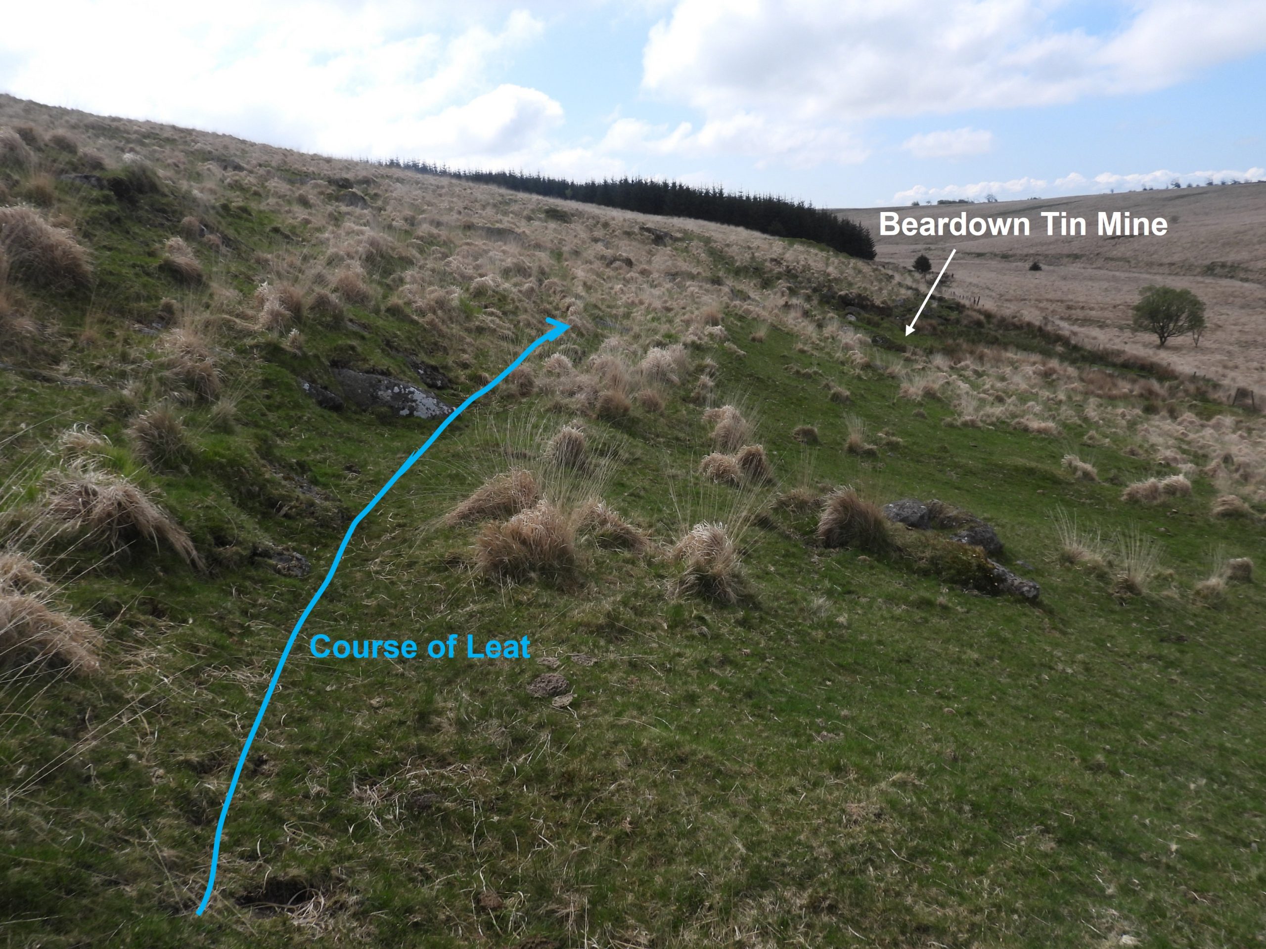
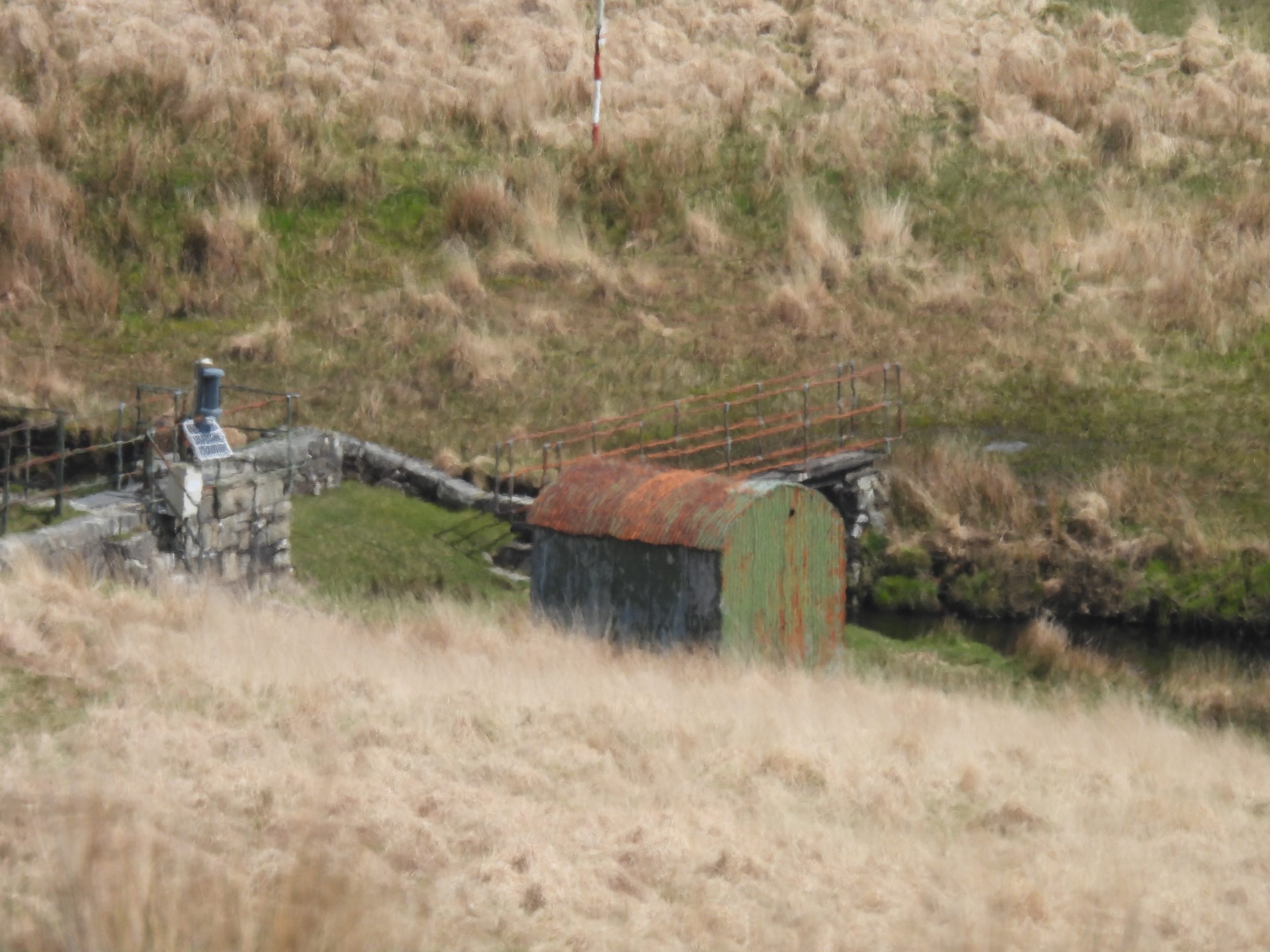
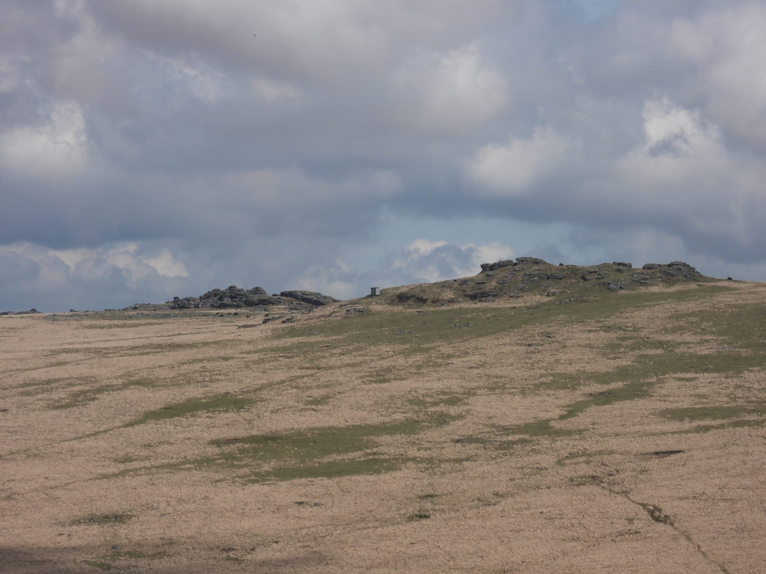
Location of Beardown Mine. It is best accessed from Two Bridges following the track through Beardown Farm then through the plantation before turning west (alongside the trees) and across the ridge. There is a fenceline which is easily crossed by a stile. If attempting to access the area via Holming Beam, the explorer will be met by drystone walls and barbed wire fence and will have to first climb the hill to a gate (two-thirds up the hillside) before descending again to the mine.Location of the mine as viewed from Long Plantation. The easiest access is as previously described which follows the line of shafts and trial pits down hill.Zoomed in view of the mine from Long Plantation. From this distance, the features of the mine are not very discernible.This annotated photograph highlighting some of the key features of the mine. From this zoomed in view, the building foundations are the easiest feature to discernApproaching the mine from the east alongside Beardown Hill (just after the stile over the fenceline), earth upthrust from the first shaft can be found. The photograph is ‘trompe de l’oeil’ as the terrain looks flattish all the way to Long Plantation in spite the River Cowsic valley lying between the two.There appears to be two major (largish) shafts on the hillside. The first one is located at SX60038 76158. The shaft appears to have been part of a linear openworkFrom the first large shaft are a series of what look like trial pits which straddle the crest and W facing slope of Beardown Hill.The second (largish) shaft as viewed from Long Plantation.Close up of the second large shaft. This shaft is located at SX59848 76172After the second (largish) shaft the series of trial pits continue down the slope to the ‘Beardown Mine / Wheal Virgin’View of the mine from the end of the series of trial pits.This sketch map is based on (with additions) to the plan created by DTRG and published in Devon Mineral Mining Club Journal 3, no 1, page 31. The features shown are discernible but some do require close attention to confirm their location.The two most discernible features of the mine are the building foundations and the stamps area. The dressing floor is a reed filled area. The whole area is about 25m x 25m. Toward the south edge of the complex is a NW-SE building located on a platform. It has an entrance which faces west which is just over 1m wide.The building measures around 5m x 3m. The building is cut 0.7m into the hillside on the SE side and similarly built up on the NW. The building is located at SX59745 76258Its NW and SW walls, 0.8m thick and 0.4m high. The SW wall, it is suggested possibly was the location of a fireplace.The building is considered to have presumably been an office, smithy or accommodation.To the NW of the building and before the line of ‘Dock Leat’ / marshy area is the reed filled area which is assumed was the dressing floorThere are two lengths of revetment walling which appear to define the edge of the dressing floor. The piece of walling in the photograph is located at SX59746 76266The two pieces of walling are each around 5m long and around 0.8m high.The two revetments aren’t the easiest to discern as they are overgrown. The second revetment is located at SX59742 76261Towards the northern edge of the mine complex a shallow depression (wheelpit) and a stamps area can be found.There is believed to have been ‘three hammers’ in the stamps area. The stamps area is located at SX59742 76274The wheelpit is a very shallow depression to the south of the stamps area and immediately below (to the east) where a dry leat (embankment) terminates. The author estimated the wheelpit as being at SX59742 76273Looking across the mine complex from the northMarshy area next to the original ‘Dock Leat’. The water may well be from the discharge point of a (probable) adit.The DTRG article mentions a rush filled depression measuring 2m x 1m which might have been the site of a buddle. This feature was difficult to find / discernThe author isn’t 100% convinced he found the ‘Buddle’ recorded by the DTRGA (possible) blocked adit can be found to the south of the building amongst some large rocks. There is a algae / duckweed covered pool, which is the probable location of the adit. The series of pits are located above and to the east of this location.The source of water for the pool appears to be coming from an old pipe, which is driven into the hillside. Is this pipe a modern feature or (possibly) does it date from the time of the mine ?Close up of the water discharge from the pipe, which is probably compelling evidence that this is where the adit is located. The amount of water here certainly appears to emanate from an underground source. The pipe is located at SX59735 76235Above the stamps area / wheelpit on top of an embankment the terminating point of a mine leat can be found. From this location there (most likely) would have been a wooden launder to feed water to the waterwheel.The shallow depression of the mine leat can be followed north from the mine. The leat starts from the Cowsic River, about 1km upstream. The leat may have been laundered across the Beardown Brook. River Cowsic weir where the ‘Dock Leat’ course crossed. The leat would have originally traversed from a northerly direction (on the east side of the river) to a southerly direction (on the west side of the river). The ‘Dock Leat’ on the east side of the river is now “dry” due to an aqueduct having been constructed near Beardown Farm, which carries the water (from West Dart) to meet with the water from the Cowsic, downstream from this point.Beardown Tors dominate the area above and to the north east of the mine.