A collection of walks, discoveries, insights and pictures of exploring Dartmoor National Park
August 1, 2021
Beating the Bounds of Okehampton Common
At Okehampton, they used to beat their bounds on Ascension Day (40th day of Easter). In William Crossings’ account of 1885 it was conducted in September. His account is interesting insofar as it mentions the custom of “Spurling”, which is where quantities of apples and nuts amongst other items would be thrown by the bounders into certain miry places on the route, where the youngsters would scramble for them, thus remembering the place at that boundary point.
In Crossings’ account he states: “About 10 o’clock in the forenoon a party of over 100 persons on foot together with some 25 horseman, headed by a band of music; set out from the town for the commons, and after viewing the various boundary marks the company repaired to the slopes of Yes Tor and partook of refreshments, which had been provided, the expenses of the day being defrayed by subscription. Most of the perambulations of the commons have some particular custom pertaining to them. That which was formerly observed when the one in question took place was the throwing of apples and nuts into boggy places, as the bound beaters proceeded, for the boys who followed scrambled for”.
This post records the known boundary markers to the author, on the commons, most of which must have been extant in Crossings day. Much of the information for this post has been sourced using the Dartmoor Boundary Markers (second edition) book by Dave Brewer. Thanks also to Mark Fenlon, who assisted with information (Brewer sketch) relating to the inscribed boundary rock in the West Okement Valley.
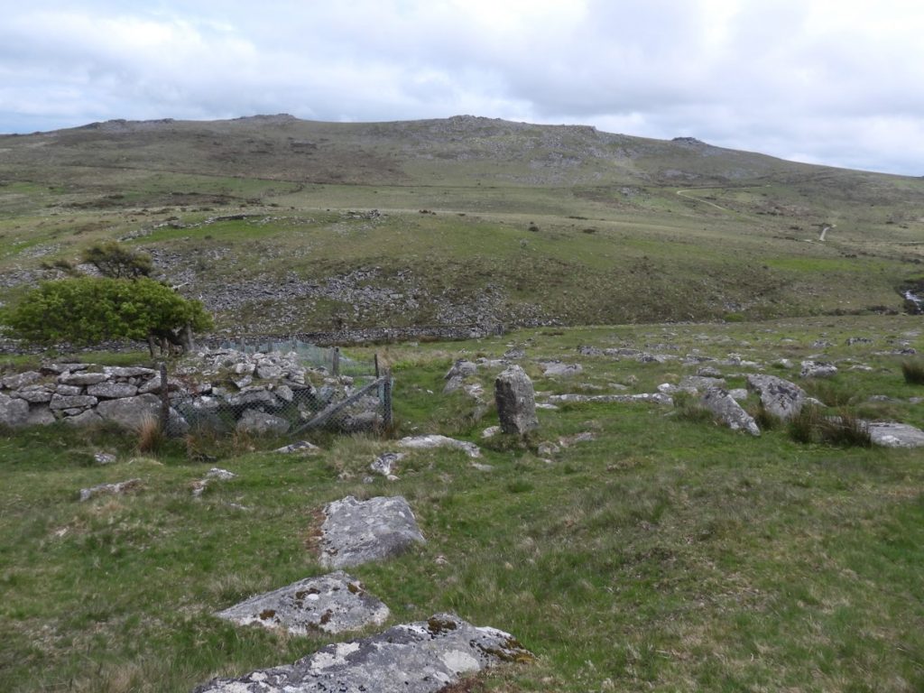
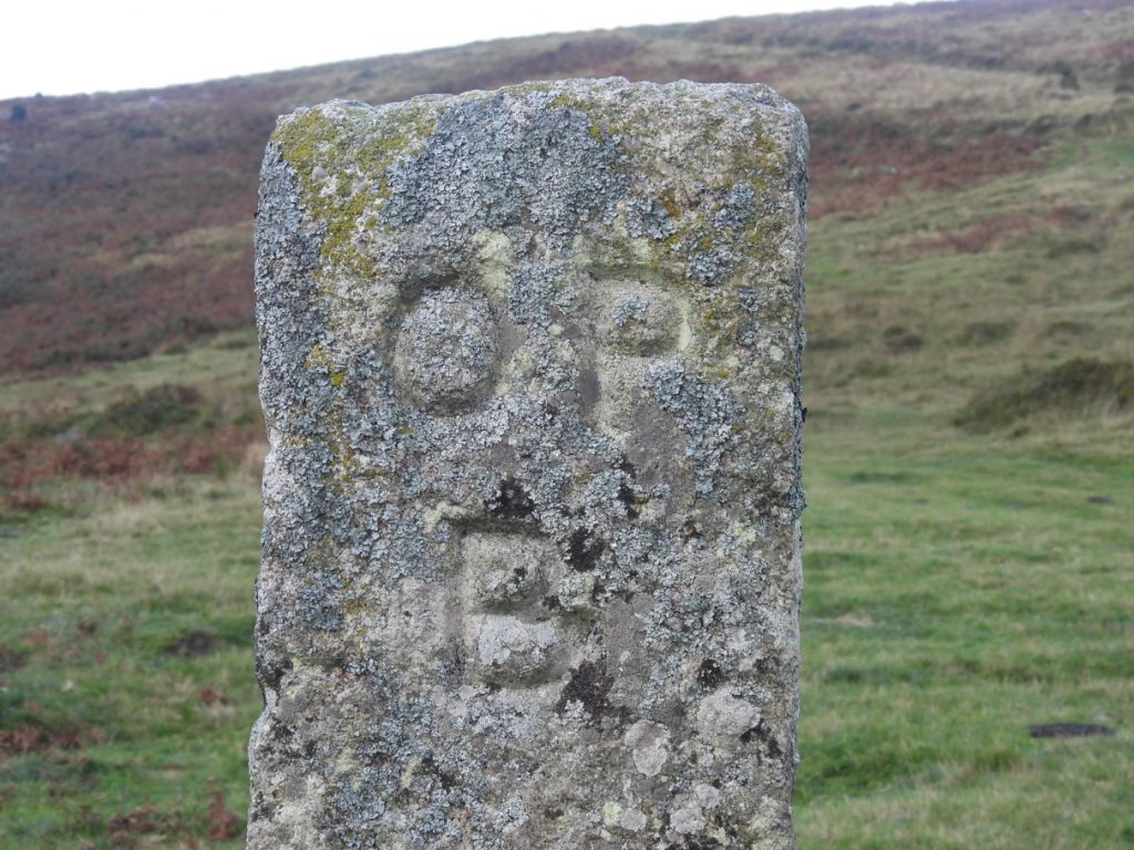
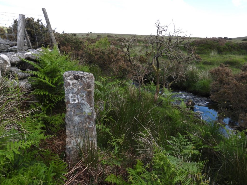
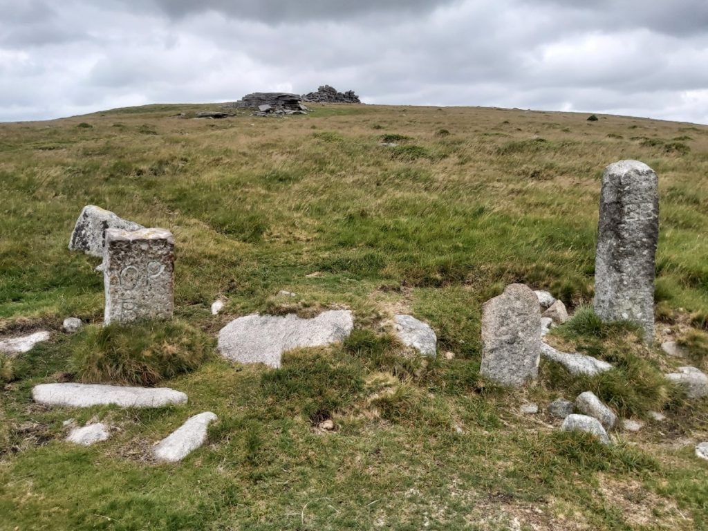
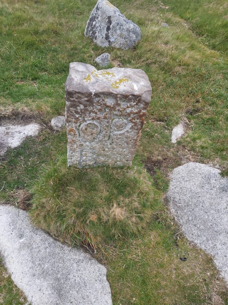
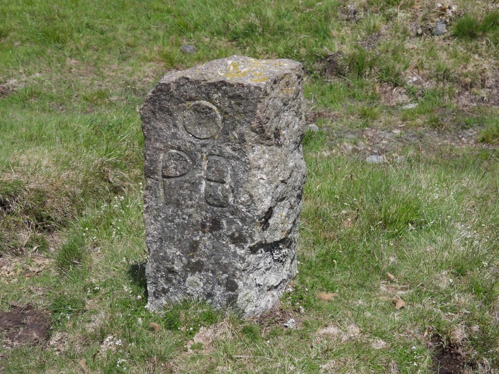
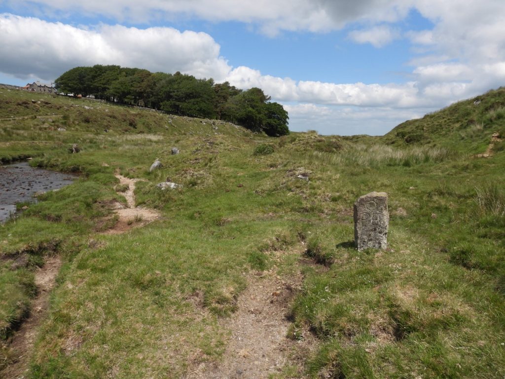
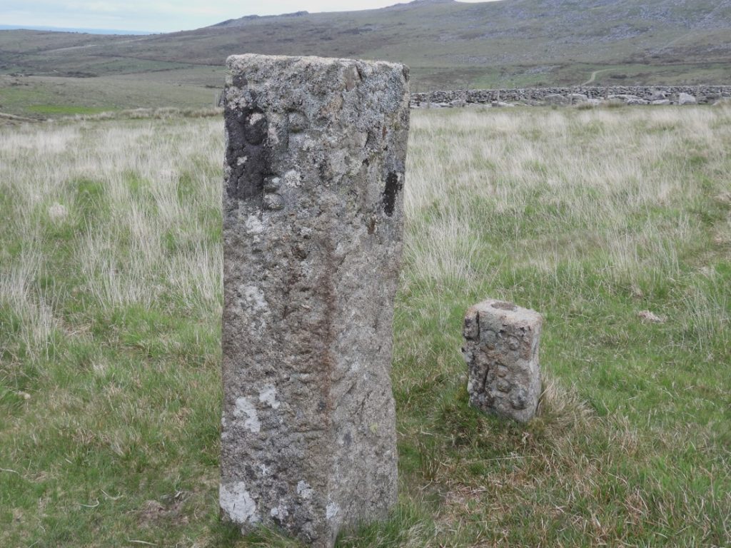
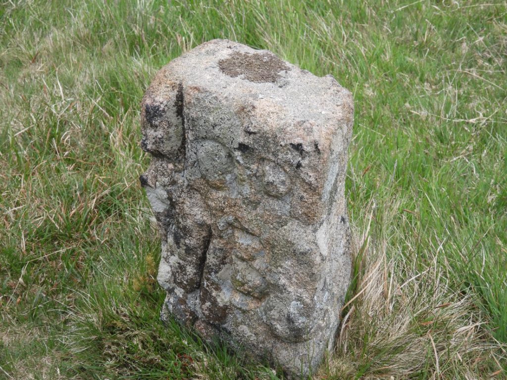
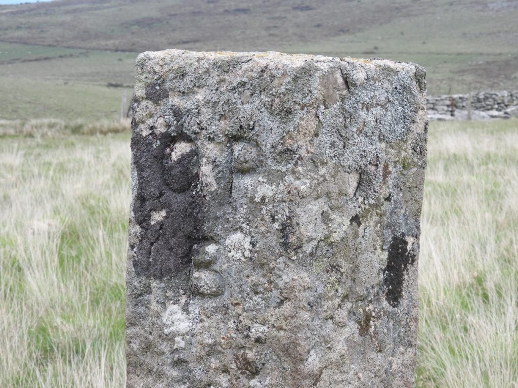
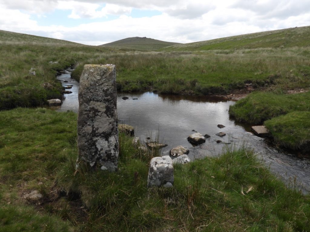
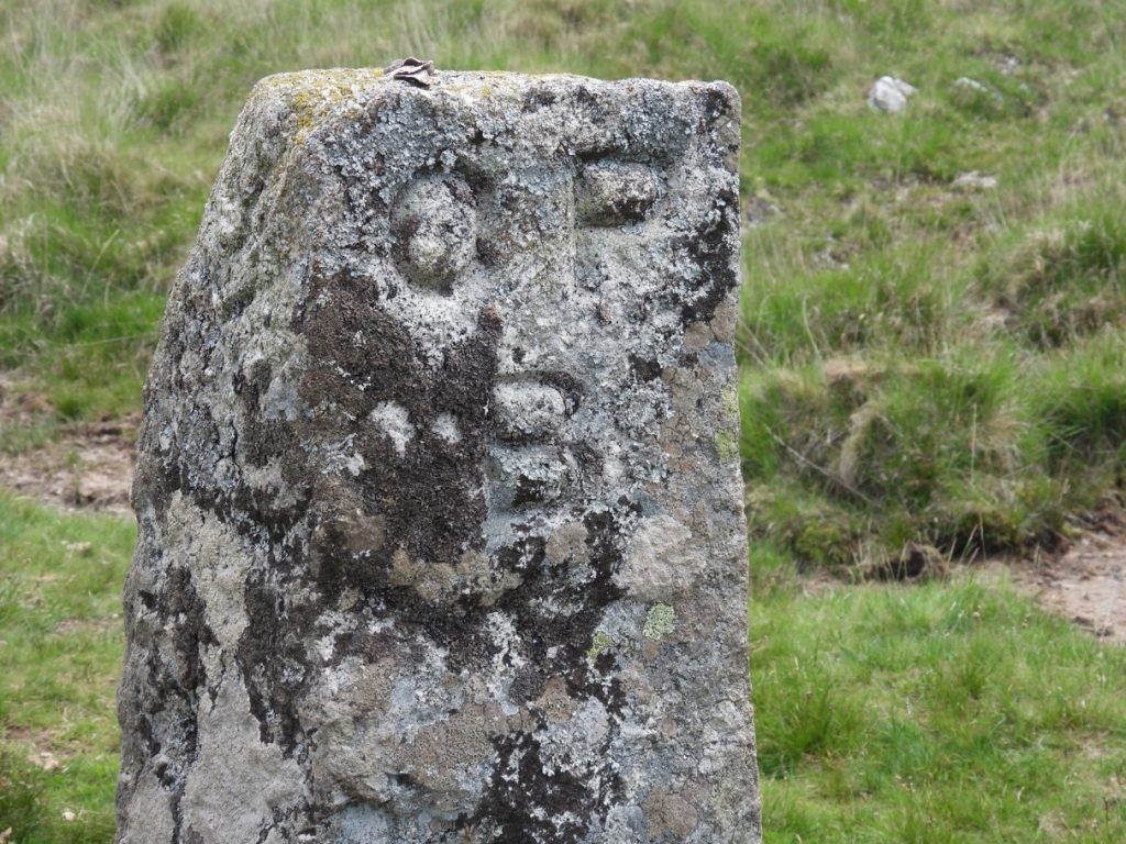
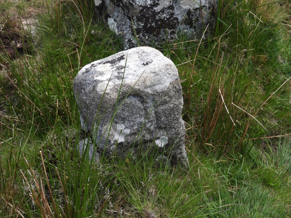
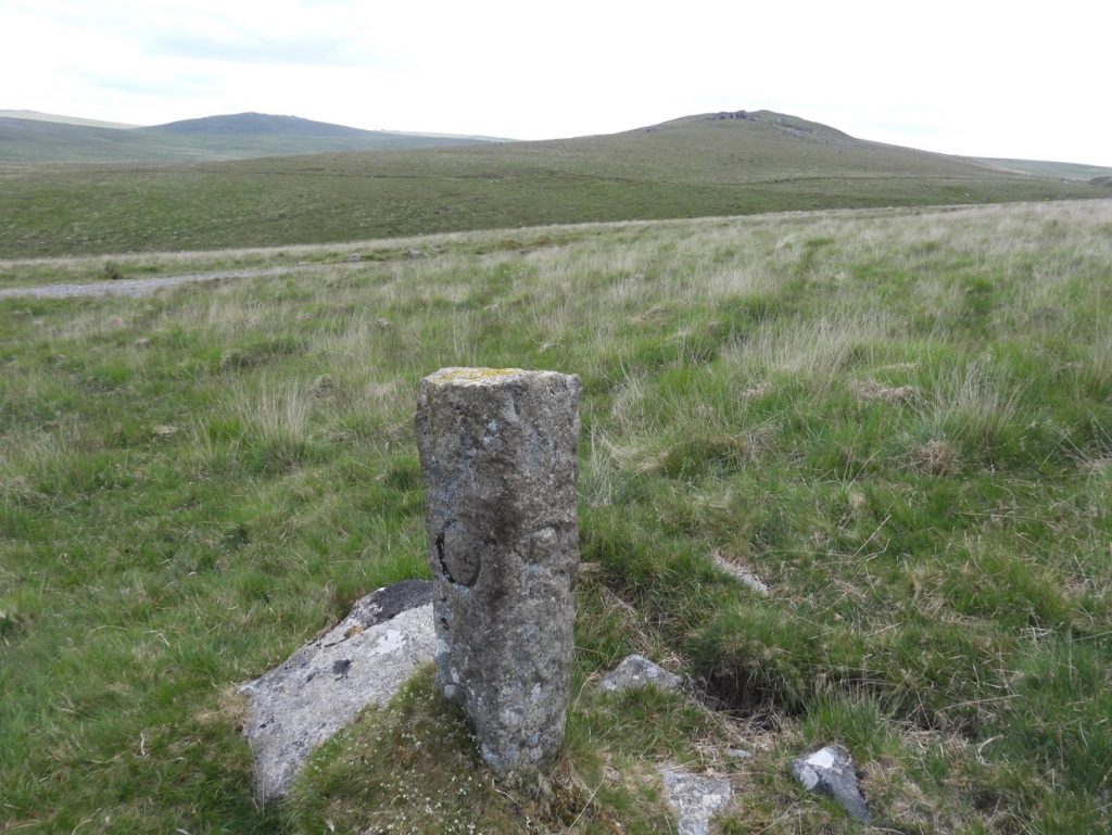
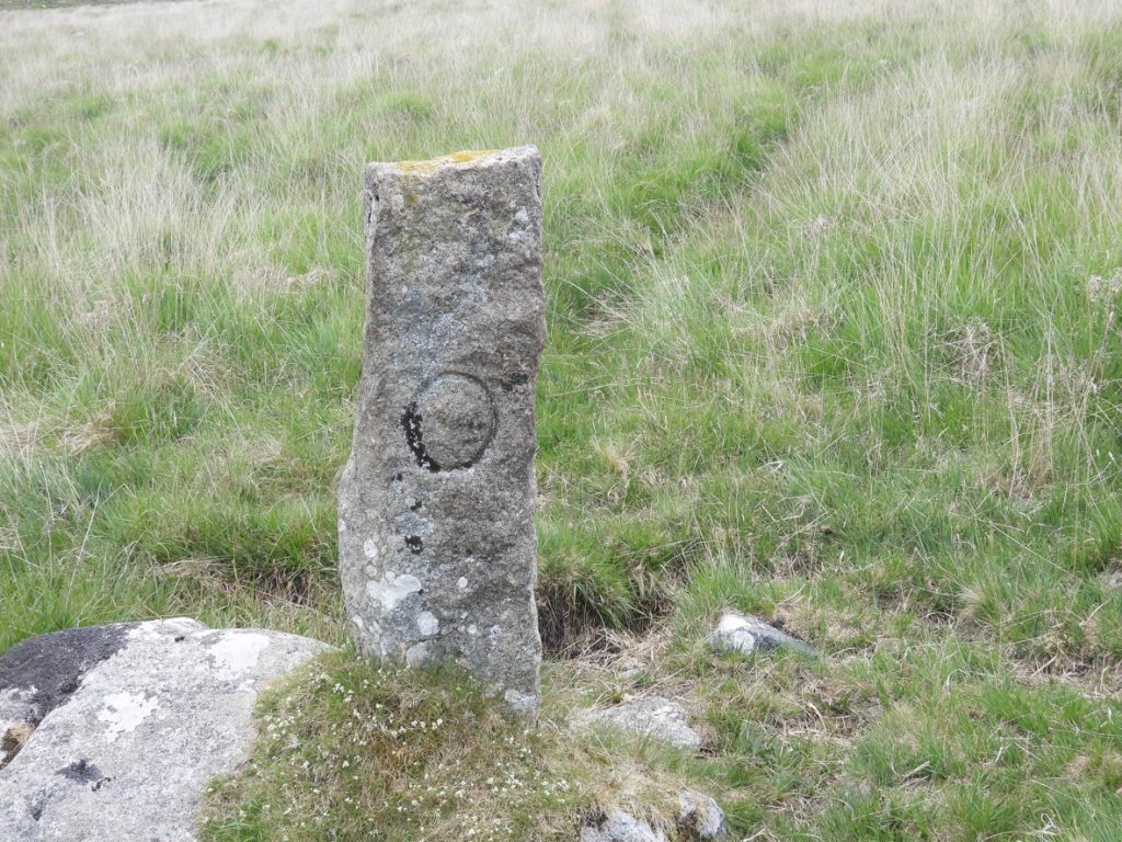
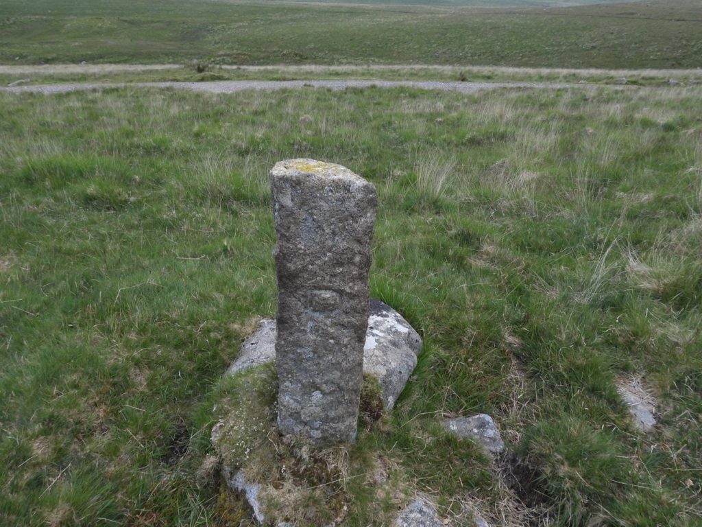
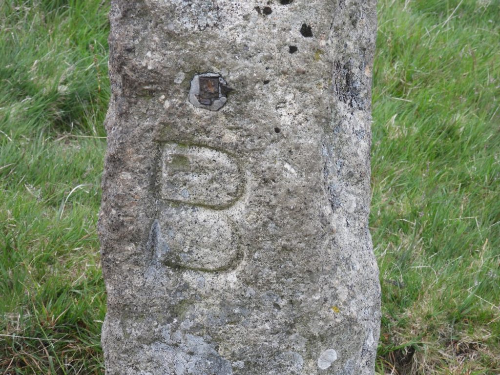
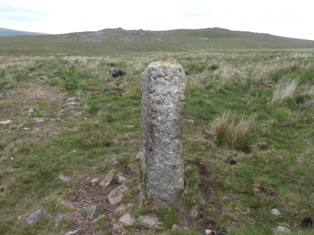
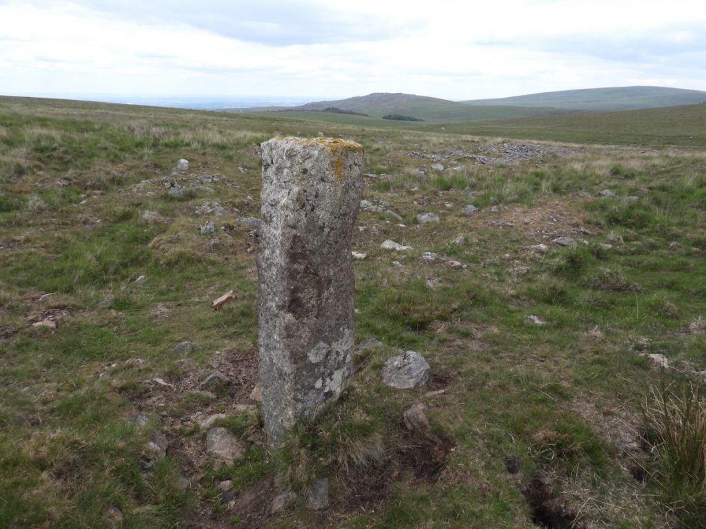
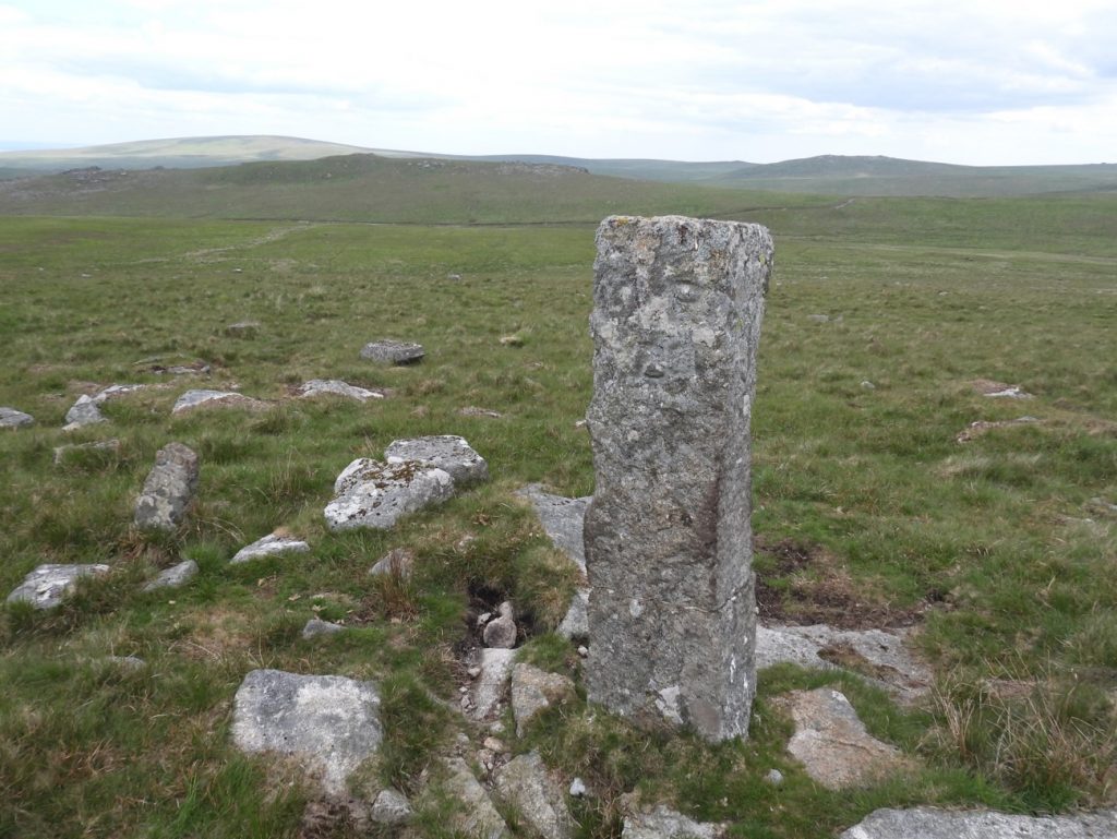
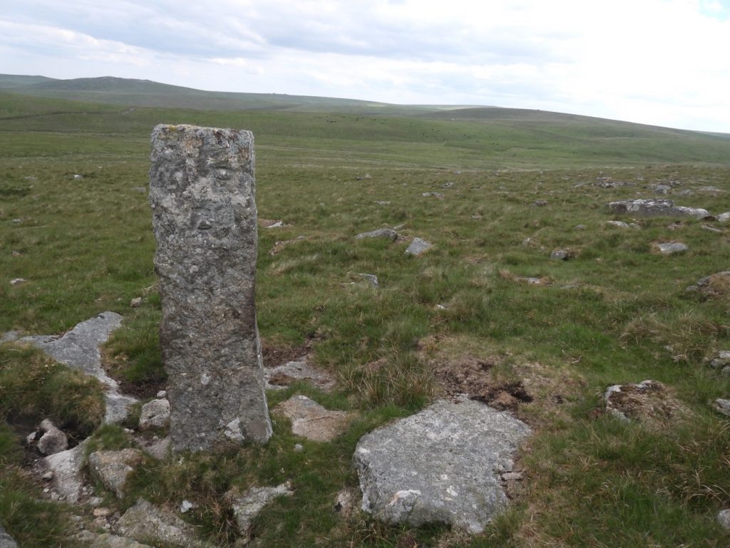
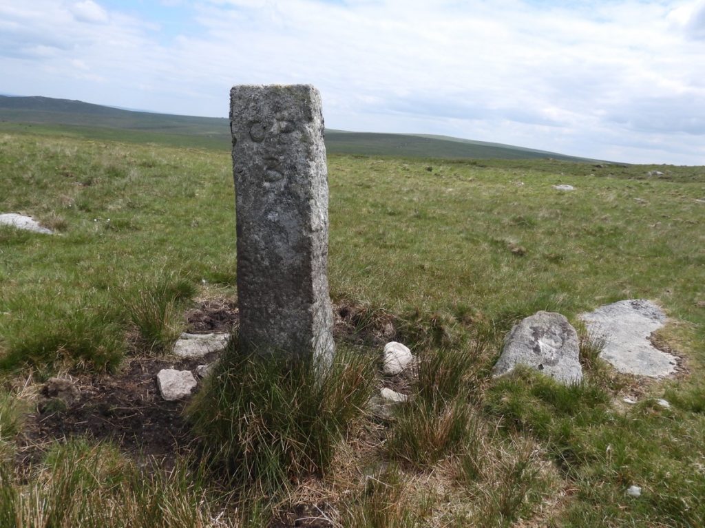
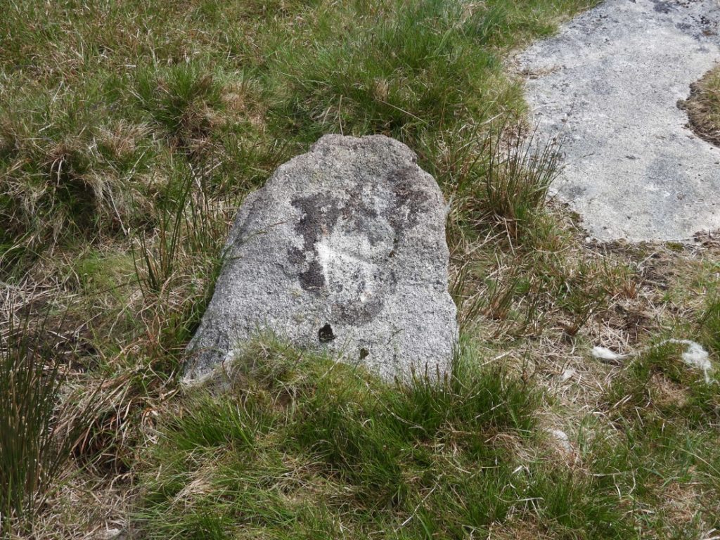
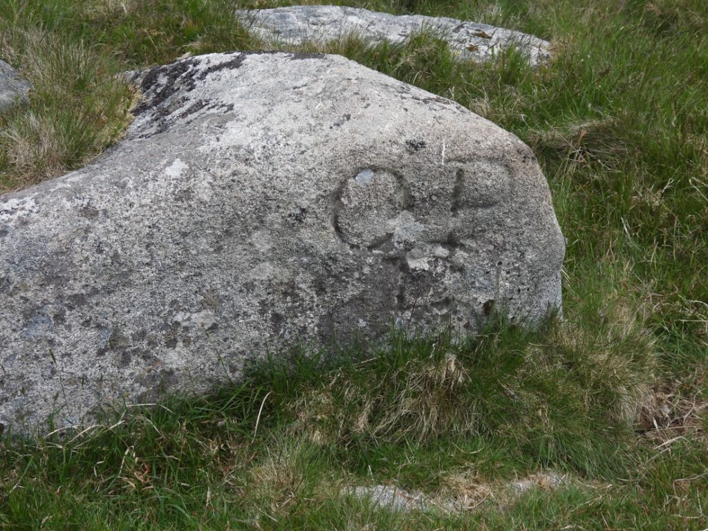
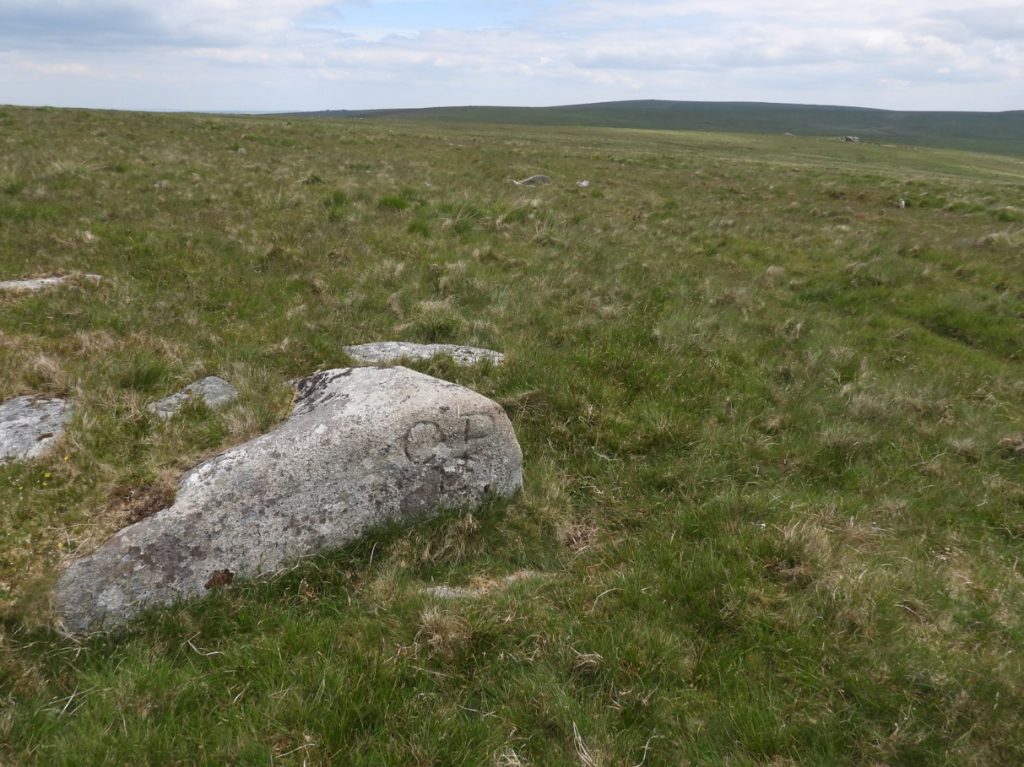
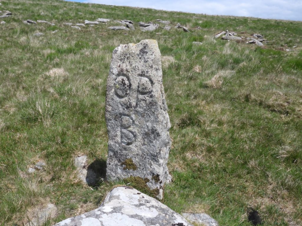
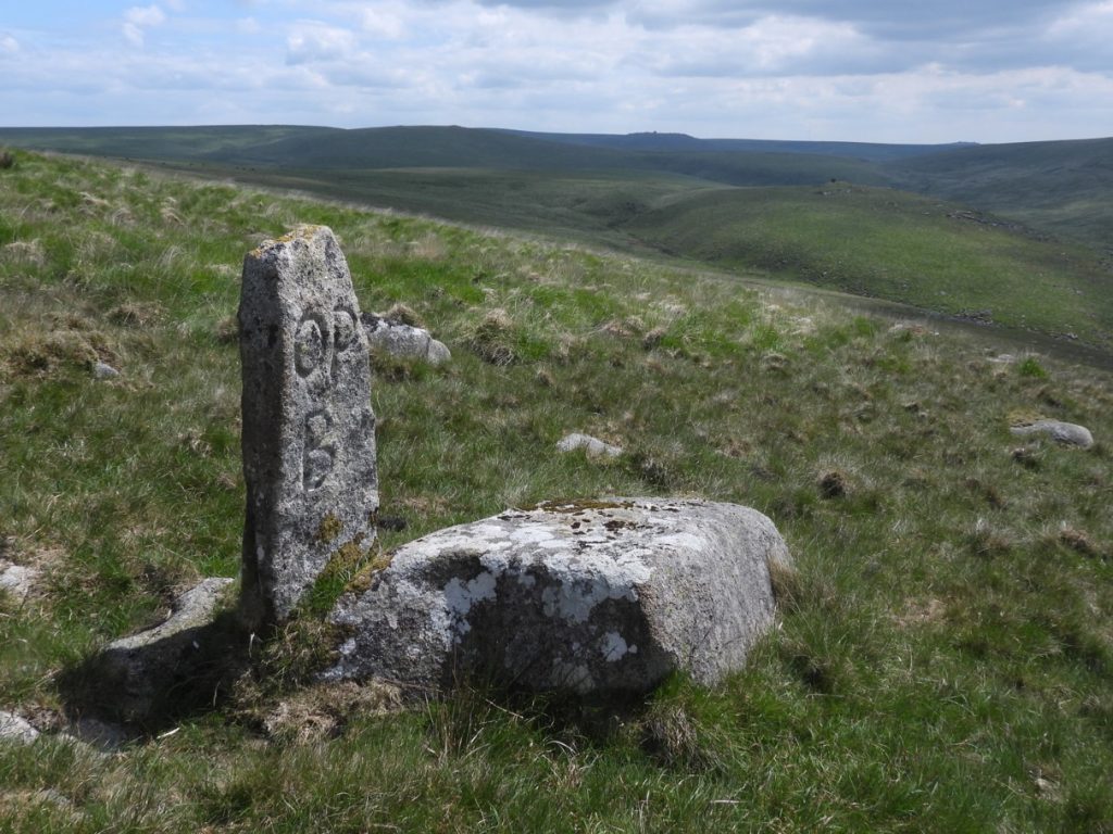
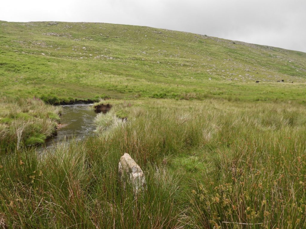
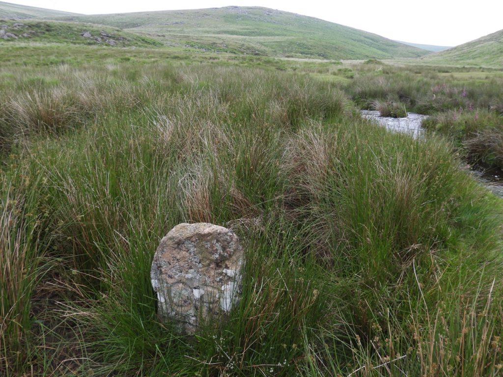
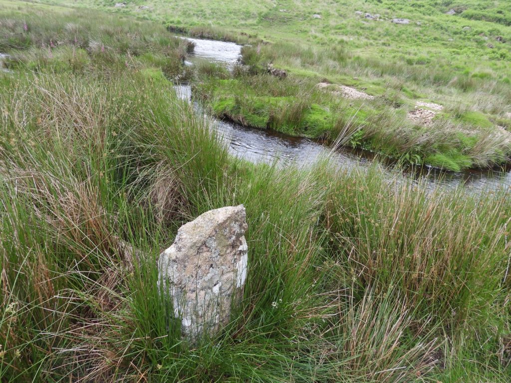
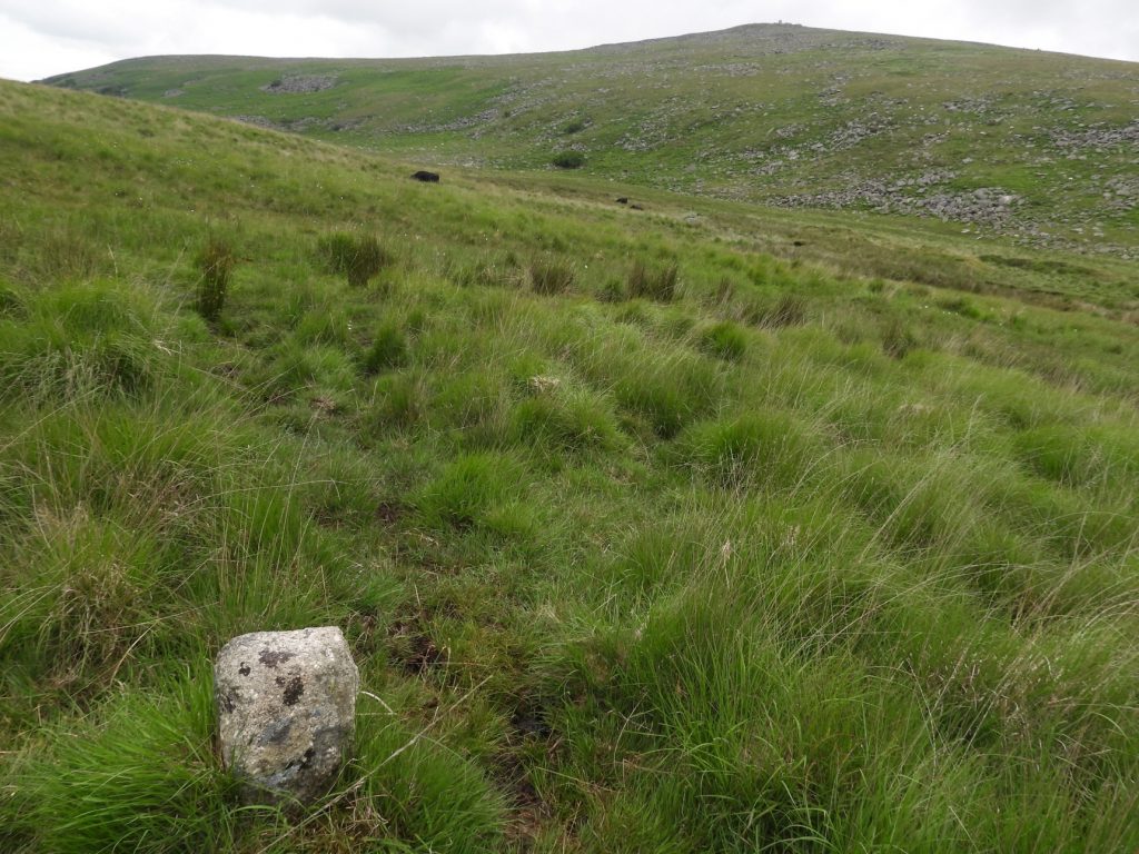
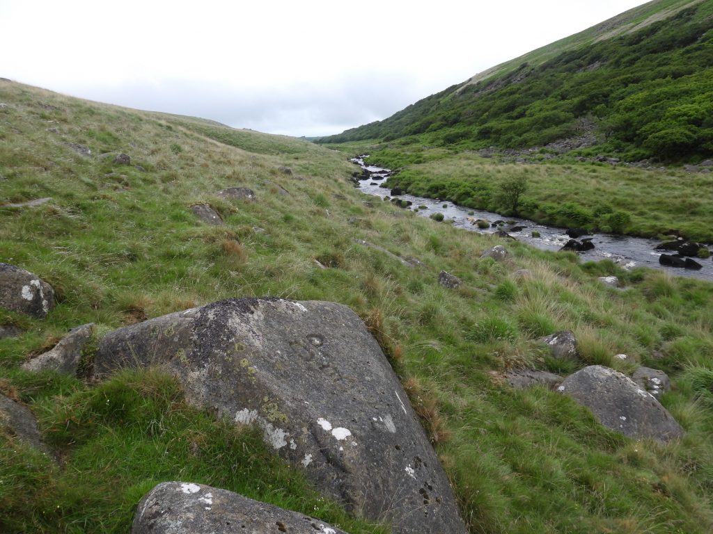
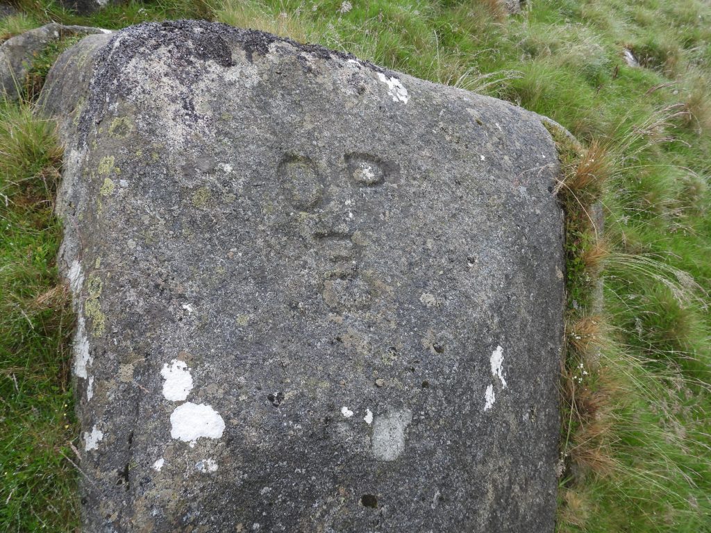
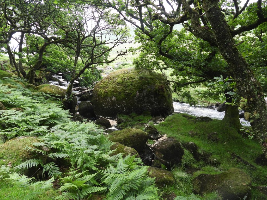
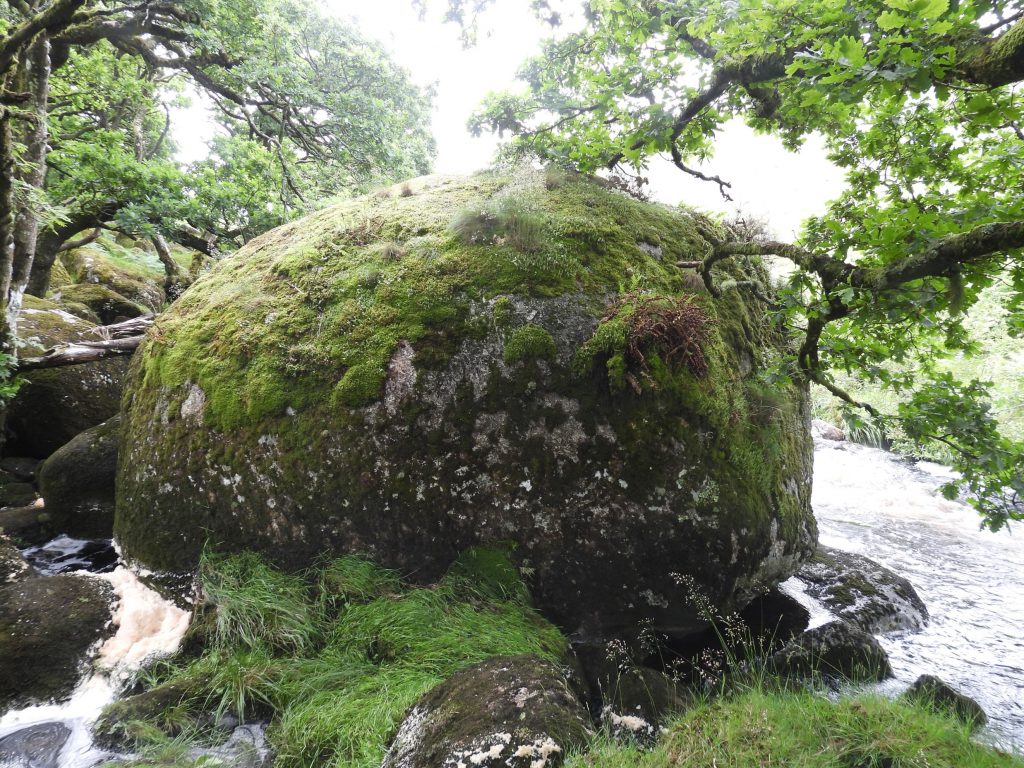
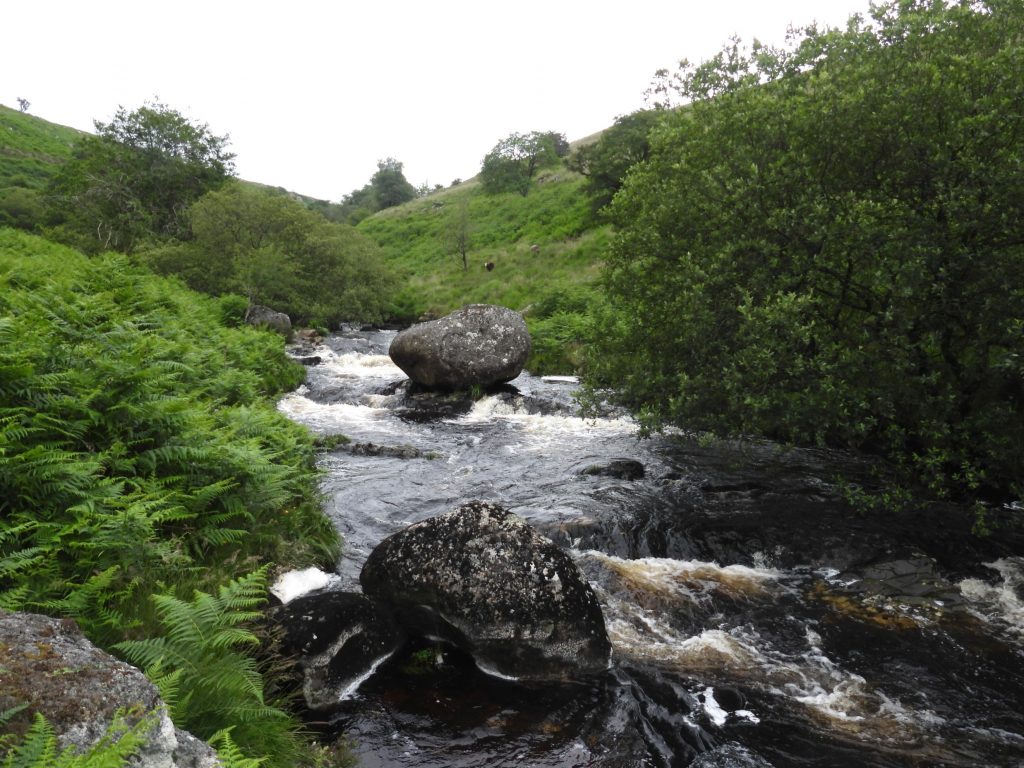
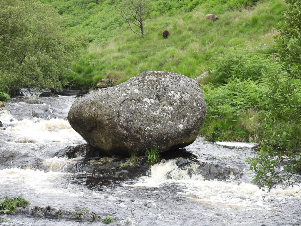
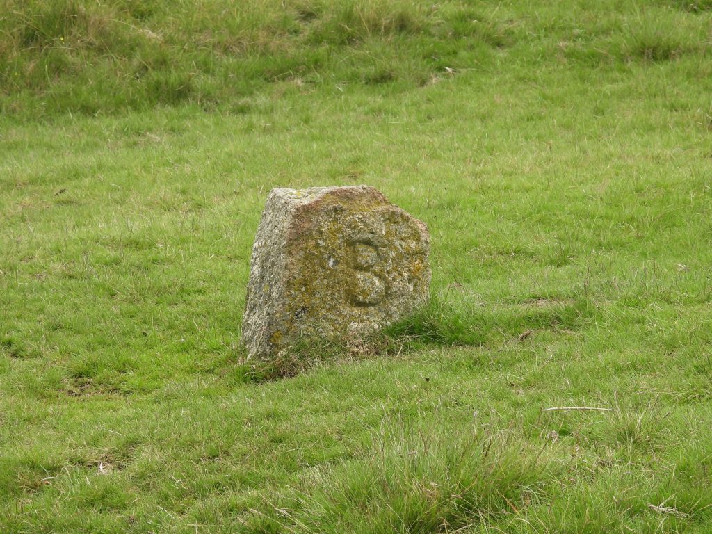
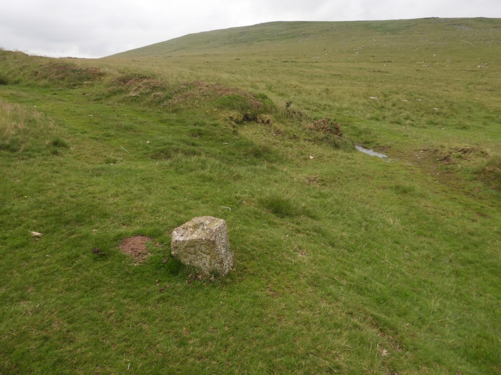
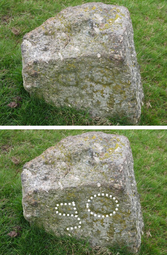
This sketch map of the Okehampton bounds. The original (19th Century) bounds are shown by the black dotted line and the West Okement River. After 1987, there was a boundary as shown by the gold “dash – dot” line because East Okement Farm was included into the bounds.Halstock Corner “OPB” with Belstone Tors and Winter Tor (amongst others) in the backgroundThe Halstock Corner “OPB” lies at SX60377 92577Cullever Steps “OPBs”. The larger (19th century one) replaced the smaller one.Cullever Steps (19th Century) “OPB” can be found at SX60135 91896.Close up of Cullever Steps (older) “OPB”.Near to Cullever Steps on the North-East corner of East Okement enclosures lies a Belstone Bounds “BB” standing stone. It can be found at SX60628 92076.Lower Tor BS’s. There are two Belstone Bounds stones here alongside an “OPB”Close up of Lower Tor “OPB” which can be found at SX 61242 91485.“OPB” boundstone at Henrys Ford. This stone is believed to date from 1987, when East Okement farm was included into the Okehampton bounds. Henrys Ford is a relatively recent name having first been named by MOD (1990s) and put on their OS training area map. It was named after Henry Cooper who was then the tenant of East Okement Farm. Close up of the “OPB” boundstone at Henrys Ford. It can be located at SX60646 90993.There are two “OPBs” at Hartor Corner. The larger of the two (like others on this boundary) is the 19th century replacement for the older (smaller) one. These stones lie on the pre-1987 boundary when East Okement Farm wasn’t included in the Okehampton Bounds.Close up of the smaller (older) Hartor Corner “OPB” Close up of the larger (19th century) Hartor Corner “OPB”Two “OPB” boundary stones at Middle Ford (aka Row Tor combe) on Black-a-Ven brook. There are Lovely views to East Mill Tor from this point. These stones lie on the pre-1987 boundary when East Okement Farm wasn’t included in the Okehampton Bounds and can be located at SX59839 91213.Close up of the larger of the two Row Tor combe “OPBs” Close up of the smaller of the two Row Tor combe “OPBs” “OPB” boundary stone on Row Tor Ridge. This one is unusual insofar as the O, P and B are on three different sides. East Mill Tor and Oke Tor beyond. This boundstone can be found at SX58682 90770.Row Tor Ridge showing the “O” inscription.Row Tor Ridge showing the “P” inscription. Row Tor Ridge showing the “B” inscription. New Bridge “OPB” with East Mill Tor in the background.New Bridge “OPB” can be found at SX59395 90228.Two “OPB” stones near OP3. Note the small low boundstone to the left (a few metres away) from the larger stone. This is area is noted by Dave Brewer at Curtery Clitters, albeit the two boundstones are some distance from the Curtery Clitters marked on the OS Map.The Curtery Clitters “OPBs” are located at SX59047 89623.Two “OPB” boundstones (note the “broken” one to the right of the large one are known as Inner Dinger.The “broken” older “OPB” at Inner Dinger. It can be located at SX58729 89146.Dinger Ridge “OPB” can be found at SX58224 88575.The Boundary rock is marked on OS map and is called Dinger Ridge. It can be found near the footpath between Dinger Tor and High Willhays. Outer Dinger “OPB” boundstone. It can be found at SX58026 88353.Outer Dinger “OPB” boundstone with Lints Tor and Fur Tor beyond.Sandy Ford “OPB” boundstone, lies on the right bank of the West Okement in a reedy area. This view is looking north-west (ish) in the direction of Steng-a-Tor (out of sight). The picture belies the steepness of the valley side here.Sandy Ford “OPB” boundstone, lies on the right bank of the West Okement in a reedy area. This picture shows Lints Tor in the background looking south.Close up of the Sandy Ford “OPB” lies at SX57430 87941This small boundstone lies near Sandy Ford and has a crude inscription on it. This stone was visited by the Okehampton “bounders” on their 1995 beating the bounds. It lies on the left (west) bank of the West Okement as Okehampton used to lay claim to side of the river.Small boundstone inscribed “P” (believed meaning “parish”). It can be located at SX57379 87939.A large natural boulder with the usual “OPB” inscribed on it lies close to the south Black-a-Tor copse (on opposite bank) and the line of range poles which lead down from Fordland Ledge, cross the river and proceed up the hill to Kitty Tor. Like with the “P” boundstone, this lies on the left (west) bank of the river. Dave Brewer in his book quotes that “Eddie Hain, the former Park Ranger, says that a farmer called Worden was one of the most vociferous in the former disputes over the boundaries”. This rock perhaps is testament to the disputes as it suggest Okehampton has claim to the whole river due to its location.The West Okement “OPB” boulder can be found at SX56854 88602.This large boulder at the north end of Black-a-Tor Copse is called “Black Tor” rock by the Okehampton Parish “bounders”.Close up of “Black Tor” rock. It can be found at SX56323 89366.Just upstream from Vellake Corner is a large rock known to the Okehampton Parish “bounders” as “Vellake Rock”Close up of Vellake Rock. It can be found at SX55714 90303.Boundary Stone called “Iron Gate” by William Crossing. “B” stands for BridestoweThe other side of the Iron Gate boundary stone inscription has been stated by some as being “SP” (Sourton Parish) and by others as being a mirror image of “OP”.A theory as to the inscription on the this side of the “Iron Gate” boundary stone is that it was intended as ‘S|O’ with the dividing line showing they should be read separately as Sourton and Okehampton, with ‘B’ for Bridestowe on the reverse, at this triple parish boundary point. It can be located at SX54460 89507.