A collection of walks, discoveries, insights and pictures of exploring Dartmoor National Park
August 27, 2021
An Exploration of Two post-medieval buildings in the Trowlesworthy Tors Bronze Age enclosures
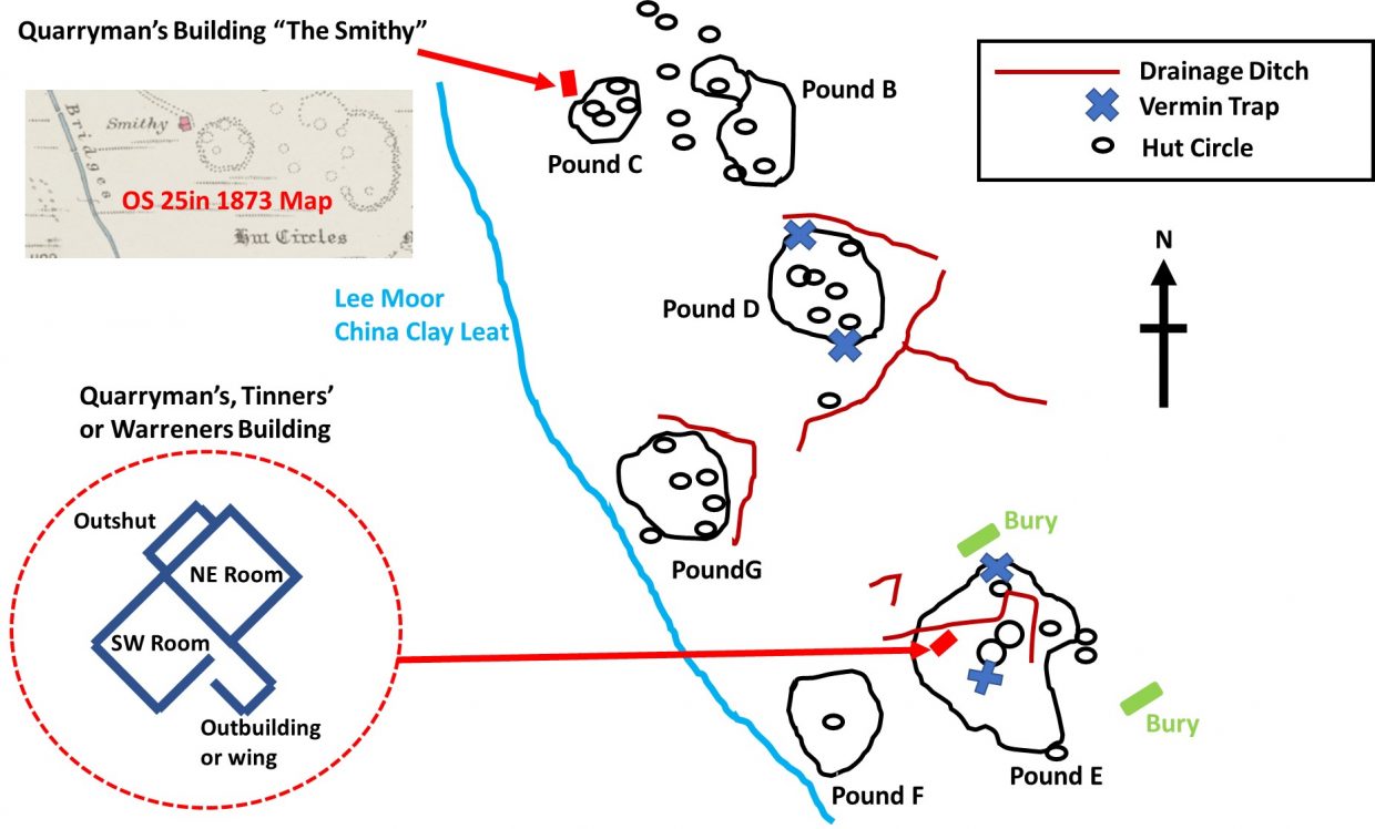
In the Dartmoor Atlas of Antiquities (Volume Three – The South West) by Jeremy Butler in the description relating to the Trowlesworthy Tors enclosures (map 51), there are two “modern” buildings which are briefly mentioned. One of the buildings is next to Pound C (Butler nomenclature) and is stated as “probably associated with the quarry on the summit of the Tor” (Little Trowlesworthy). The second building is located within Pound E is stated as being a “two-roomed building of no great age”.
Intrigued by these two very brief entries in the Butler book, this post has been created following additional research using the Dartmoor HER and complemented with a site visit.
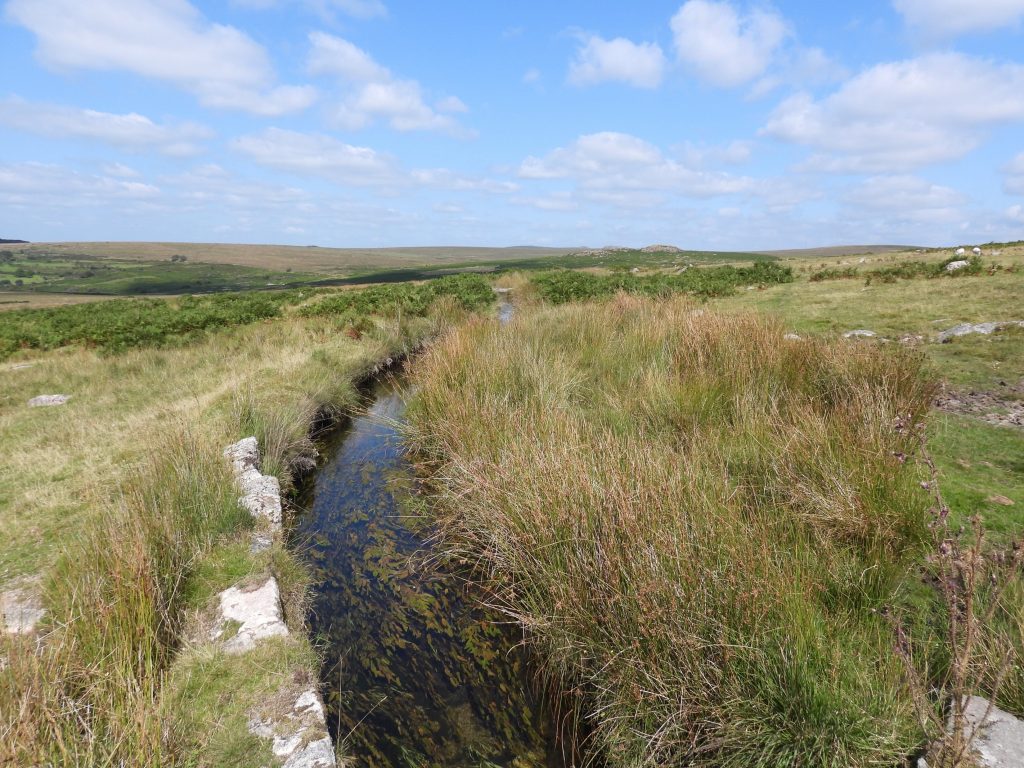
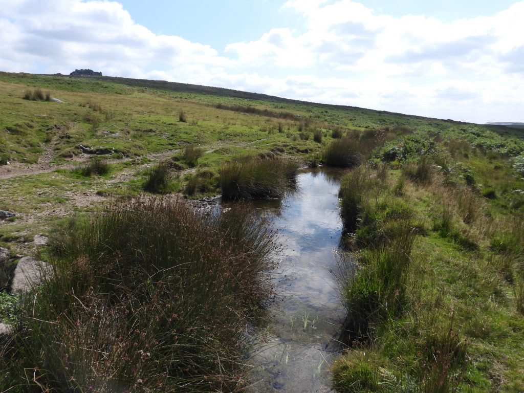
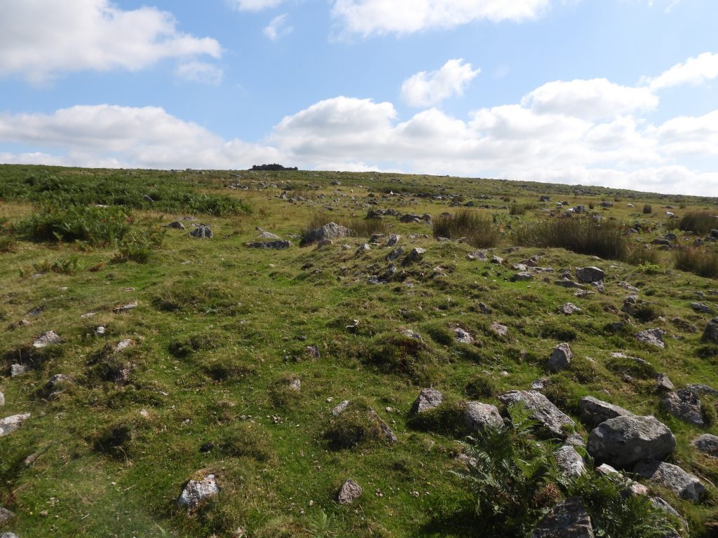
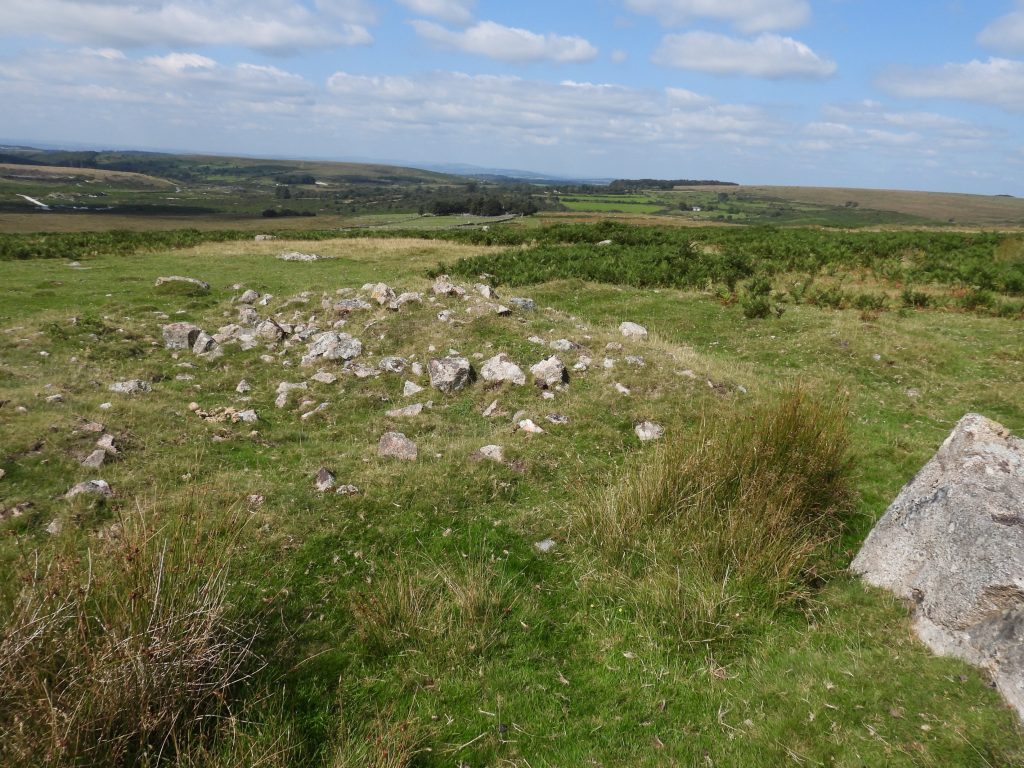
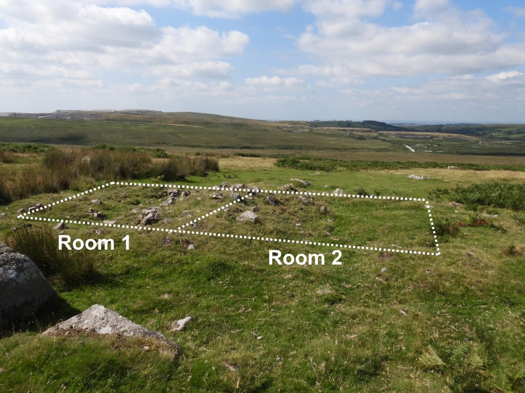
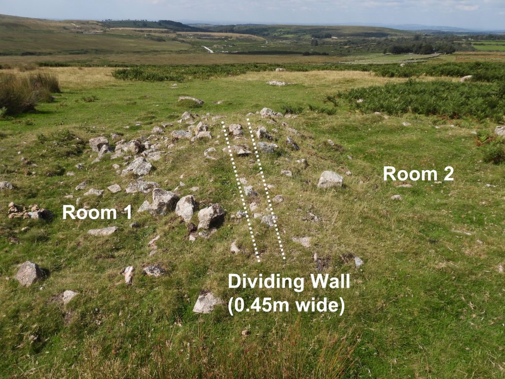
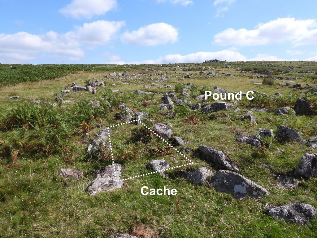
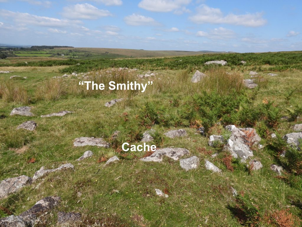
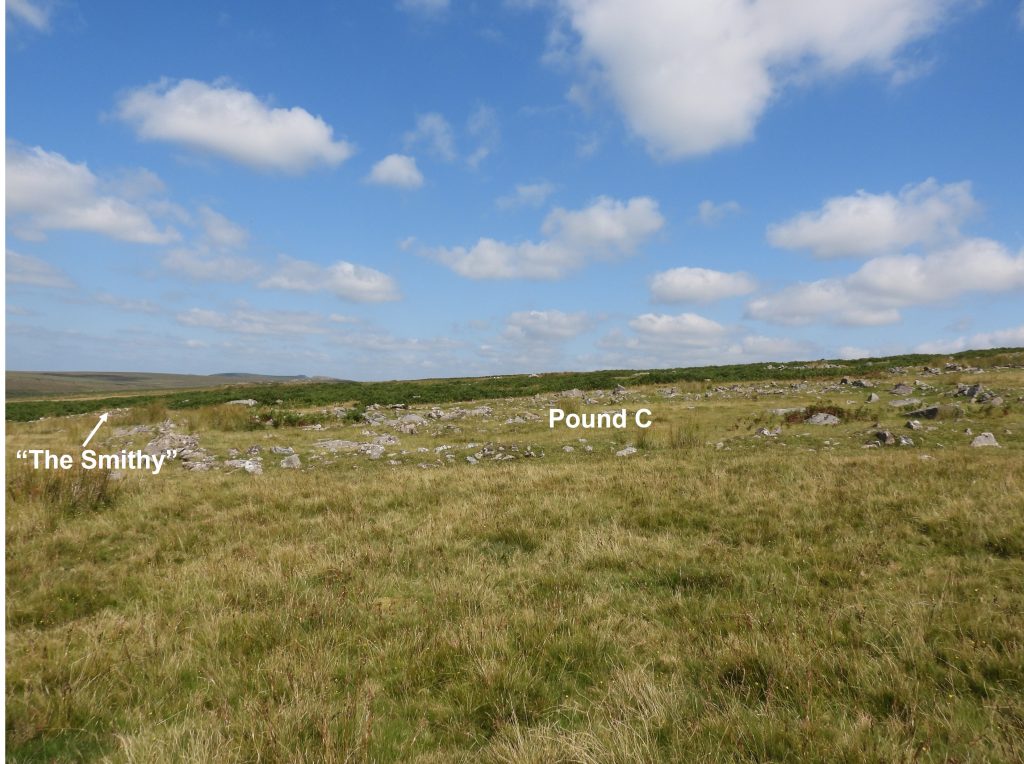
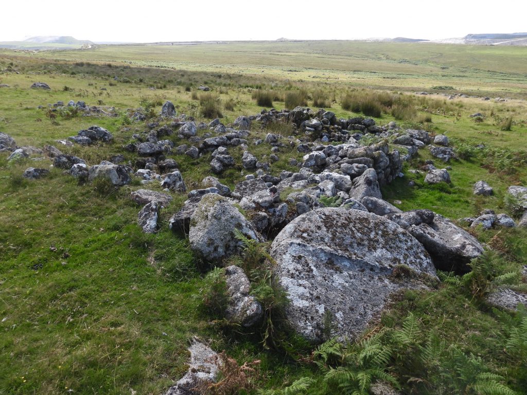
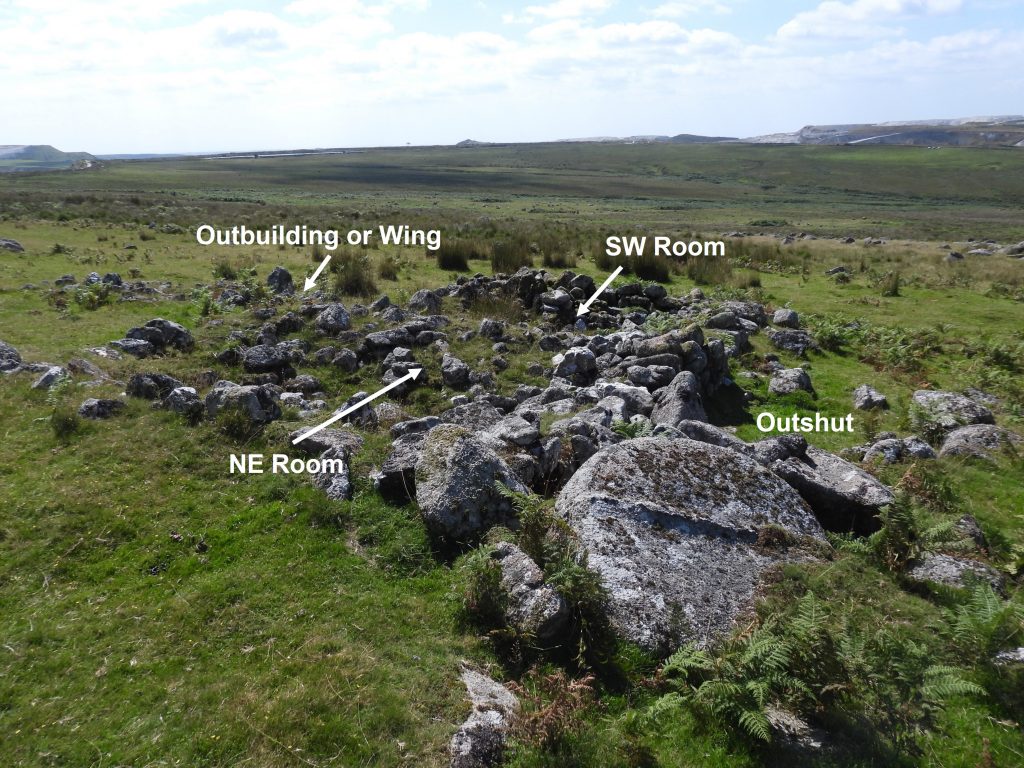
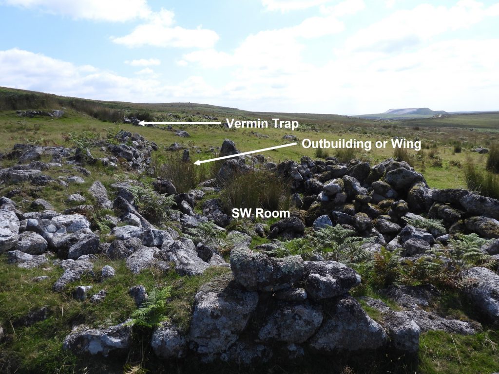
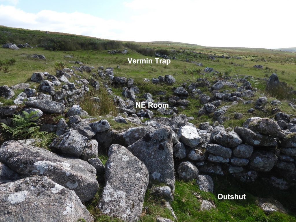
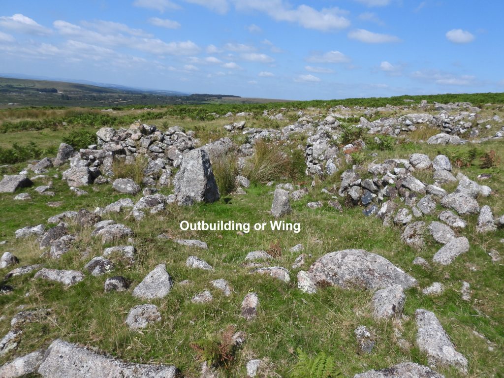
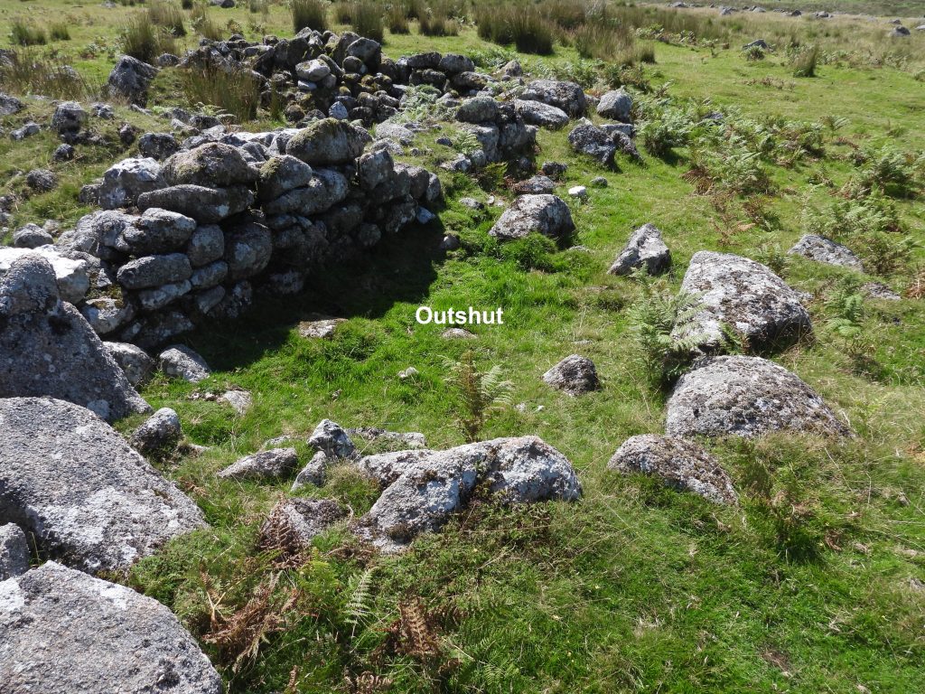
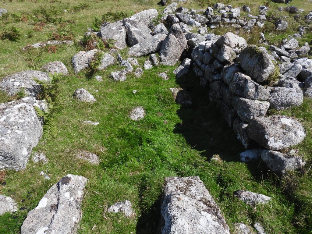
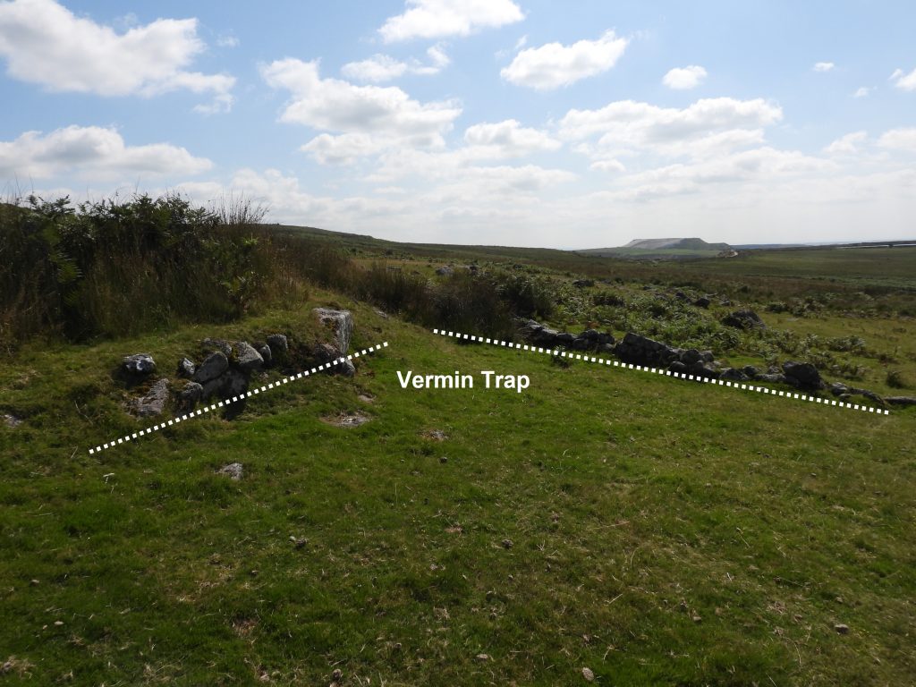
This sketch map is based on the Butler map, figure 51.1 found in the Dartmoor Atlas of Antiquities (Volume Three – The South West) page 157 and shows the relative locations of the two “modern” buildings. The most northerly building, near Pound C is shown on OS 25in 1873 map named as “Smithy”.Lee Moor Clay Leat is over 4km long, being fed by the River Plym (augmented by Hen Tor Brook and Spanish Lake) and empties into Big Pond. The leat borders the western side of the area covered in this post.The leat was built to serve the China Clay quarries, possibly as early as 1809. Crucially, the leat appears to have had very little impact on the bronze age enclosures. The are numerous bridges over the leat which were build for the benefit of the rabbits, when the area was part of the extensive Trowlesworthy Warren (which ceased warrening in 1956). The last warrener was Robert Giles.The building known as “The Smithy” are very ruinous and could easily be missed. The building can be found at SX57338 64550. The picture shows Little Trowlesworthy on the horizon.The Smithy can be best viewed looking from above in a South Westerly direction. The stone to construct this building may have been taken from nearby abandoned stone hut circles and enclosure walling. “The Smithy” is described in the Dartmoor HER as : “a two compartment structure which may have been the smithy and dormitory for workers at Little Trowlesworthy quarry until the 1880s”. The quarry was worked by John Freeman Sons and Co. of Penryn until the 1880’s. “The Smithy” was demolished by a local farmer to build his shippen.The Dartmoor HER further describes “The Smithy” thus: “The interior of the northern room (room 2) measures 4.5m long by 2.5m wide, whilst the southern one (room 1) is 4.5m long by 3m wide. The partition wall separating the two rooms measures 0.45m wide and stands up to 0.9m high, whilst the exterior wall survives as a 1.5m wide and 0.6m high rubble bank”.A cache is nearby to “The Smithy” and is attached to the outer face of a prehistoric enclosure. The author found the cache quite difficult to discern but (hopefully) successfully located it at SX57345 64541. The cache is described as “surviving as a 1.3m wide and 1m high rubble wall surrounding a rectangular internal area which measures 1.9m long by 1m wide”. The rocks in the picture appear to fit the description and is the closest point to the pound from “The Smithy”.The cache structure was probably built for storage of tools and equipment.General view of Pound C in relation to “The Smithy”.Approx 200-300m South East from “The Smithy” the second “modern building” can be found.The second building is divided into four sections; NE room, SW room, an outbuilding or wing and an outshut. The Dartmoor HER records that “the function of this building remains uncertain, although it has been suggested that it is likely to have been a quarryman’s or even a tinner’s house, although clearly it could have equally been associated with warrening or upland grazing”. The author hasn’t found a reference where a possible age for the structure has been estimated other than “it is medieval or later date”.This building lies within Pound E and the material used in its construction may have been taken from nearby hut circles. The walls of the building are of drystone construction and measure 0.9m wide and stand up to 1m high (ref: Dartmoor HER). The south west room measures 4m long by 3.2m wide and the centre of the room is located at SX57564 64209.The north east room measures 4.3m long by 3.2m wide and is separated from the south west room by a 0.8m wide and 0.7m high partition. The centre of the room is at SX57568 64213.To the east of the SW room is a doorway which leads through the south eastern wall. This leads to a horseshoe shaped outbuilding (or wing) composed of rubble walling with inner and outer facings standing up to 0.8m high. It is recorded in the Dartmoor HER that the interior of this structure measures 2.5sq m. The centre of the structure is located at SX57564 64209.Next to the north western side of the two rooms an “outshut”, which is an extension possibly with a lean-to roof. The centre of the structure can be found at SX57565 64216.The Outshut is recored as measuring 2.5m long by 2m wide defined by lines of large stones protruding through the turf.A short distance (a few 10’s of metres) to the east from the building is a vermin trap, showing a classic “V” entrance. There are two “V” shapes making up an “X” shape. There are lots of vermin traps in the area which are worth exploring.