A collection of walks, discoveries, insights and pictures of exploring Dartmoor National Park
September 14, 2020
AN EXPLORATION OF DEVON COPPER MINE / OKEHAMPTON WHEAL MARIA
Steve Grigg
In researching this exploration, reference was made to mindat.org and Dr Phil Newman thesis; Tin and Copper Mining on Dartmoor c1700-1914. On the mindat.org website, it was stated by Hamilton Jenkin (1981) that the mine was started in 1863 and despite initial promise, the working was unsuccessful and the machinery and materials were put up for auction in 1866.
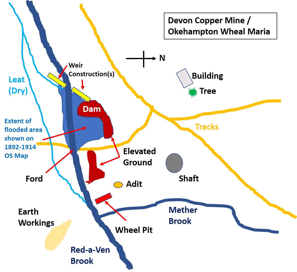
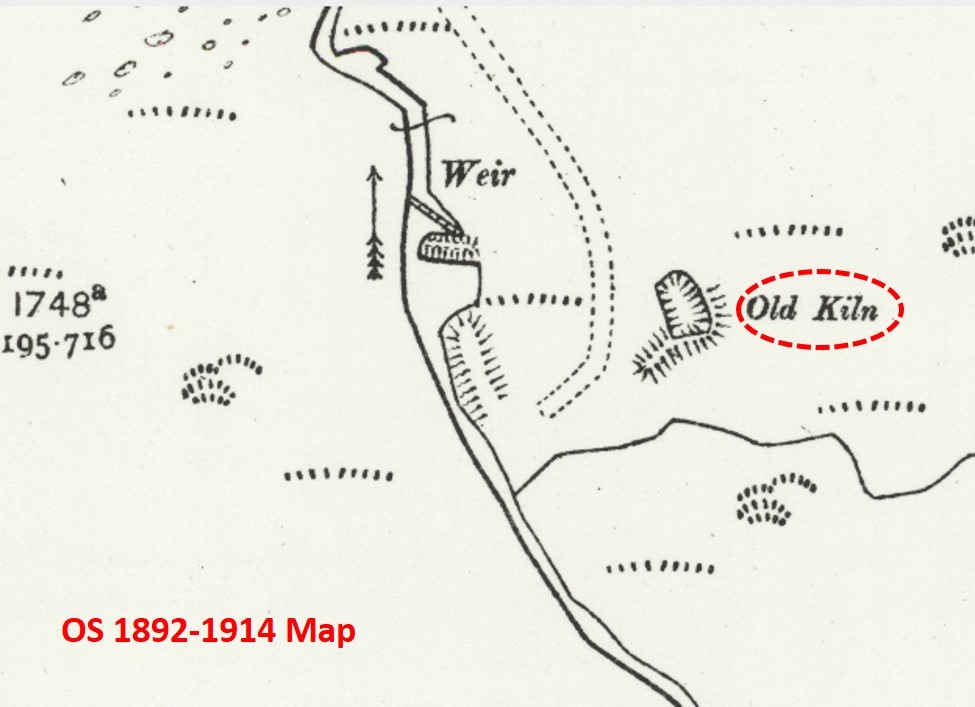
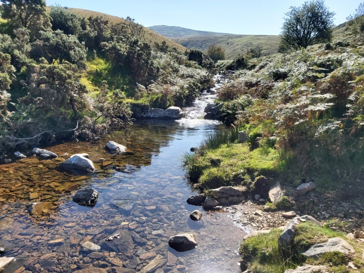
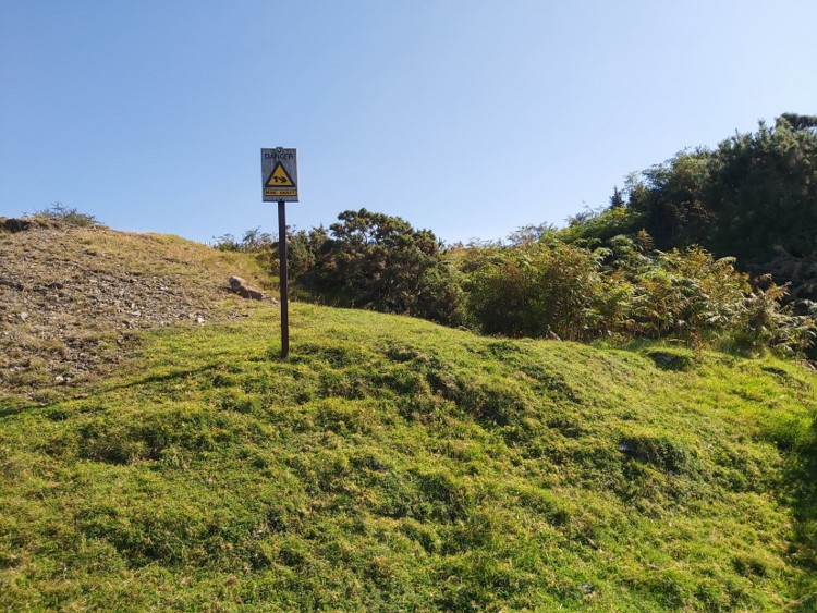
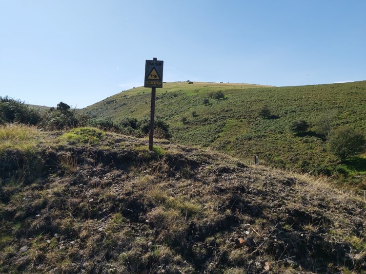
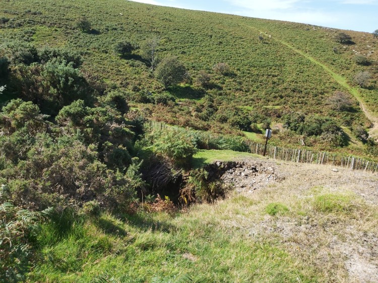
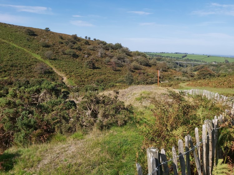
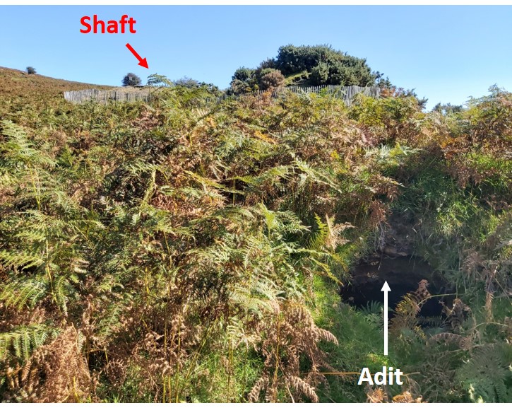
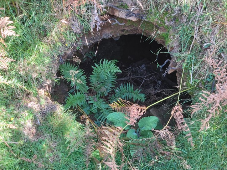
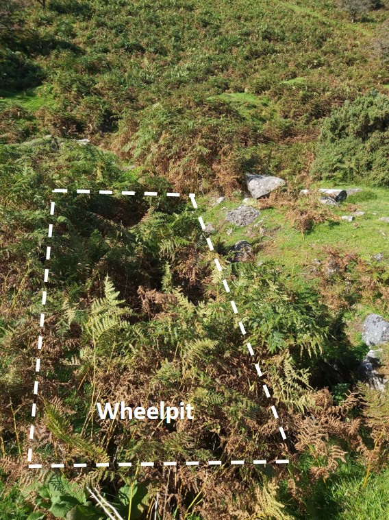
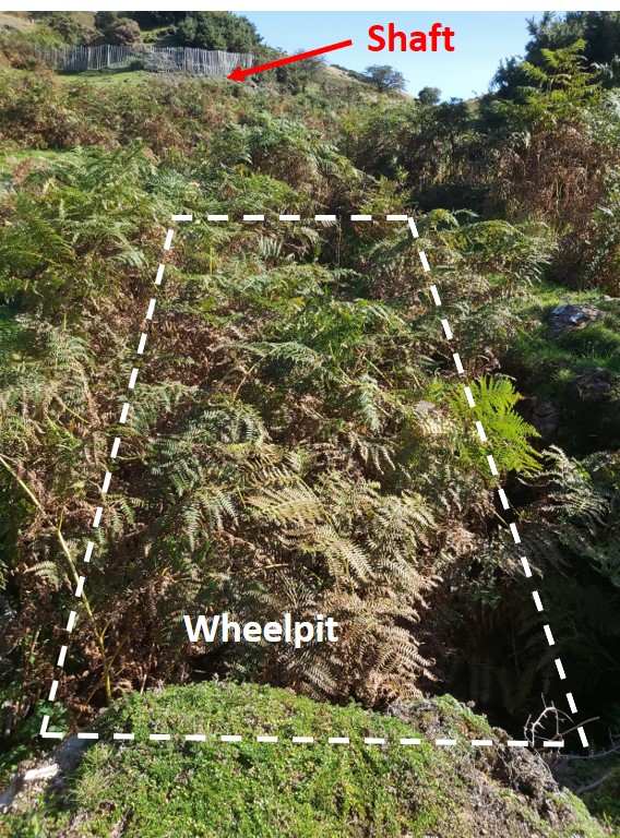
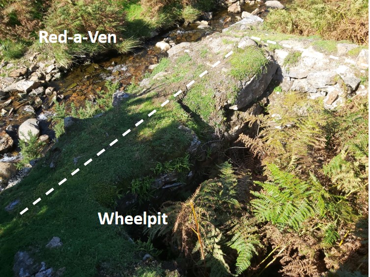
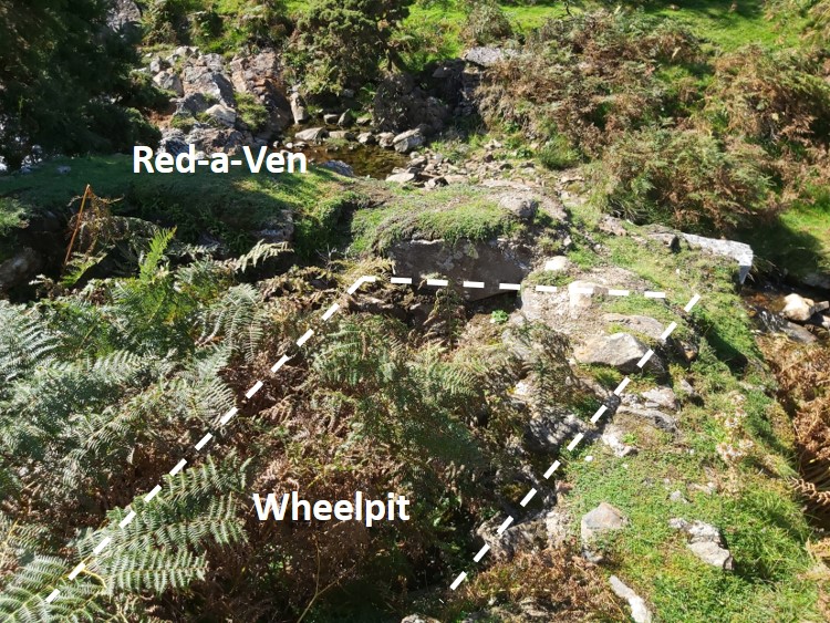
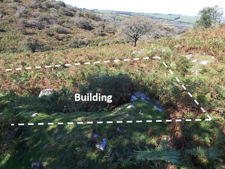
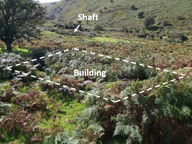
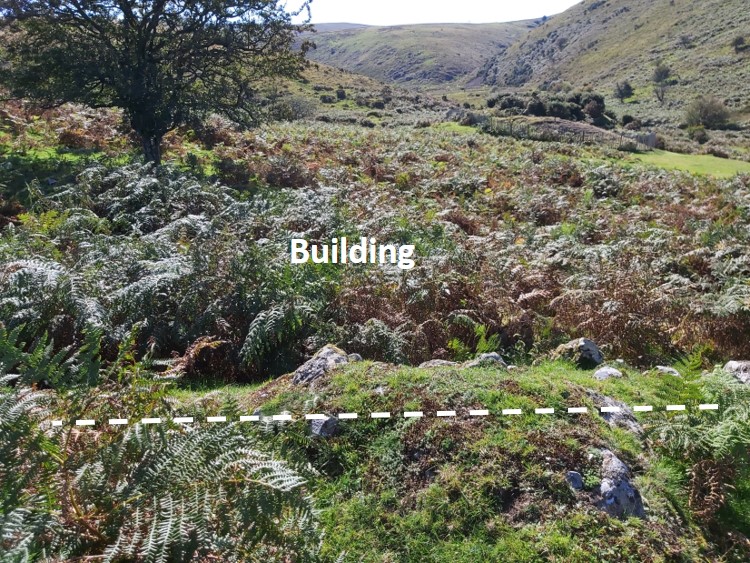
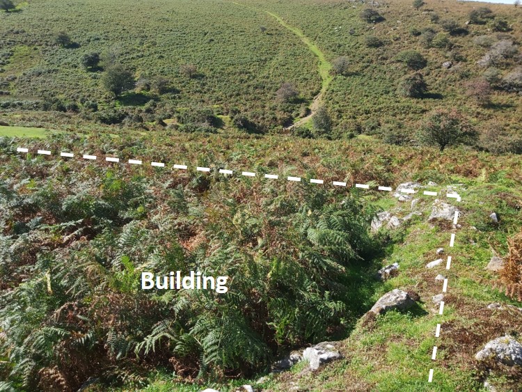
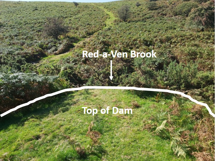
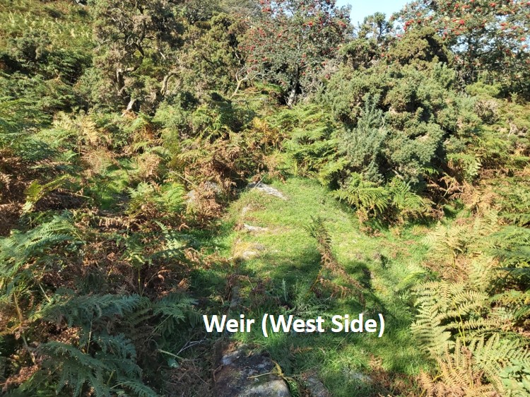
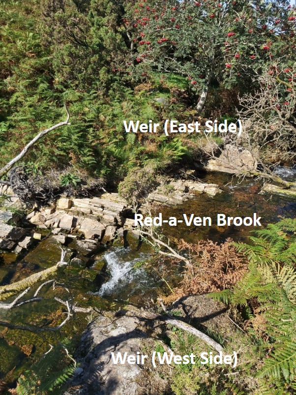
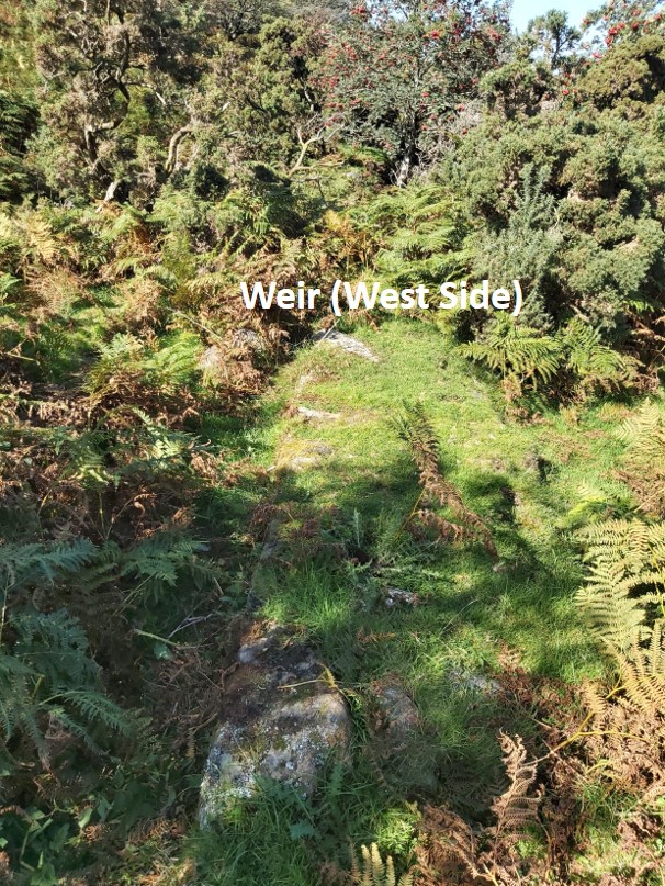
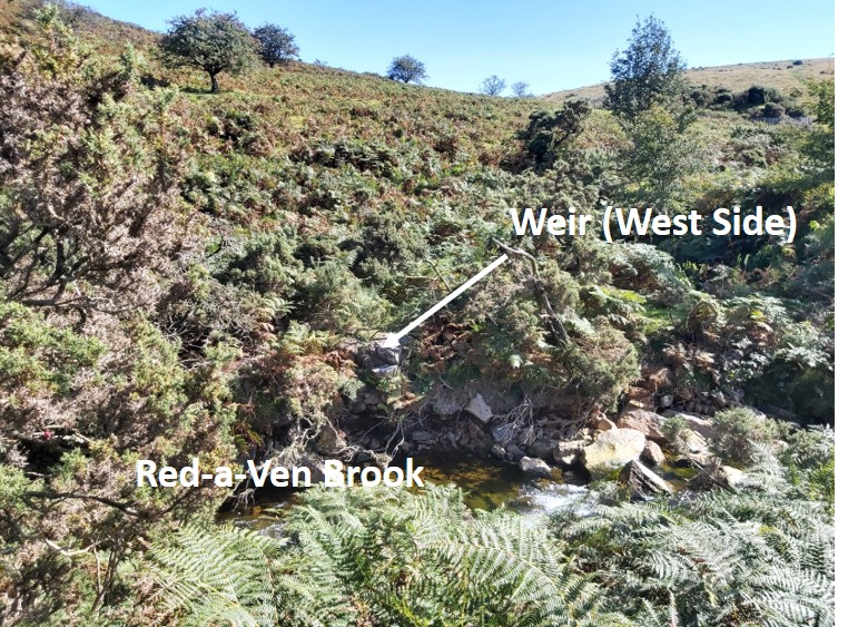
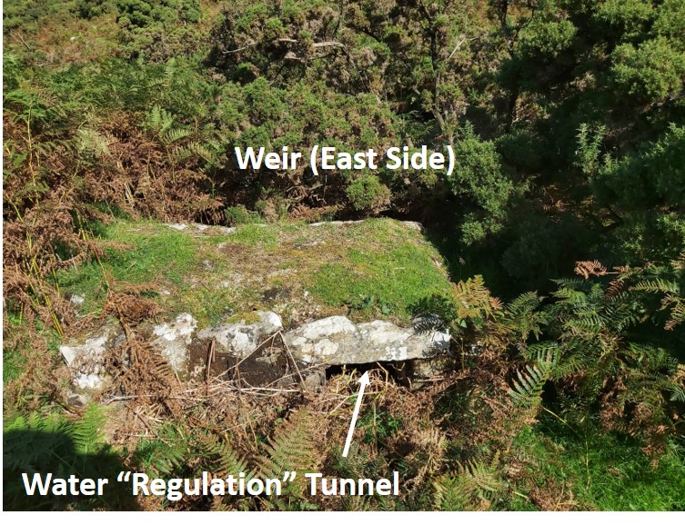
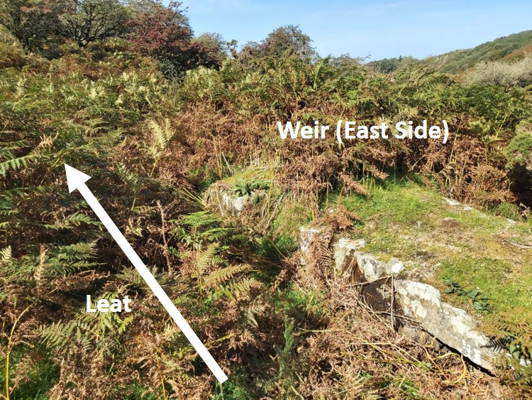
This plan is based on the Dr Newman original, with a number of additions added by the author. It should be noted that the weir wasn’t connected operationally with mineThis map from 1892-1914 shows an “old kiln” where the shaft is located – is this a map makers mistake ? Also, it shows the weir fully intact which formed a “head” of water on the Red-a-Ven Brook.Ford on the Red-a-Ven – SX56945 91777The shaft is now fenced off and there are two danger signs on the site. This is the 2nd warning sign at the shaft. Longstone Hill is across the valleyThe shaft was sunk to 25 fathoms (18 fathoms below the adit)Shaft – SX57016 91769. From this picture Meldon Viaduct can be seen.Location of the adit in relation to the shaftAdit – SX56977 91749The wheelpit is very overgrown in the summerThe wheel would have been used for pumping the mine. The author speculates the wheel was driven from water from Mether Brook, which descends steeply down to the Red-a-Ven from the west.The end of the wheelpit is next to the Red-a-VenWheelpit – SX56963 91744There is the ruins of a building just a short distance from the mine shaftAlthough the building is close to the mine, the author is unsure if it was part of the mining operations.The north wall is the best preservedBuilding – SX57017 91822There is an obvious earthwork (dam) next to the brook, just downstream from the ford. It is likely that dam (at SX56949 91799) would have been used with the weir walls to create a “head” of water from the Red-a-Ven brook. After a bit of bracken clearance a weir wall on the west side of the brook becomes an obvious featureAt the end of the weir wall on the west side of the brook, the end of the weir wall on the east side can be seen across the Red-a-VenWeir (west side) – SX56953 91805Looking across the brook from the east sideThe weir wall on the east side is at SX56940 91815 and looks like it has a “regulator” tunnel associated with it. Was this for overflow ? There is a leat channel next to the east side weir wall, which leads to the main leat. It is likely this system supplemented the main leat, maybe because in the dry season the water flow from the original take off point wasn’t sufficient. Having a “head” of water would have provided this. It is interesting that this is shown on 1892-1914 OS map
Alexandre March 25, 2022
This is new to me excellent blog, i recommend it to everyone earned my respect removed all my doubts.
Congratulations on the site, also know mine:
https://strelato.com
.